KA2 0AB - 3 bedroom detached bungalow for sale in Dundonald Road, Kil…
View on Property Piper
3 bedroom detached bungalow for sale in Dundonald Road, Kilmarnock, KA2
Property Details
- Price: £395000
- Bedrooms: 3
- Bathrooms: 2
- Property Type: undefined
- Property SubType: undefined
Brochure Descriptions
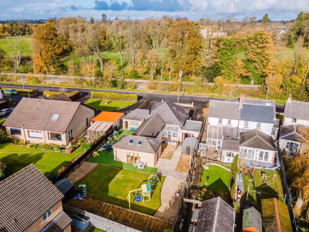
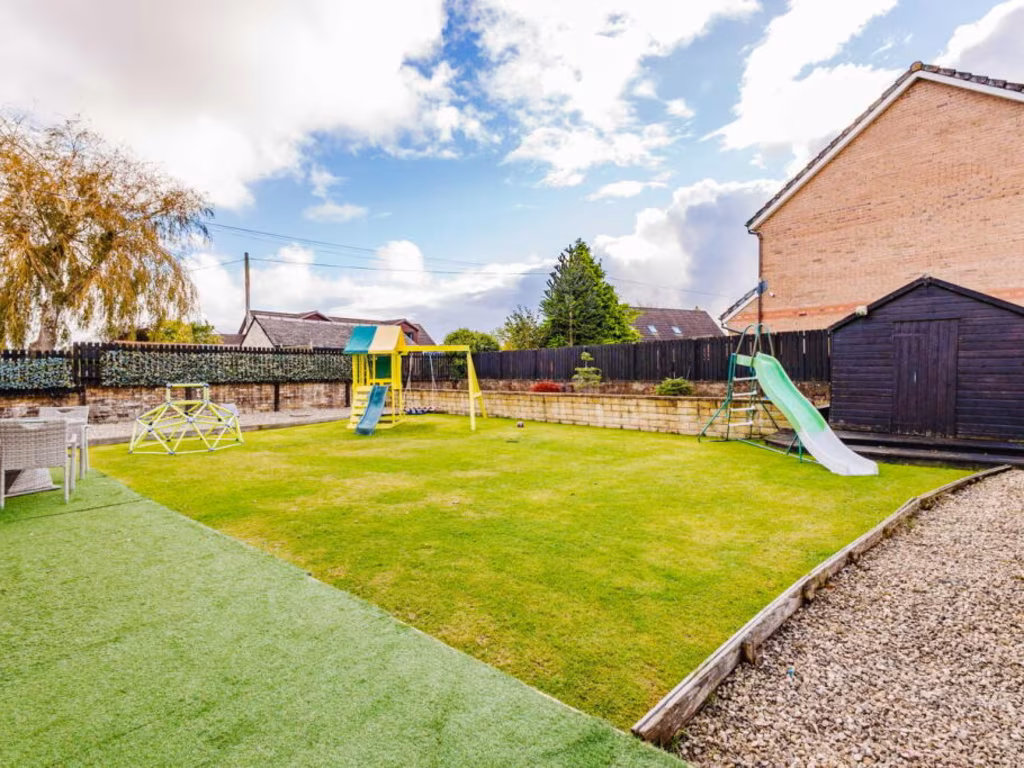
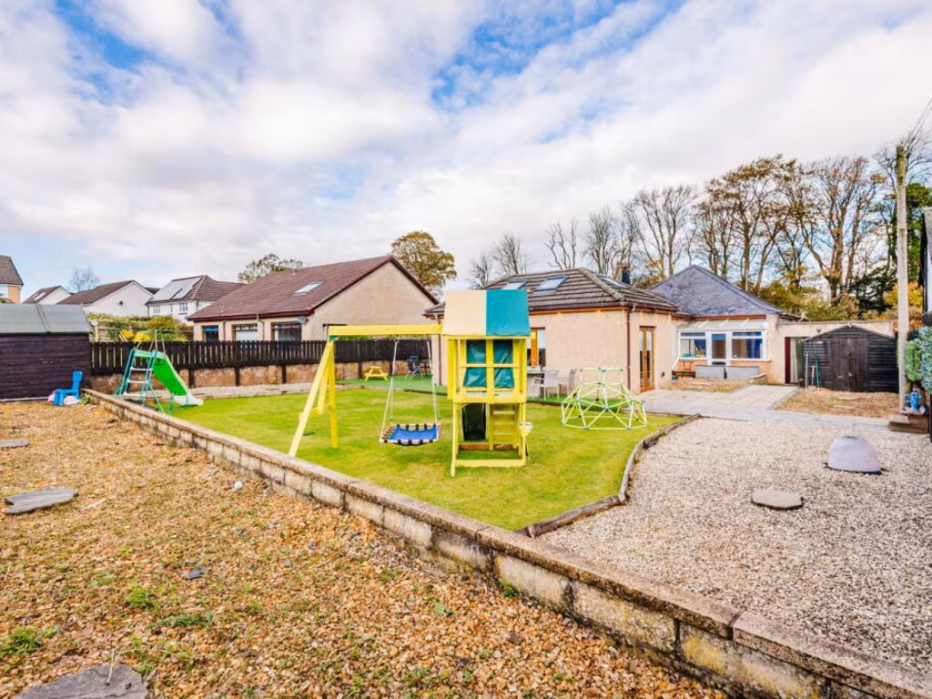
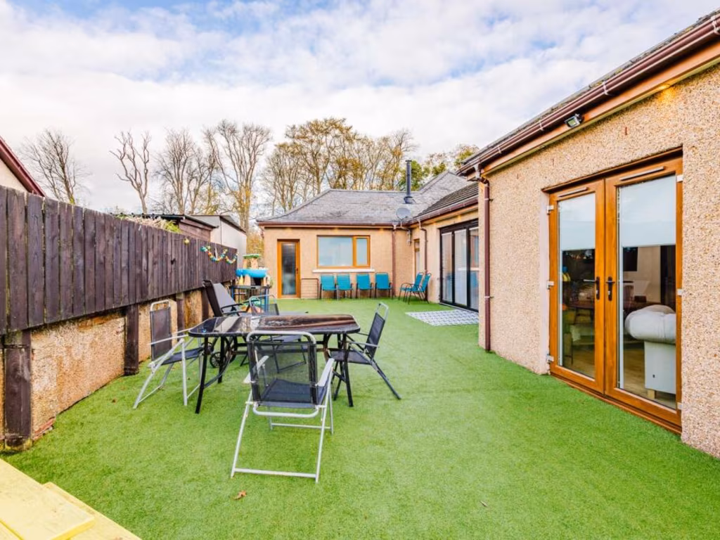
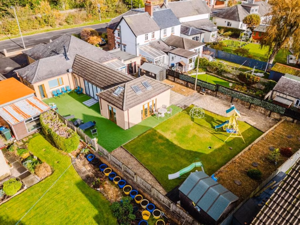
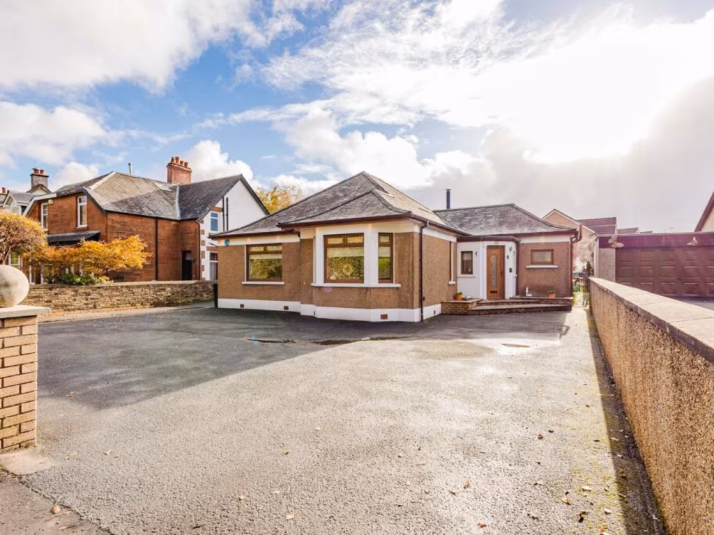
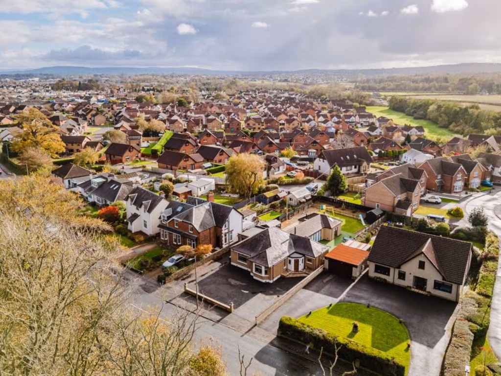
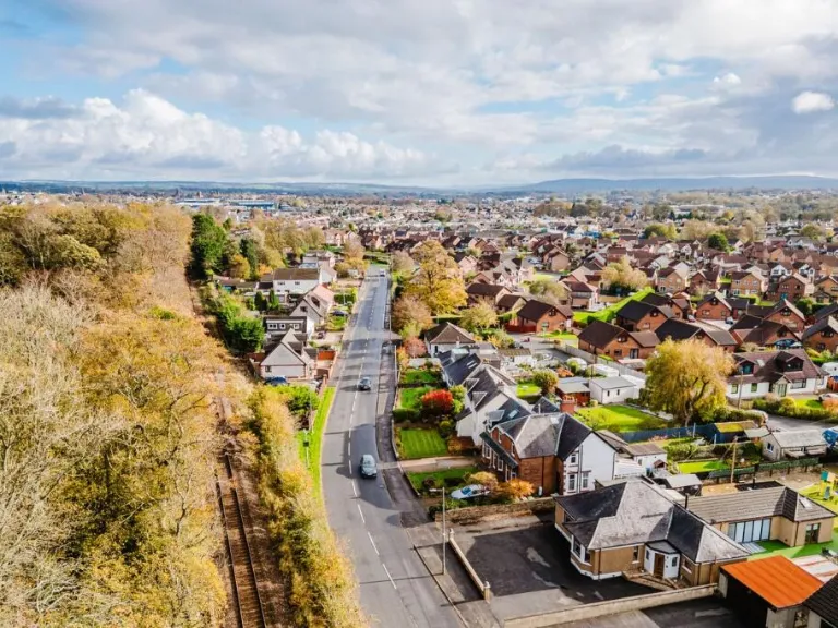
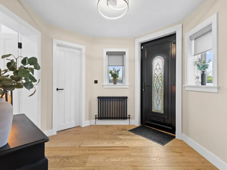
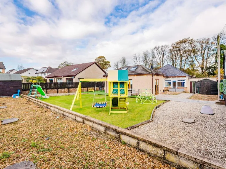
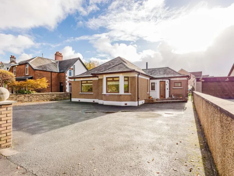
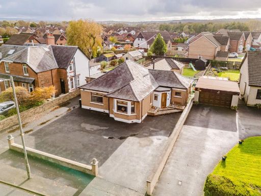
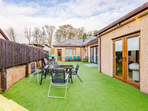
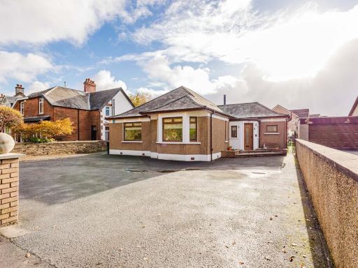
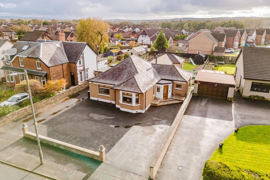
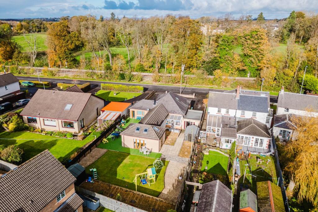
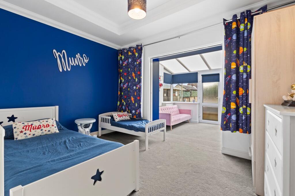
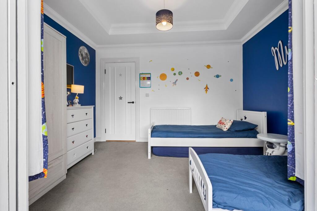
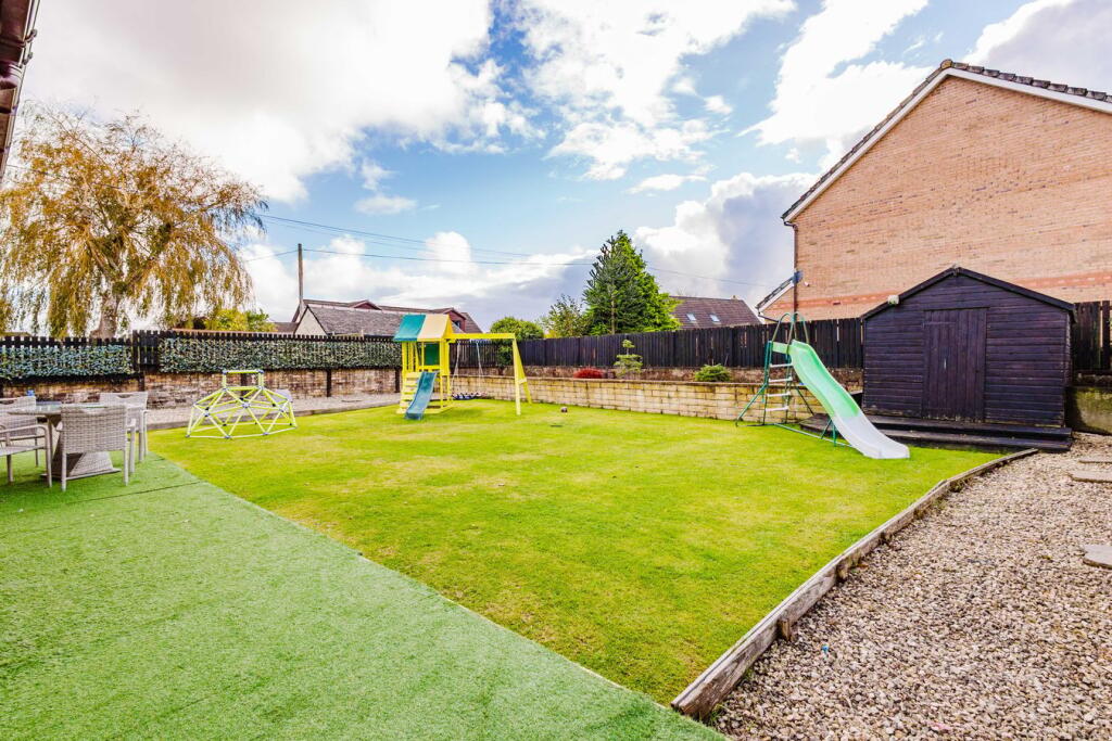
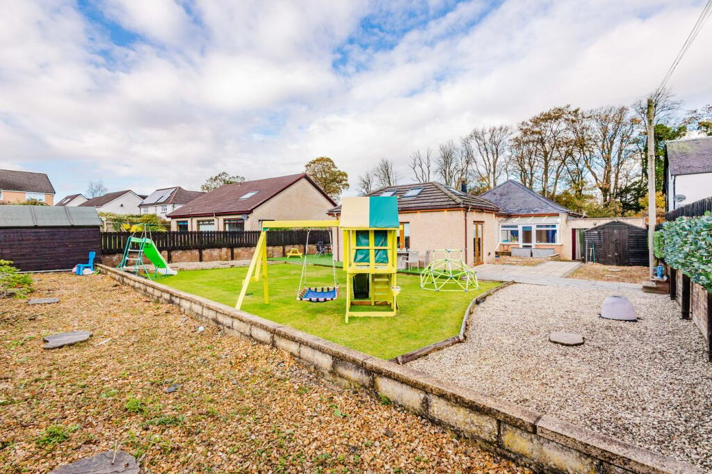
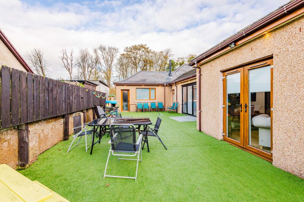
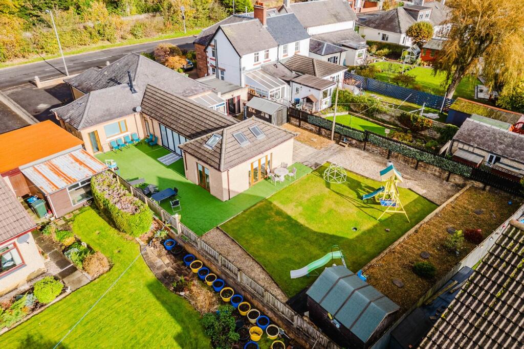
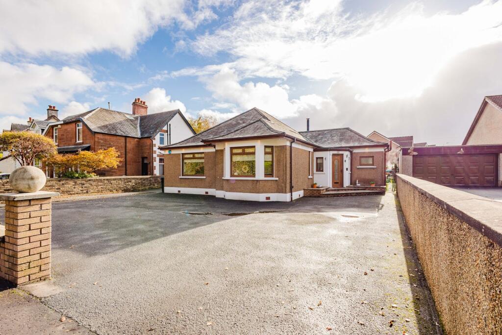
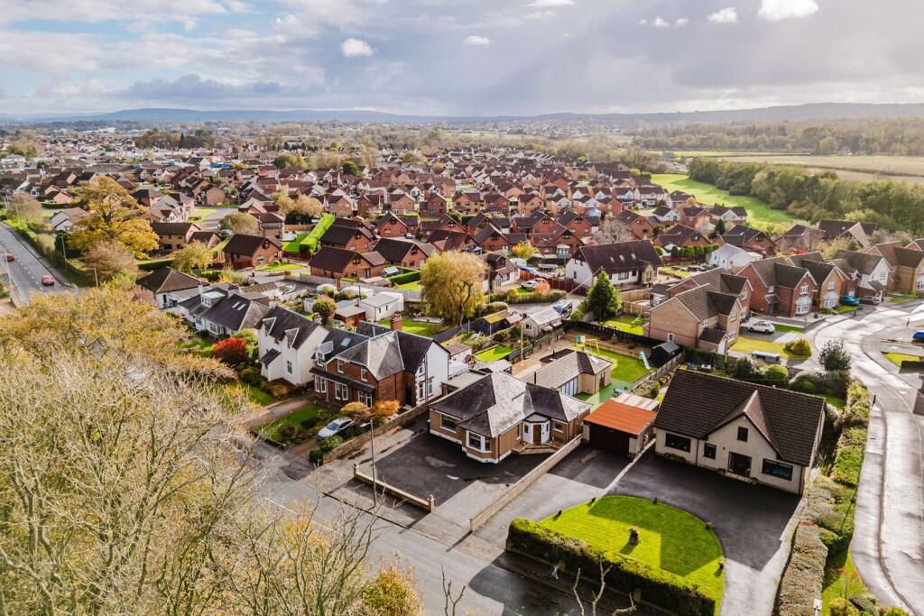
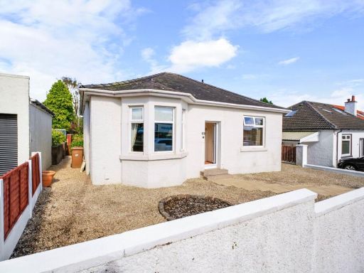
- Detached single-storey bungalow with a hipped roof set on a generous corner/forecourt plot. The property sits well back from the road behind a very large tarmac driveway providing extensive off-street parking and access to a detached double garage. The house appears to have a bay window to the front and a modest covered porch entrance. Rear garden space is visible and appears to be of average size for the neighbourhood, with neighbouring residential suburban views and a generally elevated outlook over surrounding housing. Overall plot size: medium to large for a bungalow; the dwelling itself appears to be a modest-to-average sized single‑level family home suitable for downsizers or small families. No internal features or room counts are visible from the images provided.
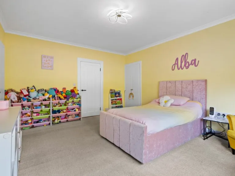
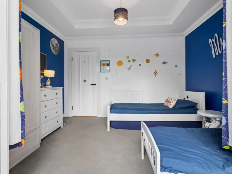
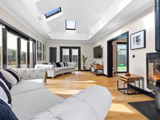
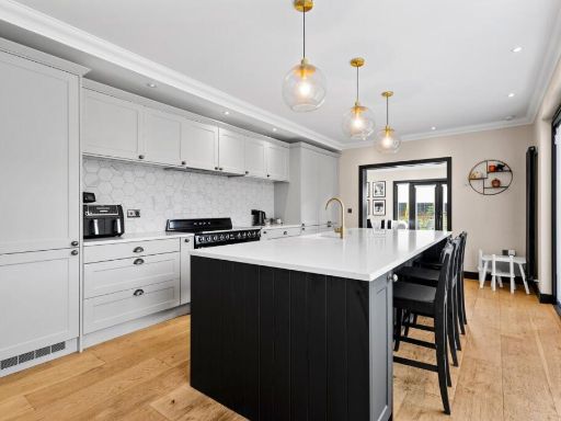
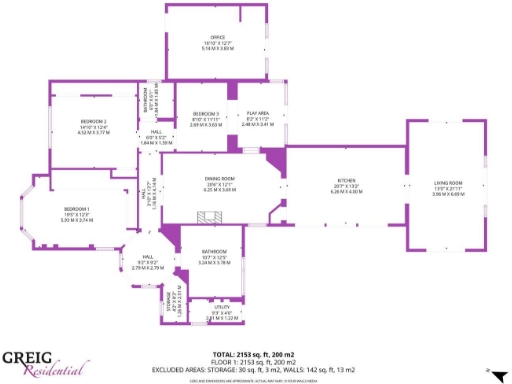
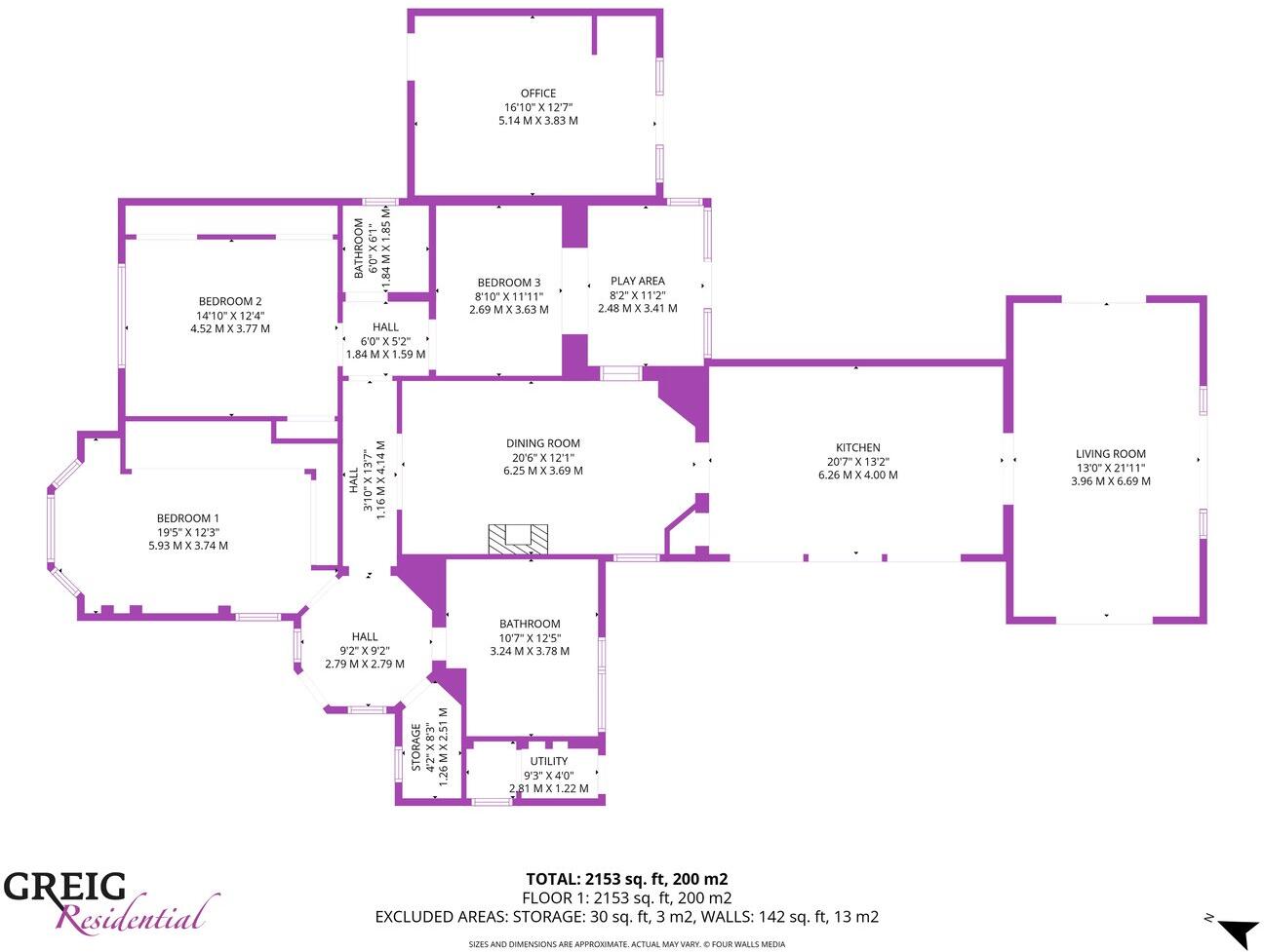
- Floorplan shows a substantial single-level detached residential property (approx. 2153 sq ft / 200 m2) arranged with a large living room, separate kitchen, dining room, principal bedroom with bay window, two further bedrooms, an office/play area, bathroom, utility and ancillary storage. The layout indicates generous internal circulation and sizeable principal reception spaces suited to family occupation. Overall property footprint is large; gardens or external grounds are not visible on this image. No specific external views (sea, river, forest or city) can be determined from the provided image.
- Document is a home report cover for a residential property at 212 Dundonald Road, Kilmarnock (KA2 0AB). The image does not show the property itself (no exterior or interior photographs), so specific features cannot be confirmed. Based on the context (home report produced by Allied Surveyors / oneSURVEY and marketed by Greig Residential), this is a private dwelling in an urban/suburban area of Kilmarnock. No information on number of rooms, floor area, garden size, or views is visible. From a valuator perspective: limited data prevents an accurate valuation — key missing information includes property type (terraced/semidetached/detached/flat), number of bedrooms/bathrooms, living area condition, plot size and any notable views or improvements. Recommend obtaining the full home report or photographs and floorplans to assess accommodation size, construction/condition and any location-specific factors affecting value.
- Document contains only the property address; no photographs or floorplans of the dwelling are present. Based on the address alone this appears to be a residential property on Dundonald Road, Kilmarnock (urban/suburban street). There is insufficient information to determine property type (house/flat), number of rooms, internal condition, garden size or total floor area. From a valuer's perspective: further information is required — internal photographs, floor plans, tenure details and a site inspection are needed to assess accommodation, condition and market value. Recommended next steps: obtain full EPC/floorplan, internal and external photos, and arrange a viewing to establish size, layout and condition.
Image Descriptions
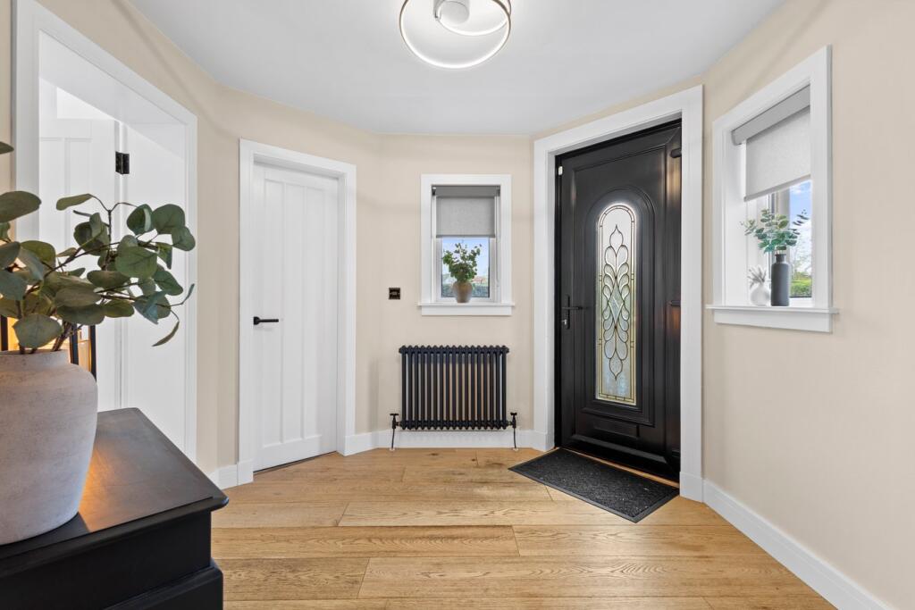
- single-story house Bungalow
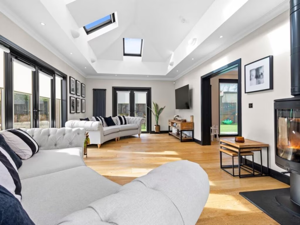
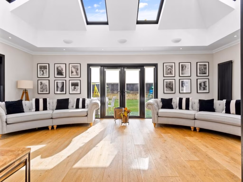
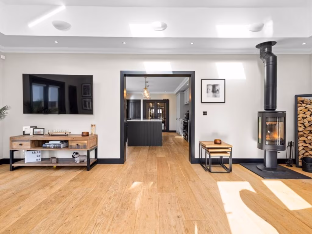
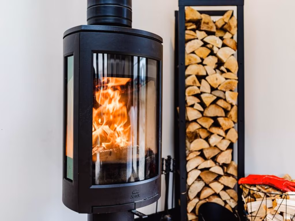
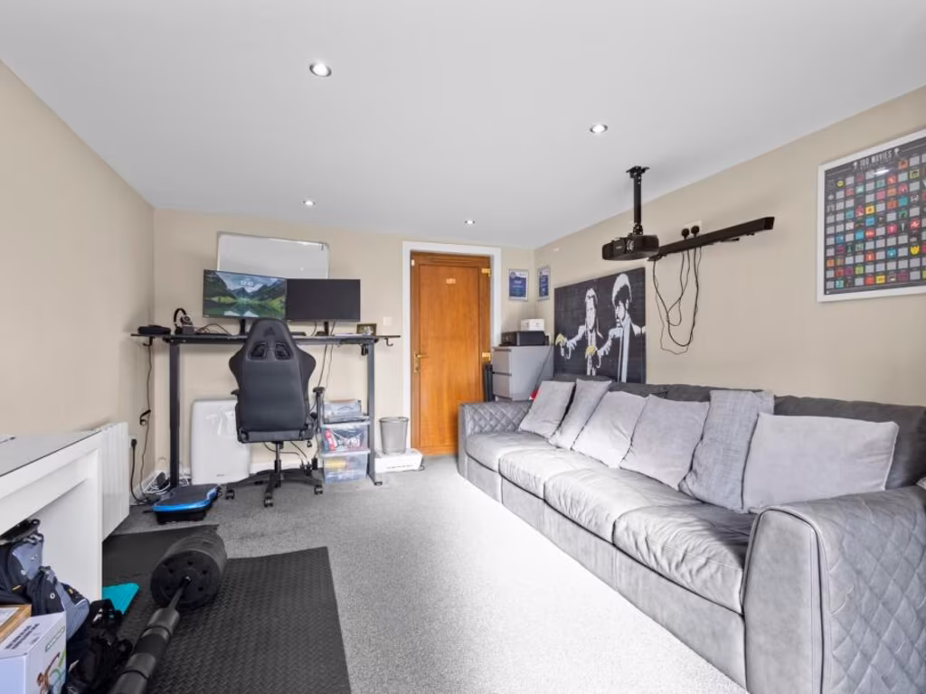
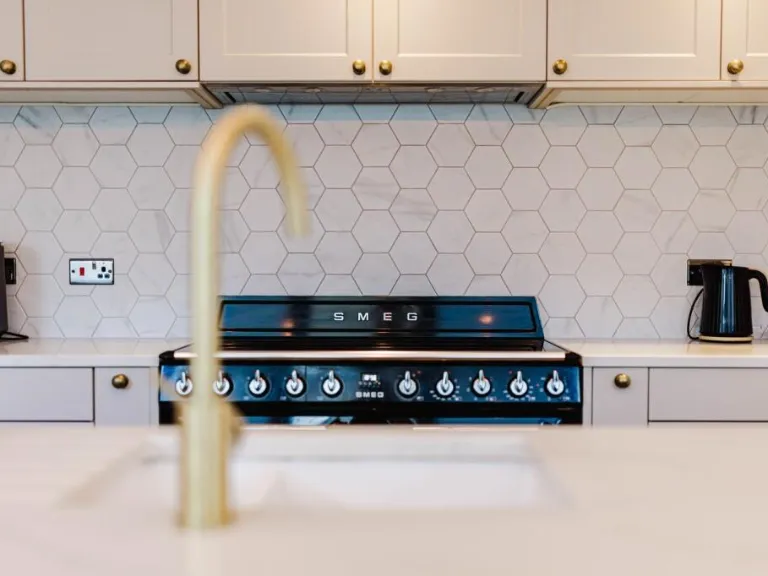
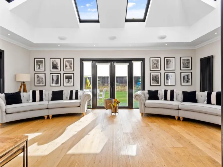
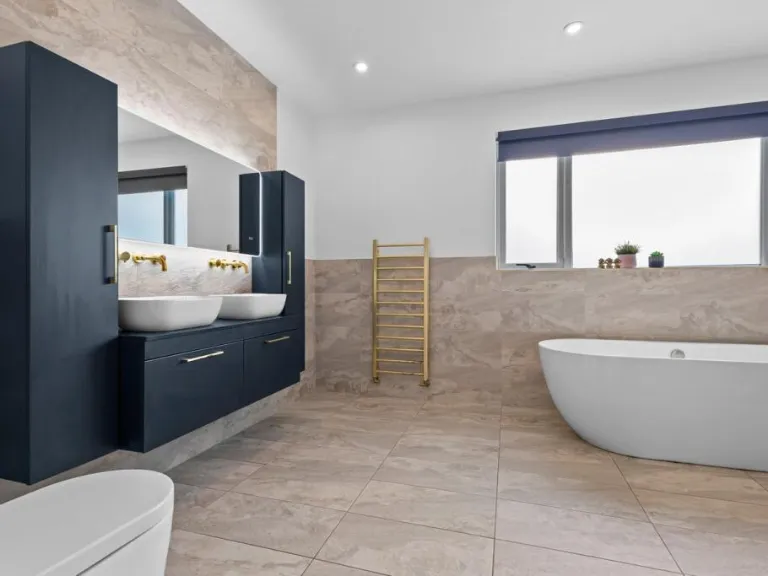
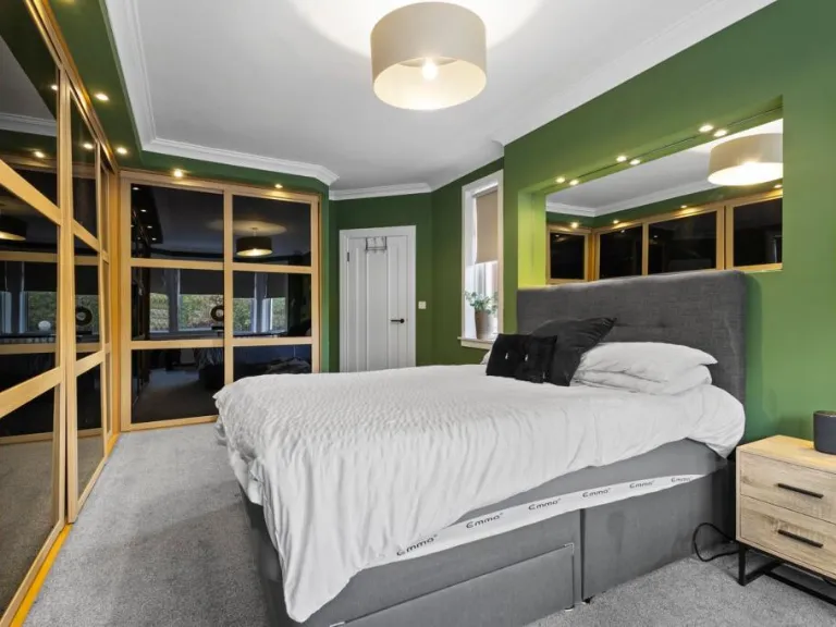
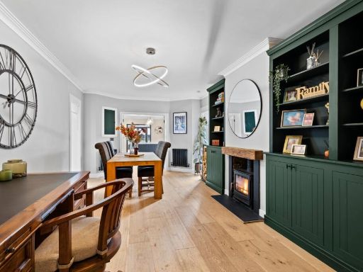
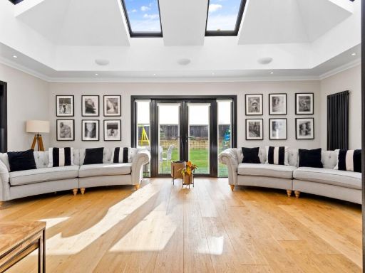
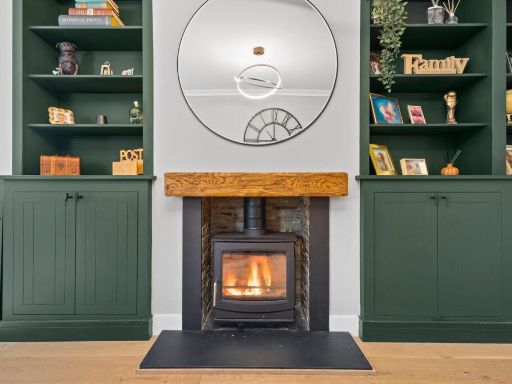
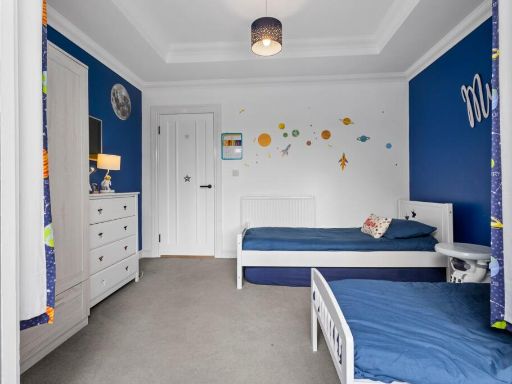
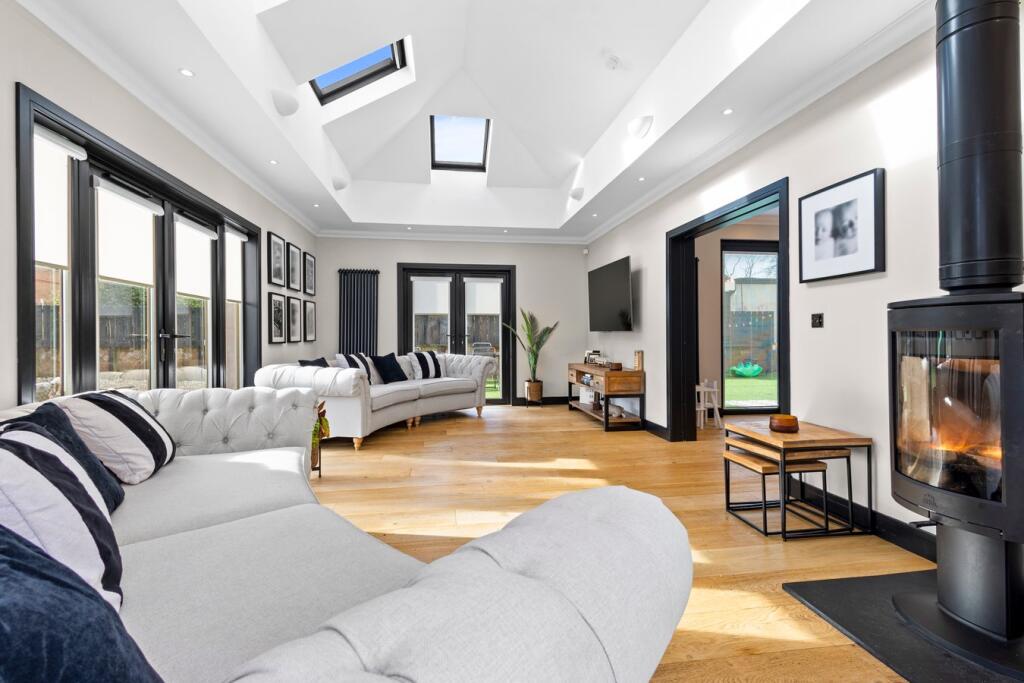
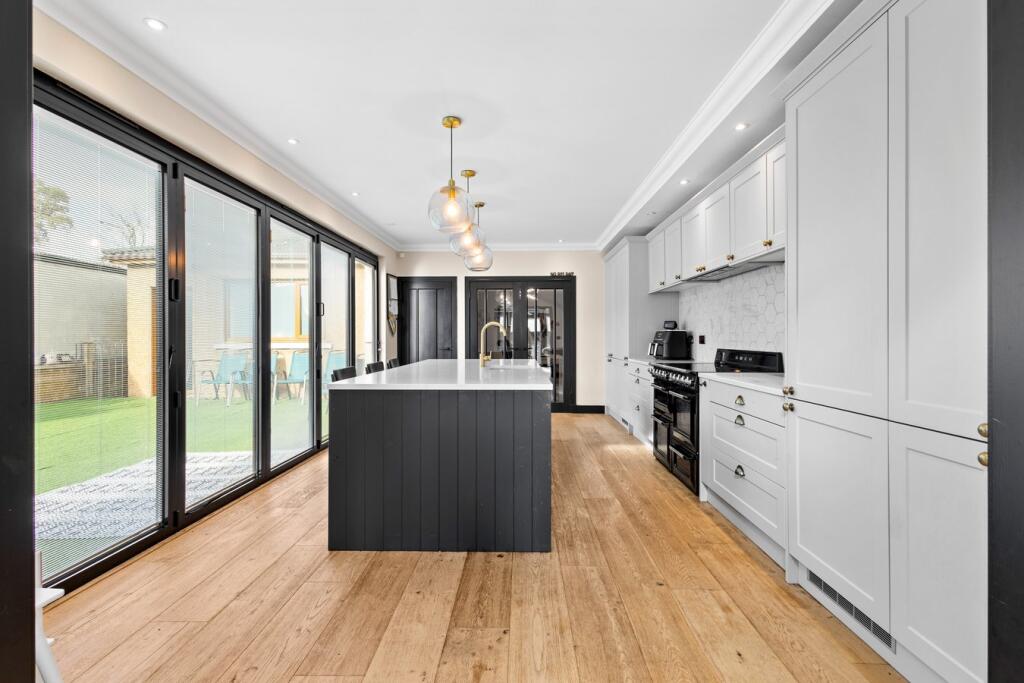
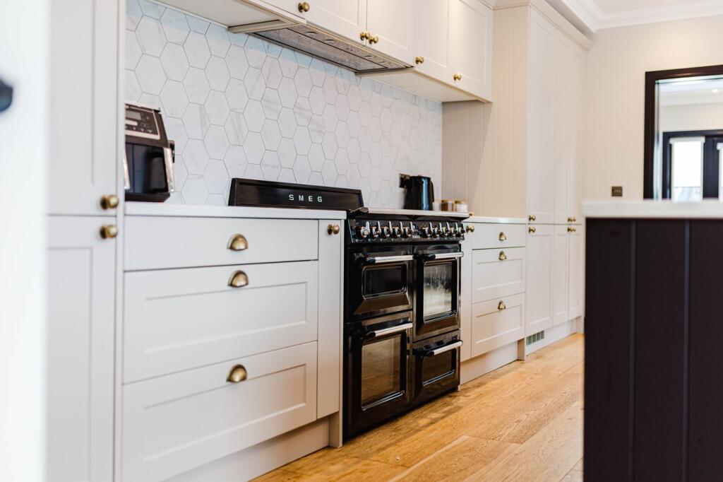
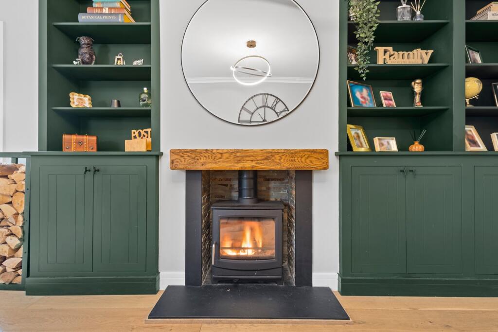
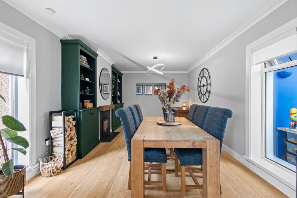
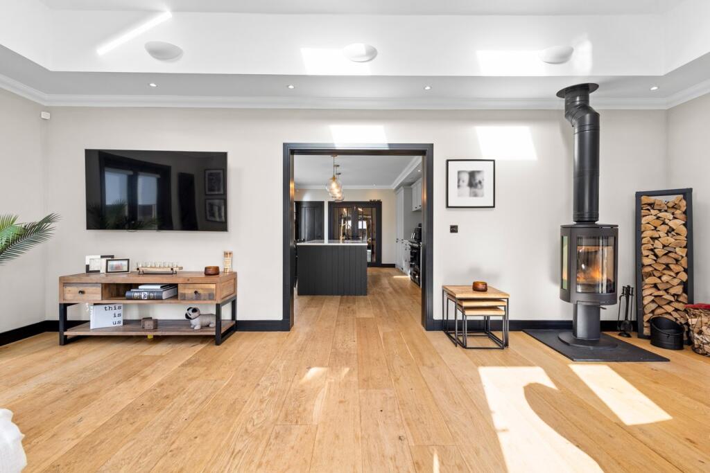
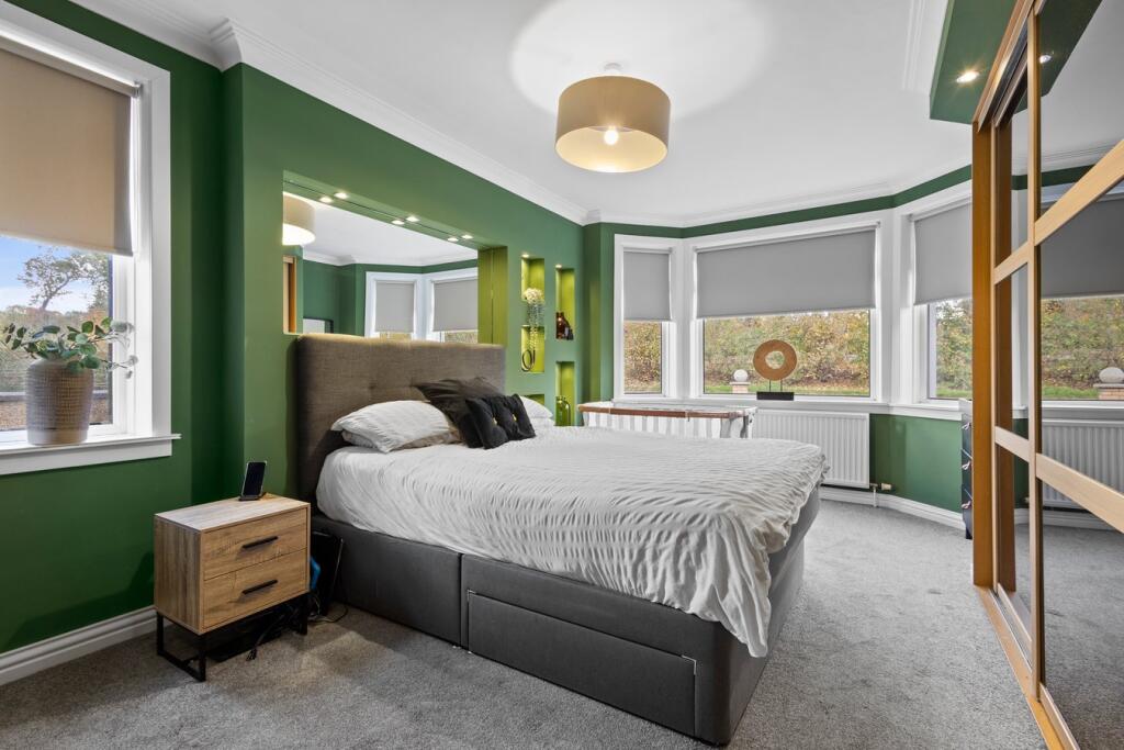
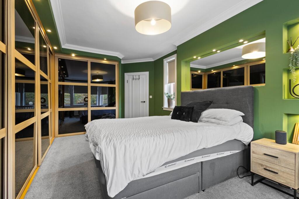
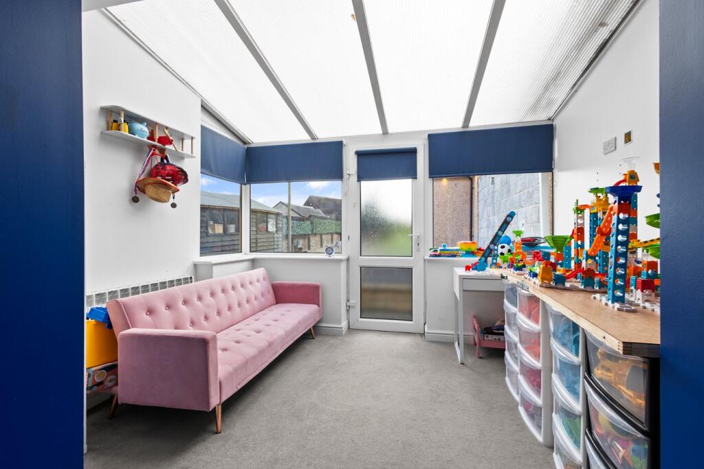
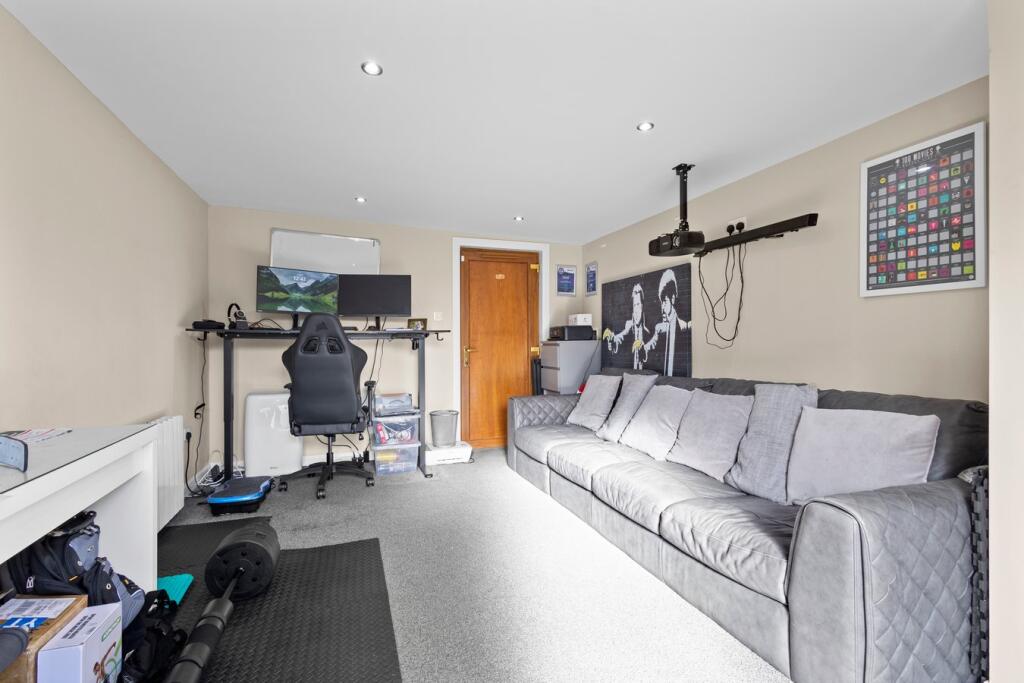
- living room contemporary
Floorplan Description
- Single-floor residential layout with multiple bedrooms, living and service rooms.
Rooms
- OFFICE:
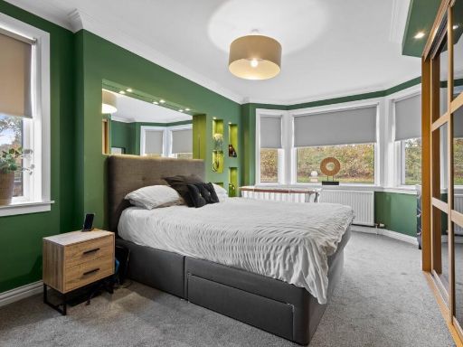
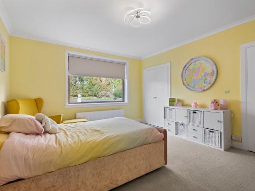
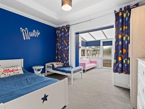
- BEDROOM 1:
- BEDROOM 2:
- BEDROOM 3:
- PLAY AREA:
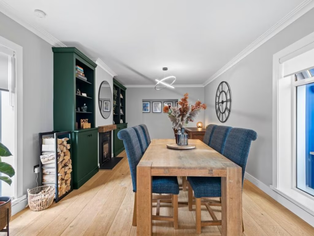
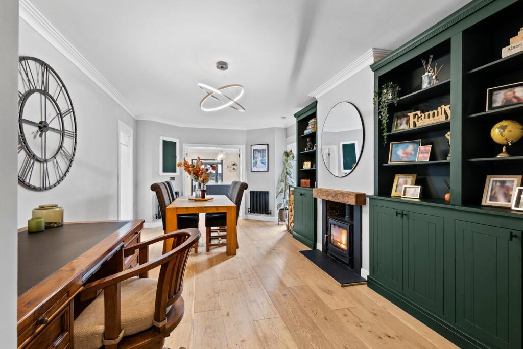
- DINING ROOM:
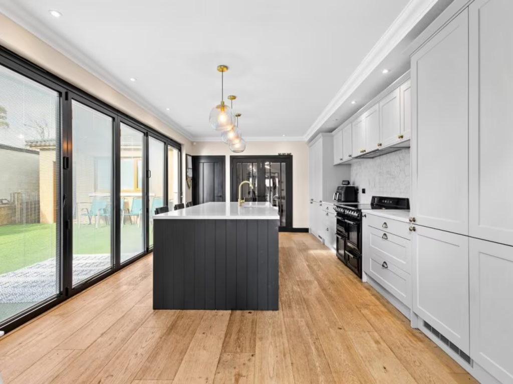
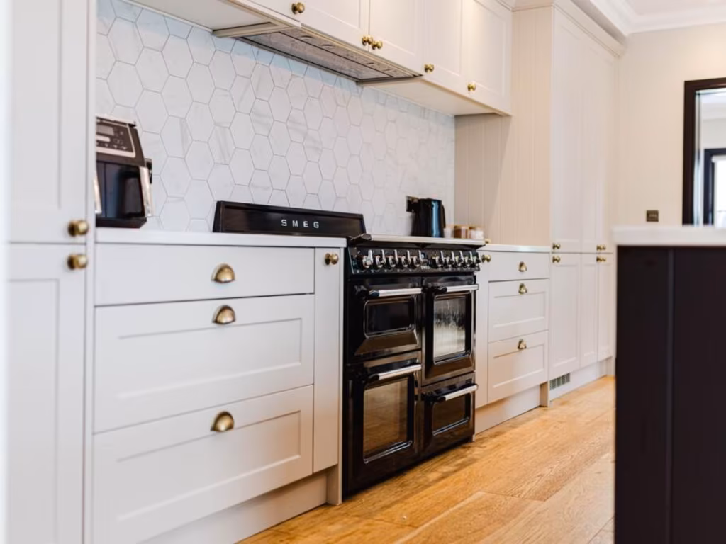
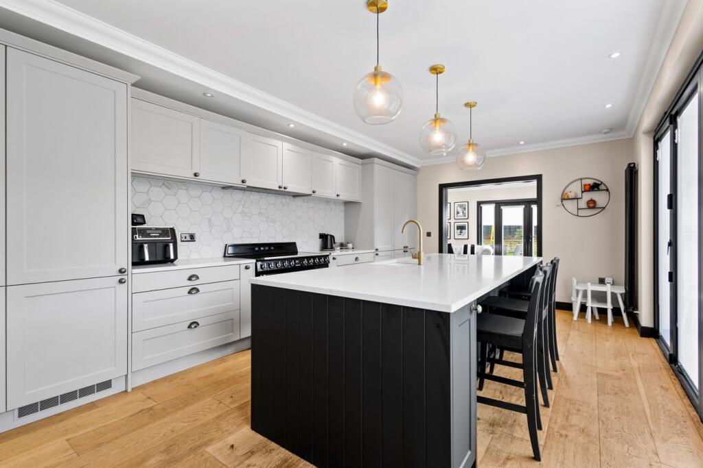
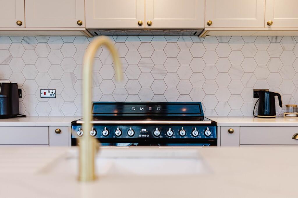
- KITCHEN:
- LIVING ROOM:
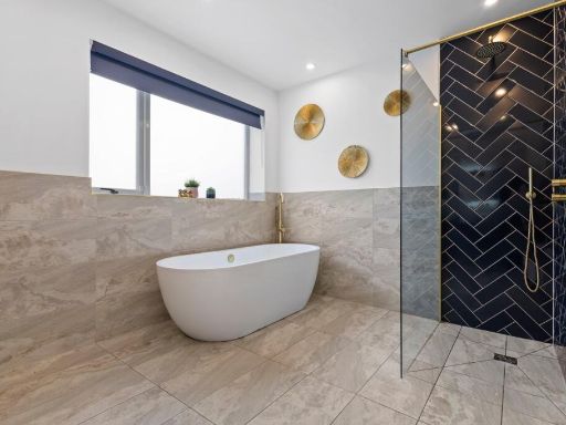
- BATHROOM:
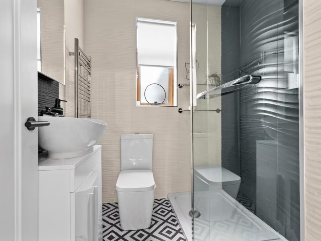
- BATHROOM:
- UTILITY:
- HALL:
- HALL:
- STORAGE:
Textual Property Features
Detected Visual Features
- bungalow
- single-story
- asphalt driveway
- garage
- detached
- residential neighborhood
- gabled roof
- bay window
- modern exterior
- contemporary style
- vaulted ceiling
- skylights
- large windows
- open plan
- modern design
- hardwood flooring
- living room
Nearest Bars And Restaurants
- Id: 539414564
- Tags:
- Accuracy: 13 feet
- Amenity: fast_food
- Cuisine: regional
- Name: Short Stop
- TagsNormalized:
- Lat: 55.5994833
- Lon: -4.496984
- FullGeoHash: gcuu39t6kwvs
- PartitionGeoHash: gcuu
- Images:
- FoodStandards: null
- Distance: 1745.2
,- Id: 539414584
- Tags:
- Accuracy: 31 feet
- Amenity: fast_food
- Cuisine: chinese
- Name: The Golden Loch
- Opening_hours: Mo off; Tu-Th 16:00-22:45; Sa 16:00-23:30; Su 16:00-22:45
- TagsNormalized:
- Lat: 55.6014626
- Lon: -4.4970885
- FullGeoHash: gcuu39vmfpzg
- PartitionGeoHash: gcuu
- Images:
- FoodStandards: null
- Distance: 1744.2
,- Id: 539414585
- Tags:
- Accuracy: 41 feet
- Amenity: fast_food
- Cuisine: kebab
- Name: Kilmarnock Kebab House
- TagsNormalized:
- Lat: 55.6013845
- Lon: -4.4970899
- FullGeoHash: gcuu39vmd1q9
- PartitionGeoHash: gcuu
- Images:
- FoodStandards: null
- Distance: 1743.3
,- Id: 43059257
- Tags:
- Amenity: restaurant
- Brand: Pizza Hut
- Brand:wikidata: Q191615
- Brand:wikipedia: en:Pizza Hut
- Building: yes
- Cuisine: pizza
- Name: Pizza Hut
- Opening_hours: Mo-Th 11:30-22:00; Fr,Sa 11:30-23:00; Su 12:00-22:00
- Wheelchair: limited
- TagsNormalized:
- restaurant
- pizza
- pizza hut
- hut
- Lat: 55.5990307
- Lon: -4.4971473
- FullGeoHash: gcuu39mrbfeb
- PartitionGeoHash: gcuu
- Images:
- FoodStandards: null
- Distance: 1737.6
,- Id: 539414587
- Tags:
- Amenity: pub
- Name: The Howard Arms
- Wheelchair: limited
- TagsNormalized:
- Lat: 55.6012005
- Lon: -4.4974171
- FullGeoHash: gcuu39vh6x48
- PartitionGeoHash: gcuu
- Images:
- FoodStandards: null
- Distance: 1721.3
}
Nearest Grocery shops
- Id: 891004218
- Tags:
- Building: yes
- Name: Morrisons
- Operator: Morrisons
- Shop: convenience
- TagsNormalized:
- Lat: 55.6120257
- Lon: -4.5028161
- FullGeoHash: gcuu3ec5sbbz
- PartitionGeoHash: gcuu
- Images:
- FoodStandards: null
- Distance: 1913.8
,- Id: 8880549143
- Tags:
- Name: Kilmarnock Minimarket
- Shop: convenience
- TagsNormalized:
- Lat: 55.6057563
- Lon: -4.4973329
- FullGeoHash: gcuu3dtph838
- PartitionGeoHash: gcuu
- Images:
- FoodStandards: null
- Distance: 1834.1
,- Id: 749111024
- Tags:
- Name: R & J Paton
- Opening_hours: Mo-Fr 07:00-19:00; Sa 08:00-19:30; Su 08:00-14:00
- Shop: convenience
- TagsNormalized:
- Lat: 55.6018231
- Lon: -4.5049522
- FullGeoHash: gcuu36p85504
- PartitionGeoHash: gcuu
- Images:
- FoodStandards: null
- Distance: 1258.4
}
Nearest Religious buildings
- Id: 753371024
- Tags:
- Amenity: place_of_worship
- Building: yes
- Denomination: church_of_scotland
- Name: St Andrew's and St Marnock's Parish Church
- Religion: christian
- TagsNormalized:
- place of worship
- church
- church of scotland
- parish
- christian
- Lat: 55.6073025
- Lon: -4.4991031
- FullGeoHash: gcuu3e5b5298
- PartitionGeoHash: gcuu
- Images:
- FoodStandards: null
- Distance: 1800
,- Id: 316112637
- Tags:
- Amenity: place_of_worship
- Denomination: scottish_episcopal
- Name: Holy Trinity
- Religion: christian
- Url: http://holytrinitykilmarnock.co.uk/2.html
- Wikidata: Q15815833
- TagsNormalized:
- place of worship
- scottish episcopal
- christian
- church
- Lat: 55.6075412
- Lon: -4.5004727
- FullGeoHash: gcuu3e4c7kur
- PartitionGeoHash: gcuu
- Images:
- FoodStandards: null
- Distance: 1736
,- Id: 126059147
- Tags:
- Amenity: place_of_worship
- Building: yes
- Denomination: Churches of God
- Name: Bonnyton Hall
- Religion: christian
- Source: Bing,survey
- TagsNormalized:
- place of worship
- church
- christian
- Lat: 55.6129291
- Lon: -4.5119157
- FullGeoHash: gcuu3k48b9ru
- PartitionGeoHash: gcuu
- Images:
- FoodStandards: null
- Distance: 1640.7
}
Nearest Medical buildings
- Id: 1150129659
- Tags:
- Aeroway: helipad
- Name: University Hospital Crosshouse
- Operator: NHS
- TagsNormalized:
- helipad
- hospital
- university
- Lat: 55.6131684
- Lon: -4.5447841
- FullGeoHash: gcuu2s4d4vgr
- PartitionGeoHash: gcuu
- Images:
- FoodStandards: null
- Distance: 1924.5
,- Id: 8880549131
- Tags:
- Amenity: dentist
- Healthcare: dentist
- Healthcare:speciality: orthodontics
- Name: Ayrshire Orthodontics
- TagsNormalized:
- dentist
- health
- healthcare
- orthodontics
- Lat: 55.6048525
- Lon: -4.4969307
- FullGeoHash: gcuu3dt3tzv3
- PartitionGeoHash: gcuu
- Images:
- FoodStandards: null
- Distance: 1826.1
,- Id: 943888965
- Tags:
- Amenity: veterinary
- Building: yes
- Name: Valley Veterinary Surgery
- TagsNormalized:
- Lat: 55.5937054
- Lon: -4.4980537
- FullGeoHash: gcuu38s8gcb4
- PartitionGeoHash: gcuu
- Images:
- FoodStandards: null
- Distance: 1820.3
,- Id: 12337155
- Tags:
- Addr:
- Postcode: KA2 0BE
- Street: Kilmarnock Road
- Amenity: hospital
- Emergency: yes
- Fhrs:
- Healthcare: hospital
- Name: University Hospital Crosshouse
- Source:
- Type: multipolygon
- Wikidata: Q7894766
- Wikipedia: en:University Hospital Crosshouse
- TagsNormalized:
- hospital
- health
- healthcare
- university
- Lat: 55.6136829
- Lon: -4.5397785
- FullGeoHash: gcuu2snjpmzu
- PartitionGeoHash: gcuu
- Images:
- FoodStandards:
- Id: 538672
- FHRSID: 538672
- LocalAuthorityBusinessID: PI/000008150
- BusinessName: Crosshouse Hospital
- BusinessType: Restaurant/Cafe/Canteen
- BusinessTypeID: 1
- AddressLine1: Crosshouse Hospital
- AddressLine2: Kilmarnock Road
- AddressLine3: Crosshouse
- AddressLine4: Kilmarnock
- PostCode: KA2 0BE
- RatingValue: Pass
- RatingKey: fhis_pass_en-GB
- RatingDate: 2022-12-14
- LocalAuthorityCode: 764
- LocalAuthorityName: East Ayrshire
- LocalAuthorityWebSite: http://eac.eu/
- LocalAuthorityEmailAddress: environmentalhealth@east-ayrshire.gov.uk
- Scores:
- Hygiene: null
- Structural: null
- ConfidenceInManagement: null
- NewRatingPending: false
- Geocode:
- Longitude: -4.53942700000000
- Latitude: 55.61394700000000
- Distance: 1783.5
}
Nearest Airports
- Id: 97095239
- Tags:
- Addr:
- Aerodrome: international
- Aerodrome:type: public
- Aeroway: aerodrome
- Arp: no
- Atis: 121.125
- Ele: 20
- Iata: PIK
- Icao: EGPK
- Is_in: South Ayrshire
- Name: Glasgow Prestwick Airport
- Name_1: Prestwick Airport
- Name_2: Glasgow Prestwick Airport
- Operator: Infratil Airports Europe
- Owner: Infratil
- Size: 1817727
- Tower_frequency: 118.150
- Website: https://www.glasgowprestwick.com/
- Wikidata: Q8992
- Wikipedia: en:Glasgow Prestwick Airport
- TagsNormalized:
- airport
- international airport
- Lat: 55.5022118
- Lon: -4.5948374
- FullGeoHash: gcuexry5ud0v
- PartitionGeoHash: gcue
- Images:
- FoodStandards: null
- Distance: 11741.2
,- Id: 1100796130
- Tags:
- Addr:
- City: Paisley
- Postcode: PA3 2SW
- Aerodrome: international
- Aerodrome:type: public
- Aeroway: aerodrome
- Iata: GLA
- Icao: EGPF
- Ifr: yes
- Is_in: Paisley, Scotland, UK
- Name: Glasgow Airport
- Operator: Glasgow Airport Limited
- Phone: +44 141 887 1111
- Ref: GLA
- Source: CAA AIP
- Wikidata: Q8721
- Wikipedia: en:Glasgow Airport
- TagsNormalized:
- airport
- international airport
- Lat: 55.8705835
- Lon: -4.4351667
- FullGeoHash: gcuvg4fmtpsh
- PartitionGeoHash: gcuv
- Images:
- FoodStandards: null
- Distance: 30597.4
,- Id: 4519551
- Tags:
- Aerodrome: international
- Name: Glasgow International Airport
- Type: site
- Wikidata: Q8721
- TagsNormalized:
- airport
- international airport
- Lat: 55.8705829
- Lon: -4.4355768
- FullGeoHash: gcuvg4fjexd0
- PartitionGeoHash: gcuv
- Images:
- FoodStandards: null
- Distance: 30592.6
}
Nearest Leisure Facilities
- Id: 1002141505
- Tags:
- TagsNormalized:
- Lat: 55.5978469
- Lon: -4.5143032
- FullGeoHash: gcuu332bcjge
- PartitionGeoHash: gcuu
- Images:
- FoodStandards: null
- Distance: 701.2
,- Id: 43653383
- Tags:
- Addr:
- City: Kilmarnock
- Country: GB
- Postcode: KA1 2RT
- Street: Irvine Road
- Description: 18 hole Par 71
- Golf:
- Leisure: golf_course
- Name: Annanhill Golf Club
- Phone: +44 1563 521512
- Source: landsat
- Website: https://annanhillgolfclub.co.uk/
- Wikidata: Q14849084
- TagsNormalized:
- golf
- golf course
- leisure
- club
- Lat: 55.6060518
- Lon: -4.5231353
- FullGeoHash: gcuu34f2er3g
- PartitionGeoHash: gcuu
- Images:
- FoodStandards: null
- Distance: 672.2
,- Id: 1070087660
- Tags:
- TagsNormalized:
- Lat: 55.5992839
- Lon: -4.5184775
- FullGeoHash: gcuu31t9rcdz
- PartitionGeoHash: gcuu
- Images:
- FoodStandards: null
- Distance: 403.4
,- Id: 1070087659
- Tags:
- TagsNormalized:
- Lat: 55.5991174
- Lon: -4.5189006
- FullGeoHash: gcuu31t2mfxq
- PartitionGeoHash: gcuu
- Images:
- FoodStandards: null
- Distance: 382.3
,- Id: 1070087658
- Tags:
- TagsNormalized:
- Lat: 55.5990501
- Lon: -4.5253944
- FullGeoHash: gcuu312xywjk
- PartitionGeoHash: gcuu
- Images:
- FoodStandards: null
- Distance: 121.1
}
Nearest Tourist attractions
- Id: 324879558
- Tags:
- Addr:
- City: Kilmarnock
- Housenumber: 27
- Postcode: KA3 1DW
- Street: Wellington Street
- Building: yes
- Name: Dean Park Guest House
- Rooms: 6
- Tourism: guest_house
- Website: http://kilmarnockbandb.co.uk/
- TagsNormalized:
- Lat: 55.6147387
- Lon: -4.4948426
- FullGeoHash: gcuu3sqgqddq
- PartitionGeoHash: gcuu
- Images:
- FoodStandards: null
- Distance: 2487.1
,- Id: 500439267
- Tags:
- Name: Dick Institute
- Tourism: museum
- Wikidata: Q5273047
- Wikipedia: en:Dick Institute
- TagsNormalized:
- Lat: 55.6083883
- Lon: -4.4897203
- FullGeoHash: gcuu3g4wmfvv
- PartitionGeoHash: gcuu
- Images:
- FoodStandards: null
- Distance: 2386.3
,- Id: 730780122
- Tags:
- TagsNormalized:
- Lat: 55.5948204
- Lon: -4.5544719
- FullGeoHash: gcuu22ex31et
- PartitionGeoHash: gcuu
- Images:
- FoodStandards: null
- Distance: 1956.9
}
Nearest Bus stations and stops
- Id: 526199403
- Tags:
- Accuracy: 19 feet
- Bus: yes
- Highway: bus_stop
- Name: Low Glencairn Street
- Public_transport: platform
- Shelter: yes
- Tactile_paving: yes
- TagsNormalized:
- Lat: 55.5992591
- Lon: -4.4967443
- FullGeoHash: gcuu39t94m07
- PartitionGeoHash: gcuu
- Images:
- FoodStandards: null
- Distance: 1761.4
,- Id: 538501998
- Tags:
- Accuracy: 22 feet
- Bus: yes
- Highway: bus_stop
- Public_transport: platform
- Ref: 6180377
- Shelter: yes
- Tactile_paving: yes
- TagsNormalized:
- Lat: 55.6003712
- Lon: -4.4968041
- FullGeoHash: gcuu39tx8u7v
- PartitionGeoHash: gcuu
- Images:
- FoodStandards: null
- Distance: 1755.5
,- Id: 526199401
- Tags:
- Accuracy: 31 feet
- Bus: yes
- Highway: bus_stop
- Name: Low Glencairn Street / Holmquarry Road
- Public_transport: platform
- Ref: 6180191
- Shelter: yes
- Tactile_paving: yes
- TagsNormalized:
- Lat: 55.5988926
- Lon: -4.4969347
- FullGeoHash: gcuu39mrjbf3
- PartitionGeoHash: gcuu
- Images:
- FoodStandards: null
- Distance: 1752
,- Id: 526199404
- Tags:
- Accuracy: 7 feet
- Bus: yes
- Highway: bus_stop
- Name: Low Glencairn Street / West Shaw Street
- Public_transport: platform
- Ref: 6180378
- Tactile_paving: yes
- TagsNormalized:
- Lat: 55.6001455
- Lon: -4.4969985
- FullGeoHash: gcuu39tqk66f
- PartitionGeoHash: gcuu
- Images:
- FoodStandards: null
- Distance: 1743
,- Id: 524700472
- Tags:
- Bus: yes
- Highway: bus_stop
- Name: Tesco Extra
- Public_transport: platform
- TagsNormalized:
- Lat: 55.6017726
- Lon: -4.4991017
- FullGeoHash: gcuu39gzg3ds
- PartitionGeoHash: gcuu
- Images:
- FoodStandards: null
- Distance: 1621.9
}
Nearest Hotels
- Id: 713542966
- Tags:
- Brand: Travelodge
- Brand:wikidata: Q9361374
- Brand:wikipedia: en:Travelodge UK
- Building: yes
- Internet_access: wlan
- Internet_access:fee: customers
- Internet_access:ssid: Travelodge WiFi
- Name: Travelodge
- Operator: Travelodge
- Tourism: hotel
- TagsNormalized:
- Lat: 55.5971731
- Lon: -4.4718448
- FullGeoHash: gcuu61ptn2nz
- PartitionGeoHash: gcuu
- Images:
- FoodStandards: null
- Distance: 3339
,- Id: 1021371550
- Tags:
- Addr:
- Postcode: KA1 2DP
- Street: Rugby Road
- Fhrs:
- Name: Park Hotel
- Source:
- Tourism: hotel
- Website: https://kilmarnockfc.co.uk/
- Wheelchair: yes
- TagsNormalized:
- Lat: 55.6039061
- Lon: -4.5104668
- FullGeoHash: gcuu367s4x25
- PartitionGeoHash: gcuu
- Images:
- FoodStandards: null
- Distance: 992.9
,- Id: 161402431
- Tags:
- Brand: Premier Inn
- Brand:wikidata: Q2108626
- Building: yes
- Internet_access: wlan
- Internet_access:fee: customers
- Internet_access:operator: Virgin Media
- Internet_access:ssid: Premier Inn Free Wi-Fi
- Name: Premier Inn
- Tourism: hotel
- TagsNormalized:
- Lat: 55.6027401
- Lon: -4.5313676
- FullGeoHash: gcuu2fhm7qp2
- PartitionGeoHash: gcuu
- Images:
- FoodStandards: null
- Distance: 510.8
}
Tags
- bungalow
- single-story
- asphalt driveway
- garage
- detached
- residential neighborhood
- gabled roof
- bay window
- modern exterior
- contemporary style
- vaulted ceiling
- skylights
- large windows
- open plan
- modern design
- hardwood flooring
- living room
Local Market Stats
- Average Price/sqft: £153
- Planning Success Rate: 91%
Similar Properties
 3 bedroom detached bungalow for sale in Irvine Road, Kilmarnock, KA1 — £275,000 • 3 bed • 2 bath • 1271 ft²
 3 bedroom detached bungalow for sale in Muirburn Cottage, Auchencloigh, Galston, KA4 — £255,000 • 3 bed • 2 bath • 1852 ft²
 3 bedroom semi-detached house for sale in Glenapp Quadrant, Kilmarnock, KA1 — £200,000 • 3 bed • 1 bath • 1085 ft²
 2 bedroom detached bungalow for sale in 20 Knockinlaw Road, Kilmarnock, KA3 1SG, KA3 — £265,000 • 2 bed • 1 bath • 1098 ft²
 4 bedroom detached house for sale in Dunollie Gardens, Kilmarnock, KA3 — £240,000 • 4 bed • 3 bath • 1026 ft²
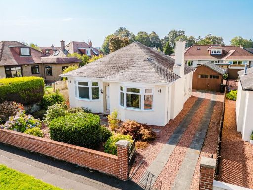 3 bedroom detached bungalow for sale in Fairlie Avenue, Kilmarnock, KA1 — £240,000 • 3 bed • 1 bath • 900 ft²
Meta
- {
"@context": "https://schema.org",
"@type": "Residence",
"name": "3 bedroom detached bungalow for sale in Dundonald Road, Kil…",
"description": "",
"url": "https://propertypiper.co.uk/property/4f467fa7-2436-4dab-bdfe-c6d9f029f964",
"image": "https://image-a.propertypiper.co.uk/7f711d21-8a55-4d0e-9dc2-ae3b00df9239-1024.jpeg",
"address": {
"@type": "PostalAddress",
"streetAddress": "212, DUNDONALD ROAD, KILMARNOCK",
"postalCode": "KA2 0AB",
"addressLocality": "East Ayrshire",
"addressRegion": "Kilmarnock and Loudoun",
"addressCountry": "Scotland"
},
"geo": {
"@type": "GeoCoordinates",
"latitude": 55.6000757,
"longitude": -4.5247442
},
"numberOfRooms": 3,
"numberOfBathroomsTotal": 2,
"floorSize": {
"@type": "QuantitativeValue",
"value": 2153,
"unitCode": "FTK"
},
"offers": {
"@type": "Offer",
"price": 395000,
"priceCurrency": "GBP",
"availability": "https://schema.org/InStock"
},
"additionalProperty": [
{
"@type": "PropertyValue",
"name": "Feature",
"value": "bungalow"
},
{
"@type": "PropertyValue",
"name": "Feature",
"value": "single-story"
},
{
"@type": "PropertyValue",
"name": "Feature",
"value": "asphalt driveway"
},
{
"@type": "PropertyValue",
"name": "Feature",
"value": "garage"
},
{
"@type": "PropertyValue",
"name": "Feature",
"value": "detached"
},
{
"@type": "PropertyValue",
"name": "Feature",
"value": "residential neighborhood"
},
{
"@type": "PropertyValue",
"name": "Feature",
"value": "gabled roof"
},
{
"@type": "PropertyValue",
"name": "Feature",
"value": "bay window"
},
{
"@type": "PropertyValue",
"name": "Feature",
"value": "modern exterior"
},
{
"@type": "PropertyValue",
"name": "Feature",
"value": "contemporary style"
},
{
"@type": "PropertyValue",
"name": "Feature",
"value": "vaulted ceiling"
},
{
"@type": "PropertyValue",
"name": "Feature",
"value": "skylights"
},
{
"@type": "PropertyValue",
"name": "Feature",
"value": "large windows"
},
{
"@type": "PropertyValue",
"name": "Feature",
"value": "open plan"
},
{
"@type": "PropertyValue",
"name": "Feature",
"value": "modern design"
},
{
"@type": "PropertyValue",
"name": "Feature",
"value": "hardwood flooring"
},
{
"@type": "PropertyValue",
"name": "Feature",
"value": "living room"
}
]
}
High Res Floorplan Images
Compatible Floorplan Images
FloorplanImages Thumbnail