TW11 9JX - 2 bedroom flat for sale in Kingston Road, Teddington, TW11
View on Property Piper
2 bedroom flat for sale in Kingston Road, Teddington, TW11
Property Details
- Price: £565000
- Bedrooms: 2
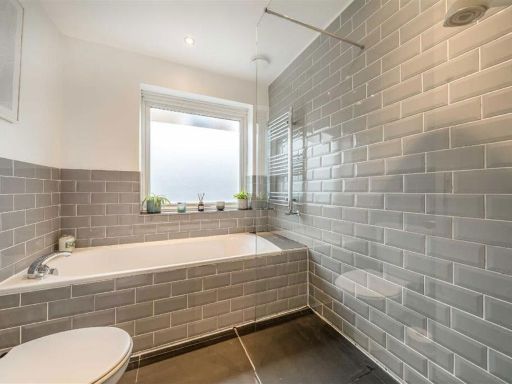
- Bathrooms: 1
- Property Type: undefined
- Property SubType: undefined
Brochure Descriptions
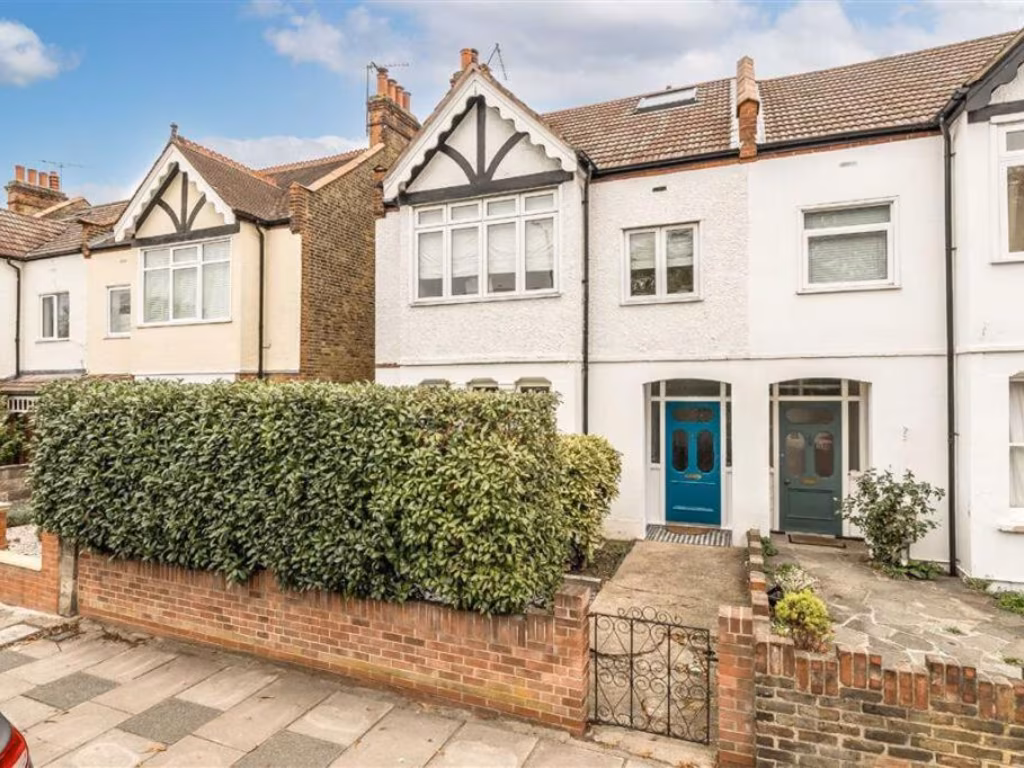
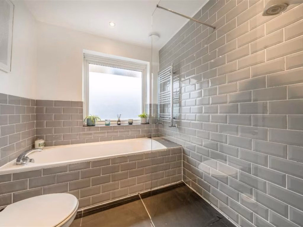
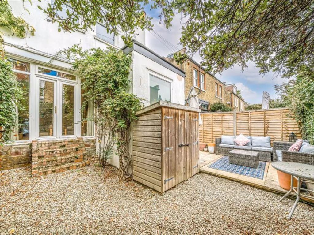
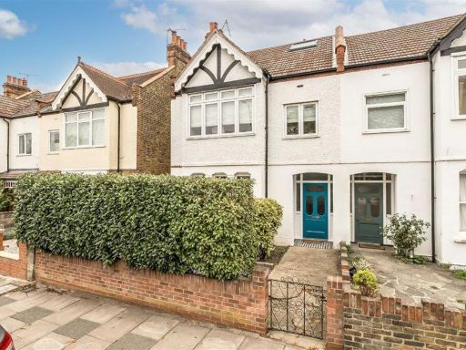
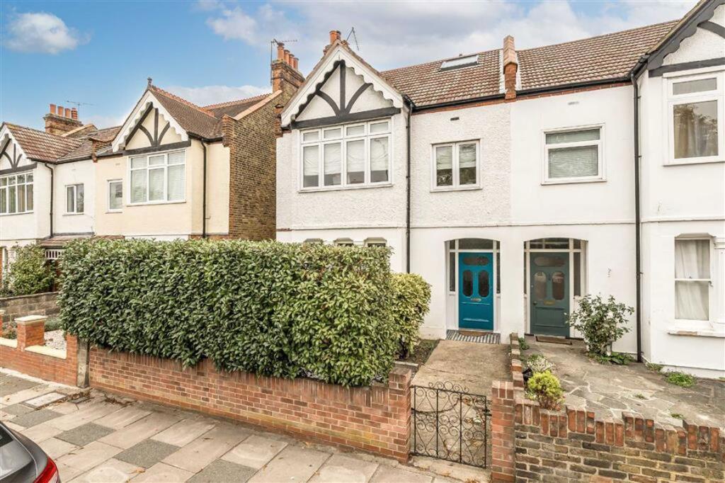
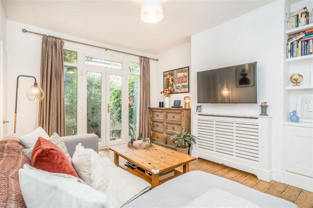
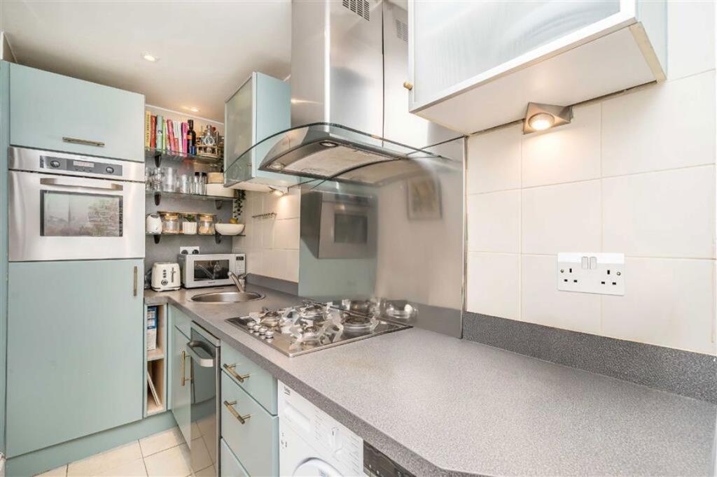
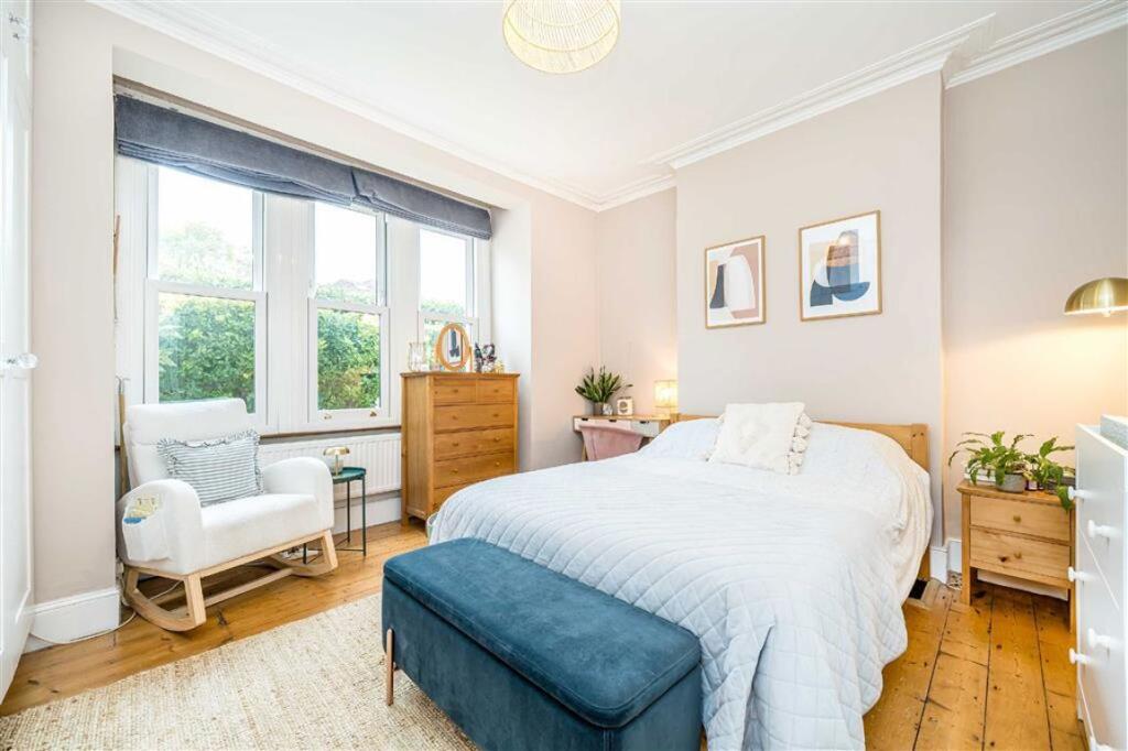
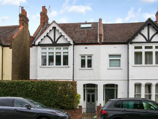
- Mid-terraced two-bedroom period house presented in good decorative order. The front elevation is a traditional painted brick/pebble finish with a small walled front garden and gated path; internal images show a living room, fitted kitchen, and a double bedroom on the first floor together with a second bedroom and bathroom. The property appears to have a private rear garden (small to average size) and benefits from natural light to principal rooms. Located on Kingston Road, within easy walking distance of local high street amenities and rail connections (Kingston/Surbiton area). Overall plot and accommodation size are typical for a two-bedroom terraced house in this suburban area (small-to-average garden; overall property size: small/average).
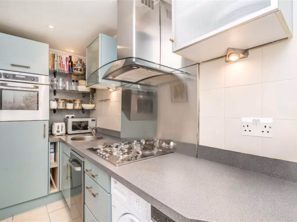
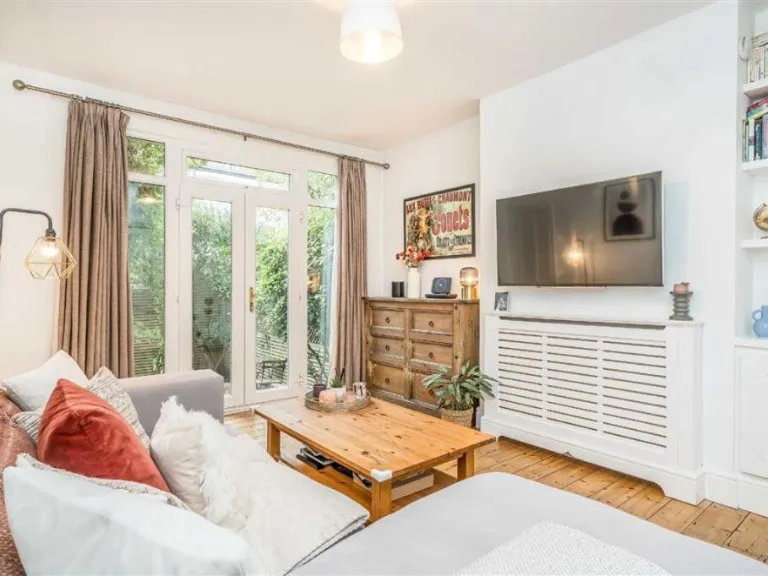
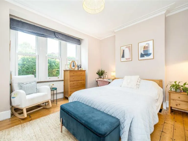
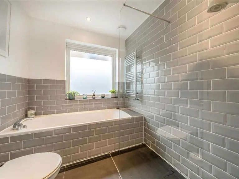
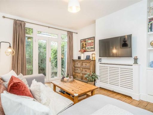
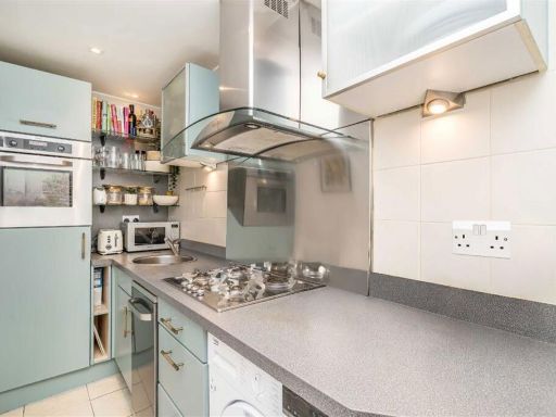
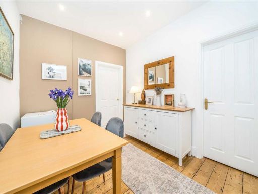
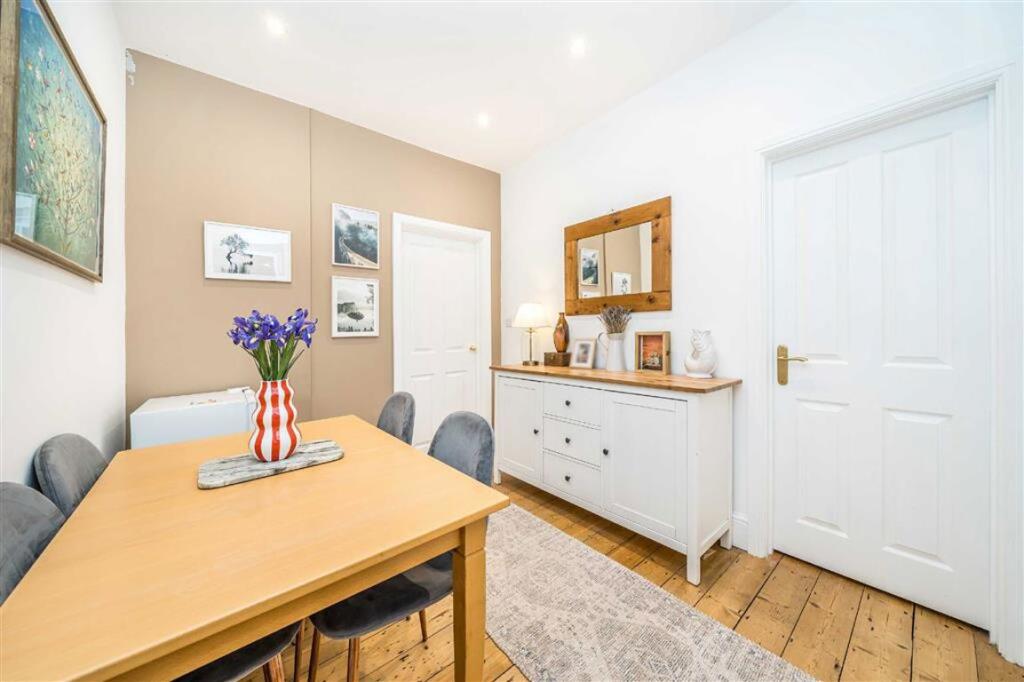
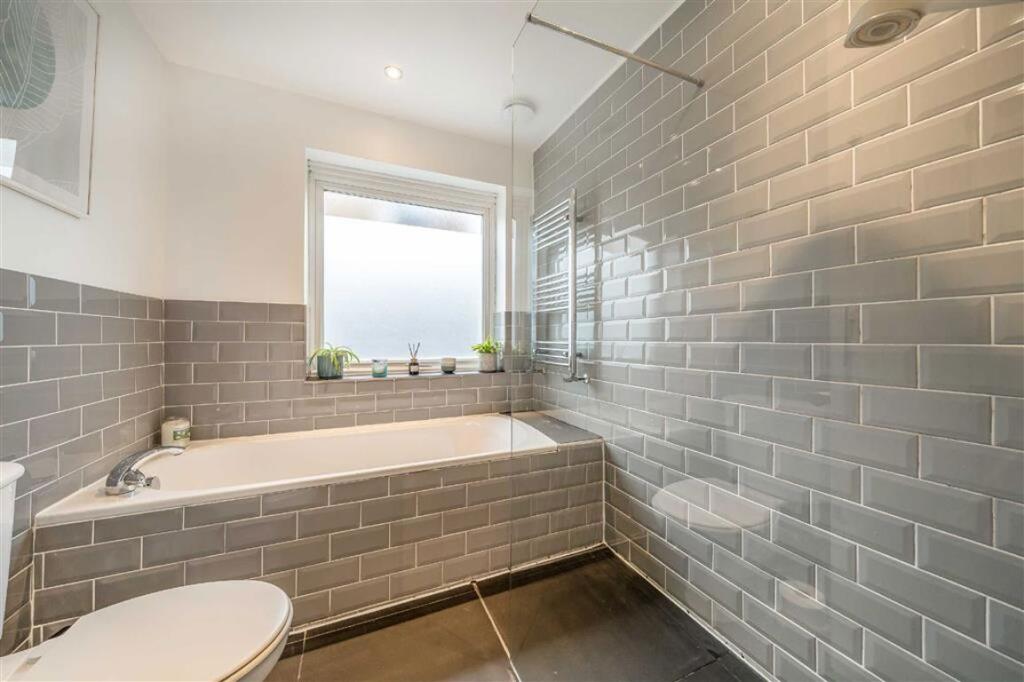
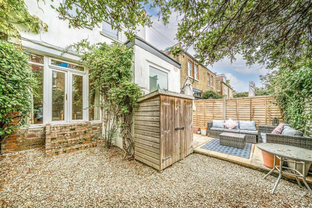
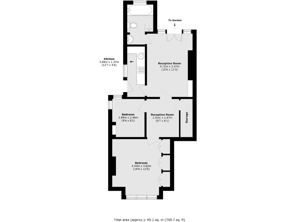
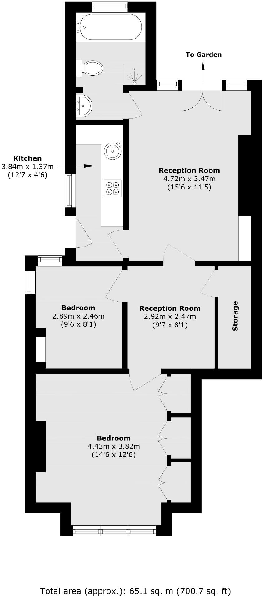
- Ground-floor flat arranged over a single level shown on the floorplan. The accommodation comprises two bedrooms (one larger front bedroom and one smaller mid bedroom), two reception rooms (one larger rear reception with doors leading out to a garden and one smaller central reception), a separate kitchen and a bathroom. There is also a storage/utility cupboard off the inner reception. The layout indicates a through-plan arrangement from front to back with direct access to a rear garden. Room sizes are modest — the property footprint is typical of a compact urban flat (total area stated on the plan: approx. 65.1 sq. m / 700.7 sq. ft). Overall the property is a small-to-medium sized ground-floor flat suitable for first-time buyers or buy-to-let investors, with rear garden amenity and dual reception flexibility which adds functional living space.
Image Descriptions
- exterior of an early 20th-century semi-detached house Tudor Revival
- living room modern
Rooms
- Kitchen:
- Reception Room:
- Reception Room:
- Bedroom:
- Bedroom:
Textual Property Features
Detected Visual Features
- Tudor Revival
- semi-detached
- brickwork
- gable
- traditional
- period property
- bay windows
- modern living room
- French doors
- wooden flooring
- garden access
EPC Details
- Fully double glazed
- Solid brick, as built, no insulation (assumed)
- Boiler and radiators, mains gas
- Low energy lighting in 63% of fixed outlets
- Suspended, no insulation (assumed)
Nearby Schools
- Fern Hill Primary School
- The Tiffin Girls' School
- St Mary's and St Peter's Church of England Primary School
- Newland House School
- St Richard Reynolds Catholic Primary School
- Orleans Primary School
- Hampton Wick Infant and Nursery School
- Sacred Heart Roman Catholic Primary School
- Collis Primary School
- The Kingston Academy
- St Richard's Church of England Primary School
- St James's Roman Catholic Primary School
- Grey Court School
- St Mary's Church of England Primary School
- Teddington School
- Meadlands Primary School
- Twickenham Primary Academy
- The German School
- Orleans Park School
- Hampton Court House
- St John the Baptist Church of England Junior School
- Stanley Primary School
- Radnor House
- Archdeacon Cambridge's Church of England Primary School
- St Catherine's School
- The Russell Primary School
- St Richard Reynolds Catholic High School
Nearest General Shops
- Id: 850120518
- Tags:
- Building: yes
- Shop: car_repair
- TagsNormalized:
- Lat: 51.4278847
- Lon: -0.3262505
- FullGeoHash: gcpu8d4mju9c
- PartitionGeoHash: gcpu
- Images:
- FoodStandards: null
- Distance: 280.3
,- Id: 708005540
- Tags:
- Addr:
- City: Teddington
- Housenumber: 161
- Street: High Street
- Building: retail
- Building:levels: 3
- Contact:
- Name: Holmes and Daughters
- Opening_hours: Mo-Fr 09:00-17:00
- Shop: funeral_directors
- TagsNormalized:
- retail
- funeral
- funeral directors
- shop
- Lat: 51.4278083
- Lon: -0.3262
- FullGeoHash: gcpu8d4kwyrd
- PartitionGeoHash: gcpu
- Images:
- FoodStandards: null
- Distance: 272.4
,- Id: 710474611
- Tags:
- Addr:
- Housenumber: 174
- Street: High Street
- Building: retail
- Building:levels: 2
- Name: Fari’s
- Shop: hairdresser
- TagsNormalized:
- Lat: 51.4274518
- Lon: -0.3263906
- FullGeoHash: gcpu8d46dece
- PartitionGeoHash: gcpu
- Images:
- FoodStandards: null
- Distance: 262.1
}
Nearest Grocery shops
- Id: 707077037
- Tags:
- Addr:
- Housenumber: 156
- Postcode: TW11 8HZ
- Street: High Street
- Building: retail
- Building:levels: 3
- Contact:
- Website: https://www.cookfood.net/shops/Teddington
- Fhrs:
- Name: Cook
- Roof:
- Shop: frozen_food
- Source:
- TagsNormalized:
- retail
- frozen food
- food
- shop
- Lat: 51.4273326
- Lon: -0.3273073
- FullGeoHash: gcpu8d19vjtu
- PartitionGeoHash: gcpu
- Images:
- FoodStandards: null
- Distance: 314.7
,- Id: 1060572944
- Tags:
- Addr:
- City: Teddington
- Housenumber: 149
- Postcode: TW11 9JP
- Street: Kingston Road
- Building: yes
- Fhrs:
- Name: Teddington Food & Wine
- Shop: convenience
- Source: FHRS Open Data
- TagsNormalized:
- Lat: 51.4240264
- Lon: -0.3212453
- FullGeoHash: gcpu89qndmq4
- PartitionGeoHash: gcpu
- Images:
- FoodStandards: null
- Distance: 286.1
,- Id: 708005543
- Tags:
- Addr:
- Housenumber: 196
- Postcode: TW11 8HU
- Street: High Street
- Brand: Sainsbury's Local
- Brand:wikidata: Q13218434
- Brand:wikipedia: en:Sainsbury's Local
- Building: retail
- Building:levels: 1
- Fhrs:
- Name: Sainsbury's Local
- Shop: convenience
- Source:
- TagsNormalized:
- sainsburys
- sainsburys local
- retail
- convenience
- shop
- Lat: 51.4275023
- Lon: -0.3256869
- FullGeoHash: gcpu8d4ffvq0
- PartitionGeoHash: gcpu
- Images:
- FoodStandards: null
- Distance: 223.6
}
Nearest Supermarkets
- Id: 4770293
- Tags:
- Addr:
- City: Kingston upon Thames
- Housenumber: 1
- Postcode: KT2 5NZ
- Street: Sury Basin
- Alt_name: Sainsbury's Sury Basin Superstore
- Brand: Sainsbury's
- Brand:wikidata: Q152096
- Brand:wikipedia: en:Sainsbury's
- Building: yes
- Name: Sainsbury's
- Shop: supermarket
- TagsNormalized:
- sainsburys
- supermarket
- shop
- Lat: 51.4155913
- Lon: -0.303206
- FullGeoHash: gcpu3pgjwbch
- PartitionGeoHash: gcpu
- Images:
- FoodStandards: null
- Distance: 1822.9
,- Id: 289309563
- Tags:
- Addr:
- City: Teddington
- Housenumber: 20-28
- Postcode: TW11 8RF
- Street: Broad Street
- Brand: Tesco
- Brand:wikidata: Q487494
- Building: yes
- Fhrs:
- Name: Tesco
- Opening_hours: Mo-Fr 07:00-23:00; Sa 07:00-22:00; Su 11:00-17:00; PH Mo 08:00-20:00
- Operator: Tesco
- Phone: +44 345 6779669
- Shop: supermarket
- Wheelchair: yes
- TagsNormalized:
- Lat: 51.4257429
- Lon: -0.3385908
- FullGeoHash: gcpu83c2wm23
- PartitionGeoHash: gcpu
- Images:
- FoodStandards: null
- Distance: 1078.9
,- Id: 731909920
- Tags:
- Addr:
- City: Teddington
- Housenumber: 210
- Postcode: TW11 9JF
- Street: Kingston Road
- Brand: Co-op Food
- Brand:wikidata: Q3277439
- Building: retail
- Building:levels: 0
- Fhrs:
- Name: Co-op Food
- Operator: The Co-operative Group
- Operator:wikidata: Q117202
- Shop: supermarket
- Smoking: outside
- Website: https://www.coop.co.uk/store-finder/TW11-9JF/210-kingston-road
- TagsNormalized:
- co-op
- co-op food
- food
- retail
- supermarket
- shop
- Lat: 51.4207801
- Lon: -0.3189635
- FullGeoHash: gcpu88zez85t
- PartitionGeoHash: gcpu
- Images:
- FoodStandards: null
- Distance: 680.1
}
Nearest Religious buildings
- Id: 256206205
- Tags:
- Addr:
- City: Teddington
- Street: St. Mark's Road
- Amenity: place_of_worship
- Architect: Cyril Farey
- Architect:wikidata: Q25138493
- Architect:wikipedia: en:Cyril Farey
- Building: church
- Contact:
- Website: http://stmarkteddington.uk
- Denomination: anglican
- Image: https://commons.wikimedia.org/wiki/File:St_Mark’s,_Teddington.jpg
- Name: Saint Mark's Parish Church of South Teddington and Hampton Wick
- Religion: christian
- Short_name: St Mark's
- Source: Bing
- Source:name: OpenStreetBugs
- Wikidata: Q20055654
- Wikipedia: en:St Mark's, Teddington
- TagsNormalized:
- place of worship
- church
- anglican
- parish
- christian
- Lat: 51.4210793
- Lon: -0.3209311
- FullGeoHash: gcpu88ym3zbm
- PartitionGeoHash: gcpu
- Images:
- FoodStandards: null
- Distance: 603
,- Id: 468656659
- Tags:
- Addr:
- City: Teddington
- Housename: St Mary With St Alban C of E Church
- Housenumber: 7
- Postcode: TW11 9NN
- Street: Twickenham Road
- Amenity: place_of_worship
- Building: church
- Denomination: anglican
- Name: St Mary With St Alban C of E Church
- Religion: christian
- Wikidata: Q17531025
- TagsNormalized:
- place of worship
- church
- anglican
- christian
- Lat: 51.4285592
- Lon: -0.3253008
- FullGeoHash: gcpu8d715fq1
- PartitionGeoHash: gcpu
- Images:
- FoodStandards: null
- Distance: 291.9
,- Id: 810884221
- Tags:
- Amenity: community_centre
- Building: yes
- Name: St Mary with St Alban Church Hall
- TagsNormalized:
- community centre
- church
- church hall
- Lat: 51.4277551
- Lon: -0.3251239
- FullGeoHash: gcpu8d5k2h6h
- PartitionGeoHash: gcpu
- Images:
- FoodStandards: null
- Distance: 213
}
Nearest Medical buildings
- Id: 781268997
- Tags:
- Addr:
- Housenumber: 202
- Postcode: TW11 9JD
- Street: Kingston Road
- Amenity: pharmacy
- Building: yes
- Building:levels: 2
- Dispensing: yes
- Healthcare: pharmacy
- Name: Herbert and Shrive
- Roof:
- TagsNormalized:
- Lat: 51.421167
- Lon: -0.3191906
- FullGeoHash: gcpu88zw4261
- PartitionGeoHash: gcpu
- Images:
- FoodStandards: null
- Distance: 634.4
,- Id: 952589869
- Tags:
- Addr:
- Amenity: pharmacy
- Building: yes
- Dispensing: yes
- Healthcare: pharmacy
- Name: Kirby's Pharmacy & Dentist
- TagsNormalized:
- pharmacy
- health
- healthcare
- dentist
- Lat: 51.427555
- Lon: -0.3312753
- FullGeoHash: gcpu86ng0xp5
- PartitionGeoHash: gcpu
- Images:
- FoodStandards: null
- Distance: 585.6
,- Id: 298834096
- Tags:
- Addr:
- Housenumber: 53
- Postcode: TW11 8HA
- Street: High Street
- Amenity: pharmacy
- Building: commercial
- Healthcare: pharmacy
- Name: Kirby's Pharmacy & Dentist
- TagsNormalized:
- pharmacy
- health
- healthcare
- dentist
- Lat: 51.4273813
- Lon: -0.3312965
- FullGeoHash: gcpu86nf0nxq
- PartitionGeoHash: gcpu
- Images:
- FoodStandards: null
- Distance: 582.8
,- Id: 298834147
- Tags:
- Addr:
- Housenumber: 55
- Postcode: TW11 8HA
- Street: High Street
- Amenity: pharmacy
- Building: yes
- Dispensing: yes
- Healthcare: pharmacy
- Name: Kirby's Pharmacy & Dentist
- TagsNormalized:
- pharmacy
- health
- healthcare
- dentist
- Lat: 51.4273825
- Lon: -0.3312143
- FullGeoHash: gcpu86nf4nuw
- PartitionGeoHash: gcpu
- Images:
- FoodStandards: null
- Distance: 577.3
}
Nearest Airports
- Id: 260720166
- Tags:
- Aerodrome: international
- Aeroway: aerodrome
- Alt_name: Gatwick Airport
- Ele: 62
- Iata: LGW
- Icao: EGKK
- Internet_access: wlan
- Internet_access:fee: no
- Internet_access:ssid: Gatwick FREE Wi-Fi
- Name: London Gatwick Airport
- Operator: Gatwick Airport Limited
- Ref: LGW
- Website: https://www.gatwickairport.com/
- Wikidata: Q8703
- Wikipedia: en:Gatwick Airport
- TagsNormalized:
- airport
- international airport
- Lat: 51.1540917
- Lon: -0.1883773
- FullGeoHash: gcpg58qf4mzd
- PartitionGeoHash: gcpg
- Images:
- FoodStandards: null
- Distance: 31688
,- Id: 121158889
- Tags:
- Aerodrome: continental
- Aeroway: aerodrome
- Fhrs:
- Authority: City of London Corporation
- Iata: LCY
- Icao: EGLC
- Name: London City Airport
- Operator: London City Airport Limited
- Ref: LCY
- Website: https://www.londoncityairport.com/
- Wikidata: Q8982
- Wikipedia: en:London City Airport
- TagsNormalized:
- airport
- continental airport
- Lat: 51.5042658
- Lon: 0.0539987
- FullGeoHash: u10j10p64702
- PartitionGeoHash: u10j
- Images:
- FoodStandards: null
- Distance: 27519.7
,- Id: 14001268
- Tags:
- Access: yes
- Aerodrome: international
- Aerodrome:type: public
- Aeroway: aerodrome
- Alt_name: London Heathrow
- Alt_name_2: London Heathrow Airport
- Ele: 25
- Iata: LHR
- Icao: EGLL
- Int_name: Heathrow Airport
- Name: London Heathrow Airport
- Note: area still approx
- Old_name: London Airport
- Operator: Heathrow Airport Limited
- Rank_aci:
- Ref: LHR
- Short_name: Heathrow
- Type: multipolygon
- Website: https://www.heathrow.com/
- Wikidata: Q8691
- Wikipedia: en:Heathrow Airport
- TagsNormalized:
- airport
- international airport
- Lat: 51.4677522
- Lon: -0.4547736
- FullGeoHash: gcpsv9kv7h2h
- PartitionGeoHash: gcps
- Images:
- FoodStandards: null
- Distance: 10223.8
}
Nearest Leisure Facilities
- Id: 850120493
- Tags:
- Leisure: pitch
- Lit: no
- Sport: cricket
- Surface: grass
- TagsNormalized:
- pitch
- leisure
- cricket
- sports
- Lat: 51.4273367
- Lon: -0.3224226
- FullGeoHash: gcpu8dj1zn2k
- PartitionGeoHash: gcpu
- Images:
- FoodStandards: null
- Distance: 119.5
,- Id: 1029547470
- Tags:
- Leisure: pitch
- Lit: no
- Sport: soccer
- Surface: grass
- TagsNormalized:
- Lat: 51.4262155
- Lon: -0.3213688
- FullGeoHash: gcpu89vgrt6h
- PartitionGeoHash: gcpu
- Images:
- FoodStandards: null
- Distance: 117.9
,- Id: 1029547473
- Tags:
- Leisure: pitch
- Lit: no
- Sport: rugby_union
- Surface: grass
- TagsNormalized:
- pitch
- leisure
- rugby
- rugby union
- sports
- Lat: 51.4269963
- Lon: -0.3219232
- FullGeoHash: gcpu89vxfwuw
- PartitionGeoHash: gcpu
- Images:
- FoodStandards: null
- Distance: 107.5
,- Id: 850120488
- Tags:
- Leisure: pitch
- Lit: no
- Sport: soccer
- Surface: grass
- TagsNormalized:
- Lat: 51.4255841
- Lon: -0.3222095
- FullGeoHash: gcpu89trezxn
- PartitionGeoHash: gcpu
- Images:
- FoodStandards: null
- Distance: 102.4
,- Id: 850120491
- Tags:
- Leisure: pitch
- Lit: no
- Name: Nets
- Sport: cricket
- TagsNormalized:
- pitch
- leisure
- cricket
- sports
- Lat: 51.4259685
- Lon: -0.3223234
- FullGeoHash: gcpu89v3cr67
- PartitionGeoHash: gcpu
- Images:
- FoodStandards: null
- Distance: 65.4
}
Nearest Tourist attractions
- Id: 10314624068
- Tags:
- Addr:
- City: Twickenham
- Housenumber: 25
- Postcode: TW1 3DU
- Street: The Embankment
- Check_date: 2023-01-08
- Contact:
- Phone: +44 20 8892 4077
- Website: https://twickenham-museum.org.uk
- Fee: no
- Museum: history
- Name: Twickenham Museum
- Opening_hours: Sa 13:00-15:00; Su 14:00-16:00
- Operator:
- Tourism: museum
- Wheelchair: limited
- TagsNormalized:
- Lat: 51.4468203
- Lon: -0.3256181
- FullGeoHash: gcpu8tdgkw3t
- PartitionGeoHash: gcpu
- Images:
- FoodStandards: null
- Distance: 2284.5
,- Id: 16960853
- Tags:
- Amenity: fountain
- Artwork_type: statue
- Name: Diana Fountain
- Tourism: artwork
- Wikidata: Q5271155
- Wikipedia: en:Diana Fountain, Bushy Park
- TagsNormalized:
- Lat: 51.4099265
- Lon: -0.3362121
- FullGeoHash: gcpu2qght8yh
- PartitionGeoHash: gcpu
- Images:
- FoodStandards: null
- Distance: 2040.1
,- Id: 207444024
- Tags:
- Addr:
- City: Twickenham
- Housenumber: 268
- Postcode: TW1 4ST
- Street: Waldegrave Road
- Building: detached
- Building:colour: white
- Building:levels: 3
- Fhrs:
- Historic: house
- Name: Strawberry Hill House
- Roof:
- Source:
- Tourism: villa
- Wikidata: Q7622436
- Wikipedia: en:Strawberry Hill House
- TagsNormalized:
- Lat: 51.4381936
- Lon: -0.3348139
- FullGeoHash: gcpu8kh1nq28
- PartitionGeoHash: gcpu
- Images:
- FoodStandards: null
- Distance: 1549.9
}
Nearest Hotels
- Id: 298834132
- Tags:
- Addr:
- Housenumber: 19
- Postcode: TW11 0AB
- Street: Park Road
- Building: yes
- Building:levels: 3
- Fhrs:
- Name: The Park Hotel
- Source:
- Tourism: hotel
- Wikidata: Q27085011
- TagsNormalized:
- Lat: 51.4256307
- Lon: -0.3341924
- FullGeoHash: gcpu83u8hb2h
- PartitionGeoHash: gcpu
- Images:
- FoodStandards: null
- Distance: 775.9
,- Id: 710474607
- Tags:
- Addr:
- Housename: Park House
- Postcode: TW11 9AD
- Street: Station Road
- Brand: Travelodge
- Brand:wikidata: Q9361374
- Building: yes
- Building:levels: 7
- Fhrs:
- Authority: Richmond-Upon-Thames
- Id: 433136
- Local_authority_id: 117581
- Internet_access: wlan
- Internet_access:fee: customers
- Internet_access:ssid: Travelodge WiFi
- Name: Travelodge
- Source:
- Tourism: hotel
- TagsNormalized:
- Lat: 51.4263809
- Lon: -0.3335567
- FullGeoHash: gcpu83vh7s4p
- PartitionGeoHash: gcpu
- Images:
- FoodStandards: null
- Distance: 727.9
,- Id: 197804158
- Tags:
- Addr:
- Postcode: TW11 9NU
- Street: Broom Road
- Building: yes
- Fhrs:
- Name: The Lensbury
- Source:
- Tourism: hotel
- Wikidata: Q6523233
- TagsNormalized:
- Lat: 51.4279282
- Lon: -0.3193053
- FullGeoHash: gcpu8dpmrsst
- PartitionGeoHash: gcpu
- Images:
- FoodStandards: null
- Distance: 314.6
}
Tags
- Tudor Revival
- semi-detached
- brickwork
- gable
- traditional
- period property
- bay windows
- modern living room
- French doors
- wooden flooring
- garden access
Local Market Stats
- Average Price/sqft: £736
- Avg Income: £71700
- Rental Yield: 4.2%
- Social Housing: 7%
- Planning Success Rate: 83%
AirBnB Data
- 1km average: £153/night
- Listings in 1km: 3
Similar Properties
 2 bedroom apartment for sale in Kingston Road, Teddington, TW11 — £565,000 • 2 bed • 1 bath • 731 ft²
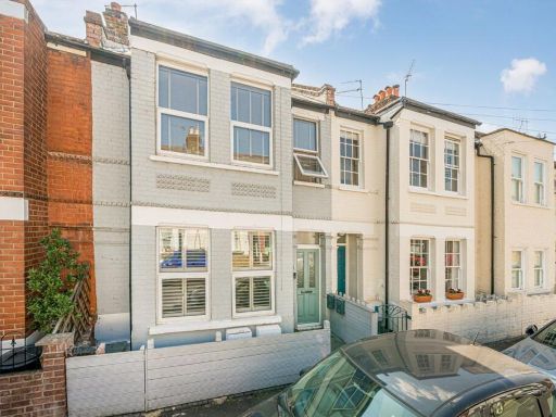 2 bedroom flat for sale in Stanley Gardens Road, Teddington, TW11 — £495,000 • 2 bed • 1 bath • 630 ft²
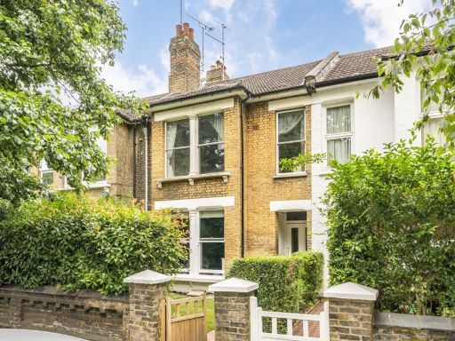 2 bedroom flat for sale in Kingston Road, Teddington, TW11 — £499,950 • 2 bed • 1 bath • 1129 ft²
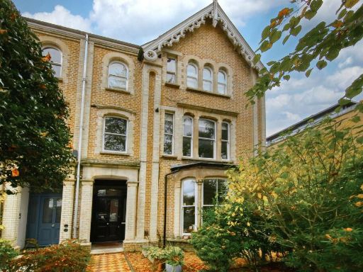 2 bedroom apartment for sale in Cromwell Road, Teddington, TW11 — £475,000 • 2 bed • 1 bath • 581 ft²
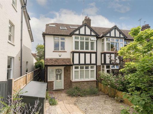 4 bedroom semi-detached house for sale in Kingston Road, Teddington, TW11 — £1,225,000 • 4 bed • 2 bath • 1441 ft²
 2 bedroom flat for sale in Waldegrave Road, Teddington, TW11 — £499,950 • 2 bed • 1 bath • 722 ft²
Meta
- {
"@context": "https://schema.org",
"@type": "Residence",
"name": "2 bedroom flat for sale in Kingston Road, Teddington, TW11",
"description": "",
"url": "https://propertypiper.co.uk/property/4f3c77bd-b688-48ce-8e1c-e19a95c2dbe4",
"image": "https://image-a.propertypiper.co.uk/9fdbd8bc-7562-4473-83ec-85ebf161d25d-1024.jpeg",
"address": {
"@type": "PostalAddress",
"streetAddress": "77b, Kingston Road",
"postalCode": "TW11 9JX",
"addressLocality": "Richmond upon Thames",
"addressRegion": "Twickenham",
"addressCountry": "England"
},
"geo": {
"@type": "GeoCoordinates",
"latitude": 51.426337669375826,
"longitude": -0.3230583647849319
},
"numberOfRooms": 2,
"numberOfBathroomsTotal": 1,
"floorSize": {
"@type": "QuantitativeValue",
"value": 700,
"unitCode": "FTK"
},
"offers": {
"@type": "Offer",
"price": 565000,
"priceCurrency": "GBP",
"availability": "https://schema.org/InStock"
},
"additionalProperty": [
{
"@type": "PropertyValue",
"name": "Feature",
"value": "Tudor Revival"
},
{
"@type": "PropertyValue",
"name": "Feature",
"value": "semi-detached"
},
{
"@type": "PropertyValue",
"name": "Feature",
"value": "brickwork"
},
{
"@type": "PropertyValue",
"name": "Feature",
"value": "gable"
},
{
"@type": "PropertyValue",
"name": "Feature",
"value": "traditional"
},
{
"@type": "PropertyValue",
"name": "Feature",
"value": "period property"
},
{
"@type": "PropertyValue",
"name": "Feature",
"value": "bay windows"
},
{
"@type": "PropertyValue",
"name": "Feature",
"value": "modern living room"
},
{
"@type": "PropertyValue",
"name": "Feature",
"value": "French doors"
},
{
"@type": "PropertyValue",
"name": "Feature",
"value": "wooden flooring"
},
{
"@type": "PropertyValue",
"name": "Feature",
"value": "garden access"
}
]
}
High Res Floorplan Images
Compatible Floorplan Images
FloorplanImages Thumbnail