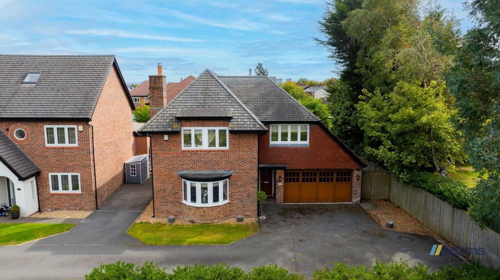
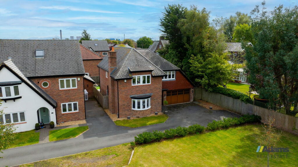
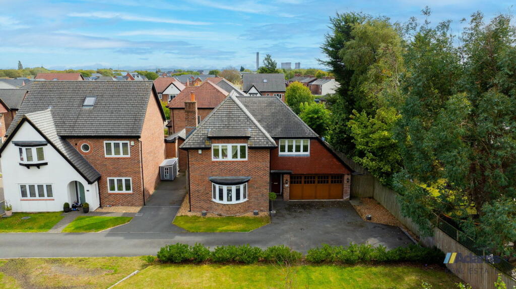
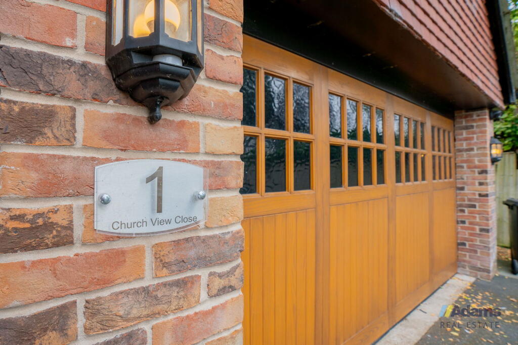
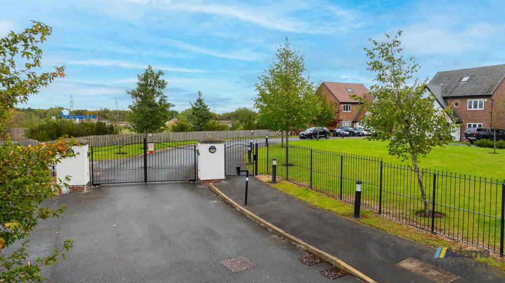
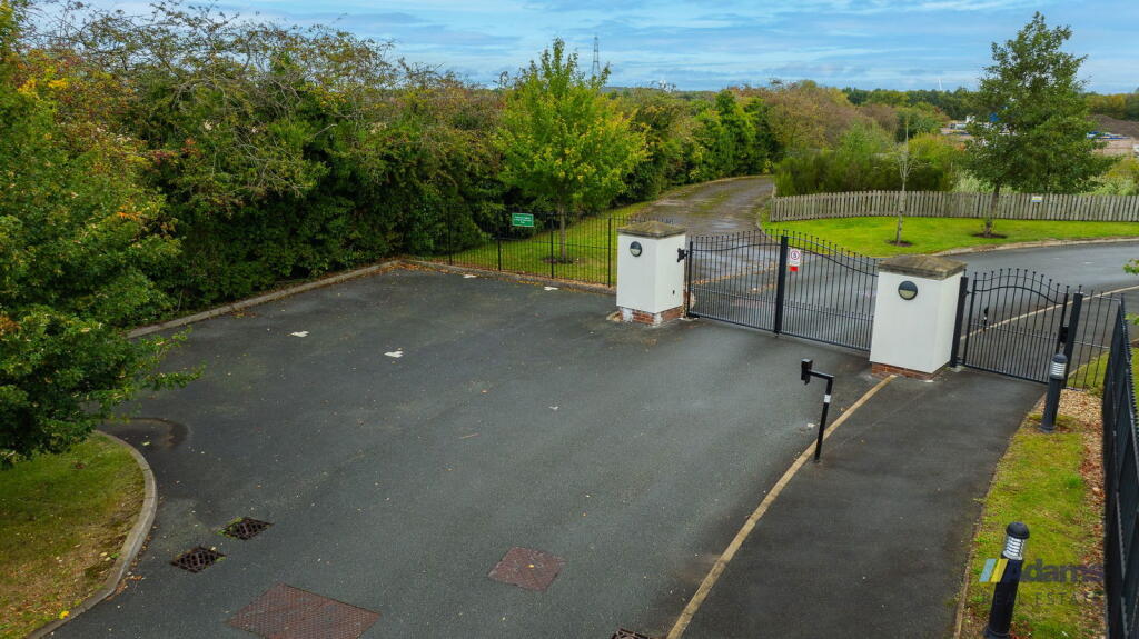
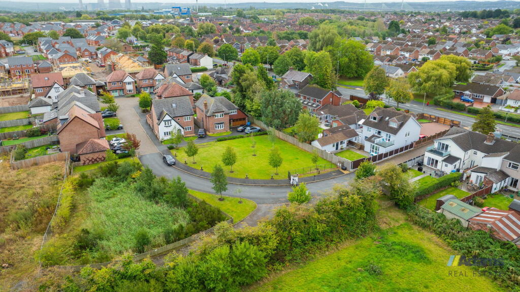
WA8 5AA - 5 bedroom detached house for sale in Church View Close, Wid…
View on Property Piper
5 bedroom detached house for sale in Church View Close, Widnes, WA8
Property Details
- Price: £600000
- Bedrooms: 5
- Bathrooms: 3
- Property Type: undefined
- Property SubType: undefined
Image Descriptions
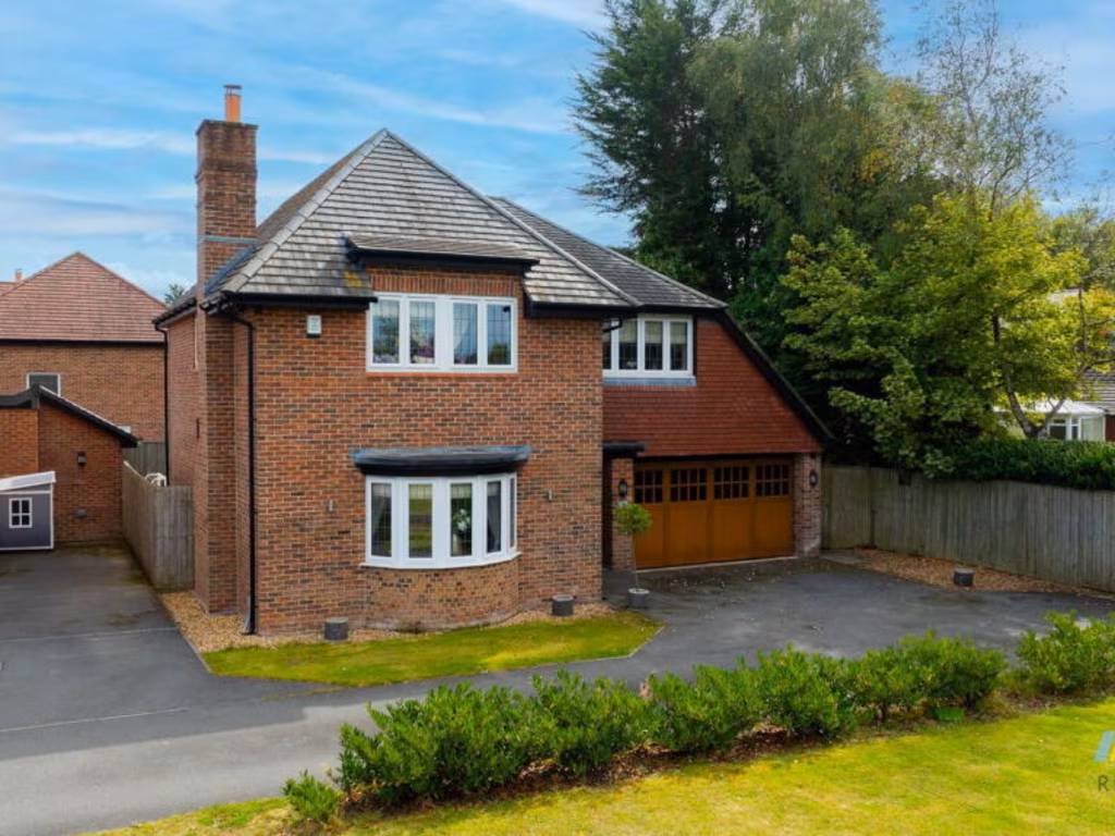
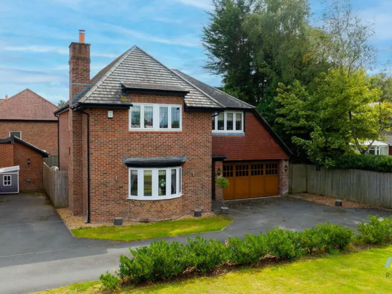
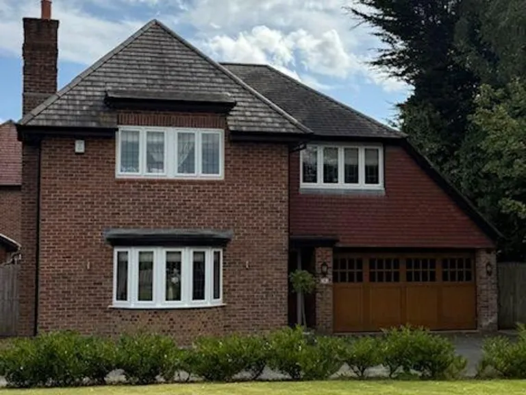
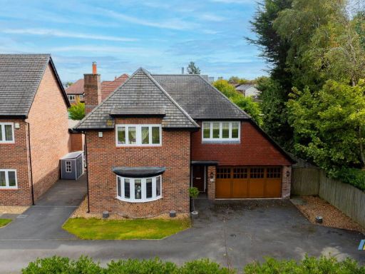
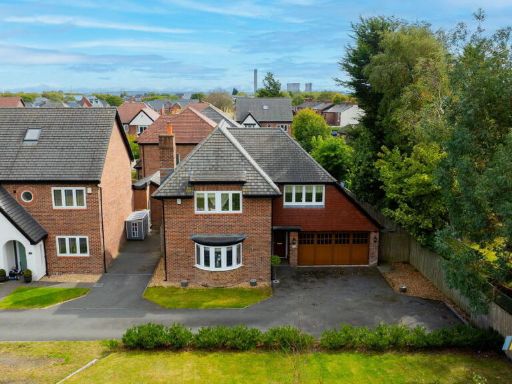
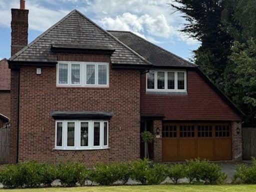
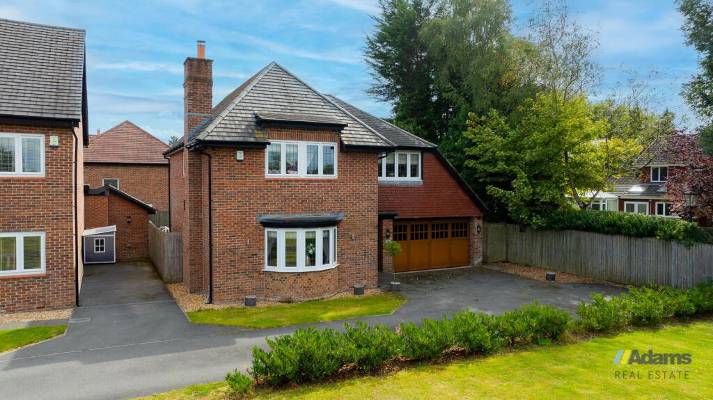
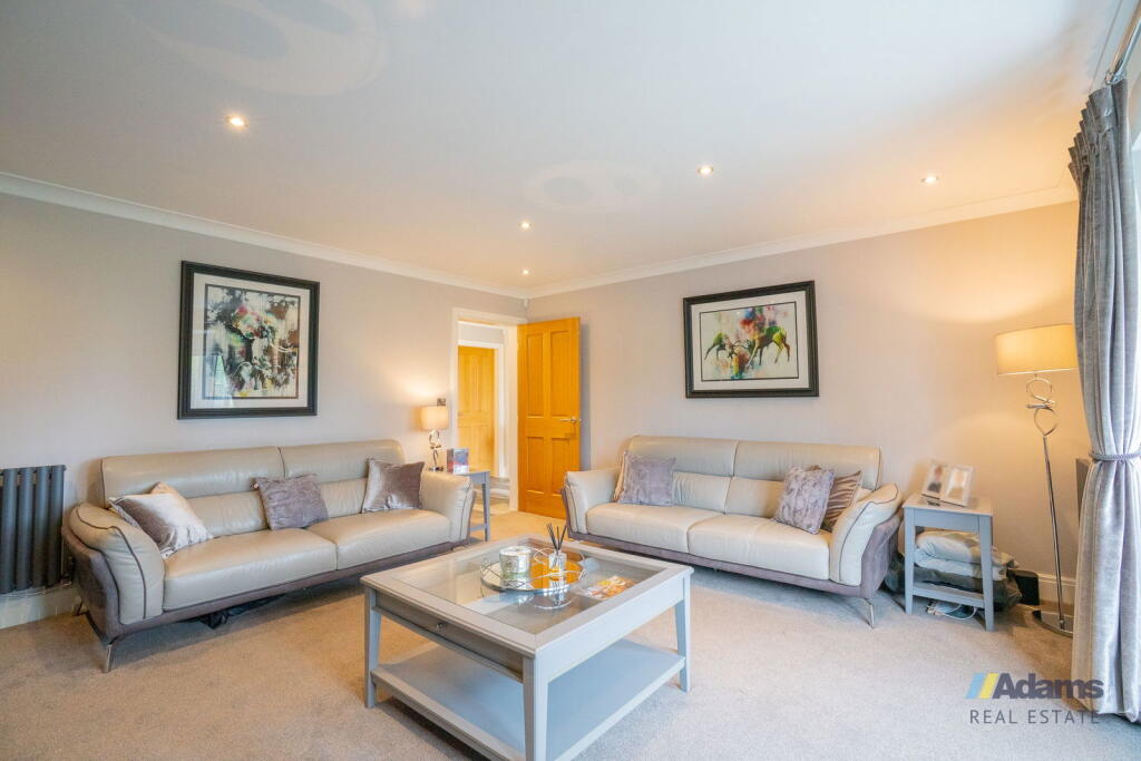
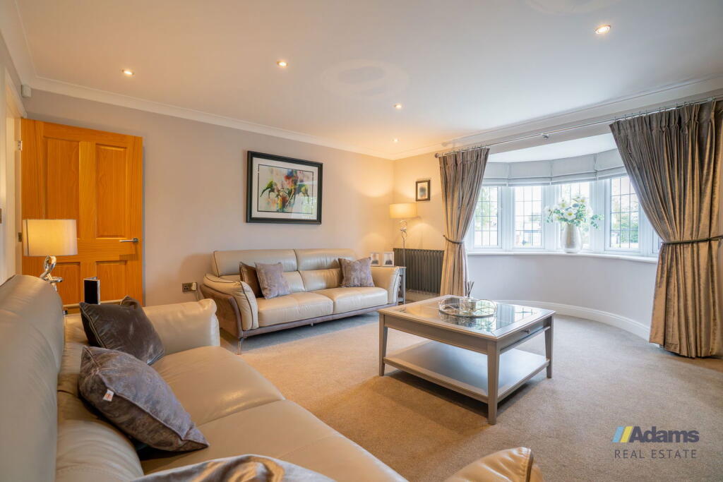
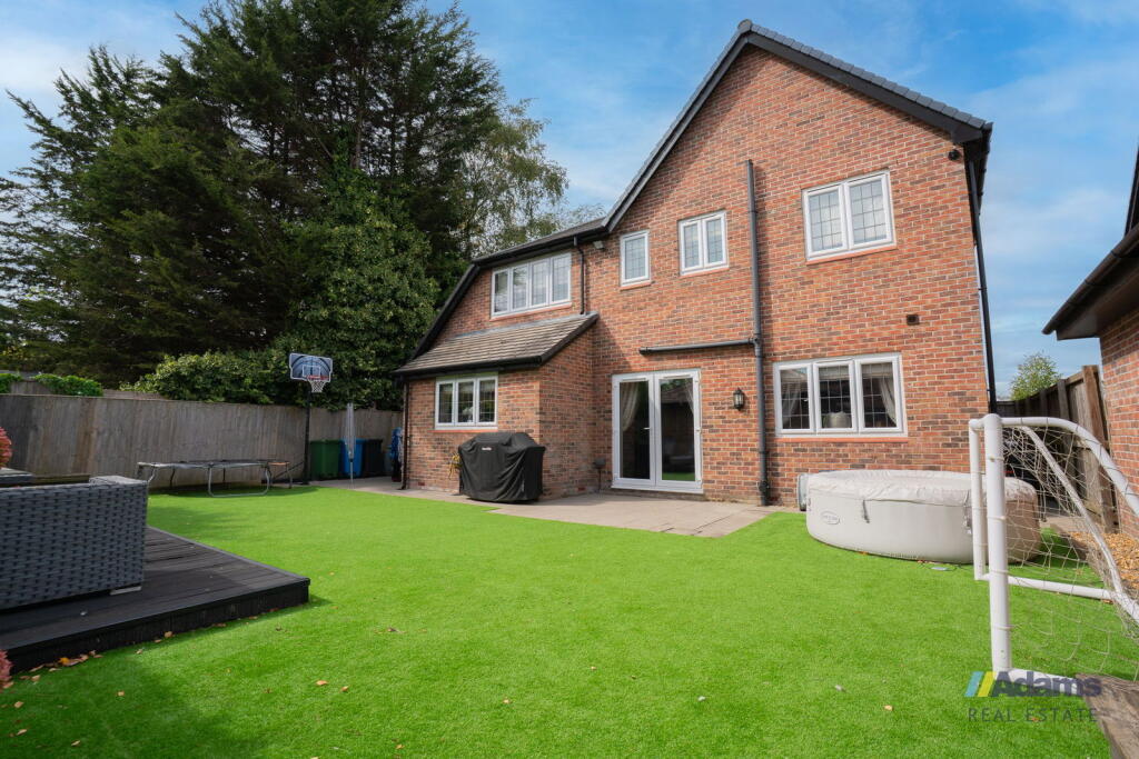
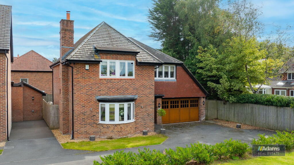
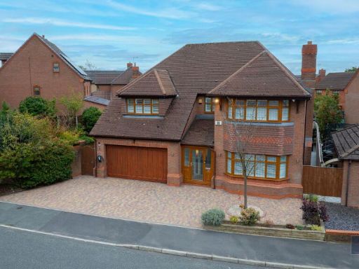
- detached house modern
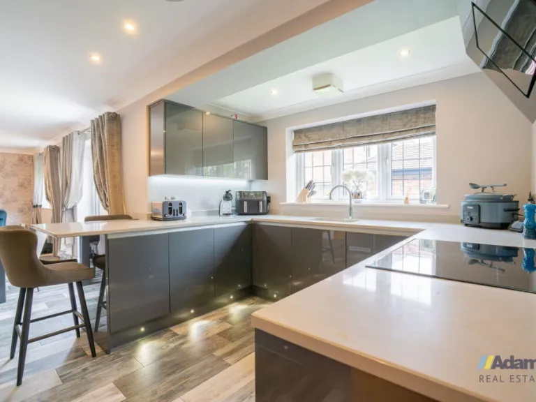
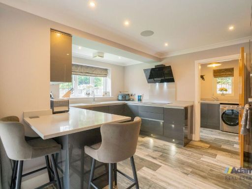
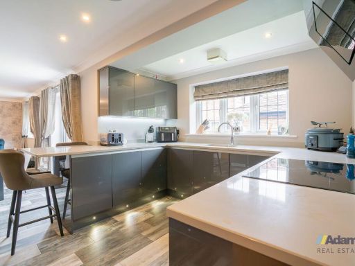
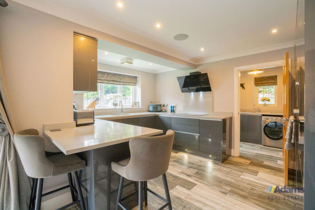
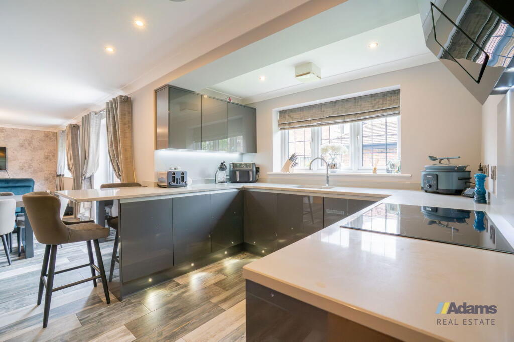
- kitchen contemporary
Floorplan Description
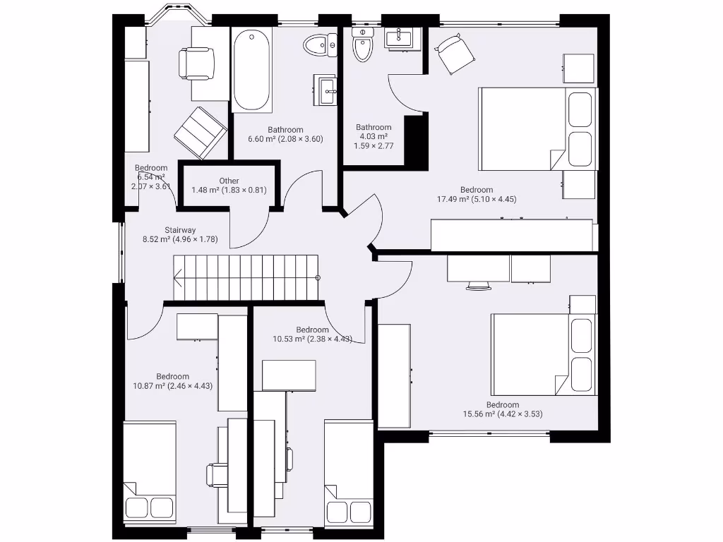
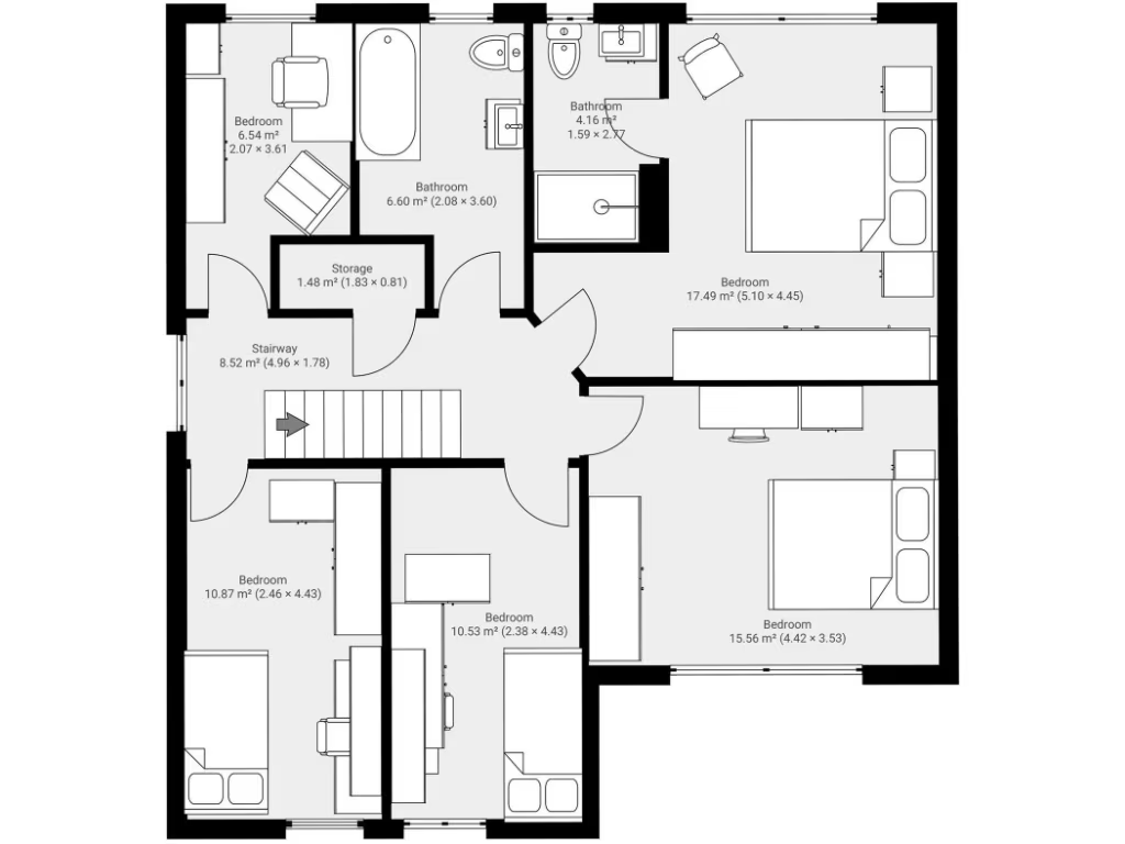
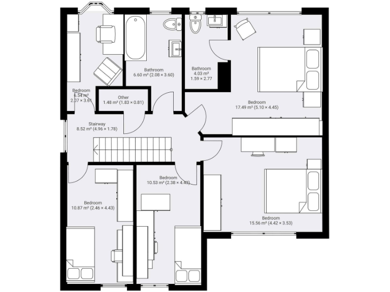
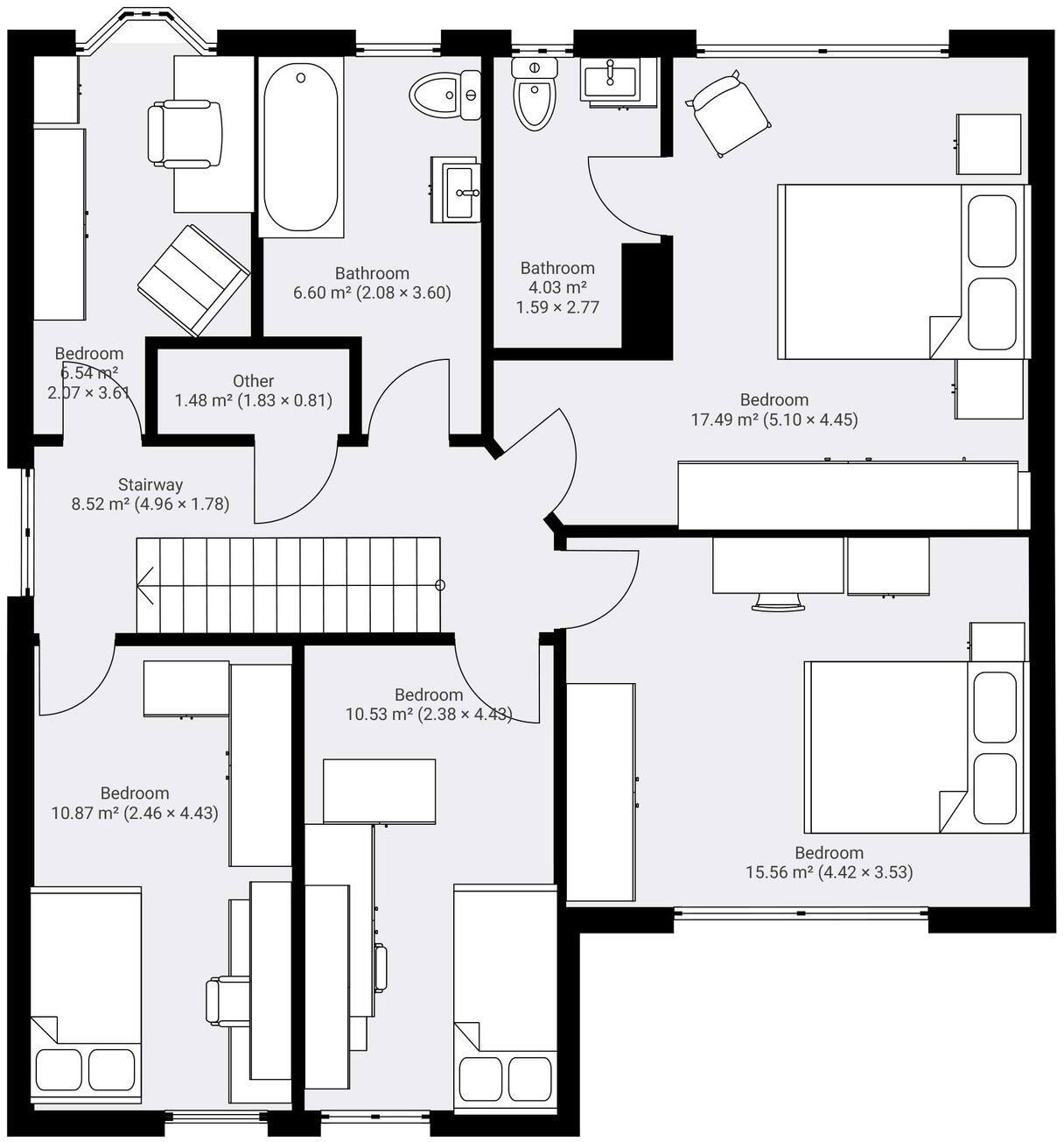
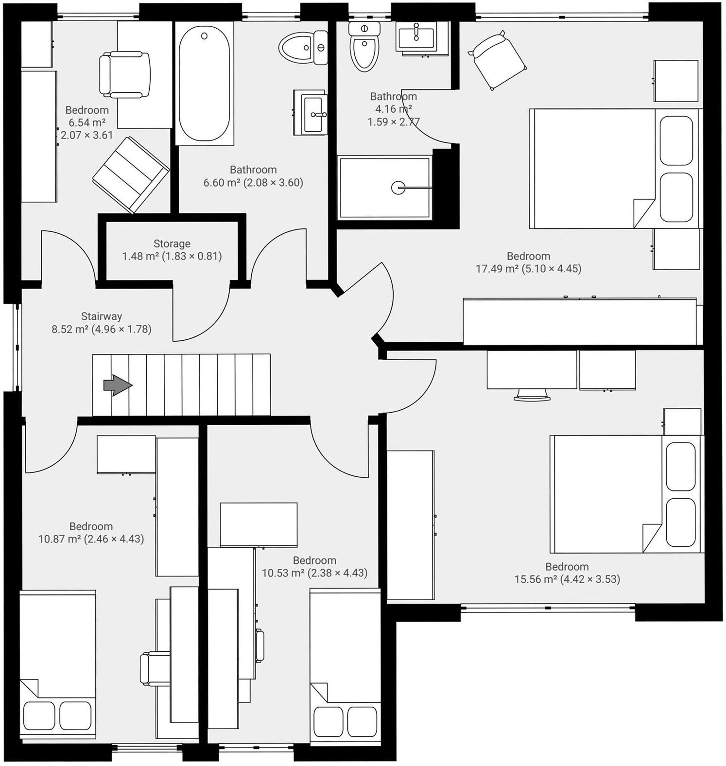
- First-floor plan with five bedrooms, two bathrooms, stairway and small utility space.
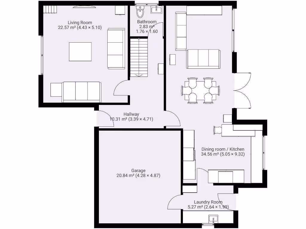
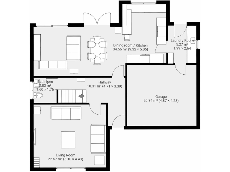
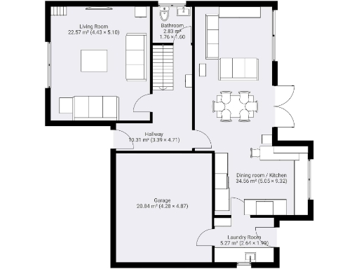
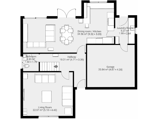
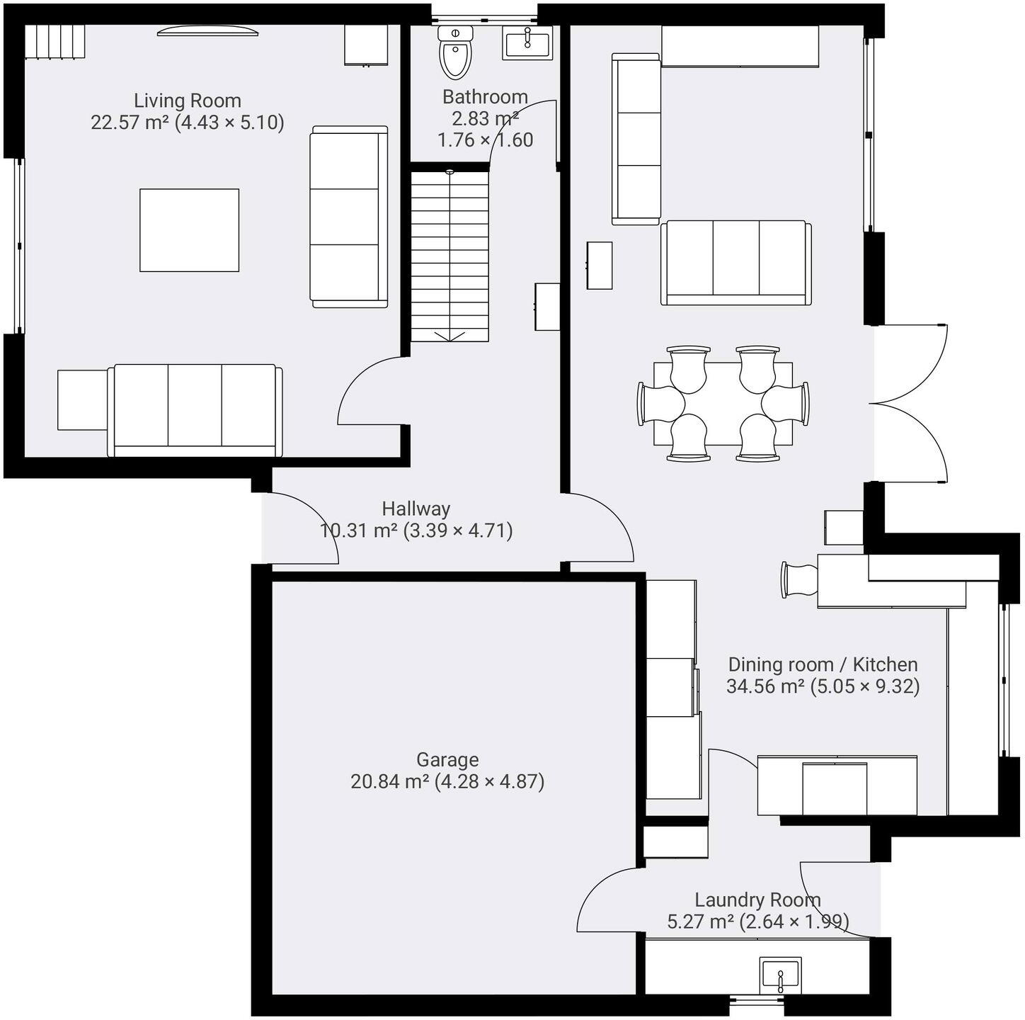
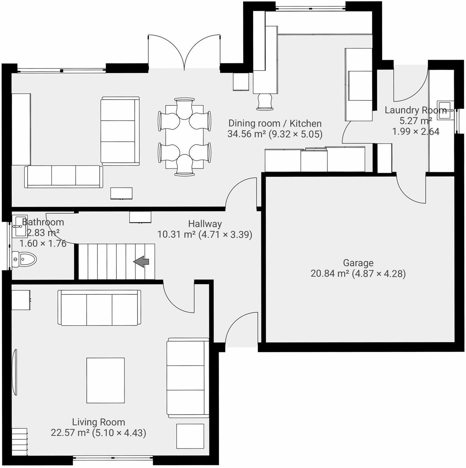
- Ground-floor plan with living room, bathroom, hallway, dining/kitchen, laundry and garage
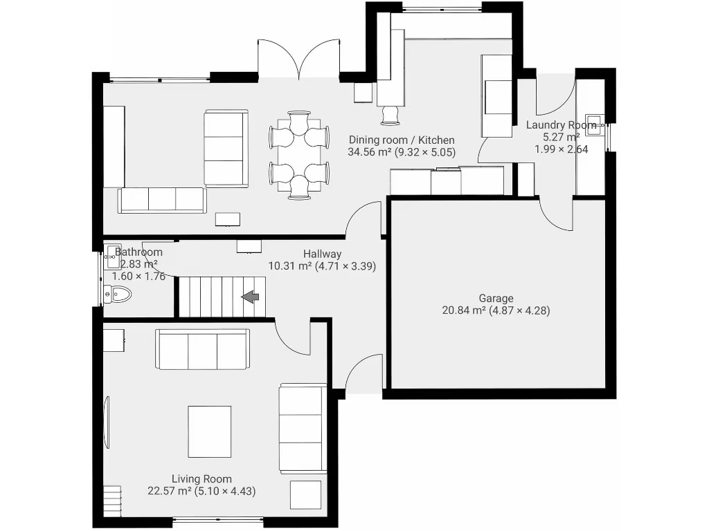
- Ground floor plan with living room, dining room/kitchen, hallway, bathroom, laundry and attached garage.
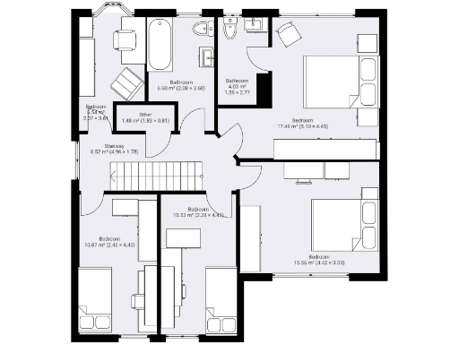
- Single floor plan with multiple bedrooms, two bathrooms, storage and stairway.
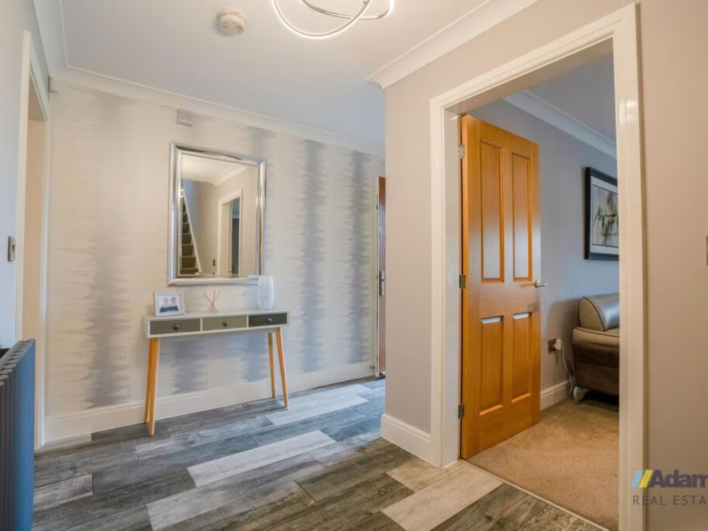
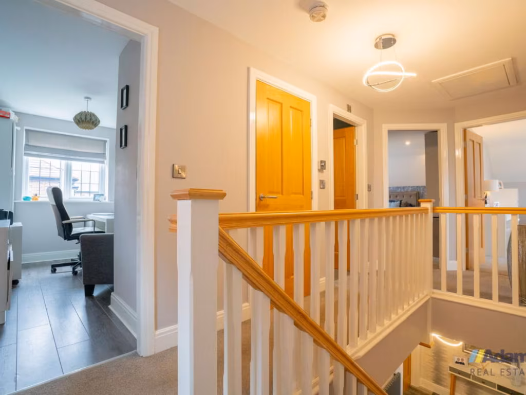
Rooms
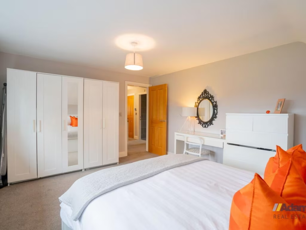
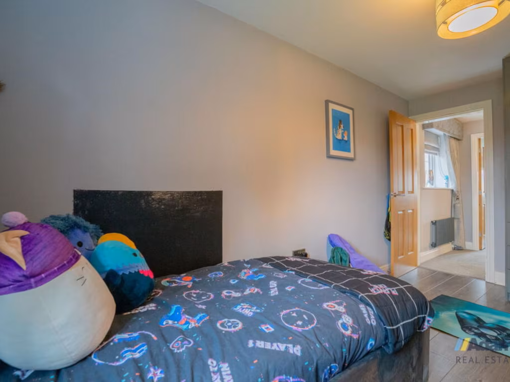
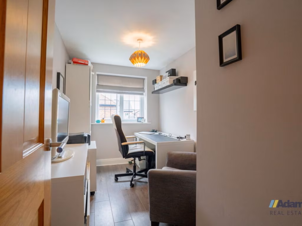
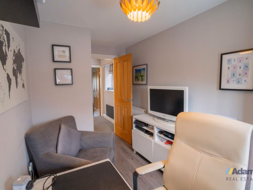
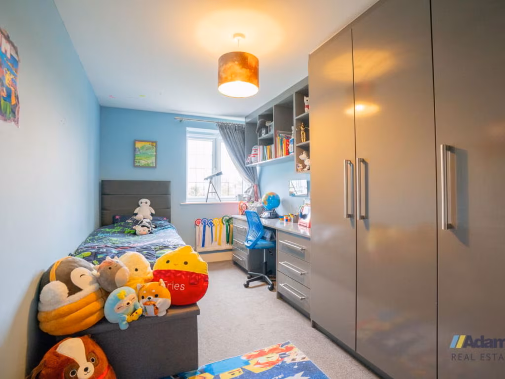
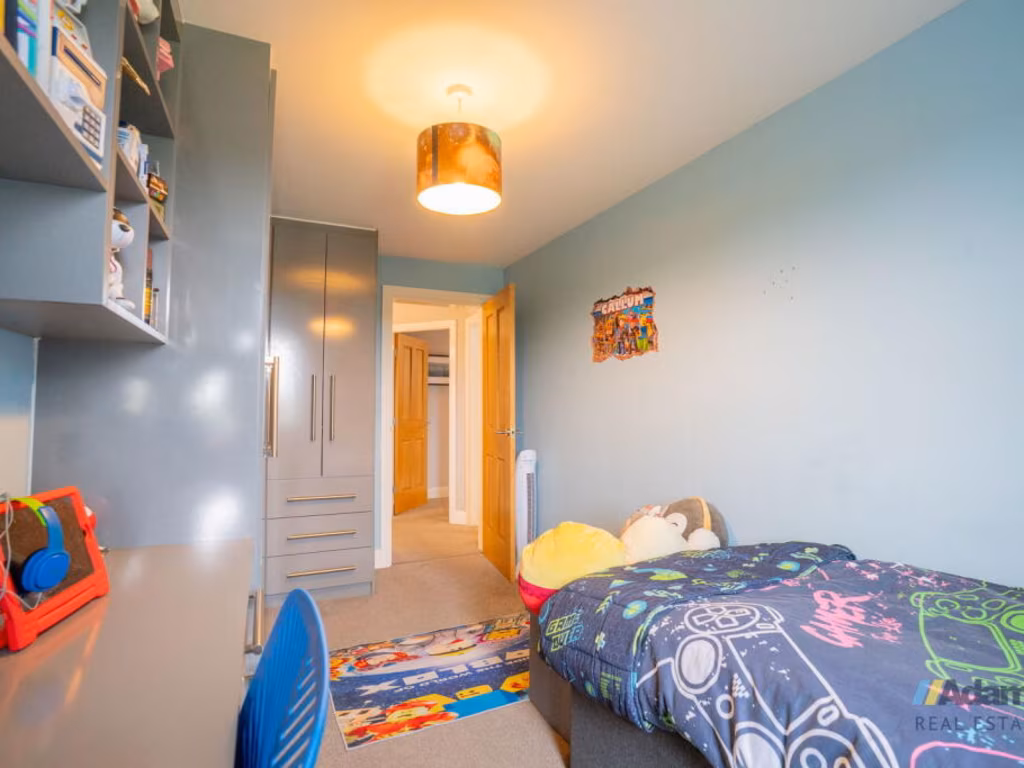
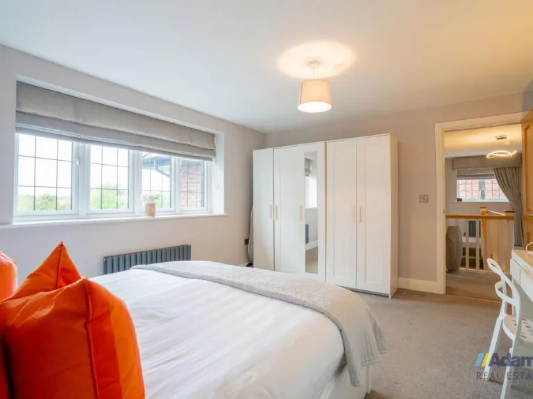
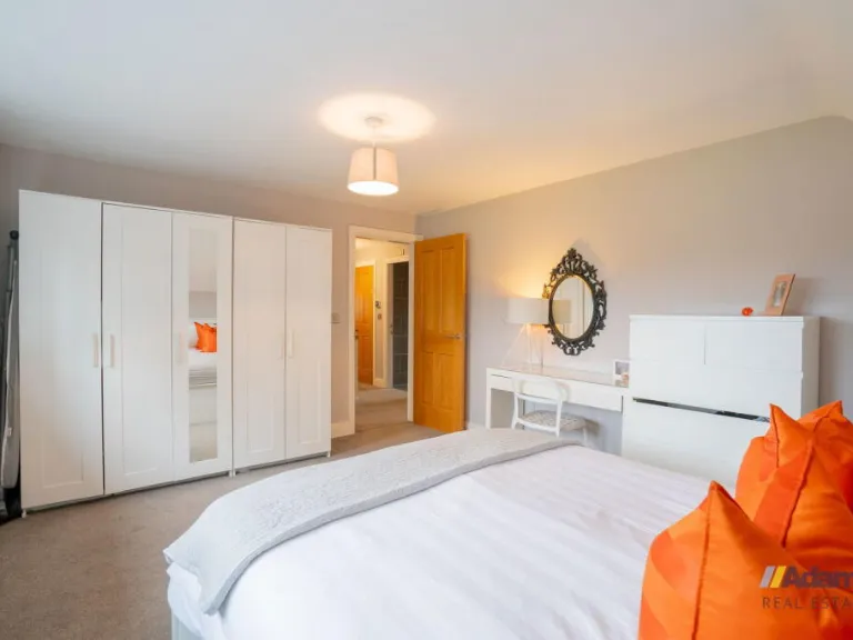
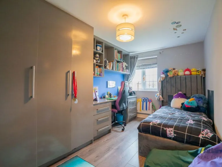
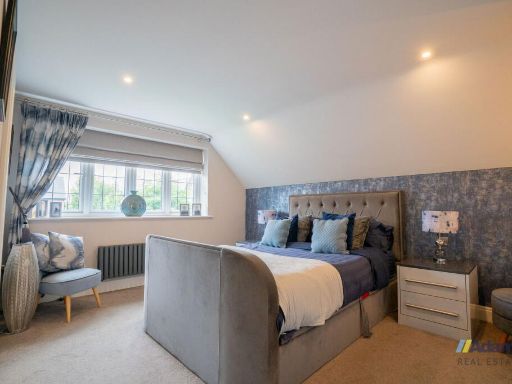
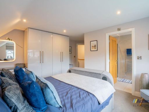
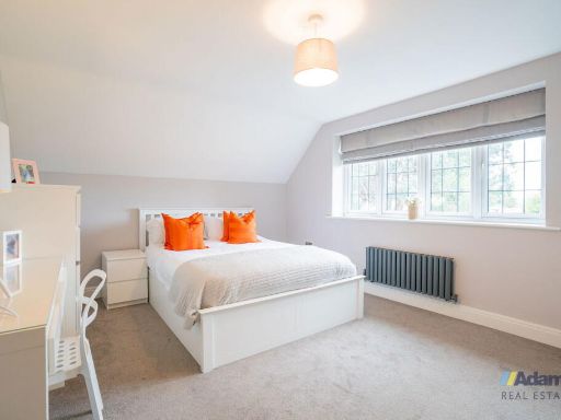
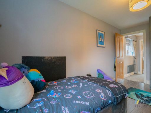
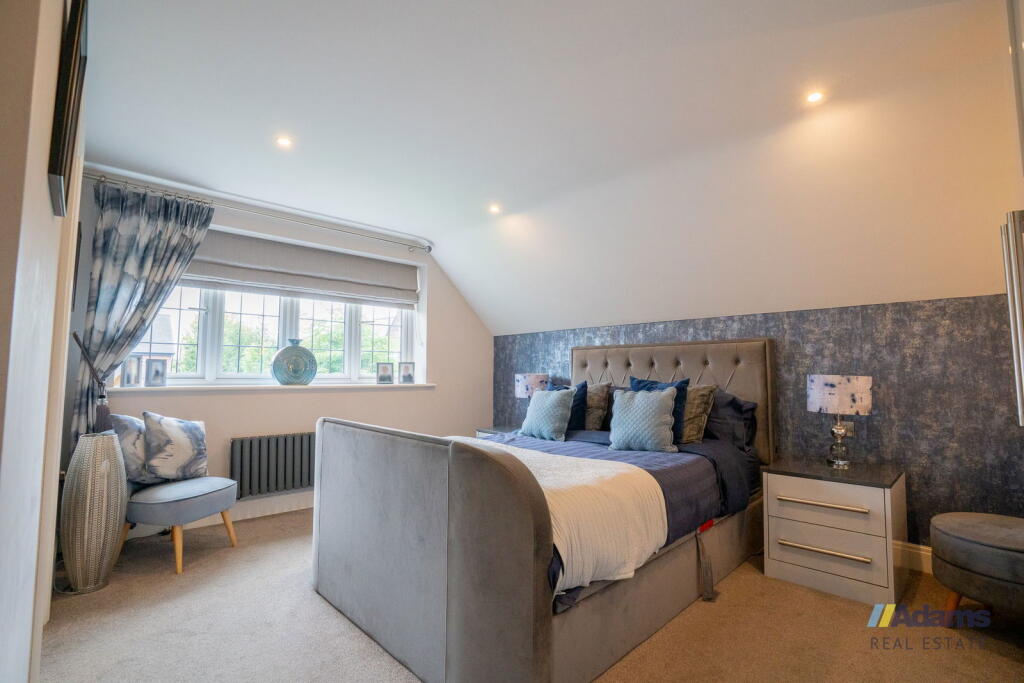
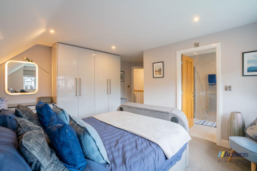
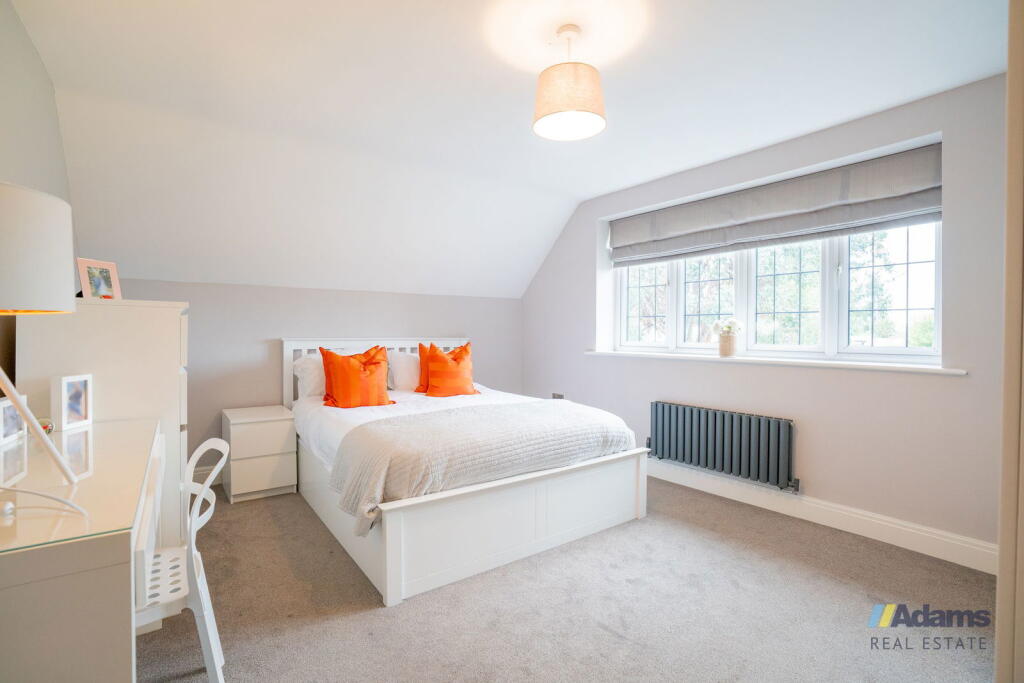
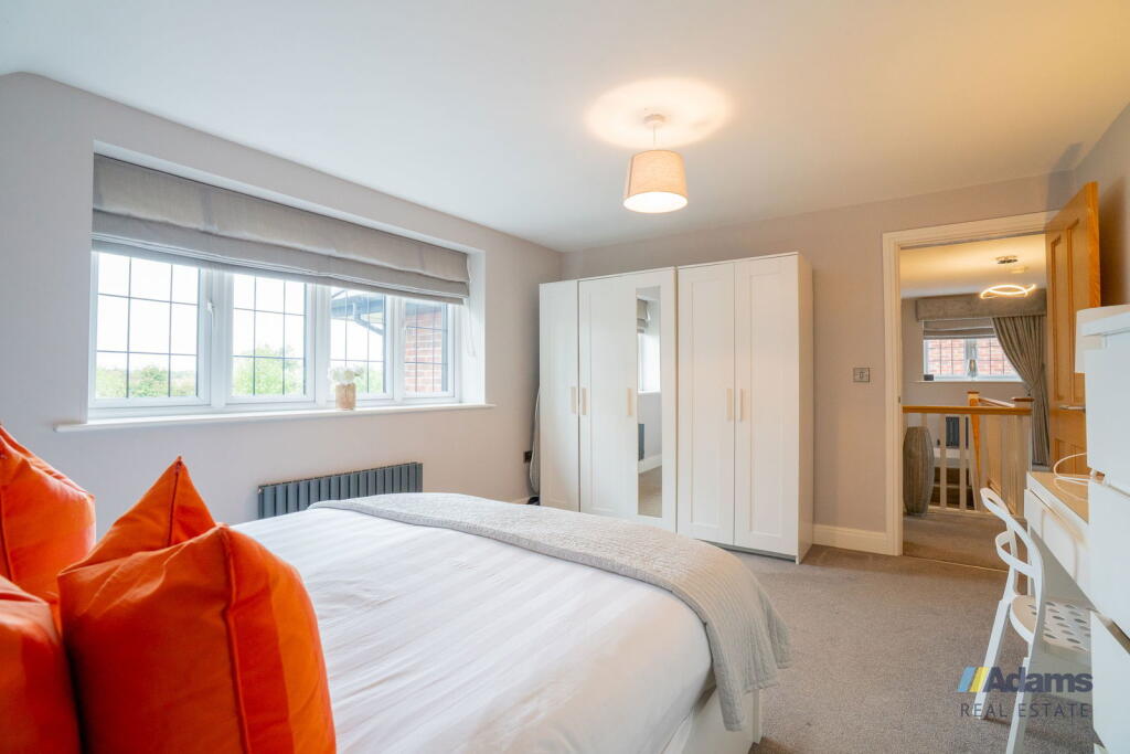
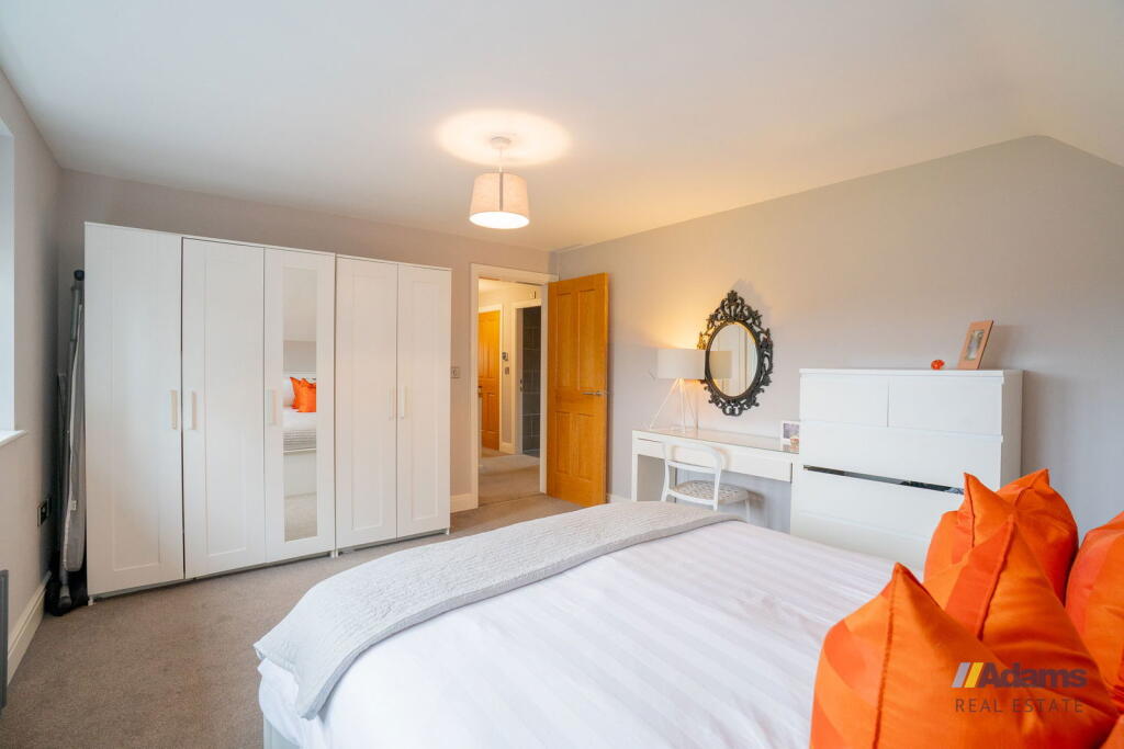
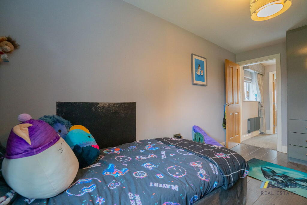
- Bedroom:
- Bedroom:
- Bedroom:
- Bedroom:
- Bedroom:
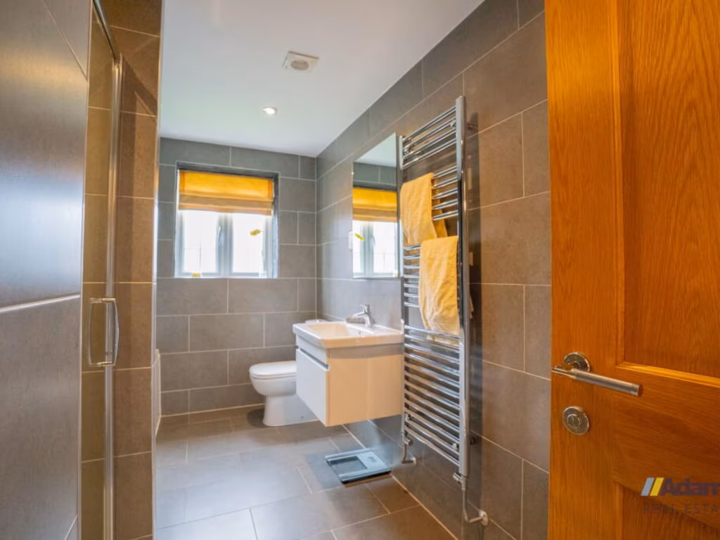
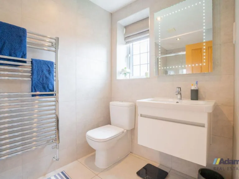
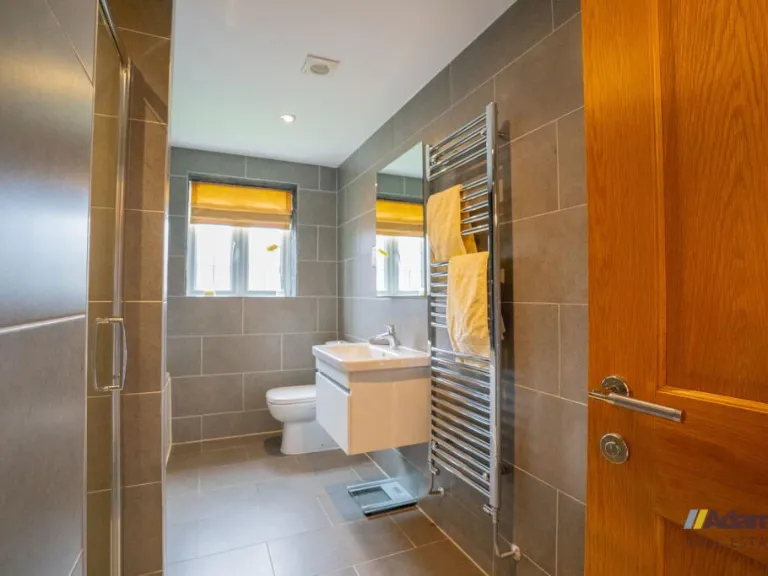
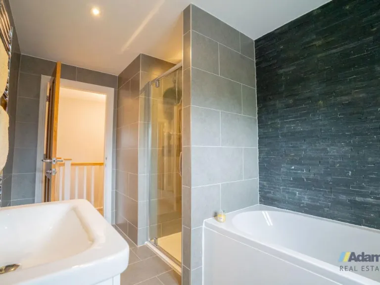
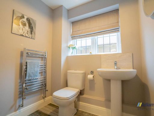
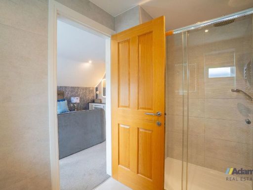
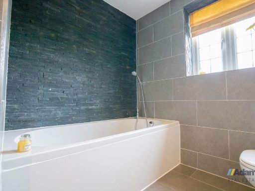
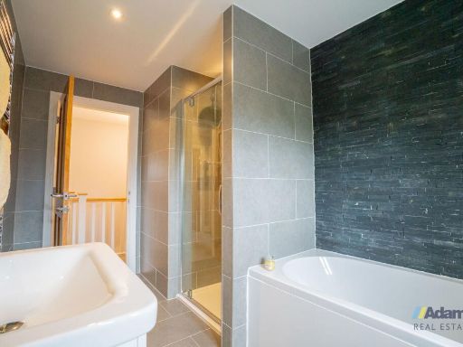
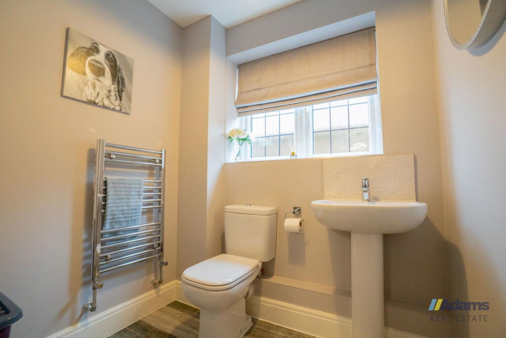
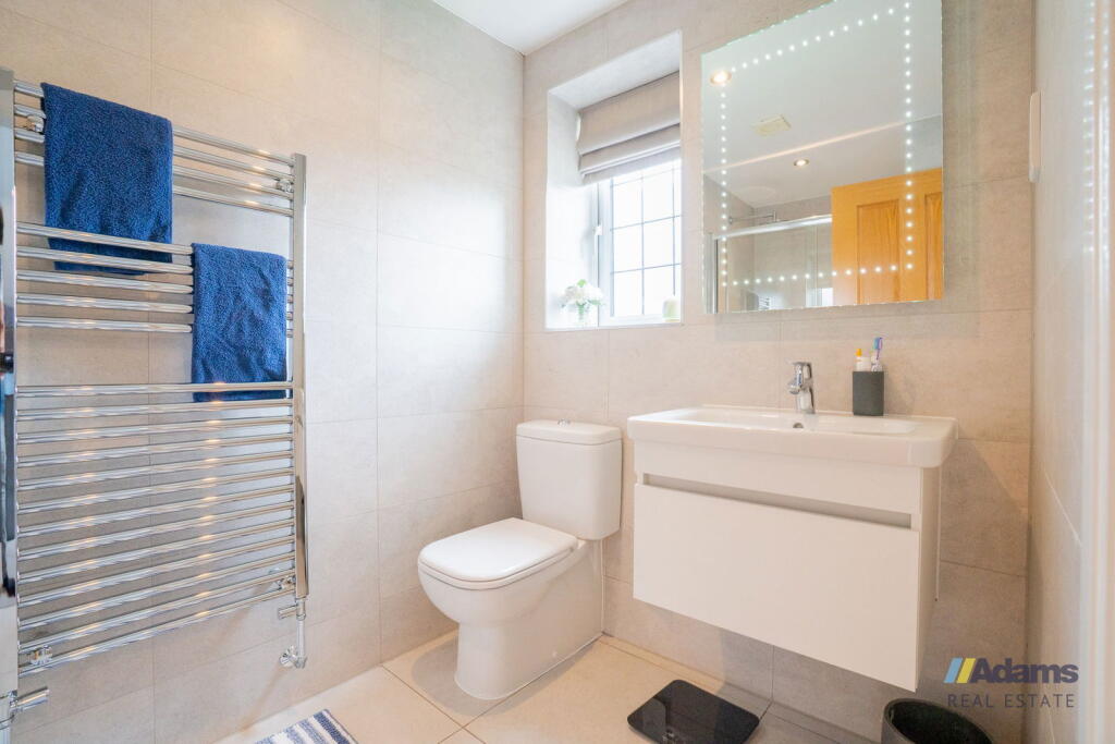
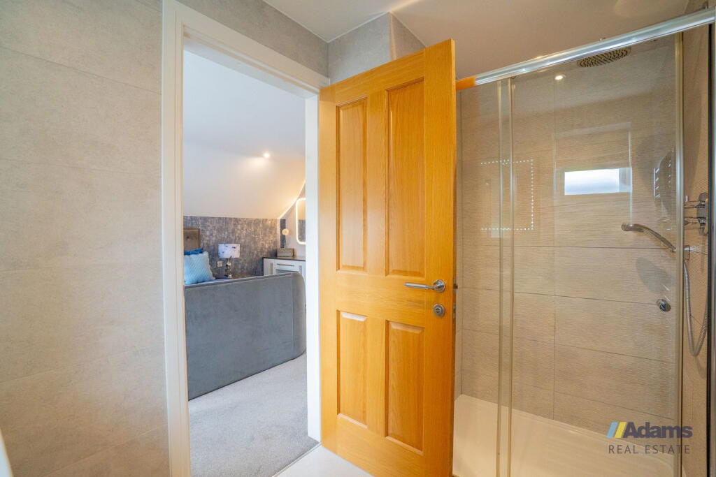
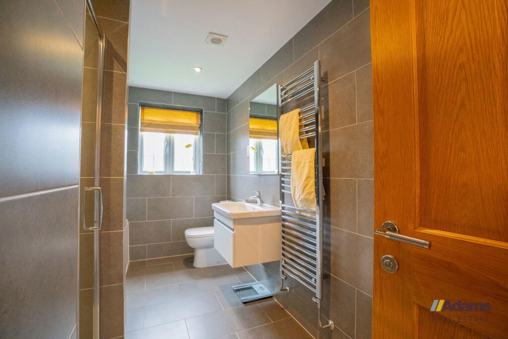
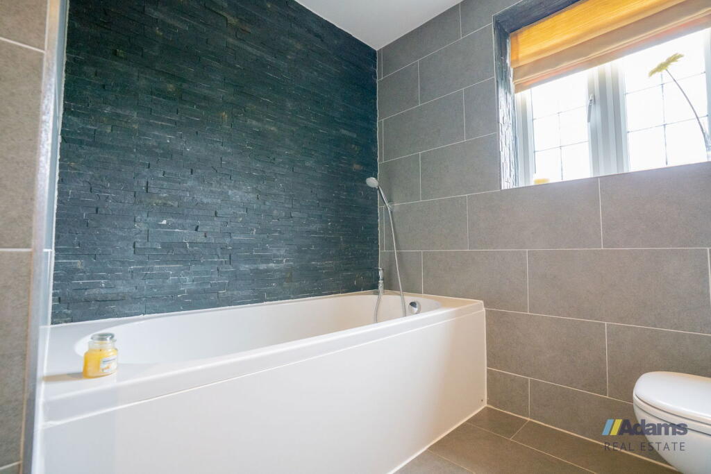
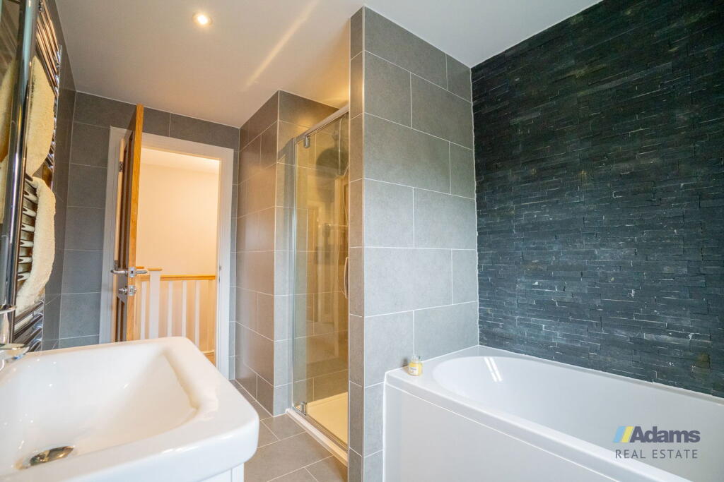
- Bathroom:
- Bathroom:
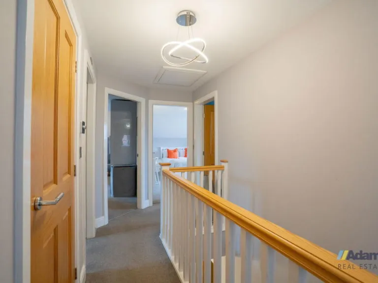
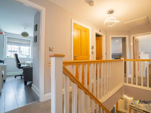
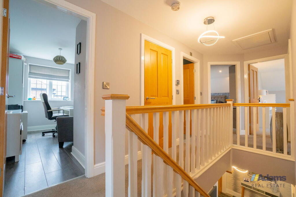
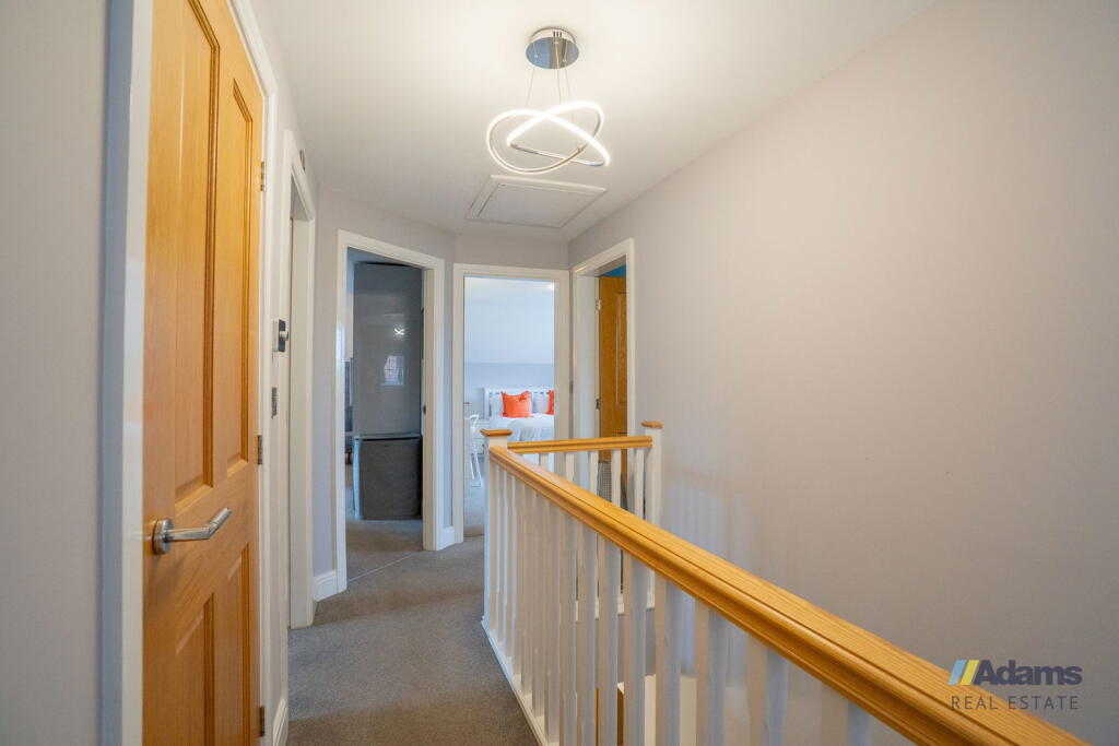
- Stairway:
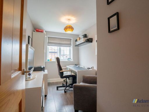
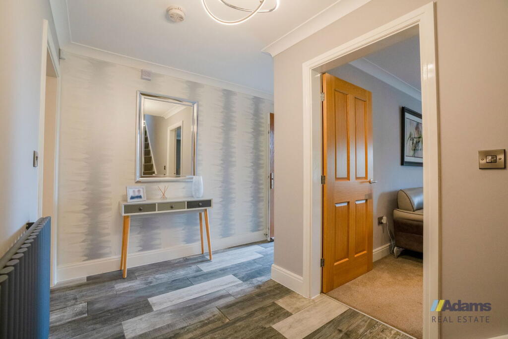
- Other:
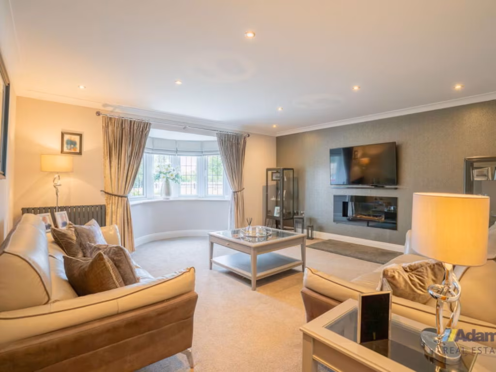
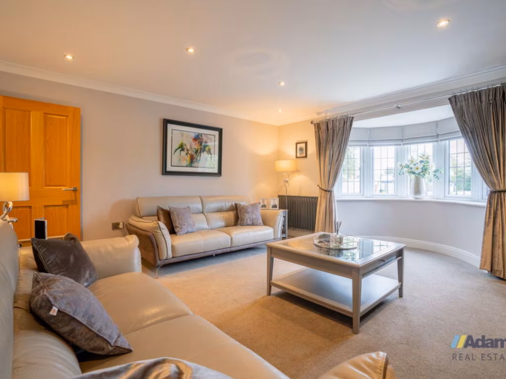
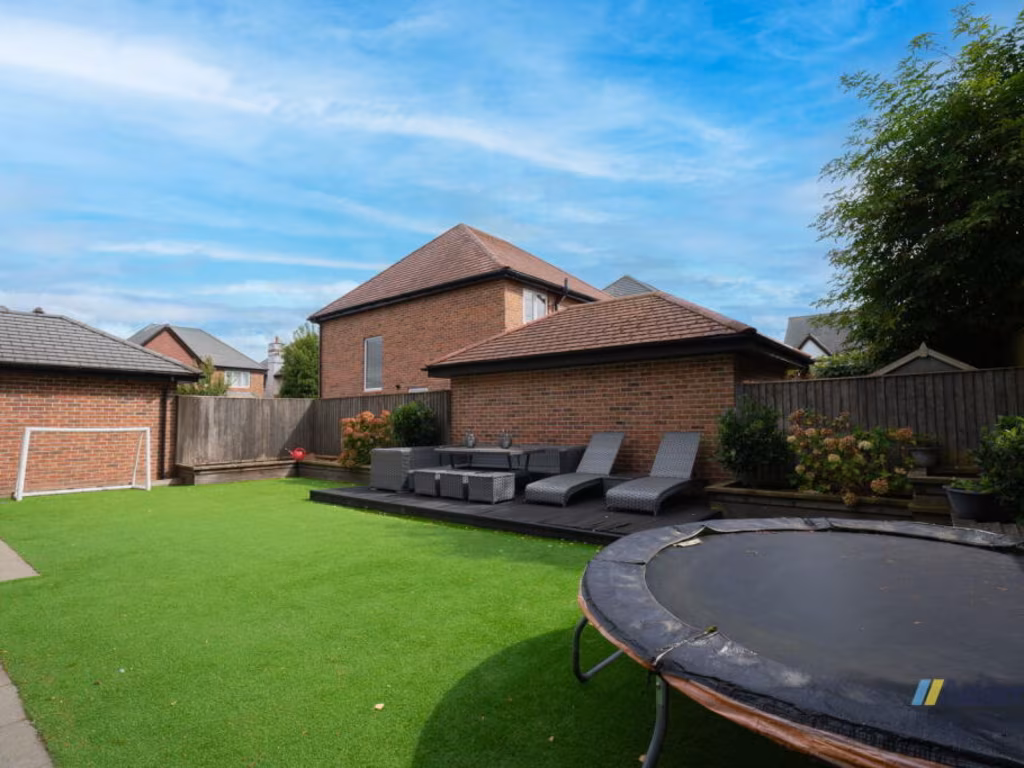
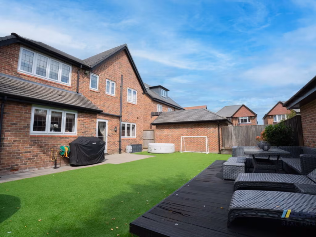
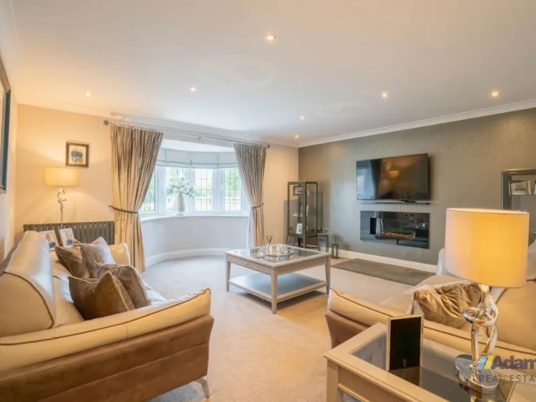
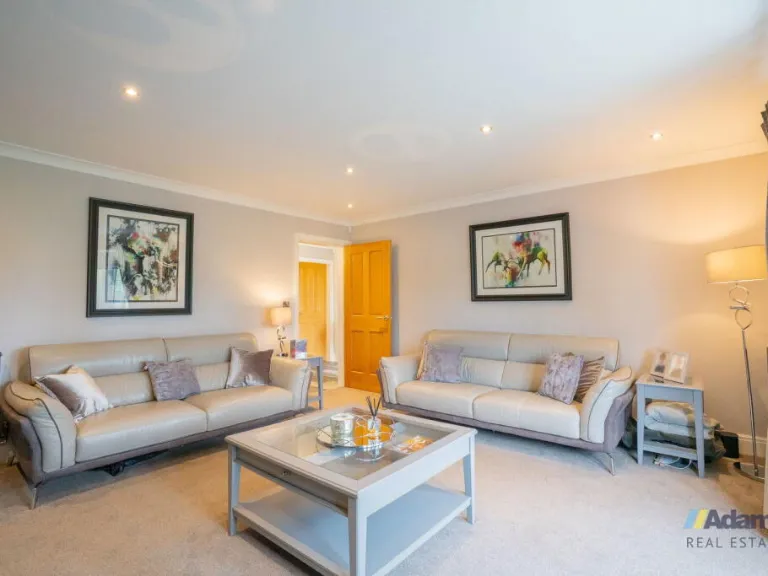
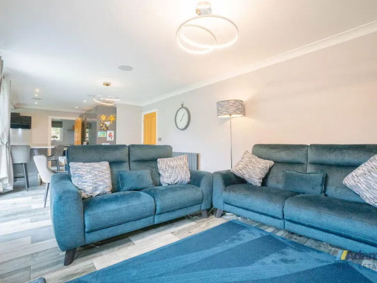
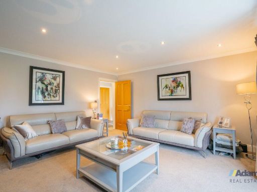
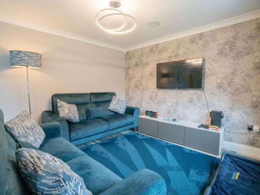
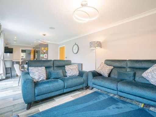
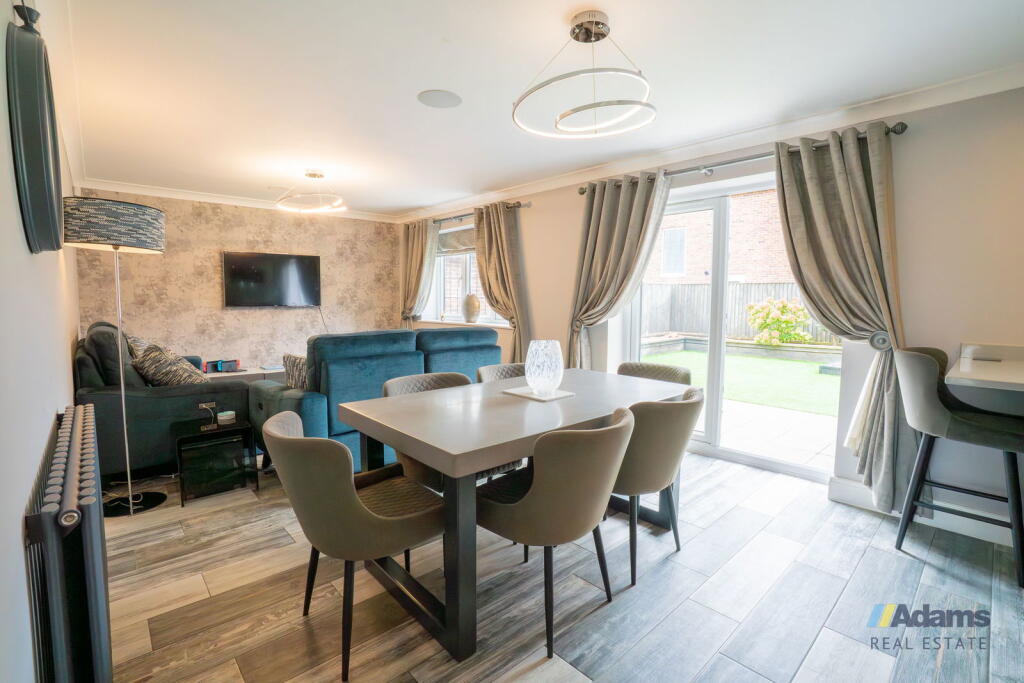
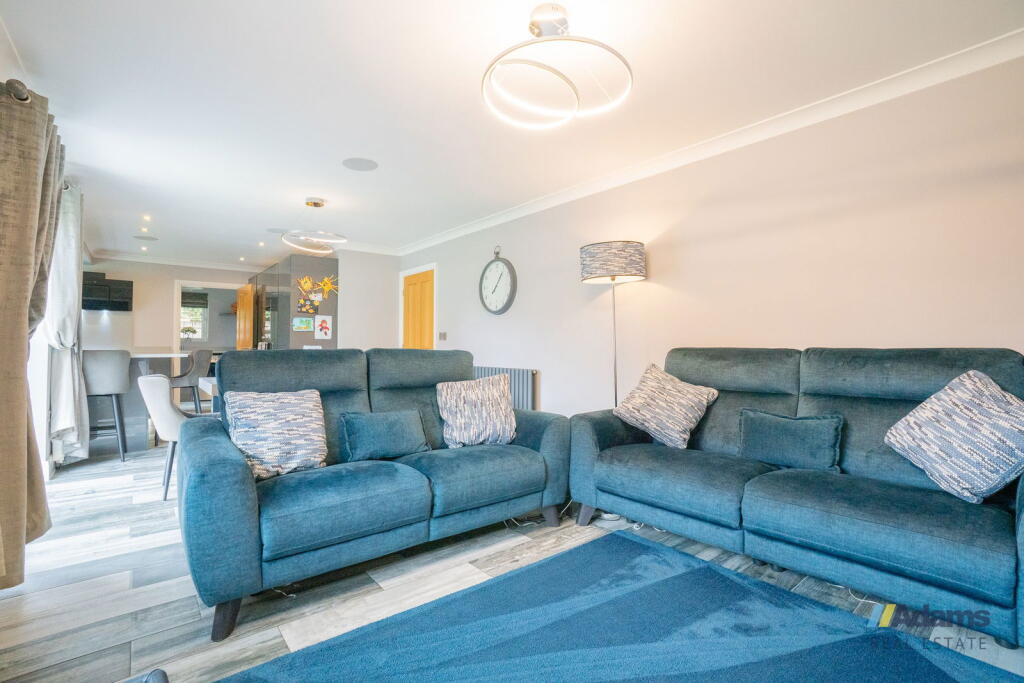
- Living Room: large
- Bathroom: small
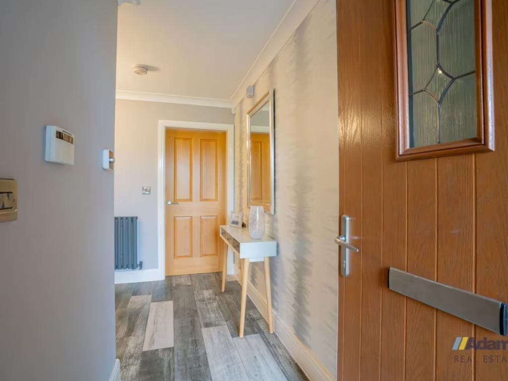
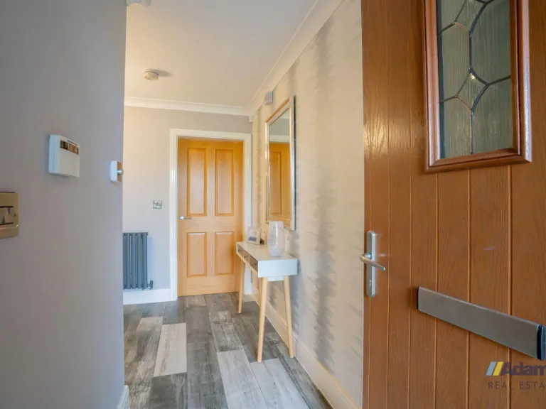
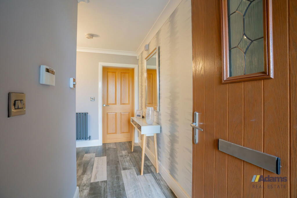
- Hallway: average
- Garage: average
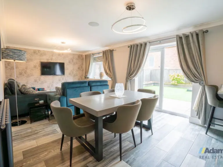
- Dining room / Kitchen: large
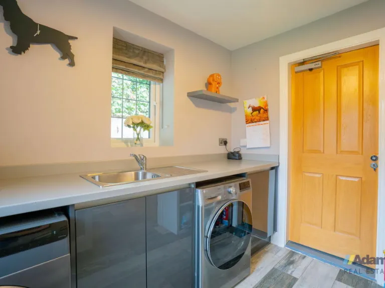
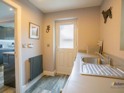
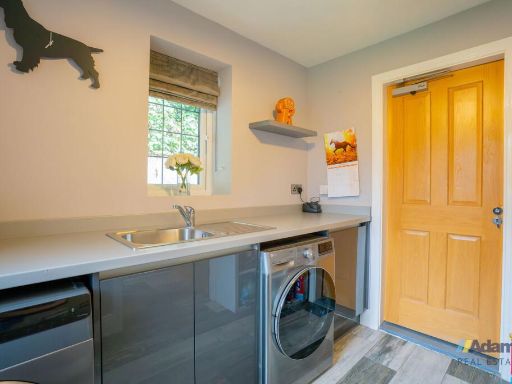
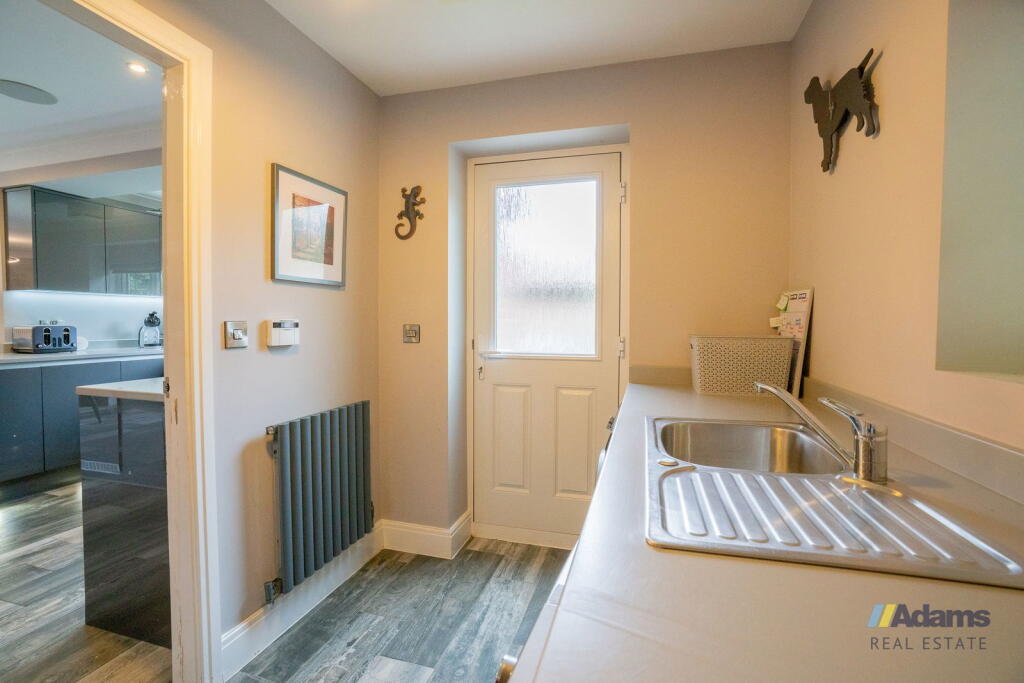
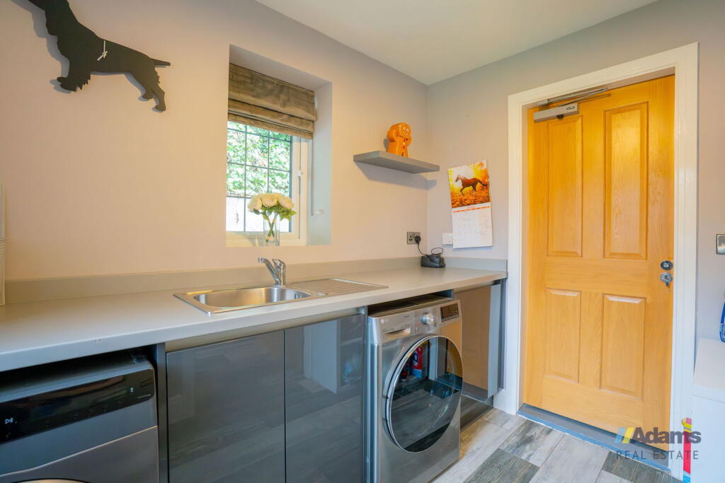
- Laundry Room: small
- Dining room / Kitchen:
- Laundry Room:
- Bathroom:
- Hallway:
- Living Room:
- Garage:
- Bedroom:
- Bathroom:
- Storage:
- Stairway:
- Bedroom:
- Bedroom:
- Bathroom:
- Bedroom:
- Bedroom:
Textual Property Features
Detected Visual Features
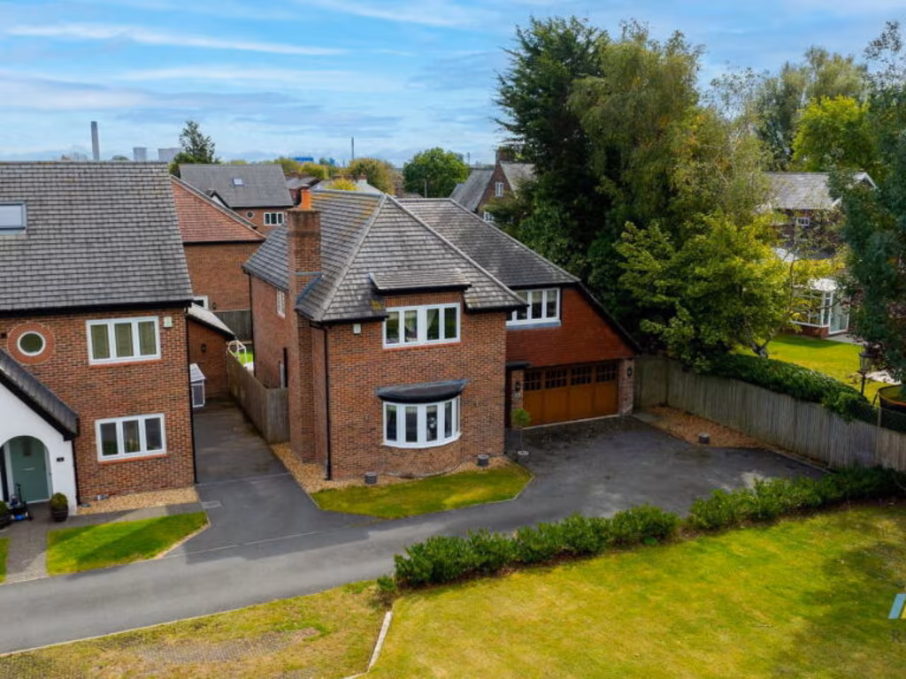
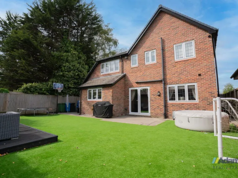
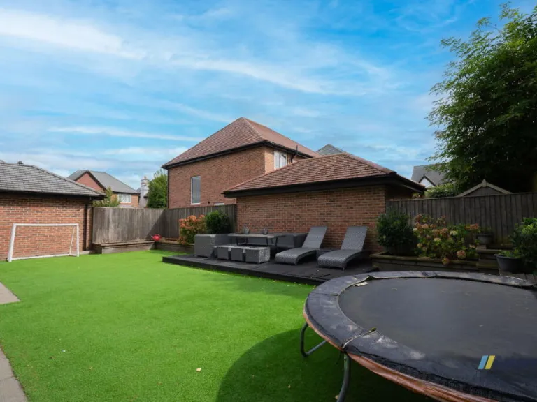
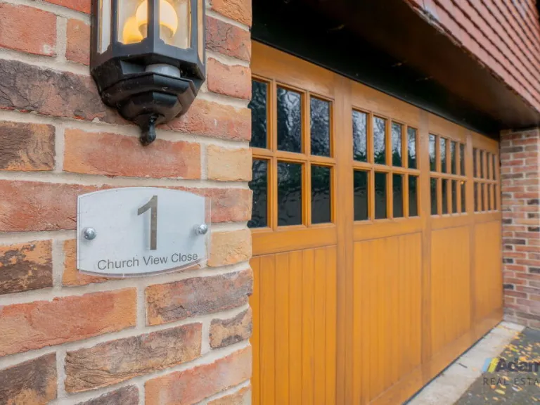
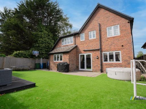
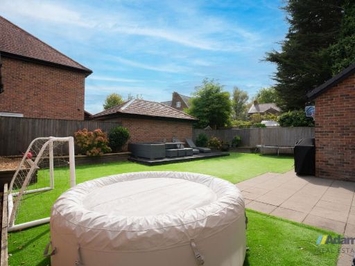
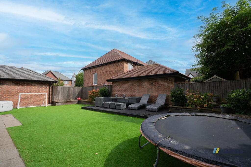
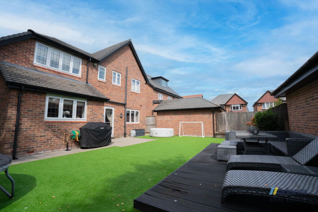
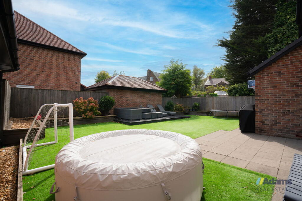
- detached house
- modern
- brick exterior
- bay window
- pitched roof
- garage
- driveway
- garden
- fence
- residential neighborhood
- kitchen
- contemporary
- open-plan
- island
- breakfast bar
- gloss cabinets
- integrated appliances
- downlights
- tiled floor
EPC Details
- High performance glazing
- Average thermal transmittance 0.19 W/m-¦K
- Boiler and underfloor heating, mains gas
- Low energy lighting in all fixed outlets
- Average thermal transmittance 0.14 W/m-¦K
Nearby Schools
- St Bede's Catholic Infant School
- Ditton Primary School
- St John Fisher Catholic Primary School
- Saints Peter and Paul Catholic High School
- Fairfield Primary School
- Wade Deacon High School
- Moorfield Primary School
- The Sutton Academy
- Farnworth Church of England Controlled Primary School
- Lunts Heath Primary School
- Cronton Church of England Primary Academy
- Tower College
- St Theresa's Catholic Primary School
- St Gerard's Catholic Primary and Nursery School
- Kingsway Primary Academy School
- St Bede's Catholic Junior School
- Ormiston Chadwick Academy
- Holy Family Catholic Primary School & Nursery
- Rainhill High School
- Sutton Manor Community Primary School
- Sherdley Primary School
- Eaves Primary School
- St Bartholomew's Catholic Primary School
Nearest General Shops
- Id: 35356196
- Tags:
- Addr:
- City: Widnes
- Postcode: WA8 5SQ
- Street: Lunts Heath Road
- Building: yes
- Name: Motor Bodies Widnes
- Operator: Motor Bodies Widnes
- Shop: car_repair
- TagsNormalized:
- motor
- car repair
- repair
- shop
- Lat: 53.3862409
- Lon: -2.7192633
- FullGeoHash: gcqpdnevksd7
- PartitionGeoHash: gcqp
- Images:
- FoodStandards: null
- Distance: 543
,- Id: 35356202
- Tags:
- Building: yes
- Name: Jewson's
- Shop: hardware
- TagsNormalized:
- Lat: 53.3868824
- Lon: -2.7184748
- FullGeoHash: gcqpdnu3nunq
- PartitionGeoHash: gcqp
- Images:
- FoodStandards: null
- Distance: 532.9
,- Id: 366831100
- Tags:
- Building: yes
- Name: Horns Garage
- Shop: car
- TagsNormalized:
- Lat: 53.3872525
- Lon: -2.7190886
- FullGeoHash: gcqpdnu529ht
- PartitionGeoHash: gcqp
- Images:
- FoodStandards: null
- Distance: 475.5
}
Nearest Supermarkets
- Id: 42258572
- Tags:
- Addr:
- Postcode: WA8 6UF
- Street: Green Oaks Way
- Brand: ALDI
- Brand:wikidata: Q41171672
- Brand:wikipedia: en:Aldi
- Building: yes
- Contact:
- Website: https://stores.aldi.co.uk/widnes/green-oaks-way
- Ele: 1
- Fhrs:
- Name: ALDI
- Opening_hours: Mo-Sa 08:00-22:00; Su 10:00-16:00
- Operator: Aldi Stores
- Shop: supermarket
- TagsNormalized:
- Lat: 53.3657367
- Lon: -2.7227445
- FullGeoHash: gcqpd4cmgqqe
- PartitionGeoHash: gcqp
- Images:
- FoodStandards: null
- Distance: 2683.4
,- Id: 24960899
- Tags:
- Addr:
- Postcode: WA8 6UA
- Street: Green Oaks Way
- Brand: Morrisons
- Brand:wikidata: Q922344
- Brand:wikipedia: en:Morrisons
- Building: yes
- Contact:
- Website: https://my.morrisons.com/storefinder/19
- Fhrs:
- Name: Morrisons
- Shop: supermarket
- Source:
- Wheelchair: yes
- TagsNormalized:
- Lat: 53.367581
- Lon: -2.7237633
- FullGeoHash: gcqpd528ewnu
- PartitionGeoHash: gcqp
- Images:
- FoodStandards:
- Id: 113812
- FHRSID: 113812
- LocalAuthorityBusinessID: 42809
- BusinessName: Morrisons
- BusinessType: Retailers - supermarkets/hypermarkets
- BusinessTypeID: 7840
- AddressLine1: Green Oaks Way
- AddressLine2: Widnes
- AddressLine3: Cheshire
- AddressLine4: null
- PostCode: WA8 6UA
- RatingValue: 5
- RatingKey: fhrs_5_en-GB
- RatingDate: 2019-01-31
- LocalAuthorityCode: 889
- LocalAuthorityName: Halton
- LocalAuthorityWebSite: http://www.halton.gov.uk
- LocalAuthorityEmailAddress: FSA_Enforcement@halton.gov.uk
- Scores:
- Hygiene: 5
- Structural: 5
- ConfidenceInManagement: 0
- NewRatingPending: false
- Geocode:
- Longitude: -2.72392700000000
- Latitude: 53.36765000000000
- Distance: 2475.9
,- Id: 796445181
- Tags:
- Brand: ALDI
- Brand:wikidata: Q41171672
- Brand:wikipedia: en:Aldi
- Building: yes
- Building:levels: 1
- Contact:
- Website: https://stores.aldi.co.uk/widnes/derby-road-greengate-way
- Name: ALDI
- Shop: supermarket
- TagsNormalized:
- Lat: 53.3841645
- Lon: -2.7194175
- FullGeoHash: gcqpdn7c2cx3
- PartitionGeoHash: gcqp
- Images:
- FoodStandards: null
- Distance: 724.9
}
Nearest Religious buildings
- Id: 352278054
- Tags:
- Amenity: place_of_worship
- Building: yes
- Denomination: roman_catholic
- Name: St Pius X
- Religion: christian
- TagsNormalized:
- place of worship
- catholic
- roman catholic
- christian
- church
- Lat: 53.3810993
- Lon: -2.7319068
- FullGeoHash: gcqp9vdxmyns
- PartitionGeoHash: gcqp
- Images:
- FoodStandards: null
- Distance: 1080
,- Id: 26180239
- Tags:
- Addr:
- City: Farnworth
- Postcode: WA8 9HU
- Street: Pit Lane
- Amenity: place_of_worship
- Building: yes
- Denomination: anglican
- Name: St. Lukes
- Phone: +44 151 423 4311
- Religion: christian
- Source: Yahoo;Local resident;Website
- Website: http://www.st-luke.co.uk/
- Wikidata: Q7594045
- Wikipedia: en:St Luke's Church, Farnworth
- TagsNormalized:
- place of worship
- anglican
- christian
- church
- Lat: 53.3843938
- Lon: -2.7275126
- FullGeoHash: gcqp9ymfsk71
- PartitionGeoHash: gcqp
- Images:
- FoodStandards: null
- Distance: 631.6
,- Id: 347682681
- Tags:
- Amenity: pub
- Building: yes
- Name: The Church View Inn
- Outdoor_seating: yes
- Smoking: outside
- TagsNormalized:
- Lat: 53.3894507
- Lon: -2.7244715
- FullGeoHash: gcqpdp2054yy
- PartitionGeoHash: gcqp
- Images:
- FoodStandards: null
- Distance: 48.3
}
Nearest Medical buildings
- Id: 9931766807
- Tags:
- Addr:
- City: Widnes
- Housename: Fir Park Medical Centre
- Postcode: WA8 9DT
- Street: Queensbury Way
- Amenity: pharmacy
- Dispensing: yes
- Healthcare: pharmacy
- Name: Allied Pharmacy - Upton Rocks
- TagsNormalized:
- Lat: 53.3812128
- Lon: -2.7477971
- FullGeoHash: gcqp9mz05emc
- PartitionGeoHash: gcqp
- Images:
- FoodStandards: null
- Distance: 1801.7
,- Id: 259422791
- Tags:
- Amenity: doctors
- Building: yes
- Healthcare: doctor
- Name: Beaconsfield Surgery
- Website: http://www.beaconsfield-surgery.co.uk/
- TagsNormalized:
- doctor
- doctors
- health
- healthcare
- surgery
- Lat: 53.3797364
- Lon: -2.7243211
- FullGeoHash: gcqpdj2pw8nf
- PartitionGeoHash: gcqp
- Images:
- FoodStandards: null
- Distance: 1123.7
,- Id: 350350695
- Tags:
- Amenity: dentist
- Building: yes
- Healthcare: dentist
- Name: Peelhouse Lane Dental Practice
- TagsNormalized:
- dentist
- health
- healthcare
- dental
- Lat: 53.380876
- Lon: -2.7259229
- FullGeoHash: gcqp9vxn1ks8
- PartitionGeoHash: gcqp
- Images:
- FoodStandards: null
- Distance: 999.3
,- Id: 352849456
- Tags:
- Amenity: pharmacy
- Brand: Rowlands Pharmacy
- Brand:wikidata: Q62663235
- Building: yes
- Healthcare: pharmacy
- Name: Rowlands Pharmacy
- TagsNormalized:
- pharmacy
- rowlands pharmacy
- health
- healthcare
- Lat: 53.3818237
- Lon: -2.7264701
- FullGeoHash: gcqp9vyestht
- PartitionGeoHash: gcqp
- Images:
- FoodStandards: null
- Distance: 898
}
Nearest Airports
- Id: 1224469
- Tags:
- Addr:
- City: Manchester
- Country: GB
- Postcode: M90 1QX
- Aerodrome: international
- Aeroway: aerodrome
- Arp: yes
- Atis: 128.175
- Iata: MAN
- Icao: EGCC
- Name: Manchester Airport
- Note: rough sketched outline referring to Yahoo imagery - true boundary is where?
- Old_name: Ringway
- Operator: Manchester Airport PLC
- Size: 18720000
- Source:
- Tower_frequency: 118.625,119.400
- Type: multipolygon
- Website: https://www.manchesterairport.co.uk/
- Wikidata: Q8694
- Wikipedia: en:Manchester Airport
- TagsNormalized:
- airport
- international airport
- Lat: 53.3503197
- Lon: -2.2798822
- FullGeoHash: gcqrs05u4ukt
- PartitionGeoHash: gcqr
- Images:
- FoodStandards: null
- Distance: 29842.8
,- Id: 116737532
- Tags:
- Addr:
- City: Liverpool
- Country: GB
- Postcode: L24 1YD
- Street: Speke Hall Avenue
- Aerodrome: international
- Aerodrome:type: public
- Aeroway: aerodrome
- Iata: LPL
- Icao: EGGP
- Is_in: Liverpool,England,UK
- Name: Liverpool John Lennon Airport
- Old_name: Speke Airport
- Operator: Liverpool Airport plc
- Source: wikipedia
- Website: https://www.liverpoolairport.com/
- Wikidata: Q8727
- Wikipedia: en:Liverpool John Lennon Airport
- TagsNormalized:
- airport
- international airport
- Lat: 53.3357677
- Lon: -2.8518179
- FullGeoHash: gcmzrj7r7gdr
- PartitionGeoHash: gcmz
- Images:
- FoodStandards: null
- Distance: 10353
}
Nearest Leisure Facilities
- Id: 26524380
- Tags:
- Leisure: pitch
- Lit: no
- Source: survey
- Sport: cricket
- Surface: grass
- TagsNormalized:
- pitch
- leisure
- cricket
- sports
- Lat: 53.3823175
- Lon: -2.7285847
- FullGeoHash: gcqp9vvne35z
- PartitionGeoHash: gcqp
- Images:
- FoodStandards: null
- Distance: 873.1
,- Id: 350450331
- Tags:
- Leisure: sports_centre
- Name: Widnes Cricket Club
- Sport: cricket
- TagsNormalized:
- sports
- sports centre
- leisure
- cricket
- club
- Lat: 53.3824257
- Lon: -2.7286111
- FullGeoHash: gcqp9vvp4v2j
- PartitionGeoHash: gcqp
- Images:
- FoodStandards: null
- Distance: 862.1
,- Id: 25863635
- Tags:
- Leisure: park
- Name: Birchfield Gardens
- TagsNormalized:
- Lat: 53.3889718
- Lon: -2.7371228
- FullGeoHash: gcqp9xnvk3tq
- PartitionGeoHash: gcqp
- Images:
- FoodStandards: null
- Distance: 822.8
,- Id: 350341935
- Tags:
- Leisure: pitch
- Name: DISUSED Ring Of Bells/Farnworth
- Sport: bowls
- TagsNormalized:
- pitch
- leisure
- disused
- bowls
- sports
- Lat: 53.3838143
- Lon: -2.7286335
- FullGeoHash: gcqp9yjp60r2
- PartitionGeoHash: gcqp
- Images:
- FoodStandards: null
- Distance: 716.5
,- Id: 352849407
- Tags:
- TagsNormalized:
- Lat: 53.3839217
- Lon: -2.7280434
- FullGeoHash: gcqp9yjrzur2
- PartitionGeoHash: gcqp
- Images:
- FoodStandards: null
- Distance: 692.2
}
Nearest Tourist attractions
- Id: 327000695
- Tags:
- Name: Sunny Side Naturist Camp
- Tourism: camp_site
- TagsNormalized:
- Lat: 53.3974745
- Lon: -2.7841562
- FullGeoHash: gcqpb8swu6ww
- PartitionGeoHash: gcqp
- Images:
- FoodStandards: null
- Distance: 4026.3
,- Id: 282445976
- Tags:
- Access: yes
- Historic: ruins
- Historic:civilization: modern
- Landuse: industrial
- Name: Old Pyrites Kilns
- Ruins: building
- Tourism: attraction
- TagsNormalized:
- industrial
- attraction
- tourism
- Lat: 53.3547947
- Lon: -2.7318415
- FullGeoHash: gcqp9bfwpqx7
- PartitionGeoHash: gcqp
- Images:
- FoodStandards: null
- Distance: 3924.6
,- Id: 298904021
- Tags:
- Building: yes
- Name: Rainhill Railway Museum
- Tourism: museum
- TagsNormalized:
- Lat: 53.4148171
- Lon: -2.764441
- FullGeoHash: gcqpc5fgzge7
- PartitionGeoHash: gcqp
- Images:
- FoodStandards: null
- Distance: 3823.7
}
Nearest Bus stations and stops
- Id: 529414908
- Tags:
- Bin: yes
- Bus: yes
- Departures_board: timetable
- Highway: bus_stop
- Name: Glebe Garage
- Public_transport: platform
- Shelter: yes
- TagsNormalized:
- Lat: 53.3873743
- Lon: -2.7197984
- FullGeoHash: gcqpdngebpgk
- PartitionGeoHash: gcqp
- Images:
- FoodStandards: null
- Distance: 430.2
,- Id: 529415063
- Tags:
- Bin: yes
- Bus: yes
- Departures_board: timetable
- Highway: bus_stop
- Name: Cranshaw Lane
- Public_transport: platform
- Shelter: no
- TagsNormalized:
- Lat: 53.3901583
- Lon: -2.7287363
- FullGeoHash: gcqp9zkupyfe
- PartitionGeoHash: gcqp
- Images:
- FoodStandards: null
- Distance: 263.4
,- Id: 529415108
- Tags:
- Bus: yes
- Departures_board: timetable
- Highway: bus_stop
- Name: Cranshaw Lane
- Public_transport: platform
- Shelter: no
- TagsNormalized:
- Lat: 53.3902213
- Lon: -2.7284278
- FullGeoHash: gcqp9zmhx48g
- PartitionGeoHash: gcqp
- Images:
- FoodStandards: null
- Distance: 244.3
,- Id: 529415028
- Tags:
- Bus: yes
- Departures_board: timetable
- Highway: bus_stop
- Name: Church View
- Public_transport: platform
- Shelter: yes
- TagsNormalized:
- Lat: 53.3891418
- Lon: -2.7241831
- FullGeoHash: gcqpdp0q3cmu
- PartitionGeoHash: gcqp
- Images:
- FoodStandards: null
- Distance: 87.6
,- Id: 5002843899
- Tags:
- Bus: yes
- Departures_board: timetable
- Highway: bus_stop
- Name: Church View
- Public_transport: platform
- Shelter: yes
- TagsNormalized:
- Lat: 53.389124
- Lon: -2.7245554
- FullGeoHash: gcqpdp0n1q01
- PartitionGeoHash: gcqp
- Images:
- FoodStandards: null
- Distance: 81.1
}
Nearest Hotels
- Id: 4713198208
- Tags:
- Brand: Premier Inn
- Brand:wikidata: Q2108626
- Brand:wikipedia: en:Travelodge UK
- Internet_access: wlan
- Internet_access:fee: customers
- Internet_access:operator: Virgin Media
- Internet_access:ssid: Premier Inn Free Wi-Fi
- Name: Premier Inn
- Tourism: hotel
- TagsNormalized:
- Lat: 53.4074556
- Lon: -2.7526514
- FullGeoHash: gcqpc6e8fx66
- PartitionGeoHash: gcqp
- Images:
- FoodStandards: null
- Distance: 2692.1
,- Id: 552087586
- Tags:
- Addr:
- City: Widnes
- Postcode: WA8 9AR
- Street: Cronton Lane
- Contact:
- Email: info@hillcrest-hotel.co.uk
- Phone: +44 151 424 1616
- Fhrs:
- Name: The Hillcrest Hotel
- Tourism: hotel
- Website: https://www.corushotels.com/widnes/
- TagsNormalized:
- Lat: 53.3901616
- Lon: -2.7435761
- FullGeoHash: gcqp9x6hnp3r
- PartitionGeoHash: gcqp
- Images:
- FoodStandards: null
- Distance: 1245.6
,- Id: 529409499
- Tags:
- Addr:
- Postcode: WA8 3UJ
- Street: Derby Road
- Fhrs:
- Name: Everglades Park Hotel
- Tourism: hotel
- TagsNormalized:
- Lat: 53.3853021
- Lon: -2.7121079
- FullGeoHash: gcqpdq3pgm9g
- PartitionGeoHash: gcqp
- Images:
- FoodStandards: null
- Distance: 981.3
}
Tags
- detached house
- modern
- brick exterior
- bay window
- pitched roof
- garage
- driveway
- garden
- fence
- residential neighborhood
- kitchen
- contemporary
- modern
- open-plan
- island
- breakfast bar
- gloss cabinets
- integrated appliances
- downlights
- tiled floor
Local Market Stats
- Average Price/sqft: £190
- Avg Income: £39800
- Rental Yield: 4%
- Social Housing: 15%
- Planning Success Rate: 96%
Similar Properties
 5 bedroom detached house for sale in Upton Rocks Avenue, Widnes, WA8 — £600,000 • 5 bed • 5 bath
 4 bedroom detached house for sale in Norlands Park, Widnes, WA8 — £600,000 • 4 bed • 4 bath • 2605 ft²
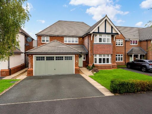 4 bedroom detached house for sale in Birket Drive, Widnes, WA8 — £600,000 • 4 bed • 4 bath • 2259 ft²
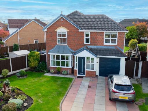 5 bedroom detached house for sale in Grundy Close, Sandringham Gardens, Widnes, WA8 — £500,000 • 5 bed • 4 bath • 905 ft²
 6 bedroom detached house for sale in Alderwood Court, Widnes, WA8 — £850,000 • 6 bed • 5 bath • 3926 ft²
 4 bedroom detached house for sale in Stratton Park, Widnes, WA8 — £500,000 • 4 bed • 3 bath • 1951 ft²
Meta
- {
"@context": "https://schema.org",
"@type": "Residence",
"name": "5 bedroom detached house for sale in Church View Close, Wid…",
"description": "",
"url": "https://propertypiper.co.uk/property/4ef2efb0-524f-44a7-ab50-1f3f14eab396",
"image": "https://image-a.propertypiper.co.uk/e79fa031-b74f-4fa1-904c-26ce3436ca36-1024.jpeg",
"address": {
"@type": "PostalAddress",
"streetAddress": "1, Church View Close",
"postalCode": "WA8 5AA",
"addressLocality": "Halton",
"addressRegion": "Halton",
"addressCountry": "England"
},
"geo": {
"@type": "GeoCoordinates",
"latitude": 53.38983827330087,
"longitude": -2.7248000230321474
},
"numberOfRooms": 5,
"numberOfBathroomsTotal": 3,
"floorSize": {
"@type": "QuantitativeValue",
"value": 1008,
"unitCode": "FTK"
},
"offers": {
"@type": "Offer",
"price": 600000,
"priceCurrency": "GBP",
"availability": "https://schema.org/InStock"
},
"additionalProperty": [
{
"@type": "PropertyValue",
"name": "Feature",
"value": "detached house"
},
{
"@type": "PropertyValue",
"name": "Feature",
"value": "modern"
},
{
"@type": "PropertyValue",
"name": "Feature",
"value": "brick exterior"
},
{
"@type": "PropertyValue",
"name": "Feature",
"value": "bay window"
},
{
"@type": "PropertyValue",
"name": "Feature",
"value": "pitched roof"
},
{
"@type": "PropertyValue",
"name": "Feature",
"value": "garage"
},
{
"@type": "PropertyValue",
"name": "Feature",
"value": "driveway"
},
{
"@type": "PropertyValue",
"name": "Feature",
"value": "garden"
},
{
"@type": "PropertyValue",
"name": "Feature",
"value": "fence"
},
{
"@type": "PropertyValue",
"name": "Feature",
"value": "residential neighborhood"
},
{
"@type": "PropertyValue",
"name": "Feature",
"value": "kitchen"
},
{
"@type": "PropertyValue",
"name": "Feature",
"value": "contemporary"
},
{
"@type": "PropertyValue",
"name": "Feature",
"value": "modern"
},
{
"@type": "PropertyValue",
"name": "Feature",
"value": "open-plan"
},
{
"@type": "PropertyValue",
"name": "Feature",
"value": "island"
},
{
"@type": "PropertyValue",
"name": "Feature",
"value": "breakfast bar"
},
{
"@type": "PropertyValue",
"name": "Feature",
"value": "gloss cabinets"
},
{
"@type": "PropertyValue",
"name": "Feature",
"value": "integrated appliances"
},
{
"@type": "PropertyValue",
"name": "Feature",
"value": "downlights"
},
{
"@type": "PropertyValue",
"name": "Feature",
"value": "tiled floor"
}
]
}
High Res Floorplan Images
Compatible Floorplan Images
FloorplanImages Thumbnail