LS14 5LE - 2 bedroom semidetached house for sale in Swarcliffe Road, L…
View on Property Piper
2 bedroom semi-detached house for sale in Swarcliffe Road, Leeds, LS14
Property Details
- Price: £220000
- Bedrooms: 2
- Bathrooms: 1
- Property Type: undefined
- Property SubType: undefined
Brochure Descriptions
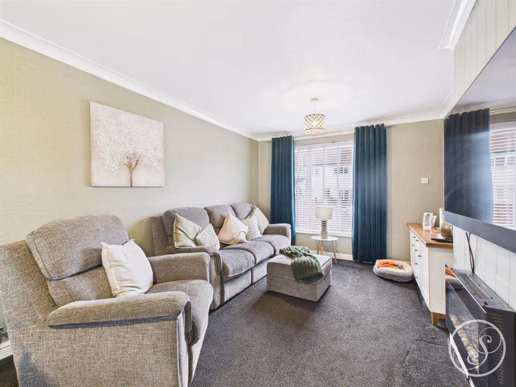
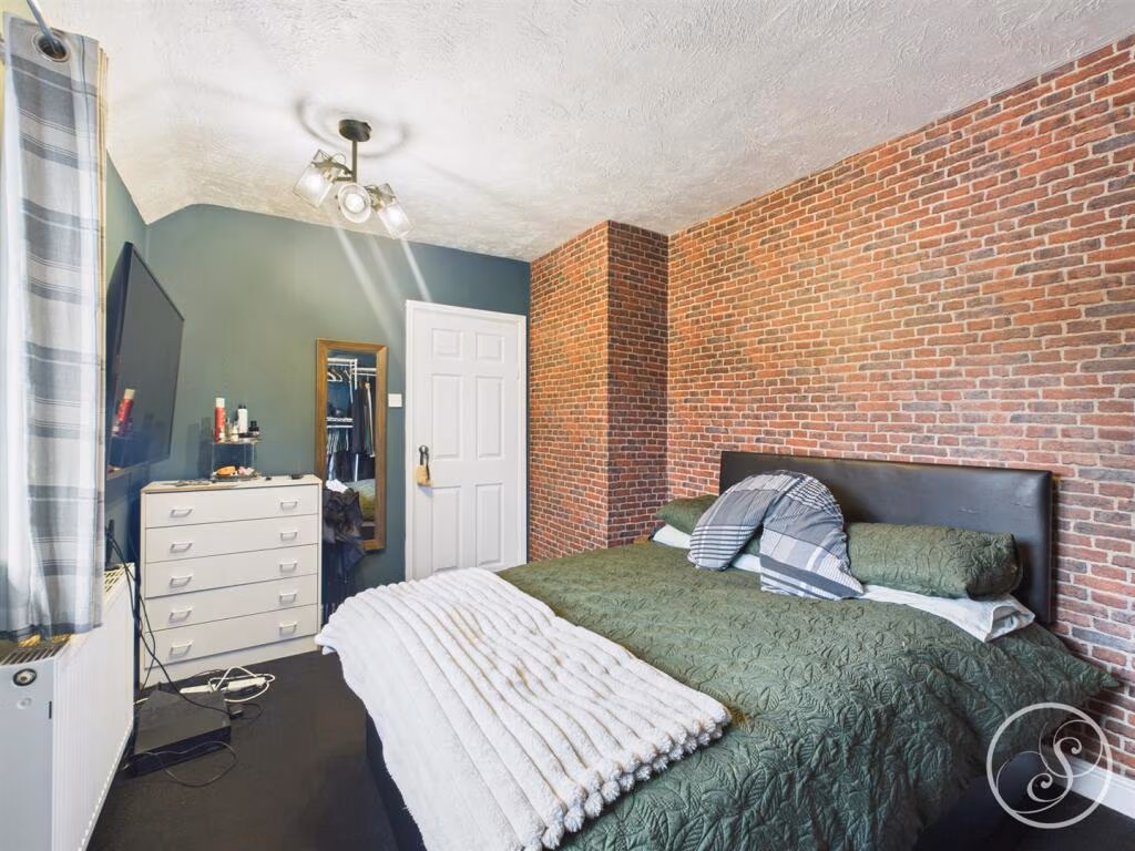
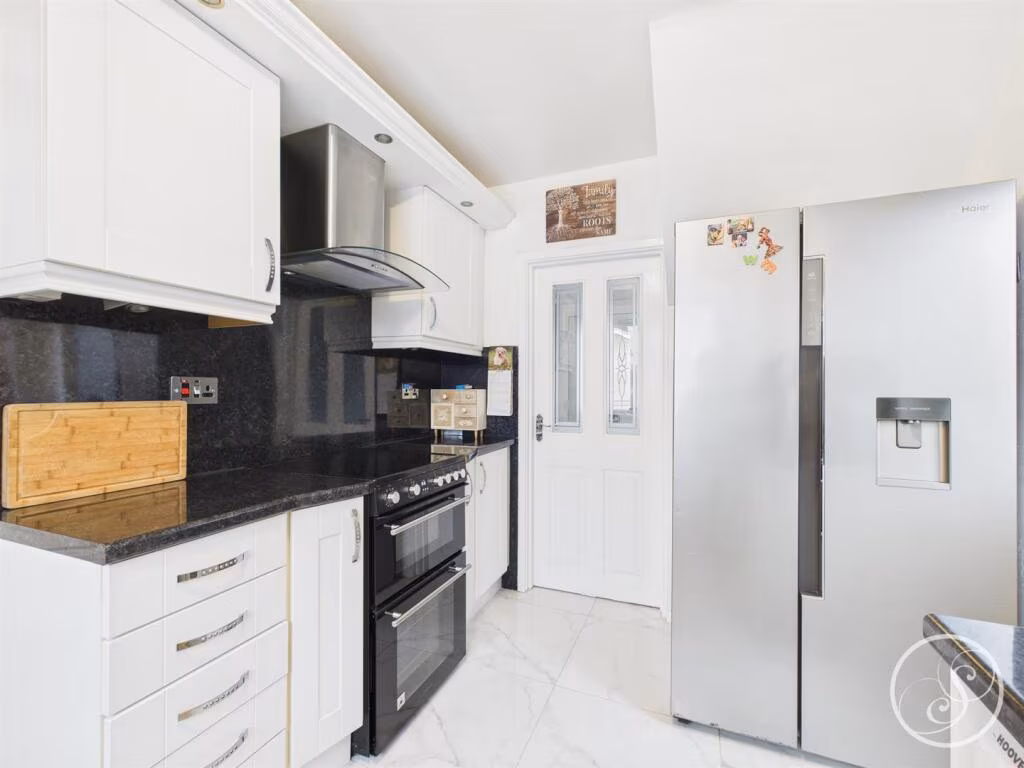
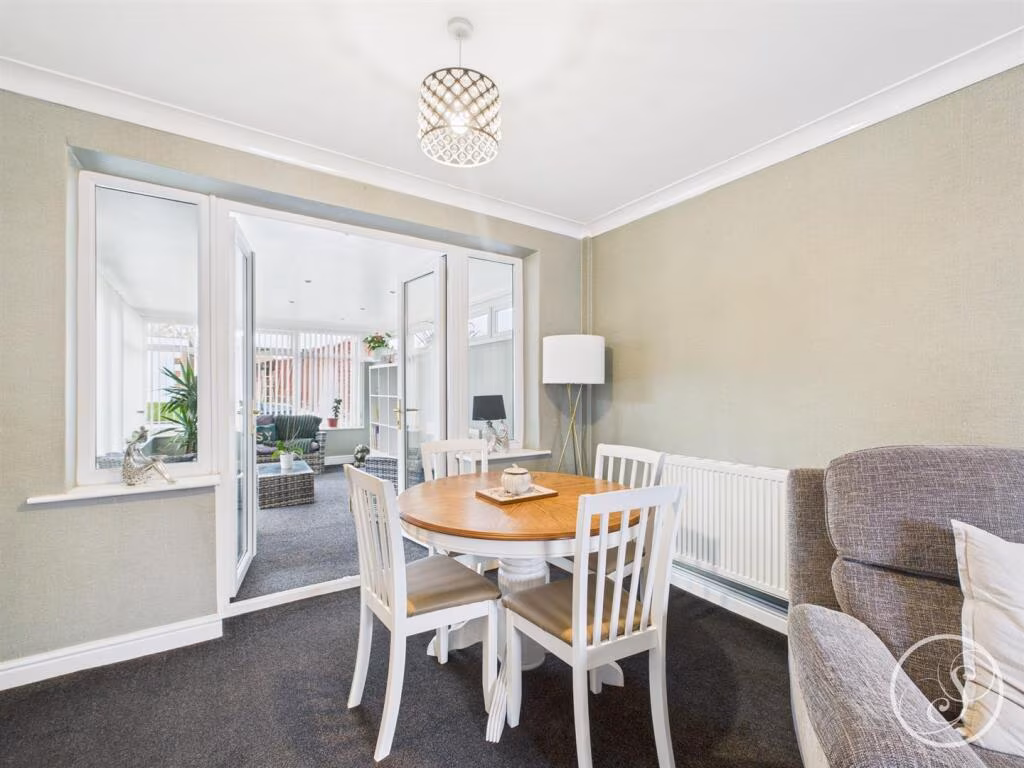
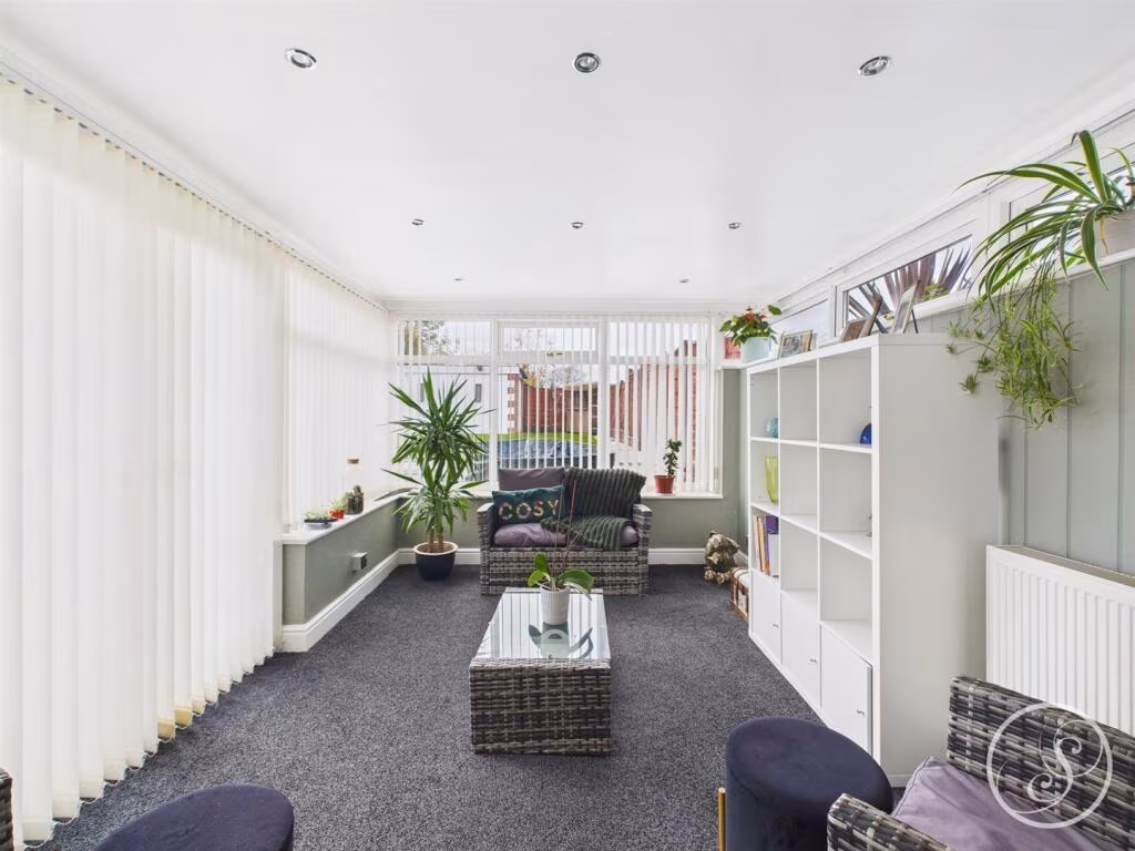
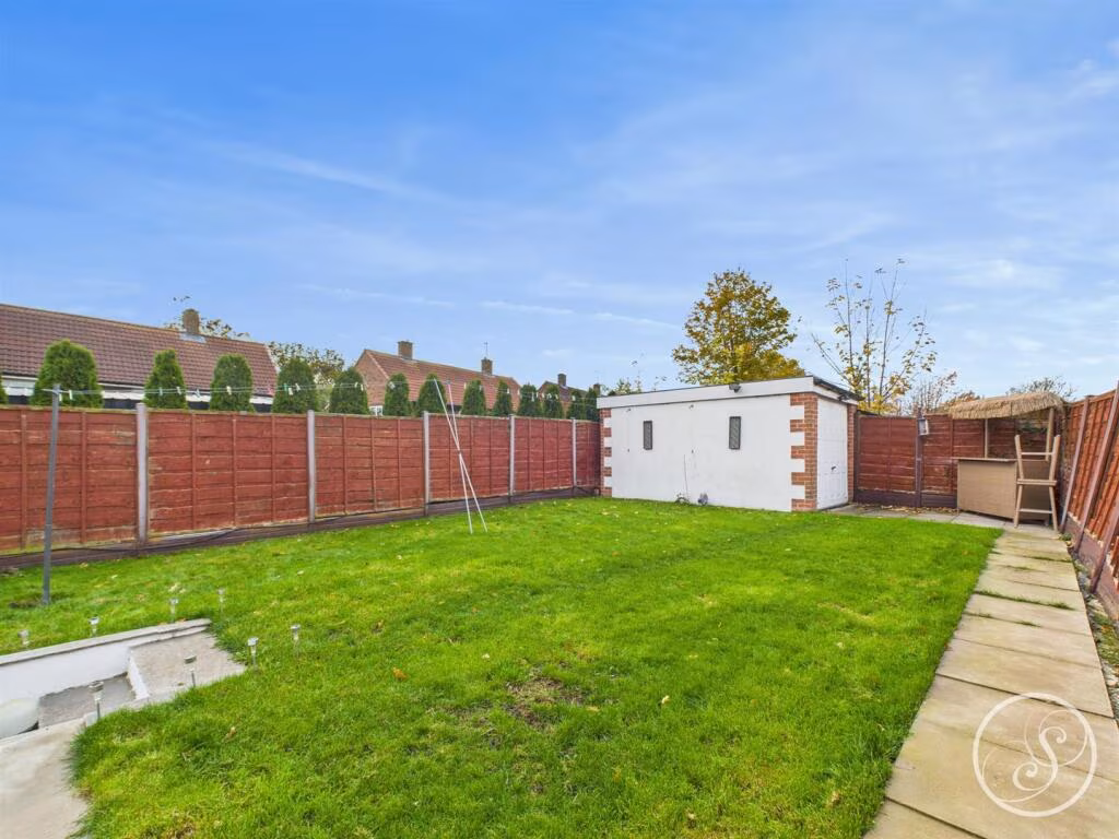
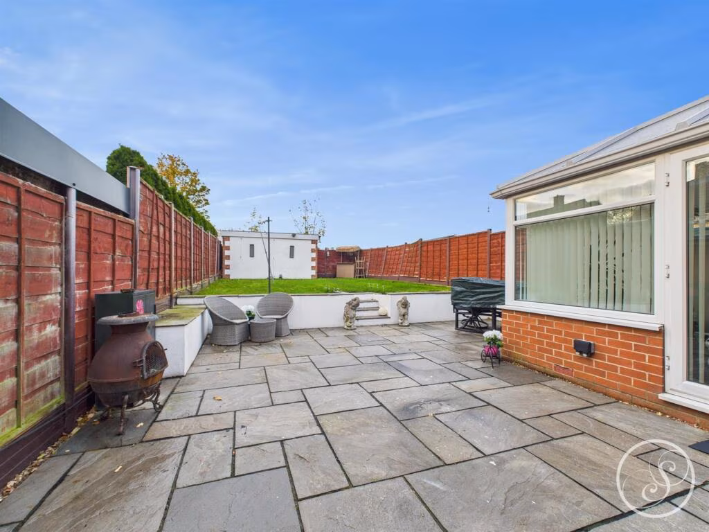
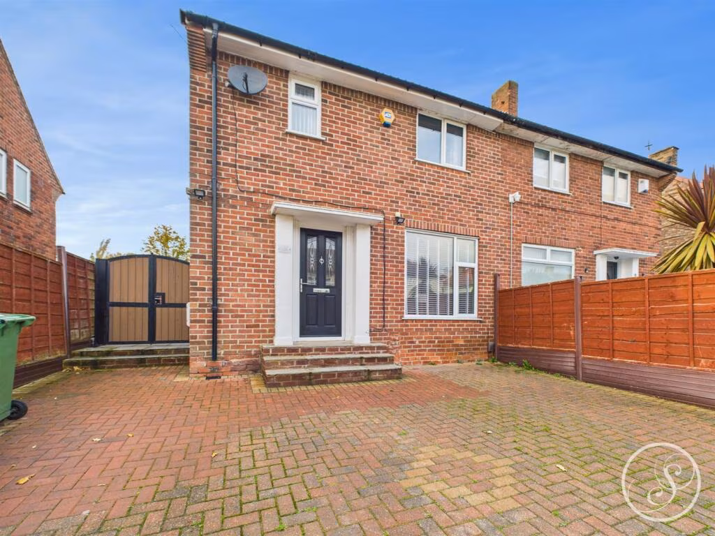
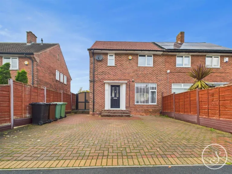
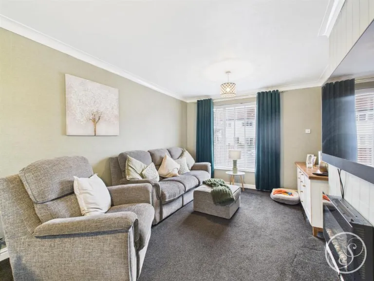
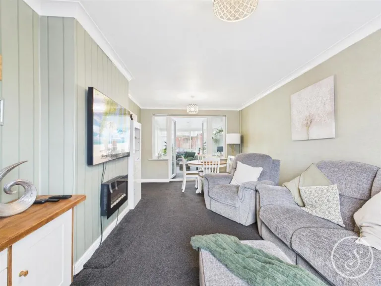
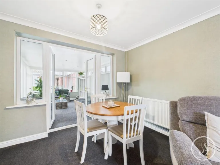
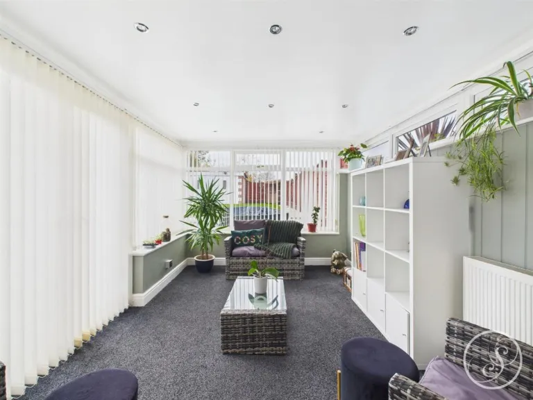
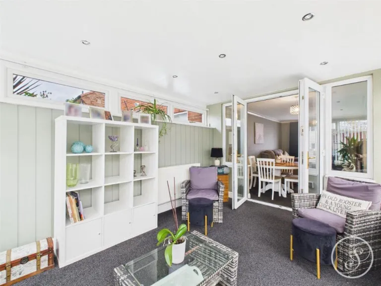
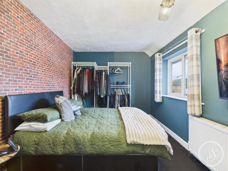
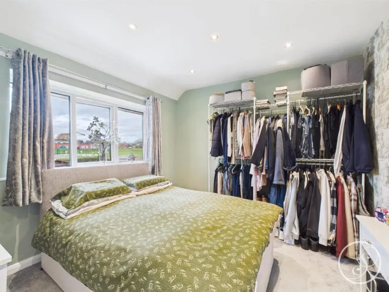
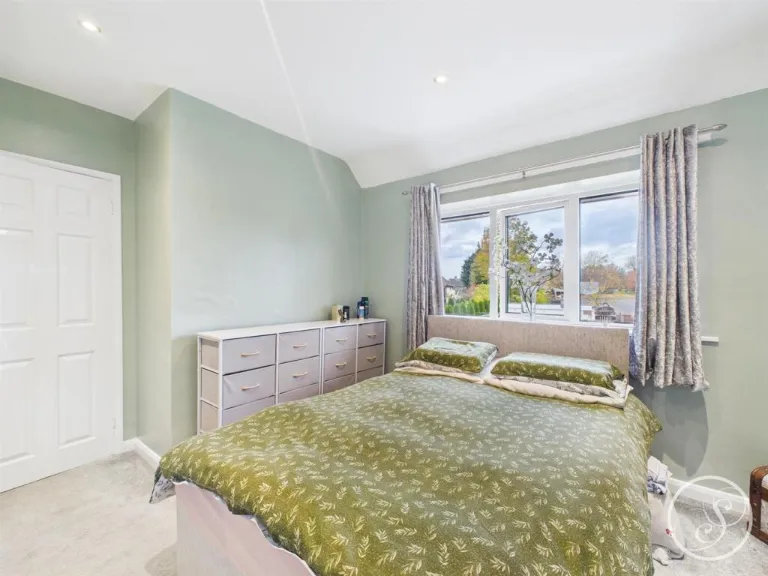
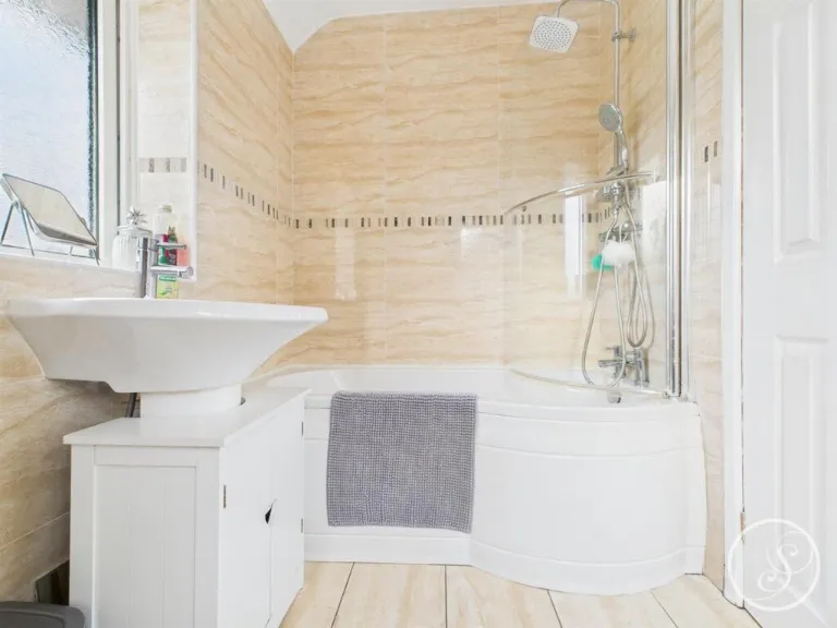
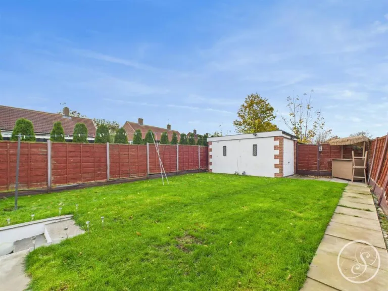
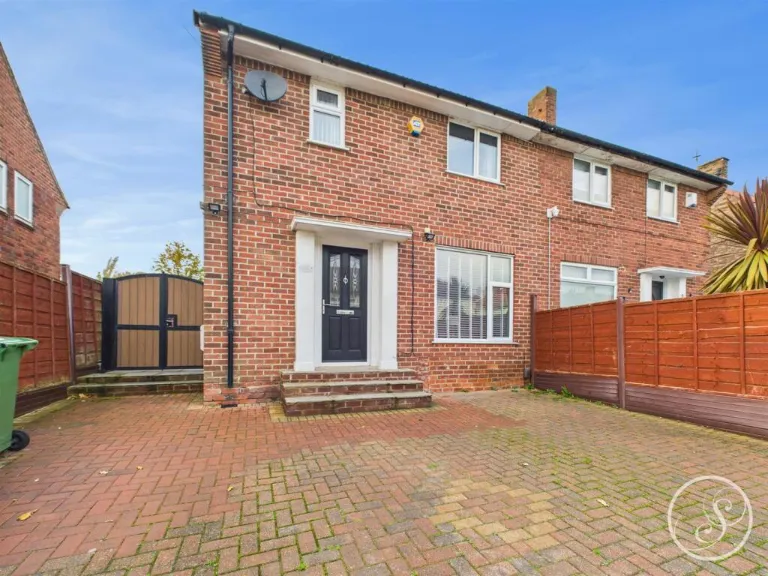
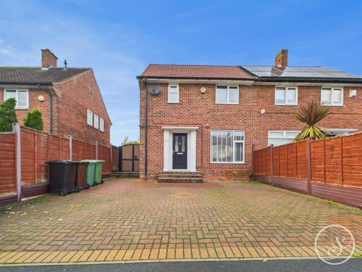
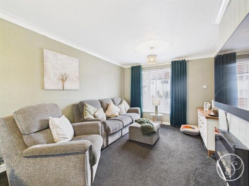
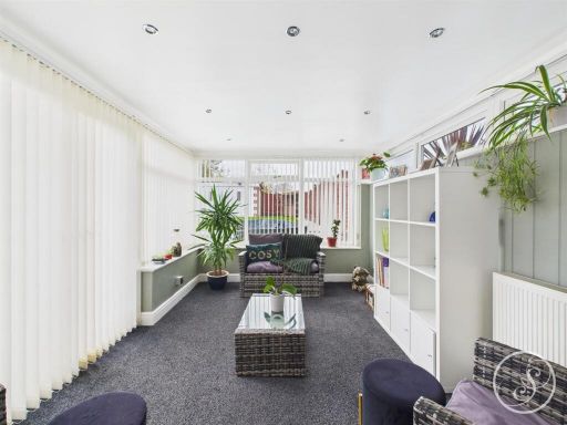
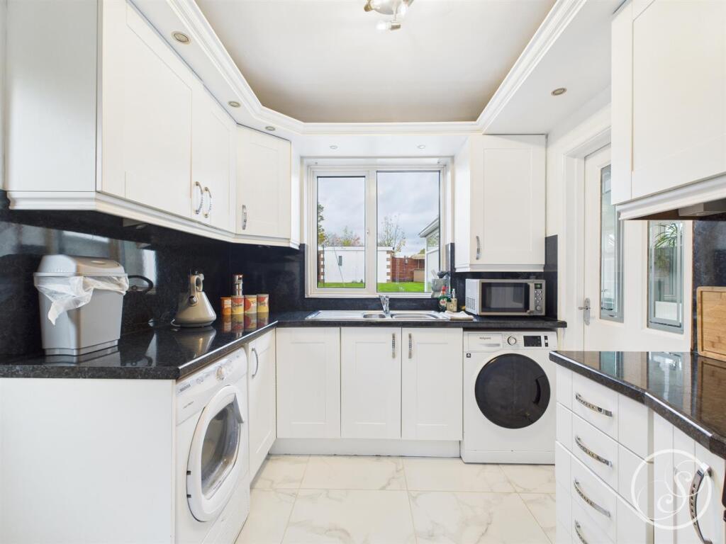
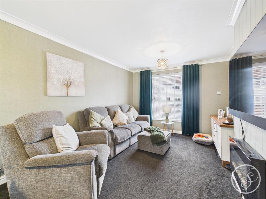
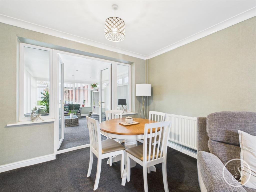
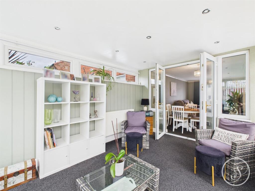
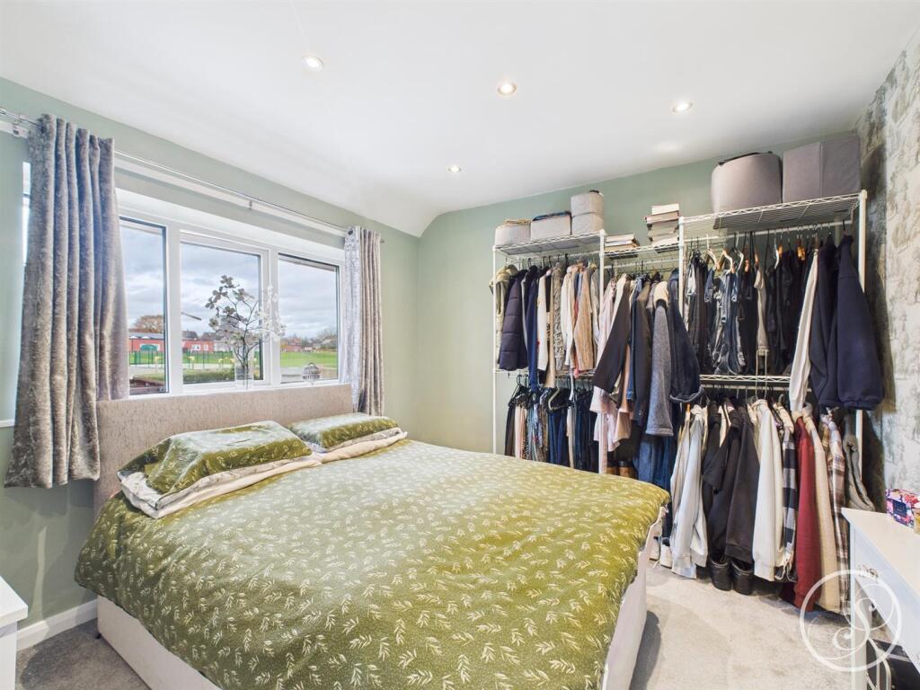
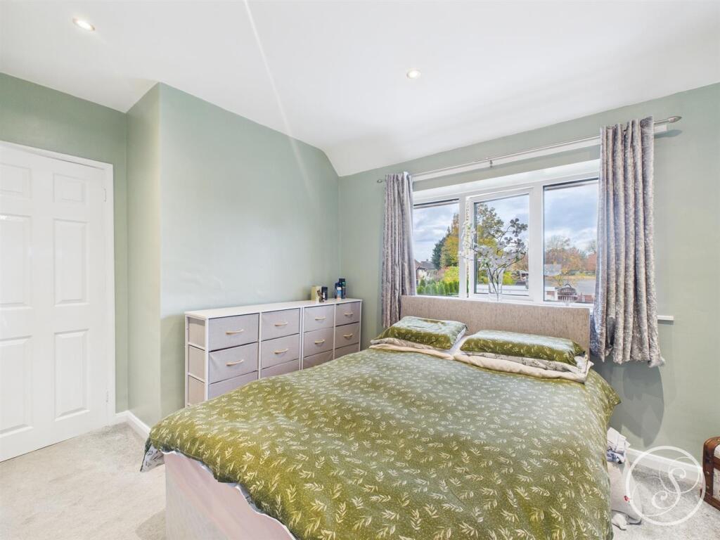
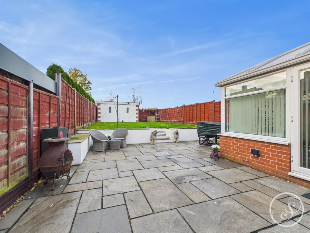
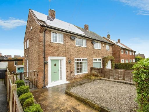
- Well presented two-bedroom semi-detached brick house. Externally the property features a wide block-paved driveway providing off-road parking for two cars to the front and a large rear garden with patio and grassed area. The accommodation briefly comprises entrance, fitted kitchen, lounge/diner, conservatory, first floor landing, two bedrooms, family bathroom and a useful loft space. Interiors appear modern and neutrally finished. Property is typical of suburban location with neighbouring semi-detached homes; overall plot and garden are large for this house type while internal living space is small-to-average for a two-bedroom semi.
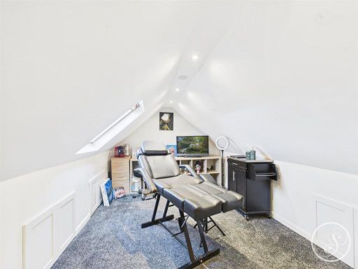
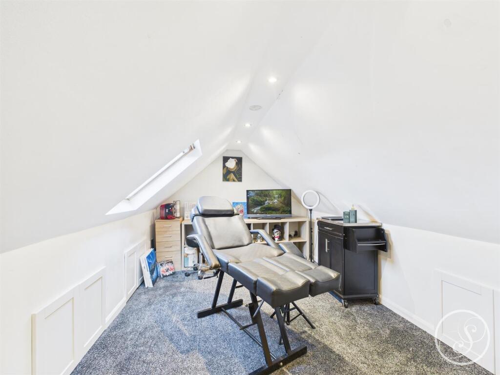
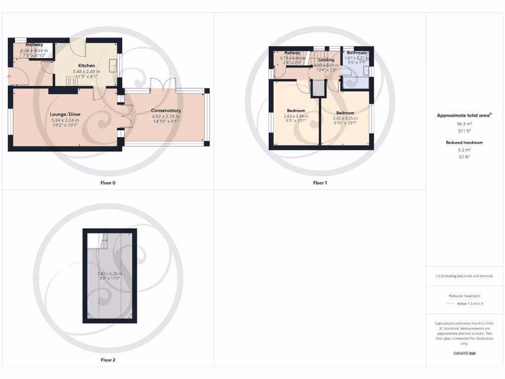
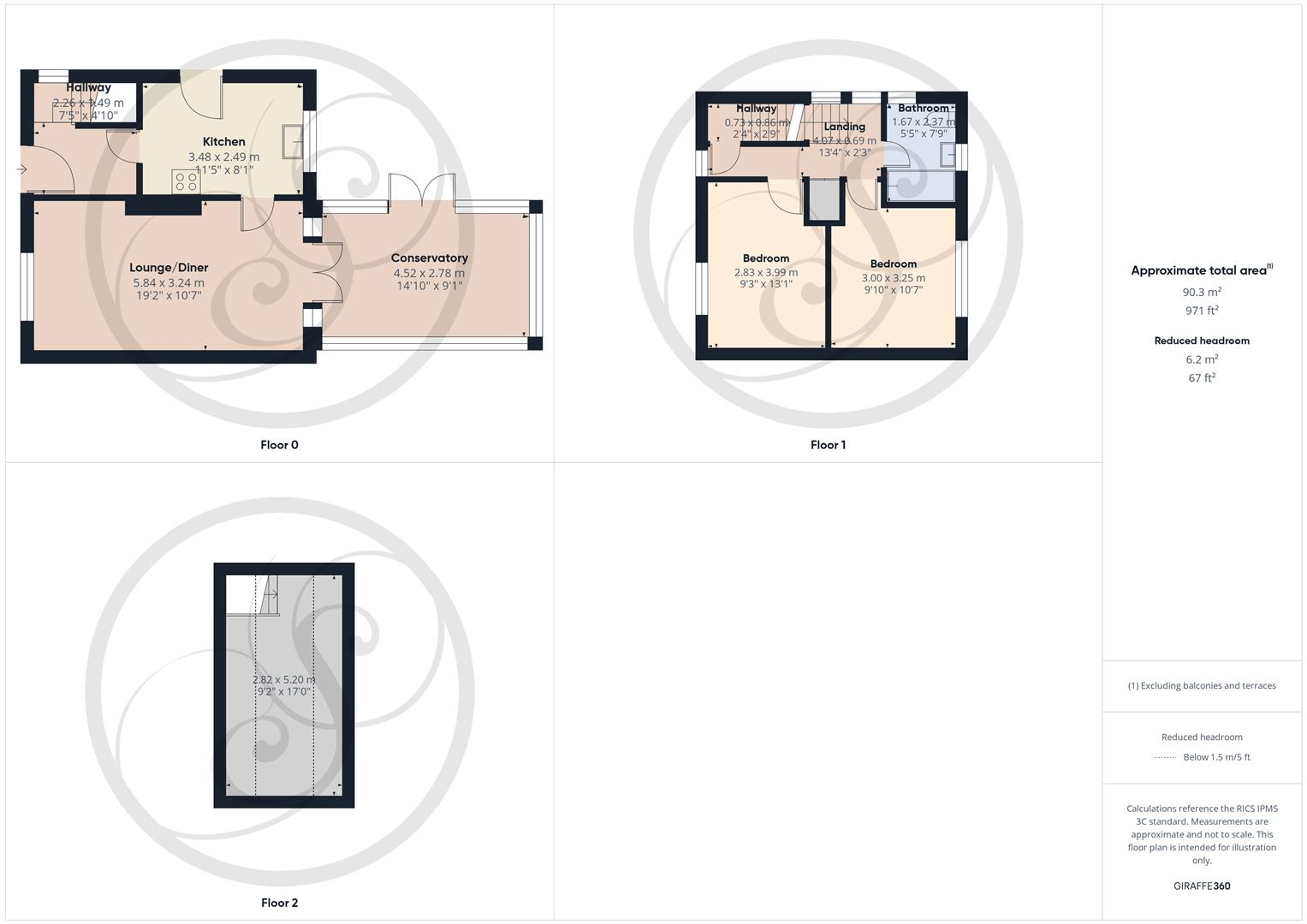
- Mid-20th century two-storey residential house located in the Swarcliffe area of Leeds. Based on the supplied floor plans the accommodation comprises: ground-floor lounge/diner (open plan, average-sized), kitchen, rear conservatory providing additional living space, and a bathroom and two bedrooms at first-floor level. There is also a loft/attic area shown on the plan (limited headroom). The overall internal area is shown as approximately 90.3 m² (c. 971 ft²). The property appears to be a modest family home on a typical suburban plot with an average-sized rear garden (conservatory indicates direct garden access). The plan and map position suggest a residential street location with local amenities nearby. Energy rating graphics on the page indicate a current rating in the mid-range with potential to improve. Overall condition and finish cannot be inferred from the plans alone; valuation would depend on internal condition, garden size/detail, and local comparable sales in LS15.
Image Descriptions
- semi-detached house front exterior semi-detached
- kitchen modern
Floorplan Description
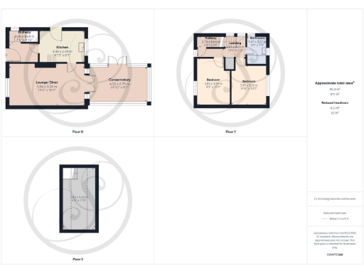
- Three-floor property with lounge/diner, kitchen, conservatory, two bedrooms, bathroom and additional upper rooms.
Rooms
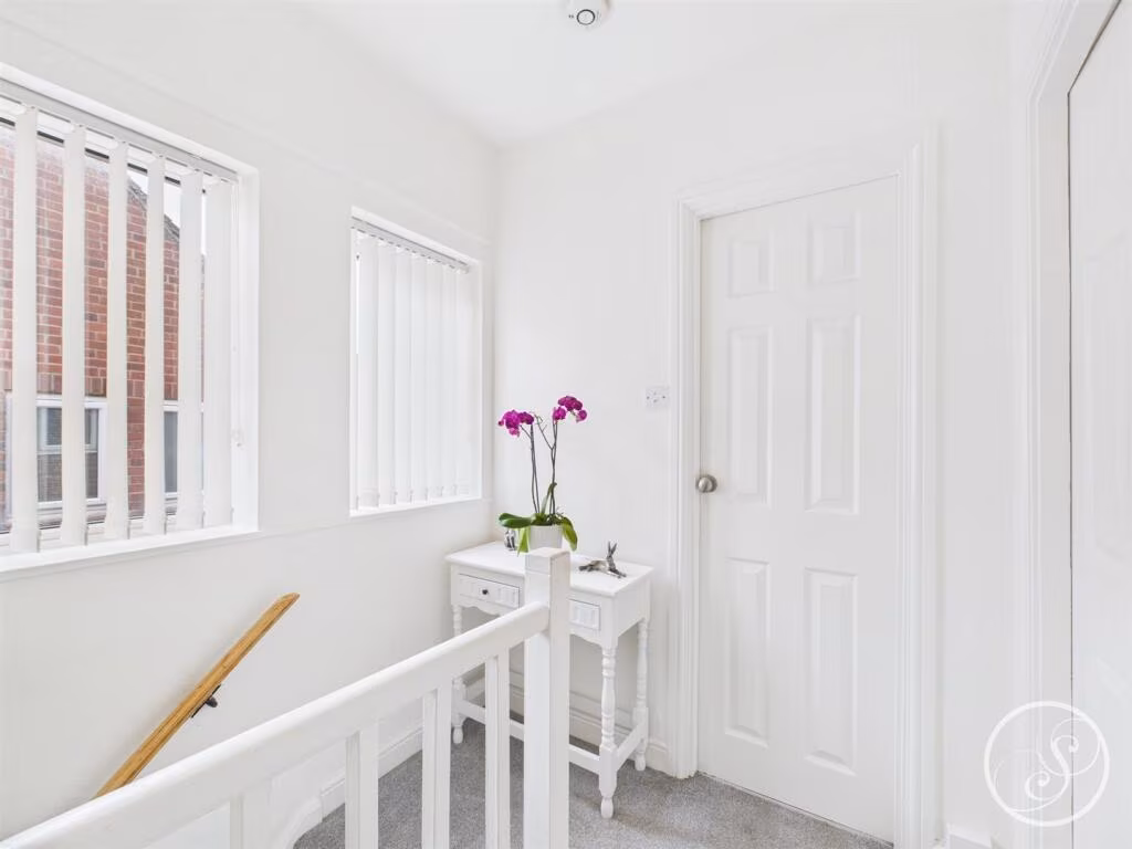
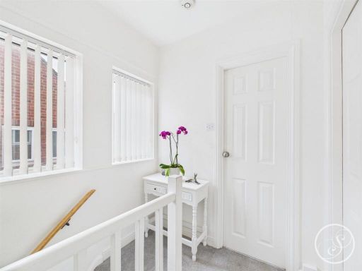
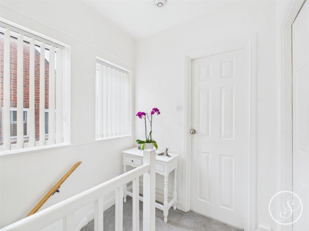
- Hallway:
- Kitchen:
- Lounge/Diner:
- Conservatory:
- Hallway:
- Landing:
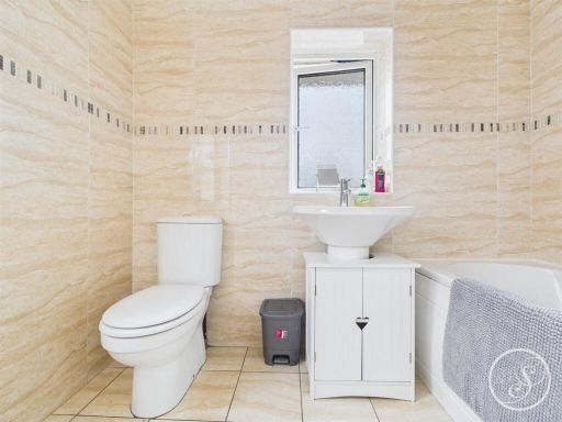
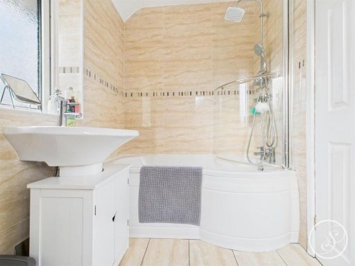
- Bathroom:
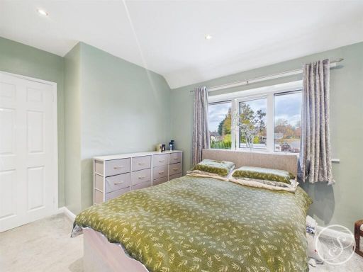
- Bedroom:
- Bedroom:
- 2.82 x 5.20 m:
Textual Property Features
Detected Visual Features
- semi-detached
- brick exterior
- two-story
- paved driveway
- solar panels
- side gate
- wrought iron fencing
- modern kitchen
- white cabinets
- black countertops
- appliances
- small kitchen
- garden view
EPC Details
- Fully double glazed
- Cavity wall, as built, no insulation (assumed)
- Boiler and radiators, mains gas
- Low energy lighting in 90% of fixed outlets
- Solid, no insulation (assumed)
Nearby Schools
- Manston St James Primary Academy
- St Nicholas Catholic Primary School
- Manston Primary
- Swarcliffe Primary School
- Scholes (Elmet) Primary School
- Colton Primary School
- Whitkirk Primary School
- Austhorpe Primary School
- John Smeaton Academy
- Bishop Young Church of England Academy
- Temple Learning Academy
- Temple Moor High School
- Corpus Christi Catholic Primary School
- Templenewsam Halton Primary School
- Seacroft Grange Primary School
- Leeds East Academy
- Beechwood Primary School
- Our Lady of Good Counsel Catholic Primary School
- Grimes Dyke Primary School
- Grange Farm Primary School
- White Laith Primary School
- Whinmoor St Paul's Church of England Primary School
- Fieldhead Carr Primary School
- Corpus Christi Catholic College, A Voluntary Academy
- Cross Gates Primary School
- Wykebeck Primary School
- Parklands Primary School
- St Theresa's Catholic Primary School
- Shadwell Primary School
Nearest General Shops
- Id: 5179646205
- Tags:
- Addr:
- City: Leeds
- Housenumber: 4
- Postcode: LS14 5AQ
- Street: Swarcliffe Parade
- Suburb: Seacroft
- Fhrs:
- Name: United News & Booze
- Shop: newsagent
- TagsNormalized:
- Lat: 53.8173733
- Lon: -1.4518708
- FullGeoHash: gcwfnvnubvw8
- PartitionGeoHash: gcwf
- Images:
- FoodStandards:
- Id: 553168
- FHRSID: 553168
- LocalAuthorityBusinessID: 11/01260/COMM
- BusinessName: United News And Booze
- BusinessType: Retailers - other
- BusinessTypeID: 4613
- AddressLine1: 4 Swarcliffe Parade
- AddressLine2: Seacroft
- AddressLine3: Leeds
- AddressLine4: null
- PostCode: LS14 5AQ
- RatingValue: 5
- RatingKey: fhrs_5_en-GB
- RatingDate: 2013-05-30
- LocalAuthorityCode: 413
- LocalAuthorityName: Leeds
- LocalAuthorityWebSite: http://www.leeds.gov.uk/
- LocalAuthorityEmailAddress: food.safety@leeds.gov.uk
- Scores:
- Hygiene: 0
- Structural: 0
- ConfidenceInManagement: 0
- NewRatingPending: false
- Geocode:
- Longitude: -1.45153900000000
- Latitude: 53.81743200000000
- Distance: 271.6
,- Id: 80506970
- Tags:
- Addr:
- Street: Swarcliffe Parade
- Building: yes
- Shop: mall
- TagsNormalized:
- Lat: 53.817451
- Lon: -1.4515999
- FullGeoHash: gcwfnvnvr7bx
- PartitionGeoHash: gcwf
- Images:
- FoodStandards: null
- Distance: 255.5
,- Id: 5179646207
- Tags:
- Brand: Betfred
- Brand:wikidata: Q4897425
- Brand:wikipedia: en:Betfred
- Name: Betfred
- Shop: bookmaker
- TagsNormalized:
- Lat: 53.8174976
- Lon: -1.4515127
- FullGeoHash: gcwfnvpj9k9t
- PartitionGeoHash: gcwf
- Images:
- FoodStandards: null
- Distance: 248.3
}
Nearest Religious buildings
- Id: 80507001
- Tags:
- Addr:
- City: Leeds
- Postcode: LS14 5AW
- Street: Swarcliffe Drive
- Amenity: place_of_worship
- Building: yes
- Denomination: roman_catholic
- Email: office.blessedjohnnewman@dioceseofleeds.org.uk
- Name: St. Gregory the Great
- Old_name: St Gregory
- Religion: christian
- Wheelchair: limited
- TagsNormalized:
- place of worship
- catholic
- roman catholic
- christian
- church
- Lat: 53.8171544
- Lon: -1.4498304
- FullGeoHash: gcwfpj078s8n
- PartitionGeoHash: gcwf
- Images:
- FoodStandards: null
- Distance: 259.9
,- Id: 80507010
- Tags:
- Addr:
- City: Leeds
- Housename: St Luke's
- Postcode: LS14 5AS
- Street: Stanks Lane North
- Amenity: community_centre
- Building: church
- Name: St Lukes
- Note: former church, stopped being used for worship in 2012
- Opening_hours: "various as people book hall, some recurring events /clubs"
- Wheelchair: yes
- TagsNormalized:
- Lat: 53.8216258
- Lon: -1.4487461
- FullGeoHash: gcwfpjcj9y0x
- PartitionGeoHash: gcwf
- Images:
- FoodStandards: null
- Distance: 247.4
,- Id: 80506996
- Tags:
- Addr:
- City: Leeds
- Housename: Swarcliffe Baptist Church
- Postcode: LS14 5JU
- Street: Swarcliffe Drive
- Amenity: place_of_worship
- Building: yes
- Denomination: baptist
- Name: Swarcliffe Baptist Church
- Religion: christian
- Wheelchair: yes
- TagsNormalized:
- place of worship
- baptist
- church
- christian
- Lat: 53.8206096
- Lon: -1.4524017
- FullGeoHash: gcwfnvwru8fc
- PartitionGeoHash: gcwf
- Images:
- FoodStandards: null
- Distance: 210.7
}
Nearest Medical buildings
- Id: 577886052
- Tags:
- Addr:
- City: Leeds
- Housenumber: 896
- Postcode: LS14 6HT
- Street: York Road
- Amenity: dentist
- Building: yes
- Healthcare: dentist
- Name: Seacroft Dental Surgery
- TagsNormalized:
- dentist
- health
- healthcare
- dental
- surgery
- Lat: 53.8156063
- Lon: -1.4558642
- FullGeoHash: gcwfnugfeuhg
- PartitionGeoHash: gcwf
- Images:
- FoodStandards: null
- Distance: 587
,- Id: 6010342748
- Tags:
- Addr:
- City: Leeds
- Housename: Windmill Health Centre
- Postcode: LS14 5BD
- Street: Whinmoor Way
- Amenity: pharmacy
- Brand: Lloyds Pharmacy
- Brand:wikidata: Q6662870
- Brand:wikipedia: en:LloydsPharmacy
- Healthcare: pharmacy
- Name: Lloyds Pharmacy
- TagsNormalized:
- pharmacy
- lloyds pharmacy
- health
- healthcare
- Lat: 53.8217133
- Lon: -1.444083
- FullGeoHash: gcwfpjuqnqt9
- PartitionGeoHash: gcwf
- Images:
- FoodStandards: null
- Distance: 449.8
,- Id: 916765914
- Tags:
- Addr:
- City: Leeds
- Housenumber: 83a
- Postcode: LS14 5BD
- Street: Whinmoor Way
- Amenity: doctors
- Building: yes
- Fixme: no gps
- Healthcare: clinic
- Name: Windmill Health Centre
- TagsNormalized:
- doctor
- doctors
- clinic
- health
- healthcare
- health centre
- Lat: 53.8216793
- Lon: -1.4442287
- FullGeoHash: gcwfpjuq501n
- PartitionGeoHash: gcwf
- Images:
- FoodStandards: null
- Distance: 439.8
,- Id: 691290295
- Tags:
- Amenity: clinic
- Area: yes
- Building: no
- Healthcare: clinic
- Note: (Windmill) Medical Centre
- TagsNormalized:
- Lat: 53.8217651
- Lon: -1.4443524
- FullGeoHash: gcwfpjuq80hy
- PartitionGeoHash: gcwf
- Images:
- FoodStandards: null
- Distance: 438.5
}
Nearest Airports
- Id: 11519546
- Tags:
- Addr:
- City: Leeds
- Postcode: LS19 7TU
- Aerodrome: international
- Aerodrome:type: public
- Aeroway: aerodrome
- Iata: LBA
- Icao: EGNM
- Name: Leeds Bradford Airport
- Operator: Leeds Bradford Airport Limited
- Operator:type: private
- Ref: LBA
- Type: multipolygon
- Website: https://www.leedsbradfordairport.co.uk/
- Wikidata: Q8699
- Wikipedia: en:Leeds Bradford Airport
- TagsNormalized:
- airport
- international airport
- Lat: 53.8667047
- Lon: -1.660138
- FullGeoHash: gcwf6nph7cx3
- PartitionGeoHash: gcwf
- Images:
- Q8699-1
- Q8699-2
- Q8699-3
- Q8699-4
- FoodStandards: null
- Distance: 14763.5
}
Nearest Leisure Facilities
- Id: 9764189305
- Tags:
- Description: www.facebook.com/stlukescommunitygardenLS14/
- Garden:
- Leisure: garden
- Name: St. Lukes Community Garden and Orchard
- TagsNormalized:
- Lat: 53.8216993
- Lon: -1.4482983
- FullGeoHash: gcwfpjcqh5yw
- PartitionGeoHash: gcwf
- Images:
- FoodStandards: null
- Distance: 264.8
,- Id: 704139842
- Tags:
- Leisure: pitch
- Lit: no
- Sport: soccer
- Surface: grass
- TagsNormalized:
- Lat: 53.8179384
- Lon: -1.4499185
- FullGeoHash: gcwfpj20nqy7
- PartitionGeoHash: gcwf
- Images:
- FoodStandards: null
- Distance: 172.9
,- Id: 694983688
- Tags:
- Highway: footway
- Leisure: track
- Lit: no
- Sport: running
- Surface: tartan
- TagsNormalized:
- footway
- track
- leisure
- running
- sports
- Lat: 53.8204185
- Lon: -1.4493634
- FullGeoHash: gcwfpj8wemhm
- PartitionGeoHash: gcwf
- Images:
- FoodStandards: null
- Distance: 107.2
,- Id: 694983689
- Tags:
- Leisure: pitch
- Lit: no
- Sport: yes
- Surface: tartan
- TagsNormalized:
- Lat: 53.8201152
- Lon: -1.4501347
- FullGeoHash: gcwfpj8hckth
- PartitionGeoHash: gcwf
- Images:
- FoodStandards: null
- Distance: 72.5
,- Id: 694983690
- Tags:
- Leisure: pitch
- Lit: no
- Sport: yes
- Surface: asphalt
- TagsNormalized:
- Lat: 53.8199682
- Lon: -1.4503422
- FullGeoHash: gcwfnvxuh94r
- PartitionGeoHash: gcwf
- Images:
- FoodStandards: null
- Distance: 63.5
}
Nearest Tourist attractions
- Id: 6515395869
- Tags:
- Access: customers
- Brand: Go Ape
- Brand:website: https://goape.co.uk/
- Brand:wikidata: Q5574692
- Brand:wikipedia: en:Go Ape
- Fee: yes
- Name: Go Ape - Treetop Adventure
- Operator: Go Ape
- Playground: structure
- Tourism: theme_park
- Website: https://goape.co.uk/locations/temple-newsam
- TagsNormalized:
- Lat: 53.7876818
- Lon: -1.4534245
- FullGeoHash: gcwcyztxuy85
- PartitionGeoHash: gcwc
- Images:
- FoodStandards: null
- Distance: 3545
,- Id: 6211253234
- Tags:
- TagsNormalized:
- Lat: 53.7983451
- Lon: -1.4259745
- FullGeoHash: gcwfp99wh6kk
- PartitionGeoHash: gcwf
- Images:
- FoodStandards: null
- Distance: 2824.6
,- Id: 7869213639
- Tags:
- Name: Kingswear Gallery
- Tourism: gallery
- TagsNormalized:
- Lat: 53.8026775
- Lon: -1.4451146
- FullGeoHash: gcwfp47xq6h2
- PartitionGeoHash: gcwf
- Images:
- FoodStandards: null
- Distance: 1894.9
}
Nearest Train stations
- Id: 7156706693
- Tags:
- Alt_name: Leeds City
- Name: Leeds
- Naptan:
- Network: National Rail
- Operator: Network Rail
- Platforms: 17
- Public_transport: station
- Railway: station
- Ref:
- Train: yes
- Wheelchair: yes
- Wikidata: Q1466941
- Wikipedia: en:Leeds railway station
- TagsNormalized:
- Lat: 53.794414
- Lon: -1.548621
- FullGeoHash: gcwfhbbr4t86
- PartitionGeoHash: gcwf
- Images:
- FoodStandards: null
- Distance: 7061.9
,- Id: 3070021776
- Tags:
- Name: Woodlesford
- Naptan:
- Network: National Rail
- Public_transport: station
- Railway: station
- Ref:
- Wikidata: Q2432424
- Wikipedia: en:Woodlesford railway station
- TagsNormalized:
- Lat: 53.757064
- Lon: -1.4435652
- FullGeoHash: gcwcz4hvd7pc
- PartitionGeoHash: gcwc
- Images:
- FoodStandards: null
- Distance: 6953.7
,- Id: 6012608609
- Tags:
- Name: East Garforth
- Naptan:
- Network: National Rail
- Public_transport: station
- Railway: station
- Ref:
- Wikidata: Q2537875
- Wikipedia: en:East Garforth railway station
- TagsNormalized:
- Lat: 53.7922376
- Lon: -1.3715945
- FullGeoHash: gcx40b94rxch
- PartitionGeoHash: gcx4
- Images:
- FoodStandards: null
- Distance: 5963.3
,- Id: 559899668
- Tags:
- Name: Garforth
- Naptan:
- Network: National Rail
- Public_transport: station
- Railway: station
- Ref:
- Wikidata: Q2324929
- Wikipedia: en:Garforth railway station
- TagsNormalized:
- Lat: 53.7965742
- Lon: -1.382282
- FullGeoHash: gcx40937y2rc
- PartitionGeoHash: gcx4
- Images:
- FoodStandards: null
- Distance: 5114
,- Id: 6012826244
- Tags:
- Alt_name: Crossgates
- Name: Cross Gates
- Naptan:
- Network: National Rail
- Public_transport: station
- Railway: station
- Ref:
- Source: NPE
- Train: yes
- Wikidata: Q1857460
- Wikipedia: en:Cross Gates railway station
- TagsNormalized:
- Lat: 53.8050605
- Lon: -1.450353
- FullGeoHash: gcwfnfzvhq4r
- PartitionGeoHash: gcwf
- Images:
- FoodStandards: null
- Distance: 1605.1
}
Nearest Hotels
- Id: 886634065
- Tags:
- Access: customers
- Amenity: parking
- Fee: yes
- Name: Thorpe Park Hotel
- Operator: Thorpe Park Hotel
- Operator:type: business
- Parking: surface
- Surface: asphalt
- TagsNormalized:
- Lat: 53.7940493
- Lon: -1.4274171
- FullGeoHash: gcwfp8bt4c8e
- PartitionGeoHash: gcwf
- Images:
- FoodStandards: null
- Distance: 3188.3
,- Id: 307009379
- Tags:
- Addr:
- City: Leeds
- Postcode: LS15 7AY
- Street: Selby Road
- Alt_name: Premier Inn Leeds East
- Brand: Premier Inn
- Brand:wikidata: Q2108626
- Brand:wikipedia: en:Premier Inn
- Building: yes
- Contact:
- Website: https://www.premierinn.com/gb/en/hotels/england/west-yorkshire/leeds/leeds-east.html
- Fhrs:
- Internet_access: wlan
- Internet_access:fee: customers
- Internet_access:operator: Virgin Media
- Internet_access:ssid: Premier Inn Free Wi-Fi
- Name: Premier Inn
- Operator: Premier Inn
- Tourism: hotel
- TagsNormalized:
- Lat: 53.7982642
- Lon: -1.450375
- FullGeoHash: gcwfncxveg64
- PartitionGeoHash: gcwf
- Images:
- FoodStandards: null
- Distance: 2360.7
,- Id: 80506988
- Tags:
- Addr:
- City: Leeds
- Postcode: LS14 5QF
- Street: Mill Green View (ring road)
- Building: yes
- Fhrs:
- Name: Britannia Hotel
- Old_name: Ramada Jarvis
- Operator: Britannia Hotel Leeds
- Tourism: hotel
- TagsNormalized:
- Lat: 53.8220849
- Lon: -1.4555242
- FullGeoHash: gcwfnyh07gf6
- PartitionGeoHash: gcwf
- Images:
- FoodStandards: null
- Distance: 473.1
}
Tags
- semi-detached
- brick exterior
- two-story
- paved driveway
- solar panels
- side gate
- wrought iron fencing
- modern kitchen
- white cabinets
- black countertops
- appliances
- small kitchen
- garden view
Local Market Stats
- Average Price/sqft: £215
- Avg Income: £35800
- Rental Yield: 5.2%
- Social Housing: 16%
- Planning Success Rate: 85%
Similar Properties
 3 bedroom semi-detached house for sale in Swarcliffe Road, Leeds, LS14 — £210,000 • 3 bed • 1 bath • 620 ft²
 2 bedroom semi-detached house for sale in Swarcliffe Drive, Leeds, LS14 — £185,000 • 2 bed • 1 bath • 808 ft²
 2 bedroom semi-detached house for sale in Swarcliffe Drive, Leeds, LS14 — £190,000 • 2 bed • 1 bath • 797 ft²
 2 bedroom semi-detached house for sale in Mill Green Place, Leeds, West Yorkshire, LS14 — £180,000 • 2 bed • 2 bath • 1025 ft²
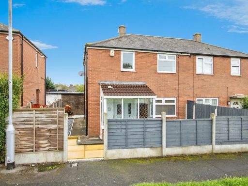 2 bedroom semi-detached house for sale in Hansby Avenue, Leeds, LS14 — £190,000 • 2 bed • 1 bath • 539 ft²
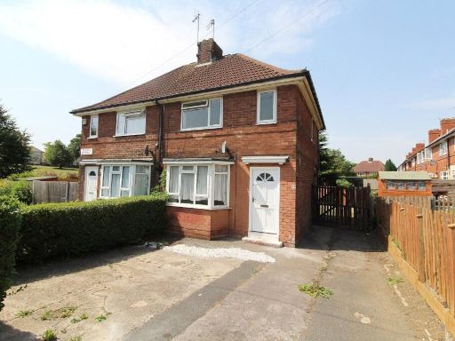 2 bedroom semi-detached house for sale in Skelwith Approach, Leeds, LS14 — £155,000 • 2 bed • 1 bath • 644 ft²
Meta
- {
"@context": "https://schema.org",
"@type": "Residence",
"name": "2 bedroom semidetached house for sale in Swarcliffe Road, L…",
"description": "",
"url": "https://propertypiper.co.uk/property/4ebb7ee4-f112-4c10-bece-5935db668075",
"image": "https://image-a.propertypiper.co.uk/78941fd1-7588-4156-9155-31a6b4d81af9-1024.jpeg",
"address": {
"@type": "PostalAddress",
"streetAddress": "5 Swarcliffe Road",
"postalCode": "LS14 5LE",
"addressLocality": "Leeds",
"addressRegion": "Leeds East",
"addressCountry": "England"
},
"geo": {
"@type": "GeoCoordinates",
"latitude": 53.819491588856856,
"longitude": -1.4498103661722943
},
"numberOfRooms": 2,
"numberOfBathroomsTotal": 1,
"floorSize": {
"@type": "QuantitativeValue",
"value": 971,
"unitCode": "FTK"
},
"offers": {
"@type": "Offer",
"price": 220000,
"priceCurrency": "GBP",
"availability": "https://schema.org/InStock"
},
"additionalProperty": [
{
"@type": "PropertyValue",
"name": "Feature",
"value": "semi-detached"
},
{
"@type": "PropertyValue",
"name": "Feature",
"value": "brick exterior"
},
{
"@type": "PropertyValue",
"name": "Feature",
"value": "two-story"
},
{
"@type": "PropertyValue",
"name": "Feature",
"value": "paved driveway"
},
{
"@type": "PropertyValue",
"name": "Feature",
"value": "solar panels"
},
{
"@type": "PropertyValue",
"name": "Feature",
"value": "side gate"
},
{
"@type": "PropertyValue",
"name": "Feature",
"value": "wrought iron fencing"
},
{
"@type": "PropertyValue",
"name": "Feature",
"value": "modern kitchen"
},
{
"@type": "PropertyValue",
"name": "Feature",
"value": "white cabinets"
},
{
"@type": "PropertyValue",
"name": "Feature",
"value": "black countertops"
},
{
"@type": "PropertyValue",
"name": "Feature",
"value": "appliances"
},
{
"@type": "PropertyValue",
"name": "Feature",
"value": "small kitchen"
},
{
"@type": "PropertyValue",
"name": "Feature",
"value": "garden view"
}
]
}
High Res Floorplan Images
Compatible Floorplan Images
FloorplanImages Thumbnail