S20 5FH - 3 bedroom end of terrace house for sale in Ruby Lane, Mosbo…
View on Property Piper
3 bedroom end of terrace house for sale in Ruby Lane, Mosborough, Sheffield, S20
Property Details
- Price: £230000
- Bedrooms: 3
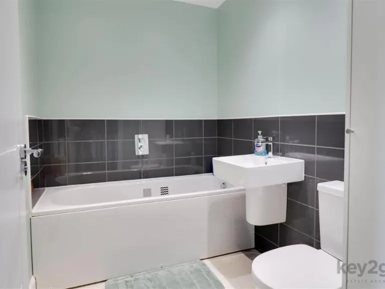
- Bathrooms: 2
- Property Type: undefined
- Property SubType: undefined
Brochure Descriptions
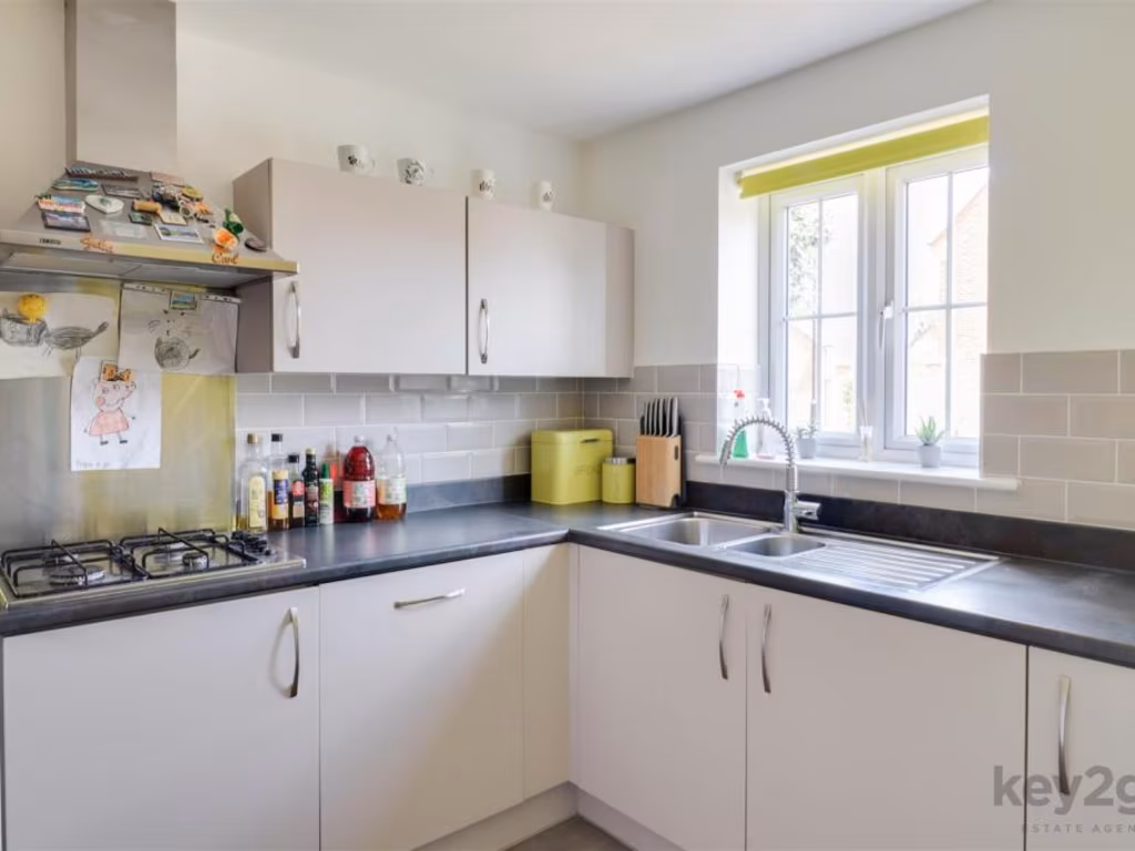
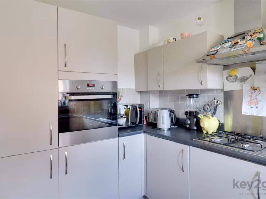
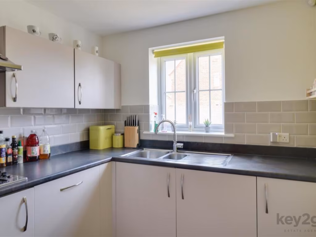
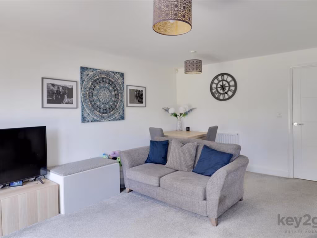
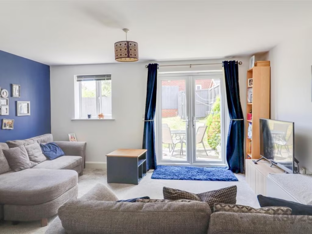
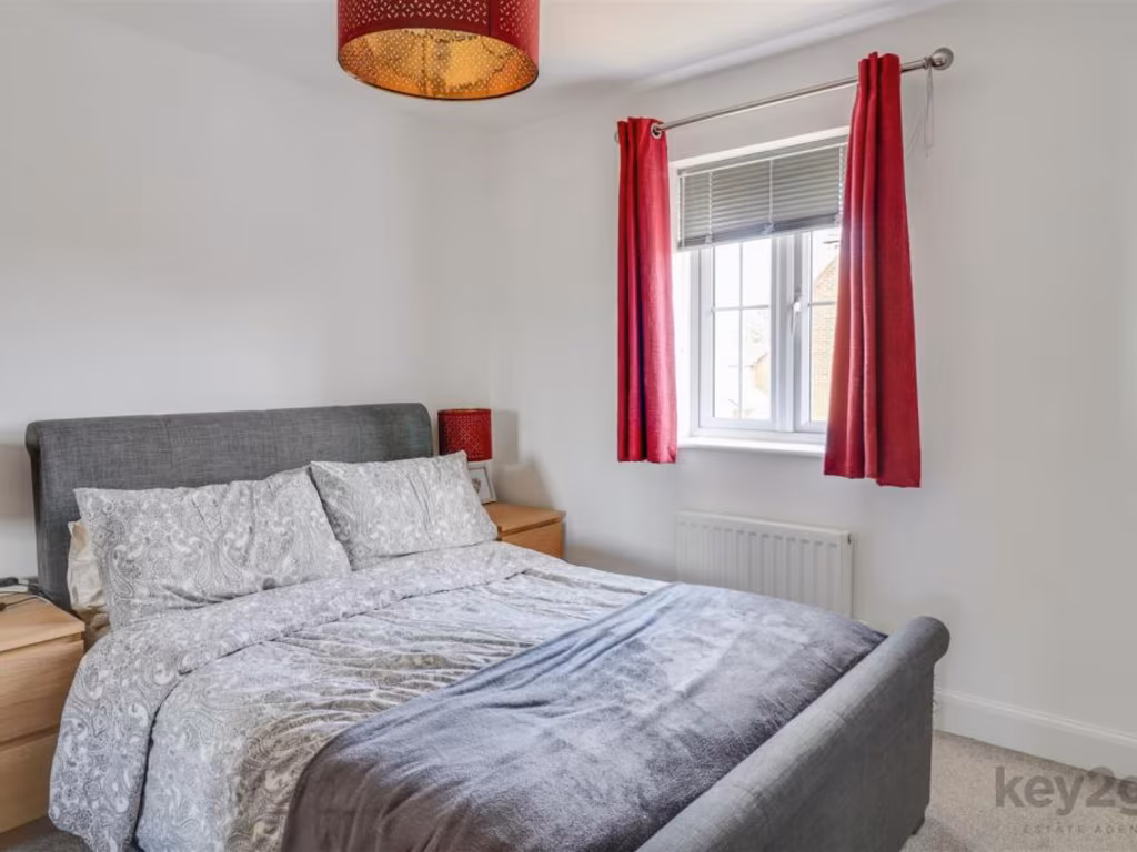
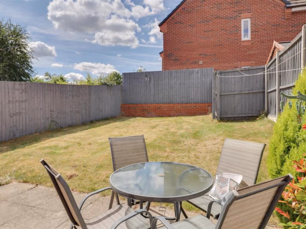
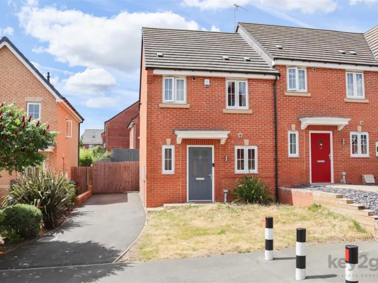
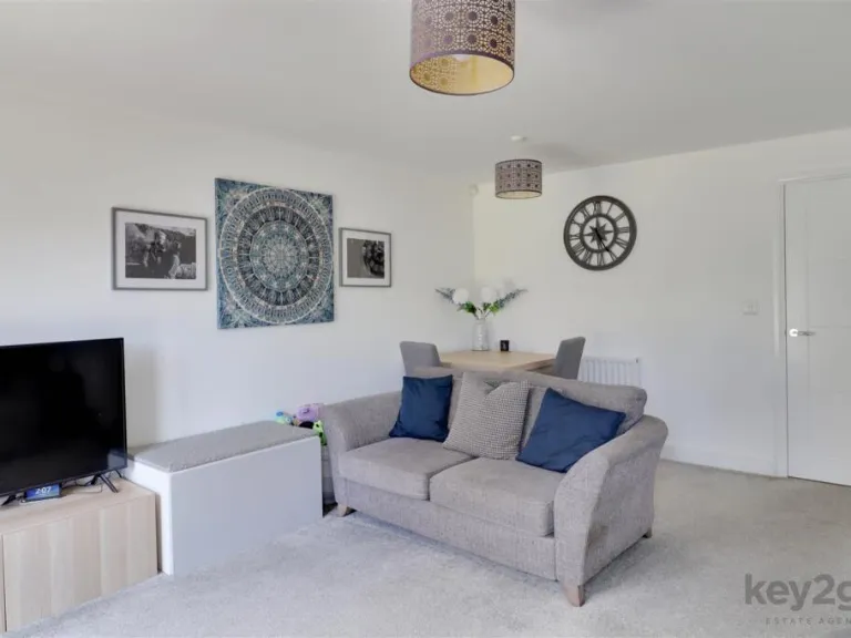
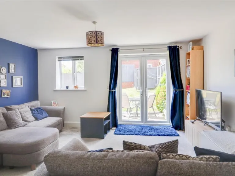
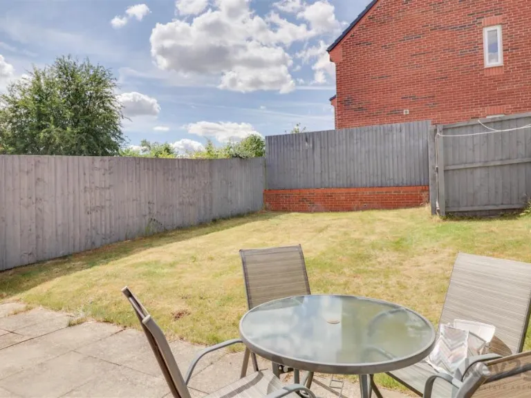
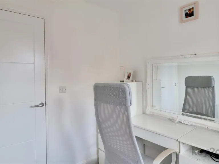
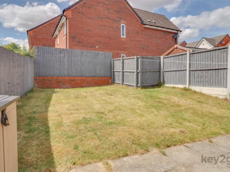
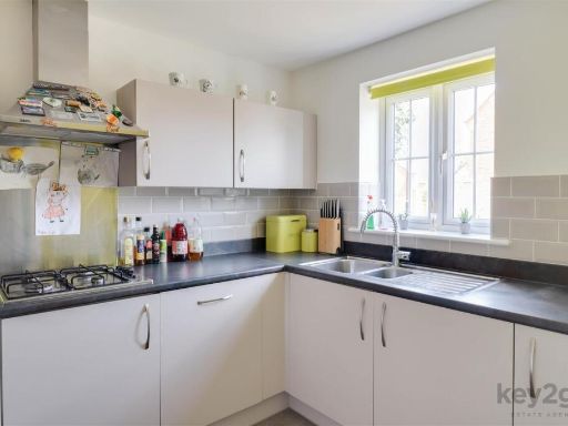
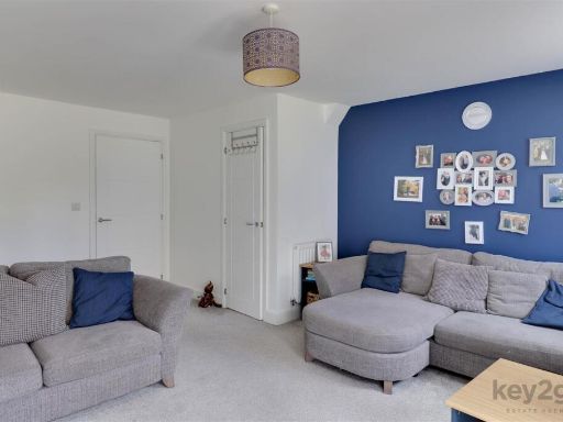
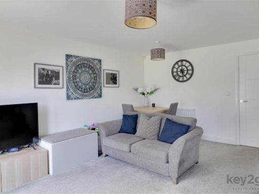
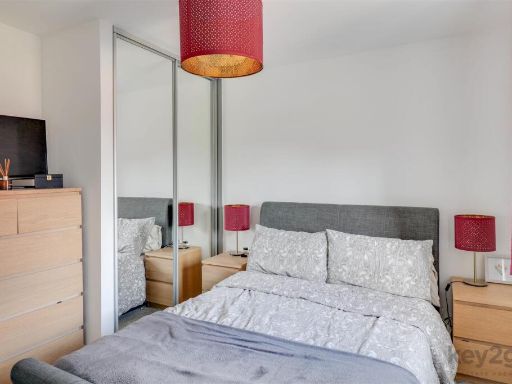
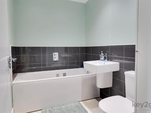
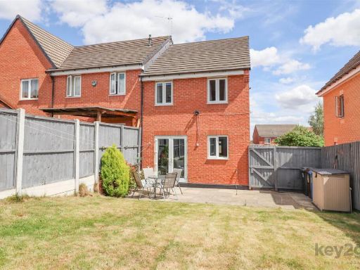
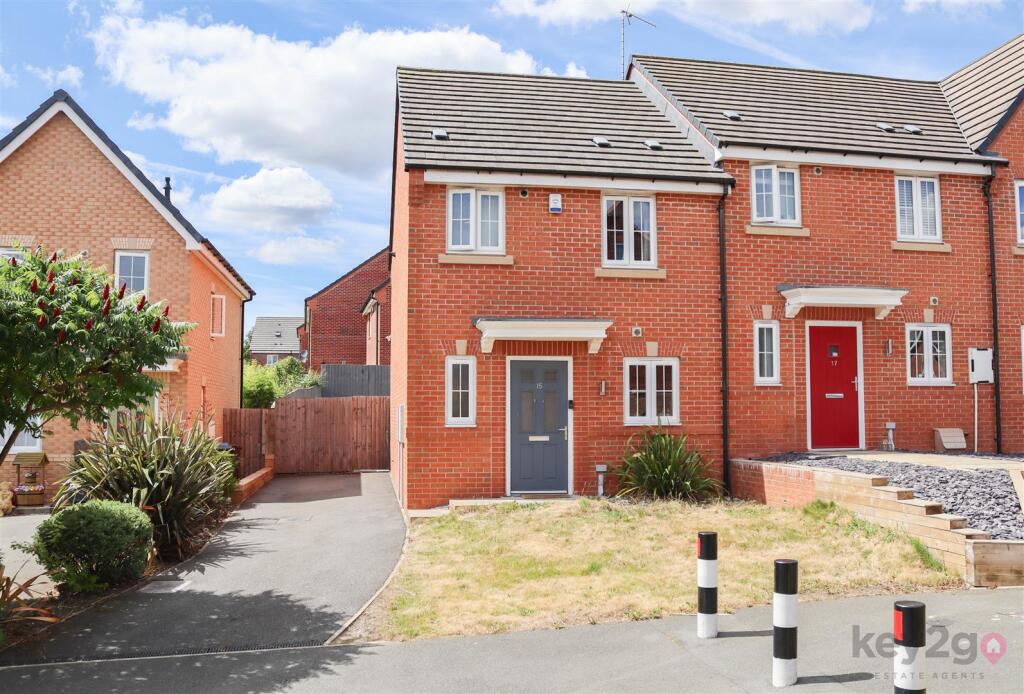
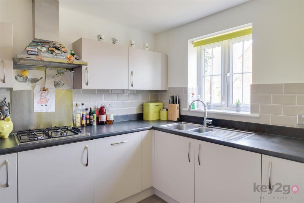
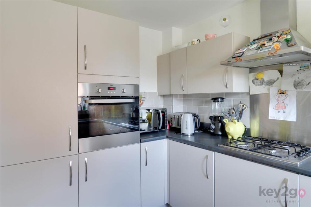
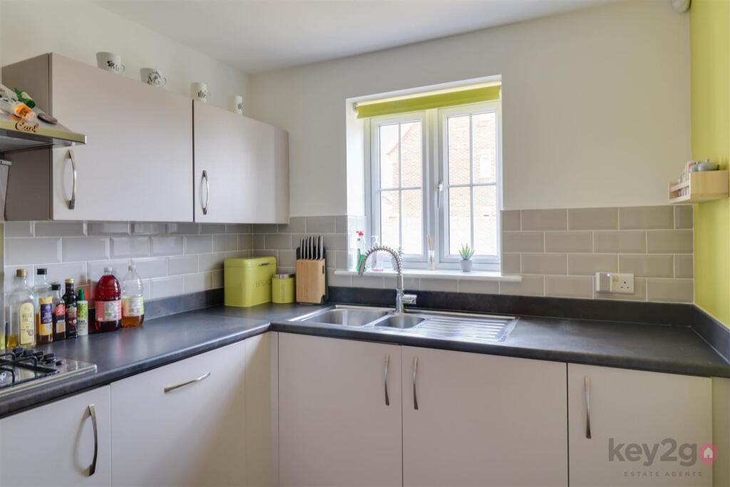
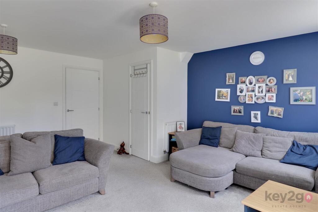
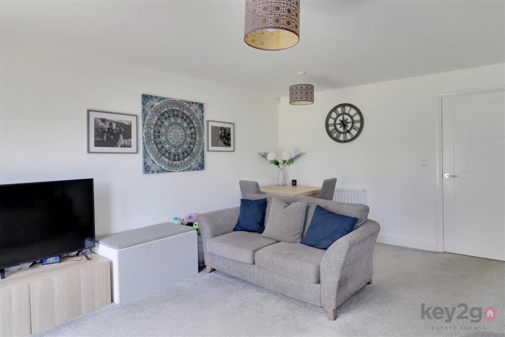
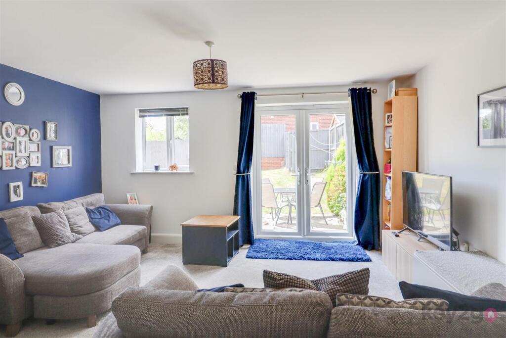
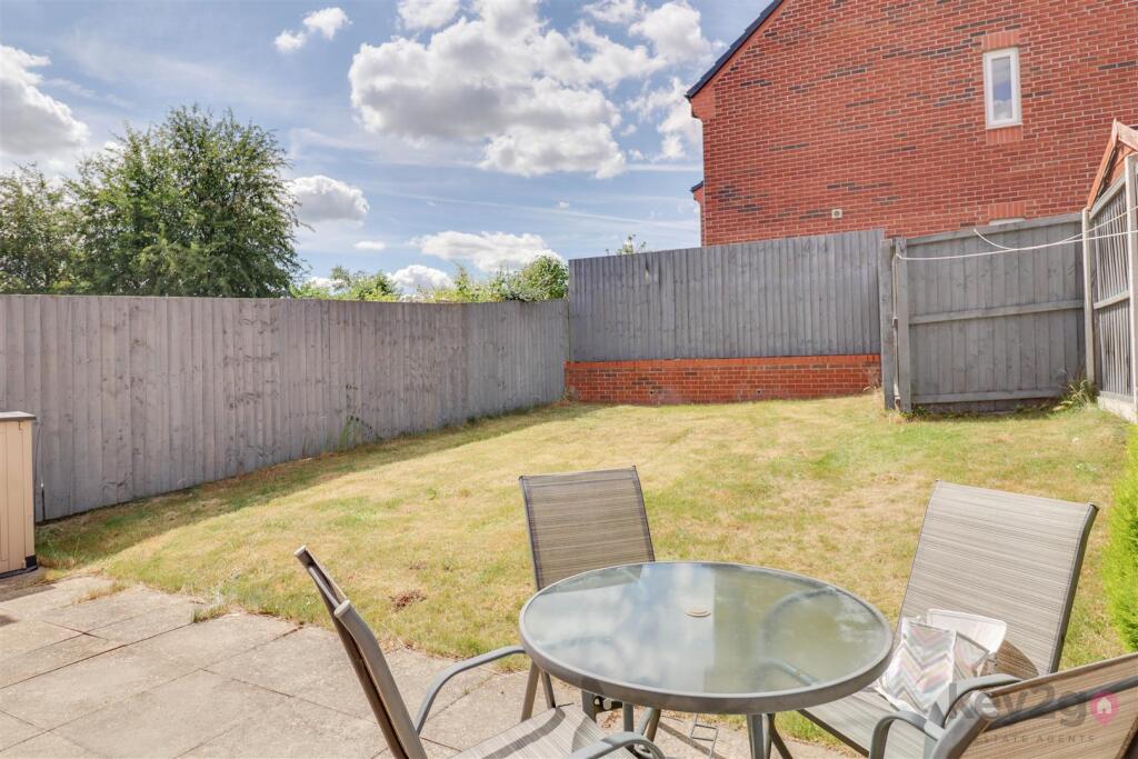
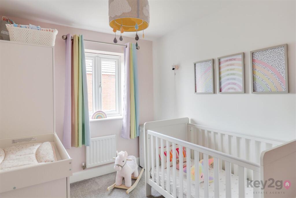
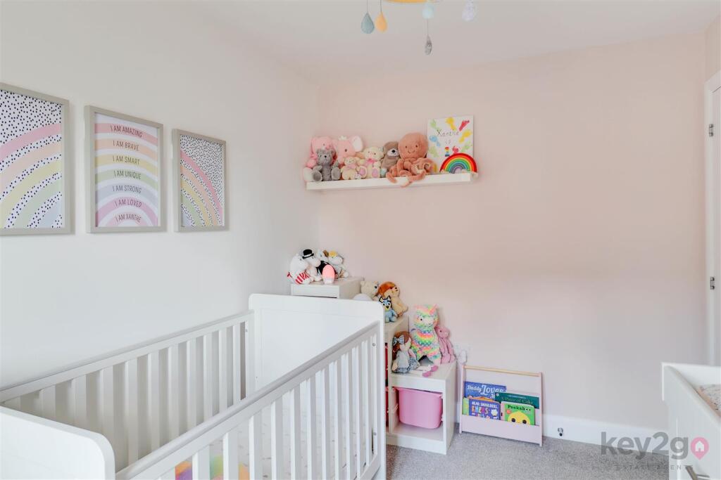
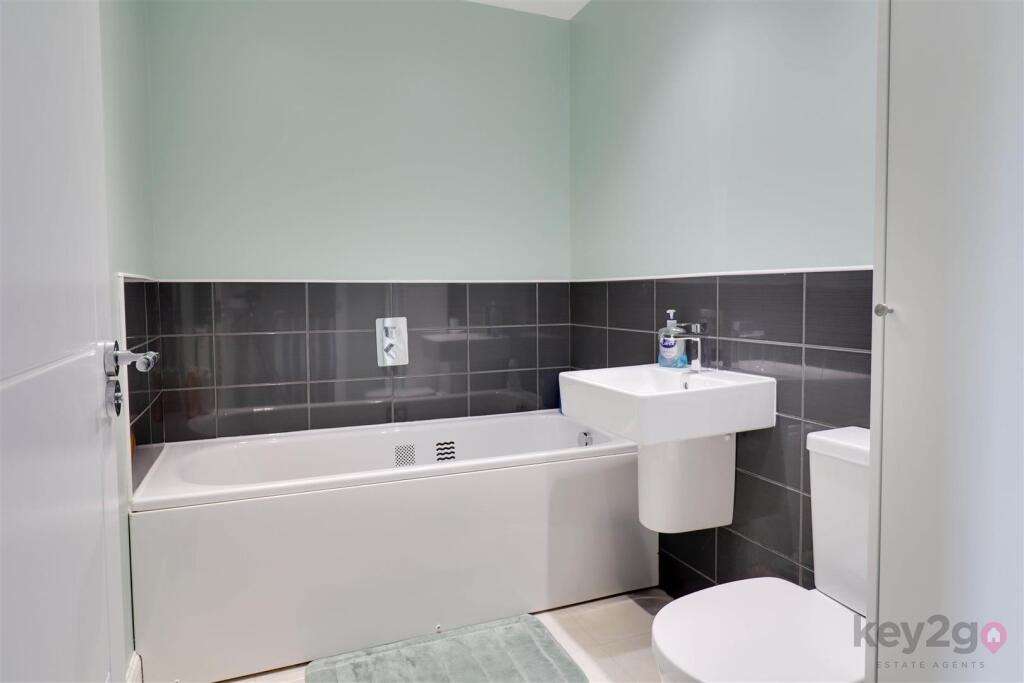
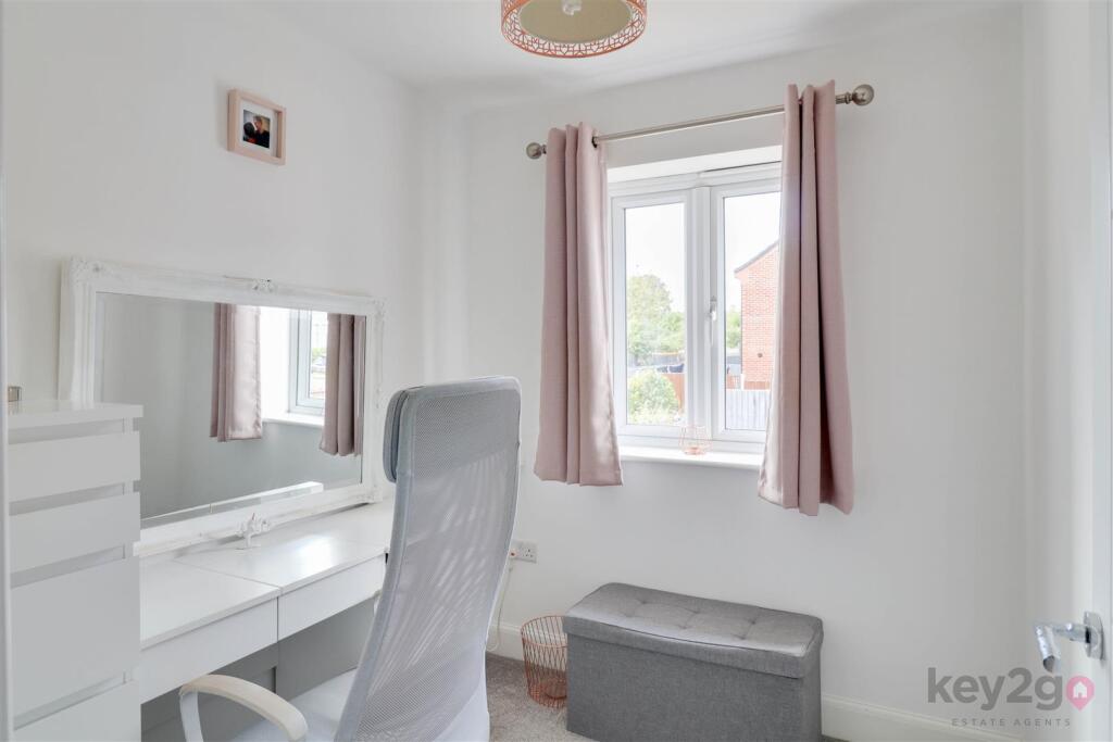
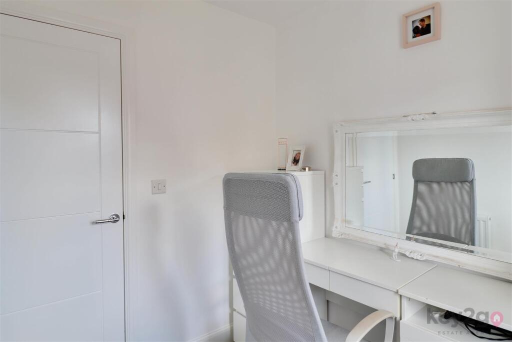
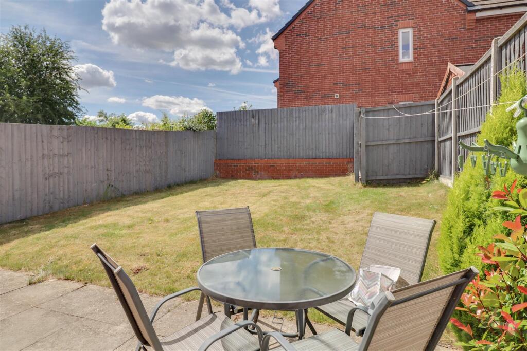
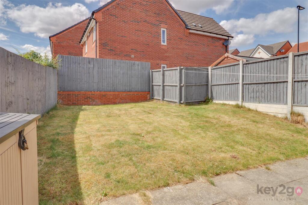
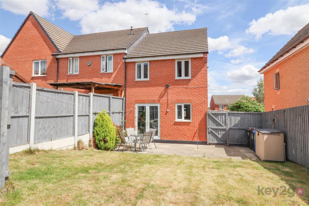
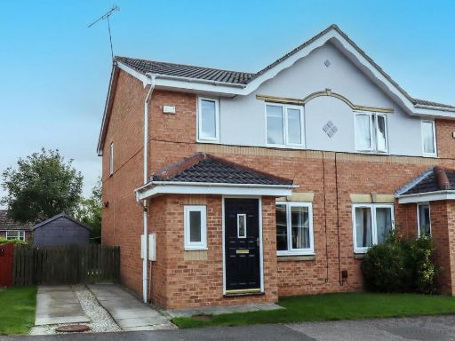
- The property is a modern semi-detached house with adequate outdoor greenery, set in a quiet residential area. The property offers a front driveway for parking and a small, easy-to-maintain garden. Inside, the property boasts spacious rooms with three bedrooms, a large open-plan kitchen with modern fittings, and bright living areas which are suffused with natural light from large windows. The reception room opens up to the outside, suggesting an adequate garden area to the rear. The fitted kitchen and bathrooms indicate a recent build or a modern renovation, offering the homeowner a sleek, move-in ready home. Given the number of bedrooms and bathrooms, along with the functional layout, it provides an ideal home for a small family.
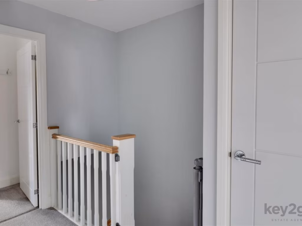
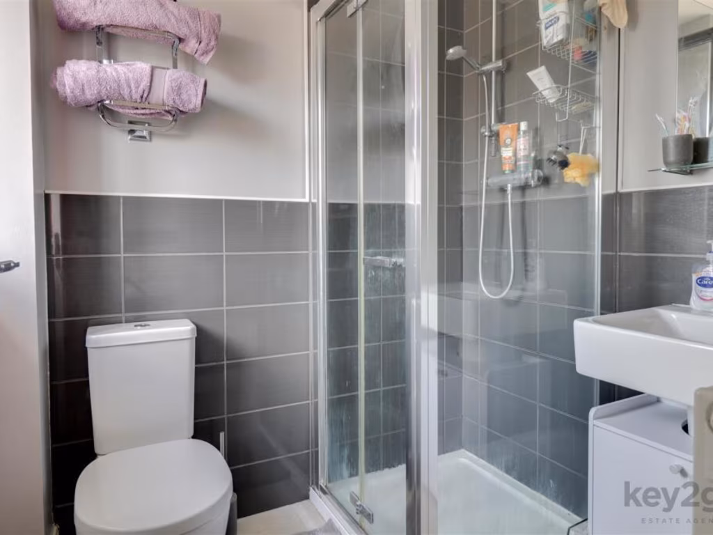
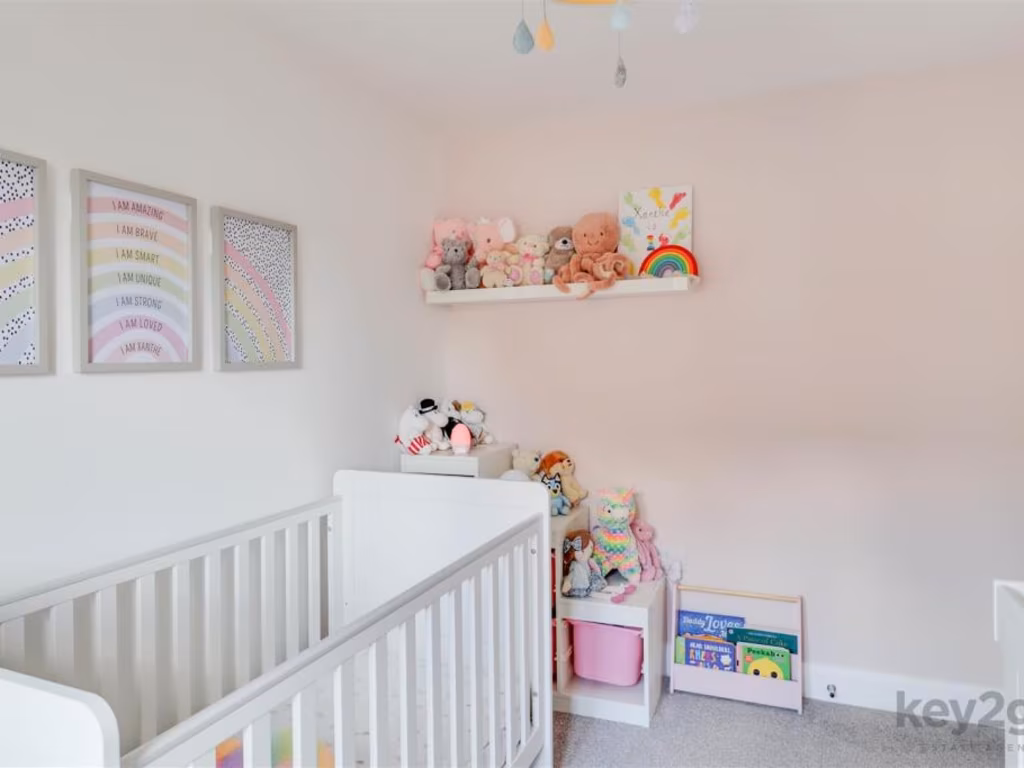
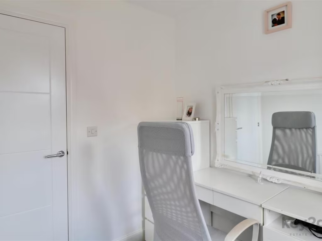
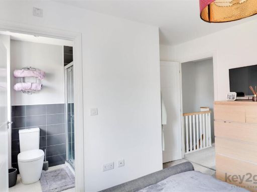
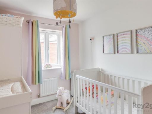
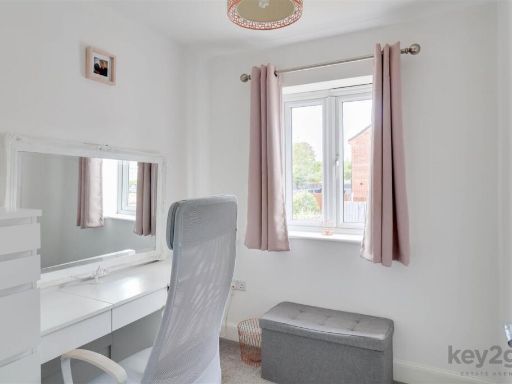
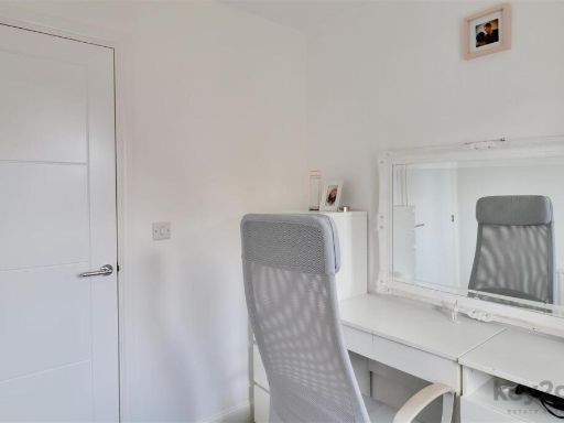
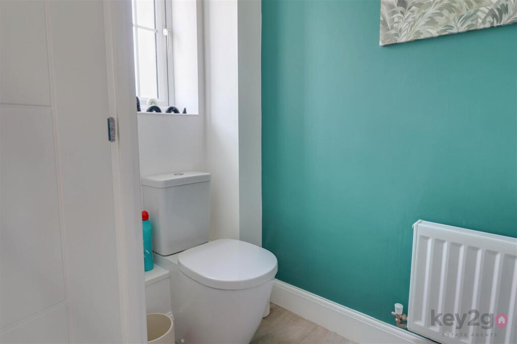
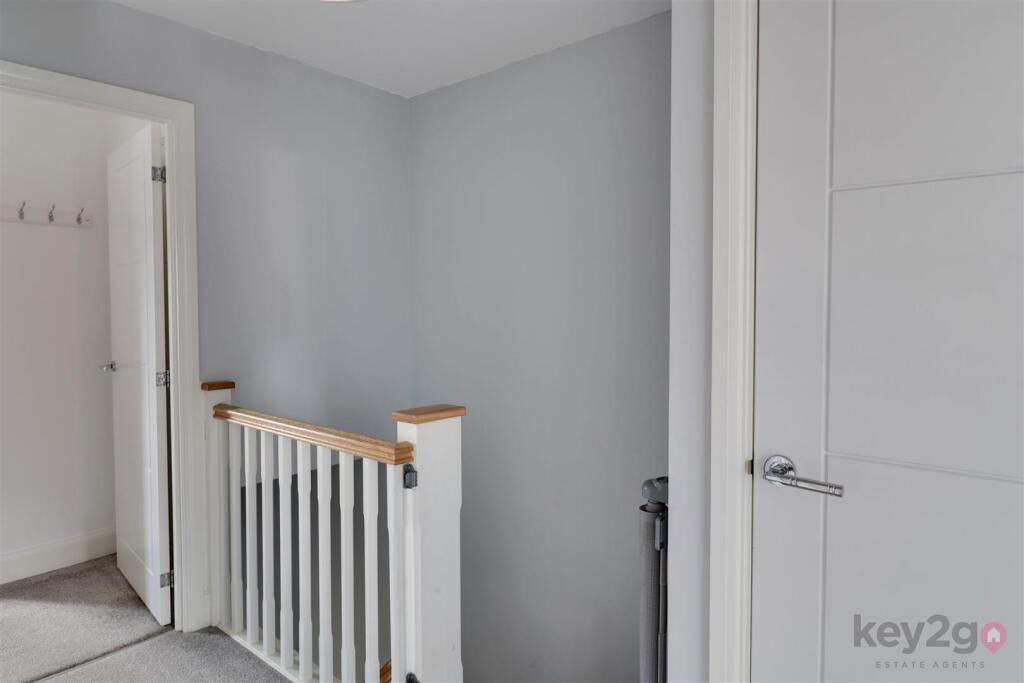
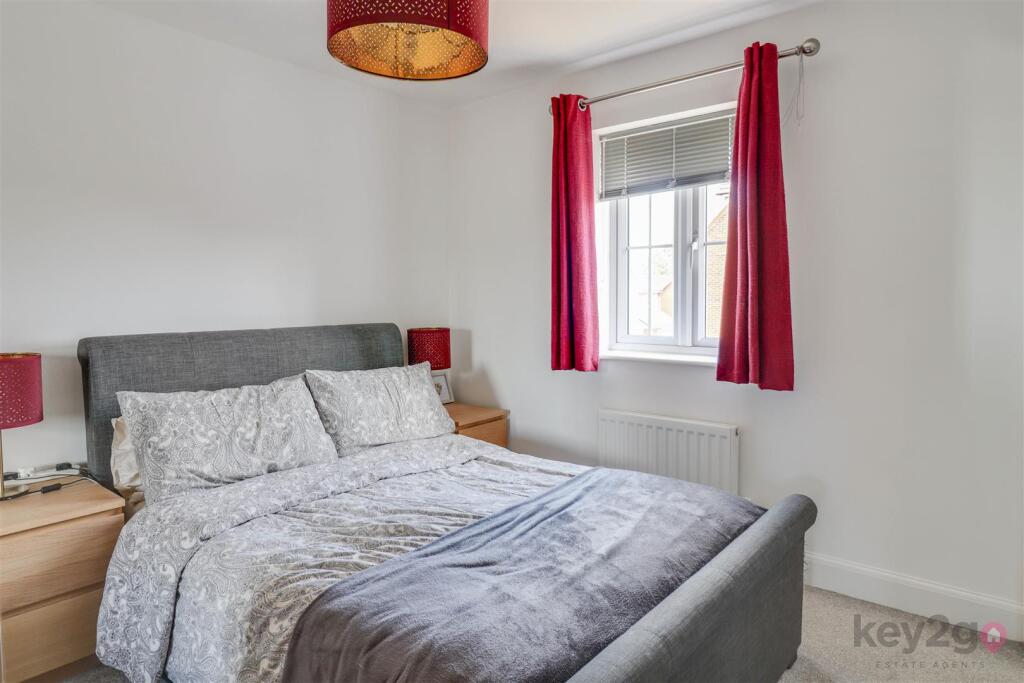
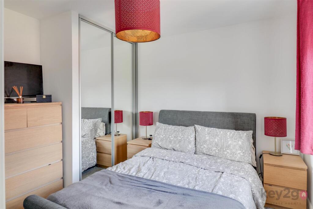
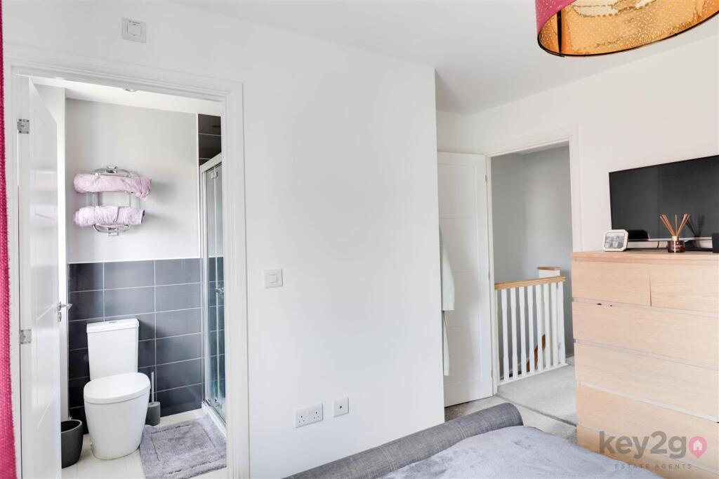
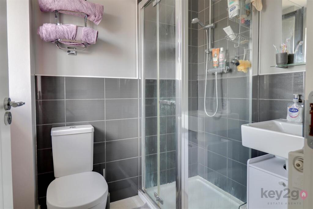
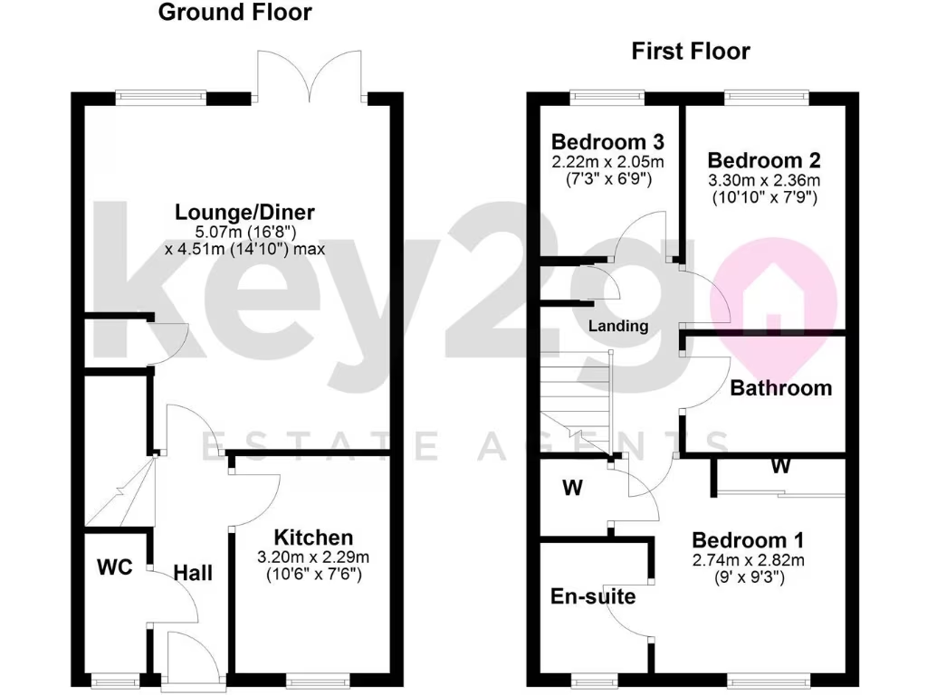
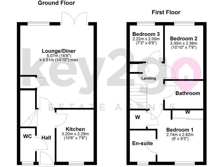
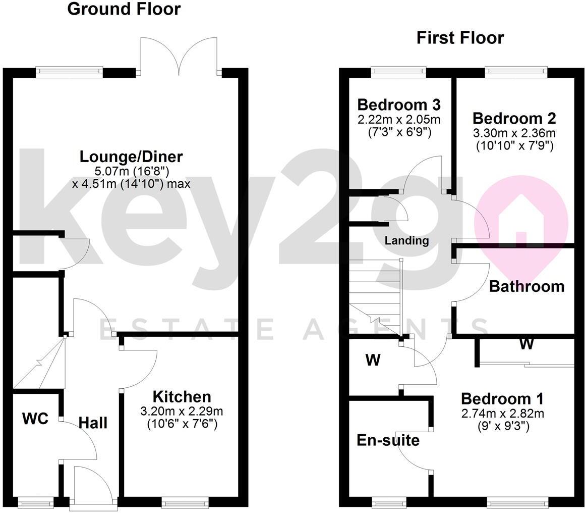
- This residential property encompasses a well-defined spatial arrangement with a ground and first floor. The ground floor features a welcoming lounge/diner of average size, providing a recognizable social hub. Moving from the entryway through the hall leads into a practical kitchen area, designed for function and flow. Upstairs, the property contains three bedrooms, with the master bedroom enjoying the luxury of an ensuite. The inclusion of central bathroom and separate WC downstairs highlights suitability for family living or hosting guests. The overall size of the property appears generous, providing ample living accommodation without being cramped. Based on the surrounding map, this property is likely situated in a residential area, possibly with views over the Mosborough region, potentially offering scenic urban landscapes.
Image Descriptions
- semi-detached house modern
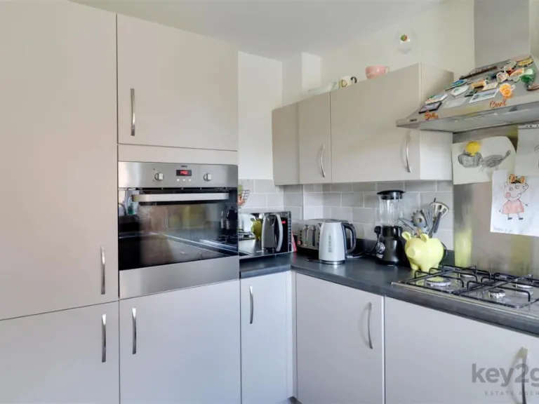
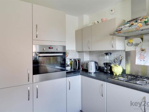
- kitchen modern
Floorplan Description
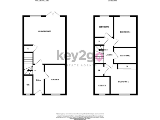
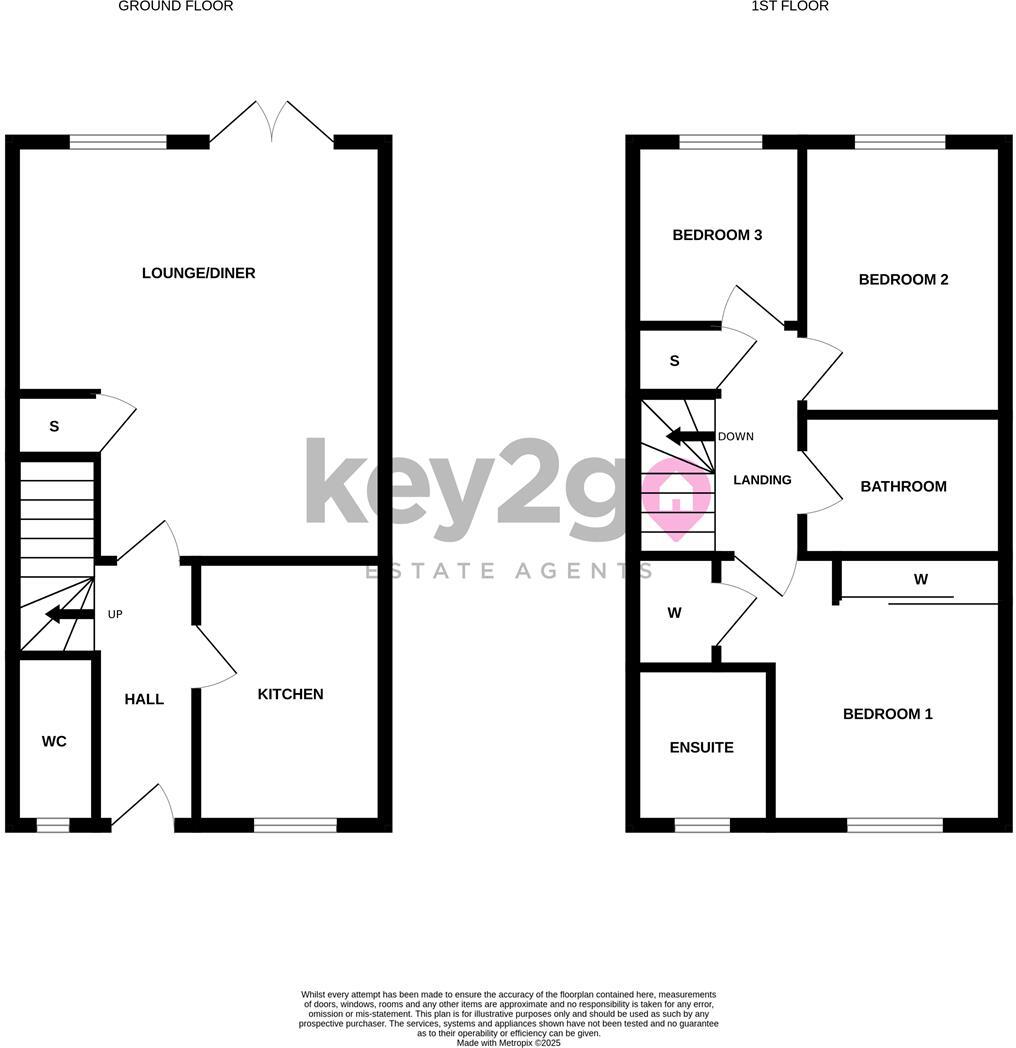
- Two-story property with three bedrooms, featuring a Lounge/Diner, Kitchen, WC, Bathroom, and Ensuite.
- Two-storey property with lounge/diner, kitchen and three bedrooms.
Rooms
- Lounge/Diner:
- Kitchen:
- WC:
- Hall:
- Bedroom 1:
- Bedroom 2:
- Bedroom 3:
- Bathroom:
- Ensuite:
- Lounge/Diner:
- Kitchen:
- WC:
- Hall:
- Bedroom 3:
- Bedroom 2:
- Bedroom 1:
- Bathroom:
- En-suite:
Textual Property Features
Detected Visual Features
- semi-detached
- modern
- two-storey
- brick exterior
- driveway
- garden
- kitchen
- white cabinets
- subway tiles
- gas stove
- small kitchen
- bright
- standard ceiling
- clean
EPC Details
- High performance glazing
- Average thermal transmittance 0.27 W/m-¦K
- Boiler and radiators, mains gas
- Low energy lighting in all fixed outlets
- Average thermal transmittance 0.19 W/m-¦K
Nearby Schools
- Marsh Lane Primary School
- St Giles CofE Primary School
- Birley Spa Primary Academy
- Birk Hill Infant & Nursery School
- Halfway Junior School
- Shortbrook Primary School
- Waterthorpe Infant School
- Birley Primary Academy
- Rainbow Forge Primary Academy
- Beighton Nursery Infant School
- Reignhead Primary School
- Woodhouse West Primary School
- Brunswick Community Primary School
- Ballifield Primary School
- Renishaw Primary School
- Eckington School
- Mosborough Primary School
- Ridgeway Primary School
- The Birley Academy
- St John Fisher Primary, A Catholic Voluntary Academy
- Aston Fence Junior and Infant School
- Eckington Junior School
- Camms CofE (Aided) Primary School
- Halfway Nursery Infant School
- Emmanuel Anglican/Methodist Junior School
- Westfield School
- Brook House Junior
- Outwood Academy City
- Handsworth Grange Community Sports College
Nearest General Shops
- Id: 1062673672
- Tags:
- Brand: Wilko
- Brand:wikidata: Q8002536
- Name: Wilko
- Shop: variety_store
- TagsNormalized:
- Lat: 53.3412285
- Lon: -1.3531948
- FullGeoHash: gcrp3nqxhm8y
- PartitionGeoHash: gcrp
- Images:
- FoodStandards: null
- Distance: 1495.6
,- Id: 298446313
- Tags:
- TagsNormalized:
- Lat: 53.3212997
- Lon: -1.3644495
- FullGeoHash: gcrp2fy7n48w
- PartitionGeoHash: gcrp
- Images:
- FoodStandards: null
- Distance: 843.2
,- Id: 360991207
- Tags:
- Brand: Ladbrokes
- Brand:wikidata: Q1799875
- Brand:wikipedia: en:Ladbrokes Coral
- Building: yes
- Name: Ladbrokes
- Shop: bookmaker
- TagsNormalized:
- Lat: 53.3267446
- Lon: -1.3623813
- FullGeoHash: gcrp2gzfy1wy
- PartitionGeoHash: gcrp
- Images:
- FoodStandards: null
- Distance: 238.9
}
Nearest Grocery shops
- Id: 8835552185
- Tags:
- TagsNormalized:
- Lat: 53.3272672
- Lon: -1.3380092
- FullGeoHash: gcrp3ecty5h5
- PartitionGeoHash: gcrp
- Images:
- FoodStandards: null
- Distance: 1477.5
,- Id: 108012336
- Tags:
- Amenity: fuel
- Brand: Morrisons
- Brand:wikidata: Q922344
- Brand:wikipedia: en:Morrisons
- Building: yes
- Contact:
- Website: https://my.morrisons.com/storefinder/1101
- Fuel:
- Name: Morrisons
- Operator: Morrisons
- Shop: convenience
- TagsNormalized:
- fuel
- morrisons
- convenience
- shop
- Lat: 53.3239081
- Lon: -1.3430946
- FullGeoHash: gcrp37mfr8uj
- PartitionGeoHash: gcrp
- Images:
- FoodStandards: null
- Distance: 1240.9
,- Id: 5943529575
- Tags:
- Brand: Nisa
- Brand:wikidata: Q16999069
- Name: Nisa
- Shop: convenience
- TagsNormalized:
- Lat: 53.330771
- Lon: -1.3493102
- FullGeoHash: gcrp3k96qb32
- PartitionGeoHash: gcrp
- Images:
- FoodStandards: null
- Distance: 766.4
}
Nearest Supermarkets
- Id: 361121881
- Tags:
- Addr:
- City: Sheffield
- Postcode: S20 7JZ
- Street: Beighton Road East
- Brand: Asda
- Brand:wikidata: Q297410
- Brand:wikipedia: en:Asda
- Building: yes
- Contact:
- Phone: +44 114 229 1001
- Website: https://storelocator.asda.com/yorkshire-&-humber/sheffield/beighton-road-east
- Fhrs:
- Name: Asda
- Opening_hours: Mo 08:00-24:00; Tu-Fr 00:00-24:00; Sa 00:00-22:00; Su 10:00-16:00
- Operator: Asda Stores Ltd
- Shop: supermarket
- Wheelchair: yes
- TagsNormalized:
- Lat: 53.3441932
- Lon: -1.3602345
- FullGeoHash: gcrp3p182nre
- PartitionGeoHash: gcrp
- Images:
- FoodStandards:
- Id: 914936
- FHRSID: 914936
- LocalAuthorityBusinessID: 41173
- BusinessName: Asda Sheffield Mosborough Superstore
- BusinessType: Retailers - supermarkets/hypermarkets
- BusinessTypeID: 7840
- AddressLine1: null
- AddressLine2: Beighton Road East
- AddressLine3: Sheffield
- AddressLine4: null
- PostCode: S20 7AB
- RatingValue: 5
- RatingKey: fhrs_5_en-GB
- RatingDate: 2021-11-25
- LocalAuthorityCode: 425
- LocalAuthorityName: Sheffield
- LocalAuthorityWebSite: https://www.sheffield.gov.uk
- LocalAuthorityEmailAddress: healthprotection@sheffield.gov.uk
- Scores:
- Hygiene: 0
- Structural: 0
- ConfidenceInManagement: 0
- NewRatingPending: false
- Geocode:
- Longitude: -1.36084902286530
- Latitude: 53.34432601928710
- Distance: 1751.8
,- Id: 1039453251
- Tags:
- Brand: Sainsbury's
- Brand:wikidata: Q152096
- Brand:wikipedia: en:Sainsbury's
- Name: Sainsbury's
- Shop: supermarket
- TagsNormalized:
- sainsburys
- supermarket
- shop
- Lat: 53.3416996
- Lon: -1.3498857
- FullGeoHash: gcrp3q91cms2
- PartitionGeoHash: gcrp
- Images:
- FoodStandards: null
- Distance: 1625
,- Id: 71213950
- Tags:
- Addr:
- City: Sheffield
- Postcode: S20 8GN
- Street: Oxclose Park Road North
- Brand: Morrisons
- Brand:wikidata: Q922344
- Brand:wikipedia: en:Morrisons
- Building: supermarket
- Name: Morrisons
- Shop: supermarket
- Website: https://my.morrisons.com/storefinder/101
- TagsNormalized:
- Lat: 53.3251595
- Lon: -1.3431174
- FullGeoHash: gcrp37tcx45n
- PartitionGeoHash: gcrp
- Images:
- FoodStandards: null
- Distance: 1189.8
}
Nearest Religious buildings
- Id: 360993660
- Tags:
- Addr:
- City: Sheffield
- Postcode: S20 5BU
- Street: Cadman Street
- Amenity: place_of_worship
- Building: yes
- Denomination: methodist
- Fhrs:
- Name: Mosborough Methodist
- Religion: christian
- TagsNormalized:
- place of worship
- methodist
- christian
- church
- Lat: 53.3237078
- Lon: -1.3644134
- FullGeoHash: gcrp2gq3ngee
- PartitionGeoHash: gcrp
- Images:
- FoodStandards: null
- Distance: 596.8
,- Id: 360993656
- Tags:
- Addr:
- City: Sheffield
- Housenumber: 79
- Postcode: S20 5BP
- Street: Queen Street
- Alt_name: Elim Pentecostal Church
- Amenity: place_of_worship
- Building: yes
- Denomination: pentecostal
- Fhrs:
- Name: Mosborough, Elim Church
- Religion: christian
- TagsNormalized:
- place of worship
- pentecostal
- church
- christian
- Lat: 53.324162
- Lon: -1.3648759
- FullGeoHash: gcrp2gq5u06b
- PartitionGeoHash: gcrp
- Images:
- FoodStandards:
- Id: 557883
- FHRSID: 557883
- LocalAuthorityBusinessID: 16946
- BusinessName: Mosborough Elim Church
- BusinessType: Other catering premises
- BusinessTypeID: 7841
- AddressLine1: Elim Pentecostal Church
- AddressLine2: 79 Queen Street
- AddressLine3: Mosborough
- AddressLine4: Sheffield
- PostCode: S20 5BP
- RatingValue: 5
- RatingKey: fhrs_5_en-GB
- RatingDate: 2014-05-20
- LocalAuthorityCode: 425
- LocalAuthorityName: Sheffield
- LocalAuthorityWebSite: https://www.sheffield.gov.uk
- LocalAuthorityEmailAddress: healthprotection@sheffield.gov.uk
- Scores:
- Hygiene: 0
- Structural: 0
- ConfidenceInManagement: 0
- NewRatingPending: false
- Geocode:
- Longitude: -1.36440800000000
- Latitude: 53.32519900000000
- Distance: 569.1
,- Id: 204722804
- Tags:
- Amenity: place_of_worship
- Building: church
- Denomination: anglican
- Name: St Mark's Church
- Religion: christian
- Source: Bing
- Wikidata: Q105103016
- TagsNormalized:
- place of worship
- church
- anglican
- christian
- Lat: 53.3247362
- Lon: -1.3614837
- FullGeoHash: gcrp352x55k1
- PartitionGeoHash: gcrp
- Images:
- FoodStandards: null
- Distance: 420.9
}
Nearest Medical buildings
- Id: 4322663439
- Tags:
- Amenity: pharmacy
- Brand: Lloyds Pharmacy
- Brand:wikidata: Q6662870
- Healthcare: pharmacy
- Name: Lloyds Pharmacy
- TagsNormalized:
- pharmacy
- lloyds pharmacy
- health
- healthcare
- Lat: 53.3414888
- Lon: -1.352072
- FullGeoHash: gcrp3nx2wqnn
- PartitionGeoHash: gcrp
- Images:
- FoodStandards: null
- Distance: 1547.5
,- Id: 99202379
- Tags:
- Addr:
- City: Sheffield
- Postcode: S20 6PD
- Street: Moorthorpe Bank
- Amenity: doctors
- Building: yes
- Healthcare: doctor
- Name: Owlthorpe Surgery
- TagsNormalized:
- doctor
- doctors
- health
- healthcare
- surgery
- Lat: 53.3386546
- Lon: -1.3759439
- FullGeoHash: gcrp2wn04jvu
- PartitionGeoHash: gcrp
- Images:
- FoodStandards: null
- Distance: 1545.1
,- Id: 6134814953
- Tags:
- Amenity: pharmacy
- Dispensing: yes
- Healthcare: pharmacy
- TagsNormalized:
- Lat: 53.3253442
- Lon: -1.364715
- FullGeoHash: gcrp2gw4xuds
- PartitionGeoHash: gcrp
- Images:
- FoodStandards: null
- Distance: 457.7
,- Id: 360993072
- Tags:
- Amenity: doctors
- Building: yes
- Healthcare: doctor
- Name: Mosborough Health Centre
- TagsNormalized:
- doctor
- doctors
- health
- healthcare
- health centre
- Lat: 53.3255494
- Lon: -1.3648304
- FullGeoHash: gcrp2gw5v4us
- PartitionGeoHash: gcrp
- Images:
- FoodStandards: null
- Distance: 446.1
}
Nearest Airports
- Id: 100889514
- Tags:
- Addr:
- Aerodrome: international
- Aerodrome:type: public
- Area: yes
- Cities_served: Doncaster, Sheffield
- Closest_town: Doncaster
- Disused:
- Ele: 17
- Iata: DSA
- Icao: EGCN
- Ifr: yes
- Is_in: Finningley
- Name: Doncaster Sheffield Airport
- Old_iata: FNY
- Old_icao: EGXI
- Old_name: RAF Finningley
- Old_operator: Royal Air Force
- Old_type: military
- Operator: Doncaster Sheffield Airport Limited/Peel Airports
- Source: wikipedia
- Tower_frequency: 128.775
- Vfr: yes
- Website: https://www.robinhoodairport.com/
- Wikidata: Q8996
- Wikipedia: en:Robin Hood Airport Doncaster Sheffield
- TagsNormalized:
- airport
- international airport
- Lat: 53.4761577
- Lon: -1.0054086
- FullGeoHash: gcx21p5chq34
- PartitionGeoHash: gcx2
- Images:
- FoodStandards: null
- Distance: 28686.5
}
Nearest Leisure Facilities
- Id: 298442614
- Tags:
- TagsNormalized:
- Lat: 53.3276733
- Lon: -1.3544586
- FullGeoHash: gcrp3hj8nyf6
- PartitionGeoHash: gcrp
- Images:
- FoodStandards: null
- Distance: 388.8
,- Id: 696672579
- Tags:
- Leisure: pitch
- Source: Maxar-Premium
- Sport: soccer
- TagsNormalized:
- Lat: 53.3310058
- Lon: -1.357283
- FullGeoHash: gcrp3heeth03
- PartitionGeoHash: gcrp
- Images:
- FoodStandards: null
- Distance: 343.8
,- Id: 298440593
- Tags:
- Leisure: sports_centre
- Name: Isobel Bowler Sports Ground
- TagsNormalized:
- sports
- sports centre
- leisure
- Lat: 53.3313337
- Lon: -1.3589543
- FullGeoHash: gcrp3hdmw14j
- PartitionGeoHash: gcrp
- Images:
- FoodStandards: null
- Distance: 331.8
,- Id: 696672573
- Tags:
- Leisure: pitch
- Source: Maxar-Premium
- Sport: soccer
- TagsNormalized:
- Lat: 53.3312411
- Lon: -1.3590012
- FullGeoHash: gcrp3hdkuzzk
- PartitionGeoHash: gcrp
- Images:
- FoodStandards: null
- Distance: 321.1
,- Id: 769463067
- Tags:
- Leisure: pitch
- Sport: bowls
- TagsNormalized:
- Lat: 53.3267966
- Lon: -1.3609105
- FullGeoHash: gcrp35c507rs
- PartitionGeoHash: gcrp
- Images:
- FoodStandards: null
- Distance: 189.1
}
Nearest Tourist attractions
- Id: 8108150165
- Tags:
- TagsNormalized:
- Lat: 53.3405606
- Lon: -1.3209165
- FullGeoHash: gcrp3yq5k3jm
- PartitionGeoHash: gcrp
- Images:
- FoodStandards: null
- Distance: 2934.3
,- Id: 162040460
- Tags:
- Name: Bramley Park
- Source: Bing
- Tourism: caravan_site
- TagsNormalized:
- Lat: 53.309021
- Lon: -1.3883404
- FullGeoHash: gcrp22t593f2
- PartitionGeoHash: gcrp
- Images:
- FoodStandards: null
- Distance: 2857.1
,- Id: 390506883
- Tags:
- Name: Ravencar Farm Bed & Breakfast
- Postal_code: S21 5RH
- Tourism: guest_house
- TagsNormalized:
- bed
- farm
- guest house
- tourism
- Lat: 53.3068305
- Lon: -1.3812472
- FullGeoHash: gcrp284ny97q
- PartitionGeoHash: gcrp
- Images:
- FoodStandards: null
- Distance: 2780.9
}
Nearest Train stations
- Id: 3157354104
- Tags:
- Name: Darnall
- Naptan:
- Network: National Rail
- Operator: Northern Rail
- Public_transport: station
- Railway: station
- Ref:
- Source: wikipedia
- Wikidata: Q2975270
- Wikipedia: en:Darnall railway station
- TagsNormalized:
- Lat: 53.3845451
- Lon: -1.4123572
- FullGeoHash: gcqzxy7e98qp
- PartitionGeoHash: gcqz
- Images:
- FoodStandards: null
- Distance: 7135.6
,- Id: 3157350618
- Tags:
- Name: Kiveton Bridge
- Naptan:
- Network: National Rail
- Operator: Northern Rail
- Public_transport: station
- Railway: station
- Ref:
- Source: wikipedia
- Wikidata: Q3448631
- Wikipedia: en:Kiveton Bridge railway station
- TagsNormalized:
- Lat: 53.3409362
- Lon: -1.2670815
- FullGeoHash: gcrp7nmm6z5w
- PartitionGeoHash: gcrp
- Images:
- FoodStandards: null
- Distance: 6335.3
,- Id: 102031003
- Tags:
- Building: train_station
- Name: Barrow Hill Roundhouse
- Railway: turntable
- Tourism: attraction
- Wikidata: Q4863884
- Wikipedia: en:Barrow Hill Engine Shed
- TagsNormalized:
- station
- train
- train station
- railway
- attraction
- tourism
- Lat: 53.2744292
- Lon: -1.381839
- FullGeoHash: gcrp0d3f0c6h
- PartitionGeoHash: gcrp
- Images:
- FoodStandards: null
- Distance: 6175.8
,- Id: 1716256015
- Tags:
- Name: Roundhouse Halt
- Public_transport: station
- Railway: station
- Usage: tourism
- Website: https://www.barrowhill.org/
- TagsNormalized:
- Lat: 53.2746594
- Lon: -1.3813376
- FullGeoHash: gcrp0d65ks21
- PartitionGeoHash: gcrp
- Images:
- FoodStandards: null
- Distance: 6143.2
,- Id: 3157353528
- Tags:
- Name: Woodhouse
- Naptan:
- Network: National Rail
- Operator: Northern Rail
- Public_transport: station
- Railway: station
- Ref:
- Source: wikipedia
- Wikidata: Q2497249
- Wikipedia: en:Woodhouse railway station
- TagsNormalized:
- Lat: 53.3637962
- Lon: -1.3573689
- FullGeoHash: gcrp94edeh87
- PartitionGeoHash: gcrp
- Images:
- FoodStandards: null
- Distance: 3935.9
}
Nearest Hotels
- Id: 615926937
- Tags:
- Amenity: pub
- Name: West End Hotel
- TagsNormalized:
- Lat: 53.3144871
- Lon: -1.3189468
- FullGeoHash: gcrp3cxe6k9z
- PartitionGeoHash: gcrp
- Images:
- FoodStandards: null
- Distance: 3147
,- Id: 363773497
- Tags:
- Amenity: pub
- Building: yes
- Name: The Royal Hotel
- TagsNormalized:
- Lat: 53.3090001
- Lon: -1.3552534
- FullGeoHash: gcrp30t5kmcu
- PartitionGeoHash: gcrp
- Images:
- FoodStandards: null
- Distance: 2186.1
,- Id: 343389600
- Tags:
- Addr:
- City: Sheffield
- Country: GB
- Postcode: S20 5EA
- Street: High Street
- Fhrs:
- Name: Mosborough Hall Hotel
- Operator: Best Westen
- Tourism: hotel
- TagsNormalized:
- Lat: 53.3215943
- Lon: -1.3567463
- FullGeoHash: gcrp34uhc98e
- PartitionGeoHash: gcrp
- Images:
- FoodStandards: null
- Distance: 794.4
}
Tags
- semi-detached
- modern
- two-storey
- brick exterior
- driveway
- garden
- modern
- kitchen
- white cabinets
- subway tiles
- gas stove
- small kitchen
- bright
- standard ceiling
- clean
Local Market Stats
- Average Price/sqft: £238
- Avg Income: £41300
- Rental Yield: 4.8%
- Social Housing: 13%
- Planning Success Rate: 89%
Similar Properties
 3 bedroom semi-detached house for sale in Plumbley Hall Road, Mosborough, Sheffield, S20 — £260,000 • 3 bed • 2 bath • 697 ft²
 2 bedroom semi-detached house for sale in Rose Hill Close, Mosborough, Sheffield, South Yorkshire, S20 — £200,000 • 2 bed • 1 bath • 582 ft²
 3 bedroom semi-detached house for sale in Oak Street, Mosborough, Sheffield, S20 — £220,000 • 3 bed • 1 bath • 758 ft²
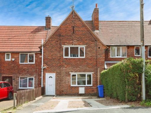 3 bedroom terraced house for sale in Moor Crescent, Mosborough, Sheffield, S20 — £190,000 • 3 bed • 1 bath • 808 ft²
 3 bedroom semi-detached house for sale in Ruby Lane, Mosborough, Sheffield, S20 — £220,000 • 3 bed • 2 bath • 806 ft²
 4 bedroom semi-detached house for sale in Moor Farm Avenue, Mosborough, Sheffield, S20 — £300,000 • 4 bed • 2 bath • 1122 ft²
Meta
- {
"@context": "https://schema.org",
"@type": "Residence",
"name": "3 bedroom end of terrace house for sale in Ruby Lane, Mosbo…",
"description": "",
"url": "https://propertypiper.co.uk/property/4be05ec7-4ad1-4a2e-9d58-3aaa45a70c24",
"image": "https://image-a.propertypiper.co.uk/2591e935-0cbb-4999-8e21-819c87a08537-1024.jpeg",
"address": {
"@type": "PostalAddress",
"streetAddress": "15, Ruby Lane, Mosborough, SHEFFIELD",
"postalCode": "S20 5FH",
"addressLocality": "Sheffield",
"addressRegion": "Sheffield South East",
"addressCountry": "England"
},
"geo": {
"@type": "GeoCoordinates",
"latitude": 53.32843911927212,
"longitude": -1.3601707848340978
},
"numberOfRooms": 3,
"numberOfBathroomsTotal": 2,
"floorSize": {
"@type": "QuantitativeValue",
"value": 809,
"unitCode": "FTK"
},
"offers": {
"@type": "Offer",
"price": 230000,
"priceCurrency": "GBP",
"availability": "https://schema.org/InStock"
},
"additionalProperty": [
{
"@type": "PropertyValue",
"name": "Feature",
"value": "semi-detached"
},
{
"@type": "PropertyValue",
"name": "Feature",
"value": "modern"
},
{
"@type": "PropertyValue",
"name": "Feature",
"value": "two-storey"
},
{
"@type": "PropertyValue",
"name": "Feature",
"value": "brick exterior"
},
{
"@type": "PropertyValue",
"name": "Feature",
"value": "driveway"
},
{
"@type": "PropertyValue",
"name": "Feature",
"value": "garden"
},
{
"@type": "PropertyValue",
"name": "Feature",
"value": "modern"
},
{
"@type": "PropertyValue",
"name": "Feature",
"value": "kitchen"
},
{
"@type": "PropertyValue",
"name": "Feature",
"value": "white cabinets"
},
{
"@type": "PropertyValue",
"name": "Feature",
"value": "subway tiles"
},
{
"@type": "PropertyValue",
"name": "Feature",
"value": "gas stove"
},
{
"@type": "PropertyValue",
"name": "Feature",
"value": "small kitchen"
},
{
"@type": "PropertyValue",
"name": "Feature",
"value": "bright"
},
{
"@type": "PropertyValue",
"name": "Feature",
"value": "standard ceiling"
},
{
"@type": "PropertyValue",
"name": "Feature",
"value": "clean"
}
]
}
High Res Floorplan Images
Compatible Floorplan Images
FloorplanImages Thumbnail