HP21 8FQ - 1 bedroom apartment for sale in Coxhill Way, Aylesbury, HP21
View on Property Piper
1 bedroom apartment for sale in Coxhill Way, Aylesbury, HP21
Property Details
- Price: £180000
- Bedrooms: 1
- Bathrooms: 1
- Property Type: undefined
- Property SubType: undefined
Brochure Descriptions
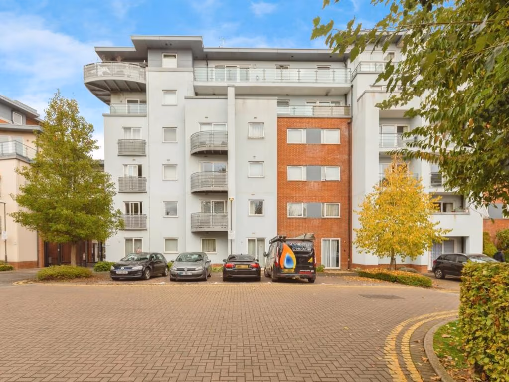
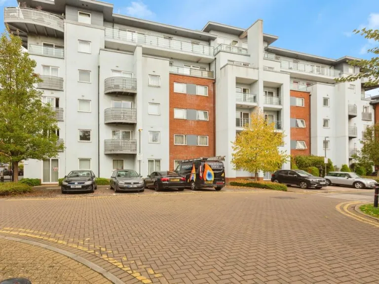
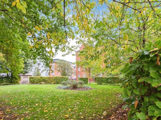
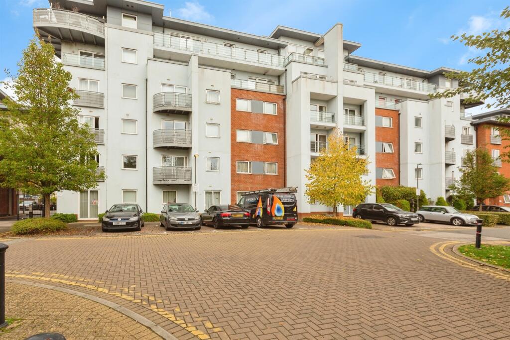
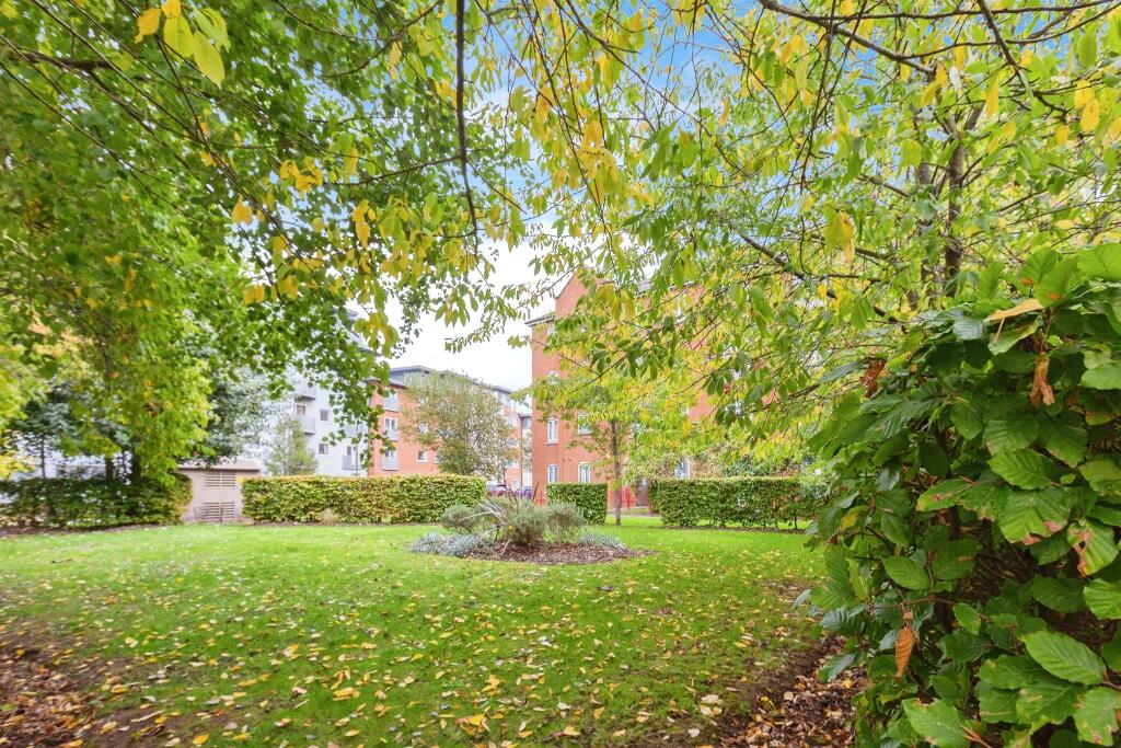
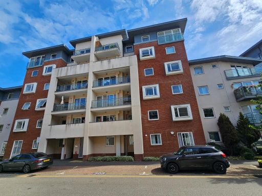
- Purpose-built modern apartment block of around 4–5 storeys with recessed balconies and brick/white rendered elevations. The building sits around a paved communal courtyard/parking forecourt with planted beds and small ornamental trees. Likely contains multiple flats accessed from a central entrance; no private garden visible (communal grounds only). Overall the property reads as a medium-sized residential apartment development in an urban/suburban setting with on-site parking and street-facing courtyard views.
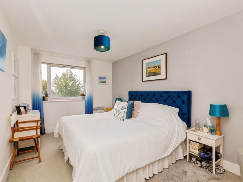
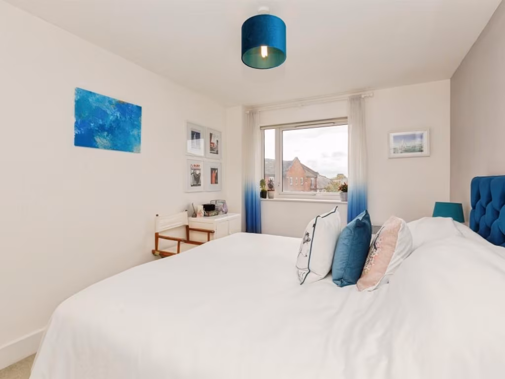
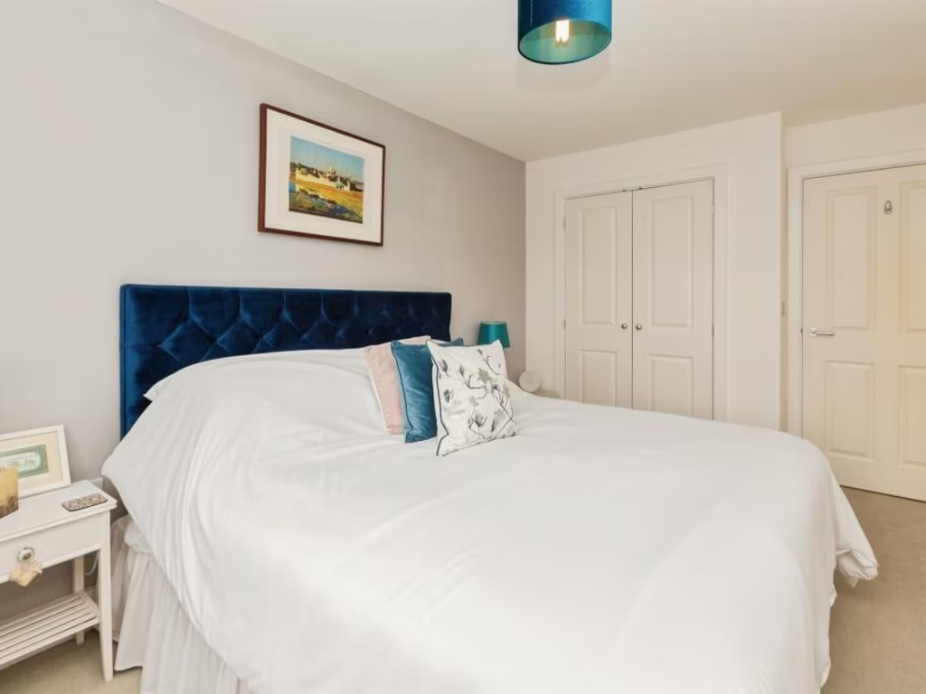
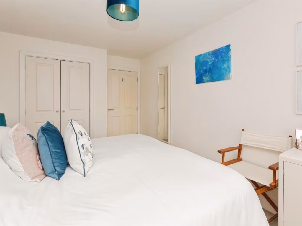
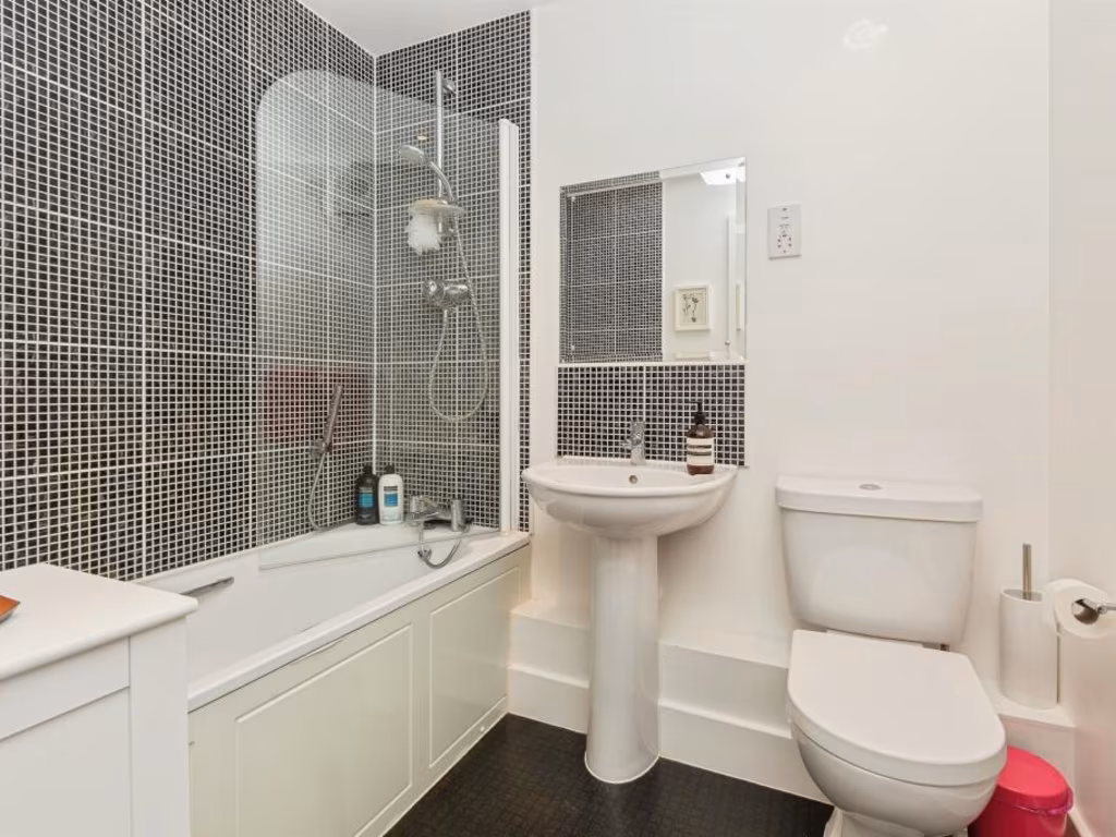
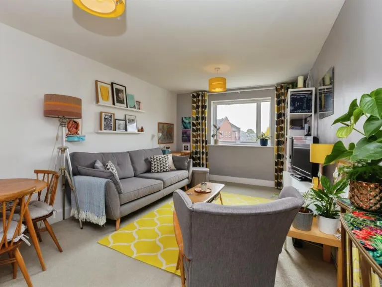
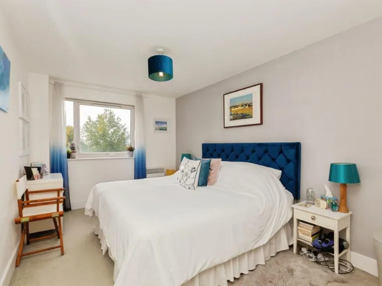
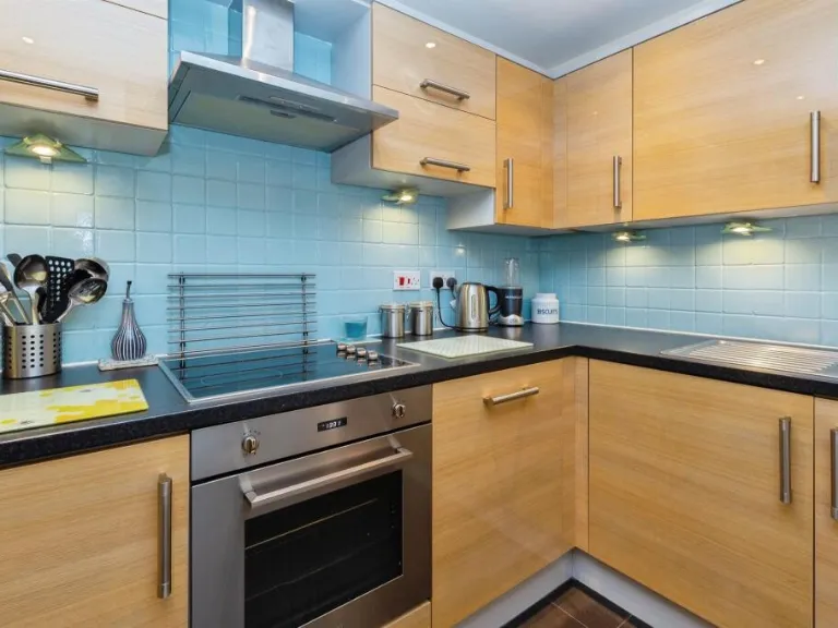
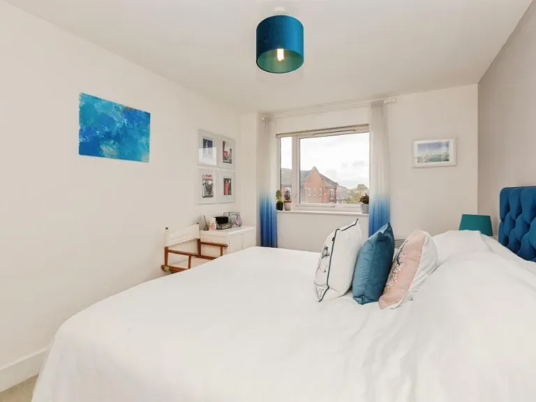
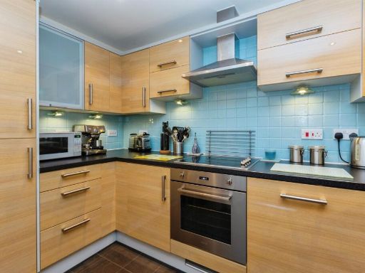
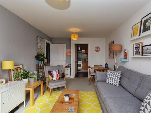
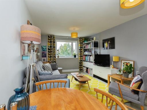
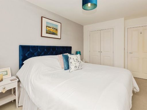
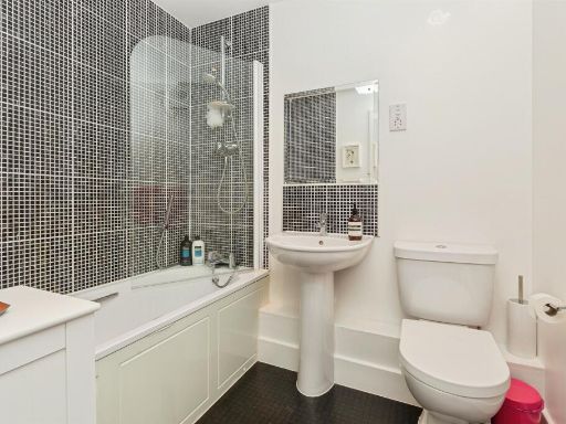
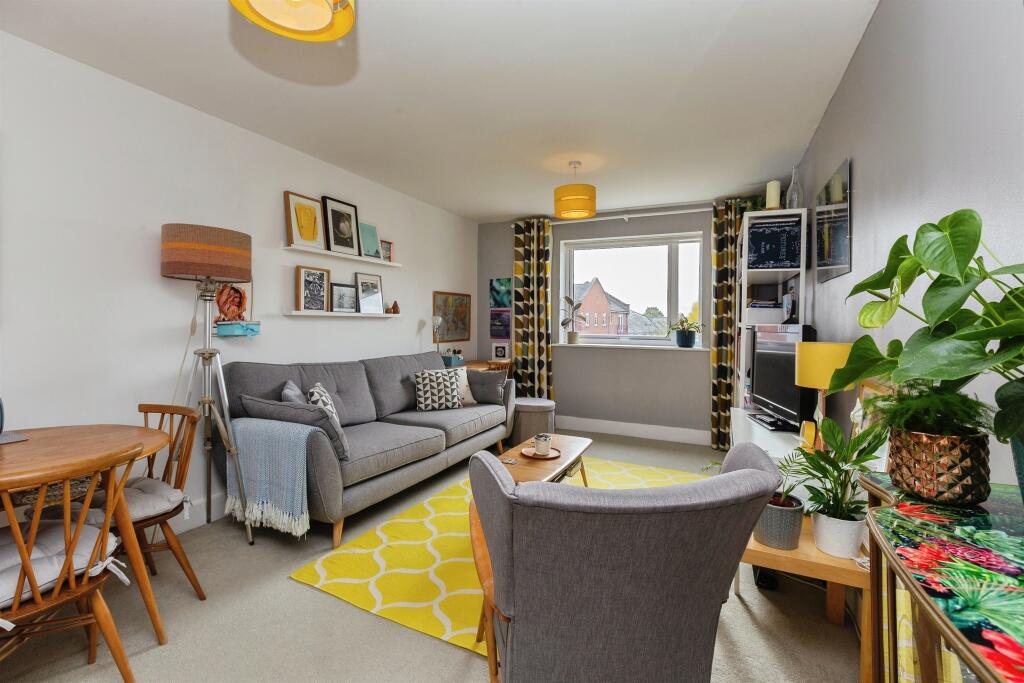
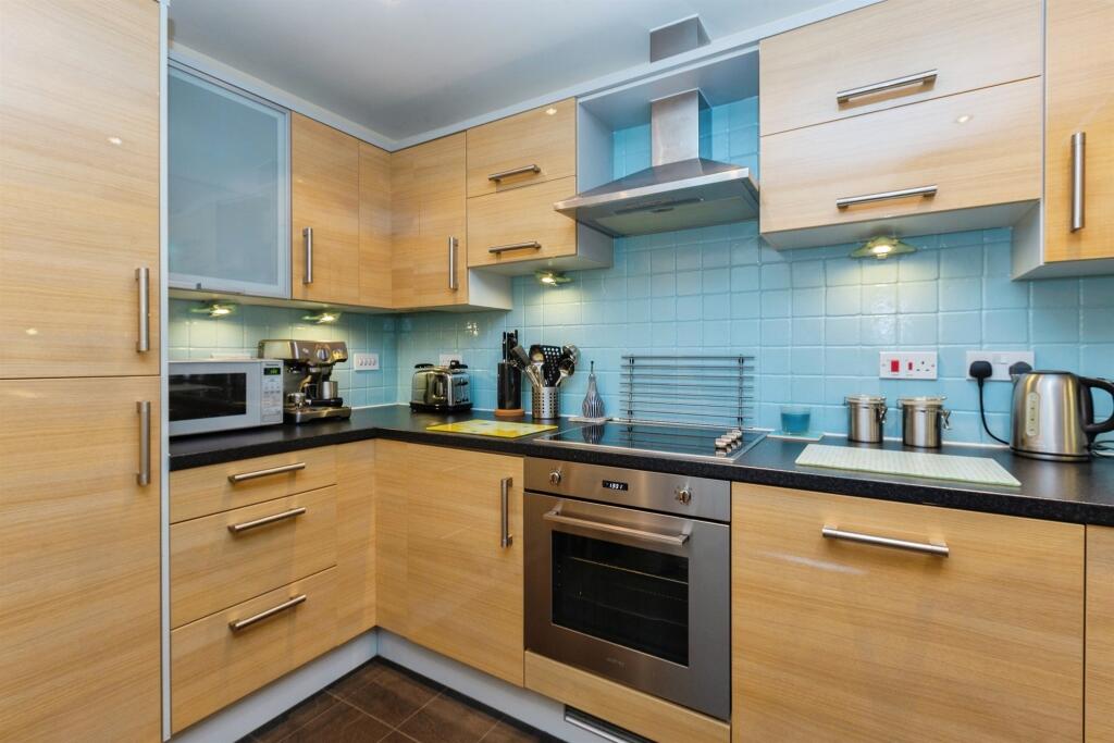
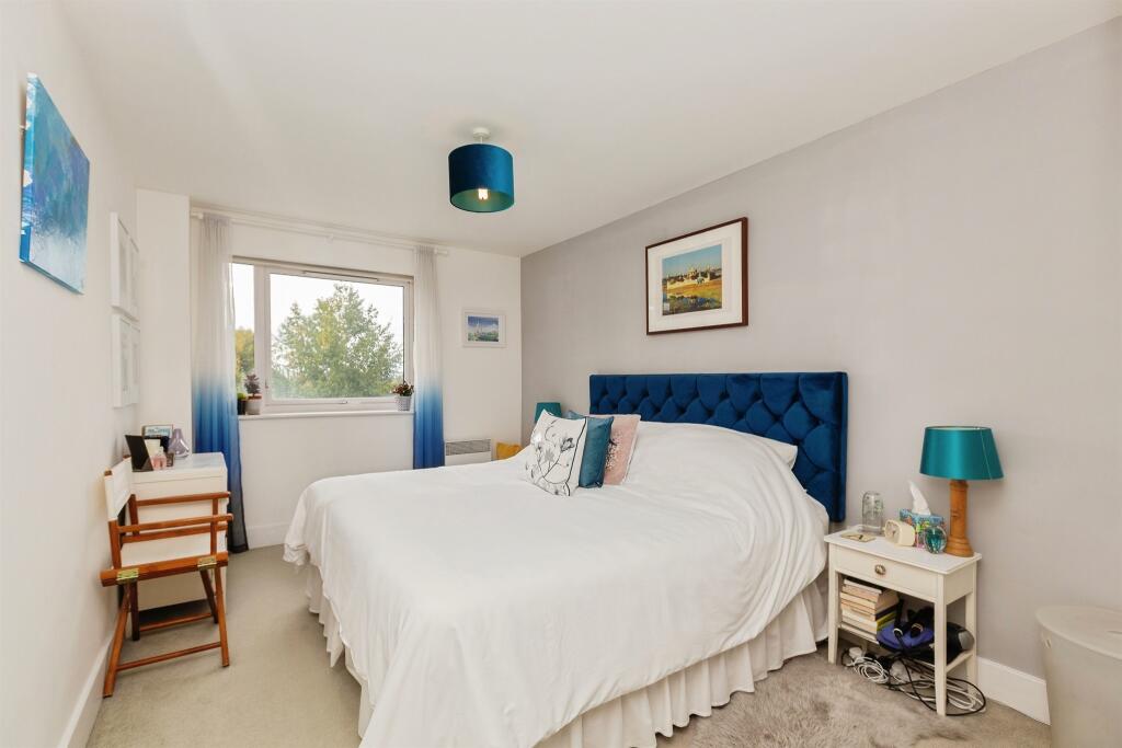
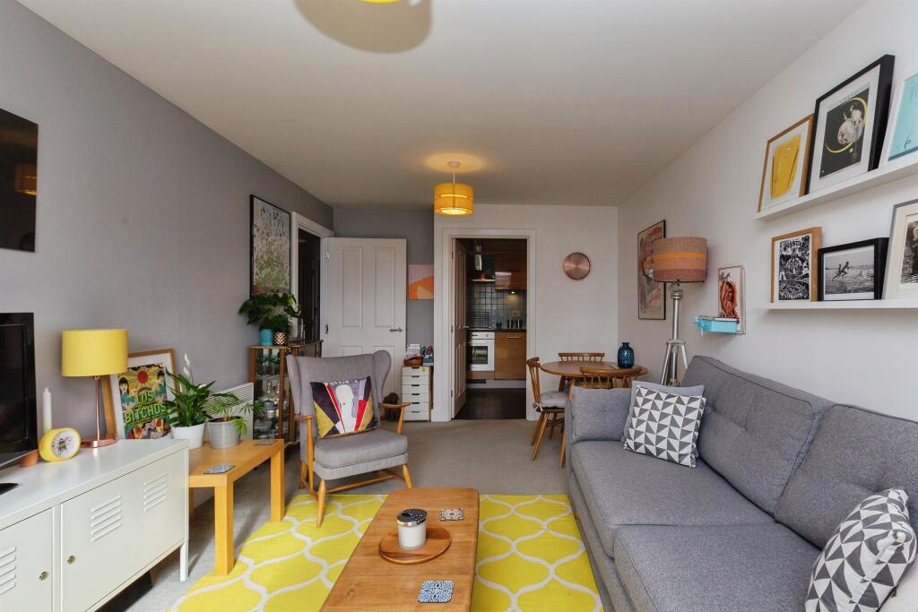
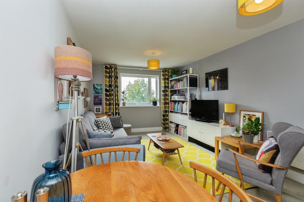
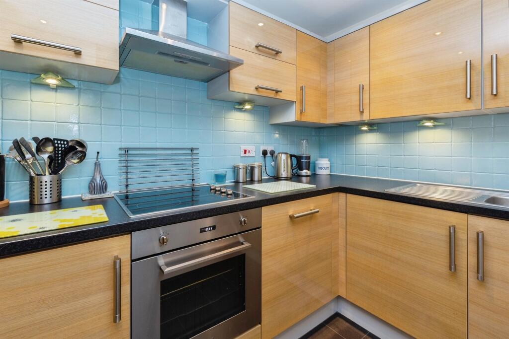
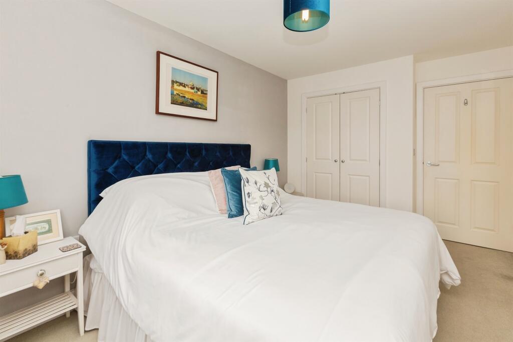
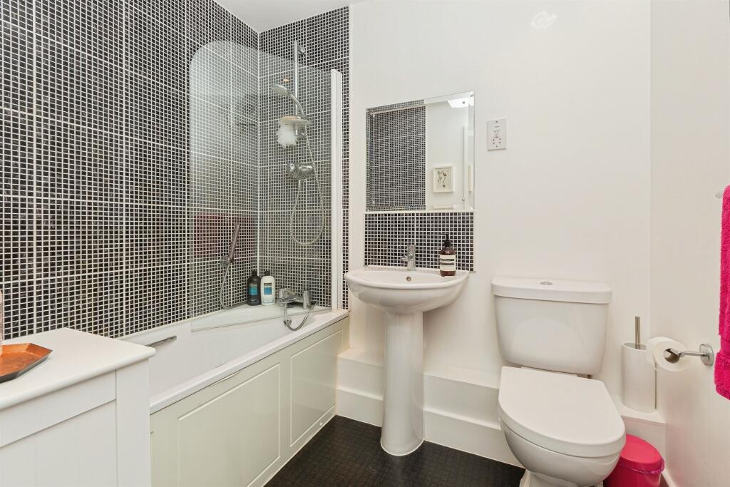
- Third-floor one-bedroom (advertised as double bedroom) apartment situated in Stanton House on Coxhill Way, Aylesbury. Leasehold flat with EPC rating B. The accommodation includes a separate kitchen with appliances, living room and bathroom. The building sits within communal grounds with allocated parking and mature landscaping visible from the property. The location is close to the railway station and local amenities. Room sizes appear average for a purpose-built apartment; overall property size is consistent with a standard one-bedroom third-floor flat. Notable lease/service details shown on the listing: Service Charge £1,992.00 and Ground Rent £304.00 (Council Tax Band B).
Image Descriptions
- apartment complex Contemporary
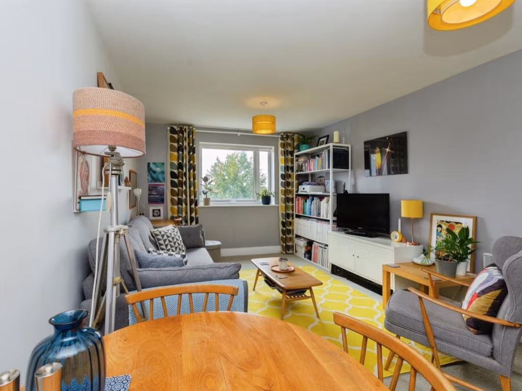
- living room Contemporary
Floorplan Description
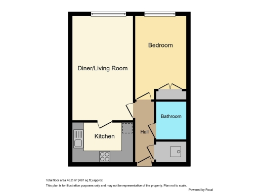
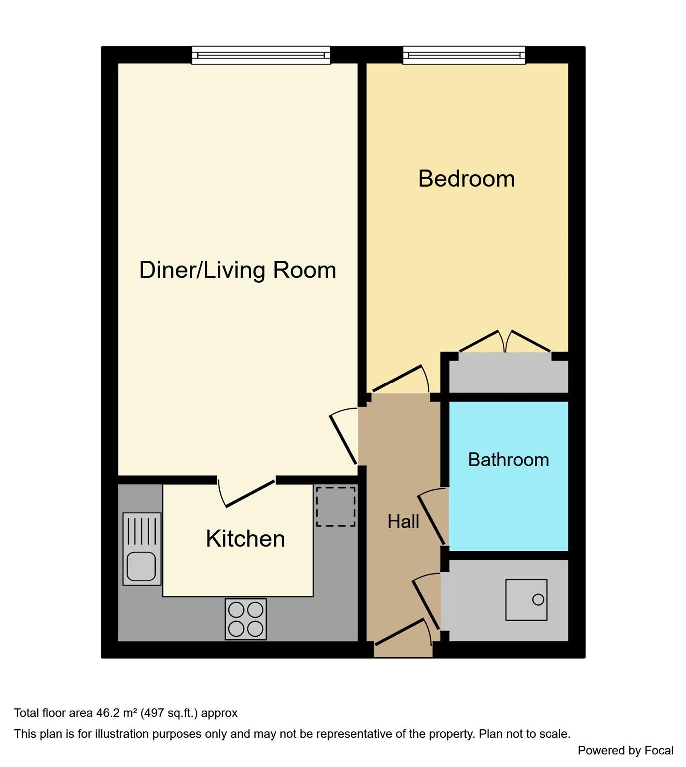
- Single-floor apartment with a diner/living room, kitchen, bedroom, bathroom and hall.
Rooms
- Diner/Living Room:
- Kitchen:
- Bedroom:
- Hall:
- Bathroom:
Textual Property Features
Detected Visual Features
- Contemporary
- Apartment
- Brick
- Concrete
- Balcony
- Parking
- Urban
- Modern
- contemporary
- living room
- window
- natural light
- white walls
- modern
- simple design
- neutral color palette
EPC Details
- Fully double glazed
- Cavity wall, as built, insulated (assumed)
- Room heaters, electric
- Low energy lighting in all fixed outlets
- (another dwelling below)
Nearby Schools
- The Mandeville School
- Turnfurlong Junior School
- Broughton Junior School
- Elmhurst School
- Thomas Hickman School
- Bierton Church of England Combined School
- The Grange School
- Aylesbury Grammar School
- St Mary's Church of England School
- Buckingham Park Church of England Primary School
- William Harding School
- St Joseph's Catholic Infant School
- Aylesbury High School
- Sir Henry Floyd Grammar School
- Aylesbury UTC
- Broughton Community Schools (Infants)
- Haydon Abbey School and Pre-School
- St Louis Catholic Primary School
- Turnfurlong Infant School
- Oak Green School
- St Edward's Catholic Junior School
- Bearbrook Combined School
Nearest General Shops
- Id: 5676043865
- Tags:
- Level: 1
- Name: Surelock Homes Security
- Shop: yes
- TagsNormalized:
- Lat: 51.8150057
- Lon: -0.813746
- FullGeoHash: gcpqv2xkq35h
- PartitionGeoHash: gcpq
- Images:
- FoodStandards: null
- Distance: 223.5
,- Id: 5676043863
- Tags:
- Level: 1
- Name: Pumping Iron
- Shop: sports
- Website: https://www.pumpingironstore.com/
- TagsNormalized:
- Lat: 51.8149618
- Lon: -0.813797
- FullGeoHash: gcpqv2xkj0uy
- PartitionGeoHash: gcpq
- Images:
- FoodStandards: null
- Distance: 218.3
,- Id: 5690898529
- Tags:
- Brand: Shoe Zone
- Brand:wikidata: Q7500016
- Brand:wikipedia: en:Shoe Zone
- Level: 1
- Name: Shoe Zone
- Shop: shoes
- Website: https://www.shoezone.com/Stores/Aylesbury-1889
- TagsNormalized:
- Lat: 51.8149294
- Lon: -0.8138399
- FullGeoHash: gcpqv2x7u4uv
- PartitionGeoHash: gcpq
- Images:
- FoodStandards: null
- Distance: 214.4
}
Nearest Grocery shops
- Id: 5676046128
- Tags:
- Brand: Grape Tree
- Brand:wikidata: Q87071497
- Name: Grape Tree
- Shop: health_food
- Website: https://www.grapetree.co.uk/stores/locator/store/l/aylesbury/high-street/3423698
- TagsNormalized:
- grape tree
- health
- health food
- food
- shop
- Lat: 51.8168984
- Lon: -0.8111308
- FullGeoHash: gcpqv8cr73cn
- PartitionGeoHash: gcpq
- Images:
- FoodStandards: null
- Distance: 477.7
,- Id: 5676043432
- Tags:
- Name: Sonns Health Store
- Shop: health_food
- TagsNormalized:
- health
- health food
- food
- shop
- Lat: 51.816132
- Lon: -0.8137916
- FullGeoHash: gcpqv2z6v715
- PartitionGeoHash: gcpq
- Images:
- FoodStandards: null
- Distance: 348.1
,- Id: 5690898317
- Tags:
- Addr:
- Housenumber: 40
- Postcode: HP20 2SP
- Street: Friars Square
- Brand: Holland & Barrett
- Brand:wikidata: Q5880870
- Brand:wikipedia: en:Holland & Barrett
- Fhrs:
- Level: 1
- Name: Holland & Barrett
- Shop: health_food
- Website: https://www.hollandandbarrett.com/stores/aylesbury-3180/
- TagsNormalized:
- holland & barrett
- health
- health food
- food
- shop
- Lat: 51.8158559
- Lon: -0.8128758
- FullGeoHash: gcpqv8b14xeu
- PartitionGeoHash: gcpq
- Images:
- FoodStandards:
- Id: 370284
- FHRSID: 370284
- LocalAuthorityBusinessID: EH/00025302
- BusinessName: Holland & Barrett
- BusinessType: Retailers - other
- BusinessTypeID: 4613
- AddressLine1: 40 Friars Square
- AddressLine2: Aylesbury
- AddressLine3: Buckinghamshire
- AddressLine4: null
- PostCode: HP20 2SP
- RatingValue: 5
- RatingKey: fhrs_5_en-GB
- RatingDate: 2019-05-01
- LocalAuthorityCode: 021
- LocalAuthorityName: Buckinghamshire
- LocalAuthorityWebSite: http://www.buckinghamshire.gov.uk
- LocalAuthorityEmailAddress: environmentalhealth@buckinghamshire.gov.uk
- Scores:
- Hygiene: 0
- Structural: 0
- ConfidenceInManagement: 0
- NewRatingPending: false
- Geocode:
- Longitude: -0.81303200000000
- Latitude: 51.81564900000000
- Distance: 327.4
}
Nearest Medical buildings
- Id: 5676043411
- Tags:
- Amenity: dentist
- Healthcare: dentist
- Name: Rycote Dental Practice
- Website: http://www.rycotedental.co.uk/
- TagsNormalized:
- dentist
- health
- healthcare
- dental
- Lat: 51.8163538
- Lon: -0.8179906
- FullGeoHash: gcpqv2uk5kqn
- PartitionGeoHash: gcpq
- Images:
- FoodStandards: null
- Distance: 459.4
,- Id: 1614265539
- Tags:
- Amenity: dentist
- Fixme: Does this have a name?
- Healthcare: dentist
- TagsNormalized:
- Lat: 51.8159923
- Lon: -0.8139754
- FullGeoHash: gcpqv2z60cpc
- PartitionGeoHash: gcpq
- Images:
- FoodStandards: null
- Distance: 332.1
,- Id: 5676043429
- Tags:
- Amenity: chiropractor
- Name: The Foot Clinic
- Website: https://aylesburyfootclinic.co.uk/
- TagsNormalized:
- Lat: 51.8159641
- Lon: -0.8140397
- FullGeoHash: gcpqv2z1zeb1
- PartitionGeoHash: gcpq
- Images:
- FoodStandards: null
- Distance: 328.9
,- Id: 1672121964
- Tags:
- Amenity: doctors
- Healthcare: doctor
- Name: Brookside Centre
- Source: OS_OpenData_StreetView
- TagsNormalized:
- doctor
- doctors
- health
- healthcare
- Lat: 51.812994
- Lon: -0.8115362
- FullGeoHash: gcpqv8309f4u
- PartitionGeoHash: gcpq
- Images:
- FoodStandards: null
- Distance: 174.5
}
Nearest Airports
- Id: 110273499
- Tags:
- Addr:
- Country: GB
- Postcode: LU2 9LY
- Aerodrome: international
- Aerodrome:type: public
- Aeroway: aerodrome
- Alt_name: London Luton
- Iata: LTN
- Icao: EGGW
- Name: London Luton Airport
- Website: https://www.london-luton.co.uk/
- Wikidata: Q8712
- Wikipedia: en:Luton Airport
- TagsNormalized:
- airport
- international airport
- Lat: 51.8780363
- Lon: -0.3701408
- FullGeoHash: gcpxps47rngh
- PartitionGeoHash: gcpx
- Images:
- FoodStandards: null
- Distance: 31341.3
}
Nearest Leisure Facilities
- Id: 157012439
- Tags:
- TagsNormalized:
- Lat: 51.8161798
- Lon: -0.815724
- FullGeoHash: gcpqv2y50k00
- PartitionGeoHash: gcpq
- Images:
- FoodStandards: null
- Distance: 370.6
,- Id: 5690896683
- Tags:
- Brand: Anytime Fitness
- Brand:wikidata: Q4778364
- Brand:wikipedia: en:Anytime Fitness
- Leisure: fitness_centre
- Name: Anytime Fitness
- Website: https://www.anytimefitness.co.uk/gyms/UK-0023/aylesbury-south-east-hp20-1ur/
- TagsNormalized:
- anytime fitness
- fitness
- fitness centre
- leisure
- Lat: 51.8151151
- Lon: -0.810121
- FullGeoHash: gcpqv8dhfv9c
- PartitionGeoHash: gcpq
- Images:
- FoodStandards: null
- Distance: 358.9
,- Id: 3760241033
- Tags:
- Addr:
- City: Aylesbury
- Housenumber: 6-8
- Postcode: HP20 2PU
- Street: Great Western Street
- Brand: The Gym
- Brand:wikidata: Q48815022
- Brand:wikipedia: en:The Gym Group
- Leisure: fitness_centre
- Name: The Gym
- Opening_hours: 24/7
- Website: https://www.thegymgroup.com/find-a-gym/aylesbury/
- TagsNormalized:
- the gym
- gym
- fitness
- fitness centre
- leisure
- Lat: 51.8155995
- Lon: -0.8129158
- FullGeoHash: gcpqv88p9xy4
- PartitionGeoHash: gcpq
- Images:
- FoodStandards: null
- Distance: 299.1
,- Id: 133889166
- Tags:
- Leisure: park
- Source: Bing
- TagsNormalized:
- Lat: 51.8143743
- Lon: -0.8115614
- FullGeoHash: gcpqv89095ry
- PartitionGeoHash: gcpq
- Images:
- FoodStandards: null
- Distance: 230.2
,- Id: 133889075
- Tags:
- Access: private
- Description: Sign says access for Lloyds Bank only
- Leisure: park
- Source: Bing
- TagsNormalized:
- Lat: 51.8136775
- Lon: -0.811624
- FullGeoHash: gcpqv82uxc93
- PartitionGeoHash: gcpq
- Images:
- FoodStandards: null
- Distance: 184.3
}
Nearest Tourist attractions
- Id: 259196915
- Tags:
- Fixme: ?building?
- Name: Oak Farm Animal Park
- Source: npe
- Tourism: zoo
- TagsNormalized:
- Lat: 51.8177968
- Lon: -0.7729805
- FullGeoHash: gcpqy3jhs1ry
- PartitionGeoHash: gcpq
- Images:
- FoodStandards: null
- Distance: 2874.6
,- Id: 5696553371
- Tags:
- Name: Roald Dahl Children's Gallery
- Tourism: museum
- Website: https://www.buckscountymuseum.org/roalddahl/
- Wikidata: Q15272788
- Wikipedia: en:Roald Dahl Children's Gallery
- TagsNormalized:
- Lat: 51.8173005
- Lon: -0.8147706
- FullGeoHash: gcpqv3n9wkzj
- PartitionGeoHash: gcpq
- Images:
- FoodStandards: null
- Distance: 479.9
,- Id: 2332756770
- Tags:
- Name: Buckinghamshire County Museum
- Source: local knowledge
- Tourism: museum
- Website: http://www.buckscountymuseum.org
- Wikidata: Q4983261
- Wikipedia: en:Buckinghamshire County Museum
- TagsNormalized:
- Lat: 51.817258
- Lon: -0.8150469
- FullGeoHash: gcpqv3n92hbz
- PartitionGeoHash: gcpq
- Images:
- FoodStandards: null
- Distance: 477.5
}
Nearest Train stations
- Id: 21137939
- Tags:
- Name: Wendover
- Naptan:
- Network: National Rail
- Public_transport: station
- Railway: station
- Ref:
- Source: NPE
- Wikidata: Q2751439
- Wikipedia: en:Wendover railway station
- TagsNormalized:
- Lat: 51.7618168
- Lon: -0.7476905
- FullGeoHash: gcpqqyzw3w18
- PartitionGeoHash: gcpq
- Images:
- FoodStandards: null
- Distance: 7297.2
,- Id: 5777593692
- Tags:
- Name: Little Kimble
- Naptan:
- Network: National Rail
- Operator: Chiltern Railways
- Public_transport: station
- Railway: station
- Ref:
- Wikidata: Q2116125
- Wikipedia: en:Little Kimble railway station
- TagsNormalized:
- Lat: 51.7523306
- Lon: -0.8085573
- FullGeoHash: gcpqmt5ppjxu
- PartitionGeoHash: gcpq
- Images:
- FoodStandards: null
- Distance: 6757.5
,- Id: 3464902054
- Tags:
- Name: Aylesbury Vale Parkway
- Naptan:
- Network: National Rail
- Public_transport: station
- Railway: station
- Ref:
- Wheelchair: yes
- Wikidata: Q4831380
- Wikipedia: en:Aylesbury Vale Parkway railway station
- TagsNormalized:
- Lat: 51.8312778
- Lon: -0.859831
- FullGeoHash: gcpqu7tgh6rx
- PartitionGeoHash: gcpq
- Images:
- FoodStandards: null
- Distance: 3744
,- Id: 3724898182
- Tags:
- Name: Stoke Mandeville
- Naptan:
- Network: National Rail
- Public_transport: station
- Railway: station
- Ref:
- Source: NPE
- Wikidata: Q2244698
- Wikipedia: en:Stoke Mandeville railway station
- TagsNormalized:
- Lat: 51.7878849
- Lon: -0.7843417
- FullGeoHash: gcpqw5sy792q
- PartitionGeoHash: gcpq
- Images:
- FoodStandards: null
- Distance: 3461.7
,- Id: 7153884935
- Tags:
- Name: Aylesbury
- Naptan:
- Network: National Rail
- Operator: Chiltern Railways
- Public_transport: station
- Railway: station
- Ref:
- Website: http://www.nationalrail.co.uk/stations_destinations/AYS.aspx
- Wikidata: Q2338815
- Wikipedia: en:Aylesbury railway station
- TagsNormalized:
- Lat: 51.8134286
- Lon: -0.8143149
- FullGeoHash: gcpqv2r5154u
- PartitionGeoHash: gcpq
- Images:
- FoodStandards: null
- Distance: 49.8
}
Nearest Bus stations and stops
- Id: 8722042222
- Tags:
- Bus: yes
- Highway: bus_stop
- Name: Exchange Street
- Public_transport: platform
- TagsNormalized:
- Lat: 51.8160092
- Lon: -0.8084606
- FullGeoHash: gcpqv8g61s0n
- PartitionGeoHash: gcpq
- Images:
- FoodStandards: null
- Distance: 510.3
,- Id: 3723304545
- Tags:
- Bench: yes
- Bus: yes
- Departures_board: realtime
- Highway: bus_stop
- Name: Exchange Street E3
- Public_transport: platform
- Shelter: yes
- TagsNormalized:
- Lat: 51.8157044
- Lon: -0.8091996
- FullGeoHash: gcpqv8fb273h
- PartitionGeoHash: gcpq
- Images:
- FoodStandards: null
- Distance: 449.8
,- Id: 3723304544
- Tags:
- Bench: yes
- Bin: no
- Bus: yes
- Departures_board: realtime
- Highway: bus_stop
- Name: Exchange Street E2
- Public_transport: platform
- Shelter: yes
- TagsNormalized:
- Lat: 51.8155444
- Lon: -0.809374
- FullGeoHash: gcpqv8dxkjx1
- PartitionGeoHash: gcpq
- Images:
- FoodStandards: null
- Distance: 429
,- Id: 3723304543
- Tags:
- Bench: yes
- Bus: yes
- Departures_board: realtime
- Highway: bus_stop
- Name: Exchange Street E1
- Public_transport: platform
- Shelter: yes
- TagsNormalized:
- Lat: 51.8151535
- Lon: -0.8097904
- FullGeoHash: gcpqv8dm4s8w
- PartitionGeoHash: gcpq
- Images:
- FoodStandards: null
- Distance: 379.1
,- Id: 632226278
- Tags:
- Bus: yes
- Highway: bus_stop
- Name: Railway Station
- Public_transport: platform
- TagsNormalized:
- Lat: 51.8143359
- Lon: -0.8150855
- FullGeoHash: gcpqv2w2rhk0
- PartitionGeoHash: gcpq
- Images:
- FoodStandards: null
- Distance: 163.3
}
Nearest Hotels
- Id: 324414391
- Tags:
- Brand: Premier Inn
- Brand:wikidata: Q2108626
- Brand:wikipedia: en:Premier Inn
- Building: yes
- Fax: +44 871 527 8037
- Internet_access: wlan
- Internet_access:fee: customers
- Internet_access:operator: Virgin Media
- Internet_access:ssid: Premier Inn Free Wi-Fi
- Name: Premier Inn Aylesbury
- Operator: Premier Inn
- Phone: +44 871 527 8036
- Smoking: no
- Source: bing
- Tourism: hotel
- Website: http://www.premierinn.com/
- Wheelchair: yes
- TagsNormalized:
- Lat: 51.8283981
- Lon: -0.8152324
- FullGeoHash: gcpqv7n679wt
- PartitionGeoHash: gcpq
- Images:
- FoodStandards: null
- Distance: 1713.3
,- Id: 971208151
- Tags:
- Name: Olympic Lodge
- Tourism: hotel
- Website: https://www.stokemandevillestadium.co.uk/accommodation/
- TagsNormalized:
- Lat: 51.8012669
- Lon: -0.8012993
- FullGeoHash: gcpqty0s225c
- PartitionGeoHash: gcpq
- Images:
- FoodStandards: null
- Distance: 1573.4
,- Id: 3723304551
- Tags:
- Brand: Travelodge
- Brand:wikidata: Q9361374
- Brand:wikipedia: en:Travelodge UK
- Internet_access: wlan
- Internet_access:fee: customers
- Internet_access:ssid: Travelodge WiFi
- Name: Travelodge Aylesbury Hotel
- Operator: Travelodge
- Tourism: hotel
- Website: https://www.travelodge.co.uk/hotels/579/Aylesbury-hotel
- TagsNormalized:
- Lat: 51.814537
- Lon: -0.8081529
- FullGeoHash: gcpqv8e989v8
- PartitionGeoHash: gcpq
- Images:
- FoodStandards: null
- Distance: 441.2
}
Tags
- Contemporary
- Apartment
- Brick
- Concrete
- Balcony
- Parking
- Urban
- Modern
- contemporary
- living room
- window
- natural light
- white walls
- modern
- simple design
- neutral color palette
AirBnB Data
- 1km average: £92/night
- Listings in 1km: 10
Similar Properties
 1 bedroom apartment for sale in Coxhill Way, Aylesbury, HP21 — £160,000 • 1 bed • 1 bath • 527 ft²
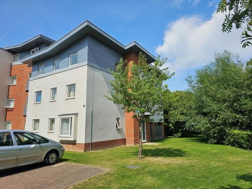 3 bedroom apartment for sale in Coxhill Way, Aylesbury, HP21 — £230,000 • 3 bed • 2 bath • 937 ft²
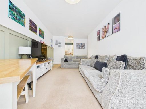 2 bedroom flat for sale in Stanton House, Coxhill Way, Aylesbury, HP21 — £212,500 • 2 bed • 2 bath • 625 ft²
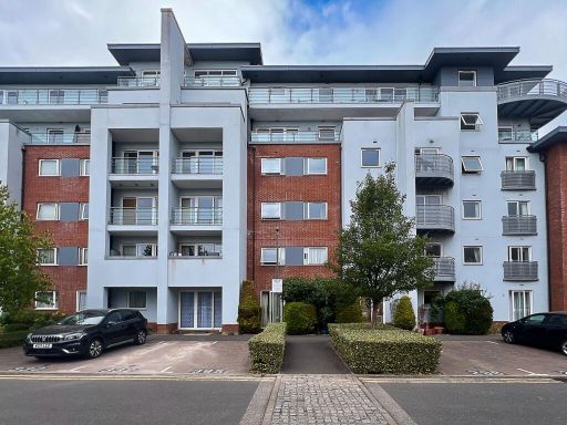 1 bedroom apartment for sale in Coxhill Way, Stanton House Coxhill Way, HP21 — £150,000 • 1 bed • 1 bath • 515 ft²
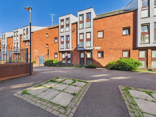 1 bedroom flat for sale in Wycliffe End, Aylesbury, Buckinghamshire, HP19 — £115,000 • 1 bed • 1 bath • 431 ft²
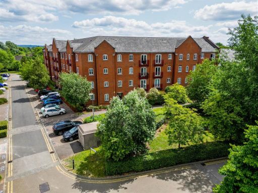 1 bedroom flat for sale in Coxhill Way, Aylesbury, HP21 — £180,000 • 1 bed • 1 bath • 458 ft²
Meta
- {
"@context": "https://schema.org",
"@type": "Residence",
"name": "1 bedroom apartment for sale in Coxhill Way, Aylesbury, HP21",
"description": "",
"url": "https://propertypiper.co.uk/property/4affc6e4-04cc-467a-b1de-18892c6b22f4",
"image": "https://image-a.propertypiper.co.uk/7fde203d-39c6-49ee-9d3a-b8a22d28a812-1024.jpeg",
"address": {
"@type": "PostalAddress",
"streetAddress": "Coxhill Way, Aylesbury",
"postalCode": "HP21 8FQ",
"addressLocality": "Buckinghamshire",
"addressRegion": "Aylesbury",
"addressCountry": "England"
},
"geo": {
"@type": "GeoCoordinates",
"latitude": 51.81300642863228,
"longitude": -0.8140746308957101
},
"numberOfRooms": 1,
"numberOfBathroomsTotal": 1,
"floorSize": {
"@type": "QuantitativeValue",
"value": 497,
"unitCode": "FTK"
},
"offers": {
"@type": "Offer",
"price": 180000,
"priceCurrency": "GBP",
"availability": "https://schema.org/InStock"
},
"additionalProperty": [
{
"@type": "PropertyValue",
"name": "Feature",
"value": "Contemporary"
},
{
"@type": "PropertyValue",
"name": "Feature",
"value": "Apartment"
},
{
"@type": "PropertyValue",
"name": "Feature",
"value": "Brick"
},
{
"@type": "PropertyValue",
"name": "Feature",
"value": "Concrete"
},
{
"@type": "PropertyValue",
"name": "Feature",
"value": "Balcony"
},
{
"@type": "PropertyValue",
"name": "Feature",
"value": "Parking"
},
{
"@type": "PropertyValue",
"name": "Feature",
"value": "Urban"
},
{
"@type": "PropertyValue",
"name": "Feature",
"value": "Modern"
},
{
"@type": "PropertyValue",
"name": "Feature",
"value": "contemporary"
},
{
"@type": "PropertyValue",
"name": "Feature",
"value": "living room"
},
{
"@type": "PropertyValue",
"name": "Feature",
"value": "window"
},
{
"@type": "PropertyValue",
"name": "Feature",
"value": "natural light"
},
{
"@type": "PropertyValue",
"name": "Feature",
"value": "white walls"
},
{
"@type": "PropertyValue",
"name": "Feature",
"value": "modern"
},
{
"@type": "PropertyValue",
"name": "Feature",
"value": "simple design"
},
{
"@type": "PropertyValue",
"name": "Feature",
"value": "neutral color palette"
}
]
}
High Res Floorplan Images
Compatible Floorplan Images
FloorplanImages Thumbnail