W4 3NP - 3 bedroom terraced house for sale in Waldeck Road, London,…
View on Property Piper
3 bedroom terraced house for sale in Waldeck Road, London, W4
Property Details
- Price: £925000
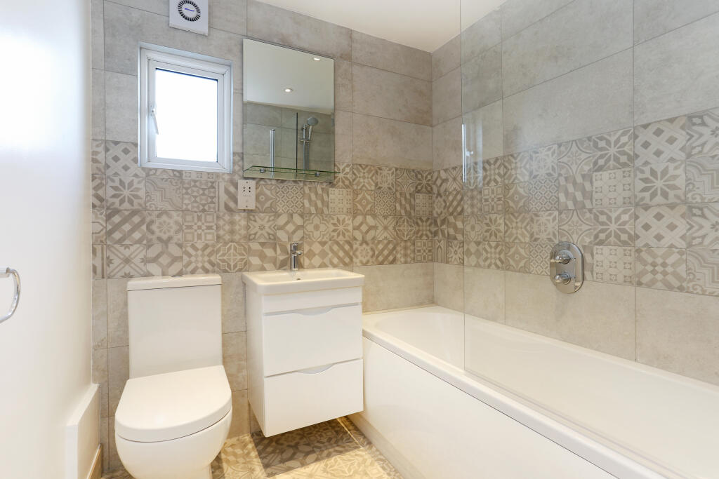
- Bedrooms: 3
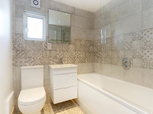
- Bathrooms: 1
- Property Type: undefined
- Property SubType: undefined
Image Descriptions
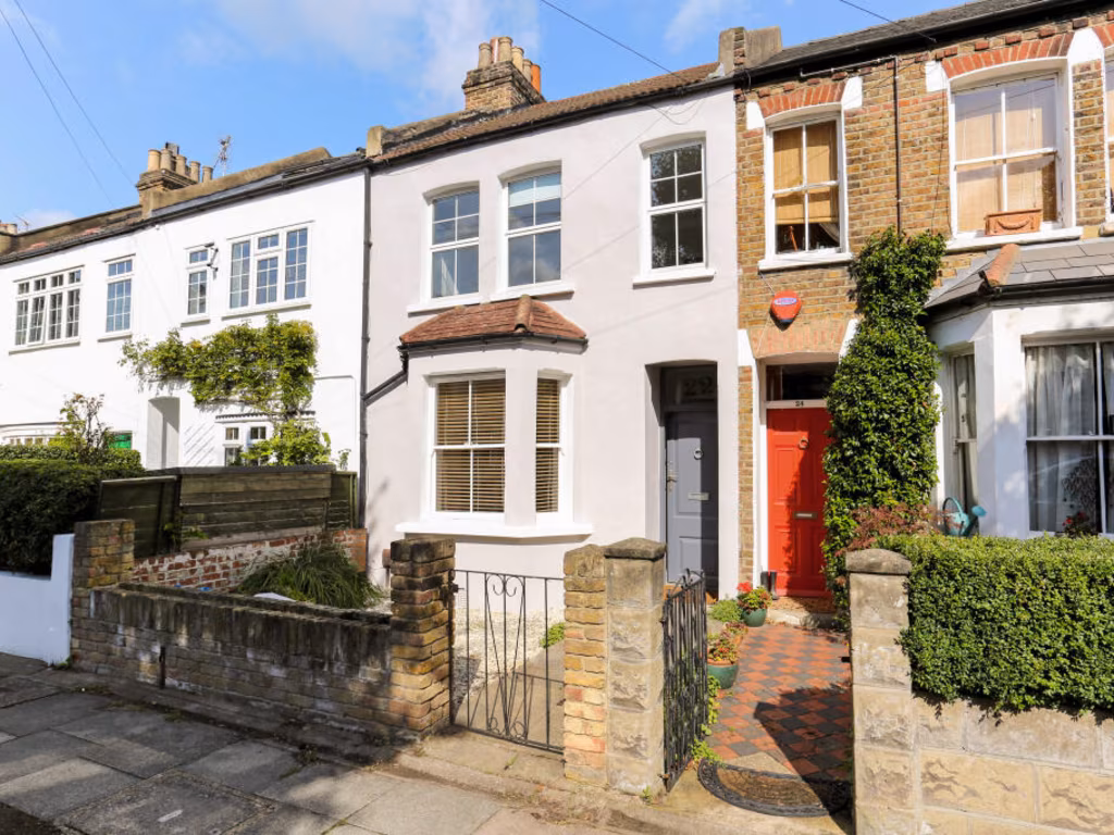
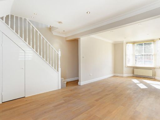
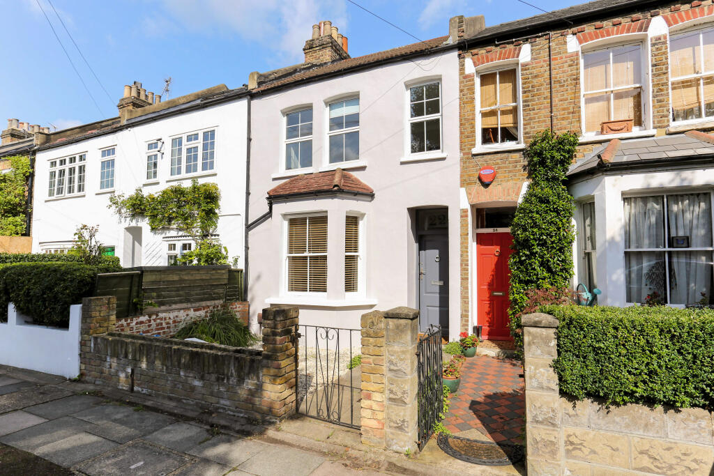
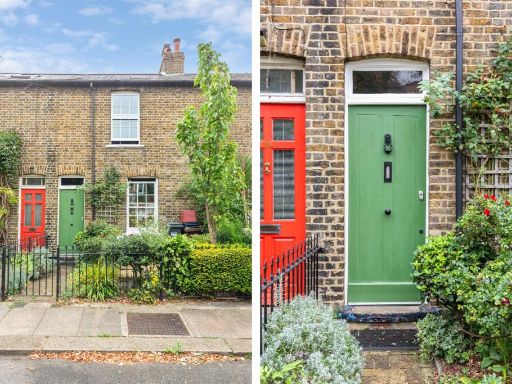
- terraced house frontage Victorian
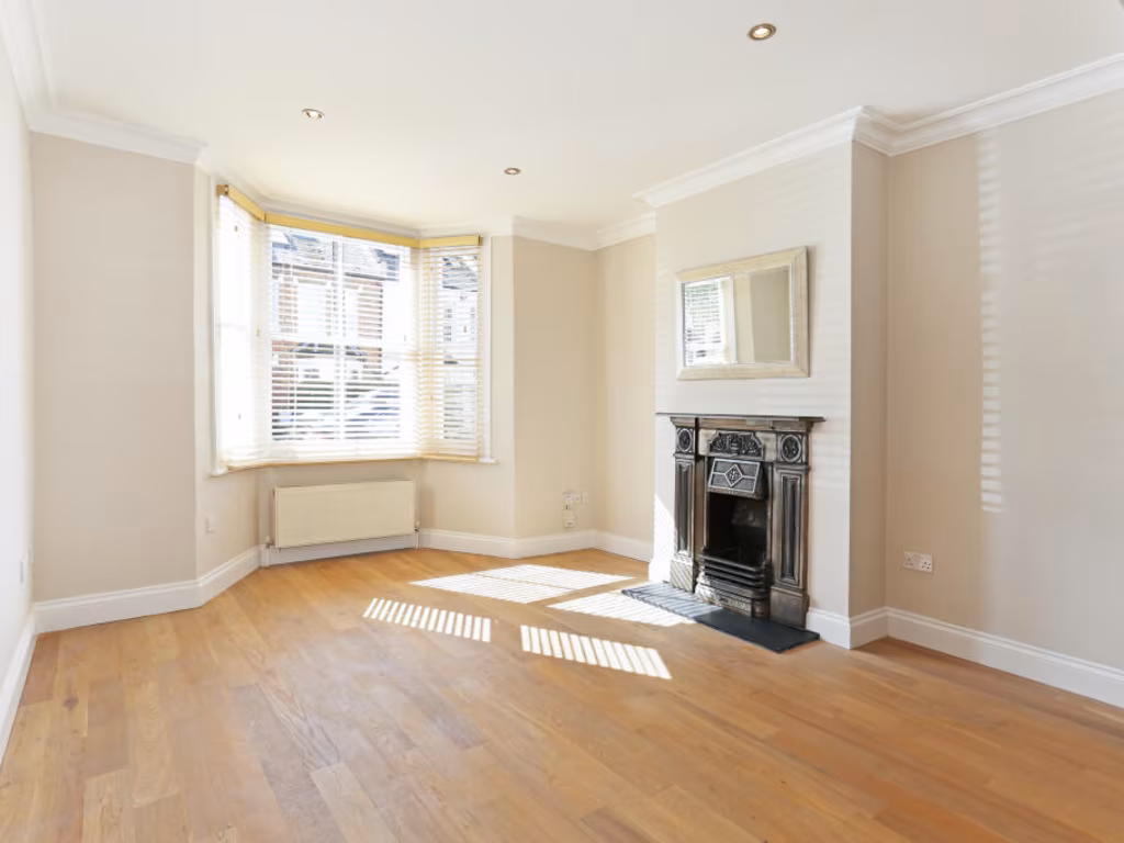
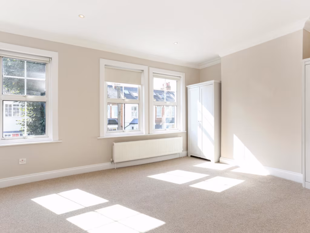
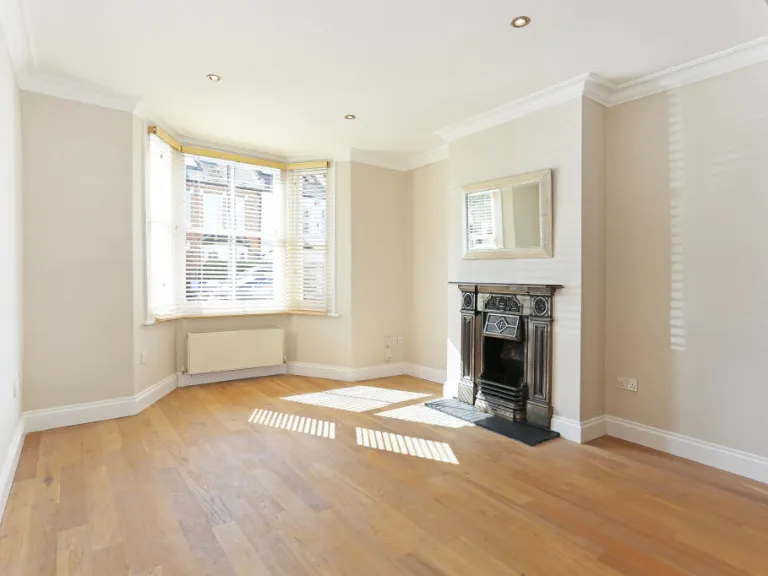
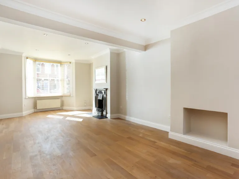
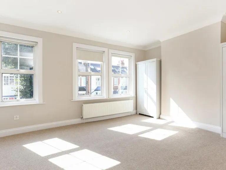
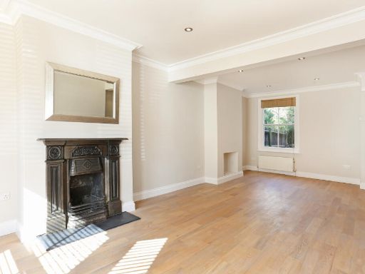
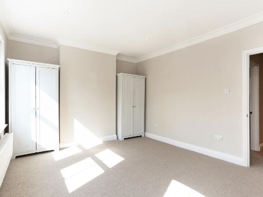
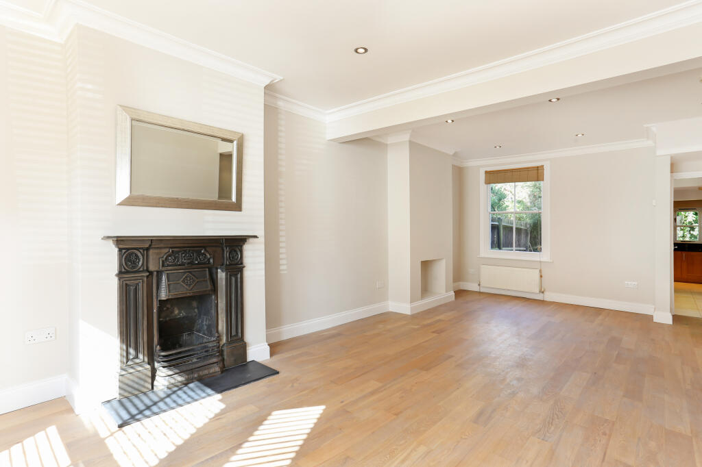
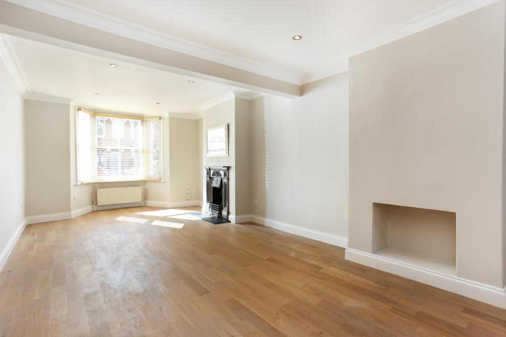
- living room contemporary
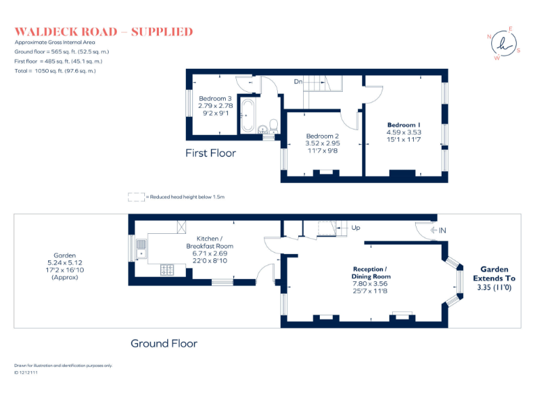
Floorplan Description
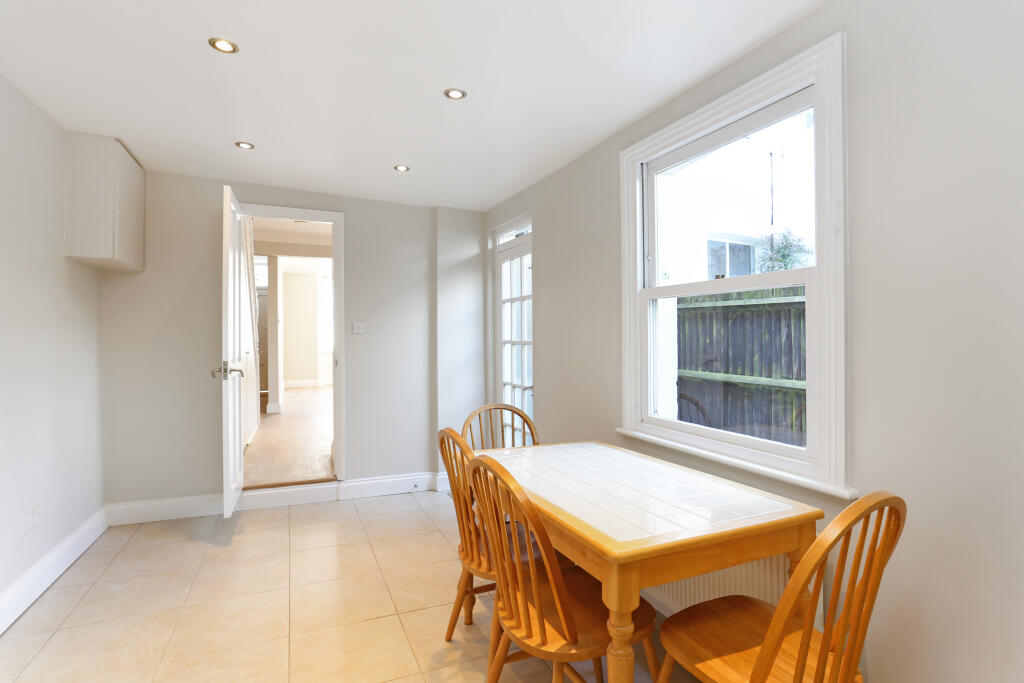
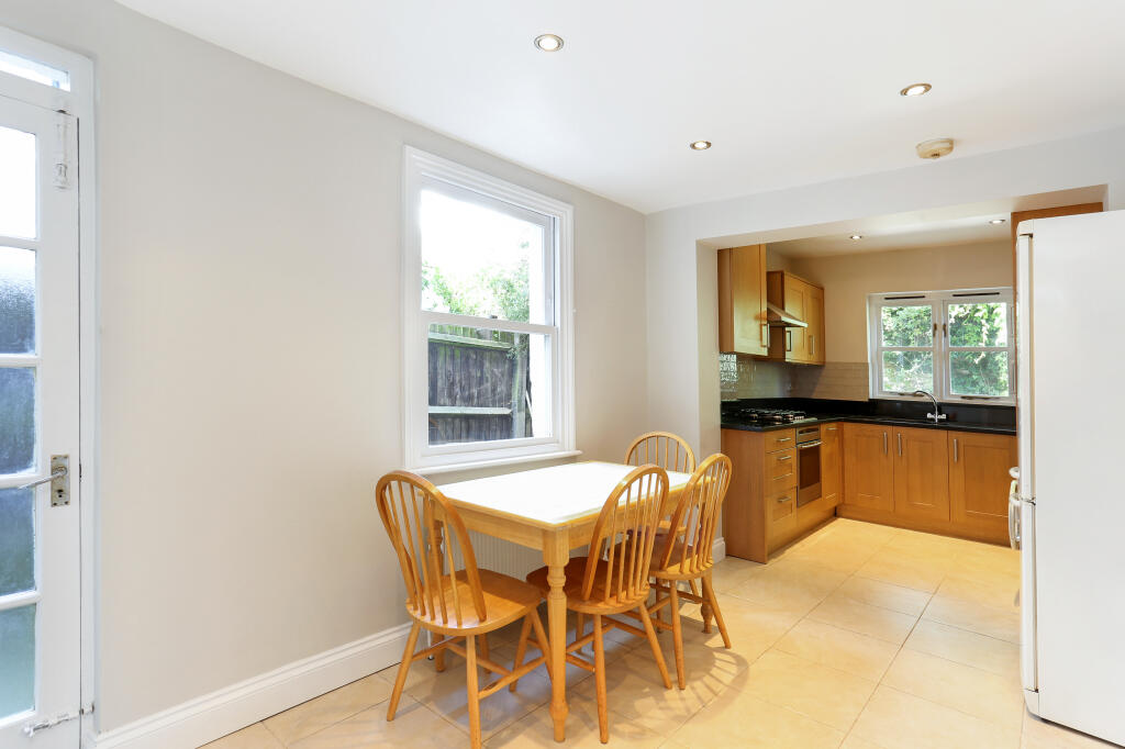
- Two-storey residential property with kitchen/breakfast room and reception/dining room.
Rooms
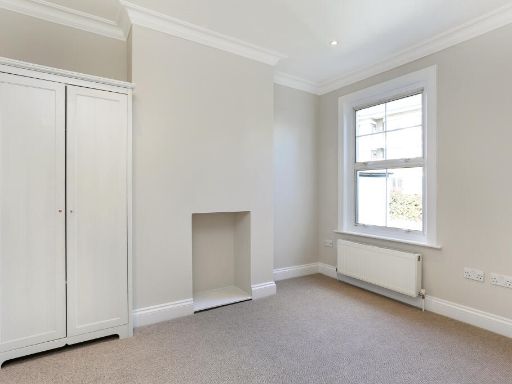
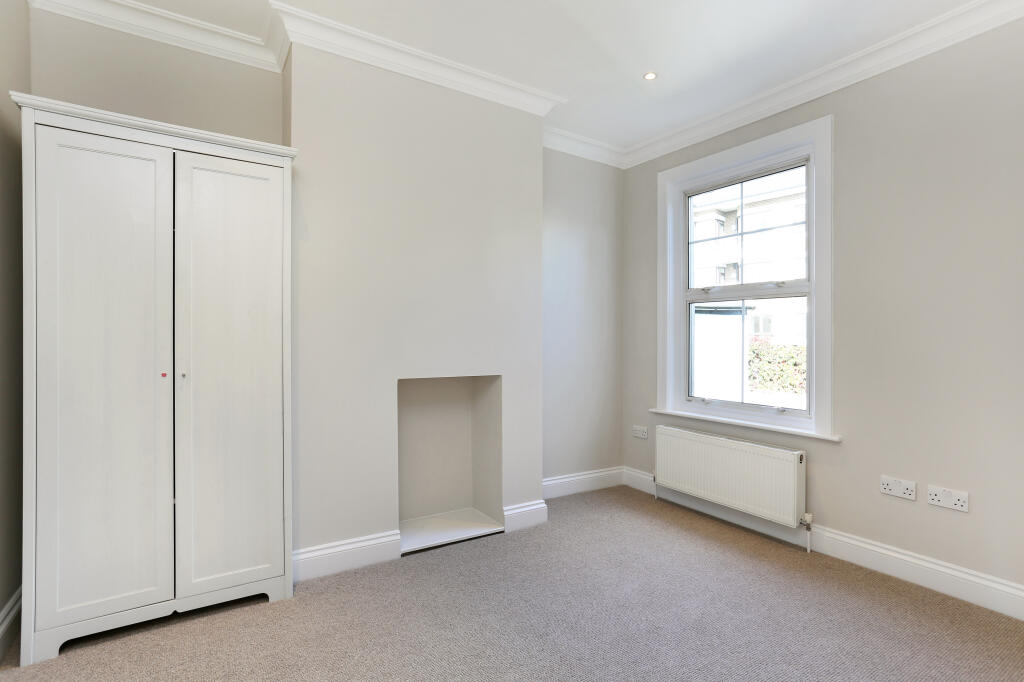
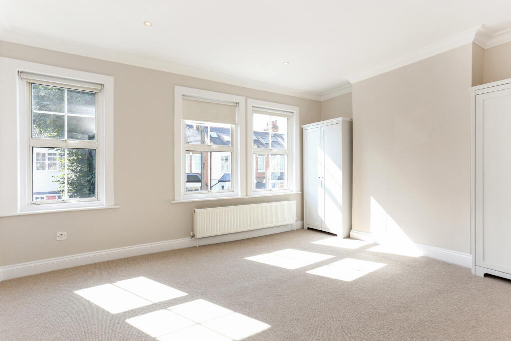
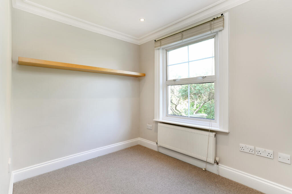
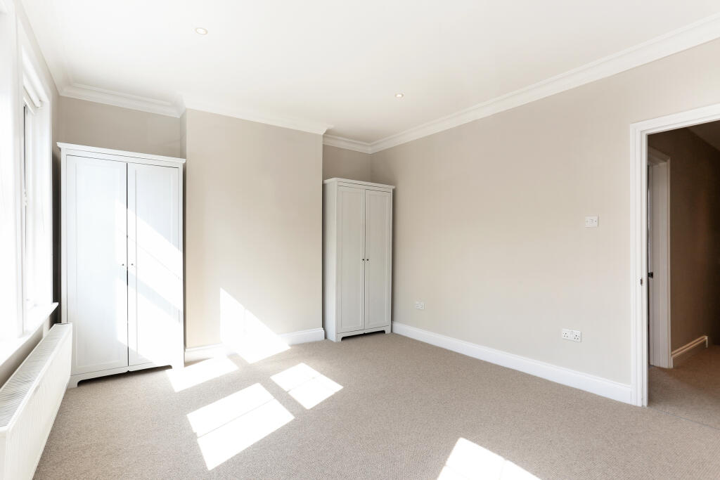
- Bedroom 3:
- Bedroom 2:
- Bedroom 1:
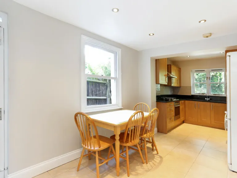
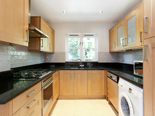
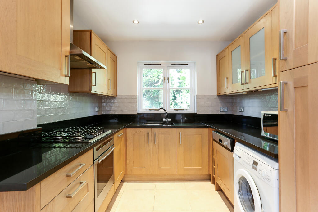
- Kitchen / Breakfast Room:
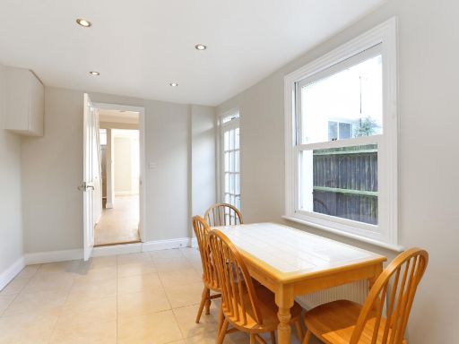
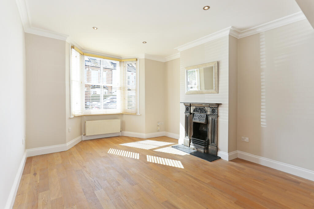
- Reception / Dining Room:
Textual Property Features
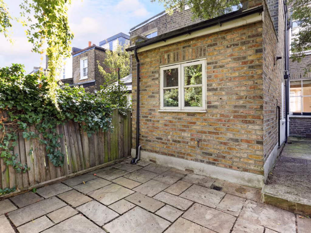
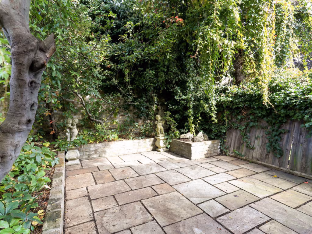
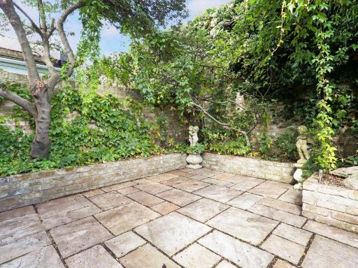
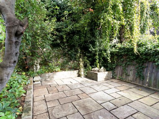
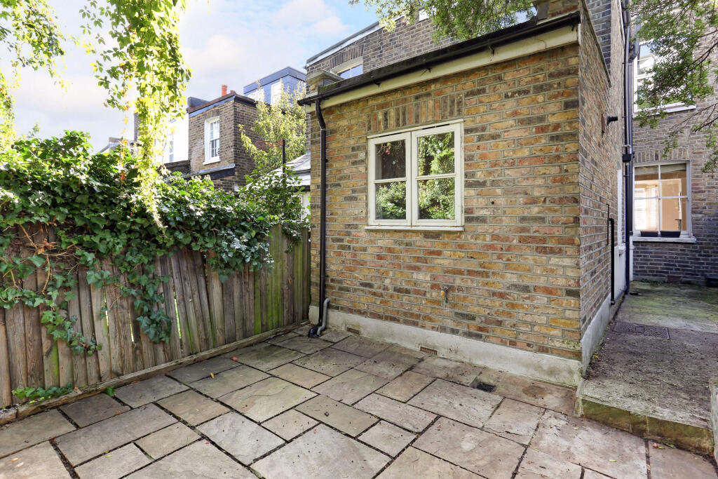
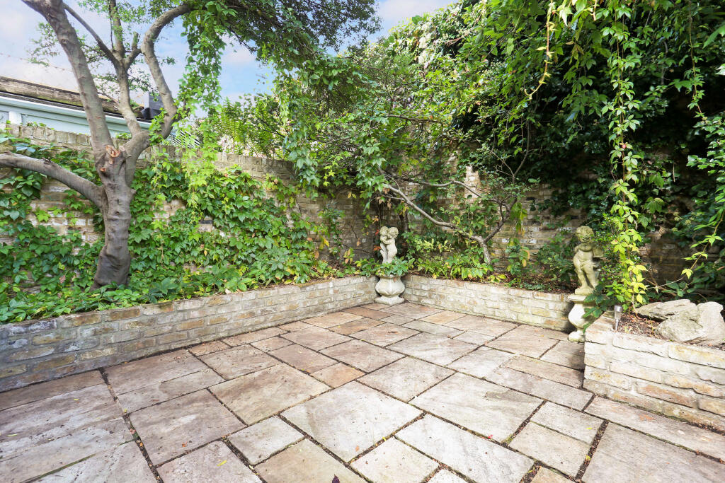
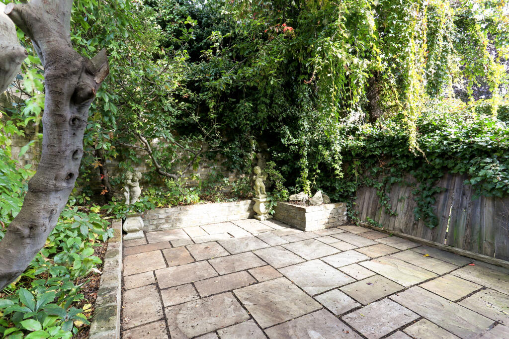
- Has Garden
- Chain Free
- Success
Detected Visual Features
- Victorian
- terraced house
- brick facade
- bay window
- period features
- front garden
- urban property
- character
- contemporary
- living room
- standard ceiling
- medium-sized room
- fireplace
- decorative mantle
- wood flooring
- neutral colors
- natural light
EPC Details
- Partial double glazing
- Solid brick, as built, no insulation (assumed)
- Boiler and radiators, mains gas
- Low energy lighting in 70% of fixed outlets
- Suspended, no insulation (assumed)
Nearby Schools
- Ark Acton Academy
- Ark Soane Academy
- The Japanese School
- Broomfield House School
- Heathfield House School
- Twyford Church of England High School
- The King's Church of England Primary School
- Brentford School for Girls
- Kew House
- Belmont Primary School
- Acton Gardens Primary School
- Grange Primary School
- Holy Trinity Church of England Primary School
- Unicorn School
- Grove Park Primary School
- St Paul's CofE Primary School
- Strand-on-the-Green Junior School
- Strand-on-the-Green Infant and Nursery School
- Lionel Primary School
- Ark Priory Primary Academy
- Darell Primary and Nursery School
- Kew Riverside Primary School
- Kew College
- Chiswick School
- Kew Green Preparatory School
- Green Dragon Primary School
- International School of London
Nearest Bars And Restaurants
- Id: 5624136034
- Tags:
- Amenity: cafe
- Name: Roastery
- TagsNormalized:
- Lat: 51.4893598
- Lon: -0.2873651
- FullGeoHash: gcpucmqerbm5
- PartitionGeoHash: gcpu
- Images:
- FoodStandards: null
- Distance: 256.8
,- Id: 7367260009
- Tags:
- Amenity: cafe
- Name: The Strand Cafe
- TagsNormalized:
- Lat: 51.4883457
- Lon: -0.287005
- FullGeoHash: gcpucmpj2739
- PartitionGeoHash: gcpu
- Images:
- FoodStandards: null
- Distance: 202.3
,- Id: 7367260010
- Tags:
- Addr:
- City: London
- Housenumber: 108
- Postcode: W4 3NQ
- Street: Strand on the Green
- Amenity: restaurant
- Cuisine: pizza
- Name: Oregano Pizza
- Website: https://oregano-w4.co.uk/
- TagsNormalized:
- Lat: 51.4883031
- Lon: -0.287005
- FullGeoHash: gcpucmpj073e
- PartitionGeoHash: gcpu
- Images:
- FoodStandards: null
- Distance: 202.1
,- Id: 130577719
- Tags:
- Amenity: pub
- Created_by: JOSM
- Name: The Bell and Crown
- Wheelchair: limited
- TagsNormalized:
- Lat: 51.4869374
- Lon: -0.2830003
- FullGeoHash: gcpucscvjsg8
- PartitionGeoHash: gcpu
- Images:
- FoodStandards: null
- Distance: 167.1
,- Id: 3507694575
- Tags:
- Amenity: restaurant
- Name: The Steam Packet
- Outdoor_seating: yes
- Phone: +44 20 3994 8140
- TagsNormalized:
- Lat: 51.4874025
- Lon: -0.2847041
- FullGeoHash: gcpucsbxvgmp
- PartitionGeoHash: gcpu
- Images:
- FoodStandards: null
- Distance: 106.6
}
Nearest General Shops
- Id: 3485142735
- Tags:
- Addr:
- City: Brentford
- Housenumber: 8
- Postcode: TW8 0FJ
- Street: Kew Bridge Road
- Name: Hammond's Butchers and Delicatessen
- Opening_hours: Tu-We 09:00-18:00; Th-Fr 09:00-20:00; Sa 08:00-18:00; Su 10:00-16:00
- Shop: butcher
- Shop_1: deli
- Website: http://hammonds.uk.net/
- TagsNormalized:
- Lat: 51.4883945
- Lon: -0.2877694
- FullGeoHash: gcpucmnmwkrs
- PartitionGeoHash: gcpu
- Images:
- FoodStandards: null
- Distance: 255.4
,- Id: 7392762267
- Tags:
- Name: Lapels
- Shop: dry_cleaning
- TagsNormalized:
- Lat: 51.4882583
- Lon: -0.287004
- FullGeoHash: gcpucmphb742
- PartitionGeoHash: gcpu
- Images:
- FoodStandards: null
- Distance: 202.1
,- Id: 7392762268
- Tags:
- Name: PR Hair
- Shop: hairdresser
- TagsNormalized:
- Lat: 51.4882124
- Lon: -0.2870013
- FullGeoHash: gcpucmph86kq
- PartitionGeoHash: gcpu
- Images:
- FoodStandards: null
- Distance: 202
}
Nearest Grocery shops
- Id: 1861929940
- Tags:
- Name: Shop'n Drive
- Note: Part of petrol station
- Shop: convenience
- Source: survey
- TagsNormalized:
- Lat: 51.4915785
- Lon: -0.2833765
- FullGeoHash: gcpuctc8hvgn
- PartitionGeoHash: gcpu
- Images:
- FoodStandards: null
- Distance: 370.1
,- Id: 3238234910
- Tags:
- Addr:
- City: Brentford
- Housename: Kew Bridge Piazza
- Housenumber: 8
- Postcode: TW8 0FJ
- Street: Kew Bridge Road
- Unit: 9
- Brand: Sainsbury's Local
- Brand:wikidata: Q13218434
- Brand:wikipedia: en:Sainsbury's Local
- Fhrs:
- Level: 0
- Name: Sainsbury's Local
- Opening_hours: Mo-Su,PH 07:00-23:00
- Shop: convenience
- Source:
- Website: https://stores.sainsburys.co.uk/4224/brentford-kew-bridge-road-local
- TagsNormalized:
- sainsburys
- sainsburys local
- convenience
- shop
- Lat: 51.4884855
- Lon: -0.2881424
- FullGeoHash: gcpucmnnjv37
- PartitionGeoHash: gcpu
- Images:
- FoodStandards:
- Id: 493072
- FHRSID: 493072
- LocalAuthorityBusinessID: 134688
- BusinessName: Sainsbury's Local
- BusinessType: Retailers - supermarkets/hypermarkets
- BusinessTypeID: 7840
- AddressLine1: Unit 9, Kew Bridge Piazza
- AddressLine2: 8 Kew Bridge Road
- AddressLine3: Brentford
- AddressLine4: null
- PostCode: TW8 0FJ
- RatingValue: 5
- RatingKey: fhrs_5_en-GB
- RatingDate: 2019-06-27
- LocalAuthorityCode: 518
- LocalAuthorityName: Hounslow
- LocalAuthorityWebSite: http://www.hounslow.gov.uk
- LocalAuthorityEmailAddress: foodsafety@hounslow.gov.uk
- Scores:
- Hygiene: 0
- Structural: 5
- ConfidenceInManagement: 0
- NewRatingPending: false
- Geocode:
- Longitude: -0.28832200000000
- Latitude: 51.48804340000000
- Distance: 281.8
,- Id: 10103387967
- Tags:
- Name: Nipa Stores
- Shop: convenience
- TagsNormalized:
- Lat: 51.4892887
- Lon: -0.2874951
- FullGeoHash: gcpucmqdugh4
- PartitionGeoHash: gcpu
- Images:
- FoodStandards: null
- Distance: 261.3
}
Nearest Supermarkets
- Id: 160474946
- Tags:
- Addr:
- City: London
- Housenumber: 31
- Postcode: W4 5UT
- Street: Essex Place
- Alt_name: Sainsbury's Chiswick Superstore
- Brand: Sainsbury's
- Brand:wikidata: Q152096
- Brand:wikipedia: en:Sainsbury's
- Building: yes
- Name: Sainsbury's
- Shop: supermarket
- TagsNormalized:
- sainsburys
- supermarket
- shop
- Lat: 51.4934108
- Lon: -0.2651161
- FullGeoHash: gcpucynfy7e0
- PartitionGeoHash: gcpu
- Images:
- FoodStandards: null
- Distance: 1431.9
,- Id: 5553890959
- Tags:
- Addr:
- City: Brentford
- Housename: Unit 1, Burgoyne House
- Postcode: TW8 0GB
- Street: Ealing Road
- Brand:
- Name: Sainsbury's Local
- Opening_hours: Mo-Sa 07:00-23:00, Su 11:00-23:00
- Operator: Sainsbury's
- Shop: supermarket
- TagsNormalized:
- sainsburys
- sainsburys local
- supermarket
- shop
- Lat: 51.4905407
- Lon: -0.3025806
- FullGeoHash: gcpucjedjk7x
- PartitionGeoHash: gcpu
- Images:
- FoodStandards: null
- Distance: 1305
,- Id: 9898005636
- Tags:
- Brand: Co-op Food
- Level: 0
- Name: Co-op Food
- Operator: The Co-operative Group
- Operator:wikidata: Q117202
- Organic: yes
- Shop: supermarket
- Toilets: no
- Wheelchair: yes
- TagsNormalized:
- co-op
- co-op food
- food
- supermarket
- shop
- Lat: 51.4925911
- Lon: -0.2752112
- FullGeoHash: gcpuctzw54ew
- PartitionGeoHash: gcpu
- Images:
- FoodStandards: null
- Distance: 779.3
}
Nearest Religious buildings
- Id: 4766398
- Tags:
- Addr:
- City: Richmond
- Housename: Queen's Church of England primary school
- Postcode: TW9 3HJ
- Street: Cumberland Road
- Amenity: school
- Denomination: anglican
- Fee: no
- Fhrs:
- Isced:
- Name: Queen's Church of England primary school
- Operator: London Borough of Richmond Upon Thames
- Operator:short: LBRUT
- Operator:wikidata: Q32515
- Ref:
- Religion: christian
- Website: https://www.queens.richmond.sch.uk/
- Wikidata: Q67891295
- TagsNormalized:
- school
- anglican
- church
- christian
- Lat: 51.4811576
- Lon: -0.2855246
- FullGeoHash: gcpuceb56z37
- PartitionGeoHash: gcpu
- Images:
- FoodStandards: null
- Distance: 798.2
,- Id: 1005633916
- Tags:
- Addr:
- City: London
- Housenumber: 57
- Street: Harvard Road
- Amenity: place_of_worship
- Building: yes
- Denomination: orthodox
- Name: Cathedral of the Nativity of the Mother of God and the Holy Royal Martyrs
- Religion: christian
- Website: https://www.russianchurchlondon.org/en/
- TagsNormalized:
- place of worship
- orthodox
- cathedral
- christian
- church
- Lat: 51.489631
- Lon: -0.2760368
- FullGeoHash: gcpuctquzfuh
- PartitionGeoHash: gcpu
- Images:
- FoodStandards: null
- Distance: 577.2
,- Id: 56046748
- Tags:
- Addr:
- City: Kew
- Housenumber: 31
- Postcode: TW9 3AA
- Street: Kew Green
- Amenity: place_of_worship
- Building: church
- Denomination: anglican
- Fhrs:
- Name: Saint Anne's Church
- Religion: christian
- Source:
- Wikidata: Q7586996
- Wikipedia: en:St Anne's Church, Kew
- TagsNormalized:
- place of worship
- church
- anglican
- christian
- Lat: 51.4838544
- Lon: -0.2878372
- FullGeoHash: gcpuckq7hyj4
- PartitionGeoHash: gcpu
- Images:
- FoodStandards: null
- Distance: 556.5
}
Nearest Medical buildings
- Id: 679124827
- Tags:
- Amenity: doctors
- Healthcare: doctor
- Name: Wellesley Road Practice
- TagsNormalized:
- doctor
- doctors
- health
- healthcare
- Lat: 51.4908311
- Lon: -0.2716415
- FullGeoHash: gcpucvd5y697
- PartitionGeoHash: gcpu
- Images:
- FoodStandards: null
- Distance: 907.1
,- Id: 5305477360
- Tags:
- Amenity: dentist
- Healthcare: dentist
- Name: Burlington Dental Centre
- TagsNormalized:
- dentist
- health
- healthcare
- dental
- Lat: 51.4908389
- Lon: -0.2720699
- FullGeoHash: gcpucv9guk1f
- PartitionGeoHash: gcpu
- Images:
- FoodStandards: null
- Distance: 879.2
,- Id: 587870068
- Tags:
- Addr:
- Housenumber: 320
- Street: Kew Road
- Amenity: dentist
- Building: house
- Building:levels: 1
- Healthcare: dentist
- Name: Whitehouse Dental
- Phone: +44 20 8940 3444
- Roof:
- Website: https://www.molars.com/
- TagsNormalized:
- dentist
- health
- healthcare
- dental
- Lat: 51.4815031
- Lon: -0.2876852
- FullGeoHash: gcpuc7yt2ry2
- PartitionGeoHash: gcpu
- Images:
- FoodStandards: null
- Distance: 793.7
,- Id: 7332673686
- Tags:
- Amenity: dentist
- Healthcare: dentist
- TagsNormalized:
- Lat: 51.4865836
- Lon: -0.2807134
- FullGeoHash: gcpucsge4fuf
- PartitionGeoHash: gcpu
- Images:
- FoodStandards: null
- Distance: 300.2
}
Nearest Airports
- Id: 260720166
- Tags:
- Aerodrome: international
- Aeroway: aerodrome
- Alt_name: Gatwick Airport
- Ele: 62
- Iata: LGW
- Icao: EGKK
- Internet_access: wlan
- Internet_access:fee: no
- Internet_access:ssid: Gatwick FREE Wi-Fi
- Name: London Gatwick Airport
- Operator: Gatwick Airport Limited
- Ref: LGW
- Website: https://www.gatwickairport.com/
- Wikidata: Q8703
- Wikipedia: en:Gatwick Airport
- TagsNormalized:
- airport
- international airport
- Lat: 51.1540917
- Lon: -0.1883773
- FullGeoHash: gcpg58qf4mzd
- PartitionGeoHash: gcpg
- Images:
- FoodStandards: null
- Distance: 37750.5
,- Id: 121158889
- Tags:
- Aerodrome: continental
- Aeroway: aerodrome
- Fhrs:
- Authority: City of London Corporation
- Iata: LCY
- Icao: EGLC
- Name: London City Airport
- Operator: London City Airport Limited
- Ref: LCY
- Website: https://www.londoncityairport.com/
- Wikidata: Q8982
- Wikipedia: en:London City Airport
- TagsNormalized:
- airport
- continental airport
- Lat: 51.5042658
- Lon: 0.0539987
- FullGeoHash: u10j10p64702
- PartitionGeoHash: u10j
- Images:
- FoodStandards: null
- Distance: 23471.7
,- Id: 14001268
- Tags:
- Access: yes
- Aerodrome: international
- Aerodrome:type: public
- Aeroway: aerodrome
- Alt_name: London Heathrow
- Alt_name_2: London Heathrow Airport
- Ele: 25
- Iata: LHR
- Icao: EGLL
- Int_name: Heathrow Airport
- Name: London Heathrow Airport
- Note: area still approx
- Old_name: London Airport
- Operator: Heathrow Airport Limited
- Rank_aci:
- Ref: LHR
- Short_name: Heathrow
- Type: multipolygon
- Website: https://www.heathrow.com/
- Wikidata: Q8691
- Wikipedia: en:Heathrow Airport
- TagsNormalized:
- airport
- international airport
- Lat: 51.4677522
- Lon: -0.4547736
- FullGeoHash: gcpsv9kv7h2h
- PartitionGeoHash: gcps
- Images:
- FoodStandards: null
- Distance: 12039.2
}
Nearest Leisure Facilities
- Id: 23729643
- Tags:
- Building: yes
- Leisure: sports_centre
- Name: Brentford Fountain Leisure Centre
- Sport: swimming;basketball
- Toilets:
- Wheelchair: yes
- TagsNormalized:
- sports
- sports centre
- leisure
- fountain
- swimming
- basketball
- Lat: 51.4909974
- Lon: -0.2847438
- FullGeoHash: gcpuct8sucxe
- PartitionGeoHash: gcpu
- Images:
- FoodStandards: null
- Distance: 305.6
,- Id: 222712430
- Tags:
- Leisure: park
- Name: Westerly Ware
- Wikidata: Q17035982
- Wikipedia: en:Westerley Ware
- TagsNormalized:
- Lat: 51.4859269
- Lon: -0.28631
- FullGeoHash: gcpuckxx22ru
- PartitionGeoHash: gcpu
- Images:
- FoodStandards: null
- Distance: 303.6
,- Id: 206283
- Tags:
- Name: Brentford Fountain Leisure Centre
- Naptan:
- StopAreaCode: 490G00004290
- StopAreaType: GPBS
- Verified: no
- Network: London Buses
- Operator: Transport for London
- Public_transport: stop_area
- Public_transport:version: 2
- Type: public_transport
- TagsNormalized:
- Lat: 51.4906132
- Lon: -0.2844934
- FullGeoHash: gcpuct8fdcfr
- PartitionGeoHash: gcpu
- Images:
- FoodStandards: null
- Distance: 261
,- Id: 6962682773
- Tags:
- Leisure: fitness_centre
- Name: Scott's Personal Training
- Sport: fitness
- TagsNormalized:
- fitness
- fitness centre
- leisure
- sports
- Lat: 51.4893086
- Lon: -0.2874472
- FullGeoHash: gcpucmqdvyzc
- PartitionGeoHash: gcpu
- Images:
- FoodStandards: null
- Distance: 259.3
,- Id: 647782158
- Tags:
- Leisure: park
- Name: Kew Bridge Court Resident Park
- TagsNormalized:
- Lat: 51.4889305
- Lon: -0.2848092
- FullGeoHash: gcpuct28g2qf
- PartitionGeoHash: gcpu
- Images:
- FoodStandards: null
- Distance: 88
}
Nearest Tourist attractions
- Id: 129870347
- Tags:
- Addr:
- Housenumber: 399
- Postcode: TW8 0DU
- Street: Brentford High Street
- Building: yes
- Name: The Musical Museum
- Opening_hours: Mo-Su 00:00-24:00
- Phone: +44 20 8560 8108
- Tourism: museum
- Website: https://www.musicalmuseum.co.uk/
- Wikidata: Q6942523
- TagsNormalized:
- Lat: 51.4878375
- Lon: -0.2931207
- FullGeoHash: gcpucm4d3u96
- PartitionGeoHash: gcpu
- Images:
- FoodStandards: null
- Distance: 627.5
,- Id: 838163904
- Tags:
- Addr:
- City: London
- Country: GB
- Postcode: TW8 0EN
- Street: Green Dragon Lane
- Alt_name: Kew Bridge Steam Museum
- Contact:
- Website: http://www.waterandsteam.org.uk
- Landuse: commercial
- Name: London Museum of Water and Steam
- Opening_hours: Mo-Su,PH 11:00-16:00
- Start_date: 1975
- Tourism: museum
- Website: http://www.waterandsteam.org.uk
- Wheelchair: limited
- Wheelchair:description: Blue Badge space, Automatic doors open outward. Lift/ramp to lower level & yard with railway. Accessible toilet has only 120cm clear width. Upper levels by stairs only.
- Wikidata: Q6397882
- Wikipedia: en:London Museum of Water & Steam
- TagsNormalized:
- Lat: 51.4889858
- Lon: -0.2904058
- FullGeoHash: gcpucmk9149s
- PartitionGeoHash: gcpu
- Images:
- FoodStandards: null
- Distance: 444.6
,- Id: 7220431
- Tags:
- Name: Kew Pond
- Natural: water
- Tourism: attraction
- Type: multipolygon
- TagsNormalized:
- pond
- water
- attraction
- tourism
- Lat: 51.4846781
- Lon: -0.2853732
- FullGeoHash: gcpucs2pyrd7
- PartitionGeoHash: gcpu
- Images:
- FoodStandards: null
- Distance: 410.3
}
Nearest Hotels
- Id: 44358424
- Tags:
- Addr:
- City: London
- Housenumber: 626
- Postcode: W4 5RY
- Street: Chiswick High Road
- Building: yes
- Internet_access: wlan
- Name: Clayton Hotel
- Tourism: hotel
- Website: https://www.claytonhotelchiswick.com/
- Wikidata: Q56085005
- TagsNormalized:
- Lat: 51.4924433
- Lon: -0.2784214
- FullGeoHash: gcpuctvm0r1u
- PartitionGeoHash: gcpu
- Images:
- FoodStandards: null
- Distance: 606.7
,- Id: 591266031
- Tags:
- Building: yes
- Fhrs:
- Name: Coach & Horses
- Tourism: hotel
- TagsNormalized:
- Lat: 51.4831918
- Lon: -0.2861891
- FullGeoHash: gcpuckpx769c
- PartitionGeoHash: gcpu
- Images:
- FoodStandards: null
- Distance: 584.2
,- Id: 591266030
- Tags:
- Addr:
- City: Richmond
- Housenumber: 8
- Postcode: TW9 3BH
- Street: Kew Green
- Amenity: pub
- Building: hotel
- Fhrs:
- Name: Coach & Horses
- Source:
- Toilets: yes
- Toilets:access: customers
- Tourism: hotel
- TagsNormalized:
- Lat: 51.4832591
- Lon: -0.2864173
- FullGeoHash: gcpuckprtzpf
- PartitionGeoHash: gcpu
- Images:
- FoodStandards: null
- Distance: 581.2
}
Tags
- Victorian
- terraced house
- brick facade
- bay window
- period features
- front garden
- urban property
- character
- contemporary
- living room
- standard ceiling
- medium-sized room
- fireplace
- decorative mantle
- wood flooring
- neutral colors
- natural light
Local Market Stats
- Average Price/sqft: £838
- Avg Income: £68100
- Rental Yield: 3.9%
- Social Housing: 15%
- Planning Success Rate: 83%
AirBnB Data
- 1km average: £159/night
- Listings in 1km: 19
Similar Properties
 2 bedroom terraced house for sale in Spring Grove, London, W4 — £925,000 • 2 bed • 1 bath • 802 ft²
 4 bedroom semi-detached house for sale in Wellesley Road, London, W4 — £1,700,000 • 4 bed • 3 bath • 2233 ft²
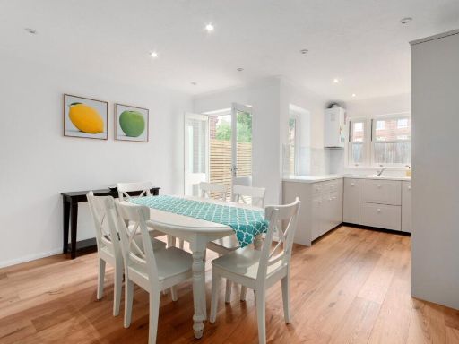 3 bedroom terraced house for sale in Waldeck Road, Chiswick, London, W4 — £950,000 • 3 bed • 2 bath • 1074 ft²
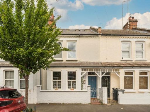 4 bedroom terraced house for sale in Oxford Gardens, Chiswick, W4 — £1,175,000 • 4 bed • 3 bath • 1597 ft²
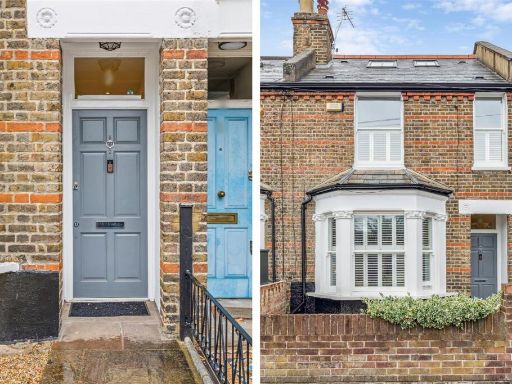 3 bedroom terraced house for sale in Hearne Road, London, W4 — £1,195,000 • 3 bed • 2 bath • 1433 ft²
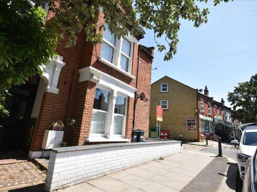 2 bedroom maisonette for sale in Thames Road, Chiswick, Chiswick, W4 — £640,000 • 2 bed • 2 bath • 947 ft²
Meta
- {
"@context": "https://schema.org",
"@type": "Residence",
"name": "3 bedroom terraced house for sale in Waldeck Road, London,…",
"description": "",
"url": "https://propertypiper.co.uk/property/43df1e82-52d7-4742-8088-6e1fe50b4c82",
"image": "https://image-a.propertypiper.co.uk/d457757a-a87a-4a4f-a62e-fbcfdfc46038-1024.jpeg",
"address": {
"@type": "PostalAddress",
"streetAddress": "22 WALDECK ROAD LONDON ",
"postalCode": "W4 3NP",
"addressLocality": "Hounslow",
"addressRegion": "Brentford and Isleworth",
"addressCountry": "England"
},
"geo": {
"@type": "GeoCoordinates",
"latitude": 51.48827998511104,
"longitude": -0.2840857279739488
},
"numberOfRooms": 3,
"numberOfBathroomsTotal": 1,
"floorSize": {
"@type": "QuantitativeValue",
"value": 1050,
"unitCode": "FTK"
},
"offers": {
"@type": "Offer",
"price": 925000,
"priceCurrency": "GBP",
"availability": "https://schema.org/InStock"
},
"additionalProperty": [
{
"@type": "PropertyValue",
"name": "Feature",
"value": "Victorian"
},
{
"@type": "PropertyValue",
"name": "Feature",
"value": "terraced house"
},
{
"@type": "PropertyValue",
"name": "Feature",
"value": "brick facade"
},
{
"@type": "PropertyValue",
"name": "Feature",
"value": "bay window"
},
{
"@type": "PropertyValue",
"name": "Feature",
"value": "period features"
},
{
"@type": "PropertyValue",
"name": "Feature",
"value": "front garden"
},
{
"@type": "PropertyValue",
"name": "Feature",
"value": "urban property"
},
{
"@type": "PropertyValue",
"name": "Feature",
"value": "character"
},
{
"@type": "PropertyValue",
"name": "Feature",
"value": "contemporary"
},
{
"@type": "PropertyValue",
"name": "Feature",
"value": "living room"
},
{
"@type": "PropertyValue",
"name": "Feature",
"value": "standard ceiling"
},
{
"@type": "PropertyValue",
"name": "Feature",
"value": "medium-sized room"
},
{
"@type": "PropertyValue",
"name": "Feature",
"value": "fireplace"
},
{
"@type": "PropertyValue",
"name": "Feature",
"value": "decorative mantle"
},
{
"@type": "PropertyValue",
"name": "Feature",
"value": "wood flooring"
},
{
"@type": "PropertyValue",
"name": "Feature",
"value": "neutral colors"
},
{
"@type": "PropertyValue",
"name": "Feature",
"value": "natural light"
}
]
}
High Res Floorplan Images
Compatible Floorplan Images
FloorplanImages Thumbnail