SW12 8HR - 4 bedroom terraced house for sale in Sarsfeld Road, London,…
View on Property Piper
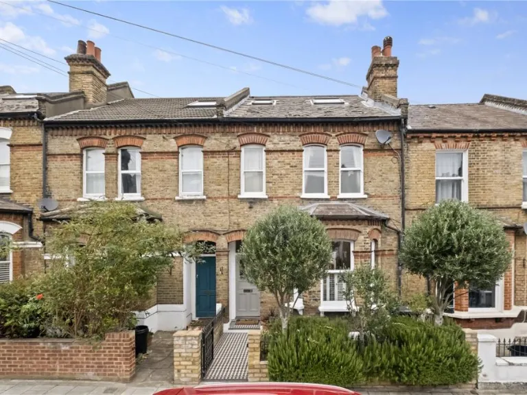
4 bedroom terraced house for sale in Sarsfeld Road, London, SW12
Property Details
- Price: £1825000
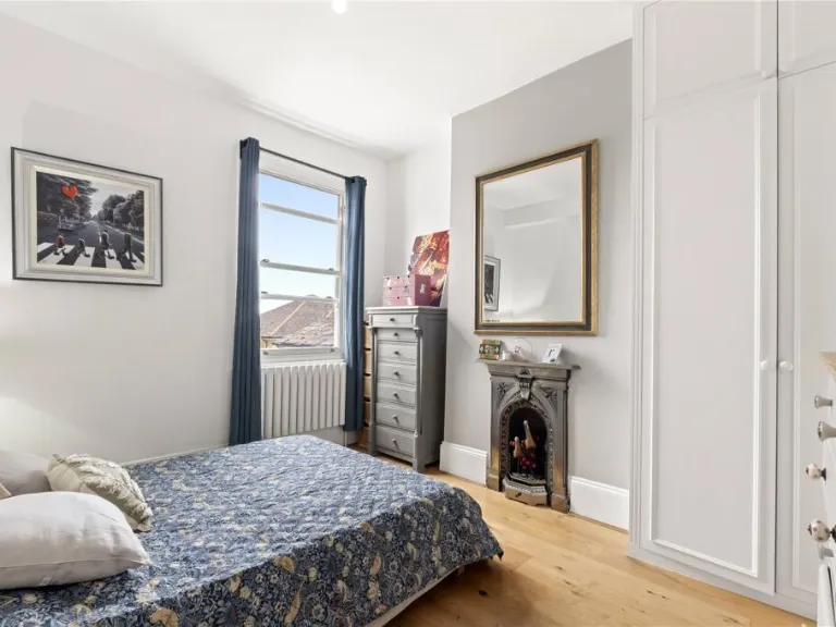
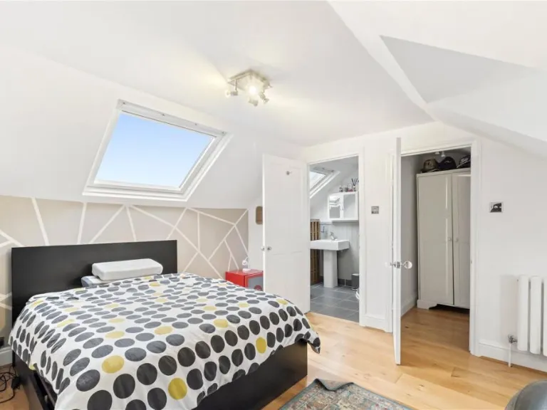
- Bedrooms: 4
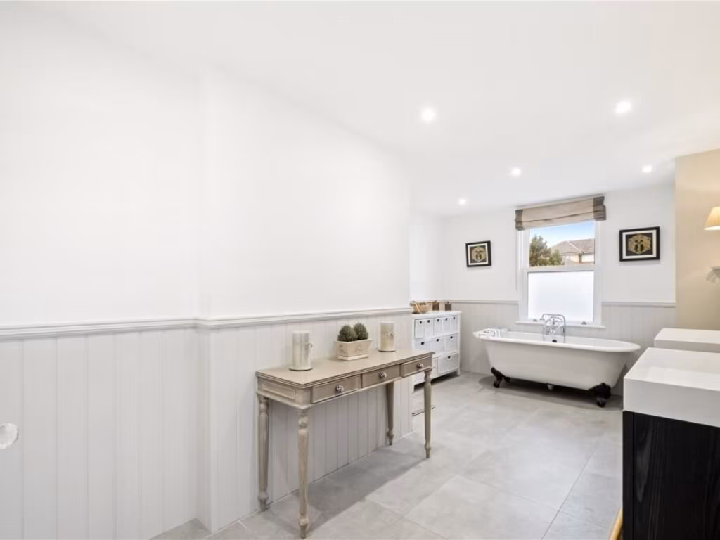
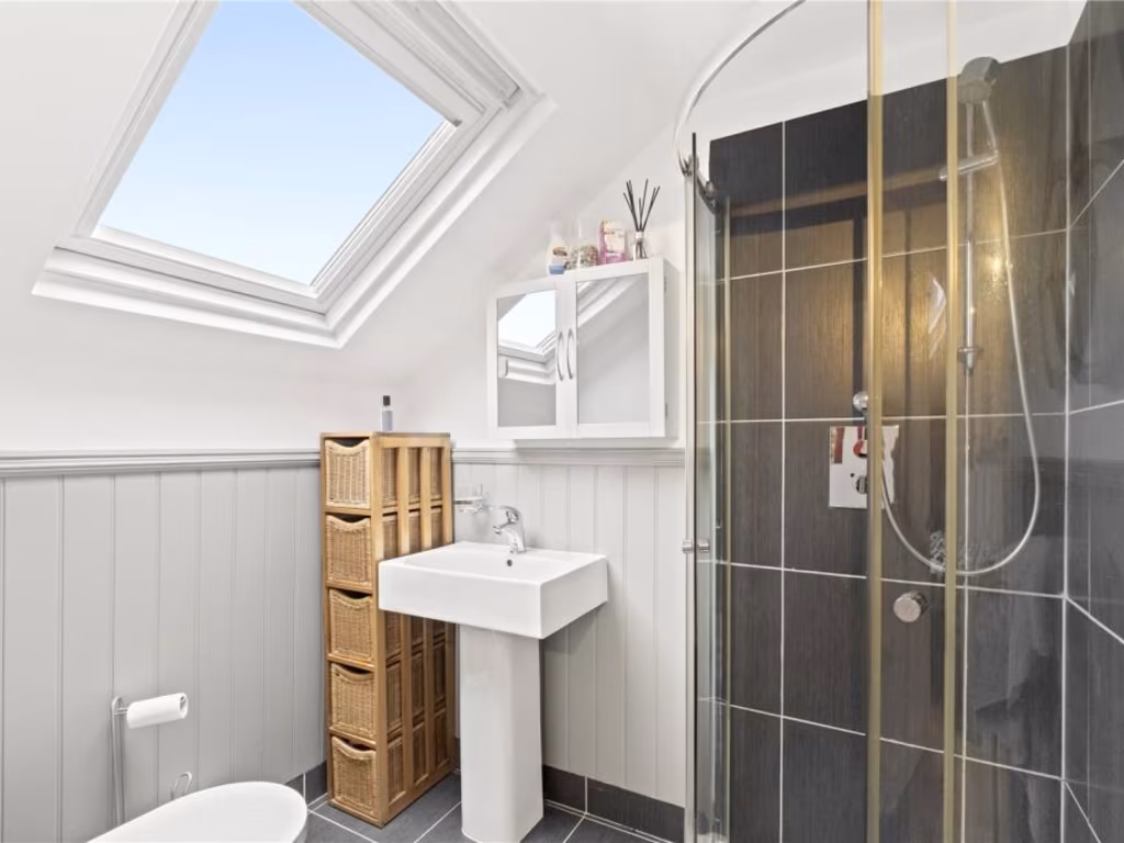
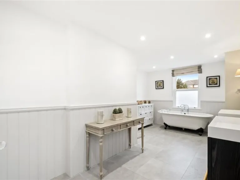
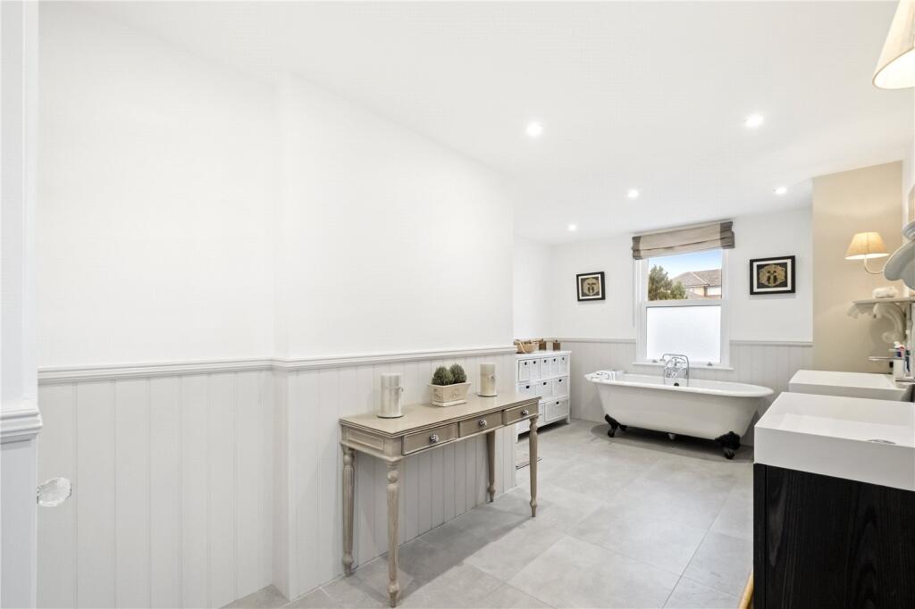
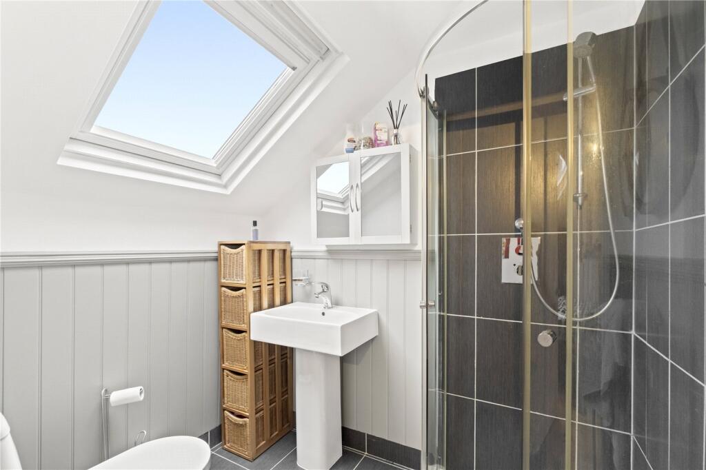
- Bathrooms: 3
- Property Type: undefined
- Property SubType: undefined
Image Descriptions
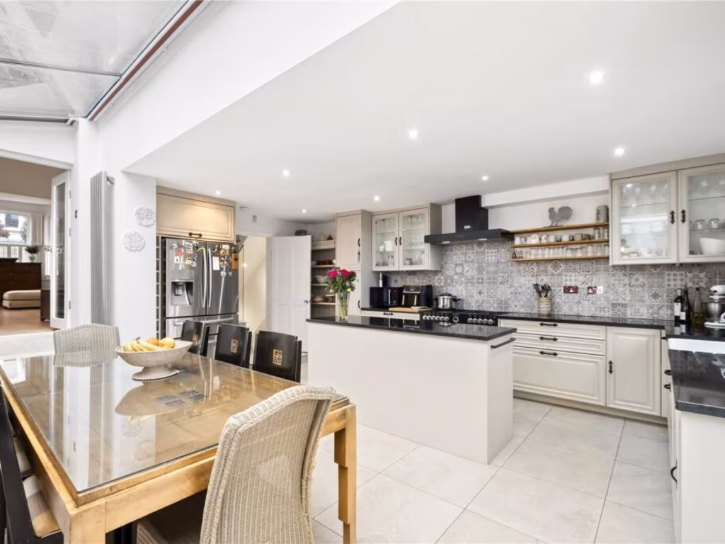
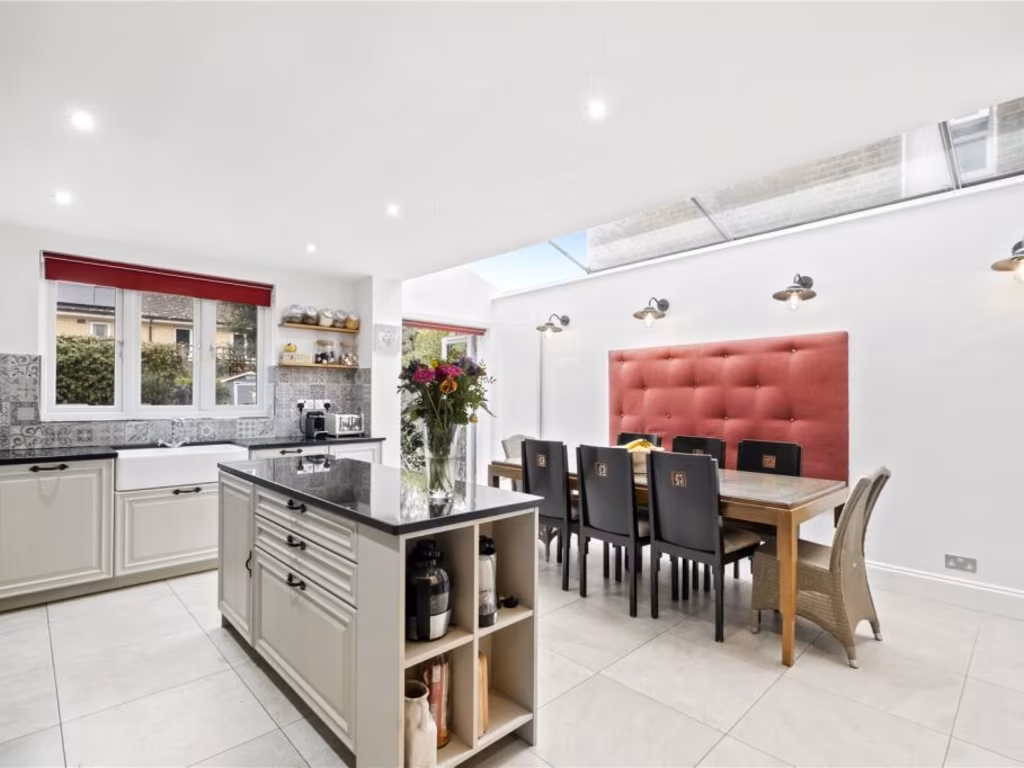
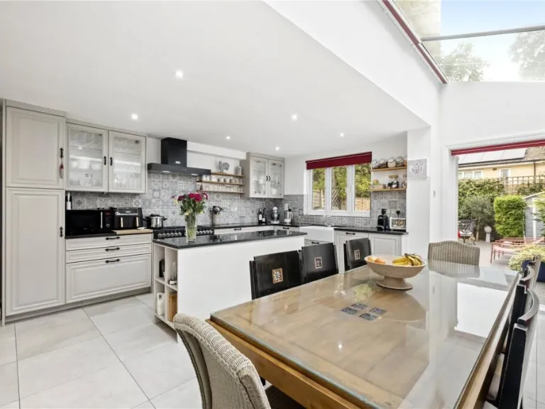
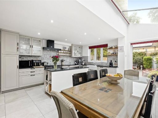
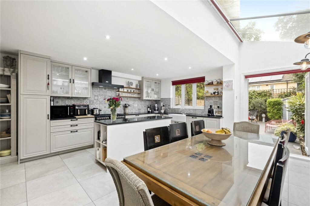
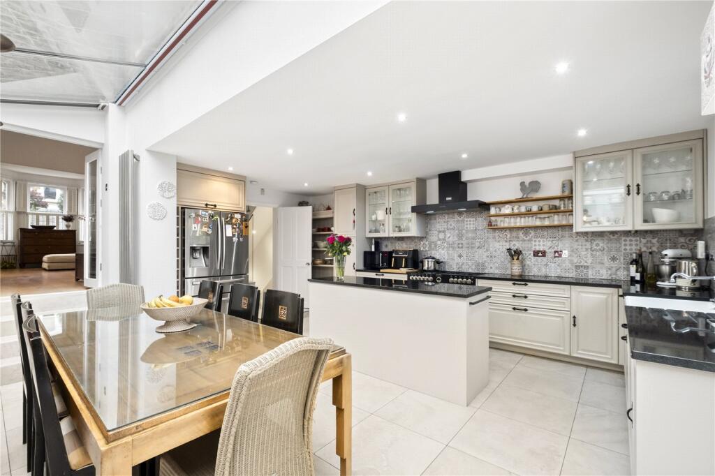
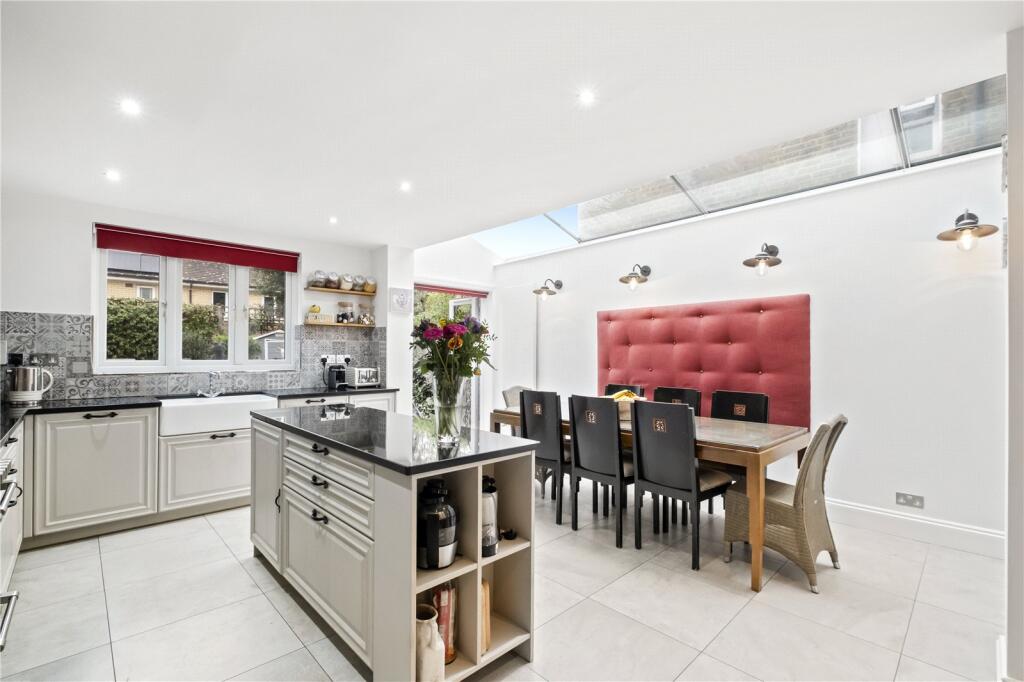
- kitchen modern
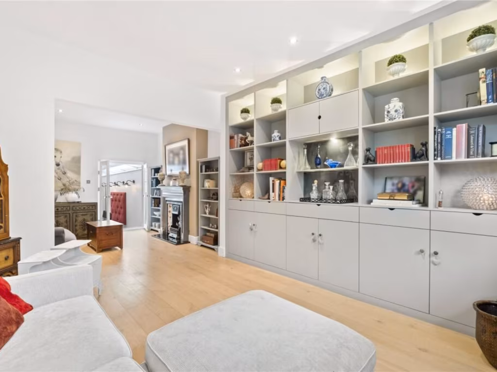
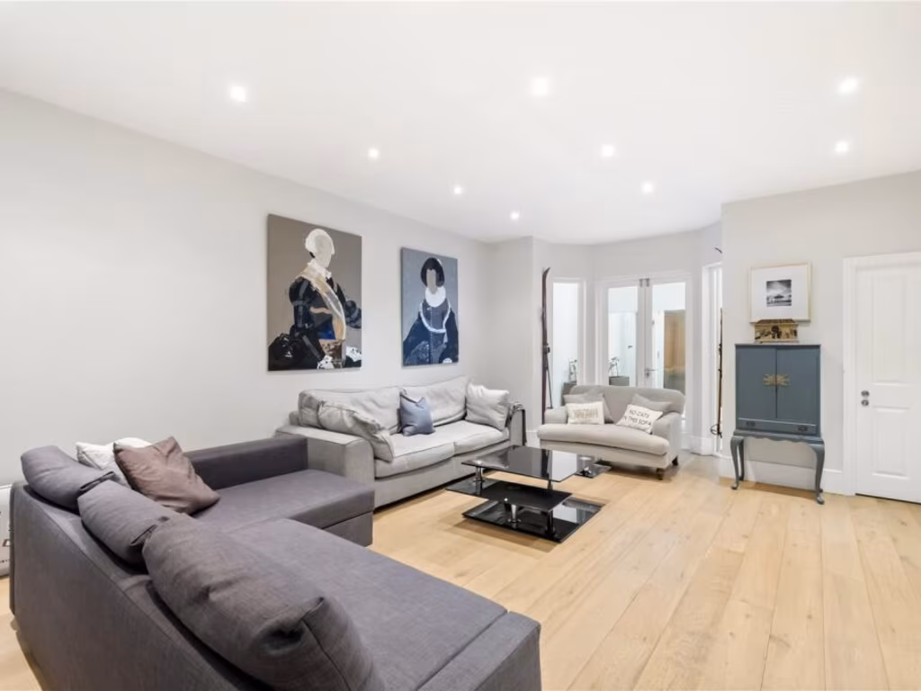
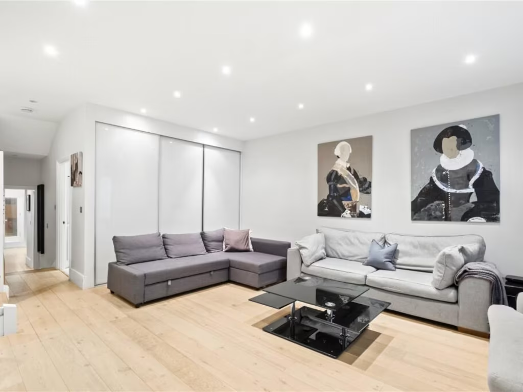
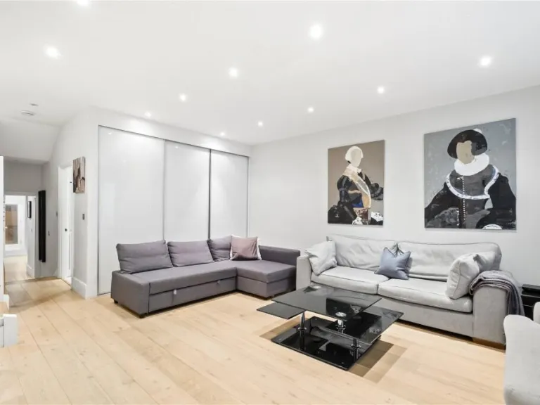
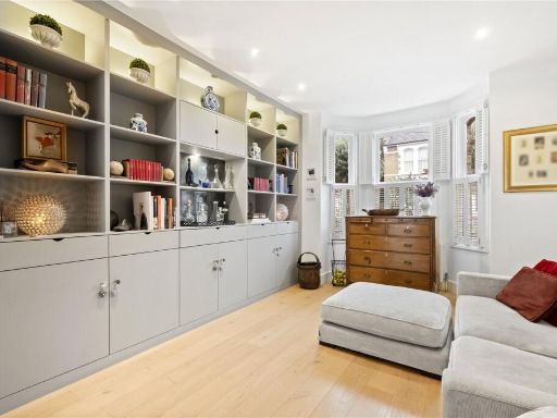
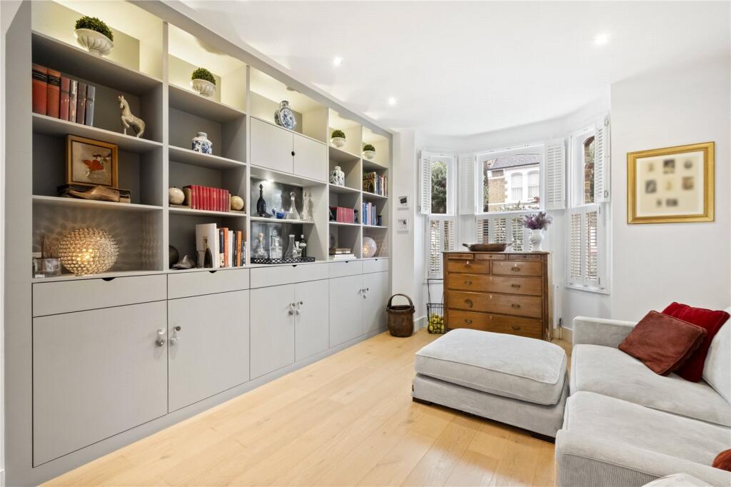
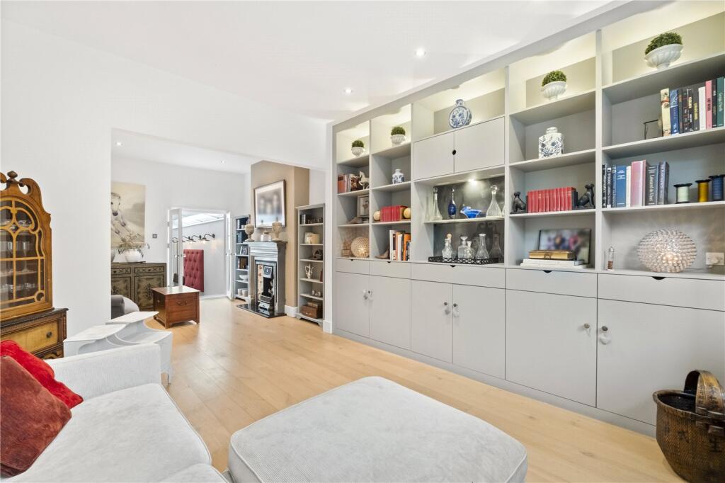
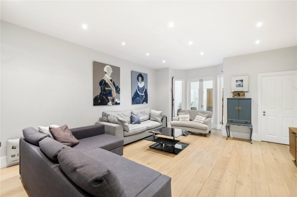
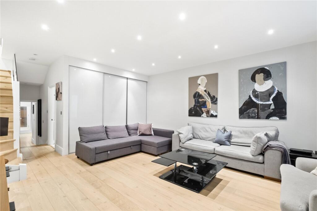
- living room modern
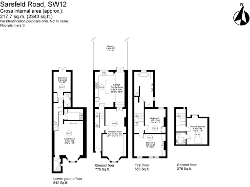
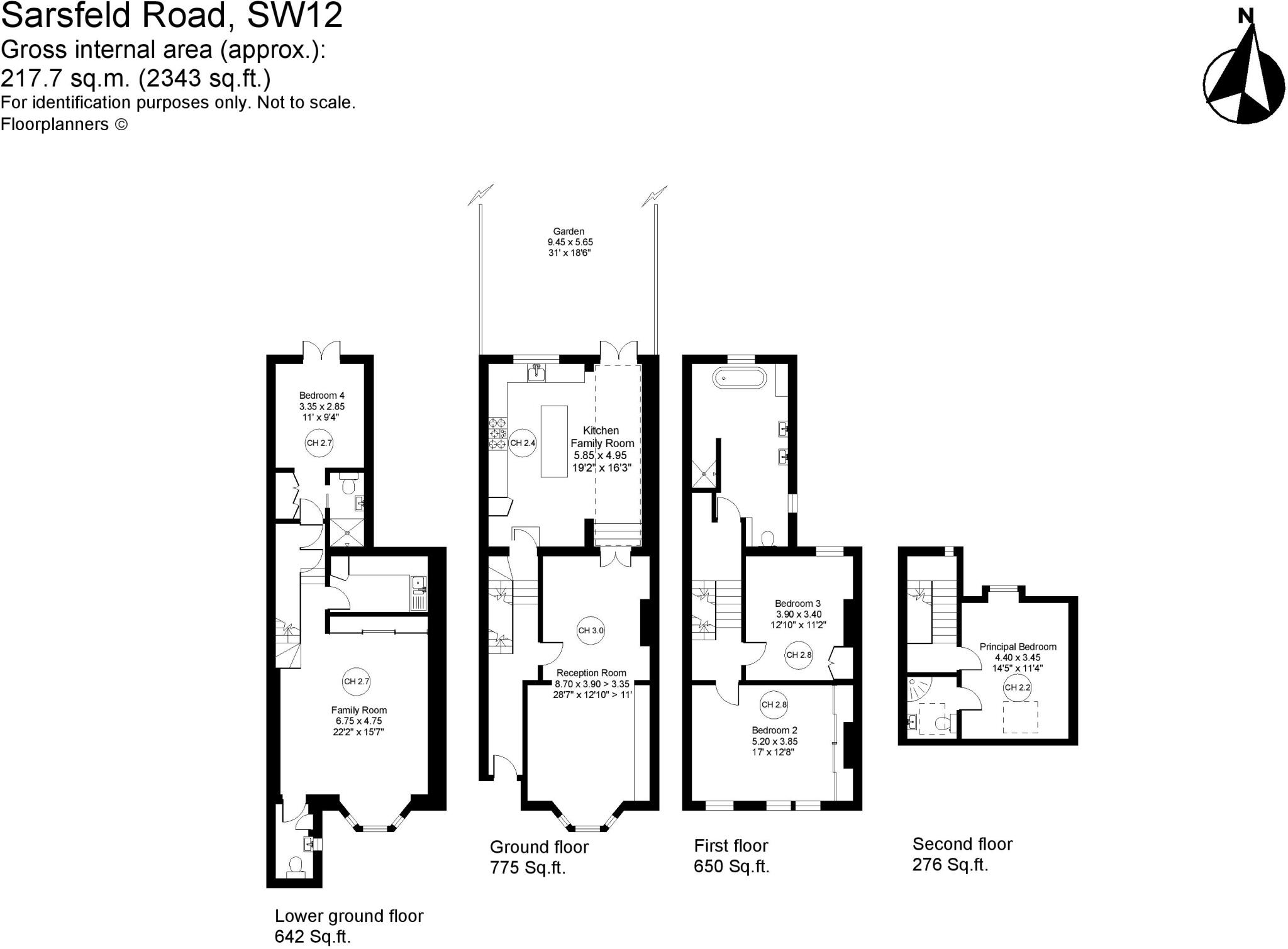
Floorplan Description
- Four-storey residential property with reception, kitchen/family area and four bedrooms
Rooms
- Family Room:
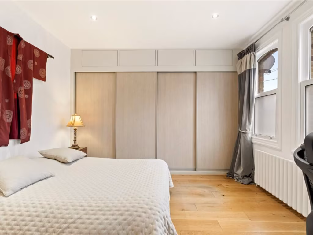
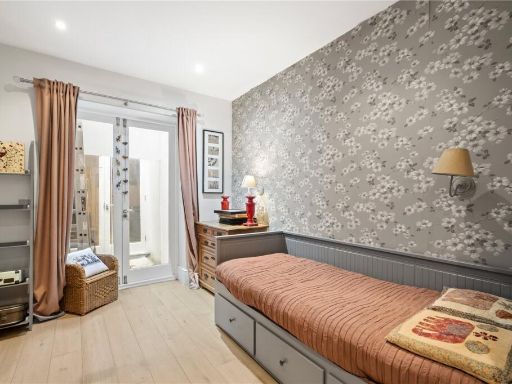
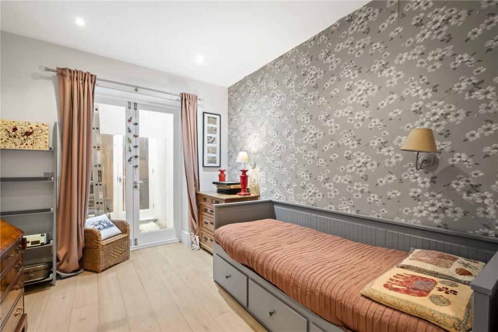
- Bedroom 4:
- Reception Room:
- Kitchen Family Room:
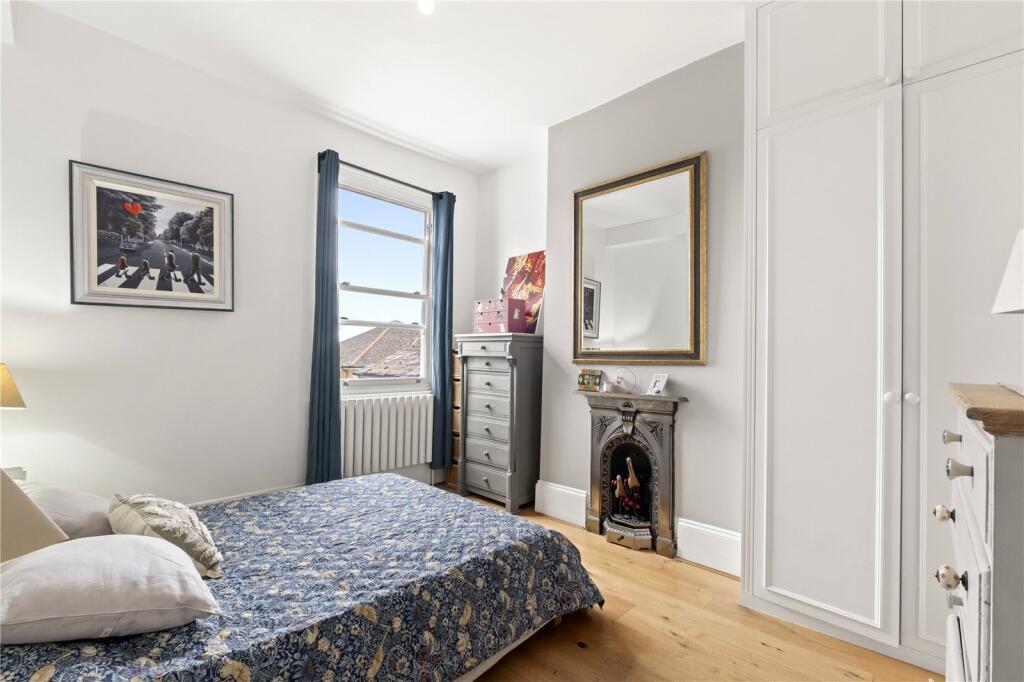
- Bedroom 2:
- Bedroom 3:
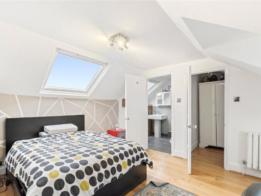
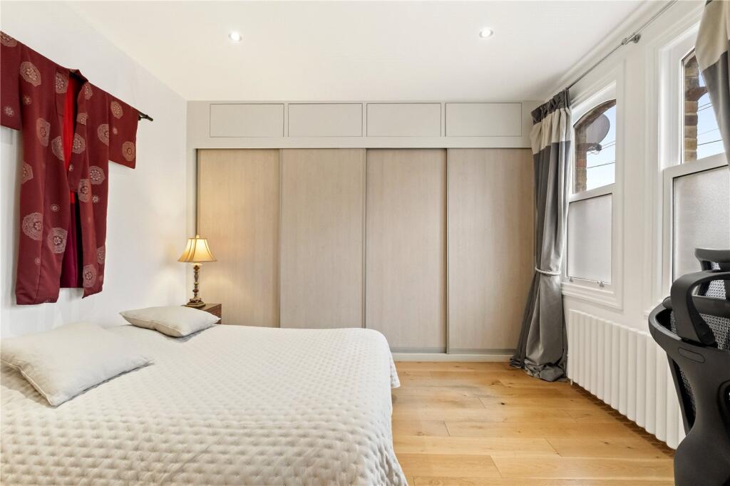
- Principal Bedroom:
- Bedroom 3 (lower ground?):
Textual Property Features
Detected Visual Features
- modern kitchen
- open plan
- tile backsplash
- kitchen island
- bright
- spacious
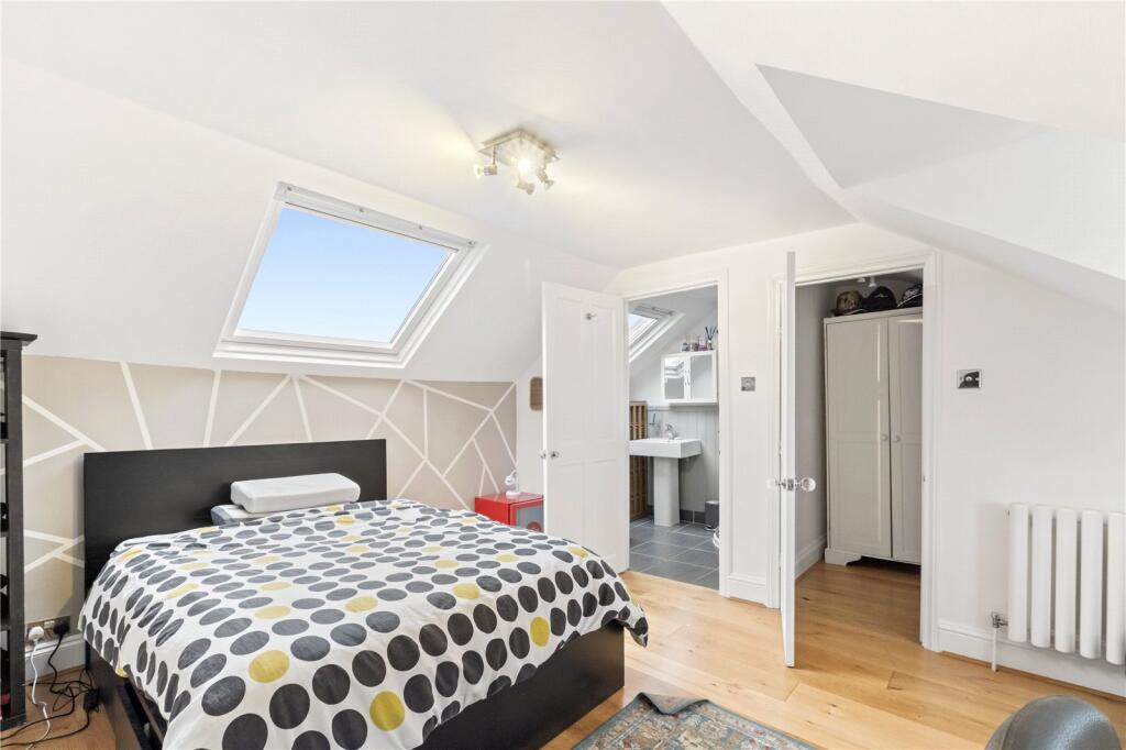
- skylight
- well-maintained
- modern design
- bay window
- built-in shelves
- wood flooring
- neutral color scheme
- plantation shutters
- natural light
EPC Details
- Fully double glazed
- Solid brick, as built, no insulation (assumed)
- Boiler and radiators, mains gas
- Low energy lighting in 59% of fixed outlets
- Suspended, no insulation (assumed)
Nearby Schools
- Al Risalah Secondary School
- Alderbrook Primary School
- Broomwood Hall School
- Northcote Lodge School
- Ark Bolingbroke Academy
- St Boniface RC Primary School
- Franciscan Primary School
- Ernest Bevin Academy
- Rutherford House School
- Belleville Primary School
- Tooting Primary School
- Hillbrook School
- Fircroft Primary School
- Trinity St Mary's CofE Primary School
- Thomas's Clapham
- Gatton (VA) Primary School
- Al Risalah Boys' School
- St Anselm's Catholic Primary School
- Eveline Day School
- Finton House School
- Ravenstone Primary School
- Chestnut Grove Academy
- Hornsby House School
- Holy Ghost Catholic Primary School
- Honeywell Junior School
- Honeywell Infant School
Nearest Bars And Restaurants
- Id: 385484284
- Tags:
- Amenity: restaurant
- Name: Dexter's
- TagsNormalized:
- Lat: 51.4448562
- Lon: -0.1668006
- FullGeoHash: gcpusjq81222
- PartitionGeoHash: gcpu
- Images:
- FoodStandards: null
- Distance: 432.6
,- Id: 385484286
- Tags:
- Addr:
- Housenumber: 35
- Postcode: SW17 7EF
- Street: Bellevue Road
- Amenity: restaurant
- Fhrs:
- Name: Brinkley's Kitchen
- Source:
- TagsNormalized:
- Lat: 51.4438433
- Lon: -0.1678004
- FullGeoHash: gcpusjjf1gqy
- PartitionGeoHash: gcpu
- Images:
- FoodStandards: null
- Distance: 404.3
,- Id: 9046184017
- Tags:
- Amenity: restaurant
- Name: Gazette
- TagsNormalized:
- Lat: 51.4435906
- Lon: -0.1676027
- FullGeoHash: gcpusjjbws67
- PartitionGeoHash: gcpu
- Images:
- FoodStandards: null
- Distance: 377.3
,- Id: 10233198715
- Tags:
- Addr:
- Housenumber: 206
- Postcode: SW17 7HP
- Street: Trinity Road
- Amenity: restaurant
- Check_date: 2023-01-21
- Cuisine: moroccan
- Currency:
- Name: L’Atelier Restaurant
- Note: L'Atelier is a local restaurant based near to Wandsworth Common in London. We are a Moroccan restaurant which has a unique Belgium twist to it. We have more than 30-years of experience and serve a fantastic range of dishes. Booking essential.
- Opening_hours: Mo-Sa 09:00-21:00; Su 09:00-15:00
- Payment:
- Lightning: yes
- Lightning_contactless: yes
- Onchain: yes
- Phone: +44 20 8682 1183
- Survey:
- Website: https://www.latelierrestaurant.co.uk/
- TagsNormalized:
- Lat: 51.4430327
- Lon: -0.167031
- FullGeoHash: gcpushym7uke
- PartitionGeoHash: gcpu
- Images:
- FoodStandards: null
- Distance: 312.1
,- Id: 187284060
- Tags:
- Addr:
- Housenumber: 198-200
- Postcode: SW17 7HR
- Street: Trinity Road
- Amenity: restaurant
- Cuisine: italian
- Fhrs:
- Name: Pizza Express
- Source:
- TagsNormalized:
- Lat: 51.4427534
- Lon: -0.1667732
- FullGeoHash: gcpushyecbkc
- PartitionGeoHash: gcpu
- Images:
- FoodStandards: null
- Distance: 282.7
}
Nearest General Shops
- Id: 4382767706
- Tags:
- Name: Balham Barnets
- Shop: hairdresser
- TagsNormalized:
- Lat: 51.4405239
- Lon: -0.1555849
- FullGeoHash: gcpuskqwy8em
- PartitionGeoHash: gcpu
- Images:
- FoodStandards: null
- Distance: 533.2
,- Id: 8623394439
- Tags:
- Name: Nilkanrai
- Shop: newsagent
- TagsNormalized:
- Lat: 51.4370843
- Lon: -0.162087
- FullGeoHash: gcpus7cfxp7p
- PartitionGeoHash: gcpu
- Images:
- FoodStandards: null
- Distance: 524.1
,- Id: 385484294
- Tags:
- Name: L'Amandrine
- Shop: bakery
- TagsNormalized:
- Lat: 51.4457703
- Lon: -0.1659241
- FullGeoHash: gcpusjrjmdwj
- PartitionGeoHash: gcpu
- Images:
- FoodStandards: null
- Distance: 489.1
}
Nearest Grocery shops
- Id: 385484296
- Tags:
- Addr:
- Housenumber: 12
- Postcode: SW17 7EG
- Street: Bellevue Road
- Name: Rasons Local
- Shop: convenience
- TagsNormalized:
- Lat: 51.4455233
- Lon: -0.1661012
- FullGeoHash: gcpusjr5cs9u
- PartitionGeoHash: gcpu
- Images:
- FoodStandards: null
- Distance: 469.7
,- Id: 316835886
- Tags:
- Addr:
- Housenumber: 27-29
- Postcode: SW17 7EF
- Street: Bellevue Road
- Alt_name: Sainsbury's Wandsworth Common Local
- Brand:
- Building: yes
- Name: Sainsbury's Local
- Opening_hours: 07:00-23:00
- Operator: Sainsbury's
- Shop: convenience
- TagsNormalized:
- sainsburys
- sainsburys local
- convenience
- shop
- Lat: 51.4441922
- Lon: -0.1673452
- FullGeoHash: gcpusjnhhs6r
- PartitionGeoHash: gcpu
- Images:
- FoodStandards: null
- Distance: 403.8
,- Id: 187280740
- Tags:
- Name: Manvika Food & Wine
- Shop: convenience
- TagsNormalized:
- Lat: 51.4429674
- Lon: -0.1669513
- FullGeoHash: gcpushymjb0j
- PartitionGeoHash: gcpu
- Images:
- FoodStandards: null
- Distance: 303.9
}
Nearest Supermarkets
- Id: 95856853
- Tags:
- Addr:
- City: London
- Housenumber: 147-151
- Postcode: SW12 9AU
- Street: Balham High Road
- Alt_name: Sainsbury's Balham Superstore
- Brand: Sainsbury's
- Brand:wikidata: Q152096
- Brand:wikipedia: en:Sainsbury's
- Building: yes
- Fhrs:
- Name: Sainsbury's
- Opening_hours: Mo-Sa 07:00-23:00; Su 11:00-17:00
- Shop: supermarket
- Wheelchair: yes
- TagsNormalized:
- sainsburys
- supermarket
- shop
- Lat: 51.4439357
- Lon: -0.1513961
- FullGeoHash: gcpust1f8hwv
- PartitionGeoHash: gcpu
- Images:
- FoodStandards: null
- Distance: 840.9
,- Id: 310822359
- Tags:
- Addr:
- City: London
- Housenumber: 163
- Street: Balham High Road
- Brand: ALDI
- Brand:wikidata: Q41171672
- Brand:wikipedia: en:Aldi
- Building: yes
- Contact:
- Website: https://stores.aldi.co.uk/london/163-165-balham-high-road
- Name: Aldi
- Name:fa: آلدی
- Operator: Aldi
- Shop: supermarket
- Wheelchair: yes
- TagsNormalized:
- Lat: 51.443539
- Lon: -0.1521296
- FullGeoHash: gcpust10r4ez
- PartitionGeoHash: gcpu
- Images:
- FoodStandards: null
- Distance: 780
,- Id: 3230191330
- Tags:
- Addr:
- Country: GB
- Housenumber: 279-291
- Postcode: SW17 7BA
- Street: Balham High Road
- Alt_name: LIDL Balham
- Brand: Lidl
- Brand:wikidata: Q151954
- Fhrs:
- Name: Lidl
- Shop: supermarket
- TagsNormalized:
- Lat: 51.4363025
- Lon: -0.1581264
- FullGeoHash: gcpus7sy5msr
- PartitionGeoHash: gcpu
- Images:
- FoodStandards: null
- Distance: 695.3
}
Nearest Religious buildings
- Id: 881249704
- Tags:
- Amenity: place_of_worship
- Building: church
- Denomination: anglican
- Name: St Mary Magdalene
- Religion: christian
- Wikidata: Q26670533
- TagsNormalized:
- place of worship
- church
- anglican
- christian
- Lat: 51.4433311
- Lon: -0.1669399
- FullGeoHash: gcpushyrn5bx
- PartitionGeoHash: gcpu
- Images:
- FoodStandards: null
- Distance: 323.1
,- Id: 169130189
- Tags:
- Amenity: place_of_worship
- Denomination: evangelical
- Evangelical: FIEC
- Name: Trinity Road Chapel
- Religion: christian
- TagsNormalized:
- place of worship
- evangelical
- chapel
- christian
- church
- Lat: 51.4422933
- Lon: -0.1667646
- FullGeoHash: gcpushy944e2
- PartitionGeoHash: gcpu
- Images:
- FoodStandards: null
- Distance: 266.4
,- Id: 9445532784
- Tags:
- Amenity: place_of_worship
- Denomination: anglican
- Name: St. Jude's Balham
- Religion: christian
- TagsNormalized:
- place of worship
- anglican
- christian
- church
- Lat: 51.4424277
- Lon: -0.1599782
- FullGeoHash: gcpuskg9b5xd
- PartitionGeoHash: gcpu
- Images:
- FoodStandards: null
- Distance: 223.2
}
Nearest Medical buildings
- Id: 4391390089
- Tags:
- Amenity: dentist
- Healthcare: dentist
- Name: Balham Dental Care
- Name:en: Balham Dental Care
- TagsNormalized:
- dentist
- health
- healthcare
- dental
- Lat: 51.4440508
- Lon: -0.1534037
- FullGeoHash: gcpust0736ju
- PartitionGeoHash: gcpu
- Images:
- FoodStandards: null
- Distance: 713.2
,- Id: 291674458
- Tags:
- Addr:
- Housenumber: 256
- Postcode: SW17 7AW
- Street: Balham High Road
- Amenity: pharmacy
- Name: Day Lewis
- Website: https://www.daylewis.co.uk/pharmacyFinder.php
- TagsNormalized:
- Lat: 51.440189
- Lon: -0.1558068
- FullGeoHash: gcpuskqsc6np
- PartitionGeoHash: gcpu
- Images:
- FoodStandards: null
- Distance: 529.4
,- Id: 26596785
- Tags:
- Amenity: doctors
- Building: yes
- Name: Balham Park Surgery
- Wheelchair: yes
- TagsNormalized:
- Lat: 51.4406944
- Lon: -0.1558769
- FullGeoHash: gcpuskqrzb3y
- PartitionGeoHash: gcpu
- Images:
- FoodStandards: null
- Distance: 508.9
,- Id: 385484292
- Tags:
- Addr:
- Housenumber: 13
- Postcode: SW17 7EG
- Street: Bellevue Road
- Amenity: pharmacy
- Fhrs:
- Name: Bellevue Pharmacy
- Source:
- TagsNormalized:
- Lat: 51.4454644
- Lon: -0.1661515
- FullGeoHash: gcpusjr583sk
- PartitionGeoHash: gcpu
- Images:
- FoodStandards: null
- Distance: 465.5
}
Nearest Airports
- Id: 260720166
- Tags:
- Aerodrome: international
- Aeroway: aerodrome
- Alt_name: Gatwick Airport
- Ele: 62
- Iata: LGW
- Icao: EGKK
- Internet_access: wlan
- Internet_access:fee: no
- Internet_access:ssid: Gatwick FREE Wi-Fi
- Name: London Gatwick Airport
- Operator: Gatwick Airport Limited
- Ref: LGW
- Website: https://www.gatwickairport.com/
- Wikidata: Q8703
- Wikipedia: en:Gatwick Airport
- TagsNormalized:
- airport
- international airport
- Lat: 51.1540917
- Lon: -0.1883773
- FullGeoHash: gcpg58qf4mzd
- PartitionGeoHash: gcpg
- Images:
- FoodStandards: null
- Distance: 32036
,- Id: 121158889
- Tags:
- Aerodrome: continental
- Aeroway: aerodrome
- Fhrs:
- Authority: City of London Corporation
- Iata: LCY
- Icao: EGLC
- Name: London City Airport
- Operator: London City Airport Limited
- Ref: LCY
- Website: https://www.londoncityairport.com/
- Wikidata: Q8982
- Wikipedia: en:London City Airport
- TagsNormalized:
- airport
- continental airport
- Lat: 51.5042658
- Lon: 0.0539987
- FullGeoHash: u10j10p64702
- PartitionGeoHash: u10j
- Images:
- FoodStandards: null
- Distance: 16559.8
,- Id: 14001268
- Tags:
- Access: yes
- Aerodrome: international
- Aerodrome:type: public
- Aeroway: aerodrome
- Alt_name: London Heathrow
- Alt_name_2: London Heathrow Airport
- Ele: 25
- Iata: LHR
- Icao: EGLL
- Int_name: Heathrow Airport
- Name: London Heathrow Airport
- Note: area still approx
- Old_name: London Airport
- Operator: Heathrow Airport Limited
- Rank_aci:
- Ref: LHR
- Short_name: Heathrow
- Type: multipolygon
- Website: https://www.heathrow.com/
- Wikidata: Q8691
- Wikipedia: en:Heathrow Airport
- TagsNormalized:
- airport
- international airport
- Lat: 51.4677522
- Lon: -0.4547736
- FullGeoHash: gcpsv9kv7h2h
- PartitionGeoHash: gcps
- Images:
- FoodStandards: null
- Distance: 20421.1
}
Nearest Leisure Facilities
- Id: 838518189
- Tags:
- TagsNormalized:
- Lat: 51.4442255
- Lon: -0.1552497
- FullGeoHash: gcpusmnuq6tq
- PartitionGeoHash: gcpu
- Images:
- FoodStandards: null
- Distance: 604
,- Id: 380821779
- Tags:
- Building: yes
- Leisure: sports_centre
- Name: Heathfield Bowls Club
- TagsNormalized:
- sports
- sports centre
- leisure
- bowls
- club
- Lat: 51.4437006
- Lon: -0.1711469
- FullGeoHash: gcpusj537bze
- PartitionGeoHash: gcpu
- Images:
- FoodStandards: null
- Distance: 603.3
,- Id: 838518188
- Tags:
- TagsNormalized:
- Lat: 51.4442713
- Lon: -0.1554881
- FullGeoHash: gcpusmnu8g5x
- PartitionGeoHash: gcpu
- Images:
- FoodStandards: null
- Distance: 591.7
,- Id: 305154781
- Tags:
- TagsNormalized:
- Lat: 51.4445961
- Lon: -0.1567915
- FullGeoHash: gcpusmjy6rzc
- PartitionGeoHash: gcpu
- Images:
- FoodStandards: null
- Distance: 534.3
,- Id: 360288571
- Tags:
- Access: yes
- Leisure: playground
- Name: Upper Tooting Park Play Space
- TagsNormalized:
- Lat: 51.4394451
- Lon: -0.1587897
- FullGeoHash: gcpuskk27ztf
- PartitionGeoHash: gcpu
- Images:
- FoodStandards: null
- Distance: 390.1
}
Nearest Tourist attractions
- Id: 3693422673
- Tags:
- Access: destination
- Source: gps+mapnoter
- Tourism: picnic_site
- TagsNormalized:
- Lat: 51.4352954
- Lon: -0.1449637
- FullGeoHash: gcpusew2q450
- PartitionGeoHash: gcpu
- Images:
- FoodStandards: null
- Distance: 1443.2
,- Id: 7380885685
- Tags:
- Name: Liberty Mews
- Tourism: apartment
- TagsNormalized:
- Lat: 51.4511813
- Lon: -0.1487673
- FullGeoHash: gcpusw7sv7r5
- PartitionGeoHash: gcpu
- Images:
- FoodStandards: null
- Distance: 1439.5
,- Id: 8779699675
- Tags:
- Name: London Sewing Machine Museum
- Tourism: museum
- Website: https://www.craftysewer.com/acatalog/London_Sewing_Machine_Museum.html
- Wikidata: Q113370163
- TagsNormalized:
- Lat: 51.4365561
- Lon: -0.1587095
- FullGeoHash: gcpus7srtv18
- PartitionGeoHash: gcpu
- Images:
- FoodStandards: null
- Distance: 651.3
}
Nearest Hotels
- Id: 4374453088
- Tags:
- Name: Gateway Hotel
- Tourism: hotel
- Wheelchair: yes
- TagsNormalized:
- Lat: 51.4509716
- Lon: -0.1480326
- FullGeoHash: gcpuswk5ws6b
- PartitionGeoHash: gcpu
- Images:
- FoodStandards: null
- Distance: 1458.4
,- Id: 5680294721
- Tags:
- TagsNormalized:
- Lat: 51.4471511
- Lon: -0.1733916
- FullGeoHash: gcpusj9trsjf
- PartitionGeoHash: gcpu
- Images:
- FoodStandards: null
- Distance: 936
,- Id: 4314441174
- Tags:
- Addr:
- Housenumber: 177
- Postcode: SW12 9BW
- Street: Balham High Road
- Brand: Travelodge
- Brand:wikidata: Q9361374
- Brand:wikipedia: en:Travelodge UK
- Fhrs:
- Name: Travelodge
- Source:
- Toilets:
- Tourism: hotel
- Wheelchair: yes
- TagsNormalized:
- Lat: 51.4428417
- Lon: -0.1529261
- FullGeoHash: gcpussbsk8dp
- PartitionGeoHash: gcpu
- Images:
- FoodStandards: null
- Distance: 709.6
}
Tags
- modern kitchen
- open plan
- tile backsplash
- kitchen island
- bright
- spacious
- skylight
- well-maintained
- modern design
- bay window
- built-in shelves
- wood flooring
- neutral color scheme
- plantation shutters
- natural light
Local Market Stats
- Average Price/sqft: £825
- Avg Income: £83400
- Rental Yield: 4.2%
- Social Housing: 15%
- Planning Success Rate: 90%
AirBnB Data
- 1km average: £142/night
- Listings in 1km: 15
Similar Properties
 4 bedroom terraced house for sale in Swanage Road, London, SW18 — £1,500,000 • 4 bed • 2 bath • 1783 ft²
 4 bedroom semi-detached house for sale in Sarsfeld Road, London, SW12 — £1,895,000 • 4 bed • 3 bath • 2672 ft²
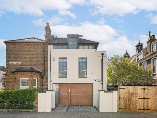 4 bedroom house for sale in Wiseton Road, Wandsworth, South West London, SW17, United Kingdom, SW17 — £2,750,000 • 4 bed • 4 bath • 3400 ft²
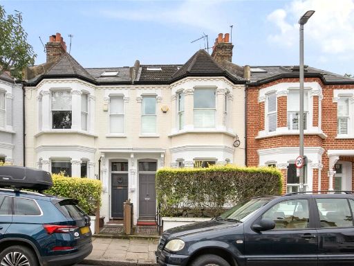 4 bedroom terraced house for sale in Cicada Road, London, SW18 — £1,295,000 • 4 bed • 2 bath • 1747 ft²
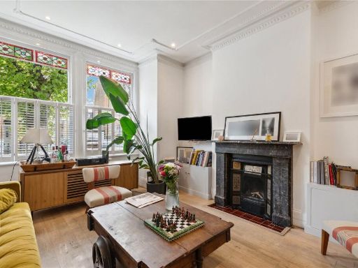 4 bedroom house for sale in Swanage Road, SW18 — £1,500,000 • 4 bed • 2 bath • 1756 ft²
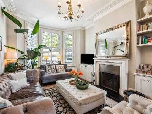 4 bedroom semi-detached house for sale in Heslop Road, London, SW12 — £1,975,000 • 4 bed • 2 bath • 2532 ft²
Meta
- {
"@context": "https://schema.org",
"@type": "Residence",
"name": "4 bedroom terraced house for sale in Sarsfeld Road, London,…",
"description": "",
"url": "https://propertypiper.co.uk/property/435ea5bc-e2d3-4610-807c-a8ce8b4cd4b8",
"image": "https://image-a.propertypiper.co.uk/61ecca51-3a80-444d-9cbb-6e787121ca7b-1024.jpeg",
"address": {
"@type": "PostalAddress",
"streetAddress": "17 SARSFELD ROAD LONDON",
"postalCode": "SW12 8HR",
"addressLocality": "Wandsworth",
"addressRegion": "Tooting",
"addressCountry": "England"
},
"geo": {
"@type": "GeoCoordinates",
"latitude": 51.44176197759148,
"longitude": -0.16301655699930215
},
"numberOfRooms": 4,
"numberOfBathroomsTotal": 3,
"floorSize": {
"@type": "QuantitativeValue",
"value": 2343,
"unitCode": "FTK"
},
"offers": {
"@type": "Offer",
"price": 1825000,
"priceCurrency": "GBP",
"availability": "https://schema.org/InStock"
},
"additionalProperty": [
{
"@type": "PropertyValue",
"name": "Feature",
"value": "modern kitchen"
},
{
"@type": "PropertyValue",
"name": "Feature",
"value": "open plan"
},
{
"@type": "PropertyValue",
"name": "Feature",
"value": "tile backsplash"
},
{
"@type": "PropertyValue",
"name": "Feature",
"value": "kitchen island"
},
{
"@type": "PropertyValue",
"name": "Feature",
"value": "bright"
},
{
"@type": "PropertyValue",
"name": "Feature",
"value": "spacious"
},
{
"@type": "PropertyValue",
"name": "Feature",
"value": "skylight"
},
{
"@type": "PropertyValue",
"name": "Feature",
"value": "well-maintained"
},
{
"@type": "PropertyValue",
"name": "Feature",
"value": "modern design"
},
{
"@type": "PropertyValue",
"name": "Feature",
"value": "bay window"
},
{
"@type": "PropertyValue",
"name": "Feature",
"value": "built-in shelves"
},
{
"@type": "PropertyValue",
"name": "Feature",
"value": "wood flooring"
},
{
"@type": "PropertyValue",
"name": "Feature",
"value": "neutral color scheme"
},
{
"@type": "PropertyValue",
"name": "Feature",
"value": "plantation shutters"
},
{
"@type": "PropertyValue",
"name": "Feature",
"value": "natural light"
}
]
}
High Res Floorplan Images
Compatible Floorplan Images
FloorplanImages Thumbnail