PE12 6BX - 3 bedroom link detached house for sale in Austendyke Road,…
View on Property Piper
3 bedroom link detached house for sale in Austendyke Road, Weston Hills, PE12
Property Details
- Price: £260000
- Bedrooms: 3
- Bathrooms: 2
- Property Type: undefined
- Property SubType: undefined
Brochure Descriptions
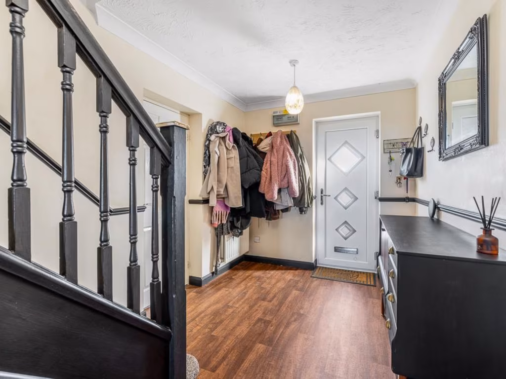
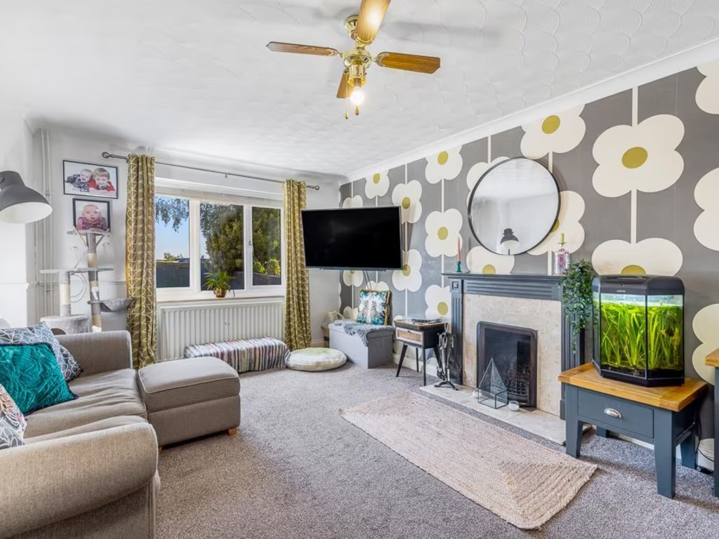
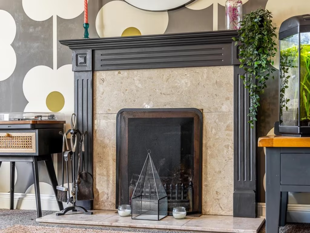
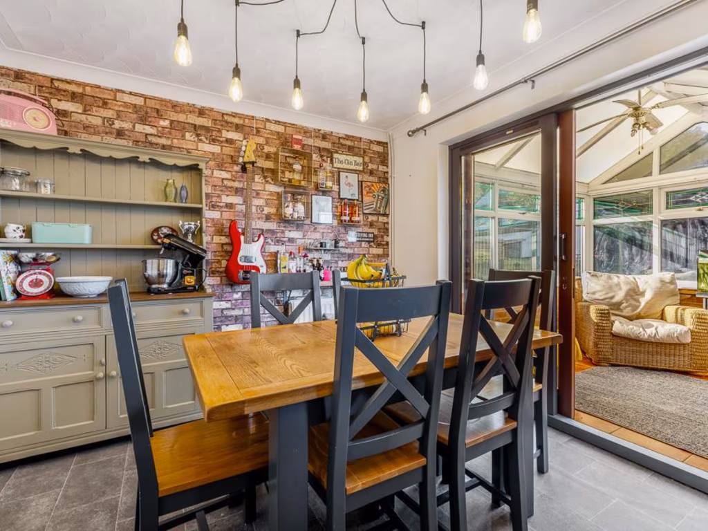
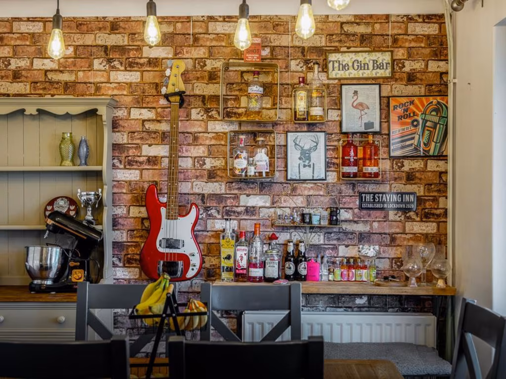
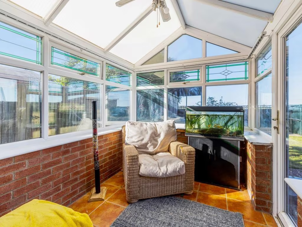
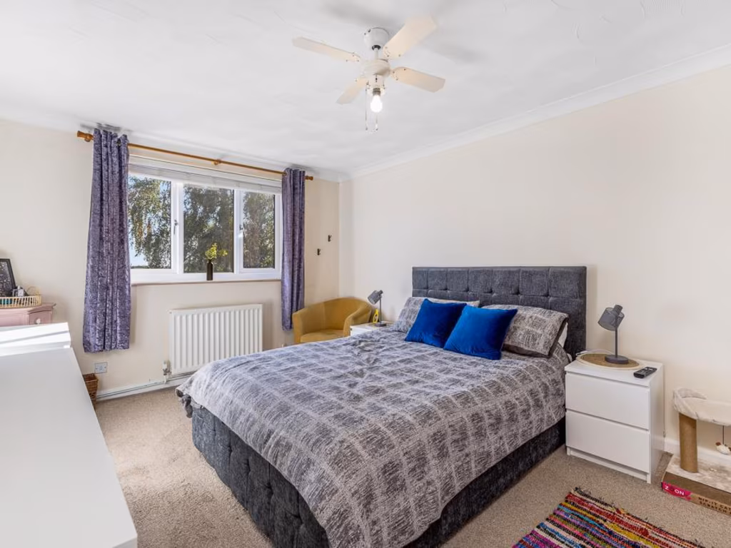
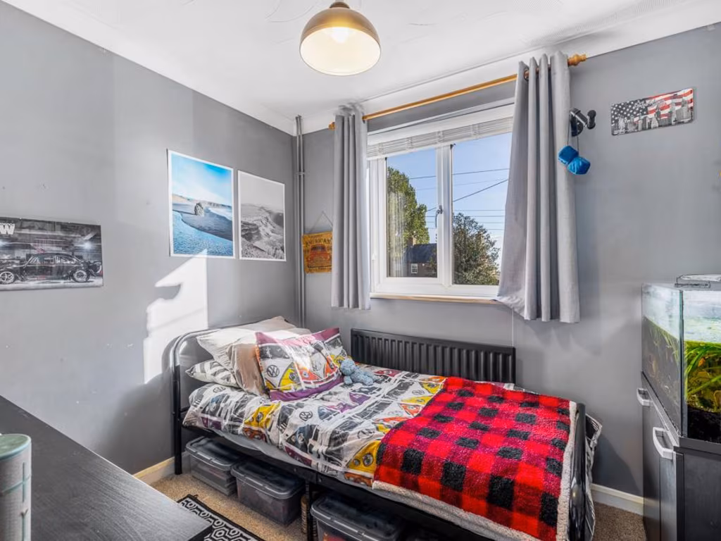
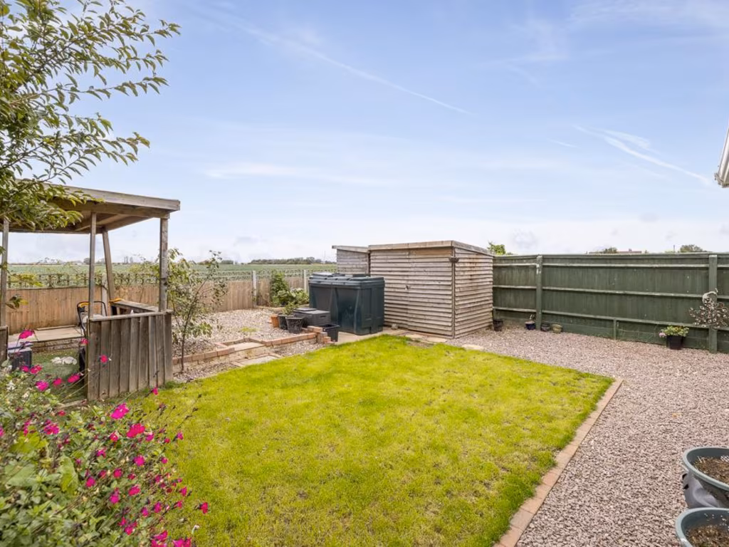
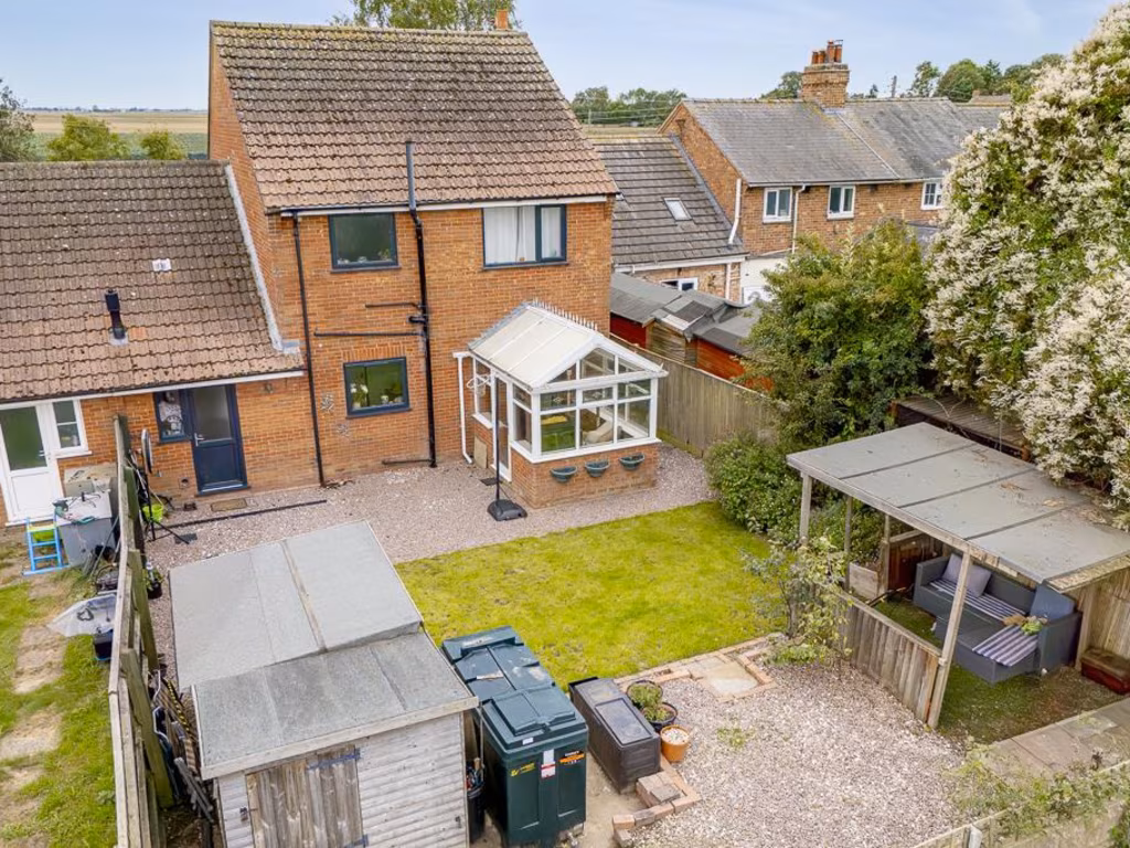
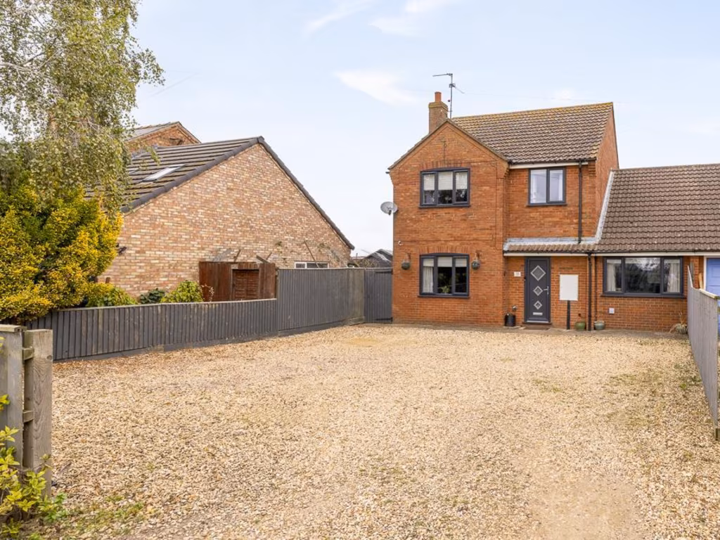
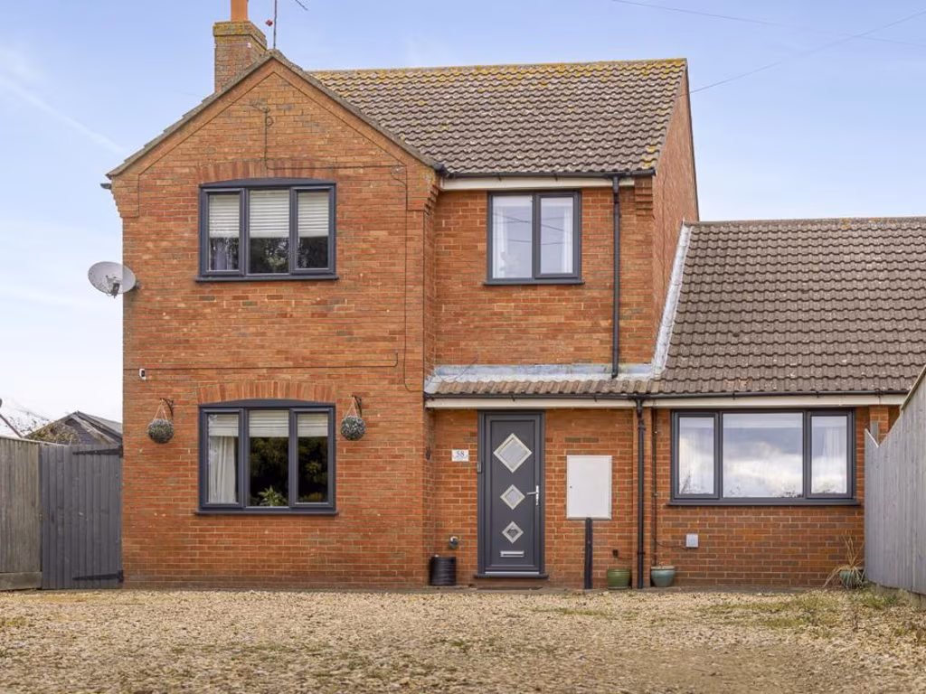
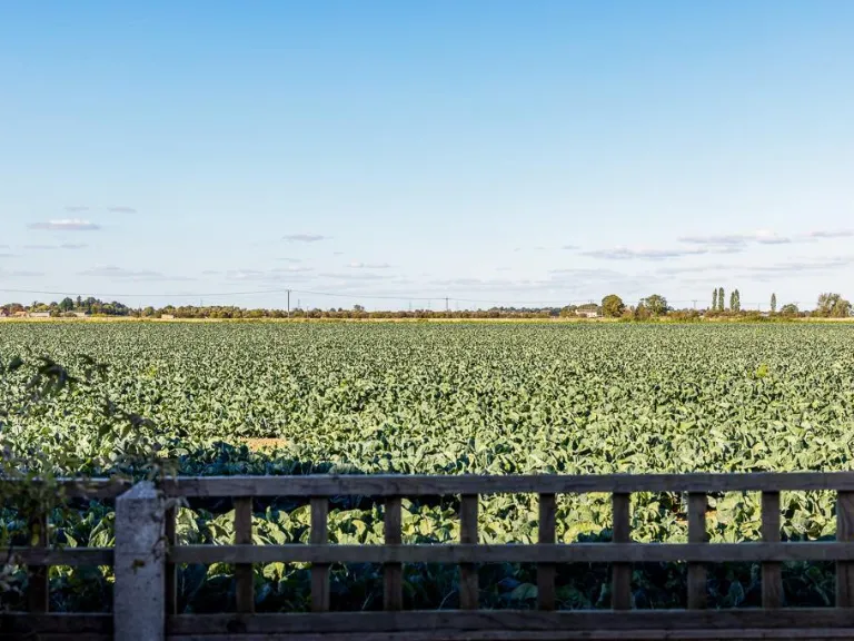
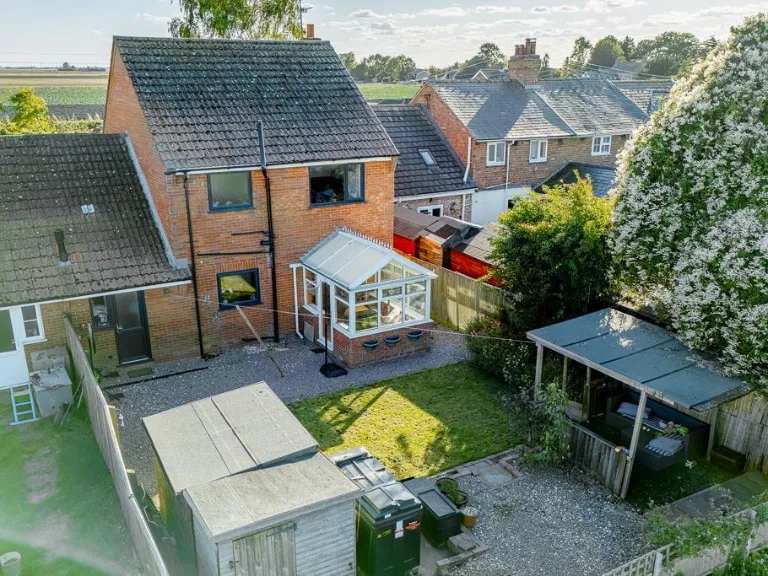
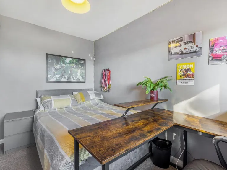
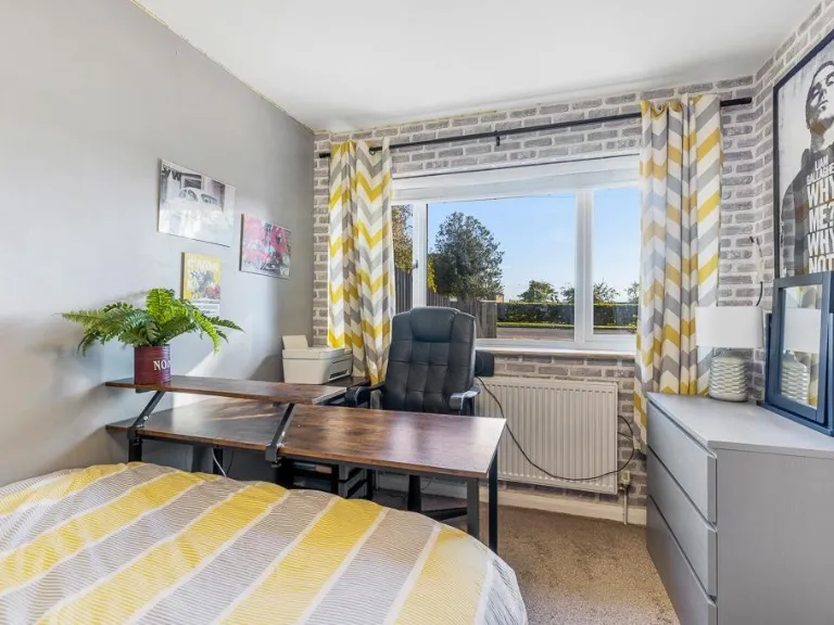
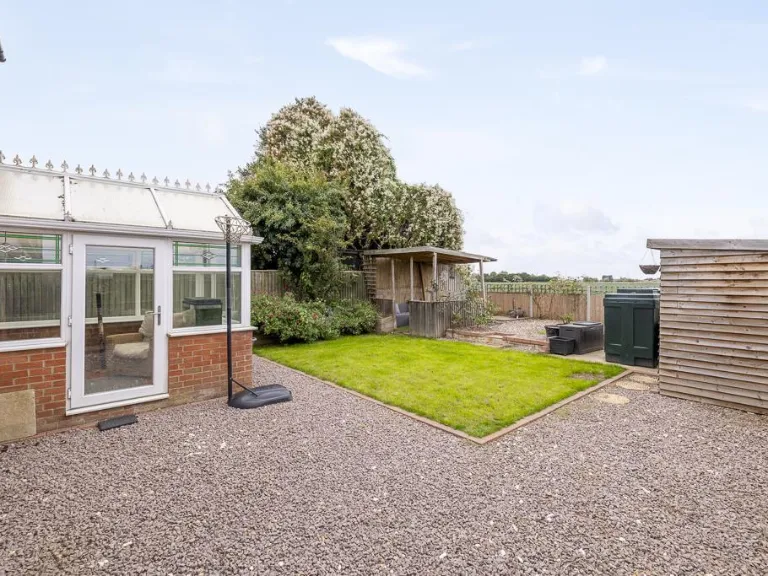
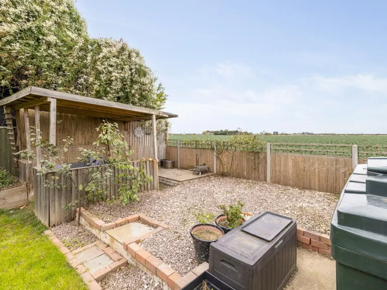
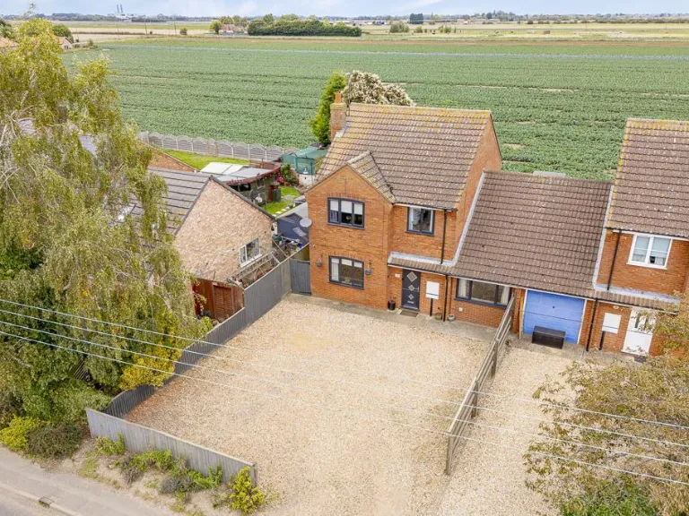
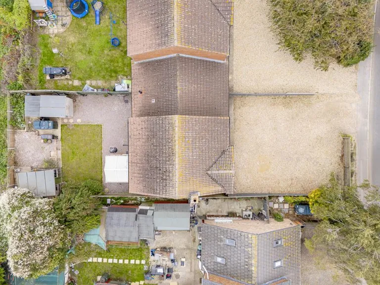
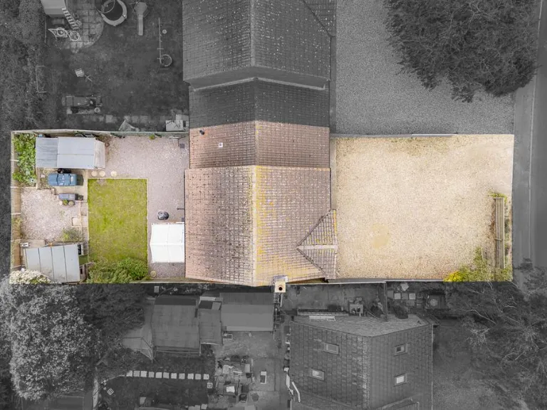
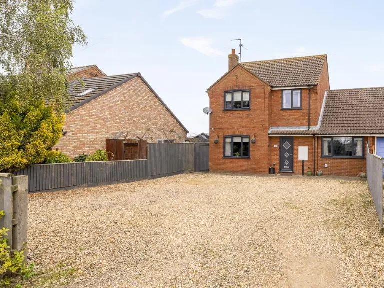
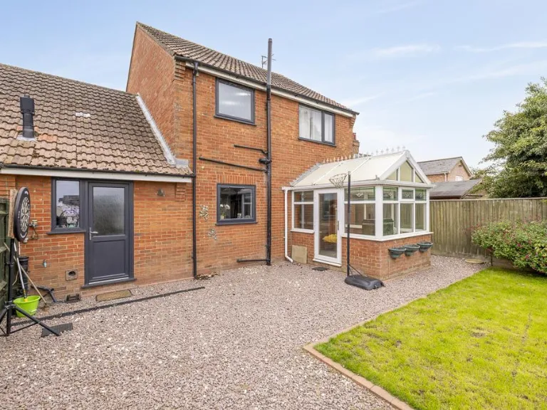
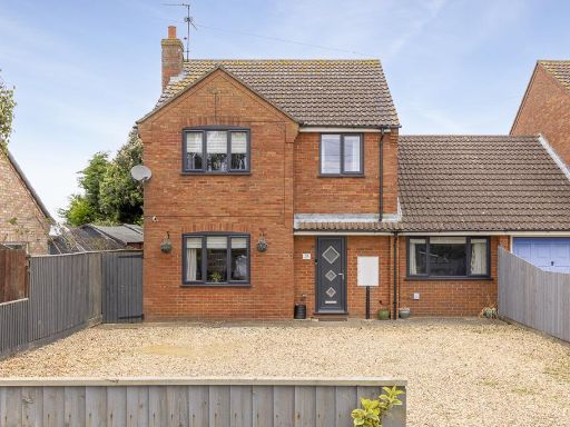
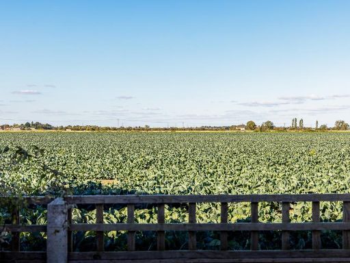
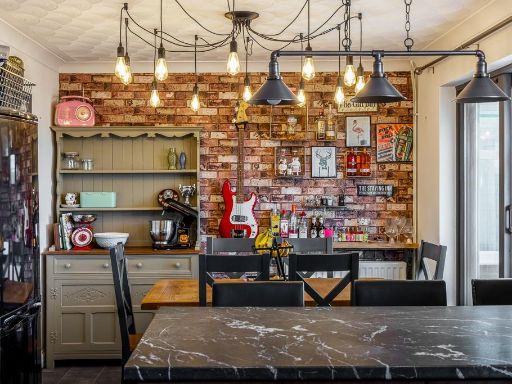
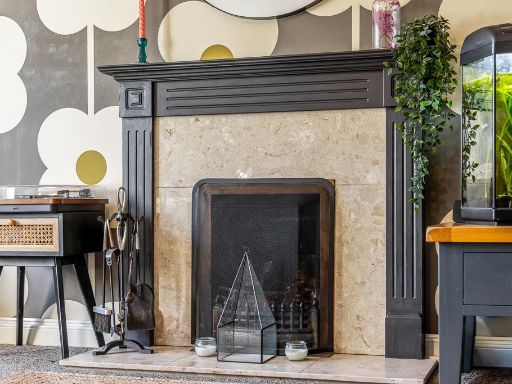
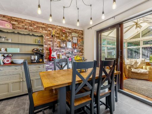
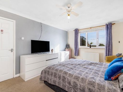
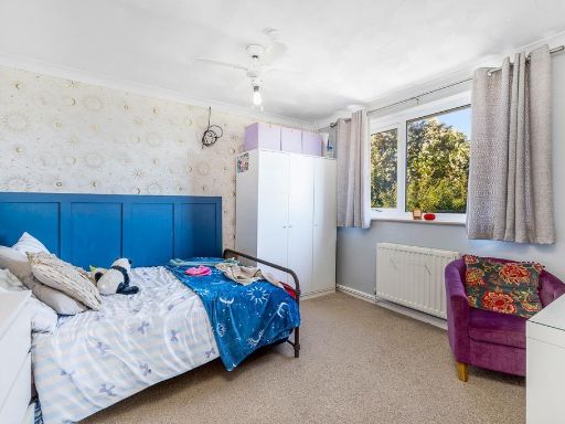
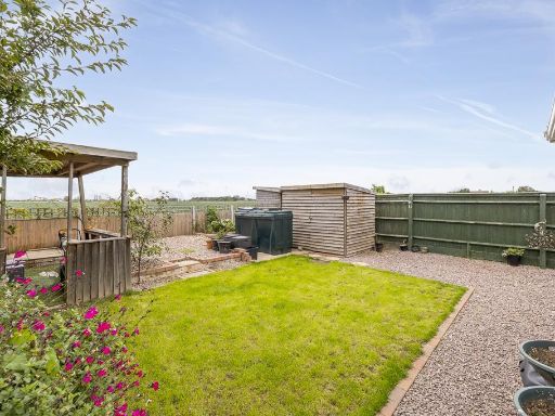
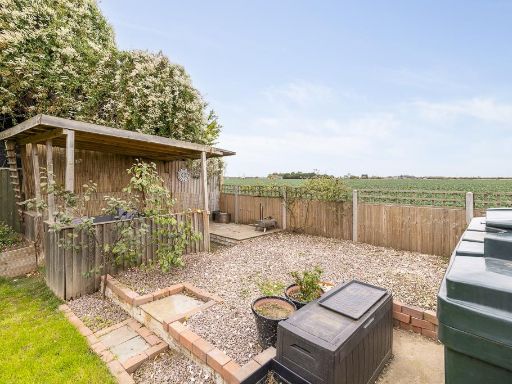
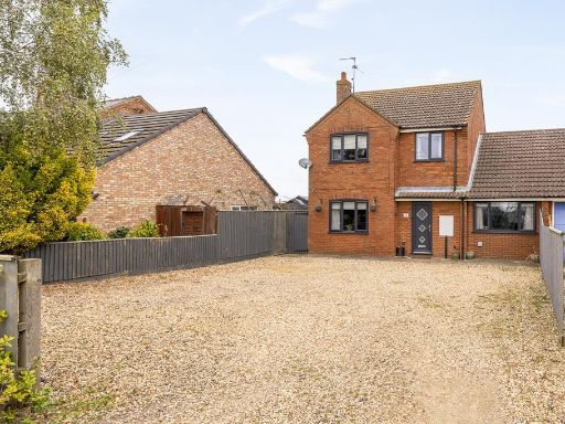
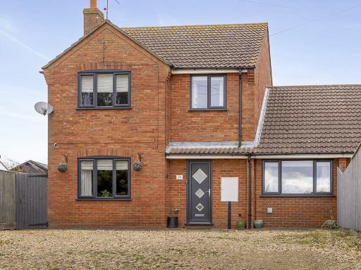
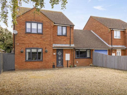
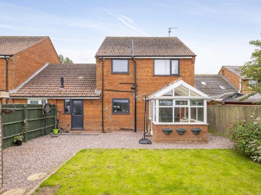
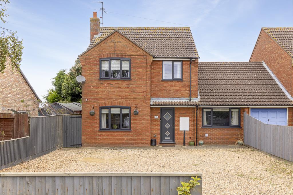
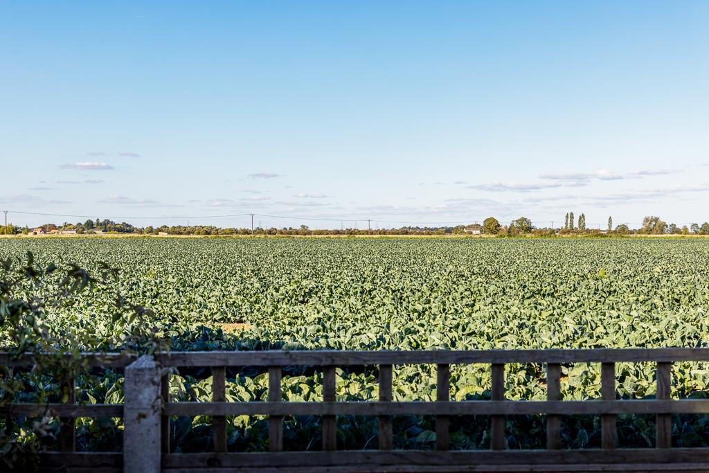
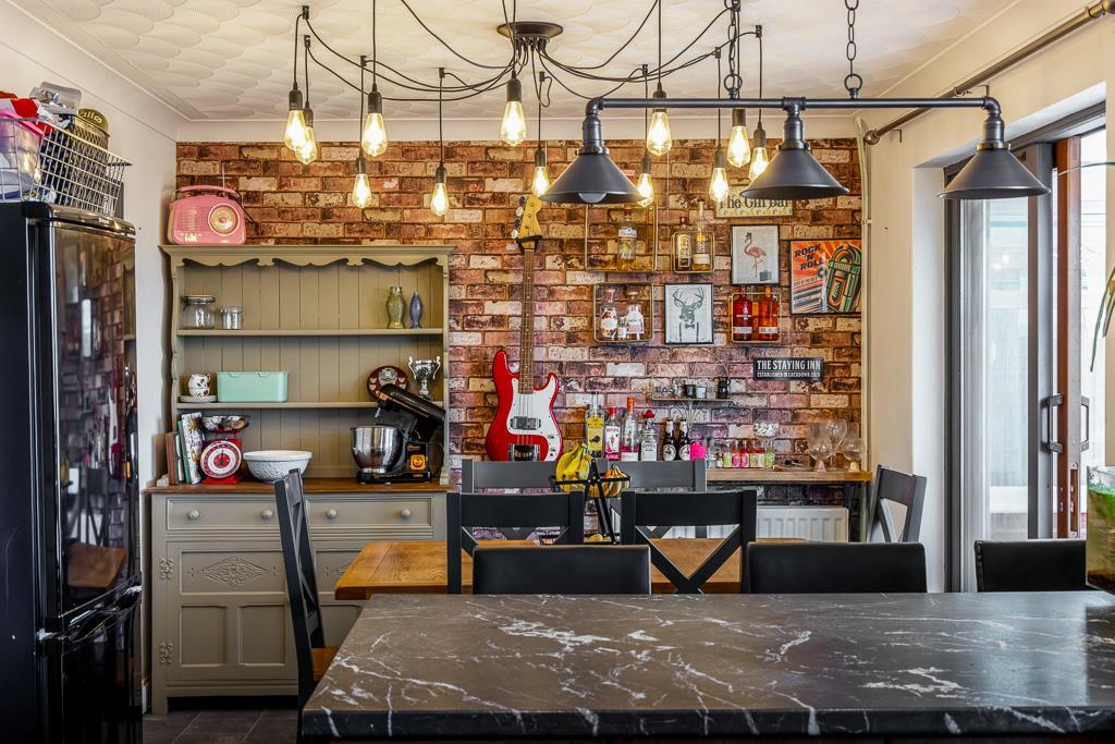
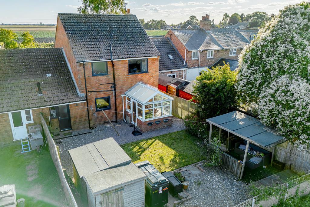
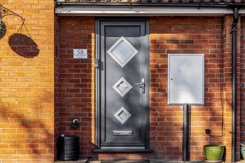
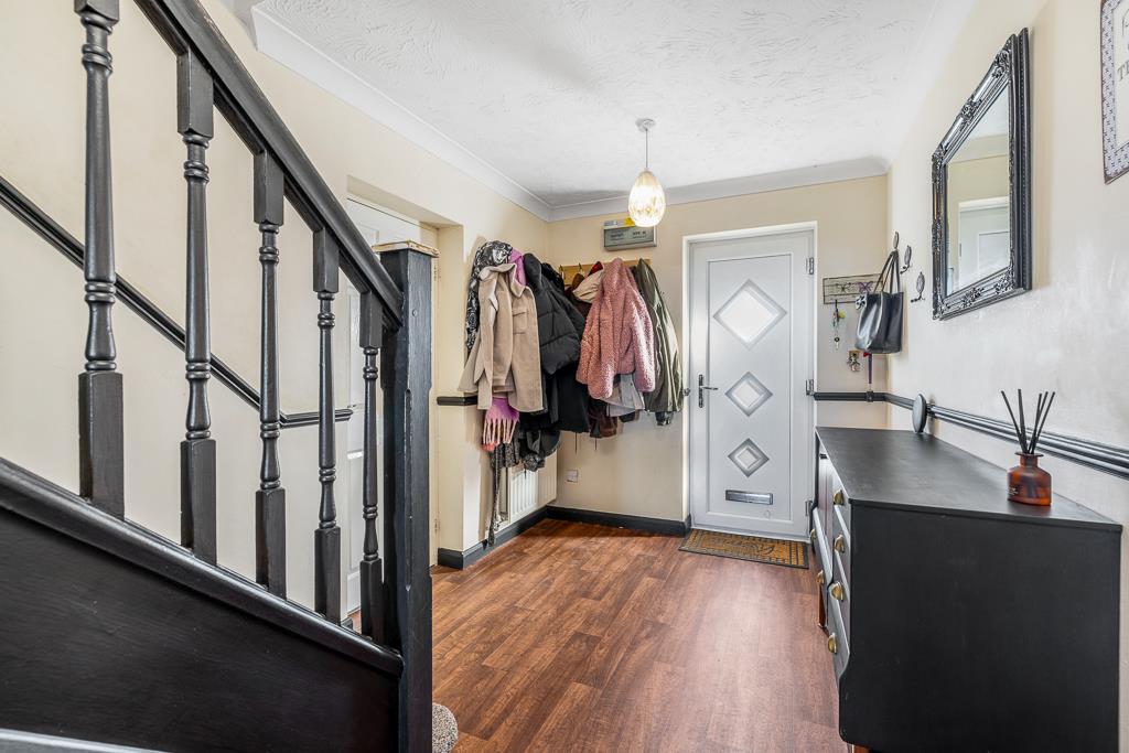
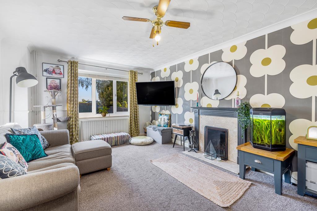
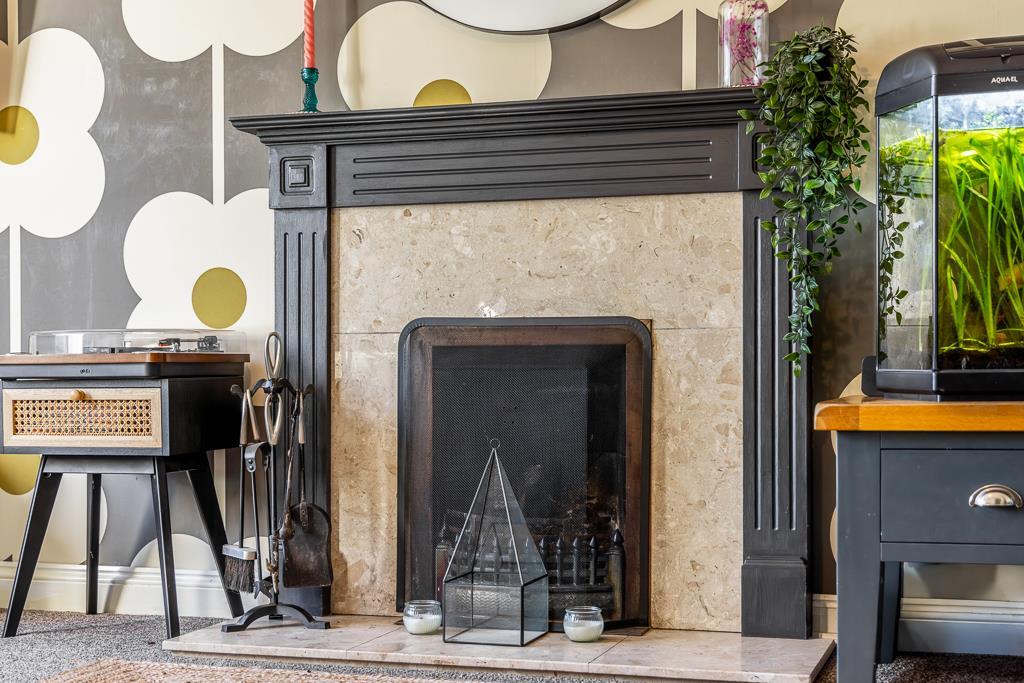
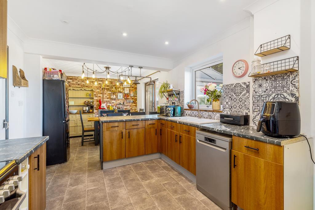
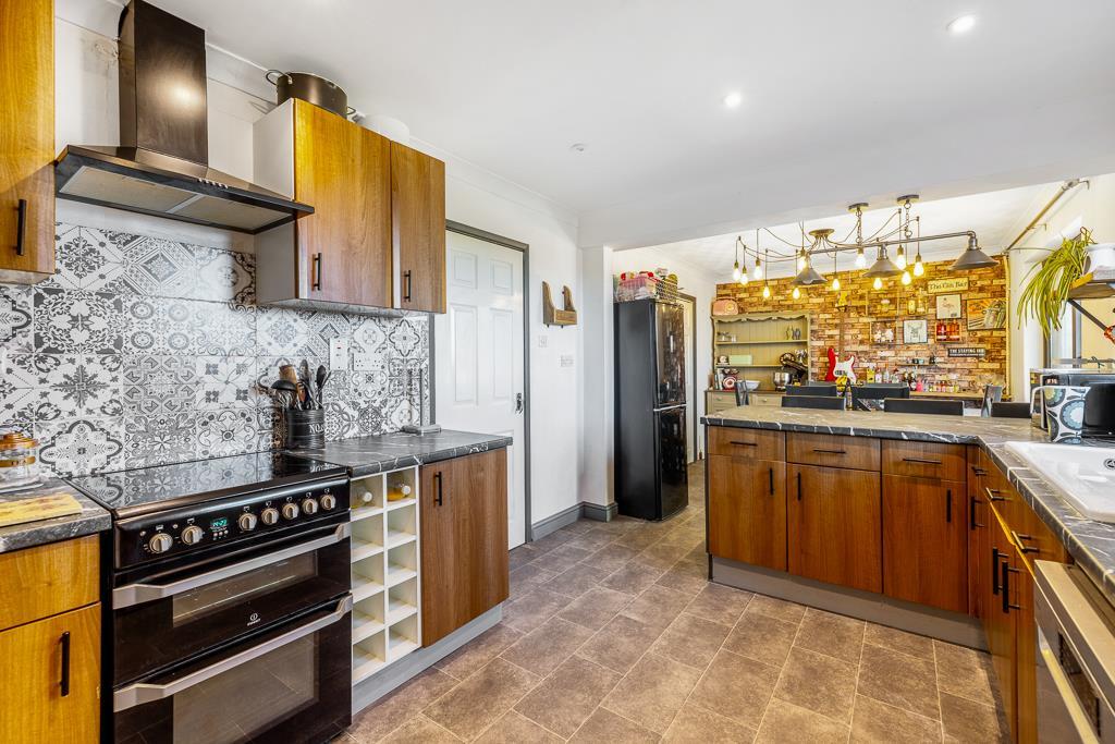
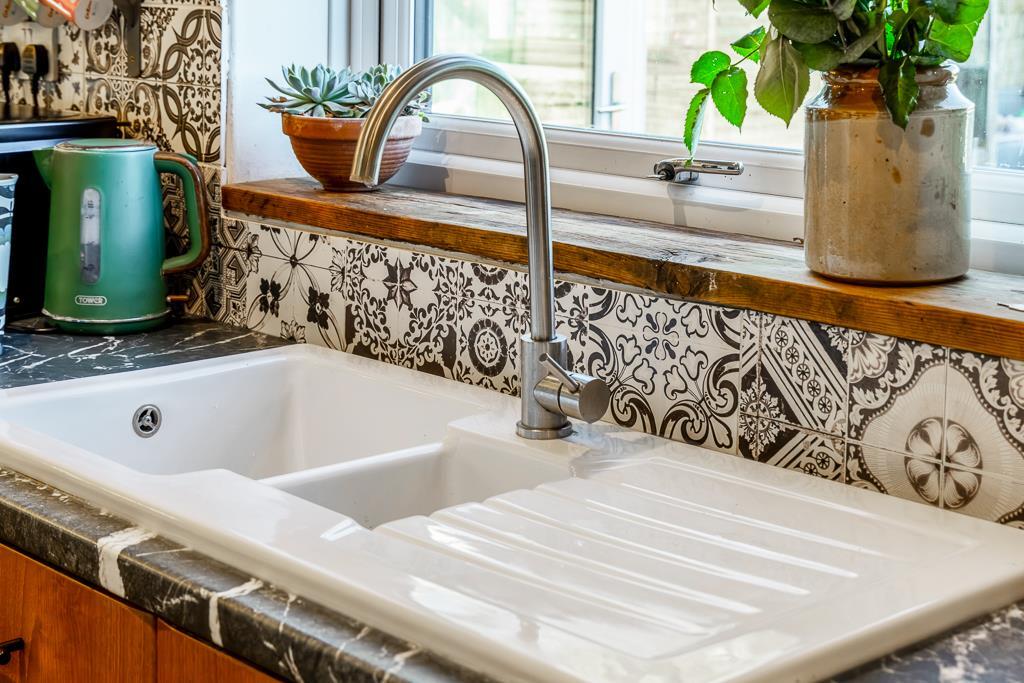
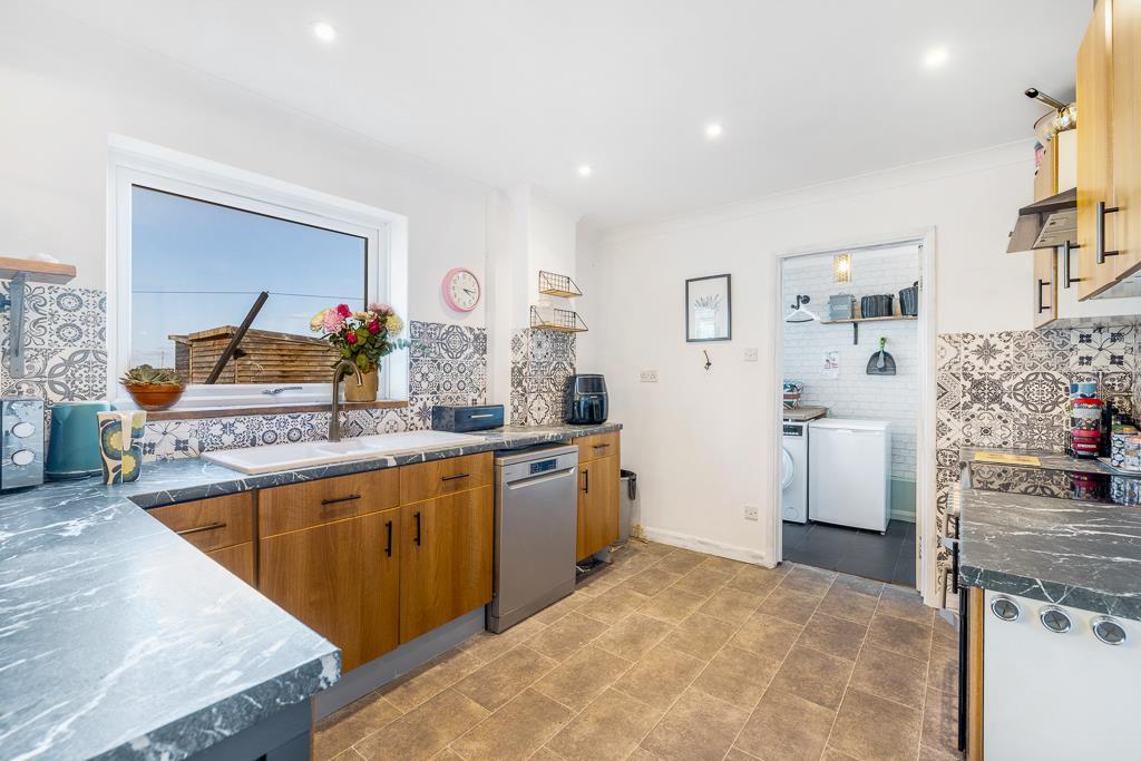
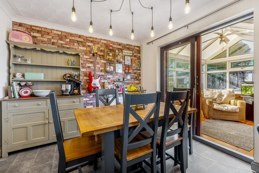
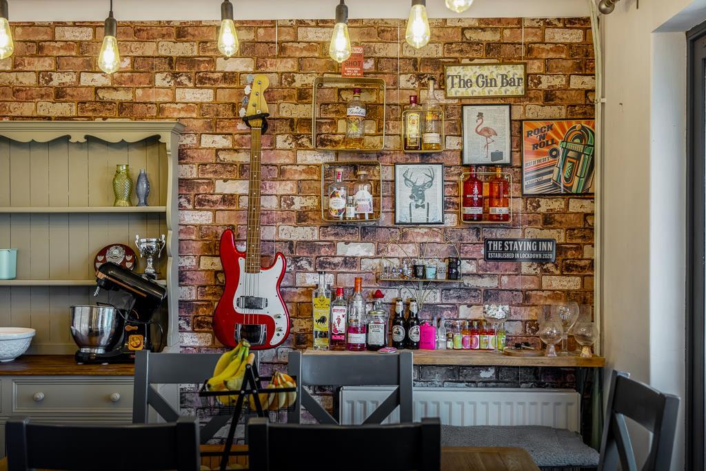
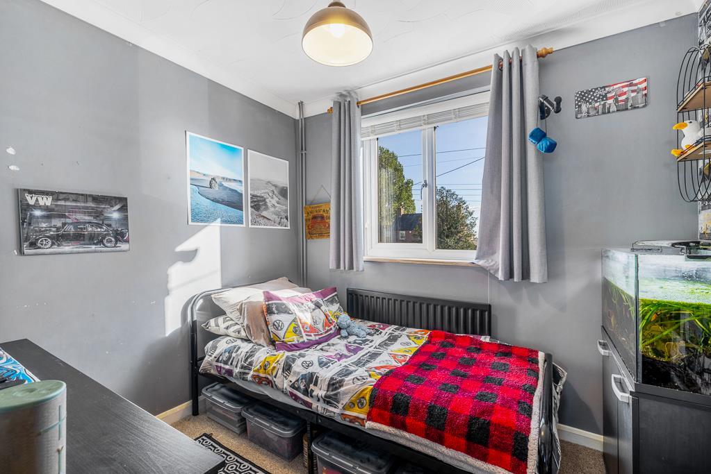
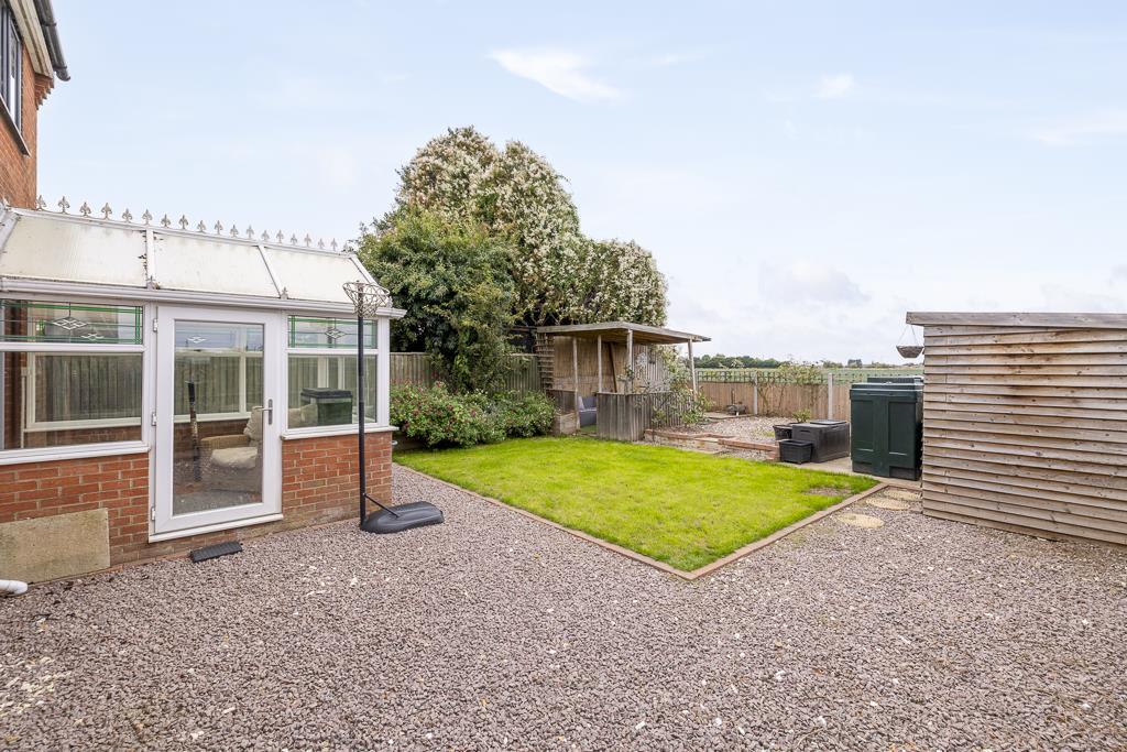
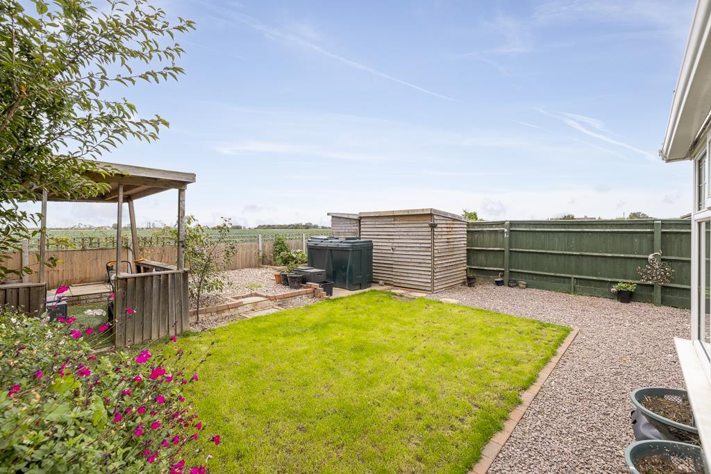
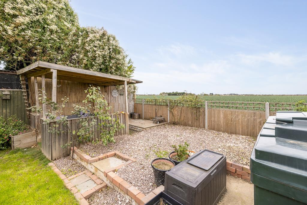
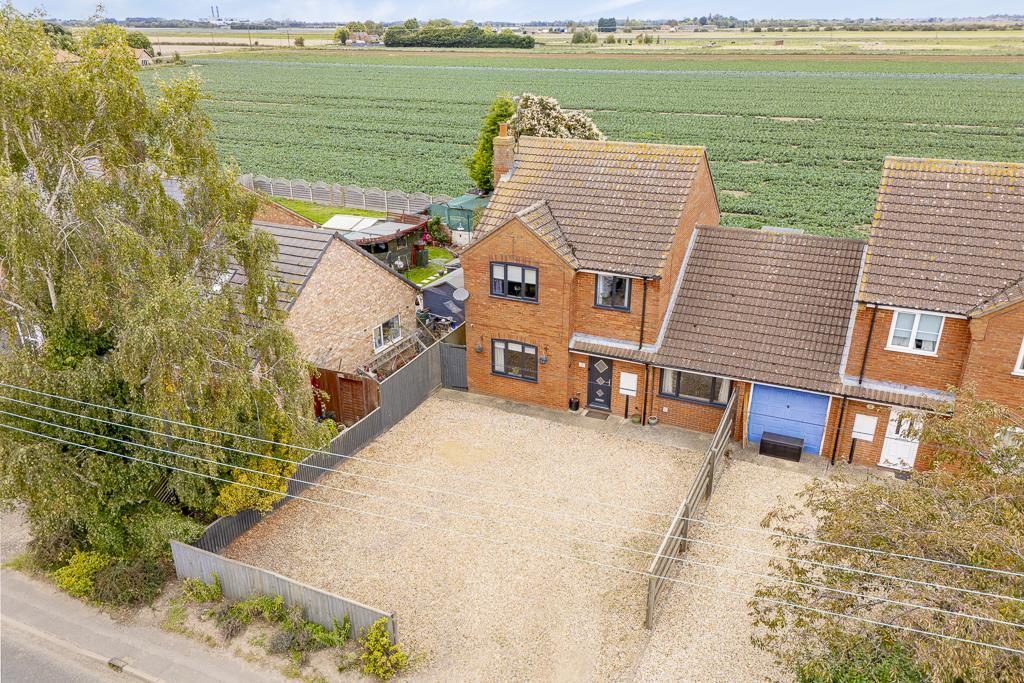
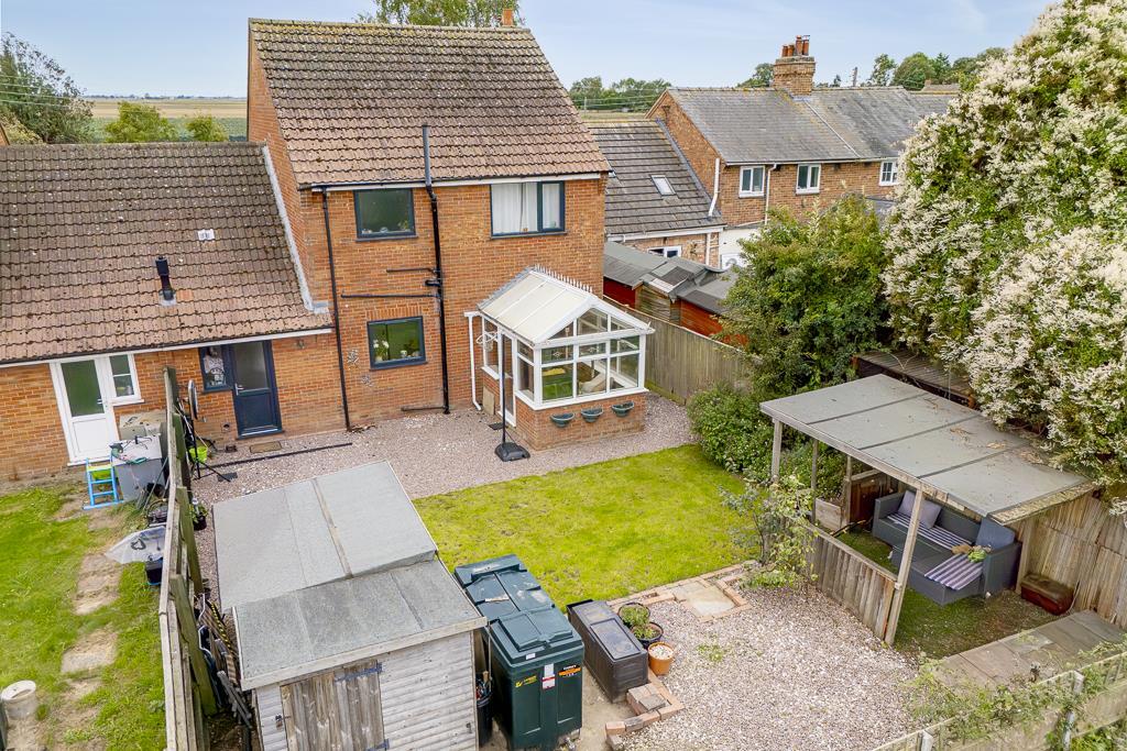
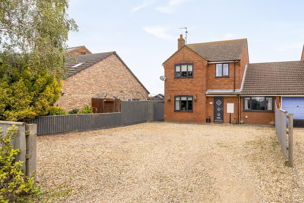
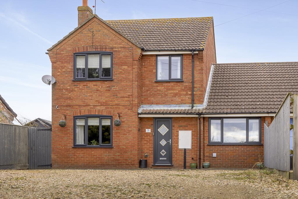
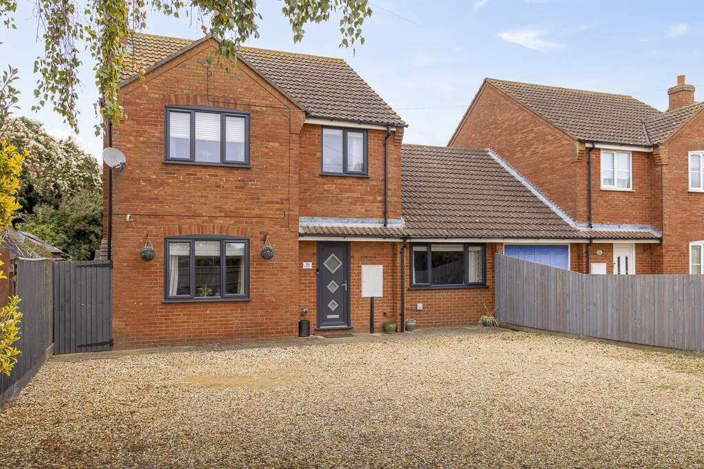
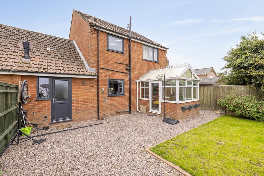
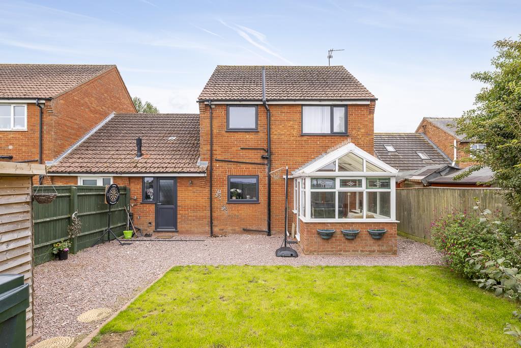
- Detached two-storey brick house with converted garage and substantial gravel drive providing ample off-road parking. The property appears to offer 3/4 bedrooms with a well-presented, open-plan living arrangement and good-sized rooms. External presentation is low-maintenance with a modest rear garden and boundaries providing privacy. The location benefits from countryside views and a popular village setting within easy driving distance of local services. Overall this is a medium-sized family home, suited to buyers seeking straightforward, low-maintenance accommodation with generous parking and scope for slight modernisation or upgrading.
Image Descriptions
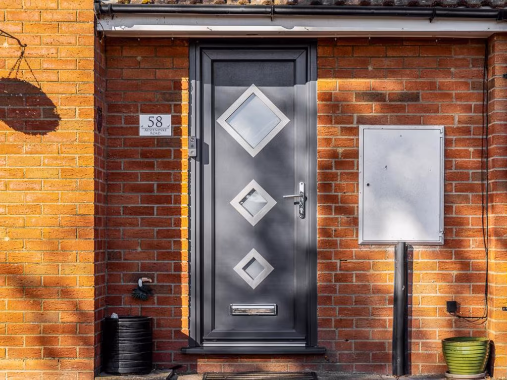
- semi-detached house modern
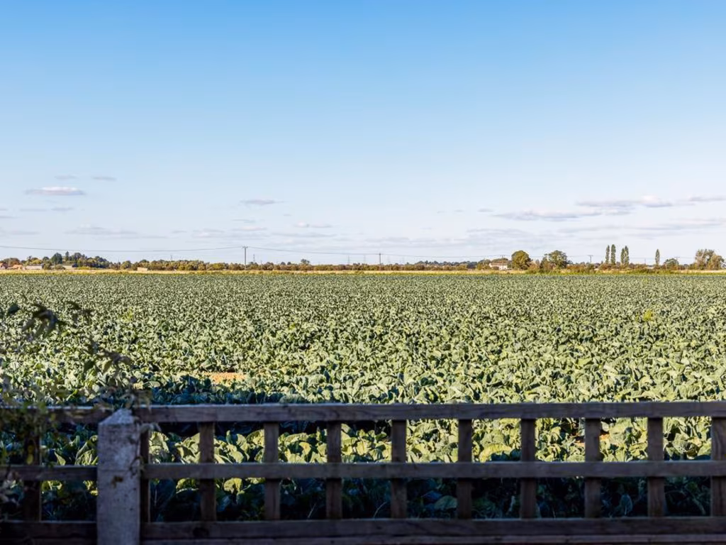
- farmland
Floorplan Description
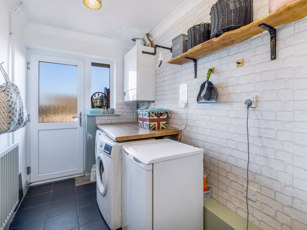
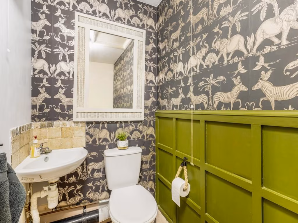
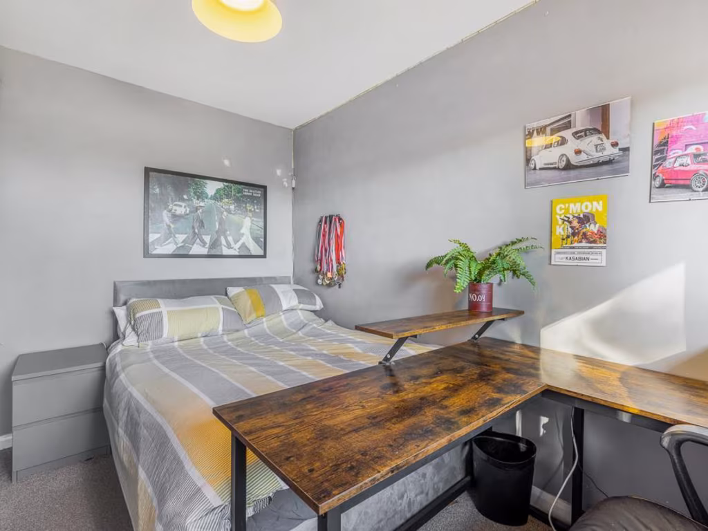
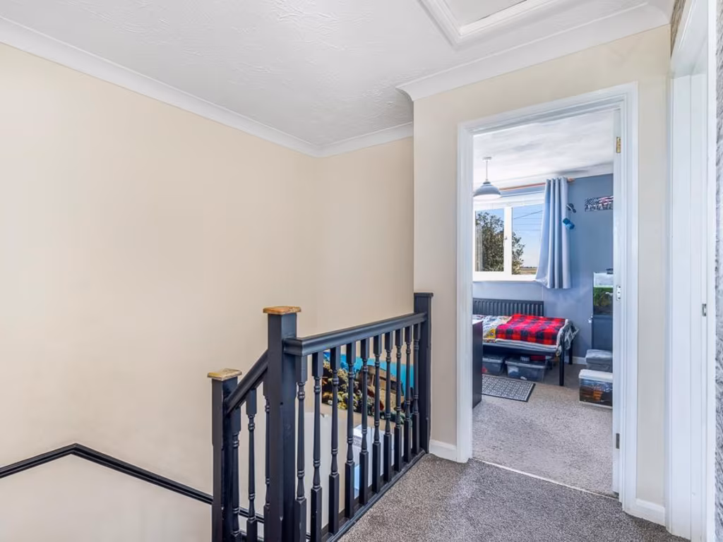
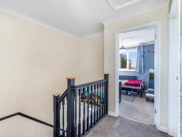
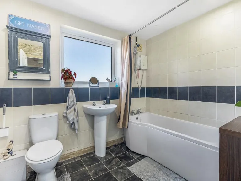
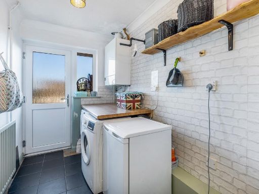
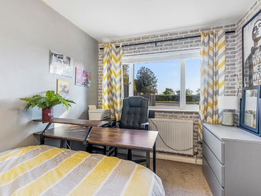
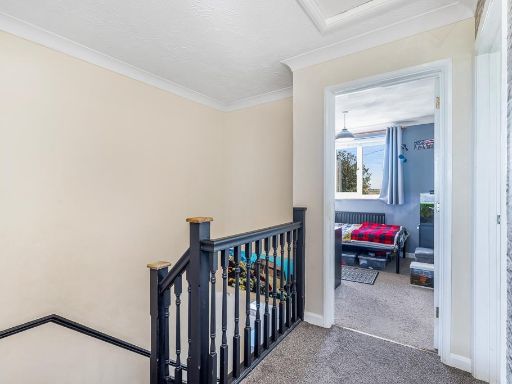
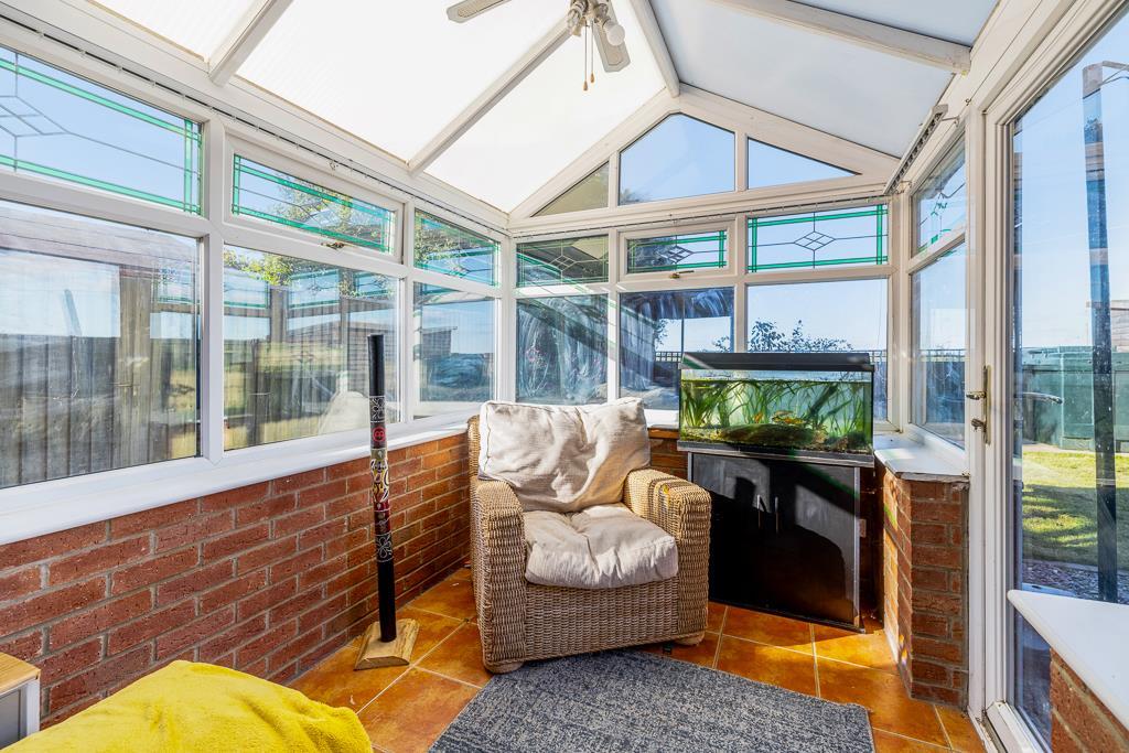
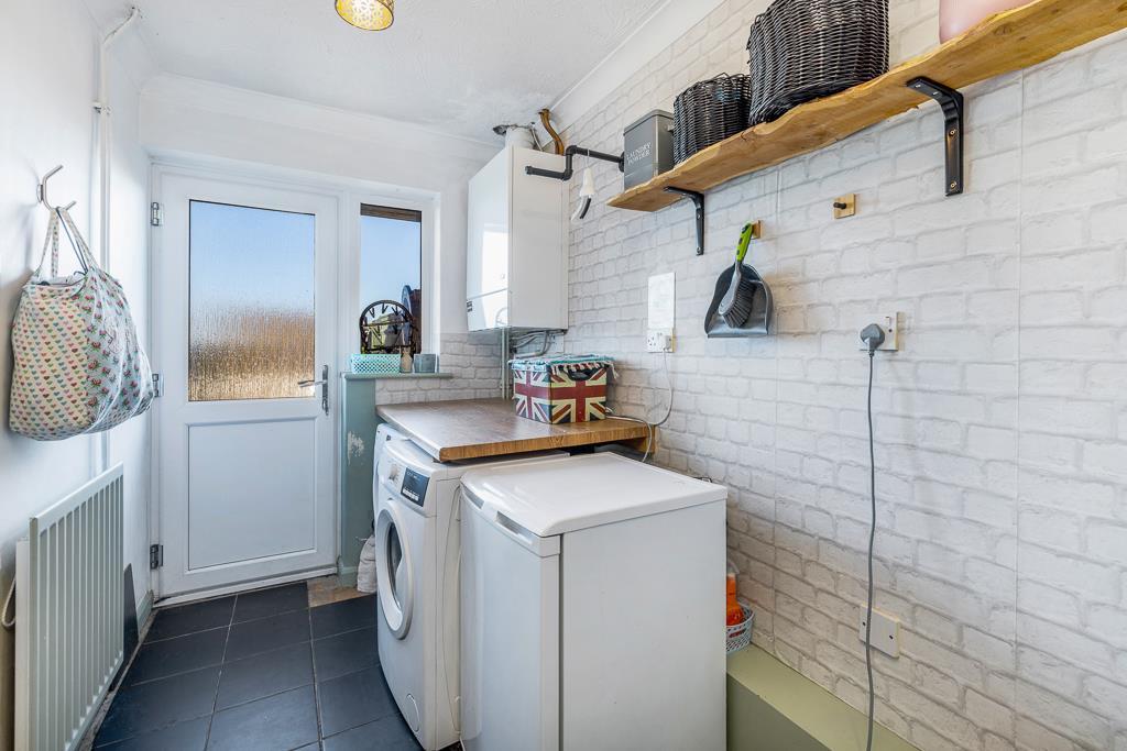
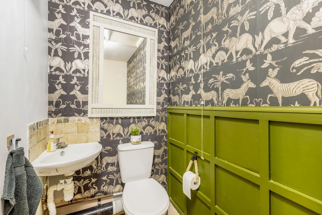
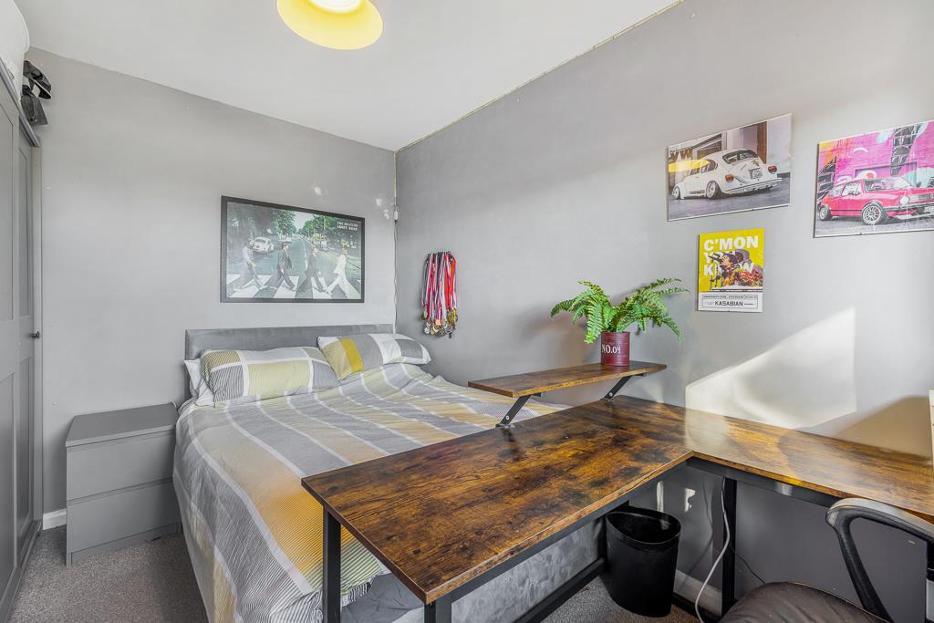
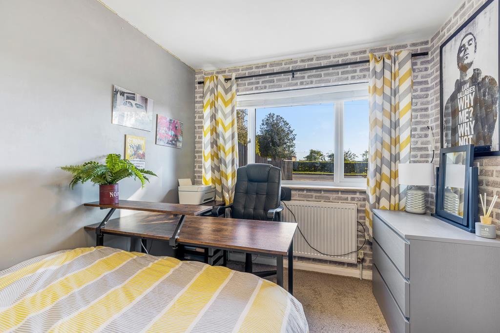
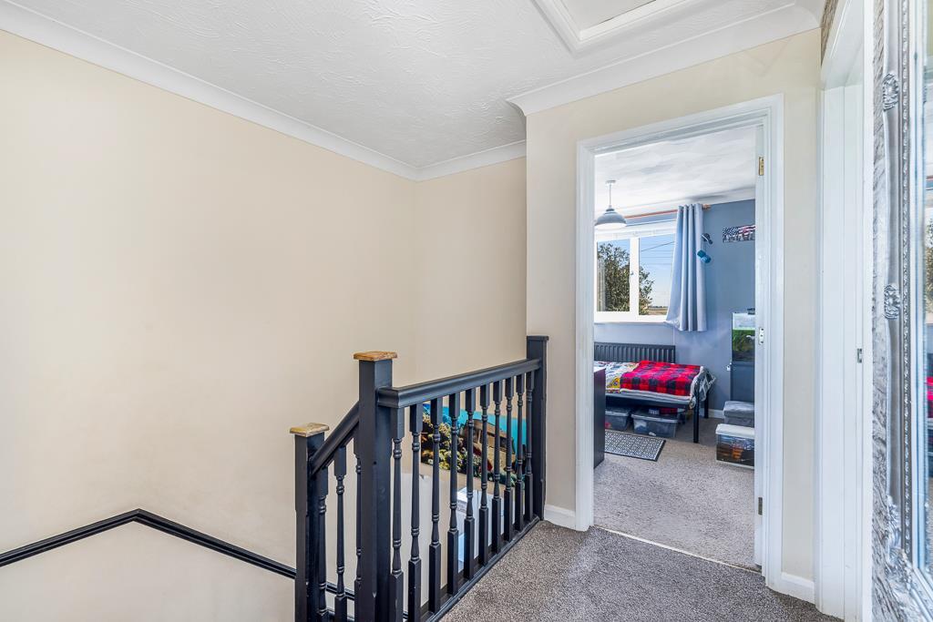
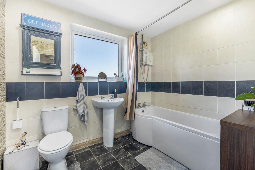
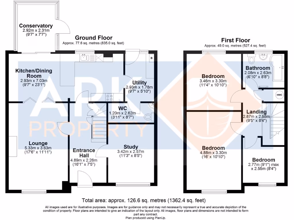
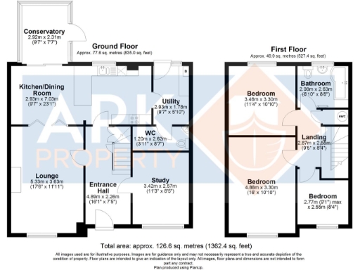
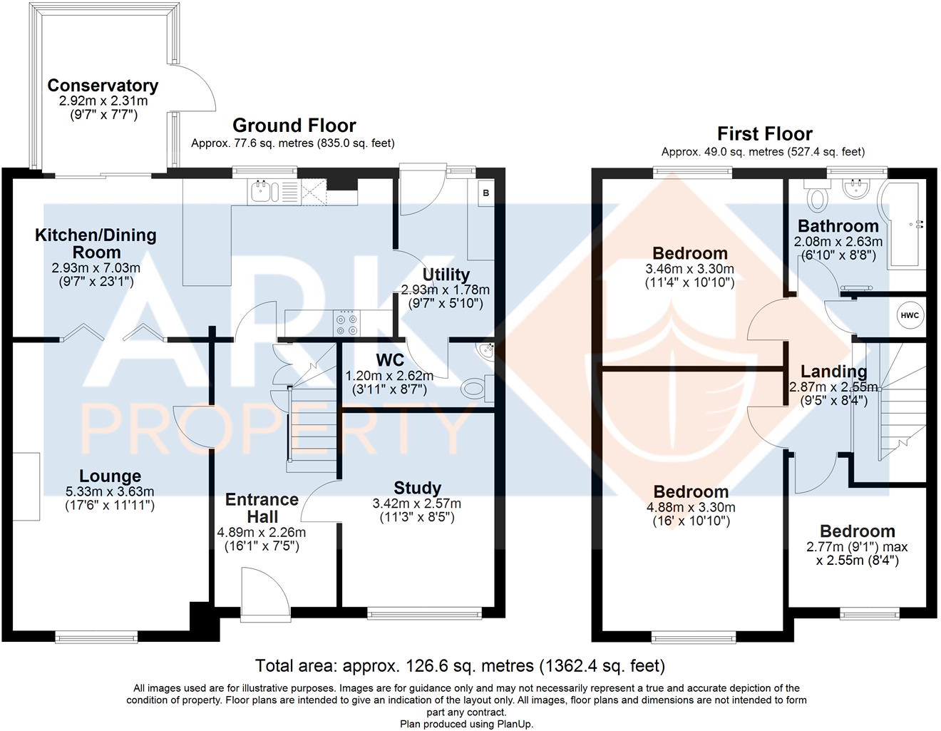
- Two-storey house with kitchen/dining, lounge, study and conservatory on ground floor; three bedrooms and bathroom on first floor.
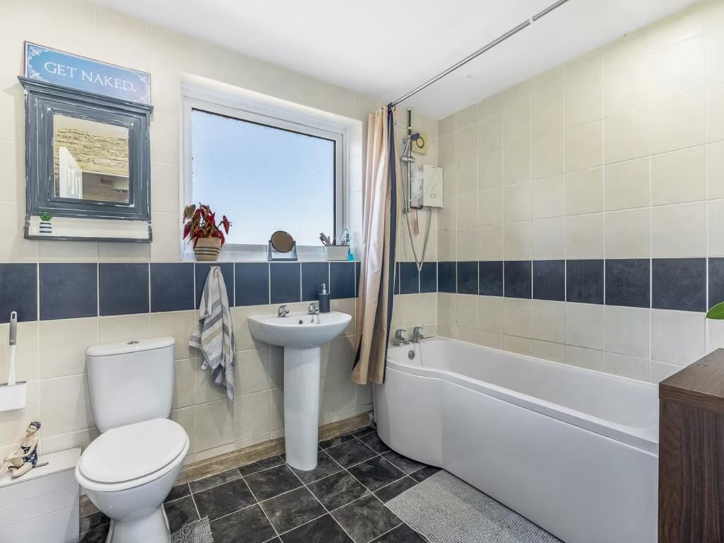
Rooms
- Conservatory: average
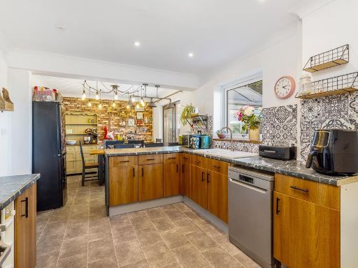
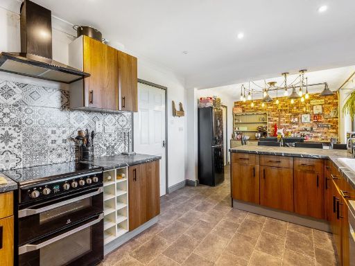
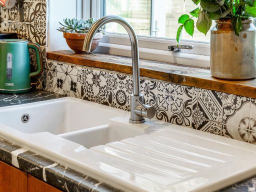
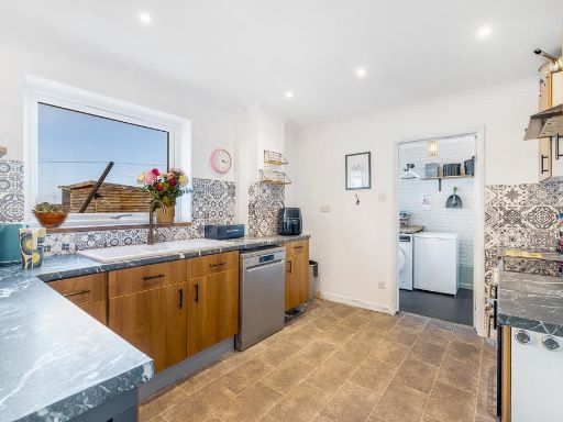
- Kitchen/Dining Room: large
- Lounge: large
- Entrance Hall: average
- WC: small
- Study: average
- Utility: small
- Bedroom: average
- Bathroom: small
- Landing: small
- Bedroom: large
- Bedroom: small
Textual Property Features
Detected Visual Features
- semi-detached
- modern
- two-story
- red brick
- driveway
- double-glazed windows
- mixed roofing
- suburban
- gravel front
- farmland
- agricultural
- rural
- land
- open field
- agriculture
- crop field
- expansive view
EPC Details
- Fully double glazed
- Cavity wall, filled cavity
- Boiler and radiators, oil
- Low energy lighting in 93% of fixed outlets
- Solid, no insulation (assumed)
Nearby Schools
- The Holbeach William Stukeley Church of England Voluntary Aided Primary School
- Moulton Chapel Primary School
- Spalding Parish Church of England Day School
- Monkshouse Primary Academy
- Wygate Park Academy
- Spalding High School
- St Paul's Community Primary and Nursery School, Spalding
- Weston St Mary Church of England Primary School
- The Pinchbeck East Church of England Primary Academy
- Surfleet Primary School
- Holbeach Bank Primary Academy
- The Cowbit St Mary's (Endowed) CofE Primary
- Ayscoughfee Hall School
- Springwell Alternative Academy Spalding
- The John Harrox Primary School, Moulton
- University Academy Holbeach
- Holbeach Primary Academy
- Weston Hills CofE Primary School
- The Spalding St John the Baptist Church of England Primary School
- Spalding Grammar School
- Spalding Academy
- St Norbert's Catholic Voluntary Academy
- Spalding Primary Academy
- Whaplode Church of England Primary School
Nearest General Shops
- Id: 730207963
- Tags:
- Building: yes
- Name: 1st call Auto Assist
- Shop: car_repair
- TagsNormalized:
- Lat: 52.7825615
- Lon: -0.1206742
- FullGeoHash: gcrum2b0sndg
- PartitionGeoHash: gcru
- Images:
- FoodStandards: null
- Distance: 1817.1
,- Id: 10170915811
- Tags:
- Name: West Nursery
- Shop: garden_centre
- TagsNormalized:
- Lat: 52.7818027
- Lon: -0.1142879
- FullGeoHash: gcrum2su2chv
- PartitionGeoHash: gcru
- Images:
- FoodStandards: null
- Distance: 1379.4
,- Id: 10171610192
- Tags:
- Name: Petals Nursery
- Shop: garden_centre
- TagsNormalized:
- Lat: 52.7802036
- Lon: -0.1122517
- FullGeoHash: gcrum2q6br54
- PartitionGeoHash: gcru
- Images:
- FoodStandards: null
- Distance: 1216.5
}
Nearest Religious buildings
- Id: 146669341
- Tags:
- Amenity: place_of_worship
- Building: yes
- Denomination: anglican
- Name: All Saints
- Religion: christian
- Source: Bing
- Wikidata: Q17531117
- TagsNormalized:
- place of worship
- anglican
- christian
- church
- Lat: 52.7987864
- Lon: -0.0626451
- FullGeoHash: gcruqedrhr0k
- PartitionGeoHash: gcru
- Images:
- FoodStandards: null
- Distance: 3045.6
,- Id: 182771636
- Tags:
- Addr:
- City: Weston
- Country: GB
- Postcode: PE12 6HU
- Street: Small Drove
- Amenity: school
- Fhrs:
- Authority: South Holland
- Id: 243306
- Local_authority_id: 4900
- Name: Weston St Mary Church of England Primary School
- Source: Bing
- Wikidata: Q66140347
- TagsNormalized:
- Lat: 52.8055306
- Lon: -0.0849569
- FullGeoHash: gcruqhfns27e
- PartitionGeoHash: gcru
- Images:
- FoodStandards:
- Id: 243306
- FHRSID: 243306
- LocalAuthorityBusinessID: 4900
- BusinessName: Weston St Marys Primary School
- BusinessType: School/college/university
- BusinessTypeID: 7845
- AddressLine1: Weston St Mary Primary School Small Drove
- AddressLine2: Weston
- AddressLine3: Spalding
- AddressLine4: Lincolnshire
- PostCode: PE12 6HU
- RatingValue: 5
- RatingKey: fhrs_5_en-GB
- RatingDate: 2022-09-26
- LocalAuthorityCode: 223
- LocalAuthorityName: South Holland
- LocalAuthorityWebSite: http://www.sholland.gov.uk
- LocalAuthorityEmailAddress: foodhs@sholland.gov.uk
- Scores:
- Hygiene: 5
- Structural: 5
- ConfidenceInManagement: 0
- NewRatingPending: false
- Geocode:
- Longitude: -0.08617799729109
- Latitude: 52.80390548706050
- Distance: 2997.4
,- Id: 376979930
- Tags:
- Amenity: place_of_worship
- Building: yes
- Denomination: anglican
- Name: St. John the Evangelist
- Religion: christian
- Source: Bing
- Wikidata: Q26317665
- TagsNormalized:
- place of worship
- anglican
- evangelist
- christian
- church
- Lat: 52.7608283
- Lon: -0.1103308
- FullGeoHash: gcrujkzdj572
- PartitionGeoHash: gcru
- Images:
- FoodStandards: null
- Distance: 2308.4
}
Nearest Medical buildings
- Id: 941857236
- Tags:
- Addr:
- City: Spalding
- Postcode: PE11 2BY
- Street: West Elloe Avenue
- Amenity: doctors
- Building: yes
- Healthcare: doctor
- Name: Monro Medical Centre
- TagsNormalized:
- doctor
- doctors
- health
- healthcare
- Lat: 52.7940078
- Lon: -0.1475469
- FullGeoHash: gcrukdue3um5
- PartitionGeoHash: gcru
- Images:
- FoodStandards: null
- Distance: 3946
,- Id: 256688
- Tags:
- Name: Health Centre
- Naptan:
- StopAreaCode: 270G00013952
- StopAreaType: GPBS
- Verified: no
- Public_transport: stop_area
- Source: naptan_import
- Type: public_transport
- TagsNormalized:
- Lat: 52.7947809
- Lon: -0.14683
- FullGeoHash: gcrukdvpfs7x
- PartitionGeoHash: gcru
- Images:
- FoodStandards: null
- Distance: 3939.4
,- Id: 7253744740
- Tags:
- Amenity: clinic
- Healthcare: clinic
- Name: Back On Track Therapy
- TagsNormalized:
- clinic
- health
- healthcare
- therapy
- track
- Lat: 52.7862395
- Lon: -0.1515864
- FullGeoHash: gcruk93w5u0z
- PartitionGeoHash: gcru
- Images:
- FoodStandards: null
- Distance: 3935.8
,- Id: 7261795438
- Tags:
- Amenity: clinic
- Healthcare: clinic
- Name: Total Healthcare Clinic
- TagsNormalized:
- clinic
- health
- healthcare
- total
- Lat: 52.7902607
- Lon: -0.1444101
- FullGeoHash: gcrukdnve1b5
- PartitionGeoHash: gcru
- Images:
- FoodStandards: null
- Distance: 3592.1
}
Nearest Leisure Facilities
- Id: 727915843
- Tags:
- Leisure: park
- Name: Weston Playing Field
- TagsNormalized:
- Lat: 52.8025841
- Lon: -0.0846583
- FullGeoHash: gcruqh6m7745
- PartitionGeoHash: gcru
- Images:
- FoodStandards: null
- Distance: 2682.6
,- Id: 6821920035
- Tags:
- TagsNormalized:
- Lat: 52.8025522
- Lon: -0.0852017
- FullGeoHash: gcruqh3vntjh
- PartitionGeoHash: gcru
- Images:
- FoodStandards: null
- Distance: 2670.6
,- Id: 950081142
- Tags:
- Leisure: sports_centre
- Name: Fun Farm High ropes
- Phone: +44 1406373444
- Sport: climbing
- Website: https://funfarmhighropes.co.uk/
- TagsNormalized:
- sports
- sports centre
- leisure
- farm
- climbing
- Lat: 52.802886
- Lon: -0.0989872
- FullGeoHash: gcrumsrzj7mu
- PartitionGeoHash: gcru
- Images:
- FoodStandards: null
- Distance: 2656.7
,- Id: 1111716474
- Tags:
- Building: yes
- Dance:
- Leisure: dance
- Name: Spalding School of Dance
- TagsNormalized:
- Lat: 52.782888
- Lon: -0.1238946
- FullGeoHash: gcrum0vf953r
- PartitionGeoHash: gcru
- Images:
- FoodStandards: null
- Distance: 2036.5
,- Id: 10170915822
- Tags:
- Leisure: amusement_arcade
- Name: Scalextric Racing
- Sport: rc_car
- TagsNormalized:
- amusement arcade
- leisure
- sports
- Lat: 52.7794622
- Lon: -0.1166061
- FullGeoHash: gcrum25nduu5
- PartitionGeoHash: gcru
- Images:
- FoodStandards: null
- Distance: 1504.2
}
Nearest Hotels
- Id: 7256325731
- Tags:
- Addr:
- City: Spalding
- Country: GB
- Housenumber: 80-84
- Postcode: PE11 1QF
- Street: Pinchbeck Road
- Fhrs:
- Authority: South Holland
- Id: 243316
- Local_authority_id: 25877
- Name: The Woodlands
- Tourism: hotel
- TagsNormalized:
- Lat: 52.7933943
- Lon: -0.1514053
- FullGeoHash: gcrukd9zb1bp
- PartitionGeoHash: gcru
- Images:
- FoodStandards: null
- Distance: 4156.7
,- Id: 7259227813
- Tags:
- Addr:
- City: Spalding
- Country: GB
- Housenumber: 22
- Postcode: PE11 1TX
- Street: High Street
- Bar: yes
- Fhrs:
- Authority: South Holland
- Id: 243590
- Local_authority_id: 3145
- Internet_access: wlan
- Internet_access:fee: no
- Name: Cley Hall Hotel
- Pets_allowed: no
- Phone: +44 1775 725 157
- Rooms: 21
- Smoking: no
- Stars: 4
- Tourism: hotel
- Website: https://www.cleyhall.com/
- Wheelchair: limited
- TagsNormalized:
- Lat: 52.7885802
- Lon: -0.14588
- FullGeoHash: gcruk9vgb8xf
- PartitionGeoHash: gcru
- Images:
- FoodStandards: null
- Distance: 3626.8
,- Id: 4517003759
- Tags:
- Addr:
- City: Spalding
- Country: GB
- Postcode: PE12 6EU
- Street: Camel Gate
- Brand: Travelodge
- Brand:wikidata: Q9361374
- Brand:wikipedia: en:Travelodge UK
- Fhrs:
- Authority: South Holland
- Id: 243297
- Local_authority_id: 28983
- Internet_access: wlan
- Internet_access:fee: customers
- Internet_access:ssid: Travelodge WiFi
- Name: Travelodge Hotel Spalding
- Operator: Travelodge
- Phone: +44 871 984 6383
- Smoking: no
- Tourism: hotel
- TagsNormalized:
- Lat: 52.798304
- Lon: -0.1276481
- FullGeoHash: gcrum5eh3t4x
- PartitionGeoHash: gcru
- Images:
- FoodStandards: null
- Distance: 3094.1
}
Tags
- semi-detached
- modern
- two-story
- red brick
- driveway
- double-glazed windows
- mixed roofing
- suburban
- gravel front
- farmland
- agricultural
- rural
- land
- open field
- agriculture
- crop field
- expansive view
Local Market Stats
- Average Price/sqft: £221
- Avg Income: £37100
- Rental Yield: 3.2%
- Social Housing: 8%
- Planning Success Rate: 87%
Similar Properties
 5 bedroom detached house for sale in Broadgate, Weston Hills, Spalding, PE12 — £465,000 • 5 bed • 3 bath • 2400 ft²
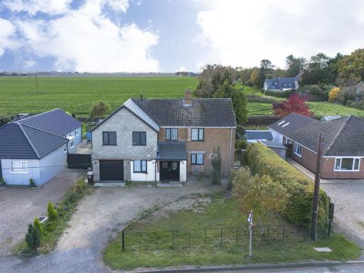 5 bedroom detached house for sale in Austendyke Road, Weston Hills, Spalding, PE12 — £450,000 • 5 bed • 4 bath • 2350 ft²
 3 bedroom detached bungalow for sale in Broadgate, Weston Hills, Spalding, PE12 — £425,000 • 3 bed • 1 bath • 1940 ft²
 3 bedroom detached house for sale in Armstrongs Close, Weston, Spalding, PE12 — £260,000 • 3 bed • 1 bath • 1291 ft²
 4 bedroom detached house for sale in Carisbrooke Way, Weston Hills, Spalding, PE12 — £385,000 • 4 bed • 2 bath • 2259 ft²
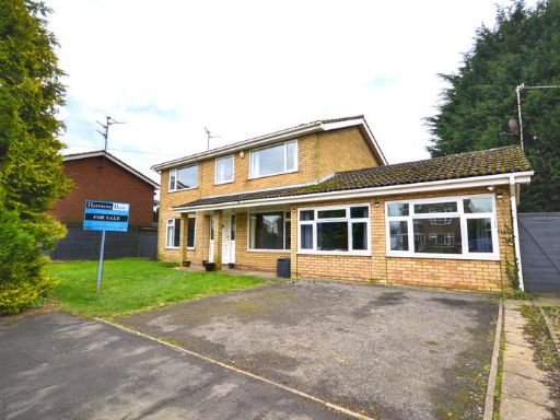 5 bedroom detached house for sale in St Marys Close, Weston, Spalding , PE12 — £289,995 • 5 bed • 2 bath • 1279 ft²
Meta
- {
"@context": "https://schema.org",
"@type": "Residence",
"name": "3 bedroom link detached house for sale in Austendyke Road,…",
"description": "",
"url": "https://propertypiper.co.uk/property/41d38df4-2baf-44c9-b27f-87d3b74bf157",
"image": "https://image-a.propertypiper.co.uk/d43637a0-b988-4c31-8171-23c7676aa41d-1024.jpeg",
"address": {
"@type": "PostalAddress",
"streetAddress": "58 AUSTENDYKE ROAD WESTON HILLS SPALDING",
"postalCode": "PE12 6BX",
"addressLocality": "South Holland",
"addressRegion": "South Holland and The Deepings",
"addressCountry": "England"
},
"geo": {
"@type": "GeoCoordinates",
"latitude": 52.779166050938414,
"longitude": -0.09424712465166074
},
"numberOfRooms": 3,
"numberOfBathroomsTotal": 2,
"floorSize": {
"@type": "QuantitativeValue",
"value": 1362,
"unitCode": "FTK"
},
"offers": {
"@type": "Offer",
"price": 260000,
"priceCurrency": "GBP",
"availability": "https://schema.org/InStock"
},
"additionalProperty": [
{
"@type": "PropertyValue",
"name": "Feature",
"value": "semi-detached"
},
{
"@type": "PropertyValue",
"name": "Feature",
"value": "modern"
},
{
"@type": "PropertyValue",
"name": "Feature",
"value": "two-story"
},
{
"@type": "PropertyValue",
"name": "Feature",
"value": "red brick"
},
{
"@type": "PropertyValue",
"name": "Feature",
"value": "driveway"
},
{
"@type": "PropertyValue",
"name": "Feature",
"value": "double-glazed windows"
},
{
"@type": "PropertyValue",
"name": "Feature",
"value": "mixed roofing"
},
{
"@type": "PropertyValue",
"name": "Feature",
"value": "suburban"
},
{
"@type": "PropertyValue",
"name": "Feature",
"value": "gravel front"
},
{
"@type": "PropertyValue",
"name": "Feature",
"value": "farmland"
},
{
"@type": "PropertyValue",
"name": "Feature",
"value": "agricultural"
},
{
"@type": "PropertyValue",
"name": "Feature",
"value": "rural"
},
{
"@type": "PropertyValue",
"name": "Feature",
"value": "land"
},
{
"@type": "PropertyValue",
"name": "Feature",
"value": "open field"
},
{
"@type": "PropertyValue",
"name": "Feature",
"value": "agriculture"
},
{
"@type": "PropertyValue",
"name": "Feature",
"value": "crop field"
},
{
"@type": "PropertyValue",
"name": "Feature",
"value": "expansive view"
}
]
}
High Res Floorplan Images
Compatible Floorplan Images
FloorplanImages Thumbnail