EX33 2HF - 2 bedroom semidetached bungalow for sale in The Brittons, B…
View on Property Piper
2 bedroom semi-detached bungalow for sale in The Brittons, Braunton, Devon, EX33
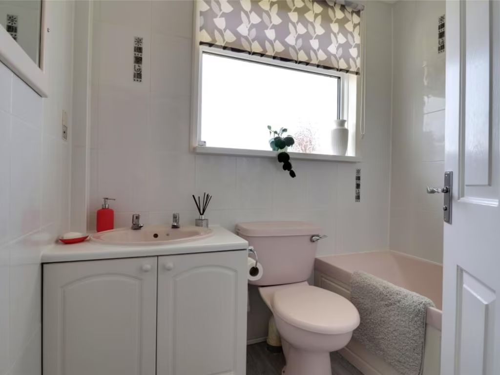
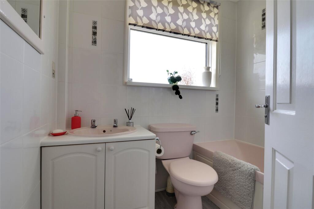
Property Details
- Price: £251250
- Bedrooms: 2
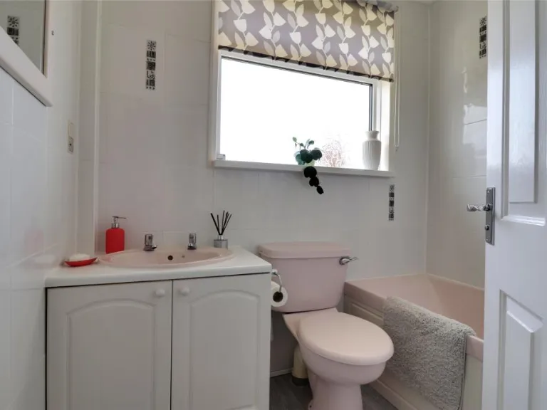
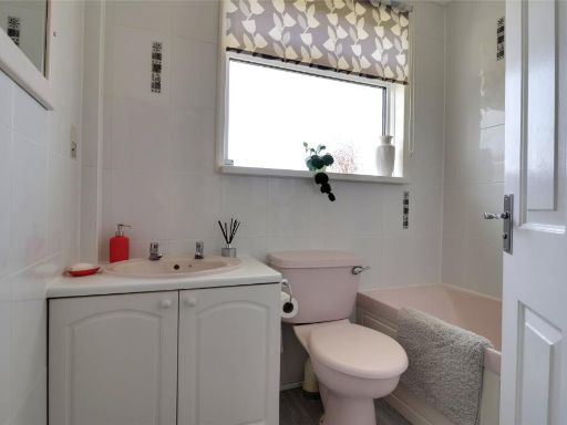
- Bathrooms: 1
- Property Type: undefined
- Property SubType: undefined
Image Descriptions
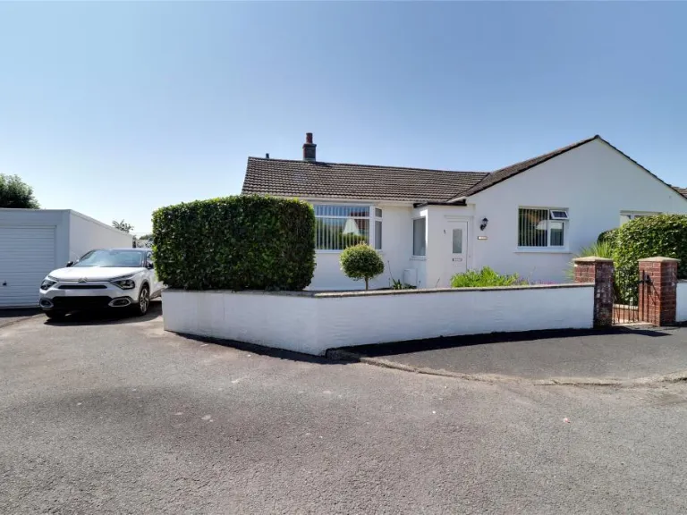
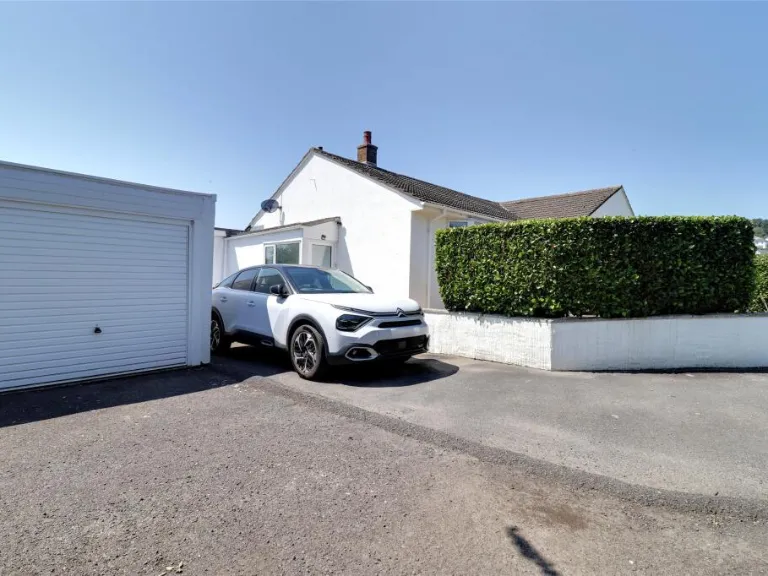
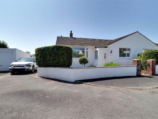
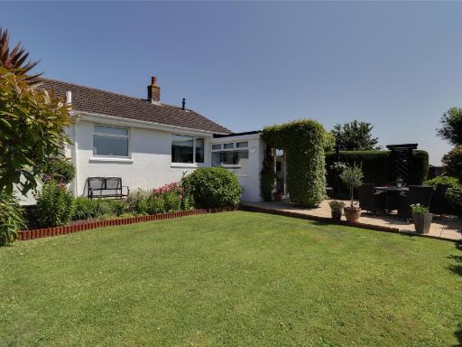
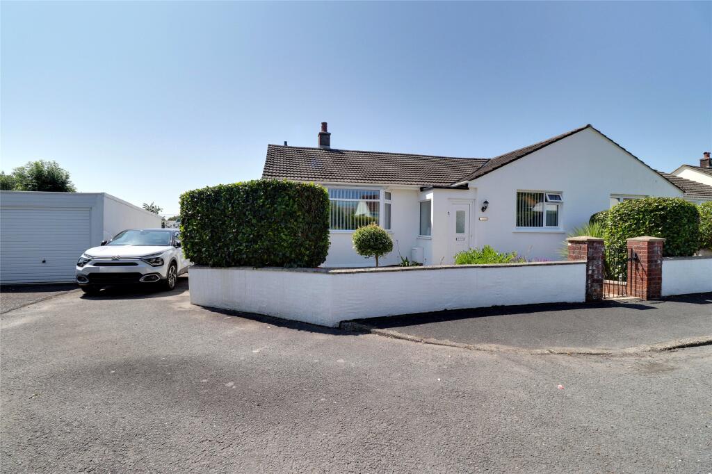
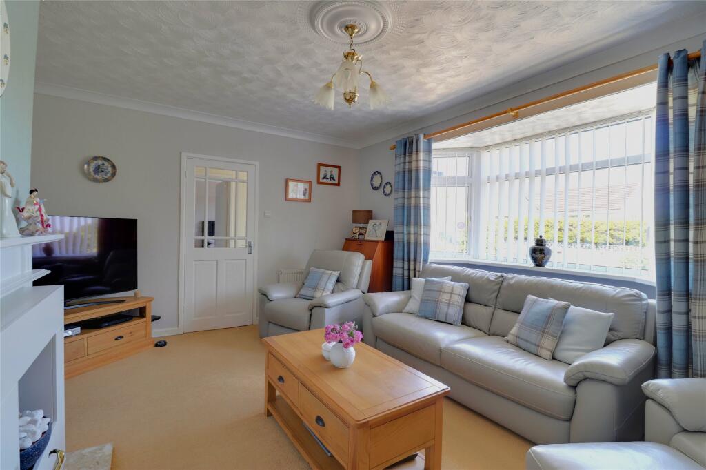
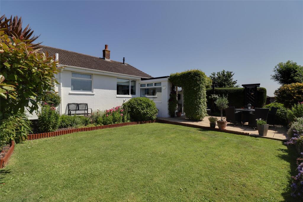
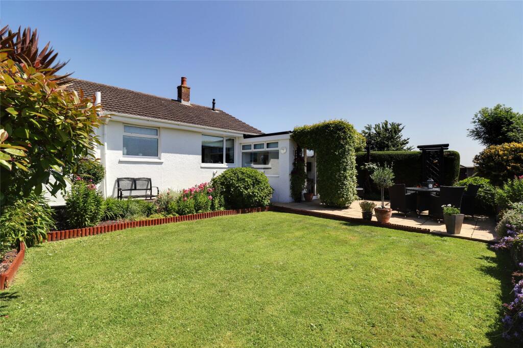
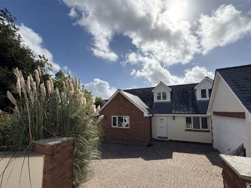
- bungalow mid-20th century
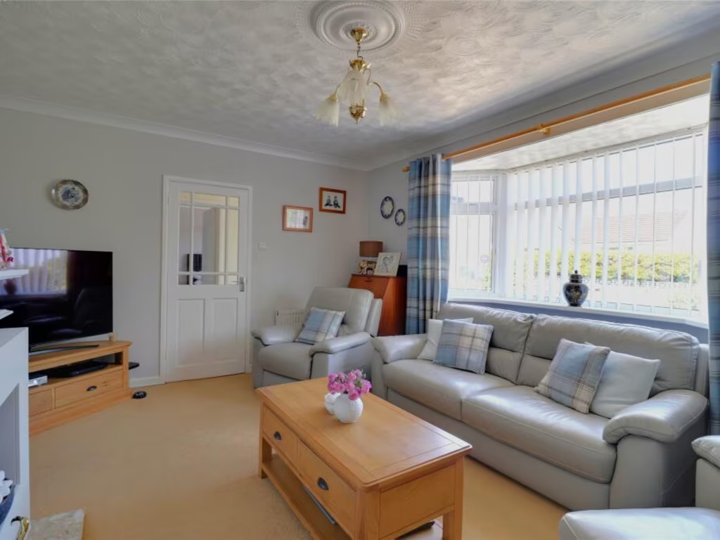
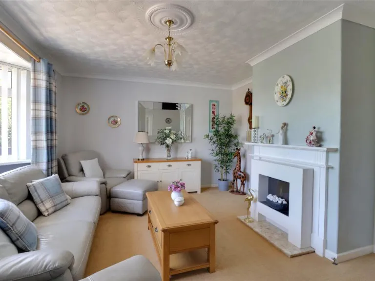
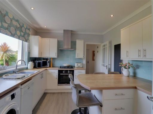
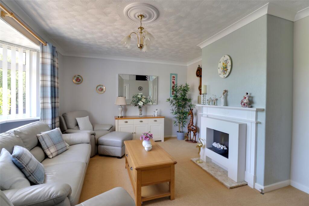
- living room contemporary
Floorplan Description
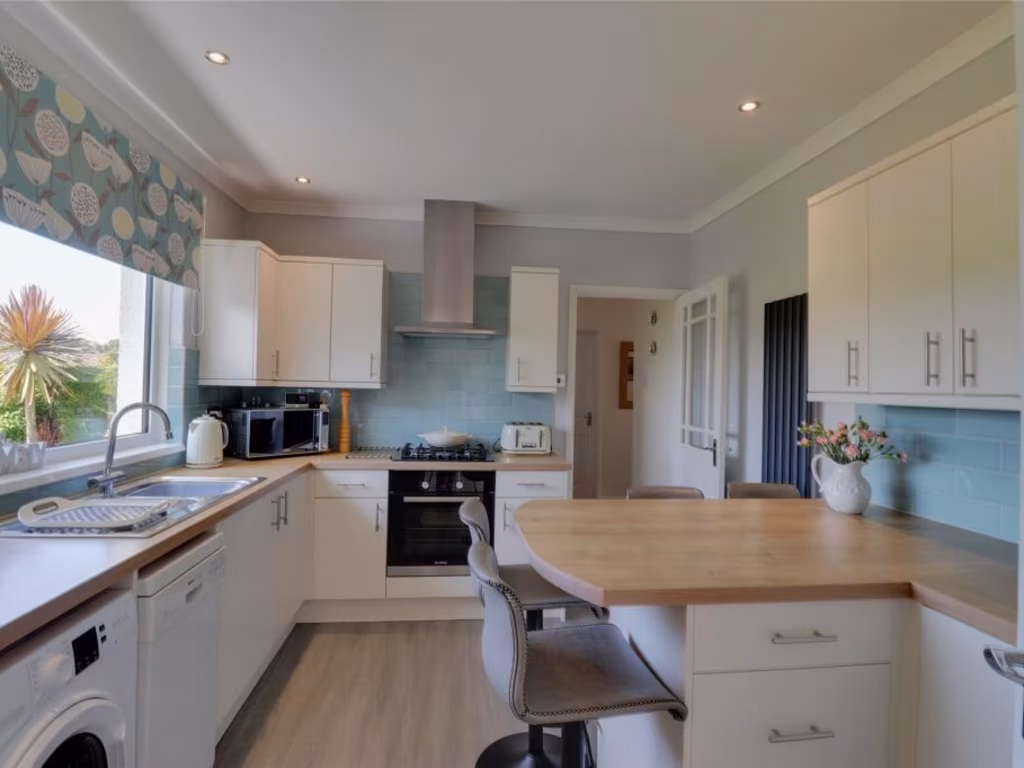
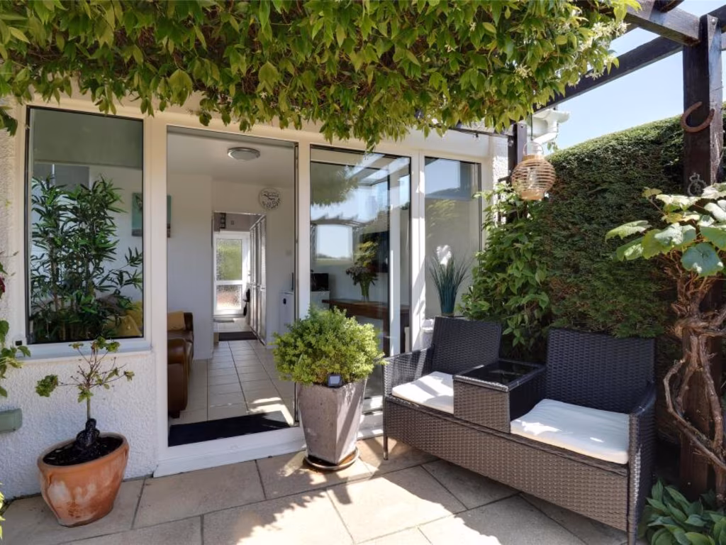
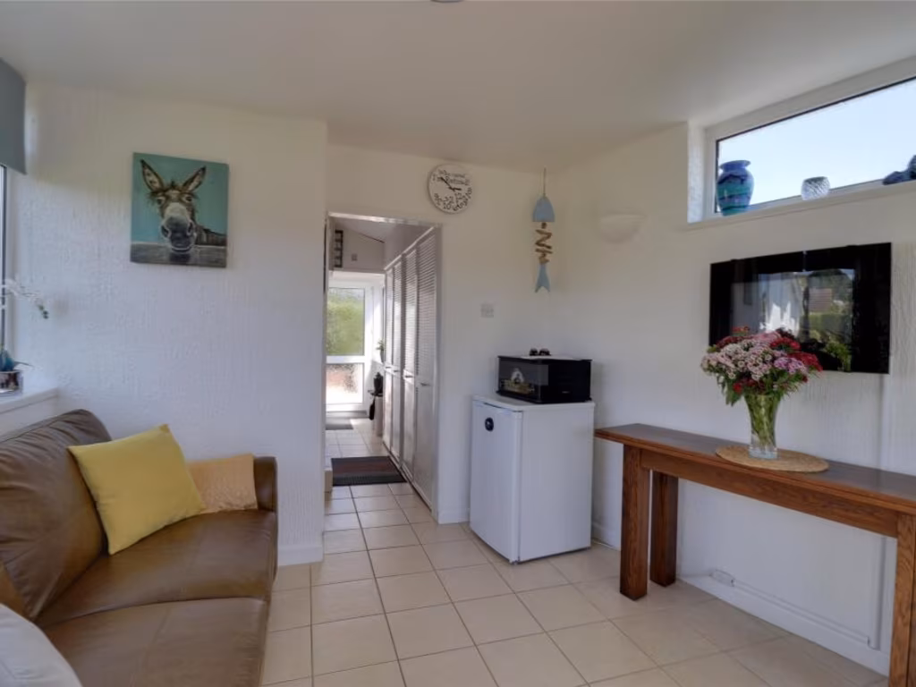
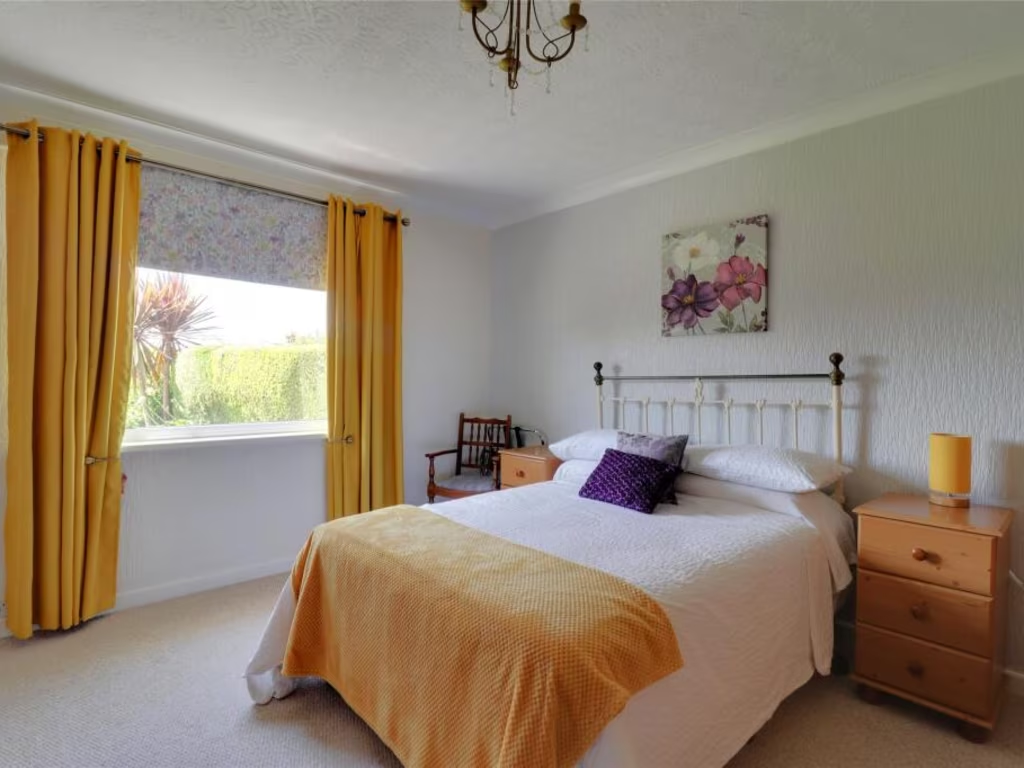
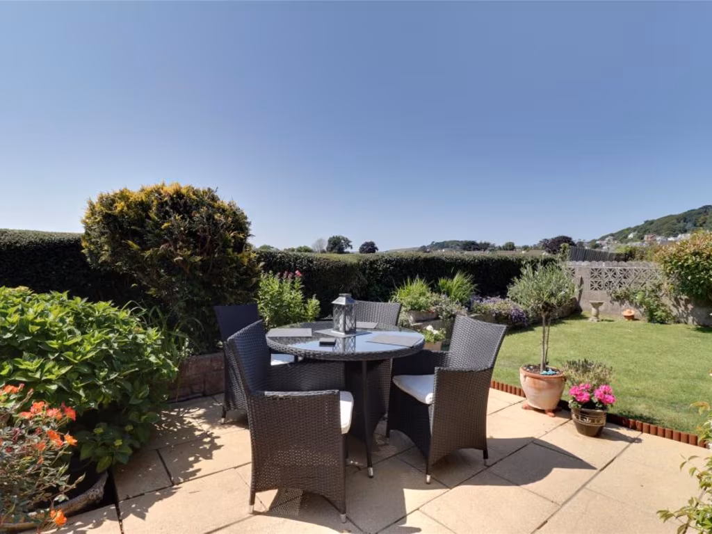
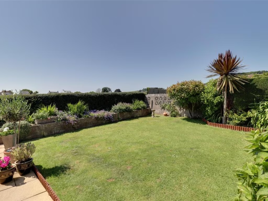
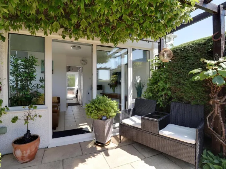
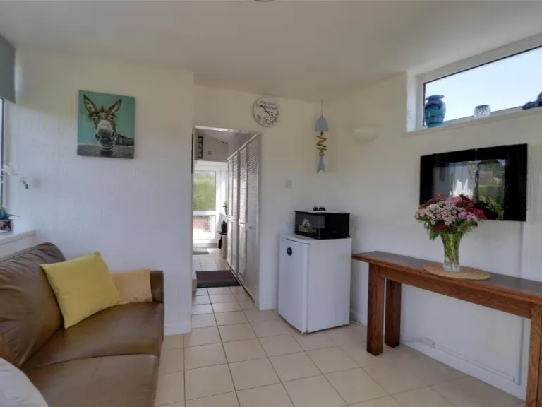
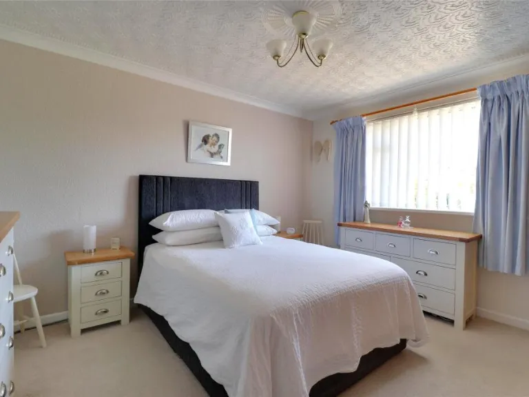
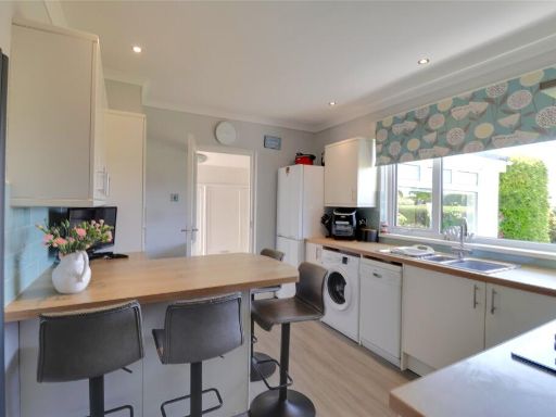
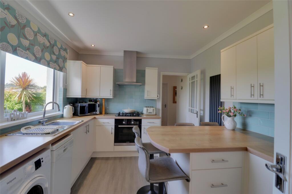
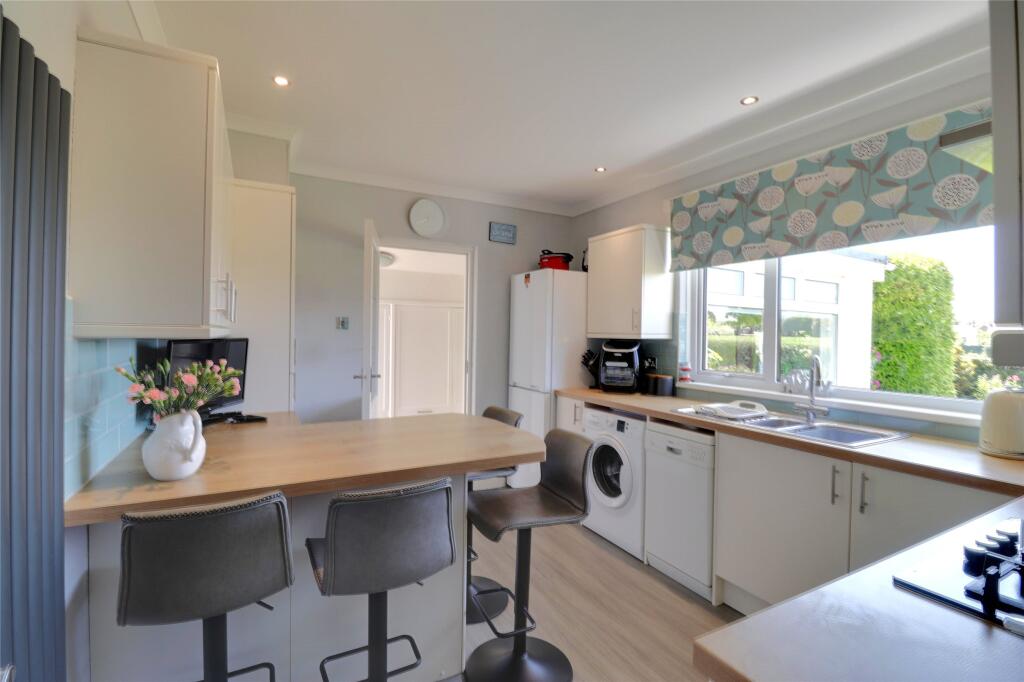
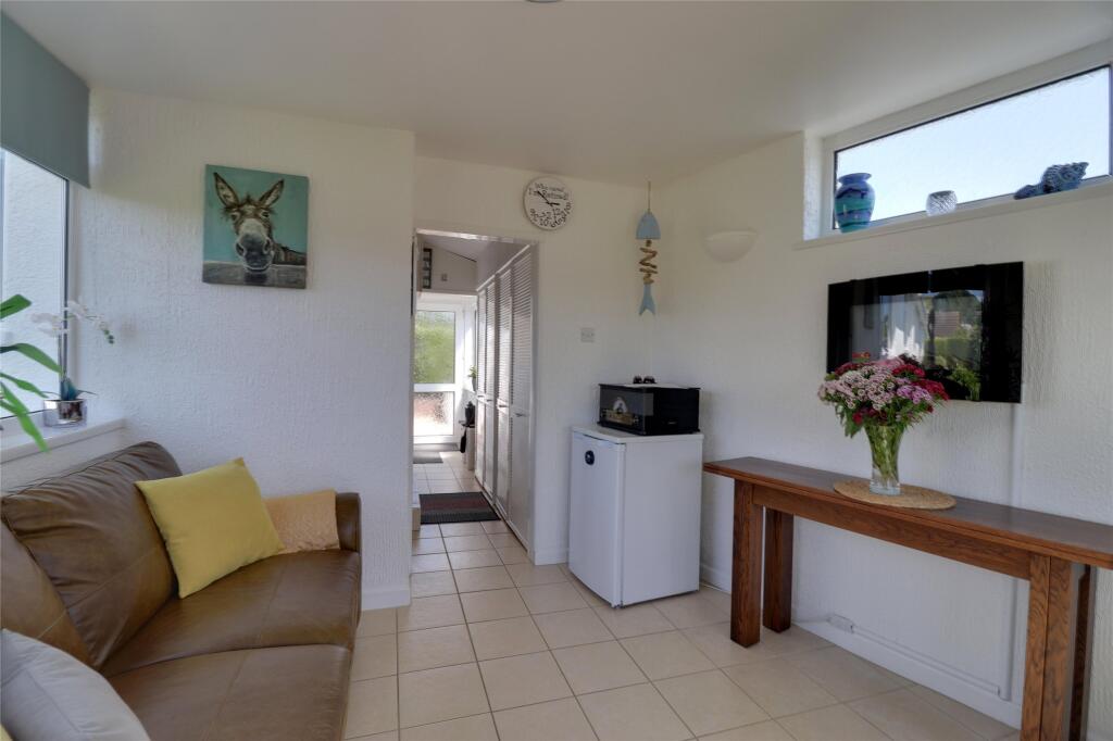
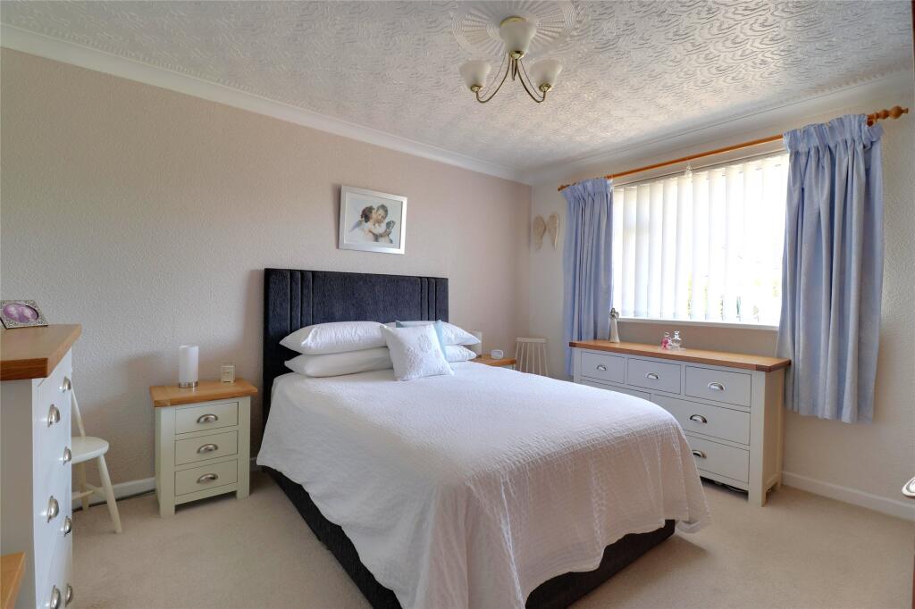
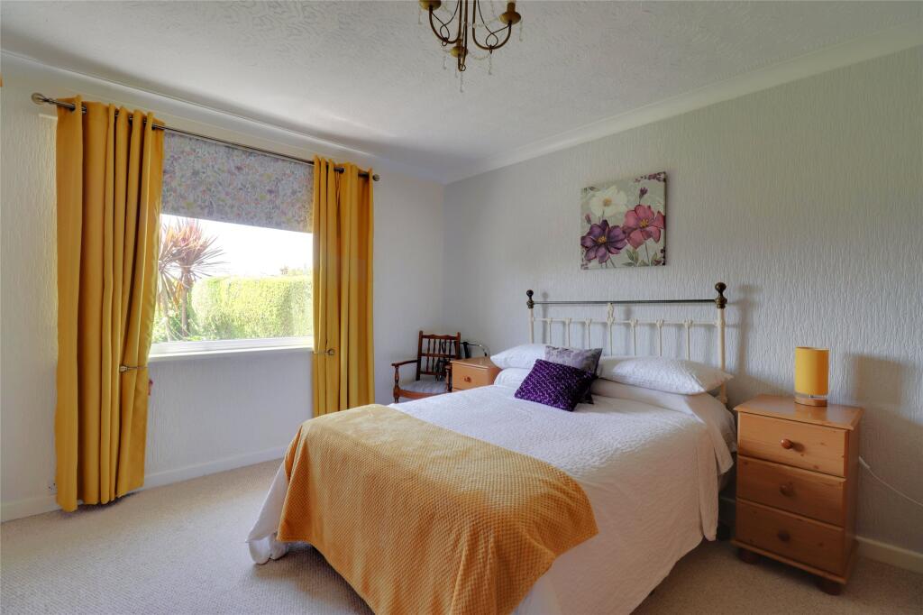
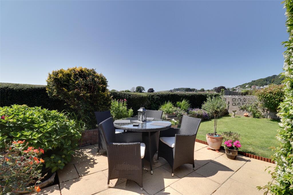
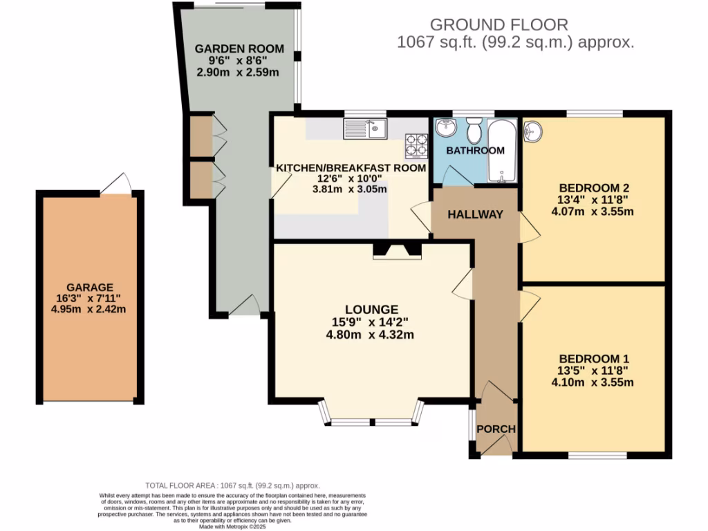
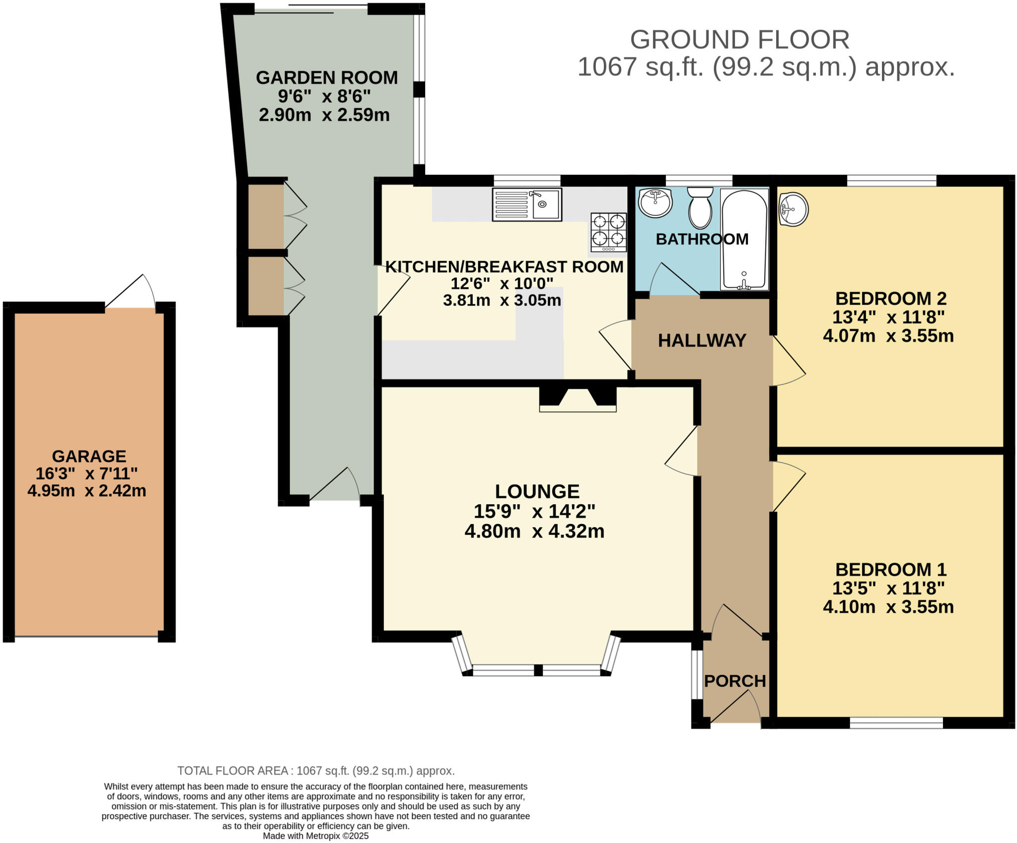
- A single-story property with a garden room, kitchen/breakfast room, lounge, and two bedrooms.
Rooms
- Garden Room: Small
- Kitchen/Breakfast Room: Average
- Lounge: Large
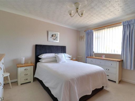
- Bedroom 1: Average
- Bedroom 2: Average
Textual Property Features
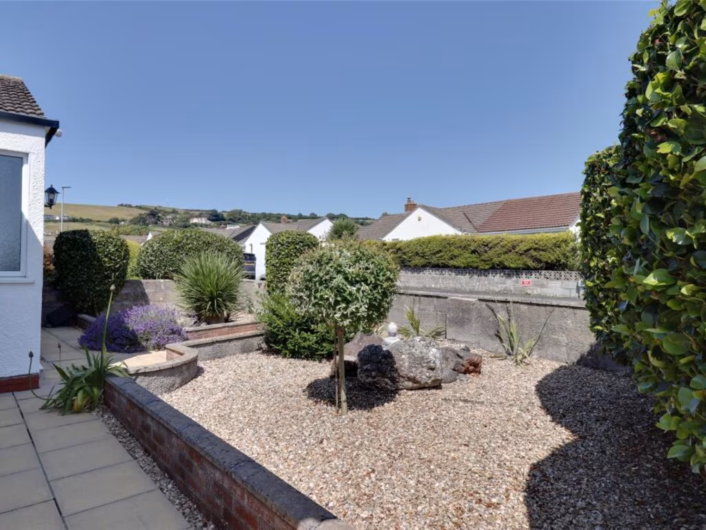
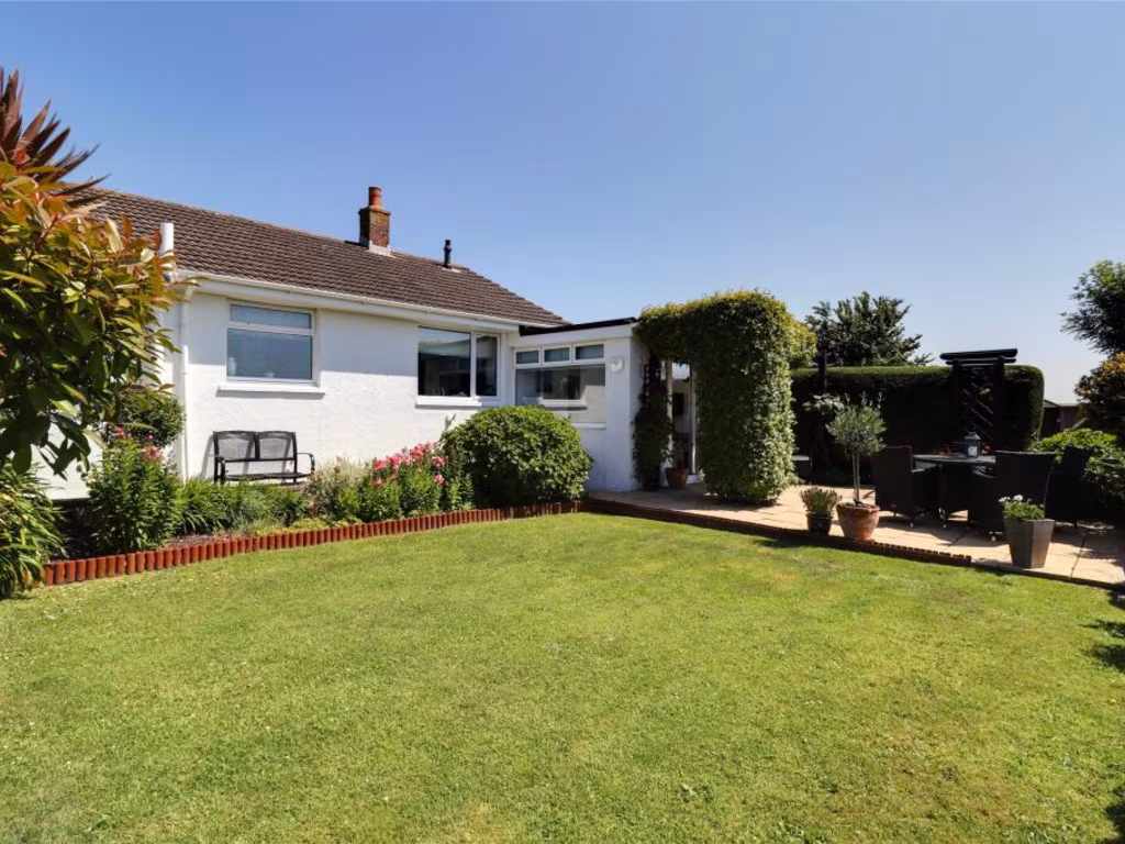
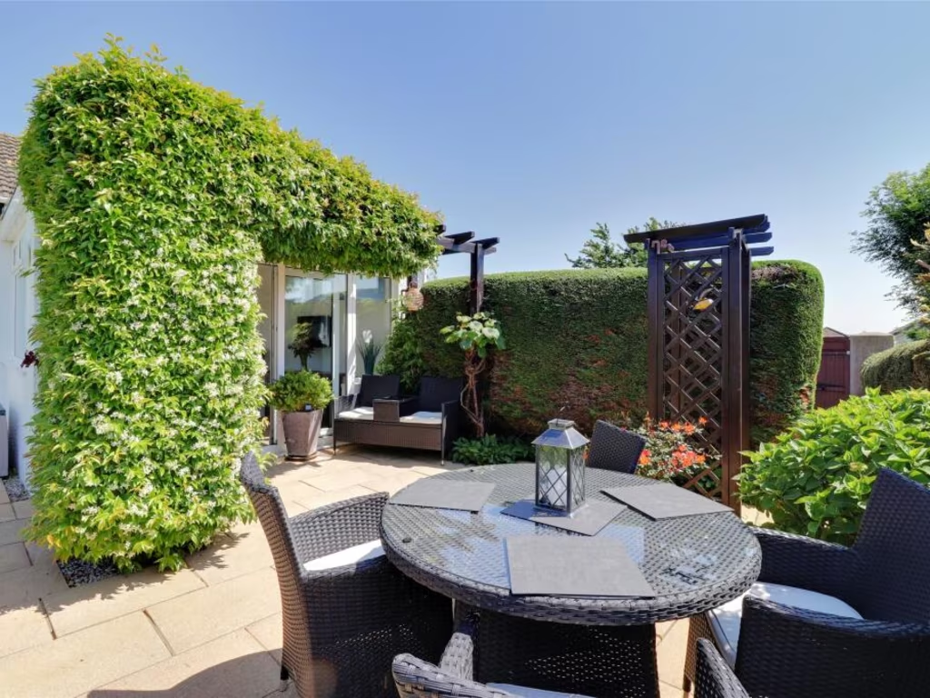
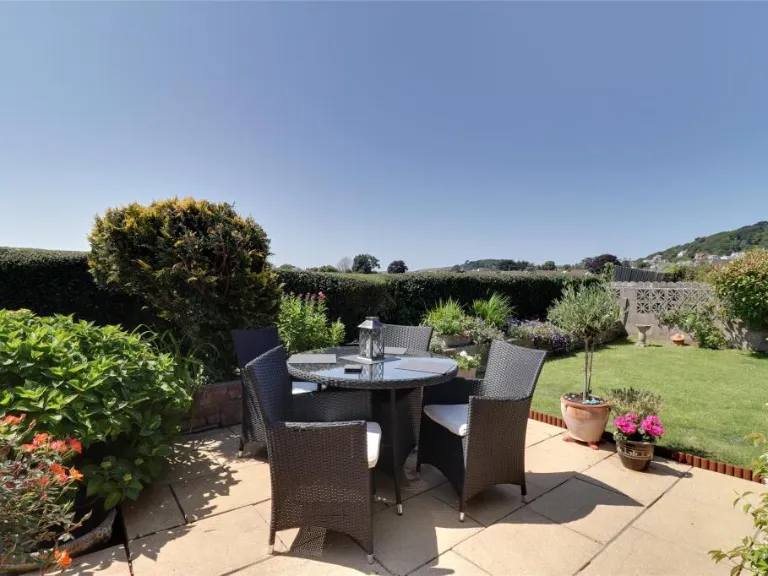
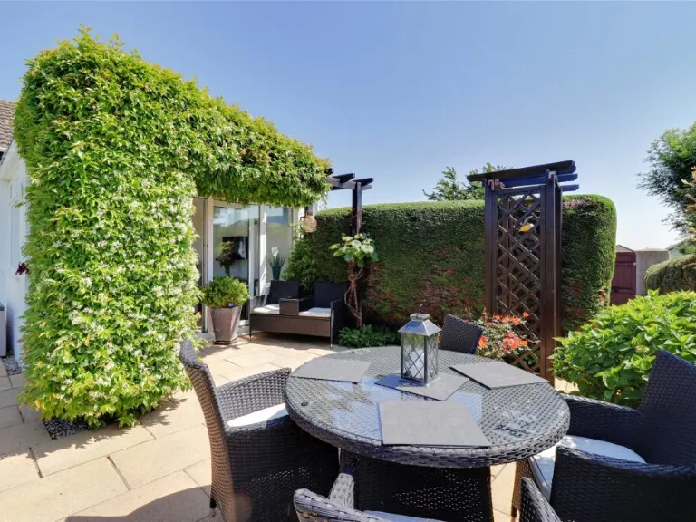
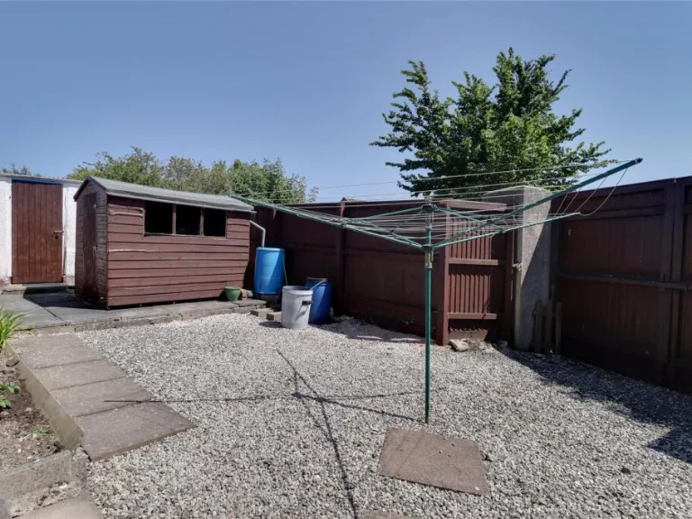
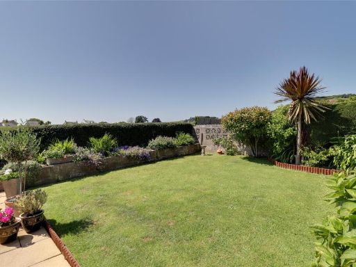
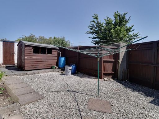
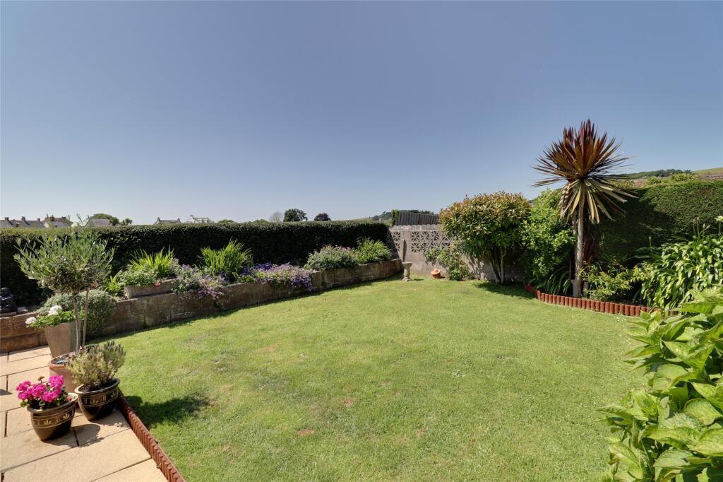
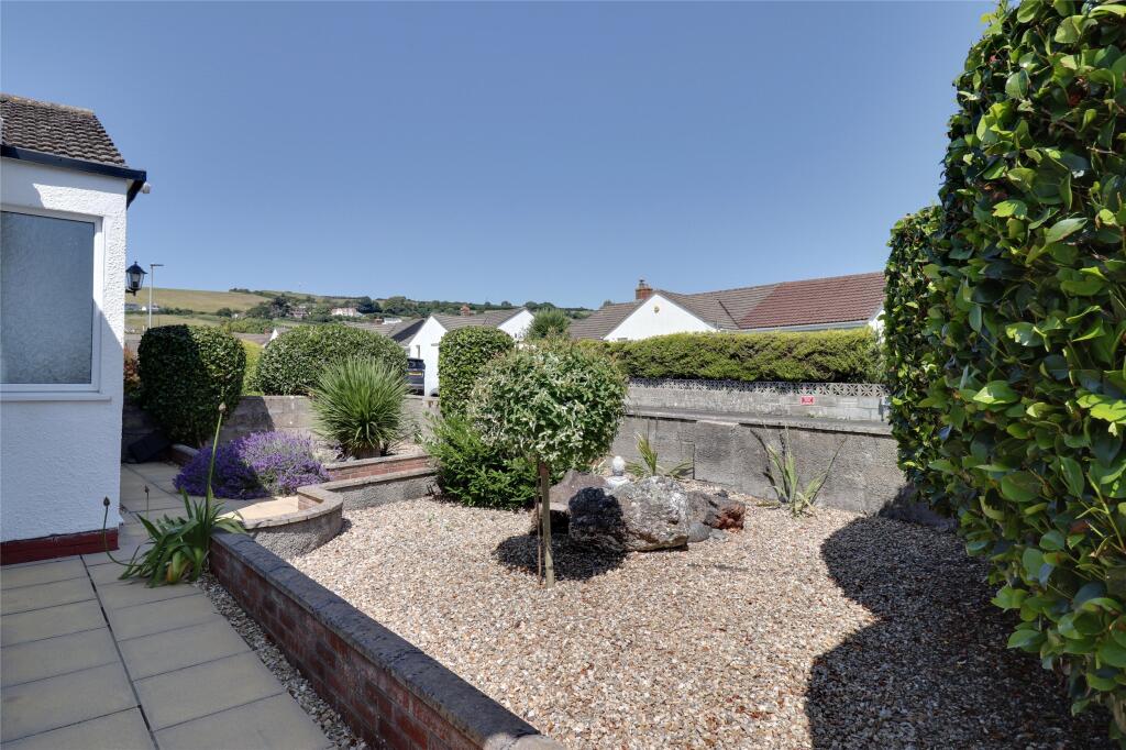
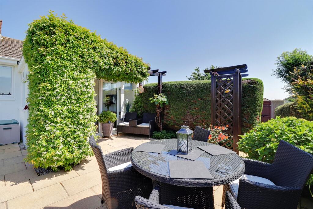
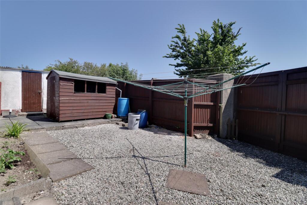
- Has Garden
- Is Retirement
- Success
Detected Visual Features
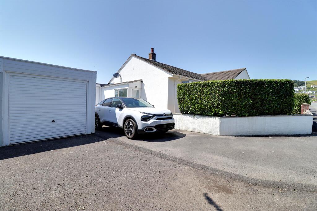
- bungalow
- single-story
- mid-20th century
- garage
- garden
- private driveway
- cul-de-sac
- living room
- contemporary
- fireplace
- ceiling rose
- cornicing
- neutral tones
- well-kept
- medium size room
- standard ceiling height
Nearby Schools
- Appledore School
- Instow Community Primary and Pre-School
- The Shoreline Academy
- Ashleigh CofE Primary School
- Marwood School
- St George's CofE Infant and Nursery School
- The Park Community School
- Our Lady's Catholic Primary School, Barnstaple
- Pilton Community College
- Braunton Academy
- Southmead School
- Woolacombe School
- St Margaret's Church of England (Aided) Junior School
- Holywell Church of England School
- Fremington Primary School
- Sticklepath Community Primary Academy
- Pilton Bluecoat Church of England Academy
- Kingsacre Primary School
- West Down School
- Roundswell Community Primary Academy
- Yeo Valley Primary School
- Pilton Infants' Academy
- Caen Community Primary School
Nearest Bars And Restaurants
- Id: 4623791851
- Tags:
- Amenity: restaurant
- Name: At One Restaurant
- TagsNormalized:
- Lat: 51.108447
- Lon: -4.161725
- FullGeoHash: gcj4c2182c0c
- PartitionGeoHash: gcj4
- Images:
- FoodStandards: null
- Distance: 535.7
,- Id: 4623791852
- Tags:
- Amenity: restaurant
- Cuisine: french
- Name: Le Bistro du Coin
- TagsNormalized:
- Lat: 51.108416
- Lon: -4.161095
- FullGeoHash: gcj4c21bp7q8
- PartitionGeoHash: gcj4
- Images:
- FoodStandards: null
- Distance: 497.5
,- Id: 2446288789
- Tags:
- Amenity: pub
- Food: yes
- Name: Mariners Arms
- Real_ale: yes
- Wikidata: Q79838445
- TagsNormalized:
- Lat: 51.10624
- Lon: -4.1618281
- FullGeoHash: gcj49r97qmsh
- PartitionGeoHash: gcj4
- Images:
- FoodStandards: null
- Distance: 458.3
,- Id: 1316053349
- Tags:
- Amenity: restaurant
- Cuisine: fish_and_chips
- Name: Squires
- TagsNormalized:
- Lat: 51.107708
- Lon: -4.1610172
- FullGeoHash: gcj49rf5cr29
- PartitionGeoHash: gcj4
- Images:
- FoodStandards: null
- Distance: 451.4
,- Id: 4623791856
- Tags:
- Amenity: bar
- Name: SQ Bar Restaurant
- TagsNormalized:
- Lat: 51.107866
- Lon: -4.160806
- FullGeoHash: gcj49rfhyhwp
- PartitionGeoHash: gcj4
- Images:
- FoodStandards: null
- Distance: 447.1
}
Nearest General Shops
- Id: 4623791853
- Tags:
- Name: Slees Home Hardware
- Shop: hardware
- TagsNormalized:
- Lat: 51.1083669
- Lon: -4.1615125
- FullGeoHash: gcj49rcxvdp7
- PartitionGeoHash: gcj4
- Images:
- FoodStandards: null
- Distance: 518.4
,- Id: 4623791857
- Tags:
- Name: Reed's Butchers
- Shop: butcher
- TagsNormalized:
- Lat: 51.108
- Lon: -4.161459
- FullGeoHash: gcj49rctwvxr
- PartitionGeoHash: gcj4
- Images:
- FoodStandards: null
- Distance: 494
,- Id: 4623791855
- Tags:
- Name: L&R Dry Cleaners
- Shop: dry_cleaning
- TagsNormalized:
- Lat: 51.108179
- Lon: -4.1608556
- FullGeoHash: gcj49rfntp15
- PartitionGeoHash: gcj4
- Images:
- FoodStandards: null
- Distance: 468.7
}
Nearest Grocery shops
- Id: 542162882
- Tags:
- Name: Brook Stores
- Shop: convenience
- TagsNormalized:
- Lat: 51.1308124
- Lon: -4.2241654
- FullGeoHash: gchfzuh49f3b
- PartitionGeoHash: gchf
- Images:
- FoodStandards: null
- Distance: 5552.7
,- Id: 4623796891
- Tags:
- Name: Best One xPress
- Shop: convenience
- TagsNormalized:
- Lat: 51.0941779
- Lon: -4.1370626
- FullGeoHash: gcj49v7mpmne
- PartitionGeoHash: gcj4
- Images:
- FoodStandards: null
- Distance: 1815.3
,- Id: 4623791864
- Tags:
- Name: John Patts Fruit Shop
- Shop: greengrocer
- TagsNormalized:
- Lat: 51.107256
- Lon: -4.16062
- FullGeoHash: gcj49rf36e0c
- PartitionGeoHash: gcj4
- Images:
- FoodStandards: null
- Distance: 404.6
}
Nearest Supermarkets
- Id: 162873946
- Tags:
- Addr:
- City: Barnstaple
- Housename: Roundswell Business Park
- Postcode: EX31 3NH
- Street: Gratton Way
- Alt_name: Sainsbury's Barnstaple Superstore
- Brand: Sainsbury's
- Brand:wikidata: Q152096
- Brand:wikipedia: en:Sainsbury's
- Building: yes
- Name: Sainsbury's
- Shop: supermarket
- Wheelchair: yes
- TagsNormalized:
- sainsburys
- supermarket
- shop
- Lat: 51.0670085
- Lon: -4.0837297
- FullGeoHash: gcj4e06qfhq7
- PartitionGeoHash: gcj4
- Images:
- FoodStandards: null
- Distance: 6603.6
,- Id: 46423220
- Tags:
- Addr:
- City: Barnstaple
- Housenumber: 5
- Postcode: EX31 3RY
- Street: Roundswell Business Park
- Brand: ALDI
- Brand:wikidata: Q41171672
- Building: yes
- Name: ALDI
- Phone: +44 1271 329837
- Shop: supermarket
- TagsNormalized:
- Lat: 51.0664537
- Lon: -4.0862685
- FullGeoHash: gcj4e027xhcm
- PartitionGeoHash: gcj4
- Images:
- FoodStandards: null
- Distance: 6511.7
,- Id: 29237601
- Tags:
- Brand: Tesco
- Brand:wikidata: Q487494
- Brand:wikipedia: en:Tesco
- Building: yes
- Contact:
- Website: https://www.tesco.com/store-locator/braunton/vellator-way
- Name: Tesco Braunton
- Shop: supermarket
- TagsNormalized:
- Lat: 51.103043
- Lon: -4.1645182
- FullGeoHash: gcj49pp2z9wj
- PartitionGeoHash: gcj4
- Images:
- FoodStandards: null
- Distance: 713.5
}
Nearest Religious buildings
- Id: 860986932
- Tags:
- Amenity: place_of_worship
- Building: church
- Denomination: anglican
- Name: St Brannock's Church
- Religion: christian
- Wikidata: Q7592696
- Wikipedia: en:St Brannock's Church, Braunton
- TagsNormalized:
- place of worship
- church
- anglican
- christian
- Lat: 51.1129854
- Lon: -4.1597845
- FullGeoHash: gcj4c2fftzpf
- PartitionGeoHash: gcj4
- Images:
- FoodStandards: null
- Distance: 856.8
,- Id: 237079868
- Tags:
- Amenity: place_of_worship
- Building: yes
- Name: Christ Church
- Religion: christian
- TagsNormalized:
- place of worship
- church
- christian
- Lat: 51.1096712
- Lon: -4.1610407
- FullGeoHash: gcj4c24p2tr0
- PartitionGeoHash: gcj4
- Images:
- FoodStandards: null
- Distance: 587.1
,- Id: 237079869
- Tags:
- Amenity: place_of_worship
- Building: yes
- Name: Braunton Pentecostal Church
- Religion: christian
- TagsNormalized:
- place of worship
- church
- pentecostal
- christian
- Lat: 51.1089604
- Lon: -4.1612301
- FullGeoHash: gcj4c21gk2cb
- PartitionGeoHash: gcj4
- Images:
- FoodStandards: null
- Distance: 542.1
}
Nearest Medical buildings
- Id: 347347372
- Tags:
- Addr:
- City: Barnstaple
- Housenumber: 69-70
- Postcode: EX31 1HX
- Street: High Street
- Amenity: pharmacy
- Brand: Boots
- Brand:wikidata: Q6123139
- Brand:wikipedia: en:Boots UK
- Dispensing: yes
- Healthcare: pharmacy
- Name: Boots
- TagsNormalized:
- pharmacy
- boots
- health
- healthcare
- Lat: 51.0813193
- Lon: -4.0607013
- FullGeoHash: gcj4ee546b1d
- PartitionGeoHash: gcj4
- Images:
- FoodStandards: null
- Distance: 7145.8
,- Id: 3679034182
- Tags:
- Amenity: pharmacy
- Brand:
- Name: Boots
- TagsNormalized:
- Lat: 51.0720302
- Lon: -4.1265005
- FullGeoHash: gcj4d17hjs6p
- PartitionGeoHash: gcj4
- Images:
- FoodStandards: null
- Distance: 4261.1
,- Id: 324331834
- Tags:
- TagsNormalized:
- Lat: 51.107508
- Lon: -4.1629016
- FullGeoHash: gcj49rbdv658
- PartitionGeoHash: gcj4
- Images:
- FoodStandards: null
- Distance: 563.2
,- Id: 4623791854
- Tags:
- Amenity: pharmacy
- Name: Lloyds Pharmacy
- TagsNormalized:
- Lat: 51.108506
- Lon: -4.162087
- FullGeoHash: gcj4c2128k4c
- PartitionGeoHash: gcj4
- Images:
- FoodStandards: null
- Distance: 560.5
}
Nearest Leisure Facilities
- Id: 195561684
- Tags:
- Leisure: pitch
- Sport: tennis
- TagsNormalized:
- Lat: 51.1023505
- Lon: -4.1537925
- FullGeoHash: gcj49qzkc8ef
- PartitionGeoHash: gcj4
- Images:
- FoodStandards: null
- Distance: 399.1
,- Id: 29240993
- Tags:
- Leisure: track
- Sport: running
- TagsNormalized:
- track
- leisure
- running
- sports
- Lat: 51.1029793
- Lon: -4.1522263
- FullGeoHash: gcj49x02qjg9
- PartitionGeoHash: gcj4
- Images:
- FoodStandards: null
- Distance: 381.2
,- Id: 195563299
- Tags:
- Leisure: pitch
- Sport: athletics
- TagsNormalized:
- pitch
- leisure
- athletic
- athletics
- sports
- Lat: 51.1029946
- Lon: -4.152285
- FullGeoHash: gcj49x02s8xu
- PartitionGeoHash: gcj4
- Images:
- FoodStandards: null
- Distance: 377.5
,- Id: 29240813
- Tags:
- TagsNormalized:
- Lat: 51.1060545
- Lon: -4.1588925
- FullGeoHash: gcj49red6g0c
- PartitionGeoHash: gcj4
- Images:
- FoodStandards: null
- Distance: 252.3
,- Id: 29241205
- Tags:
- Leisure: pitch
- Sport: tennis
- Surface: asphalt
- TagsNormalized:
- Lat: 51.1037719
- Lon: -4.1560565
- FullGeoHash: gcj49rjthce9
- PartitionGeoHash: gcj4
- Images:
- FoodStandards: null
- Distance: 233
}
Nearest Tourist attractions
- Id: 2449193002
- Tags:
- Name: Kingsacre
- Tourism: guest_house
- TagsNormalized:
- Lat: 51.109726
- Lon: -4.1723398
- FullGeoHash: gcj4c01z9rmz
- PartitionGeoHash: gcj4
- Images:
- FoodStandards: null
- Distance: 1266.7
,- Id: 237079873
- Tags:
- Building: public
- Tourism: museum
- TagsNormalized:
- Lat: 51.108492
- Lon: -4.1627512
- FullGeoHash: gcj4c20b8c7w
- PartitionGeoHash: gcj4
- Images:
- FoodStandards: null
- Distance: 599.5
,- Id: 237643608
- Tags:
- Building: yes
- Disused:
- Name: Museum of British Surfing
- Tourism: museum
- Wikidata: Q28402342
- Wikipedia: en:Museum of British Surfing
- TagsNormalized:
- Lat: 51.1079387
- Lon: -4.1631053
- FullGeoHash: gcj49rbt2d79
- PartitionGeoHash: gcj4
- Images:
- FoodStandards: null
- Distance: 594
}
Nearest Train stations
- Id: 7985809804
- Tags:
- Name: Killington Lane
- Public_transport: station
- Railway: station
- Train: yes
- Usage: tourism
- TagsNormalized:
- Lat: 51.1967627
- Lon: -3.9036851
- FullGeoHash: gcj5r0j6v833
- PartitionGeoHash: gcj5
- Images:
- FoodStandards: null
- Distance: 20255.2
,- Id: 152203117
- Tags:
- Amenity: pub
- Building: train_station
- Name: The Puffing Billy
- Wikidata: Q79684460
- TagsNormalized:
- bar
- pub
- station
- train
- train station
- Lat: 50.9571627
- Lon: -4.1655966
- FullGeoHash: gcj1chqwyxd5
- PartitionGeoHash: gcj1
- Images:
- FoodStandards: null
- Distance: 16544.8
,- Id: 9079211824
- Tags:
- Public_transport: station
- Railway: station
- Usage: tourism
- TagsNormalized:
- Lat: 51.1886258
- Lon: -4.0042878
- FullGeoHash: gcj5hys5m76w
- PartitionGeoHash: gcj5
- Images:
- FoodStandards: null
- Distance: 13991.3
,- Id: 32037600
- Tags:
- Name: Chapelton
- Naptan:
- Network: National Rail
- Public_transport: station
- Railway: station
- Ref:
- Request_stop: yes
- Wikidata: Q2291762
- Wikipedia: en:Chapelton railway station
- TagsNormalized:
- Lat: 51.016229
- Lon: -4.0245509
- FullGeoHash: gcj4hrjrj4m7
- PartitionGeoHash: gcj4
- Images:
- FoodStandards: null
- Distance: 13517.4
,- Id: 6900362324
- Tags:
- Addr:
- City: Barnstaple
- Postcode: EX31 2AU
- Street: Station Road
- Internet_access: yes
- Internet_access:fee: yes
- Name: Barnstaple
- Name:lt: Barnstaplas
- Naptan:
- Network: National Rail
- Old_name: Barnstaple Junction
- Operator: Great Western Railway
- Public_transport: station
- Railway: station
- Ref:
- Wheelchair: yes
- Wikidata: Q800448
- Wikipedia: en:Barnstaple railway station
- TagsNormalized:
- Lat: 51.0737586
- Lon: -4.0632151
- FullGeoHash: gcj4e99q0nxj
- PartitionGeoHash: gcj4
- Images:
- FoodStandards: null
- Distance: 7353
}
Nearest Bus stations and stops
- Id: 617160795
- Tags:
- Bus: yes
- Highway: bus_stop
- Public_transport: platform
- TagsNormalized:
- Lat: 51.0767362
- Lon: -4.0615843
- FullGeoHash: gcj4ed4rw1xp
- PartitionGeoHash: gcj4
- Images:
- FoodStandards: null
- Distance: 7300.1
,- Id: 542275276
- Tags:
- Bus: yes
- Highway: bus_stop
- Public_transport: platform
- Shelter: yes
- TagsNormalized:
- Lat: 51.1342118
- Lon: -4.2363265
- FullGeoHash: gchfzsenq7yn
- PartitionGeoHash: gchf
- Images:
- FoodStandards: null
- Distance: 6477.2
,- Id: 3907233689
- Tags:
- Bus: yes
- Highway: bus_stop
- Name: Lagoon View
- Public_transport: platform
- Shelter: yes
- TagsNormalized:
- Lat: 51.0663748
- Lon: -4.1568865
- FullGeoHash: gcj492m51w0z
- PartitionGeoHash: gcj4
- Images:
- FoodStandards: null
- Distance: 4386.7
,- Id: 9481978678
- Tags:
- Bus: yes
- Highway: bus_stop
- Public_transport: platform
- Shelter: yes
- TagsNormalized:
- Lat: 51.1258343
- Lon: -4.1551401
- FullGeoHash: gcj4c7nmd4qb
- PartitionGeoHash: gcj4
- Images:
- FoodStandards: null
- Distance: 2226.3
,- Id: 9481978677
- Tags:
- Bench: yes
- Bus: yes
- Highway: bus_stop
- Public_transport: platform
- Shelter: yes
- TagsNormalized:
- Lat: 51.1255986
- Lon: -4.1554016
- FullGeoHash: gcj4c7nhhn7f
- PartitionGeoHash: gcj4
- Images:
- FoodStandards: null
- Distance: 2200.1
}
Nearest Hotels
- Id: 151789685
- Tags:
- Building: yes
- Name: Saunton Sands Hotel
- Source: Bing
- Tourism: hotel
- TagsNormalized:
- Lat: 51.1183753
- Lon: -4.2209221
- FullGeoHash: gchfzcy6j7u6
- PartitionGeoHash: gchf
- Images:
- FoodStandards: null
- Distance: 4789.2
,- Id: 151789683
- Tags:
- Access: customers
- Amenity: parking
- Name: Saunton Sands Hotel
- Source: Bing
- TagsNormalized:
- Lat: 51.118112
- Lon: -4.2197749
- FullGeoHash: gchfzcz284ez
- PartitionGeoHash: gchf
- Images:
- FoodStandards: null
- Distance: 4704.1
,- Id: 1562108889
- Tags:
- Accommodation: yes
- Addr:
- City: Braunton
- Housename: The George Hotel
- Postcode: EX33 2JJ
- Street: Exeter Road
- Amenity: pub
- Food: yes
- Name: The George Hotel
- Operator: The Ohh Pub Company
- Real_ale: yes
- TagsNormalized:
- Lat: 51.1079124
- Lon: -4.1611602
- FullGeoHash: gcj49rcvjvqh
- PartitionGeoHash: gcj4
- Images:
- FoodStandards: null
- Distance: 471.1
}
Tags
- bungalow
- single-story
- mid-20th century
- garage
- garden
- private driveway
- cul-de-sac
- living room
- contemporary
- fireplace
- ceiling rose
- cornicing
- neutral tones
- well-kept
- medium size room
- standard ceiling height
Local Market Stats
- Average Price/sqft: £387
- Avg Income: £45700
- Rental Yield: 2.3%
- Social Housing: 5%
- Planning Success Rate: 92%
AirBnB Data
- 1km average: £75/night
- Listings in 1km: 14
Similar Properties
 3 bedroom detached house for sale in Higher Park Road, Braunton, Devon, EX33 — £351,750 • 3 bed • 2 bath • 1545 ft²
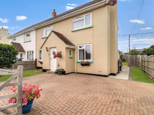 3 bedroom end of terrace house for sale in Field Close, Braunton, Devon, EX33 — £241,250 • 3 bed • 1 bath
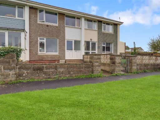 2 bedroom terraced house for sale in Ralph Close, Braunton, Devon, EX33 — £184,250 • 2 bed • 1 bath • 669 ft²
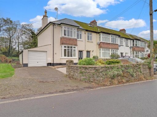 3 bedroom end of terrace house for sale in South Street, Braunton, Devon, EX33 — £254,500 • 3 bed • 2 bath • 810 ft²
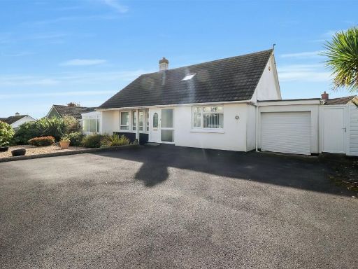 3 bedroom detached bungalow for sale in Bay View Road, Northam, Bideford, Devon, EX39 — £318,250 • 3 bed • 1 bath • 1768 ft²
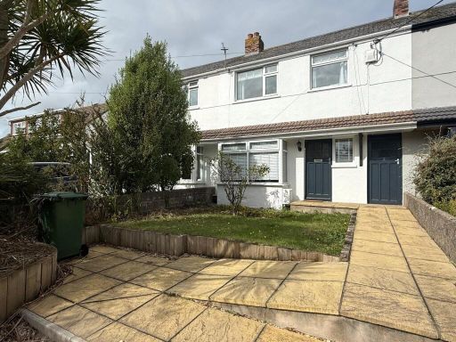 3 bedroom terraced house for sale in Selbourne Close, Braunton, EX33 — £251,250 • 3 bed • 1 bath • 755 ft²
Meta
- {
"@context": "https://schema.org",
"@type": "Residence",
"name": "2 bedroom semidetached bungalow for sale in The Brittons, B…",
"description": "",
"url": "https://propertypiper.co.uk/property/3d50f090-42b7-4c20-b2d3-5a7d028cb6e5",
"image": "https://image-a.propertypiper.co.uk/1d3138a4-39dc-4aa1-b704-98b3e88f52ac-1024.jpeg",
"address": {
"@type": "PostalAddress",
"streetAddress": "The Brittons, Braunton, Devon, EX33",
"postalCode": "EX33 2HF",
"addressLocality": "North Devon",
"addressRegion": "North Devon",
"addressCountry": "England"
},
"geo": {
"@type": "GeoCoordinates",
"latitude": 51.1058129,
"longitude": -4.1552998
},
"numberOfRooms": 2,
"numberOfBathroomsTotal": 1,
"floorSize": {
"@type": "QuantitativeValue",
"value": 1067,
"unitCode": "FTK"
},
"offers": {
"@type": "Offer",
"price": 251250,
"priceCurrency": "GBP",
"availability": "https://schema.org/InStock"
},
"additionalProperty": [
{
"@type": "PropertyValue",
"name": "Feature",
"value": "bungalow"
},
{
"@type": "PropertyValue",
"name": "Feature",
"value": "single-story"
},
{
"@type": "PropertyValue",
"name": "Feature",
"value": "mid-20th century"
},
{
"@type": "PropertyValue",
"name": "Feature",
"value": "garage"
},
{
"@type": "PropertyValue",
"name": "Feature",
"value": "garden"
},
{
"@type": "PropertyValue",
"name": "Feature",
"value": "private driveway"
},
{
"@type": "PropertyValue",
"name": "Feature",
"value": "cul-de-sac"
},
{
"@type": "PropertyValue",
"name": "Feature",
"value": "living room"
},
{
"@type": "PropertyValue",
"name": "Feature",
"value": "contemporary"
},
{
"@type": "PropertyValue",
"name": "Feature",
"value": "fireplace"
},
{
"@type": "PropertyValue",
"name": "Feature",
"value": "ceiling rose"
},
{
"@type": "PropertyValue",
"name": "Feature",
"value": "cornicing"
},
{
"@type": "PropertyValue",
"name": "Feature",
"value": "neutral tones"
},
{
"@type": "PropertyValue",
"name": "Feature",
"value": "well-kept"
},
{
"@type": "PropertyValue",
"name": "Feature",
"value": "medium size room"
},
{
"@type": "PropertyValue",
"name": "Feature",
"value": "standard ceiling height"
}
]
}
High Res Floorplan Images
Compatible Floorplan Images
FloorplanImages Thumbnail