BS21 5EP - 2 bedroom terraced house for sale in Positioned just off Fo…
View on Property Piper
2 bedroom terraced house for sale in Positioned just off Fosseway in Clevedon, BS21
Property Details
- Price: £259000
- Bedrooms: 2
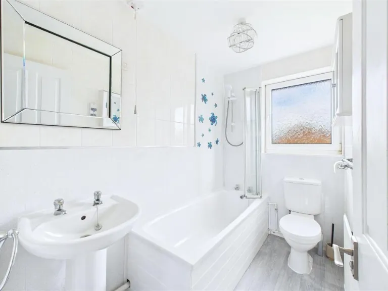
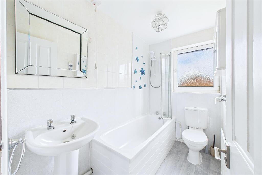
- Bathrooms: 1
- Property Type: undefined
- Property SubType: undefined
Brochure Descriptions
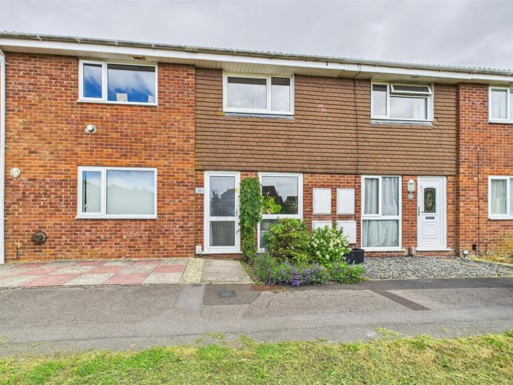
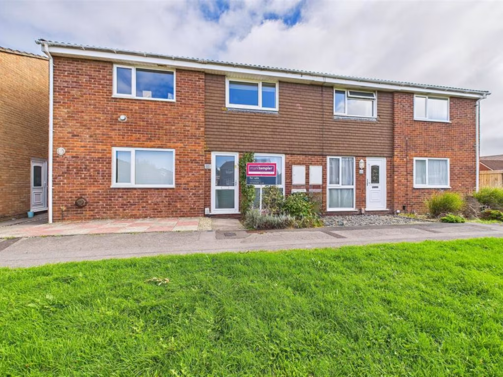
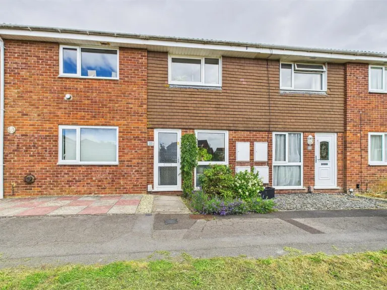
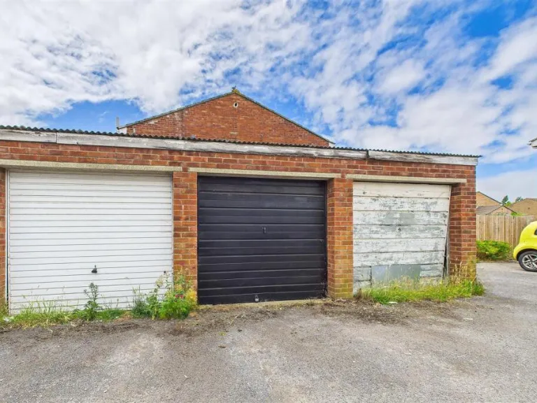
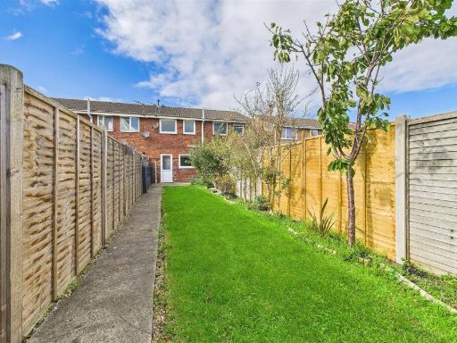
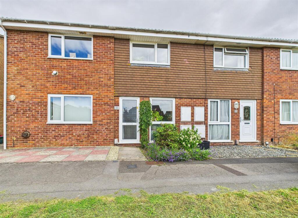
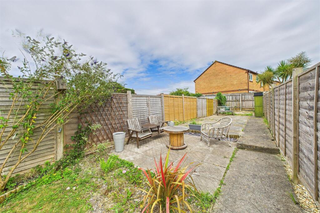
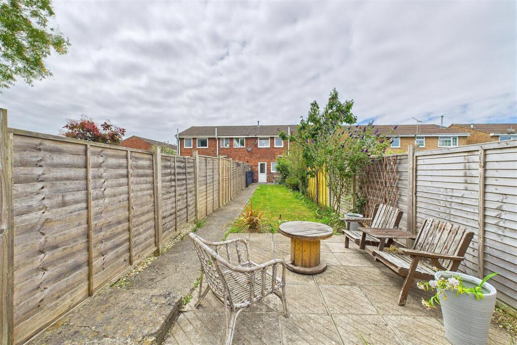
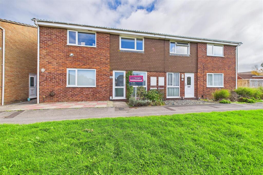
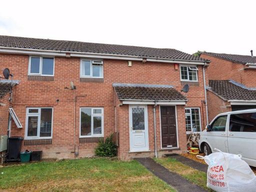
- This property is a mid-20th century terraced house, part of a neatly arranged street of similar properties. The home's facade is a blend of red brick and brown boarding, typical of suburban developments of its era, providing an aesthetic that is both sturdy and classic. The property's size appears to be average for a family home, featuring at least two floors with three visible windows on the upper level indicating multiple bedrooms. The entrance is set back slightly from the sidewalk, with a small but well-maintained garden adding a touch of greenery to the frontage. There is no garage visible from the exterior, implying that parking may be on-street. The immediate surroundings appear suburban, with no significant views of the natural landscape or urban skyline.
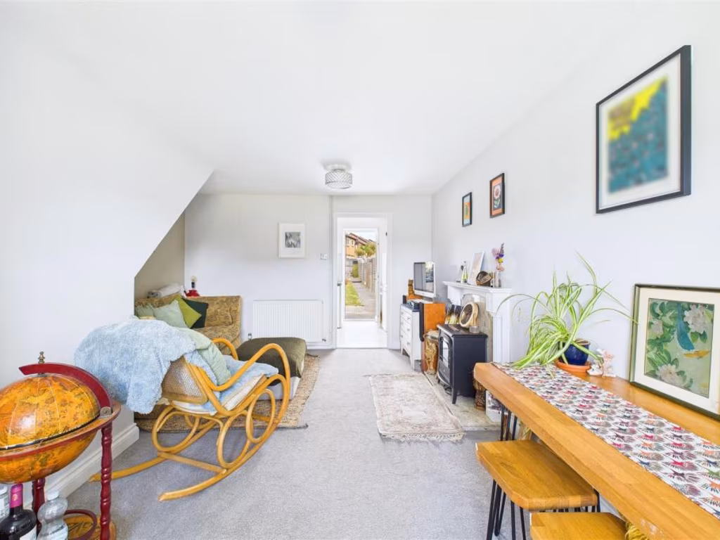
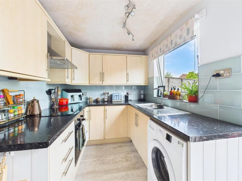
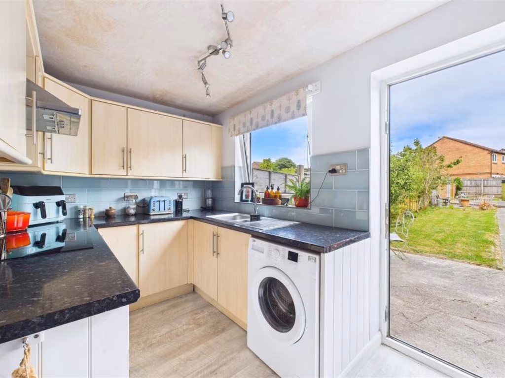
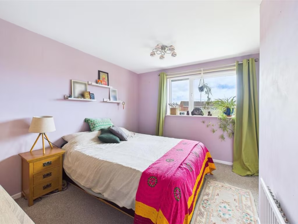
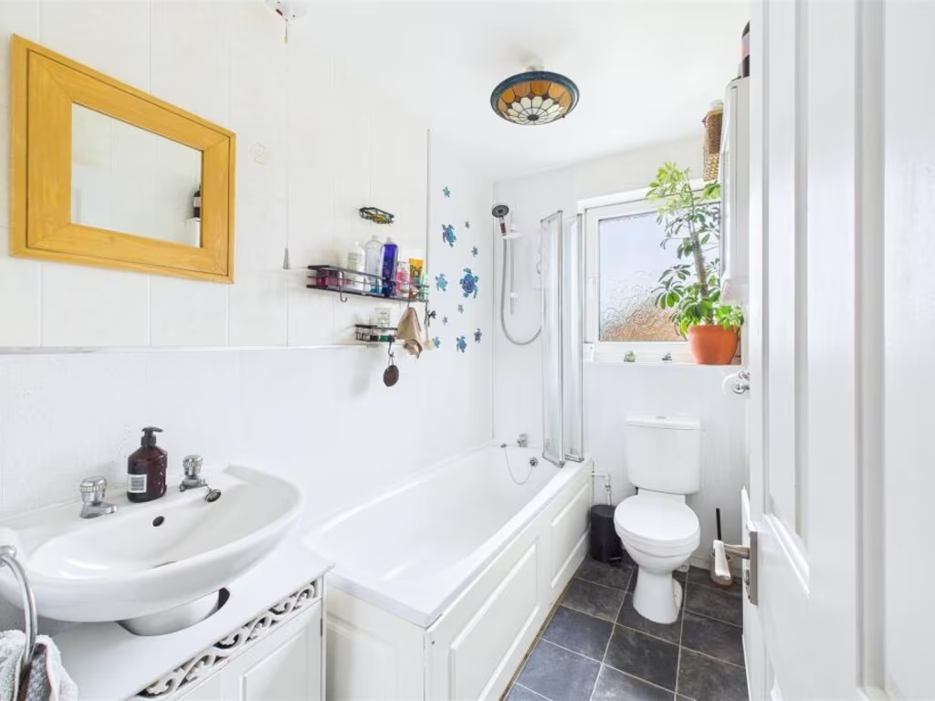
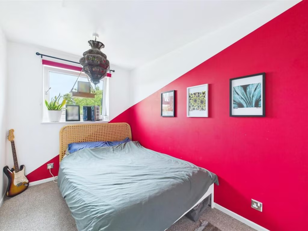
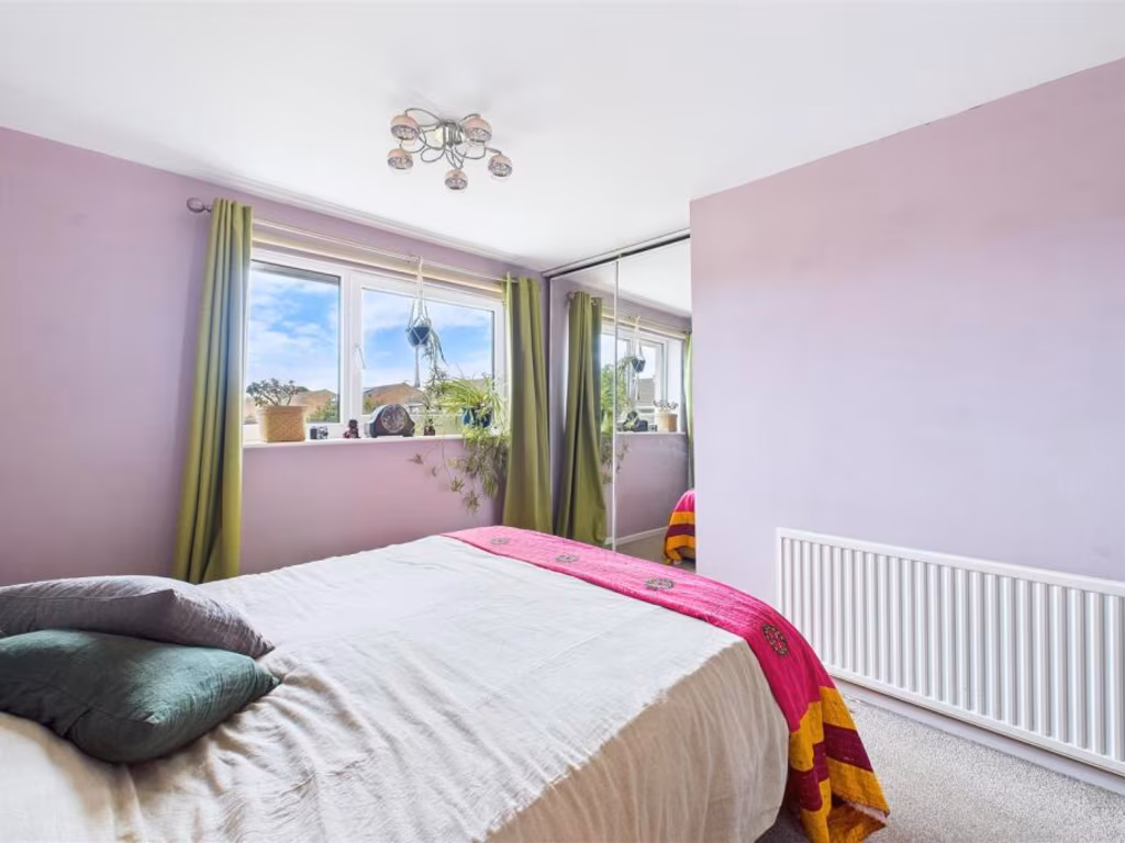
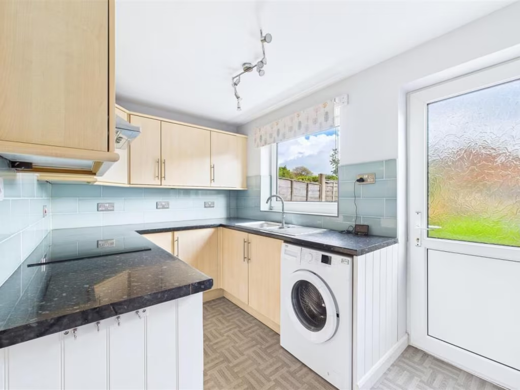
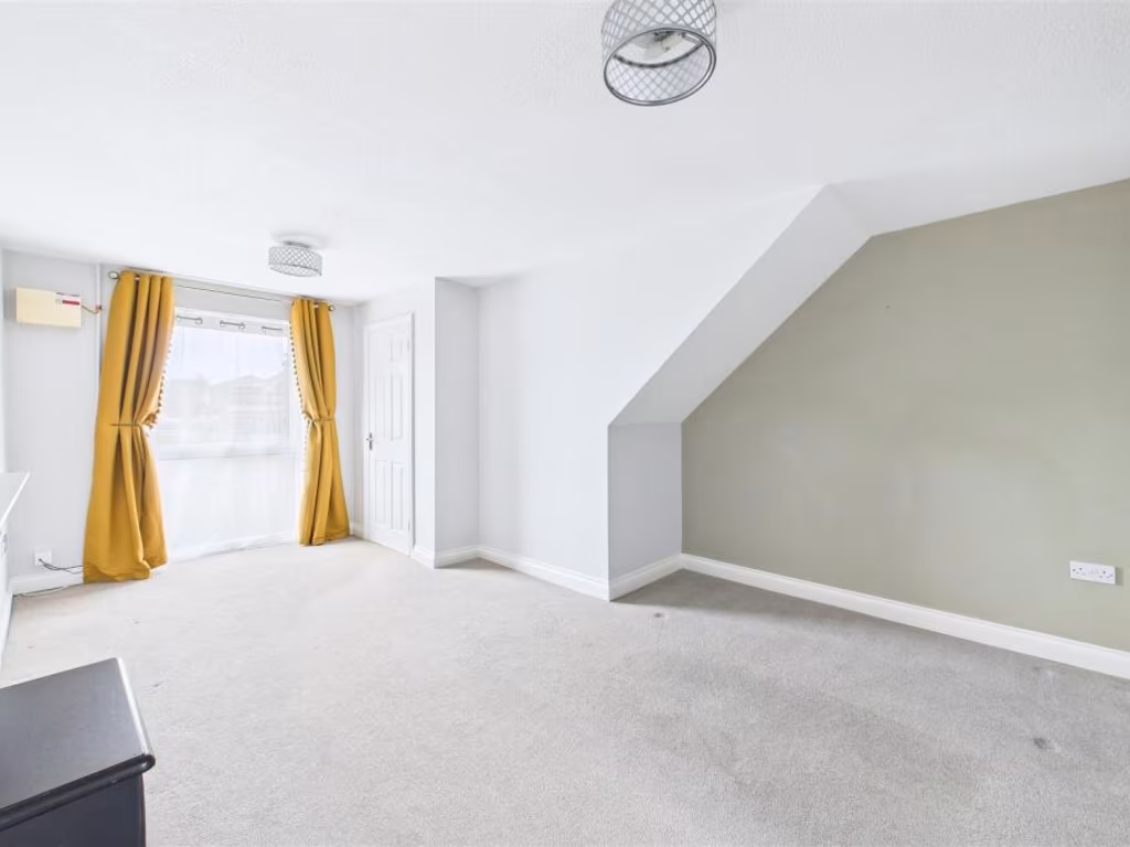
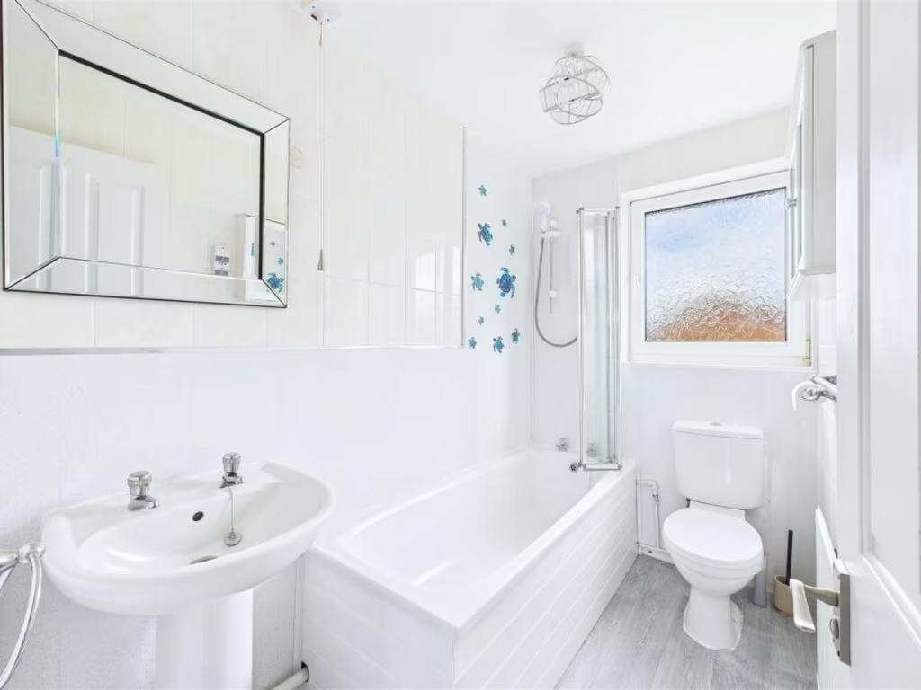
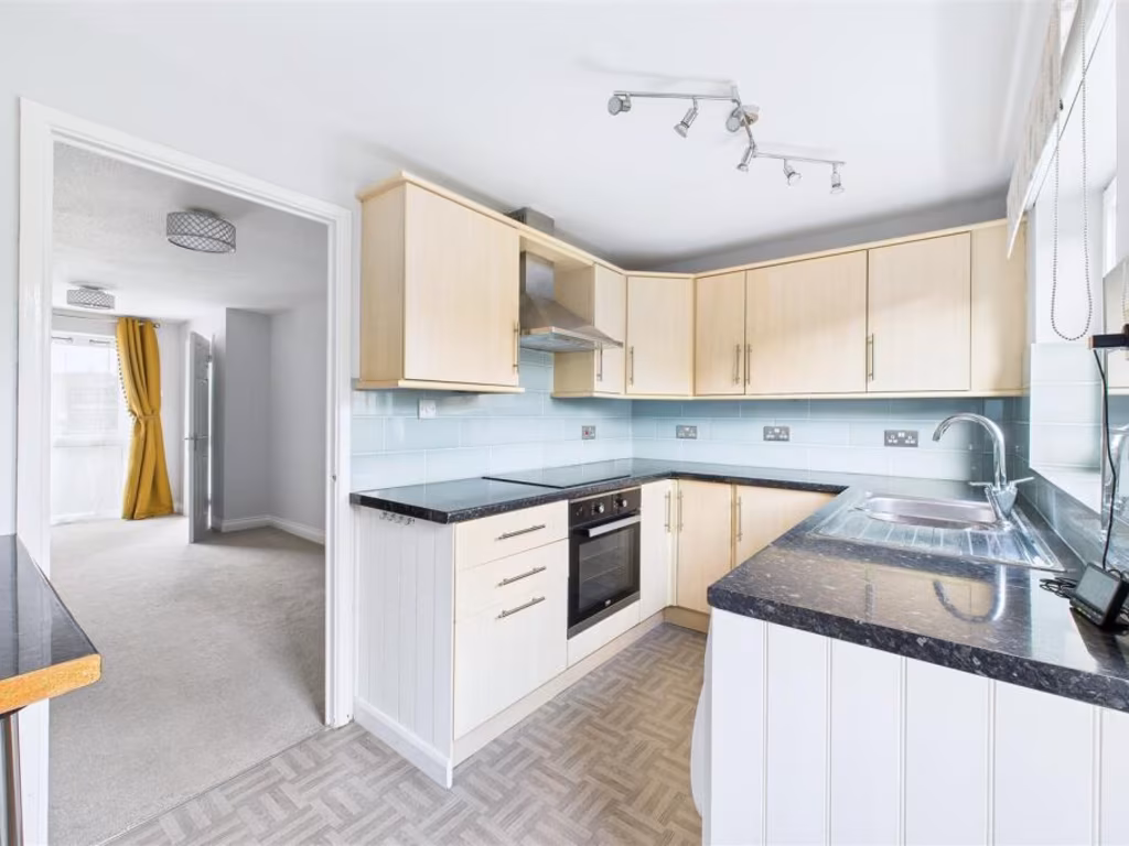
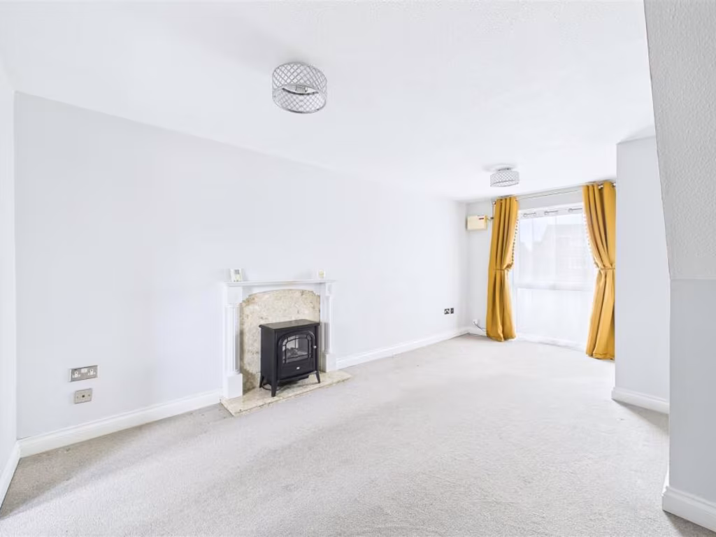
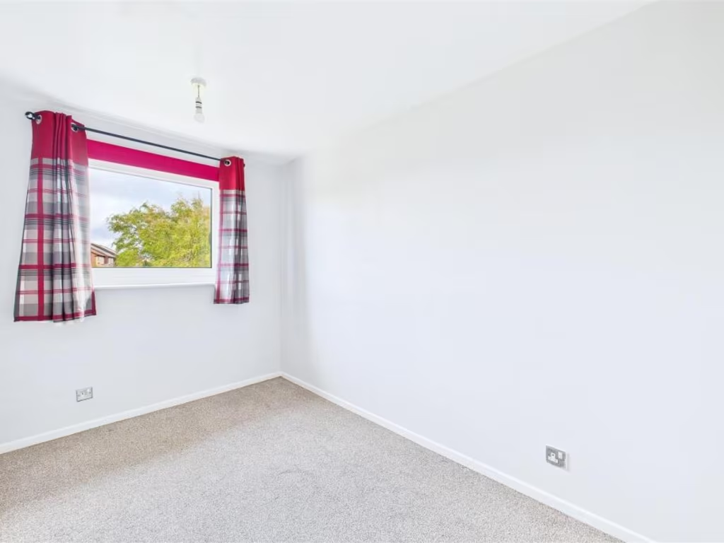
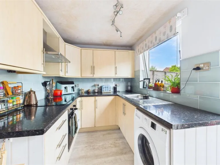
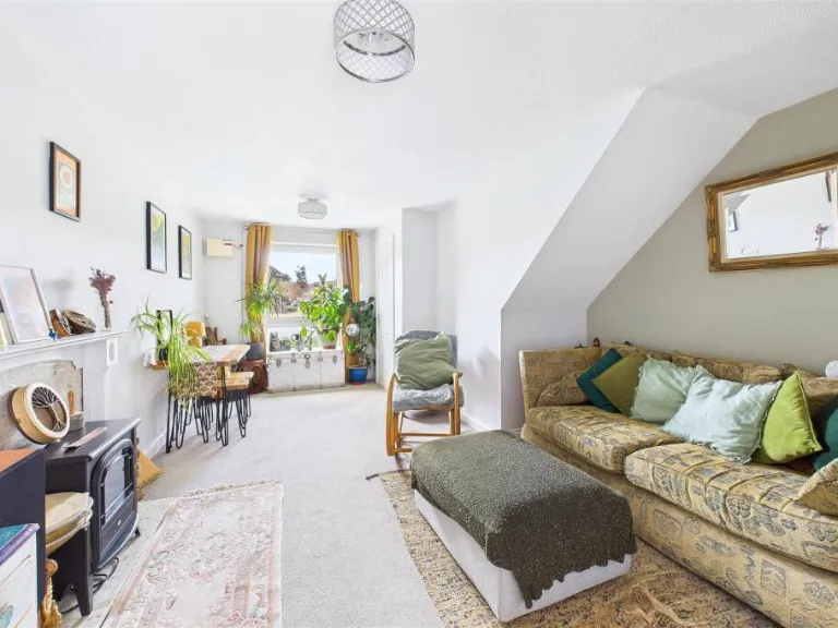
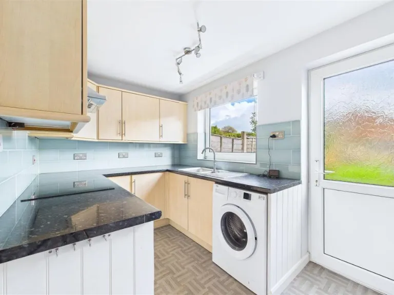
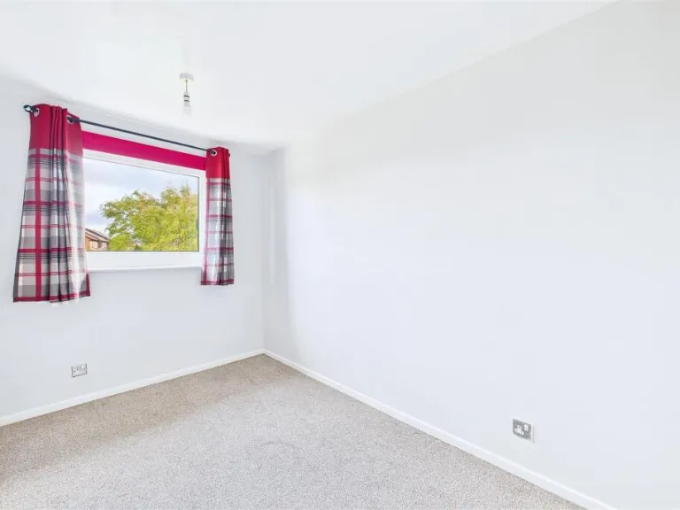
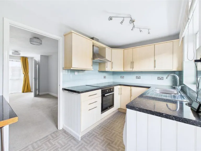
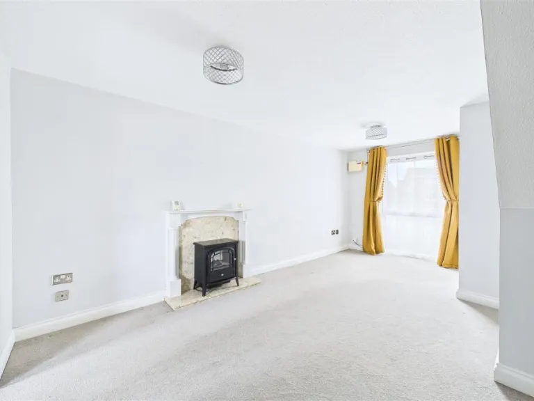
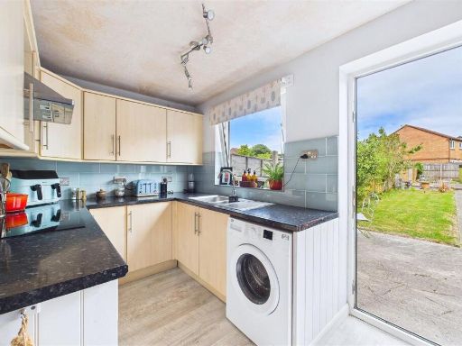
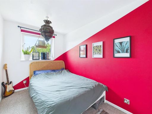
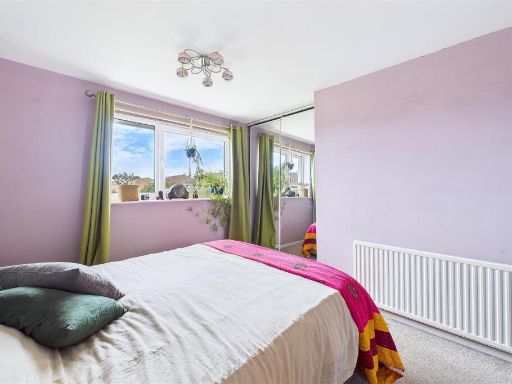
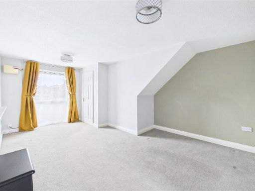
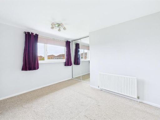
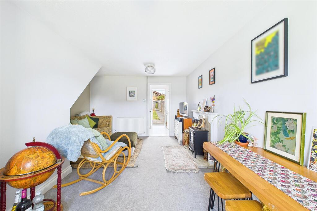
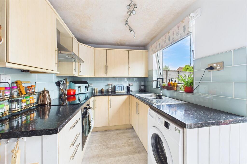
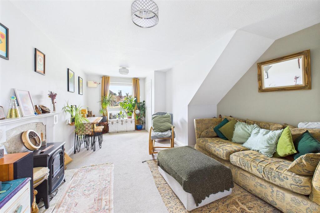
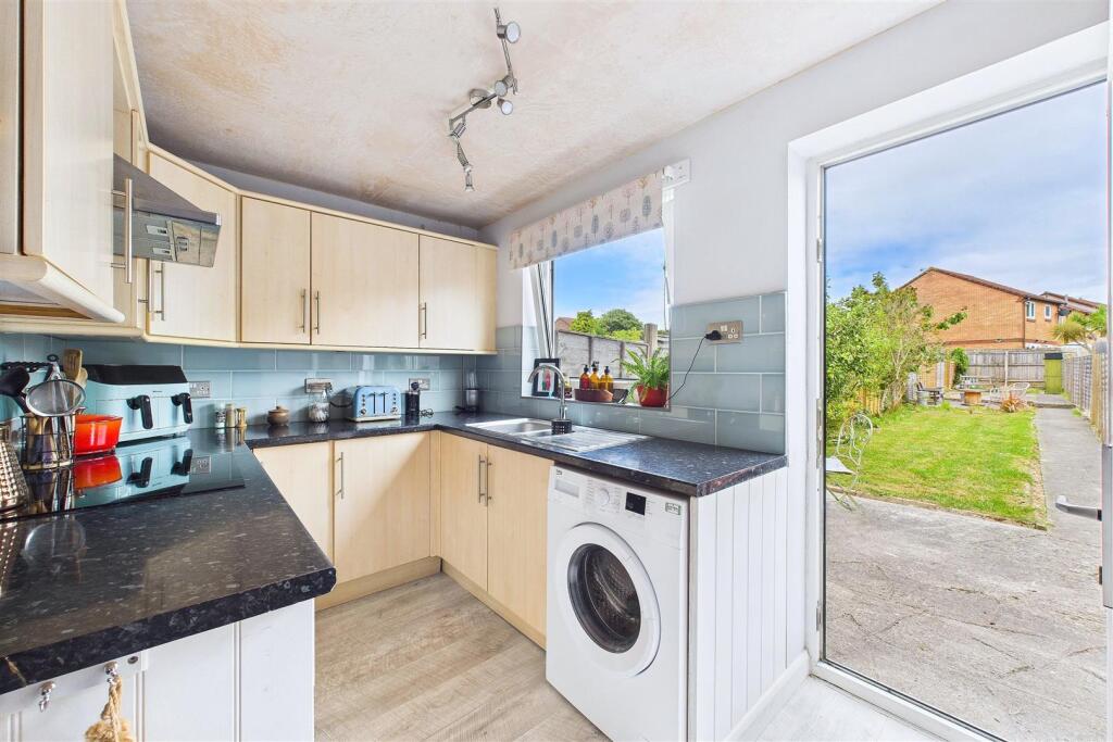
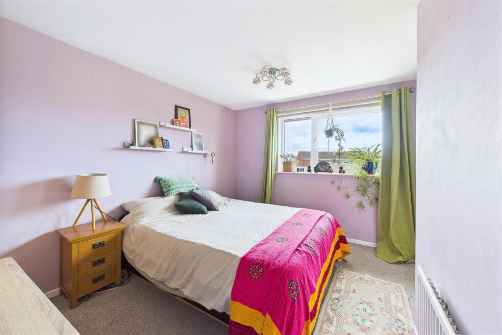
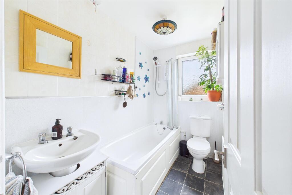
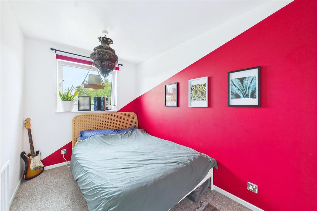
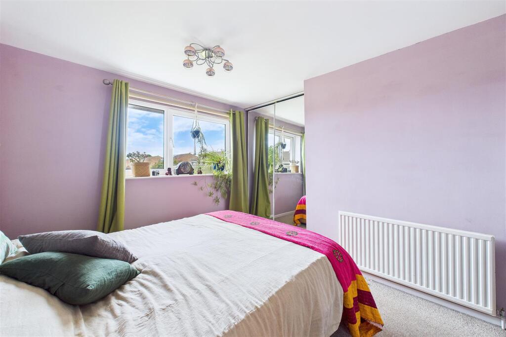
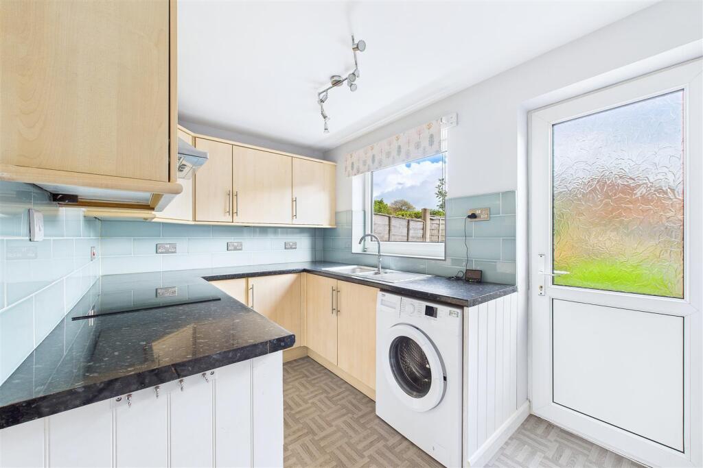
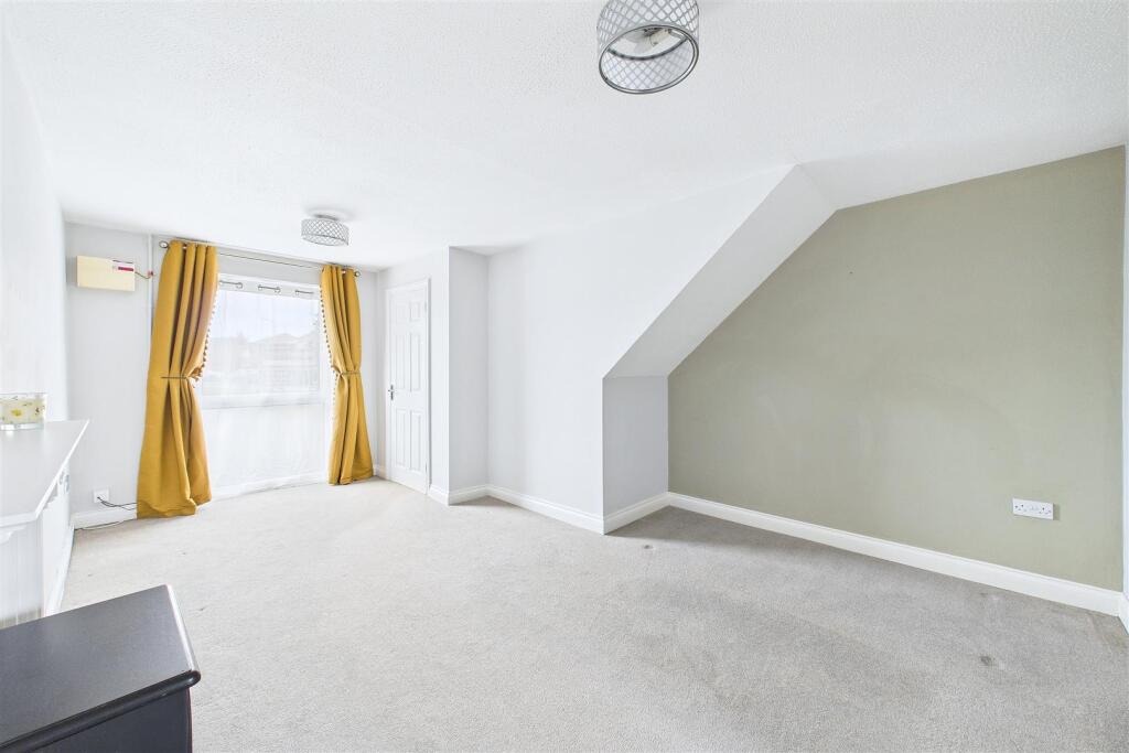
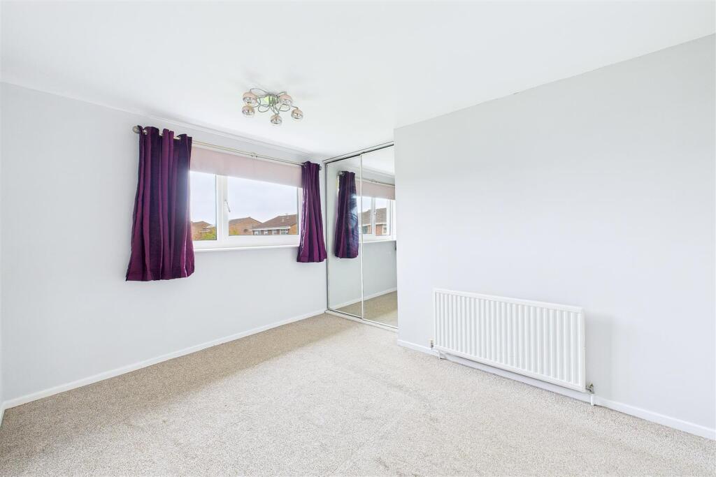
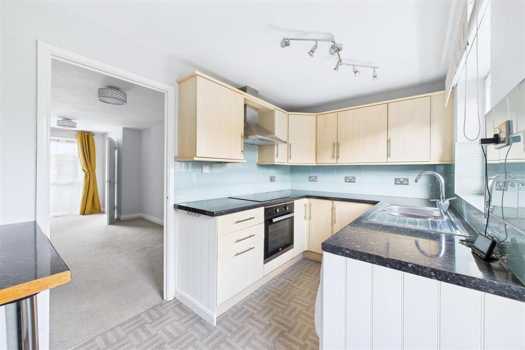
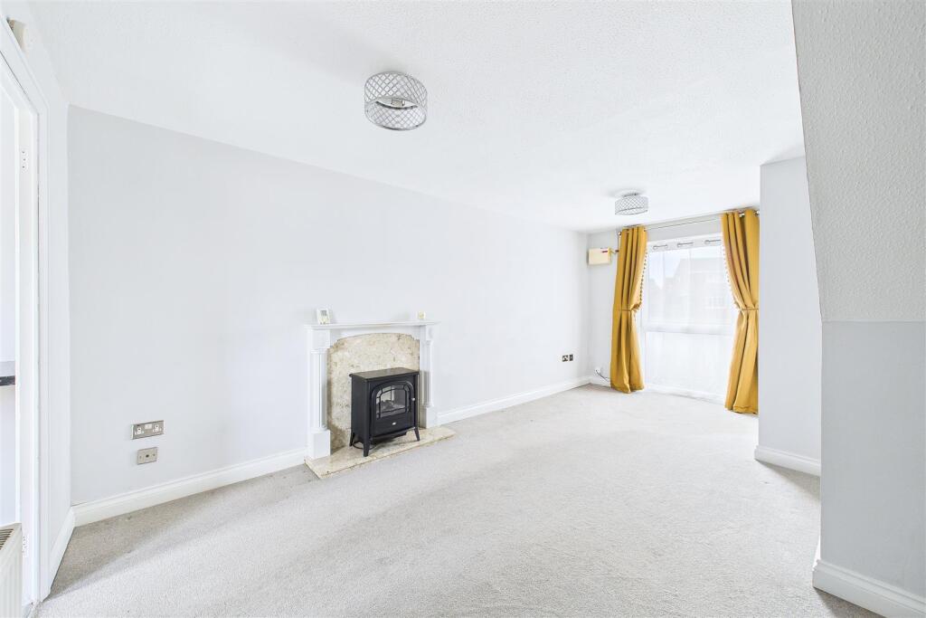
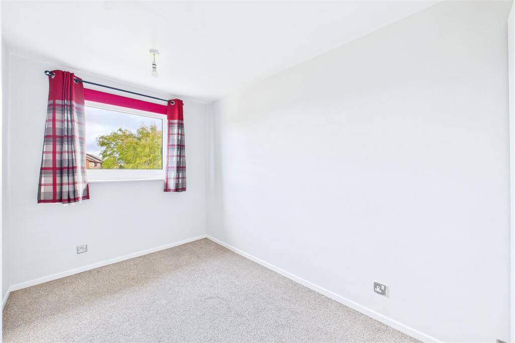
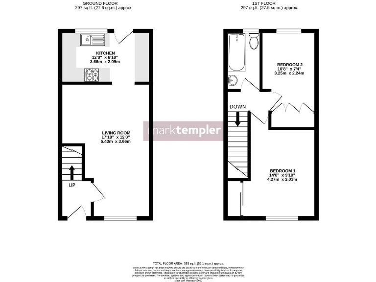
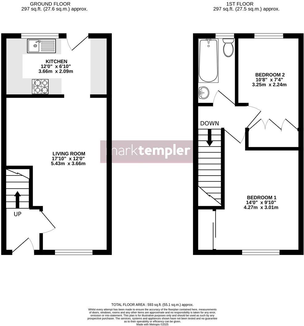
- The property for sale is a two-story residence. The ground floor features an average-sized kitchen and generous living room space that is ideal for family gatherings or entertaining guests. The first-floor houses two bedrooms of modest size and a bathroom serving both rooms. The dimensions indicate a compact yet functional layout conducive to small families or individuals seeking a cozy home environment.
Image Descriptions
- terraced house mid-20th century
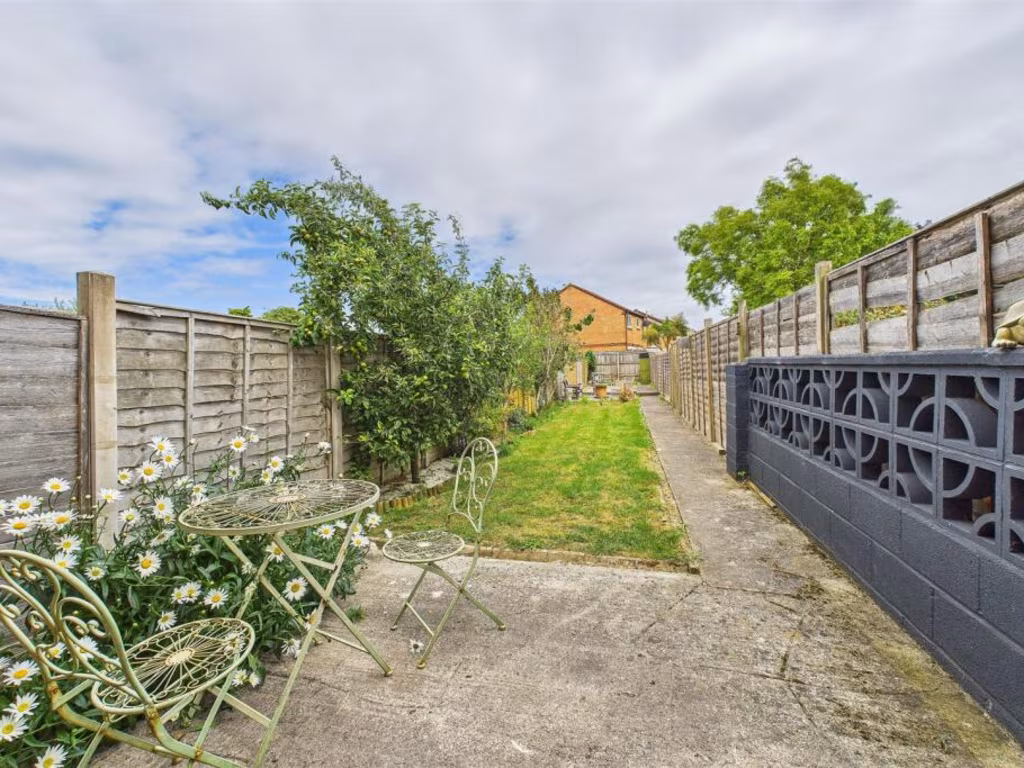
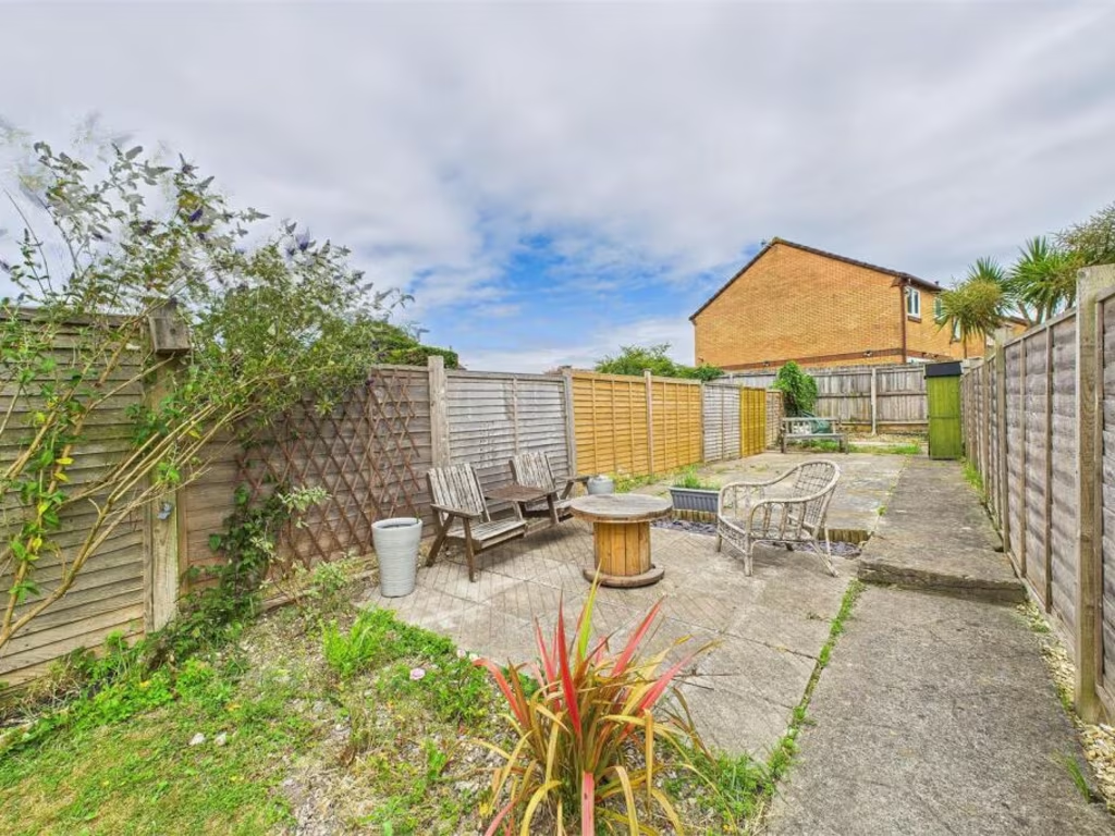
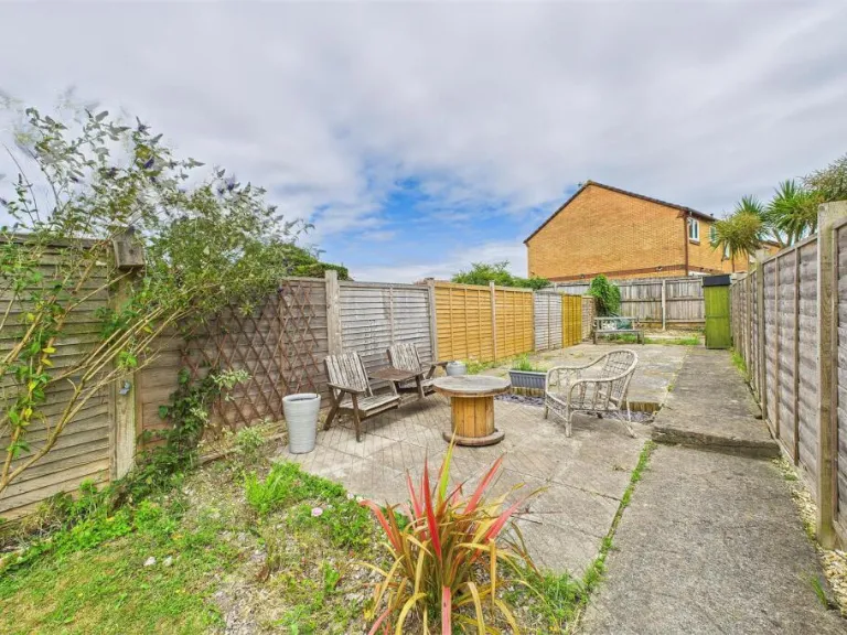
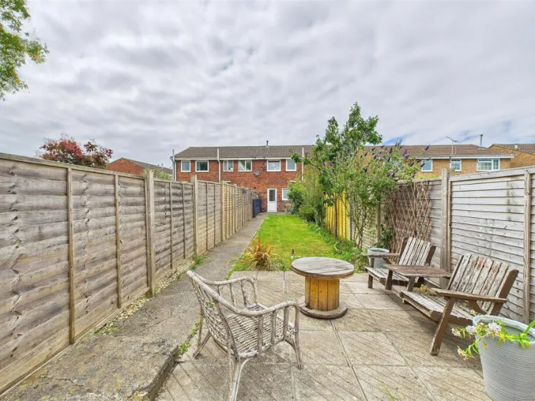
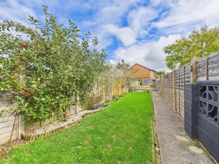
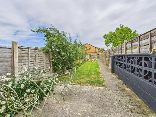
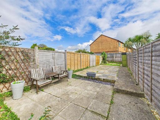
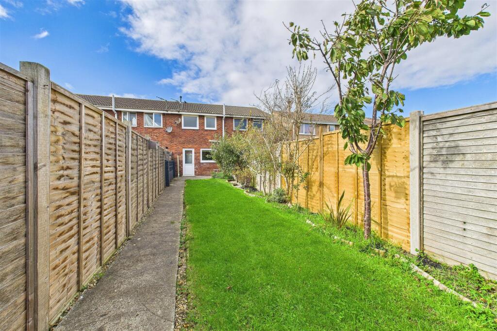
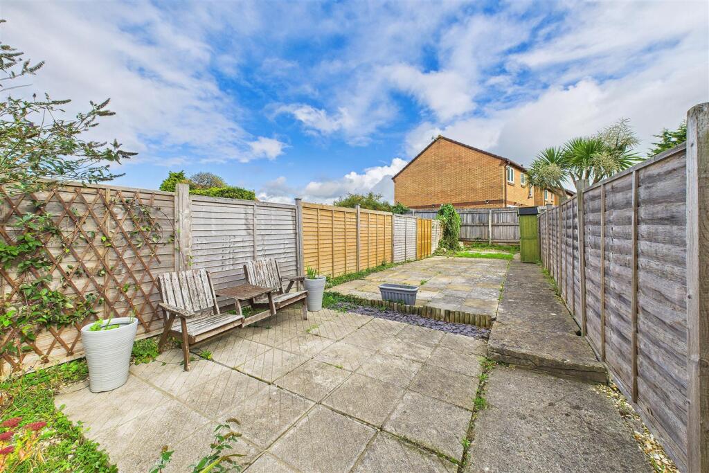
- back garden Post-war
Floorplan Description
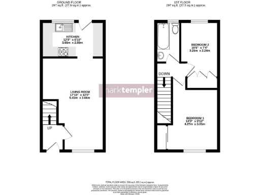
- A 2-bedroom, multi-story property with a living room and kitchen on the ground floor and bedrooms on the first floor.
Rooms
- Kitchen:
- Living Room:
- Bedroom 1:
- Bedroom 2:
Textual Property Features
Detected Visual Features
- terraced house
- brick exterior
- mid-20th century
- two-storey
- urban setting
- garden
- outdoor space
- fencing
- patio
- backyard
- landscaped
- plants
EPC Details
- Fully double glazed
- Cavity wall, as built, no insulation (assumed)
- Boiler and radiators, mains gas
- Low energy lighting in 88% of fixed outlets
- Solid, no insulation (assumed)
Nearby Schools
- Becket Primary School
- Priory Community School
- St Andrew's CofE Primary School
- Yatton Infant School
- Yatton Church of England Junior School
- Court-De-Wyck Church School
- Hannah More Infant School
- Worle Village Primary School
- St Georges Church School
- Castle Batch Primary School Academy
- Chestnut Park Primary
- Grove Junior School
- St John the Evangelist Church School
- Nailsea School
- Yeo Moor Primary School
- Kingshill Church School
- Gordano School
- St Joseph's Catholic Primary School
- St Peter's Church of England Primary School
- Mary Elton Primary School
- St Nicholas Chantry Church of England Primary School
- All Saints Church of England Primary School
- Tickenham Church of England Primary School
- High Down Infant School
- St Mark's Ecumenical Anglican/Methodist Primary School
- Clevedon School
- High Down Junior School
Nearest General Shops
- Id: 131288349
- Tags:
- Addr:
- City: Clevedon
- Postcode: BS21 6HX
- Street: Great Western Road
- Brand: B&M Bargains
- Brand:wikidata: Q4836931
- Brand:wikipedia: en:B & M
- Building: yes
- Contact:
- Website: https://www.bmstores.co.uk/stores/clevedon-52
- Name: B&M Bargains
- Opening_hours: Mo-Sa 08:00-20:00; Su 10:00-16:00
- Payment:
- Shop: variety_store
- Source: bing
- TagsNormalized:
- Lat: 51.434991
- Lon: -2.8530206
- FullGeoHash: gcjux56qxc38
- PartitionGeoHash: gcju
- Images:
- FoodStandards: null
- Distance: 519.8
,- Id: 211033657
- Tags:
- Brand: Jewson
- Brand:wikidata: Q6190226
- Brand:wikipedia: en:Jewson
- Building: retail
- Contact:
- Website: https://www.jewson.co.uk/branch-finder/clevedon-njb-branch/
- Name: Jewson
- Shop: doityourself
- Source: Bing
- TagsNormalized:
- jewson
- retail
- doityourself
- shop
- Lat: 51.4284458
- Lon: -2.8618708
- FullGeoHash: gcjuwfk03t4k
- PartitionGeoHash: gcju
- Images:
- FoodStandards: null
- Distance: 502.4
,- Id: 893130172
- Tags:
- Addr:
- City: Clevedon
- Housenumber: 119 -121
- Postcode: BS21 6JE
- Street: Kenn Road
- Brand: Kwik Fit
- Brand:wikidata: Q958053
- Brand:wikipedia: en:Kwik Fit
- Building: yes
- Name: Kwik Fit
- Phone: +44 1275 342473
- Shop: car_repair
- TagsNormalized:
- kwik fit
- car repair
- repair
- shop
- Lat: 51.4313994
- Lon: -2.8530494
- FullGeoHash: gcjux4f3x5sp
- PartitionGeoHash: gcju
- Images:
- FoodStandards: null
- Distance: 191.8
}
Nearest Grocery shops
- Id: 4440646676
- Tags:
- Addr:
- City: Clevedon
- Housenumber: 12A
- Postcode: BS21 6ND
- Street: Old Street
- Name: A Better Weigh
- Phone: +44 1275 560927
- Shop: health_food
- TagsNormalized:
- health
- health food
- food
- shop
- Lat: 51.4366605
- Lon: -2.8510152
- FullGeoHash: gcjux5gbq82z
- PartitionGeoHash: gcju
- Images:
- FoodStandards: null
- Distance: 744.1
,- Id: 10201898037
- Tags:
- Brand: Holland & Barrett
- Brand:wikidata: Q5880870
- Name: Holland & Barrett
- Shop: health_food
- TagsNormalized:
- holland & barrett
- health
- health food
- food
- shop
- Lat: 51.4358785
- Lon: -2.8528341
- FullGeoHash: gcjux5desnsw
- PartitionGeoHash: gcju
- Images:
- FoodStandards: null
- Distance: 617.6
,- Id: 859803756
- Tags:
- Addr:
- City: Clevedon
- Housenumber: 32
- Postcode: BS21 6QA
- Street: Strode Road
- Building: yes
- Name: Patel News Market
- Shop: convenience
- TagsNormalized:
- Lat: 51.4342319
- Lon: -2.86099
- FullGeoHash: gcjuwgkdn5g0
- PartitionGeoHash: gcju
- Images:
- FoodStandards: null
- Distance: 557.9
}
Nearest Religious buildings
- Id: 841479734
- Tags:
- Addr:
- City: Clevedon
- Postcode: BS21 6NL
- Street: Coleridge Vale Road North
- Amenity: place_of_worship
- Building: yes
- Name: The Christadelphians
- Religion: christian
- TagsNormalized:
- place of worship
- christian
- church
- Lat: 51.4354757
- Lon: -2.8570161
- FullGeoHash: gcjuwgx96ew7
- PartitionGeoHash: gcju
- Images:
- FoodStandards: null
- Distance: 555.2
,- Id: 403920260
- Tags:
- Addr:
- City: Clevedon
- Place: Clevedon
- Postcode: BS21 5EL
- Street: Fosseway
- Amenity: school
- Denomination: anglican
- Isced:
- Name: St John the Evangelist Church School
- Ref:
- Religion: christian
- Website: http://www.st-johnevangelist.n-somerset.sch.uk/
- Wikidata: Q67149947
- TagsNormalized:
- school
- anglican
- church
- evangelist
- christian
- Lat: 51.4294491
- Lon: -2.8598628
- FullGeoHash: gcjuwfmw225t
- PartitionGeoHash: gcju
- Images:
- FoodStandards: null
- Distance: 328.7
,- Id: 895027051
- Tags:
- Addr:
- City: Clevedon
- Postcode: BS21 6LH
- Street: Kenn Road
- Amenity: place_of_worship
- Building: yes
- Denomination: methodist
- Name: Kenn Road Methodist Church
- Religion: christian
- TagsNormalized:
- place of worship
- methodist
- church
- christian
- Lat: 51.4287768
- Lon: -2.8525369
- FullGeoHash: gcjux46f74f7
- PartitionGeoHash: gcju
- Images:
- FoodStandards: null
- Distance: 285.7
}
Nearest Airports
- Id: 47483196
- Tags:
- Aerodrome: international
- Aeroway: aerodrome
- Iata: BRS
- Icao: EGGD
- Internet_access: wlan
- Internet_access:fee: no
- Name: Bristol Airport
- Type: public
- Website: https://www.bristolairport.co.uk/
- Wikidata: Q8725
- Wikipedia: en:Bristol Airport
- TagsNormalized:
- airport
- international airport
- Lat: 51.3830799
- Lon: -2.7186615
- FullGeoHash: gcnh64h24s74
- PartitionGeoHash: gcnh
- Images:
- FoodStandards: null
- Distance: 10860.5
,- Id: 319112968
- Tags:
- Aerodrome: international
- Aerodrome:type: public
- Aeroway: aerodrome
- Iata: CWL
- Icao: EGFF
- Internet_access: yes
- Internet_access:fee: no
- Is_in: Cardiff,Wales,UK
- Name: Cardiff Airport
- Operator: Cardiff International Airport Limited
- Source: Gagravarr_Airports
- Type: civil
- Wikidata: Q8994
- Wikipedia: en:Cardiff Airport
- TagsNormalized:
- airport
- international airport
- Lat: 51.3978554
- Lon: -3.3438203
- FullGeoHash: gcjs7utn5qdy
- PartitionGeoHash: gcjs
- Images:
- FoodStandards: null
- Distance: 34061.6
}
Nearest Leisure Facilities
- Id: 905795764
- Tags:
- Leisure: outdoor_seating
- Operator: The Crab Apple
- TagsNormalized:
- outdoor
- outdoor seating
- leisure
- Lat: 51.4273008
- Lon: -2.8590276
- FullGeoHash: gcjuwfn1ezdw
- PartitionGeoHash: gcju
- Images:
- FoodStandards: null
- Distance: 439.4
,- Id: 514539660
- Tags:
- TagsNormalized:
- Lat: 51.4292312
- Lon: -2.8601515
- FullGeoHash: gcjuwfmkcxs3
- PartitionGeoHash: gcju
- Images:
- FoodStandards: null
- Distance: 356.7
,- Id: 195653990
- Tags:
- Leisure: pitch
- Sport: rugby_union
- TagsNormalized:
- pitch
- leisure
- rugby
- rugby union
- sports
- Lat: 51.4336792
- Lon: -2.8546229
- FullGeoHash: gcjux51qfkwz
- PartitionGeoHash: gcju
- Images:
- FoodStandards: null
- Distance: 350.2
,- Id: 195653825
- Tags:
- Leisure: pitch
- Lit: yes
- Sport: rugby_union
- Surface: grass
- TagsNormalized:
- pitch
- leisure
- rugby
- rugby union
- sports
- Lat: 51.433138
- Lon: -2.8551877
- FullGeoHash: gcjux50gtrcd
- PartitionGeoHash: gcju
- Images:
- FoodStandards: null
- Distance: 285.7
,- Id: 195653639
- Tags:
- Leisure: pitch
- Lit: yes
- Sport: soccer
- Surface: grass
- TagsNormalized:
- Lat: 51.4325976
- Lon: -2.8558769
- FullGeoHash: gcjux502t5pg
- PartitionGeoHash: gcju
- Images:
- FoodStandards: null
- Distance: 226.6
}
Nearest Tourist attractions
- Id: 1913140347
- Tags:
- Name: Clevedon Miniature Railway
- Tourism: attraction
- TagsNormalized:
- Lat: 51.4351637
- Lon: -2.8683196
- FullGeoHash: gcjuwerre33y
- PartitionGeoHash: gcju
- Images:
- FoodStandards: null
- Distance: 1026
,- Id: 851174558
- Tags:
- Name: Colehouse Farm Caravan Park
- Tourism: caravan_site
- TagsNormalized:
- Lat: 51.4231043
- Lon: -2.8575109
- FullGeoHash: gcjuwcr1r1mm
- PartitionGeoHash: gcju
- Images:
- FoodStandards: null
- Distance: 842.6
,- Id: 851246749
- Tags:
- Name: Riverside Park
- Tourism: chalet
- TagsNormalized:
- Lat: 51.4232089
- Lon: -2.855396
- FullGeoHash: gcjux12cbkym
- PartitionGeoHash: gcju
- Images:
- FoodStandards: null
- Distance: 819.1
}
Nearest Train stations
- Id: 21277582
- Tags:
- Name: Weston-super-Mare
- Naptan:
- Network: National Rail
- Public_transport: station
- Railway: station
- Ref:
- Source: NPE
- Wikidata: Q2335883
- Wikipedia: en:Weston-super-Mare railway station
- TagsNormalized:
- Lat: 51.344496
- Lon: -2.9718305
- FullGeoHash: gcjuh6gzr7f8
- PartitionGeoHash: gcju
- Images:
- FoodStandards: null
- Distance: 12522
,- Id: 21277557
- Tags:
- Name: Weston Milton
- Naptan:
- Network: National Rail
- Operator: GWR
- Public_transport: station
- Railway: station
- Ref:
- Source: NPE + GPX
- Wikidata: Q2432877
- Wikipedia: en:Weston Milton railway station
- TagsNormalized:
- Lat: 51.3485177
- Lon: -2.9422803
- FullGeoHash: gcjuj59qzckz
- PartitionGeoHash: gcju
- Images:
- FoodStandards: null
- Distance: 10933
,- Id: 253893851
- Tags:
- Name: Worle
- Naptan:
- Network: National Rail
- Public_transport: station
- Railway: station
- Ref:
- Wikidata: Q2416797
- Wikipedia: en:Worle railway station
- TagsNormalized:
- Lat: 51.3578502
- Lon: -2.9093225
- FullGeoHash: gcjujv3mpv5v
- PartitionGeoHash: gcju
- Images:
- FoodStandards: null
- Distance: 8907.8
,- Id: 492098581
- Tags:
- Internet_access: no
- Name: Nailsea and Backwell
- Naptan:
- Network: National Rail
- Operator: GWR
- Public_transport: station
- Railway: station
- Ref:
- Source: GPX + NPE
- Wikidata: Q6959642
- Wikipedia: en:Nailsea and Backwell railway station
- TagsNormalized:
- Lat: 51.4196718
- Lon: -2.7496898
- FullGeoHash: gcnh92ttr9d9
- PartitionGeoHash: gcnh
- Images:
- FoodStandards: null
- Distance: 7434.4
,- Id: 21277558
- Tags:
- Name: Yatton
- Naptan:
- Network: National Rail
- Operator: GWR
- Platforms: 2
- Public_transport: station
- Railway: station
- Ref:
- Source: NPE + GPX
- Wikidata: Q1957149
- Wikipedia: en:Yatton railway station
- TagsNormalized:
- Lat: 51.3908826
- Lon: -2.8277046
- FullGeoHash: gcjurekvtdye
- PartitionGeoHash: gcju
- Images:
- FoodStandards: null
- Distance: 4815.7
}
Nearest Hotels
- Id: 132045252
- Tags:
- Alt_name: Bridge Inn
- Building: yes
- Name: Inn Lodge
- Tourism: hotel
- TagsNormalized:
- Lat: 51.4001385
- Lon: -2.8408617
- FullGeoHash: gcjurm57e07c
- PartitionGeoHash: gcju
- Images:
- FoodStandards: null
- Distance: 3533
,- Id: 214800767
- Tags:
- Addr:
- City: Clevedon
- Place: Clevedon
- Postcode: BS21 7BL
- Street: Wellington Terrace
- Brand: Best Western
- Brand:wikidata: Q830334
- Building: hotel
- Fhrs:
- Name: Walton Park Hotel
- Operator: Best Western
- Source:
- Tourism: hotel
- TagsNormalized:
- Lat: 51.4485261
- Lon: -2.8555876
- FullGeoHash: gcjuxjbt7urs
- PartitionGeoHash: gcju
- Images:
- FoodStandards: null
- Distance: 1996.1
,- Id: 851246751
- Tags:
- Amenity: animal_boarding
- Animal_boarding: cat
- Building: yes
- Name: The Willow Cats Hotel
- TagsNormalized:
- Lat: 51.4195708
- Lon: -2.8564044
- FullGeoHash: gcjux08h8ywx
- PartitionGeoHash: gcju
- Images:
- FoodStandards: null
- Distance: 1225.3
}
Tags
- terraced house
- brick exterior
- mid-20th century
- two-storey
- urban setting
- garden
- outdoor space
- fencing
- patio
- backyard
- landscaped
- plants
Local Market Stats
- Average Price/sqft: £373
- Avg Income: £49700
- Rental Yield: 3.6%
- Social Housing: 2%
- Planning Success Rate: 92%
AirBnB Data
- 1km average: £106/night
- Listings in 1km: 4
Similar Properties
 2 bedroom terraced house for sale in Staples Close, Clevedon, BS21 — £260,000 • 2 bed • 1 bath
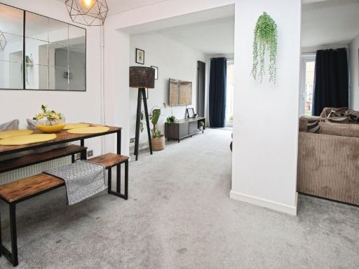 2 bedroom terraced house for sale in Pedder Road, Clevedon, North Somerset, BS21 — £299,950 • 2 bed • 1 bath • 822 ft²
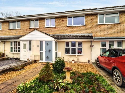 3 bedroom terraced house for sale in Popular position on the outskirts of Clevedon, BS21 — £325,000 • 3 bed • 2 bath • 856 ft²
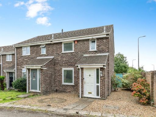 3 bedroom semi-detached house for sale in The Chaffins, Clevedon, Somerset, BS21 — £315,000 • 3 bed • 1 bath • 807 ft²
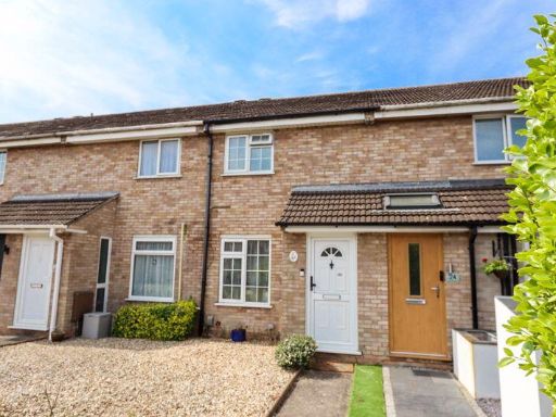 2 bedroom terraced house for sale in Yeoward Road, Clevedon, BS21 — £275,000 • 2 bed • 1 bath • 309 ft²
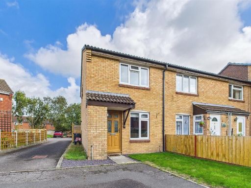 2 bedroom end of terrace house for sale in Cul-de-sac on the outskirts of Clevedon, BS21 — £249,950 • 2 bed • 1 bath • 542 ft²
Meta
- {
"@context": "https://schema.org",
"@type": "Residence",
"name": "2 bedroom terraced house for sale in Positioned just off Fo…",
"description": "",
"url": "https://propertypiper.co.uk/property/3c7a7269-b061-40d7-b56f-a05808447c84",
"image": "https://image-a.propertypiper.co.uk/0c5230de-2a27-4444-95f1-63379c070971-1024.jpeg",
"address": {
"@type": "PostalAddress",
"streetAddress": "43 RUDDYMEAD CLEVEDON",
"postalCode": "BS21 5EP",
"addressLocality": "North Somerset",
"addressRegion": "North Somerset",
"addressCountry": "England"
},
"geo": {
"@type": "GeoCoordinates",
"latitude": 51.430575116442306,
"longitude": -2.8554794183750074
},
"numberOfRooms": 2,
"numberOfBathroomsTotal": 1,
"floorSize": {
"@type": "QuantitativeValue",
"value": 593,
"unitCode": "FTK"
},
"offers": {
"@type": "Offer",
"price": 259000,
"priceCurrency": "GBP",
"availability": "https://schema.org/InStock"
},
"additionalProperty": [
{
"@type": "PropertyValue",
"name": "Feature",
"value": "terraced house"
},
{
"@type": "PropertyValue",
"name": "Feature",
"value": "brick exterior"
},
{
"@type": "PropertyValue",
"name": "Feature",
"value": "mid-20th century"
},
{
"@type": "PropertyValue",
"name": "Feature",
"value": "two-storey"
},
{
"@type": "PropertyValue",
"name": "Feature",
"value": "urban setting"
},
{
"@type": "PropertyValue",
"name": "Feature",
"value": "garden"
},
{
"@type": "PropertyValue",
"name": "Feature",
"value": "outdoor space"
},
{
"@type": "PropertyValue",
"name": "Feature",
"value": "fencing"
},
{
"@type": "PropertyValue",
"name": "Feature",
"value": "patio"
},
{
"@type": "PropertyValue",
"name": "Feature",
"value": "backyard"
},
{
"@type": "PropertyValue",
"name": "Feature",
"value": "landscaped"
},
{
"@type": "PropertyValue",
"name": "Feature",
"value": "plants"
}
]
}
High Res Floorplan Images
Compatible Floorplan Images
FloorplanImages Thumbnail