HP10 8AQ - 3 bedroom semidetached house for sale in Chilton Close, Pen…
View on Property Piper
3 bedroom semi-detached house for sale in Chilton Close, Penn, HP10
Property Details
- Price: £750000
- Bedrooms: 3
- Bathrooms: 2
- Property Type: undefined
- Property SubType: undefined
Image Descriptions
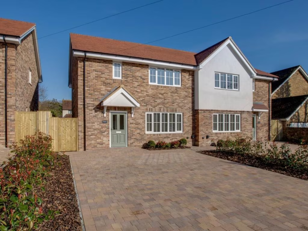
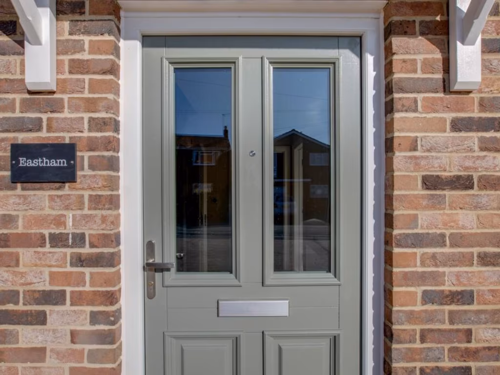
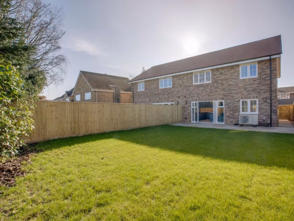
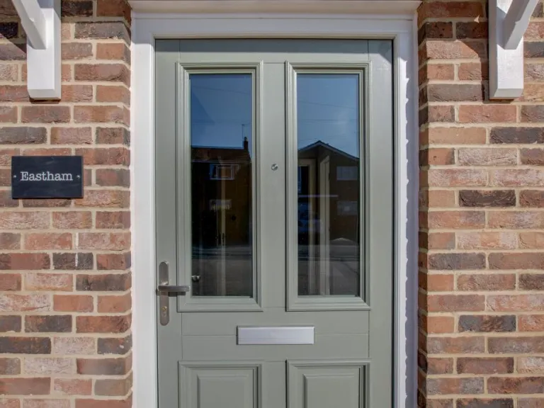
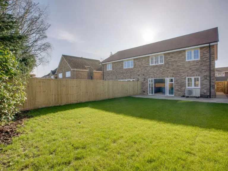
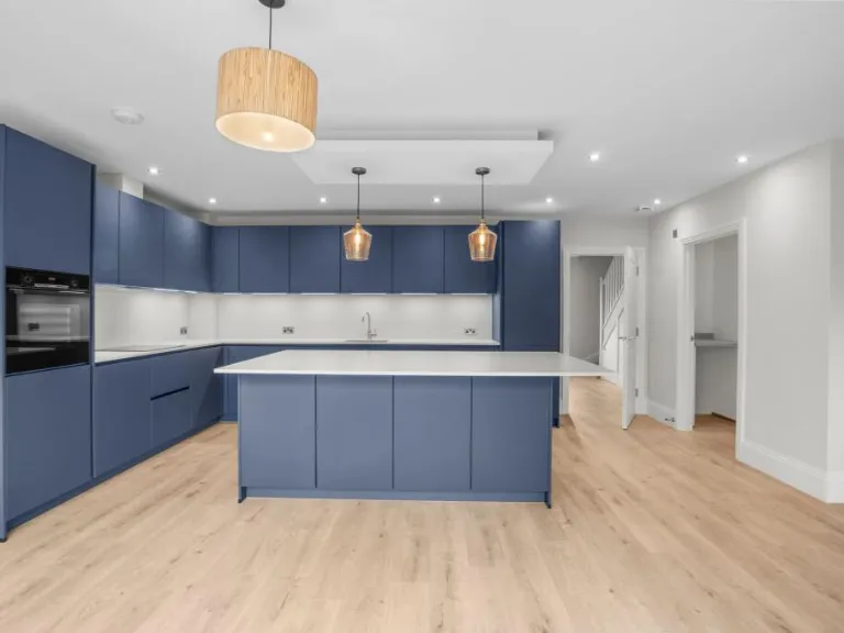
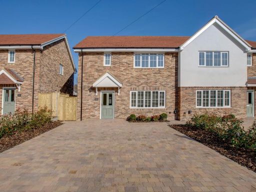
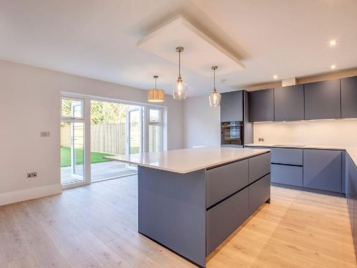
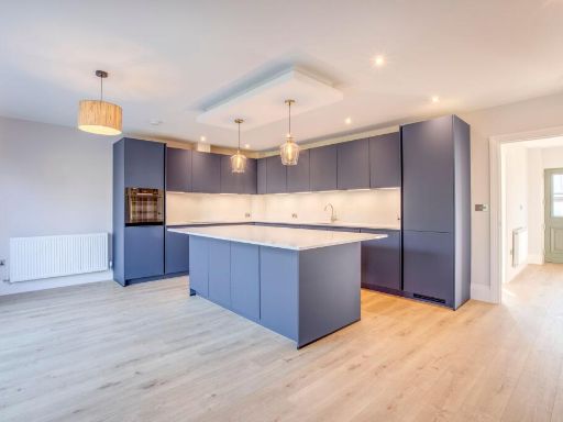
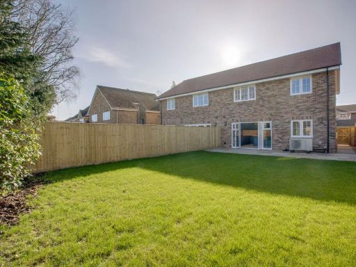
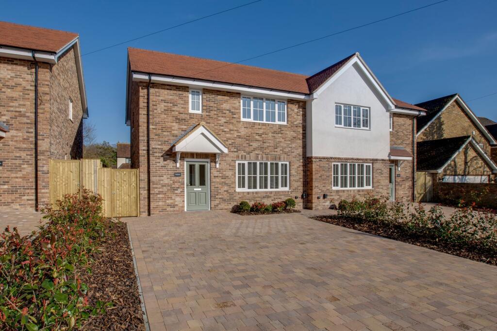
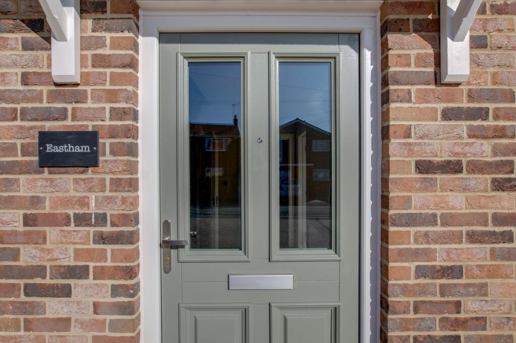
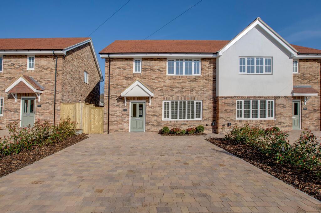
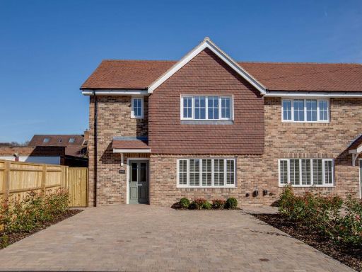
- front of a detached house modern
- newly built semi-detached house modern
Floorplan Description
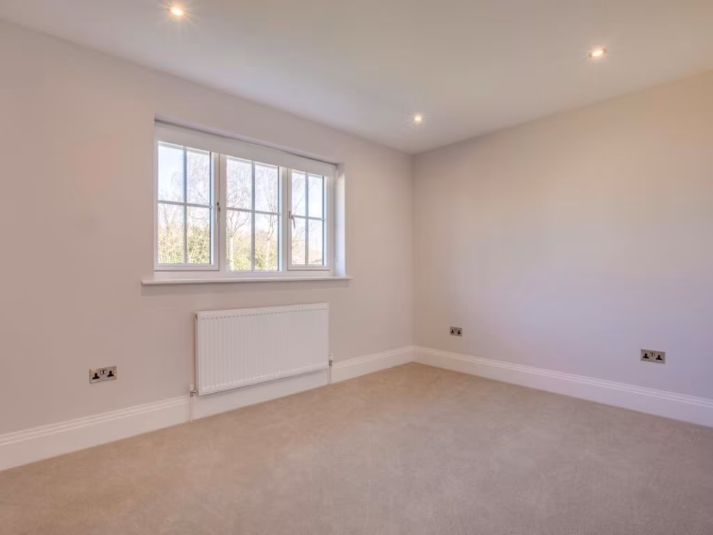
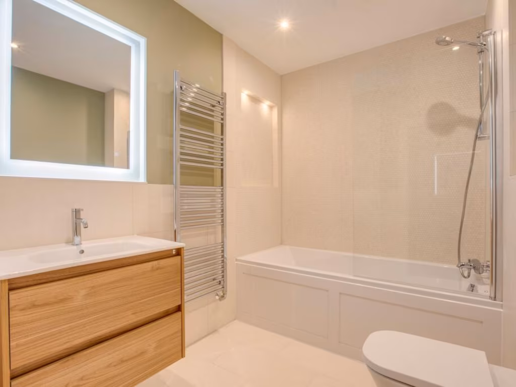
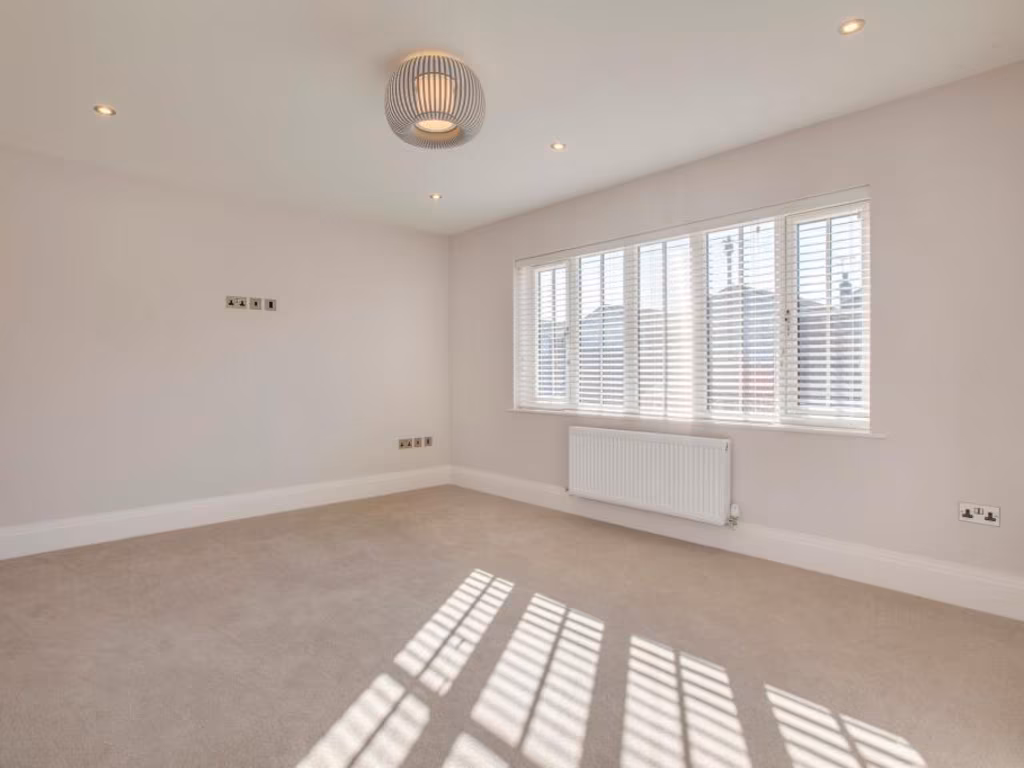
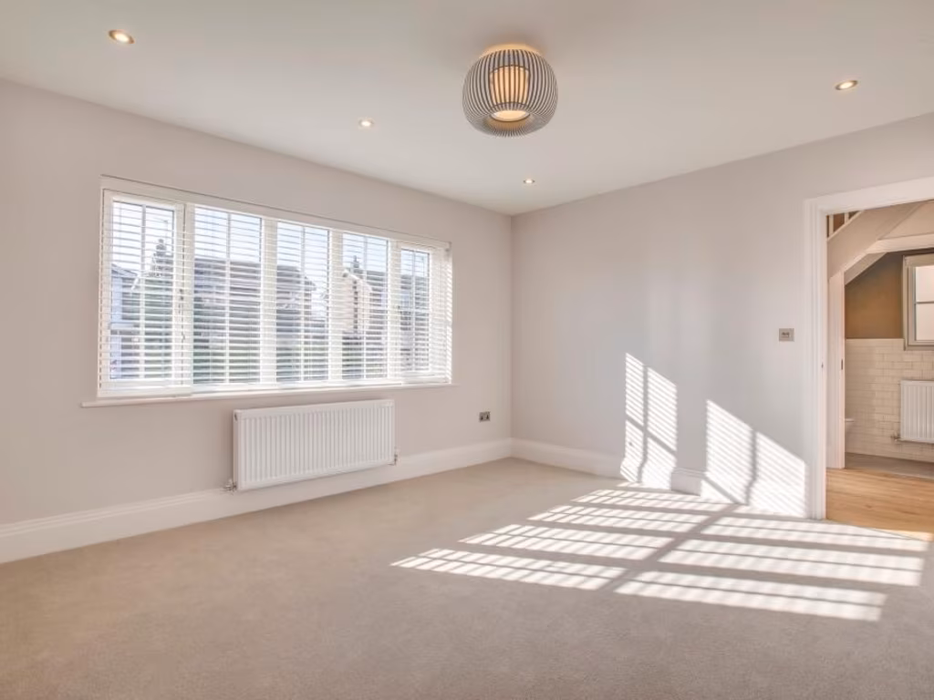
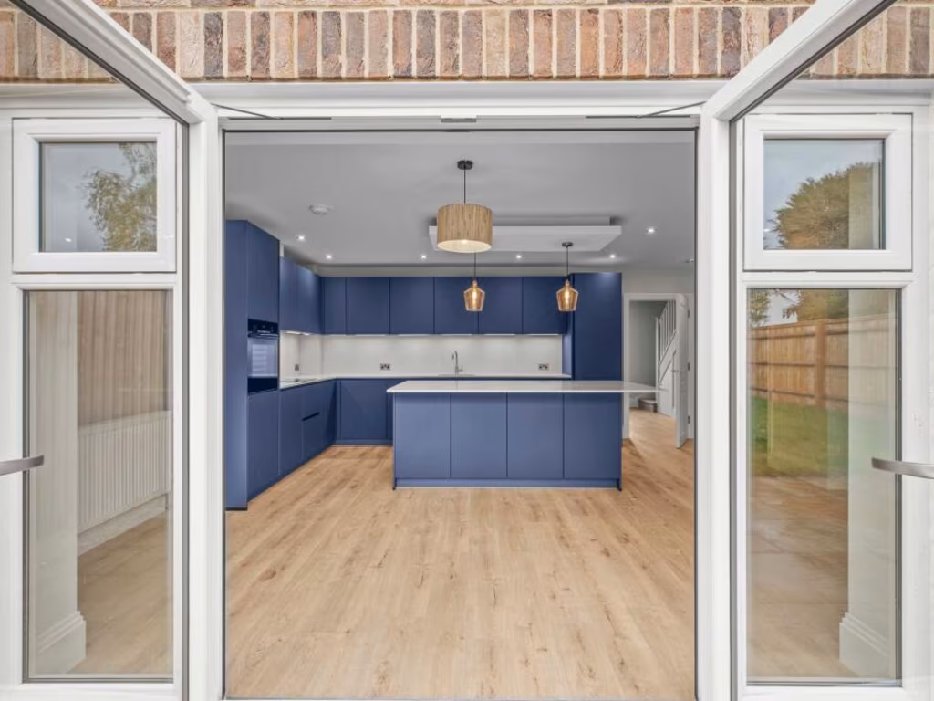
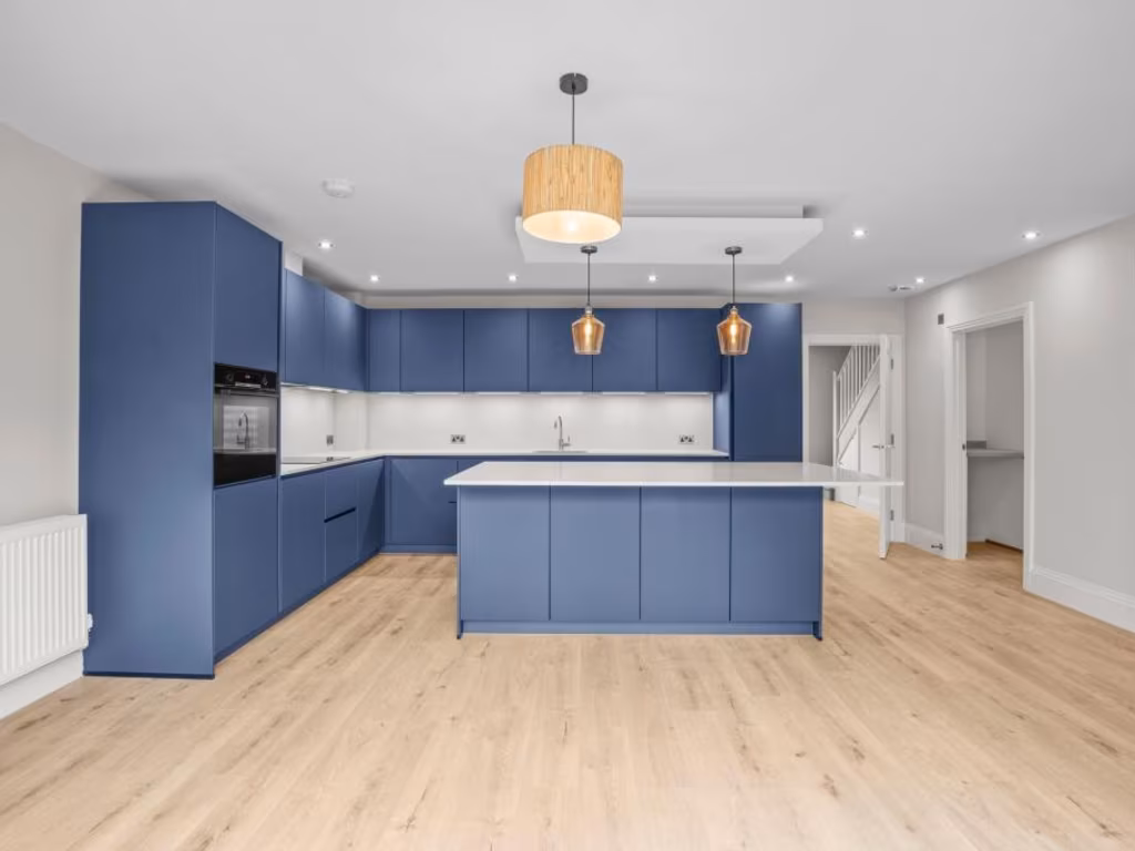
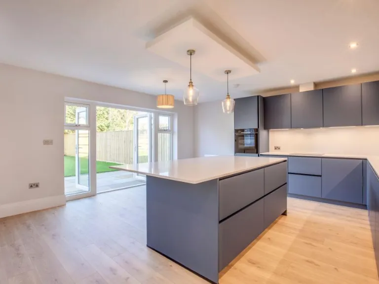
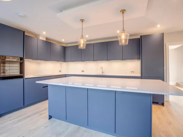
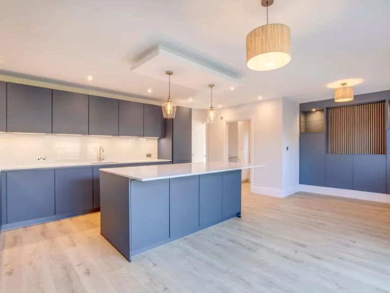
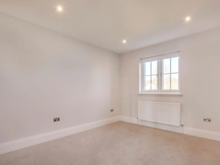
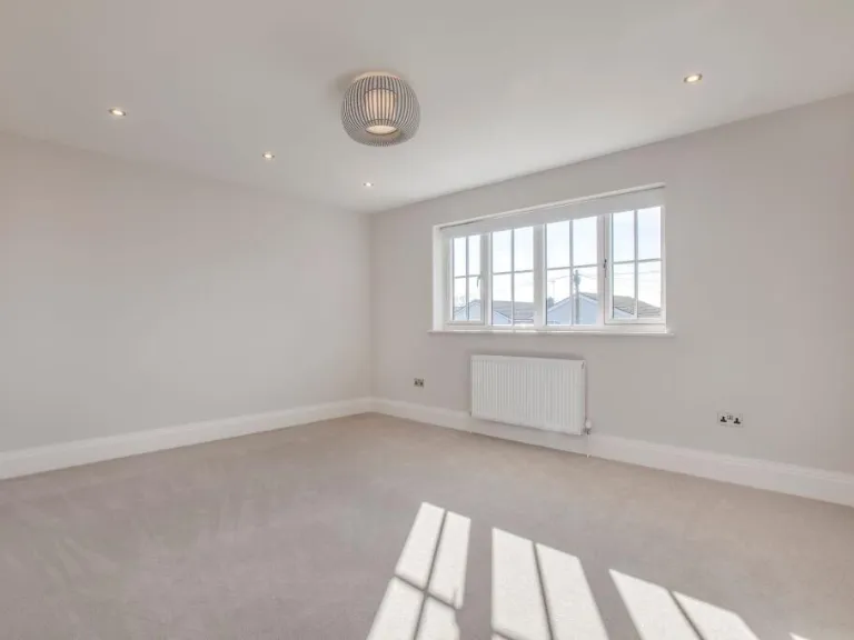
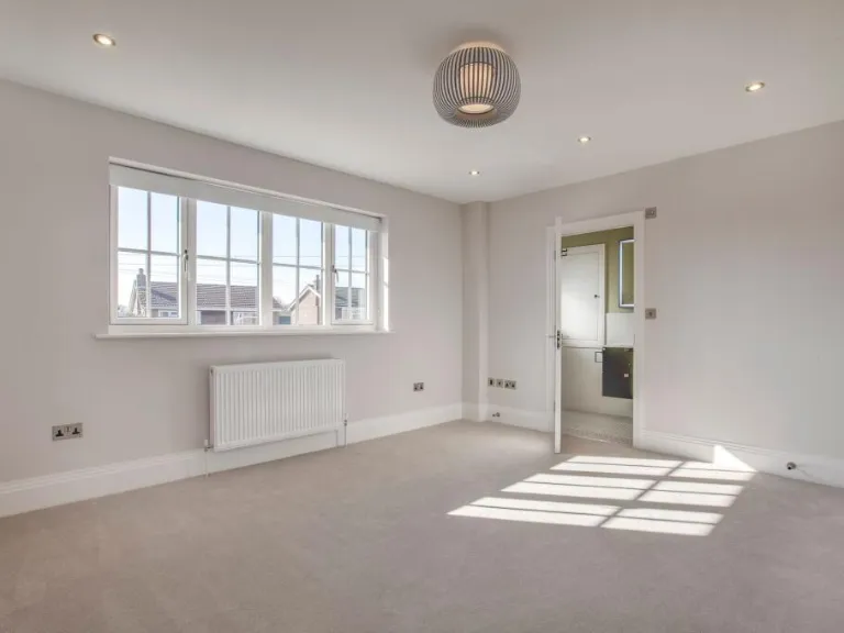
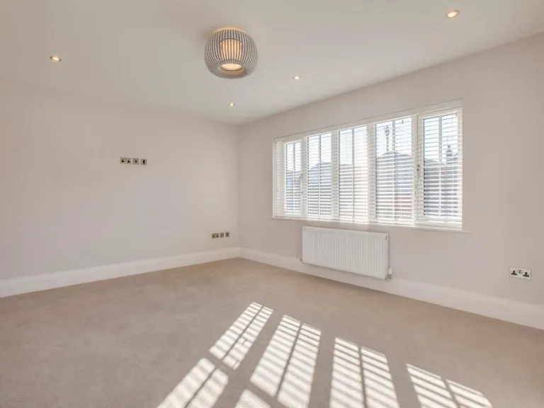
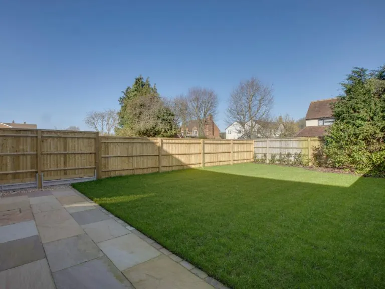
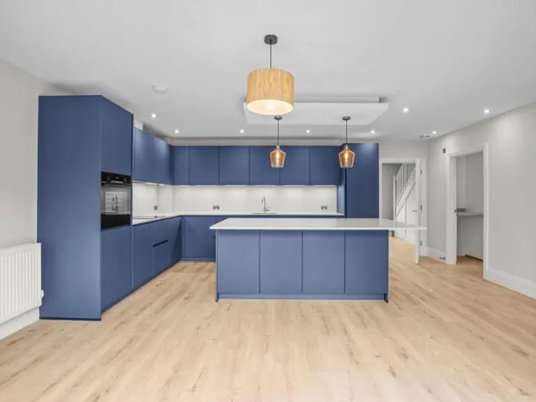
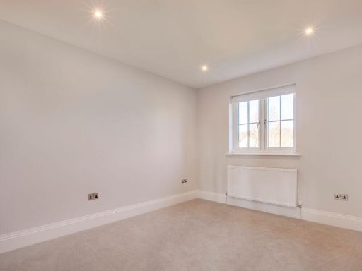
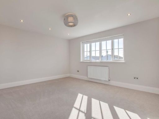
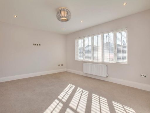
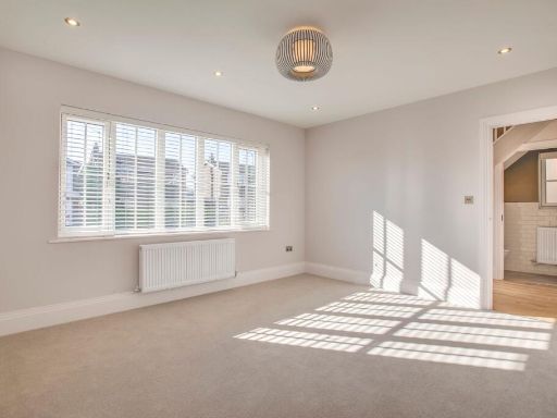
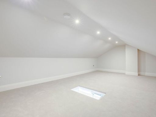
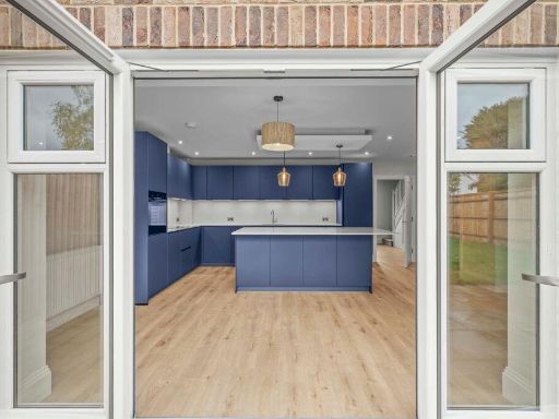
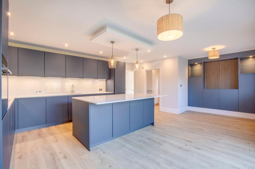
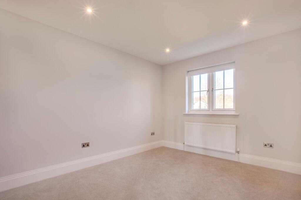
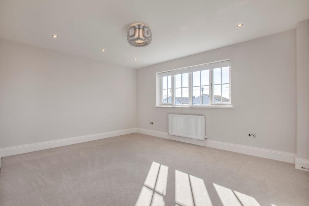
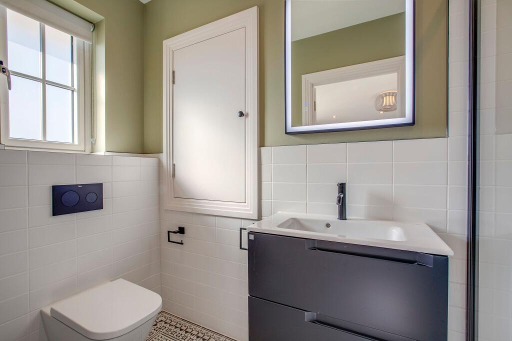
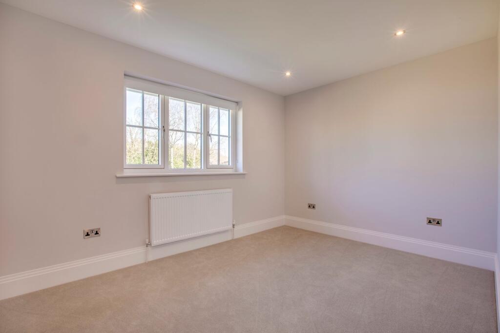
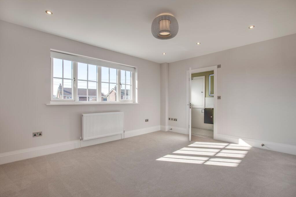
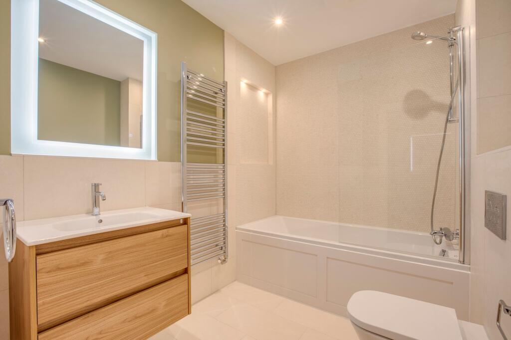
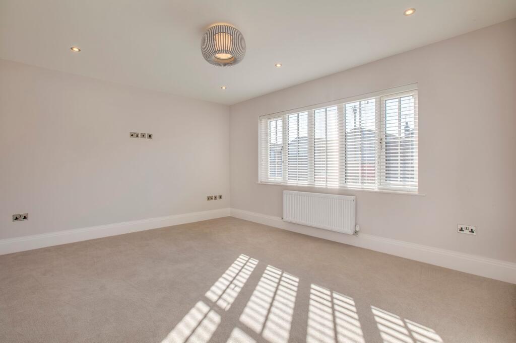
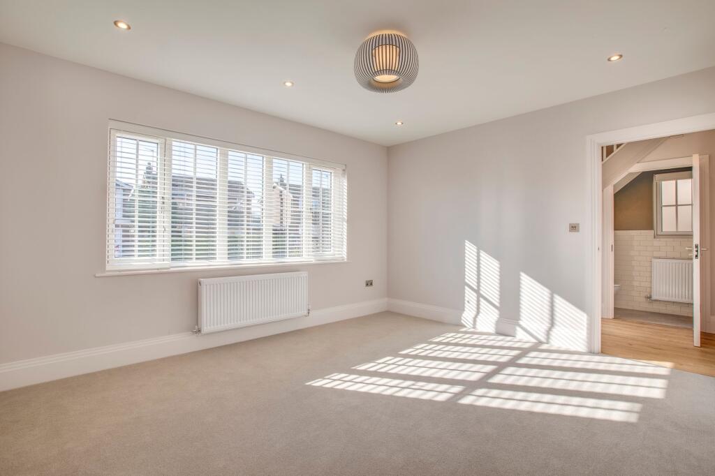
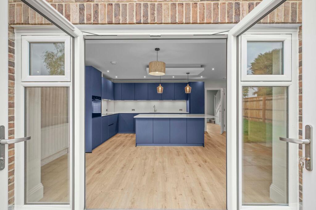
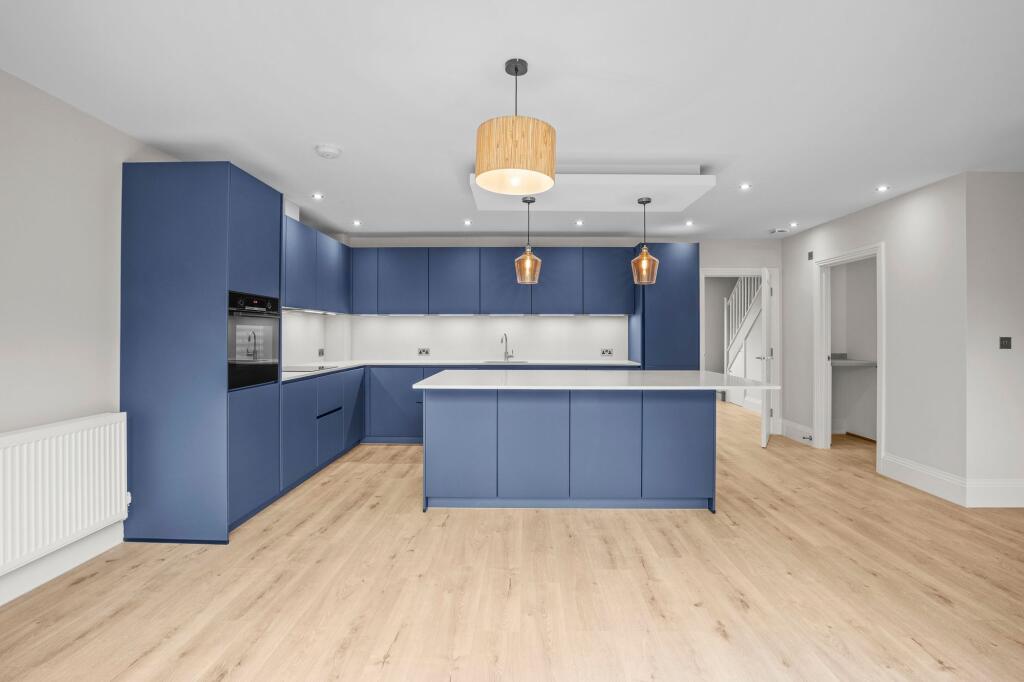
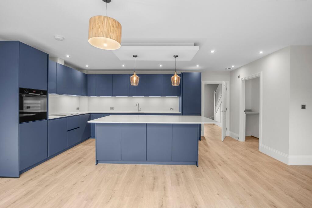
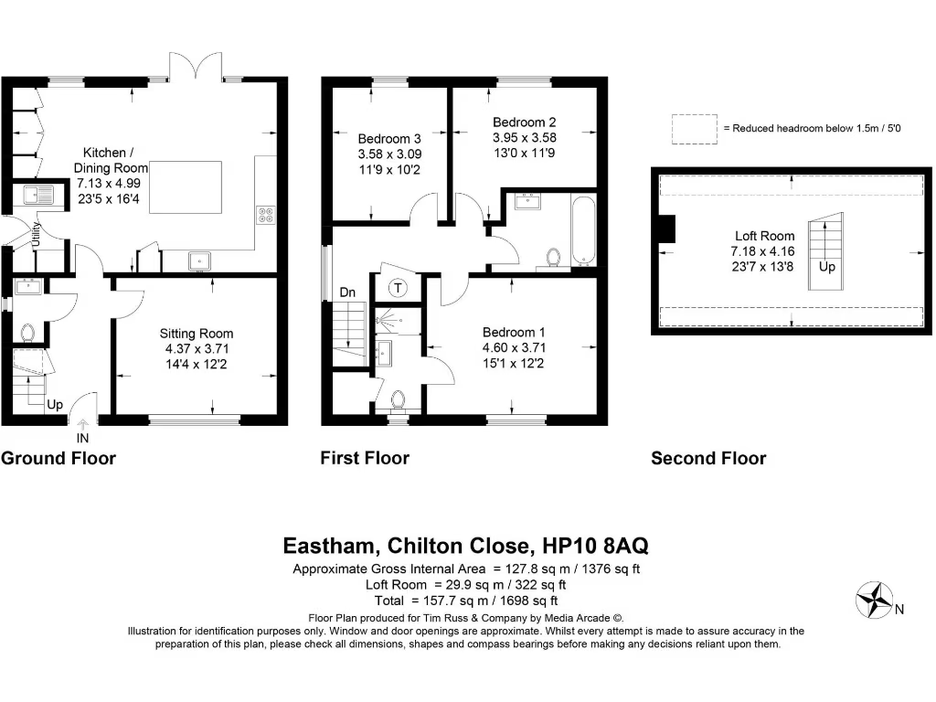
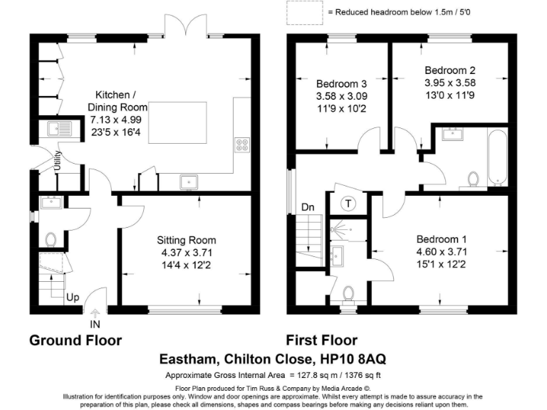
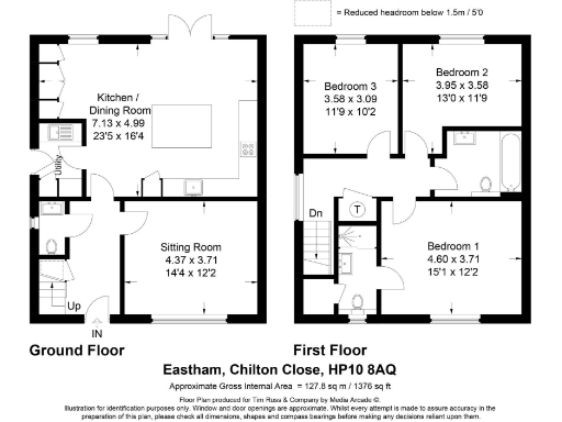
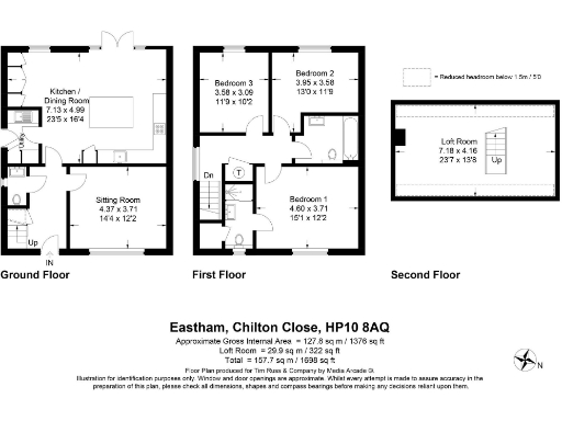
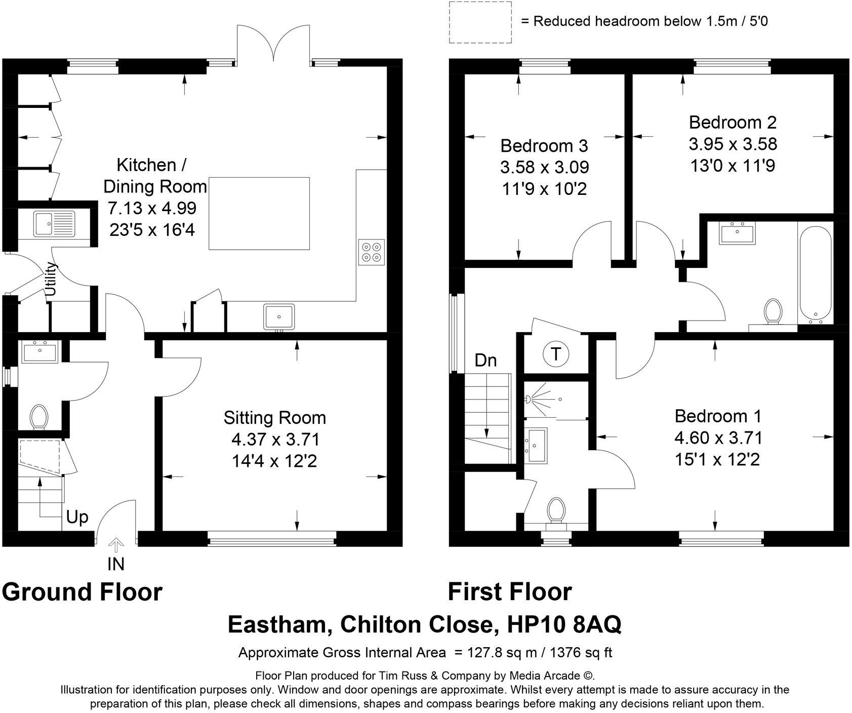
- A multi-story property with a kitchen/dining room, sitting room, three bedrooms, and a bathroom.
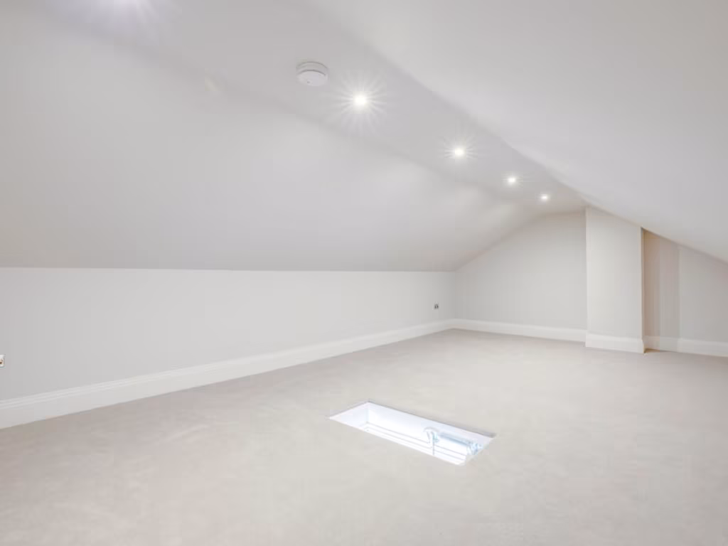
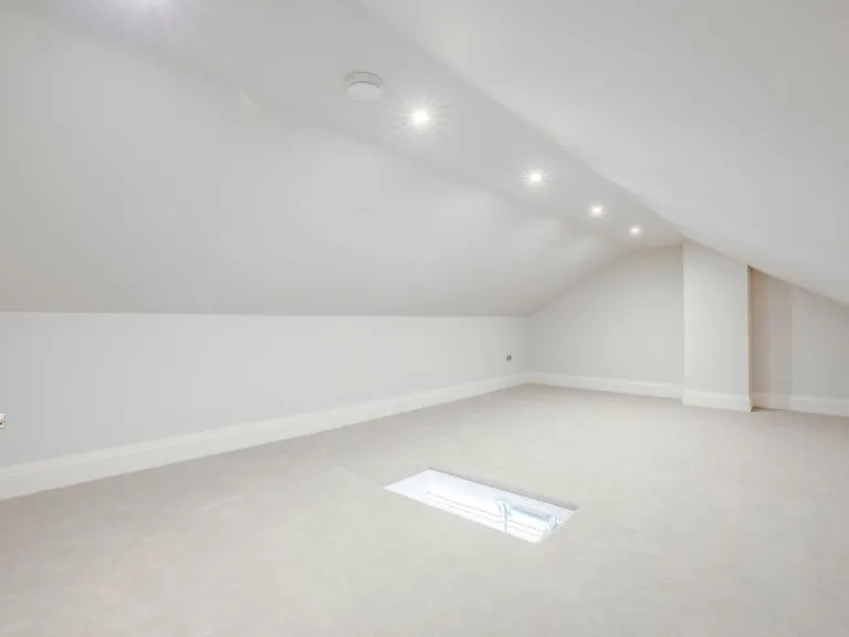
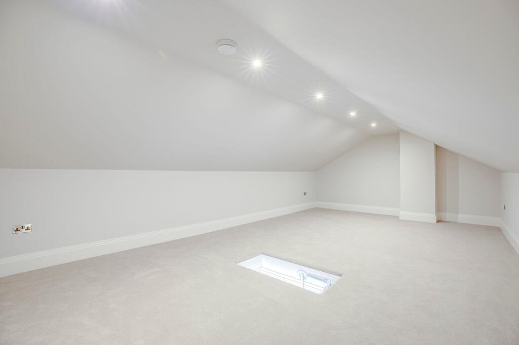
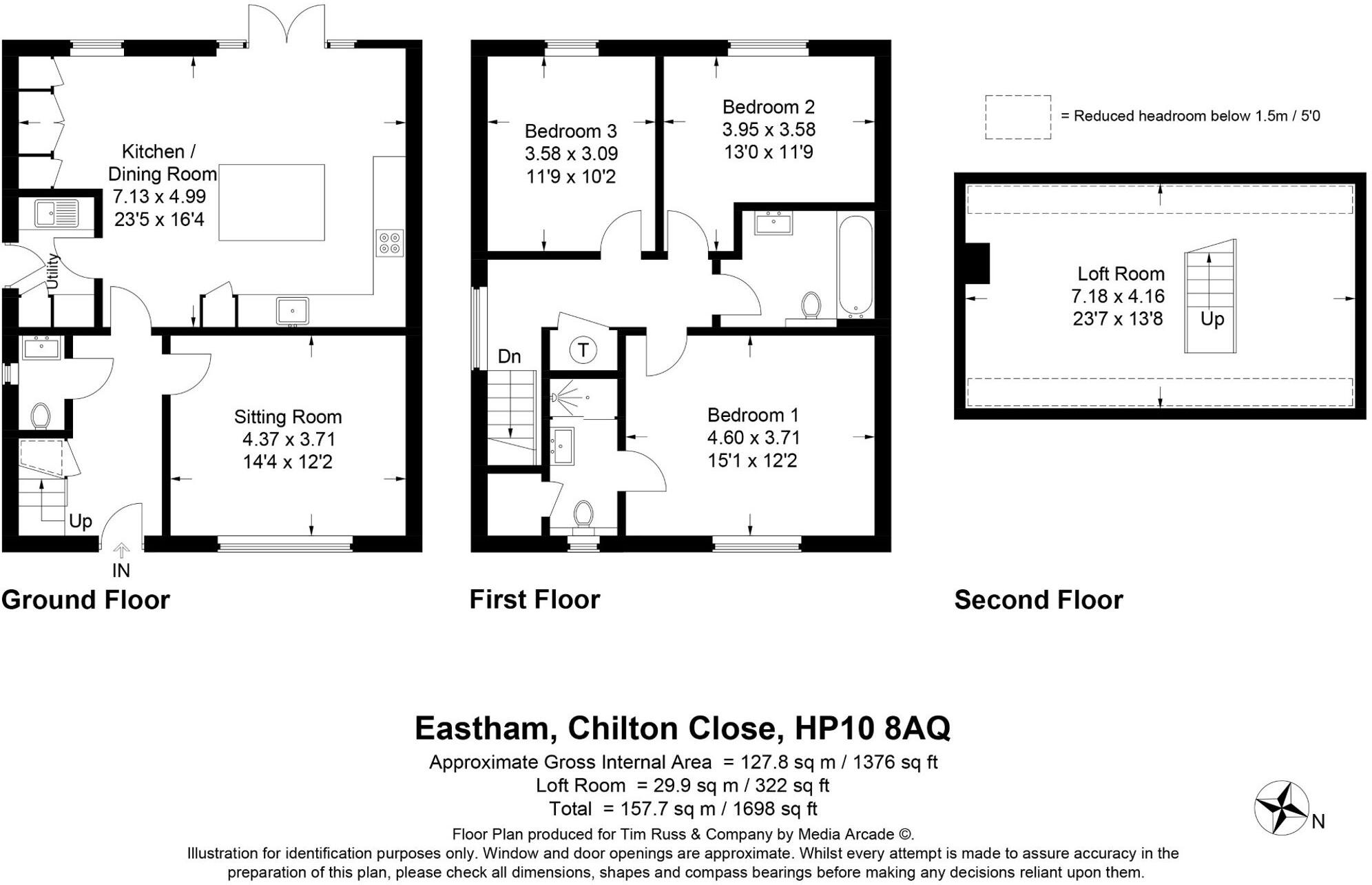
- A multi-story home featuring a large kitchen/dining room, sitting room, three bedrooms, and a loft room. Located at Eastham, Chilton Close.
Rooms
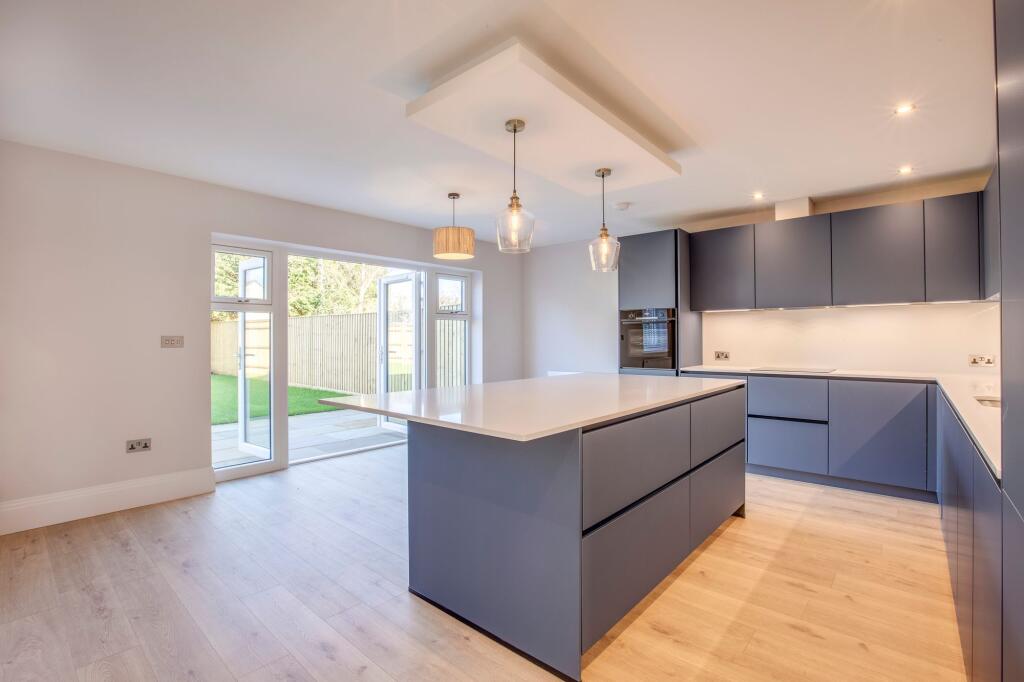
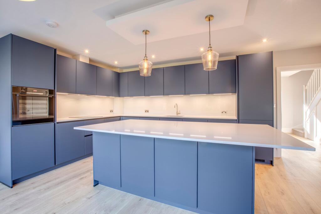
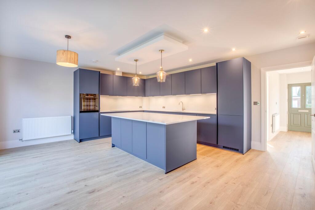
- Kitchen / Dining Room: Large
- Sitting Room: Average
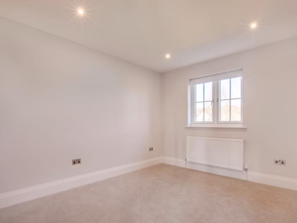
- Bedroom 1: Average
- Bedroom 2: Average
- Bedroom 3: Small
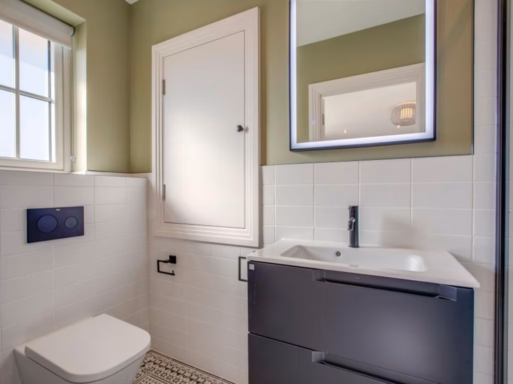
- Bathroom:
- Kitchen / Dining Room: large
- Sitting Room: average
- Bedroom 1: average
- Bedroom 2: average
- Bedroom 3: average
- Loft Room: large
Textual Property Features
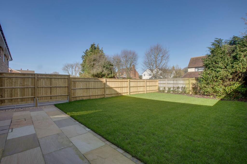
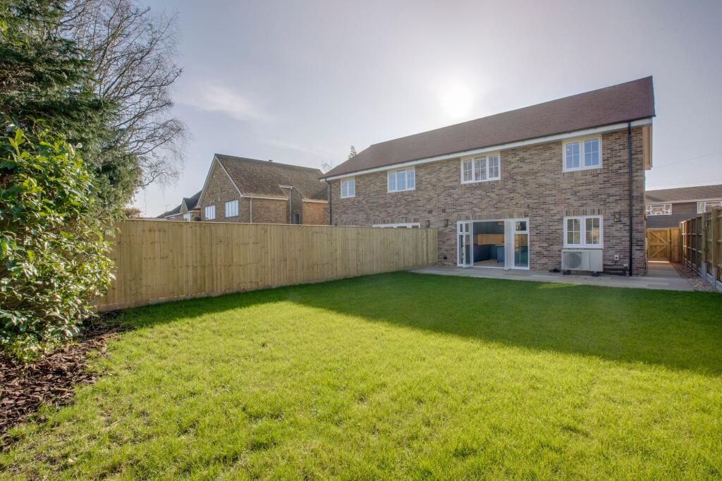
- Is New Build
- Has Garden
- Success
Detected Visual Features
- modern
- detached
- two-story
- brick façade
- off-street parking
- driveway
- new build
- family home
- residential
- suburban
- semi-detached
- newly built
- brick and render
- low maintenance
EPC Details
- Fully double glazed
- Cavity wall, as built, insulated (assumed)
- Boiler and radiators, mains gas
- Low energy lighting in 61% of fixed outlets
- Solid, no insulation (assumed)
Nearby Schools
- Beechview Academy
- The Highcrest Academy
- Ash Hill Primary School
- Kings Wood School and Nursery
- Tylers Green Middle School
- The Royal Grammar School, High Wycombe
- Widmer End Community Combined School
- Holmer Green Senior School
- Holmer Green First School and Pre-School
- Juniper Hill School
- Carrington Infant School
- Marsh School
- Curzon Church of England Combined School
- Little Kingshill Combined School
- Carrington Junior School
- Loudwater Combined School
- Crown House School
- Tylers Green First School
- Great Kingshill Church of England Combined School
- Holmer Green Junior School
- Highworth Combined School and Nursery
- Manor Farm Community Infant School
- Manor Farm Junior School
- Hazlemere Church of England Combined School
- Cedar Park School & Nursery
- Little Missenden Church of England School
Nearest General Shops
- Id: 3440964535
- Tags:
- Name: Penn Motor Company
- Shop: car_repair
- TagsNormalized:
- motor
- car repair
- repair
- shop
- Lat: 51.6421667
- Lon: -0.6947285
- FullGeoHash: gcptb1nj7tsg
- PartitionGeoHash: gcpt
- Images:
- FoodStandards: null
- Distance: 183.1
,- Id: 3440964525
- Tags:
- Name: Charisma Cutz
- Shop: hairdresser
- TagsNormalized:
- Lat: 51.6442481
- Lon: -0.6980745
- FullGeoHash: gcptb1e9t9tg
- PartitionGeoHash: gcpt
- Images:
- FoodStandards: null
- Distance: 148.2
,- Id: 3440964536
- Tags:
- Name: Thrills and Spills Party Shop
- Shop: party
- TagsNormalized:
- Lat: 51.6441631
- Lon: -0.6980332
- FullGeoHash: gcptb1e9n9u8
- PartitionGeoHash: gcpt
- Images:
- FoodStandards: null
- Distance: 140.7
}
Nearest Grocery shops
- Id: 1028682265
- Tags:
- Addr:
- City: Hazlemere
- Postcode: HP15 7LG
- Street: Amersham Road
- Brand: Spar
- Brand:wikidata: Q610492
- Brand:wikipedia: en:SPAR (retailer)
- Building: yes
- Name: Spar
- Opening_hours: 24/7
- Phone: +441494714571
- Shop: convenience
- Website: https://www.spar.co.uk/store-locator/afb18027-spar-euro-garages-hazelmere-cross-roads
- TagsNormalized:
- Lat: 51.6520755
- Lon: -0.712425
- FullGeoHash: gcpmzfcppkc2
- PartitionGeoHash: gcpm
- Images:
- FoodStandards: null
- Distance: 1465.6
,- Id: 1028682262
- Tags:
- Addr:
- City: Hazlemere
- Postcode: HP15 7LG
- Street: Amersham Road
- Brand: Little Waitrose
- Brand:wikidata: Q771734
- Brand:wikipedia: en:Waitrose
- Building: yes
- Name: Little Waitrose
- Opening_hours: 24/7
- Phone: +441494716854
- Shop: convenience
- Website: https://www.waitrose.com/content/waitrose/en/bf_home/bf/584.html
- TagsNormalized:
- little waitrose
- waitrose
- convenience
- shop
- Lat: 51.651766
- Lon: -0.7115065
- FullGeoHash: gcpmzfcvken3
- PartitionGeoHash: gcpm
- Images:
- FoodStandards: null
- Distance: 1395.2
,- Id: 3440964534
- Tags:
- Name: Kings Ride
- Shop: convenience
- TagsNormalized:
- Lat: 51.6416209
- Lon: -0.7019682
- FullGeoHash: gcptb10f4zye
- PartitionGeoHash: gcpt
- Images:
- FoodStandards: null
- Distance: 442.5
}
Nearest Religious buildings
- Id: 346769615
- Tags:
- Addr:
- Amenity: school
- Capacity: 230
- Denomination: anglican
- Diocese: Diocese of Oxford
- Isced:
- Max_age: 11
- Min_age: 3
- Name: Hazlemere Church of England Combined School
- Phone: +44 1494 521420
- Ref:
- Religion: christian
- School:
- Boarding: no
- Gender: mixed
- Selective: no
- Trust: no
- Type: voluntary_aided
- Website: https://www.hazlemere-ce.bucks.sch.uk/
- Wikidata: Q66223411
- TagsNormalized:
- school
- anglican
- church
- christian
- Lat: 51.6486967
- Lon: -0.7159965
- FullGeoHash: gcpmzdqeknfk
- PartitionGeoHash: gcpm
- Images:
- FoodStandards: null
- Distance: 1476.7
,- Id: 860049640
- Tags:
- Amenity: place_of_worship
- Building: church
- Denomination: anglican
- Name: St Margaret's
- Religion: christian
- Wikidata: Q26418617
- TagsNormalized:
- place of worship
- church
- anglican
- christian
- Lat: 51.6353388
- Lon: -0.6959947
- FullGeoHash: gcpt8pvjwhu9
- PartitionGeoHash: gcpt
- Images:
- FoodStandards: null
- Distance: 906.7
,- Id: 337002125
- Tags:
- Amenity: place_of_worship
- Building: church
- Denomination: methodist
- Name: The Methodist Church
- Religion: christian
- TagsNormalized:
- place of worship
- church
- methodist
- christian
- Lat: 51.6427963
- Lon: -0.6961971
- FullGeoHash: gcptb1m116vz
- PartitionGeoHash: gcpt
- Images:
- FoodStandards: null
- Distance: 77.5
}
Nearest Medical buildings
- Id: 611608839
- Tags:
- Amenity: pharmacy
- Name: Rowlands Pharmacy
- TagsNormalized:
- pharmacy
- rowlands pharmacy
- Lat: 51.6371499
- Lon: -0.7231011
- FullGeoHash: gcpmz832nw2t
- PartitionGeoHash: gcpm
- Images:
- FoodStandards: null
- Distance: 1978.8
,- Id: 992621781
- Tags:
- Amenity: pharmacy
- Brand: Boots
- Brand:wikidata: Q6123139
- Healthcare: pharmacy
- Name: Boots
- TagsNormalized:
- pharmacy
- boots
- health
- healthcare
- Lat: 51.6576195
- Lon: -0.7095354
- FullGeoHash: gcpmzggr6whp
- PartitionGeoHash: gcpm
- Images:
- FoodStandards: null
- Distance: 1816.9
,- Id: 10693586902
- Tags:
- Amenity: pharmacy
- Brand: Rowlands Pharmacy
- Brand:wikidata: Q62663235
- Healthcare: pharmacy
- Name: Rowlands Pharmacy
- Survey:
- TagsNormalized:
- pharmacy
- rowlands pharmacy
- health
- healthcare
- Lat: 51.6514893
- Lon: -0.7134274
- FullGeoHash: gcpmzfb7xzmz
- PartitionGeoHash: gcpm
- Images:
- FoodStandards: null
- Distance: 1478.7
,- Id: 3398846880
- Tags:
- Amenity: doctors
- Healthcare: doctor
- Name: Highfield Surgery
- TagsNormalized:
- doctor
- doctors
- health
- healthcare
- surgery
- Lat: 51.6504255
- Lon: -0.7133234
- FullGeoHash: gcpmzf8td35t
- PartitionGeoHash: gcpm
- Images:
- FoodStandards: null
- Distance: 1404.7
}
Nearest Airports
- Id: 14001268
- Tags:
- Access: yes
- Aerodrome: international
- Aerodrome:type: public
- Aeroway: aerodrome
- Alt_name: London Heathrow
- Alt_name_2: London Heathrow Airport
- Ele: 25
- Iata: LHR
- Icao: EGLL
- Int_name: Heathrow Airport
- Name: London Heathrow Airport
- Note: area still approx
- Old_name: London Airport
- Operator: Heathrow Airport Limited
- Rank_aci:
- Ref: LHR
- Short_name: Heathrow
- Type: multipolygon
- Website: https://www.heathrow.com/
- Wikidata: Q8691
- Wikipedia: en:Heathrow Airport
- TagsNormalized:
- airport
- international airport
- Lat: 51.4677522
- Lon: -0.4547736
- FullGeoHash: gcpsv9kv7h2h
- PartitionGeoHash: gcps
- Images:
- FoodStandards: null
- Distance: 25704.1
}
Nearest Leisure Facilities
- Id: 885062126
- Tags:
- TagsNormalized:
- Lat: 51.6401865
- Lon: -0.6998841
- FullGeoHash: gcptb0f3gs2x
- PartitionGeoHash: gcpt
- Images:
- FoodStandards: null
- Distance: 442.6
,- Id: 883765911
- Tags:
- TagsNormalized:
- Lat: 51.640766
- Lon: -0.6951403
- FullGeoHash: gcptb0vv609b
- PartitionGeoHash: gcpt
- Images:
- FoodStandards: null
- Distance: 313.4
,- Id: 883766204
- Tags:
- TagsNormalized:
- Lat: 51.64118
- Lon: -0.6949268
- FullGeoHash: gcptb0vzxj9j
- PartitionGeoHash: gcpt
- Images:
- FoodStandards: null
- Distance: 274
,- Id: 942371541
- Tags:
- TagsNormalized:
- Lat: 51.6420258
- Lon: -0.6981217
- FullGeoHash: gcptb15sse6e
- PartitionGeoHash: gcpt
- Images:
- FoodStandards: null
- Distance: 205.4
,- Id: 337002120
- Tags:
- TagsNormalized:
- Lat: 51.6420675
- Lon: -0.6978955
- FullGeoHash: gcptb15ucg57
- PartitionGeoHash: gcpt
- Images:
- FoodStandards: null
- Distance: 192.5
}
Nearest Bus stations and stops
- Id: 3426731572
- Tags:
- Amenity: waste_basket
- Bus: yes
- Highway: bus_stop
- Name: Curzon Avenue
- Public_transport: platform
- TagsNormalized:
- Lat: 51.6462287
- Lon: -0.6981434
- FullGeoHash: gcptb1gth4fd
- PartitionGeoHash: gcpt
- Images:
- FoodStandards: null
- Distance: 329.8
,- Id: 3440964532
- Tags:
- Bus: yes
- Highway: bus_stop
- Name: Hazlemere Road
- Public_transport: platform
- TagsNormalized:
- Lat: 51.6456264
- Lon: -0.6965871
- FullGeoHash: gcptb1uc86e1
- PartitionGeoHash: gcpt
- Images:
- FoodStandards: null
- Distance: 238.3
,- Id: 3440964531
- Tags:
- Bus: yes
- Highway: bus_stop
- Name: Hazlemere Road
- Public_transport: platform
- TagsNormalized:
- Lat: 51.645082
- Lon: -0.6961434
- FullGeoHash: gcptb1tn6tjf
- PartitionGeoHash: gcpt
- Images:
- FoodStandards: null
- Distance: 177.4
,- Id: 3440964527
- Tags:
- Bus: yes
- Highway: bus_stop
- Name: Coppice Farm
- Public_transport: platform
- TagsNormalized:
- Lat: 51.6433138
- Lon: -0.6950656
- FullGeoHash: gcptb1mu5g3w
- PartitionGeoHash: gcpt
- Images:
- FoodStandards: null
- Distance: 87.9
,- Id: 3440964528
- Tags:
- Bus: yes
- Highway: bus_stop
- Name: Coppice Farm
- Public_transport: platform
- TagsNormalized:
- Lat: 51.6434647
- Lon: -0.6952595
- FullGeoHash: gcptb1mszr8f
- PartitionGeoHash: gcpt
- Images:
- FoodStandards: null
- Distance: 72.3
}
Nearest Hotels
- Id: 98604524
- Tags:
- Addr:
- City: High Wycombe
- Housename: Travelodge High Wycombe Central Hotel
- Postcode: HP11 2DQ
- Street: Octagon Parade
- Brand: Travelodge
- Brand:wikidata: Q9361374
- Brand:wikipedia: en:Travelodge UK
- Building: yes
- Fhrs:
- Authority: Buckinghamshire
- Id: 624580
- Local_authority_id: 14/00069/MIXED
- Name: High Wycombe Central Travelodge
- Tourism: hotel
- Website: https://www.travelodge.co.uk/hotels/535/High-Wycombe-hotel
- TagsNormalized:
- Lat: 51.6304661
- Lon: -0.7537158
- FullGeoHash: gcpmwz51m0ky
- PartitionGeoHash: gcpm
- Images:
- FoodStandards: null
- Distance: 4218.3
,- Id: 548600876
- Tags:
- Addr:
- City: High Wycombe
- Postcode: HP13 5FX
- Street: Premier Way
- Brand: Premier Inn
- Brand:wikidata: Q2108626
- Building: yes
- Fhrs:
- Internet_access: wlan
- Internet_access:fee: customers
- Internet_access:operator: Virgin Media
- Internet_access:ssid: Premier Inn Free Wi-Fi
- Name: Premier Inn
- Source:
- Tourism: hotel
- Website: https://www.premierinn.com/gb/en/hotels/england/buckinghamshire/high-wycombe/high-wycombe-central.html
- TagsNormalized:
- Lat: 51.6322956
- Lon: -0.7536477
- FullGeoHash: gcpmwz75ytx8
- PartitionGeoHash: gcpm
- Images:
- FoodStandards: null
- Distance: 4148.3
,- Id: 109161179
- Tags:
- Brand: Premier Inn
- Brand:wikidata: Q2108626
- Building: yes
- Name: Premier Inn High Wycombe
- Operator: Premier Inn
- Tourism: hotel
- TagsNormalized:
- Lat: 51.6076748
- Lon: -0.6940133
- FullGeoHash: gcpt84yskrf5
- PartitionGeoHash: gcpt
- Images:
- FoodStandards: null
- Distance: 3985.6
}
Tags
- modern
- detached
- two-story
- brick façade
- off-street parking
- driveway
- new build
- family home
- residential
- suburban
- modern
- semi-detached
- newly built
- brick and render
- driveway
- low maintenance
- family home
Local Market Stats
- Average Price/sqft: £486
- Avg Income: £59800
- Rental Yield: 3.2%
- Social Housing: 7%
- Planning Success Rate: 86%
Similar Properties
 3 bedroom semi-detached house for sale in Chilton Close, Penn, HP10 — £795,000 • 3 bed • 2 bath • 1423 ft²
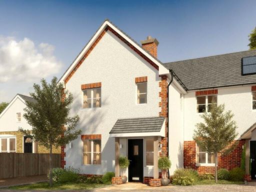 3 bedroom semi-detached house for sale in Burleighfield Estate, London Road, Loudwater, High Wycombe, HP10 — £599,000 • 3 bed • 1 bath • 1018 ft²
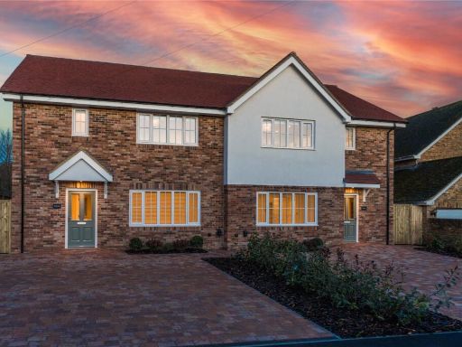 3 bedroom semi-detached house for sale in Chilton Close, Penn, Buckinghamshire, HP10 — £795,000 • 3 bed • 2 bath • 1745 ft²
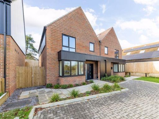 3 bedroom semi-detached house for sale in Park Lane, Stokenchurch, HP14 — £575,000 • 3 bed • 2 bath • 1362 ft²
 3 bedroom semi-detached house for sale in New Pond Road, Holmer Green, High Wycombe, Buckinghamshire, HP15 — £675,000 • 3 bed • 2 bath • 1173 ft²
 3 bedroom semi-detached house for sale in London Road, Loudwater, High Wycombe, Buckinghamshire, HP10 — £599,000 • 3 bed • 2 bath • 1076 ft²
Meta
- {
"@context": "https://schema.org",
"@type": "Residence",
"name": "3 bedroom semidetached house for sale in Chilton Close, Pen…",
"description": "",
"url": "https://propertypiper.co.uk/property/3bd53ed2-37a0-4d6e-935f-53bb9fadc0df",
"image": "https://image-a.propertypiper.co.uk/9abe1739-4dde-4e65-a589-106ccaff35df-1024.jpeg",
"address": {
"@type": "PostalAddress",
"streetAddress": "ASHLEIGH CHILTON CLOSE PENN HIGH WYCOMBE",
"postalCode": "HP10 8AQ",
"addressLocality": "Buckinghamshire",
"addressRegion": "Wycombe",
"addressCountry": "England"
},
"geo": {
"@type": "GeoCoordinates",
"latitude": 51.64349021847581,
"longitude": -0.6963070859631545
},
"numberOfRooms": 3,
"numberOfBathroomsTotal": 2,
"floorSize": {
"@type": "QuantitativeValue",
"value": 1376,
"unitCode": "FTK"
},
"offers": {
"@type": "Offer",
"price": 750000,
"priceCurrency": "GBP",
"availability": "https://schema.org/InStock"
},
"additionalProperty": [
{
"@type": "PropertyValue",
"name": "Feature",
"value": "modern"
},
{
"@type": "PropertyValue",
"name": "Feature",
"value": "detached"
},
{
"@type": "PropertyValue",
"name": "Feature",
"value": "two-story"
},
{
"@type": "PropertyValue",
"name": "Feature",
"value": "brick façade"
},
{
"@type": "PropertyValue",
"name": "Feature",
"value": "off-street parking"
},
{
"@type": "PropertyValue",
"name": "Feature",
"value": "driveway"
},
{
"@type": "PropertyValue",
"name": "Feature",
"value": "new build"
},
{
"@type": "PropertyValue",
"name": "Feature",
"value": "family home"
},
{
"@type": "PropertyValue",
"name": "Feature",
"value": "residential"
},
{
"@type": "PropertyValue",
"name": "Feature",
"value": "suburban"
},
{
"@type": "PropertyValue",
"name": "Feature",
"value": "modern"
},
{
"@type": "PropertyValue",
"name": "Feature",
"value": "semi-detached"
},
{
"@type": "PropertyValue",
"name": "Feature",
"value": "newly built"
},
{
"@type": "PropertyValue",
"name": "Feature",
"value": "brick and render"
},
{
"@type": "PropertyValue",
"name": "Feature",
"value": "driveway"
},
{
"@type": "PropertyValue",
"name": "Feature",
"value": "low maintenance"
},
{
"@type": "PropertyValue",
"name": "Feature",
"value": "family home"
}
]
}
High Res Floorplan Images
Compatible Floorplan Images
FloorplanImages Thumbnail