EN9 3XX - 5 bedroom end of terrace house for sale in Christie Road, W…
View on Property Piper
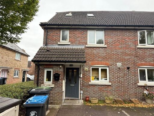
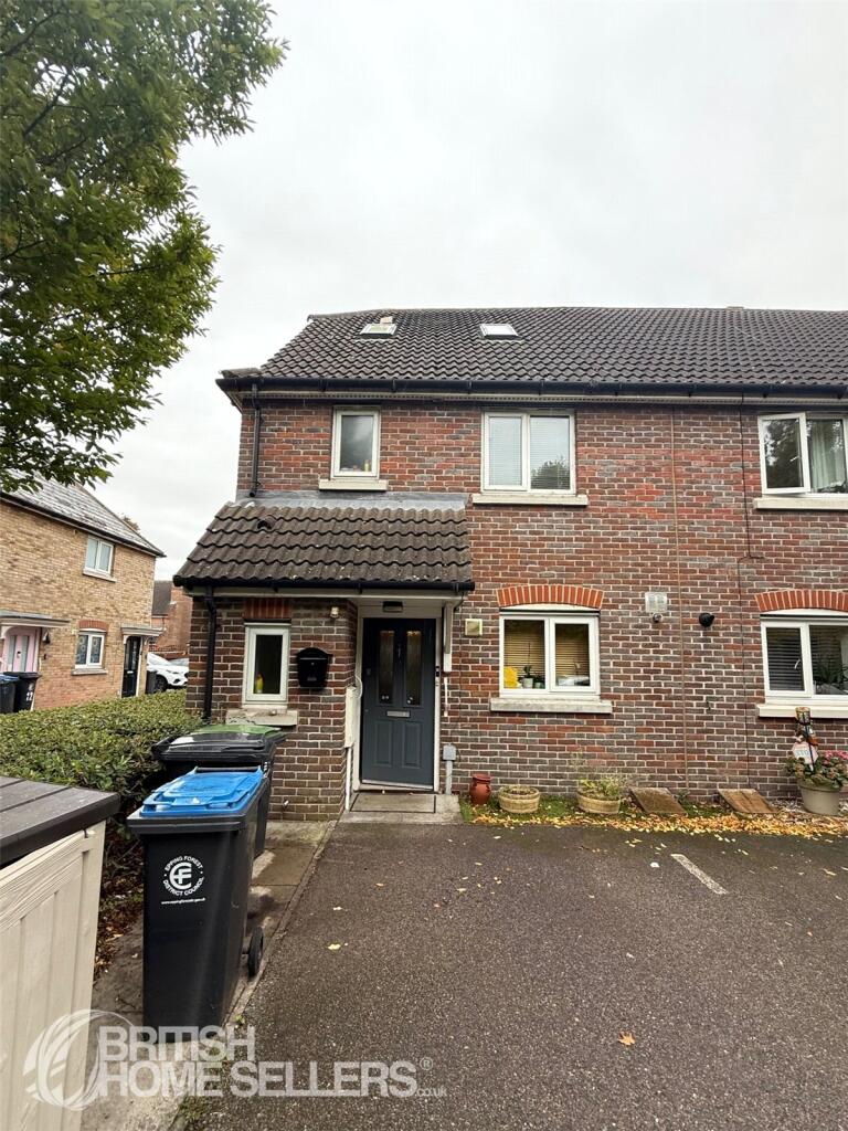
5 bedroom end of terrace house for sale in Christie Road, Waltham Abbey, Essex, EN9
Property Details
- Price: £470000
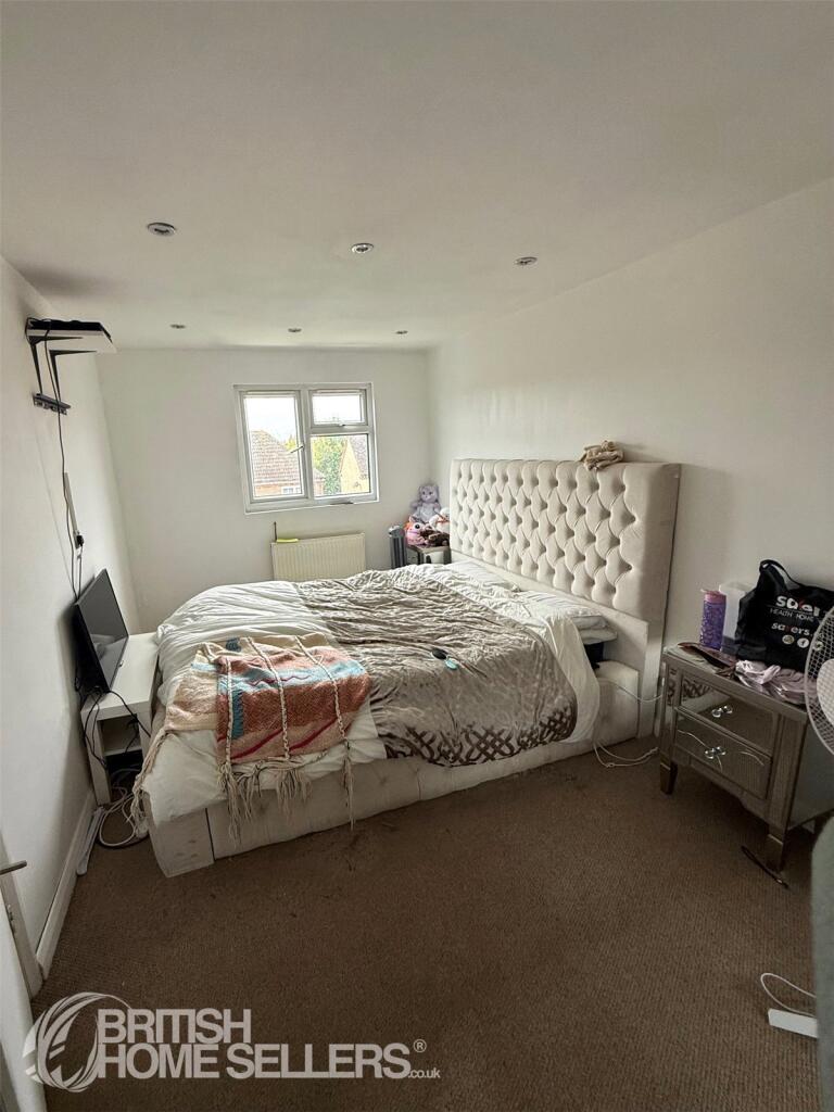
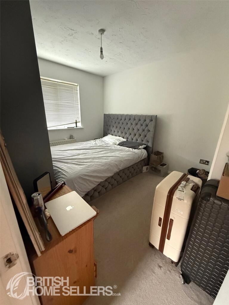
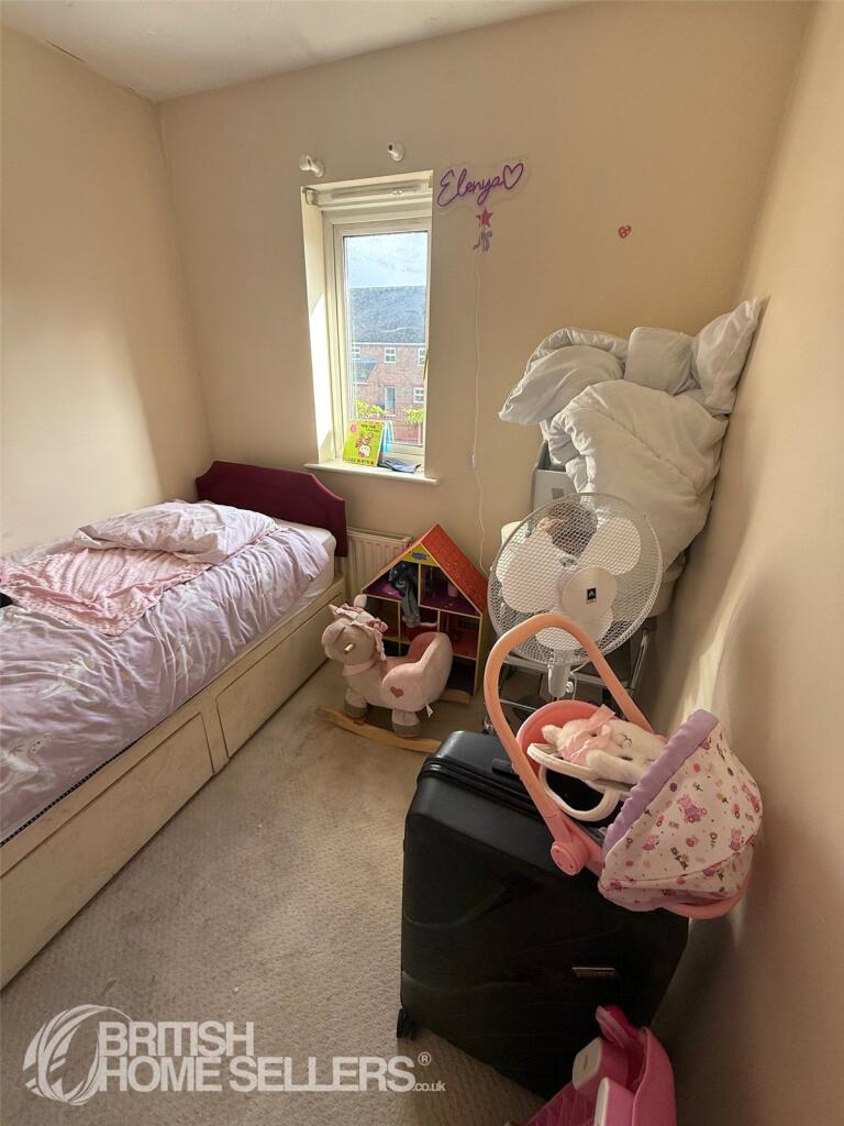
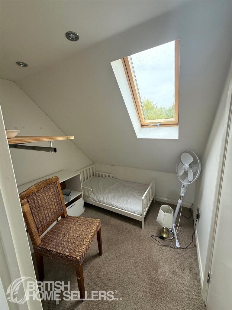
- Bedrooms: 5
- Bathrooms: 2
- Property Type: undefined
- Property SubType: undefined
Image Descriptions
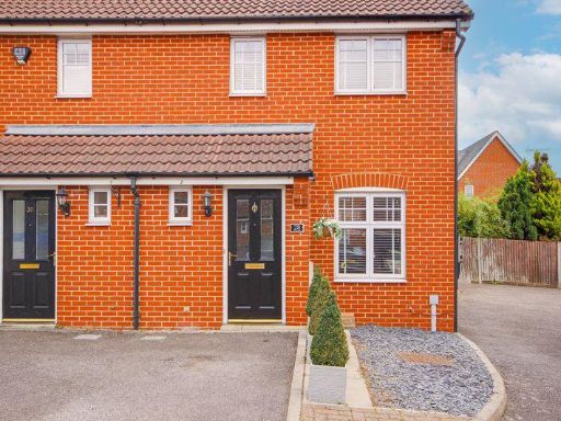
- semi-detached house modern
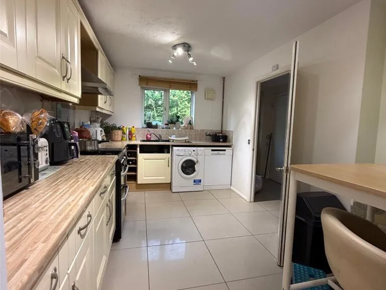
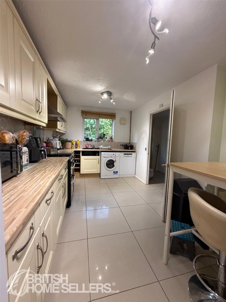
- kitchen modern
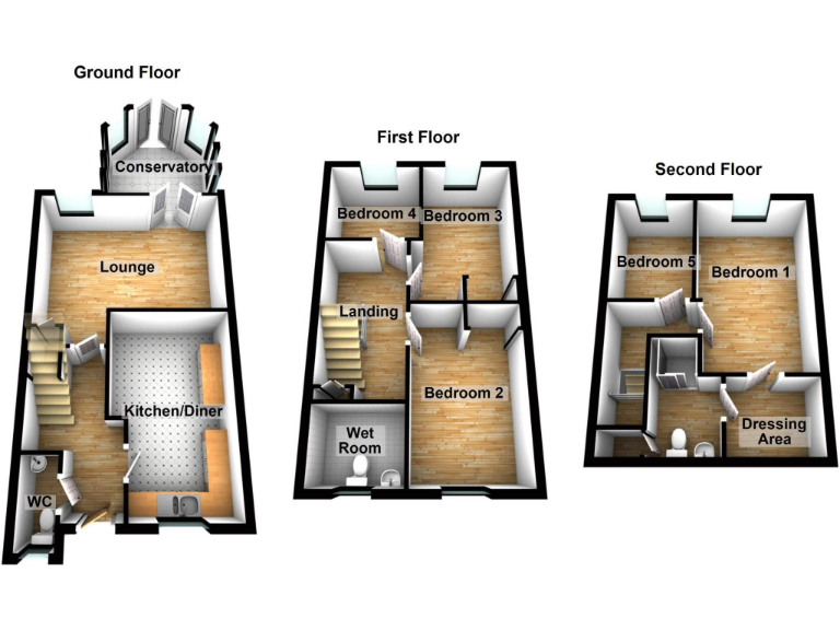
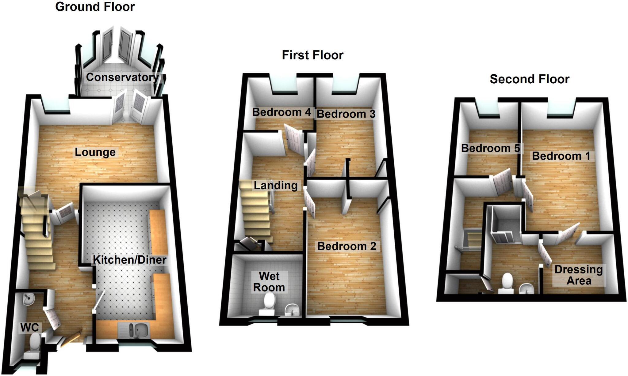
Rooms
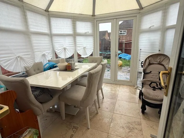
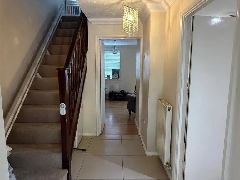
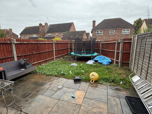
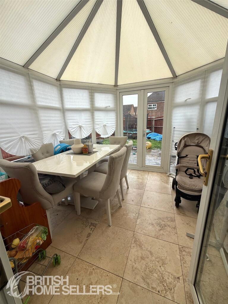
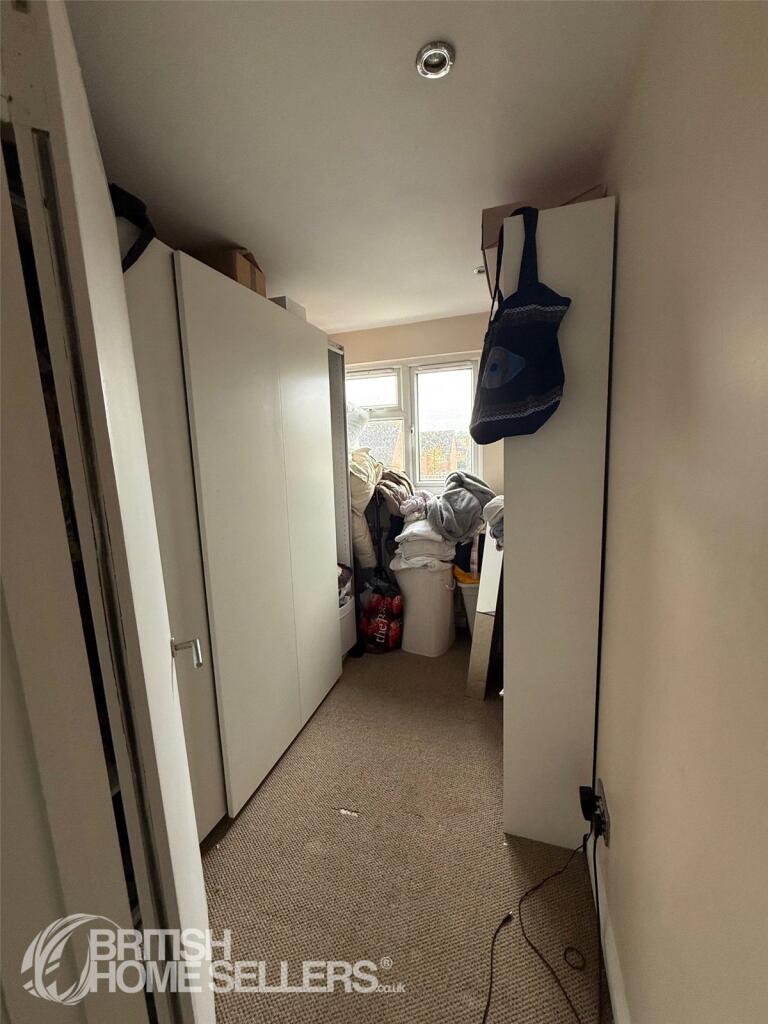
- Conservatory:
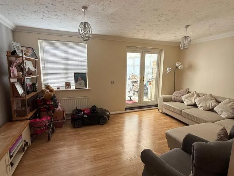
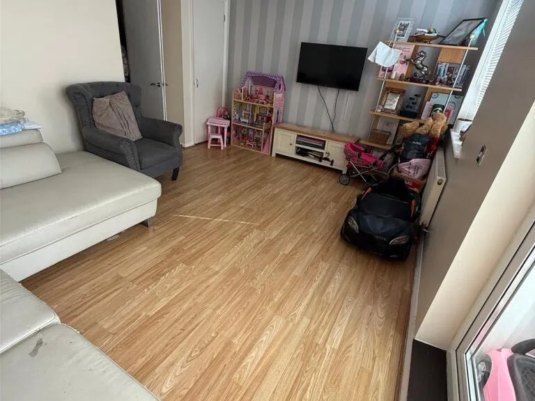
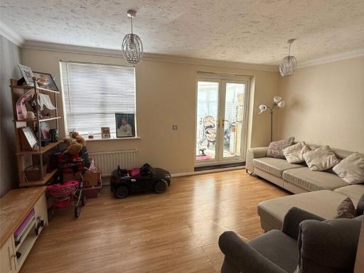
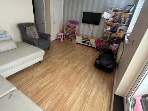
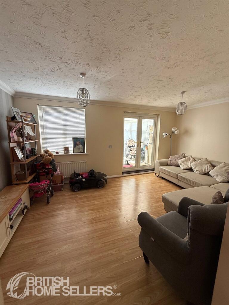
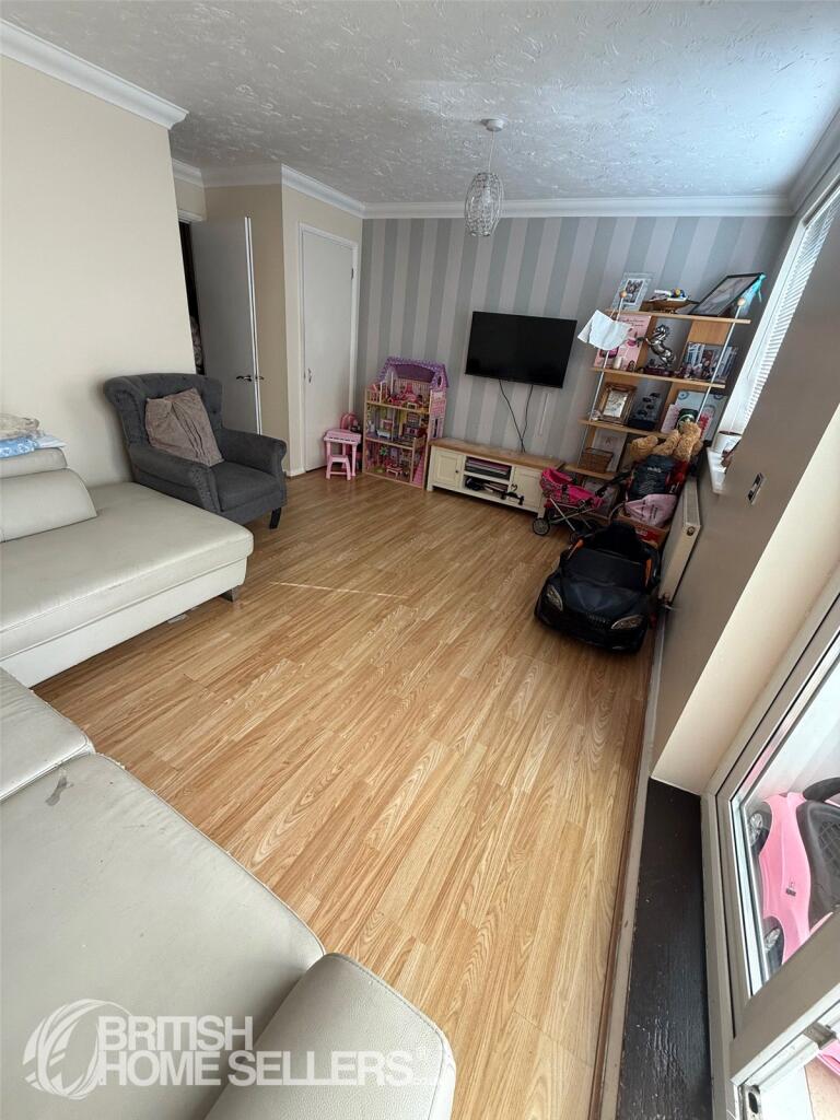
- Lounge:
- Kitchen/Diner:
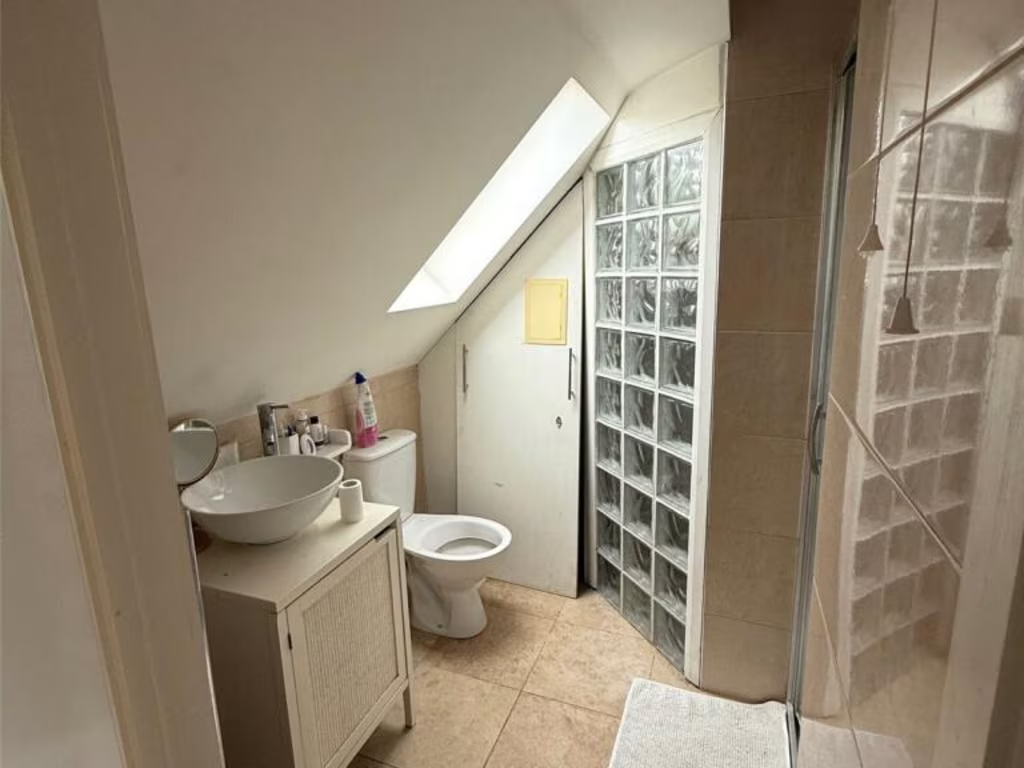
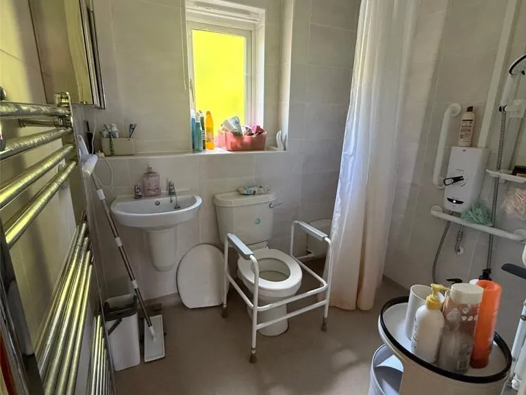
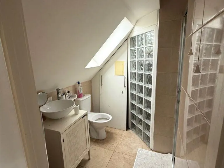
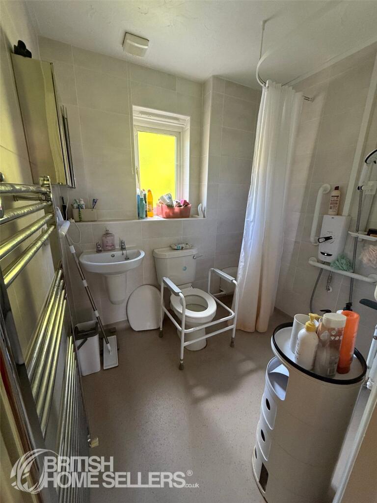
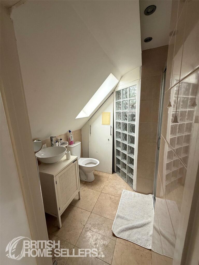
- WC:
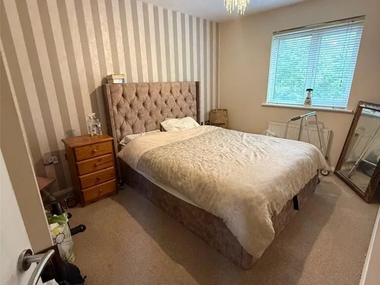
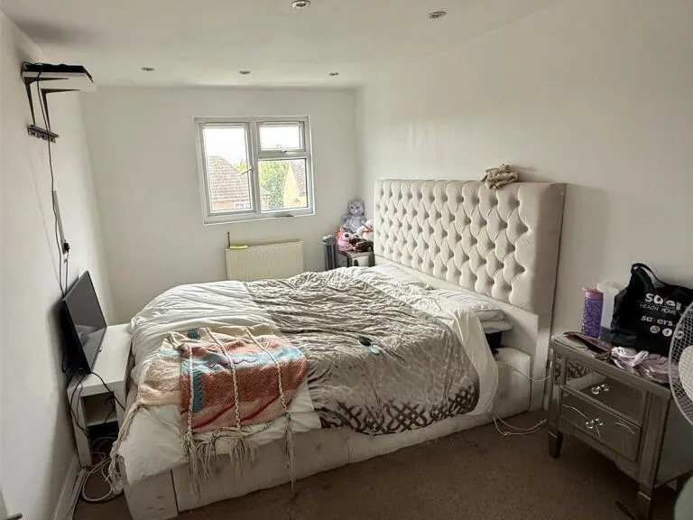
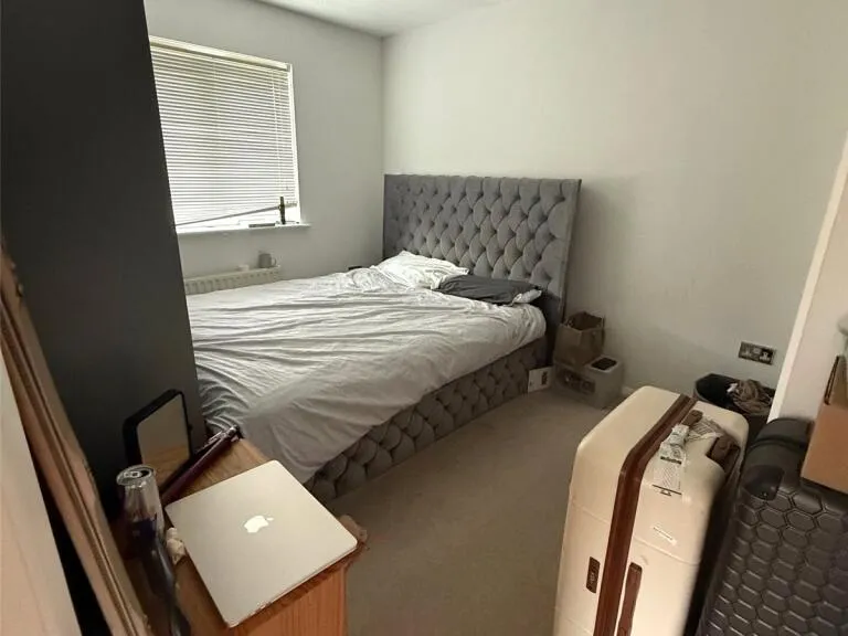
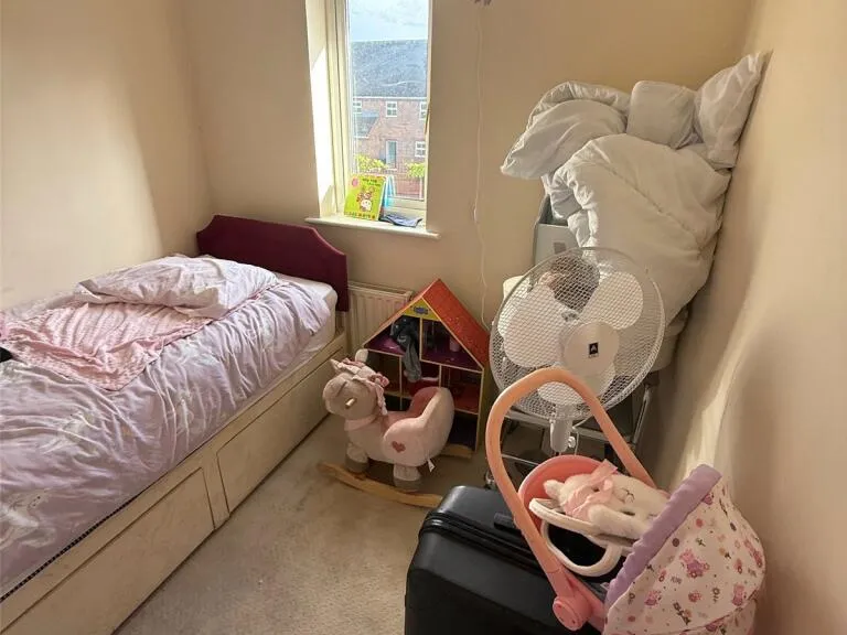
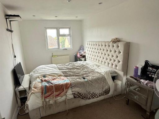
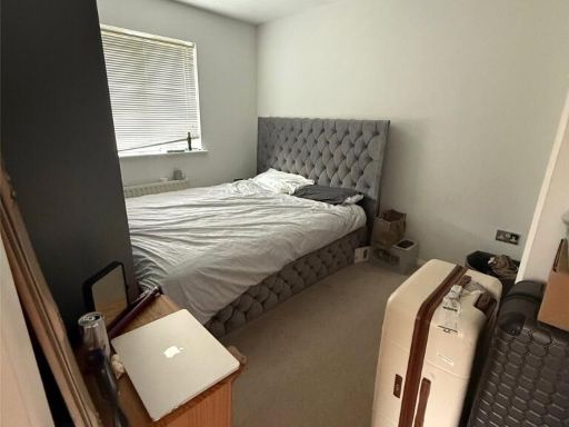
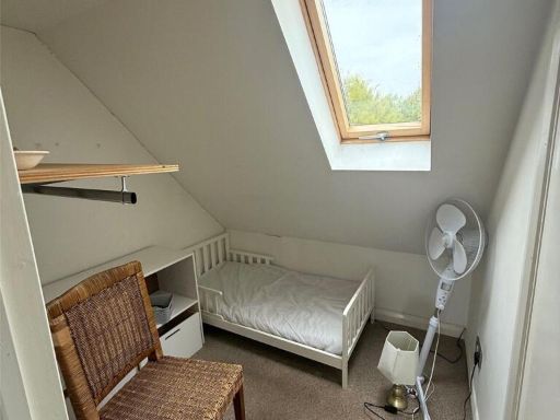
- Bedroom 4:
- Bedroom 3:
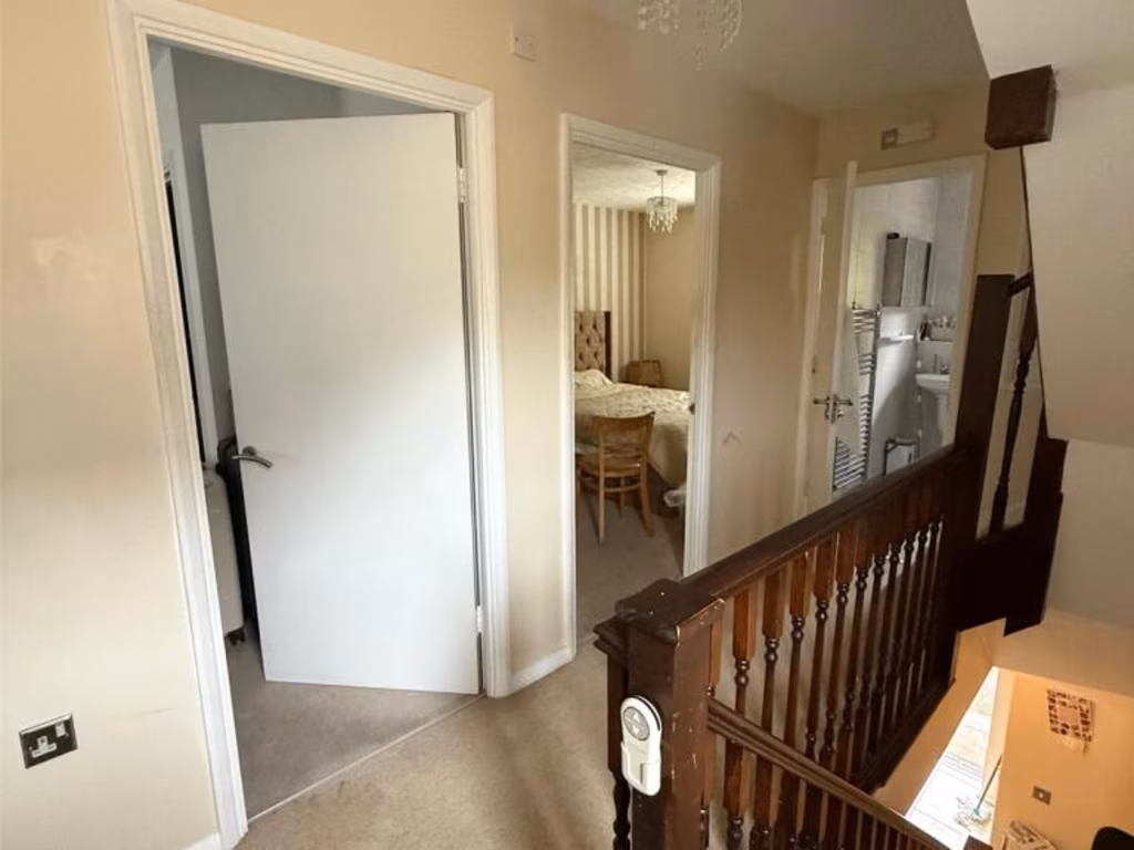
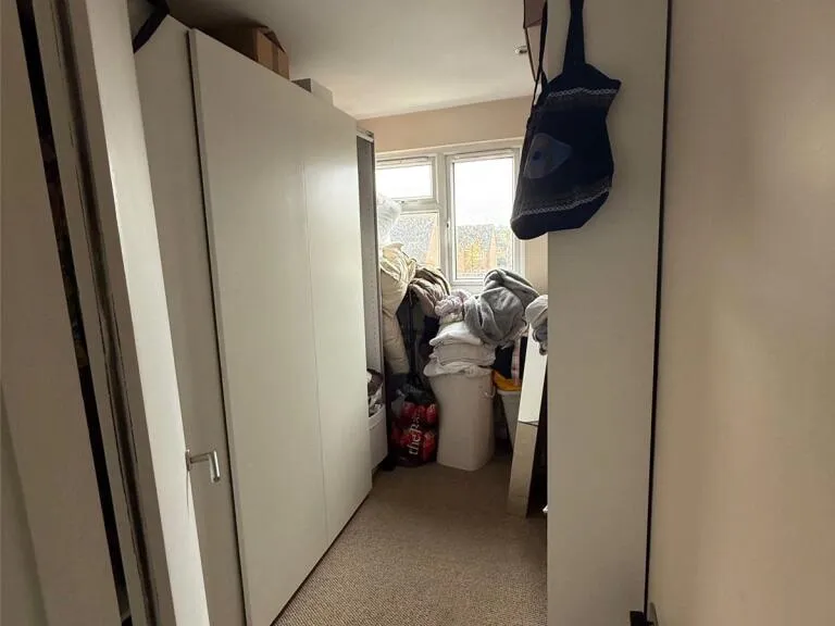
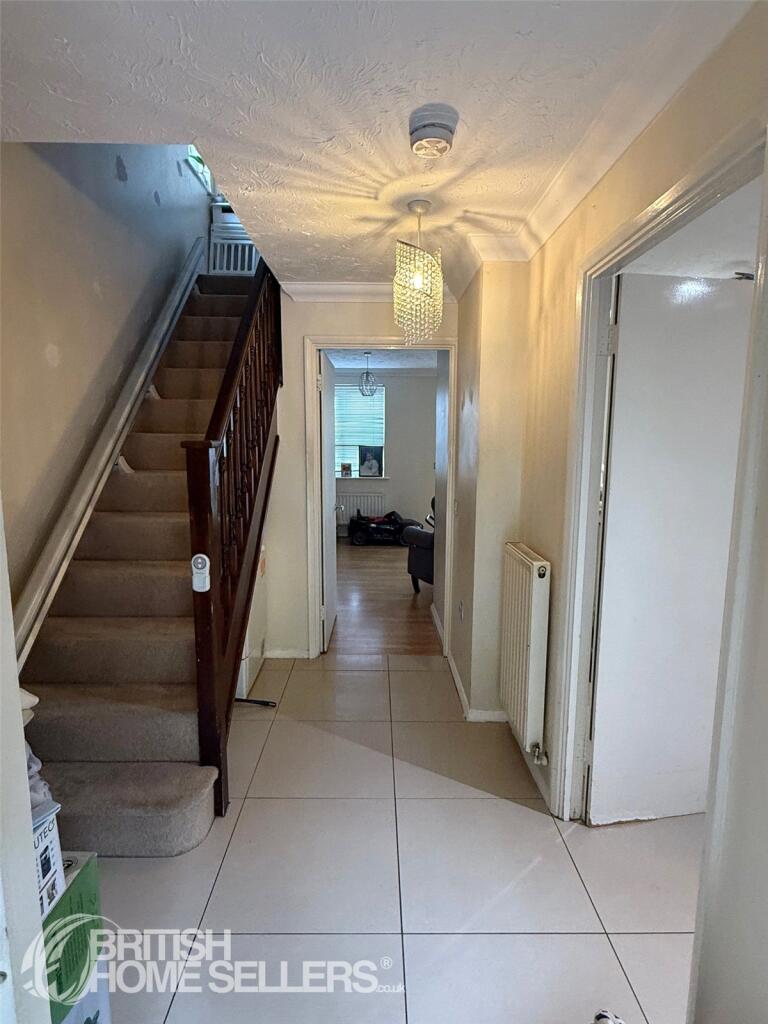
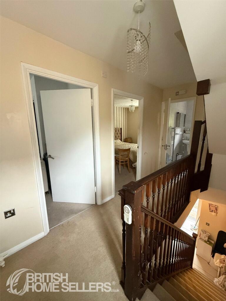
- Landing:
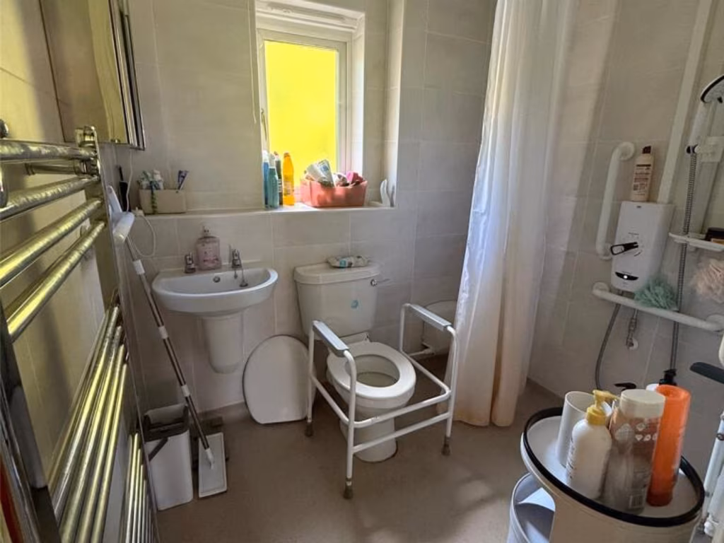
- Wet Room:
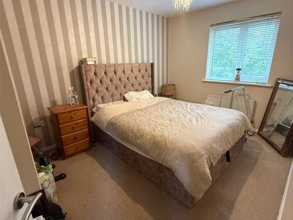
- Bedroom 2:
- Bedroom 5:
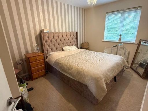
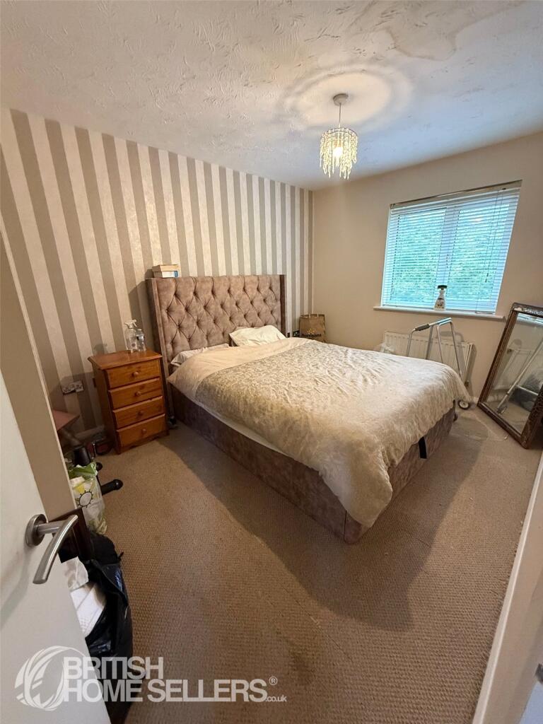
- Bedroom 1:
- Dressing Area:
Textual Property Features
Detected Visual Features
- semi-detached
- modern
- brick facade
- residential area
- roof tiles
- off-street parking
- modern kitchen
- medium size
- neutral tones
- standard ceiling
- ceramic tile floor
- light fixtures
- tile backsplash
- double window
EPC Details
- Fully double glazed
- Cavity wall, as built, insulated (assumed)
- Boiler and radiators, mains gas
- Low energy lighting in 17% of fixed outlets
- Solid, limited insulation (assumed)
Nearby Schools
- Waltham Holy Cross Primary Academy
- Yardley Primary School
- Prince of Wales Primary School
- Oasis Academy Enfield
- Holdbrook Primary School and Nursery
- St Joseph's Catholic Primary School (Wx)
- Holy Trinity Church of England Primary School
- Downfield Primary School
- High Beech CofE Primary School
- Leverton Primary School
- Ark John Keats Academy
- Keys Meadow Primary School
- Hurst Drive Primary School
- Brookland Infant and Nursery School
- King Harold Business & Enterprise Academy
- Brimsdown Primary School
- Freshsteps Independent school
- Four Swannes Primary School
- Brookland Junior School
- Hillhouse CofE Primary School
- Eastfield Primary School
- Chesterfield Primary School
- Freezywater St George's CofE VA Primary School
- The Lea Valley Academy
- Millbrook School
- Haileybury Turnford
Nearest Grocery shops
- Id: 3559287021
- Tags:
- Addr:
- Housenumber: 389
- Postcode: EN3 6HN
- Street: Ordnance Road
- Name: Shelpa Express
- Shop: convenience
- Source: gps+mapnoter
- TagsNormalized:
- Lat: 51.6707391
- Lon: -0.0211445
- FullGeoHash: gcpvzw2eg7cs
- PartitionGeoHash: gcpv
- Images:
- FoodStandards: null
- Distance: 1259.6
,- Id: 7887985297
- Tags:
- Addr:
- Housenumber: 54-62
- Postcode: EN3 6GS
- Street: Island Centre Way
- Brand: Tesco Express
- Brand:wikidata: Q98456772
- Brand:wikipedia: en:Tesco
- Contact:
- Website: https://www.tesco.com/store-locator/enfield/54-62-island-centre-way
- Name: Tesco Express
- Shop: convenience
- TagsNormalized:
- tesco
- tesco express
- convenience
- shop
- Lat: 51.6688734
- Lon: -0.0163495
- FullGeoHash: gcpvzwh1500g
- PartitionGeoHash: gcpv
- Images:
- FoodStandards: null
- Distance: 1193.5
,- Id: 9328569056
- Tags:
- Addr:
- City: Waltham Abbey
- Postcode: EN9 1NA
- Street: Sewardstone Road
- Name: Waltham Abbey Express
- Shop: convenience
- TagsNormalized:
- Lat: 51.686228
- Lon: 0.0017051
- FullGeoHash: u10n011npepr
- PartitionGeoHash: u10n
- Images:
- FoodStandards: null
- Distance: 1103
}
Nearest Supermarkets
- Id: 4736268882
- Tags:
- Addr:
- City: Waltham Abbey
- Housenumber: 7-9
- Postcode: EN9 1ER
- Street: Sun Street
- Brand: Co-op Food
- Brand:wikidata: Q3277439
- Brand:wikipedia: en:Co-op Food
- Name: Co-op Food
- Opening_hours: 7am to 10pm
- Operator: Co-operative Group Limited
- Shop: supermarket
- TagsNormalized:
- co-op
- co-op food
- food
- supermarket
- shop
- Lat: 51.6866745
- Lon: -0.0019484
- FullGeoHash: gcpypcq8dw7p
- PartitionGeoHash: gcpy
- Images:
- FoodStandards: null
- Distance: 1035.5
,- Id: 2458613938
- Tags:
- Addr:
- Brand: Tesco
- Brand:wikidata: Q487494
- Brand:wikipedia: en:Tesco
- Contact:
- Website: https://www.tesco.com/store-locator/waltham-abbey/sewardstone-rd
- Name: Tesco
- Operator: Tesco Stores Ltd
- Shop: supermarket
- TagsNormalized:
- Lat: 51.6847827
- Lon: 0.0025535
- FullGeoHash: u10n00cvetb4
- PartitionGeoHash: u10n
- Images:
- FoodStandards: null
- Distance: 1009.2
,- Id: 2892073547
- Tags:
- Addr:
- Country: GB
- Housenumber: 118-126
- Postcode: EN9 1JD
- Street: Cartersfield Road
- Brand: Lidl
- Brand:wikidata: Q151954
- Brand:wikipedia: en:Lidl
- Fhrs:
- Name: Lidl
- Operator: Lidl
- Shop: supermarket
- TagsNormalized:
- Lat: 51.6832462
- Lon: 0.0008786
- FullGeoHash: u10n008ssrrh
- PartitionGeoHash: u10n
- Images:
- FoodStandards:
- Id: 1030248
- FHRSID: 1030248
- LocalAuthorityBusinessID: PI/000135217
- BusinessName: Lidl Great Britain Limited
- BusinessType: Retailers - supermarkets/hypermarkets
- BusinessTypeID: 7840
- AddressLine1: Lidl
- AddressLine2: 118-126 Cartersfield Road
- AddressLine3: Waltham Abbey
- AddressLine4: Essex
- PostCode: EN9 1JD
- RatingValue: 4
- RatingKey: fhrs_4_en-GB
- RatingDate: 2022-07-26
- LocalAuthorityCode: 115
- LocalAuthorityName: Epping Forest
- LocalAuthorityWebSite: http://www.eppingforestdc.gov.uk
- LocalAuthorityEmailAddress: environmentalhealth@eppingforestdc.gov.uk
- Scores:
- Hygiene: 0
- Structural: 10
- ConfidenceInManagement: 5
- NewRatingPending: false
- Geocode:
- Longitude: -0.00047400000039
- Latitude: 51.68185043334960
- Distance: 804.7
}
Nearest Religious buildings
- Id: 2458619712
- Tags:
- Addr:
- City: Waltham Abbey
- Postcode: EN9 1NA
- Street: Monkswood Avenue
- Amenity: place_of_worship
- Denomination: pentecostal
- Name: Lea Valley Church
- Religion: christian
- TagsNormalized:
- place of worship
- pentecostal
- church
- christian
- Lat: 51.6867961
- Lon: 0.0021997
- FullGeoHash: u10n01397m0h
- PartitionGeoHash: u10n
- Images:
- FoodStandards: null
- Distance: 1174.6
,- Id: 136183789
- Tags:
- Amenity: place_of_worship
- Building: church
- Denomination: anglican
- Name: Church of the Holy Cross and St Lawrence (Waltham Abbey Church)
- Religion: christian
- Wikidata: Q3603291
- Wikipedia: en:Waltham Abbey Church
- TagsNormalized:
- place of worship
- church
- anglican
- christian
- Lat: 51.6876027
- Lon: -0.0034666
- FullGeoHash: gcpypcmqp5x0
- PartitionGeoHash: gcpy
- Images:
- FoodStandards: null
- Distance: 1105.6
,- Id: 620077527
- Tags:
- Amenity: place_of_worship
- Building: yes
- Denomination: baptist
- Name: Waltham Abbey Baptist church
- Religion: christian
- TagsNormalized:
- place of worship
- baptist
- church
- christian
- Lat: 51.6861676
- Lon: -0.0038998
- FullGeoHash: gcpypcjjtpup
- PartitionGeoHash: gcpy
- Images:
- FoodStandards: null
- Distance: 943.4
}
Nearest Medical buildings
- Id: 7898767504
- Tags:
- Addr:
- Housenumber: 43
- Postcode: EN3 6GS
- Street: Island Centre Way
- Amenity: doctors
- Healthcare: doctor
- Name: Enfield Island Surgery
- Website: https://www.enfieldislandsurgery.nhs.uk/
- TagsNormalized:
- doctor
- doctors
- health
- healthcare
- surgery
- Lat: 51.668295
- Lon: -0.0167839
- FullGeoHash: gcpvztgv8um1
- PartitionGeoHash: gcpv
- Images:
- FoodStandards: null
- Distance: 1263.8
,- Id: 7887985299
- Tags:
- Addr:
- Housenumber: 68
- Postcode: EN3 6GS
- Street: Island Centre Way
- Amenity: pharmacy
- Healthcare: pharmacy
- Name: Numark Pharmacy
- TagsNormalized:
- Lat: 51.6688804
- Lon: -0.016703
- FullGeoHash: gcpvzw5c4c3m
- PartitionGeoHash: gcpv
- Images:
- FoodStandards: null
- Distance: 1206.2
,- Id: 6127561470
- Tags:
- Amenity: pharmacy
- Brand: Lloyds Pharmacy
- Brand:wikidata: Q6662870
- Brand:wikipedia: en:LloydsPharmacy
- Dispensing: yes
- Healthcare: pharmacy
- Name: Lloyds Pharmacy
- TagsNormalized:
- pharmacy
- lloyds pharmacy
- health
- healthcare
- Lat: 51.6869057
- Lon: -0.0017077
- FullGeoHash: gcpypcqf01wd
- PartitionGeoHash: gcpy
- Images:
- FoodStandards: null
- Distance: 1065.3
,- Id: 6926839156
- Tags:
- Addr:
- City: Waltham Abbey
- Housenumber: 2a
- Postcode: EN9 1DL
- Street: Market Square
- Amenity: dentist
- Healthcare: dentist
- Name: Market Square Dental Surgery
- Opening_hours: 08:30-17:00
- TagsNormalized:
- dentist
- health
- healthcare
- dental
- surgery
- Lat: 51.6869946
- Lon: -0.0025392
- FullGeoHash: gcpypcq4sf4s
- PartitionGeoHash: gcpy
- Images:
- FoodStandards: null
- Distance: 1056.5
}
Nearest Airports
- Id: 121158889
- Tags:
- Aerodrome: continental
- Aeroway: aerodrome
- Fhrs:
- Authority: City of London Corporation
- Iata: LCY
- Icao: EGLC
- Name: London City Airport
- Operator: London City Airport Limited
- Ref: LCY
- Website: https://www.londoncityairport.com/
- Wikidata: Q8982
- Wikipedia: en:London City Airport
- TagsNormalized:
- airport
- continental airport
- Lat: 51.5042658
- Lon: 0.0539987
- FullGeoHash: u10j10p64702
- PartitionGeoHash: u10j
- Images:
- FoodStandards: null
- Distance: 19762.1
,- Id: 14001268
- Tags:
- Access: yes
- Aerodrome: international
- Aerodrome:type: public
- Aeroway: aerodrome
- Alt_name: London Heathrow
- Alt_name_2: London Heathrow Airport
- Ele: 25
- Iata: LHR
- Icao: EGLL
- Int_name: Heathrow Airport
- Name: London Heathrow Airport
- Note: area still approx
- Old_name: London Airport
- Operator: Heathrow Airport Limited
- Rank_aci:
- Ref: LHR
- Short_name: Heathrow
- Type: multipolygon
- Website: https://www.heathrow.com/
- Wikidata: Q8691
- Wikipedia: en:Heathrow Airport
- TagsNormalized:
- airport
- international airport
- Lat: 51.4677522
- Lon: -0.4547736
- FullGeoHash: gcpsv9kv7h2h
- PartitionGeoHash: gcps
- Images:
- FoodStandards: null
- Distance: 38777.5
}
Nearest Leisure Facilities
- Id: 584533963
- Tags:
- Leisure: pitch
- Sport: soccer
- Surface: grass
- TagsNormalized:
- Lat: 51.6828783
- Lon: -0.009949
- FullGeoHash: gcpypb8f84v3
- PartitionGeoHash: gcpy
- Images:
- FoodStandards: null
- Distance: 589.4
,- Id: 584533966
- Tags:
- Leisure: pitch
- Sport: soccer
- Surface: grass
- TagsNormalized:
- Lat: 51.6830434
- Lon: -0.0077522
- FullGeoHash: gcpypbd7e3ed
- PartitionGeoHash: gcpy
- Images:
- FoodStandards: null
- Distance: 573.9
,- Id: 584533964
- Tags:
- Leisure: pitch
- Sport: soccer
- Surface: grass
- TagsNormalized:
- Lat: 51.6828606
- Lon: -0.0088766
- FullGeoHash: gcpypb9d3pt0
- PartitionGeoHash: gcpy
- Images:
- FoodStandards: null
- Distance: 566.2
,- Id: 851677965
- Tags:
- TagsNormalized:
- Lat: 51.682706
- Lon: -0.0067569
- FullGeoHash: gcpypbe1dd9w
- PartitionGeoHash: gcpy
- Images:
- FoodStandards: null
- Distance: 534.2
,- Id: 584533965
- Tags:
- Leisure: pitch
- Sport: baseball
- Surface: grass
- TagsNormalized:
- pitch
- leisure
- baseball
- sports
- Lat: 51.6817694
- Lon: -0.0093564
- FullGeoHash: gcpypb3hjup7
- PartitionGeoHash: gcpy
- Images:
- FoodStandards: null
- Distance: 459.6
}
Nearest Tourist attractions
- Id: 5345856342
- Tags:
- TagsNormalized:
- Lat: 51.6887472
- Lon: -0.0023213
- FullGeoHash: gcpypcwkcbv5
- PartitionGeoHash: gcpy
- Images:
- FoodStandards: null
- Distance: 1248.1
,- Id: 5345856344
- Tags:
- TagsNormalized:
- Lat: 51.6886888
- Lon: -0.0030485
- FullGeoHash: gcpypctu2vyy
- PartitionGeoHash: gcpy
- Images:
- FoodStandards: null
- Distance: 1229.7
,- Id: 7907700298
- Tags:
- Name: Waltham Abbey Gatehouse
- Tourism: attraction
- TagsNormalized:
- Lat: 51.6884666
- Lon: -0.003856
- FullGeoHash: gcpypct5nhsc
- PartitionGeoHash: gcpy
- Images:
- FoodStandards: null
- Distance: 1194.3
}
Nearest Hotels
- Id: 584530977
- Tags:
- TagsNormalized:
- Lat: 51.6810818
- Lon: 0.0281895
- FullGeoHash: u10n08k80ggt
- PartitionGeoHash: u10n
- Images:
- FoodStandards: null
- Distance: 2451.5
,- Id: 237602085
- Tags:
- Brand: Premier Inn
- Brand:wikidata: Q2108626
- Building: yes
- Name: Premier Inn
- Operator: Premier Inn
- Tourism: hotel
- TagsNormalized:
- Lat: 51.6684023
- Lon: 0.0028548
- FullGeoHash: u10jbjfn6829
- PartitionGeoHash: u10j
- Images:
- FoodStandards: null
- Distance: 1256
,- Id: 12349799
- Tags:
- Addr:
- City: Enfield
- Postcode: EN3 7XY
- Street: Solar Way
- Brand: Premier Inn
- Brand:wikidata: Q2108626
- Brand:wikipedia: en:Premier Inn
- Building: hotel
- Internet_access: wlan
- Internet_access:fee: customers
- Internet_access:operator: Virgin Media
- Internet_access:ssid: Premier Inn Free Wi-Fi
- Name: Premier Inn
- Tourism: hotel
- TagsNormalized:
- Lat: 51.6753543
- Lon: -0.0195506
- FullGeoHash: gcpvzx1yb2np
- PartitionGeoHash: gcpv
- Images:
- FoodStandards: null
- Distance: 910.9
}
Tags
- semi-detached
- modern
- brick facade
- residential area
- roof tiles
- off-street parking
- modern kitchen
- medium size
- neutral tones
- standard ceiling
- ceramic tile floor
- light fixtures
- tile backsplash
- double window
Local Market Stats
- Average Price/sqft: £433
- Avg Income: £48200
- Rental Yield: 4.3%
- Social Housing: 8%
- Planning Success Rate: 67%
AirBnB Data
- 1km average: £76/night
- Listings in 1km: 1
Similar Properties
 2 bedroom end of terrace house for sale in Hayden Road, Waltham Abbey EN9 3YU, EN9 — £415,000 • 2 bed • 1 bath • 675 ft²
 4 bedroom semi-detached house for sale in Southfield Road, Enfield, EN3 — £600,000 • 4 bed • 2 bath • 1332 ft²
 3 bedroom semi-detached house for sale in Jervis Avenue, Enfield, Middlesex, EN3 — £435,000 • 3 bed • 1 bath • 786 ft²
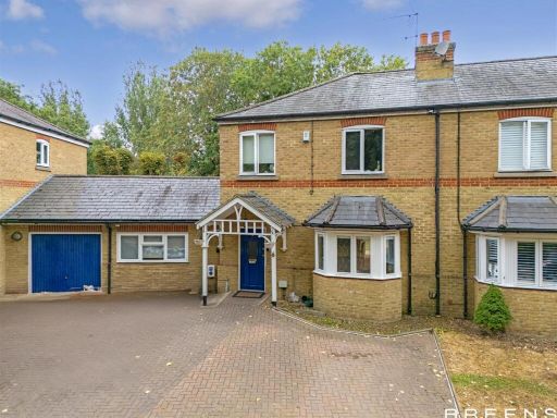 5 bedroom semi-detached house for sale in Heron Mead, Enfield, EN3 — £700,000 • 5 bed • 4 bath • 2024 ft²
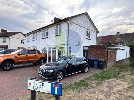 3 bedroom semi-detached house for sale in Hook Gate, Enfield, Greater London, EN1 — £469,995 • 3 bed • 2 bath • 951 ft²
 4 bedroom semi-detached house for sale in Logan Close, Enfield, EN3 — £500,000 • 4 bed • 1 bath • 888 ft²
Meta
- {
"@context": "https://schema.org",
"@type": "Residence",
"name": "5 bedroom end of terrace house for sale in Christie Road, W…",
"description": "",
"url": "https://propertypiper.co.uk/property/3a46f4d2-76d7-488d-992f-f1ca53f0481a",
"image": "https://image-a.propertypiper.co.uk/ba426cf0-2608-4ab7-9568-531729e02d35-1024.jpeg",
"address": {
"@type": "PostalAddress",
"streetAddress": "10 CHRISTIE ROAD WALTHAM ABBEY",
"postalCode": "EN9 3XX",
"addressLocality": "Epping Forest",
"addressRegion": "Epping Forest",
"addressCountry": "England"
},
"geo": {
"@type": "GeoCoordinates",
"latitude": 51.67790368385085,
"longitude": -0.006995250298983712
},
"numberOfRooms": 5,
"numberOfBathroomsTotal": 2,
"floorSize": {
"@type": "QuantitativeValue",
"value": 1217,
"unitCode": "FTK"
},
"offers": {
"@type": "Offer",
"price": 470000,
"priceCurrency": "GBP",
"availability": "https://schema.org/InStock"
},
"additionalProperty": [
{
"@type": "PropertyValue",
"name": "Feature",
"value": "semi-detached"
},
{
"@type": "PropertyValue",
"name": "Feature",
"value": "modern"
},
{
"@type": "PropertyValue",
"name": "Feature",
"value": "brick facade"
},
{
"@type": "PropertyValue",
"name": "Feature",
"value": "residential area"
},
{
"@type": "PropertyValue",
"name": "Feature",
"value": "roof tiles"
},
{
"@type": "PropertyValue",
"name": "Feature",
"value": "off-street parking"
},
{
"@type": "PropertyValue",
"name": "Feature",
"value": "modern kitchen"
},
{
"@type": "PropertyValue",
"name": "Feature",
"value": "medium size"
},
{
"@type": "PropertyValue",
"name": "Feature",
"value": "neutral tones"
},
{
"@type": "PropertyValue",
"name": "Feature",
"value": "standard ceiling"
},
{
"@type": "PropertyValue",
"name": "Feature",
"value": "ceramic tile floor"
},
{
"@type": "PropertyValue",
"name": "Feature",
"value": "light fixtures"
},
{
"@type": "PropertyValue",
"name": "Feature",
"value": "tile backsplash"
},
{
"@type": "PropertyValue",
"name": "Feature",
"value": "double window"
}
]
}
High Res Floorplan Images
Compatible Floorplan Images
FloorplanImages Thumbnail