ME11 5DT - 3 bedroom terraced house for sale in Stanley Avenue, Queenb…
View on Property Piper
3 bedroom terraced house for sale in Stanley Avenue, Queenborough, ME11
Property Details
- Price: £230000
- Bedrooms: 3
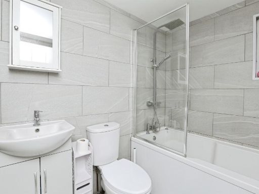
- Bathrooms: 1
- Property Type: undefined
- Property SubType: undefined
Image Descriptions
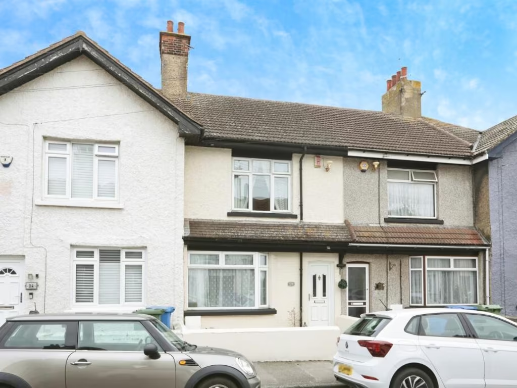
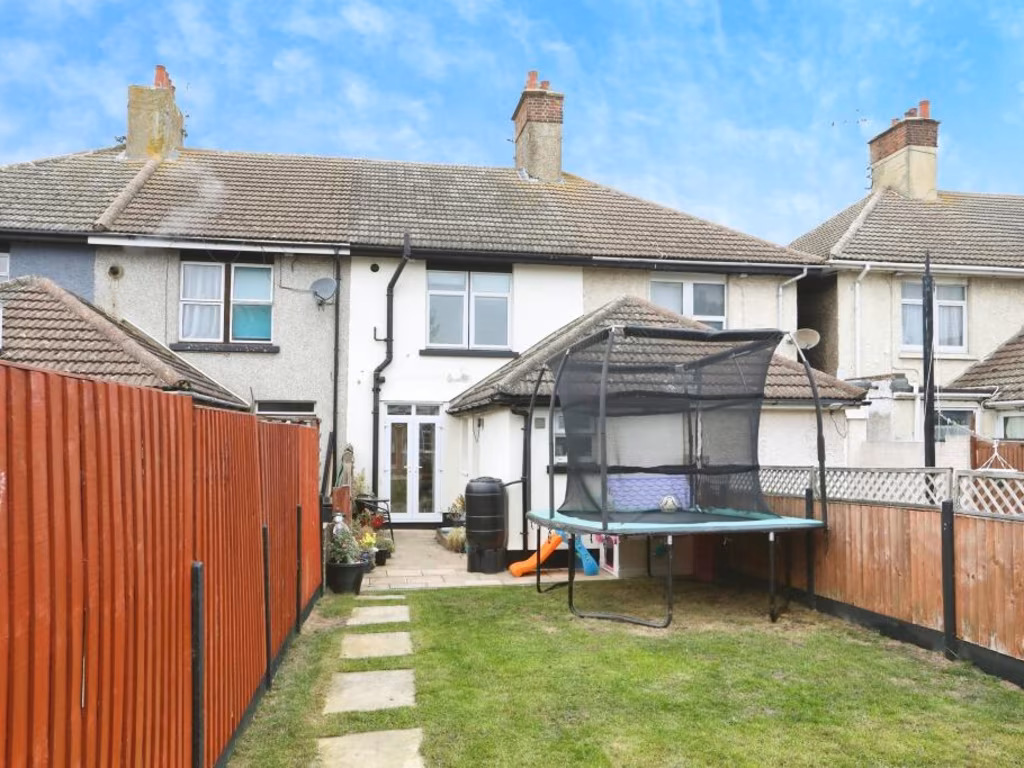
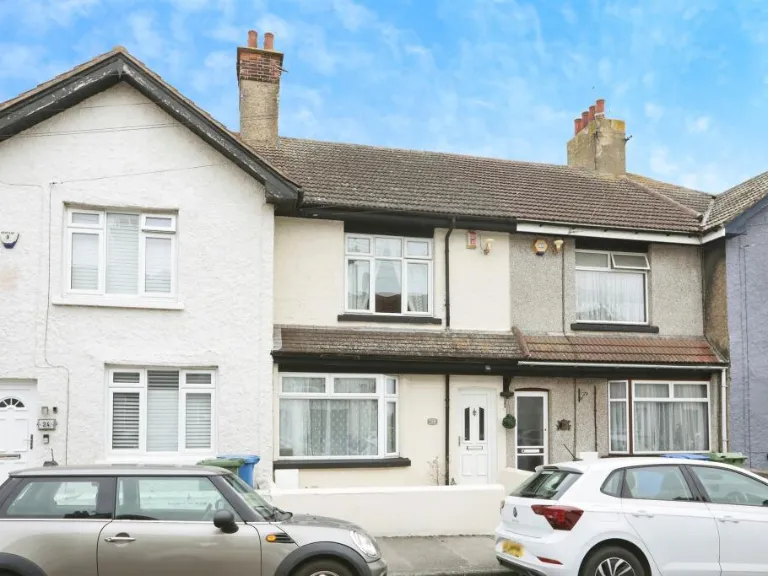
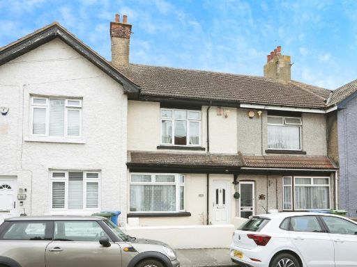
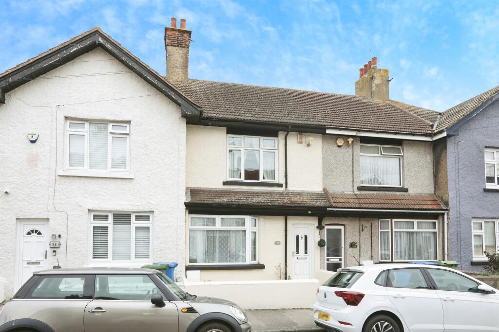
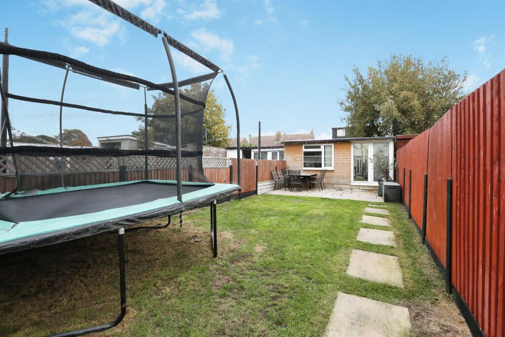
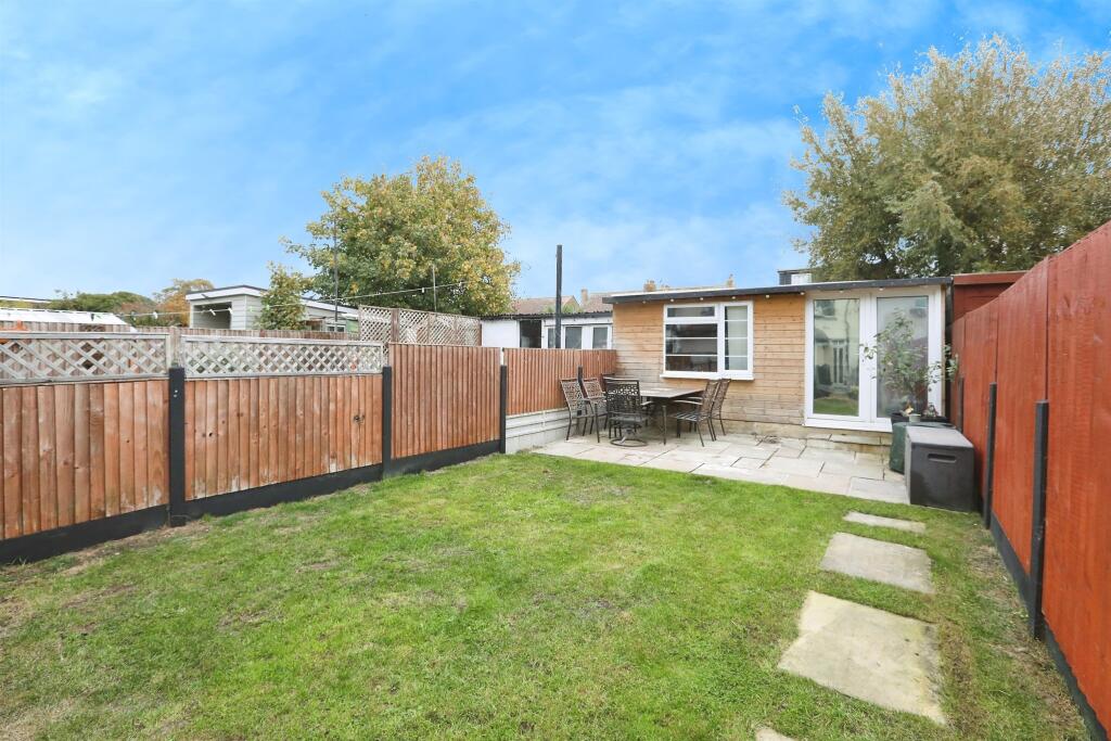
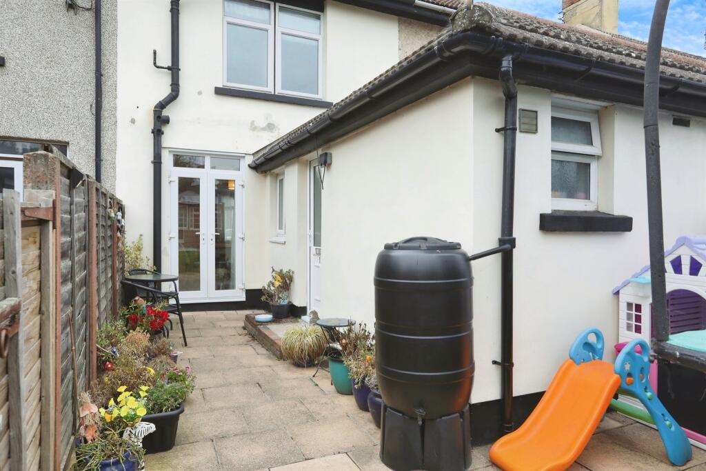
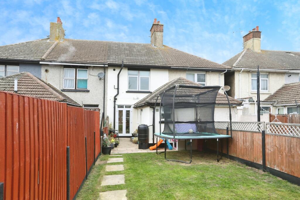
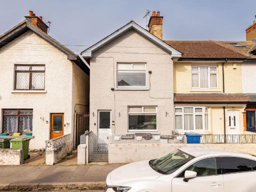
- exterior Terraced
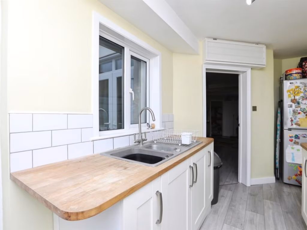
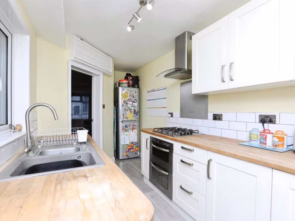
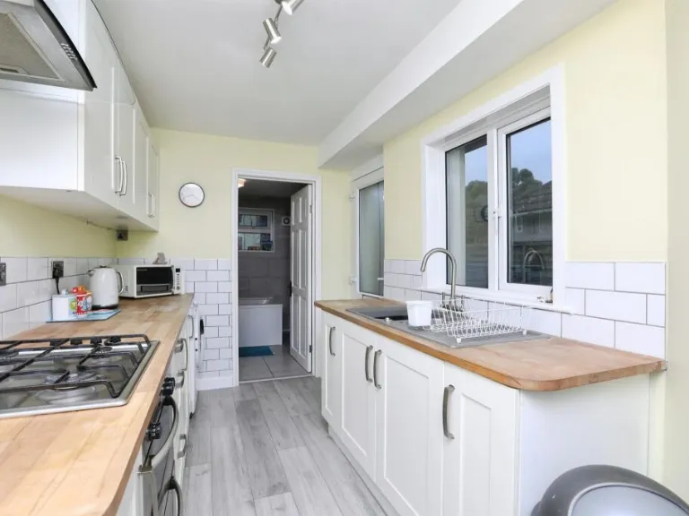
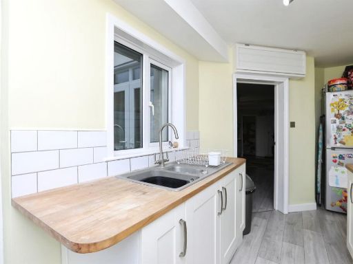
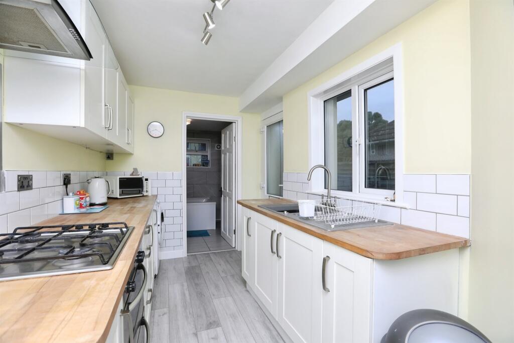
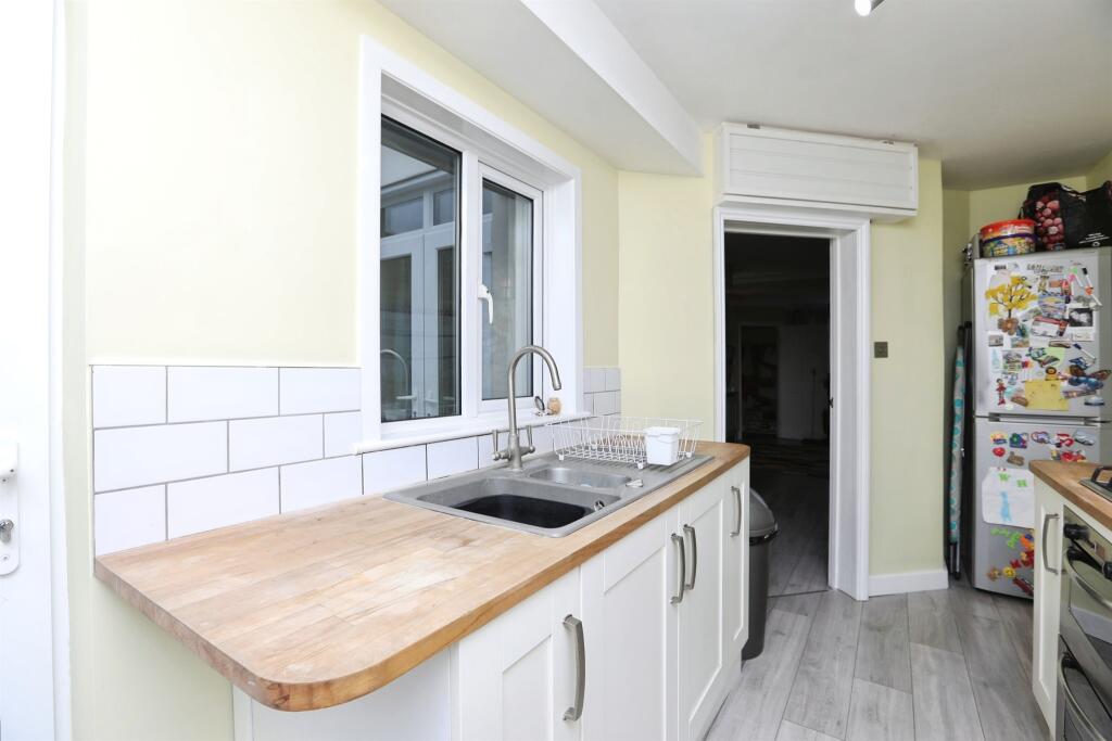
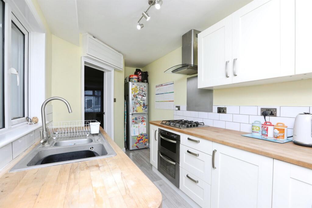
- kitchen Modern
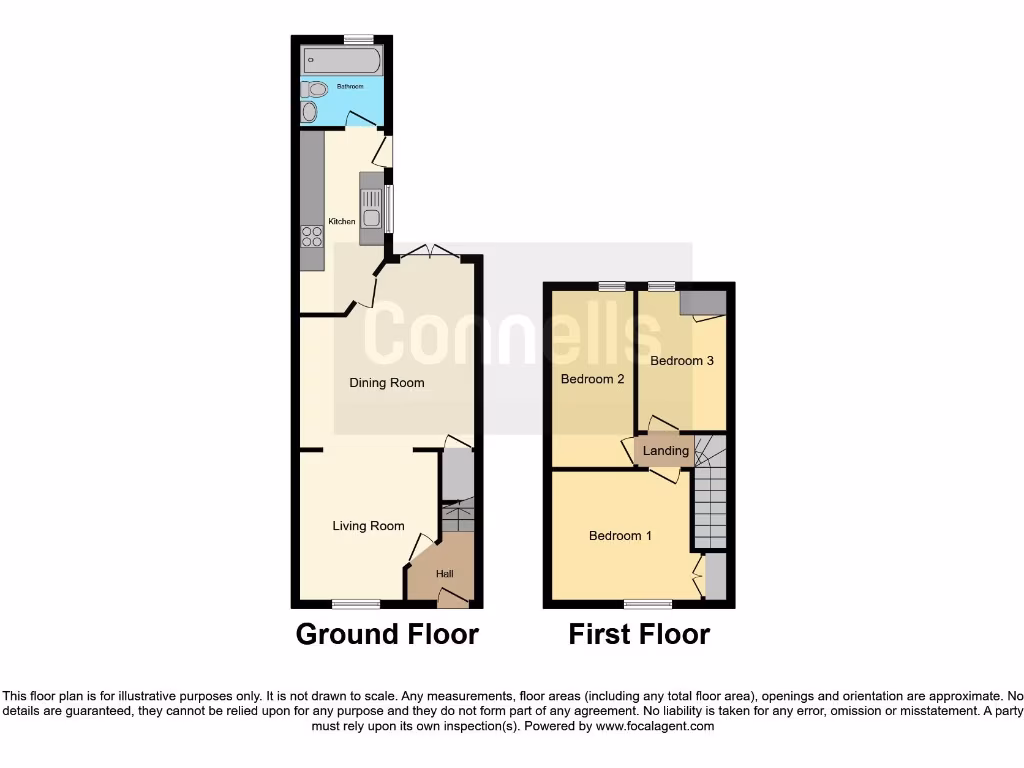
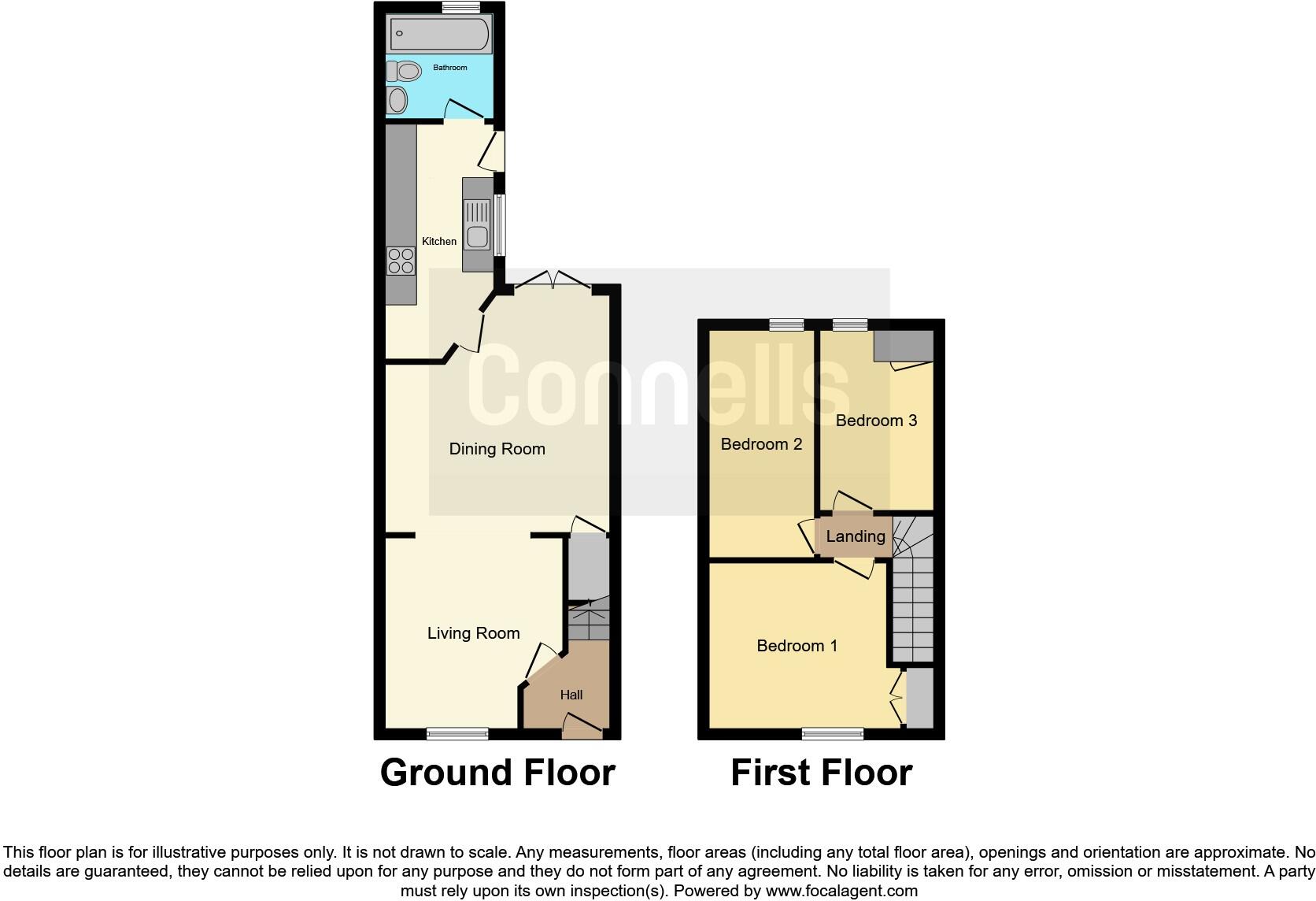
Floorplan Description
- Two-storey property with three bedrooms.
Rooms
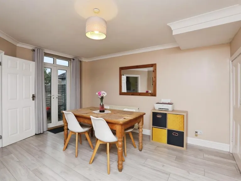
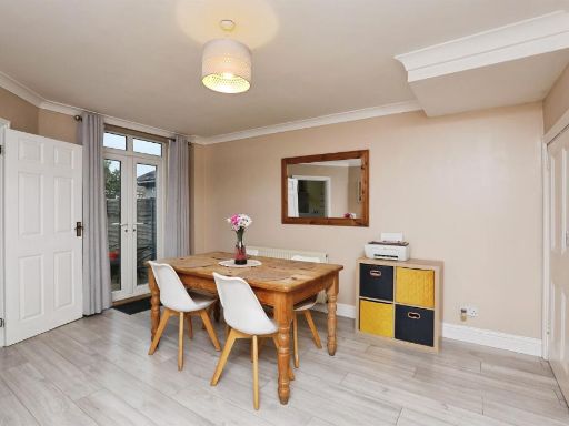
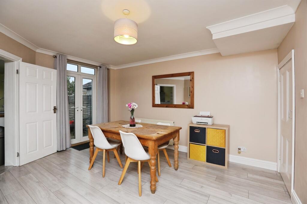
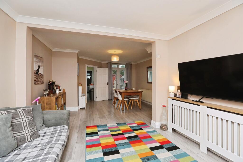
- Dining Room:
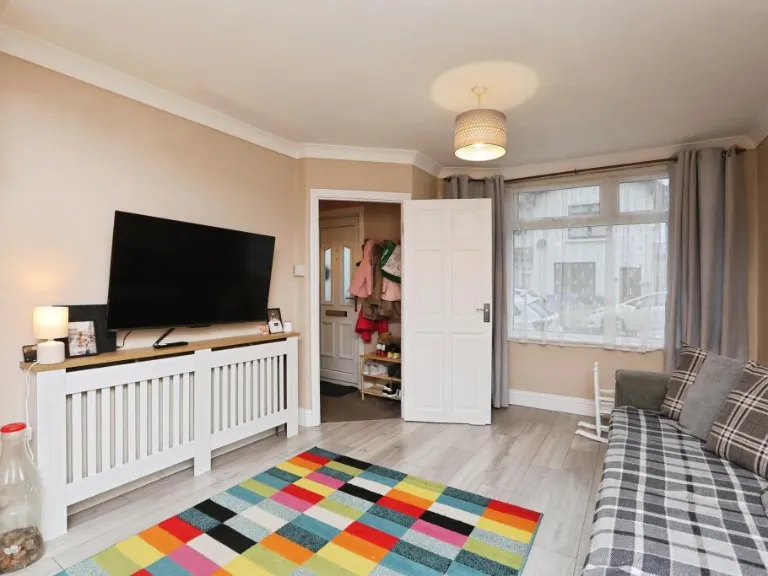
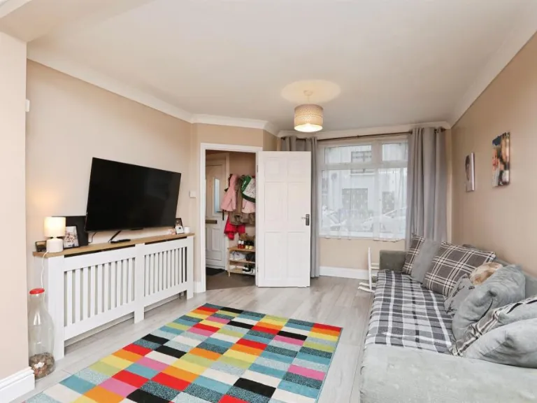
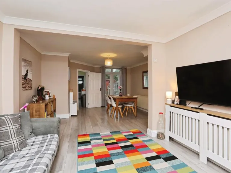
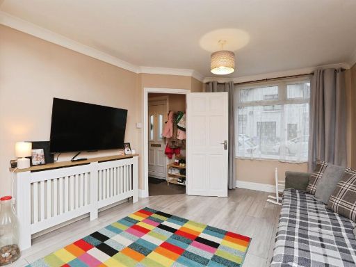
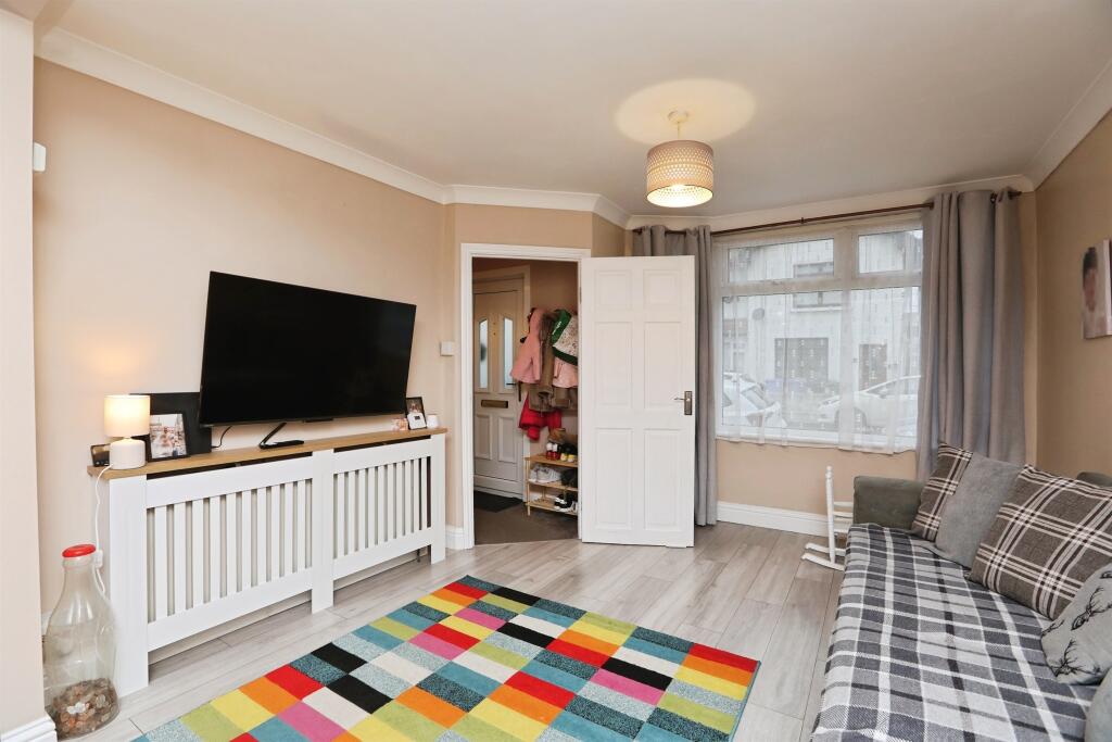
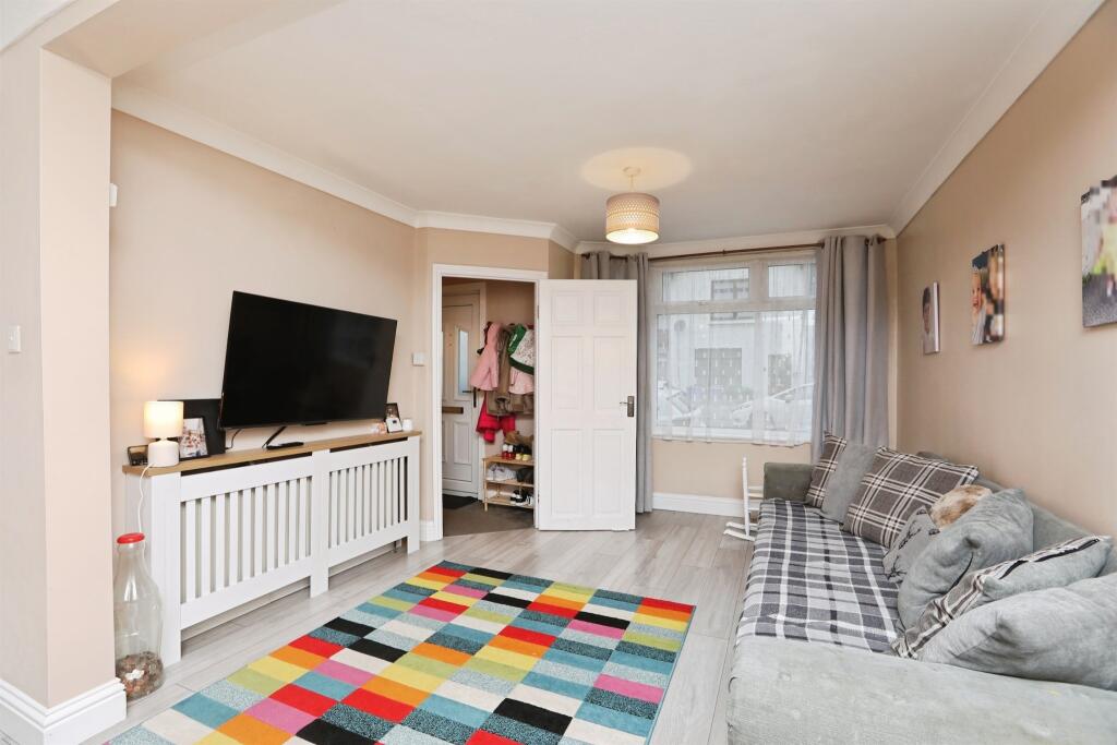
- Living Room:
- Kitchen:
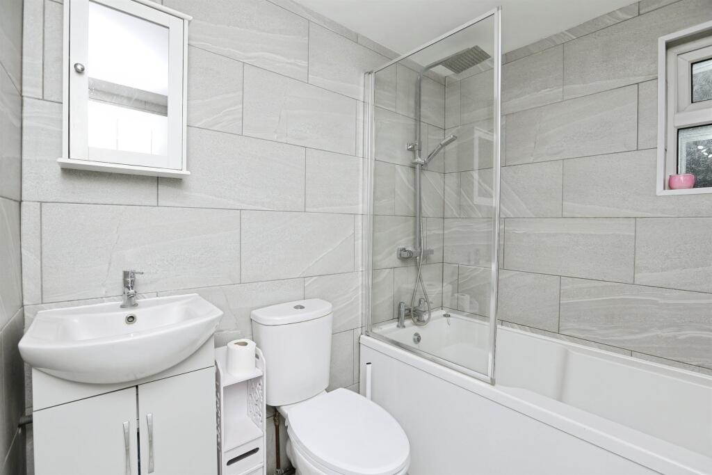
- Bathroom:
- Hall:
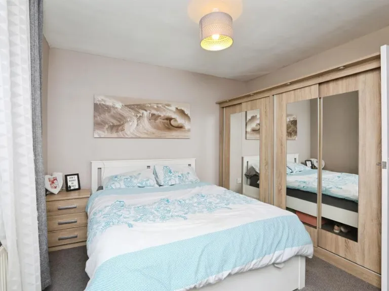
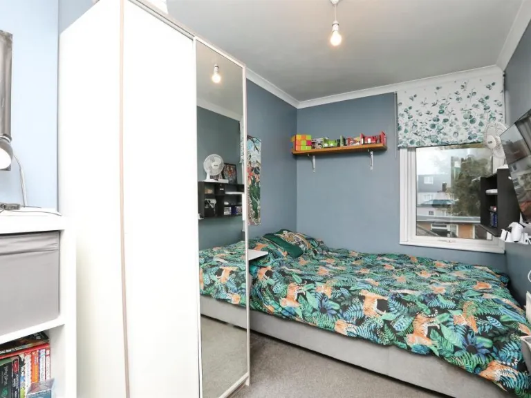
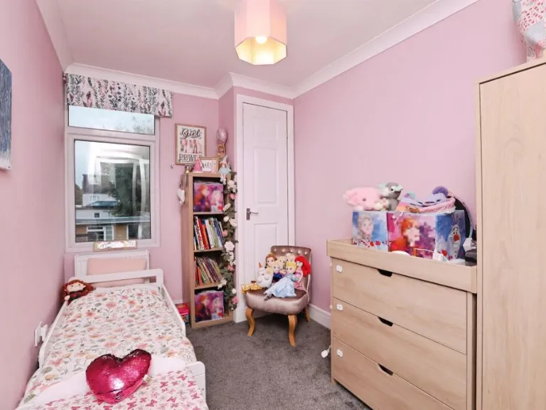
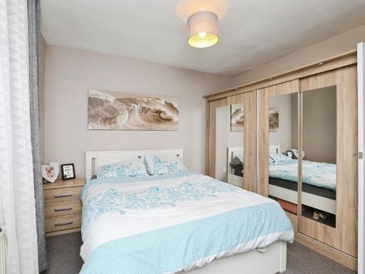
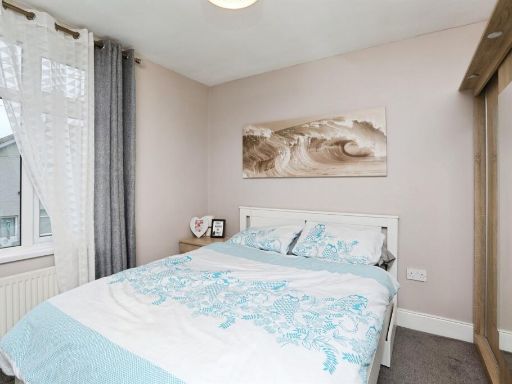
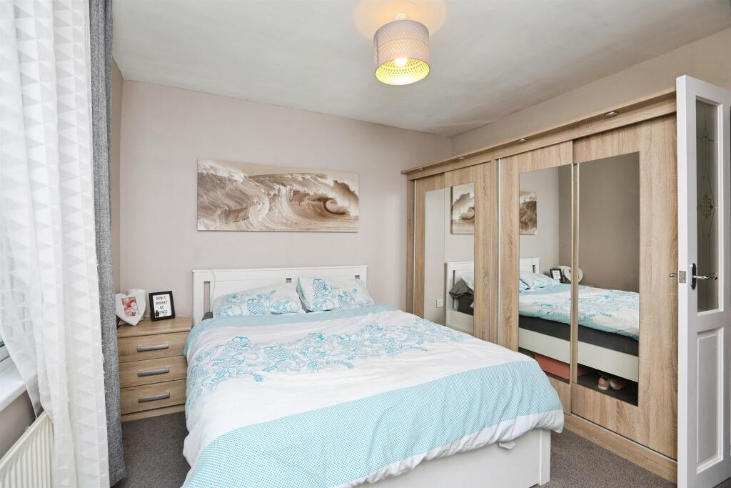
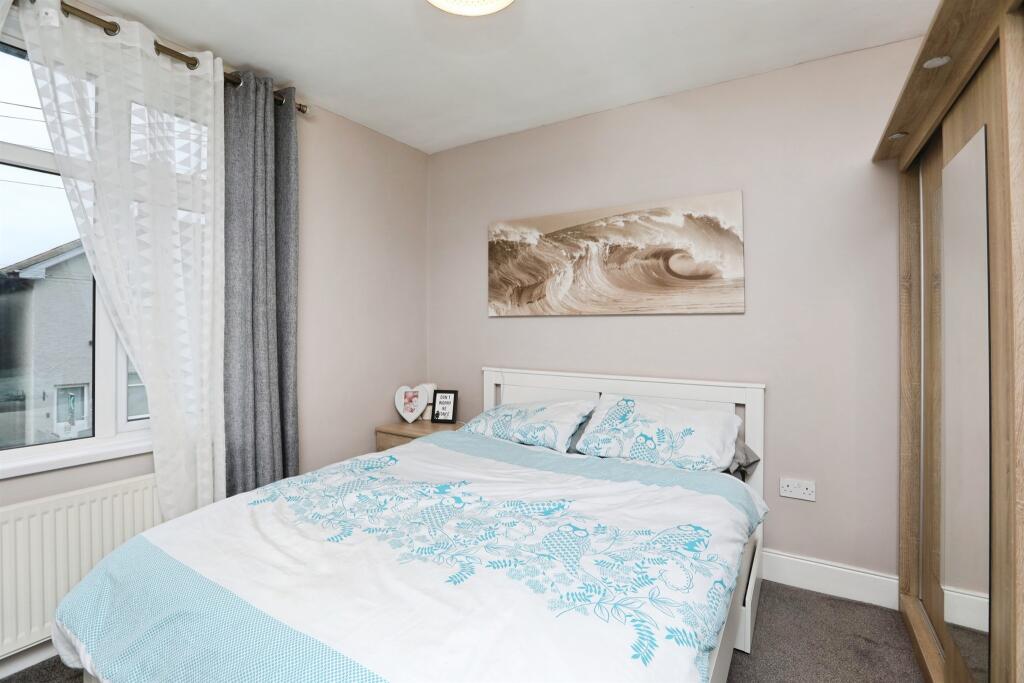
- Bedroom 1:
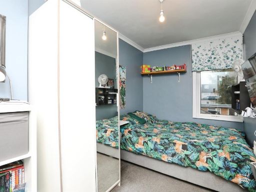
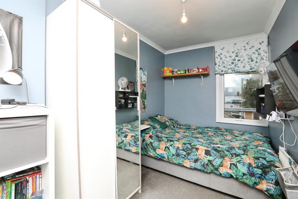
- Bedroom 2:
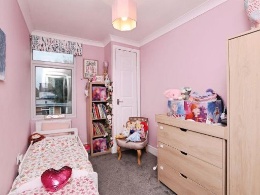
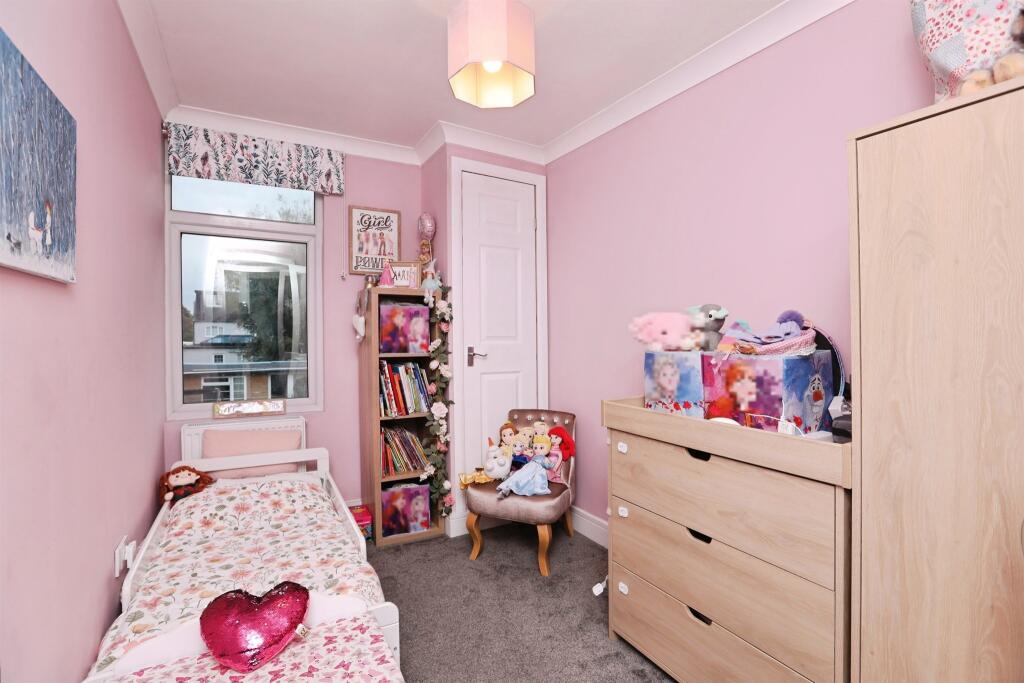
- Bedroom 3:
- Landing:
Textual Property Features
Detected Visual Features
- terraced house
- two-storey
- chimney
- double-glazed windows
- off-street parking
- potential for modernization
- dated exterior
- modern kitchen
- white cabinets
- tile backsplash
- laminate flooring
- track lighting
EPC Details
- Fully double glazed
- Solid brick, as built, no insulation (assumed)
- Boiler and radiators, mains gas
- No low energy lighting
- Suspended, no insulation (assumed)
Nearby Schools
- Westlands School
- Grove Park Primary School
- Bobbing Village School
- Kemsley Primary Academy
- Holywell Primary School
- Eastchurch Church of England Primary School
- Queenborough School and Nursery
- St Georges CofE (Aided) Primary School
- Minster in Sheppey Primary School
- West Minster Primary School
- Milton Court Primary Academy
- Halfway Houses Primary School
- Richmond Primary School
- St Edward's Catholic Primary School
- Sunny Bank Primary School
- Regis Manor Primary School
- Newington Church of England Primary School
- Lower Halstow Primary School
- Iwade School
- Thistle Hill Academy
- Rose Street Primary School
- St James Church of England Primary Academy
Nearest General Shops
- Id: 3141649844
- Tags:
- Addr:
- Housename: Neatscourt Retail Park
- Housenumber: Unit 3
- Postcode: ME11 5AR
- Street: Thomsett Way
- Brand: B&M Bargains
- Brand:wikidata: Q4836931
- Brand:wikipedia: en:B & M
- Contact:
- Website: https://www.bmstores.co.uk/stores/kent-isle-of-sheppey-394
- Fhrs:
- Authority: Swale
- Id: 730122
- Inspectiondate: 2014-09-23
- Rating: 5
- Name: B&M Bargains
- Operator: B And M Retail Ltd
- Shop: variety_store
- TagsNormalized:
- Lat: 51.4116293
- Lon: 0.7554583
- FullGeoHash: u10s3pnn7qqd
- PartitionGeoHash: u10s
- Images:
- FoodStandards:
- Id: 730122
- FHRSID: 730122
- LocalAuthorityBusinessID: 14/500170/MIXED
- BusinessName: B And M Retail Ltd
- BusinessType: Retailers - other
- BusinessTypeID: 4613
- AddressLine1: Unit 3
- AddressLine2: Neatscourt Retail Park
- AddressLine3: Thomsett Way
- AddressLine4: Queenborough
- PostCode: ME11 5AR
- RatingValue: 5
- RatingKey: fhrs_5_en-GB
- RatingDate: 2014-09-23
- LocalAuthorityCode: 189
- LocalAuthorityName: Swale
- LocalAuthorityWebSite: http://www.swale.gov.uk
- LocalAuthorityEmailAddress: EHAdmin@MidKent.gov.uk
- Scores:
- Hygiene: 5
- Structural: 0
- ConfidenceInManagement: 0
- NewRatingPending: false
- Geocode:
- Longitude: 0.75782700000000
- Latitude: 51.41068700000000
- Distance: 320.6
,- Id: 4838849545
- Tags:
- Female: yes
- Level: 0
- Male: no
- Name: Number One Hair
- Shop: hairdresser
- Unisex: no
- TagsNormalized:
- Lat: 51.4154317
- Lon: 0.7507457
- FullGeoHash: u10s3pfstehs
- PartitionGeoHash: u10s
- Images:
- FoodStandards: null
- Distance: 214.5
,- Id: 4838849542
- Tags:
- Female: yes
- Level: 0
- Male: no
- Name: Rebecca's Hair & Beauty
- Shop: hairdresser
- Unisex: no
- TagsNormalized:
- Lat: 51.4150847
- Lon: 0.7526517
- FullGeoHash: u10s3pu4d43y
- PartitionGeoHash: u10s
- Images:
- FoodStandards: null
- Distance: 139.7
}
Nearest Supermarkets
- Id: 60448668
- Tags:
- Addr:
- City: Sheerness
- Country: GB
- County: Kent
- Postcode: ME12 1RH
- Street: Bridge Road
- Brand: Tesco
- Brand:wikidata: Q487494
- Brand:wikipedia: en:Tesco
- Building: yes
- Contact:
- Website: https://www.tesco.com/store-locator/sheerness/bridge-road
- Designation: Sheerness Superstore
- Fhrs:
- Name: Tesco
- Roof:
- Shop: supermarket
- TagsNormalized:
- Lat: 51.4426247
- Lon: 0.7596923
- FullGeoHash: u10s9kc5n079
- PartitionGeoHash: u10s
- Images:
- FoodStandards:
- Id: 714538
- FHRSID: 714538
- LocalAuthorityBusinessID: PI/000101986/SW
- BusinessName: Tesco
- BusinessType: Retailers - supermarkets/hypermarkets
- BusinessTypeID: 7840
- AddressLine1: Bridge Road
- AddressLine2: Sheerness
- AddressLine3: Kent
- AddressLine4: null
- PostCode: ME12 1RH
- RatingValue: 5
- RatingKey: fhrs_5_en-GB
- RatingDate: 2022-05-17
- LocalAuthorityCode: 189
- LocalAuthorityName: Swale
- LocalAuthorityWebSite: http://www.swale.gov.uk
- LocalAuthorityEmailAddress: EHAdmin@MidKent.gov.uk
- Scores:
- Hygiene: 0
- Structural: 0
- ConfidenceInManagement: 0
- NewRatingPending: false
- Geocode:
- Longitude: 0.75936900000000
- Latitude: 51.44177000000000
- Distance: 3240.3
,- Id: 60556686
- Tags:
- Addr:
- Postcode: ME12 1AQ
- Street: Millenium Way
- Brand: ALDI
- Brand:wikidata: Q41171672
- Brand:wikipedia: en:Aldi
- Building: yes
- Contact:
- Website: https://stores.aldi.co.uk/sheerness/pepys-avenue
- Designation: Sheerness
- Name: Aldi
- Shop: supermarket
- Source: Bing
- TagsNormalized:
- Lat: 51.4395848
- Lon: 0.7594405
- FullGeoHash: u10s9k3121xg
- PartitionGeoHash: u10s
- Images:
- FoodStandards: null
- Distance: 2903.8
,- Id: 545366415
- Tags:
- Addr:
- Brand: Morrisons
- Brand:wikidata: Q922344
- Brand:wikipedia: en:Morrisons
- Building: yes
- Contact:
- Website: https://my.morrisons.com/storefinder/572
- Name: Morrisons
- Shop: supermarket
- TagsNormalized:
- Lat: 51.4106785
- Lon: 0.7578467
- FullGeoHash: u10s3ppbgj56
- PartitionGeoHash: u10s
- Images:
- FoodStandards: null
- Distance: 511.6
}
Nearest Religious buildings
- Id: 60792213
- Tags:
- Amenity: place_of_worship
- Building: yes
- Denomination: methodist
- Name: The Church in Hope Street
- Religion: christian
- Source: OS_OpenData_StreetView
- TagsNormalized:
- place of worship
- methodist
- church
- christian
- Lat: 51.4397156
- Lon: 0.7612208
- FullGeoHash: u10s9k6619zr
- PartitionGeoHash: u10s
- Images:
- FoodStandards: null
- Distance: 2941.1
,- Id: 60554799
- Tags:
- Amenity: place_of_worship
- Building: yes
- Denomination: baptist
- Name: Minster Road Baptist Church
- Religion: christian
- Source: auto_os_street_view
- TagsNormalized:
- place of worship
- baptist
- church
- christian
- Lat: 51.4224739
- Lon: 0.7815806
- FullGeoHash: u10s9c1js5ut
- PartitionGeoHash: u10s
- Images:
- FoodStandards: null
- Distance: 2235.2
,- Id: 60551894
- Tags:
- Amenity: place_of_worship
- Building: church
- Denomination: anglican
- Name: Holy Trinity
- Religion: christian
- Source: auto_os_street_view
- Wikidata: Q17546407
- TagsNormalized:
- place of worship
- church
- anglican
- christian
- Lat: 51.417602
- Lon: 0.7442981
- FullGeoHash: u10s8bmcprsz
- PartitionGeoHash: u10s
- Images:
- FoodStandards: null
- Distance: 705.2
}
Nearest Medical buildings
- Id: 4317226889
- Tags:
- Amenity: pharmacy
- Name: Halfway Pharmacy
- TagsNormalized:
- Lat: 51.4221999
- Lon: 0.7775346
- FullGeoHash: u10s99nhjbgf
- PartitionGeoHash: u10s
- Images:
- FoodStandards: null
- Distance: 1971
,- Id: 4894276889
- Tags:
- Amenity: veterinary
- Name: Abbey Veterinary Surgery
- TagsNormalized:
- Lat: 51.4219859
- Lon: 0.7772337
- FullGeoHash: u10s99jfybgq
- PartitionGeoHash: u10s
- Images:
- FoodStandards: null
- Distance: 1941.4
,- Id: 4838849541
- Tags:
- Amenity: dentist
- Healthcare: dentist
- Name: Dental Clinic
- TagsNormalized:
- dentist
- health
- healthcare
- clinic
- dental
- Lat: 51.4162006
- Lon: 0.7474834
- FullGeoHash: u10s90031dkp
- PartitionGeoHash: u10s
- Images:
- FoodStandards: null
- Distance: 435
,- Id: 506359175
- Tags:
- Amenity: pharmacy
- Brand: Well Pharmacy
- Brand:wikidata: Q7726524
- Dispensing: yes
- Healthcare: pharmacy
- Name: Well Pharmacy
- TagsNormalized:
- pharmacy
- well pharmacy
- health
- healthcare
- Lat: 51.4161644
- Lon: 0.7475013
- FullGeoHash: u10s9002f59r
- PartitionGeoHash: u10s
- Images:
- FoodStandards: null
- Distance: 431.6
}
Nearest Airports
- Id: 103894219
- Tags:
- Aerodrome: international
- Aeroway: aerodrome
- Iata: SEN
- Icao: EGMC
- Name: London Southend Airport
- Old_name: Southend Municipal Airport
- Ref: SEN
- Wikidata: Q1415441
- TagsNormalized:
- airport
- international airport
- Lat: 51.5701749
- Lon: 0.6924624
- FullGeoHash: u10mru04p937
- PartitionGeoHash: u10m
- Images:
- FoodStandards: null
- Distance: 17874
}
Nearest Leisure Facilities
- Id: 1007327883
- Tags:
- TagsNormalized:
- Lat: 51.4159405
- Lon: 0.7481405
- FullGeoHash: u10s3pbz8cvz
- PartitionGeoHash: u10s
- Images:
- FoodStandards: null
- Distance: 381.3
,- Id: 1007327882
- Tags:
- TagsNormalized:
- Lat: 51.4162157
- Lon: 0.7485778
- FullGeoHash: u10s90115jk1
- PartitionGeoHash: u10s
- Images:
- FoodStandards: null
- Distance: 378.6
,- Id: 649165679
- Tags:
- Leisure: park
- Name: King George's Playing Field
- TagsNormalized:
- Lat: 51.4165069
- Lon: 0.7549082
- FullGeoHash: u10s90jdyes6
- PartitionGeoHash: u10s
- Images:
- FoodStandards: null
- Distance: 341.7
,- Id: 1353519195
- Tags:
- TagsNormalized:
- Lat: 51.4159447
- Lon: 0.7546609
- FullGeoHash: u10s3pvx8fgb
- PartitionGeoHash: u10s
- Images:
- FoodStandards: null
- Distance: 279.4
,- Id: 485025392
- Tags:
- Leisure: pitch
- Sport: bowls
- TagsNormalized:
- Lat: 51.4141602
- Lon: 0.7544112
- FullGeoHash: u10s3ptm5n1g
- PartitionGeoHash: u10s
- Images:
- FoodStandards: null
- Distance: 138.9
}
Nearest Tourist attractions
- Id: 60552359
- Tags:
- Addr:
- Housenumber: 214
- Postcode: ME12 3DF
- Street: Queenborough Road
- Building: yes
- Fhrs:
- Authority: Swale
- Id: 718409
- Inspectiondate: 2015-07-10
- Rating: Exempt
- Name: Sheppey Guest House
- Source: auto_os_street_view
- Tourism: guest_house
- TagsNormalized:
- Lat: 51.4198682
- Lon: 0.7658873
- FullGeoHash: u10s92twqqnv
- PartitionGeoHash: u10s
- Images:
- FoodStandards: null
- Distance: 1146.8
,- Id: 648758594
- Tags:
- Caravans: yes
- Dryer: yes
- Fee: yes
- Motorhome: yes
- Name: Leo Bay
- Power_supply: yes
- Tents: no
- Tourism: caravan_site
- Washing_machine: yes
- Website: https://leobay.co.uk/
- TagsNormalized:
- Lat: 51.4096372
- Lon: 0.7381872
- FullGeoHash: u10s2ycdc4br
- PartitionGeoHash: u10s
- Images:
- FoodStandards: null
- Distance: 1095.4
,- Id: 4838849525
- Tags:
- Addr:
- City: Queenborough
- Housename: The Guildhall
- Postcode: ME11 5AA
- Street: High Street
- Name: Queenborough Guildhall Museum
- Opening_hours: Sa 14:00-17:00
- Tourism: museum
- Website: https://www.queenboroughguildhallmuseum.co.uk/
- Wikidata: Q113370135
- TagsNormalized:
- Lat: 51.4172403
- Lon: 0.7425256
- FullGeoHash: u10s8bhxnh71
- PartitionGeoHash: u10s
- Images:
- FoodStandards: null
- Distance: 787.3
}
Nearest Train stations
- Id: 3726061852
- Tags:
- Addr:
- Postcode: ME10 3ED
- Street: St. Michaels Road
- Name: Sittingbourne
- Naptan:
- Network: National Rail
- Platforms: 3
- Public_transport: station
- Railway: station
- Ref:
- Train: yes
- Wheelchair: yes
- Wikidata: Q1919614
- Wikipedia: en:Sittingbourne railway station
- TagsNormalized:
- Lat: 51.342078
- Lon: 0.7351464
- FullGeoHash: u10s0dx361hb
- PartitionGeoHash: u10s
- Images:
- FoodStandards: null
- Distance: 8069
,- Id: 2315856087
- Tags:
- Name: Sittingbourne Viaduct
- Public_transport: station
- Railway: station
- Train: yes
- Usage: tourism
- Wheelchair: no
- TagsNormalized:
- Lat: 51.345203
- Lon: 0.7336166
- FullGeoHash: u10s0en5qx84
- PartitionGeoHash: u10s
- Images:
- FoodStandards: null
- Distance: 7742.8
,- Id: 90219136
- Tags:
- Name: Kemsley Down
- Network: Sittingbourne and Kemsley Light Railway
- Operator: Sittingbourne and Kemsley Light Railway
- Public_transport: station
- Railway: station
- Tourism: heritage_railway
- Train: yes
- Usage: tourism
- TagsNormalized:
- station
- railway
- tourism
- train
- Lat: 51.3618635
- Lon: 0.7567947
- FullGeoHash: u10s1nphd971
- PartitionGeoHash: u10s
- Images:
- FoodStandards: null
- Distance: 5786.5
,- Id: 855651597
- Tags:
- Name: Swale
- Naptan:
- Network: National Rail
- Old_name: Kings Ferry Bridge Halt;Swale Halt
- Public_transport: station
- Railway: station
- Ref:
- Train: yes
- Wikidata: Q2191551
- Wikipedia: en:Swale railway station
- TagsNormalized:
- Lat: 51.3889653
- Lon: 0.7468492
- FullGeoHash: u10s2gpf6v7n
- PartitionGeoHash: u10s
- Images:
- FoodStandards: null
- Distance: 2792.6
,- Id: 29704570
- Tags:
- Name: Queenborough
- Naptan:
- Network: National Rail
- Public_transport: station
- Railway: station
- Ref:
- Wikidata: Q2323119
- Wikipedia: en:Queenborough railway station
- TagsNormalized:
- Lat: 51.4159485
- Lon: 0.7497508
- FullGeoHash: u10s3pczw7qx
- PartitionGeoHash: u10s
- Images:
- FoodStandards: null
- Distance: 301.8
}
Nearest Hotels
- Id: 9664484167
- Tags:
- Addr:
- City: Sheerness
- Country: GB
- County: Kent
- Housenumber: 29
- Postcode: ME12 1AB
- Street: Broadway
- Fhrs:
- Name: The Royal Hotel
- Tourism: hotel
- TagsNormalized:
- Lat: 51.4403429
- Lon: 0.7640111
- FullGeoHash: u10s9kkmdwzv
- PartitionGeoHash: u10s
- Images:
- FoodStandards: null
- Distance: 3054.3
,- Id: 60552612
- Tags:
- Addr:
- Postcode: ME11 5AQ
- Street: High Street
- Alt_name: Queen Phillipa Hotel
- Building: yes
- Fhrs:
- Authority: Swale
- Id: 730141
- Inspectiondate: 2016-07-21
- Rating: 4
- Name: The Queen Philippa Bed And Breakfast
- Source: OS_Street_View
- Stars: 4
- Tourism: hotel
- TagsNormalized:
- Lat: 51.4163135
- Lon: 0.7473973
- FullGeoHash: u10s9001xxeb
- PartitionGeoHash: u10s
- Images:
- FoodStandards: null
- Distance: 447.4
,- Id: 60555871
- Tags:
- Addr:
- Housenumber: 10-13
- Postcode: ME11 5HB
- Street: Rushenden Road
- Building: yes
- Fhrs:
- Authority: Swale
- Id: 714413
- Inspectiondate: 2014-09-23
- Rating: 4
- Name: The Trafalgar Hotel and Restaurant
- Source: auto_os_street_view
- Tourism: hotel
- TagsNormalized:
- Lat: 51.4149401
- Lon: 0.7473119
- FullGeoHash: u10s3pb1txs0
- PartitionGeoHash: u10s
- Images:
- FoodStandards: null
- Distance: 378.8
}
Tags
- terraced house
- two-storey
- chimney
- double-glazed windows
- off-street parking
- potential for modernization
- dated exterior
- modern kitchen
- white cabinets
- tile backsplash
- laminate flooring
- track lighting
Local Market Stats
- Average Price/sqft: £256
- Avg Income: £37700
- Social Housing: 17%
- Planning Success Rate: 76%
AirBnB Data
- 1km average: £121/night
- Listings in 1km: 2
Similar Properties
 3 bedroom end of terrace house for sale in Stanley Avenue, Queenborough, ME11 5DT, ME11 — £230,000 • 3 bed • 1 bath • 790 ft²
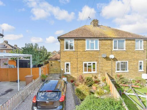 3 bedroom semi-detached house for sale in Coronation Crescent, Queenborough, Sheerness, Kent, ME11 — £260,000 • 3 bed • 2 bath • 639 ft²
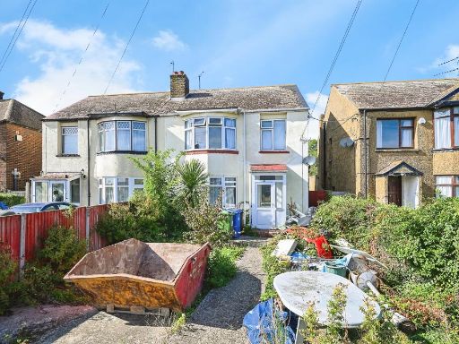 3 bedroom semi-detached house for sale in Borough Road, QUEENBOROUGH, ME11 — £240,000 • 3 bed • 1 bath • 991 ft²
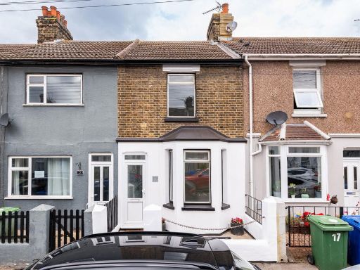 3 bedroom terraced house for sale in Gordon Avenue,Queenborough,ME11 5BD, ME11 — £210,000 • 3 bed • 1 bath • 650 ft²
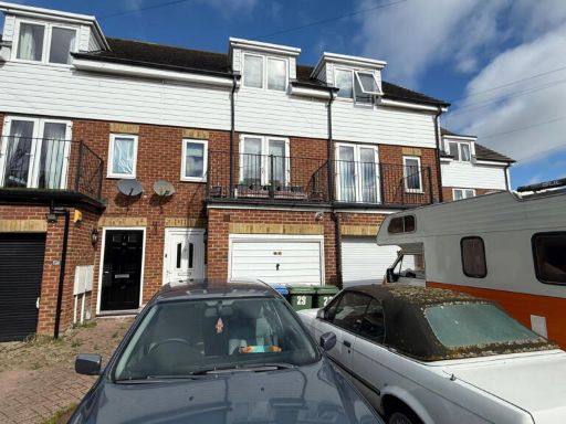 3 bedroom terraced house for sale in Mount Field, Queenborough, Kent, ME11 5DB, ME11 — £280,000 • 3 bed • 2 bath • 1376 ft²
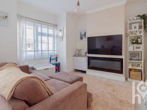 2 bedroom end of terrace house for sale in North Road, Queenborough, ME11 — £225,000 • 2 bed • 1 bath • 533 ft²
Meta
- {
"@context": "https://schema.org",
"@type": "Residence",
"name": "3 bedroom terraced house for sale in Stanley Avenue, Queenb…",
"description": "",
"url": "https://propertypiper.co.uk/property/38e4608a-82ab-4408-8eae-98efa980d91a",
"image": "https://image-a.propertypiper.co.uk/fb62ad31-a58c-4c52-84e4-f7fff834ac0c-1024.jpeg",
"address": {
"@type": "PostalAddress",
"streetAddress": "36 STANLEY AVENUE QUEENBOROUGH",
"postalCode": "ME11 5DT",
"addressLocality": "Swale",
"addressRegion": "Sittingbourne and Sheppey",
"addressCountry": "England"
},
"geo": {
"@type": "GeoCoordinates",
"latitude": 51.41383337353403,
"longitude": 0.7524776180196397
},
"numberOfRooms": 3,
"numberOfBathroomsTotal": 1,
"floorSize": {
"@type": "QuantitativeValue",
"value": 915,
"unitCode": "FTK"
},
"offers": {
"@type": "Offer",
"price": 230000,
"priceCurrency": "GBP",
"availability": "https://schema.org/InStock"
},
"additionalProperty": [
{
"@type": "PropertyValue",
"name": "Feature",
"value": "terraced house"
},
{
"@type": "PropertyValue",
"name": "Feature",
"value": "two-storey"
},
{
"@type": "PropertyValue",
"name": "Feature",
"value": "chimney"
},
{
"@type": "PropertyValue",
"name": "Feature",
"value": "double-glazed windows"
},
{
"@type": "PropertyValue",
"name": "Feature",
"value": "off-street parking"
},
{
"@type": "PropertyValue",
"name": "Feature",
"value": "potential for modernization"
},
{
"@type": "PropertyValue",
"name": "Feature",
"value": "dated exterior"
},
{
"@type": "PropertyValue",
"name": "Feature",
"value": "modern kitchen"
},
{
"@type": "PropertyValue",
"name": "Feature",
"value": "white cabinets"
},
{
"@type": "PropertyValue",
"name": "Feature",
"value": "tile backsplash"
},
{
"@type": "PropertyValue",
"name": "Feature",
"value": "laminate flooring"
},
{
"@type": "PropertyValue",
"name": "Feature",
"value": "track lighting"
}
]
}
High Res Floorplan Images
Compatible Floorplan Images
FloorplanImages Thumbnail