TQ2 6TP - 2 bedroom apartment for sale in Baythorpe Lodge, Livermead…
View on Property Piper
2 bedroom apartment for sale in Baythorpe Lodge, Livermead Hill, TQ2
Property Details
- Price: £230000
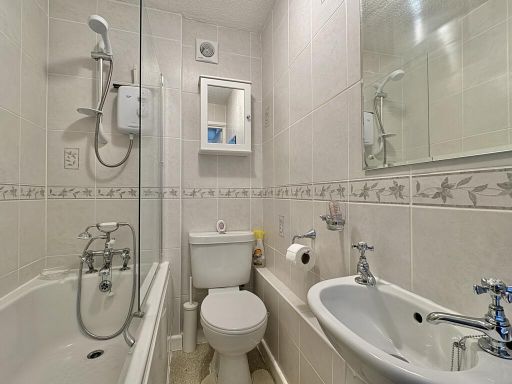
- Bedrooms: 2
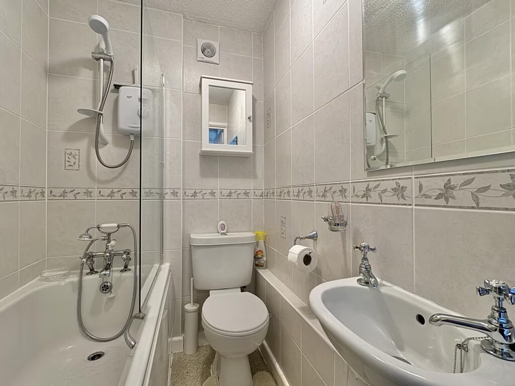
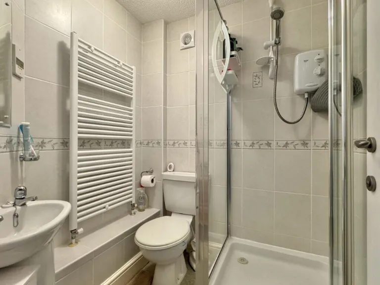
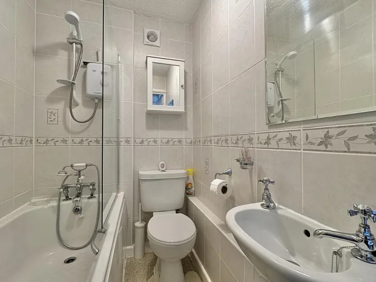
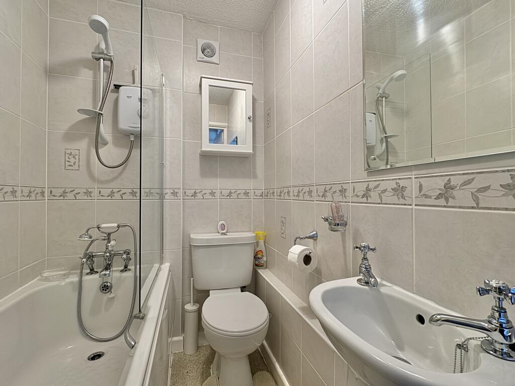
- Bathrooms: 2
- Property Type: undefined
- Property SubType: undefined
Image Descriptions
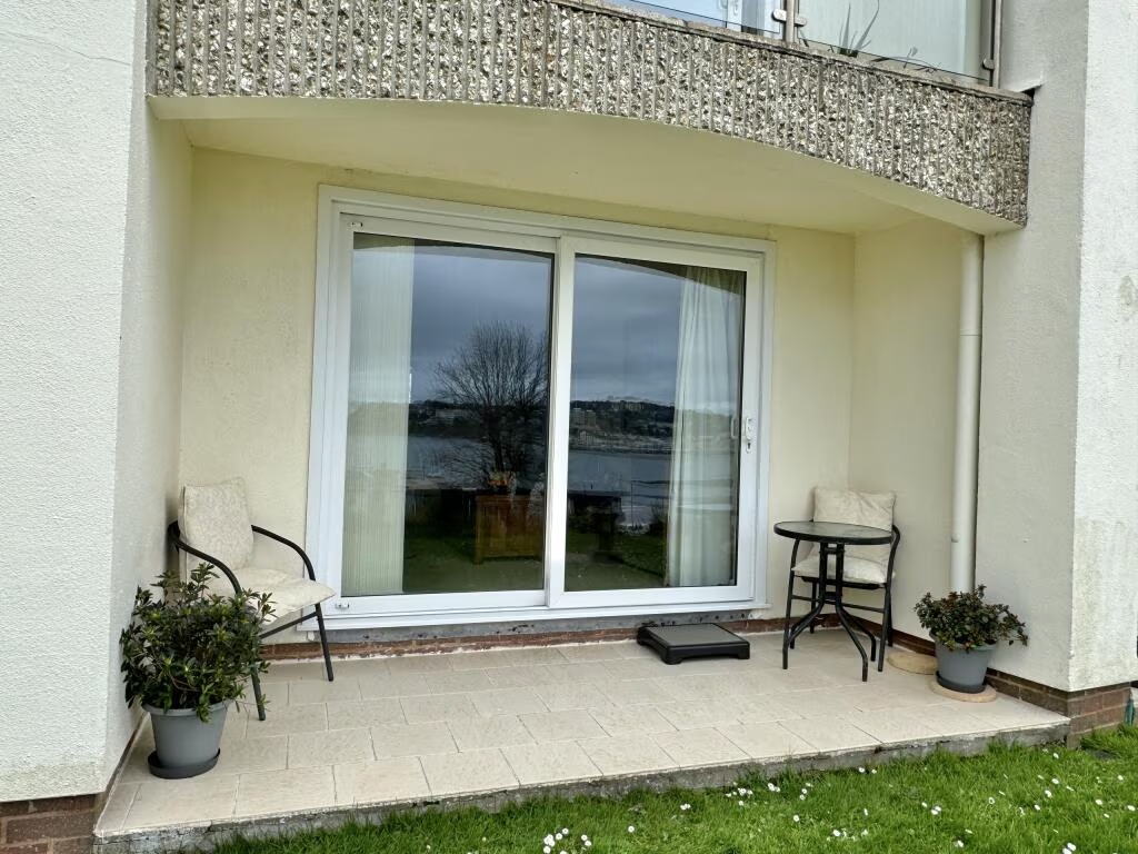
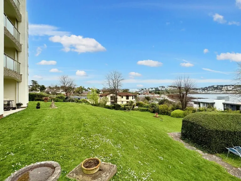
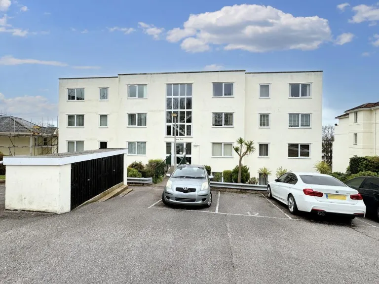
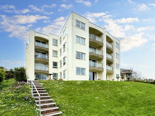
- apartment building mid-century modern
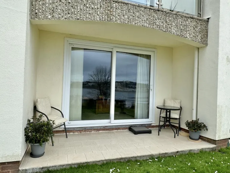
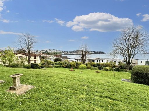
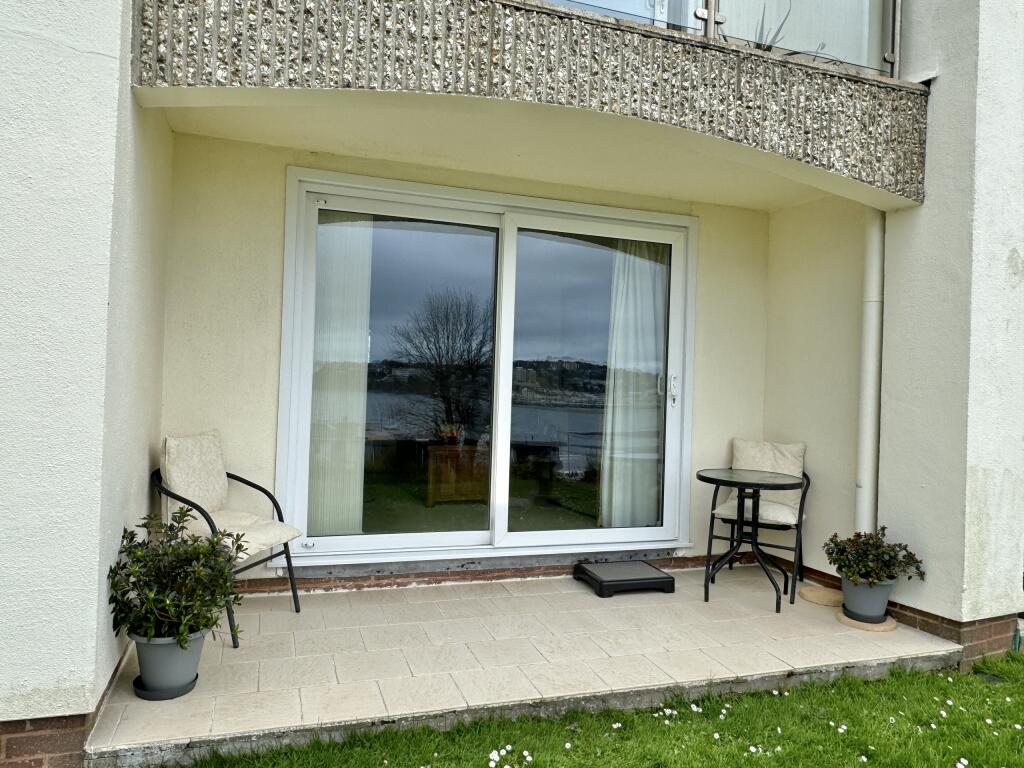
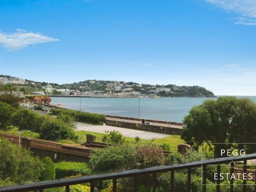
- garden with sea view
Floorplan Description
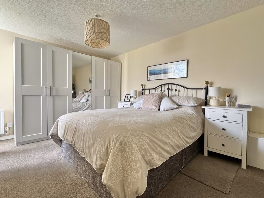
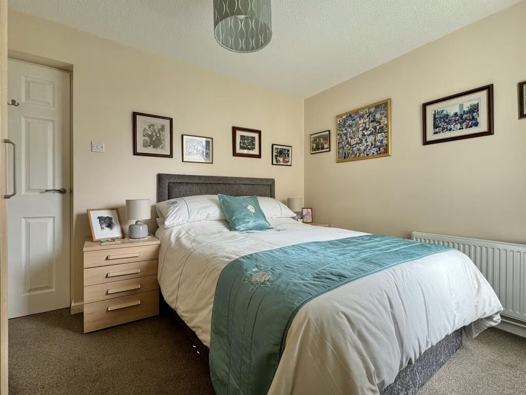
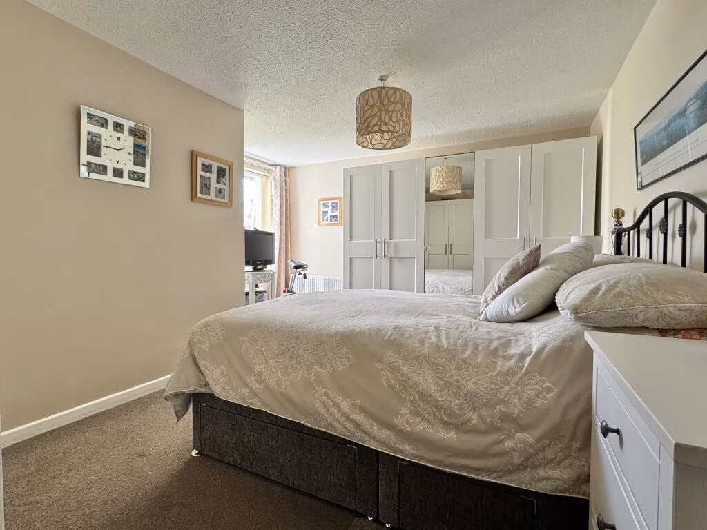
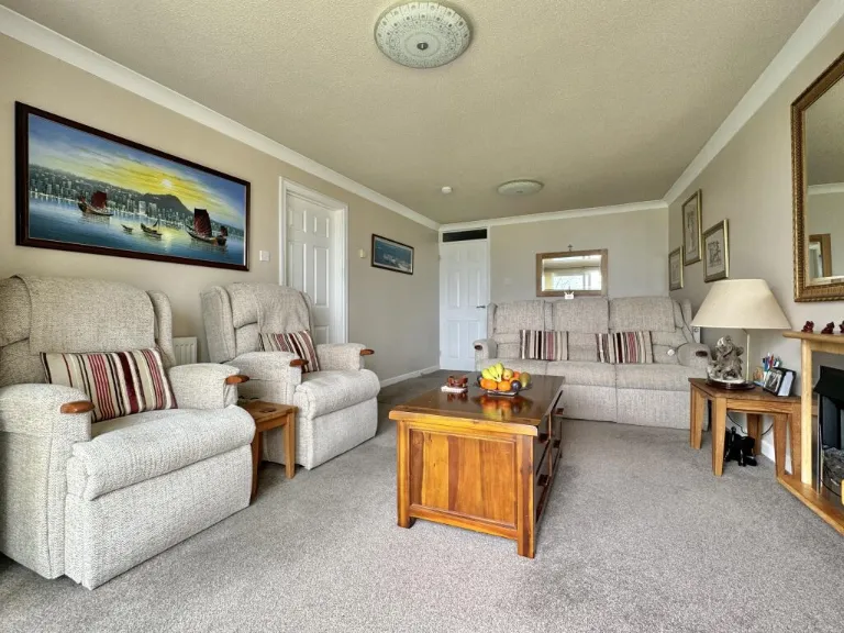
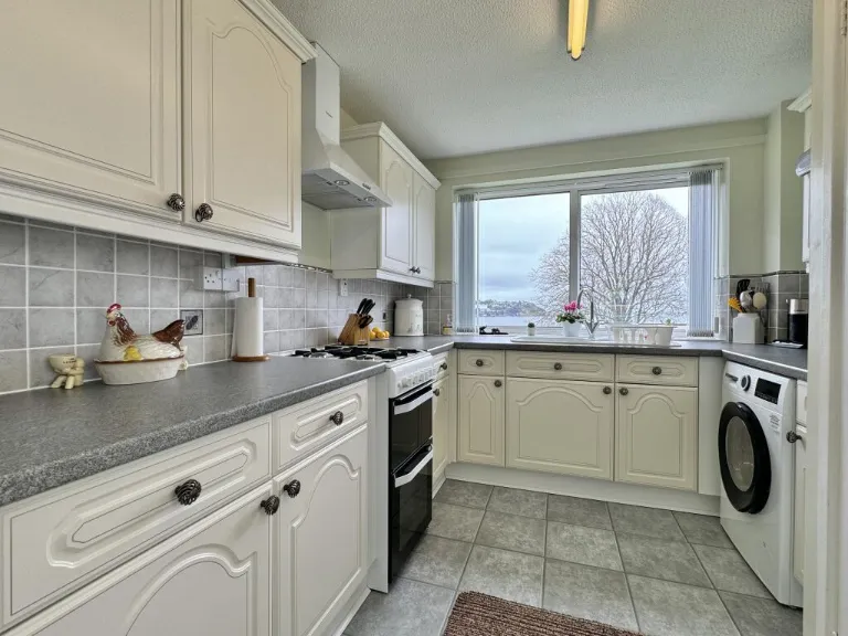
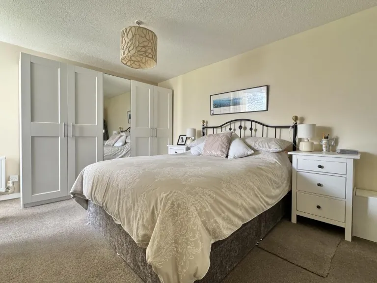
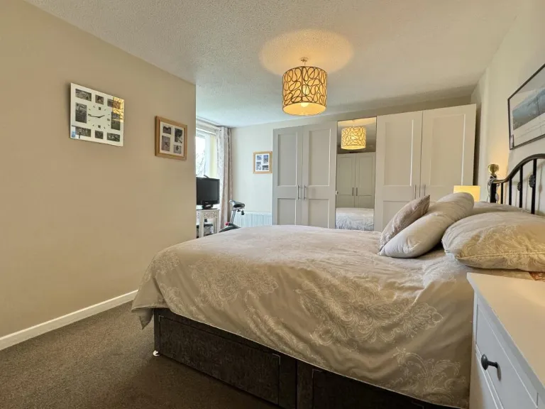
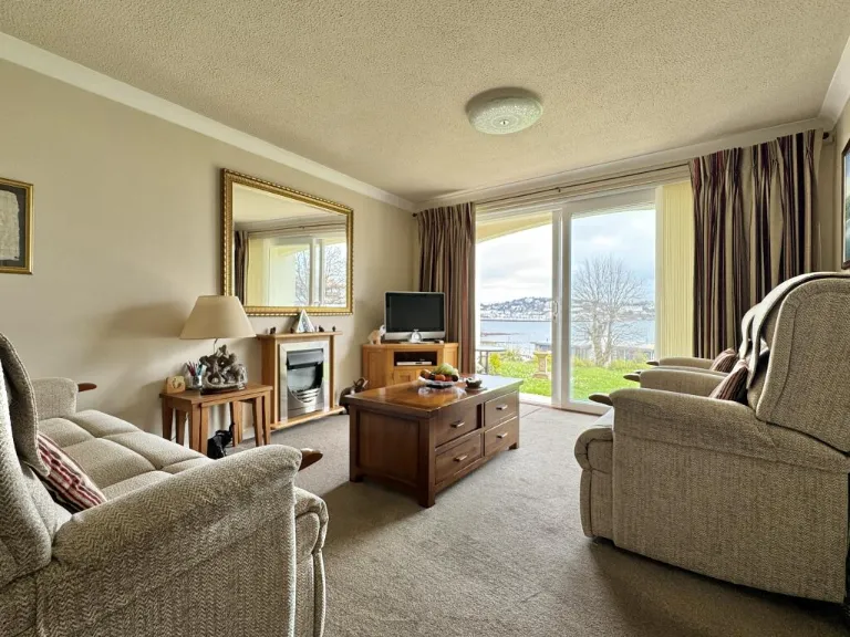
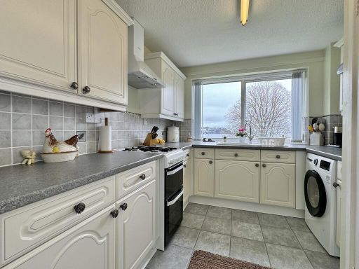
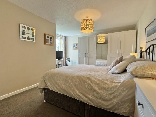
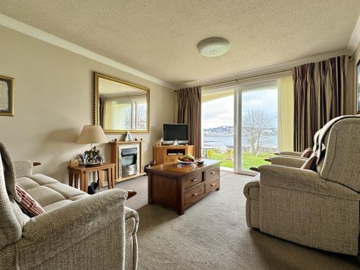
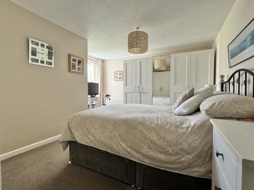
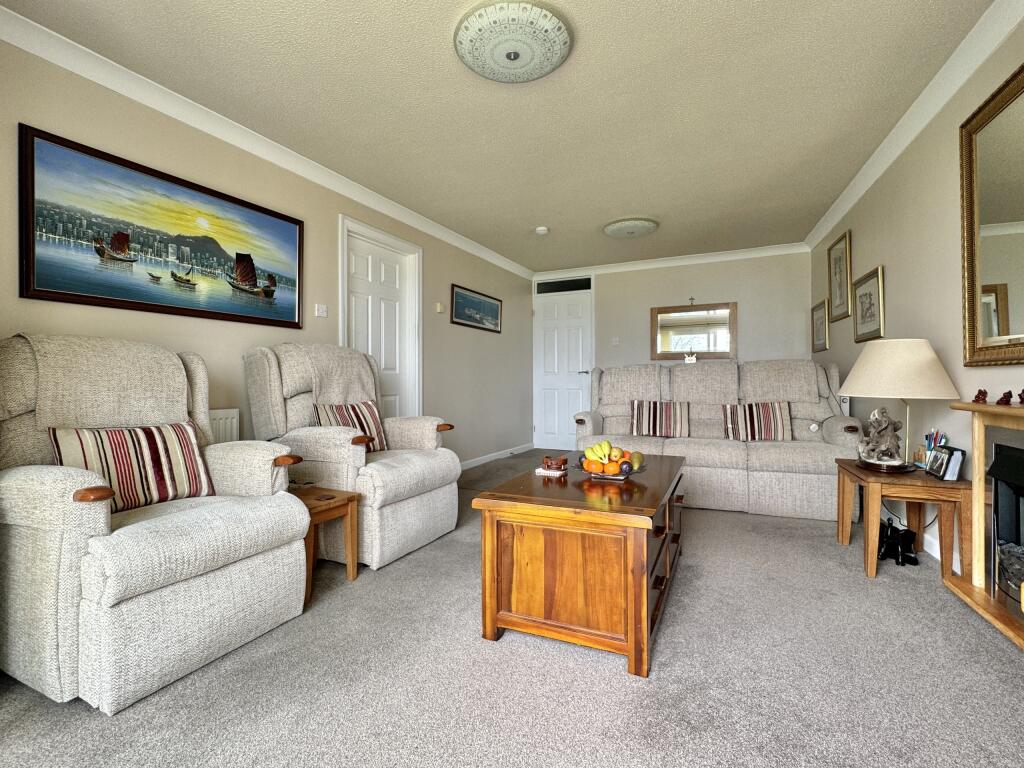
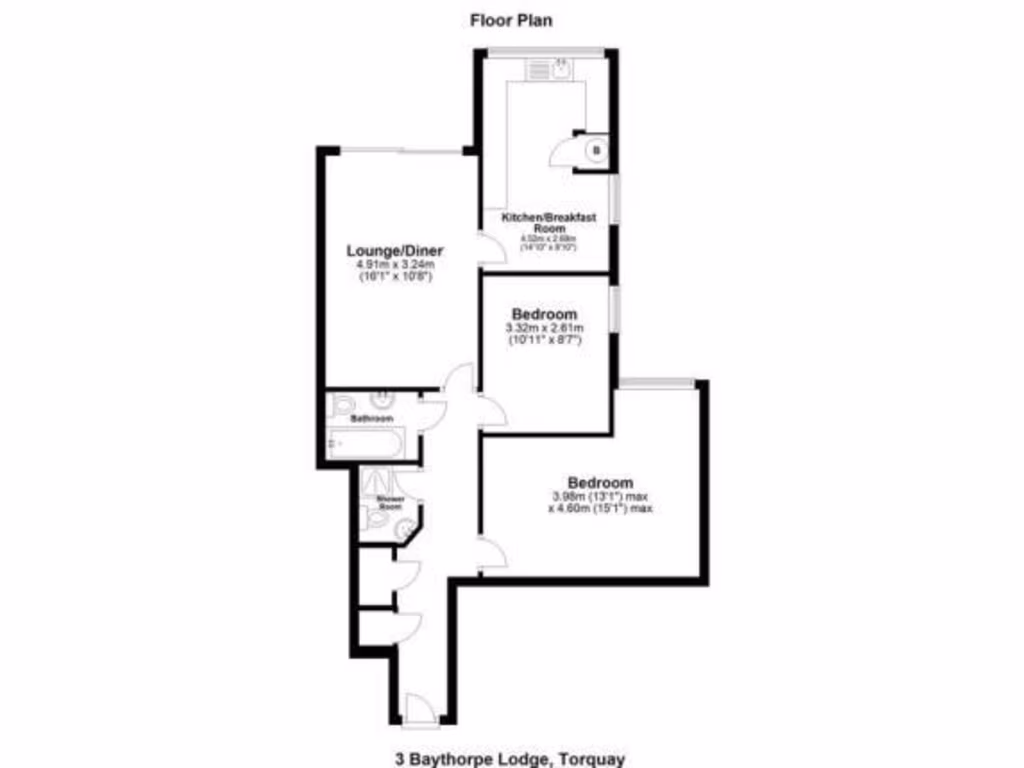
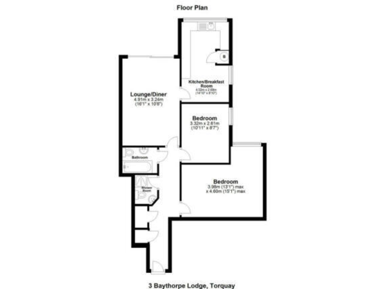
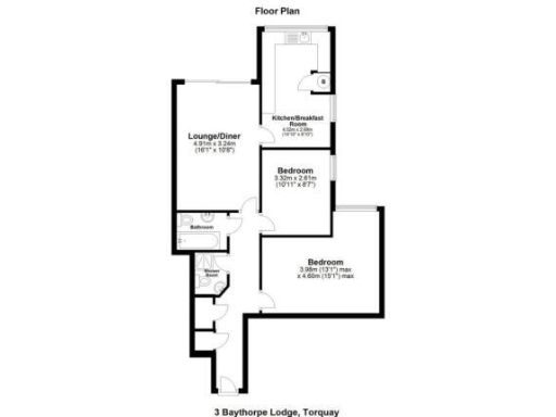
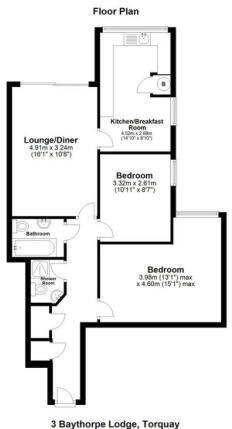
- Single-floor apartment with lounge/diner, kitchen/breakfast room and two bedrooms
Rooms
- Lounge/Diner:
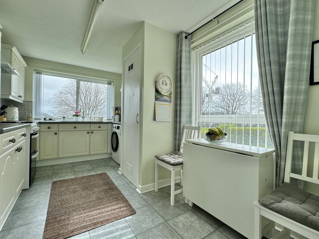
- Kitchen/Breakfast Room:
- Bedroom:
- Bedroom:
Textual Property Features
Detected Visual Features
- apartment building
- mid-century modern
- four-story
- balconies
- stucco exterior
- communal green area
- garden
- sloped lawn
- sea view
- coastal property
- landscape
- outdoor space
- waterfront
- scenic
- nature
- open space
EPC Details
- Fully double glazed
- Cavity wall, as built, insulated (assumed)
- Boiler and radiators, mains gas
- Low energy lighting in all fixed outlets
- Solid, no insulation (assumed)
Nearby Schools
- Hayes School
- Warberry CofE Academy
- Ellacombe Church of England Academy
- Our Lady of the Angels Catholic Primary School
- Torre Church of England Academy
- Torquay Academy
- Shiphay Learning Academy
- St Cuthbert Mayne School
- St Marychurch Church of England Primary and Nursery School
- The Lodestar Academy
- St Michael's Church of England Academy
- Curledge Street Academy
- Oldway Primary School
- Preston Primary School
- Cockington Primary School
- All Saints Babbacombe CofE Primary School
- The Spires College
- Upton St James CofE Primary School
- Priory Roman Catholic Primary School, Torquay
- Sacred Heart Catholic School
- Ilsham Church of England Academy
- Sherwell Valley Primary School
- Torquay Boys' Grammar School
- Torquay Girls Grammar School
- Homelands Primary School
- Abbey School
- St Margaret's Academy
- Barton Hill Academy
Nearest Bars And Restaurants
- Id: 1957040143
- Tags:
- Amenity: restaurant
- Cuisine: indian
- Name: Thariks
- Source: survey
- TagsNormalized:
- Lat: 50.4488415
- Lon: -3.556352
- FullGeoHash: gbvqzpfmfcxt
- PartitionGeoHash: gbvq
- Images:
- FoodStandards: null
- Distance: 1066
,- Id: 194771156
- Tags:
- Addr:
- City: Torquay
- Postcode: TQ2 5JY
- Amenity: restaurant
- Building: yes
- Name: Mr. Cook Steak & Grill House
- Source: Bing
- Source:postcode: ons_opendata_postcodes
- Url: https://mrcooktorquay.com/
- TagsNormalized:
- Lat: 50.4646058
- Lon: -3.5423678
- FullGeoHash: gbvrp6u98u75
- PartitionGeoHash: gbvr
- Images:
- FoodStandards: null
- Distance: 981
,- Id: 708028001
- Tags:
- TagsNormalized:
- Lat: 50.4638144
- Lon: -3.5407687
- FullGeoHash: gbvrp6ttn0g6
- PartitionGeoHash: gbvr
- Images:
- FoodStandards: null
- Distance: 943.4
,- Id: 194902426
- Tags:
- Addr:
- City: Torquay
- Postcode: TQ2 6HW
- Amenity: pub
- Building: yes
- Name: Chelston Manor
- Source: Bing;survey
- Source:postcode: ons_opendata_postcodes
- Url: www.chelstonmanor.co.uk
- Wikidata: Q26569211
- TagsNormalized:
- Lat: 50.4633301
- Lon: -3.5471192
- FullGeoHash: gbvrp6944ns1
- PartitionGeoHash: gbvr
- Images:
- FoodStandards: null
- Distance: 788.5
,- Id: 860728801
- Tags:
- Amenity: cafe
- Building: yes
- TagsNormalized:
- Lat: 50.4591699
- Lon: -3.5415249
- FullGeoHash: gbvrp3v1urp8
- PartitionGeoHash: gbvr
- Images:
- FoodStandards: null
- Distance: 494.4
}
Nearest General Shops
- Id: 1957040154
- Tags:
- Name: Riviera Car Centre
- Shop: car
- Source: survey
- TagsNormalized:
- Lat: 50.4492725
- Lon: -3.5556172
- FullGeoHash: gbvrp04bk458
- PartitionGeoHash: gbvr
- Images:
- FoodStandards: null
- Distance: 996
,- Id: 2537373600
- Tags:
- Addr:
- Name: The Co-operative
- Shop: supermarket
- TagsNormalized:
- Lat: 50.4630364
- Lon: -3.5457838
- FullGeoHash: gbvrp6d03pzc
- PartitionGeoHash: gbvr
- Images:
- FoodStandards: null
- Distance: 758.8
,- Id: 8604109255
- Tags:
- TagsNormalized:
- Lat: 50.4628285
- Lon: -3.5461644
- FullGeoHash: gbvrp63z23h1
- PartitionGeoHash: gbvr
- Images:
- FoodStandards: null
- Distance: 733.7
}
Nearest Grocery shops
- Id: 1988375414
- Tags:
- Name: Louise's
- Shop: greengrocer
- TagsNormalized:
- Lat: 50.4471559
- Lon: -3.5589147
- FullGeoHash: gbvqzp87zr2y
- PartitionGeoHash: gbvq
- Images:
- FoodStandards: null
- Distance: 1326.2
,- Id: 610475504
- Tags:
- Brand: Spar
- Brand:wikidata: Q610492
- Name: SPAR
- Shop: convenience
- TagsNormalized:
- Lat: 50.4480857
- Lon: -3.5575029
- FullGeoHash: gbvqzpc92hv9
- PartitionGeoHash: gbvq
- Images:
- FoodStandards: null
- Distance: 1182.7
,- Id: 5914148323
- Tags:
- Brand: Londis
- Brand:wikidata: Q21008564
- Name: Londis
- Shop: convenience
- TagsNormalized:
- Lat: 50.4488719
- Lon: -3.5553259
- FullGeoHash: gbvqzpgjfzkf
- PartitionGeoHash: gbvq
- Images:
- FoodStandards: null
- Distance: 1018.7
}
Nearest Supermarkets
- Id: 1018724573
- Tags:
- Addr:
- City: Paignton
- Housename: Victoria Shopping Centre
- Postcode: TQ4 6PE
- Street: Parkside Road
- Unit: 1,2
- Alt_name: LIDL Paignton
- Brand: Lidl
- Brand:wikidata: Q151954
- Brand:wikipedia: en:Lidl
- Fhrs:
- Name: Lidl
- Shop: supermarket
- Source:
- Postcode: ONS_Postcode_Directory
- Wheelchair: yes
- TagsNormalized:
- Lat: 50.4361088
- Lon: -3.5638566
- FullGeoHash: gbvqyvsgsh5u
- PartitionGeoHash: gbvq
- Images:
- FoodStandards:
- Id: 1036944
- FHRSID: 1036944
- LocalAuthorityBusinessID: A076P6PARK/1
- BusinessName: Lidl
- BusinessType: Retailers - supermarkets/hypermarkets
- BusinessTypeID: 7840
- AddressLine1: 1-2 Victoria Square
- AddressLine2: Parkside Road
- AddressLine3: Paignton
- AddressLine4: Devon
- PostCode: TQ4 6PE
- RatingValue: 5
- RatingKey: fhrs_5_en-GB
- RatingDate: 2018-02-20
- LocalAuthorityCode: 892
- LocalAuthorityName: Torbay
- LocalAuthorityWebSite: http://www.torbay.gov.uk/
- LocalAuthorityEmailAddress: food.safety@torbay.gov.uk
- Scores:
- Hygiene: 5
- Structural: 0
- ConfidenceInManagement: 5
- NewRatingPending: false
- Geocode:
- Longitude: -3.56329670000000
- Latitude: 50.43587510000000
- Distance: 2544.4
,- Id: 2376054786
- Tags:
- Addr:
- City: Torquay
- Housename: Union Square Shopping Centre
- Housenumber: 5-6
- Postcode: TQ1 3UT
- Street: Union Street
- Brand: Iceland
- Brand:wikidata: Q721810
- Contact:
- Website: https://www.iceland.co.uk/store-finder/store?StoreID=1260&StoreName=TORQUAY
- Name: Iceland
- Shop: supermarket
- TagsNormalized:
- Lat: 50.4673234
- Lon: -3.5296398
- FullGeoHash: gbvrpemc3qvy
- PartitionGeoHash: gbvr
- Images:
- FoodStandards: null
- Distance: 1729.3
,- Id: 746955845
- Tags:
- Brand: Tesco Express
- Brand:wikidata: Q98456772
- Contact:
- Website: https://www.tesco.com/store-locator/paignton/concord-house
- Name: Tesco Express
- Shop: supermarket
- Wheelchair: yes
- TagsNormalized:
- tesco
- tesco express
- supermarket
- shop
- Lat: 50.4459116
- Lon: -3.559853
- FullGeoHash: gbvqyzru9rt0
- PartitionGeoHash: gbvq
- Images:
- FoodStandards: null
- Distance: 1475.2
}
Nearest Religious buildings
- Id: 280715704
- Tags:
- Amenity: place_of_worship
- Denomination: pentecostal
- Name: Living Waters Pentecostal Church
- Religion: christian
- TagsNormalized:
- place of worship
- pentecostal
- church
- christian
- Lat: 50.448535
- Lon: -3.5562722
- FullGeoHash: gbvqzpfkhbe3
- PartitionGeoHash: gbvq
- Images:
- FoodStandards: null
- Distance: 1089.1
,- Id: 121950819
- Tags:
- Amenity: place_of_worship
- Building: yes
- Denomination: roman_catholic
- Name: Church of Our Lady of Walsingham with St. Cuthbert Mayne
- Religion: christian
- Service_times: 09:30 a.m. Daily
- TagsNormalized:
- place of worship
- catholic
- roman catholic
- church
- christian
- Lat: 50.4649184
- Lon: -3.5471237
- FullGeoHash: gbvrp6c56n8u
- PartitionGeoHash: gbvr
- Images:
- FoodStandards: null
- Distance: 965.1
,- Id: 189659737
- Tags:
- Amenity: place_of_worship
- Building: yes
- Denomination: anglican
- Name: St. Matthew's Church
- Religion: christian
- Source: Bing
- Wikidata: Q17550071
- TagsNormalized:
- place of worship
- anglican
- church
- christian
- Lat: 50.4629597
- Lon: -3.5504338
- FullGeoHash: gbvrp4w8hckx
- PartitionGeoHash: gbvr
- Images:
- FoodStandards: null
- Distance: 790.5
}
Nearest Medical buildings
- Id: 121950818
- Tags:
- Amenity: parking
- Fee: no
- Name: Chelston Hall Surgery Car Park
- Parking: surface
- TagsNormalized:
- Lat: 50.4642677
- Lon: -3.5464529
- FullGeoHash: gbvrp69x9tm4
- PartitionGeoHash: gbvr
- Images:
- FoodStandards: null
- Distance: 892.7
,- Id: 8892228663
- Tags:
- Addr:
- City: Torquay
- Housename: Chelston Hall
- Postcode: TQ2 6HW
- Street: Old Mill Road
- Amenity: pharmacy
- Dispensing: yes
- Healthcare: pharmacy
- Name: Dowricks Chemist Of Chelston Hall Ltd
- TagsNormalized:
- pharmacy
- health
- healthcare
- chemist
- Lat: 50.464117
- Lon: -3.5464645
- FullGeoHash: gbvrp69wc3hr
- PartitionGeoHash: gbvr
- Images:
- FoodStandards: null
- Distance: 875.9
,- Id: 121950817
- Tags:
- Amenity: doctors
- Building: yes
- Name: Chelston Hall Surgery
- Opening_hours: Mo-Fr 08:30-17:00
- TagsNormalized:
- Lat: 50.4639981
- Lon: -3.5463553
- FullGeoHash: gbvrp69w5gjf
- PartitionGeoHash: gbvr
- Images:
- FoodStandards: null
- Distance: 862.9
,- Id: 8892228662
- Tags:
- Addr:
- City: Chelston, Torquay
- Housenumber: 28
- Postcode: TQ2 6HS
- Street: Walnut Road
- Amenity: pharmacy
- Brand: Day Lewis Pharmacy
- Brand:wikidata: Q62563772
- Dispensing: yes
- Drive_through: no
- Healthcare: pharmacy
- Name: Day Lewis Pharmacy
- Source: survey
- TagsNormalized:
- pharmacy
- day lewis pharmacy
- health
- healthcare
- Lat: 50.4626328
- Lon: -3.5465294
- FullGeoHash: gbvrp63qpus1
- PartitionGeoHash: gbvr
- Images:
- FoodStandards: null
- Distance: 710.8
}
Nearest Airports
- Id: 38771012
- Tags:
- Aerodrome: international
- Aerodrome:type: public
- Aeroway: aerodrome
- Ele: 31
- Iata: EXT
- Icao: EGTE
- International_flights: yes
- Name: Exeter Airport
- Source: Gagravarr_Airports
- Website: https://www.exeter-airport.co.uk/
- Wikidata: Q8999
- Wikipedia: en:Exeter Airport
- TagsNormalized:
- airport
- international airport
- Lat: 50.7348674
- Lon: -3.4136027
- FullGeoHash: gcj8dk4212c2
- PartitionGeoHash: gcj8
- Images:
- FoodStandards: null
- Distance: 32376.4
}
Nearest Leisure Facilities
- Id: 28449442
- Tags:
- TagsNormalized:
- Lat: 50.4612128
- Lon: -3.5452961
- FullGeoHash: gbvrp64muege
- PartitionGeoHash: gbvr
- Images:
- FoodStandards: null
- Distance: 562.6
,- Id: 1082270424
- Tags:
- Access: private
- Leisure: swimming_pool
- Location: outdoor
- TagsNormalized:
- swimming
- swimming pool
- pool
- leisure
- Lat: 50.4597366
- Lon: -3.5417847
- FullGeoHash: gbvrp3uvq2tv
- PartitionGeoHash: gbvr
- Images:
- FoodStandards: null
- Distance: 525.4
,- Id: 37049852
- Tags:
- Leisure: park
- Name: Corbyn's Head
- TagsNormalized:
- Lat: 50.4584954
- Lon: -3.5413306
- FullGeoHash: gbvrp3tq1129
- PartitionGeoHash: gbvr
- Images:
- FoodStandards: null
- Distance: 460
,- Id: 188585992
- Tags:
- Access: private
- Leisure: pitch
- Sport: tennis
- TagsNormalized:
- Lat: 50.4589758
- Lon: -3.5420372
- FullGeoHash: gbvrp3ubbdce
- PartitionGeoHash: gbvr
- Images:
- FoodStandards: null
- Distance: 452.9
,- Id: 1082270430
- Tags:
- Access: private
- Leisure: swimming_pool
- Location: outdoor
- TagsNormalized:
- swimming
- swimming pool
- pool
- leisure
- Lat: 50.4571762
- Lon: -3.5445371
- FullGeoHash: gbvrp36yq73s
- PartitionGeoHash: gbvr
- Images:
- FoodStandards: null
- Distance: 189.8
}
Nearest Tourist attractions
- Id: 188585884
- Tags:
- Building: yes
- Name: Cliff Court Apartments
- Source: Bing
- Tourism: apartments
- TagsNormalized:
- Lat: 50.4529073
- Lon: -3.5461581
- FullGeoHash: gbvrp29v2x8g
- PartitionGeoHash: gbvr
- Images:
- FoodStandards: null
- Distance: 373.4
,- Id: 188585889
- Tags:
- Addr:
- City: Torquay
- Postcode: TQ2 6RG
- Building: yes
- Guest_house: bed_and_breakfast
- Name: The Capri
- Source: Bing
- Tourism: guest_house
- TagsNormalized:
- Lat: 50.4535347
- Lon: -3.5472005
- FullGeoHash: gbvrp2c10hx9
- PartitionGeoHash: gbvr
- Images:
- FoodStandards: null
- Distance: 302.5
,- Id: 188585890
- Tags:
- Addr:
- City: Torquay
- Postcode: TQ2 6RH
- Building: yes
- Name: The Corbyn Apartments
- Source: Bing
- Tourism: apartments
- TagsNormalized:
- Lat: 50.4546543
- Lon: -3.5465358
- FullGeoHash: gbvrp2crxtr0
- PartitionGeoHash: gbvr
- Images:
- FoodStandards: null
- Distance: 177.4
}
Nearest Train stations
- Id: 246826119
- Tags:
- Addr:
- Name: Goodrington Sands
- Naptan:
- Public_transport: station
- Railway: station
- Request_stop: yes
- Usage: tourism
- Website: https://www.dartmouthrailriver.co.uk/
- Wikidata: Q5583591
- TagsNormalized:
- Lat: 50.4246083
- Lon: -3.5615812
- FullGeoHash: gbvqygw89hk8
- PartitionGeoHash: gbvq
- Images:
- FoodStandards: null
- Distance: 3670.4
,- Id: 3331091692
- Tags:
- Addr:
- City: Paignton
- Postcode: TQ4 6AF
- Name: Paignton Queens Park
- Naptan:
- Operator: Dartmouth Steam Railway
- Public_transport: station
- Railway: station
- Usage: tourism
- TagsNormalized:
- Lat: 50.4343005
- Lon: -3.5647477
- FullGeoHash: gbvqyvk1p753
- PartitionGeoHash: gbvq
- Images:
- FoodStandards: null
- Distance: 2751.6
,- Id: 246663389
- Tags:
- Electrified: no
- Name: Paignton
- Naptan:
- Network: National Rail
- Platforms: 2
- Public_transport: station
- Railway: station
- Ref:
- Wheelchair: yes
- Wikidata: Q2049642
- Wikipedia: en:Paignton railway station
- TagsNormalized:
- Lat: 50.4345442
- Lon: -3.5651763
- FullGeoHash: gbvqyv7ft27y
- PartitionGeoHash: gbvq
- Images:
- FoodStandards: null
- Distance: 2741.9
,- Id: 29272388
- Tags:
- Electrified: no
- Name: Torre
- Naptan:
- Network: National Rail
- Public_transport: station
- Railway: station
- Ref:
- Wikidata: Q2985310
- Wikipedia: en:Torre railway station
- TagsNormalized:
- Lat: 50.4731928
- Lon: -3.5465008
- FullGeoHash: gbvrpk3e8t16
- PartitionGeoHash: gbvr
- Images:
- FoodStandards: null
- Distance: 1884.9
,- Id: 29272140
- Tags:
- Electrified: no
- Name: Torquay
- Naptan:
- Network: National Rail
- Public_transport: station
- Railway: station
- Ref:
- Wheelchair: yes
- Wikipedia: en:Torquay railway station
- TagsNormalized:
- Lat: 50.4610509
- Lon: -3.5430302
- FullGeoHash: gbvrp6hhcmtj
- PartitionGeoHash: gbvr
- Images:
- FoodStandards: null
- Distance: 597
}
Nearest Hotels
- Id: 188585888
- Tags:
- Addr:
- City: Torquay
- Postcode: TQ2 6QJ
- Building: yes
- Name: Livermead House Hotel
- Source: Bing
- Tourism: hotel
- TagsNormalized:
- Lat: 50.4575261
- Lon: -3.5440632
- FullGeoHash: gbvrp3e23kdg
- PartitionGeoHash: gbvr
- Images:
- FoodStandards: null
- Distance: 239.5
,- Id: 188585887
- Tags:
- Addr:
- City: Torquay
- Postcode: TQ2 6RQ
- Street: Torbay Road
- Building: yes
- Name: Livermead Cliff Hotel
- Tourism: hotel
- TagsNormalized:
- Lat: 50.4545495
- Lon: -3.5455954
- FullGeoHash: gbvrp2fpj9sr
- PartitionGeoHash: gbvr
- Images:
- FoodStandards: null
- Distance: 206.1
,- Id: 1082270429
- Tags:
- TagsNormalized:
- Lat: 50.4570883
- Lon: -3.5443407
- FullGeoHash: gbvrp37jffup
- PartitionGeoHash: gbvr
- Images:
- FoodStandards: null
- Distance: 196.7
}
Tags
- apartment building
- mid-century modern
- four-story
- balconies
- stucco exterior
- communal green area
- garden
- sloped lawn
- sea view
- garden
- coastal property
- landscape
- outdoor space
- waterfront
- scenic
- nature
- open space
Local Market Stats
- Average Price/sqft: £267
- Avg Income: £42000
- Rental Yield: 3.8%
- Social Housing: 9%
- Planning Success Rate: 75%
AirBnB Data
- 1km average: £92/night
- Listings in 1km: 6
Similar Properties
 2 bedroom apartment for sale in Corbyn Mount, Torquay, TQ2 — £210,000 • 2 bed • 2 bath • 786 ft²
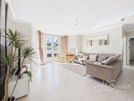 2 bedroom apartment for sale in St. Lukes Road South, Torquay, TQ2 — £310,000 • 2 bed • 1 bath • 619 ft²
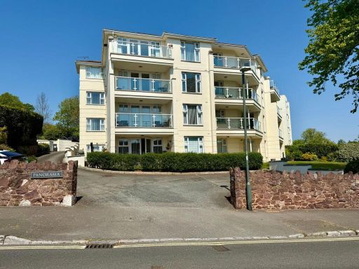 2 bedroom apartment for sale in Livermead, Torquay, TQ2 — £250,000 • 2 bed • 2 bath • 800 ft²
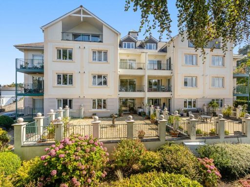 2 bedroom apartment for sale in Higher Woodfield Road,Torquay,Devon,TQ1 2LD, TQ1 — £345,000 • 2 bed • 2 bath • 949 ft²
 2 bedroom apartment for sale in Cary Road, Torquay, Devon, TQ2 — £340,000 • 2 bed • 2 bath • 893 ft²
 2 bedroom apartment for sale in Cliff Road, Torquay, Devon, TQ2 6SW, TQ2 — £190,000 • 2 bed • 2 bath • 896 ft²
Meta
- {
"@context": "https://schema.org",
"@type": "Residence",
"name": "2 bedroom apartment for sale in Baythorpe Lodge, Livermead…",
"description": "",
"url": "https://propertypiper.co.uk/property/37904f55-38ab-4304-ac4c-bce983fbda94",
"image": "https://image-a.propertypiper.co.uk/1ca99aa5-2fba-44ac-aca1-53f629c744aa-1024.jpeg",
"address": {
"@type": "PostalAddress",
"streetAddress": "BAYTHORPE LODGE 3 LIVERMEAD HILL TORQUAY",
"postalCode": "TQ2 6TP",
"addressLocality": "Torbay",
"addressRegion": "Torbay",
"addressCountry": "England"
},
"geo": {
"@type": "GeoCoordinates",
"latitude": 50.4562422,
"longitude": -3.5467804
},
"numberOfRooms": 2,
"numberOfBathroomsTotal": 2,
"floorSize": {
"@type": "QuantitativeValue",
"value": 721,
"unitCode": "FTK"
},
"offers": {
"@type": "Offer",
"price": 230000,
"priceCurrency": "GBP",
"availability": "https://schema.org/InStock"
},
"additionalProperty": [
{
"@type": "PropertyValue",
"name": "Feature",
"value": "apartment building"
},
{
"@type": "PropertyValue",
"name": "Feature",
"value": "mid-century modern"
},
{
"@type": "PropertyValue",
"name": "Feature",
"value": "four-story"
},
{
"@type": "PropertyValue",
"name": "Feature",
"value": "balconies"
},
{
"@type": "PropertyValue",
"name": "Feature",
"value": "stucco exterior"
},
{
"@type": "PropertyValue",
"name": "Feature",
"value": "communal green area"
},
{
"@type": "PropertyValue",
"name": "Feature",
"value": "garden"
},
{
"@type": "PropertyValue",
"name": "Feature",
"value": "sloped lawn"
},
{
"@type": "PropertyValue",
"name": "Feature",
"value": "sea view"
},
{
"@type": "PropertyValue",
"name": "Feature",
"value": "garden"
},
{
"@type": "PropertyValue",
"name": "Feature",
"value": "coastal property"
},
{
"@type": "PropertyValue",
"name": "Feature",
"value": "landscape"
},
{
"@type": "PropertyValue",
"name": "Feature",
"value": "outdoor space"
},
{
"@type": "PropertyValue",
"name": "Feature",
"value": "waterfront"
},
{
"@type": "PropertyValue",
"name": "Feature",
"value": "scenic"
},
{
"@type": "PropertyValue",
"name": "Feature",
"value": "nature"
},
{
"@type": "PropertyValue",
"name": "Feature",
"value": "open space"
}
]
}
High Res Floorplan Images
Compatible Floorplan Images
FloorplanImages Thumbnail