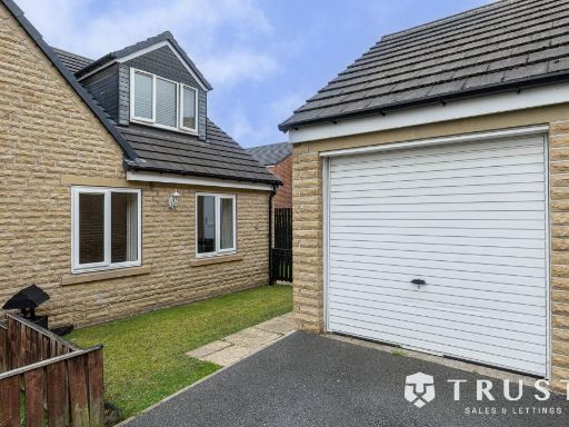
BD11 2LA - 3 bedroom semidetached house for sale in Old Lane, Birkensh…
View on Property Piper
3 bedroom semi-detached house for sale in Old Lane, Birkenshaw, Bradford, West Yorkshire, BD11
Property Details
- Price: £225000
- Bedrooms: 3
- Bathrooms: 1
- Property Type: undefined
- Property SubType: undefined
Image Descriptions
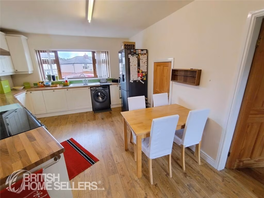
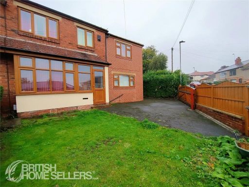
- semi-detached house modernized post-war
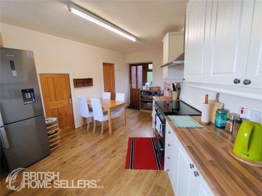
- kitchen modern
Rooms
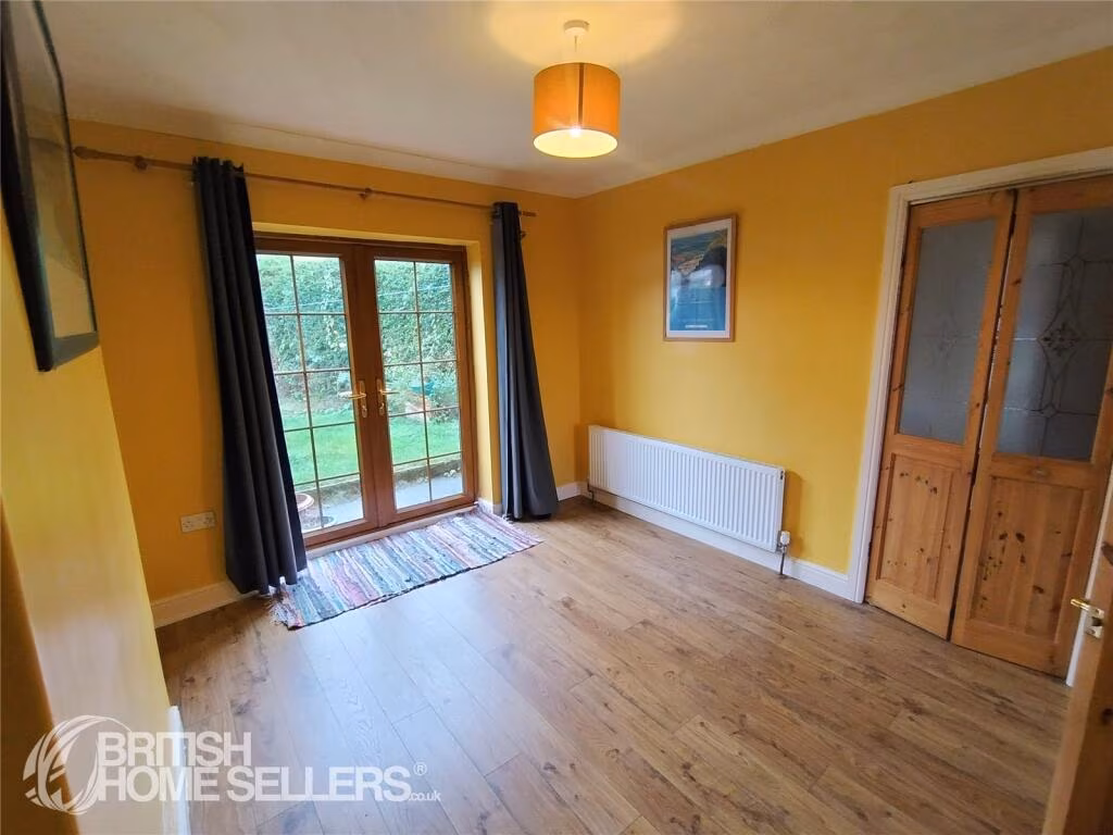
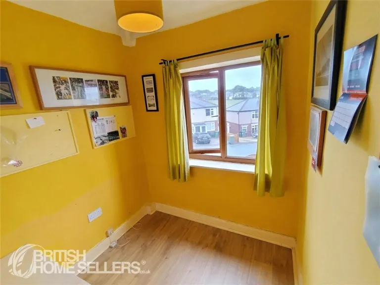
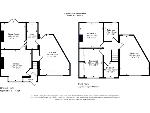
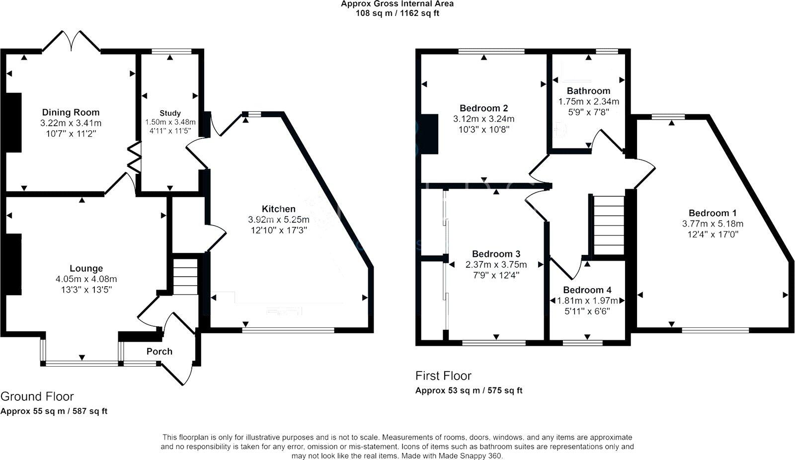
- Dining Room:
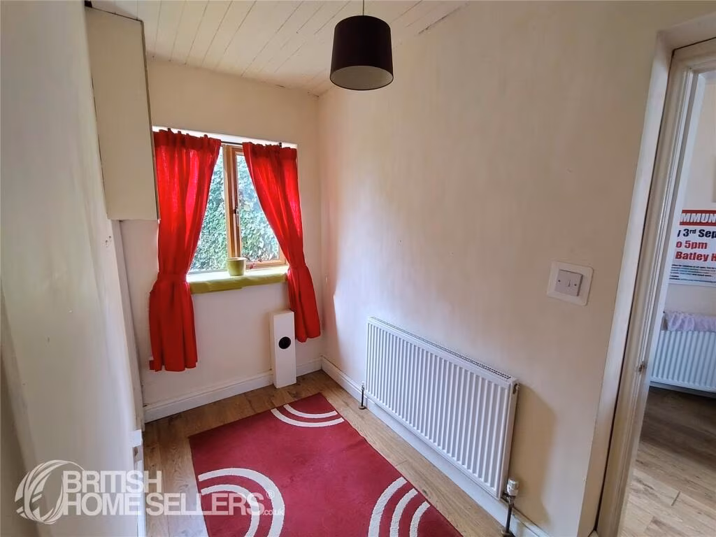
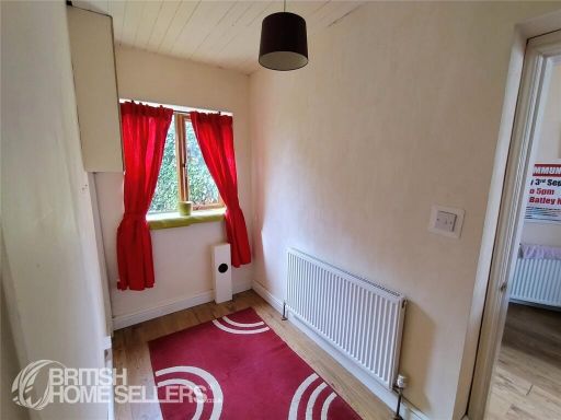
- Study:
- Kitchen:
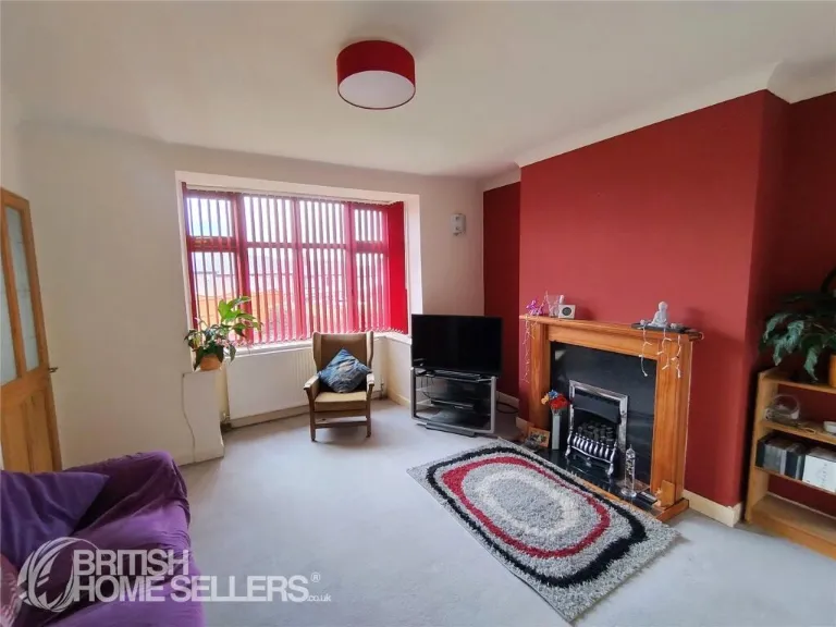
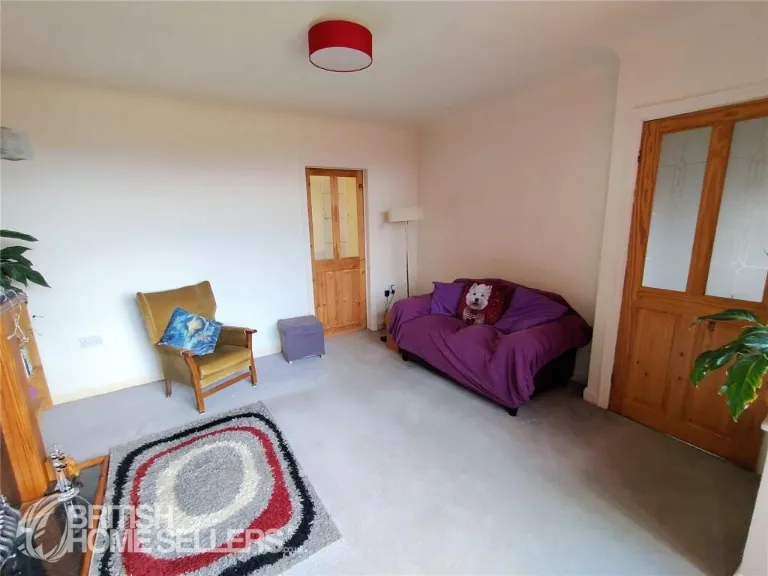
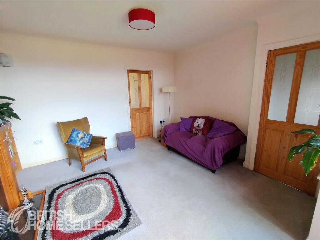
- Lounge:
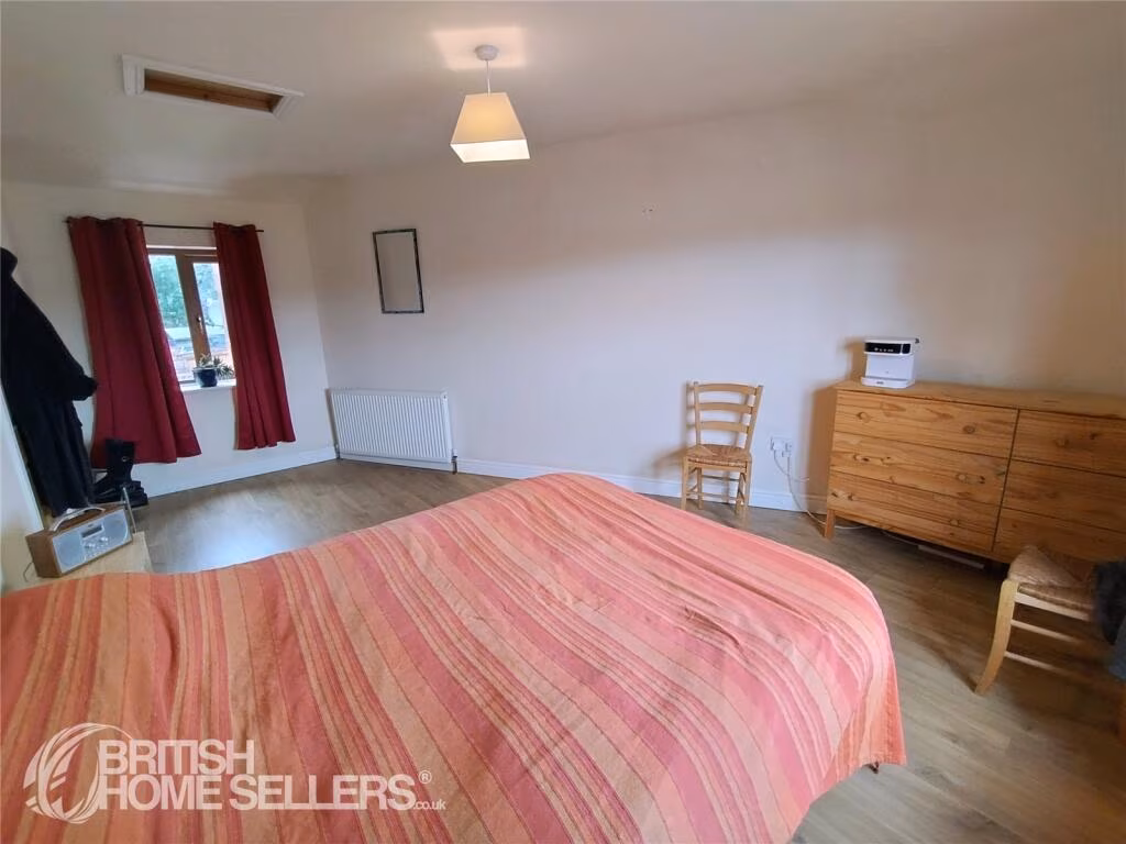
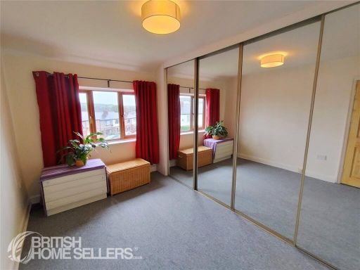
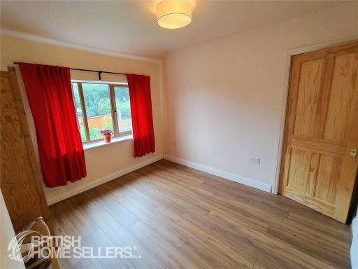
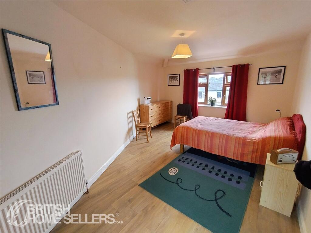
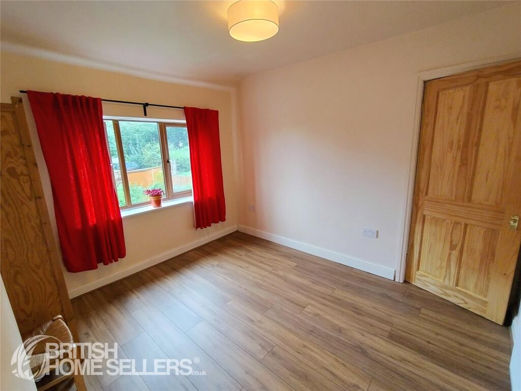
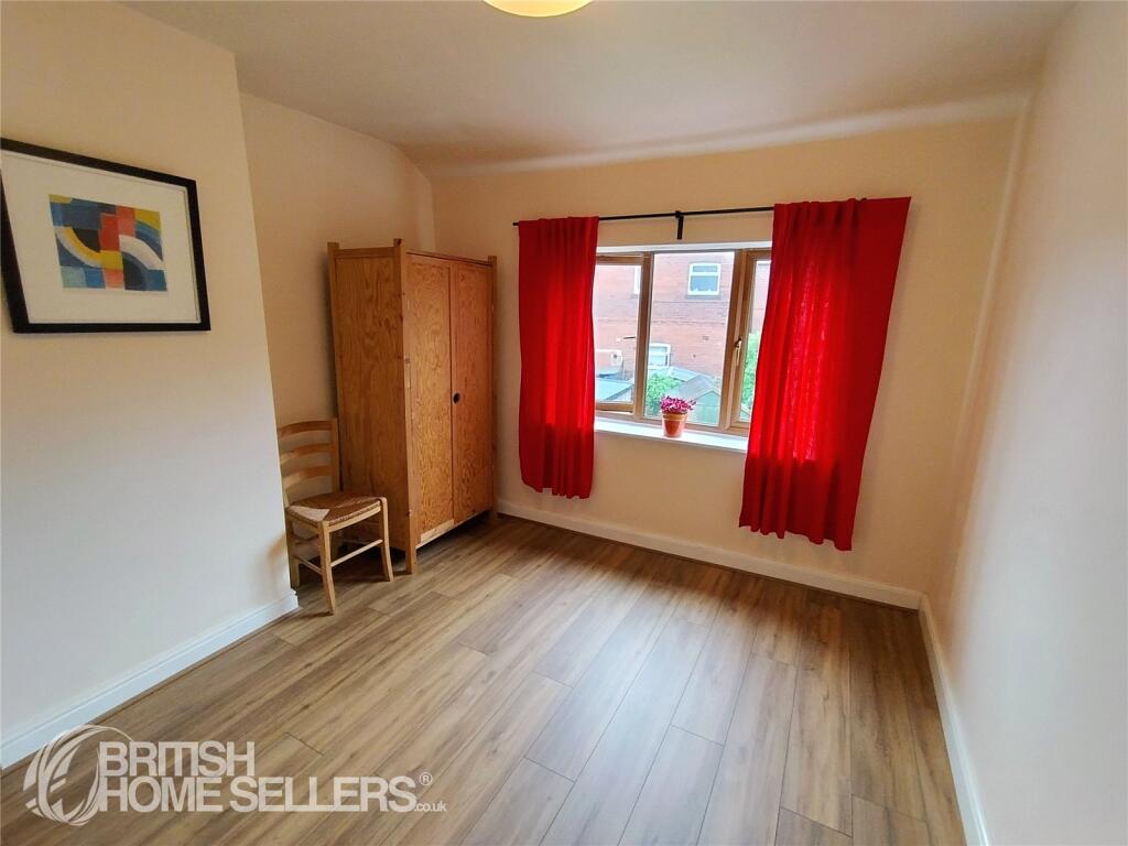
- Bedroom 2:
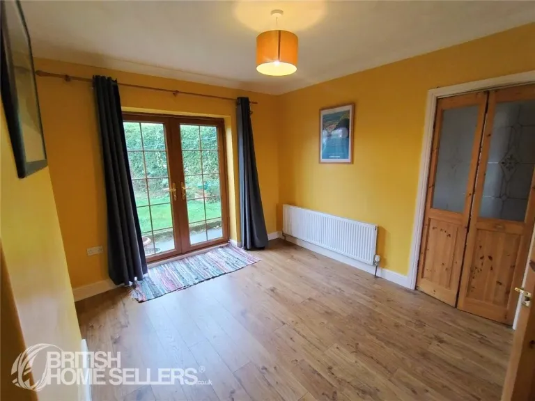
- Bathroom:
- Bedroom 1:
- Bedroom 3:
- Bedroom 4:
Textual Property Features
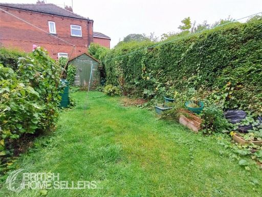
- Has Garden
- Chain Free
- Success
Detected Visual Features
- semi-detached
- driveway
- curb appeal
- renovated
- modern windows
- brickwork
- two-storey
- family home
- modern kitchen
- wooden floors
- wooden cabinets
- long countertop
- bright lighting
- pendant lights
- white tiles
- up-to-date
EPC Details
- Fully double glazed
- Cavity wall, filled cavity
- Boiler and radiators, mains gas
- Low energy lighting in 92% of fixed outlets
- Suspended, no insulation (assumed)
Nearby Schools
- Birstall Primary Academy
- Fieldhead Primary Academy
- BBG Academy
- St Columba's Catholic Primary School, a Voluntary Academy
- Southroyd Primary and Nursery School
- East Bierley Church of England Voluntary Controlled Primary School
- Tong Leadership Academy
- St John's CofE Primary School
- Ryecroft Primary Academy
- Carrwood Primary School
- Brian Jackson College
- Holy Spirit Catholic Primary Academy
- Headlands Church of England Voluntary Controlled Junior, Infant and Nursery School
- Millbridge, A Share Primary Academy
- Gomersal Primary School
- Batley Girls High School
- St Patrick's Catholic Primary Academy
- Drighlington Primary School
- Heckmondwike Grammar School
- Littletown Junior Infant and Nursery School
- Co-op Academy Smithies Moor
- Howard Park Community School
- Gomersal St Mary's Church of England Voluntary Controlled Primary School
- Windmill CofE (VC) Primary School
- St Peter's Church of England Voluntary Aided Junior, Infant and Early Years School
- Birkenshaw Church of England Voluntary Controlled Primary School
- Knowleswood Primary School
- Fulneck School
- Co-op Academy Beckfield
Nearest General Shops
- Id: 413588090
- Tags:
- Name: King Street Motors
- Shop: car
- TagsNormalized:
- Lat: 53.747148
- Lon: -1.6902583
- FullGeoHash: gcwcc835y4s4
- PartitionGeoHash: gcwc
- Images:
- FoodStandards: null
- Distance: 362.6
,- Id: 590528960
- Tags:
- Building: yes
- Clothes: women;cafe
- Name: Readmans
- Shop: clothes
- TagsNormalized:
- Lat: 53.7476654
- Lon: -1.6904043
- FullGeoHash: gcwcc83nfep0
- PartitionGeoHash: gcwc
- Images:
- FoodStandards: null
- Distance: 326.7
,- Id: 9770169394
- Tags:
- Name: Bolts on Bits
- Phone: +44 1274 688388
- Shop: car_parts
- TagsNormalized:
- Lat: 53.7481195
- Lon: -1.6875803
- FullGeoHash: gcwcc8e1kx8v
- PartitionGeoHash: gcwc
- Images:
- FoodStandards: null
- Distance: 181.9
}
Nearest Grocery shops
- Id: 413587912
- Tags:
- Addr:
- City: Bradford
- Hamlet: Birkenshaw
- Housenumber: 262
- Postcode: BD11 2HH
- Street: Moor Lane
- Fhrs:
- Name: Moor Lane Mini-Market
- Shop: convenience
- Source:
- TagsNormalized:
- Lat: 53.7454083
- Lon: -1.6815852
- FullGeoHash: gcwcc8p98nr0
- PartitionGeoHash: gcwc
- Images:
- FoodStandards: null
- Distance: 586.8
,- Id: 413588087
- Tags:
- Name: Whitehall Stores
- Shop: convenience
- TagsNormalized:
- Lat: 53.7484216
- Lon: -1.6875868
- FullGeoHash: gcwcc8e5hrup
- PartitionGeoHash: gcwc
- Images:
- FoodStandards: null
- Distance: 150.1
,- Id: 549245413
- Tags:
- Addr:
- City: Bradford
- Hamlet: Birkenshaw
- Housenumber: 2
- Postcode: BD11 2JX
- Street: Old Lane
- Fhrs:
- Name: Birkenshaw Convenience Store
- Shop: convenience
- Source:
- TagsNormalized:
- Lat: 53.7495016
- Lon: -1.6854154
- FullGeoHash: gcwcc8u9wcr4
- PartitionGeoHash: gcwc
- Images:
- FoodStandards: null
- Distance: 93.6
}
Nearest Religious buildings
- Id: 858821790
- Tags:
- Amenity: place_of_worship
- Building: church
- Denomination: methodist
- Name: East Bierley Methodist Church
- Religion: christian
- TagsNormalized:
- place of worship
- church
- methodist
- christian
- Lat: 53.7583253
- Lon: -1.7016594
- FullGeoHash: gcwcc62uuqnv
- PartitionGeoHash: gcwc
- Images:
- FoodStandards: null
- Distance: 1369.7
,- Id: 413588234
- Tags:
- Amenity: place_of_worship
- Denomination: methodist
- Name: Birkenshaw Methodist Church
- Religion: christian
- TagsNormalized:
- place of worship
- methodist
- church
- christian
- Lat: 53.7539832
- Lon: -1.6946932
- FullGeoHash: gcwcc3tgwu9p
- PartitionGeoHash: gcwc
- Images:
- FoodStandards: null
- Distance: 705
,- Id: 568435190
- Tags:
- Amenity: place_of_worship
- Building: yes
- Denomination: anglican
- Name: St. Paul's Church
- Religion: christian
- Wikidata: Q26479549
- TagsNormalized:
- place of worship
- anglican
- church
- christian
- Lat: 53.7503363
- Lon: -1.693084
- FullGeoHash: gcwcc2znkkcj
- PartitionGeoHash: gcwc
- Images:
- FoodStandards: null
- Distance: 419.2
}
Nearest Medical buildings
- Id: 676051996
- Tags:
- Addr:
- City: Bradford
- Housenumber: 151
- Postcode: BD11 1EJ
- Street: King Street
- Suburb: Drighlington
- Amenity: pharmacy
- Building: yes
- Name: Drighlington Pharmacy
- TagsNormalized:
- Lat: 53.754024
- Lon: -1.6560051
- FullGeoHash: gcwcf3d5uk35
- PartitionGeoHash: gcwc
- Images:
- FoodStandards: null
- Distance: 2081.5
,- Id: 35225448
- Tags:
- Amenity: doctors
- Name: Drighlington Medical Centre
- TagsNormalized:
- Lat: 53.7561962
- Lon: -1.6625873
- FullGeoHash: gcwcf4j2dcm0
- PartitionGeoHash: gcwc
- Images:
- FoodStandards: null
- Distance: 1748.8
,- Id: 413272738
- Tags:
- Addr:
- City: Bradford
- Housenumber: 176
- Postcode: BD11 1AU
- Street: Whitehall Road
- Suburb: Drighlington
- Amenity: pharmacy
- Name: Well Pharmacy
- TagsNormalized:
- Lat: 53.7563673
- Lon: -1.6634181
- FullGeoHash: gcwcf4h9x91t
- PartitionGeoHash: gcwc
- Images:
- FoodStandards: null
- Distance: 1707.4
,- Id: 549245185
- Tags:
- Amenity: doctors
- Name: Birkenshaw Health Centre
- TagsNormalized:
- doctor
- doctors
- health
- health centre
- Lat: 53.7528185
- Lon: -1.6925933
- FullGeoHash: gcwcc3rkzewu
- PartitionGeoHash: gcwc
- Images:
- FoodStandards: null
- Distance: 515.8
}
Nearest Airports
- Id: 11519546
- Tags:
- Addr:
- City: Leeds
- Postcode: LS19 7TU
- Aerodrome: international
- Aerodrome:type: public
- Aeroway: aerodrome
- Iata: LBA
- Icao: EGNM
- Name: Leeds Bradford Airport
- Operator: Leeds Bradford Airport Limited
- Operator:type: private
- Ref: LBA
- Type: multipolygon
- Website: https://www.leedsbradfordairport.co.uk/
- Wikidata: Q8699
- Wikipedia: en:Leeds Bradford Airport
- TagsNormalized:
- airport
- international airport
- Lat: 53.8667047
- Lon: -1.660138
- FullGeoHash: gcwf6nph7cx3
- PartitionGeoHash: gcwf
- Images:
- Q8699-1
- Q8699-2
- Q8699-3
- Q8699-4
- FoodStandards: null
- Distance: 13128.8
}
Nearest Leisure Facilities
- Id: 394411155
- Tags:
- Leisure: pitch
- Source: Bing
- TagsNormalized:
- Lat: 53.7459504
- Lon: -1.689714
- FullGeoHash: gcwcc81sfg3f
- PartitionGeoHash: gcwc
- Images:
- FoodStandards: null
- Distance: 457.7
,- Id: 43517636
- Tags:
- Leisure: park
- Name: Birkenshaw Park
- TagsNormalized:
- Lat: 53.7509344
- Lon: -1.693072
- FullGeoHash: gcwcc3p1us6j
- PartitionGeoHash: gcwc
- Images:
- FoodStandards: null
- Distance: 434.8
,- Id: 43517634
- Tags:
- Leisure: pitch
- Sport: basketball
- TagsNormalized:
- pitch
- leisure
- basketball
- sports
- Lat: 53.7508802
- Lon: -1.6928785
- FullGeoHash: gcwcc3p39463
- PartitionGeoHash: gcwc
- Images:
- FoodStandards: null
- Distance: 420.8
,- Id: 43517635
- Tags:
- TagsNormalized:
- Lat: 53.7509402
- Lon: -1.6924956
- FullGeoHash: gcwcc3p9cvrz
- PartitionGeoHash: gcwc
- Images:
- FoodStandards: null
- Distance: 399.3
,- Id: 35284620
- Tags:
- TagsNormalized:
- Lat: 53.7464468
- Lon: -1.6852493
- FullGeoHash: gcwcc8hzdzg5
- PartitionGeoHash: gcwc
- Images:
- FoodStandards: null
- Distance: 374.7
}
Nearest Tourist attractions
- Id: 360848891
- Tags:
- Addr:
- City: Batley
- Postcode: WF17 0AS
- Street: Woodlands Road
- Name: Bagshaw Museum
- Name:en: Bagshaw Museum and Wilton Park
- Tourism: museum
- Website: https://www.kirklees.gov.uk/beta/museums-and-galleries/bagshaw-museum
- Wikidata: Q17547846
- TagsNormalized:
- Lat: 53.7278845
- Lon: -1.6454926
- FullGeoHash: gcwcdscg95xg
- PartitionGeoHash: gcwc
- Images:
- FoodStandards: null
- Distance: 3641.5
,- Id: 9060095439
- Tags:
- Addr:
- City: Bradford
- Country: GB
- Housename: Model Farm
- Housenumber: 177
- Postcode: BD4 6QR
- Street: Toftshaw Lane
- Fhrs:
- Guest_house: bed_and_breakfast
- Name: Model Farm Bed & Breakfast
- Tourism: guest_house
- TagsNormalized:
- bed
- farm
- model
- guest house
- tourism
- Lat: 53.7622806
- Lon: -1.7147161
- FullGeoHash: gcwcbgp7uprp
- PartitionGeoHash: gcwc
- Images:
- FoodStandards:
- Id: 707069
- FHRSID: 707069
- LocalAuthorityBusinessID: 224322
- BusinessName: Model Farm Bed & Breakfast
- BusinessType: Hotel/bed & breakfast/guest house
- BusinessTypeID: 7842
- AddressLine1: Model Farm
- AddressLine2: 177 Toftshaw Lane
- AddressLine3: Bradford
- AddressLine4: null
- PostCode: BD4 6QR
- RatingValue: 5
- RatingKey: fhrs_5_en-GB
- RatingDate: 2020-02-17
- LocalAuthorityCode: 404
- LocalAuthorityName: Bradford
- LocalAuthorityWebSite: http://www.bradford.gov.uk
- LocalAuthorityEmailAddress: eh.admin@bradford.gov.uk
- Scores:
- Hygiene: 5
- Structural: 0
- ConfidenceInManagement: 5
- NewRatingPending: false
- Geocode:
- Longitude: -1.71478800000000
- Latitude: 53.76228800000000
- Distance: 2308.2
,- Id: 147733645
- Tags:
- Building: yes
- Name: Oakwell Hall
- Operator: Kirklees Council
- Source: Bing
- Tourism: attraction
- Wikidata: Q7074269
- Wikipedia: en:Oakwell Hall
- TagsNormalized:
- Lat: 53.7399911
- Lon: -1.6718502
- FullGeoHash: gcwc9znd5h6j
- PartitionGeoHash: gcwc
- Images:
- FoodStandards: null
- Distance: 1459.4
}
Nearest Train stations
- Id: 207388316
- Tags:
- Name: Cottingley
- Naptan:
- Network: National Rail
- Public_transport: station
- Railway: station
- Ref:
- Source: gpx
- Wikidata: Q3033284
- Wikipedia: en:Cottingley railway station
- TagsNormalized:
- Lat: 53.7680337
- Lon: -1.5877727
- FullGeoHash: gcwcgu5v6pyy
- PartitionGeoHash: gcwc
- Images:
- FoodStandards: null
- Distance: 6822
,- Id: 5383448078
- Tags:
- Departures_board: realtime
- Name: New Pudsey
- Naptan:
- Network: National Rail
- Public_transport: station
- Railway: station
- Ref:
- Timetable: real_time
- Train: yes
- Wheelchair: yes
- Wikidata: Q2197812
- Wikipedia: en:New Pudsey railway station
- TagsNormalized:
- Lat: 53.8046713
- Lon: -1.6805365
- FullGeoHash: gcwf1fb6bttn
- PartitionGeoHash: gcwf
- Images:
- FoodStandards: null
- Distance: 6127.6
,- Id: 7209380367
- Tags:
- Name: Bradford Interchange
- Naptan:
- Network: National Rail
- Note: need to check where the station is, i.e. how far from the junction
- Public_transport: station
- Railway: station
- Ref:
- Toilets:
- Wheelchair: yes
- Wikipedia: en:Bradford Interchange
- TagsNormalized:
- Lat: 53.790494
- Lon: -1.7491251
- FullGeoHash: gcwf00q266vg
- PartitionGeoHash: gcwf
- Images:
- FoodStandards: null
- Distance: 6112.5
,- Id: 6012937555
- Tags:
- Name: Batley
- Naptan:
- Network: National Rail
- Public_transport: station
- Railway: station
- Ref:
- Source: gpx
- Wikipedia: en:Batley railway station
- TagsNormalized:
- Lat: 53.7102081
- Lon: -1.6230114
- FullGeoHash: gcwce1dhth6z
- PartitionGeoHash: gcwc
- Images:
- FoodStandards: null
- Distance: 6073.1
,- Id: 4769856447
- Tags:
- Name: Low Moor
- Naptan:
- Network: National Rail
- Operator: Northern
- Platforms: 2
- Public_transport: station
- Railway: station
- Ref:
- Wikidata: Q6692924
- Wikipedia: en:Low Moor railway station
- TagsNormalized:
- Lat: 53.7501367
- Lon: -1.7523839
- FullGeoHash: gcwcb0gvnrxy
- PartitionGeoHash: gcwc
- Images:
- FoodStandards: null
- Distance: 4312.3
}
Nearest Hotels
- Id: 1049989364
- Tags:
- Addr:
- Housename: The Pastures
- Postcode: BD4 0RP
- Street: Tong Lane
- Building: yes
- Name: Tong Village Hotel
- Tourism: hotel
- TagsNormalized:
- Lat: 53.7690762
- Lon: -1.6713722
- FullGeoHash: gcwccuqgw4q9
- PartitionGeoHash: gcwc
- Images:
- FoodStandards: null
- Distance: 2382.5
,- Id: 1145091256
- Tags:
- Building: yes
- Name: Walton Veiw Hotel
- Tourism: hotel
- TagsNormalized:
- Lat: 53.7614864
- Lon: -1.6779664
- FullGeoHash: gcwccffpke3w
- PartitionGeoHash: gcwc
- Images:
- FoodStandards: null
- Distance: 1434.7
,- Id: 413587948
- Tags:
- Addr:
- City: Cleckheaton
- Hamlet: Gomersal
- Postcode: BD19 4LJ
- Street: Moor Lane
- Fhrs:
- Name: Gomersal Park Hotel
- Source:
- Tourism: hotel
- TagsNormalized:
- Lat: 53.7390631
- Lon: -1.6820968
- FullGeoHash: gcwc9wzhsr3t
- PartitionGeoHash: gcwc
- Images:
- FoodStandards: null
- Distance: 1221.4
}
Tags
- semi-detached
- driveway
- curb appeal
- renovated
- modern windows
- brickwork
- two-storey
- family home
- modern kitchen
- wooden floors
- wooden cabinets
- long countertop
- bright lighting
- pendant lights
- white tiles
- up-to-date
Local Market Stats
- Average Price/sqft: £237
- Avg Income: £42900
- Social Housing: 8%
- Planning Success Rate: 89%
Similar Properties
 3 bedroom semi-detached house for sale in Brooke Close, Bradford Road, Birstall, WF17 — £235,000 • 3 bed • 1 bath • 918 ft²
 3 bedroom terraced house for sale in Old Lane, Bradford, West Yorkshire, BD11 — £210,000 • 3 bed • 1 bath • 1503 ft²
 3 bedroom semi-detached house for sale in Holden View, Birkenshaw, BD11 — £295,000 • 3 bed • 2 bath • 795 ft²
 3 bedroom semi-detached house for sale in Blackthorne Close, Bradford, West Yorkshire, BD2 — £214,999 • 3 bed • 1 bath
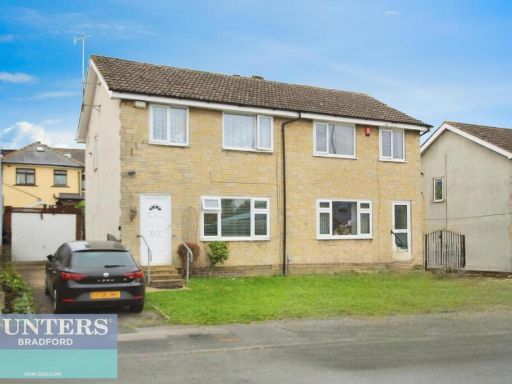 3 bedroom semi-detached house for sale in Farnham Road Bradford, West Yorkshire, BD7 3JE, BD7 — £160,000 • 3 bed • 1 bath • 731 ft²
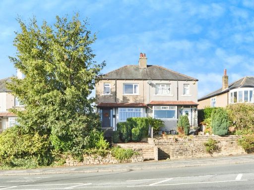 3 bedroom semi-detached house for sale in St. Annes Terrace, Baildon, Shipley, BD17 — £300,000 • 3 bed • 1 bath • 803 ft²
Meta
- {
"@context": "https://schema.org",
"@type": "Residence",
"name": "3 bedroom semidetached house for sale in Old Lane, Birkensh…",
"description": "",
"url": "https://propertypiper.co.uk/property/3772faf8-1b6b-4c90-9777-1a0484cbc805",
"image": "https://image-a.propertypiper.co.uk/6ec12d47-e101-49f2-8419-7f03c6c7c75f-1024.jpeg",
"address": {
"@type": "PostalAddress",
"streetAddress": "11 OLD LANE BIRKENSHAW BRADFORD",
"postalCode": "BD11 2LA",
"addressLocality": "Kirklees",
"addressRegion": "Batley and Spen",
"addressCountry": "England"
},
"geo": {
"@type": "GeoCoordinates",
"latitude": 53.74968912484328,
"longitude": -1.6868031463881736
},
"numberOfRooms": 3,
"numberOfBathroomsTotal": 1,
"floorSize": {
"@type": "QuantitativeValue",
"value": 1162,
"unitCode": "FTK"
},
"offers": {
"@type": "Offer",
"price": 225000,
"priceCurrency": "GBP",
"availability": "https://schema.org/InStock"
},
"additionalProperty": [
{
"@type": "PropertyValue",
"name": "Feature",
"value": "semi-detached"
},
{
"@type": "PropertyValue",
"name": "Feature",
"value": "driveway"
},
{
"@type": "PropertyValue",
"name": "Feature",
"value": "curb appeal"
},
{
"@type": "PropertyValue",
"name": "Feature",
"value": "renovated"
},
{
"@type": "PropertyValue",
"name": "Feature",
"value": "modern windows"
},
{
"@type": "PropertyValue",
"name": "Feature",
"value": "brickwork"
},
{
"@type": "PropertyValue",
"name": "Feature",
"value": "two-storey"
},
{
"@type": "PropertyValue",
"name": "Feature",
"value": "family home"
},
{
"@type": "PropertyValue",
"name": "Feature",
"value": "modern kitchen"
},
{
"@type": "PropertyValue",
"name": "Feature",
"value": "wooden floors"
},
{
"@type": "PropertyValue",
"name": "Feature",
"value": "wooden cabinets"
},
{
"@type": "PropertyValue",
"name": "Feature",
"value": "long countertop"
},
{
"@type": "PropertyValue",
"name": "Feature",
"value": "bright lighting"
},
{
"@type": "PropertyValue",
"name": "Feature",
"value": "pendant lights"
},
{
"@type": "PropertyValue",
"name": "Feature",
"value": "white tiles"
},
{
"@type": "PropertyValue",
"name": "Feature",
"value": "up-to-date"
}
]
}
High Res Floorplan Images
Compatible Floorplan Images
FloorplanImages Thumbnail