SW11 8NN - 3 bedroom apartment for sale in Howard Building, 368 Queens…
View on Property Piper
3 bedroom apartment for sale in Howard Building, 368 Queenstown Road, London, SW11
Property Details
- Price: £2950000
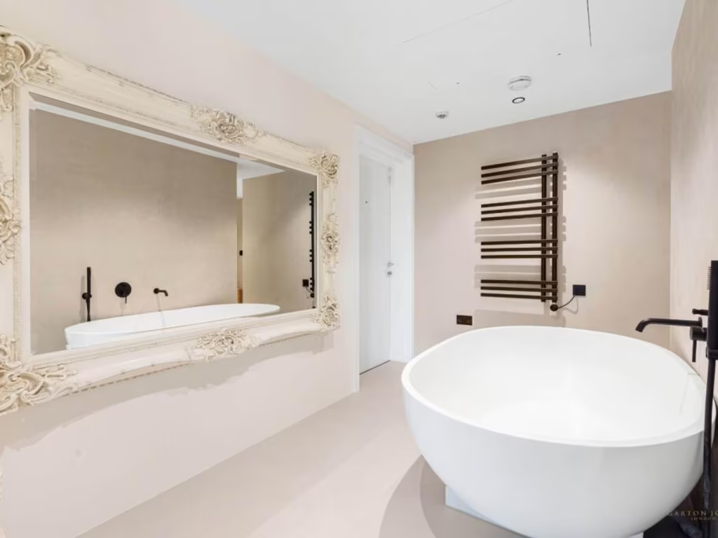
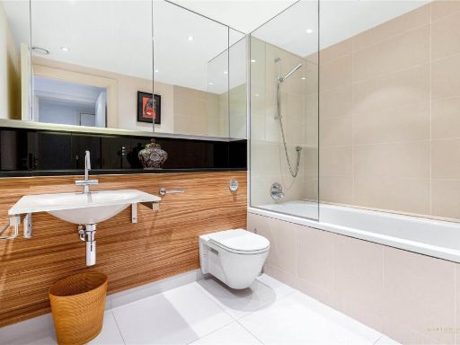
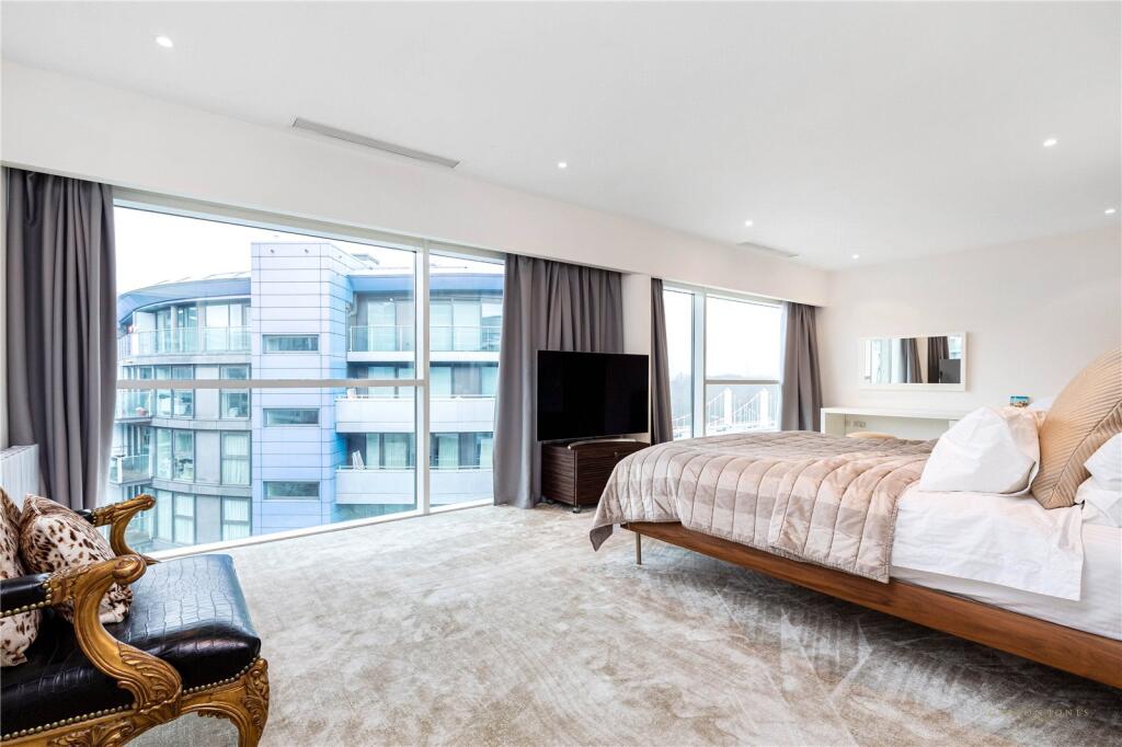
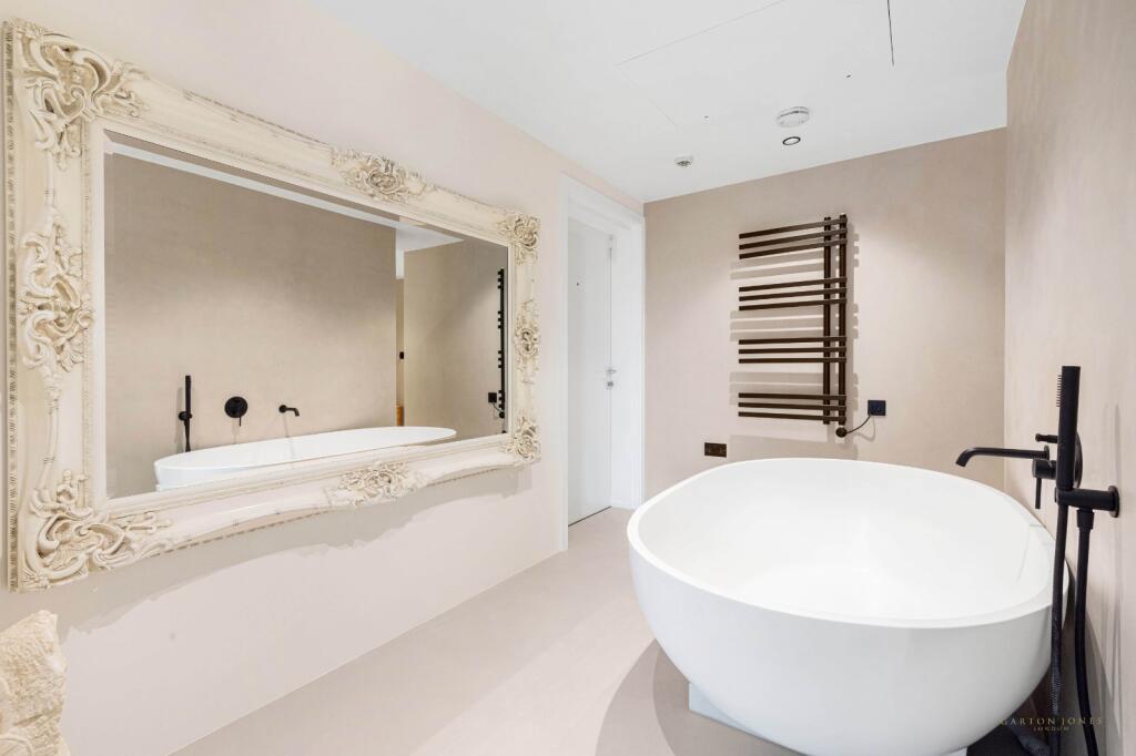
- Bedrooms: 3
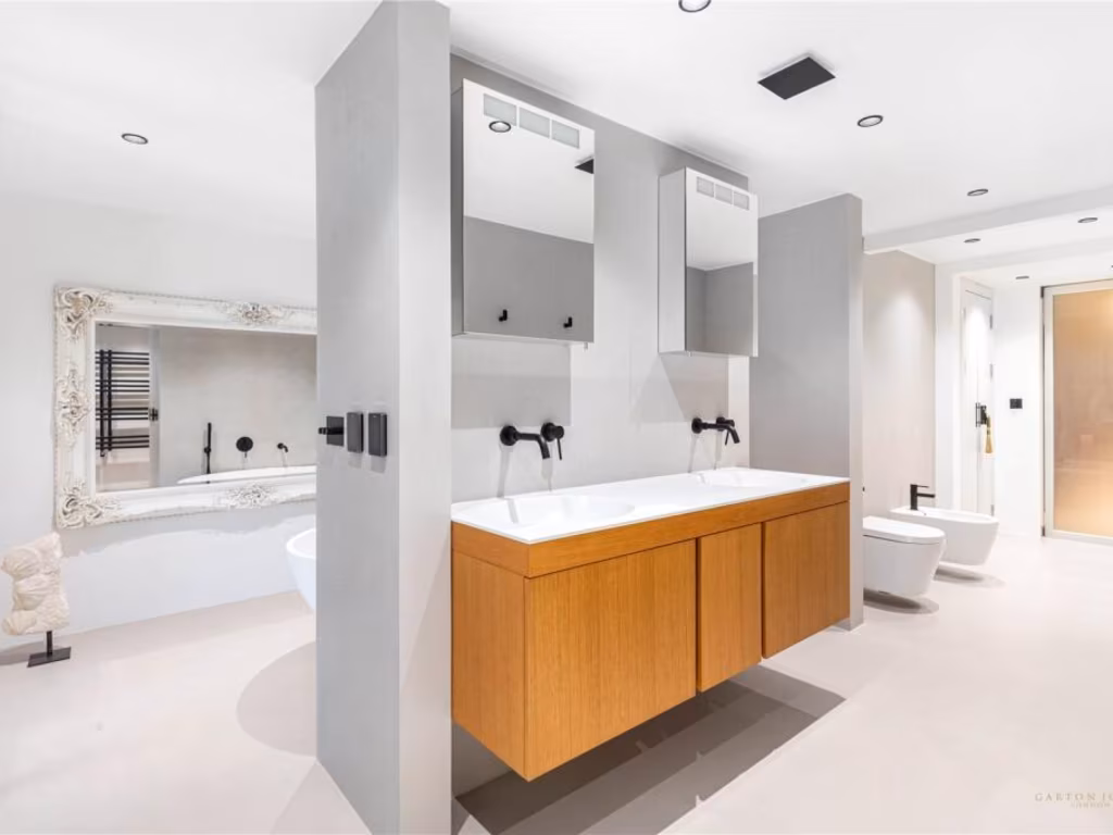
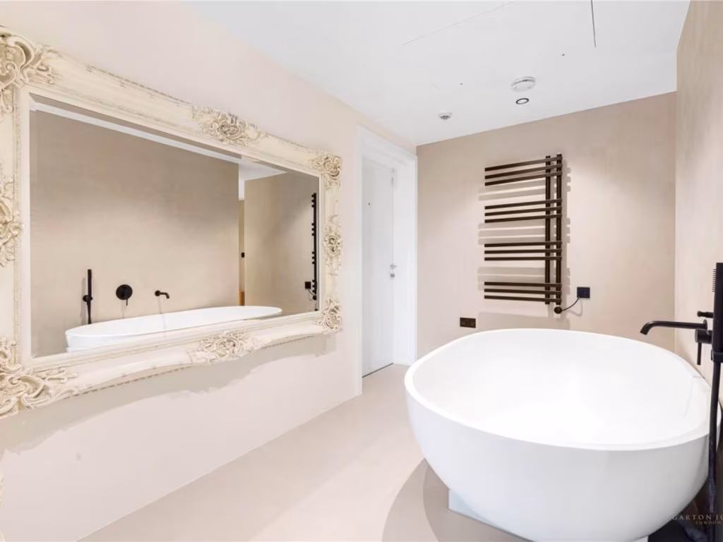
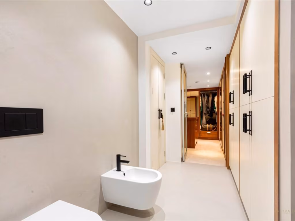
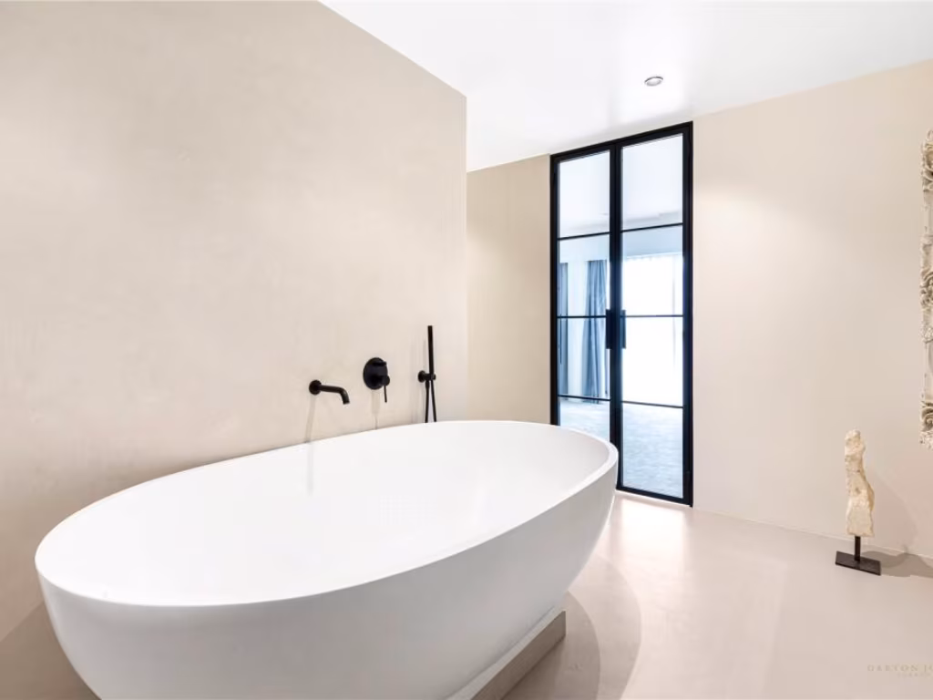
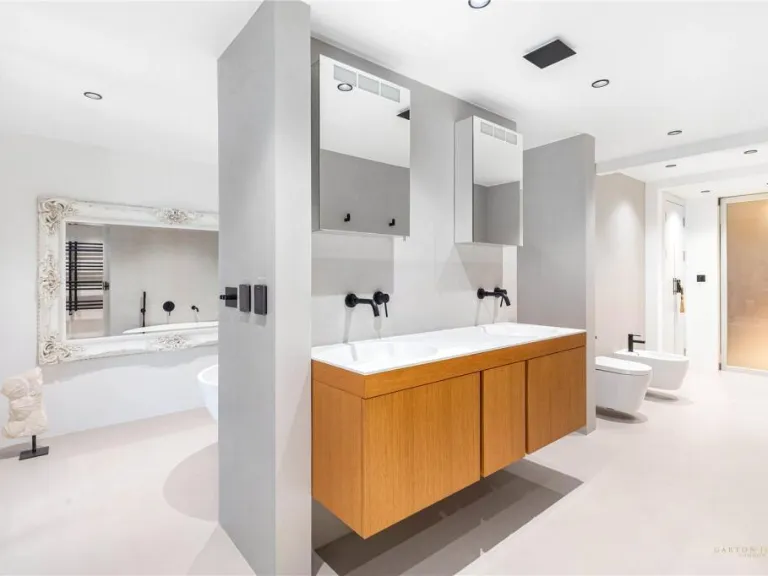
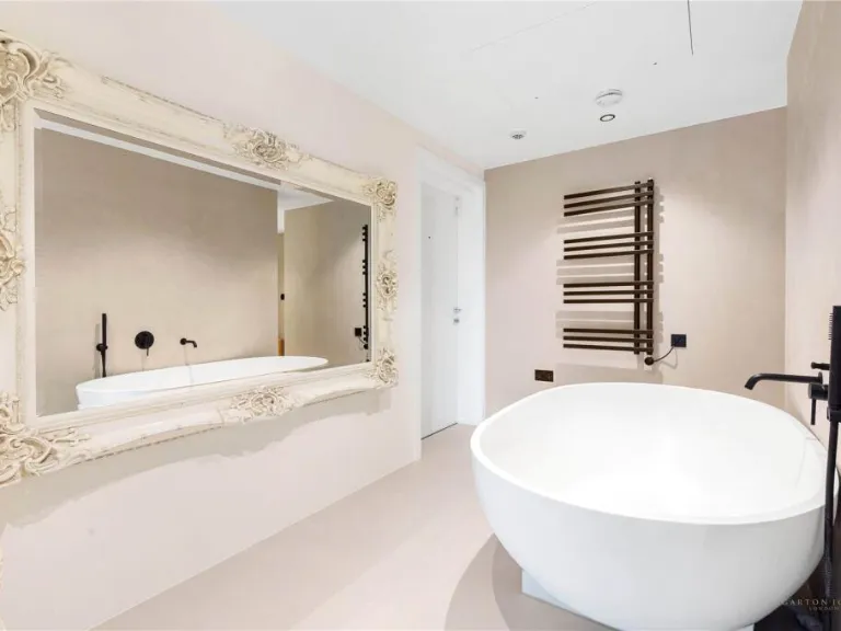
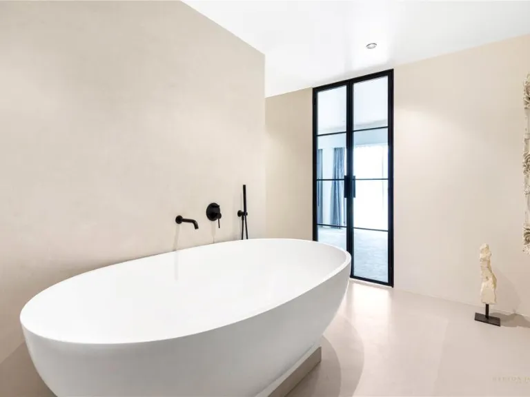
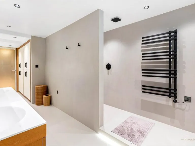
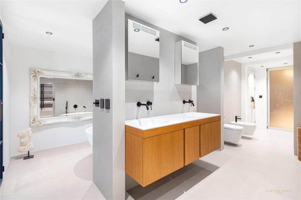
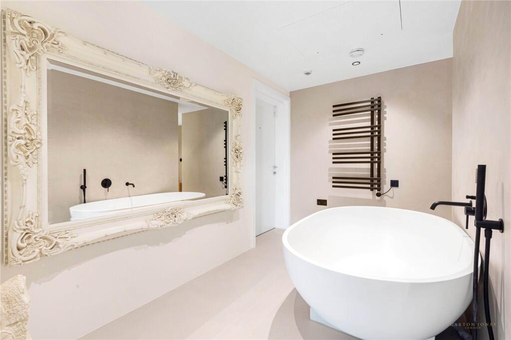
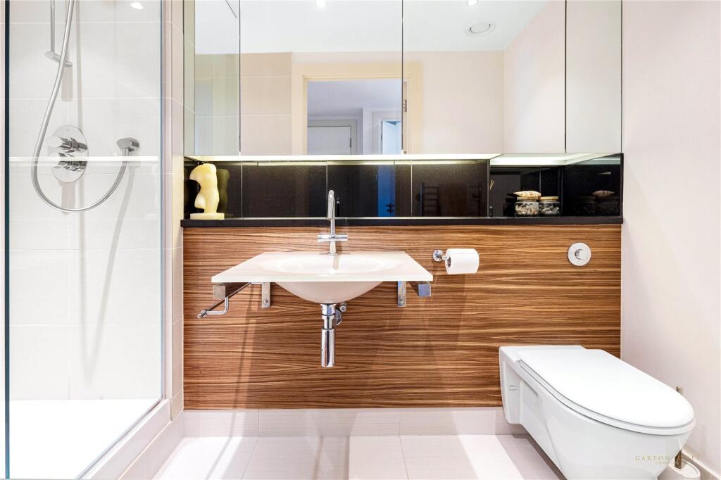
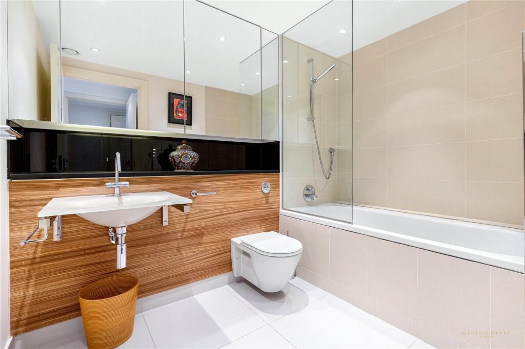
- Bathrooms: 3
- Property Type: undefined
- Property SubType: undefined
Image Descriptions
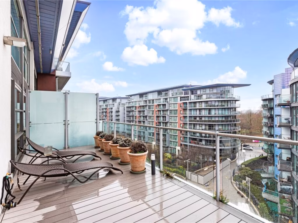
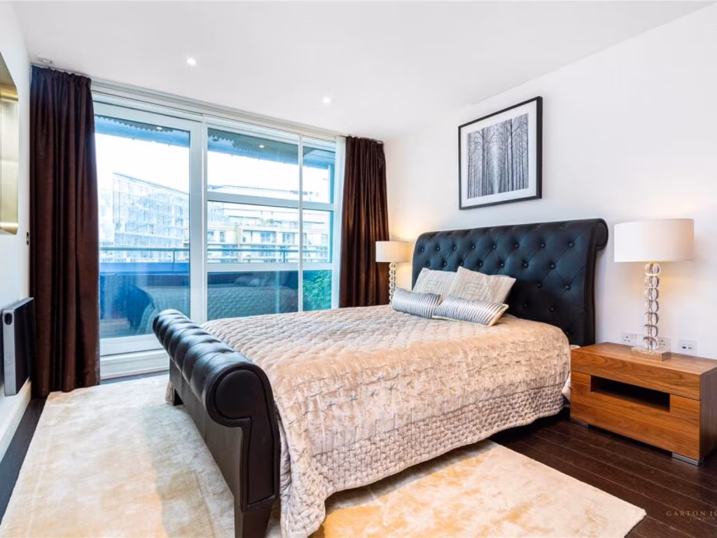
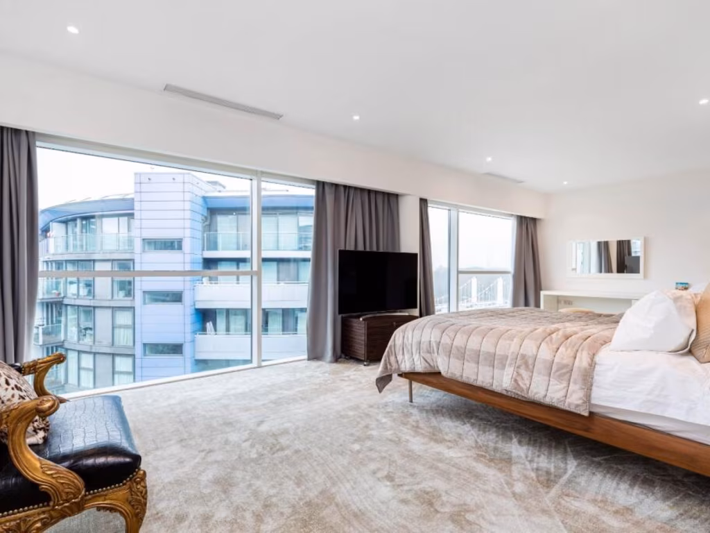
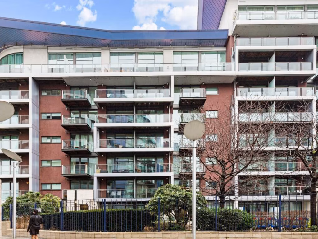
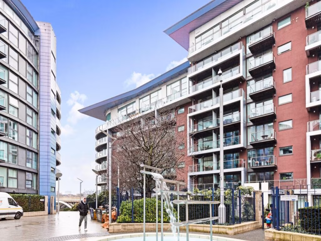
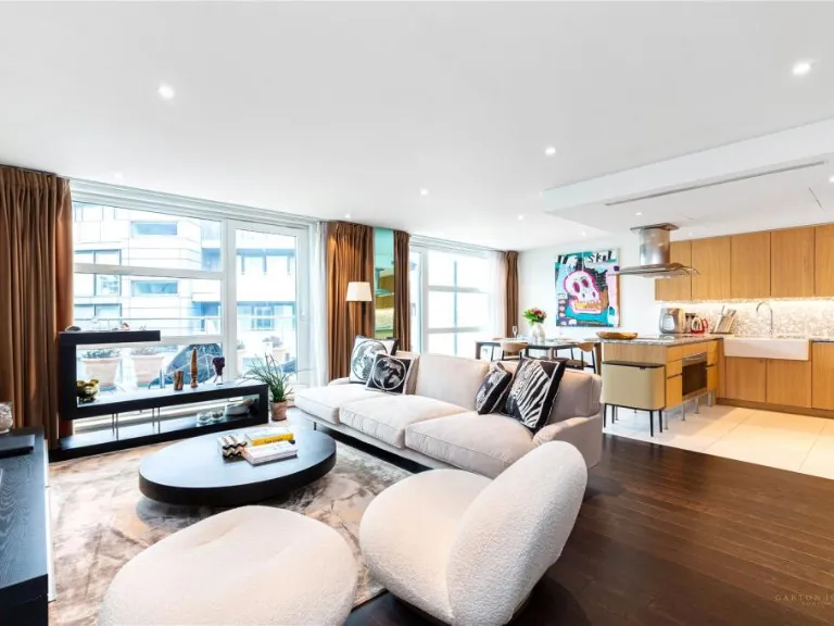
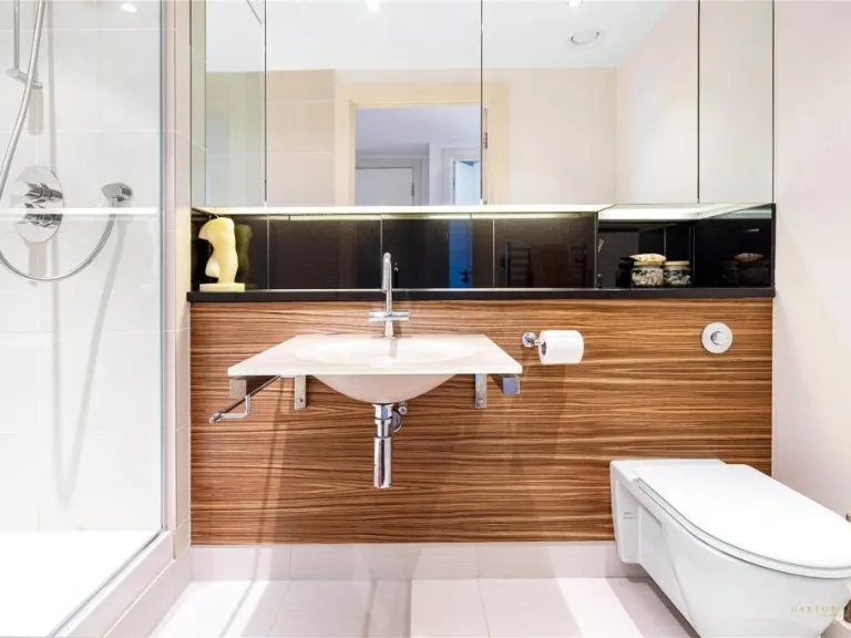
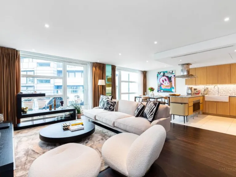
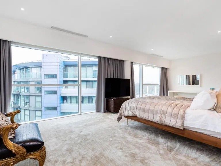
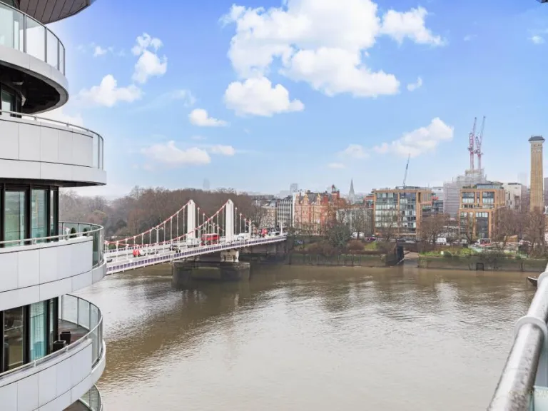
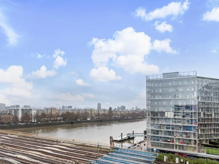
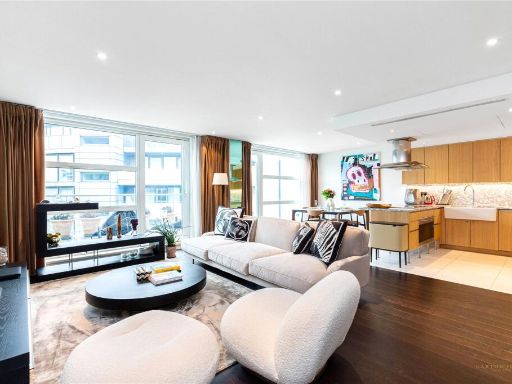
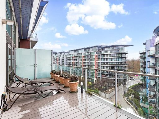
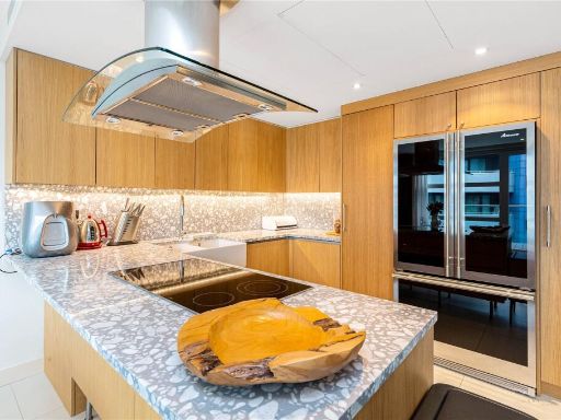
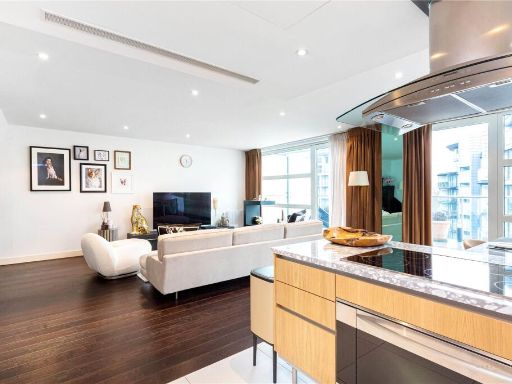
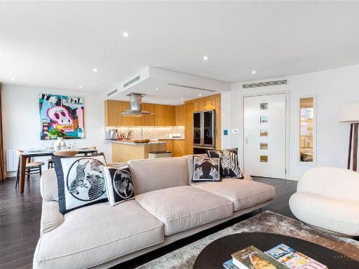
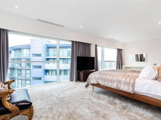
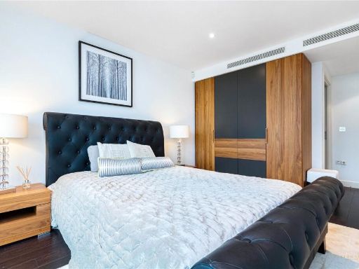
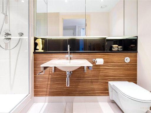
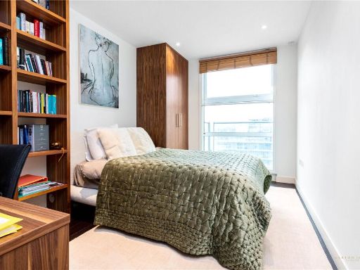
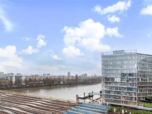
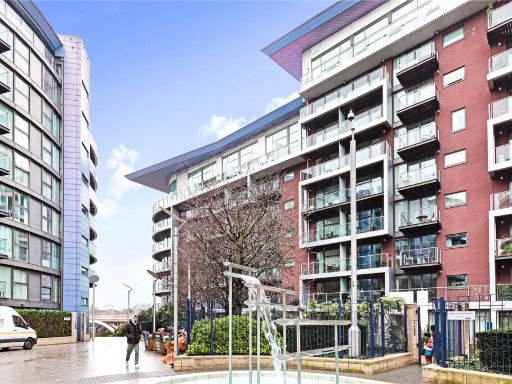
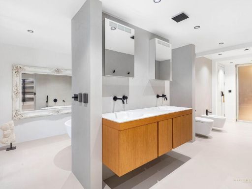
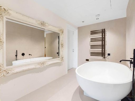
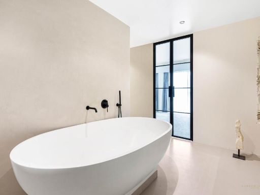
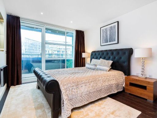
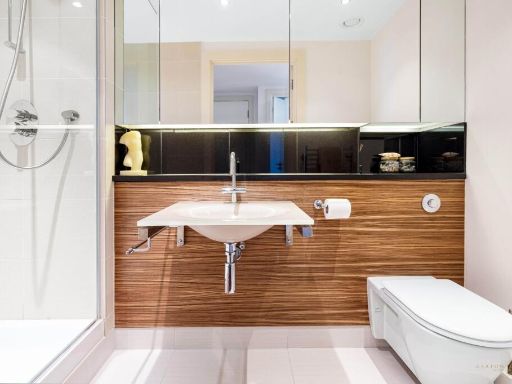
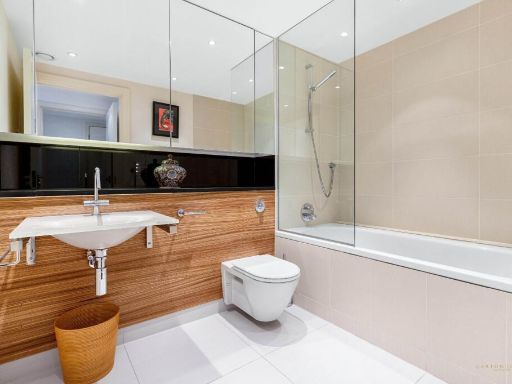
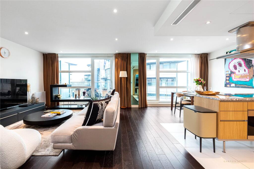
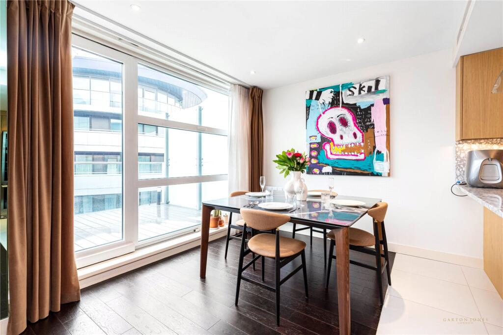
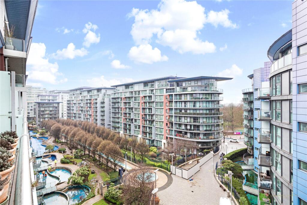
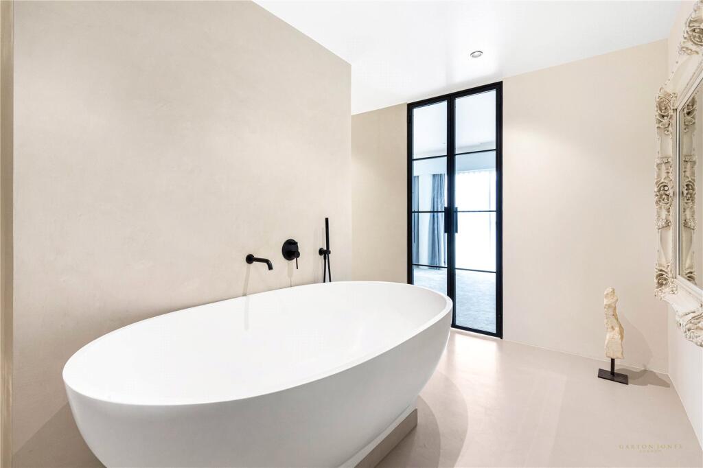
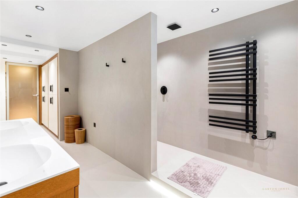
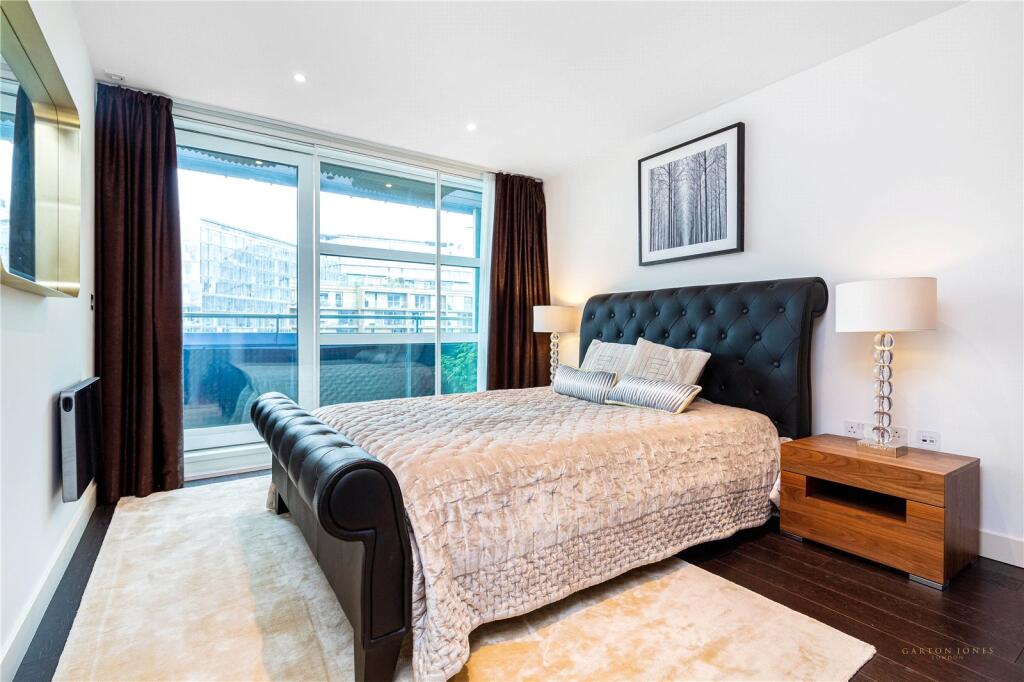
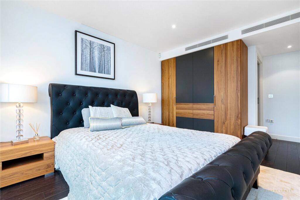
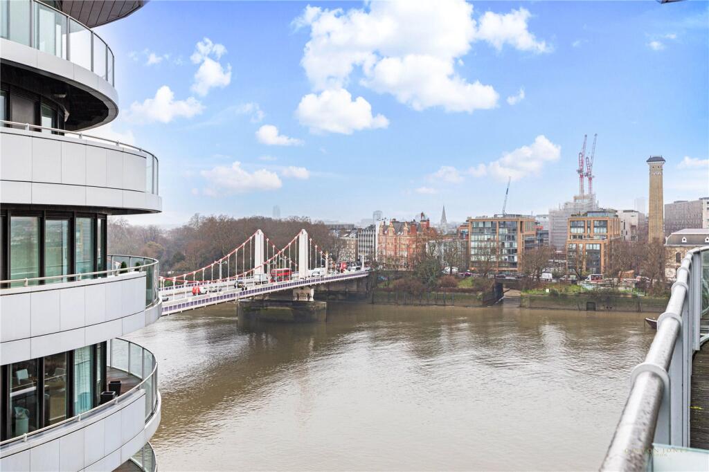
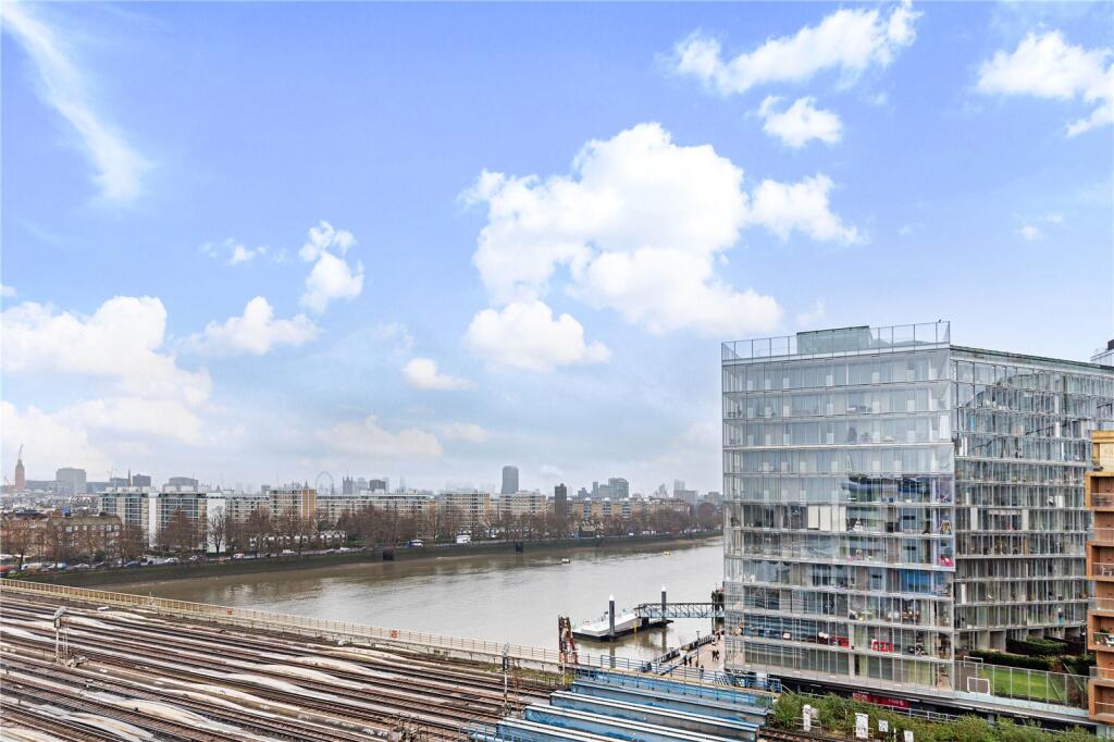
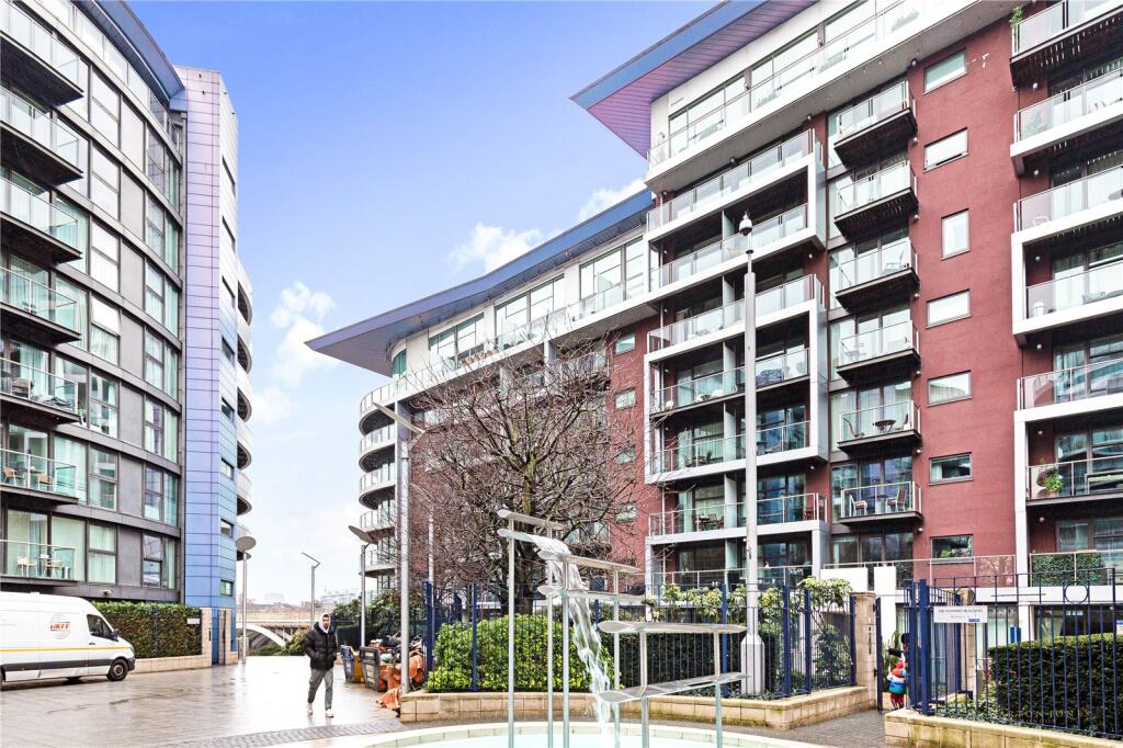
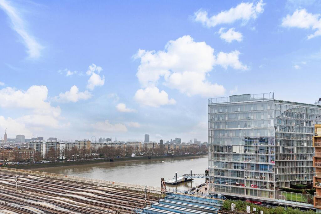
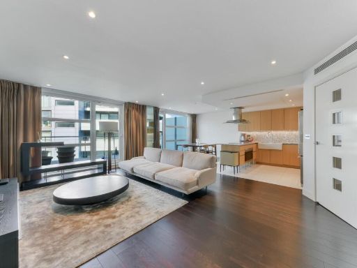
- contemporary
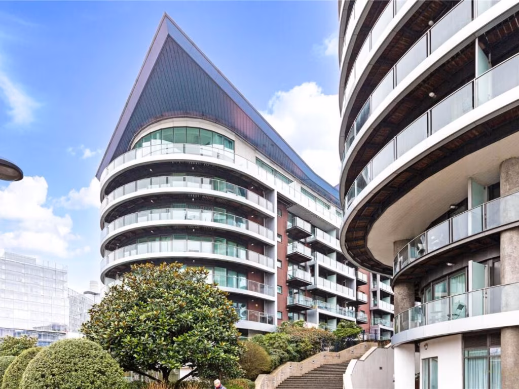
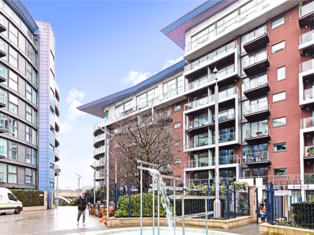
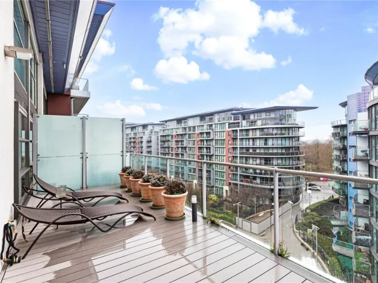
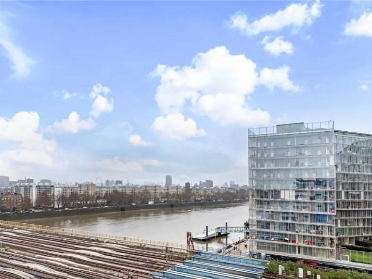
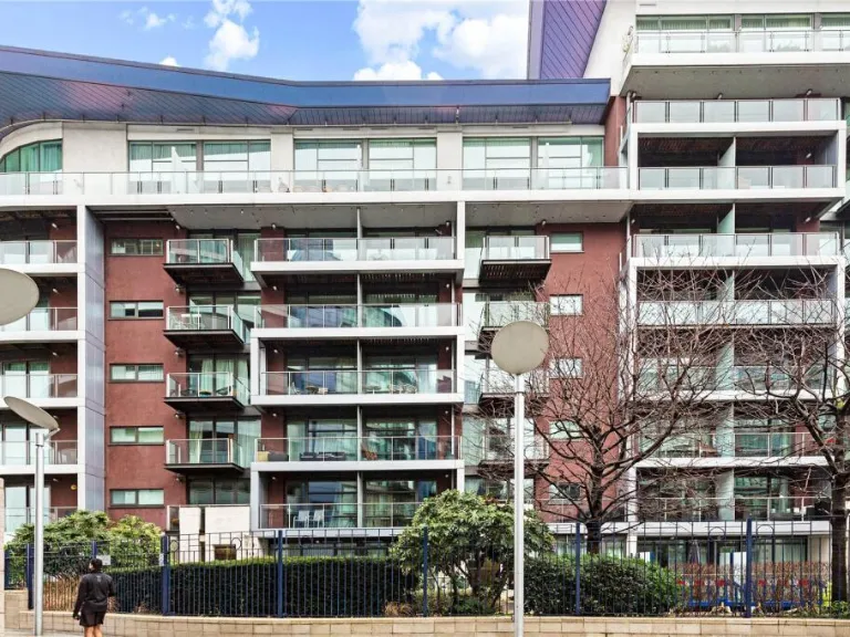
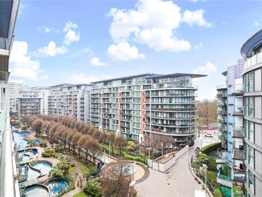
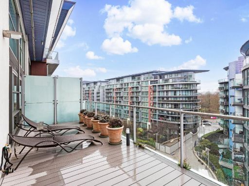
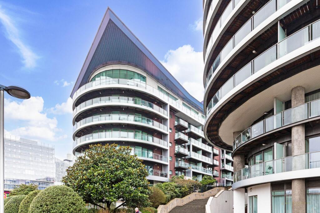
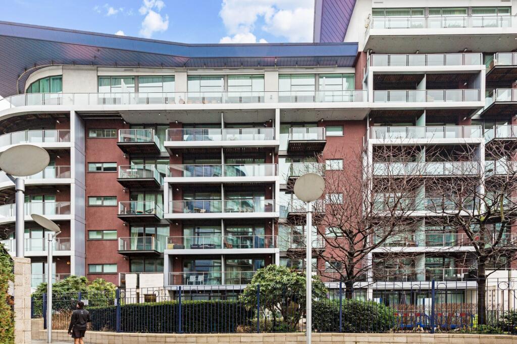
- apartment balcony modern
Floorplan Description
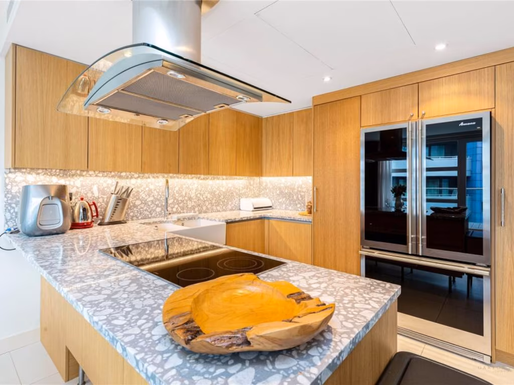
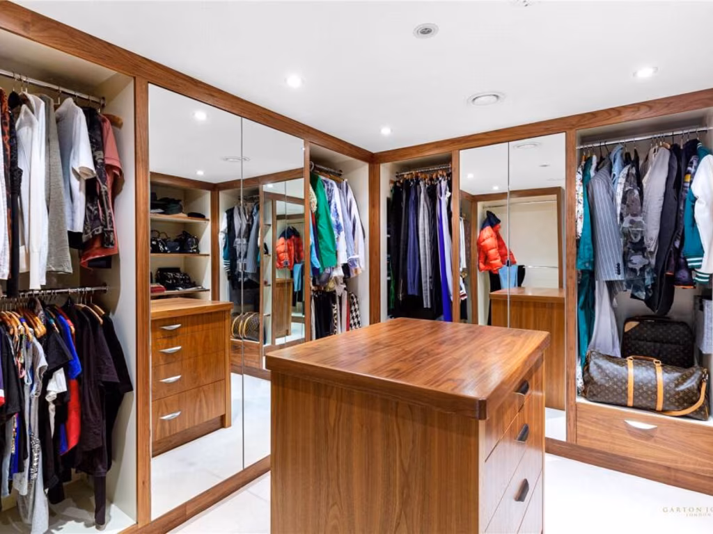
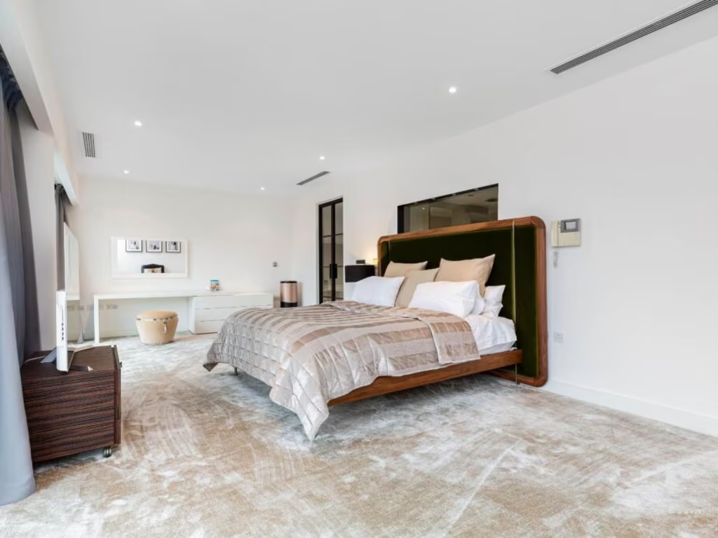
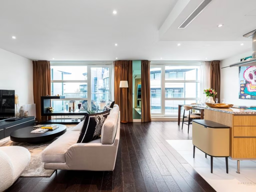
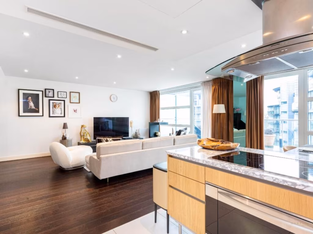
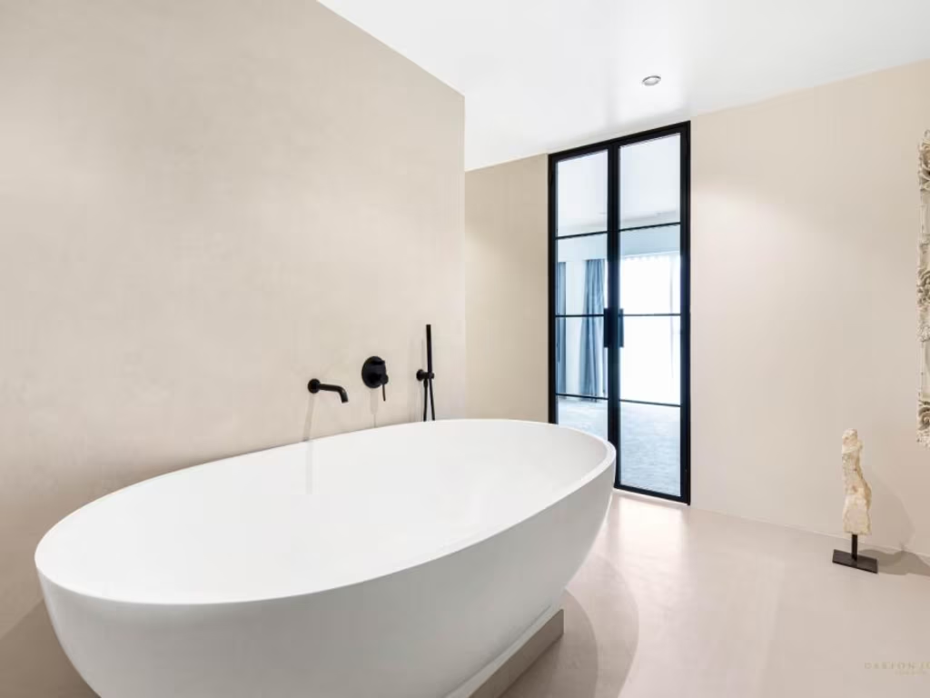
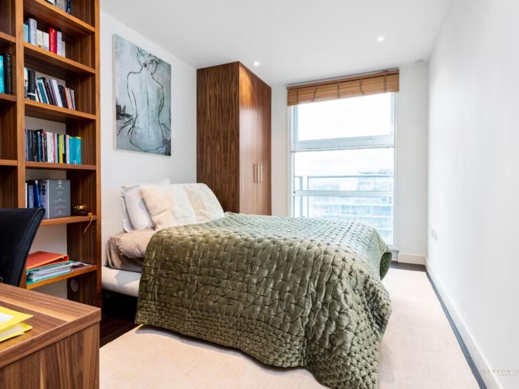
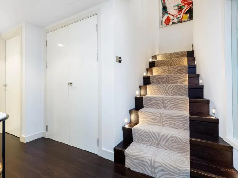
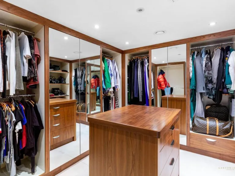
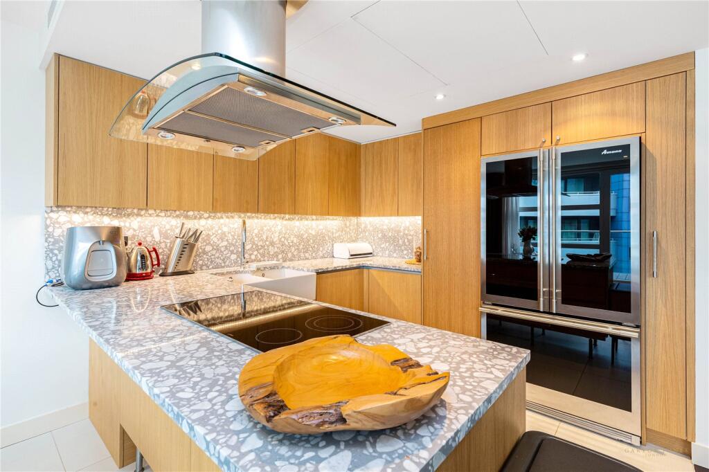
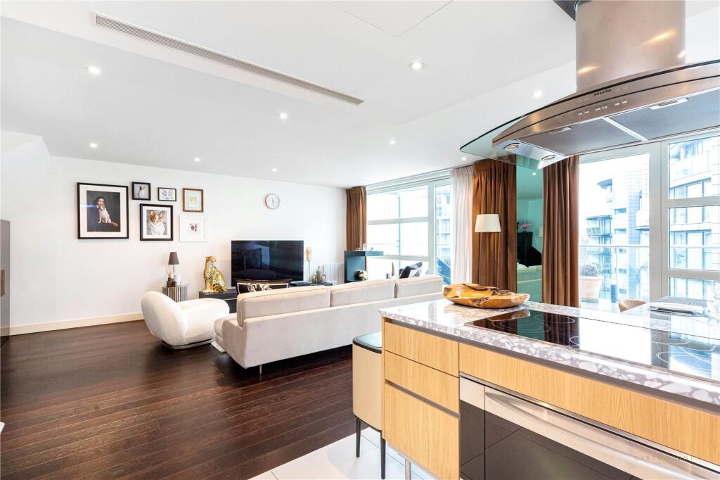
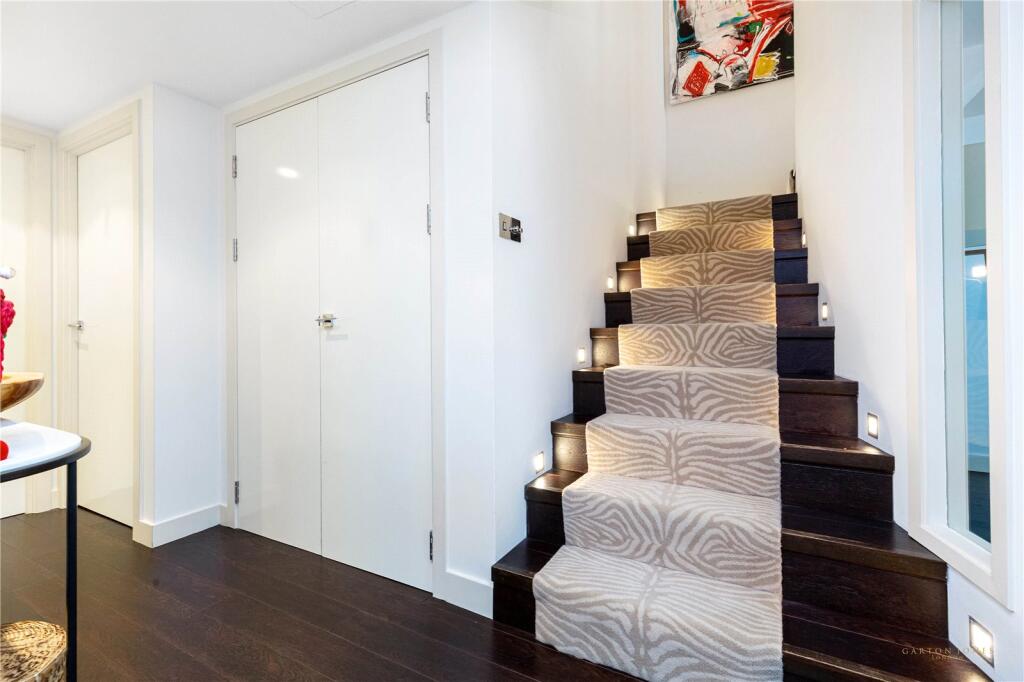
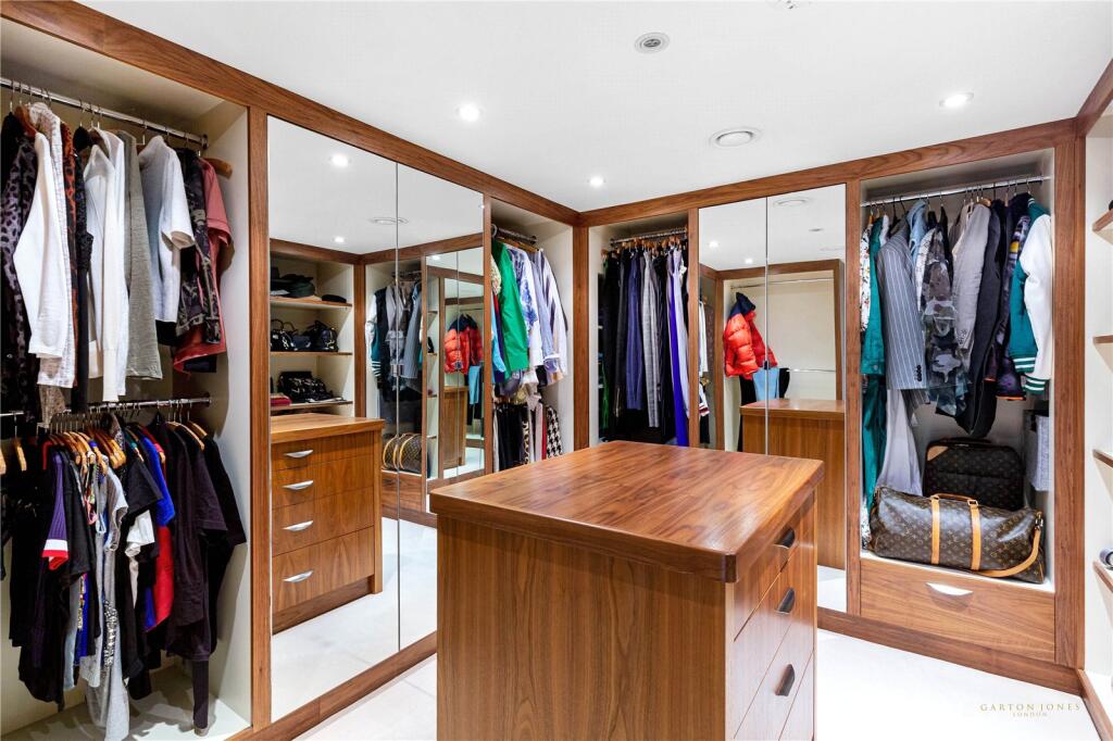
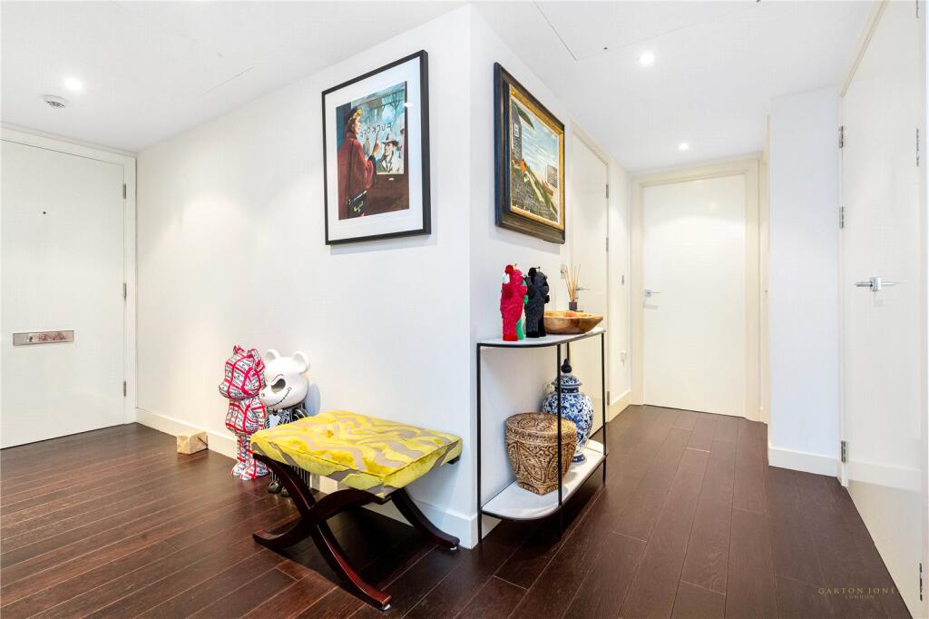
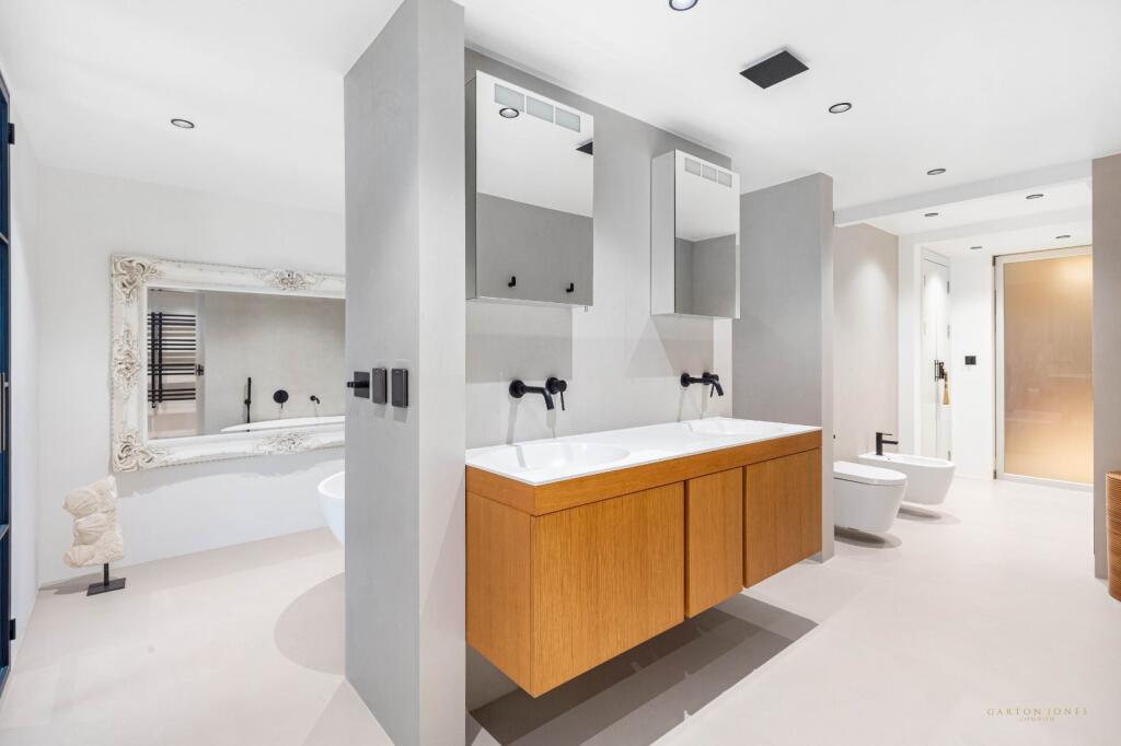
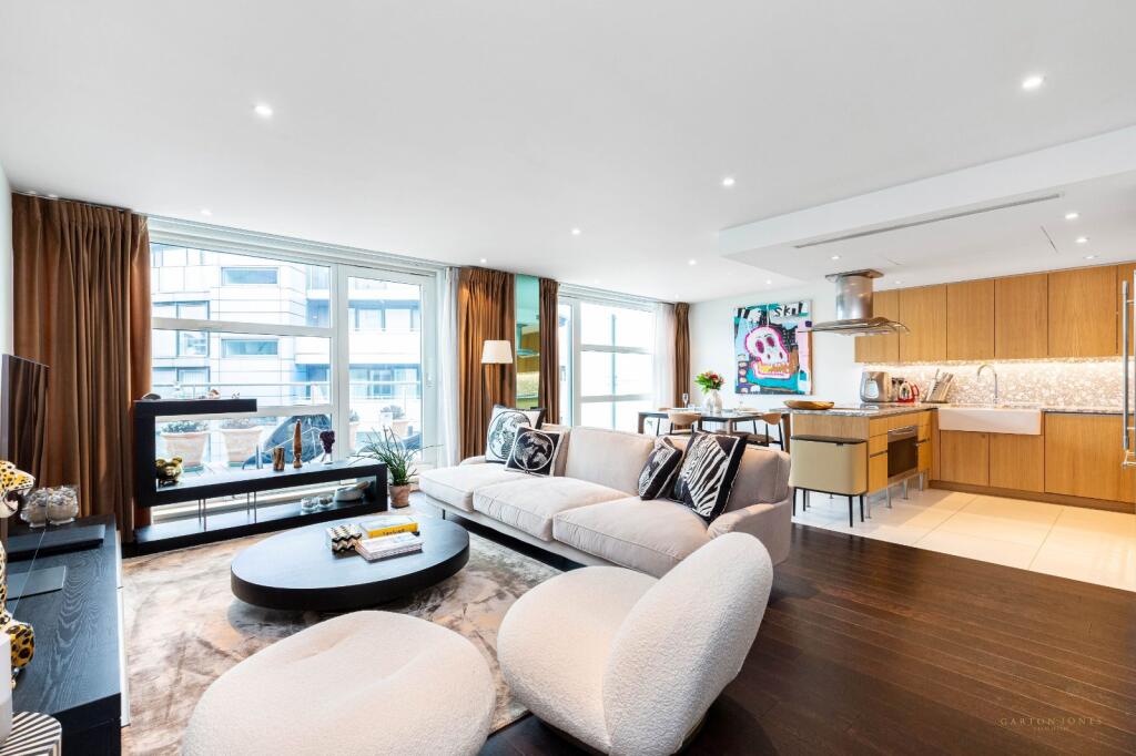
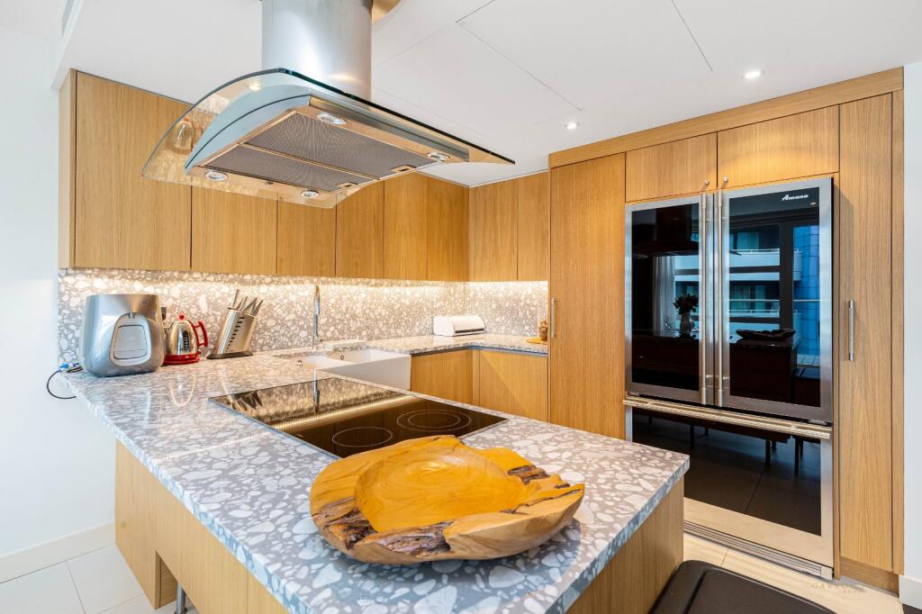
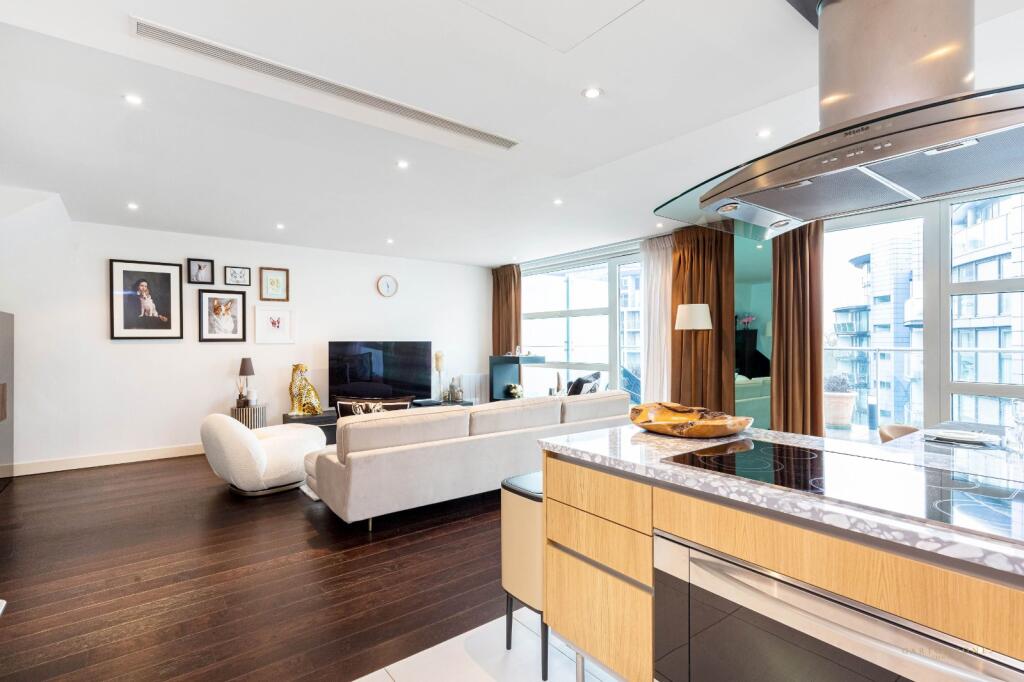
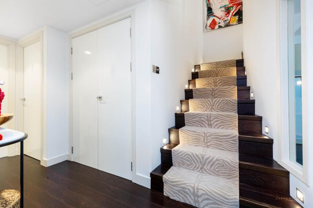
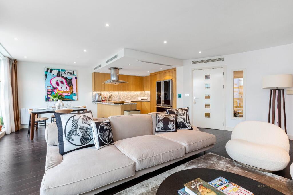
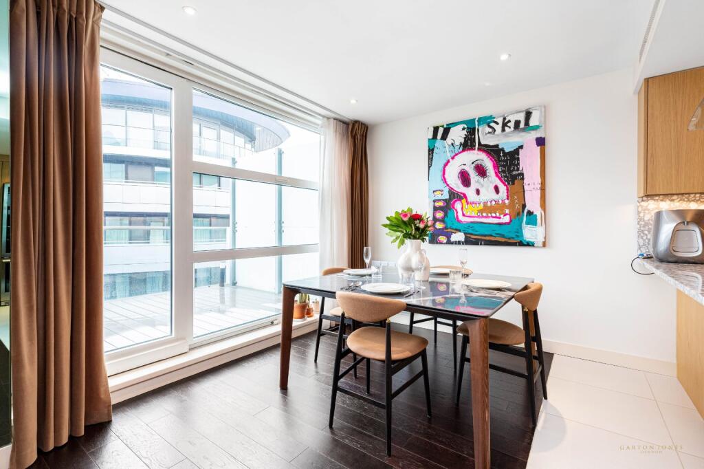
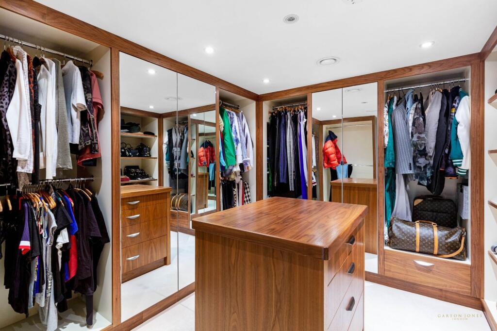
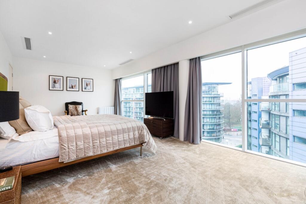
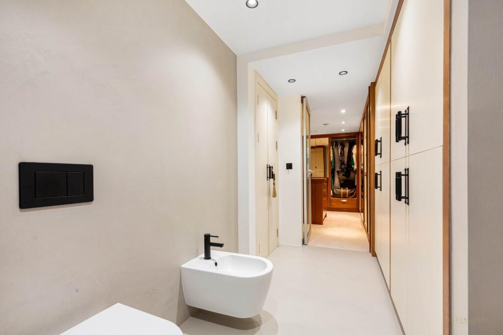
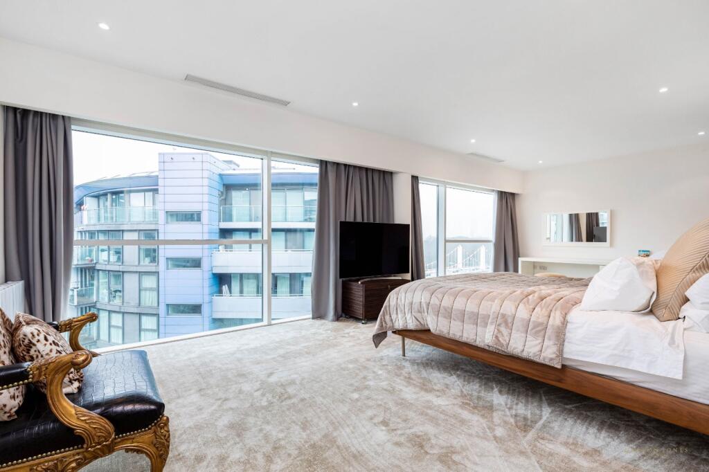
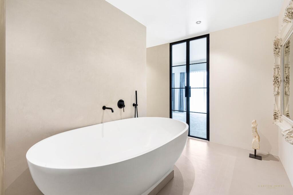
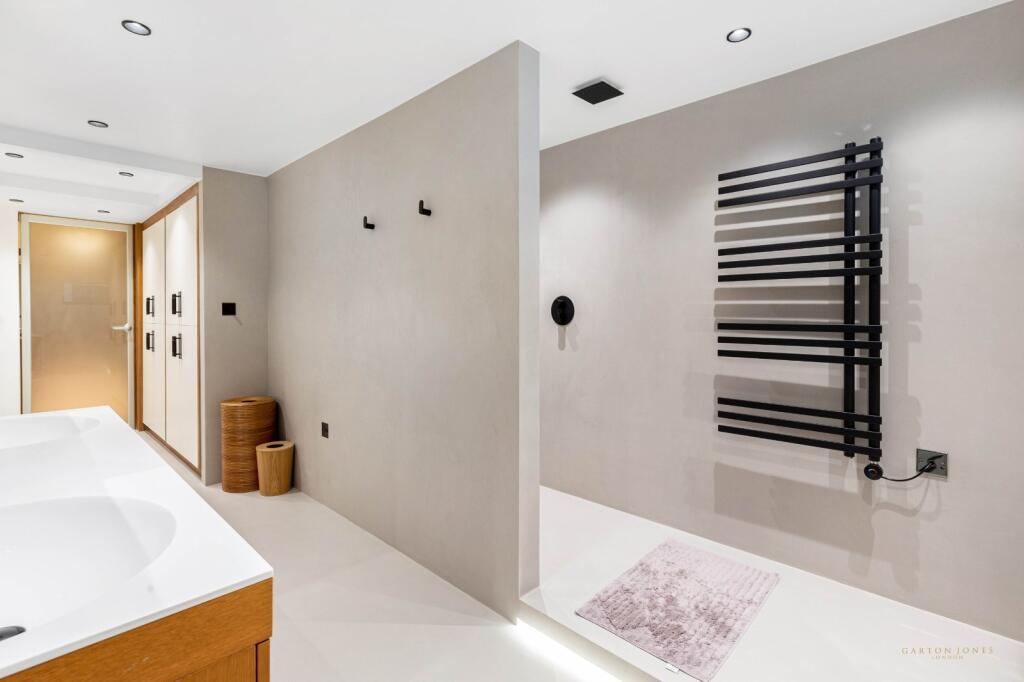
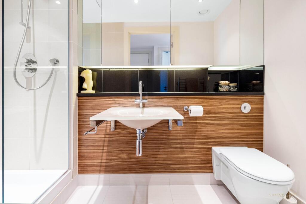
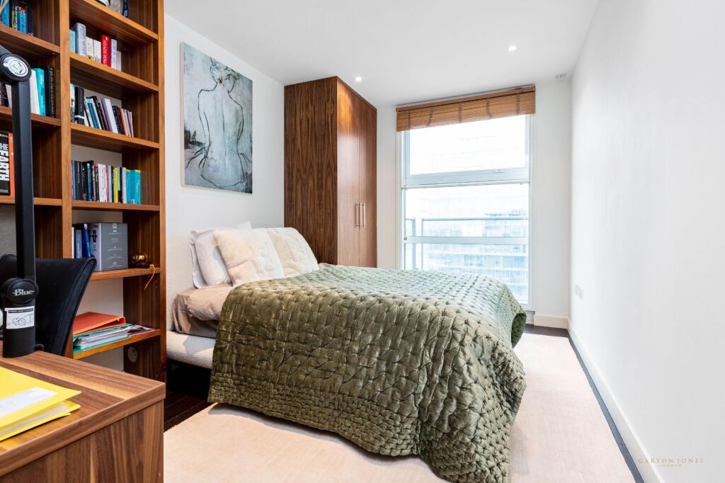
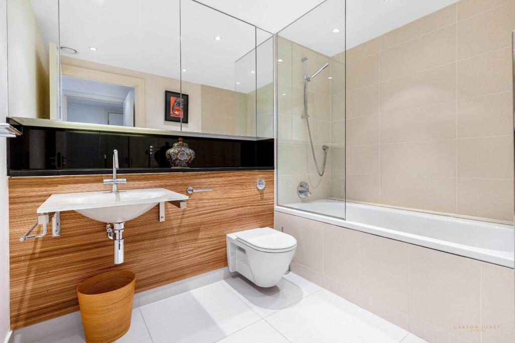
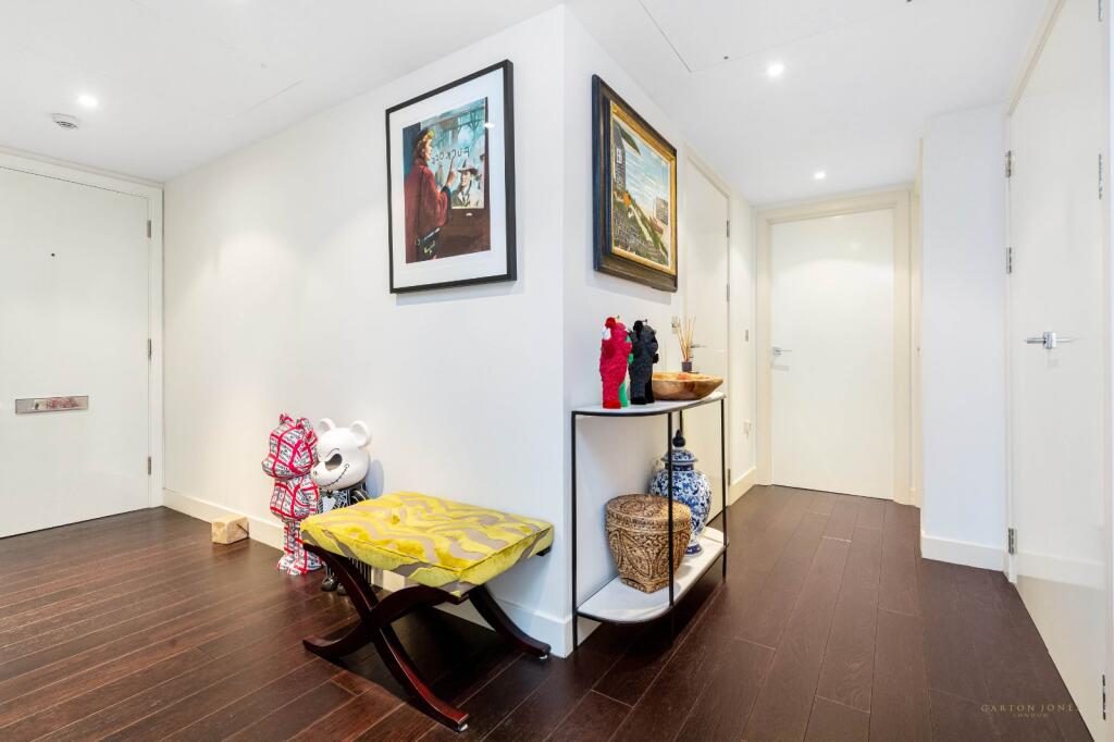
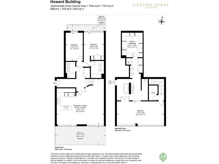
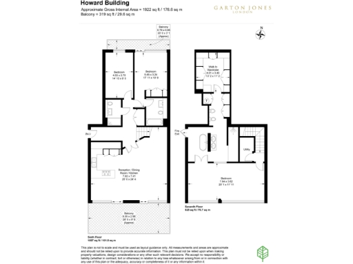
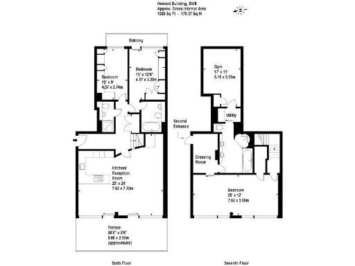
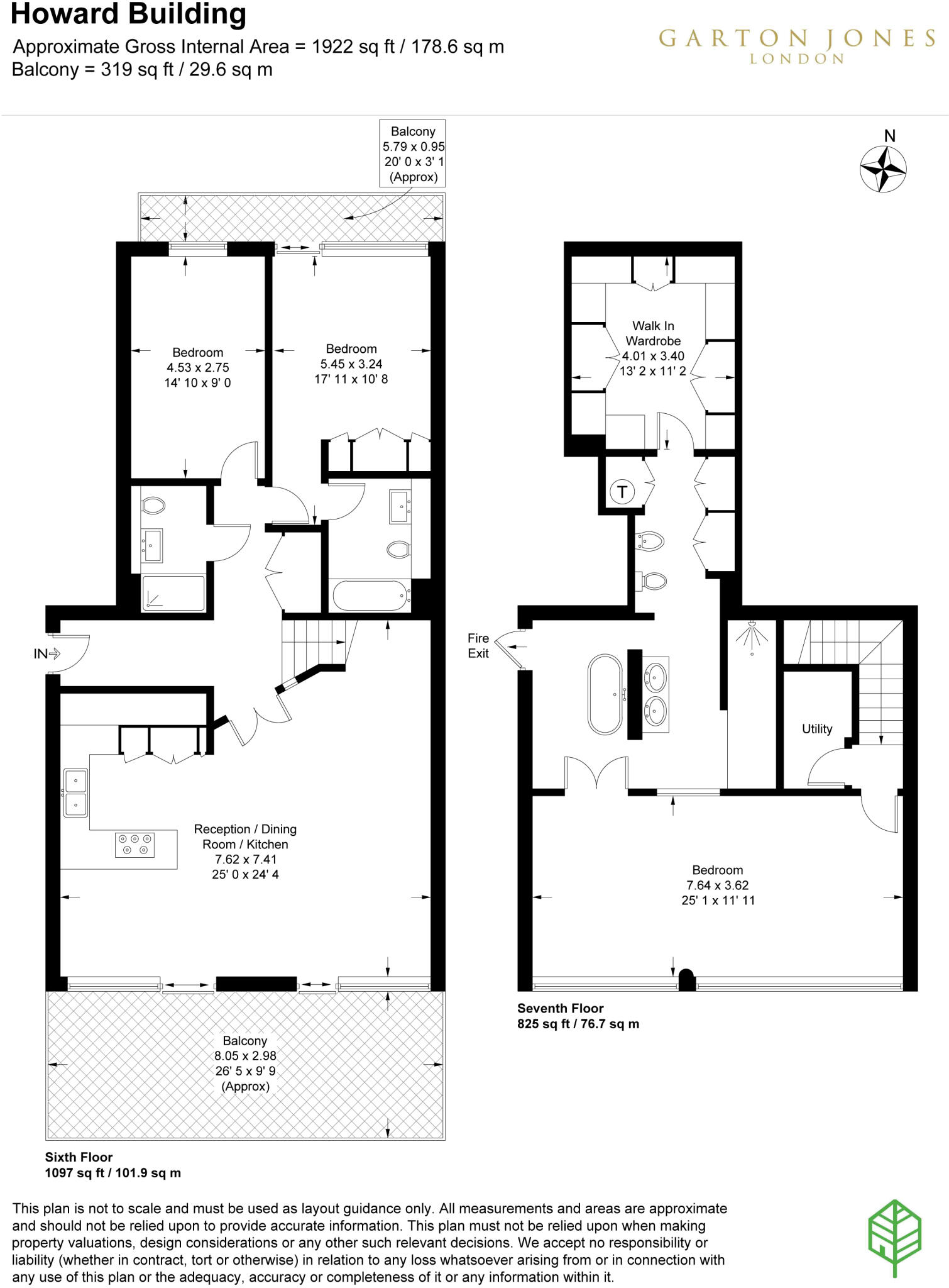
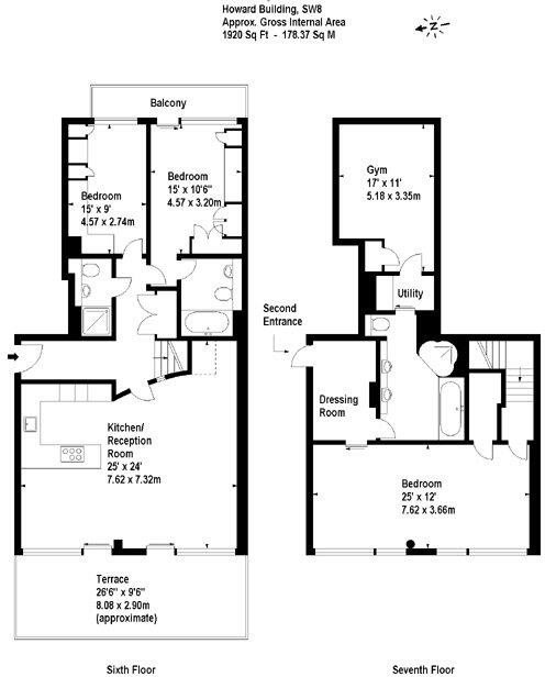
- A multi-story apartment with three bedrooms, a large reception/dining/kitchen area, and a walk-in wardrobe.
- A contemporary split-level apartment with 3 bedrooms, a gym, and a large kitchen/reception area.
Rooms
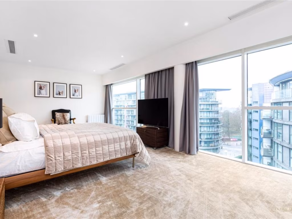
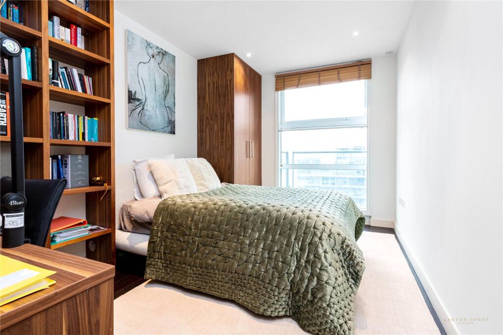
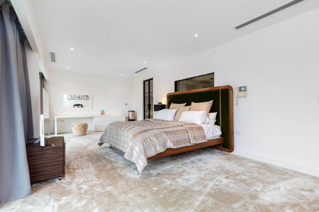
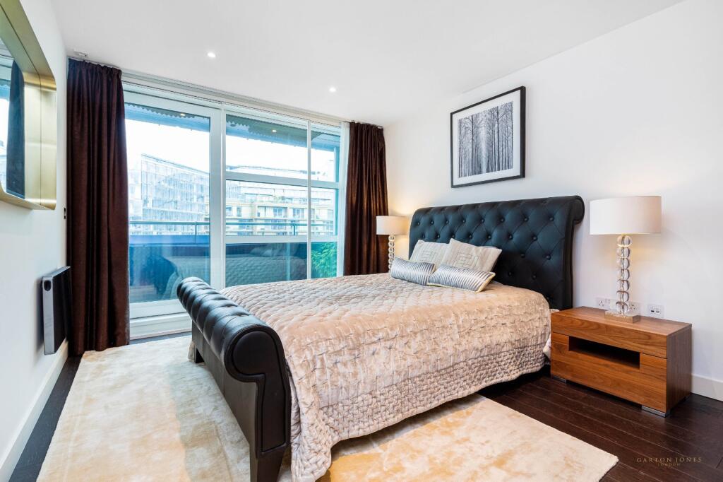
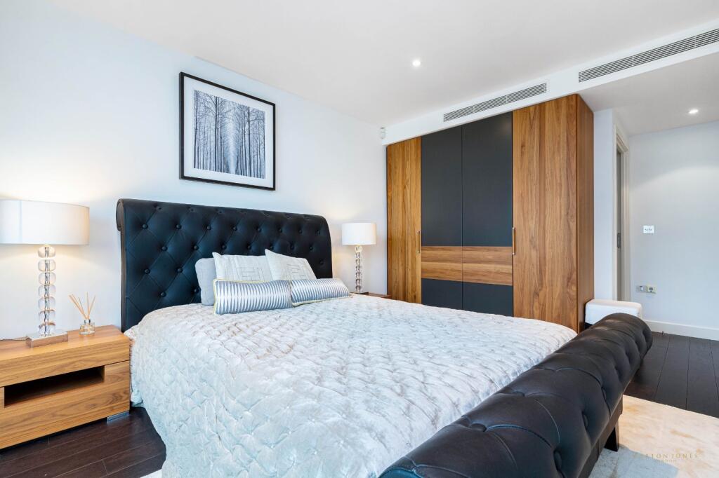
- Bedroom: Small
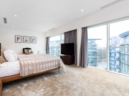
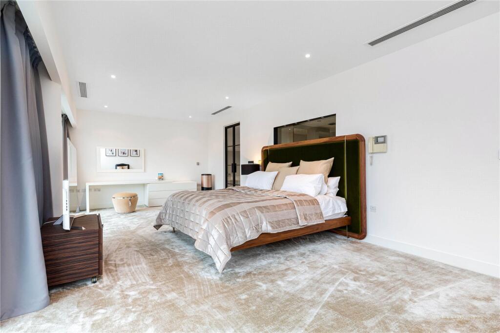
- Bedroom: Large
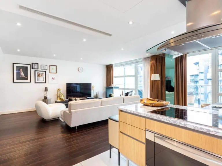
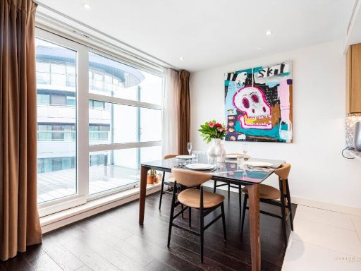
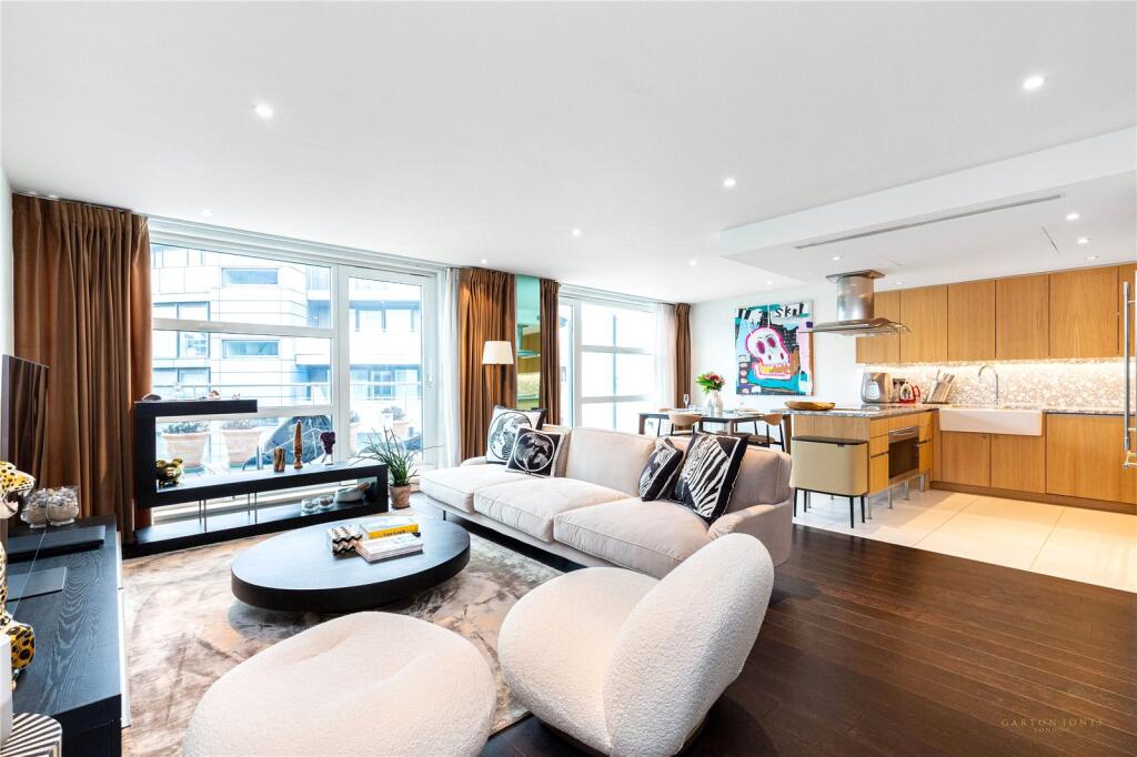
- Reception/Dining Room/Kitchen: Very Large
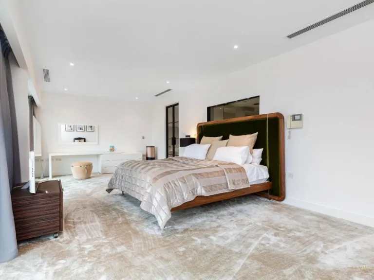
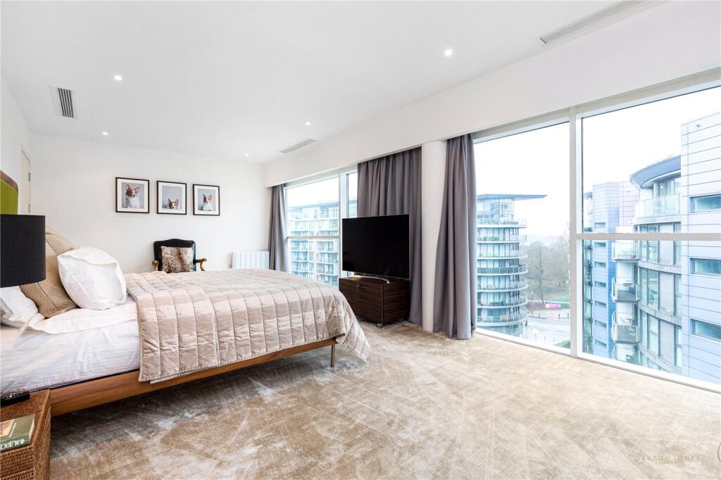
- Bedroom: Very Large
- Walk In Wardrobe: Average
- Bedroom:
- Bedroom:
- Kitchen/Reception Room:
- Gym:
- Bedroom:
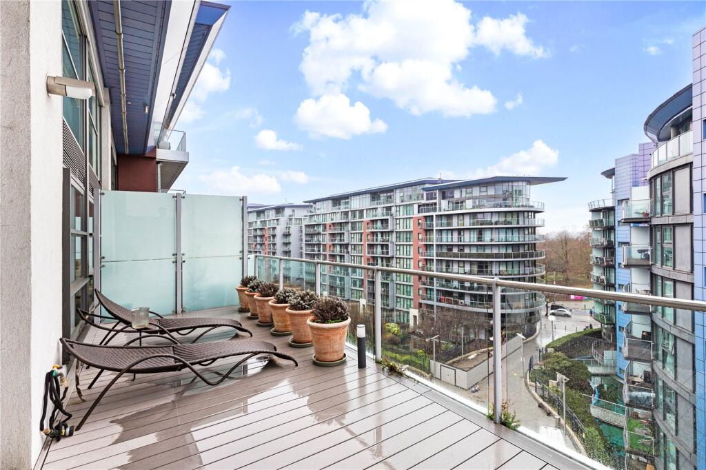
- Terrace:
Textual Property Features
Detected Visual Features
- contemporary
- modern
- open-plan
- large windows
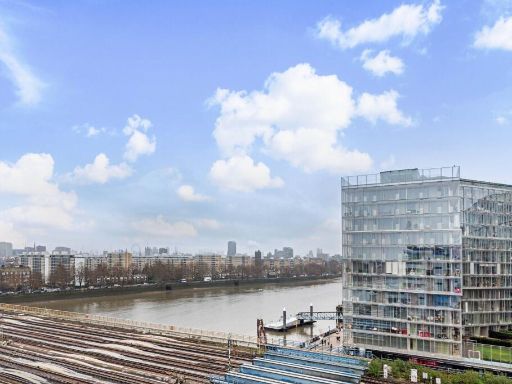
- natural light
- city view
- apartment
- balcony
- urban view
- glass railing
- decking
- contemporary architecture
- city living
EPC Details
- Fully double glazed
- System built, as built, insulated (assumed)
- Air source heat pump, warm air, electric
- No low energy lighting
- (another dwelling below)
Nearby Schools
- St Mary's RC Voluntary Aided Primary School
- Eaton Square Prep School
- Holy Trinity CofE Primary School
- Sussex House School
- Burdett-Coutts and Townshend Foundation CofE Primary School
- Shaftesbury Park Primary School
- John Burns Primary School
- Heathbrook Primary School
- St George's CofE Primary School
- Newton Preparatory School
- St Gabriel's CofE Primary School
- Pimlico Primary
- St Barnabas' CofE Primary School
- Francis Holland School
- St Joseph's Catholic Primary School
- St Vincent De Paul Catholic Primary School
- More House School
- Harris Academy Battersea
- Christ Church CofE Primary School
- Garden House School
- Eaton House School
- St Peter's Eaton Square CofE Primary School
- Westminster City School
- Chesterton Primary School
- Griffin Primary School
- Pimlico Academy
- Westminster Under School
- Westminster Cathedral Choir School
Nearest Bars And Restaurants
- Id: 9846743610
- Tags:
- Amenity: restaurant
- Cuisine: indonesian
- Name: Roti King
- TagsNormalized:
- Lat: 51.4826435
- Lon: -0.1469994
- FullGeoHash: gcpuushunsm6
- PartitionGeoHash: gcpu
- Images:
- FoodStandards: null
- Distance: 83.2
,- Id: 6345003063
- Tags:
- Addr:
- City: London
- Housenumber: 2
- Postcode: SW11 8AB
- Street: Arches Lane
- Amenity: restaurant
- Cuisine: pizza
- Name: Street Pizza Gordon Ramsay
- Opening_hours: Mo-Sa 12:00-22:00, Su 12:00-20:00
- Outdoor_seating: yes
- Phone: +44 20 7592 1225
- Website: https://www.gordonramsayrestaurants.com/street-pizza
- TagsNormalized:
- Lat: 51.4832766
- Lon: -0.1470715
- FullGeoHash: gcpuushzufre
- PartitionGeoHash: gcpu
- Images:
- FoodStandards: null
- Distance: 79.9
,- Id: 6345003065
- Tags:
- Addr:
- City: London
- Housenumber: 12-14
- Postcode: SW11 8AB
- Street: Arches Lane
- Amenity: pub
- Microbrewery: yes
- Name: Battersea Brewery
- Opening_hours: Mo-Th 12:00-23:00; Fr-Sa 12:00-24:00; Su 12:00-23:00
- Outdoor_seating: yes
- Phone: +44 20 8161 2366
- Website: https://batterseabrew.co.uk
- TagsNormalized:
- Lat: 51.4828518
- Lon: -0.147044
- FullGeoHash: gcpuushvmehj
- PartitionGeoHash: gcpu
- Images:
- FoodStandards: null
- Distance: 73.7
,- Id: 6345003066
- Tags:
- Addr:
- City: London
- Housenumber: 4
- Postcode: SW11 8AB
- Street: Arches Lane
- Amenity: restaurant
- Cuisine: indian
- Fhrs:
- Name: Cinnamon Kitchen Battersea
- Opening_hours: Mo-Su 11:30-23:00
- Phone: +44 20 3955 5480
- Website: https://cinnamon-kitchen.com
- TagsNormalized:
- Lat: 51.4830903
- Lon: -0.1470655
- FullGeoHash: gcpuushytpsh
- PartitionGeoHash: gcpu
- Images:
- FoodStandards: null
- Distance: 73.2
,- Id: 6345003064
- Tags:
- Addr:
- City: London
- Housenumber: 6
- Postcode: SW11 8AB
- Street: Arches Lane
- Amenity: restaurant
- Cuisine: japanese
- Name: Tonkotsu Ramen Bar
- Outdoor_seating: yes
- Phone: +44 20 7720 7695
- Website: https://tonkotsu.co.uk
- TagsNormalized:
- Lat: 51.4829699
- Lon: -0.1470724
- FullGeoHash: gcpuushyhcnv
- PartitionGeoHash: gcpu
- Images:
- FoodStandards: null
- Distance: 71
}
Nearest General Shops
- Id: 6344914483
- Tags:
- Addr:
- City: London
- Housenumber: 9-10
- Postcode: SW11 8EZ
- Street: Circus Road West
- Alt_website: https://www.nisalocally.co.uk/stores/greater-london/london/units-9-&-10-circus-rd-west
- Contact:
- Facebook: https://www.facebook.com/TBGeneralStore/
- Instagram: TBGeneralStore
- Twitter: TBGeneralStore
- Email: info@thebatterseageneralstore.co.uk
- Fhrs:
- Name: The Battersea General Store
- Opening_hours: Mo-Sa 07:00-23:00, Su 12:00-18:00
- Payment:
- Phone: +44 20 3196 1300
- Shop: supermarket
- Website: http://thebatterseageneralstore.co.uk/
- TagsNormalized:
- Lat: 51.4821824
- Lon: -0.1461241
- FullGeoHash: gcpuusj97n3u
- PartitionGeoHash: gcpu
- Images:
- FoodStandards: null
- Distance: 160.9
,- Id: 8588827505
- Tags:
- Addr:
- Housenumber: 12
- Postcode: SW11 8EZ
- Street: Circus Road West
- Fhrs:
- Name: Vagabond Wines
- Shop: alcohol
- Source:
- TagsNormalized:
- Lat: 51.4825061
- Lon: -0.1459439
- FullGeoHash: gcpuusjer68r
- PartitionGeoHash: gcpu
- Images:
- FoodStandards: null
- Distance: 157
,- Id: 8185964231
- Tags:
- Addr:
- City: London
- Housename: Horace Building
- Housenumber: 364
- Postcode: SW8 4NH
- Street: Queenstown Road
- Contact:
- Facebook: https://www.facebook.com/TMPlaceCBW/
- Name: Market Place Store
- Opening_hours: Mo-Su 07:30-23:00
- Phone: +44 20 7720 2585
- Shop: supermarket
- Website: https://www.nisalocally.co.uk/stores/greater-london/london/horace-building
- TagsNormalized:
- Lat: 51.4818466
- Lon: -0.1485932
- FullGeoHash: gcpuuegz3xbc
- PartitionGeoHash: gcpu
- Images:
- FoodStandards: null
- Distance: 127.1
}
Nearest Grocery shops
- Id: 2667195893
- Tags:
- Brand:
- Name: Sainsbury's Local
- Shop: convenience
- TagsNormalized:
- sainsburys
- sainsburys local
- convenience
- shop
- Lat: 51.4881923
- Lon: -0.1506416
- FullGeoHash: gcpuut4k3y9q
- PartitionGeoHash: gcpu
- Images:
- FoodStandards: null
- Distance: 609.3
,- Id: 9399470314
- Tags:
- Addr:
- Postcode: SW11 4FA
- Street: Prince of Wales Drive
- Unit: E
- Brand: Tesco Express
- Brand:wikidata: Q98456772
- Contact:
- Website: https://www.tesco.com/store-locator/london/3a-palmer-road
- Name: Tesco Express
- Operator: Tesco Stores Ltd
- Shop: convenience
- TagsNormalized:
- tesco
- tesco express
- convenience
- shop
- Lat: 51.4781467
- Lon: -0.1463986
- FullGeoHash: gcpuuem3uwj6
- PartitionGeoHash: gcpu
- Images:
- FoodStandards: null
- Distance: 546.6
,- Id: 9634525024
- Tags:
- Brand: Little Waitrose
- Brand:wikidata: Q771734
- Brand:wikipedia: en:Waitrose
- Name: Little Waitrose
- Shop: convenience
- TagsNormalized:
- little waitrose
- waitrose
- convenience
- shop
- Lat: 51.4783235
- Lon: -0.148188
- FullGeoHash: gcpuuek4fzp0
- PartitionGeoHash: gcpu
- Images:
- FoodStandards: null
- Distance: 514.1
}
Nearest Supermarkets
- Id: 3774627180
- Tags:
- Brand: Waitrose
- Brand:wikidata: Q771734
- Brand:wikipedia: en:Waitrose & Partners
- Name: Waitrose
- Official_name: Waitrose & Partners
- Operator: Waitrose & Partners
- Shop: supermarket
- TagsNormalized:
- Lat: 51.4825907
- Lon: -0.1345287
- FullGeoHash: gcpuuun5c62p
- PartitionGeoHash: gcpu
- Images:
- FoodStandards: null
- Distance: 940.4
,- Id: 845373765
- Tags:
- Addr:
- City: London
- Housenumber: 93-95
- Postcode: SW1V 3EN
- Street: Lupus Street
- Brand: Tesco Express
- Brand:wikidata: Q98456772
- Contact:
- Website: https://www.tesco.com/store-locator/london/89-95-lupus-st
- Fhrs:
- Name: Tesco Express
- Name:fa: تسکو اکسپرس
- Operator: Tesco
- Shop: supermarket
- Source:
- Addr: FSA Food Hygiene Ratings Database
- Postcode: FSA Food Hygiene Ratings Database
- TagsNormalized:
- tesco
- tesco express
- supermarket
- shop
- Lat: 51.4876931
- Lon: -0.1406914
- FullGeoHash: gcpuuv1999su
- PartitionGeoHash: gcpu
- Images:
- FoodStandards:
- Id: 428044
- FHRSID: 428044
- LocalAuthorityBusinessID: 01180/0093/0/000
- BusinessName: Tesco
- BusinessType: Retailers - supermarkets/hypermarkets
- BusinessTypeID: 7840
- AddressLine1: 93-95 Lupus Street
- AddressLine2: London
- AddressLine3: null
- AddressLine4: null
- PostCode: SW1V 3EN
- RatingValue: 5
- RatingKey: fhrs_5_en-GB
- RatingDate: 2016-02-26
- LocalAuthorityCode: 533
- LocalAuthorityName: Westminster
- LocalAuthorityWebSite: http://www.westminster.gov.uk/
- LocalAuthorityEmailAddress: foodsafety@westminster.gov.uk
- Scores:
- Hygiene: 0
- Structural: 5
- ConfidenceInManagement: 0
- NewRatingPending: false
- Geocode:
- Longitude: -0.14165700000000
- Latitude: 51.48756700000000
- Distance: 735.9
,- Id: 10209153520
- Tags:
- Brand: M&S Foodhall
- Brand:wikidata: Q714491
- Name: M&S Foodhall
- Shop: supermarket
- TagsNormalized:
- m&s foodhall
- supermarket
- shop
- Lat: 51.4801779
- Lon: -0.1445045
- FullGeoHash: gcpuuewvbb9w
- PartitionGeoHash: gcpu
- Images:
- FoodStandards: null
- Distance: 395.9
}
Nearest Religious buildings
- Id: 83016361
- Tags:
- Amenity: place_of_worship
- Building: church
- Denomination: seventh_day_adventist
- Name: Battersea Seventh Day Adventist Church
- Religion: christian
- TagsNormalized:
- place of worship
- church
- adventist
- seventh day adventist
- christian
- Lat: 51.4777441
- Lon: -0.146986
- FullGeoHash: gcpuuehzwgp2
- PartitionGeoHash: gcpu
- Images:
- FoodStandards: null
- Distance: 583.6
,- Id: 421889395
- Tags:
- Access: public
- Leisure: garden
- Name: Churchill Gardens Wildflower Garden
- TagsNormalized:
- Lat: 51.4871244
- Lon: -0.1434102
- FullGeoHash: gcpuuszw4r9s
- PartitionGeoHash: gcpu
- Images:
- FoodStandards: null
- Distance: 566.7
,- Id: 543428075
- Tags:
- Addr:
- Amenity: school
- Name: Saint Gabriel's Church of England Primary School
- Ref:
- Source:
- Addr:
- Postcode: get-information-schools.service.gov.uk
- Wikidata: Q67147620
- TagsNormalized:
- Lat: 51.4862603
- Lon: -0.1420951
- FullGeoHash: gcpuuub90yw1
- PartitionGeoHash: gcpu
- Images:
- FoodStandards: null
- Distance: 555.4
}
Nearest Medical buildings
- Id: 5255819505
- Tags:
- Amenity: pharmacy
- Healthcare: pharmacy
- Name: Greens Pharmacy
- TagsNormalized:
- Lat: 51.4897398
- Lon: -0.1500397
- FullGeoHash: gcpuut6trz4m
- PartitionGeoHash: gcpu
- Images:
- FoodStandards: null
- Distance: 767.2
,- Id: 313735526
- Tags:
- Addr:
- City: London
- Housenumber: 105
- Postcode: SW1V 3EN
- Street: Lupus Street
- Amenity: pharmacy
- Fhrs:
- Name: Simmonds Pharmacy
- TagsNormalized:
- Lat: 51.4876539
- Lon: -0.141429
- FullGeoHash: gcpuuv1126qf
- PartitionGeoHash: gcpu
- Images:
- FoodStandards:
- Id: 413414
- FHRSID: 413414
- LocalAuthorityBusinessID: 01180/0105/0/000
- BusinessName: Simmonds Chemist
- BusinessType: Retailers - other
- BusinessTypeID: 4613
- AddressLine1: 105 Lupus Street
- AddressLine2: London
- AddressLine3: null
- AddressLine4: null
- PostCode: SW1V 3EN
- RatingValue: 5
- RatingKey: fhrs_5_en-GB
- RatingDate: 2021-04-20
- LocalAuthorityCode: 533
- LocalAuthorityName: Westminster
- LocalAuthorityWebSite: http://www.westminster.gov.uk/
- LocalAuthorityEmailAddress: foodsafety@westminster.gov.uk
- Scores:
- Hygiene: 0
- Structural: 0
- ConfidenceInManagement: 0
- NewRatingPending: false
- Geocode:
- Longitude: -0.14165700000000
- Latitude: 51.48756700000000
- Distance: 697.9
,- Id: 111343934
- Tags:
- Addr:
- Housename: The Lister Hospital
- Street: Chelsea Bridge Road
- Amenity: hospital
- Building: hospital
- Building:levels: 4
- Healthcare: hospital
- Name: Lister Hospital
- Roof:
- Source: Bing
- Wikidata: Q6646489
- TagsNormalized:
- Lat: 51.4864231
- Lon: -0.150183
- FullGeoHash: gcpuusfdhkzk
- PartitionGeoHash: gcpu
- Images:
- FoodStandards: null
- Distance: 412.6
,- Id: 202894
- Tags:
- Name: Lister Hospital
- Naptan:
- StopAreaCode: 490G00009205
- StopAreaType: GPBS
- Verified: no
- Public_transport: stop_area
- Type: public_transport
- TagsNormalized:
- Lat: 51.4862981
- Lon: -0.1505181
- FullGeoHash: gcpuusf3ktte
- PartitionGeoHash: gcpu
- Images:
- FoodStandards: null
- Distance: 408.6
}
Nearest Airports
- Id: 260720166
- Tags:
- Aerodrome: international
- Aeroway: aerodrome
- Alt_name: Gatwick Airport
- Ele: 62
- Iata: LGW
- Icao: EGKK
- Internet_access: wlan
- Internet_access:fee: no
- Internet_access:ssid: Gatwick FREE Wi-Fi
- Name: London Gatwick Airport
- Operator: Gatwick Airport Limited
- Ref: LGW
- Website: https://www.gatwickairport.com/
- Wikidata: Q8703
- Wikipedia: en:Gatwick Airport
- TagsNormalized:
- airport
- international airport
- Lat: 51.1540917
- Lon: -0.1883773
- FullGeoHash: gcpg58qf4mzd
- PartitionGeoHash: gcpg
- Images:
- FoodStandards: null
- Distance: 36674
,- Id: 121158889
- Tags:
- Aerodrome: continental
- Aeroway: aerodrome
- Fhrs:
- Authority: City of London Corporation
- Iata: LCY
- Icao: EGLC
- Name: London City Airport
- Operator: London City Airport Limited
- Ref: LCY
- Website: https://www.londoncityairport.com/
- Wikidata: Q8982
- Wikipedia: en:London City Airport
- TagsNormalized:
- airport
- continental airport
- Lat: 51.5042658
- Lon: 0.0539987
- FullGeoHash: u10j10p64702
- PartitionGeoHash: u10j
- Images:
- FoodStandards: null
- Distance: 14190.5
,- Id: 14001268
- Tags:
- Access: yes
- Aerodrome: international
- Aerodrome:type: public
- Aeroway: aerodrome
- Alt_name: London Heathrow
- Alt_name_2: London Heathrow Airport
- Ele: 25
- Iata: LHR
- Icao: EGLL
- Int_name: Heathrow Airport
- Name: London Heathrow Airport
- Note: area still approx
- Old_name: London Airport
- Operator: Heathrow Airport Limited
- Rank_aci:
- Ref: LHR
- Short_name: Heathrow
- Type: multipolygon
- Website: https://www.heathrow.com/
- Wikidata: Q8691
- Wikipedia: en:Heathrow Airport
- TagsNormalized:
- airport
- international airport
- Lat: 51.4677522
- Lon: -0.4547736
- FullGeoHash: gcpsv9kv7h2h
- PartitionGeoHash: gcps
- Images:
- FoodStandards: null
- Distance: 21306.8
}
Nearest Leisure Facilities
- Id: 7872985725
- Tags:
- Leisure: fitness_centre
- Name: BMF
- TagsNormalized:
- fitness
- fitness centre
- leisure
- Lat: 51.4834107
- Lon: -0.1472891
- FullGeoHash: gcpuusk8xgm7
- PartitionGeoHash: gcpu
- Images:
- FoodStandards: null
- Distance: 76.1
,- Id: 9130361389
- Tags:
- Addr:
- City: London
- Housenumber: 6
- Postcode: SW8 4NR
- Street: Arches Lane
- Fee: yes
- Leisure: miniature_golf
- Name: Birdies
- Opening_hours: Tu-We 15:00-23:00; Th-Fr 15:00-00:00; Sa 12:00-00:00; Su 12:00-22:00
- Phone: +44 20 3011 1188
- Website: https://www.playbirdies.com/venues/battersea/
- TagsNormalized:
- miniature golf
- golf
- leisure
- Lat: 51.4830414
- Lon: -0.1470549
- FullGeoHash: gcpuushymqeb
- PartitionGeoHash: gcpu
- Images:
- FoodStandards: null
- Distance: 72.9
,- Id: 987188313
- Tags:
- TagsNormalized:
- Lat: 51.4824425
- Lon: -0.1487495
- FullGeoHash: gcpuus5dvyu7
- PartitionGeoHash: gcpu
- Images:
- FoodStandards: null
- Distance: 72
,- Id: 987188314
- Tags:
- TagsNormalized:
- Lat: 51.483132
- Lon: -0.1488768
- FullGeoHash: gcpuus5wfzmk
- PartitionGeoHash: gcpu
- Images:
- FoodStandards: null
- Distance: 57.8
,- Id: 919131942
- Tags:
- TagsNormalized:
- Lat: 51.4827046
- Lon: -0.1483889
- FullGeoHash: gcpuus5uqr9p
- PartitionGeoHash: gcpu
- Images:
- FoodStandards: null
- Distance: 33.7
}
Nearest Tourist attractions
- Id: 174444751
- Tags:
- Building: no
- Name: RHS Chelsea Flower Show Pavilion
- Note: See this website for exact dates: https://www.rhs.org.uk/shows-events/rhs-chelsea-flower-show
- Opening_hours: Mo-Su 10:00-16:00
- Temporary: yes
- Temporary:building: yes @ (May)
- Tourism: attraction
- Wikidata: Q55244914
- Wikipedia: en:Chelsea Flower Show
- TagsNormalized:
- pavilion
- attraction
- tourism
- Lat: 51.4858379
- Lon: -0.1554554
- FullGeoHash: gcpuukwy9xu4
- PartitionGeoHash: gcpu
- Images:
- FoodStandards: null
- Distance: 602.4
,- Id: 5252037573
- Tags:
- Name: Travel Joy Hostels
- Tourism: hostel
- TagsNormalized:
- Lat: 51.485426
- Lon: -0.1416308
- FullGeoHash: gcpuuu8u7g03
- PartitionGeoHash: gcpu
- Images:
- FoodStandards: null
- Distance: 525.8
,- Id: 4965216
- Tags:
- Addr:
- Housename: Battersea Power Station
- Building: industrial
- Building:material: brick
- Disused: yes
- Height: 30 m
- Listed_status: Grade II*
- Name: Battersea Power Station
- Name:en: Battersea Power Station
- Name:pl: Elektrownia Battersea
- Name:ru: Электростанция Баттерси
- Name:zh: 巴特西电站
- Roof:
- Tourism: attraction
- Wikidata: Q810953
- Wikipedia: en:Battersea Power Station
- TagsNormalized:
- industrial
- attraction
- tourism
- Lat: 51.4817754
- Lon: -0.1445519
- FullGeoHash: gcpuueyxpdw2
- PartitionGeoHash: gcpu
- Images:
- FoodStandards: null
- Distance: 277.9
}
Nearest Hotels
- Id: 537530731
- Tags:
- Addr:
- City: London
- Housenumber: 107
- Postcode: SW1V 4DA
- Street: St George's Drive
- Building: yes
- Building:colour: white
- Building:levels: 4
- Building:material: plaster
- Fhrs:
- Name: St. George's Pimlico
- Roof:
- Colour: darkgrey
- Levels: 1
- Source:
- Addr:
- Housenumber: interpolation;OS map dated 1951
- Postcode: FSA Food Hygiene Rating Scheme open data
- Tourism: hotel
- TagsNormalized:
- Lat: 51.4886317
- Lon: -0.139634
- FullGeoHash: gcpuuv4r4297
- PartitionGeoHash: gcpu
- Images:
- FoodStandards: null
- Distance: 862
,- Id: 536504137
- Tags:
- Addr:
- City: London
- Housenumber: 142-144
- Postcode: SW1V 4JE
- Street: Warwick Way
- Building: yes
- Building:levels: 3
- Fhrs:
- Internet_access: wlan
- Name: The Windermere Hotel & Brasserie
- Source:
- Addr: FSA Food Hygiene Rating Scheme open data
- Tourism: hotel
- TagsNormalized:
- Lat: 51.4903339
- Lon: -0.1459412
- FullGeoHash: gcpuutt8zmfm
- PartitionGeoHash: gcpu
- Images:
- FoodStandards: null
- Distance: 834.8
,- Id: 10209153521
- Tags:
- Addr:
- City: Battersea
- Housenumber: 1
- Postcode: SW11 8BJ
- Street: Electric Boulevard
- Name: Art 'otel
- Tourism: hotel
- Website: https://artotellondonbattersea.com
- TagsNormalized:
- Lat: 51.4804694
- Lon: -0.1452803
- FullGeoHash: gcpuuewpqxp1
- PartitionGeoHash: gcpu
- Images:
- FoodStandards: null
- Distance: 337.6
}
Tags
- contemporary
- modern
- open-plan
- large windows
- natural light
- city view
- apartment
- modern
- balcony
- urban view
- glass railing
- decking
- contemporary architecture
- city living
Local Market Stats
- Average Price/sqft: £855
- Avg Income: £75300
- Rental Yield: 4.5%
- Social Housing: 19%
- Planning Success Rate: 91%
AirBnB Data
- 1km average: £214/night
- Listings in 1km: 81
Similar Properties
 3 bedroom flat for sale in Howard Building, Chelsea Bridge Wharf, London, SW11 — £2,950,000 • 3 bed • 3 bath • 1920 ft²
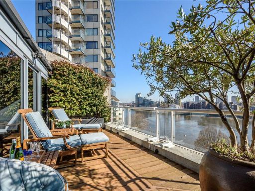 3 bedroom apartment for sale in Chelsea Crescent, Chelsea Harbour, London, SW10 — £2,995,000 • 3 bed • 2 bath • 2753 ft²
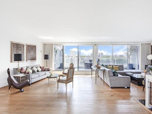 3 bedroom apartment for sale in Chelsea Crescent, Chelsea Harbour, SW10 — £3,600,000 • 3 bed • 3 bath • 2818 ft²
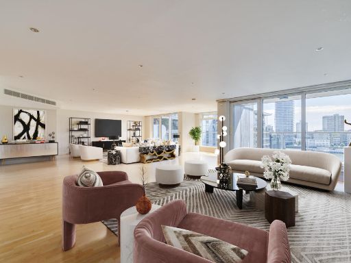 3 bedroom flat for sale in Courtyard House,
Imperial Wharf, SW6 — £2,100,000 • 3 bed • 3 bath • 2609 ft²
3 bedroom flat for sale in Courtyard House,
Imperial Wharf, SW6 — £2,100,000 • 3 bed • 3 bath • 2609 ft²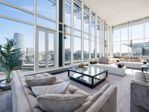 4 bedroom apartment for sale in Waterside Tower, The Boulevard, Imperial Wharf, SW6 — £5,950,000 • 4 bed • 4 bath • 3963 ft²
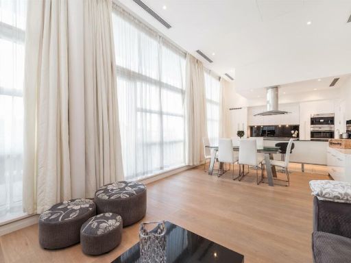 2 bedroom apartment for sale in Howard Building, 368 Queenstown Road, London, SW11 — £1,450,000 • 2 bed • 2 bath • 947 ft²
Meta
- {
"@context": "https://schema.org",
"@type": "Residence",
"name": "3 bedroom apartment for sale in Howard Building, 368 Queens…",
"description": "",
"url": "https://propertypiper.co.uk/property/3758373f-ff0e-429c-9fc4-8719bb78cb70",
"image": "https://image-a.propertypiper.co.uk/dd50e3a7-d9e2-4bf6-8117-9cc99ae0c335-1024.jpeg",
"address": {
"@type": "PostalAddress",
"streetAddress": "71 HOWARD BUILDING, 368 QUEENSTOWN ROAD, LONDON",
"postalCode": "SW11 8NN",
"addressLocality": "Wandsworth",
"addressRegion": "Battersea",
"addressCountry": "England"
},
"geo": {
"@type": "GeoCoordinates",
"latitude": 51.48294699808752,
"longitude": -0.1480973679841399
},
"numberOfRooms": 3,
"numberOfBathroomsTotal": 3,
"floorSize": {
"@type": "QuantitativeValue",
"value": 1920,
"unitCode": "FTK"
},
"offers": {
"@type": "Offer",
"price": 2950000,
"priceCurrency": "GBP",
"availability": "https://schema.org/InStock"
},
"additionalProperty": [
{
"@type": "PropertyValue",
"name": "Feature",
"value": "contemporary"
},
{
"@type": "PropertyValue",
"name": "Feature",
"value": "modern"
},
{
"@type": "PropertyValue",
"name": "Feature",
"value": "open-plan"
},
{
"@type": "PropertyValue",
"name": "Feature",
"value": "large windows"
},
{
"@type": "PropertyValue",
"name": "Feature",
"value": "natural light"
},
{
"@type": "PropertyValue",
"name": "Feature",
"value": "city view"
},
{
"@type": "PropertyValue",
"name": "Feature",
"value": "apartment"
},
{
"@type": "PropertyValue",
"name": "Feature",
"value": "modern"
},
{
"@type": "PropertyValue",
"name": "Feature",
"value": "balcony"
},
{
"@type": "PropertyValue",
"name": "Feature",
"value": "urban view"
},
{
"@type": "PropertyValue",
"name": "Feature",
"value": "glass railing"
},
{
"@type": "PropertyValue",
"name": "Feature",
"value": "decking"
},
{
"@type": "PropertyValue",
"name": "Feature",
"value": "contemporary architecture"
},
{
"@type": "PropertyValue",
"name": "Feature",
"value": "city living"
}
]
}
High Res Floorplan Images
Compatible Floorplan Images
FloorplanImages Thumbnail