SG1 1AS - 1 bedroom flat for sale in Swingate, Stevenage, SG1
View on Property Piper
1 bedroom flat for sale in Swingate, Stevenage, SG1
Property Details
- Price: £175000
- Bedrooms: 1
- Bathrooms: 1
- Property Type: undefined
- Property SubType: undefined
Brochure Descriptions
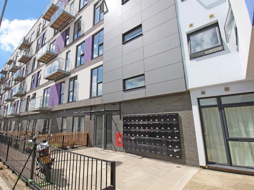
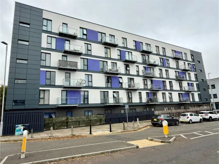
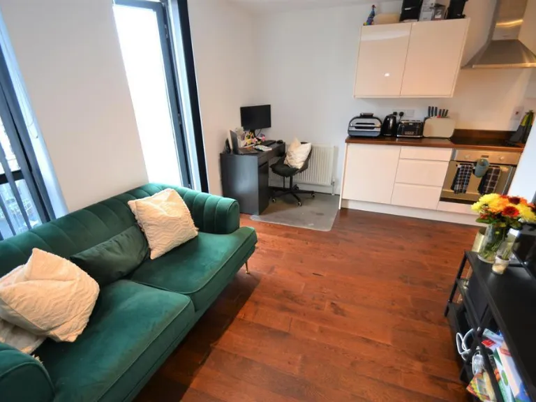
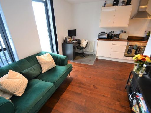
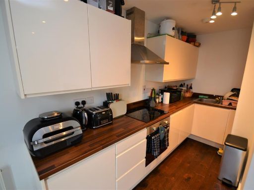
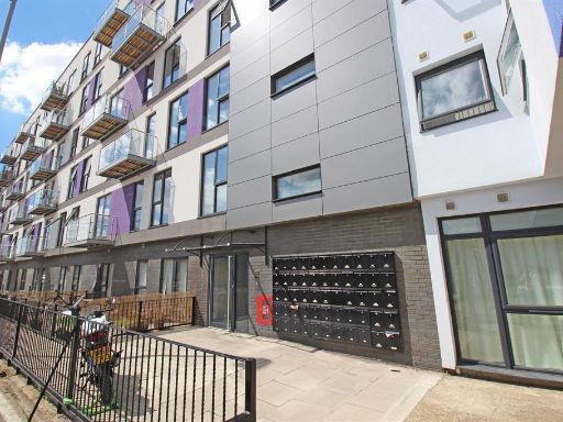
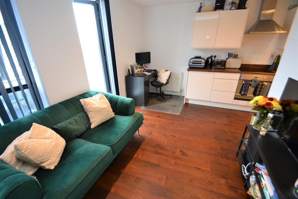
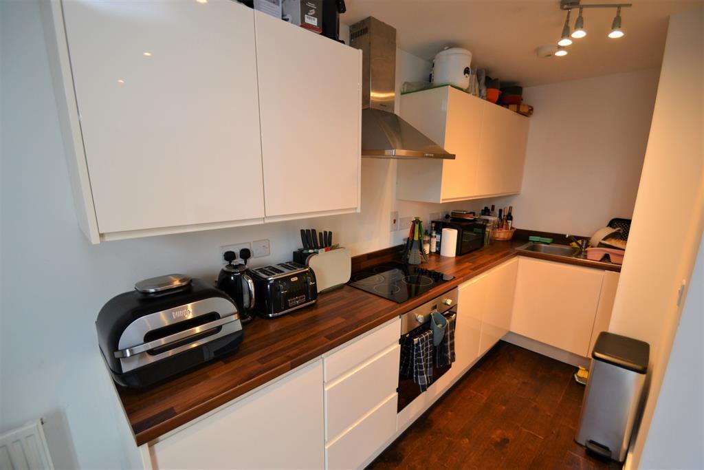
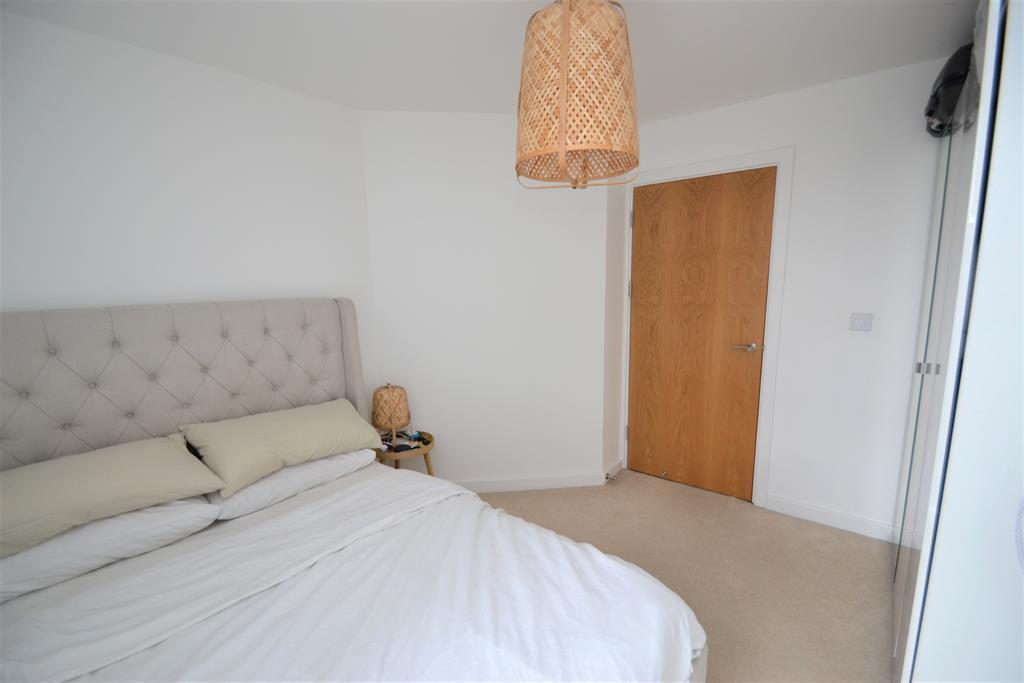
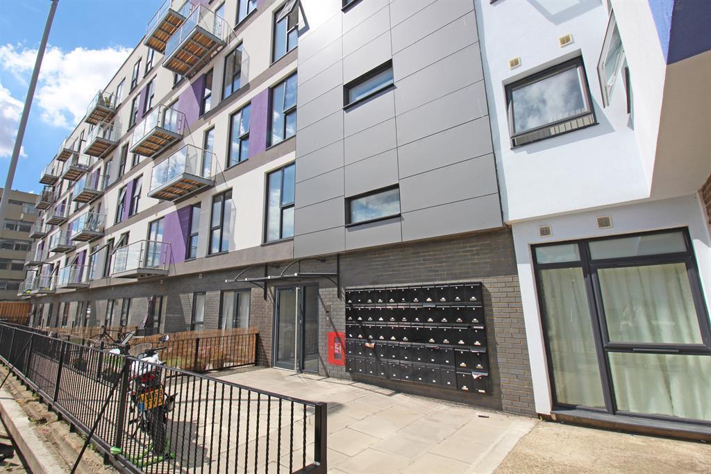
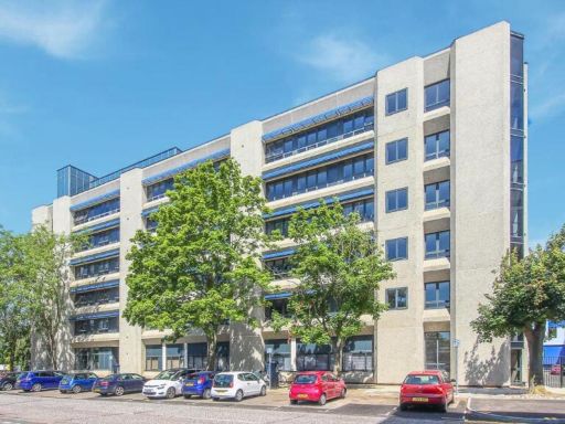
- Modern purpose‑built mid-rise apartment block in an urban setting (street-facing). The listing is for a one-bedroom, one-bathroom apartment with an open‑plan living/kitchen area. The block features balconies and contemporary external finishes (grey cladding and white render with coloured panels). The apartment appears to be average in internal size for a one‑bed flat, with a compact but well‑fitted kitchen, wood-effect flooring in the living area and typical city/street views. On‑street parking and communal ground-level boundary treatment are visible. Overall property footprint: mid-sized apartment in a multi-storey residential block in a town centre location.
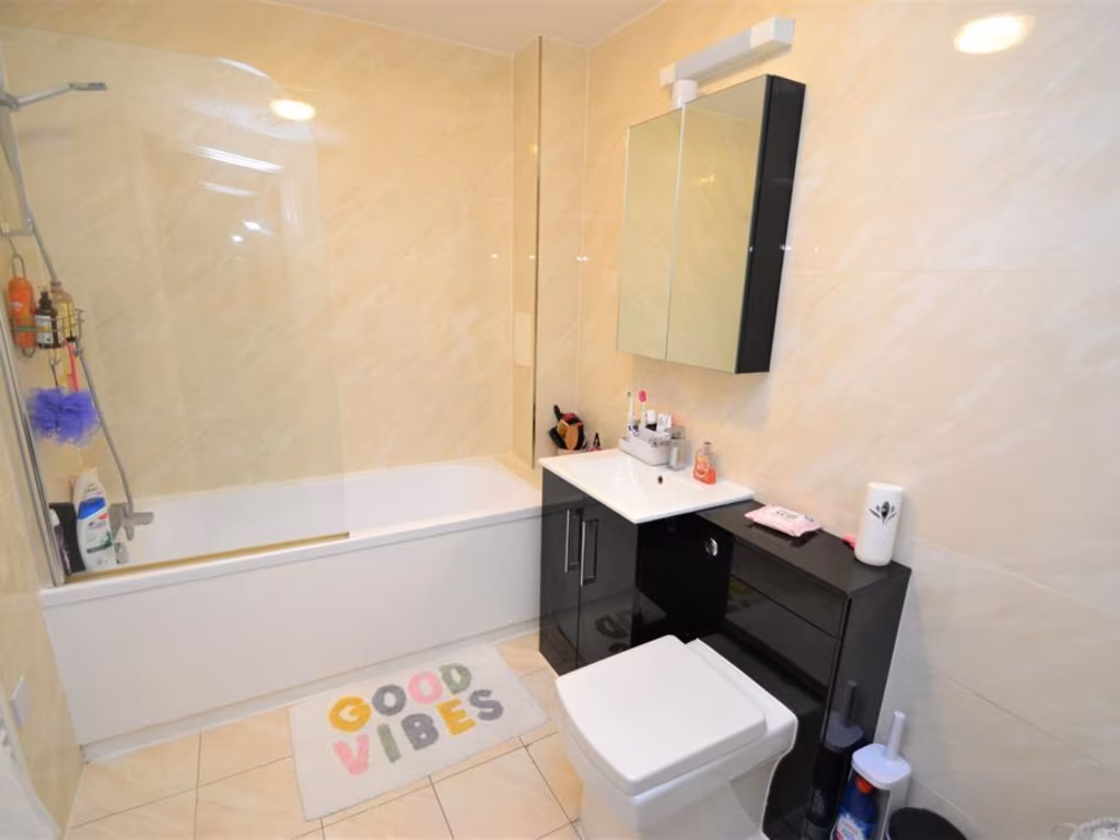
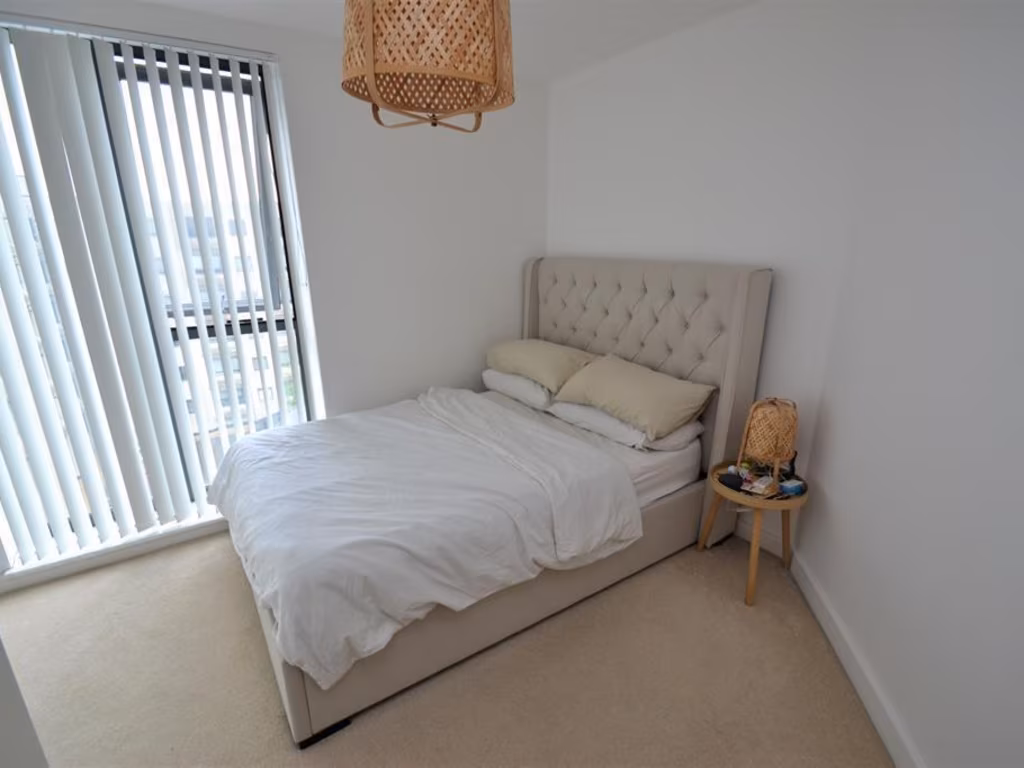
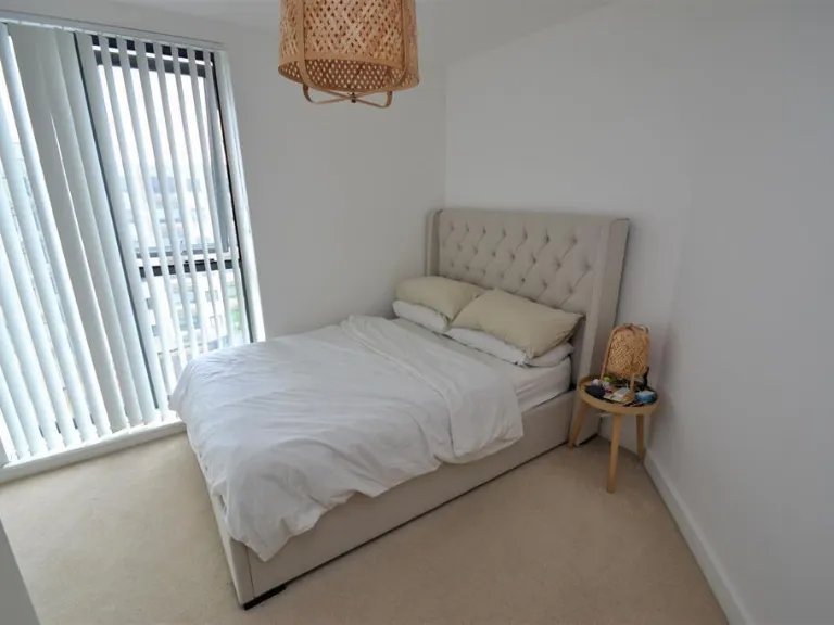
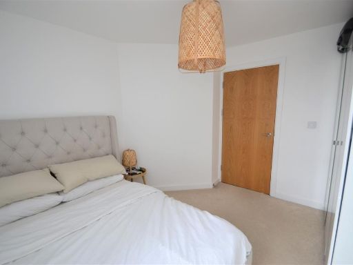
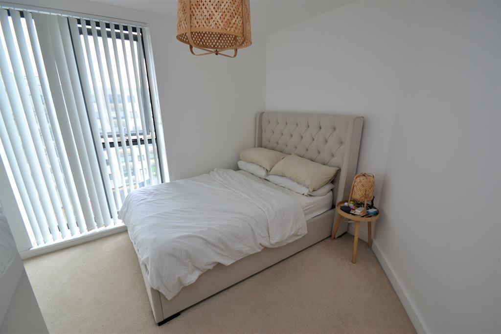
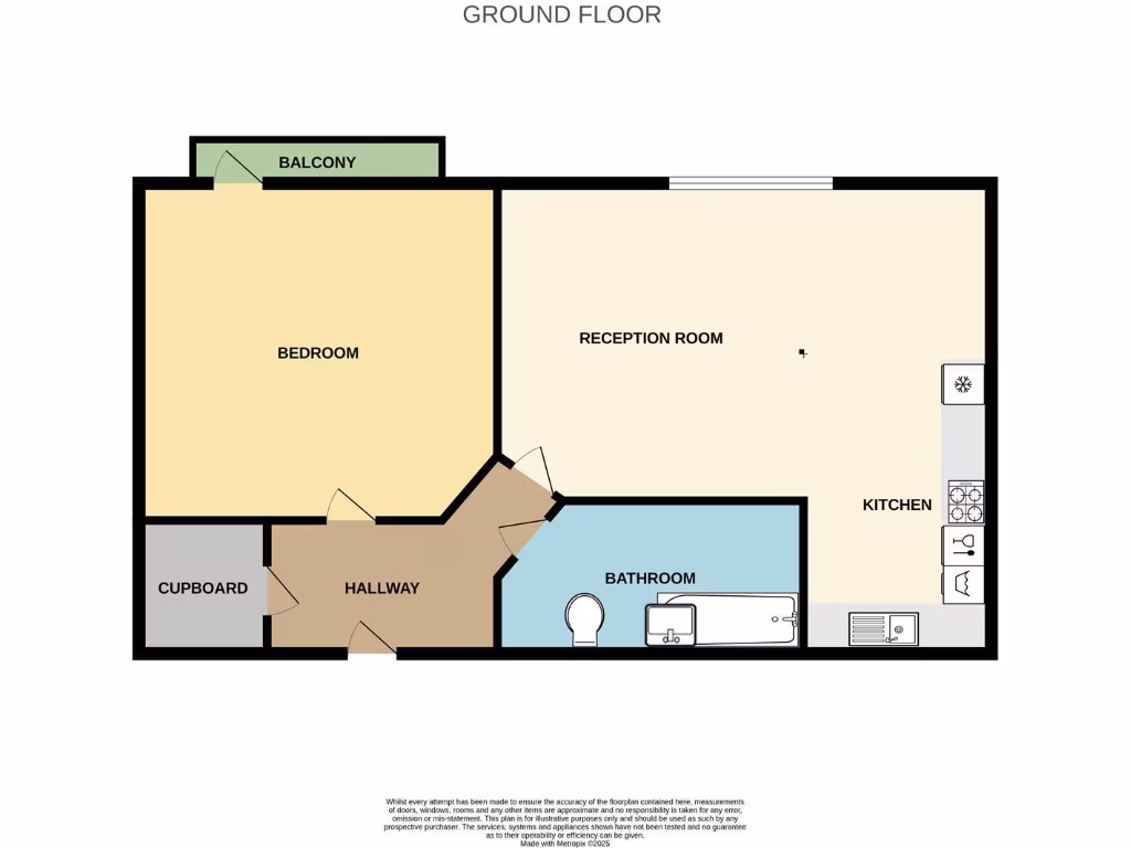
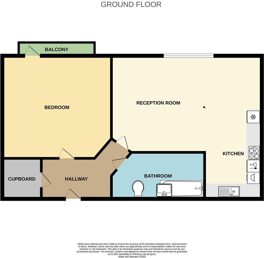
- Ground-floor one-bedroom apartment shown on the floor plan. Layout: entrance hallway with storage cupboard, one double bedroom with a small balcony, separate bathroom, and a reception room with an adjoining kitchen area. The accommodation is compact — suitable as a city/ town centre apartment — overall size appears small to average for a one-bedroom flat. No external grounds shown; location maps indicate an urban setting in Stevenage town centre. No furniture or fixtures beyond fixed kitchen and bathroom fittings are described.
Image Descriptions
- apartment complex modern
- modern apartment kitchen and living area contemporary
Floorplan Description
- Ground floor apartment floorplan showing bedroom, reception room, kitchen, bathroom, hallway, cupboard and balcony.
Rooms
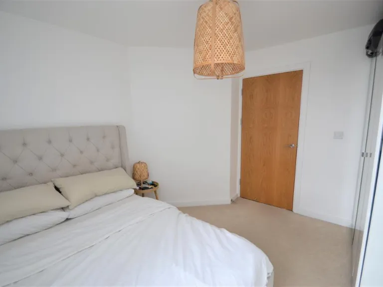
- BEDROOM:
- RECEPTION ROOM:
- KITCHEN:
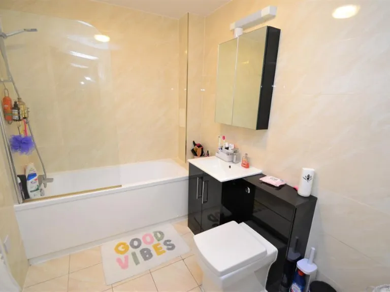
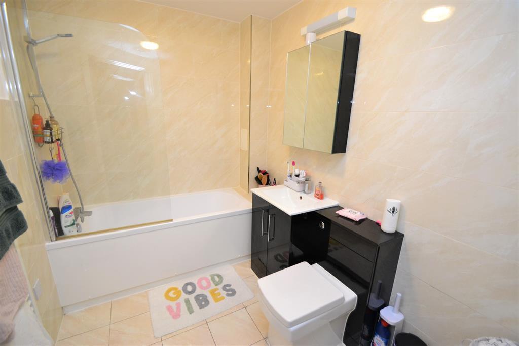
- BATHROOM:
- HALLWAY:
- CUPBOARD:
- BALCONY:
Textual Property Features
Detected Visual Features
- apartment
- modern complex
- contemporary design
- urban development
- multi-storey
- balconies
- privacy panels
- modern apartment
- open-plan living
- contemporary style
- small space
- hardwood floors
EPC Details
- High performance glazing
- Average thermal transmittance 0.13 W/m-¦K
- Boiler and radiators, electric
- Low energy lighting in all fixed outlets
- (other premises below)
Nearby Schools
- Shephalbury Park Primary School
- Marriotts School
- Moss Bury Primary School and Nursery
- The Leys Primary and Nursery School
- Roebuck Academy
- Barnwell School
- Saint Vincent de Paul Catholic Primary School
- The Thomas Alleyne Academy
- Barclay Academy
- The Giles Infant and Nursery School
- Peartree Spring Primary School
- Broom Barns Primary School
- Fairlands Primary School
- Woolenwick Infant and Nursery School
- Woolenwick Junior School
- Lodge Farm Primary School
- The Saint John Henry Newman Catholic School
- Graveley Primary School
- St Margaret Clitherow Roman Catholic Primary School
- St Nicholas CofE (VA) Primary School and Nursery
- Bedwell Primary School
- Camps Hill Primary School
- Letchmore Infants' and Nursery School
- Almond Hill Junior School
- Trotts Hill Primary and Nursery School
- Giles Junior School
Nearest General Shops
- Id: 7150028410
- Tags:
- Name: Cards Direct
- Shop: gift
- TagsNormalized:
- Lat: 51.9031395
- Lon: -0.2019784
- FullGeoHash: gcpz72svtw3z
- PartitionGeoHash: gcpz
- Images:
- FoodStandards: null
- Distance: 137.7
,- Id: 6700950132
- Tags:
- Brand: Paddy Power
- Brand:wikidata: Q3888718
- Brand:wikipedia: en:Paddy Power
- Name: Paddy Power
- Shop: bookmaker
- TagsNormalized:
- Lat: 51.902176
- Lon: -0.2029463
- FullGeoHash: gcpz72s0p4b7
- PartitionGeoHash: gcpz
- Images:
- FoodStandards: null
- Distance: 135.3
,- Id: 161116265
- Tags:
- Addr:
- City: Stevenage
- Postcode: SG1 1QR
- Building: yes
- Name: Westgate Shopping Centre
- Shop: mall
- Wheelchair: yes
- TagsNormalized:
- Lat: 51.9031451
- Lon: -0.2026784
- FullGeoHash: gcpz72smtr80
- PartitionGeoHash: gcpz
- Images:
- FoodStandards: null
- Distance: 89.7
}
Nearest Religious buildings
- Id: 275754354
- Tags:
- Addr:
- City: Stevenage
- Postcode: SG1 3LL
- Street: High Street
- Suburb: Old Town
- Amenity: place_of_worship
- Building: church
- Denomination: methodist
- Fhrs:
- Name: High Street Methodist Church
- Religion: christian
- Source:
- TagsNormalized:
- place of worship
- church
- methodist
- christian
- Lat: 51.9079657
- Lon: -0.2061126
- FullGeoHash: gcpz739cv4pk
- PartitionGeoHash: gcpz
- Images:
- FoodStandards:
- Id: 674276
- FHRSID: 674276
- LocalAuthorityBusinessID: 14/00032/MULT
- BusinessName: High Street Methodist Church
- BusinessType: Other catering premises
- BusinessTypeID: 7841
- AddressLine1: High Street
- AddressLine2: Stevenage
- AddressLine3: Herts
- AddressLine4: null
- PostCode: SG1 3LL
- RatingValue: 5
- RatingKey: fhrs_5_en-GB
- RatingDate: 2018-10-04
- LocalAuthorityCode: 161
- LocalAuthorityName: Stevenage
- LocalAuthorityWebSite: http://www.stevenage.gov.uk
- LocalAuthorityEmailAddress: env.health@stevenage.gov.uk
- Scores:
- Hygiene: 0
- Structural: 5
- ConfidenceInManagement: 0
- NewRatingPending: false
- Geocode:
- Longitude: -0.20669800043106
- Latitude: 51.90722656250000
- Distance: 548.5
,- Id: 281544998
- Tags:
- Amenity: place_of_worship
- Building: church
- Denomination: anglican
- Name: St George and St Andrew
- Religion: christian
- Wikidata: Q26657153
- TagsNormalized:
- place of worship
- church
- anglican
- christian
- Lat: 51.901561
- Lon: -0.198566
- FullGeoHash: gcpz72rkt04q
- PartitionGeoHash: gcpz
- Images:
- FoodStandards: null
- Distance: 414.4
,- Id: 10095161470
- Tags:
- Amenity: place_of_worship
- Name: Church of David
- Religion: christian
- TagsNormalized:
- place of worship
- church
- christian
- Lat: 51.9005628
- Lon: -0.2024317
- FullGeoHash: gcpz72hwdypu
- PartitionGeoHash: gcpz
- Images:
- FoodStandards: null
- Distance: 313.2
}
Nearest Medical buildings
- Id: 31352970
- Tags:
- Amenity: doctors
- Building: yes
- Name: Southgate Mental Health Centre
- TagsNormalized:
- doctor
- doctors
- health
- health centre
- Lat: 51.8998779
- Lon: -0.1998182
- FullGeoHash: gcpz72n6xyky
- PartitionGeoHash: gcpz
- Images:
- FoodStandards: null
- Distance: 468
,- Id: 197885023
- Tags:
- Amenity: hospital
- Building: yes
- Designation: Physiotherapy
- Emergency: no
- Name: Kingsway Health Centre
- Source: local knowledge
- TagsNormalized:
- hospital
- health
- health centre
- Lat: 51.8995288
- Lon: -0.2067519
- FullGeoHash: gcpz7212wm6s
- PartitionGeoHash: gcpz
- Images:
- FoodStandards: null
- Distance: 451.5
,- Id: 31353786
- Tags:
- Amenity: doctors
- Building: yes
- Name: Danestrete Health Centre
- TagsNormalized:
- doctor
- doctors
- health
- health centre
- Lat: 51.8995412
- Lon: -0.2020117
- FullGeoHash: gcpz72hbsz9n
- PartitionGeoHash: gcpz
- Images:
- FoodStandards: null
- Distance: 429.9
,- Id: 31353678
- Tags:
- Addr:
- City: Stevenage
- Postcode: SG1 1HB
- Amenity: doctors
- Building: yes
- Healthcare: doctor
- Name: Southgate Health Centre
- Operator: NHS
- TagsNormalized:
- doctor
- doctors
- health
- healthcare
- health centre
- Lat: 51.8998543
- Lon: -0.20121
- FullGeoHash: gcpz72j6x6nf
- PartitionGeoHash: gcpz
- Images:
- FoodStandards: null
- Distance: 419
}
Nearest Airports
- Id: 495488524
- Tags:
- Aerodrome: international
- Aerodrome:type: public
- Aeroway: aerodrome
- Alt_name: Stansted
- Iata: STN
- Icao: EGSS
- Is_in: Essex,England,UK
- Name: London Stansted Airport
- Ref: STN
- Source: Gagravarr_Airports
- Website: https://www.stanstedairport.com/
- Wikidata: Q8709
- Wikipedia: en:London Stansted Airport
- TagsNormalized:
- airport
- international airport
- Lat: 51.8869677
- Lon: 0.2429264
- FullGeoHash: u10pjt8zkxg4
- PartitionGeoHash: u10p
- Images:
- FoodStandards: null
- Distance: 30719.4
,- Id: 110273499
- Tags:
- Addr:
- Country: GB
- Postcode: LU2 9LY
- Aerodrome: international
- Aerodrome:type: public
- Aeroway: aerodrome
- Alt_name: London Luton
- Iata: LTN
- Icao: EGGW
- Name: London Luton Airport
- Website: https://www.london-luton.co.uk/
- Wikidata: Q8712
- Wikipedia: en:Luton Airport
- TagsNormalized:
- airport
- international airport
- Lat: 51.8780363
- Lon: -0.3701408
- FullGeoHash: gcpxps47rngh
- PartitionGeoHash: gcpx
- Images:
- FoodStandards: null
- Distance: 11741.4
}
Nearest Tourist attractions
- Id: 7663623716
- Tags:
- Name: Forster Country
- Operator: Stevenage Borough Council and Hertfordshire County Council.
- Tourism: attraction
- TagsNormalized:
- Lat: 51.9262929
- Lon: -0.1976725
- FullGeoHash: gcpz7sbh9fsd
- PartitionGeoHash: gcpz
- Images:
- FoodStandards: null
- Distance: 2602.7
,- Id: 389903070
- Tags:
- Name: Dyes Lane Caravan Park
- Tourism: caravan_site
- TagsNormalized:
- Lat: 51.9006695
- Lon: -0.2222814
- FullGeoHash: gcpz6bnpk6nb
- PartitionGeoHash: gcpz
- Images:
- FoodStandards: null
- Distance: 1287
,- Id: 559969108
- Tags:
- Addr:
- City: Stevenage
- Postcode: SG1 1XX
- Name: Stevenage Museum
- Tourism: museum
- Website: https://www.stevenage.gov.uk/stevenage-museum
- Wikidata: Q29570928
- TagsNormalized:
- Lat: 51.9014446
- Lon: -0.1986286
- FullGeoHash: gcpz72r7gdeb
- PartitionGeoHash: gcpz
- Images:
- FoodStandards: null
- Distance: 416.5
}
Nearest Train stations
- Id: 2137118353
- Tags:
- Name: Welwyn Garden City
- Naptan:
- Network: National Rail
- Public_transport: station
- Railway: station
- Ref:
- Source: NPE
- Wheelchair: yes
- Wikidata: Q2723798
- Wikipedia: en:Welwyn Garden City railway station
- TagsNormalized:
- Lat: 51.8008507
- Lon: -0.2038429
- FullGeoHash: gcpyeq59f47w
- PartitionGeoHash: gcpy
- Images:
- FoodStandards: null
- Distance: 11382
,- Id: 20981580
- Tags:
- Name: Baldock
- Naptan:
- Network: National Rail
- Public_transport: station
- Railway: station
- Ref:
- Wheelchair: no
- Wikidata: Q19953
- Wikipedia: en:Baldock railway station
- TagsNormalized:
- Lat: 51.9929714
- Lon: -0.1875624
- FullGeoHash: gcpzg9p3j2r7
- PartitionGeoHash: gcpz
- Images:
- FoodStandards: null
- Distance: 10044.1
,- Id: 6751829050
- Tags:
- Name: Welwyn North
- Naptan:
- Network: National Rail
- Public_transport: station
- Railway: station
- Ref:
- Train: yes
- Wikidata: Q2345556
- Wikipedia: en:Welwyn North railway station
- TagsNormalized:
- Lat: 51.8237723
- Lon: -0.192134
- FullGeoHash: gcpygdhp6gqe
- PartitionGeoHash: gcpy
- Images:
- FoodStandards: null
- Distance: 8870.6
,- Id: 2089152132
- Tags:
- Name: Letchworth Garden City
- Naptan:
- Network: National Rail
- Old_name: Letchworth
- Operator: First Capital Connect
- Platforms: 2
- Public_transport: station
- Railway: station
- Ref:
- Wikidata: Q2582397
- Wikipedia: en:Letchworth Garden City railway station
- TagsNormalized:
- Lat: 51.9803536
- Lon: -0.2289056
- FullGeoHash: gcpzdy9rd05x
- PartitionGeoHash: gcpz
- Images:
- FoodStandards: null
- Distance: 8746.3
,- Id: 7140195250
- Tags:
- Name: Stevenage
- Naptan:
- Network: National Rail
- Public_transport: station
- Railway: station
- Ref:
- Wheelchair: yes
- Wikidata: Q19970
- Wikipedia: en:Stevenage railway station
- TagsNormalized:
- Lat: 51.9018356
- Lon: -0.207144
- FullGeoHash: gcpz723nj5qj
- PartitionGeoHash: gcpz
- Images:
- FoodStandards: null
- Distance: 265.5
}
Nearest Hotels
- Id: 800435656
- Tags:
- Addr:
- City: Stevenage
- Postcode: SG1 3LJ
- Street: Gates Way
- Fhrs:
- Name: The Gate
- Source:
- Tourism: hotel
- TagsNormalized:
- Lat: 51.9064432
- Lon: -0.2064548
- FullGeoHash: gcpz7338vq24
- PartitionGeoHash: gcpz
- Images:
- FoodStandards: null
- Distance: 397.4
,- Id: 31353550
- Tags:
- Building: yes
- Name: Express by Holiday Inn
- Source: Bing
- Tourism: hotel
- TagsNormalized:
- Lat: 51.9001317
- Lon: -0.2020323
- FullGeoHash: gcpz72huhmcb
- PartitionGeoHash: gcpz
- Images:
- FoodStandards: null
- Distance: 367.7
,- Id: 189300767
- Tags:
- Addr:
- City: Stevenage
- Postcode: SG1 1EJ
- Street: The Forum
- Building: yes
- Fhrs:
- Internet_access: yes
- Internet_access:fee: no
- Name: Ibis Stevenage
- Operator: Accor
- Source: Bing
- Tourism: hotel
- Website: http://www.ibis.com/gb/hotel-2794-ibis-stevenage-centre/index.shtml
- TagsNormalized:
- Lat: 51.9036143
- Lon: -0.2032096
- FullGeoHash: gcpz72u02ygz
- PartitionGeoHash: gcpz
- Images:
- FoodStandards: null
- Distance: 69.3
}
Tags
- apartment
- modern complex
- contemporary design
- urban development
- multi-storey
- balconies
- privacy panels
- modern apartment
- open-plan living
- contemporary style
- small space
- hardwood floors
Local Market Stats
- Average Price/sqft: £360
- Avg Income: £48200
- Rental Yield: 4.2%
- Social Housing: 20%
- Planning Success Rate: 95%
AirBnB Data
- 1km average: £117/night
- Listings in 1km: 5
Similar Properties
 1 bedroom apartment for sale in Skyline House, Swingate, Stevenage, SG1 — £182,500 • 1 bed • 1 bath • 474 ft²
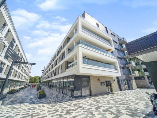 1 bedroom flat for sale in Mulberry House, Park Place, Stevenage, Hertfordshire, SG1 — £195,000 • 1 bed • 1 bath • 474 ft²
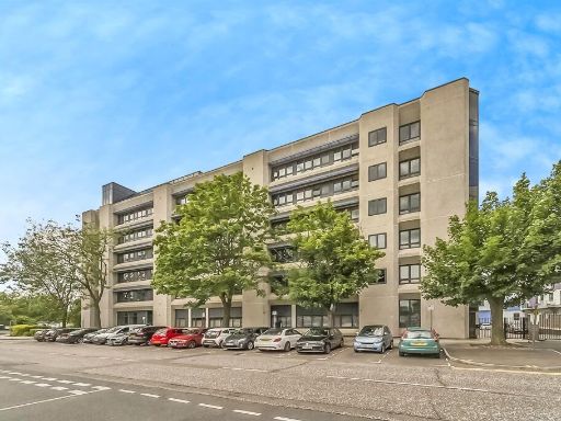 1 bedroom flat for sale in Swingate, Stevenage, SG1 — £180,000 • 1 bed • 1 bath • 515 ft²
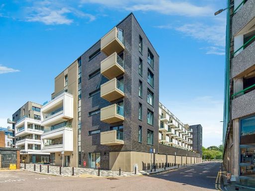 1 bedroom apartment for sale in Park Place, Town Centre, Stevenage, SG1 — £185,000 • 1 bed • 1 bath • 388 ft²
 1 bedroom apartment for sale in Swingate, Stevenage, Hertfordshire, SG1 — £176,500 • 1 bed • 1 bath • 464 ft²
 1 bedroom apartment for sale in Boston House, Stevenage, SG1 — £190,000 • 1 bed • 1 bath • 473 ft²
Meta
- {
"@context": "https://schema.org",
"@type": "Residence",
"name": "1 bedroom flat for sale in Swingate, Stevenage, SG1",
"description": "",
"url": "https://propertypiper.co.uk/property/319e6272-38e1-403c-896f-09841a1a408d",
"image": "https://image-a.propertypiper.co.uk/0c9fd255-1ae7-48f1-b3fb-baec7df19a3c-1024.jpeg",
"address": {
"@type": "PostalAddress",
"streetAddress": "Flat 48 Brickdale House, Swingate",
"postalCode": "SG1 1AS",
"addressLocality": "Stevenage",
"addressRegion": "Stevenage",
"addressCountry": "England"
},
"geo": {
"@type": "GeoCoordinates",
"latitude": 51.903211732087854,
"longitude": -0.20398150903361764
},
"numberOfRooms": 1,
"numberOfBathroomsTotal": 1,
"floorSize": {
"@type": "QuantitativeValue",
"value": 410,
"unitCode": "FTK"
},
"offers": {
"@type": "Offer",
"price": 175000,
"priceCurrency": "GBP",
"availability": "https://schema.org/InStock"
},
"additionalProperty": [
{
"@type": "PropertyValue",
"name": "Feature",
"value": "apartment"
},
{
"@type": "PropertyValue",
"name": "Feature",
"value": "modern complex"
},
{
"@type": "PropertyValue",
"name": "Feature",
"value": "contemporary design"
},
{
"@type": "PropertyValue",
"name": "Feature",
"value": "urban development"
},
{
"@type": "PropertyValue",
"name": "Feature",
"value": "multi-storey"
},
{
"@type": "PropertyValue",
"name": "Feature",
"value": "balconies"
},
{
"@type": "PropertyValue",
"name": "Feature",
"value": "privacy panels"
},
{
"@type": "PropertyValue",
"name": "Feature",
"value": "modern apartment"
},
{
"@type": "PropertyValue",
"name": "Feature",
"value": "open-plan living"
},
{
"@type": "PropertyValue",
"name": "Feature",
"value": "contemporary style"
},
{
"@type": "PropertyValue",
"name": "Feature",
"value": "small space"
},
{
"@type": "PropertyValue",
"name": "Feature",
"value": "hardwood floors"
}
]
}
High Res Floorplan Images
Compatible Floorplan Images
FloorplanImages Thumbnail