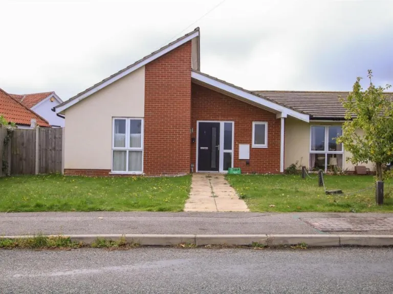
IP18 6PL - 2 bedroom bungalow for sale in Wangford Road, Reydon,, IP18
View on Property Piper
2 bedroom bungalow for sale in Wangford Road, Reydon,, IP18
Property Details
- Price: £225000
- Bedrooms: 2
- Bathrooms: 1
- Property Type: undefined
- Property SubType: undefined
Brochure Descriptions
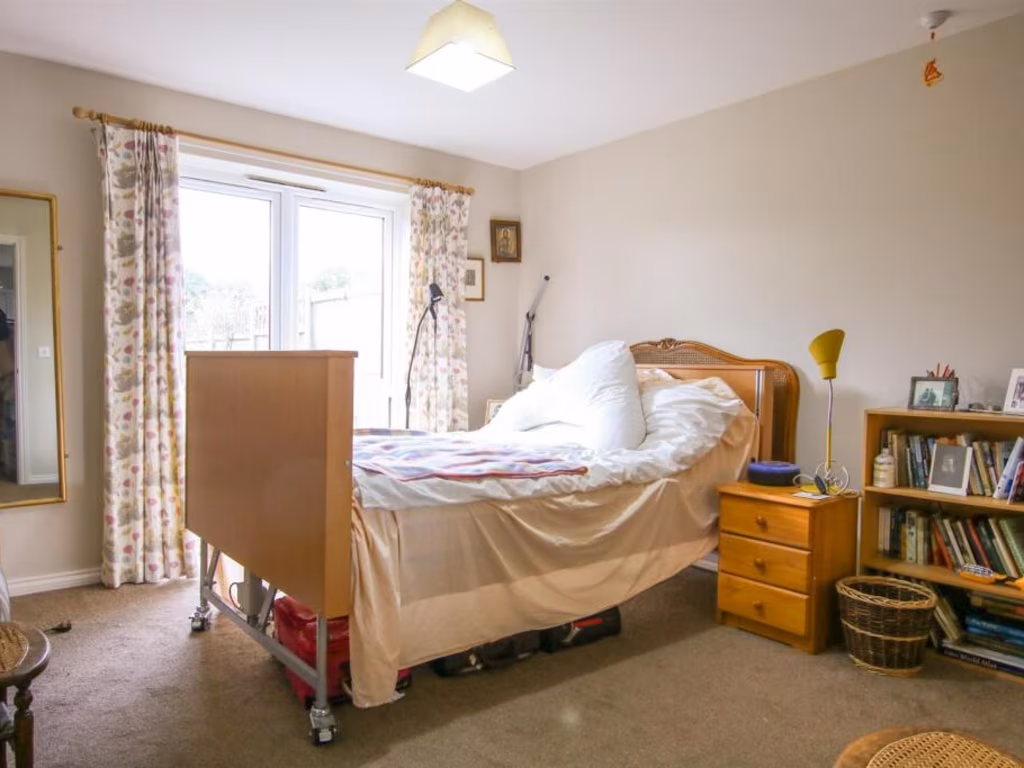
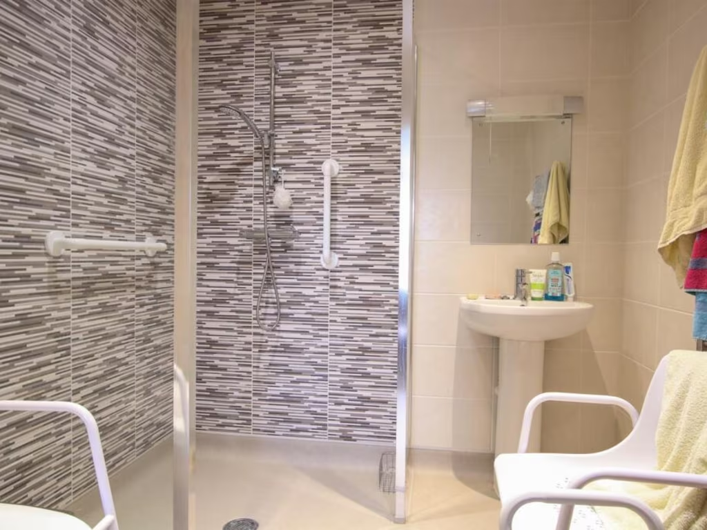
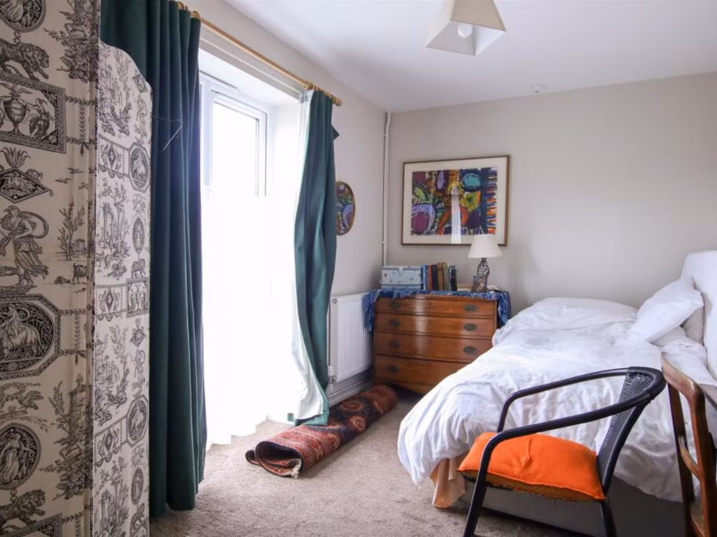
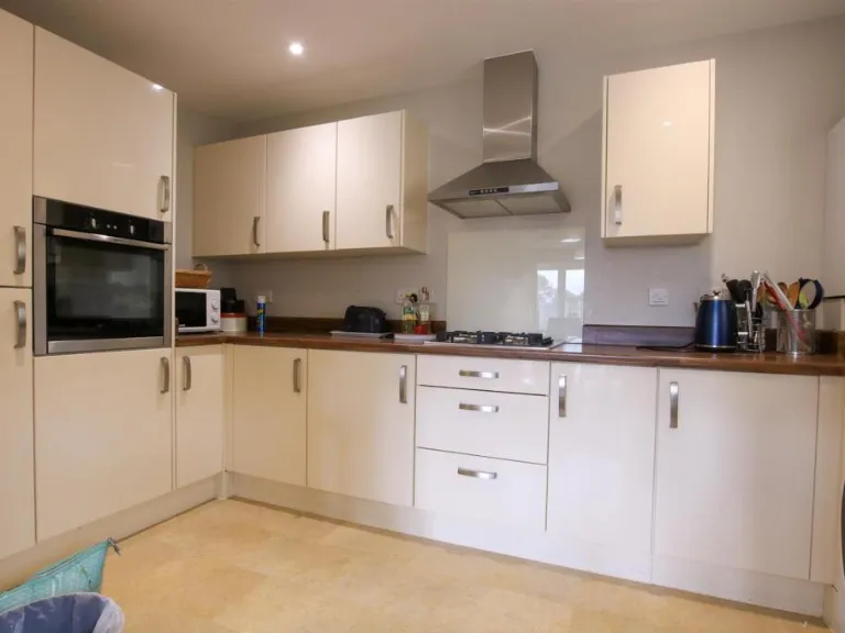
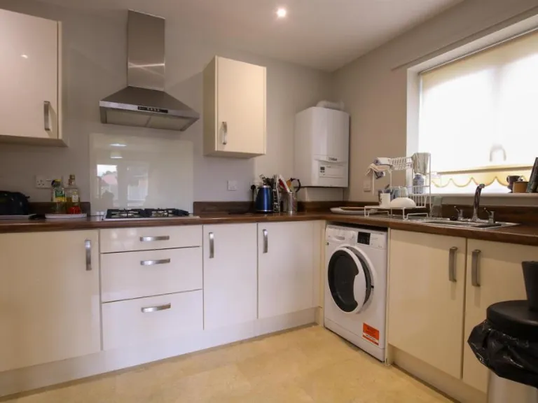
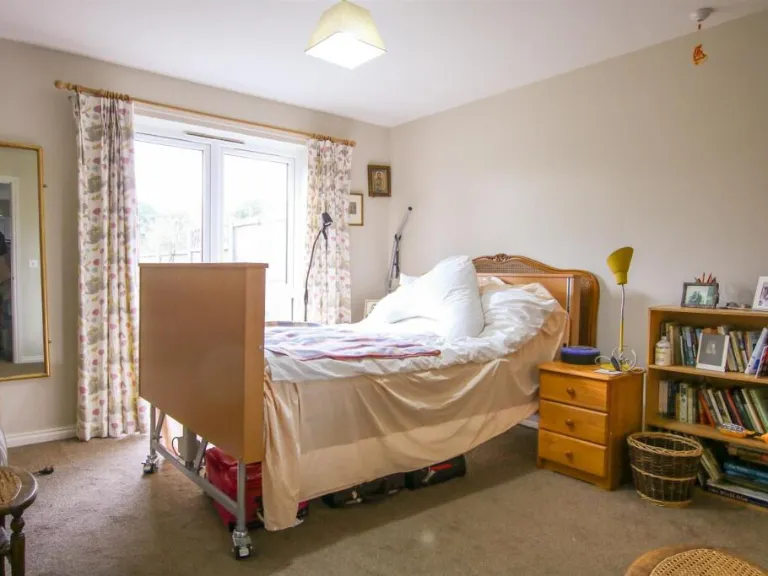
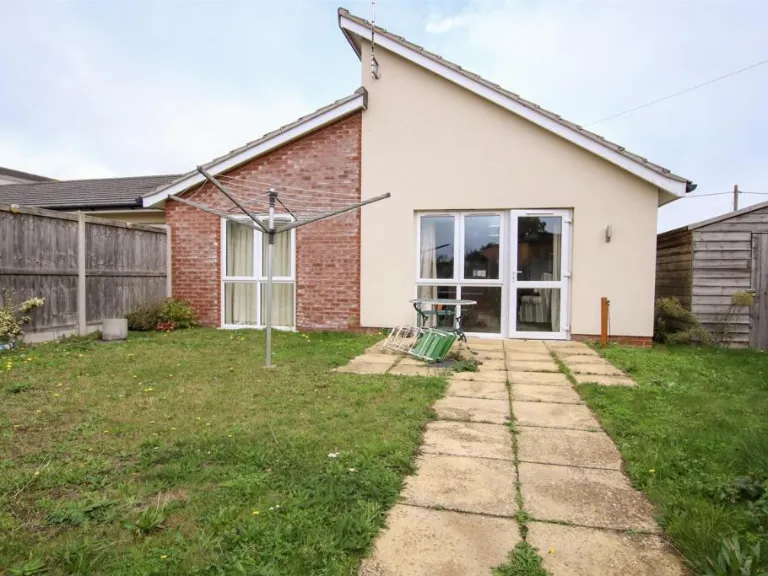
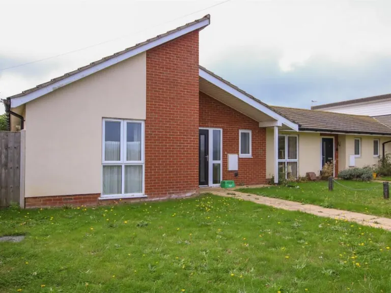
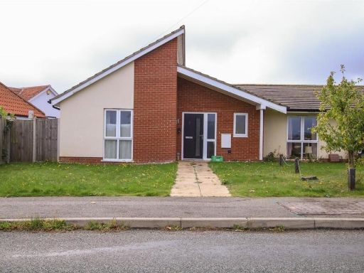
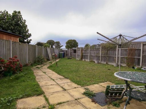
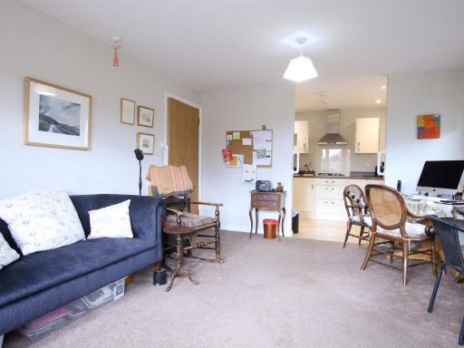
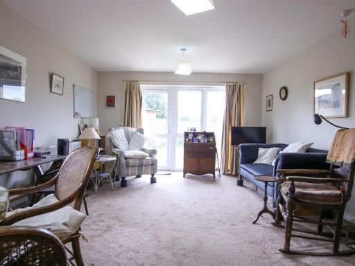
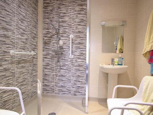
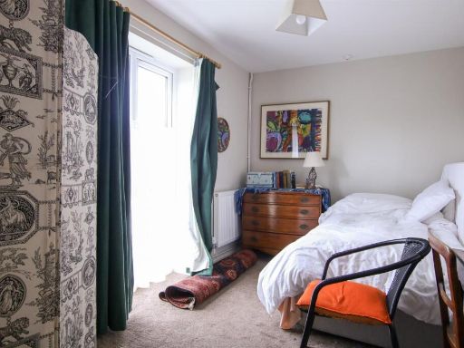
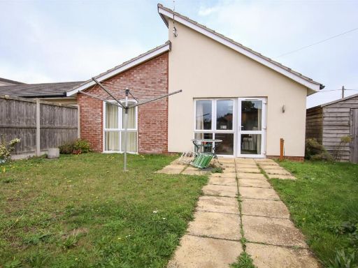
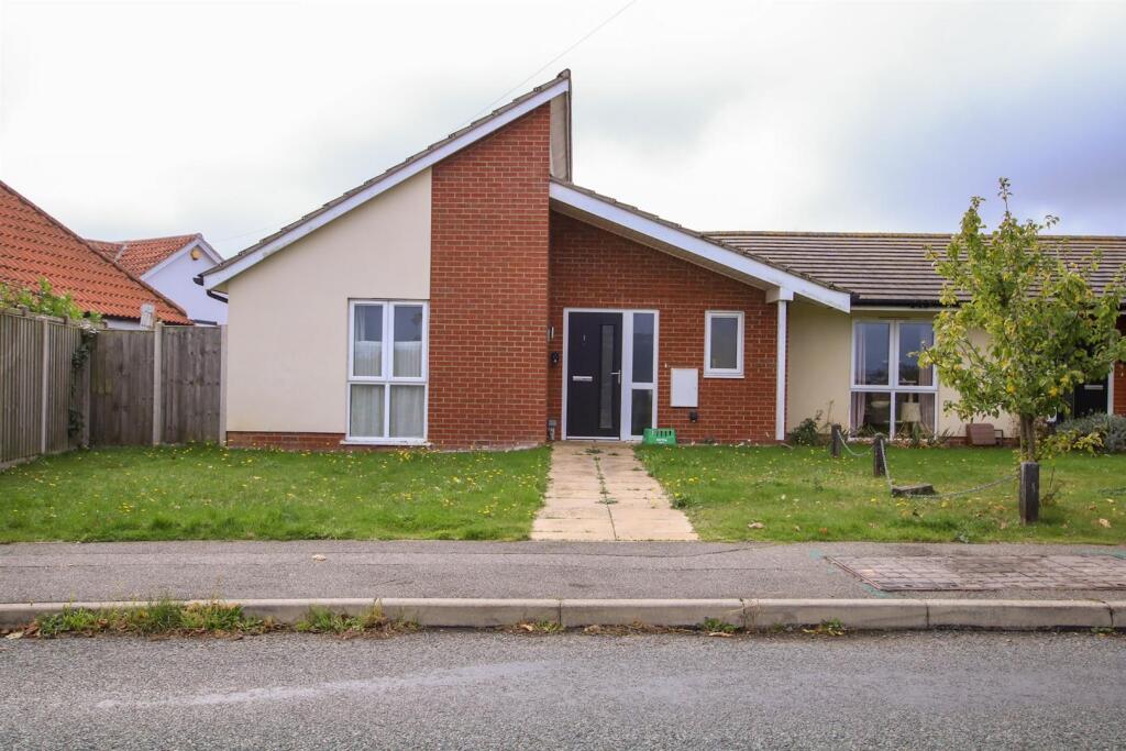
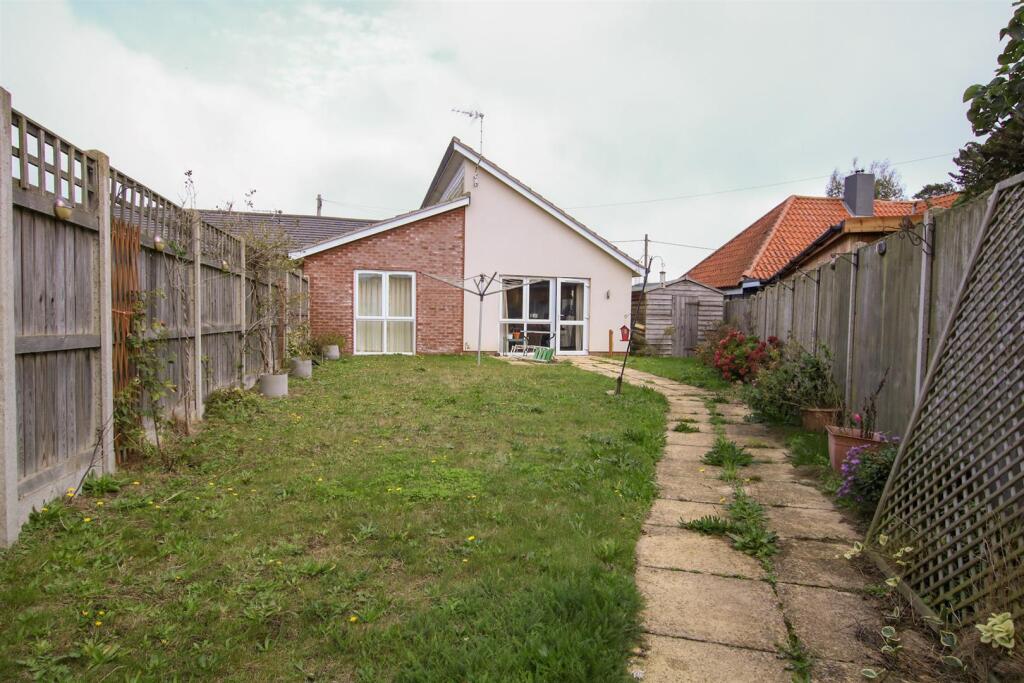
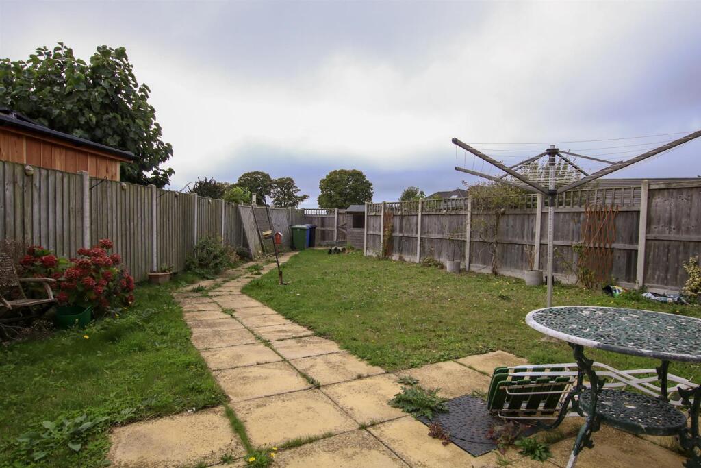
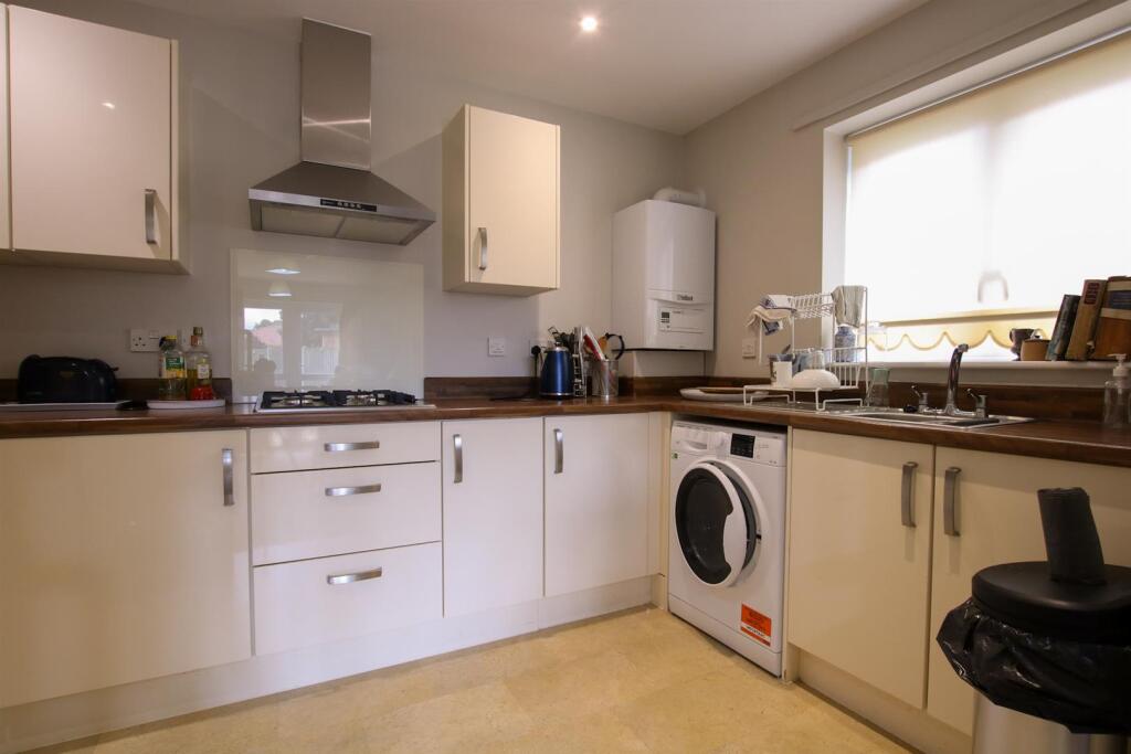
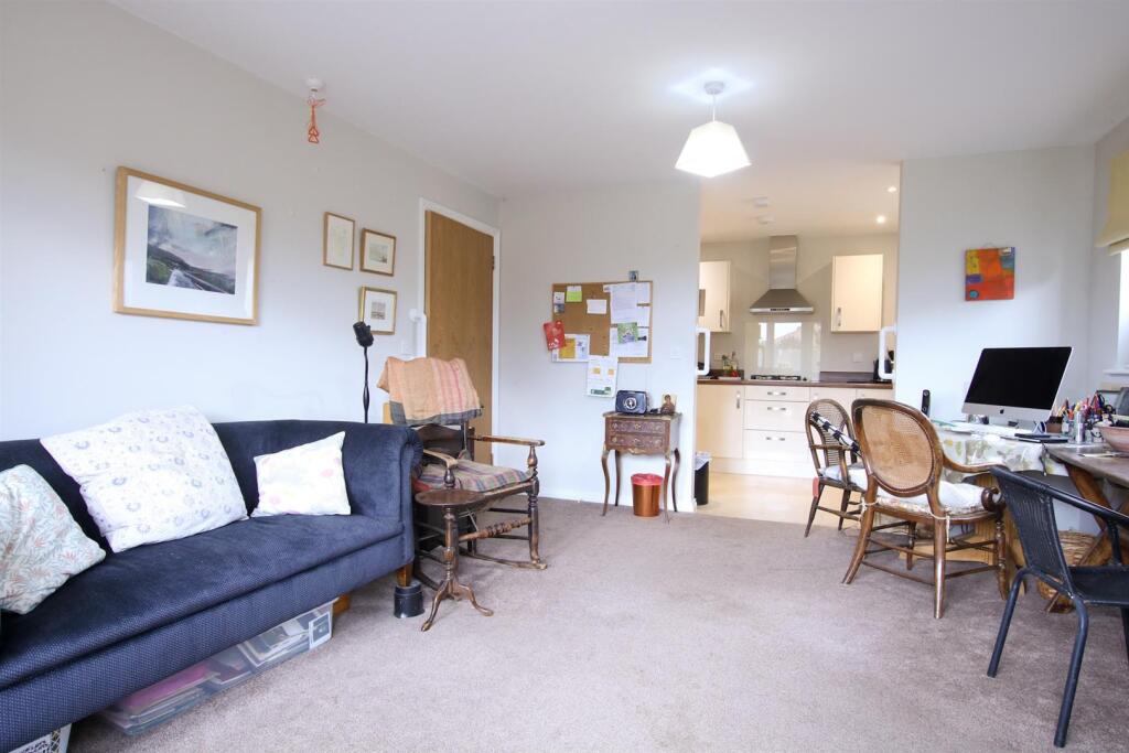
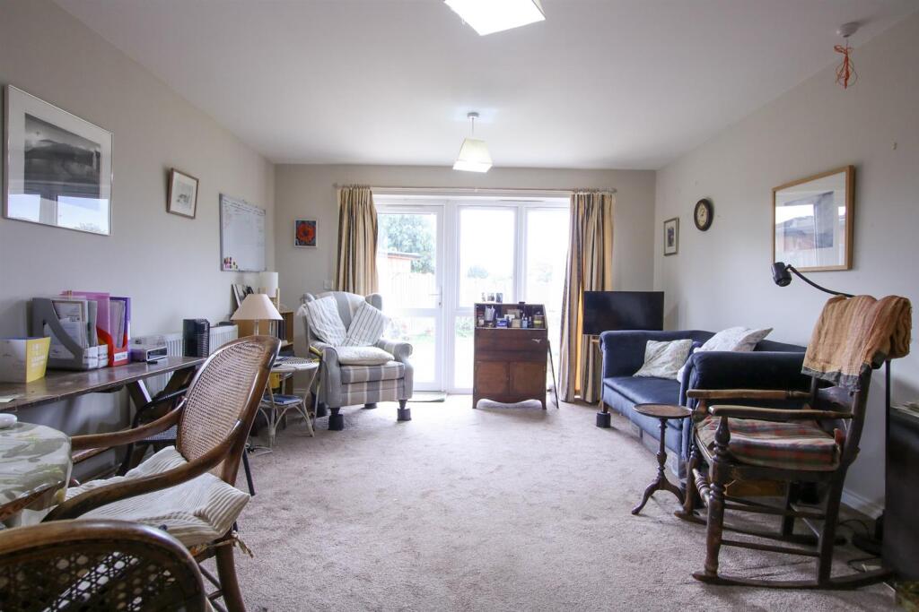
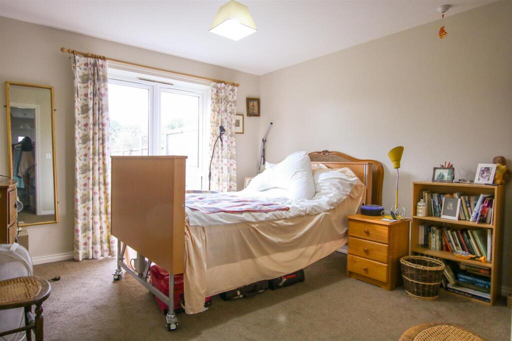
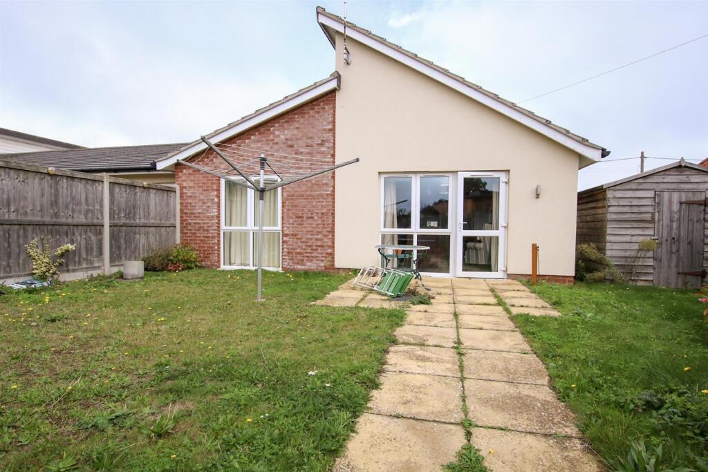
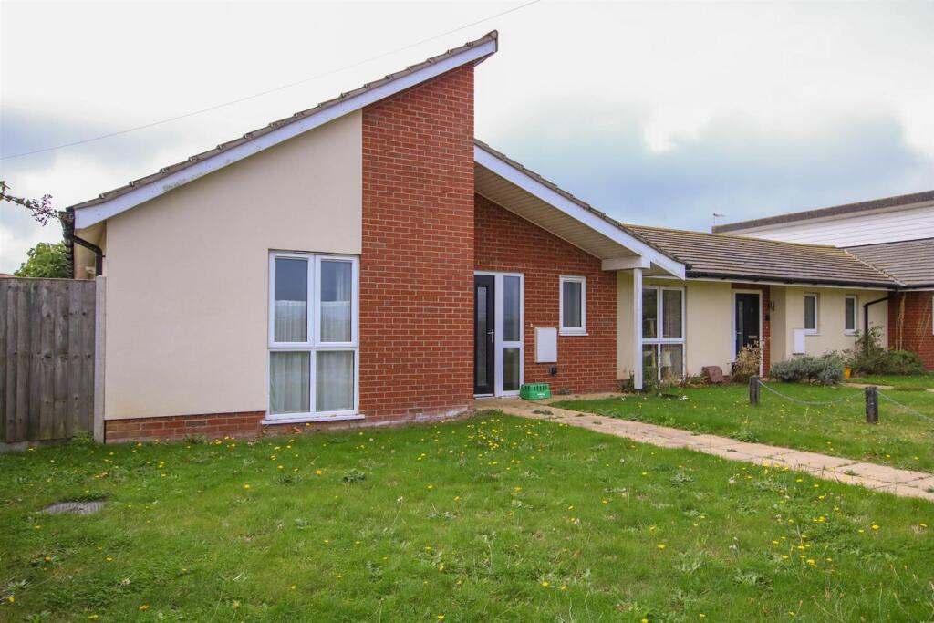
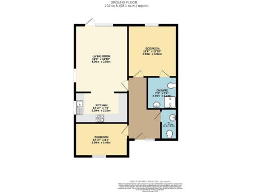
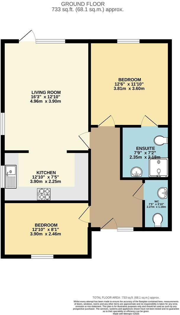
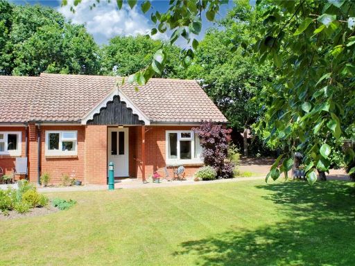
- Single-storey retirement bungalow (shared ownership for over 55s) located in Reydon. The property appears to offer 2 bedrooms (one with ensuite), open-plan kitchen and living room, gas central heating and double glazing. The design is adapted for ease of mobility and there is off‑road parking to the front. Externally there is a modest front lawn and a long, enclosed rear garden — narrow but relatively deep (average-to-large rear garden for a bungalow plot). The setting is a residential street with neighbouring houses visible; no notable views (sea/river/woodland) are evident from the images. Overall footprint suggests a small-to-average sized bungalow suitable for retirees.
Image Descriptions
- bungalow Modern
- rear exterior and garden modern bungalow
Rooms
- LIVING ROOM:
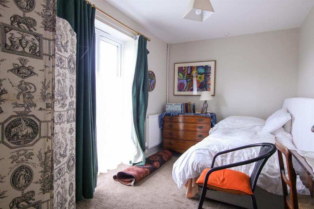
- BEDROOM:
- KITCHEN:
- BEDROOM:
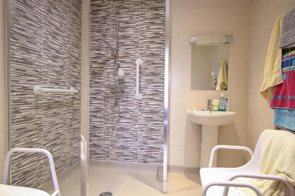
- ENSUITE:
- WC:
Textual Property Features
- Is Shared Ownership
- Has Garden
- Chain Free
- Is Retirement
- Success
Detected Visual Features
- modern bungalow
- single-story
- driveway
- large windows
- paved path
- pitched roof
- suburban
- detached
- modern
- bungalow
- single story
- rear garden
- lawn
- patio
- brickwork
- modern windows
- fenced garden
EPC Details
- High performance glazing
- Average thermal transmittance 0.19 W/m-¦K
- Boiler and radiators, mains gas
- Low energy lighting in all fixed outlets
- Average thermal transmittance 0.13 W/m-¦K
Nearby Schools
- Southwold Primary School
- Saint Felix School
- Wenhaston Primary School
- Reydon Primary School
- Brampton Church of England Primary School
Nearest Bars And Restaurants
- Id: 9758383331
- Tags:
- Amenity: cafe
- Name: The Canteen
- Website: https://www.oldhospitalhub.co.uk/canteen
- TagsNormalized:
- Lat: 52.3290926
- Lon: 1.6785837
- FullGeoHash: u131wnnr1cfs
- PartitionGeoHash: u131
- Images:
- FoodStandards: null
- Distance: 1990.6
,- Id: 93935057
- Tags:
- Addr:
- Amenity: cafe
- Building: yes
- Name: Pit Stop Cafe
- TagsNormalized:
- Lat: 52.3271454
- Lon: 1.6669917
- FullGeoHash: u131tvvgewzh
- PartitionGeoHash: u131
- Images:
- FoodStandards: null
- Distance: 1870.2
,- Id: 9317842758
- Tags:
- Amenity: cafe
- Website: https://www.southwoldrailway.co.uk/
- TagsNormalized:
- Lat: 52.3295752
- Lon: 1.6680418
- FullGeoHash: u131tyq9u5y5
- PartitionGeoHash: u131
- Images:
- FoodStandards: null
- Distance: 1624.5
,- Id: 7407661184
- Tags:
- Amenity: cafe
- Name: Old Hall Southwold Cafe & Walks
- TagsNormalized:
- Lat: 52.3359186
- Lon: 1.6438137
- FullGeoHash: u131trkyzdk6
- PartitionGeoHash: u131
- Images:
- FoodStandards: null
- Distance: 1473.9
,- Id: 8583468083
- Tags:
- Addr:
- City: Reydon
- Housenumber: 41
- Postcode: IP18 6PZ
- Street: Wangford Road
- Amenity: pub
- Name: The Randolph
- TagsNormalized:
- Lat: 52.3375812
- Lon: 1.6666407
- FullGeoHash: u131tzv8e832
- PartitionGeoHash: u131
- Images:
- FoodStandards: null
- Distance: 758.1
}
Nearest General Shops
- Id: 6432837575
- Tags:
- Name: Southwold Cycle Hire
- Shop: bicycle
- TagsNormalized:
- Lat: 52.3304428
- Lon: 1.6748781
- FullGeoHash: u131wn7wgmxd
- PartitionGeoHash: u131
- Images:
- FoodStandards: null
- Distance: 1725.6
,- Id: 499882602
- Tags:
- Building: yes
- Name: Suffolk Car Centre
- Second_hand: only
- Shop: car
- Website: https://www.suffolkcarcentre.co.uk
- TagsNormalized:
- Lat: 52.341024
- Lon: 1.6767223
- FullGeoHash: u131y0kuw6nc
- PartitionGeoHash: u131
- Images:
- FoodStandards: null
- Distance: 1075.8
,- Id: 7862958266
- Tags:
- Name: Reydon Garage Services
- Shop: car_repair
- TagsNormalized:
- garage
- service
- car repair
- repair
- shop
- Lat: 52.3415542
- Lon: 1.6763132
- FullGeoHash: u131y0kxsuvs
- PartitionGeoHash: u131
- Images:
- FoodStandards: null
- Distance: 1034.3
}
Nearest Grocery shops
- Id: 1225893714
- Tags:
- Amenity: fast_food
- Cuisine: fish_and_chips
- Name: Marks Fish Shop
- TagsNormalized:
- Lat: 52.3279188
- Lon: 1.676554
- FullGeoHash: u131wnhb4x16
- PartitionGeoHash: u131
- Images:
- FoodStandards: null
- Distance: 2024.7
,- Id: 734749681
- Tags:
- Brand: Londis
- Brand:wikidata: Q21008564
- Building: yes
- Name: Londis
- Shop: convenience
- TagsNormalized:
- Lat: 52.335385
- Lon: 1.6732018
- FullGeoHash: u131wp67sqve
- PartitionGeoHash: u131
- Images:
- FoodStandards: null
- Distance: 1214.2
,- Id: 1224739884
- Tags:
- Addr:
- City: Southwold
- Housenumber: 1
- Place: Reydon
- Postcode: IP18 6QG
- Street: Mount Pleasant
- Fhrs:
- Name: Boyden Stores
- Shop: convenience
- Source:
- TagsNormalized:
- Lat: 52.3409735
- Lon: 1.6699011
- FullGeoHash: u131vbrur88s
- PartitionGeoHash: u131
- Images:
- FoodStandards:
- Id: 1075149
- FHRSID: 1075149
- LocalAuthorityBusinessID: 18/00067/CP
- BusinessName: Boyden Stores
- BusinessType: Retailers - other
- BusinessTypeID: 4613
- AddressLine1: 1 Mount Pleasant
- AddressLine2: Reydon
- AddressLine3: Southwold
- AddressLine4: Suffolk
- PostCode: IP18 6QG
- RatingValue: 5
- RatingKey: fhrs_5_en-GB
- RatingDate: 2020-01-29
- LocalAuthorityCode: 302
- LocalAuthorityName: East Suffolk
- LocalAuthorityWebSite: http://www.eastsuffolk.gov.uk
- LocalAuthorityEmailAddress: environment@eastsuffolk.gov.uk
- Scores:
- Hygiene: 0
- Structural: 0
- ConfidenceInManagement: 5
- NewRatingPending: false
- Geocode:
- Longitude: 1.67042400000000
- Latitude: 52.34092600000000
- Distance: 644.1
}
Nearest Supermarkets
- Id: 793215064
- Tags:
- Addr:
- City: Lowestoft
- Country: GB
- Housename: Unit 1
- Place: Gateway Retail Park
- Postcode: NR33 7NR
- Brand: ALDI
- Brand:wikidata: Q41171672
- Brand:wikipedia: en:Aldi
- Building: retail
- Contact:
- Website: https://stores.aldi.co.uk/lowestoft/unit-1-gateway-retail-park
- Name: ALDI
- Opening_hours: Mo-Sa 08:00-22:00; Su 10:00-16:00
- Shop: supermarket
- TagsNormalized:
- aldi
- retail
- supermarket
- shop
- Lat: 52.445479
- Lon: 1.7228766
- FullGeoHash: u134r5qt1cvu
- PartitionGeoHash: u134
- Images:
- FoodStandards: null
- Distance: 12068.1
,- Id: 28511741
- Tags:
- Addr:
- City: Norwich
- Country: GB
- Housenumber: 18
- Postcode: NR33 7NG
- Street: Tower Road
- Brand: Morrisons
- Brand:wikidata: Q922344
- Brand:wikipedia: en:Morrisons
- Building: yes
- Contact:
- Website: https://my.morrisons.com/storefinder/286
- Name: Morrisons
- Shop: supermarket
- TagsNormalized:
- Lat: 52.4427285
- Lon: 1.7212179
- FullGeoHash: u134r4vm531h
- PartitionGeoHash: u134
- Images:
- FoodStandards: null
- Distance: 11742.3
,- Id: 1229980097
- Tags:
- Addr:
- City: Southwold
- Housenumber: 2
- Postcode: IP18 6EE
- Street: Market Place
- Brand: Co-op Food
- Brand:wikidata: Q3277439
- Brand:wikipedia: en:Co-op Food
- Fhrs:
- Name: Co-op Food
- Shop: supermarket
- Source:
- TagsNormalized:
- co-op
- co-op food
- food
- supermarket
- shop
- Lat: 52.3262915
- Lon: 1.6791432
- FullGeoHash: u131wjwwwzez
- PartitionGeoHash: u131
- Images:
- FoodStandards: null
- Distance: 2270.6
}
Nearest Religious buildings
- Id: 106298498
- Tags:
- Amenity: place_of_worship
- Building: yes
- Denomination: anglican
- Name: St Edmunds, Southwold
- Religion: christian
- Wikidata: Q15979341
- TagsNormalized:
- place of worship
- anglican
- christian
- church
- Lat: 52.3282297
- Lon: 1.678723
- FullGeoHash: u131wnn6j148
- PartitionGeoHash: u131
- Images:
- FoodStandards: null
- Distance: 2074.6
,- Id: 7248219634
- Tags:
- Amenity: place_of_worship
- Name: Reydon Chapel
- Source: OS-OpenData_StreetView
- TagsNormalized:
- Lat: 52.3409028
- Lon: 1.6707157
- FullGeoHash: u131y02ef7ry
- PartitionGeoHash: u131
- Images:
- FoodStandards: null
- Distance: 697.2
,- Id: 229018539
- Tags:
- Amenity: place_of_worship
- Building: church
- Denomination: anglican
- Name: St Margaret, Reydon
- Religion: christian
- Wikidata: Q17546804
- TagsNormalized:
- place of worship
- church
- anglican
- christian
- Lat: 52.3451769
- Lon: 1.6556989
- FullGeoHash: u131v9jsu84w
- PartitionGeoHash: u131
- Images:
- FoodStandards: null
- Distance: 428.4
}
Nearest Medical buildings
- Id: 6743186098
- Tags:
- Amenity: veterinary
- Name: Wangford Vetinerary Clinic
- TagsNormalized:
- Lat: 52.3567253
- Lon: 1.6229899
- FullGeoHash: u131ugmb42uz
- PartitionGeoHash: u131
- Images:
- FoodStandards: null
- Distance: 2992.2
,- Id: 7687688505
- Tags:
- Amenity: pharmacy
- Dispensing: yes
- Healthcare: pharmacy
- Name: Queen Street Pharmacy
- TagsNormalized:
- Lat: 52.3253107
- Lon: 1.6795902
- FullGeoHash: u131wjx112ch
- PartitionGeoHash: u131
- Images:
- FoodStandards: null
- Distance: 2379.5
,- Id: 2503168072
- Tags:
- Amenity: pharmacy
- Healthcare: pharmacy
- Source: survey
- TagsNormalized:
- Lat: 52.326365
- Lon: 1.6789272
- FullGeoHash: u131wjwx1v6v
- PartitionGeoHash: u131
- Images:
- FoodStandards: null
- Distance: 2256
,- Id: 499879371
- Tags:
- Addr:
- City: Southwold
- Housename: The Old Hospital
- Postcode: IP18 6LB
- Street: Field Stile Road
- Amenity: social_facility
- Building: yes
- Email: info@oldhospitalhub.co.uk
- Name: The Old Hospital Hub
- Old_name: Southwold Hospital
- Phone: +447883892532
- Source: OS OpenMap Local
- Website: https://www.oldhospitalhub.co.uk
- TagsNormalized:
- Lat: 52.3292203
- Lon: 1.6788106
- FullGeoHash: u131wnnrz1ey
- PartitionGeoHash: u131
- Images:
- FoodStandards: null
- Distance: 1988.2
}
Nearest Leisure Facilities
- Id: 720361347
- Tags:
- TagsNormalized:
- Lat: 52.338285
- Lon: 1.6696343
- FullGeoHash: u131tzzu973x
- PartitionGeoHash: u131
- Images:
- FoodStandards: null
- Distance: 812.4
,- Id: 295884335
- Tags:
- Leisure: park
- Name: The Rec
- TagsNormalized:
- Lat: 52.3422672
- Lon: 1.6702043
- FullGeoHash: u131y085y9f9
- PartitionGeoHash: u131
- Images:
- FoodStandards: null
- Distance: 612.3
,- Id: 295884336
- Tags:
- TagsNormalized:
- Lat: 52.3420971
- Lon: 1.6694008
- FullGeoHash: u131vbxdgf57
- PartitionGeoHash: u131
- Images:
- FoodStandards: null
- Distance: 564.9
,- Id: 295883944
- Tags:
- TagsNormalized:
- Lat: 52.3434641
- Lon: 1.6688422
- FullGeoHash: u131vbz4ybfv
- PartitionGeoHash: u131
- Images:
- FoodStandards: null
- Distance: 501.2
,- Id: 974124524
- Tags:
- TagsNormalized:
- Lat: 52.3417182
- Lon: 1.6622299
- FullGeoHash: u131vbd2sg2q
- PartitionGeoHash: u131
- Images:
- FoodStandards: null
- Distance: 217.9
}
Nearest Tourist attractions
- Id: 9317842759
- Tags:
- Addr:
- City: Southwold
- Postcode: IP18 6AZ
- Street: Blyth Road
- Museum: railway
- Name: Southwold Railway Trust
- Operator: Southwold Railway Trust
- Tourism: museum
- Website: https://www.southwoldrailway.co.uk/
- TagsNormalized:
- Lat: 52.3295516
- Lon: 1.6674698
- FullGeoHash: u131tyq1wz7w
- PartitionGeoHash: u131
- Images:
- FoodStandards: null
- Distance: 1616.8
,- Id: 1009884610
- Tags:
- Information: visitor_centre
- Name: Southwold Railway Steamworks
- Tourism: attraction
- Website: https://www.southwoldrailway.co.uk/
- TagsNormalized:
- Lat: 52.3297941
- Lon: 1.6677404
- FullGeoHash: u131tyq7jhtk
- PartitionGeoHash: u131
- Images:
- FoodStandards: null
- Distance: 1595.6
,- Id: 2996440531
- Tags:
- Name: Jubilee Certified Site
- Tourism: caravan_site
- TagsNormalized:
- Lat: 52.3435438
- Lon: 1.668664
- FullGeoHash: u131vbz54xy1
- PartitionGeoHash: u131
- Images:
- FoodStandards: null
- Distance: 488.9
}
Nearest Train stations
- Id: 263373872
- Tags:
- Name: Oulton Broad South
- Naptan:
- Network: National Rail
- Old_name: Carlton Colville
- Public_transport: station
- Railway: station
- Ref:
- Wikidata: Q1870239
- Wikipedia: en:Oulton Broad South railway station
- TagsNormalized:
- Lat: 52.4695869
- Lon: 1.7074886
- FullGeoHash: u134qzg37rgv
- PartitionGeoHash: u134
- Images:
- FoodStandards: null
- Distance: 14350.3
,- Id: 252746160
- Tags:
- Name: Beccles
- Naptan:
- Network: National Rail
- Public_transport: station
- Railway: station
- Ref:
- Source: NPE
- Wikidata: Q2659206
- Wikipedia: en:Beccles railway station
- TagsNormalized:
- Lat: 52.4588262
- Lon: 1.5696314
- FullGeoHash: u1347tyfz1fp
- PartitionGeoHash: u134
- Images:
- FoodStandards: null
- Distance: 14244.9
,- Id: 252754155
- Tags:
- Name: Darsham
- Naptan:
- Network: National Rail
- Public_transport: station
- Railway: station
- Ref:
- Source: Bing
- Train: yes
- Wikidata: Q2998721
- Wikipedia: en:Darsham railway station
- TagsNormalized:
- Lat: 52.2730379
- Lon: 1.5235658
- FullGeoHash: u1316sj2t8t1
- PartitionGeoHash: u131
- Images:
- FoodStandards: null
- Distance: 12227
,- Id: 1080701323
- Tags:
- Name: Halesworth
- Naptan:
- Network: National Rail
- Public_transport: station
- Railway: station
- Ref:
- Wikidata: Q2406246
- Wikipedia: en:Halesworth railway station
- TagsNormalized:
- Lat: 52.3469592
- Lon: 1.5057452
- FullGeoHash: u131f32rnkky
- PartitionGeoHash: u131
- Images:
- FoodStandards: null
- Distance: 10584.6
,- Id: 256709377
- Tags:
- Name: Brampton
- Naptan:
- Network: National Rail
- Public_transport: station
- Railway: station
- Ref:
- Request_stop: yes
- Wikidata: Q2599812
- Wikipedia: en:Brampton railway station (Suffolk)
- TagsNormalized:
- Lat: 52.3955079
- Lon: 1.5438215
- FullGeoHash: u13454k1vwse
- PartitionGeoHash: u134
- Images:
- FoodStandards: null
- Distance: 9853.1
}
Nearest Hotels
- Id: 1634529426
- Tags:
- Addr:
- City: Southwold
- Postcode: IP18 6DP
- Street: High Street
- Fhrs:
- Name: Crown Hotel
- Source:
- Tourism: hotel
- Wikidata: Q26664219
- TagsNormalized:
- Lat: 52.326583
- Lon: 1.678577
- FullGeoHash: u131wjy23wj9
- PartitionGeoHash: u131
- Images:
- FoodStandards: null
- Distance: 2222.8
,- Id: 6736915655
- Tags:
- Name: Sutherland House
- Tourism: hotel
- Wikidata: Q17547026
- TagsNormalized:
- Lat: 52.3275177
- Lon: 1.677183
- FullGeoHash: u131wjvmchq3
- PartitionGeoHash: u131
- Images:
- FoodStandards: null
- Distance: 2084.9
,- Id: 684178049
- Tags:
- Addr:
- City: Southwold
- Postcode: IP18 6AY
- Street: Station Road
- Fhrs:
- Name: Blyth Hotel
- Source: survey
- Source:addr: FHRS Open Data
- Tourism: hotel
- TagsNormalized:
- Lat: 52.330658
- Lon: 1.6753614
- FullGeoHash: u131wnebnv8n
- PartitionGeoHash: u131
- Images:
- FoodStandards: null
- Distance: 1723.1
}
Tags
- modern bungalow
- single-story
- driveway
- large windows
- paved path
- pitched roof
- suburban
- detached
- modern
- bungalow
- single story
- rear garden
- lawn
- patio
- brickwork
- modern windows
- fenced garden
Local Market Stats
- Average Price/sqft: £507
- Avg Income: £41600
- Social Housing: 11%
- Planning Success Rate: 90%
AirBnB Data
- 1km average: £165/night
- Listings in 1km: 5
Similar Properties
 2 bedroom bungalow for sale in Lowestoft Road, Reydon, Southwold, Suffolk, IP18 — £200,000 • 2 bed • 1 bath • 733 ft²
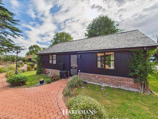 2 bedroom detached bungalow for sale in Carlton Hall Gardens, Chapel Road, Carlton Colville, Lowestoft, NR33 — £245,000 • 2 bed • 1 bath • 584 ft²
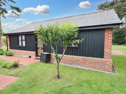 2 bedroom bungalow for sale in Chapel Road, Carlton Colville, Lowestoft, NR33 — £265,000 • 2 bed • 1 bath • 624 ft²
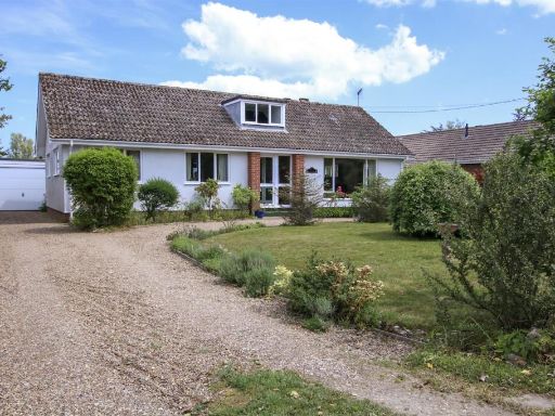 3 bedroom detached bungalow for sale in Keens Lane, Reydon, Southwold, IP18 — £475,000 • 3 bed • 1 bath • 1222 ft²
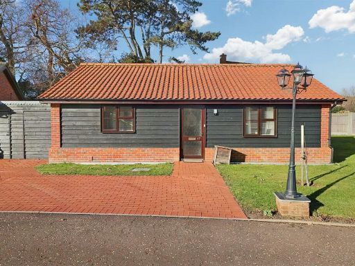 2 bedroom detached bungalow for sale in Chapel Road, Carlton Colville, Lowestoft, NR33 — £265,000 • 2 bed • 1 bath • 623 ft²
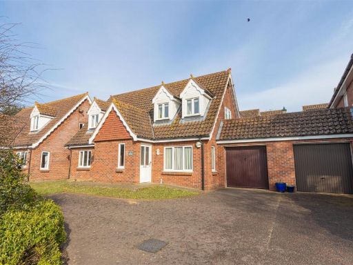 3 bedroom link detached house for sale in Covert Road, Reydon, IP18 — £260,000 • 3 bed • 2 bath • 1357 ft²
Meta
- {
"@context": "https://schema.org",
"@type": "Residence",
"name": "2 bedroom bungalow for sale in Wangford Road, Reydon,, IP18",
"description": "",
"url": "https://propertypiper.co.uk/property/317ed9b3-c8c6-4eed-a05d-2b9c1198d434",
"image": "https://image-a.propertypiper.co.uk/cc8fba51-07ff-4e16-8293-37ddc2caa486-1024.jpeg",
"address": {
"@type": "PostalAddress",
"streetAddress": "Wangford Road, Reydon,",
"postalCode": "IP18 6PL",
"addressLocality": "East Suffolk",
"addressRegion": "Suffolk Coastal",
"addressCountry": "England"
},
"geo": {
"@type": "GeoCoordinates",
"latitude": 52.34362218560677,
"longitude": 1.6614684030332816
},
"numberOfRooms": 2,
"numberOfBathroomsTotal": 1,
"floorSize": {
"@type": "QuantitativeValue",
"value": 733,
"unitCode": "FTK"
},
"offers": {
"@type": "Offer",
"price": 225000,
"priceCurrency": "GBP",
"availability": "https://schema.org/InStock"
},
"additionalProperty": [
{
"@type": "PropertyValue",
"name": "Feature",
"value": "modern bungalow"
},
{
"@type": "PropertyValue",
"name": "Feature",
"value": "single-story"
},
{
"@type": "PropertyValue",
"name": "Feature",
"value": "driveway"
},
{
"@type": "PropertyValue",
"name": "Feature",
"value": "large windows"
},
{
"@type": "PropertyValue",
"name": "Feature",
"value": "paved path"
},
{
"@type": "PropertyValue",
"name": "Feature",
"value": "pitched roof"
},
{
"@type": "PropertyValue",
"name": "Feature",
"value": "suburban"
},
{
"@type": "PropertyValue",
"name": "Feature",
"value": "detached"
},
{
"@type": "PropertyValue",
"name": "Feature",
"value": "modern"
},
{
"@type": "PropertyValue",
"name": "Feature",
"value": "bungalow"
},
{
"@type": "PropertyValue",
"name": "Feature",
"value": "single story"
},
{
"@type": "PropertyValue",
"name": "Feature",
"value": "rear garden"
},
{
"@type": "PropertyValue",
"name": "Feature",
"value": "lawn"
},
{
"@type": "PropertyValue",
"name": "Feature",
"value": "patio"
},
{
"@type": "PropertyValue",
"name": "Feature",
"value": "brickwork"
},
{
"@type": "PropertyValue",
"name": "Feature",
"value": "modern windows"
},
{
"@type": "PropertyValue",
"name": "Feature",
"value": "fenced garden"
}
]
}
High Res Floorplan Images
Compatible Floorplan Images
FloorplanImages Thumbnail