PE26 1NB - 3 bedroom detached house for sale in Biggin Lane, Ramsey, H…
View on Property Piper
3 bedroom detached house for sale in Biggin Lane, Ramsey, Huntingdon, PE26
Property Details
- Price: £450000
- Bedrooms: 3
- Bathrooms: 1
- Property Type: undefined
- Property SubType: undefined
Brochure Descriptions
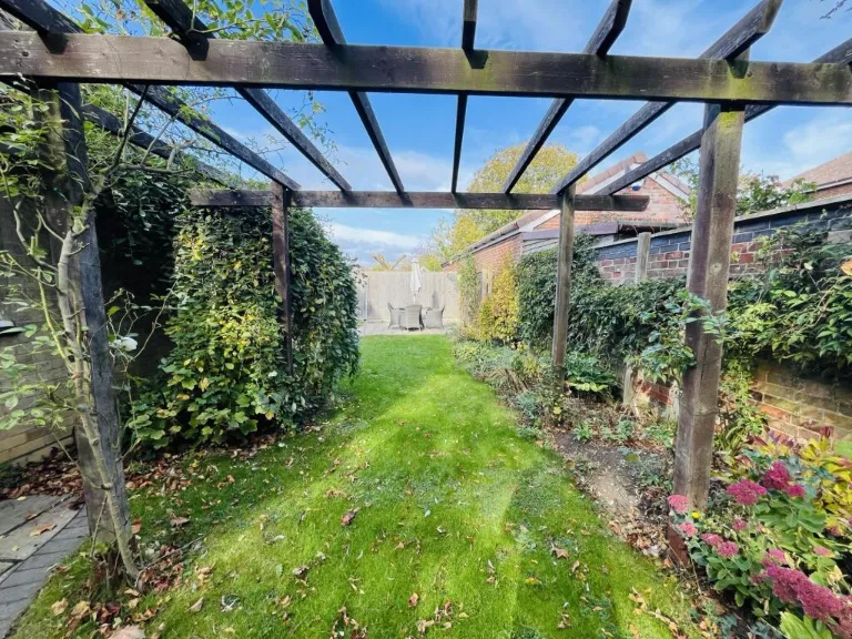
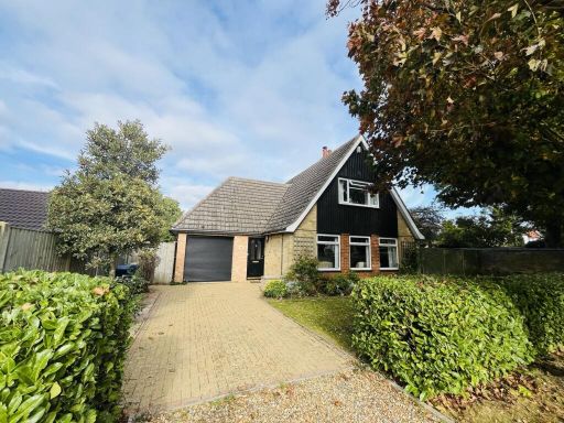
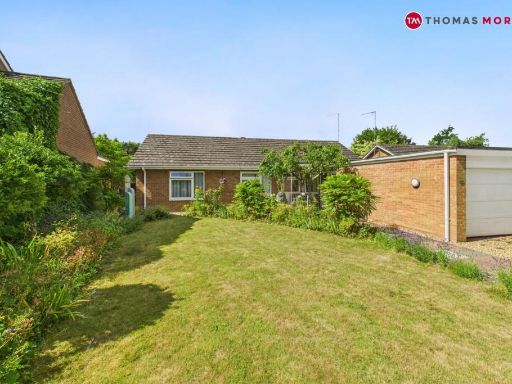
- Detached chalet-style bungalow set back from the road on Biggin Lane, Ramsey (Huntingdon). The property appears to have a pitched roof with dormer/first-floor accommodation, an integral single garage with an electronic roller door and a wide block-paved driveway providing off-street parking for multiple vehicles. Front garden is regularly maintained with hedging and mature trees offering privacy; lawn and planted beds are present. Property appears to be of average to above-average plot size for the area (garden depth visible to the right), suggesting a medium-sized overall plot. Exterior construction is mixed brick and timber cladding. No notable elevated or wide-reaching views visible from the image (private suburban/treelined street). Overall impression: a well-presented, family-orientated home with good kerb appeal, useful garage/storage, and off-street parking — suitable for purchasers seeking a spacious bungalow with potential for first-floor bedrooms or conversion works.
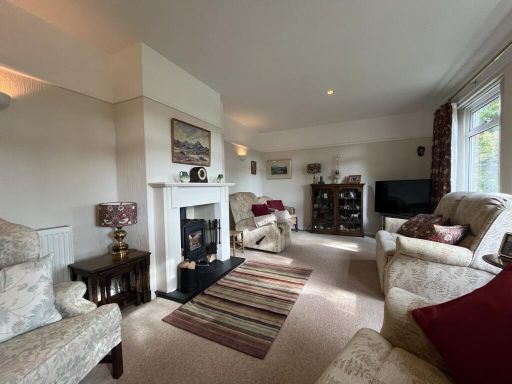
- Marketing panel shows contact details and a staged interior shot only. Based on the imagery and listing header this appears to be a residential property in Ramsey, Huntingdon (PE26 1HG). The interior photo depicts a neutral, modern living room environment with a two-seater/three-seater sofa and compact seating area, suggesting average-sized reception space suitable for a small family or couple. Finishings look contemporary and well presented. No external photos, floorplans or room counts are provided so overall property size, bedroom/bathroom numbers and garden size cannot be determined from the image alone. Valuation remarks: likely a mid-terrace or semi-detached town property in Ramsey market; condition appears good cosmetically, but recommend internal inspection, confirmation of floor area, room count and any recent refurbishments, plus a formal survey to determine construction, services and exact market value.
Image Descriptions
- detached house modern
- utility room modern
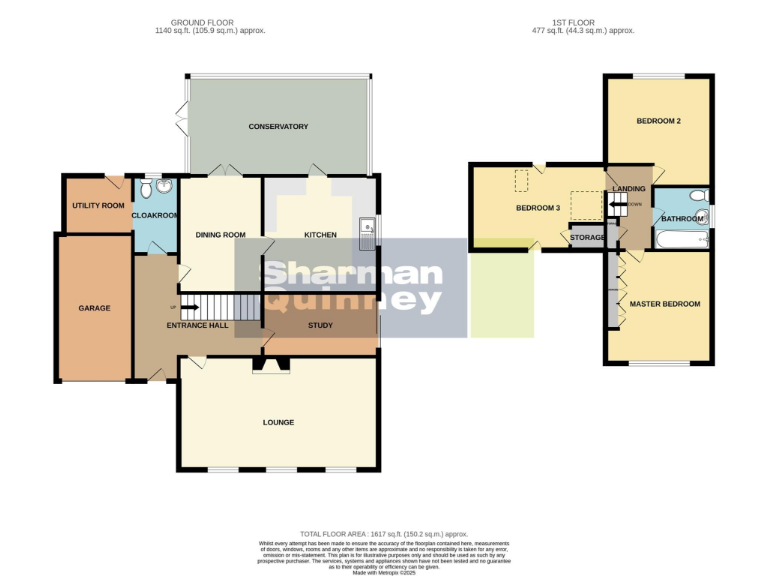
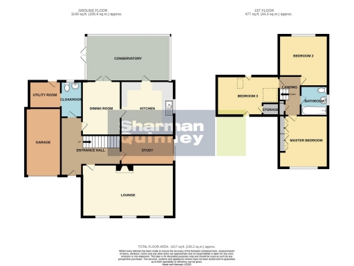
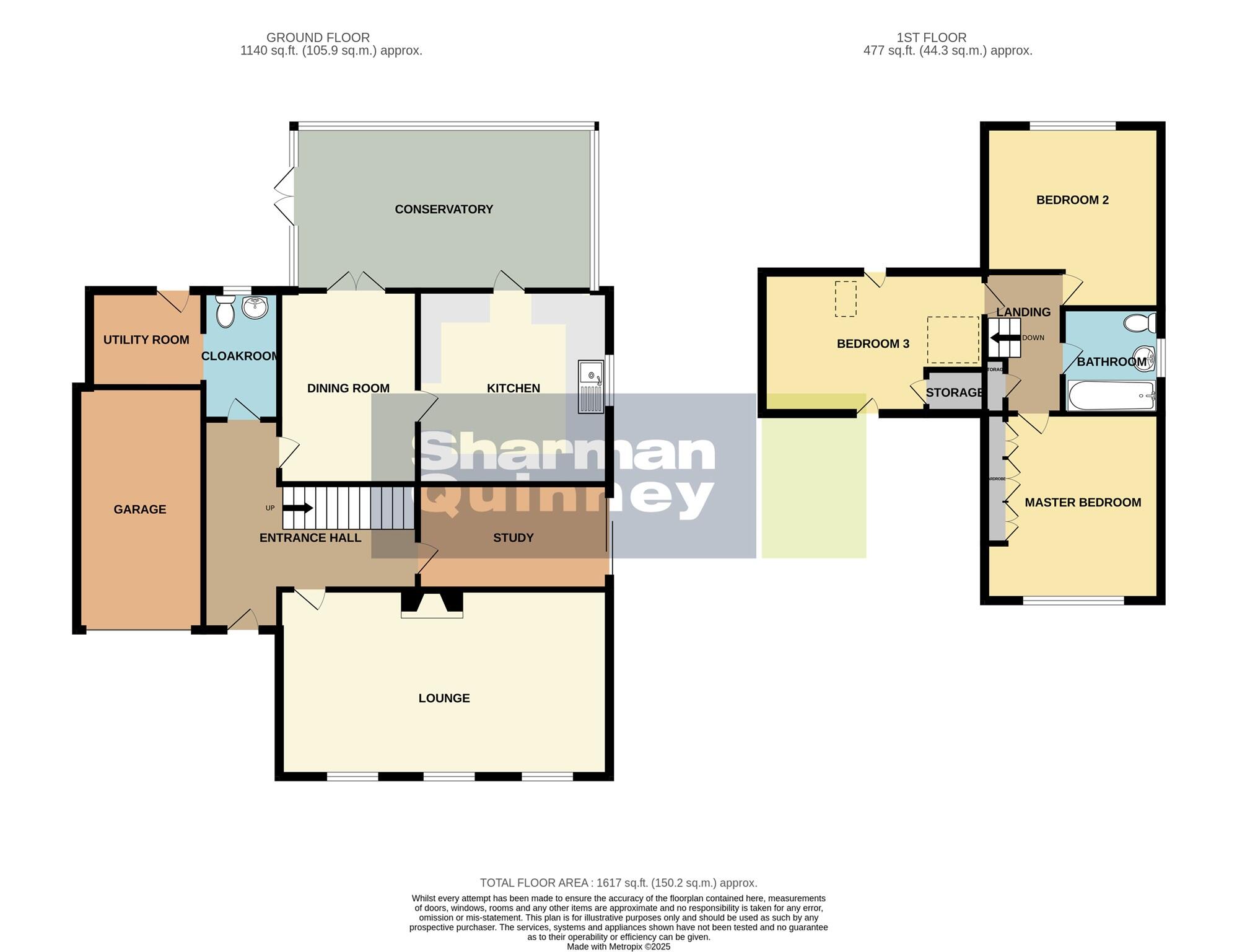
Rooms
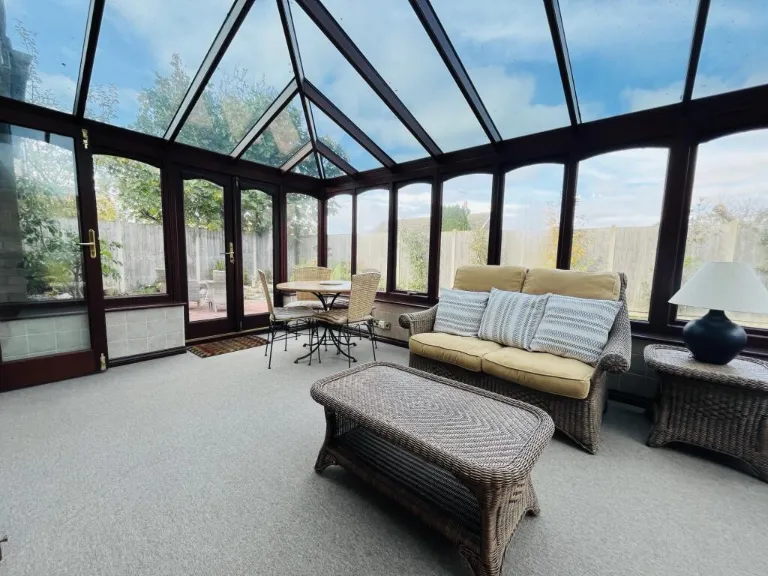
- CONSERVATORY:
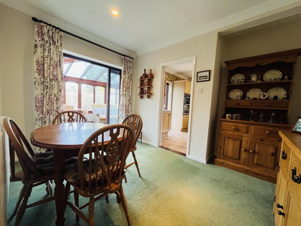
- DINING ROOM:
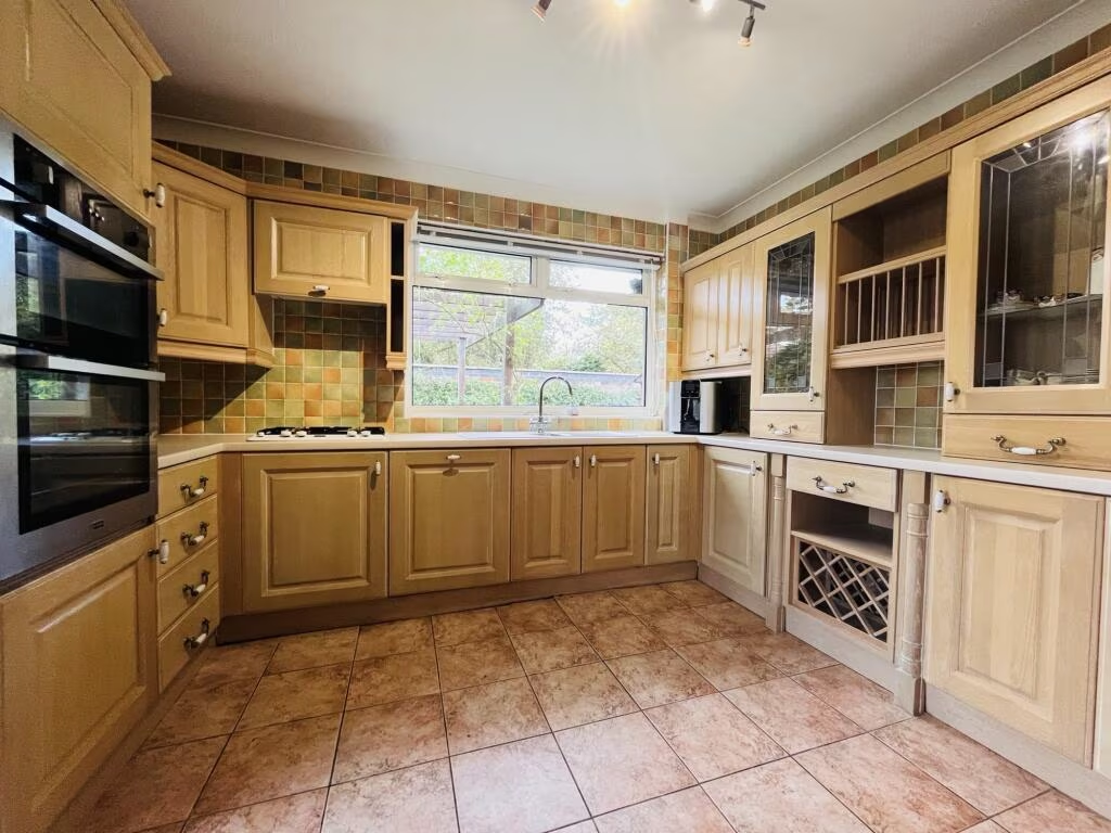
- KITCHEN:
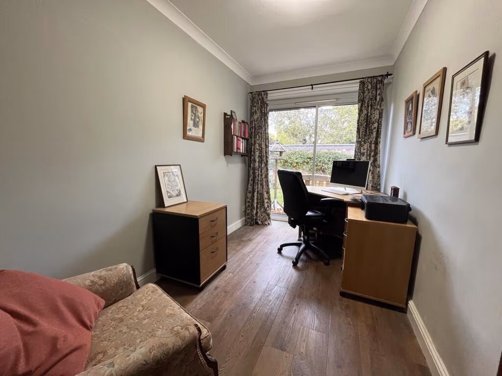
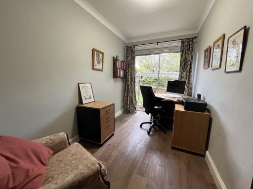
- STUDY:
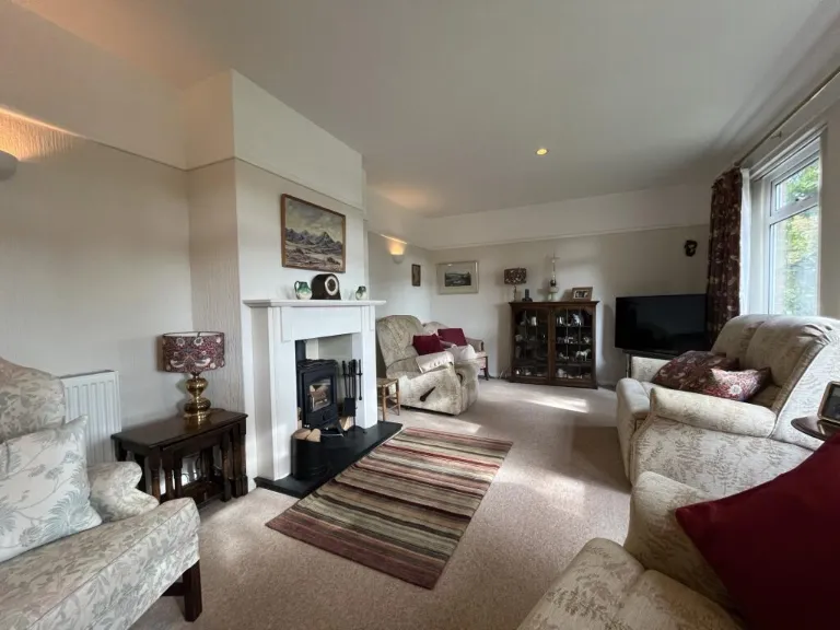
- LOUNGE:
- ENTRANCE HALL:
- GARAGE:
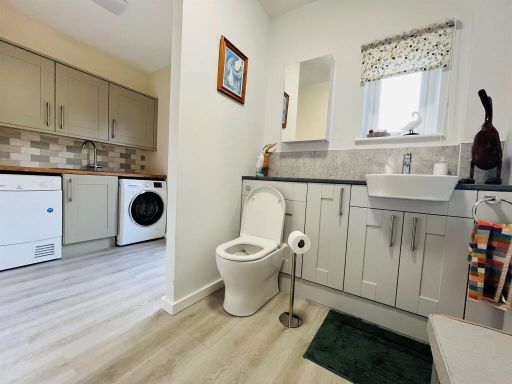
- UTILITY ROOM:
- CLOAKROOM:
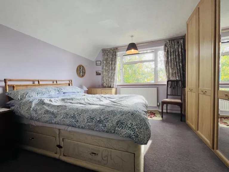
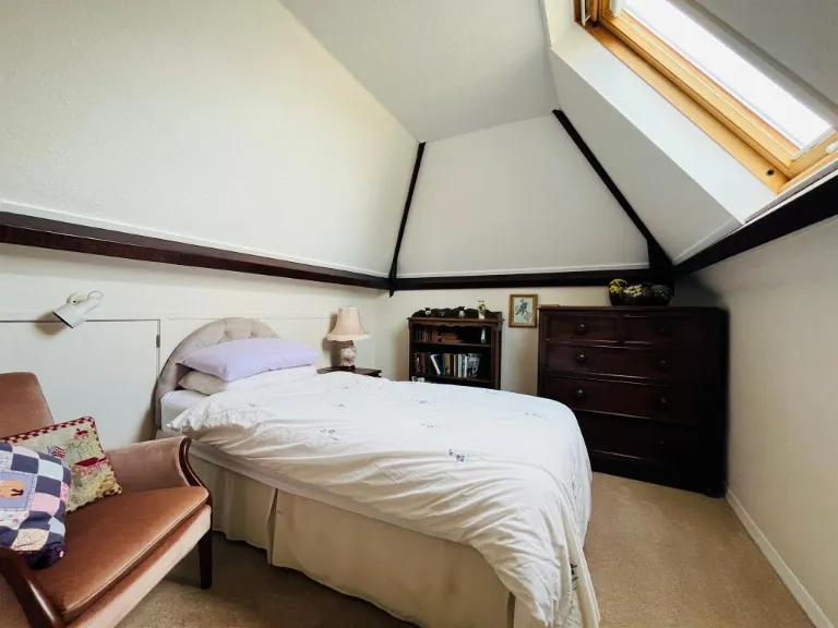
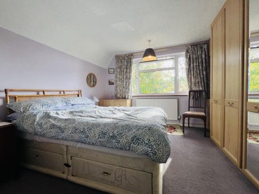
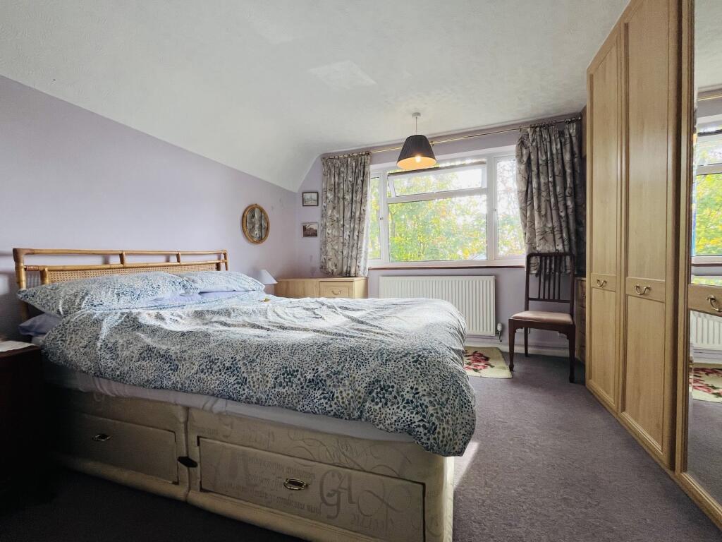
- MASTER BEDROOM:
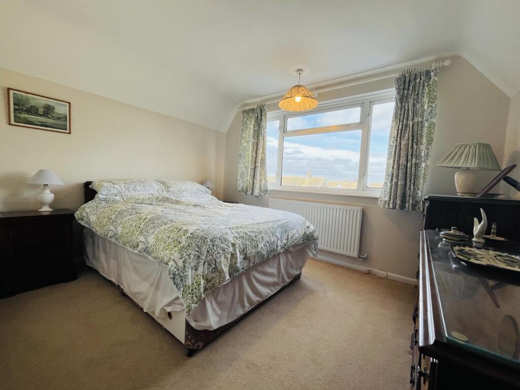
- BEDROOM 2:
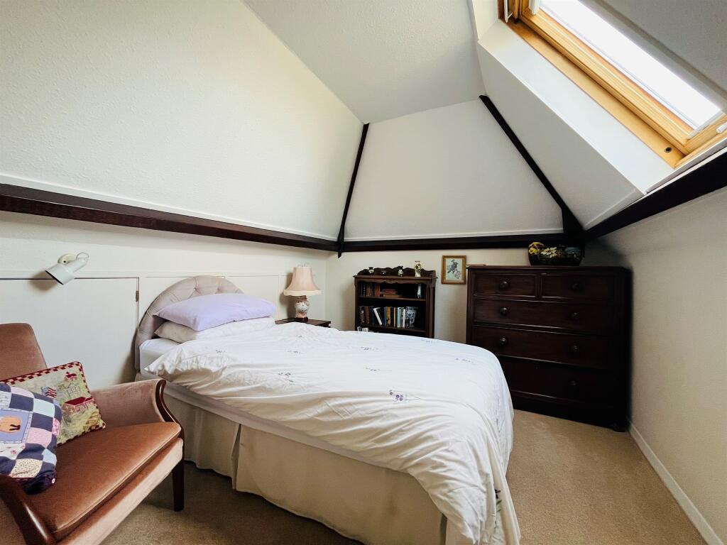
- BEDROOM 3:
- LANDING:
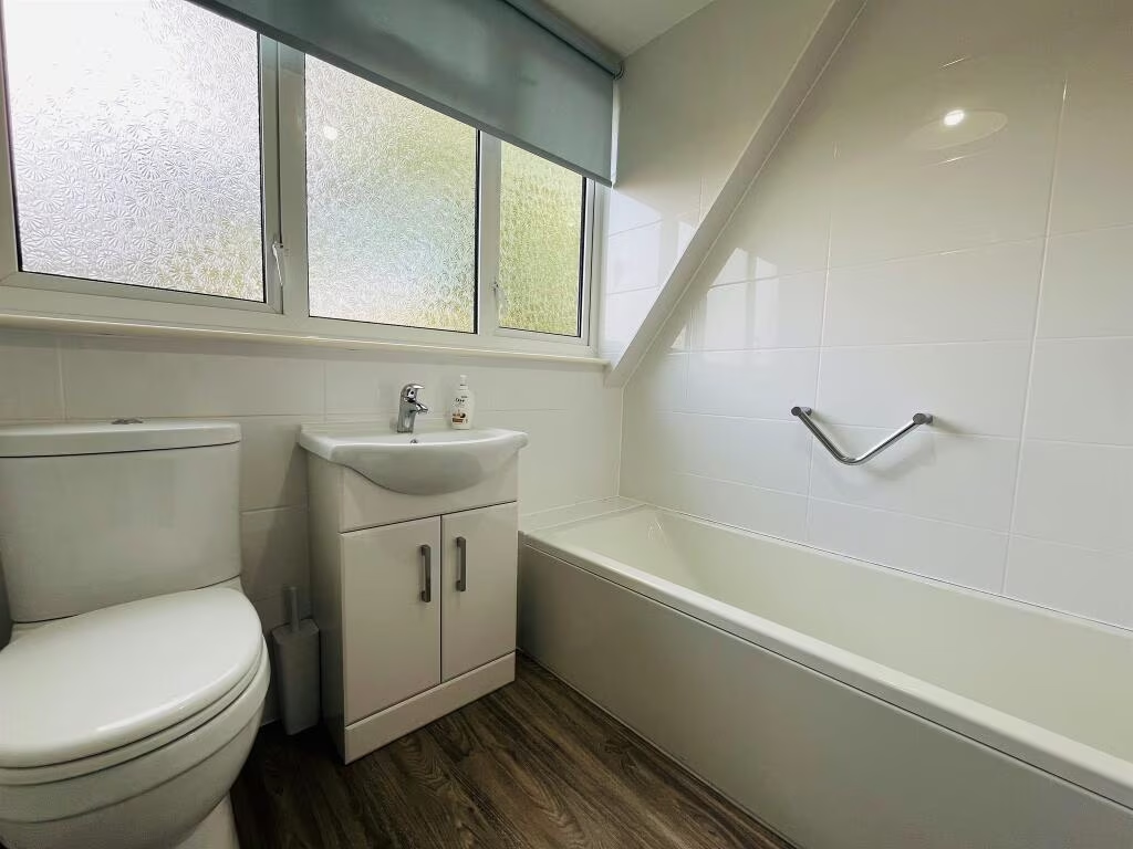
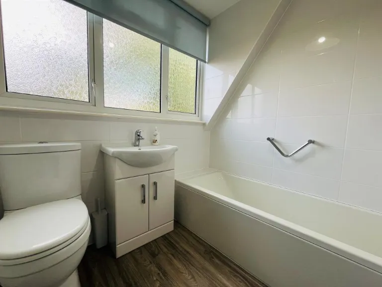
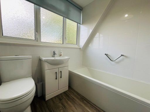
- BATHROOM:
- STORAGE:
Textual Property Features
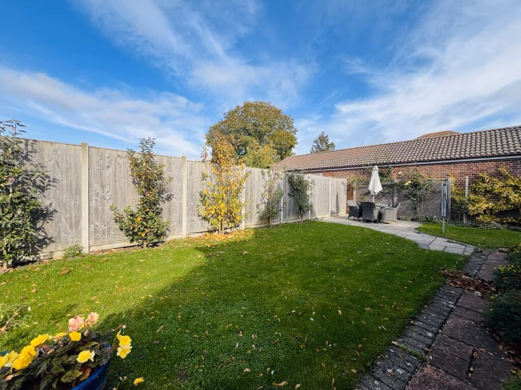
- Has Garden
- Chain Free
- Success
Detected Visual Features
- modern house
- detached
- pitched roof
- garage
- front garden
- brick facade
- black cladding
- large windows
- hedges
- modern
- utility room
- white cabinets
- sink
- washing machine
- light wood flooring
- tile backsplash
- compact
- functional
- bright
EPC Details
- Fully double glazed
- Cavity wall, filled cavity
- Boiler and radiators, mains gas
- Low energy lighting in 40% of fixed outlets
- Solid, no insulation (assumed)
Nearby Schools
- Warboys Primary Academy
- Ramsey Spinning Infant School
- Benwick Primary School
- Abbots Ripton CofE Primary School
- Upwood Primary Academy
- Bury CofE Primary School
- Ramsey Junior School
- The Ashbeach Primary School
- Abbey College, Ramsey
Nearest Bars And Restaurants
- Id: 7406402044
- Tags:
- Amenity: fast_food
- Cuisine: chinese
- Name: China Hong
- TagsNormalized:
- Lat: 52.4481128
- Lon: -0.1079151
- FullGeoHash: gcrfmeckmkue
- PartitionGeoHash: gcrf
- Images:
- FoodStandards: null
- Distance: 886.9
,- Id: 7406402045
- Tags:
- Addr:
- City: Ramsey
- Housenumber: 38
- Postcode: PE26 1AA
- Street: High Street
- Amenity: fast_food
- Cuisine: pizza
- Drive_through: no
- Name: The Golden Pizza Company
- Old_name: Chilli Express
- Website: https://www.goldenpizzaramsey.co.uk
- TagsNormalized:
- Lat: 52.4481046
- Lon: -0.1082785
- FullGeoHash: gcrfmechkgmd
- PartitionGeoHash: gcrf
- Images:
- FoodStandards: null
- Distance: 864.2
,- Id: 694711446
- Tags:
- Amenity: fast_food
- Cuisine: chinese;fish_and_chips
- Name: Wing Hing Fish Bar & Chinese
- TagsNormalized:
- Lat: 52.4502741
- Lon: -0.1165349
- FullGeoHash: gcrfmk70uxc2
- PartitionGeoHash: gcrf
- Images:
- FoodStandards: null
- Distance: 649.5
,- Id: 231915995
- Tags:
- Amenity: pub
- Building: yes
- TagsNormalized:
- Lat: 52.4399652
- Lon: -0.1147428
- FullGeoHash: gcrfm6kkyq19
- PartitionGeoHash: gcrf
- Images:
- FoodStandards: null
- Distance: 636.4
,- Id: 692256414
- Tags:
- Amenity: pub
- Name: The White Lion
- TagsNormalized:
- Lat: 52.4399896
- Lon: -0.114717
- FullGeoHash: gcrfm6kmnfsf
- PartitionGeoHash: gcrf
- Images:
- FoodStandards: null
- Distance: 635
}
Nearest General Shops
- Id: 8718873056
- Tags:
- Addr:
- City: Ramsey
- Postcode: PE26 1NE
- Street: High Street
- Name: Home & Vintage (Hope For The Nations)
- Operator: Hope For The Nations
- Shop: charity
- Website: https://www.facebook.com/hopeforthenationscharityshop/
- TagsNormalized:
- Lat: 52.4404393
- Lon: -0.1142144
- FullGeoHash: gcrfm6kzdw7t
- PartitionGeoHash: gcrf
- Images:
- FoodStandards: null
- Distance: 614.1
,- Id: 792126412
- Tags:
- Building: yes
- Name: G Tinkler
- Operator: Tinklers
- Shop: car_repair
- TagsNormalized:
- Lat: 52.445043
- Lon: -0.1111343
- FullGeoHash: gcrfm7r4d2s7
- PartitionGeoHash: gcrf
- Images:
- FoodStandards: null
- Distance: 588.5
,- Id: 7405810784
- Tags:
- Name: Swearers Funeral Directors
- Operator: Dignity
- Shop: funeral_directors
- TagsNormalized:
- funeral
- funeral directors
- shop
- Lat: 52.448807
- Lon: -0.114309
- FullGeoHash: gcrfmkhb2qm0
- PartitionGeoHash: gcrf
- Images:
- FoodStandards: null
- Distance: 582.2
}
Nearest Grocery shops
- Id: 692256405
- Tags:
- Name: Bury Stores
- Shop: convenience
- TagsNormalized:
- Lat: 52.4382091
- Lon: -0.1129225
- FullGeoHash: gcrfm6jf8wwv
- PartitionGeoHash: gcrf
- Images:
- FoodStandards: null
- Distance: 867.4
,- Id: 694711462
- Tags:
- Brand: Premier
- Brand:wikidata: Q7240340
- Brand:wikipedia: en:Premier Stores
- Name: Premier
- Shop: convenience
- TagsNormalized:
- Lat: 52.4508945
- Lon: -0.1149885
- FullGeoHash: gcrfmkkk8e6k
- PartitionGeoHash: gcrf
- Images:
- FoodStandards: null
- Distance: 753.8
,- Id: 693745602
- Tags:
- Addr:
- City: Ramsey
- Postcode: PE26 1NE
- Street: Bury Road
- Brand: Spar
- Brand:wikidata: Q610492
- Brand:wikipedia: en:Spar (retailer)
- Name: Spar
- Shop: convenience
- TagsNormalized:
- Lat: 52.4405713
- Lon: -0.1140696
- FullGeoHash: gcrfm6sbmzp8
- PartitionGeoHash: gcrf
- Images:
- FoodStandards: null
- Distance: 608.8
}
Nearest Supermarkets
- Id: 418294965
- Tags:
- Addr:
- City: Huntingdon
- Postcode: PE28 2LA
- Street: Abbots Ripton Road
- Alt_name: Tesco Huntingdon Extra
- Brand: Tesco Extra
- Brand:wikidata: Q25172225
- Brand:wikipedia: en:Tesco Extra
- Building: yes
- Contact:
- Website: https://www.tesco.com/store-locator/huntingdon/abbots-ripton-rd
- Name: Tesco Extra
- Opening_hours: Mo-Sa 00:00-24:00; Su 10:00-16:00
- Operator: Tesco Stores Ltd
- Shop: supermarket
- TagsNormalized:
- tesco
- tesco extra
- supermarket
- shop
- Lat: 52.352814
- Lon: -0.1800343
- FullGeoHash: gcrcgfschzue
- PartitionGeoHash: gcrc
- Images:
- FoodStandards: null
- Distance: 11012.8
,- Id: 626657650
- Tags:
- Brand: Tesco
- Brand:wikidata: Q487494
- Brand:wikipedia: en:Tesco
- Building: retail
- Fhrs:
- Name: Tesco
- Old_name: Jack's
- Shop: supermarket
- Website: https://www.tesco.com/store-locator/cambridgeshire/fenland-way
- TagsNormalized:
- tesco
- retail
- supermarket
- shop
- Lat: 52.4576857
- Lon: 0.0409281
- FullGeoHash: u1242vtu1tqh
- PartitionGeoHash: u124
- Images:
- FoodStandards: null
- Distance: 10986.5
,- Id: 412714255
- Tags:
- Addr:
- City: Ramsey
- Postcode: PE26 2SB
- Street: Neil Way
- Alt_name: Tesco Ramsey Superstore
- Brand: Tesco
- Brand:wikidata: Q487494
- Brand:wikipedia: en:Tesco
- Building: yes
- Contact:
- Website: https://www.tesco.com/store-locator/huntingdon/neil-way
- Name: Tesco
- Operator: Tesco Stores Ltd
- Shop: supermarket
- TagsNormalized:
- Lat: 52.4560155
- Lon: -0.1126972
- FullGeoHash: gcrfmmmfmynb
- PartitionGeoHash: gcrf
- Images:
- FoodStandards: null
- Distance: 1338.6
}
Nearest Religious buildings
- Id: 231915992
- Tags:
- Amenity: school
- Denomination: anglican
- Isced:
- Name: Bury Church of England Primary School
- Operator: Cambridgeshire County Council
- Religion: christian
- Wikidata: Q67149658
- TagsNormalized:
- school
- anglican
- church
- christian
- Lat: 52.4373485
- Lon: -0.1125197
- FullGeoHash: gcrfm3yjdn5p
- PartitionGeoHash: gcrf
- Images:
- FoodStandards: null
- Distance: 963.1
,- Id: 231915990
- Tags:
- Amenity: place_of_worship
- Building: church
- Denomination: baptist
- Name: Salem Baptist Church
- Religion: christian
- TagsNormalized:
- place of worship
- church
- baptist
- christian
- Lat: 52.4477809
- Lon: -0.1069717
- FullGeoHash: gcrfmef47qup
- PartitionGeoHash: gcrf
- Images:
- FoodStandards: null
- Distance: 931.6
,- Id: 232018931
- Tags:
- Amenity: place_of_worship
- Building: church
- Denomination: methodist
- Name: Ramsey Methodist Church
- Religion: christian
- TagsNormalized:
- place of worship
- church
- methodist
- christian
- Lat: 52.4482504
- Lon: -0.1086633
- FullGeoHash: gcrfmebv5ywb
- PartitionGeoHash: gcrf
- Images:
- FoodStandards: null
- Distance: 847.9
}
Nearest Medical buildings
- Id: 705529070
- Tags:
- Amenity: doctors
- Healthcare: doctor
- Name: Rainbow Surgery
- TagsNormalized:
- doctor
- doctors
- health
- healthcare
- surgery
- Lat: 52.4534813
- Lon: -0.1101837
- FullGeoHash: gcrfmkzg8t95
- PartitionGeoHash: gcrf
- Images:
- FoodStandards: null
- Distance: 1166.4
,- Id: 705529678
- Tags:
- Amenity: pharmacy
- Brand: Lloyds Pharmacy
- Brand:wikidata: Q6662870
- Brand:wikipedia: en:LloydsPharmacy
- Dispensing: yes
- Healthcare: pharmacy
- Name: Lloyds Pharmacy
- TagsNormalized:
- pharmacy
- lloyds pharmacy
- health
- healthcare
- Lat: 52.4489628
- Lon: -0.1070248
- FullGeoHash: gcrfms4165k9
- PartitionGeoHash: gcrf
- Images:
- FoodStandards: null
- Distance: 983
,- Id: 231915985
- Tags:
- Amenity: doctors
- Building: yes
- Healthcare: doctor
- Name: Ramsey Healthcare Centre
- TagsNormalized:
- doctor
- doctors
- health
- healthcare
- Lat: 52.4489626
- Lon: -0.1089859
- FullGeoHash: gcrfms09k7q0
- PartitionGeoHash: gcrf
- Images:
- FoodStandards: null
- Distance: 868.2
,- Id: 7405553414
- Tags:
- Amenity: dentist
- Healthcare: dentist
- Name: Ramsey Dental Practice
- TagsNormalized:
- dentist
- health
- healthcare
- dental
- Lat: 52.4470907
- Lon: -0.1113234
- FullGeoHash: gcrfm7wymyr6
- PartitionGeoHash: gcrf
- Images:
- FoodStandards: null
- Distance: 629.6
}
Nearest Leisure Facilities
- Id: 693745827
- Tags:
- Leisure: pitch
- Name: Ramsey Cricket Club
- Sport: cricket
- TagsNormalized:
- pitch
- leisure
- cricket
- club
- sports
- Lat: 52.4459712
- Lon: -0.1136616
- FullGeoHash: gcrfm7mpzmxu
- PartitionGeoHash: gcrf
- Images:
- FoodStandards: null
- Distance: 436.9
,- Id: 55183807
- Tags:
- Landuse: recreation_ground
- Leisure: park
- Name: King George's Field
- TagsNormalized:
- Lat: 52.4462358
- Lon: -0.1165011
- FullGeoHash: gcrfm7e1mqfq
- PartitionGeoHash: gcrf
- Images:
- FoodStandards: null
- Distance: 276.2
,- Id: 7487508756
- Tags:
- TagsNormalized:
- picnic
- picnic table
- leisure
- Lat: 52.4460293
- Lon: -0.1169936
- FullGeoHash: gcrfm7db3b7n
- PartitionGeoHash: gcrf
- Images:
- FoodStandards: null
- Distance: 235.7
,- Id: 7487508757
- Tags:
- TagsNormalized:
- picnic
- picnic table
- leisure
- Lat: 52.4458658
- Lon: -0.1169641
- FullGeoHash: gcrfm76z69cp
- PartitionGeoHash: gcrf
- Images:
- FoodStandards: null
- Distance: 227.2
,- Id: 55183801
- Tags:
- Leisure: playground
- Name: King George V Field Playground
- Operator: Ramsey Town Council
- TagsNormalized:
- Lat: 52.4459257
- Lon: -0.1173522
- FullGeoHash: gcrfm76x9mpu
- PartitionGeoHash: gcrf
- Images:
- FoodStandards: null
- Distance: 209.3
}
Nearest Tourist attractions
- Id: 943941381
- Tags:
- Building: yes
- Tourism: chalet
- TagsNormalized:
- Lat: 52.46719
- Lon: -0.1013815
- FullGeoHash: gcrfmxq5t9h7
- PartitionGeoHash: gcrf
- Images:
- FoodStandards: null
- Distance: 2786.7
,- Id: 839148129
- Tags:
- Access: customers
- Addr:
- City: Ramsey
- Postcode: PE26 2SB
- Street: Mill Drove
- Bbq: no
- Cabins: yes
- Caravans: yes
- Dog: yes
- Drinking_water: yes
- Fee: yes
- Hot_water: shower
- Kitchen: no
- Motor_vehicle: yes
- Name: Rivermill Touring Caravan and Camping Park
- Permanent_camping: no
- Picnic_table: yes
- Power_supply: yes
- Shower: hot
- Static_caravans: no
- Tents: yes
- Toilets: yes
- Tourism: camp_site
- Washing_machine: no
- Waste_disposal: yes
- Website: https://www.facebook.com/rivermillramsey/
- TagsNormalized:
- Lat: 52.463131
- Lon: -0.1105172
- FullGeoHash: gcrfmqxebu2q
- PartitionGeoHash: gcrf
- Images:
- FoodStandards: null
- Distance: 2135
,- Id: 802992237
- Tags:
- Name: Ramsey Rural Museum
- Tourism: museum
- TagsNormalized:
- Lat: 52.4503231
- Lon: -0.0959669
- FullGeoHash: gcrfmu617bcu
- PartitionGeoHash: gcrf
- Images:
- FoodStandards: null
- Distance: 1729.1
}
Nearest Train stations
- Id: 2612643529
- Tags:
- Name: Peterborough
- Naptan:
- Network: National Rail
- Operator: London North Eastern Railway
- Public_transport: station
- Railway: station
- Ref:
- Train: yes
- Wikidata: Q2206677
- Wikipedia: en:Peterborough railway station
- TagsNormalized:
- Lat: 52.5746038
- Lon: -0.2503162
- FullGeoHash: gcrg46ctr0qx
- PartitionGeoHash: gcrg
- Images:
- FoodStandards: null
- Distance: 16923
,- Id: 32675566
- Tags:
- Name: Orton Mere (NVR)
- Naptan:
- Public_transport: station
- Railway: station
- Tourism: heritage_railway
- Usage: tourism
- Wikidata: Q7105095
- Wikipedia: en:Orton Mere railway station
- TagsNormalized:
- Lat: 52.5600241
- Lon: -0.2800883
- FullGeoHash: gcrg18k036xh
- PartitionGeoHash: gcrg
- Images:
- FoodStandards: null
- Distance: 16789.9
,- Id: 304364349
- Tags:
- Name: Peterborough (NVR)
- Naptan:
- Operator: Nene Valley Railway
- Public_transport: station
- Railway: station
- Tourism: heritage_railway
- Usage: tourism
- Website: https://www.nvr.org.uk/nene-valley-station
- Wikidata: Q7178016
- Wikipedia: en:Peterborough Nene Valley railway station
- TagsNormalized:
- Lat: 52.5677599
- Lon: -0.2479461
- FullGeoHash: gcrg43emqkty
- PartitionGeoHash: gcrg
- Images:
- FoodStandards: null
- Distance: 16192.6
,- Id: 1645059627
- Tags:
- Name: Huntingdon
- Naptan:
- Network: National Rail
- Platforms: 3
- Public_transport: station
- Railway: station
- Ref:
- Source: NPE
- Train: yes
- Wikidata: Q5945150
- Wikipedia: en:Huntingdon railway station
- TagsNormalized:
- Lat: 52.3288086
- Lon: -0.1924714
- FullGeoHash: gcrcew5v7hfy
- PartitionGeoHash: gcrc
- Images:
- FoodStandards: null
- Distance: 13806.6
,- Id: 98001419
- Tags:
- Name: Whittlesea
- Naptan:
- Network: National Rail
- Note: station name really _is_ spelled differently friom the town!
- Public_transport: station
- Railway: station
- Ref:
- Source: survey
- Wikidata: Q2123705
- Wikipedia: en:Whittlesea railway station
- TagsNormalized:
- Lat: 52.5495767
- Lon: -0.1180869
- FullGeoHash: gcrfvq652rh5
- PartitionGeoHash: gcrf
- Images:
- FoodStandards: null
- Distance: 11653
}
Nearest Hotels
- Id: 1113147349
- Tags:
- Addr:
- City: Sawtry
- Housename: Common Barn Farm
- Postcode: PE28 5YZ
- Street: Sawtry Fen
- Amenity: animal_boarding
- Animal_boarding: cat
- Building: yes
- Name: Lillyview Pet Hotel
- Phone: +44 1487 830943
- Website: https://www.lillyviewpethotel.com
- TagsNormalized:
- Lat: 52.4322218
- Lon: -0.254584
- FullGeoHash: gcrf60yxgf83
- PartitionGeoHash: gcrf
- Images:
- FoodStandards: null
- Distance: 9242.1
,- Id: 243493351
- Tags:
- Addr:
- Postcode: PE28 3DF
- Street: Fenn Road
- Amenity: pub
- Name: Lakeside Lodge
- Sport: golf
- Tourism: hotel
- Website: http://www.lakeside-lodge.co.uk
- TagsNormalized:
- bar
- pub
- golf
- sports
- hotel
- tourism
- Lat: 52.39408
- Lon: -0.0296772
- FullGeoHash: gcrfp643skrj
- PartitionGeoHash: gcrf
- Images:
- FoodStandards: null
- Distance: 8315.4
,- Id: 9693007722
- Tags:
- Addr:
- City: Ramsey
- Housenumber: 65
- Postcode: PE26 1AB
- Street: High Street
- Email: bookings@ramseyrooms.co.uk
- Name: Ramsey Rooms
- Phone: +441487 829237
- Rooms: 10
- Tourism: hotel
- Website: https://www.ramseyrooms.co.uk
- TagsNormalized:
- Lat: 52.4478203
- Lon: -0.1062879
- FullGeoHash: gcrfmefdeq3f
- PartitionGeoHash: gcrf
- Images:
- FoodStandards: null
- Distance: 976.5
}
Tags
- modern house
- detached
- pitched roof
- garage
- front garden
- brick facade
- black cladding
- large windows
- hedges
- modern
- utility room
- white cabinets
- sink
- washing machine
- light wood flooring
- tile backsplash
- compact
- functional
- bright
Local Market Stats
- Average Price/sqft: £256
- Avg Income: £46000
- Rental Yield: 3.4%
- Social Housing: 9%
- Planning Success Rate: 89%
Similar Properties
 3 bedroom bungalow for sale in Abbots Close, Ramsey, Huntingdon, Cambridgeshire, PE26 — £400,000 • 3 bed • 1 bath • 1289 ft²
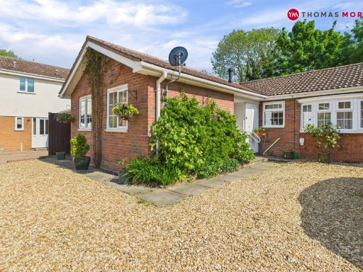 2 bedroom bungalow for sale in Fairfields Drive, Ramsey, Huntingdon, Cambridgeshire, PE26 — £280,000 • 2 bed • 1 bath • 719 ft²
 5 bedroom detached house for sale in Biggin Lane, Ramsey, Huntingdon, PE26 — £800,000 • 5 bed • 3 bath • 2426 ft²
 4 bedroom detached house for sale in Blenheim Road, Ramsey, Huntingdon, PE26 — £465,000 • 4 bed • 3 bath • 1704 ft²
 4 bedroom link detached house for sale in Signal Road, Ramsey, Huntingdon, Cambridgeshire, PE26 — £375,000 • 4 bed • 3 bath • 1763 ft²
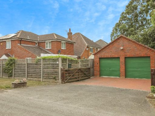 4 bedroom detached house for sale in Oilmills Road, Ramsey, Huntingdon, PE26 — £400,000 • 4 bed • 1 bath • 1776 ft²
Meta
- {
"@context": "https://schema.org",
"@type": "Residence",
"name": "3 bedroom detached house for sale in Biggin Lane, Ramsey, H…",
"description": "",
"url": "https://propertypiper.co.uk/property/2e7caf50-fceb-41b7-83c8-12059255b77a",
"image": "https://image-a.propertypiper.co.uk/37183c63-e8e2-454e-a85c-6e0601cfd298-1024.jpeg",
"address": {
"@type": "PostalAddress",
"streetAddress": "41 BIGGIN LANE RAMSEY HUNTINGDON",
"postalCode": "PE26 1NB",
"addressLocality": "Huntingdonshire",
"addressRegion": "North West Cambridgeshire",
"addressCountry": "England"
},
"geo": {
"@type": "GeoCoordinates",
"latitude": 52.4447841665898,
"longitude": -0.1198072692926982
},
"numberOfRooms": 3,
"numberOfBathroomsTotal": 1,
"floorSize": {
"@type": "QuantitativeValue",
"value": 1617,
"unitCode": "FTK"
},
"offers": {
"@type": "Offer",
"price": 450000,
"priceCurrency": "GBP",
"availability": "https://schema.org/InStock"
},
"additionalProperty": [
{
"@type": "PropertyValue",
"name": "Feature",
"value": "modern house"
},
{
"@type": "PropertyValue",
"name": "Feature",
"value": "detached"
},
{
"@type": "PropertyValue",
"name": "Feature",
"value": "pitched roof"
},
{
"@type": "PropertyValue",
"name": "Feature",
"value": "garage"
},
{
"@type": "PropertyValue",
"name": "Feature",
"value": "front garden"
},
{
"@type": "PropertyValue",
"name": "Feature",
"value": "brick facade"
},
{
"@type": "PropertyValue",
"name": "Feature",
"value": "black cladding"
},
{
"@type": "PropertyValue",
"name": "Feature",
"value": "large windows"
},
{
"@type": "PropertyValue",
"name": "Feature",
"value": "hedges"
},
{
"@type": "PropertyValue",
"name": "Feature",
"value": "modern"
},
{
"@type": "PropertyValue",
"name": "Feature",
"value": "utility room"
},
{
"@type": "PropertyValue",
"name": "Feature",
"value": "white cabinets"
},
{
"@type": "PropertyValue",
"name": "Feature",
"value": "sink"
},
{
"@type": "PropertyValue",
"name": "Feature",
"value": "washing machine"
},
{
"@type": "PropertyValue",
"name": "Feature",
"value": "light wood flooring"
},
{
"@type": "PropertyValue",
"name": "Feature",
"value": "tile backsplash"
},
{
"@type": "PropertyValue",
"name": "Feature",
"value": "compact"
},
{
"@type": "PropertyValue",
"name": "Feature",
"value": "functional"
},
{
"@type": "PropertyValue",
"name": "Feature",
"value": "bright"
}
]
}
High Res Floorplan Images
Compatible Floorplan Images
FloorplanImages Thumbnail