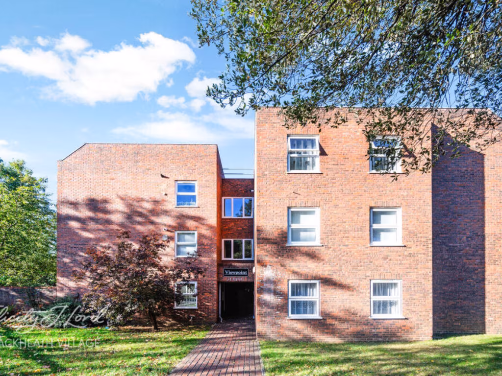
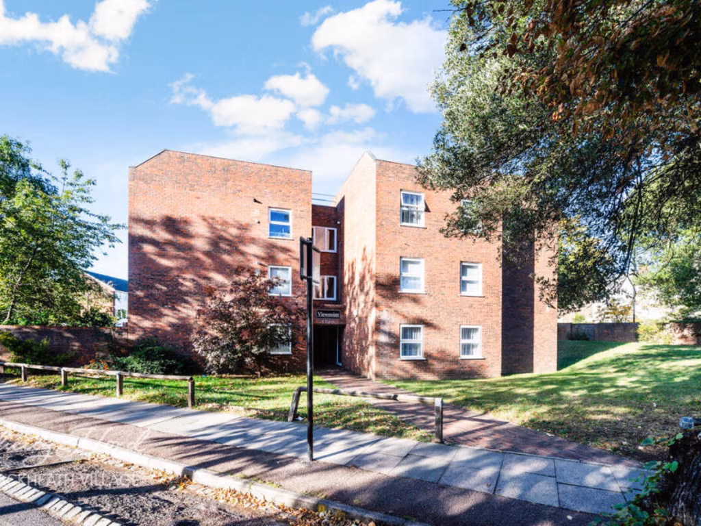
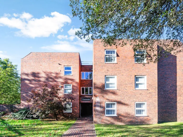
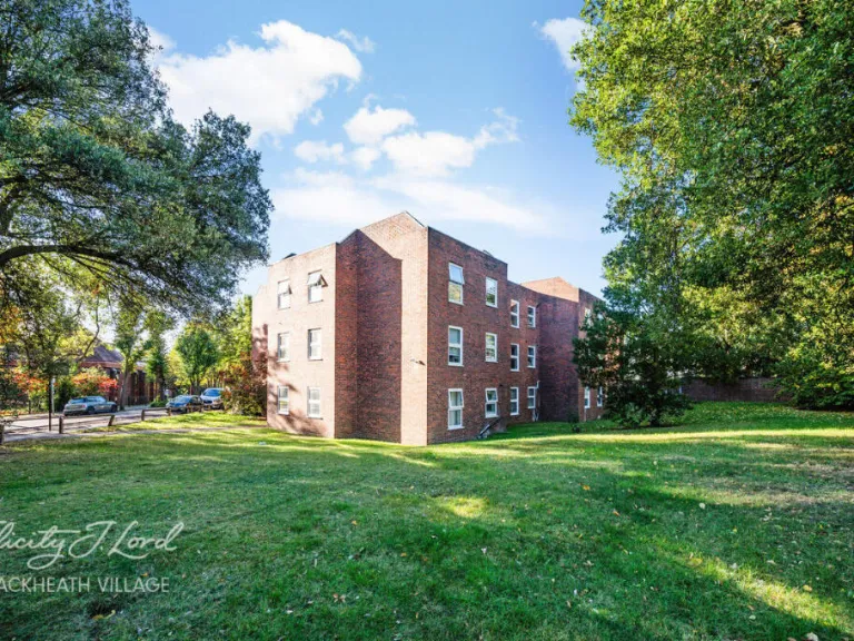
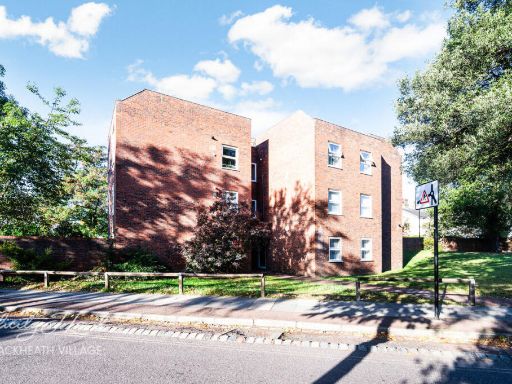
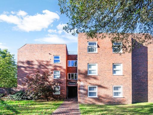
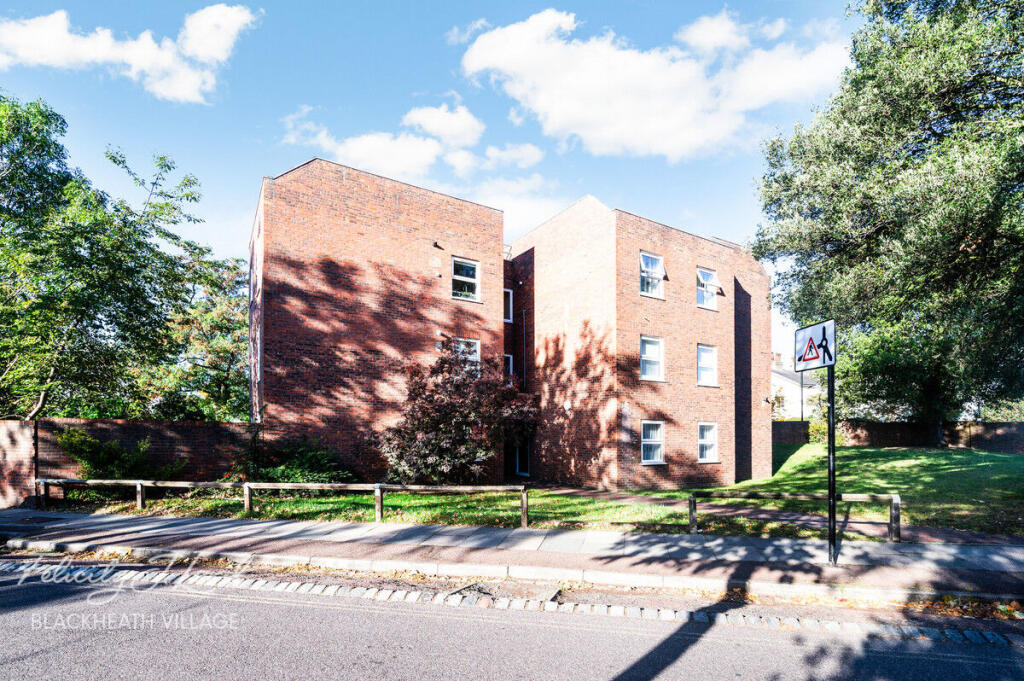
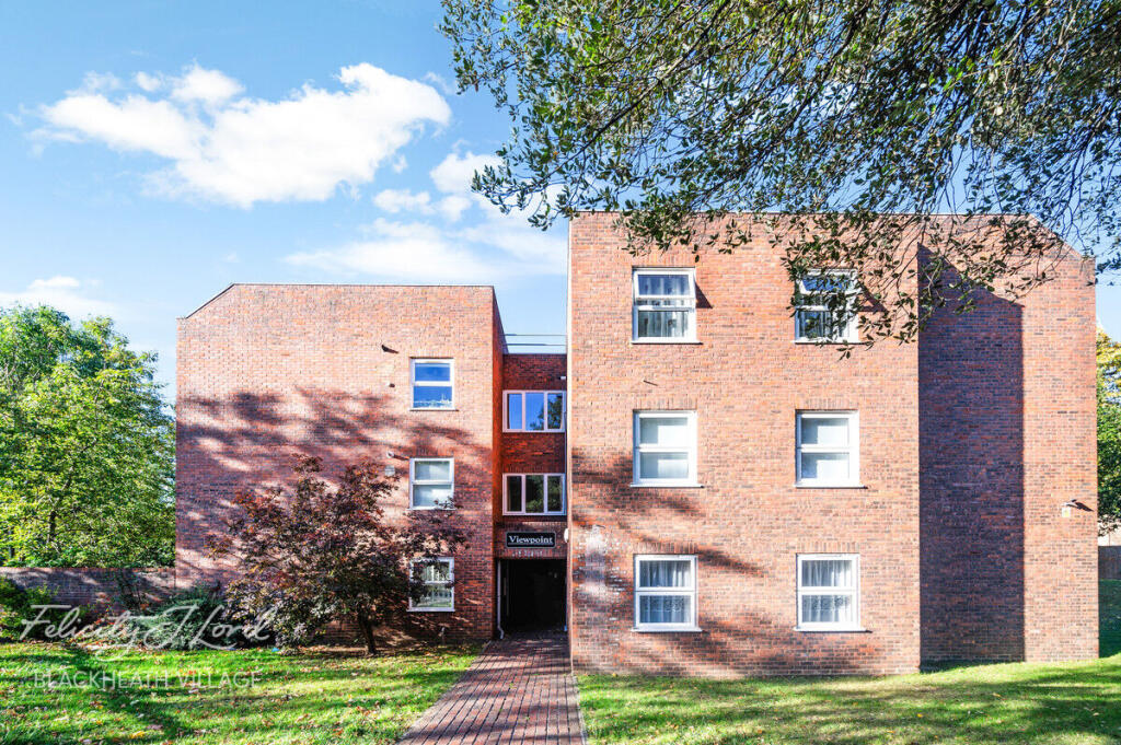
SE3 9TN - 2 bedroom flat for sale in Lee Park, London SE3
View on Property Piper
2 bedroom flat for sale in Lee Park, London SE3
Property Details
- Price: £475000
- Bedrooms: 2
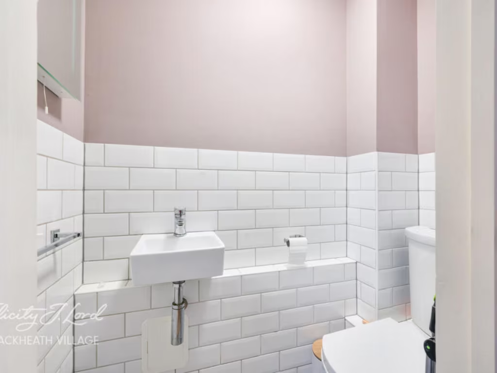
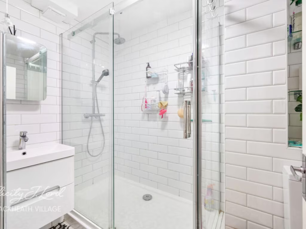
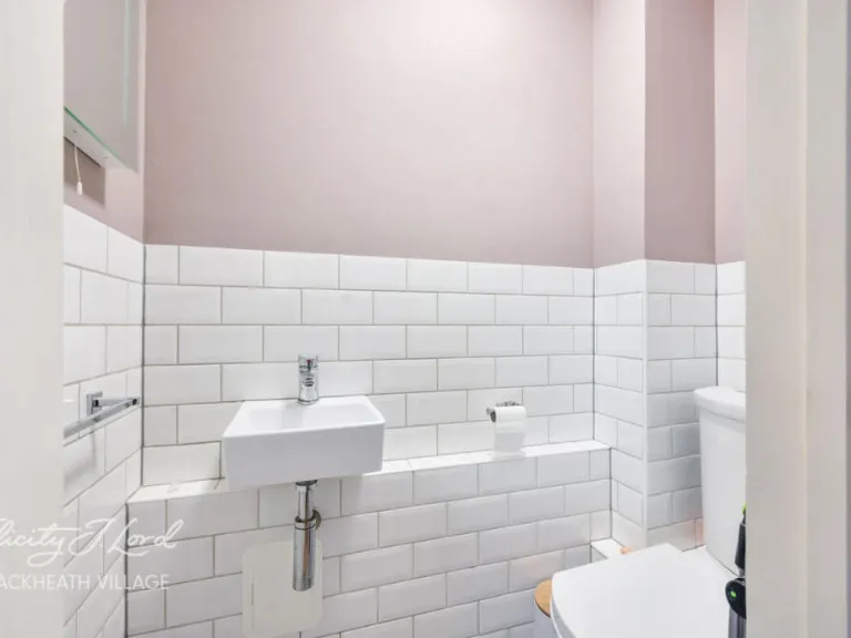
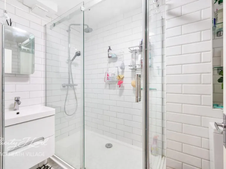
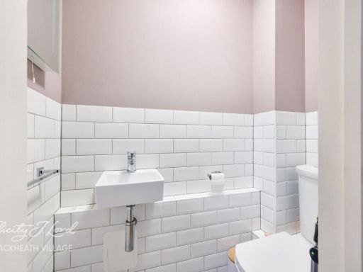
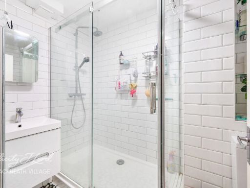
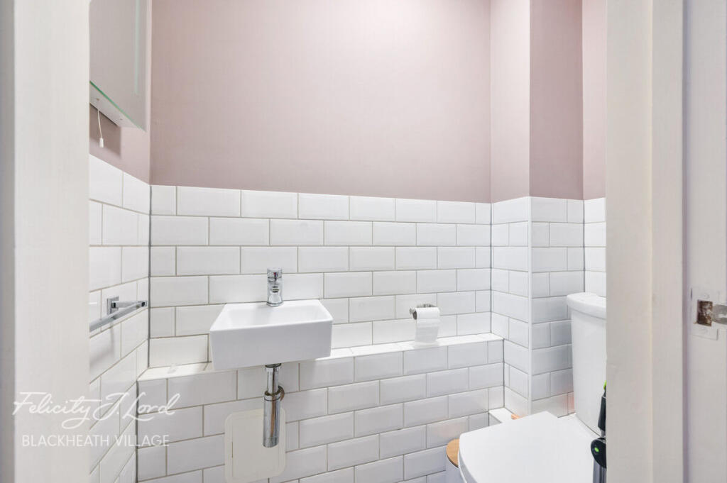
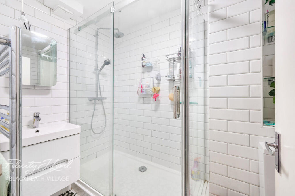
- Bathrooms: 1
- Property Type: undefined
- Property SubType: undefined
Image Descriptions
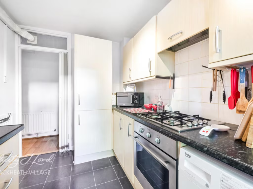
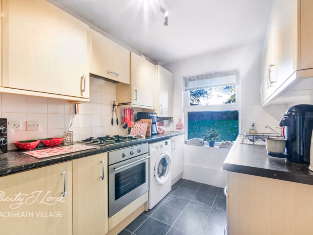
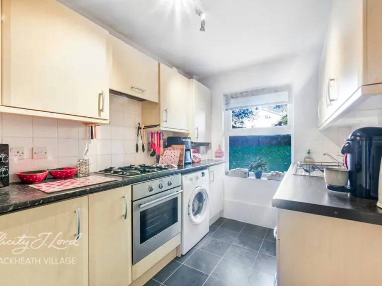
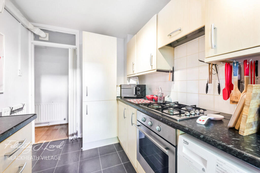
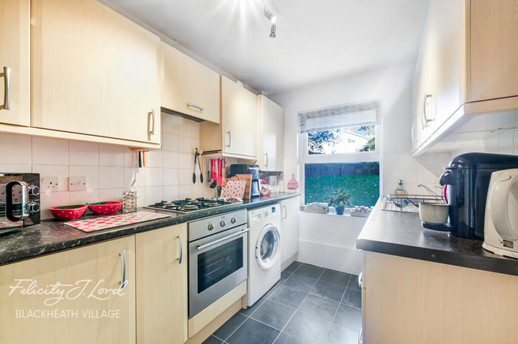
- kitchen contemporary
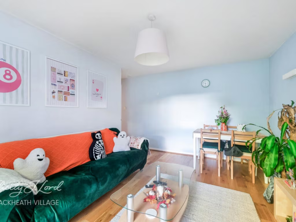
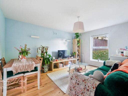
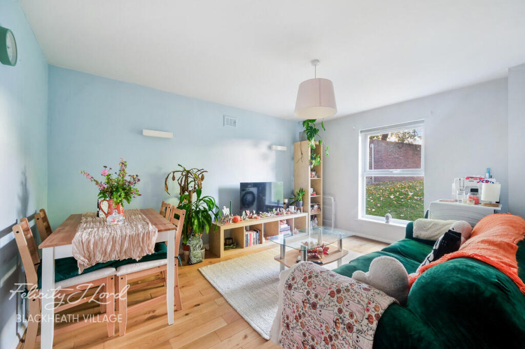
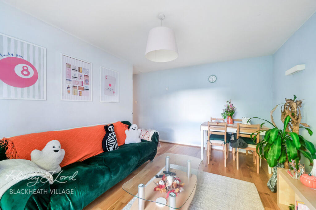
- living room modern
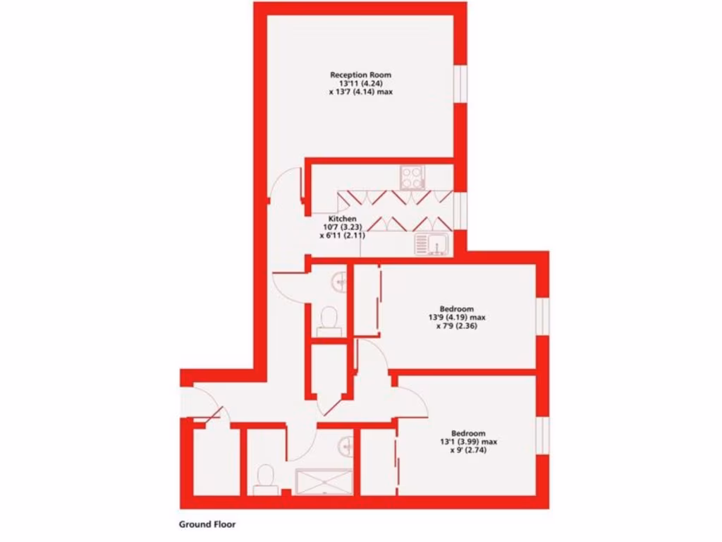
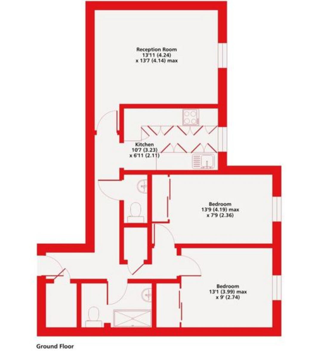
Floorplan Description
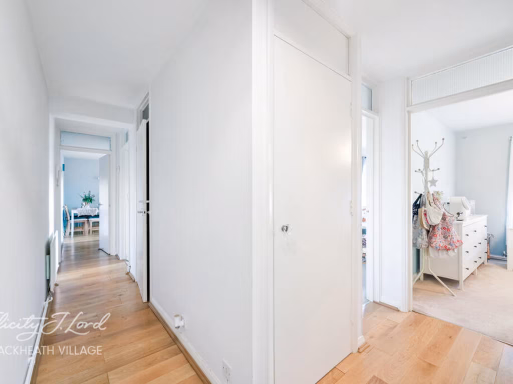
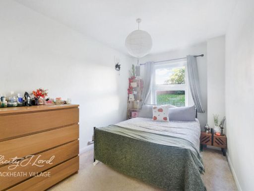
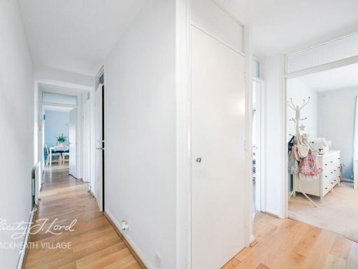
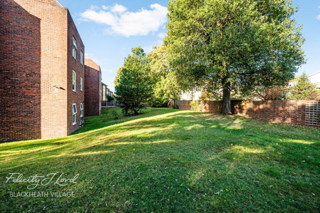
- Ground floor flat with reception room, kitchen and two bedrooms.
Rooms
- Reception Room:
- Kitchen:
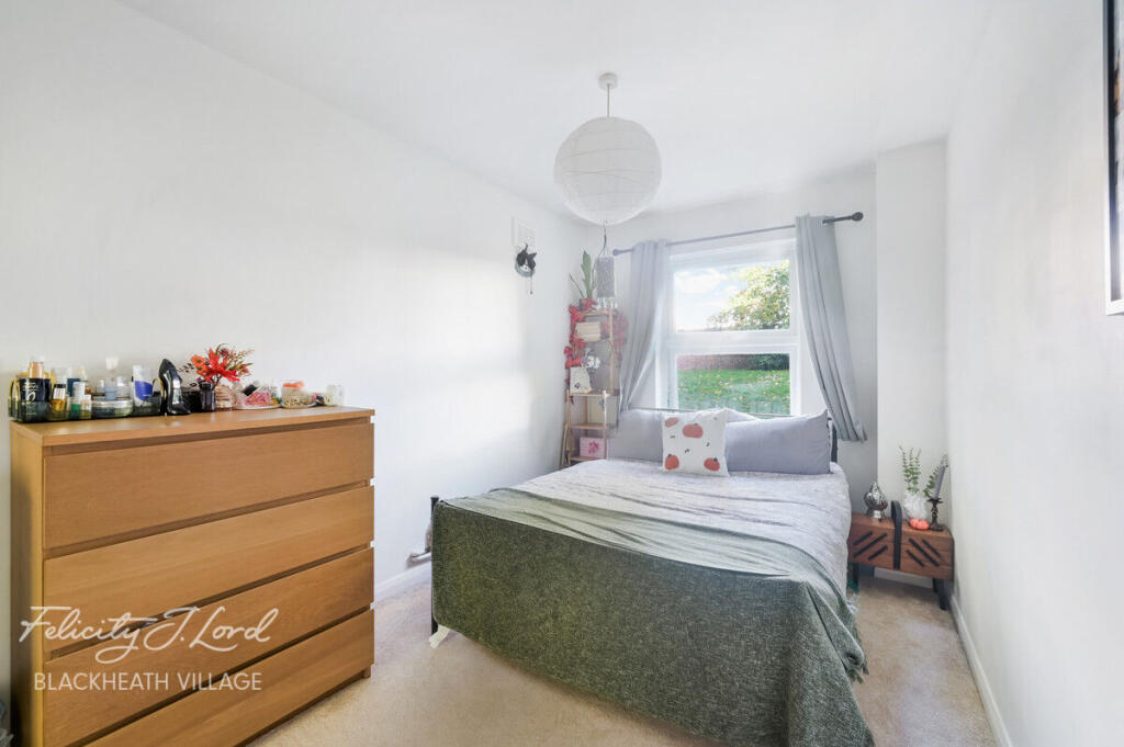
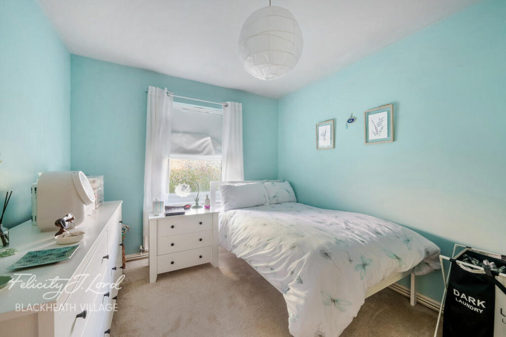
- Bedroom:
- Bedroom:
Textual Property Features
Detected Visual Features
- modern kitchen
- fitted cabinets
- gas hob
- electric oven
- tile flooring
- high gloss finish
- integrated appliances
- compact kitchen
- modern
- living room
- large window
- natural light
- hardwood floor
- open plan
EPC Details
- Fully double glazed
- Cavity wall, as built, insulated (assumed)
- Boiler and radiators, mains gas
- Low energy lighting in all fixed outlets
- Solid, no insulation (assumed)
Nearby Schools
- King's College Taunton
- Parkfield Primary School
- St George's Catholic School
- Holy Trinity Church of England Primary School
- The Castle School
- Taunton Preparatory School
- Norton Fitzwarren Church School
- Cotford St Luke Primary School
- Churchstanton Primary School
- Beech Grove Primary School
- Orchard Grove Primary School
- St Andrew's Church School
- Staplegrove Church School
- St John's Church of England Primary School
- Trull Church of England VA Primary School
- Bishop Fox's School
- Oake, Bradford and Nynehead VC Primary
- Taunton School
- Wellesley Park Primary School
- Wellington School
- Queen's College
- Bishop Henderson Church of England Primary School, Taunton
- North Town Academy
- Hemyock Primary School
- West Buckland Primary School
- Court Fields School
- Rockwell Green Church of England Primary School
- Isambard Kingdom Brunel Primary School
Nearest General Shops
- Id: 10280308678
- Tags:
- Name: WC One
- Opening_hours: Tu-Sa 09:30-17:00
- Shop: bathroom_furnishing
- TagsNormalized:
- bathroom
- bathroom furnishing
- shop
- Lat: 51.4648025
- Lon: 0.0091688
- FullGeoHash: u10hb0ysjwsc
- PartitionGeoHash: u10h
- Images:
- FoodStandards: null
- Distance: 93.9
,- Id: 10280308679
- Tags:
- Name: Selectric
- Shop: general
- TagsNormalized:
- Lat: 51.4647257
- Lon: 0.0091876
- FullGeoHash: u10hb0yey04y
- PartitionGeoHash: u10h
- Images:
- FoodStandards: null
- Distance: 87.2
,- Id: 5670081459
- Tags:
- Name: Blackheath Locksmiths Ltd
- Opening_hours: Mo-Fr 09:00-17:00
- Shop: locksmith
- TagsNormalized:
- Lat: 51.464782
- Lon: 0.0087625
- FullGeoHash: u10hb0ykh4ty
- PartitionGeoHash: u10h
- Images:
- FoodStandards: null
- Distance: 81.6
}
Nearest Religious buildings
- Id: 474648666
- Tags:
- Amenity: place_of_worship
- Building: yes
- Name: Church of Our Lady Help of Christians
- Religion: christian
- TagsNormalized:
- place of worship
- christian
- church
- Lat: 51.4650549
- Lon: 0.0108828
- FullGeoHash: u10hb0zvttdf
- PartitionGeoHash: u10h
- Images:
- FoodStandards: null
- Distance: 197.9
,- Id: 681626737
- Tags:
- Amenity: place_of_worship
- Denomination: quaker
- Name: Quaker Meeting House
- Religion: christian
- TagsNormalized:
- place of worship
- quaker
- quakers
- christian
- church
- Lat: 51.465156
- Lon: 0.0070687
- FullGeoHash: u10hb0vnk8qv
- PartitionGeoHash: u10h
- Images:
- FoodStandards: null
- Distance: 157
,- Id: 474648664
- Tags:
- Addr:
- Housenumber: 2
- Street: Lee Road
- Amenity: place_of_worship
- Building: yes
- Denomination: mormon
- Name: The Church of Jesus Christ of Latter-day Saints
- Religion: christian
- TagsNormalized:
- place of worship
- mormon
- church
- christian
- Lat: 51.4637994
- Lon: 0.0090676
- FullGeoHash: u10hb0ww7793
- PartitionGeoHash: u10h
- Images:
- FoodStandards: null
- Distance: 48.7
}
Nearest Medical buildings
- Id: 10280308647
- Tags:
- Addr:
- City: London
- Housenumber: 30
- Postcode: SE3 0AX
- Street: Montpelier Vale
- Amenity: pharmacy
- Fhrs:
- Healthcare: pharmacy
- Name: Paydens Pharmacy
- Opening_hours: Mo-Fr 09:00-18:00; Sa 09:00-17:30
- TagsNormalized:
- Lat: 51.4667137
- Lon: 0.0087199
- FullGeoHash: u10hb1nr74y1
- PartitionGeoHash: u10h
- Images:
- FoodStandards: null
- Distance: 294.9
,- Id: 593461230
- Tags:
- Addr:
- City: London
- Country: GB
- Postcode: SE3 9UD
- Street: Independents Road
- Amenity: hospital
- Building: yes
- Emergency: no
- Healthcare: hospital
- Name: The Blackheath Hospital Outpatient Centre
- Phone: +44 20 8318 7722
- Website: https://www.bmihealthcare.co.uk/hospitals/bmi-the-blackheath-hospital
- TagsNormalized:
- Lat: 51.4654398
- Lon: 0.0084375
- FullGeoHash: u10hb0yput76
- PartitionGeoHash: u10h
- Images:
- FoodStandards: null
- Distance: 152.9
,- Id: 591570712
- Tags:
- Amenity: hospital
- Healthcare: hospital
- Name: Blackheath Hospital
- TagsNormalized:
- Lat: 51.4634313
- Lon: 0.0067008
- FullGeoHash: u10hb0suhnum
- PartitionGeoHash: u10h
- Images:
- FoodStandards: null
- Distance: 143.7
,- Id: 205156
- Tags:
- Name: Blackheath Hospital
- Naptan:
- StopAreaCode: 490G00004066
- StopAreaType: GPBS
- Verified: no
- Network: London Buses
- Operator: Transport for London
- Public_transport: stop_area
- Public_transport:version: 2
- Type: public_transport
- TagsNormalized:
- Lat: 51.4638274
- Lon: 0.0066757
- FullGeoHash: u10hb0sye8cb
- PartitionGeoHash: u10h
- Images:
- FoodStandards: null
- Distance: 129.7
}
Nearest Airports
- Id: 260720166
- Tags:
- Aerodrome: international
- Aeroway: aerodrome
- Alt_name: Gatwick Airport
- Ele: 62
- Iata: LGW
- Icao: EGKK
- Internet_access: wlan
- Internet_access:fee: no
- Internet_access:ssid: Gatwick FREE Wi-Fi
- Name: London Gatwick Airport
- Operator: Gatwick Airport Limited
- Ref: LGW
- Website: https://www.gatwickairport.com/
- Wikidata: Q8703
- Wikipedia: en:Gatwick Airport
- TagsNormalized:
- airport
- international airport
- Lat: 51.1540917
- Lon: -0.1883773
- FullGeoHash: gcpg58qf4mzd
- PartitionGeoHash: gcpg
- Images:
- FoodStandards: null
- Distance: 37085
,- Id: 103894219
- Tags:
- Aerodrome: international
- Aeroway: aerodrome
- Iata: SEN
- Icao: EGMC
- Name: London Southend Airport
- Old_name: Southend Municipal Airport
- Ref: SEN
- Wikidata: Q1415441
- TagsNormalized:
- airport
- international airport
- Lat: 51.5701749
- Lon: 0.6924624
- FullGeoHash: u10mru04p937
- PartitionGeoHash: u10m
- Images:
- FoodStandards: null
- Distance: 48774.3
,- Id: 121158889
- Tags:
- Aerodrome: continental
- Aeroway: aerodrome
- Fhrs:
- Authority: City of London Corporation
- Iata: LCY
- Icao: EGLC
- Name: London City Airport
- Operator: London City Airport Limited
- Ref: LCY
- Website: https://www.londoncityairport.com/
- Wikidata: Q8982
- Wikipedia: en:London City Airport
- TagsNormalized:
- airport
- continental airport
- Lat: 51.5042658
- Lon: 0.0539987
- FullGeoHash: u10j10p64702
- PartitionGeoHash: u10j
- Images:
- FoodStandards: null
- Distance: 5468.5
}
Nearest Leisure Facilities
- Id: 591570388
- Tags:
- TagsNormalized:
- Lat: 51.4636299
- Lon: 0.0062217
- FullGeoHash: u10hb0st2gzn
- PartitionGeoHash: u10h
- Images:
- FoodStandards: null
- Distance: 165.6
,- Id: 591570386
- Tags:
- TagsNormalized:
- Lat: 51.463673
- Lon: 0.0065573
- FullGeoHash: u10hb0sv8gcr
- PartitionGeoHash: u10h
- Images:
- FoodStandards: null
- Distance: 142
,- Id: 592203623
- Tags:
- TagsNormalized:
- Lat: 51.4629685
- Lon: 0.0083102
- FullGeoHash: u10hb0w198ss
- PartitionGeoHash: u10h
- Images:
- FoodStandards: null
- Distance: 122.7
,- Id: 591570405
- Tags:
- TagsNormalized:
- Lat: 51.4635879
- Lon: 0.0069119
- FullGeoHash: u10hb0tj1h1g
- PartitionGeoHash: u10h
- Images:
- FoodStandards: null
- Distance: 122.6
,- Id: 591570385
- Tags:
- TagsNormalized:
- Lat: 51.4637388
- Lon: 0.0068287
- FullGeoHash: u10hb0syp05z
- PartitionGeoHash: u10h
- Images:
- FoodStandards: null
- Distance: 121.9
}
Nearest Tourist attractions
- Id: 53099372
- Tags:
- HE_ref: 1218679
- Building: yes
- Heritage: 2
- Heritage:operator: Historic England
- Historic: house
- Listed_status: Grade I
- Name: Ranger's House
- Opening_hours: Apr-Oct We-Su 11:00-16:00 open; 2022 Jun 26-2022 Jul 06 closed
- Opening_hours:url: https://www.english-heritage.org.uk/visit/places/rangers-house-the-wernher-collection/prices-and-opening-times/
- Operator: English Heritage
- Ref:
- Tourism: attraction
- Wikidata: Q7292740
- Wikipedia: en:Ranger's House
- TagsNormalized:
- Lat: 51.4734327
- Lon: -0.001608
- FullGeoHash: gcpuzfqy6x2f
- PartitionGeoHash: gcpu
- Images:
- FoodStandards: null
- Distance: 1255.4
,- Id: 10026375890
- Tags:
- Addr:
- City: London
- Housenumber: 16
- Postcode: SE12 8TF
- Street: Eltham Road
- Contact:
- Instagram: https://www.instagram.com/museumofneoliberalism/
- Twitter: https://twitter.com/museumofneolib
- Email: email@museumofneoliberalism.com
- Fee: no
- Museum: history
- Name: Museum of Neoliberalism
- Opening_hours: Th-Su 11:00-19:00 "appointment only, book through website"
- Phone: +44 20 3759 4845
- Tourism: museum
- Website: http://museumofneoliberalism.com
- TagsNormalized:
- Lat: 51.4560698
- Lon: 0.0123647
- FullGeoHash: u10h8r3124eu
- PartitionGeoHash: u10h
- Images:
- FoodStandards: null
- Distance: 928.3
,- Id: 5574814462
- Tags:
- Name: Via Lewisham
- Tourism: hostel
- TagsNormalized:
- Lat: 51.4573779
- Lon: 0.0037276
- FullGeoHash: u10h8pd8yy7x
- PartitionGeoHash: u10h
- Images:
- FoodStandards: null
- Distance: 814
}
Nearest Hotels
- Id: 4737232921
- Tags:
- Addr:
- Name: Nadja's Home
- Tourism: hotel
- TagsNormalized:
- Lat: 51.4475449
- Lon: -0.0054614
- FullGeoHash: gcpuxvsp8trx
- PartitionGeoHash: gcpu
- Images:
- FoodStandards: null
- Distance: 2076.4
,- Id: 958974125
- Tags:
- Addr:
- City: Lewisham
- Housenumber: 1-13
- Postcode: SE13 5AF
- Street: Lewisham High Street
- Brand: Premier Inn
- Brand:wikidata: Q2108626
- Brand:wikipedia: en:Premier Inn
- Building: hotel
- Building:colour: black
- Building:levels: 6
- Fhrs:
- Authority: Lewisham
- Id: 837875
- Local_authority_id: PI/000199406
- Internet_access: wlan
- Internet_access:fee: customers
- Internet_access:operator: Virgin Media
- Internet_access:ssid: Premier Inn Free Wi-Fi
- Name: Premier Inn London Lewisham
- Operator: Premier Inn
- Phone: +44 333 321 9338
- Roof:
- Stars: 3
- Swimming_pool: no
- Tourism: hotel
- Website: https://www.premierinn.com/gb/en/hotels/england/greater-london/london/london-lewisham.html
- TagsNormalized:
- Lat: 51.4650665
- Lon: -0.0106844
- FullGeoHash: gcpuzbbjxp9p
- PartitionGeoHash: gcpu
- Images:
- FoodStandards: null
- Distance: 1334.2
,- Id: 476304379
- Tags:
- Addr:
- City: London
- Housename: The Clarendon
- Postcode: SE3 0RW
- Street: Montpelier Row
- Building: hotel
- Contact:
- Facebook: clarendonhotelblackheath
- Instagram: clarendonblackheath
- Email: foh@clarendonhotel.com
- Fhrs:
- Name: The Clarendon
- Phone: +44 20 8318 4321
- Tourism: hotel
- Website: https://www.clarendonhotel.com/
- Wikidata: Q26354037
- TagsNormalized:
- Lat: 51.4685707
- Lon: 0.0100042
- FullGeoHash: u10hb1x61hgx
- PartitionGeoHash: u10h
- Images:
- FoodStandards: null
- Distance: 511.6
}
Tags
- modern kitchen
- fitted cabinets
- gas hob
- electric oven
- tile flooring
- high gloss finish
- integrated appliances
- compact kitchen
- modern
- living room
- large window
- natural light
- hardwood floor
- open plan
Local Market Stats
- Average Price/sqft: £634
- Avg Income: £63200
- Rental Yield: 4.6%
- Social Housing: 19%
- Planning Success Rate: 69%
AirBnB Data
- 1km average: £96/night
- Listings in 1km: 10
Similar Properties
 2 bedroom apartment for sale in The Glebe, Blackheath, London, SE3 — £539,500 • 2 bed • 1 bath • 796 ft²
 2 bedroom apartment for sale in Lee Terrace, Blackheath, London, SE3 — £625,000 • 2 bed • 1 bath • 923 ft²
 2 bedroom apartment for sale in St Johns Park, Blackheath, London, SE3 — £460,000 • 2 bed • 1 bath • 754 ft²
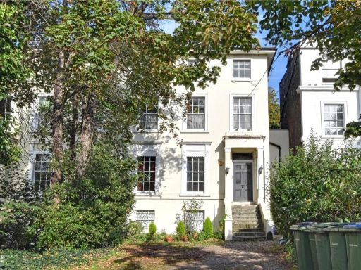 2 bedroom apartment for sale in Shooters Hill Road, Blackheath, London, SE3 — £539,000 • 2 bed • 1 bath • 928 ft²
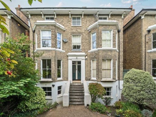 2 bedroom flat for sale in St. Johns Park, London, SE3 — £700,000 • 2 bed • 1 bath • 1124 ft²
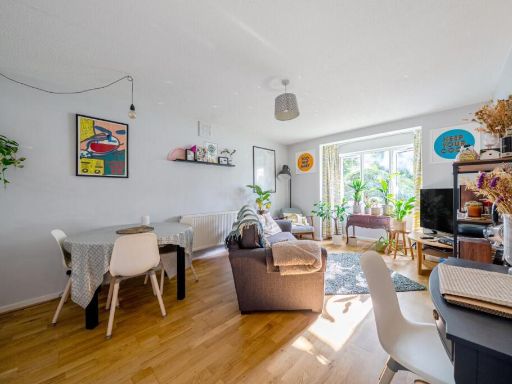 2 bedroom flat for sale in Walerand Road, Blackheath, London, SE13 — £335,000 • 2 bed • 1 bath • 623 ft²
Meta
- {
"@context": "https://schema.org",
"@type": "Residence",
"name": "2 bedroom flat for sale in Lee Park, London SE3",
"description": "",
"url": "https://propertypiper.co.uk/property/2e5f45ab-1ac7-4eae-bd08-d103dbdf769c",
"image": "https://image-a.propertypiper.co.uk/5fba650d-221d-496c-9c14-d403f419ab66-1024.jpeg",
"address": {
"@type": "PostalAddress",
"streetAddress": "VIEWPOINT FLAT 4 LEE PARK BLACKHEATH LONDON",
"postalCode": "SE3 9TN",
"addressLocality": "Lewisham",
"addressRegion": "Lewisham East",
"addressCountry": "England"
},
"geo": {
"@type": "GeoCoordinates",
"latitude": 51.46406517081552,
"longitude": 0.008507986170447956
},
"numberOfRooms": 2,
"numberOfBathroomsTotal": 1,
"floorSize": {
"@type": "QuantitativeValue",
"value": 486,
"unitCode": "FTK"
},
"offers": {
"@type": "Offer",
"price": 475000,
"priceCurrency": "GBP",
"availability": "https://schema.org/InStock"
},
"additionalProperty": [
{
"@type": "PropertyValue",
"name": "Feature",
"value": "modern kitchen"
},
{
"@type": "PropertyValue",
"name": "Feature",
"value": "fitted cabinets"
},
{
"@type": "PropertyValue",
"name": "Feature",
"value": "gas hob"
},
{
"@type": "PropertyValue",
"name": "Feature",
"value": "electric oven"
},
{
"@type": "PropertyValue",
"name": "Feature",
"value": "tile flooring"
},
{
"@type": "PropertyValue",
"name": "Feature",
"value": "high gloss finish"
},
{
"@type": "PropertyValue",
"name": "Feature",
"value": "integrated appliances"
},
{
"@type": "PropertyValue",
"name": "Feature",
"value": "compact kitchen"
},
{
"@type": "PropertyValue",
"name": "Feature",
"value": "modern"
},
{
"@type": "PropertyValue",
"name": "Feature",
"value": "living room"
},
{
"@type": "PropertyValue",
"name": "Feature",
"value": "large window"
},
{
"@type": "PropertyValue",
"name": "Feature",
"value": "natural light"
},
{
"@type": "PropertyValue",
"name": "Feature",
"value": "hardwood floor"
},
{
"@type": "PropertyValue",
"name": "Feature",
"value": "open plan"
}
]
}
High Res Floorplan Images
Compatible Floorplan Images
FloorplanImages Thumbnail