TN6 2PN - 3 bedroom chalet for sale in Luxford Drive, Crowborough, Ea…
View on Property Piper
3 bedroom chalet for sale in Luxford Drive, Crowborough, East Sussex, TN6
Property Details
- Price: £314000
- Bedrooms: 3
- Bathrooms: 1
- Property Type: undefined
- Property SubType: undefined
Image Descriptions
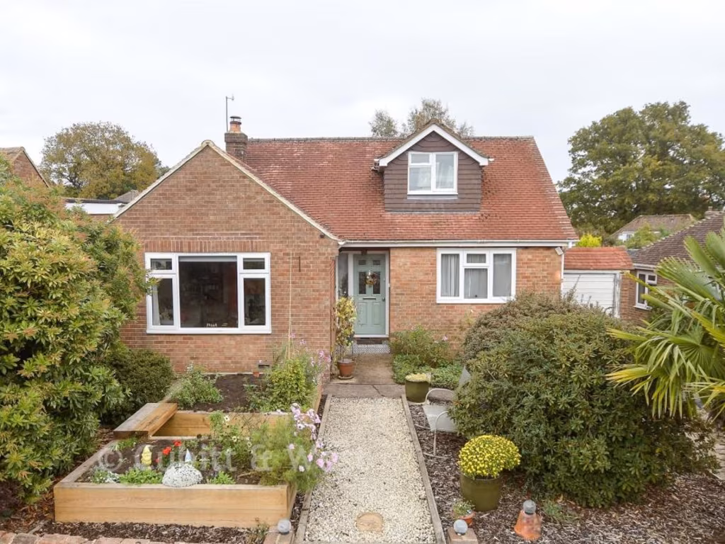
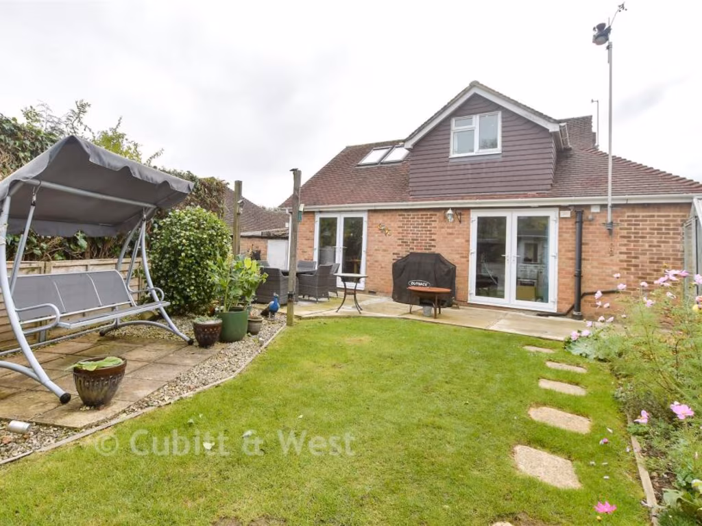
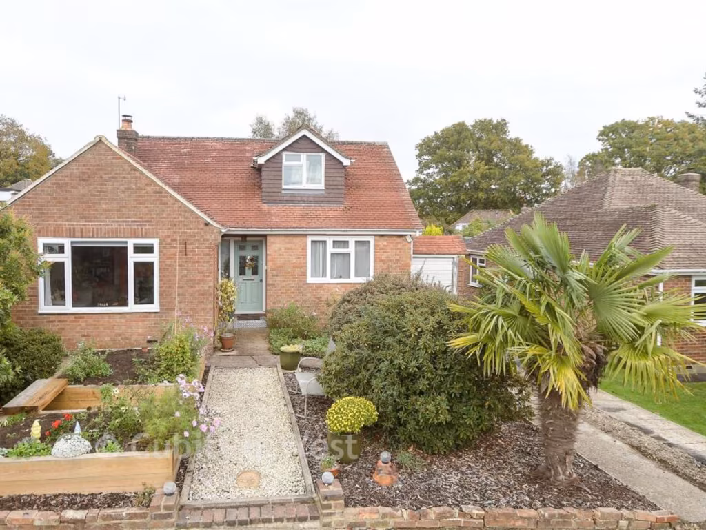
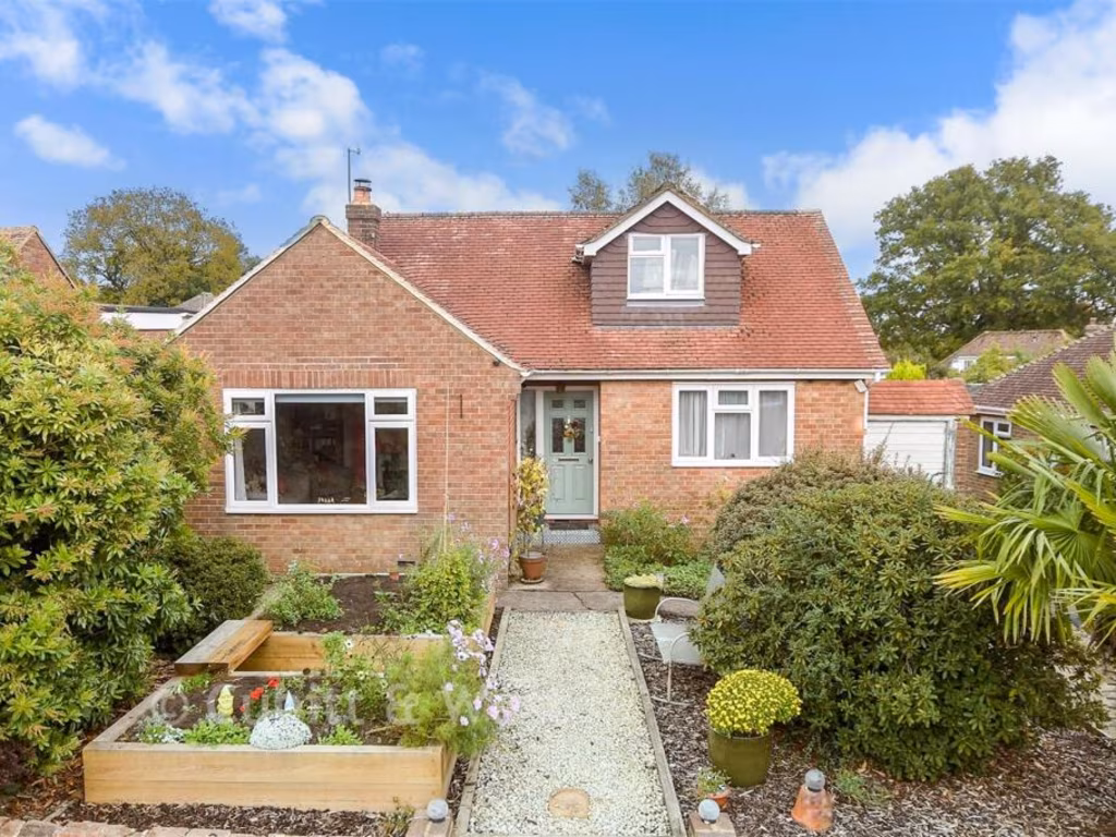
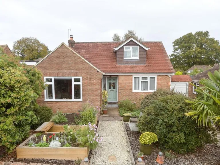
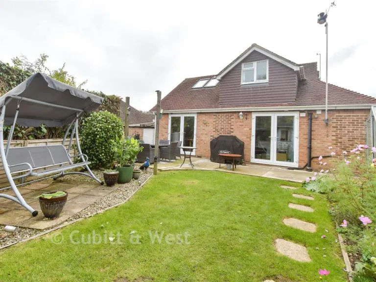
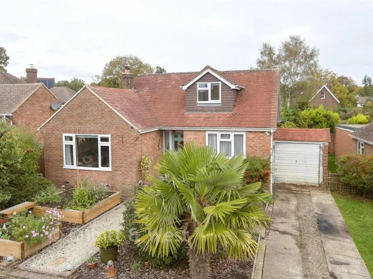
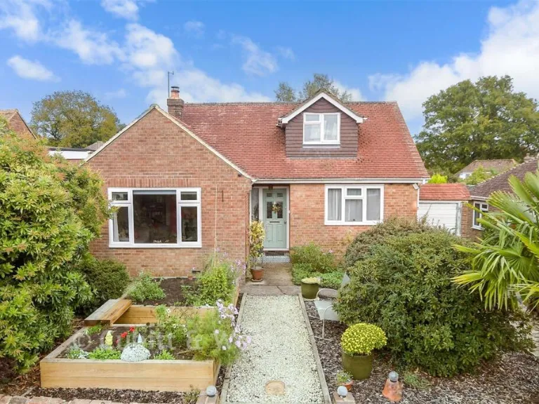
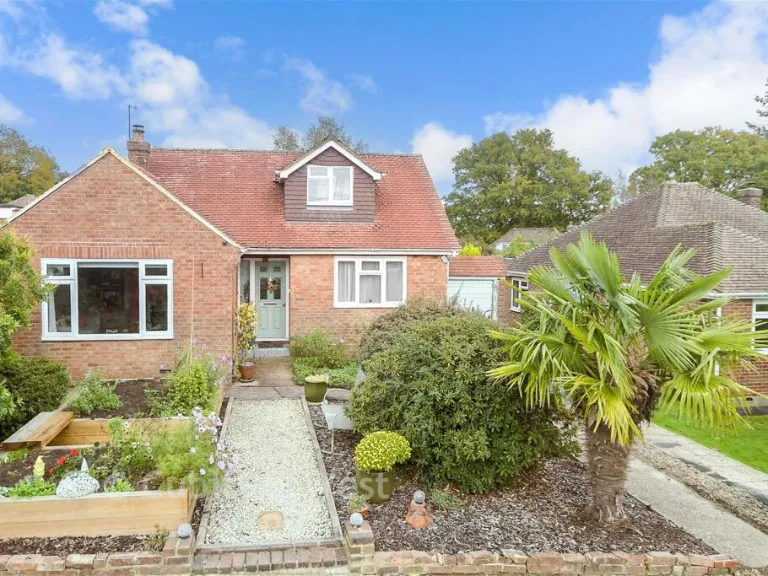
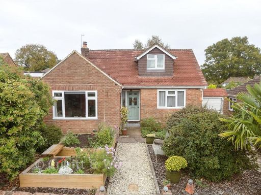
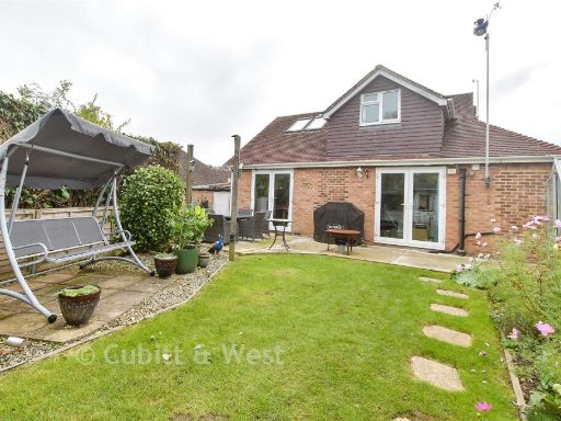
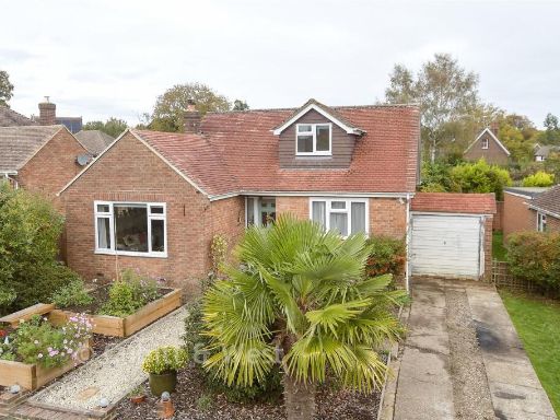
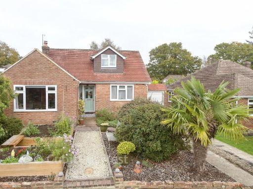
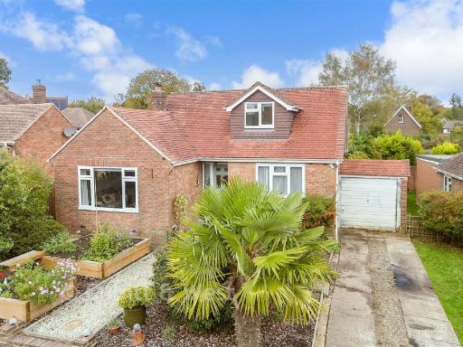
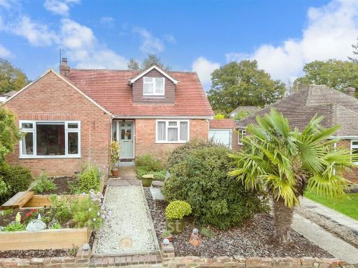
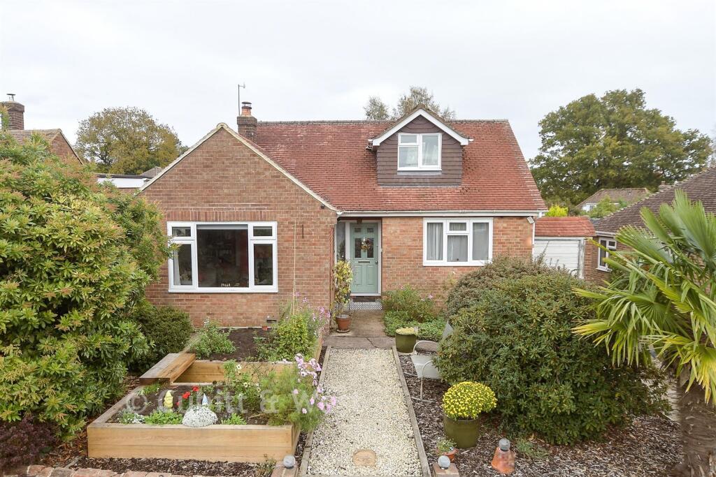
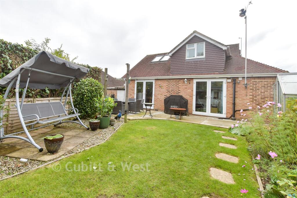
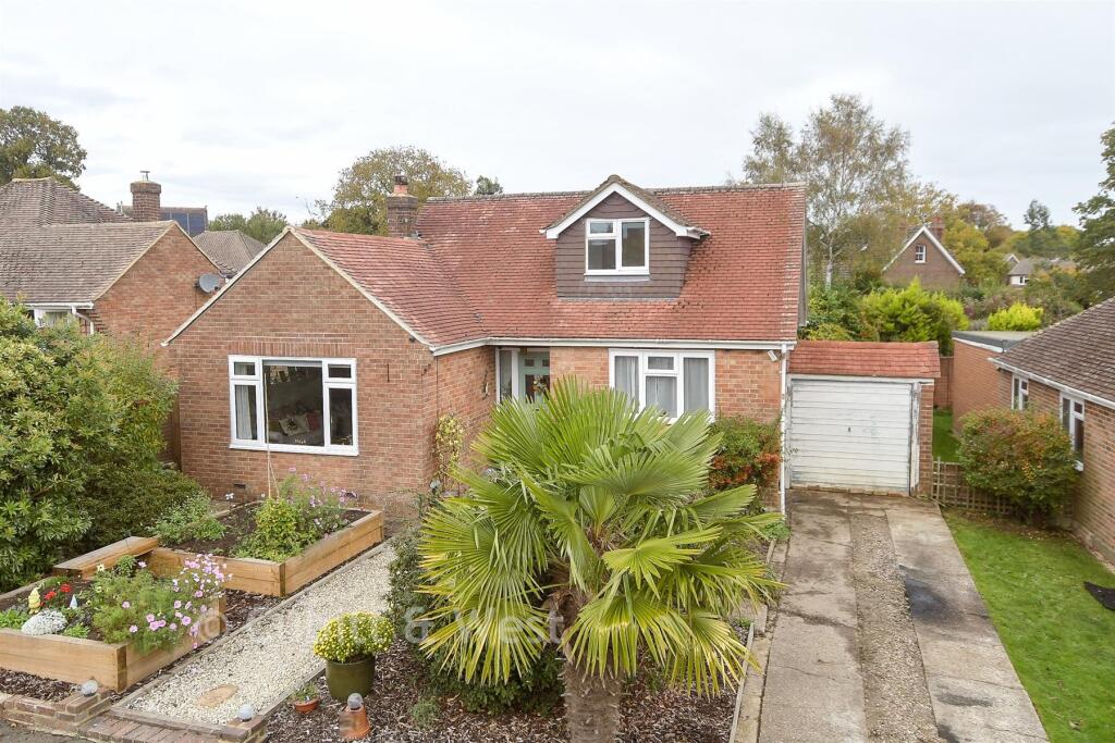
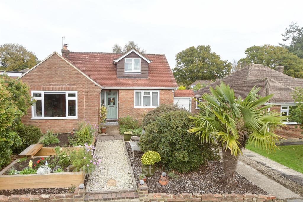
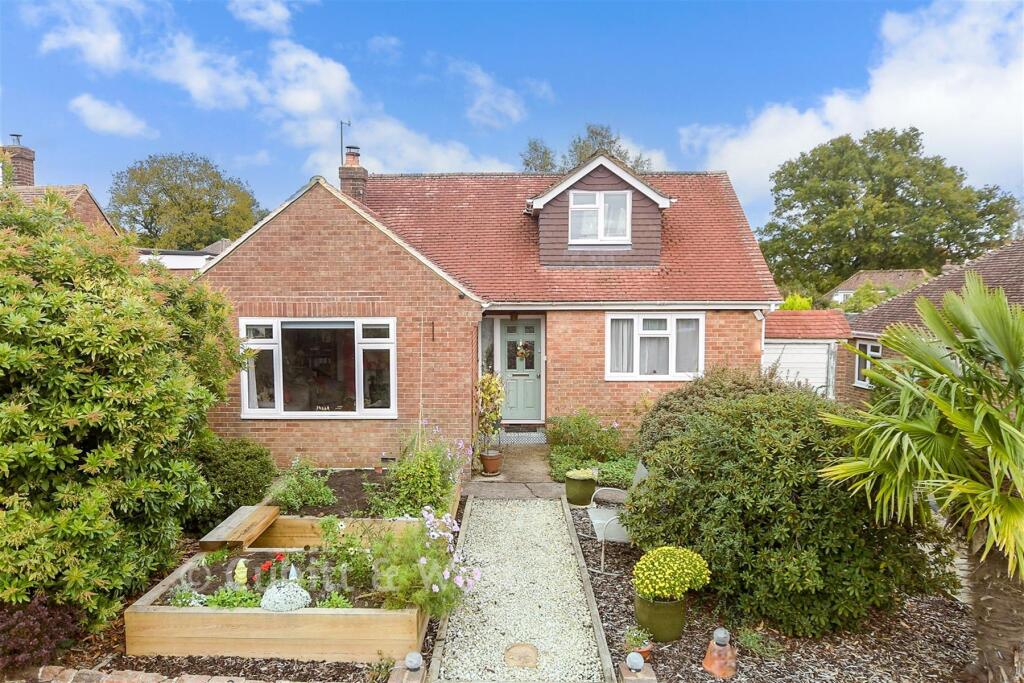
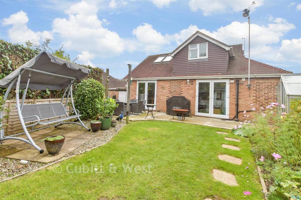
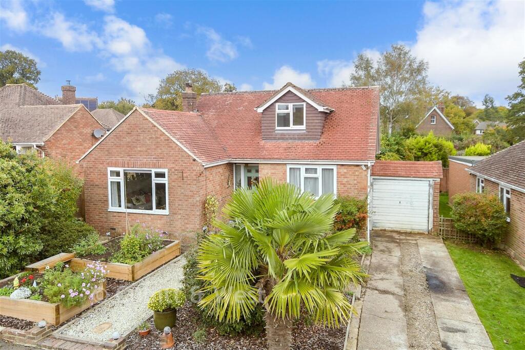
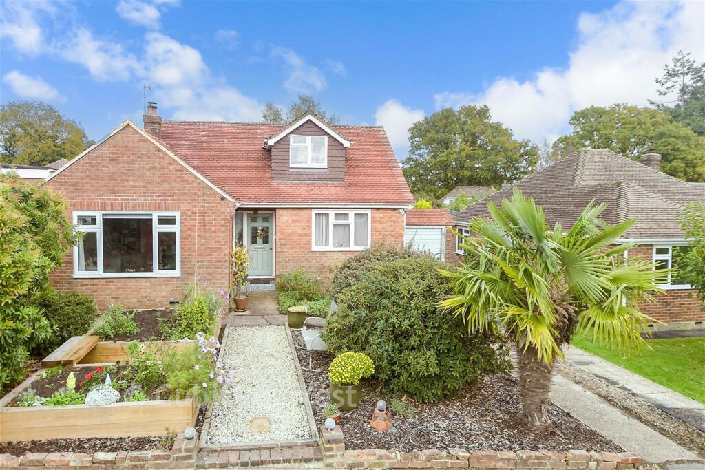
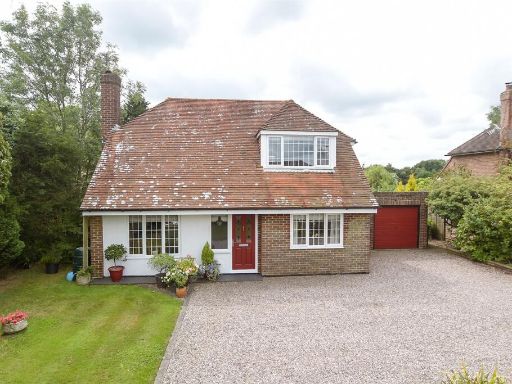
- house exterior mid-20th century suburban
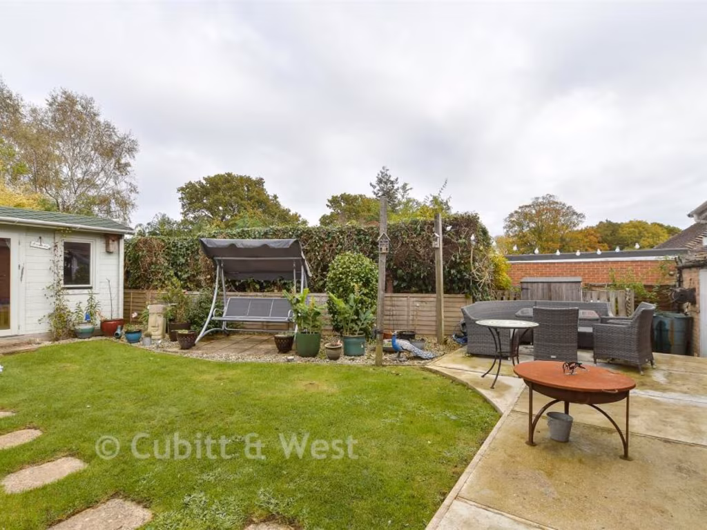
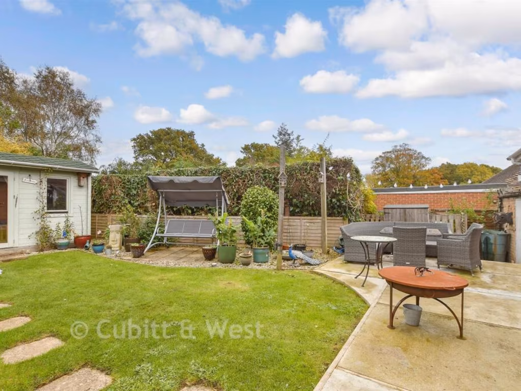
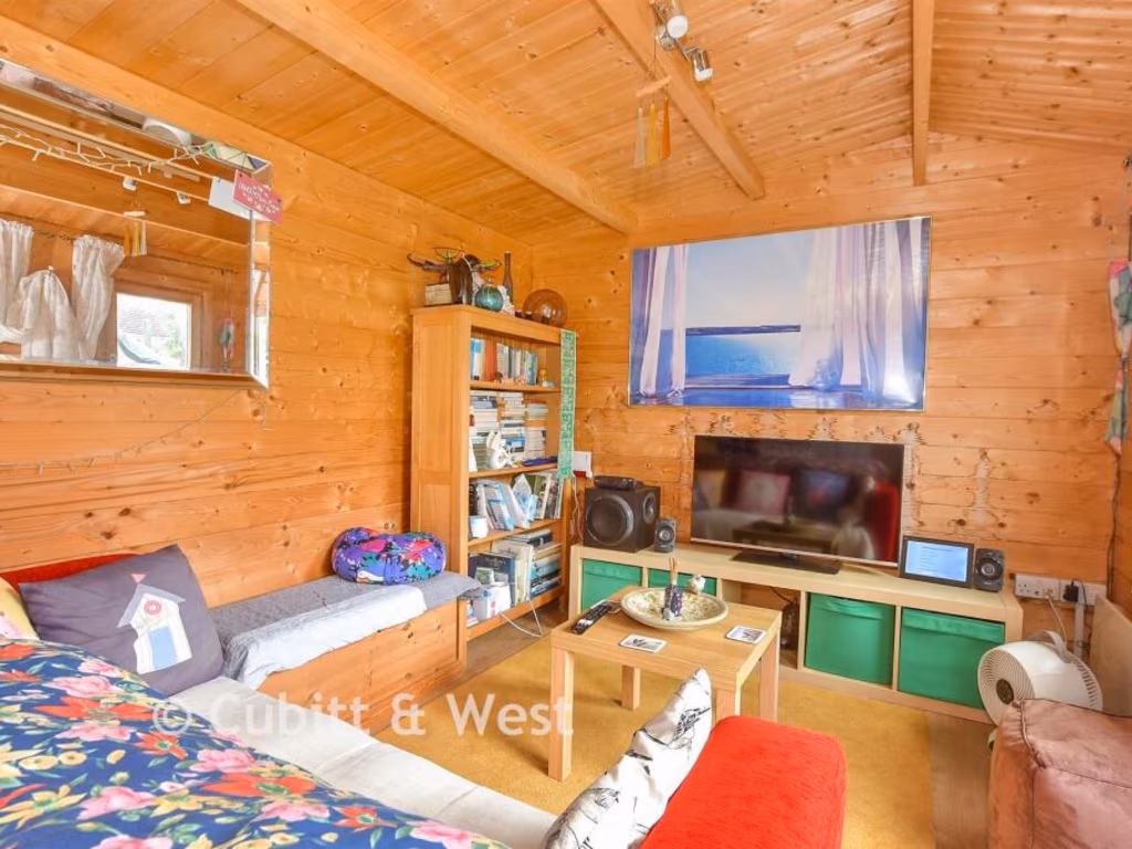
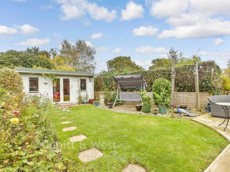
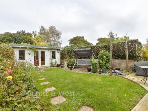
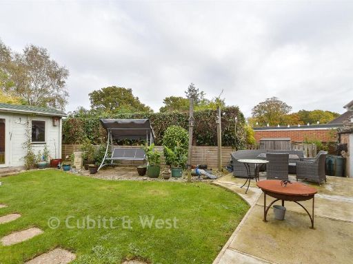
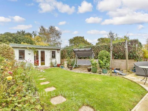
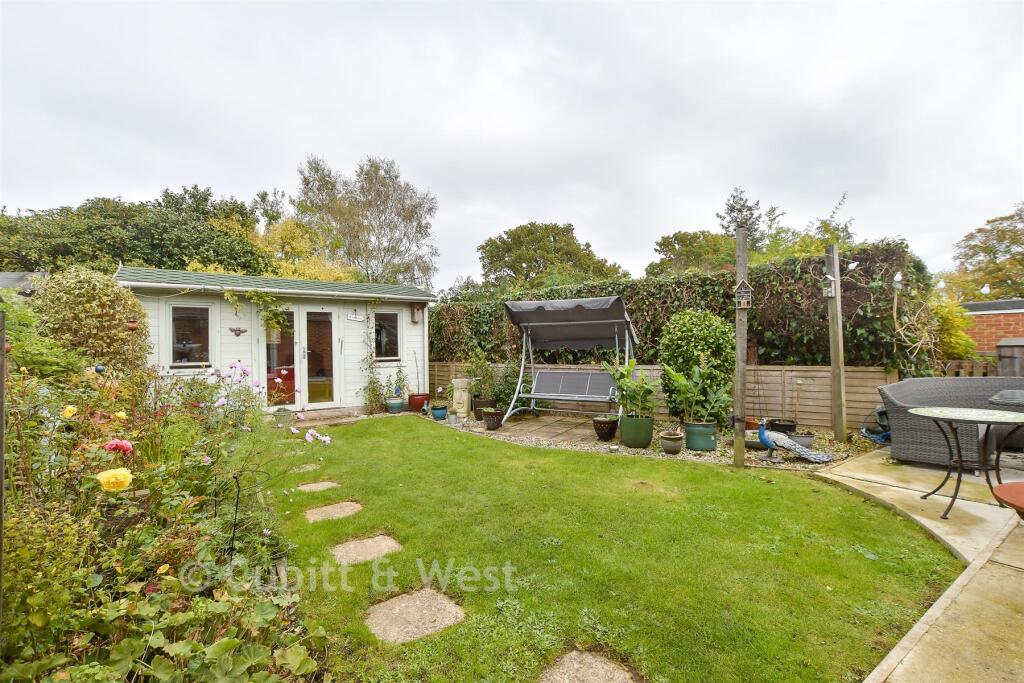
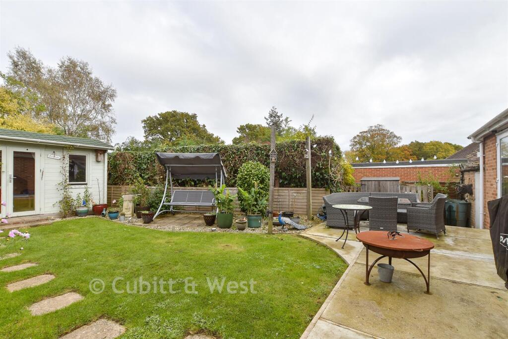
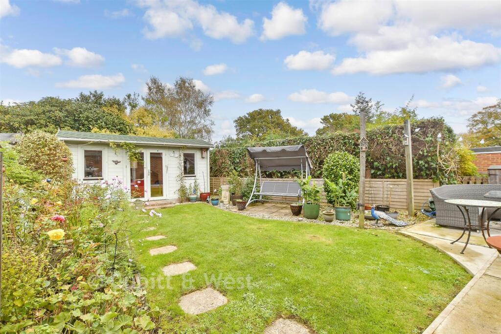
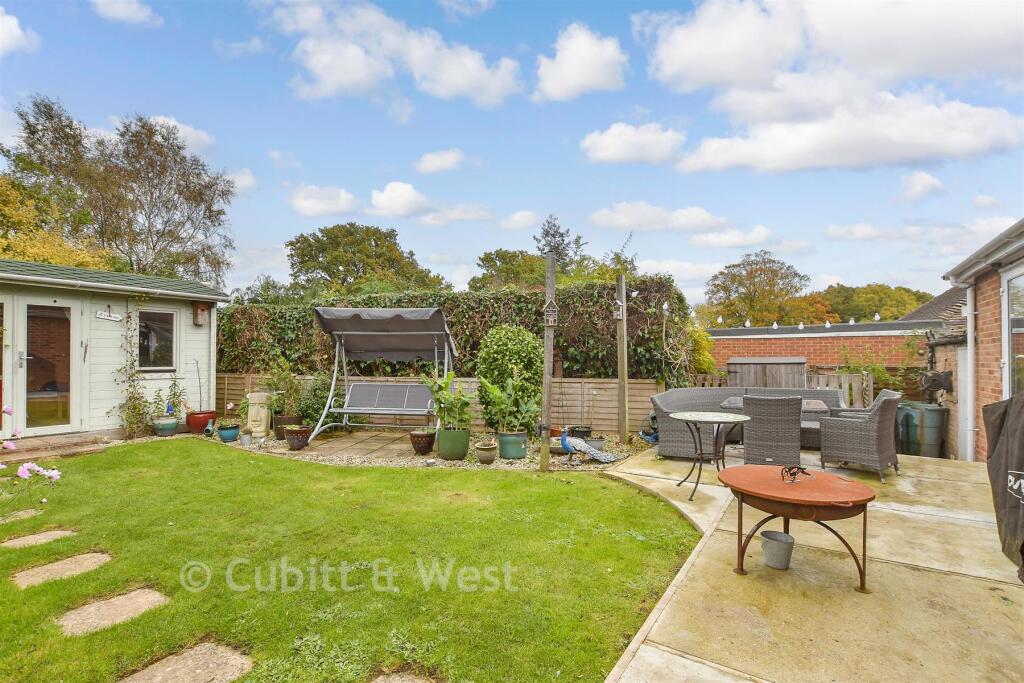
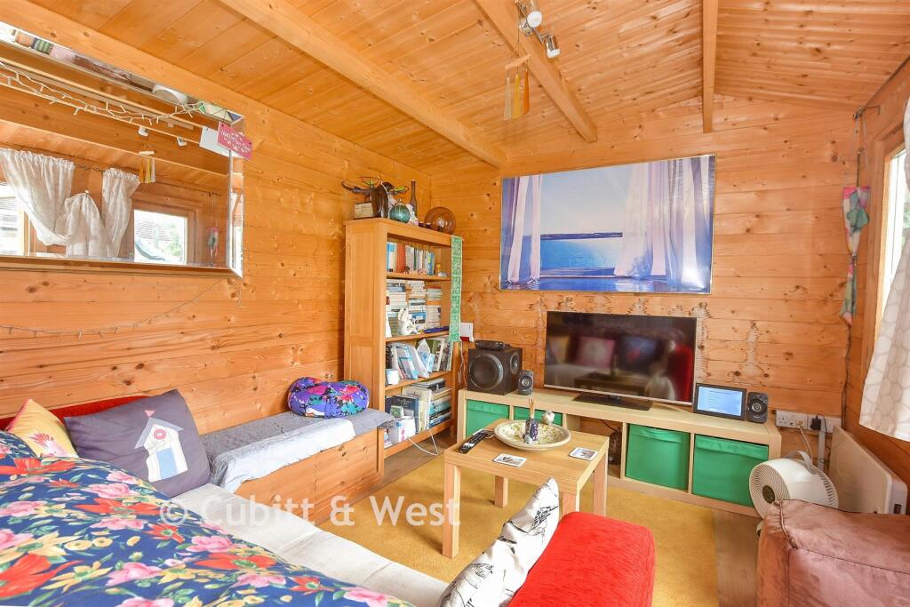
- garden with studio/outbuilding contemporary
Floorplan Description
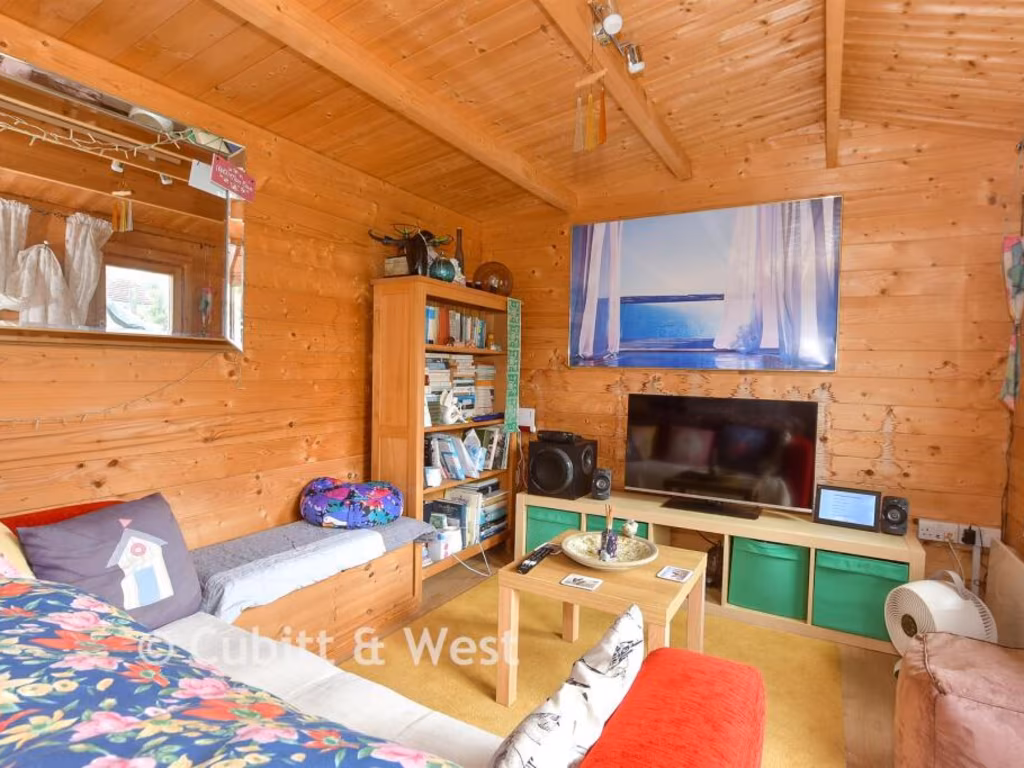
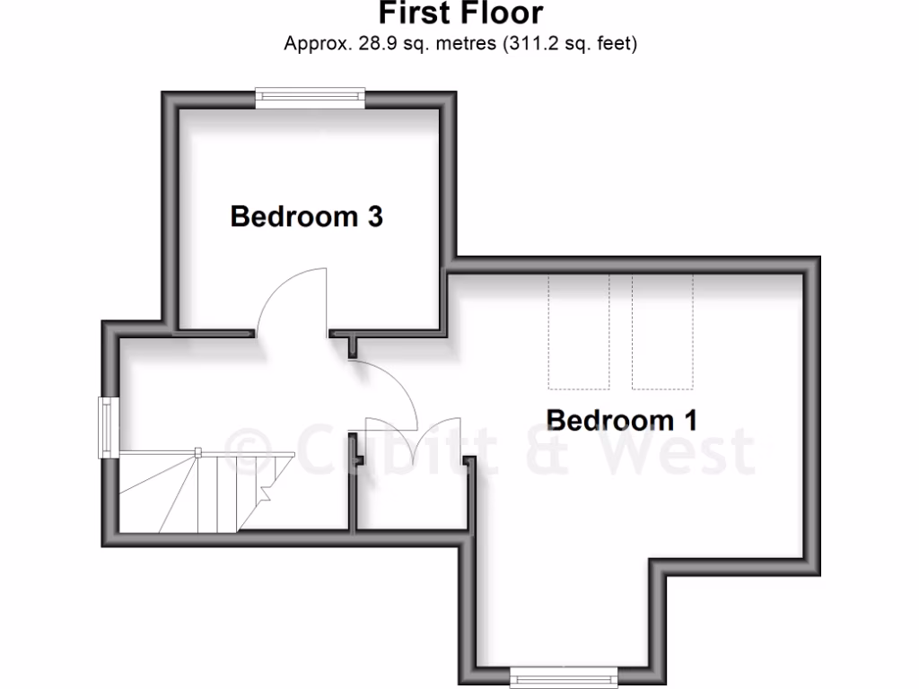
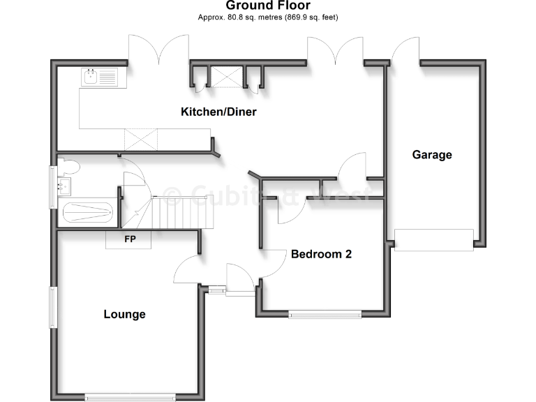
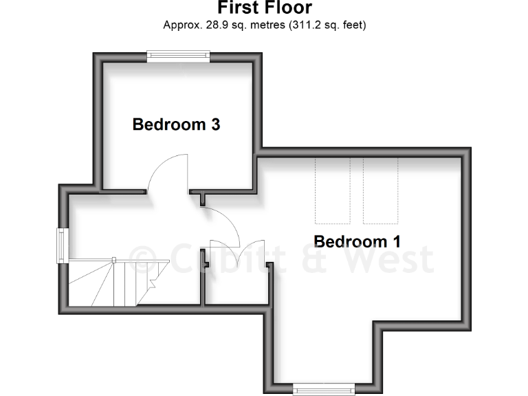
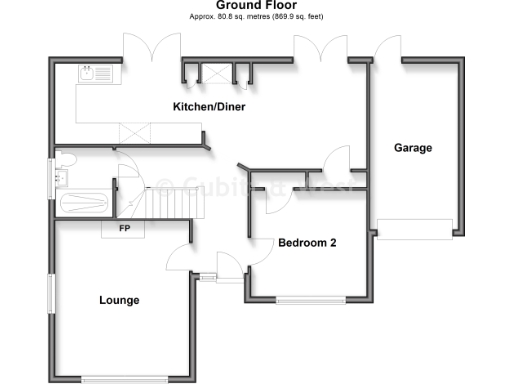
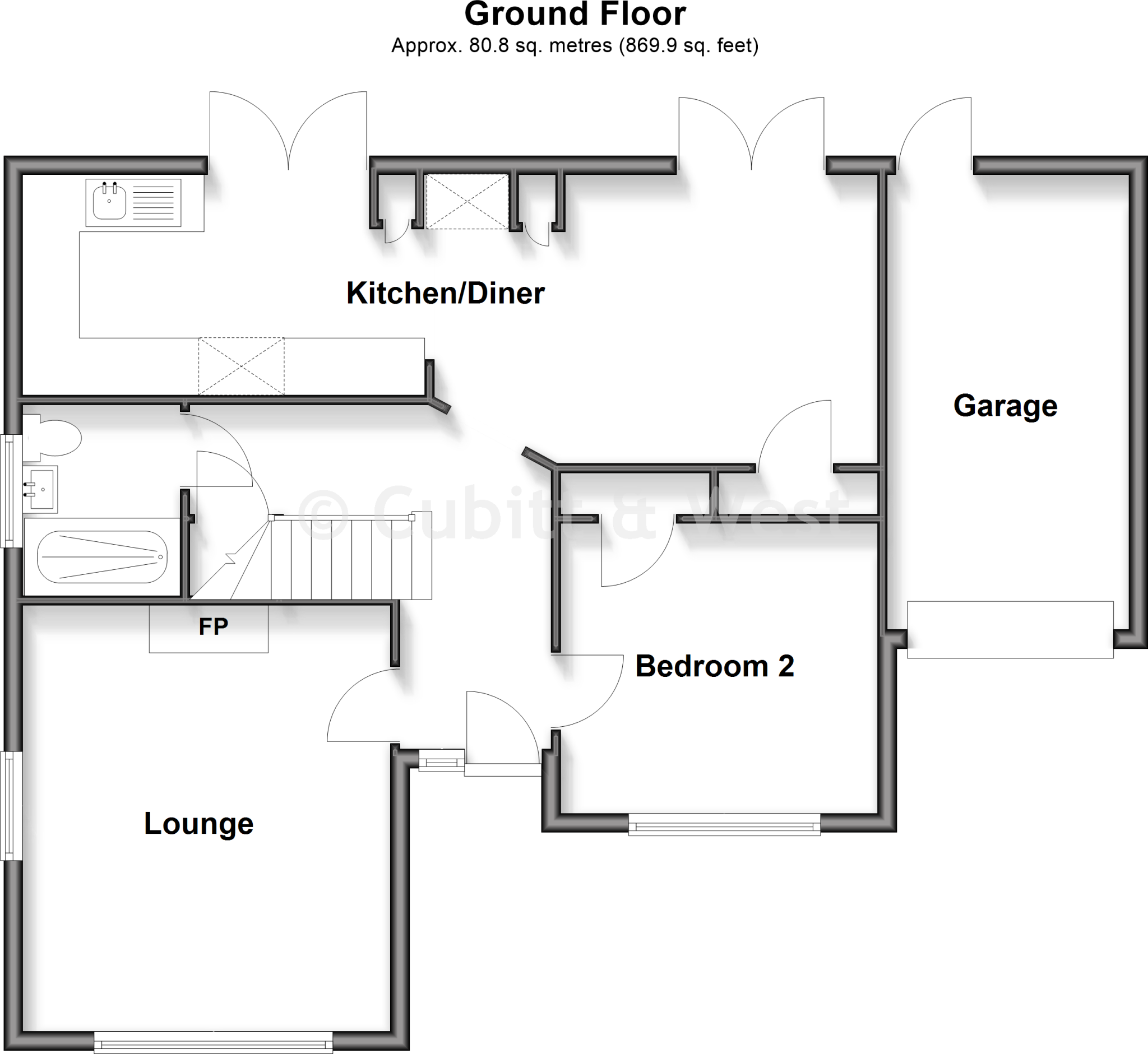
- Ground-floor plan showing Kitchen/Diner, Lounge, Bedroom 2 and Garage.
Rooms
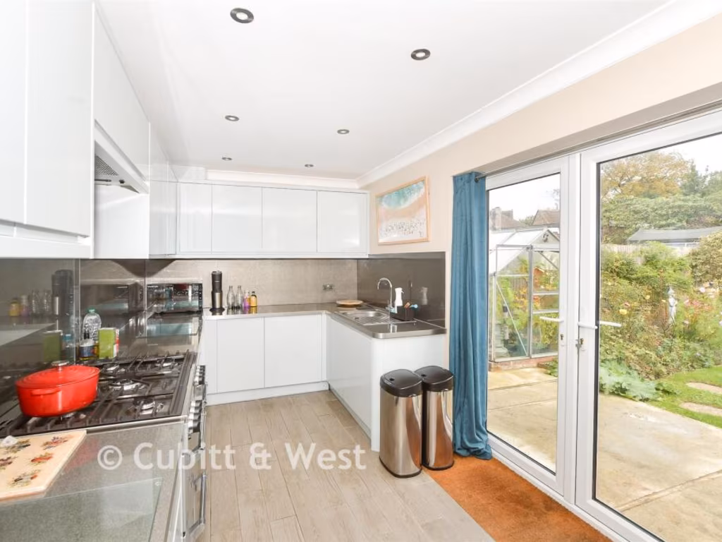
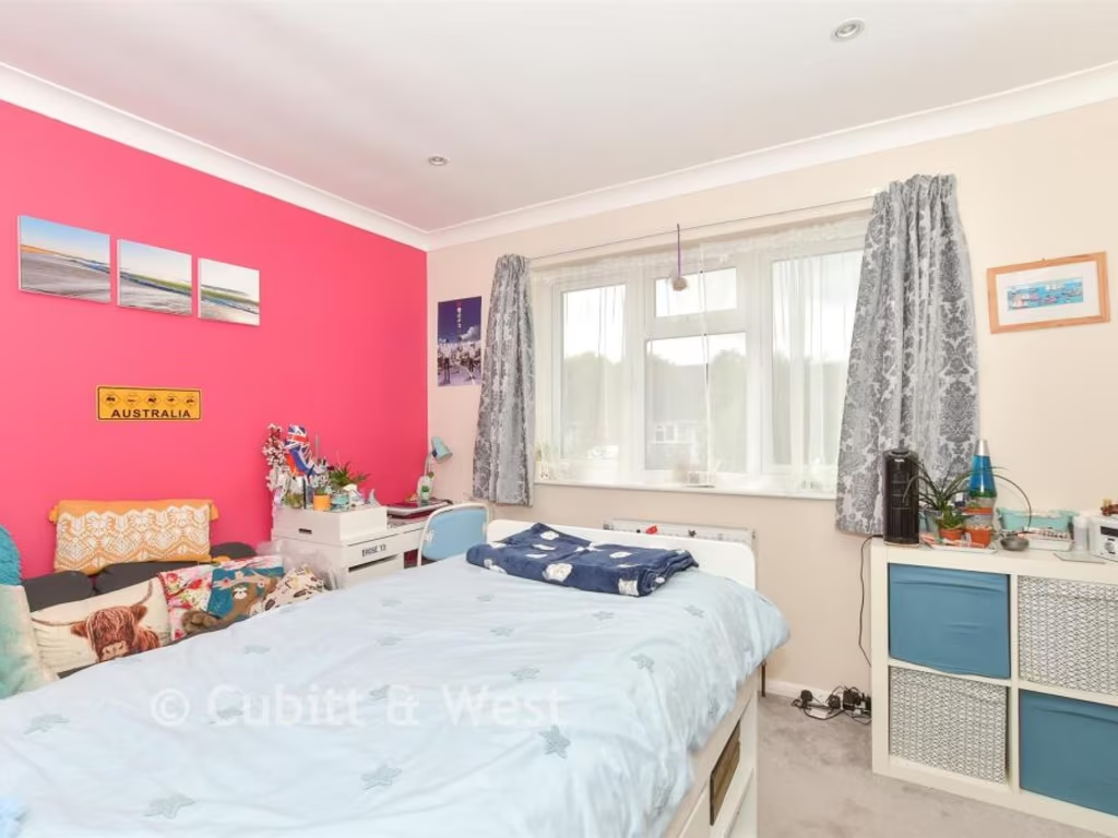
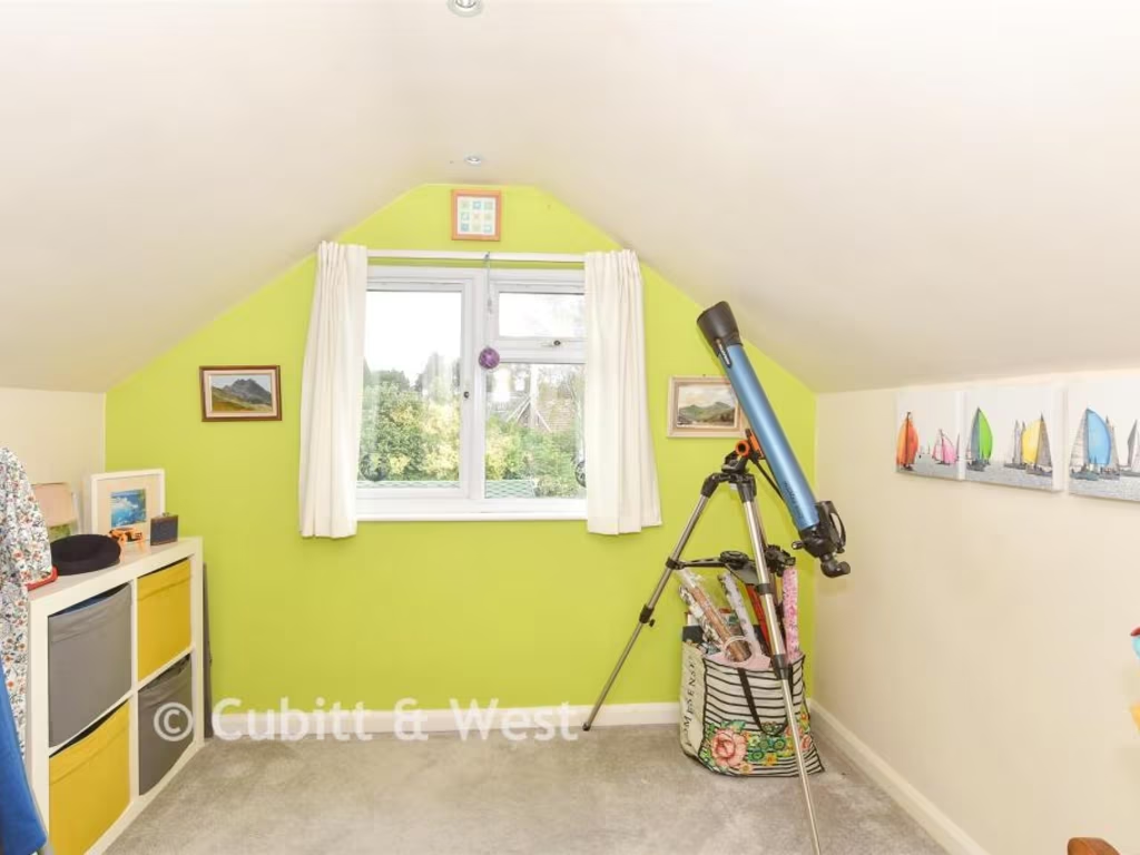
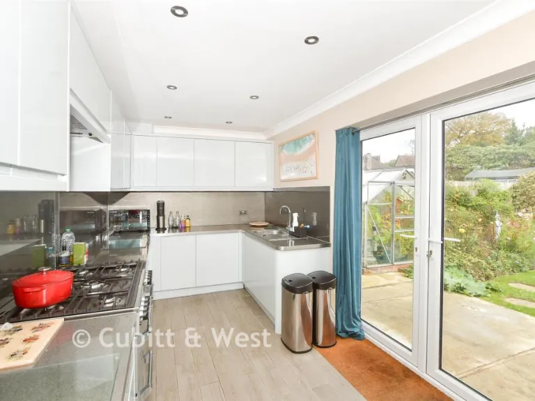
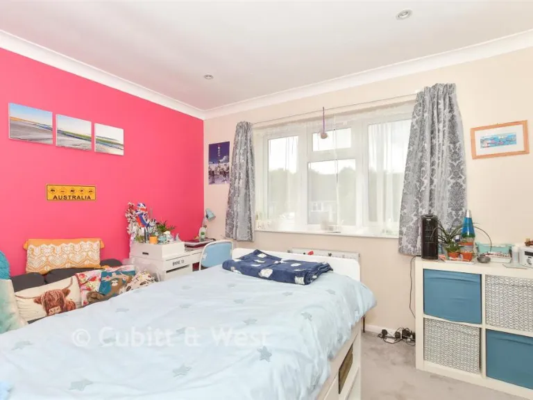
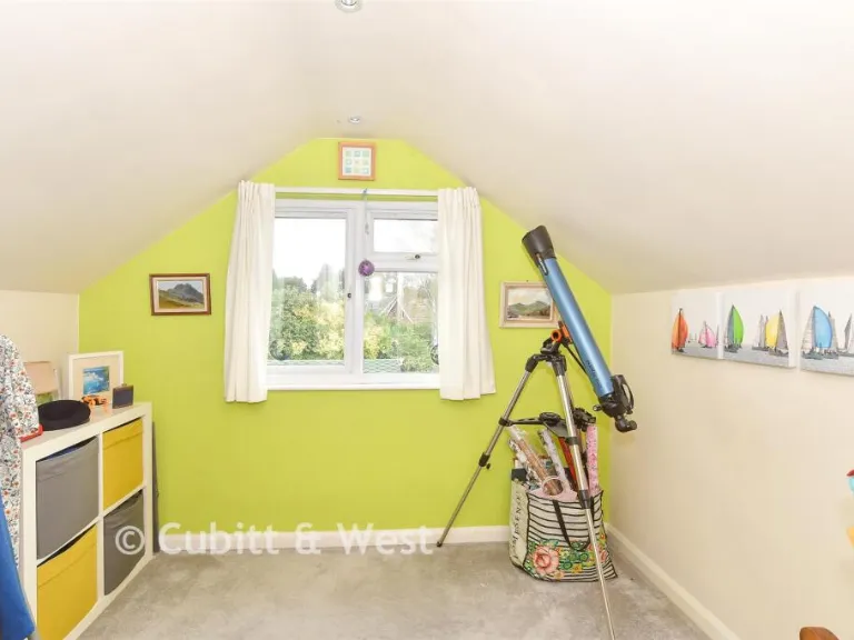
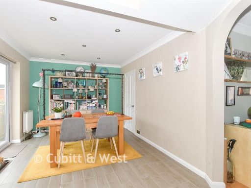
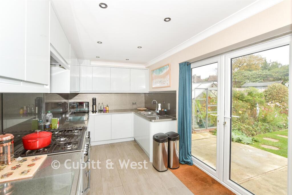
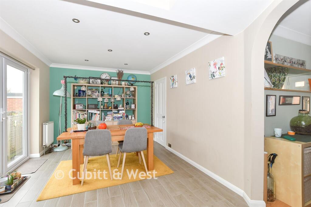
- Kitchen/Diner:
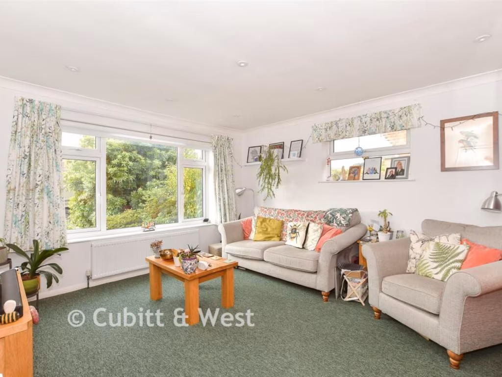
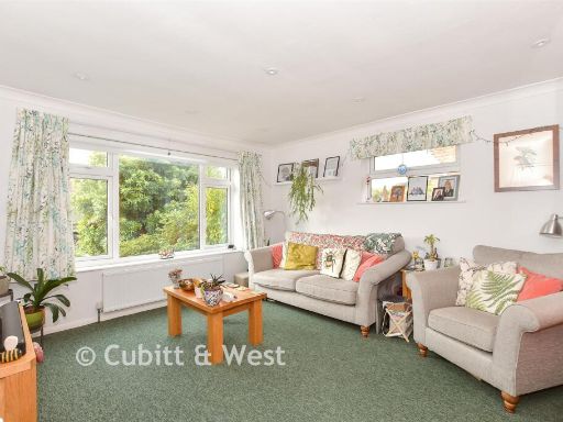
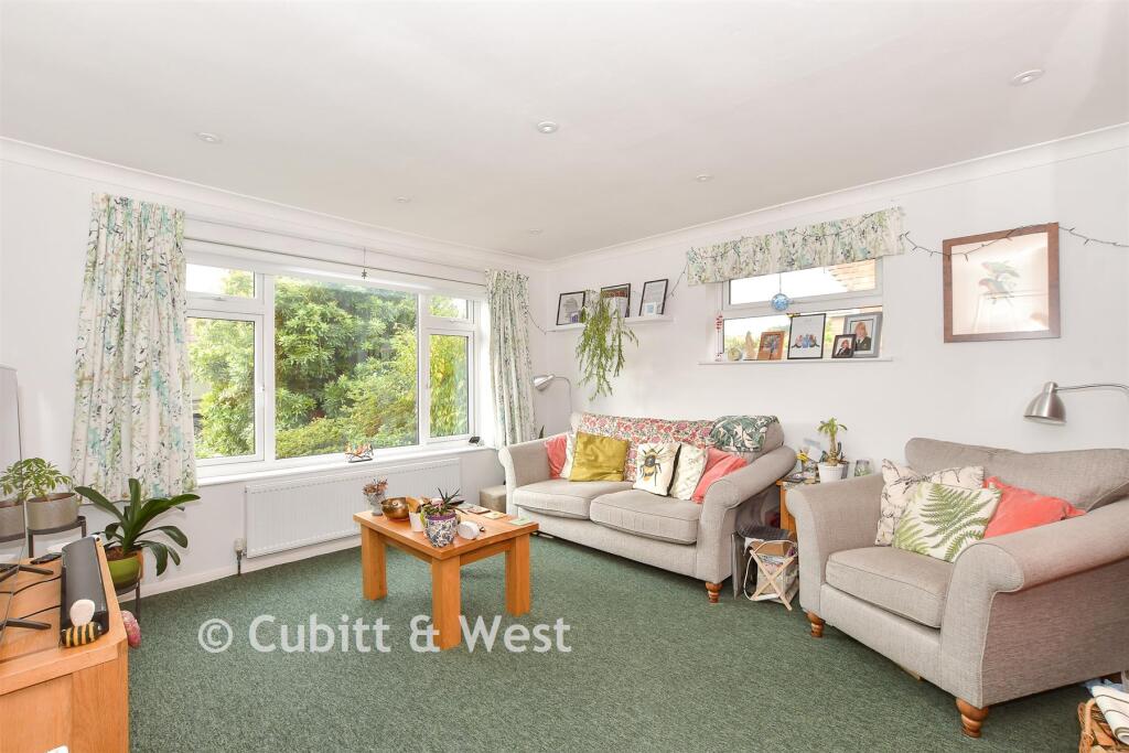
- Lounge:
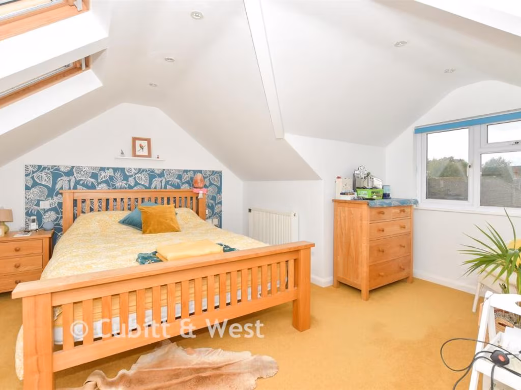
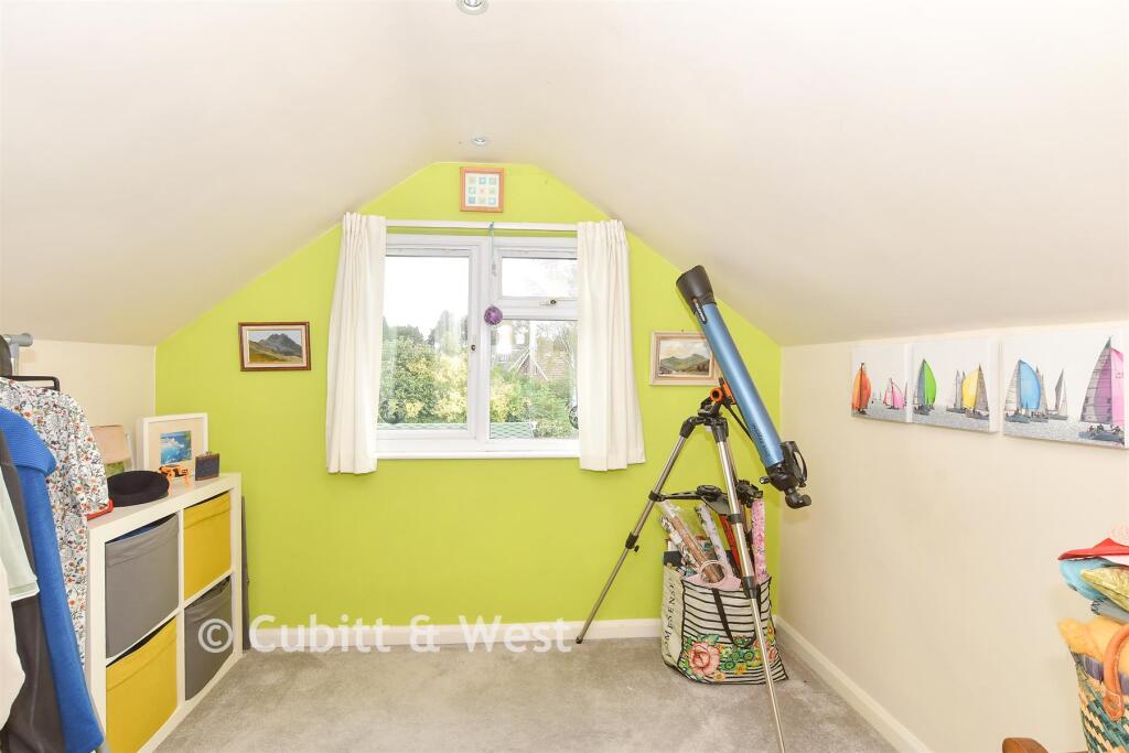
- Bedroom 2:
- Garage:
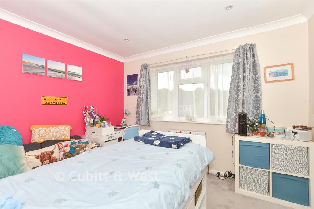
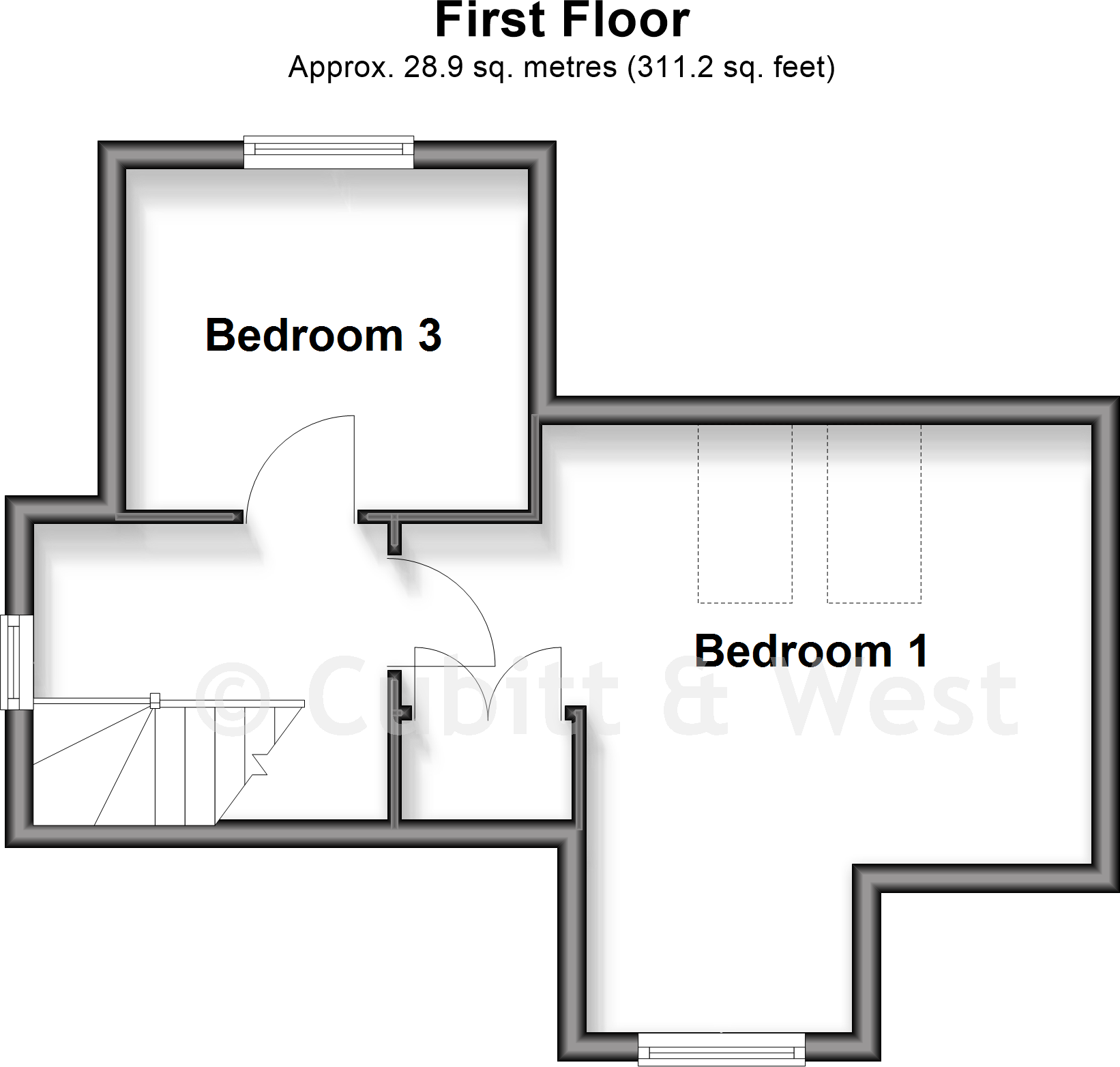
- Bedroom 3:
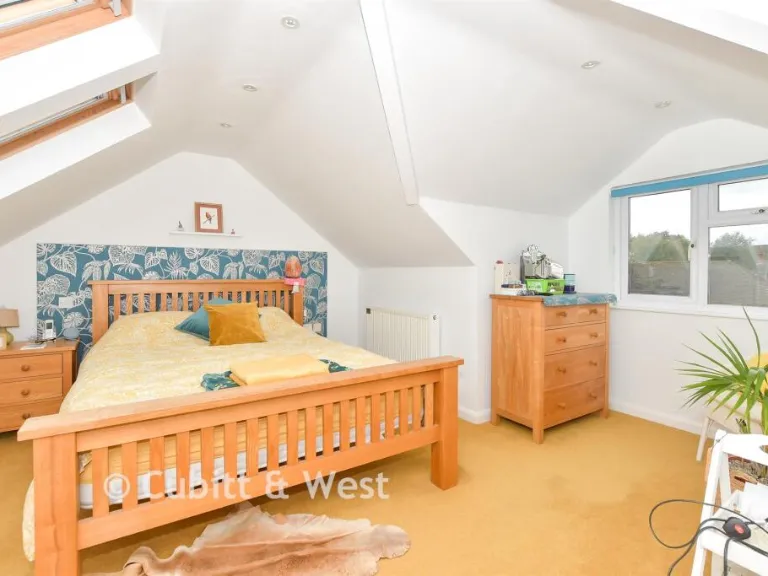
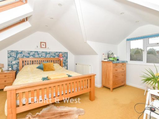
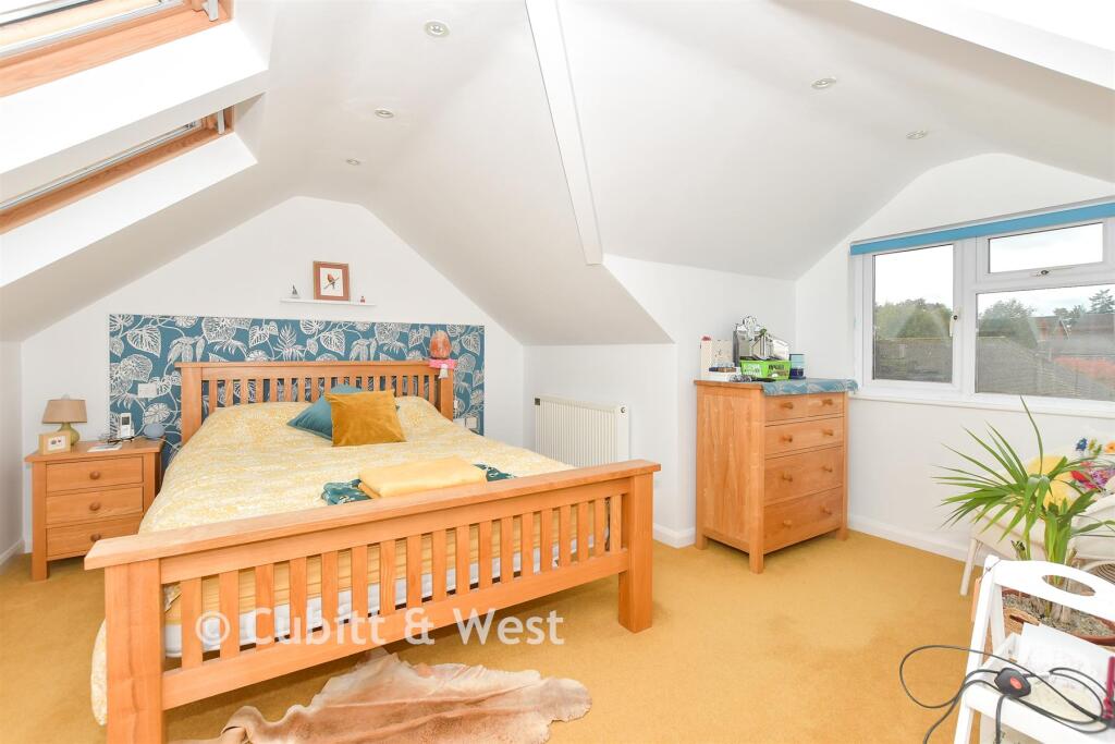
- Bedroom 1:
Textual Property Features
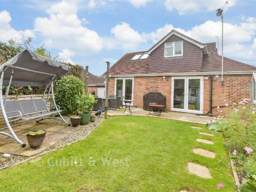
- Has Garden
- Is Retirement
- Success
Detected Visual Features
- bungalow
- brick
- pitched roof
- dormer window
- garden
- suburban
- garage
- central heating
- detached
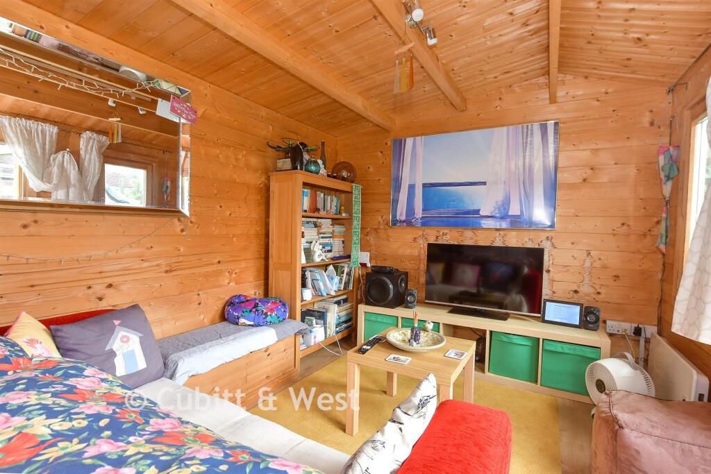
- studio
- outbuilding
- greenery
- landscaped
- patio
- plants
- bushes
- swing
- lawn
- trees
- fence
EPC Details
- Fully double glazed
- Cavity wall, filled cavity
- Boiler and radiators, mains gas
- Low energy lighting in all fixed outlets
- Suspended, no insulation (assumed)
Nearby Schools
- Skippers Hill Manor Preparatory School
- St Mary the Virgin Church of England Primary School
- Buxted CofE Primary School
- Bonners CofE School
- Mayfield School
- Ashdown Primary School
- Mark Cross Church of England Aided Primary School
- Frant Church of England Primary School
- Groombridge St Thomas' Church of England Primary School
- Manor Primary School
- St Mark's Church of England Primary School
- Jarvis Brook Primary School
- Rotherfield Primary School
- Beacon Academy
- St John's Church of England Primary School
- Rocks Park Primary School
- Five Ashes CofE Primary School
- High Hurstwood Church of England Primary School
- Mayfield Church of England Primary School
- St Marys Catholic Primary School
- Sir Henry Fermor Church of England Primary School
- St Michael's Primary School
- Uckfield College
Nearest General Shops
- Id: 190799513
- Tags:
- Addr:
- City: Crowborough
- Place: Wealden Business Park
- Postcode: TN6 2JJ
- Street: Farningham Road
- Building: yes
- Name: Travis Perkins
- Opening_hours: Mo-Fr 07:00-17:00;Sa 08:00-13:00
- Shop: doityourself
- TagsNormalized:
- travis perkins
- doityourself
- shop
- Lat: 51.0444202
- Lon: 0.1824343
- FullGeoHash: u104khkg718f
- PartitionGeoHash: u104
- Images:
- FoodStandards: null
- Distance: 696.6
,- Id: 5520665152
- Tags:
- Name: GJFleet Services
- Shop: car_repair
- TagsNormalized:
- service
- car repair
- repair
- shop
- Lat: 51.0455685
- Lon: 0.1827549
- FullGeoHash: u104kht1frxu
- PartitionGeoHash: u104
- Images:
- FoodStandards: null
- Distance: 694.6
,- Id: 952991161
- Tags:
- Addr:
- Housename: The Yard
- Postcode: TN6 3DJ
- Street: Alderbrook Close
- Building: industrial
- Name: S.TAYLOR BUILDERS MERCHANT AND HAULAGE CONTRACTORS
- Shop: doityourself
- TagsNormalized:
- industrial
- builders merchant
- doityourself
- shop
- Lat: 51.0404476
- Lon: 0.1694841
- FullGeoHash: u1047gekjm09
- PartitionGeoHash: u104
- Images:
- FoodStandards: null
- Distance: 678.6
}
Nearest Grocery shops
- Id: 856469664
- Tags:
- Addr:
- Postcode: TN6 2SD
- Street: Crowborough Hill
- Building: yes
- Fhrs:
- Name: News Plus
- Shop: convenience
- Source:
- TagsNormalized:
- Lat: 51.0554593
- Lon: 0.1688697
- FullGeoHash: u1047y6gwgqm
- PartitionGeoHash: u104
- Images:
- FoodStandards:
- Id: 184998
- FHRSID: 184998
- LocalAuthorityBusinessID: PI/400017334
- BusinessName: News Plus
- BusinessType: Retailers - other
- BusinessTypeID: 4613
- AddressLine1: Chapel Green
- AddressLine2: Crowborough
- AddressLine3: East Sussex
- AddressLine4: null
- PostCode: TN6 2SD
- RatingValue: 5
- RatingKey: fhrs_5_en-GB
- RatingDate: 2021-06-23
- LocalAuthorityCode: 107
- LocalAuthorityName: Wealden
- LocalAuthorityWebSite: http://www.wealden.gov.uk
- LocalAuthorityEmailAddress: envhealth@rother.gov.uk
- Scores:
- Hygiene: 5
- Structural: 5
- ConfidenceInManagement: 5
- NewRatingPending: false
- Geocode:
- Longitude: 0.16944500000000
- Latitude: 51.05474900000000
- Distance: 1070.2
,- Id: 141976393
- Tags:
- Addr:
- Brand: Sainsbury's Local
- Brand:wikidata: Q13218434
- Brand:wikipedia: en:Sainsbury's Local
- Building: yes
- Name: Sainsbury's Local
- Shop: convenience
- Source: bing
- TagsNormalized:
- sainsburys
- sainsburys local
- convenience
- shop
- Lat: 51.0486011
- Lon: 0.1875087
- FullGeoHash: u104km0e9kbw
- PartitionGeoHash: u104
- Images:
- FoodStandards: null
- Distance: 1058.8
,- Id: 7166315830
- Tags:
- Brand: Premier
- Brand:wikidata: Q7240340
- Brand:wikipedia: en:Premier Stores
- Name: Whitehill News & Convenience
- Operator: Premier
- Shop: convenience
- TagsNormalized:
- Lat: 51.0494512
- Lon: 0.1614292
- FullGeoHash: u1047tm89e6q
- PartitionGeoHash: u104
- Images:
- FoodStandards: null
- Distance: 878.8
}
Nearest Religious buildings
- Id: 1148064258
- Tags:
- Amenity: place_of_worship
- Denomination: strict_baptist
- Name: Rehoboth Strict Baptist Chapel
- Node_id: 1148064258
- Religion: christian
- Source: OS_OpenData_StreetView
- Source:name: OS Open Local Important Buildings Layer
- Wikidata: Q7309841
- Wikipedia: en:Rehoboth Chapel, Jarvis Brook
- TagsNormalized:
- place of worship
- baptist
- chapel
- christian
- church
- Lat: 51.0416804
- Lon: 0.180551
- FullGeoHash: u104k5g7r4ue
- PartitionGeoHash: u104
- Images:
- FoodStandards: null
- Distance: 733.3
,- Id: 1148064119
- Tags:
- Addr:
- City: Crowborough
- Postcode: TN6 2NT
- Street: Herne Road
- Amenity: place_of_worship
- Name: St. Thomas’ Chapel
- Religion: christian
- Source: OS_OpenData_StreetView
- TagsNormalized:
- place of worship
- chapel
- christian
- church
- Lat: 51.047034
- Lon: 0.1653059
- FullGeoHash: u1047ub6ebv4
- PartitionGeoHash: u104
- Images:
- FoodStandards: null
- Distance: 537.1
,- Id: 878675787
- Tags:
- Addr:
- City: Crowborough
- Postcode: TN6 3AP
- Street: Fermor Road
- Amenity: place_of_worship
- Building: church
- Denomination: anglican
- Name: St. Richard's Church
- Phone: +44 1892 611318
- Religion: christian
- Website: strichardscrowborough.org
- Wikidata: Q105081233
- TagsNormalized:
- place of worship
- church
- anglican
- christian
- Lat: 51.0418379
- Lon: 0.1713144
- FullGeoHash: u1047gusrbjq
- PartitionGeoHash: u104
- Images:
- FoodStandards: null
- Distance: 493.5
}
Nearest Medical buildings
- Id: 190799506
- Tags:
- Amenity: dentist
- Building: yes
- Healthcare: dentist
- Name: Crowborough Gentle Dental
- Phone: +44 1892 610750
- Wheelchair: yes
- TagsNormalized:
- dentist
- health
- healthcare
- dental
- Lat: 51.0485345
- Lon: 0.1866913
- FullGeoHash: u104kjpgq0x1
- PartitionGeoHash: u104
- Images:
- FoodStandards: null
- Distance: 1001.7
,- Id: 190332743
- Tags:
- Addr:
- City: Crowborough
- Postcode: TN6 2ED
- Street: Crowborough Hill
- Amenity: clinic
- Building: yes
- Healthcare: clinic
- Name: The Brook Health Centre
- TagsNormalized:
- clinic
- health
- healthcare
- health centre
- Lat: 51.0495553
- Lon: 0.1851475
- FullGeoHash: u104kjqc4nzg
- PartitionGeoHash: u104
- Images:
- FoodStandards: null
- Distance: 937.6
,- Id: 190799535
- Tags:
- Addr:
- Place: Brooklands Park
- Street: Farningham Road
- Building: yes
- Leisure: sports_centre
- Name: Isenhurst Health Clubs
- TagsNormalized:
- sports
- sports centre
- leisure
- health
- Lat: 51.0457025
- Lon: 0.1855
- FullGeoHash: u104khx4f2wu
- PartitionGeoHash: u104
- Images:
- FoodStandards: null
- Distance: 884.8
,- Id: 2563122254
- Tags:
- Amenity: dentist
- Healthcare: dentist
- Name: Crowborough Dental Care
- TagsNormalized:
- dentist
- health
- healthcare
- dental
- Lat: 51.0462554
- Lon: 0.1845716
- FullGeoHash: u104khwmuzdw
- PartitionGeoHash: u104
- Images:
- FoodStandards: null
- Distance: 818.4
}
Nearest Airports
- Id: 260720166
- Tags:
- Aerodrome: international
- Aeroway: aerodrome
- Alt_name: Gatwick Airport
- Ele: 62
- Iata: LGW
- Icao: EGKK
- Internet_access: wlan
- Internet_access:fee: no
- Internet_access:ssid: Gatwick FREE Wi-Fi
- Name: London Gatwick Airport
- Operator: Gatwick Airport Limited
- Ref: LGW
- Website: https://www.gatwickairport.com/
- Wikidata: Q8703
- Wikipedia: en:Gatwick Airport
- TagsNormalized:
- airport
- international airport
- Lat: 51.1540917
- Lon: -0.1883773
- FullGeoHash: gcpg58qf4mzd
- PartitionGeoHash: gcpg
- Images:
- FoodStandards: null
- Distance: 27933.3
}
Nearest Leisure Facilities
- Id: 138651711
- Tags:
- Leisure: pitch
- Sport: tennis
- TagsNormalized:
- Lat: 51.0478009
- Lon: 0.1722271
- FullGeoHash: u1047uvqvpvc
- PartitionGeoHash: u104
- Images:
- FoodStandards: null
- Distance: 187
,- Id: 138651709
- Tags:
- Leisure: park
- Name: Wolfe Recreation Ground
- TagsNormalized:
- Lat: 51.047156
- Lon: 0.1710447
- FullGeoHash: u1047uue1xs4
- PartitionGeoHash: u104
- Images:
- FoodStandards: null
- Distance: 168.1
,- Id: 304289941
- Tags:
- Leisure: playground
- Name: Wolfe Recreation Ground
- TagsNormalized:
- playground
- leisure
- recreation ground
- Lat: 51.0473269
- Lon: 0.1722506
- FullGeoHash: u1047uvkjxrq
- PartitionGeoHash: u104
- Images:
- FoodStandards: null
- Distance: 135.8
,- Id: 304290720
- Tags:
- Leisure: pitch
- Sport: soccer
- Surface: grass
- TagsNormalized:
- Lat: 51.0468276
- Lon: 0.1714523
- FullGeoHash: u1047uuc74k5
- PartitionGeoHash: u104
- Images:
- FoodStandards: null
- Distance: 123
,- Id: 138651713
- Tags:
- Leisure: pitch
- Sport: bowls
- TagsNormalized:
- Lat: 51.0460615
- Lon: 0.1715225
- FullGeoHash: u1047usuug83
- PartitionGeoHash: u104
- Images:
- FoodStandards: null
- Distance: 94.6
}
Nearest Tourist attractions
- Id: 6611927196
- Tags:
- Name: Old Mill Farm
- Tourism: guest_house
- TagsNormalized:
- Lat: 51.0155222
- Lon: 0.1258319
- FullGeoHash: u1044z5dune5
- PartitionGeoHash: u104
- Images:
- FoodStandards: null
- Distance: 4736
,- Id: 99244117
- Tags:
- Name: Crowborough Camping And Caravanning Club Site
- Source: Bing
- Tourism: caravan_site
- TagsNormalized:
- Lat: 51.0641798
- Lon: 0.168925
- FullGeoHash: u1047zgn2jp9
- PartitionGeoHash: u104
- Images:
- FoodStandards: null
- Distance: 2021.7
,- Id: 4759783635
- Tags:
- Historic: memorial
- Inscription: Sir Arthur Conan Doyle Resident of Crowborough 1907 - 1930
- Material: metal
- Memorial: statue
- Name: Sir Arthur Conan Doyle
- Tourism: yes
- Wheelchair: yes
- TagsNormalized:
- Lat: 51.0606629
- Lon: 0.1614464
- FullGeoHash: u1047xm9cvrn
- PartitionGeoHash: u104
- Images:
- FoodStandards: null
- Distance: 1798.6
}
Nearest Train stations
- Id: 7499119497
- Tags:
- Name: Hadlow Down
- Public_transport: station
- Railway: station
- Train: yes
- Usage: tourism
- TagsNormalized:
- Lat: 50.9959245
- Lon: 0.1922341
- FullGeoHash: u104h7ebz3k4
- PartitionGeoHash: u104
- Images:
- FoodStandards: null
- Distance: 5748.7
,- Id: 5882031667
- Tags:
- Addr:
- Name: Eridge
- Naptan:
- Network: National Rail
- Public_transport: station
- Railway: station
- Ref:
- Source: bing
- Train: yes
- Wikidata: Q2564605
- Wikipedia: en:Eridge railway station
- TagsNormalized:
- Lat: 51.0892394
- Lon: 0.2009551
- FullGeoHash: u104ssd26s6z
- PartitionGeoHash: u104
- Images:
- FoodStandards: null
- Distance: 5175.9
,- Id: 161272554
- Tags:
- Building: train_station
- Layer: 1
- Name: Eridge
- Public_transport: station
- TagsNormalized:
- station
- train
- train station
- Lat: 51.0891908
- Lon: 0.2010317
- FullGeoHash: u104ssd2h7kj
- PartitionGeoHash: u104
- Images:
- FoodStandards: null
- Distance: 5173
,- Id: 5882032218
- Tags:
- Addr:
- Postcode: TN6 2JR
- Street: Farningham Road
- Name: Crowborough
- Naptan:
- Network: National Rail
- Public_transport: station
- Railway: station
- Ref:
- Wikidata: Q2537407
- Wikipedia: en:Crowborough railway station
- TagsNormalized:
- Lat: 51.0462372
- Lon: 0.1880389
- FullGeoHash: u104kk8vvs7c
- PartitionGeoHash: u104
- Images:
- FoodStandards: null
- Distance: 1060.8
,- Id: 190799504
- Tags:
- Building: train_station
- Name: Crowborough Station
- Public_transport: station
- TagsNormalized:
- station
- train
- train station
- Lat: 51.0463382
- Lon: 0.1878947
- FullGeoHash: u104kk8y6r0k
- PartitionGeoHash: u104
- Images:
- FoodStandards: null
- Distance: 1050.9
}
Nearest Bus stations and stops
- Id: 6932167383
- Tags:
- Bus: yes
- Highway: bus_stop
- Name: Crowborough Old Lane
- Public_transport: platform
- TagsNormalized:
- Lat: 51.0514476
- Lon: 0.178393
- FullGeoHash: u104kj9uhze7
- PartitionGeoHash: u104
- Images:
- FoodStandards: null
- Distance: 702.8
,- Id: 7166323438
- Tags:
- Bus: yes
- Highway: bus_stop
- Name: Rose Court
- Public_transport: platform
- TagsNormalized:
- Lat: 51.045478
- Lon: 0.1630199
- FullGeoHash: u1047sw9qwu2
- PartitionGeoHash: u104
- Images:
- FoodStandards: null
- Distance: 692.5
,- Id: 7166499857
- Tags:
- Bus: yes
- Highway: bus_stop
- Name: Crowborough Bridger Way
- Public_transport: platform
- TagsNormalized:
- Lat: 51.0514327
- Lon: 0.1697564
- FullGeoHash: u1047ves5sgd
- PartitionGeoHash: u104
- Images:
- FoodStandards: null
- Distance: 624.5
,- Id: 7166499853
- Tags:
- Bus: yes
- Highway: bus_stop
- Name: Crowborough Luxford Road
- Public_transport: platform
- TagsNormalized:
- Lat: 51.050971
- Lon: 0.1742859
- FullGeoHash: u1047vwcmnsz
- PartitionGeoHash: u104
- Images:
- FoodStandards: null
- Distance: 543.2
,- Id: 7166378103
- Tags:
- Bus: yes
- Highway: bus_stop
- Public_transport: platform
- TagsNormalized:
- Lat: 51.0414116
- Lon: 0.173185
- FullGeoHash: u1047gy1g88p
- PartitionGeoHash: u104
- Images:
- FoodStandards: null
- Distance: 529.3
}
Nearest Hotels
- Id: 538499424
- Tags:
- Addr:
- City: Buxted
- Postcode: TN22 4AY
- Street: Station Road
- Fhrs:
- Name: Buxted Park Hotel
- Source:
- Tourism: hotel
- Wikidata: Q17556990
- TagsNormalized:
- Lat: 50.9856145
- Lon: 0.1145226
- FullGeoHash: u10449eksx6j
- PartitionGeoHash: u104
- Images:
- FoodStandards: null
- Distance: 7873.6
,- Id: 188982088
- Tags:
- Amenity: pub
- Building: hotel
- Name: Carpenter's Arms
- Phone: +44 1435 873294
- Website: https://www.facebook.com/pages/The-Carpenters-Arms/132691737411903
- TagsNormalized:
- Lat: 51.0209326
- Lon: 0.2653305
- FullGeoHash: u104q014qxhv
- PartitionGeoHash: u104
- Images:
- FoodStandards: null
- Distance: 7048.4
,- Id: 188982090
- Tags:
- Addr:
- Amenity: pub
- Building: yes
- Fhrs:
- Layer: 1
- Name: The Middle House
- Source:
- Tourism: hotel
- Wikidata: Q17535314
- TagsNormalized:
- Lat: 51.020315
- Lon: 0.2614693
- FullGeoHash: u104jzyqusj9
- PartitionGeoHash: u104
- Images:
- FoodStandards: null
- Distance: 6830.3
}
Tags
- bungalow
- brick
- pitched roof
- dormer window
- garden
- suburban
- garage
- central heating
- detached
- garden
- studio
- outbuilding
- greenery
- landscaped
- patio
- plants
- bushes
- swing
- lawn
- trees
- fence
Local Market Stats
- Average Price/sqft: £395
- Avg Income: £53700
- Rental Yield: 3.3%
- Social Housing: 4%
- Planning Success Rate: 83%
AirBnB Data
- 1km average: £95/night
- Listings in 1km: 1
Similar Properties
 3 bedroom detached bungalow for sale in Main Road, Hadlow Down, Uckfield, East Sussex, TN22 — £363,000 • 3 bed • 2 bath • 873 ft²
 3 bedroom semi-detached house for sale in Hughes Way, Uckfield, East Sussex, TN22 — £238,000 • 3 bed • 1 bath • 629 ft²
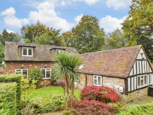 3 bedroom detached house for sale in Holtye Road, East Grinstead, West Sussex, RH19 — £561,500 • 3 bed • 3 bath • 1434 ft²
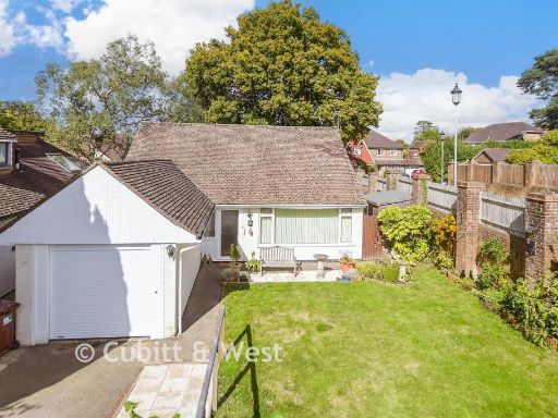 2 bedroom detached bungalow for sale in Elim Court Gardens, Crowborough, East Sussex, TN6 — £330,500 • 2 bed • 1 bath • 711 ft²
 3 bedroom semi-detached house for sale in Eastbourne Road, Halland, Lewes, East Sussex, BN8 — £244,500 • 3 bed • 1 bath • 776 ft²
 4 bedroom detached house for sale in Town Littleworth, Cooksbridge, Lewes, East Sussex, BN8 — £792,500 • 4 bed • 2 bath • 2638 ft²
Meta
- {
"@context": "https://schema.org",
"@type": "Residence",
"name": "3 bedroom chalet for sale in Luxford Drive, Crowborough, Ea…",
"description": "",
"url": "https://propertypiper.co.uk/property/2df4e90c-5b96-409c-912c-b5e8574ea1c7",
"image": "https://image-a.propertypiper.co.uk/0ac59577-3e0c-457c-9feb-10673aabde0c-1024.jpeg",
"address": {
"@type": "PostalAddress",
"streetAddress": "23 LUXFORD DRIVE CROWBOROUGH ",
"postalCode": "TN6 2PN",
"addressLocality": "Wealden",
"addressRegion": "Wealden",
"addressCountry": "England"
},
"geo": {
"@type": "GeoCoordinates",
"latitude": 51.046167876519505,
"longitude": 0.17286504922303134
},
"numberOfRooms": 3,
"numberOfBathroomsTotal": 1,
"floorSize": {
"@type": "QuantitativeValue",
"value": 1002,
"unitCode": "FTK"
},
"offers": {
"@type": "Offer",
"price": 314000,
"priceCurrency": "GBP",
"availability": "https://schema.org/InStock"
},
"additionalProperty": [
{
"@type": "PropertyValue",
"name": "Feature",
"value": "bungalow"
},
{
"@type": "PropertyValue",
"name": "Feature",
"value": "brick"
},
{
"@type": "PropertyValue",
"name": "Feature",
"value": "pitched roof"
},
{
"@type": "PropertyValue",
"name": "Feature",
"value": "dormer window"
},
{
"@type": "PropertyValue",
"name": "Feature",
"value": "garden"
},
{
"@type": "PropertyValue",
"name": "Feature",
"value": "suburban"
},
{
"@type": "PropertyValue",
"name": "Feature",
"value": "garage"
},
{
"@type": "PropertyValue",
"name": "Feature",
"value": "central heating"
},
{
"@type": "PropertyValue",
"name": "Feature",
"value": "detached"
},
{
"@type": "PropertyValue",
"name": "Feature",
"value": "garden"
},
{
"@type": "PropertyValue",
"name": "Feature",
"value": "studio"
},
{
"@type": "PropertyValue",
"name": "Feature",
"value": "outbuilding"
},
{
"@type": "PropertyValue",
"name": "Feature",
"value": "greenery"
},
{
"@type": "PropertyValue",
"name": "Feature",
"value": "landscaped"
},
{
"@type": "PropertyValue",
"name": "Feature",
"value": "patio"
},
{
"@type": "PropertyValue",
"name": "Feature",
"value": "plants"
},
{
"@type": "PropertyValue",
"name": "Feature",
"value": "bushes"
},
{
"@type": "PropertyValue",
"name": "Feature",
"value": "swing"
},
{
"@type": "PropertyValue",
"name": "Feature",
"value": "lawn"
},
{
"@type": "PropertyValue",
"name": "Feature",
"value": "trees"
},
{
"@type": "PropertyValue",
"name": "Feature",
"value": "fence"
}
]
}
High Res Floorplan Images
Compatible Floorplan Images
FloorplanImages Thumbnail