SK9 7DY - High street retail property for sale in 63 London Road, Ald…
View on Property Piper
High street retail property for sale in 63 London Road, Alderley Edge, SK9 7DY, SK9
Property Details
- Price: £550000
- Bedrooms: 1
- Bathrooms: 1
- Property Type: undefined
- Property SubType: undefined
Brochure Descriptions
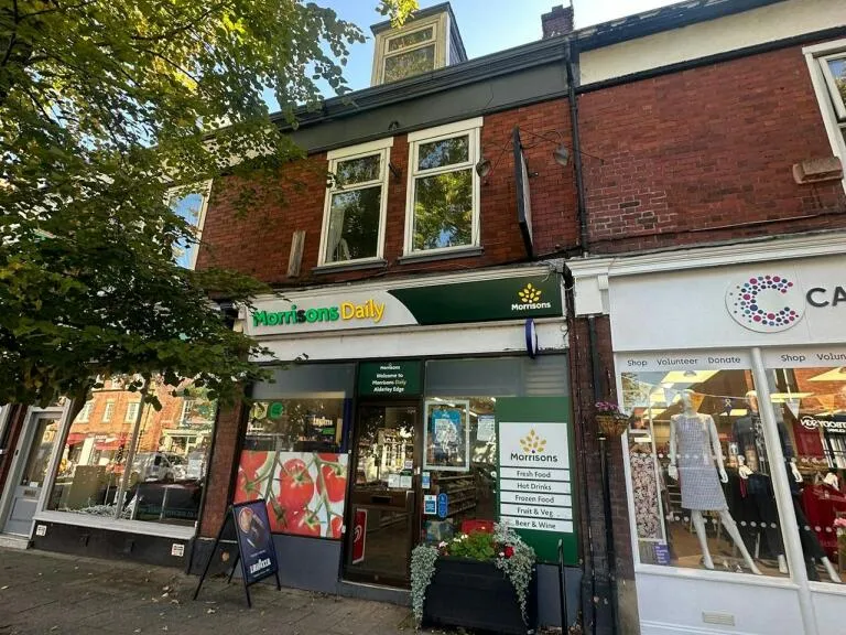
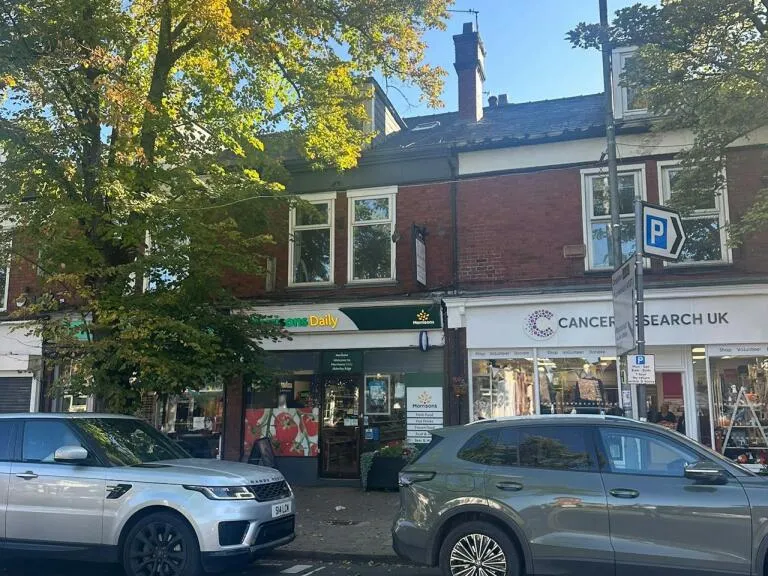
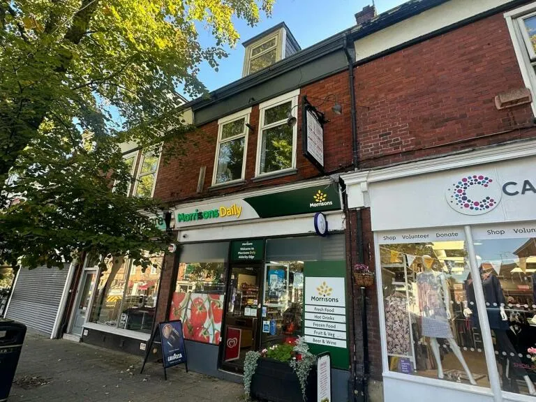
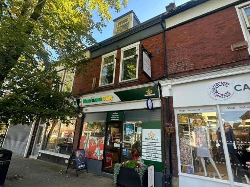
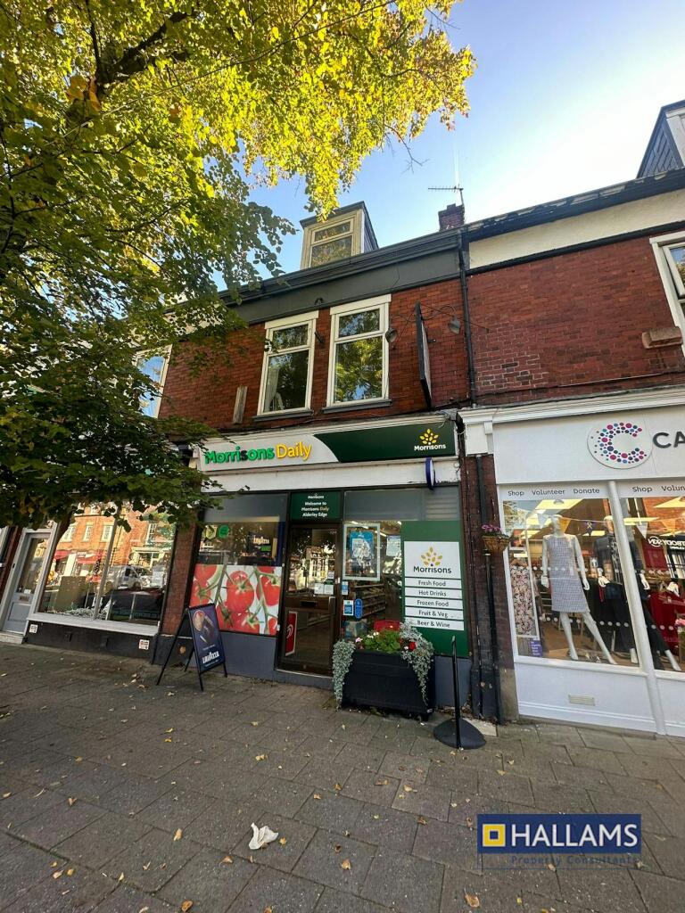
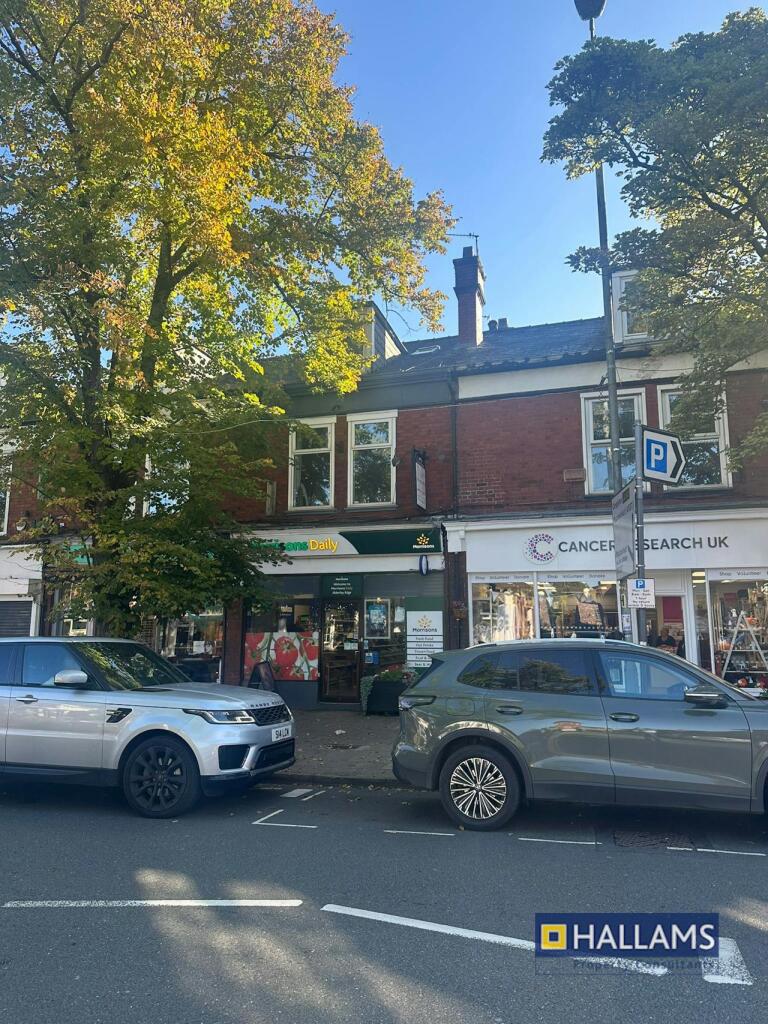
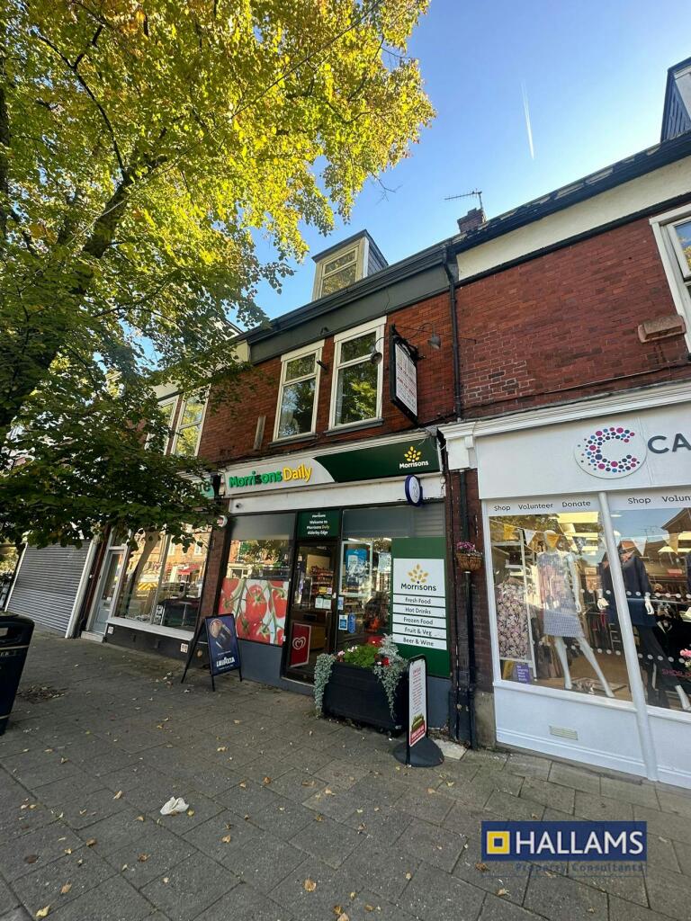
- Mid-terrace two-storey commercial/residential building located on Alderley Edge High Street. The property presents as a ground-floor retail unit with full-height glazed frontage currently trading as a convenience store (Morrisons Daily) and ancillary accommodation above (likely offices/ancillary/residential). The unit occupies a prominent high-footfall town centre position with direct frontage to the main shopping parade and clear pedestrian visibility. The building is of traditional brick construction with shopfront signage and display windows. Overall unit footprint appears small-to-moderate for town centre retail; the ground floor retail area is compact while the first-floor space provides useful ancillary accommodation. Suitable as an income-producing investment or ongoing retail operation.
- Commercial retail unit arranged over ground and basement levels in the centre of Alderley Edge. The ground floor provides an open-plan retail area with excellent frontage onto London Road (prime village high street pitch) of around 719 sq ft, with a lower-ground/basement level of useful ancillary/storage accommodation (approx. 460 sq ft). Total area approximately 1,179 sq ft. The property is presented in good order for retail use, benefits from prominent town-centre frontage and pedestrian footfall, and sits within a mixed retail/café/restaurant high street setting. EPC rating shown as C. Overall property size: small (suitable for a single retail occupier), with street and village centre views rather than wide landscape or countryside views.
Image Descriptions
- commercial property on high street Victorian
- commercial property Edwardian
Textual Property Features
Detected Visual Features
- Victorian
- commercial
- shopfront
- high street
- investment
- mixed-use
- three-story
- brick facade
- commercial property
- Edwardian
- red brick
- large windows
- shop front
- mid-terrace
- double storey
- rental income potential
Nearby Schools
- The King's School In Macclesfield
- Nether Alderley Primary School
- Pownall Hall School
- Handforth Grange Primary School
- Bolshaw Primary School
- Chelford CofE Primary School
- Mottram St Andrew Primary Academy
- Ashdene Primary School
- Wilmslow Preparatory School
- Gorsey Bank Primary School
- Ringway Primary School
- Whirley Primary School
- Alderley Edge Community Primary School
- Lindow Community Primary School
- Wilmslow High School
- Lacey Green Primary Academy
- Styal Primary School
- St James' Catholic High School
- Outwood Primary School
- The Ryleys School
- Alderley Edge School for Girls
- St Anne's Fulshaw C of E Primary School
- The Wilmslow Academy
- St Benedict's Catholic Primary School
- Etchells Primary School
Nearest General Shops
- Id: 10574442570
- Tags:
- Name: The Edit
- Shop: clothes
- TagsNormalized:
- Lat: 53.3014289
- Lon: -2.2359565
- FullGeoHash: gcqrjp5z66tb
- PartitionGeoHash: gcqr
- Images:
- FoodStandards: null
- Distance: 23.4
,- Id: 10574358480
- Tags:
- Name: SieMatic
- Shop: furniture
- TagsNormalized:
- Lat: 53.3013735
- Lon: -2.2359611
- FullGeoHash: gcqrjp5z424t
- PartitionGeoHash: gcqr
- Images:
- FoodStandards: null
- Distance: 17.3
,- Id: 10574433199
- Tags:
- Brand: Cancer Research UK
- Brand:wikidata: Q326079
- Name: Cancer Research UK
- Shop: charity
- TagsNormalized:
- cancer research uk
- charity
- shop
- Lat: 53.3012067
- Lon: -2.2359831
- FullGeoHash: gcqrjp5y1c44
- PartitionGeoHash: gcqr
- Images:
- FoodStandards: null
- Distance: 2.9
}
Nearest Religious buildings
- Id: 105918119
- Tags:
- Amenity: place_of_worship
- Building: church
- Denomination: anglican
- Name: St. Philip's Church
- Religion: christian
- Source: Bing
- Wikidata: Q7595389
- TagsNormalized:
- place of worship
- church
- anglican
- christian
- Lat: 53.3043603
- Lon: -2.2387452
- FullGeoHash: gcqrjpcb3kyw
- PartitionGeoHash: gcqr
- Images:
- FoodStandards: null
- Distance: 395.8
,- Id: 644902284
- Tags:
- Addr:
- City: Alderley Edge
- Postcode: SK9 7NS
- Street: Stamford Road
- Amenity: place_of_worship
- Building: yes
- Denomination: roman_catholic
- Name: St. Pius X Church
- Religion: christian
- TagsNormalized:
- place of worship
- catholic
- roman catholic
- church
- christian
- Lat: 53.3033178
- Lon: -2.2336861
- FullGeoHash: gcqrjpt6r6dg
- PartitionGeoHash: gcqr
- Images:
- FoodStandards: null
- Distance: 277.5
,- Id: 560562852
- Tags:
- Amenity: place_of_worship
- Building: yes
- Name: Alderley Edge Methodist Church
- Religion: christian
- Wikidata: Q4713677
- Wikipedia: en:Alderley Edge Methodist Church
- TagsNormalized:
- place of worship
- church
- methodist
- christian
- Lat: 53.3007473
- Lon: -2.2337074
- FullGeoHash: gcqrjpj7qg7n
- PartitionGeoHash: gcqr
- Images:
- FoodStandards: null
- Distance: 157.6
}
Nearest Medical buildings
- Id: 10574362752
- Tags:
- Amenity: dentist
- Healthcare: dentist
- Name: The Edge Dental
- TagsNormalized:
- dentist
- health
- healthcare
- dental
- Lat: 53.3022066
- Lon: -2.2365603
- FullGeoHash: gcqrjp77u77z
- PartitionGeoHash: gcqr
- Images:
- FoodStandards: null
- Distance: 117.3
,- Id: 4538880152
- Tags:
- Amenity: dentist
- Healthcare: dentist
- Name: Alderley Dental
- TagsNormalized:
- dentist
- health
- healthcare
- dental
- Lat: 53.3018547
- Lon: -2.2368656
- FullGeoHash: gcqrjp71v3bh
- PartitionGeoHash: gcqr
- Images:
- FoodStandards: null
- Distance: 93.5
,- Id: 2600538034
- Tags:
- Amenity: pharmacy
- Healthcare: pharmacy
- Name: Cedric's Health & Beauty
- TagsNormalized:
- pharmacy
- health
- healthcare
- beauty
- Lat: 53.3018294
- Lon: -2.2363592
- FullGeoHash: gcqrjp799j1t
- PartitionGeoHash: gcqr
- Images:
- FoodStandards: null
- Distance: 73.3
,- Id: 10574433889
- Tags:
- Amenity: dentist
- Healthcare: dentist
- Name: Kiss Dental
- TagsNormalized:
- dentist
- health
- healthcare
- dental
- Lat: 53.3014574
- Lon: -2.2359572
- FullGeoHash: gcqrjp5z6rv6
- PartitionGeoHash: gcqr
- Images:
- FoodStandards: null
- Distance: 26.6
}
Nearest Airports
- Id: 1224469
- Tags:
- Addr:
- City: Manchester
- Country: GB
- Postcode: M90 1QX
- Aerodrome: international
- Aeroway: aerodrome
- Arp: yes
- Atis: 128.175
- Iata: MAN
- Icao: EGCC
- Name: Manchester Airport
- Note: rough sketched outline referring to Yahoo imagery - true boundary is where?
- Old_name: Ringway
- Operator: Manchester Airport PLC
- Size: 18720000
- Source:
- Tower_frequency: 118.625,119.400
- Type: multipolygon
- Website: https://www.manchesterairport.co.uk/
- Wikidata: Q8694
- Wikipedia: en:Manchester Airport
- TagsNormalized:
- airport
- international airport
- Lat: 53.3503197
- Lon: -2.2798822
- FullGeoHash: gcqrs05u4ukt
- PartitionGeoHash: gcqr
- Images:
- FoodStandards: null
- Distance: 6190.7
}
Nearest Leisure Facilities
- Id: 837991888
- Tags:
- Access: yes
- Leisure: playground
- TagsNormalized:
- Lat: 53.3024003
- Lon: -2.2379049
- FullGeoHash: gcqrjp6kvp94
- PartitionGeoHash: gcqr
- Images:
- FoodStandards: null
- Distance: 185
,- Id: 146984955
- Tags:
- Leisure: pitch
- Sport: tennis
- Surface: asphalt
- TagsNormalized:
- Lat: 53.3018665
- Lon: -2.2382065
- FullGeoHash: gcqrjp61yh06
- PartitionGeoHash: gcqr
- Images:
- FoodStandards: null
- Distance: 166.7
,- Id: 10574465354
- Tags:
- Leisure: fitness_centre
- Name: Yoga on the Edge
- Sport: yoga
- TagsNormalized:
- fitness
- fitness centre
- leisure
- yoga
- sports
- Lat: 53.3000179
- Lon: -2.2365896
- FullGeoHash: gcqrjngr5emz
- PartitionGeoHash: gcqr
- Images:
- FoodStandards: null
- Distance: 140.2
,- Id: 457801137
- Tags:
- Leisure: pitch
- Name: Alderley Edge Sports & Social Crown Green Bowls Club
- Sport: bowls
- Surface: grass
- TagsNormalized:
- pitch
- leisure
- bowls
- sports
- club
- Lat: 53.3019338
- Lon: -2.2349197
- FullGeoHash: gcqrjpkd68eh
- PartitionGeoHash: gcqr
- Images:
- FoodStandards: null
- Distance: 104.7
,- Id: 4538882769
- Tags:
- Leisure: social_club
- Name: Alderley Edge Sports & Social Club
- TagsNormalized:
- social club
- club
- leisure
- sports
- Lat: 53.3018194
- Lon: -2.2353531
- FullGeoHash: gcqrjpk387rc
- PartitionGeoHash: gcqr
- Images:
- FoodStandards: null
- Distance: 77.5
}
Nearest Tourist attractions
- Id: 1508792450
- Tags:
- Email: croftcorner@hotmail.com
- Name: Croft Corner Guest House
- Phone: +44 1625 524198
- Tourism: guest_house
- Website: http://www.croftcorner.co.uk/
- TagsNormalized:
- Lat: 53.3154778
- Lon: -2.2489751
- FullGeoHash: gcqrkcf35j6t
- PartitionGeoHash: gcqr
- Images:
- FoodStandards: null
- Distance: 1806.5
,- Id: 562059928
- Tags:
- Name: Wizard Country Park
- Tourism: caravan_site
- TagsNormalized:
- Lat: 53.2894753
- Lon: -2.218121
- FullGeoHash: gcqrjt0cdn1n
- PartitionGeoHash: gcqr
- Images:
- FoodStandards: null
- Distance: 1763
,- Id: 561363719
- Tags:
- Addr:
- City: Alderley Edge
- Postcode: SK9 7BG
- Street: Macclesfield Road
- Building: yes
- Name: Wizards Thatch
- Tourism: guest_house
- Website: https://www.wizardsthatch.co.uk/
- TagsNormalized:
- Lat: 53.2999992
- Lon: -2.2351791
- FullGeoHash: gcqrjnuquxcx
- PartitionGeoHash: gcqr
- Images:
- FoodStandards: null
- Distance: 144.8
}
Nearest Train stations
- Id: 6408750143
- Tags:
- Name: Prestbury
- Naptan:
- Network: National Rail
- Operator: Northern Rail
- Public_transport: station
- Railway: station
- Ref:
- Wikipedia: en:Prestbury railway station
- TagsNormalized:
- Lat: 53.2931107
- Lon: -2.1453161
- FullGeoHash: gcqrpjtyfebk
- PartitionGeoHash: gcqr
- Images:
- FoodStandards: null
- Distance: 6090
,- Id: 20012021
- Tags:
- Name: Styal
- Naptan:
- Network: National Rail
- Public_transport: station
- Railway: station
- Ref:
- Wikipedia: en:Styal railway station
- TagsNormalized:
- Lat: 53.3485037
- Lon: -2.2404522
- FullGeoHash: gcqrmpb999vu
- PartitionGeoHash: gcqr
- Images:
- FoodStandards: null
- Distance: 5266.4
,- Id: 6416944405
- Tags:
- Name: Handforth
- Naptan:
- Network: National Rail
- Public_transport: station
- Railway: station
- Ref:
- Wikipedia: en:Handforth railway station
- TagsNormalized:
- Lat: 53.346446
- Lon: -2.2136737
- FullGeoHash: gcqrmxkj9dm3
- PartitionGeoHash: gcqr
- Images:
- FoodStandards: null
- Distance: 5242.1
,- Id: 6416944406
- Tags:
- Name: Chelford
- Naptan:
- Network: National Rail
- Public_transport: station
- Railway: station
- Ref:
- Source: NPE
- Wheelchair: yes
- Wikipedia: en:Chelford railway station
- TagsNormalized:
- Lat: 53.2704221
- Lon: -2.2804386
- FullGeoHash: gcqrh1e6tymt
- PartitionGeoHash: gcqr
- Images:
- FoodStandards: null
- Distance: 4524.9
,- Id: 446375378
- Tags:
- Name: Wilmslow
- Naptan:
- Network: National Rail
- Public_transport: station
- Railway: station
- Ref:
- Wikipedia: en:Wilmslow railway station
- TagsNormalized:
- Lat: 53.3270993
- Lon: -2.2260089
- FullGeoHash: gcqrm7ghf5z6
- PartitionGeoHash: gcqr
- Images:
- FoodStandards: null
- Distance: 2952.5
}
Nearest Hotels
- Id: 431859041
- Tags:
- Addr:
- City: Wilmslow
- Housenumber: 69-71
- Postcode: SK9 1PA
- Street: Alderley Road
- Building: yes
- Internet_access: wlan
- Internet_access:fee: no
- Name: The Wilmslow Lodge
- Tourism: hotel
- TagsNormalized:
- Lat: 53.3235955
- Lon: -2.2342193
- FullGeoHash: gcqrm5m06ytm
- PartitionGeoHash: gcqr
- Images:
- FoodStandards: null
- Distance: 2490.9
,- Id: 833052056
- Tags:
- Addr:
- Postcode: SK9 7BJ
- Street: Macclesfield Road
- Building: yes
- Fhrs:
- Name: Alderley Edge Hotel
- Tourism: hotel
- Website: https://www.alderleyedgehotel.com/
- TagsNormalized:
- Lat: 53.2984722
- Lon: -2.2341086
- FullGeoHash: gcqrjntnj7rf
- PartitionGeoHash: gcqr
- Images:
- FoodStandards: null
- Distance: 328.8
,- Id: 776482003
- Tags:
- Addr:
- City: Alderley Edge
- Housenumber: 2
- Postcode: SK9 7AA
- Street: Congleton Road
- Brand: Greene King
- Brand:wikidata: Q5564162
- Building: yes
- Internet_access: wlan
- Internet_access:fee: customers
- Name: De Trafford Arms Hotel
- Source: Bing
- Tourism: hotel
- Website: https://www.greenekinginns.co.uk/hotels/de-trafford-arms-hotel/
- TagsNormalized:
- Lat: 53.2995658
- Lon: -2.2368298
- FullGeoHash: gcqrjnghqp4y
- PartitionGeoHash: gcqr
- Images:
- FoodStandards: null
- Distance: 192.9
}
Tags
- Victorian
- commercial
- shopfront
- high street
- investment
- mixed-use
- three-story
- brick facade
- commercial property
- Edwardian
- red brick
- large windows
- shop front
- mid-terrace
- double storey
- rental income potential
Local Market Stats
- Average Price/sqft: £383
- Avg Income: £53400
- Rental Yield: 3.5%
- Social Housing: 5%
- Planning Success Rate: 90%
AirBnB Data
- 1km average: £160/night
- Listings in 1km: 1
Similar Properties
 Commercial property for sale in 14-16 London Road, Alderley Edge, Cheshire, SK9 — £785,000 • 1 bed • 1 bath • 1857 ft²
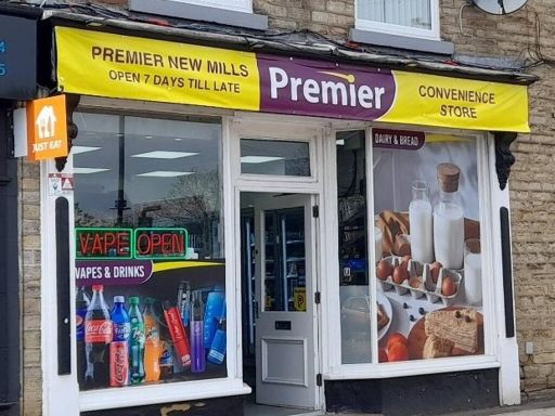 High street retail property for sale in 38 Market Street, New Mills, High Peak, Derbyshire, SK22 — £119,950 • 1 bed • 1 bath • 517 ft²
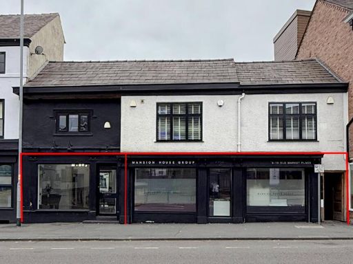 Commercial property for sale in 8-12 Old Market Place, Altrincham, WA14 4DF, WA14 — £485,000 • 1 bed • 1 bath • 1761 ft²
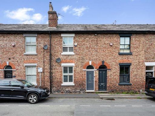 3 bedroom terraced house for sale in South Street, Alderley Edge, SK9 — £475,000 • 3 bed • 1 bath • 1073 ft²
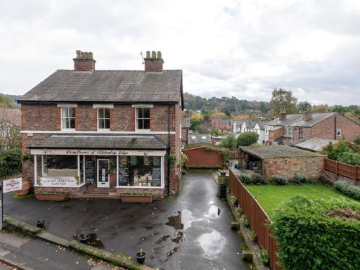 High street retail property for sale in 68 Heyes Lane, Alderley Edge, Cheshire, SK9 — £1,150,000 • 1 bed • 1 bath • 4000 ft²
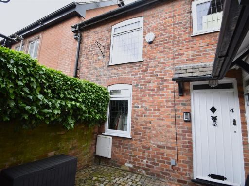 2 bedroom mews property for sale in Tyler Street, Alderley Edge, SK9 — £350,000 • 2 bed • 1 bath • 600 ft²
Meta
- {
"@context": "https://schema.org",
"@type": "Residence",
"name": "High street retail property for sale in 63 London Road, Ald…",
"description": "",
"url": "https://propertypiper.co.uk/property/28dafe80-966e-4841-810b-6350d21b7d9a",
"image": "https://image-a.propertypiper.co.uk/d398d815-52ed-46d7-8ef3-1d9a2538c0bb-1024.jpeg",
"address": {
"@type": "PostalAddress",
"streetAddress": "63 LONDON ROAD ALDERLEY EDGE",
"postalCode": "SK9 7DY",
"addressLocality": "Cheshire East",
"addressRegion": "Tatton",
"addressCountry": "England"
},
"geo": {
"@type": "GeoCoordinates",
"latitude": 53.30121841457926,
"longitude": -2.23594460542868
},
"numberOfRooms": 1,
"numberOfBathroomsTotal": 1,
"floorSize": {
"@type": "QuantitativeValue",
"value": 1179,
"unitCode": "FTK"
},
"offers": {
"@type": "Offer",
"price": 550000,
"priceCurrency": "GBP",
"availability": "https://schema.org/InStock"
},
"additionalProperty": [
{
"@type": "PropertyValue",
"name": "Feature",
"value": "Victorian"
},
{
"@type": "PropertyValue",
"name": "Feature",
"value": "commercial"
},
{
"@type": "PropertyValue",
"name": "Feature",
"value": "shopfront"
},
{
"@type": "PropertyValue",
"name": "Feature",
"value": "high street"
},
{
"@type": "PropertyValue",
"name": "Feature",
"value": "investment"
},
{
"@type": "PropertyValue",
"name": "Feature",
"value": "mixed-use"
},
{
"@type": "PropertyValue",
"name": "Feature",
"value": "three-story"
},
{
"@type": "PropertyValue",
"name": "Feature",
"value": "brick facade"
},
{
"@type": "PropertyValue",
"name": "Feature",
"value": "commercial property"
},
{
"@type": "PropertyValue",
"name": "Feature",
"value": "Edwardian"
},
{
"@type": "PropertyValue",
"name": "Feature",
"value": "red brick"
},
{
"@type": "PropertyValue",
"name": "Feature",
"value": "large windows"
},
{
"@type": "PropertyValue",
"name": "Feature",
"value": "shop front"
},
{
"@type": "PropertyValue",
"name": "Feature",
"value": "mid-terrace"
},
{
"@type": "PropertyValue",
"name": "Feature",
"value": "double storey"
},
{
"@type": "PropertyValue",
"name": "Feature",
"value": "rental income potential"
}
]
}