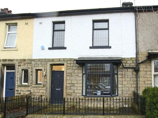
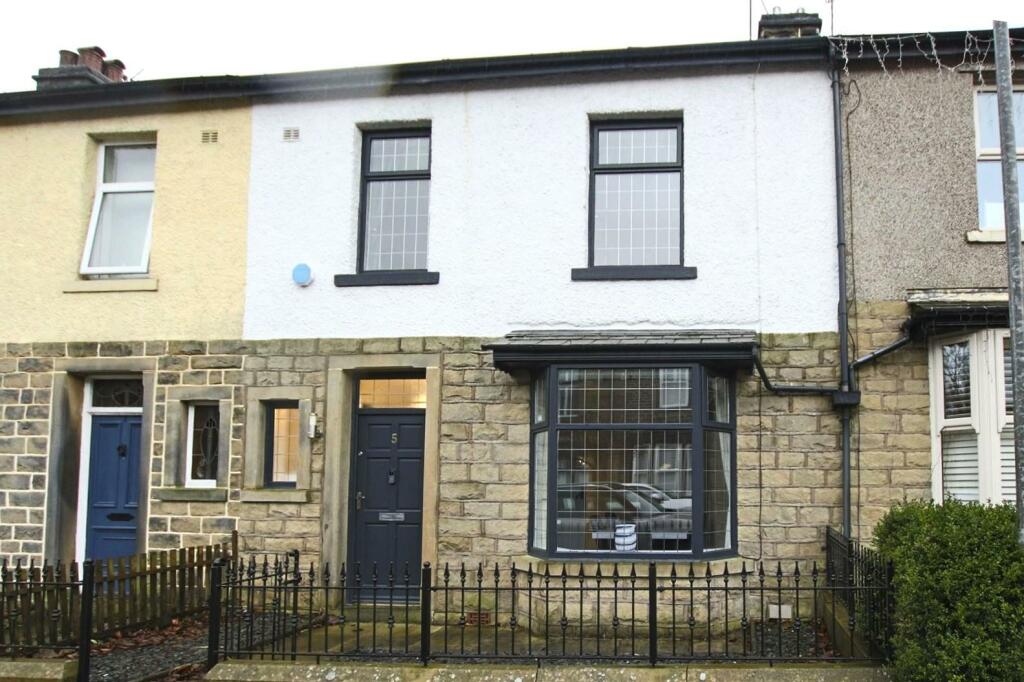
BB4 4BU - 4 bedroom terraced house for sale in Whitecroft Avenue, Has…
View on Property Piper
4 bedroom terraced house for sale in Whitecroft Avenue, Haslingden, BB4
Property Details
- Price: £300000
- Bedrooms: 4
- Bathrooms: 1
- Property Type: undefined
- Property SubType: undefined
Brochure Descriptions
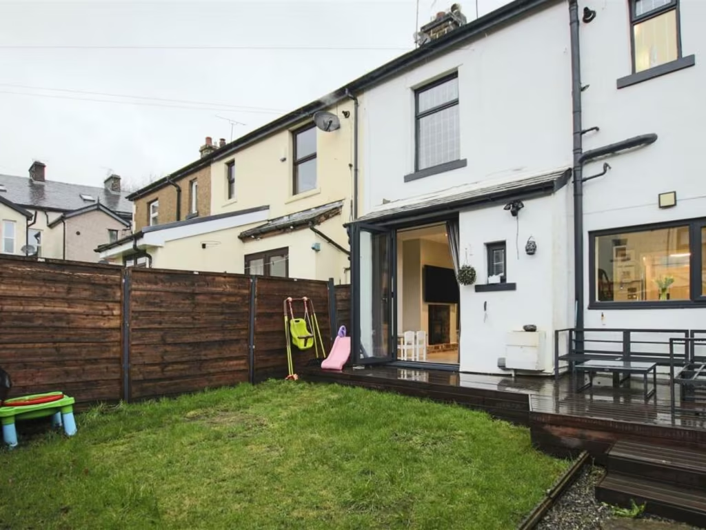
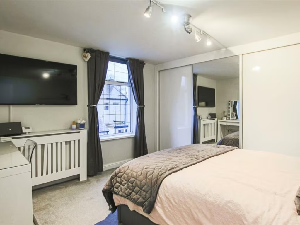
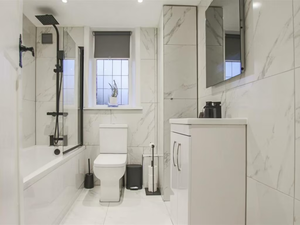
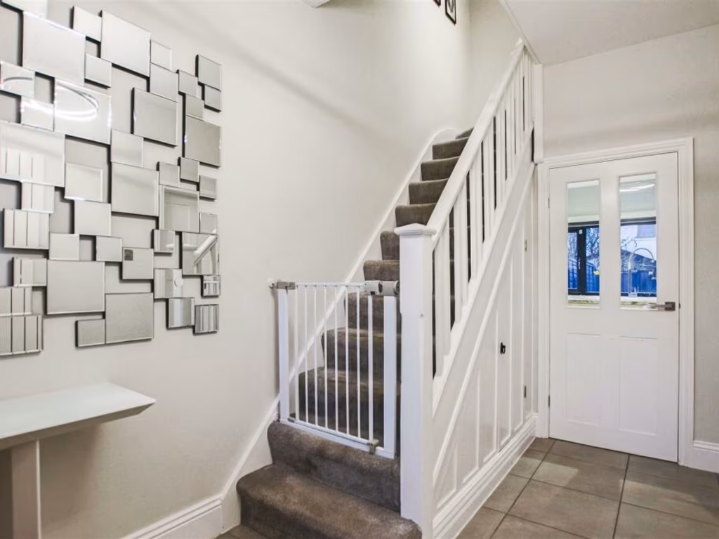
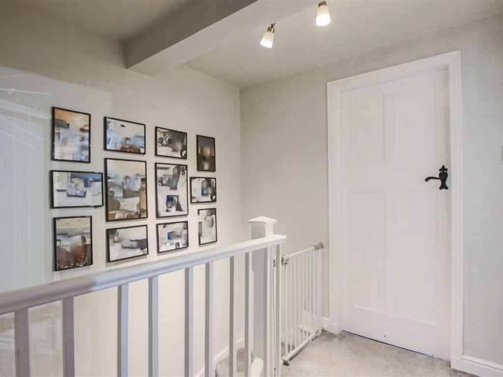
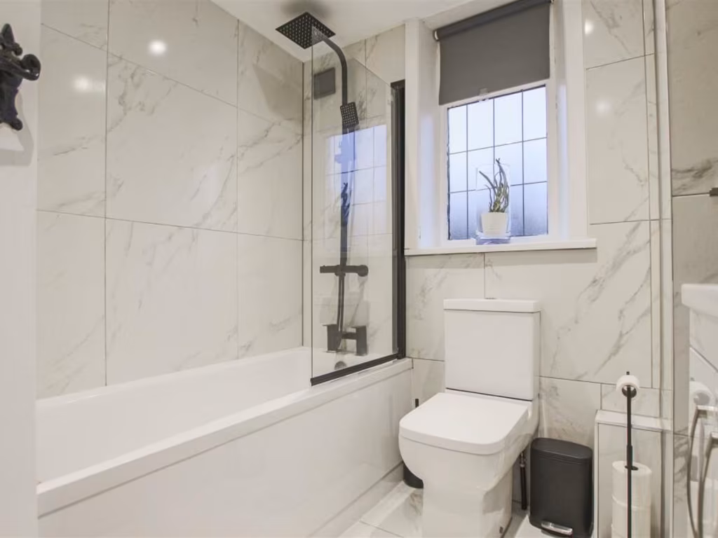
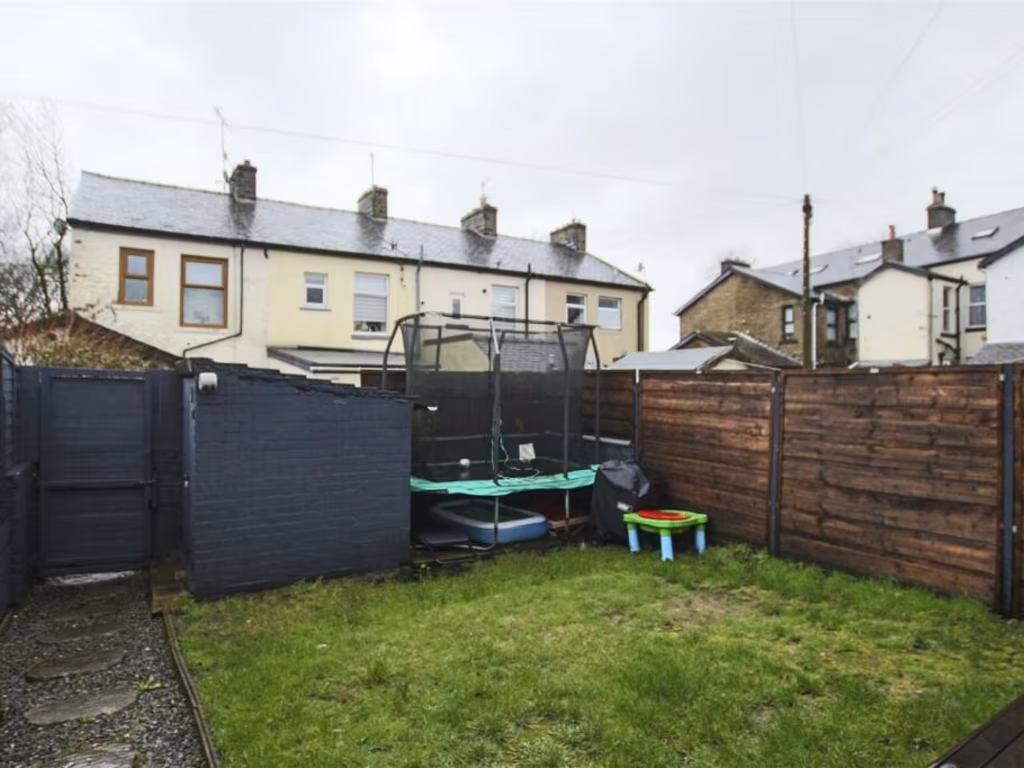
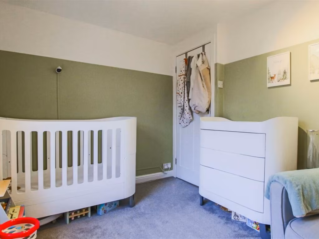
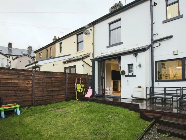
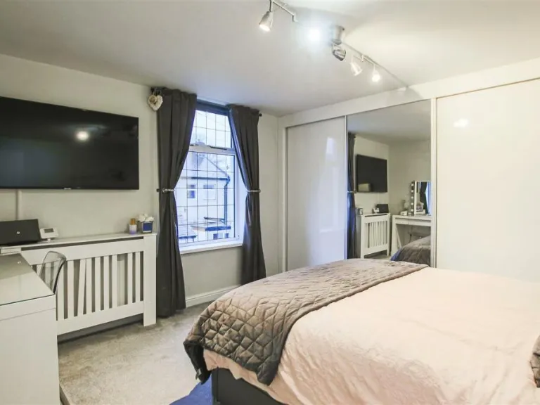
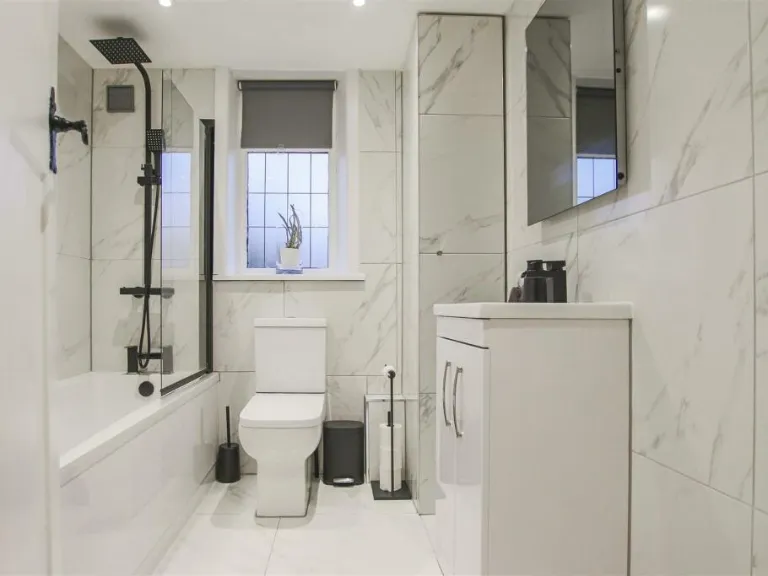
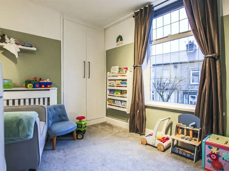
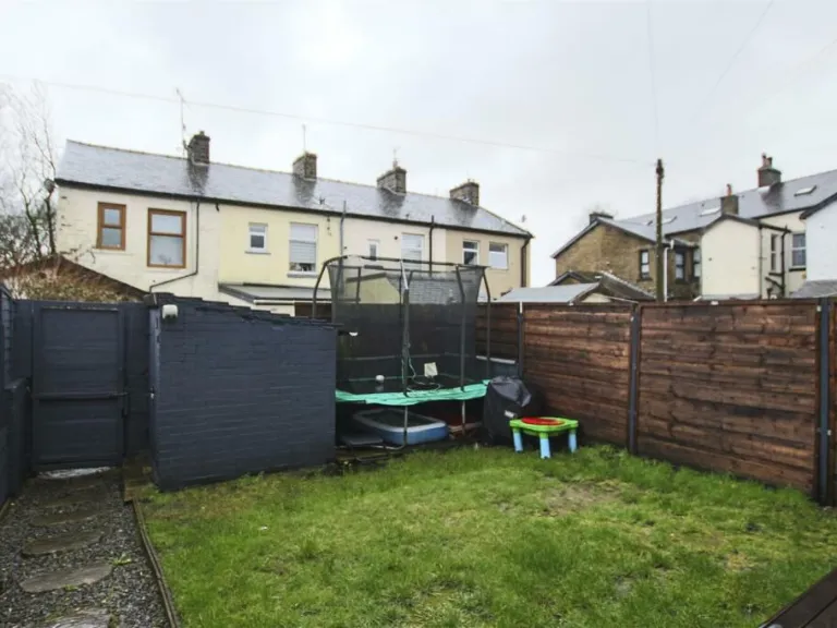
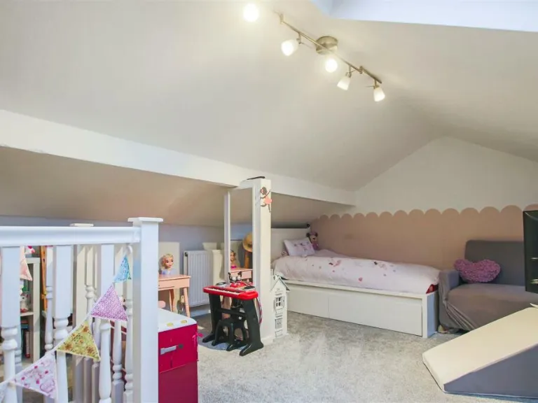
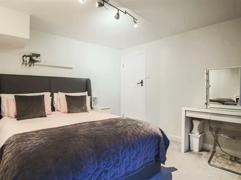
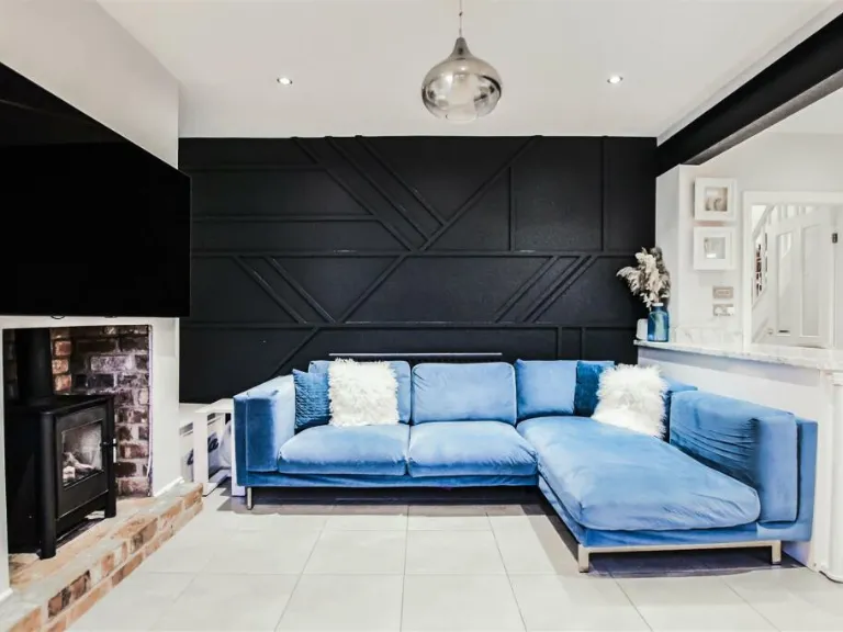
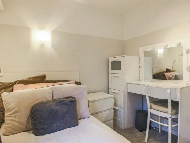
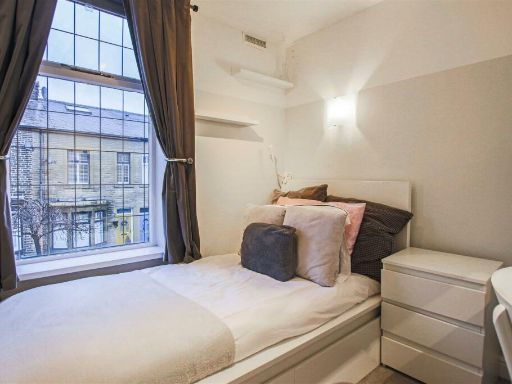
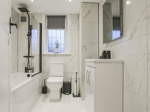
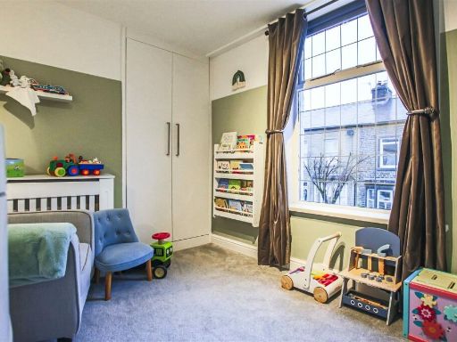
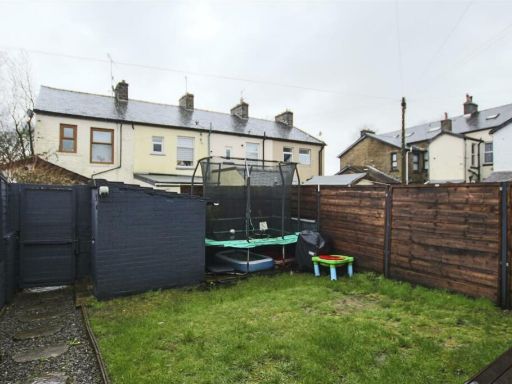
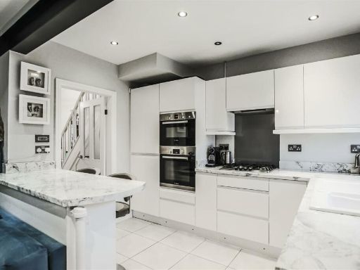
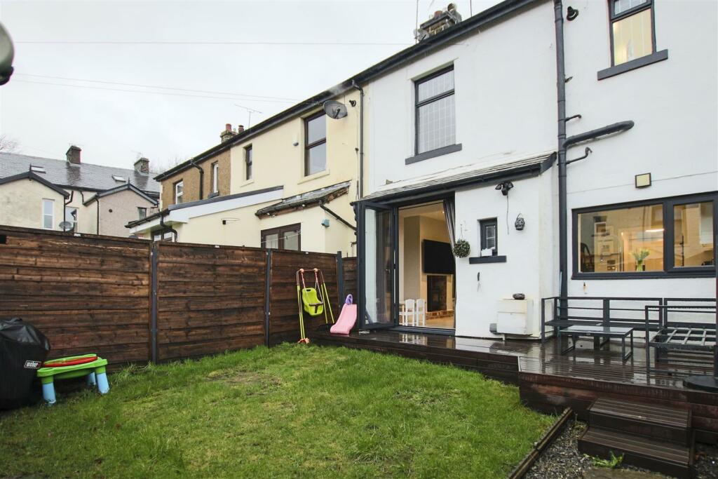
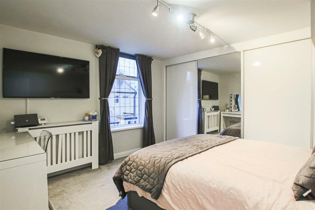
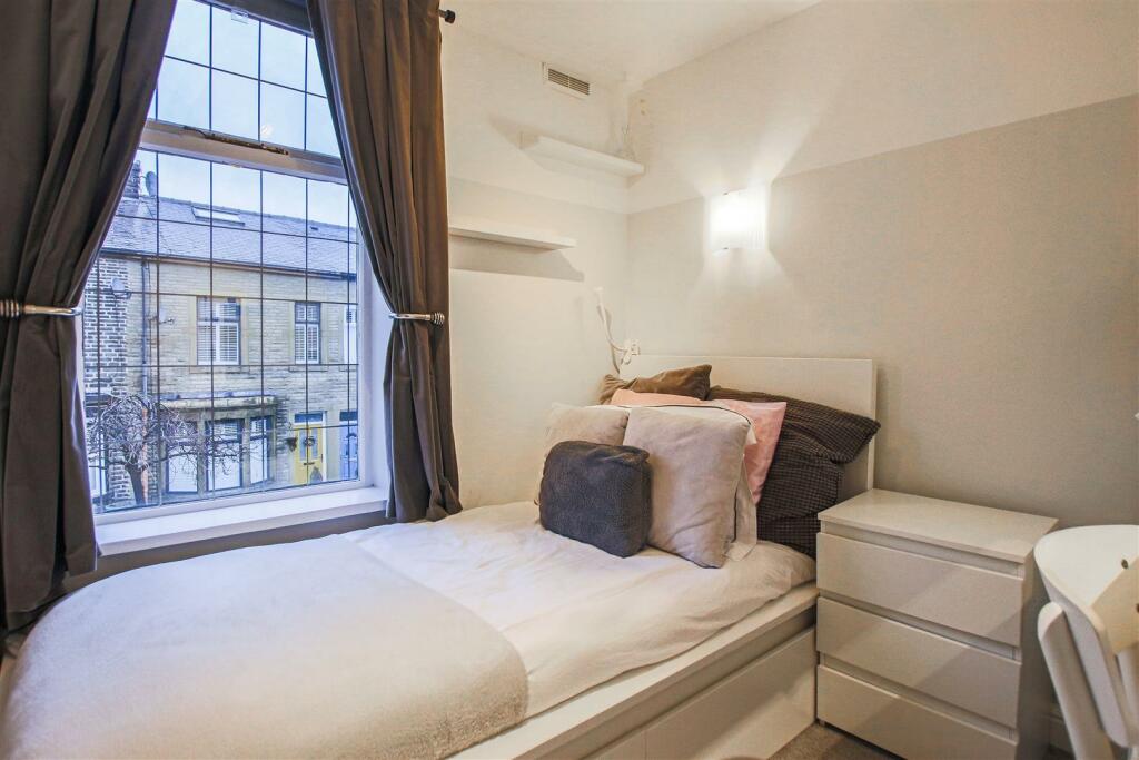
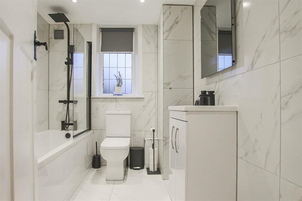
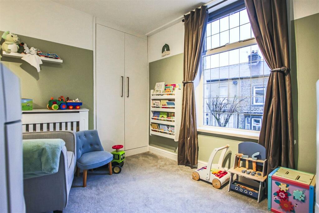
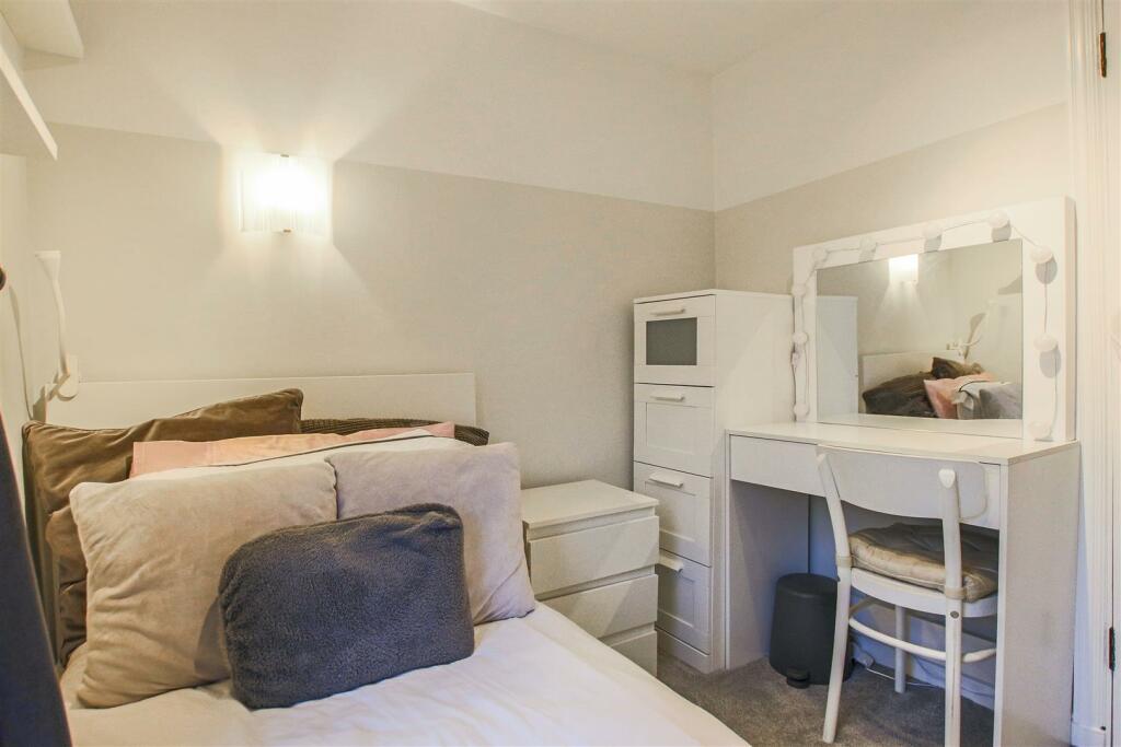
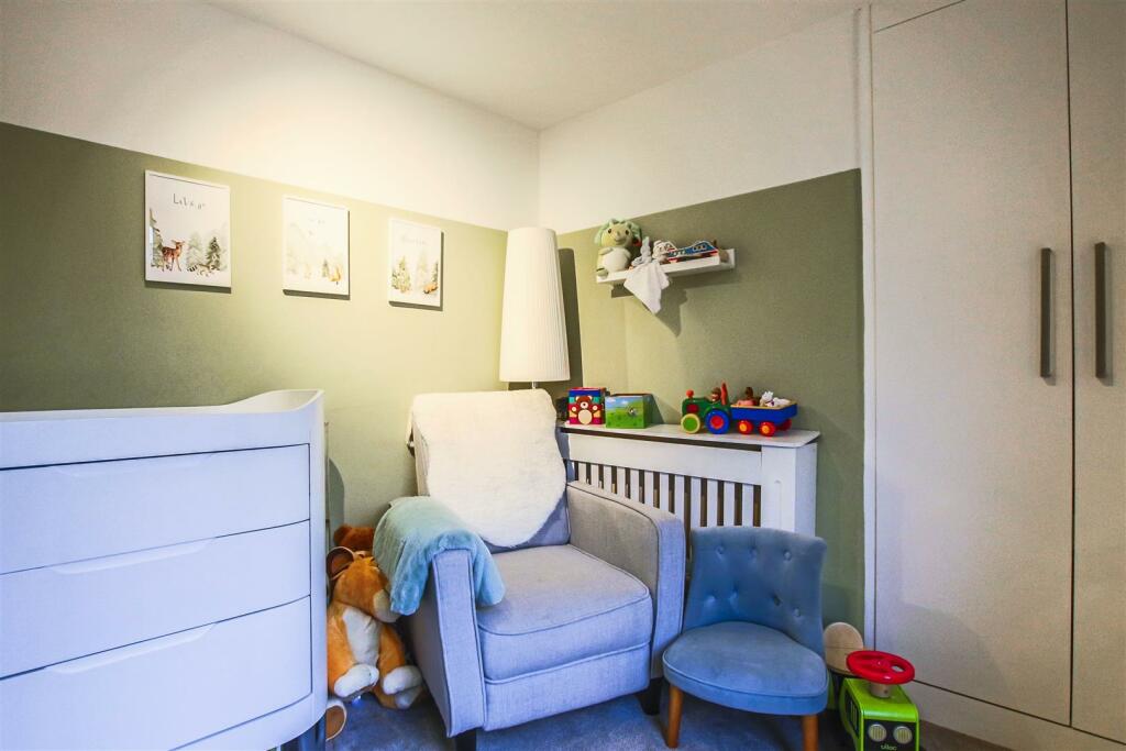
- This is a beautifully spacious family home featuring a modern open-plan kitchen/living area and a separate reception room on the ground floor. The property includes three bedrooms and a bathroom on the first floor, and an additional bedroom on the second floor. The home has a well-maintained garden suitable for outdoor activities. The rooms are of average size, offering a comfortable and functional living space.
Image Descriptions
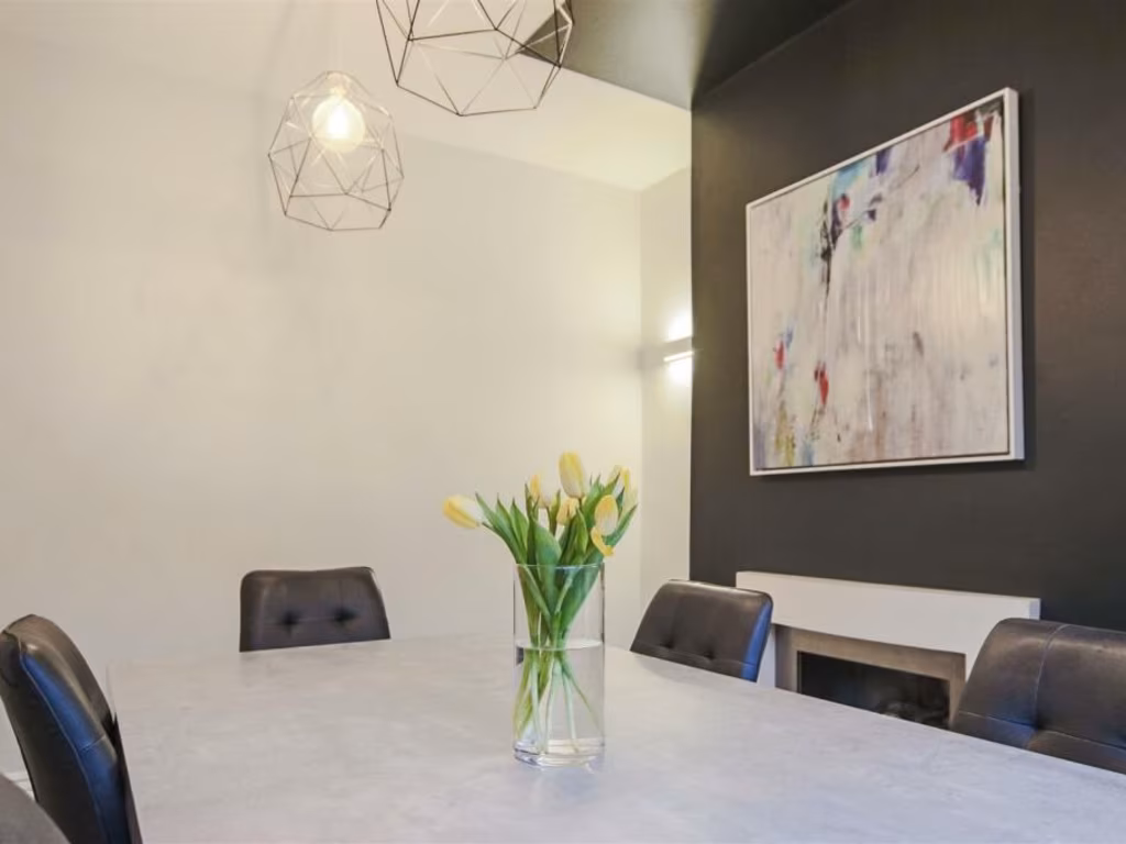
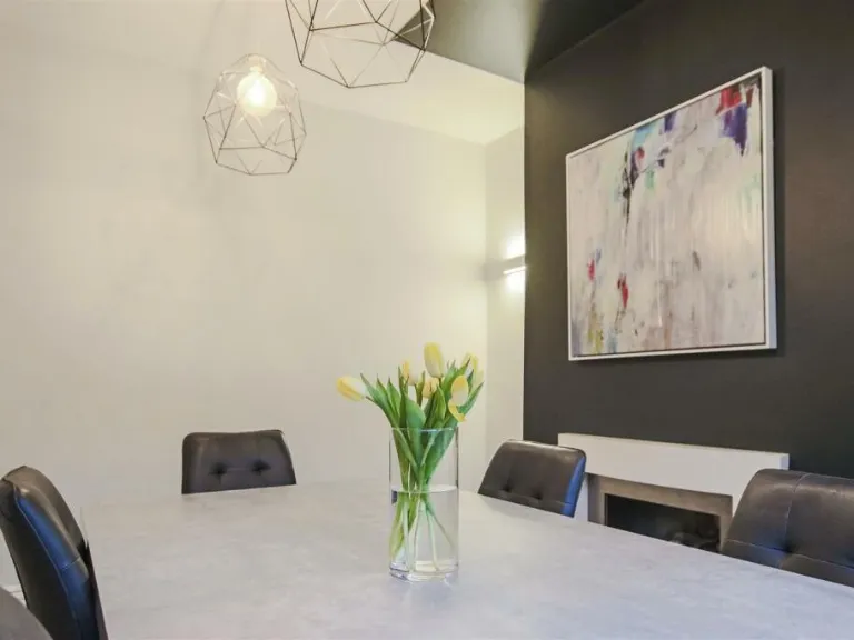
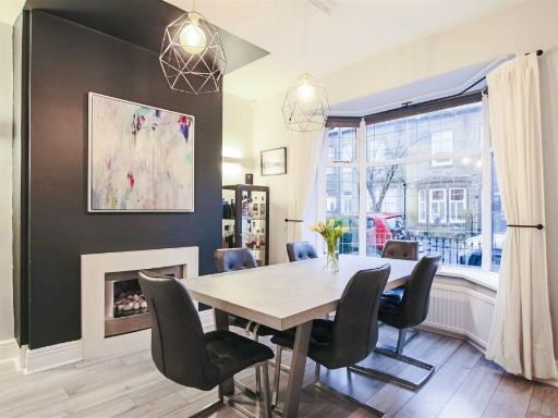
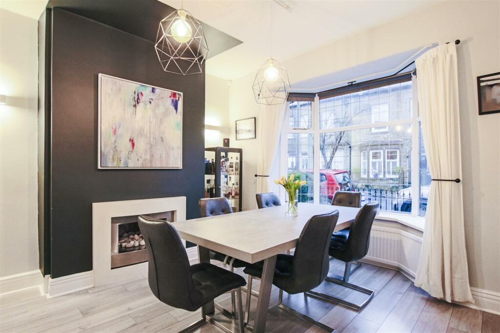
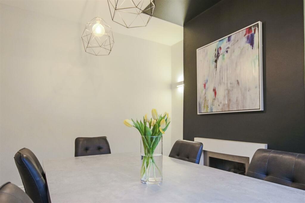
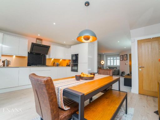
- dining room contemporary
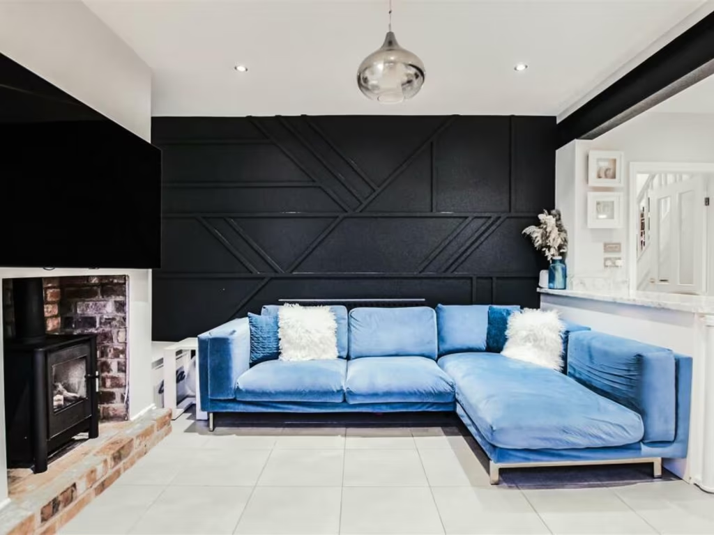
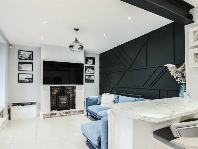
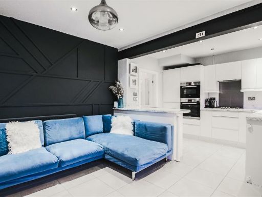
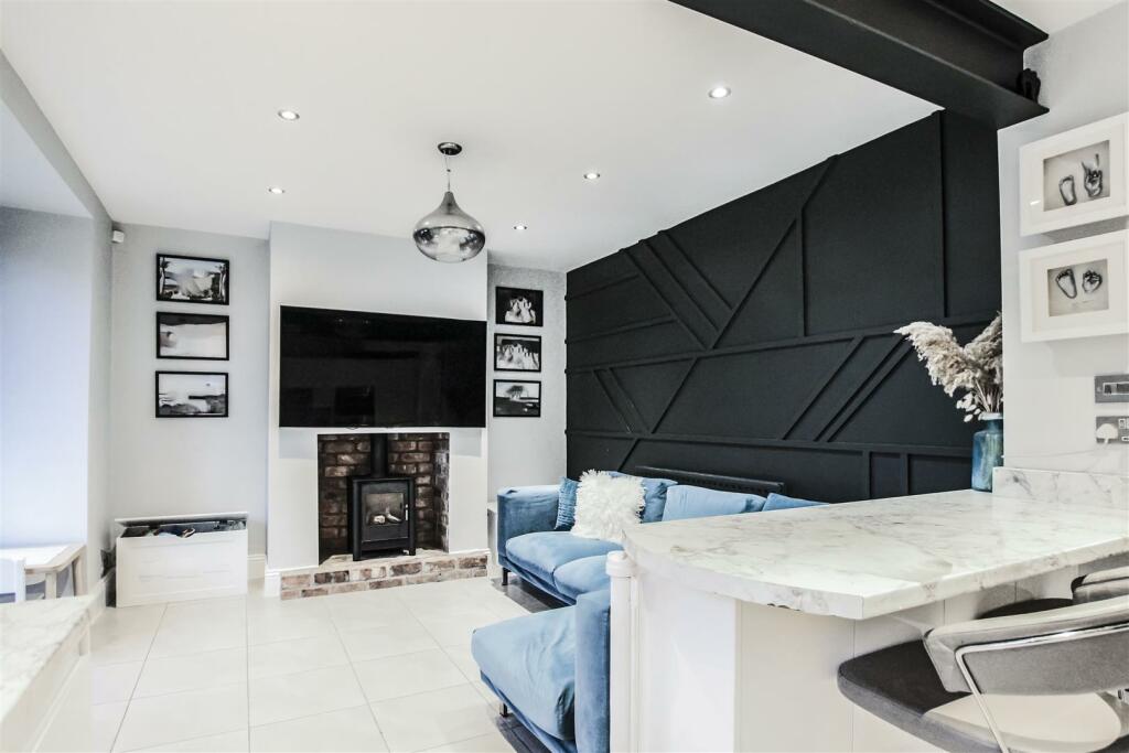
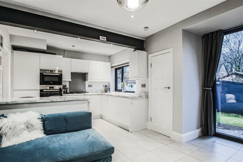
- living room contemporary
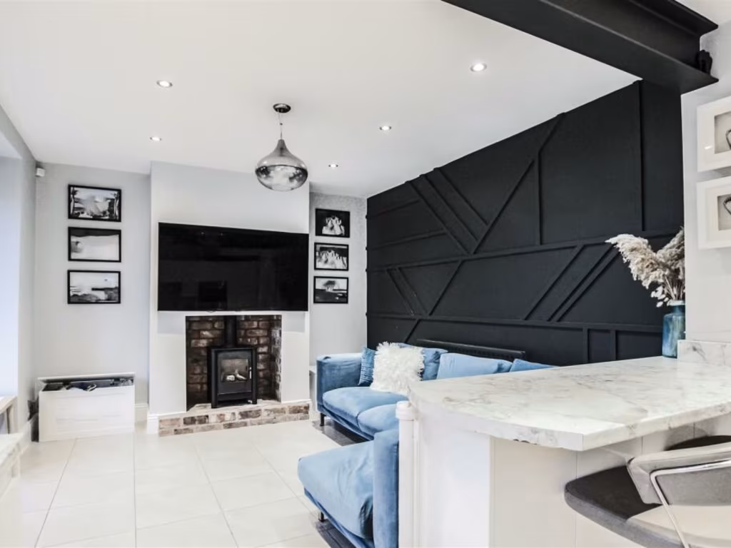
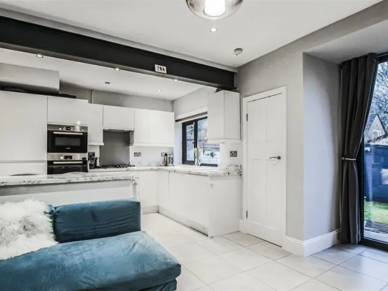
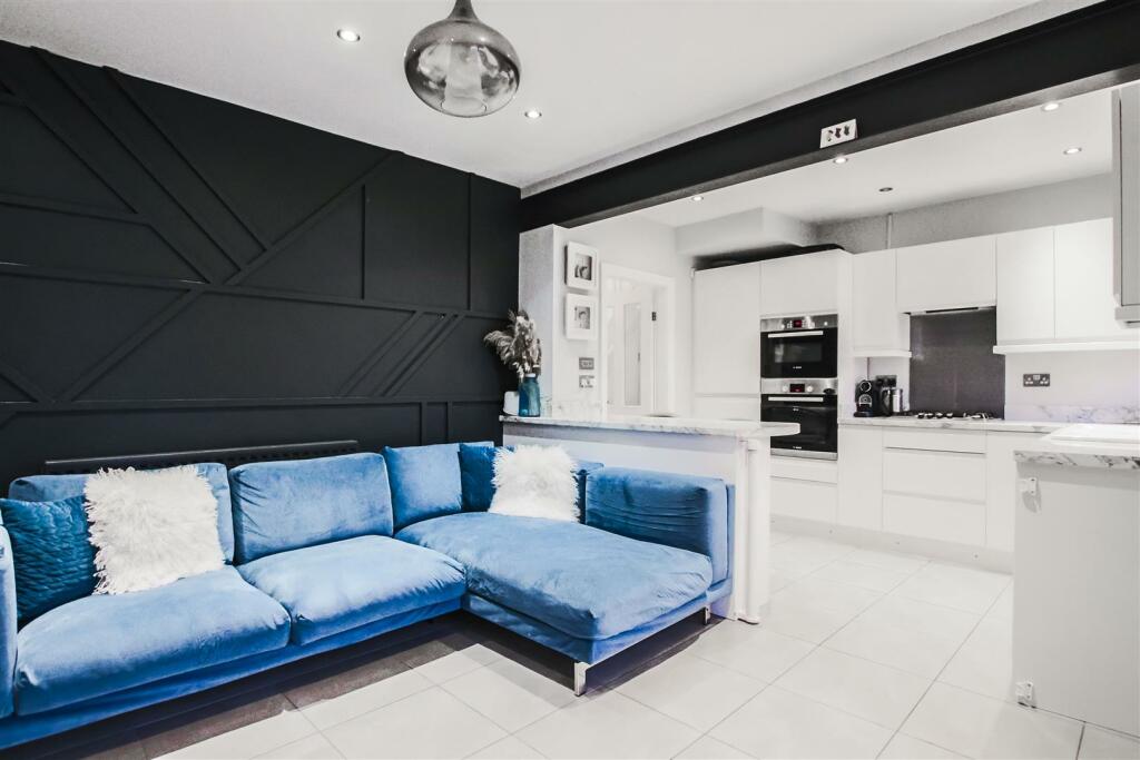
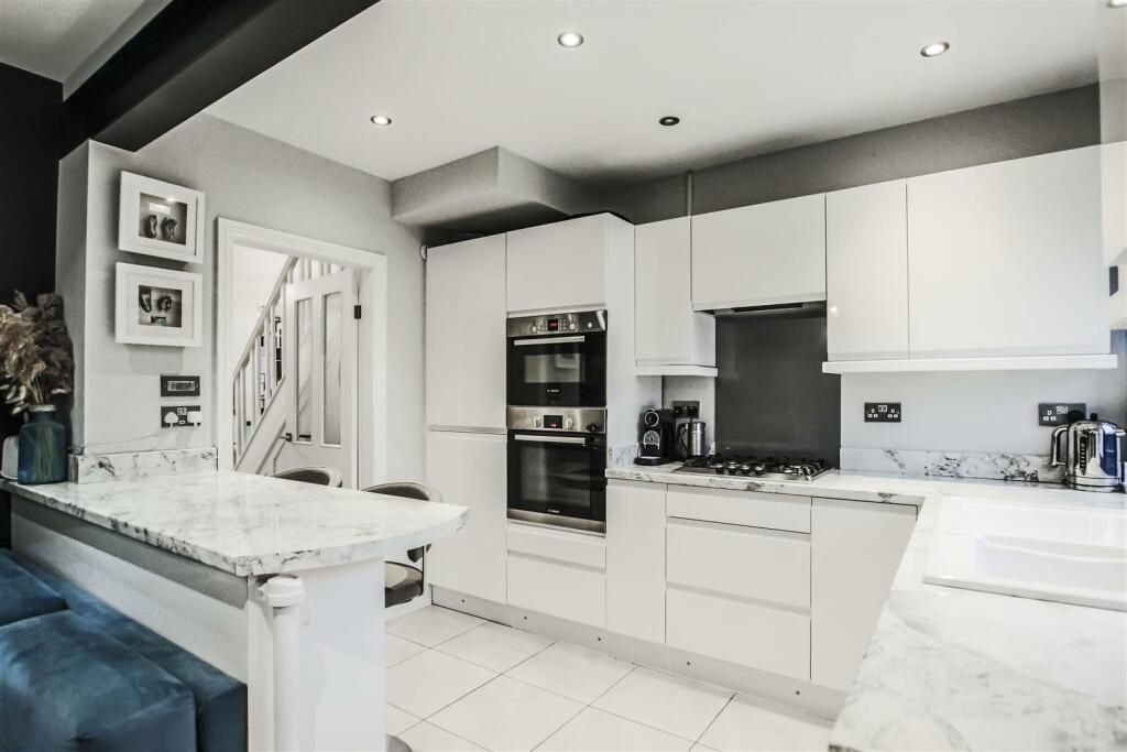
- living room and kitchen modern
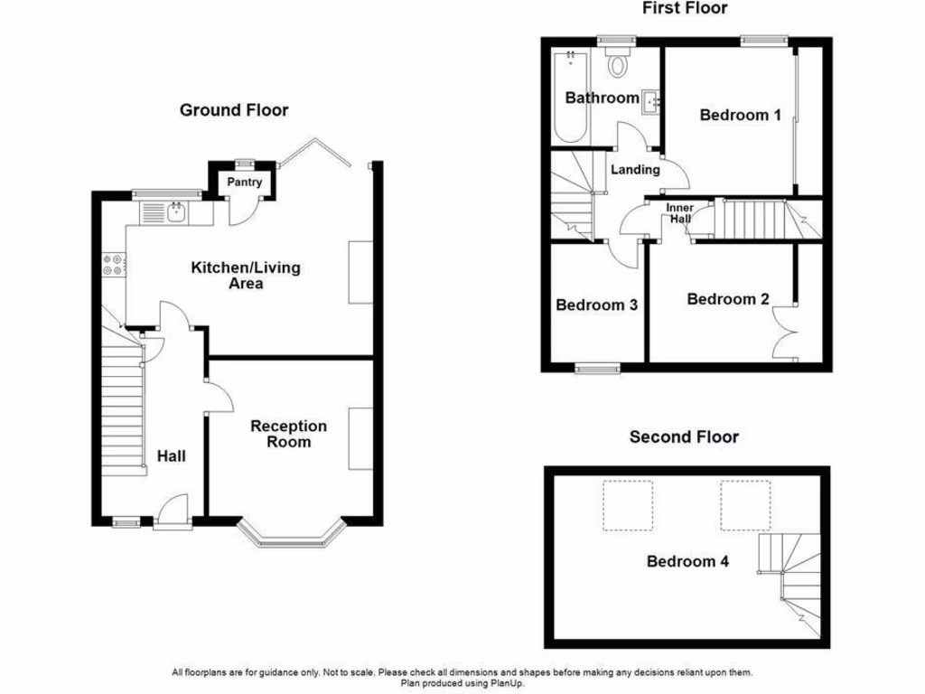
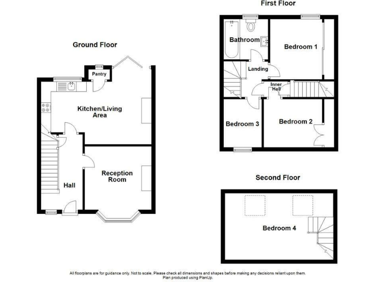
Floorplan Description
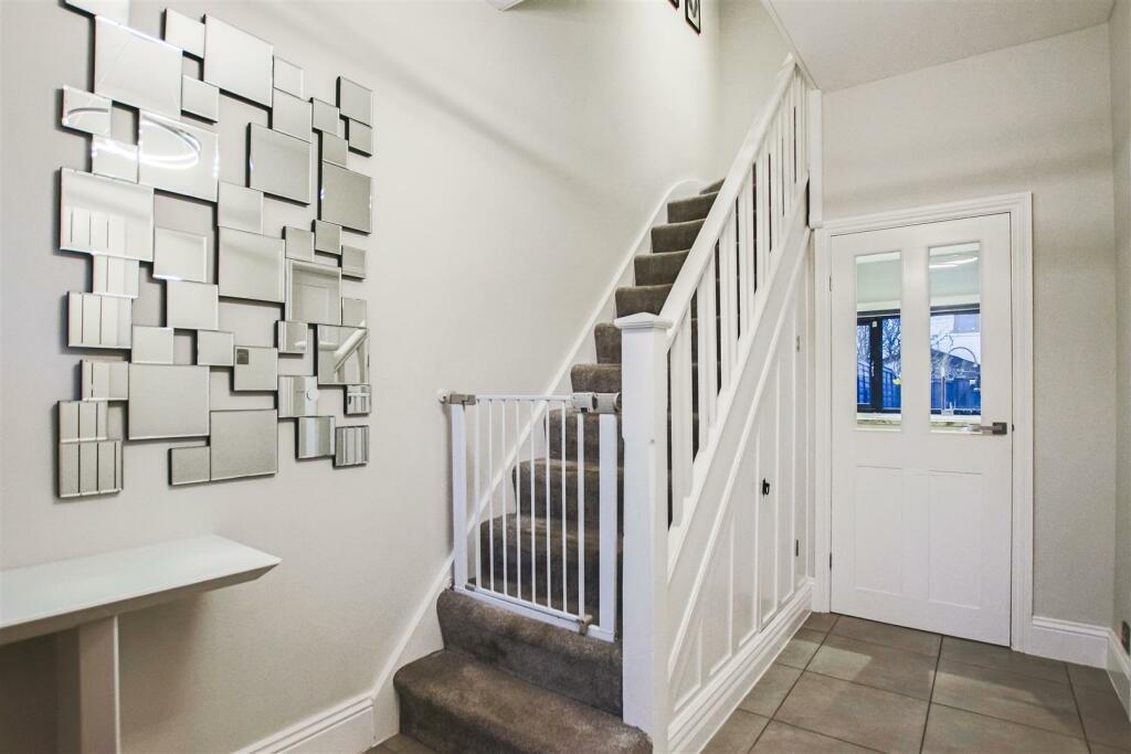
- A multi-story house with a traditional layout featuring four bedrooms.
Rooms
- Pantry: Small
- Kitchen/Living Area: Large
- Reception Room: Large
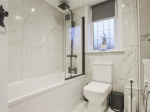
- Bathroom: Small
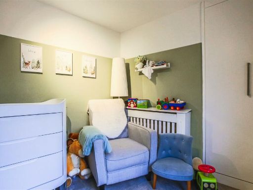
- Bedroom 1: Average
- Bedroom 2: Average
- Bedroom 3: Average
- Bedroom 4: Average
Textual Property Features
Detected Visual Features
- dining room
- contemporary style
- geometric pendant lights
- modern fireplace
- bay window
- decorative artwork
- wood flooring
- bright
- neutral colors
- living room
- contemporary
- open plan
- black accent wall
- marble countertop
- recessed lighting
- fireplace
- modern decor
- tile flooring
- modern
- open-plan
- kitchen
- blue sofa
- white cabinetry
- island
- clean lines
EPC Details
- Fully double glazed
- Sandstone or limestone, as built, no insulation (assumed)
- Boiler and radiators, mains gas
- Low energy lighting in 56% of fixed outlets
- Suspended, no insulation (assumed)
Nearby Schools
- Haslingden High School and Sixth Form
- All Saints' Roman Catholic High School, a Voluntary Academy
- Haslingden Primary School
- Haslingden St James Church of England Primary School
- The Hollins
- St Andrew's Church of England Primary School, Ramsbottom
- Edenfield Church of England Primary School
- St Veronica's Roman Catholic Primary School, Helmshore
- Helmshore Primary School
- St Mary's Roman Catholic Primary School, Haslingden
- St James-the-Less Roman Catholic Primary School, Rawtenstall
- St Mary's CofE Primary School Rawtenstall
- Rawtenstall St Paul's Church of England Primary School
- St John's Stonefold CofE Primary School
- St Anne's and St Joseph's RC Primary School, A Voluntary Academy
- Emmanuel Holcombe Church of England Primary School
- Peel Brow School
- Ramsbottom Stubbins Primary School
- Haslingden Broadway Primary School
- Rawtenstall Balladen Community Primary School
- Alder Grange School
- Austen House
- Crawshawbooth Primary School
- Baxenden St John's Church of England Primary School
Nearest Bars And Restaurants
- Id: 846146354
- Tags:
- Amenity: pub
- Name: Black Bull
- TagsNormalized:
- Lat: 53.7049064
- Lon: -2.3260415
- FullGeoHash: gcw3e0djz21t
- PartitionGeoHash: gcw3
- Images:
- FoodStandards: null
- Distance: 695.5
,- Id: 6049267172
- Tags:
- TagsNormalized:
- Lat: 53.7032813
- Lon: -2.3262116
- FullGeoHash: gcw3e06h734z
- PartitionGeoHash: gcw3
- Images:
- FoodStandards: null
- Distance: 517.2
,- Id: 481608142
- Tags:
- Amenity: fast_food
- Name: Flax Moss Chinese Chippy
- TagsNormalized:
- Lat: 53.6950611
- Lon: -2.3277884
- FullGeoHash: gcw37nbuqsg5
- PartitionGeoHash: gcw3
- Images:
- FoodStandards: null
- Distance: 438.7
,- Id: 1593380492
- Tags:
- Addr:
- City: Haslingden
- Housenumber: 276
- Postcode: BB4 6PU
- Street: Manchester Road
- Amenity: pub
- Fhrs:
- Name: Rose & Crown
- Source:
- TagsNormalized:
- Lat: 53.6976497
- Lon: -2.3188378
- FullGeoHash: gcw37pr7rpmj
- PartitionGeoHash: gcw3
- Images:
- FoodStandards:
- Id: 146034
- FHRSID: 146034
- LocalAuthorityBusinessID: 881
- BusinessName: Rose And Crown
- BusinessType: Pub/bar/nightclub
- BusinessTypeID: 7843
- AddressLine1: 276 Manchester Road
- AddressLine2: Haslingden
- AddressLine3: Rossendale
- AddressLine4: Lancashire
- PostCode: BB4 6PU
- RatingValue: 5
- RatingKey: fhrs_5_en-GB
- RatingDate: 2022-02-22
- LocalAuthorityCode: 204
- LocalAuthorityName: Rossendale
- LocalAuthorityWebSite: http://www.rossendale.gov.uk
- LocalAuthorityEmailAddress: envhealth@rossendalebc.gov.uk
- Scores:
- Hygiene: 0
- Structural: 0
- ConfidenceInManagement: 0
- NewRatingPending: false
- Geocode:
- Longitude: -2.31769700000000
- Latitude: 53.69684300000000
- Distance: 428.9
,- Id: 1440419314
- Tags:
- Amenity: pub
- Name: The Green Squirrel
- TagsNormalized:
- Lat: 53.7014257
- Lon: -2.3207796
- FullGeoHash: gcw3e0n13zm6
- PartitionGeoHash: gcw3
- Images:
- FoodStandards: null
- Distance: 418.4
}
Nearest General Shops
- Id: 6049267168
- Tags:
- Addr:
- Name: Heads Above
- Shop: hairdresser
- TagsNormalized:
- Lat: 53.705312
- Lon: -2.32586
- FullGeoHash: gcw3e0f25ec0
- PartitionGeoHash: gcw3
- Images:
- FoodStandards: null
- Distance: 739.6
,- Id: 1110659755
- Tags:
- Name: Car & Garage Supplies
- Opening_hours: Mo-Fr 09:00-18:00, Sa 09:00-17:00, Su 10:00-14:00
- Shop: car_parts
- TagsNormalized:
- Lat: 53.6960153
- Lon: -2.3169854
- FullGeoHash: gcw37r0cfqdr
- PartitionGeoHash: gcw3
- Images:
- FoodStandards: null
- Distance: 611.7
,- Id: 631223061
- Tags:
- Building: yes
- Name: Helmshore MOT Centre
- Shop: car_repair
- TagsNormalized:
- Lat: 53.6956422
- Lon: -2.3270086
- FullGeoHash: gcw37ncxbc0w
- PartitionGeoHash: gcw3
- Images:
- FoodStandards: null
- Distance: 359.5
}
Nearest Grocery shops
- Id: 6049267171
- Tags:
- Addr:
- Brand: Nisa
- Brand:wikidata: Q16999069
- Brand:wikipedia: en:Nisa (retailer)
- Name: Nisa
- Shop: convenience
- TagsNormalized:
- Lat: 53.7061821
- Lon: -2.3248621
- FullGeoHash: gcw3e0gj4vcp
- PartitionGeoHash: gcw3
- Images:
- FoodStandards: null
- Distance: 834.9
,- Id: 5908438082
- Tags:
- Addr:
- City: Haslingden
- Country: GB
- Postcode: BB4 5QG
- Street: Blackburn Road
- Brand: Premier
- Brand:wikidata: Q7240340
- Brand:wikipedia: en:Premier Stores
- Fhrs:
- Name: Premier
- Shop: convenience
- TagsNormalized:
- Lat: 53.7057269
- Lon: -2.3268502
- FullGeoHash: gcw3e0cds3ne
- PartitionGeoHash: gcw3
- Images:
- FoodStandards:
- Id: 44516
- FHRSID: 44516
- LocalAuthorityBusinessID: 1080
- BusinessName: Mr. John Monk
- BusinessType: Retailers - other
- BusinessTypeID: 4613
- AddressLine1: Stall 3
- AddressLine2: Haslingden Market
- AddressLine3: Blackburn Road
- AddressLine4: Haslingden
- PostCode: BB4 5QG
- RatingValue: 5
- RatingKey: fhrs_5_en-GB
- RatingDate: 2022-07-29
- LocalAuthorityCode: 204
- LocalAuthorityName: Rossendale
- LocalAuthorityWebSite: http://www.rossendale.gov.uk
- LocalAuthorityEmailAddress: envhealth@rossendalebc.gov.uk
- Scores:
- Hygiene: 5
- Structural: 5
- ConfidenceInManagement: 5
- NewRatingPending: false
- Geocode:
- Longitude: -2.32754100000000
- Latitude: 53.70640700000000
- Distance: 792.3
,- Id: 546937593
- Tags:
- Addr:
- Housenumber: 93
- Postcode: BB4 6NT
- Street: Manchester Road
- Building: house
- Name: Jesters Off Licence
- Opening_hours: Mo-Fr 08:00-22:30,Sa-Su 09:00-22:30
- Phone: +44 1706 214285
- Shop: convenience
- Website: http://jestersofflicensegrocers.placeweb.site/
- TagsNormalized:
- Lat: 53.7020402
- Lon: -2.3221312
- FullGeoHash: gcw3e0jj43v7
- PartitionGeoHash: gcw3
- Images:
- FoodStandards: null
- Distance: 422.7
}
Nearest Supermarkets
- Id: 825496843
- Tags:
- Addr:
- City: Rossendale
- Housenumber: 8
- Postcode: BB4 6HW
- Street: Swanney Lodge Road
- Town: Rawtenstall
- Brand: ALDI
- Brand:wikidata: Q41171672
- Brand:wikipedia: en:Aldi
- Building: yes
- Contact:
- Website: https://stores.aldi.co.uk/rawtenstall/new-hall-hey
- Fhrs:
- Name: ALDI
- Shop: supermarket
- Source:
- TagsNormalized:
- Lat: 53.6983169
- Lon: -2.2944515
- FullGeoHash: gcw37z3pr7uc
- PartitionGeoHash: gcw3
- Images:
- FoodStandards:
- Id: 999316
- FHRSID: 999316
- LocalAuthorityBusinessID: 17/00474/COMM
- BusinessName: Aldi Stores Ltd
- BusinessType: Retailers - supermarkets/hypermarkets
- BusinessTypeID: 7840
- AddressLine1: Unit 8
- AddressLine2: Swanney Lodge Road
- AddressLine3: Rawtenstall
- AddressLine4: Rossendale
- PostCode: BB4 6HW
- RatingValue: 5
- RatingKey: fhrs_5_en-GB
- RatingDate: 2022-02-07
- LocalAuthorityCode: 204
- LocalAuthorityName: Rossendale
- LocalAuthorityWebSite: http://www.rossendale.gov.uk
- LocalAuthorityEmailAddress: envhealth@rossendalebc.gov.uk
- Scores:
- Hygiene: 0
- Structural: 0
- ConfidenceInManagement: 0
- NewRatingPending: false
- Geocode:
- Longitude: -2.29481790000000
- Latitude: 53.69834420000000
- Distance: 2019.2
,- Id: 448296958
- Tags:
- Brand: M&S Foodhall
- Brand:wikidata: Q714491
- Brand:wikipedia: en:Marks & Spencer
- Building: yes
- Contact:
- Website: https://www.marksandspencer.com/stores/rawtenstall-foodhall-1455
- Name: M&S Foodhall
- Shop: supermarket
- TagsNormalized:
- m&s foodhall
- supermarket
- shop
- Lat: 53.6980012
- Lon: -2.2972522
- FullGeoHash: gcw37xrjw0uw
- PartitionGeoHash: gcw3
- Images:
- FoodStandards: null
- Distance: 1836
,- Id: 146520182
- Tags:
- Brand: Tesco
- Brand:wikidata: Q487494
- Brand:wikipedia: en:Tesco
- Building: yes
- Contact:
- Website: https://www.tesco.com/store-locator/rossendale/syke-st
- Name: Tesco
- Shop: supermarket
- Source: Bing
- Wheelchair: yes
- TagsNormalized:
- Lat: 53.6940465
- Lon: -2.3168202
- FullGeoHash: gcw37q8yqptx
- PartitionGeoHash: gcw3
- Images:
- FoodStandards: null
- Distance: 750.6
}
Nearest Religious buildings
- Id: 409606923
- Tags:
- Amenity: place_of_worship
- Building: church
- Denomination: anglican
- Name: St James
- Religion: christian
- Wikidata: Q26643884
- TagsNormalized:
- place of worship
- church
- anglican
- christian
- Lat: 53.7083554
- Lon: -2.3259146
- FullGeoHash: gcw3e163f707
- PartitionGeoHash: gcw3
- Images:
- FoodStandards: null
- Distance: 1077.6
,- Id: 409606924
- Tags:
- Addr:
- Amenity: school
- Denomination: anglican
- Name: St James' Church of England Primary School
- Ref:
- Source:
- Addr:
- Postcode: get-information-schools.service.gov.uk
- Website: https://www.haslingden-st-james.lancs.sch.uk/
- Wikidata: Q66137661
- TagsNormalized:
- Lat: 53.70756
- Lon: -2.3269531
- FullGeoHash: gcw3e11t4nf4
- PartitionGeoHash: gcw3
- Images:
- FoodStandards: null
- Distance: 995.3
,- Id: 713366757
- Tags:
- Amenity: place_of_worship
- Building: church
- Denomination: anglican
- Name: St Peter
- Religion: christian
- Wikidata: Q26328776
- TagsNormalized:
- place of worship
- church
- anglican
- christian
- Lat: 53.7008102
- Lon: -2.3215474
- FullGeoHash: gcw37pvtbh8f
- PartitionGeoHash: gcw3
- Images:
- FoodStandards: null
- Distance: 334
}
Nearest Medical buildings
- Id: 4716542039
- Tags:
- Amenity: dentist
- Healthcare: dentist
- Name: Denpoint
- TagsNormalized:
- Lat: 53.7005729
- Lon: -2.2870065
- FullGeoHash: gcw37zyssbk6
- PartitionGeoHash: gcw3
- Images:
- FoodStandards: null
- Distance: 2517.7
,- Id: 4716542042
- Tags:
- Amenity: dentist
- Healthcare: dentist
- Name: Dr D B Allen Dental Surgery
- TagsNormalized:
- dentist
- health
- healthcare
- dental
- surgery
- Lat: 53.7005514
- Lon: -2.2874467
- FullGeoHash: gcw37zyk6sk4
- PartitionGeoHash: gcw3
- Images:
- FoodStandards: null
- Distance: 2488.6
,- Id: 825496846
- Tags:
- Building: yes
- Leisure: fitness_centre
- Name: Riverside Health Club
- TagsNormalized:
- fitness
- fitness centre
- leisure
- health
- club
- Lat: 53.6966656
- Lon: -2.2985246
- FullGeoHash: gcw37xnm8rzz
- PartitionGeoHash: gcw3
- Images:
- FoodStandards: null
- Distance: 1764.9
,- Id: 846142691
- Tags:
- Amenity: pharmacy
- Healthcare: pharmacy
- TagsNormalized:
- Lat: 53.7037632
- Lon: -2.3244923
- FullGeoHash: gcw3e07r57hc
- PartitionGeoHash: gcw3
- Images:
- FoodStandards: null
- Distance: 567.2
}
Nearest Leisure Facilities
- Id: 911364148
- Tags:
- TagsNormalized:
- Lat: 53.7000336
- Lon: -2.3221032
- FullGeoHash: gcw37pv175f3
- PartitionGeoHash: gcw3
- Images:
- FoodStandards: null
- Distance: 249.4
,- Id: 483072614
- Tags:
- Access: yes
- Leisure: playground
- Max_age: 13
- Operator: Rossendale Borough Council
- TagsNormalized:
- Lat: 53.696657
- Lon: -2.3235984
- FullGeoHash: gcw37phj8nr7
- PartitionGeoHash: gcw3
- Images:
- FoodStandards: null
- Distance: 245.7
,- Id: 483072613
- Tags:
- Leisure: pitch
- Lit: no
- Name: Victoria Park (Haslingden) Crown Green Bowls Club
- Sport: bowls
- Surface: grass
- TagsNormalized:
- pitch
- leisure
- bowls
- club
- sports
- Lat: 53.6965545
- Lon: -2.3244215
- FullGeoHash: gcw37p5mj538
- PartitionGeoHash: gcw3
- Images:
- FoodStandards: null
- Distance: 240.2
,- Id: 911364147
- Tags:
- TagsNormalized:
- Lat: 53.6998809
- Lon: -2.3225999
- FullGeoHash: gcw37pu8rrrg
- PartitionGeoHash: gcw3
- Images:
- FoodStandards: null
- Distance: 213.2
,- Id: 87977520
- Tags:
- Leisure: park
- Name: Victoria Park
- TagsNormalized:
- Lat: 53.6975609
- Lon: -2.3247577
- FullGeoHash: gcw37p74vnz5
- PartitionGeoHash: gcw3
- Images:
- FoodStandards: null
- Distance: 126.2
}
Nearest Tourist attractions
- Id: 981435146
- Tags:
- Addr:
- City: Rossendale
- Postcode: BB4 6RE
- Street: Haslingden Road
- Email: info@thewhitaker.org
- Fee: no
- Museum: art
- Name: The Whitaker
- Opening_hours: We, Fr-Su 10:00-16:00; Th 10:00-20:00
- Phone: +44 170 626 0785
- Tourism: museum
- Website: https://www.thewhitaker.org/
- TagsNormalized:
- Lat: 53.7002144
- Lon: -2.2971973
- FullGeoHash: gcw37xz4rmt8
- PartitionGeoHash: gcw3
- Images:
- FoodStandards: null
- Distance: 1845.9
,- Id: 462792677
- Tags:
- TagsNormalized:
- Lat: 53.6958862
- Lon: -2.301346
- FullGeoHash: gcw37xh1ny8j
- PartitionGeoHash: gcw3
- Images:
- FoodStandards: null
- Distance: 1595.4
,- Id: 620398274
- Tags:
- Addr:
- City: Helmshore
- Postcode: BB4 4NP
- Street: Holcombe Road
- Building: industrial
- Man_made: watermill
- Museum: history;textile
- Name: Helmshore Mills Textile Museum
- Opening_hours: Fr-So 12:00-16:00
- Operator: Lancashire County Council
- Operator:type: government
- Tourism: museum
- Website: https://www.lancashire.gov.uk/leisure-and-culture/museums/helmshore-mills-textile-museum/
- Wikidata: Q113369972
- TagsNormalized:
- Lat: 53.6896288
- Lon: -2.3373419
- FullGeoHash: gcw36vcuzbpw
- PartitionGeoHash: gcw3
- Images:
- FoodStandards: null
- Distance: 1288.3
}
Nearest Train stations
- Id: 3715250482
- Tags:
- Name: Church and Oswaldtwistle
- Naptan:
- Network: National Rail
- Public_transport: station
- Railway: station
- Ref:
- Source: npe
- Train: yes
- Wheelchair: limited
- Wikipedia: en:Church & Oswaldtwistle railway station
- TagsNormalized:
- Lat: 53.7505427
- Lon: -2.3908916
- FullGeoHash: gcw3c8gp85qh
- PartitionGeoHash: gcw3
- Images:
- FoodStandards: null
- Distance: 7210.3
,- Id: 3715250477
- Tags:
- Name: Accrington
- Naptan:
- Network: National Rail
- Public_transport: station
- Railway: station
- Ref:
- Source: npe
- Train: yes
- Uic_ref: 7000025
- Wikipedia: en:Accrington railway station
- TagsNormalized:
- Lat: 53.7527983
- Lon: -2.3701201
- FullGeoHash: gcw3f16hspy7
- PartitionGeoHash: gcw3
- Images:
- FoodStandards: null
- Distance: 6707
,- Id: 27038426
- Tags:
- Name: Ramsbottom
- Naptan:
- Operator: East Lancashire Railway Preservatoion Society
- Public_transport: station
- Railway: station
- Train: yes
- Usage: tourism
- Wikidata: Q7290149
- TagsNormalized:
- Lat: 53.6473535
- Lon: -2.3146606
- FullGeoHash: gcw35q4w2rxb
- PartitionGeoHash: gcw3
- Images:
- FoodStandards: null
- Distance: 5748.2
,- Id: 27016229
- Tags:
- Name: Irwell Vale
- Public_transport: station
- Railway: station
- Usage: tourism
- TagsNormalized:
- Lat: 53.6768699
- Lon: -2.3157744
- FullGeoHash: gcw3779dqtc3
- PartitionGeoHash: gcw3
- Images:
- FoodStandards: null
- Distance: 2501.5
,- Id: 27016286
- Tags:
- Name: Rawtenstall
- Naptan:
- Operator: East Lancashire Railway Preservation Society
- Public_transport: station
- Railway: station
- Train: yes
- Usage: tourism
- TagsNormalized:
- Lat: 53.698586
- Lon: -2.2918033
- FullGeoHash: gcw37ze0vjgw
- PartitionGeoHash: gcw3
- Images:
- FoodStandards: null
- Distance: 2193.1
}
Nearest Bus stations and stops
- Id: 481608184
- Tags:
- Bus: yes
- Highway: bus_stop
- Public_transport: platform
- Shelter: yes
- TagsNormalized:
- Lat: 53.6898252
- Lon: -2.3291929
- FullGeoHash: gcw36vzvvugf
- PartitionGeoHash: gcw3
- Images:
- FoodStandards: null
- Distance: 1020
,- Id: 481608187
- Tags:
- Bus: yes
- Highway: bus_stop
- Public_transport: platform
- TagsNormalized:
- Lat: 53.689566
- Lon: -2.3256739
- FullGeoHash: gcw37jfkrueb
- PartitionGeoHash: gcw3
- Images:
- FoodStandards: null
- Distance: 1013.6
,- Id: 481608191
- Tags:
- Bus: yes
- Highway: bus_stop
- Public_transport: platform
- TagsNormalized:
- Lat: 53.6897997
- Lon: -2.3244894
- FullGeoHash: gcw37jgmg2p4
- PartitionGeoHash: gcw3
- Images:
- FoodStandards: null
- Distance: 987.8
,- Id: 846143418
- Tags:
- Bus: yes
- Highway: bus_stop
- Local_ref: Manchester Roadd / Park Street
- Name: Haslingden, Manchester Road by Park Street
- Public_transport: platform
- TagsNormalized:
- Lat: 53.7037505
- Lon: -2.3239987
- FullGeoHash: gcw3e07xnbsy
- PartitionGeoHash: gcw3
- Images:
- FoodStandards: null
- Distance: 569.1
,- Id: 846143746
- Tags:
- Bus: yes
- Highway: bus_stop
- Local_ref: Warner Street
- Name: Haslingden, Warner Street
- Public_transport: platform
- TagsNormalized:
- Lat: 53.7034329
- Lon: -2.3254579
- FullGeoHash: gcw3e06thvkz
- PartitionGeoHash: gcw3
- Images:
- FoodStandards: null
- Distance: 529.5
}
Nearest Hotels
- Id: 2328411530
- Tags:
- Addr:
- Postcode: BL0 9DS
- Street: Springwood Street
- Fhrs:
- Name: The Old Mill
- Source: Bing
- Source:addr: FHRS Open Data
- Tourism: hotel
- TagsNormalized:
- Lat: 53.6503296
- Lon: -2.3229537
- FullGeoHash: gcw35nsrz624
- PartitionGeoHash: gcw3
- Images:
- FoodStandards: null
- Distance: 5377.7
,- Id: 729204938
- Tags:
- Leisure: pitch
- Name: DISUSED Boars Head Hotel
- Sport: bowls
- TagsNormalized:
- pitch
- leisure
- disused
- hotel
- bowls
- sports
- Lat: 53.6973351
- Lon: -2.2536412
- FullGeoHash: gcw3kxqcwkg2
- PartitionGeoHash: gcw3
- Images:
- FoodStandards: null
- Distance: 4707.8
,- Id: 5908438080
- Tags:
- Amenity: pub
- Name: Commercial Hotel
- Tourism: hotel
- TagsNormalized:
- Lat: 53.7047863
- Lon: -2.3257804
- FullGeoHash: gcw3e0dmj3u2
- PartitionGeoHash: gcw3
- Images:
- FoodStandards: null
- Distance: 680.9
}
Tags
- dining room
- contemporary style
- geometric pendant lights
- modern fireplace
- bay window
- decorative artwork
- wood flooring
- bright
- neutral colors
- living room
- contemporary
- open plan
- black accent wall
- marble countertop
- recessed lighting
- fireplace
- modern decor
- tile flooring
- modern
- open-plan
- living room
- kitchen
- black accent wall
- blue sofa
- white cabinetry
- recessed lighting
- island
- bright
- clean lines
Local Market Stats
- Average Price/sqft: £192
- Avg Income: £40500
- Rental Yield: 3.4%
- Social Housing: 6%
- Planning Success Rate: 80%
AirBnB Data
- 1km average: £67/night
- Listings in 1km: 1
Similar Properties
 4 bedroom town house for sale in Grane Road, Haslingden, Rossendale, BB4 — £239,950 • 4 bed • 2 bath • 1174 ft²
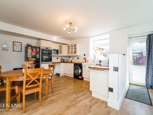 3 bedroom end of terrace house for sale in Hareholme Lane, Rossendale, BB4 — £250,000 • 3 bed • 1 bath • 1163 ft²
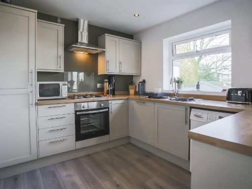 3 bedroom detached house for sale in Woodside, Haslingden, BB4 — £330,000 • 3 bed • 1 bath • 1276 ft²
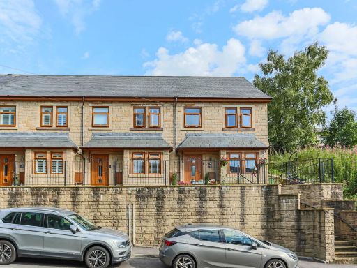 4 bedroom terraced house for sale in Grane Road, Haslingden, Rossendale, BB4 5EB, BB4 — £239,950 • 4 bed • 2 bath • 1174 ft²
 4 bedroom detached house for sale in Kirkhill Avenue, Haslingden, Rossendale, BB4 — £500,000 • 4 bed • 2 bath • 1723 ft²
 4 bedroom detached house for sale in Jubilee Close, Haslingden, Rossendale, BB4 — £475,000 • 4 bed • 2 bath • 1483 ft²
Meta
- {
"@context": "https://schema.org",
"@type": "Residence",
"name": "4 bedroom terraced house for sale in Whitecroft Avenue, Has…",
"description": "",
"url": "https://propertypiper.co.uk/property/280495f2-0ec0-491d-8d3c-932dfae58851",
"image": "https://image-a.propertypiper.co.uk/21a76629-f6b2-41d7-806e-996eb26c5a04-1024.jpeg",
"address": {
"@type": "PostalAddress",
"streetAddress": "5 WHITECROFT AVENUE HASLINGDEN ROSSENDALE",
"postalCode": "BB4 4BU",
"addressLocality": "Rossendale",
"addressRegion": "Hyndburn",
"addressCountry": "England"
},
"geo": {
"@type": "GeoCoordinates",
"latitude": 53.69867542692088,
"longitude": -2.3251177026741603
},
"numberOfRooms": 4,
"numberOfBathroomsTotal": 1,
"floorSize": {
"@type": "QuantitativeValue",
"value": 1111,
"unitCode": "FTK"
},
"offers": {
"@type": "Offer",
"price": 300000,
"priceCurrency": "GBP",
"availability": "https://schema.org/InStock"
},
"additionalProperty": [
{
"@type": "PropertyValue",
"name": "Feature",
"value": "dining room"
},
{
"@type": "PropertyValue",
"name": "Feature",
"value": "contemporary style"
},
{
"@type": "PropertyValue",
"name": "Feature",
"value": "geometric pendant lights"
},
{
"@type": "PropertyValue",
"name": "Feature",
"value": "modern fireplace"
},
{
"@type": "PropertyValue",
"name": "Feature",
"value": "bay window"
},
{
"@type": "PropertyValue",
"name": "Feature",
"value": "decorative artwork"
},
{
"@type": "PropertyValue",
"name": "Feature",
"value": "wood flooring"
},
{
"@type": "PropertyValue",
"name": "Feature",
"value": "bright"
},
{
"@type": "PropertyValue",
"name": "Feature",
"value": "neutral colors"
},
{
"@type": "PropertyValue",
"name": "Feature",
"value": "living room"
},
{
"@type": "PropertyValue",
"name": "Feature",
"value": "contemporary"
},
{
"@type": "PropertyValue",
"name": "Feature",
"value": "open plan"
},
{
"@type": "PropertyValue",
"name": "Feature",
"value": "black accent wall"
},
{
"@type": "PropertyValue",
"name": "Feature",
"value": "marble countertop"
},
{
"@type": "PropertyValue",
"name": "Feature",
"value": "recessed lighting"
},
{
"@type": "PropertyValue",
"name": "Feature",
"value": "fireplace"
},
{
"@type": "PropertyValue",
"name": "Feature",
"value": "modern decor"
},
{
"@type": "PropertyValue",
"name": "Feature",
"value": "tile flooring"
},
{
"@type": "PropertyValue",
"name": "Feature",
"value": "modern"
},
{
"@type": "PropertyValue",
"name": "Feature",
"value": "open-plan"
},
{
"@type": "PropertyValue",
"name": "Feature",
"value": "living room"
},
{
"@type": "PropertyValue",
"name": "Feature",
"value": "kitchen"
},
{
"@type": "PropertyValue",
"name": "Feature",
"value": "black accent wall"
},
{
"@type": "PropertyValue",
"name": "Feature",
"value": "blue sofa"
},
{
"@type": "PropertyValue",
"name": "Feature",
"value": "white cabinetry"
},
{
"@type": "PropertyValue",
"name": "Feature",
"value": "recessed lighting"
},
{
"@type": "PropertyValue",
"name": "Feature",
"value": "island"
},
{
"@type": "PropertyValue",
"name": "Feature",
"value": "bright"
},
{
"@type": "PropertyValue",
"name": "Feature",
"value": "clean lines"
}
]
}
High Res Floorplan Images
Compatible Floorplan Images
FloorplanImages Thumbnail