DE24 3JL - 5 bedroom detached house for sale in Cobham Close, Stenson…
View on Property Piper
5 bedroom detached house for sale in Cobham Close, Stenson Fields, DE24
Property Details
- Price: £400000
- Bedrooms: 5
- Bathrooms: 3
- Property Type: undefined
- Property SubType: undefined
Image Descriptions
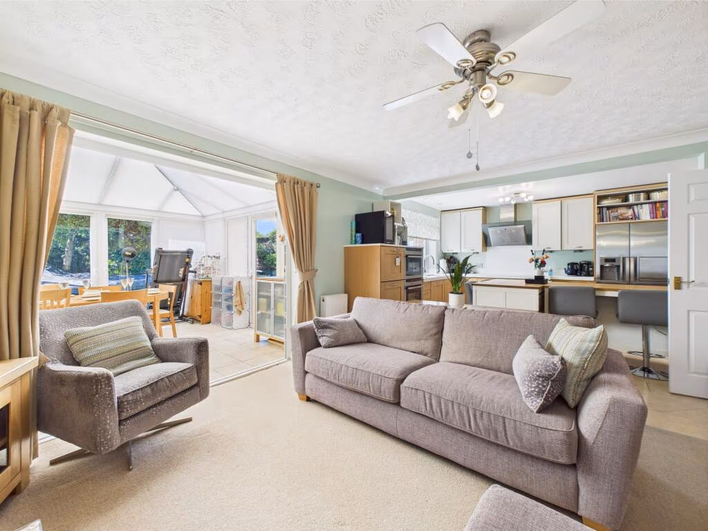
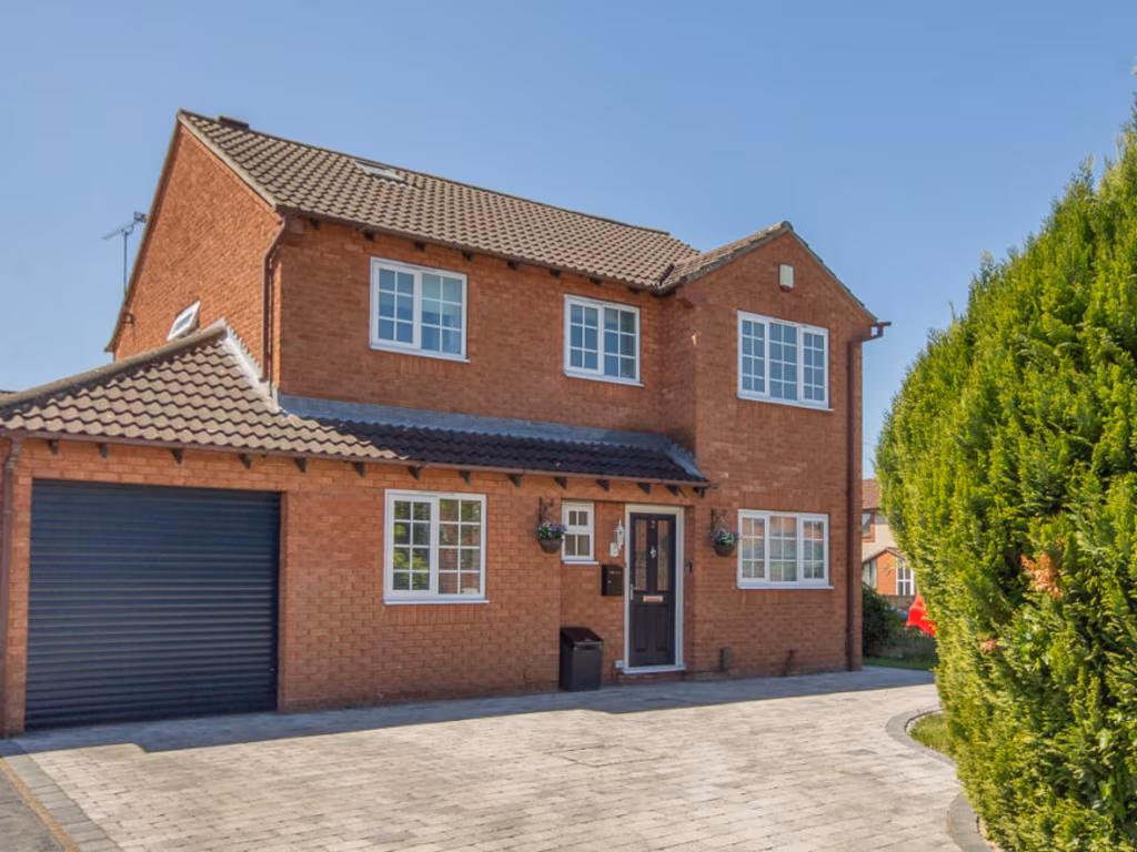
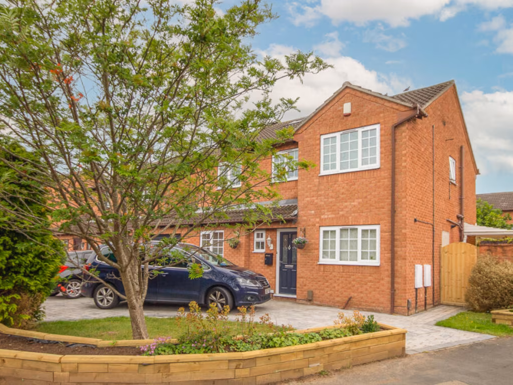
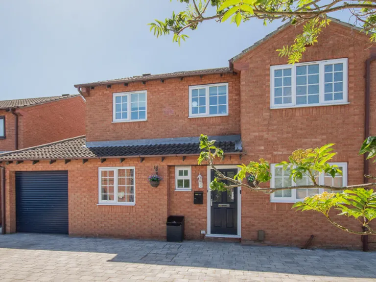
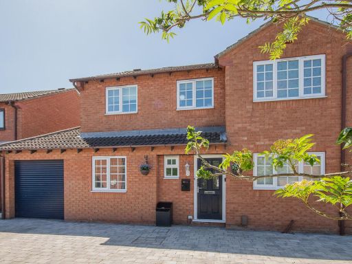
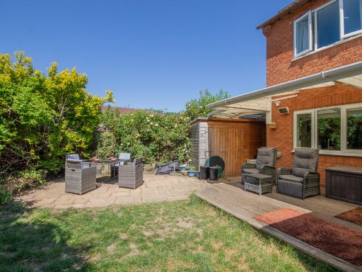
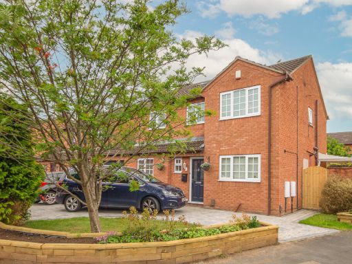
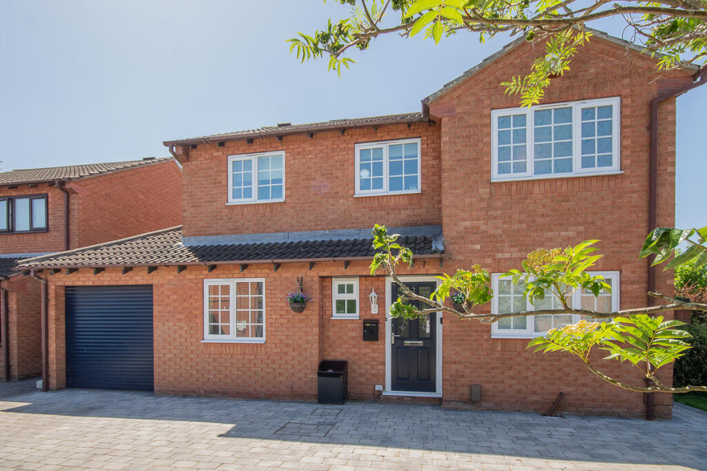
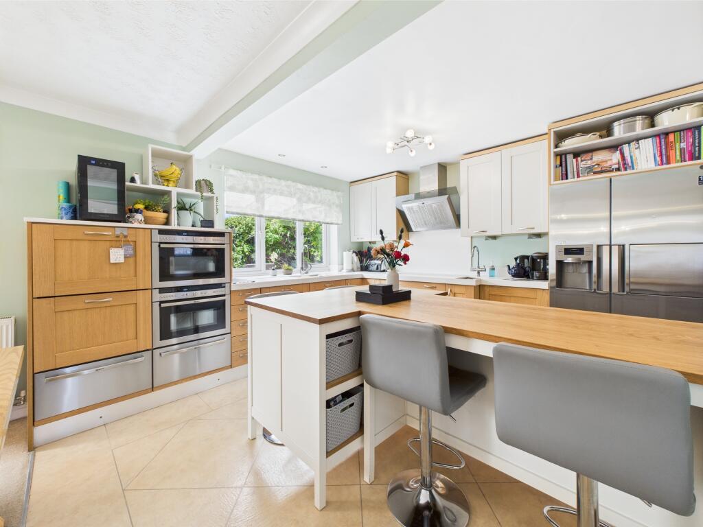
- detached house exterior modern
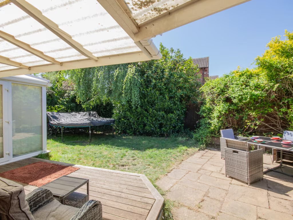
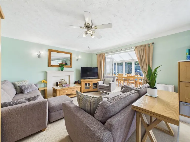
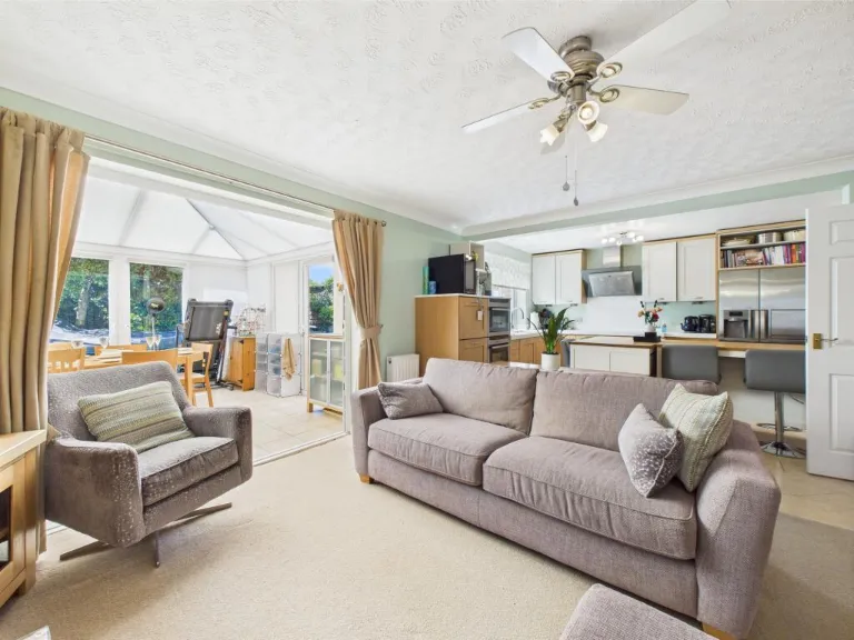
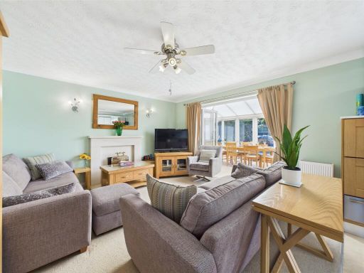
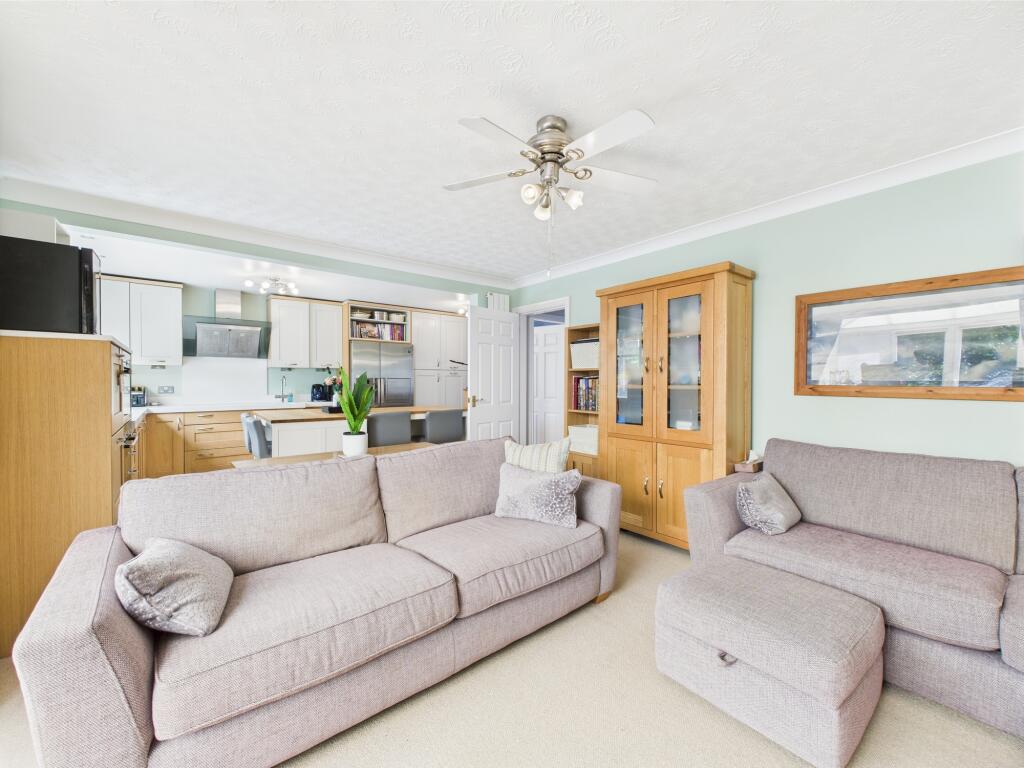
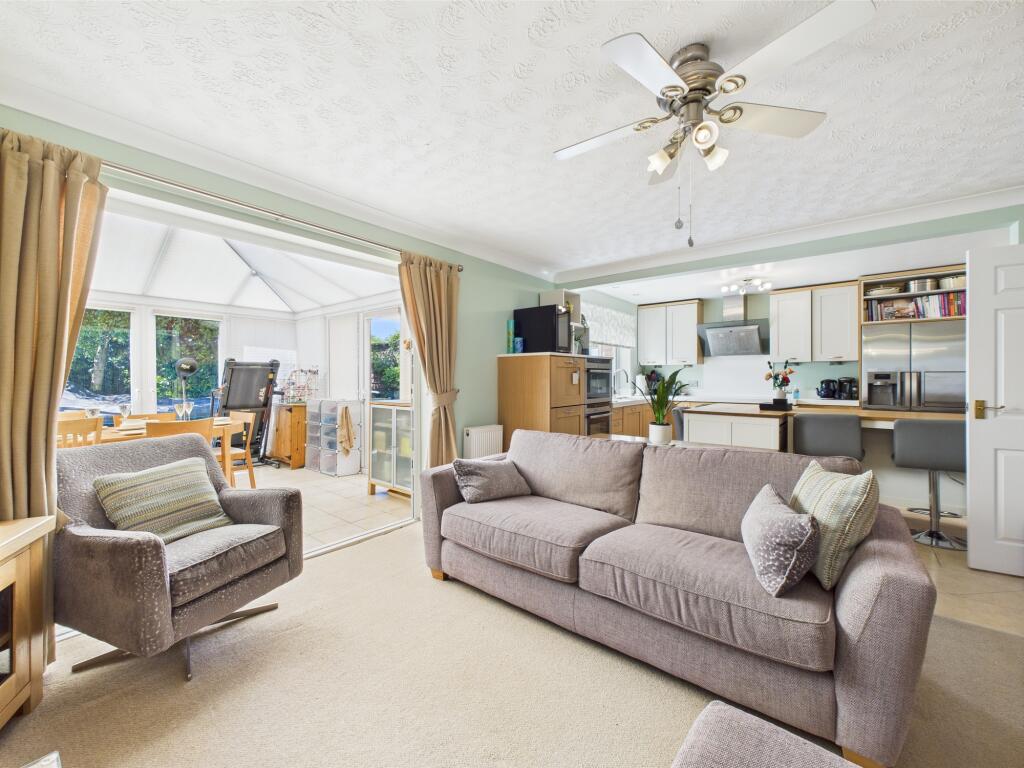
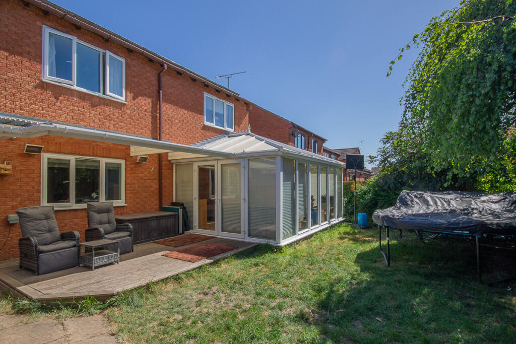
- living room with conservatory modern
Floorplan Description
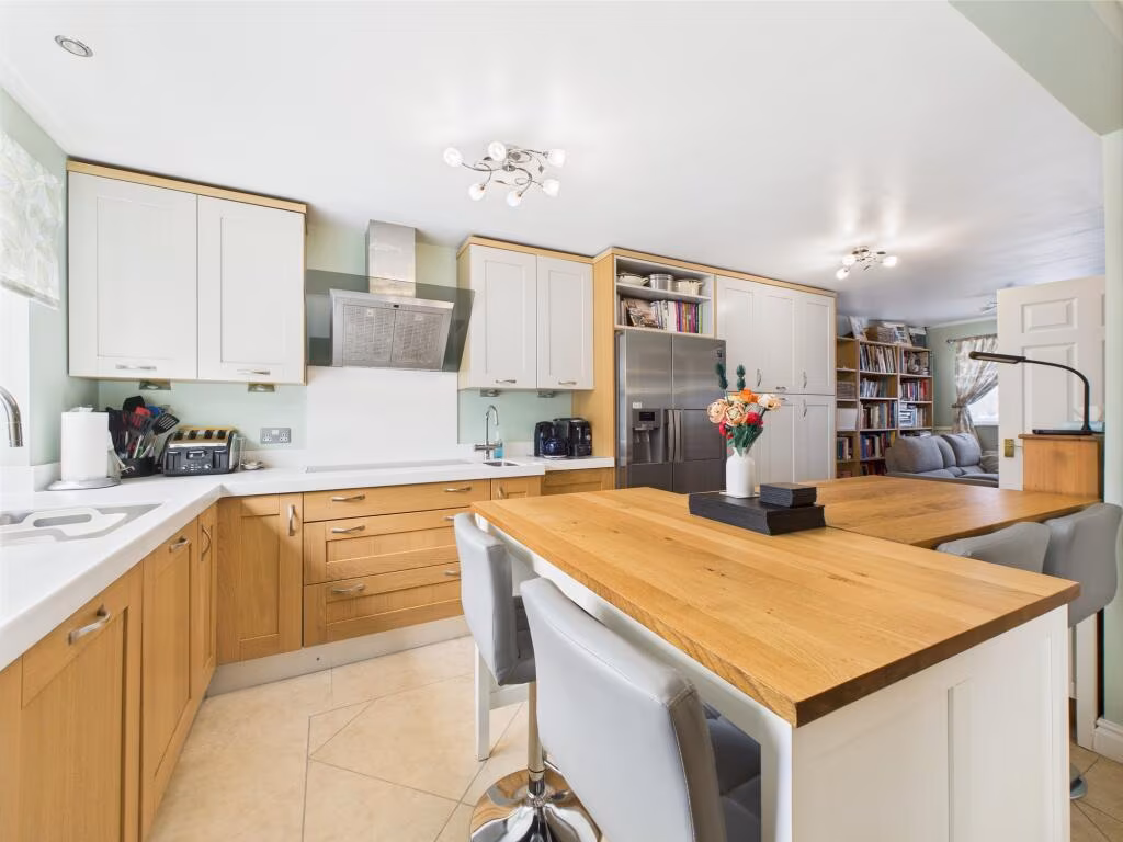
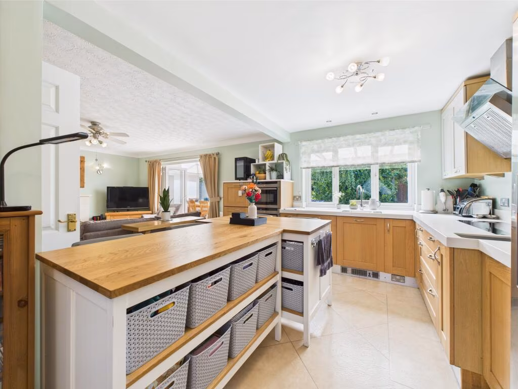
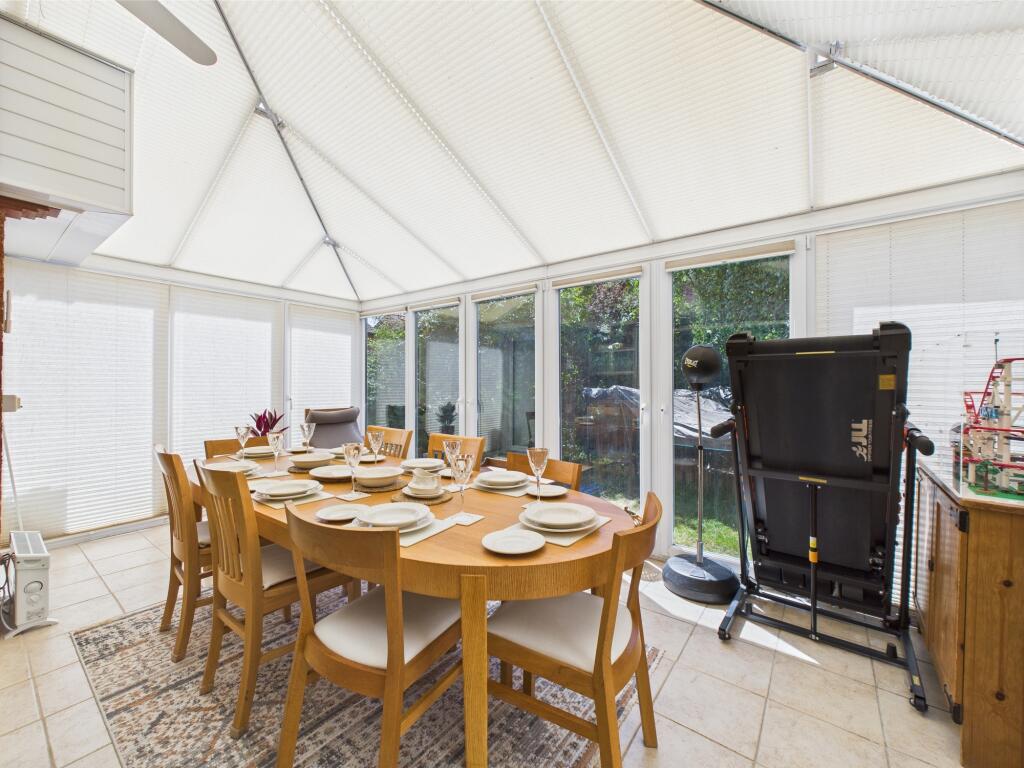
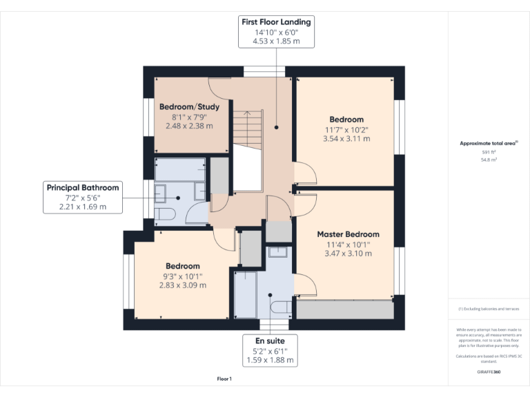
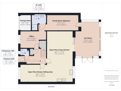
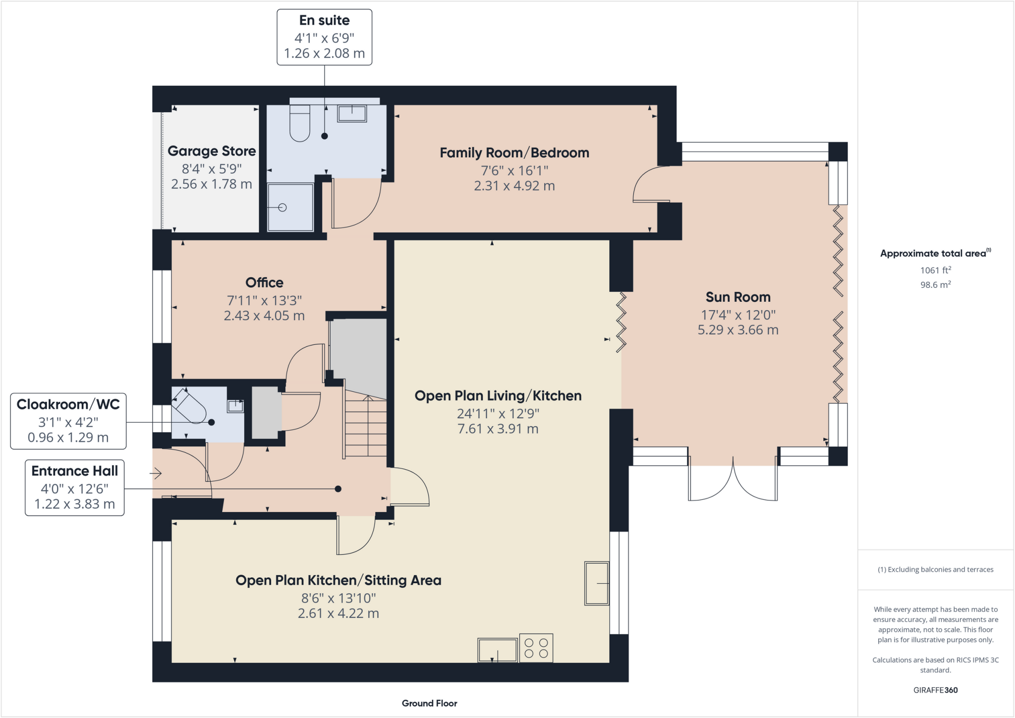
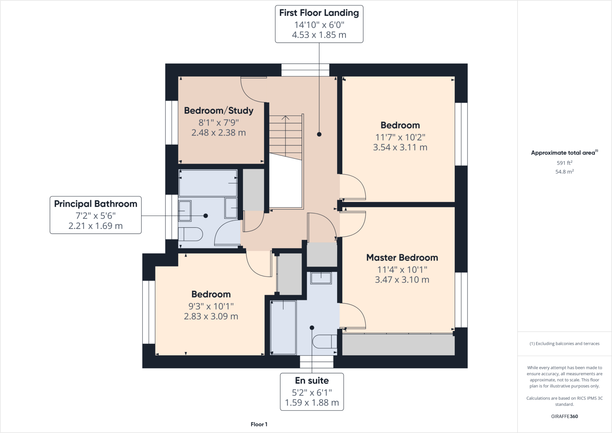
- A single-story property with various rooms including a sun room, an office, and an open-plan kitchen/living area.
Rooms
- Garage Store: Small
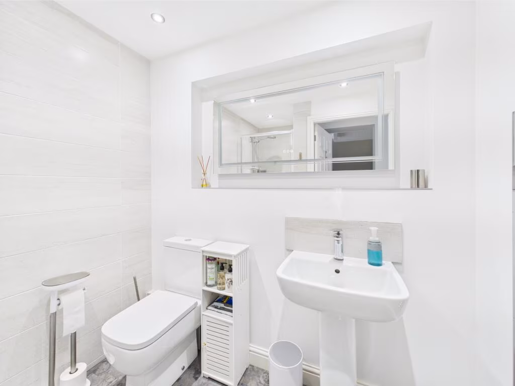
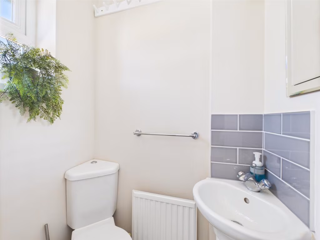
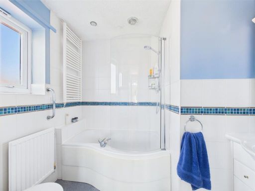
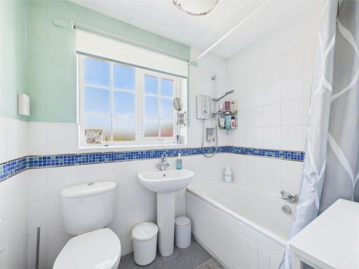
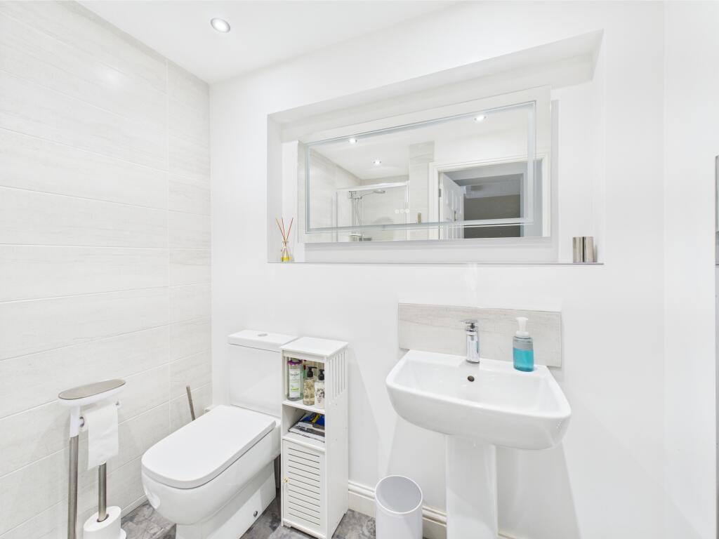
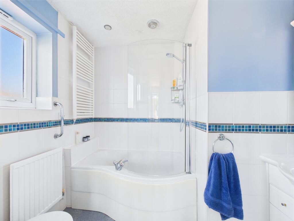
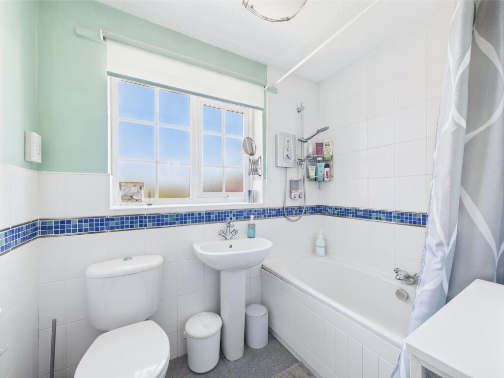
- En suite: Small
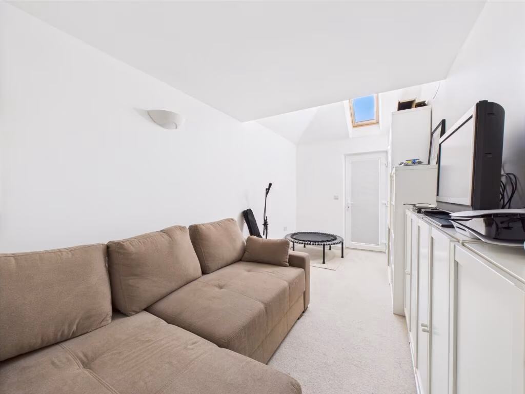
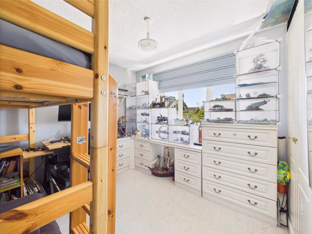
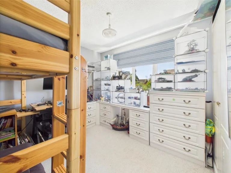
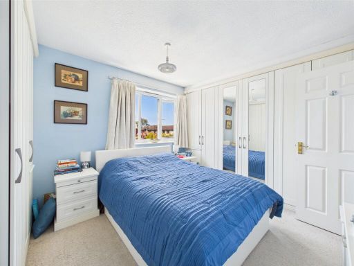
- Family Room/Bedroom: Average
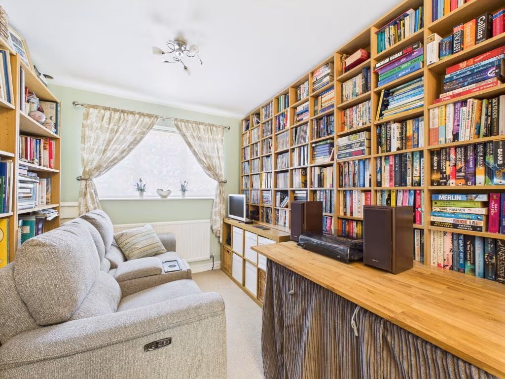
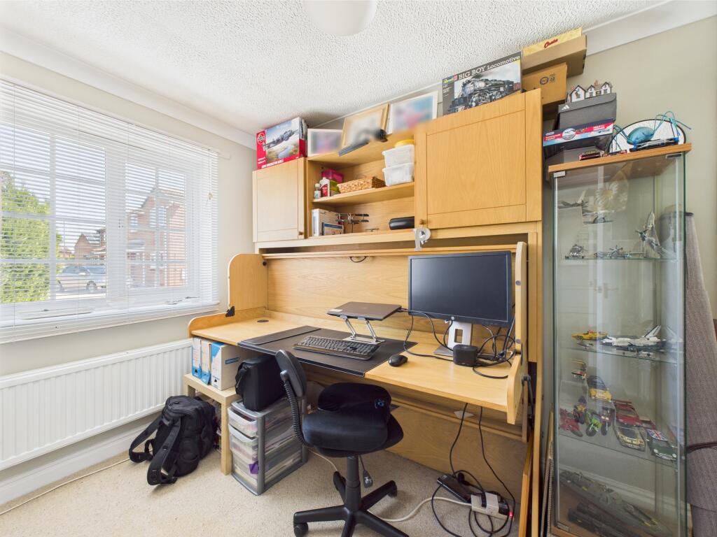
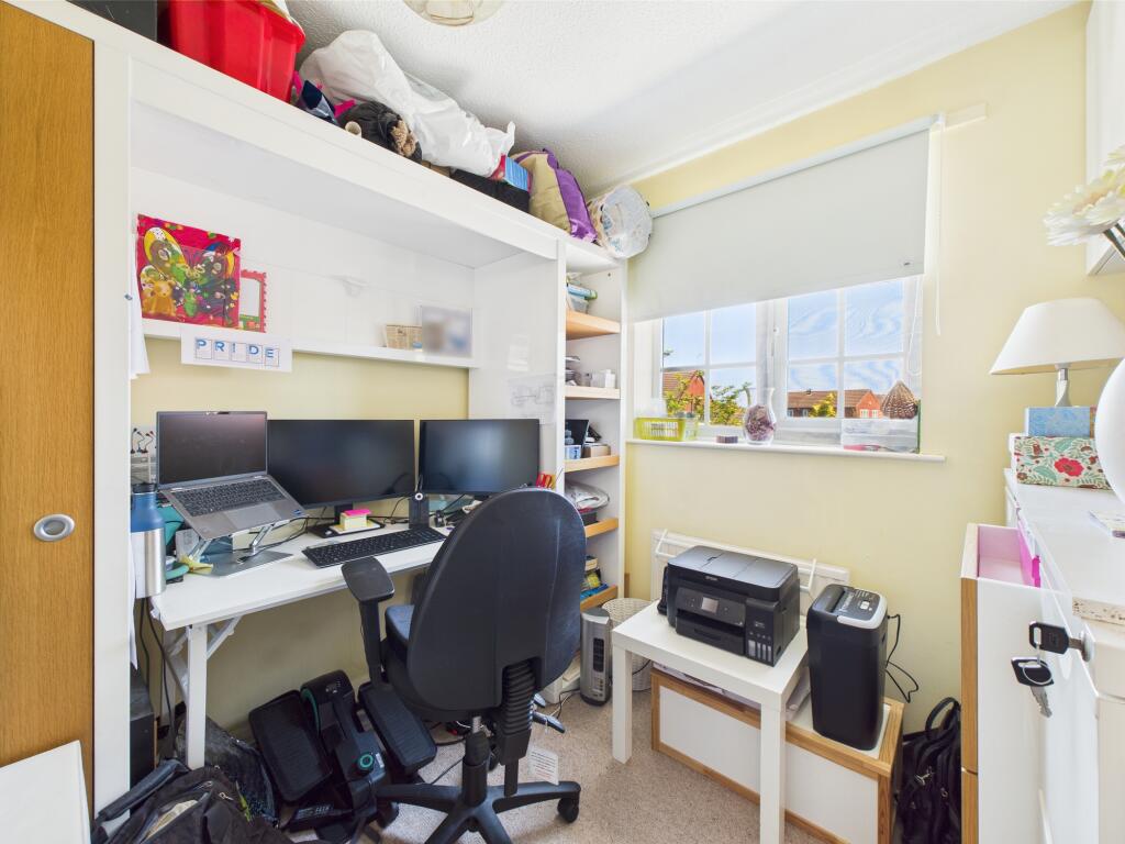
- Office: Average
- Sun Room: Average
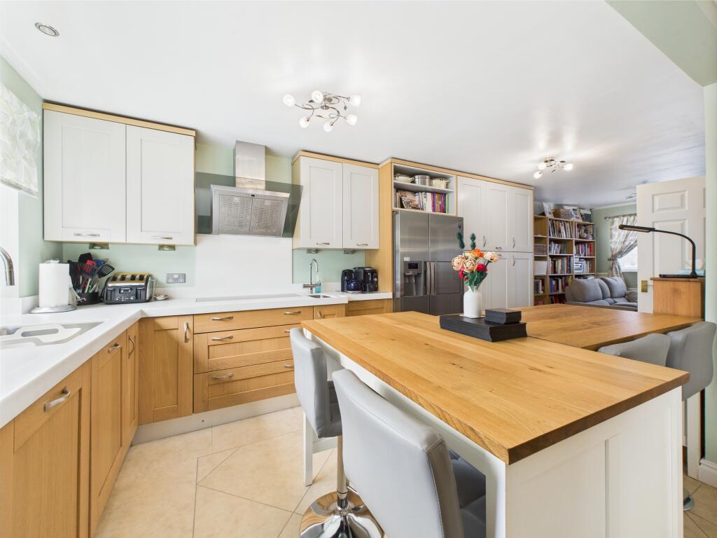
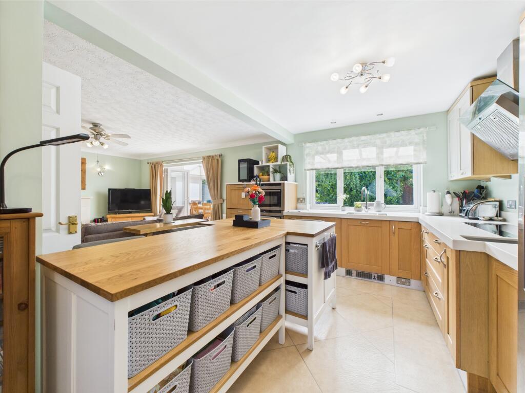
- Open Plan Kitchen/Sitting Area: Average
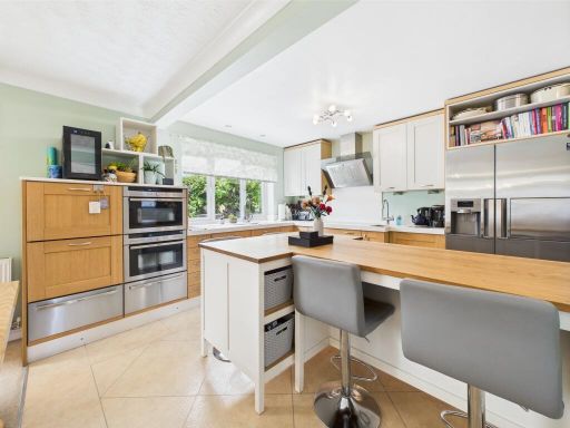
- Open Plan Living/Kitchen: Large
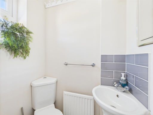
- Cloakroom/WC: Small
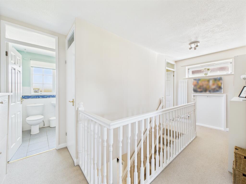
- Entrance Hall: Small
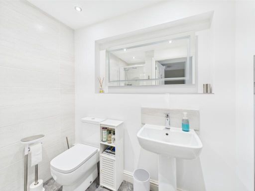
- Principal Bathroom: Small
- Bedroom/Study: Small
- First Floor Landing: Average
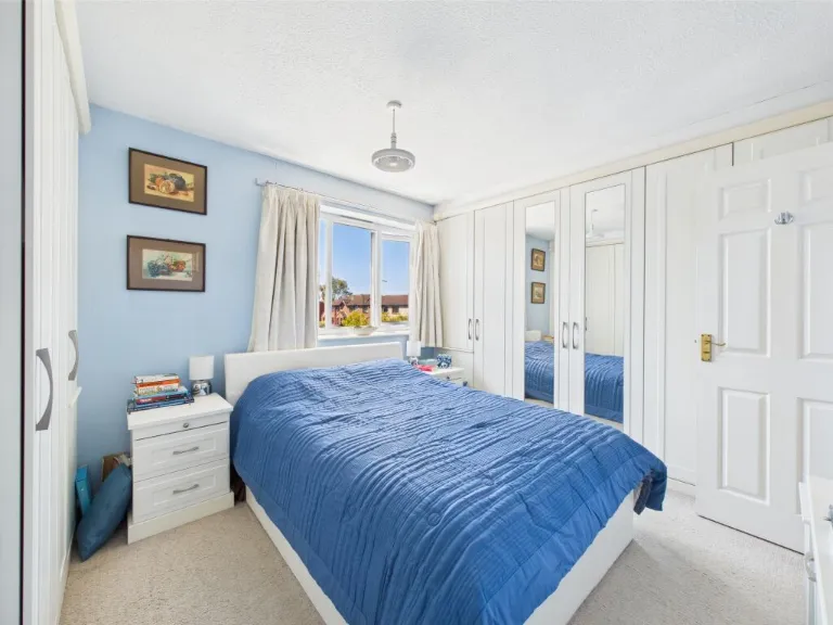
- Bedroom: Average
- Bedroom: Average
- Master Bedroom: Large
- En suite: Small
Textual Property Features
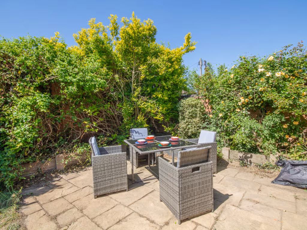
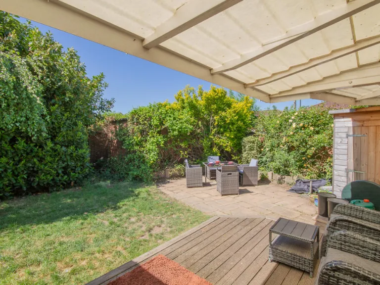
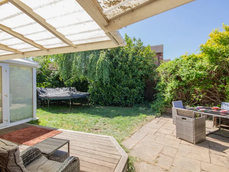
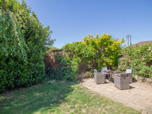
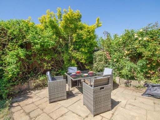
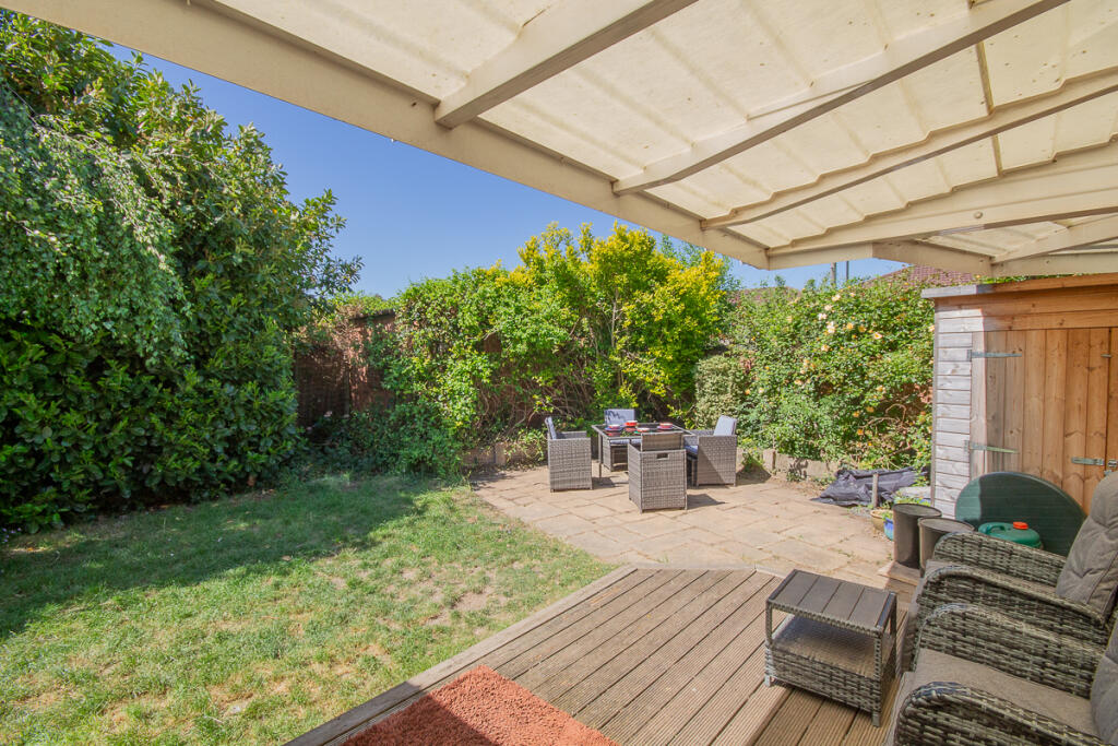
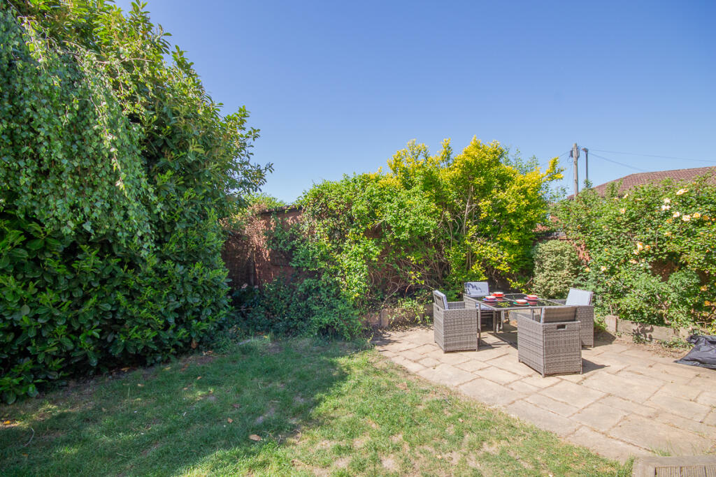
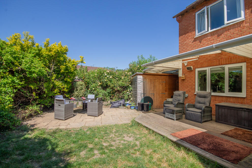
- Has Garden
- Chain Free
- Success
Detected Visual Features
- modern
- detached
- two-story
- brick exterior
- garage
- driveway
- windows
- gabled roof
- living room
- conservatory
- standard ceiling height
- medium room
- open plan
- natural light
- family home
EPC Details
- Fully double glazed
- Cavity wall, as built, insulated (assumed)
- Boiler and radiators, mains gas
- Low energy lighting in 89% of fixed outlets
- Solid, no insulation (assumed)
Nearby Schools
- Stenson Fields Primary Community School
- Redwood Primary School
- Bishop Lonsdale Church of England Primary School and Nursery
- Findern Primary School
- Ridgeway Infant School
- St George's Catholic Voluntary Academy
- Derby Moor Spencer Academy
- Sale and Davys Church of England Primary School
- Grampian Primary Academy
- Normanton House School
- Derby Grammar School
- Littleover Community School
- Cottons Farm Primary Academy
- Akaal Primary School
- Pear Tree Community Junior School
- Pear Tree Infant School
- Gayton Junior School
- St Peter's Church of England Aided Junior School
- Ash Croft Primary Academy
- City of Derby Academy
- Village Primary Academy
- Hardwick Primary School
- Dale Community Primary School
- Firs Primary School
- Highfields Spencer Academy
- Griffe Field Primary School
- Carlyle Infant and Nursery Academy
- Derby High School
- Wren Park Primary School
Nearest General Shops
- Id: 6466196015
- Tags:
- Addr:
- City: Derby
- Parentstreet: Arleston Lane
- Place: Sinfin District Centre
- Postcode: DE24 3DS
- Brand: The Co-operative Funeralcare
- Brand:wikidata: Q7726521
- Brand:wikipedia: en:Co-op Funeralcare
- Name: The Co-operative Funeralcare
- Shop: funeral_directors
- TagsNormalized:
- funeral
- the co-operative funeralcare
- funeral directors
- shop
- Lat: 52.877711
- Lon: -1.4944376
- FullGeoHash: gcquvfpfcpf8
- PartitionGeoHash: gcqu
- Images:
- FoodStandards: null
- Distance: 598.3
,- Id: 67415576
- Tags:
- Addr:
- Building: yes
- Name: New You hair design and beauty
- Shop: beauty
- Source: OS_OpenData_StreetView
- TagsNormalized:
- Lat: 52.8760183
- Lon: -1.504421
- FullGeoHash: gcquvcb90knr
- PartitionGeoHash: gcqu
- Images:
- FoodStandards: null
- Distance: 144.7
,- Id: 67415563
- Tags:
- Addr:
- City: Derby
- Country: GB
- Housenumber: 46
- Postcode: DE24 3JG
- Street: Pilgrims Way
- Suburb: Stenson Fields
- Alt_name: Santi's Cafe
- Amenity: cafe
- Building: yes
- Contact:
- Facebook: https://www.facebook.com/StensonStores/
- Fhrs:
- Name: Stenson Stores
- Old_fhrs:
- Shop: newsagent
- Source: OS_OpenData_StreetView
- TagsNormalized:
- Lat: 52.8761199
- Lon: -1.5043022
- FullGeoHash: gcquvcb9epnv
- PartitionGeoHash: gcqu
- Images:
- FoodStandards: null
- Distance: 130.9
}
Nearest Religious buildings
- Id: 65534158
- Tags:
- Addr:
- City: Derby
- Postcode: DE24 9LA
- Street: Redwood Road
- Amenity: place_of_worship
- Building: yes
- Denomination: catholic
- Name: Holy Spirit
- Religion: christian
- TagsNormalized:
- place of worship
- catholic
- christian
- church
- Lat: 52.8785874
- Lon: -1.4902789
- FullGeoHash: gcquy46b1gps
- PartitionGeoHash: gcqu
- Images:
- FoodStandards: null
- Distance: 888.8
,- Id: 286800956
- Tags:
- Addr:
- City: Derby
- Postcode: DE24 3DH
- Street: Arleston Lane
- Amenity: place_of_worship
- Building: church
- Denomination: anglican
- Name: Sinfin Moor Church
- Religion: christian
- Website: http://www.sinfinmoorchurch.org.uk/
- Wikidata: Q105094634
- TagsNormalized:
- place of worship
- church
- anglican
- christian
- Lat: 52.8768951
- Lon: -1.4920493
- FullGeoHash: gcquy1cw0xxm
- PartitionGeoHash: gcqu
- Images:
- FoodStandards: null
- Distance: 755.6
,- Id: 66313618
- Tags:
- Addr:
- City: Derby
- Postcode: DE24 3JG
- Amenity: place_of_worship
- Building: yes
- Denomination: free_church
- Name: Stenson Fields Christian Fellowship
- Religion: christian
- TagsNormalized:
- place of worship
- church
- christian
- Lat: 52.8763606
- Lon: -1.5049303
- FullGeoHash: gcquvcb5hs49
- PartitionGeoHash: gcqu
- Images:
- FoodStandards: null
- Distance: 138.8
}
Nearest Airports
- Id: 11359528
- Tags:
- Aerodrome: international
- Aerodrome:type: public
- Aeroway: aerodrome
- Iata: EMA
- Icao: EGNX
- Is_in: Castle Donington,England,UK
- Name: East Midlands Airport
- Old_name: RAF Castle Donington
- Operator: Manchester Airports Holdings Limited
- Operator:type: private
- Ref: EMA
- Type: multipolygon
- Website: https://www.eastmidlandsairport.com/
- Wikidata: Q8977
- Wikipedia: en:East Midlands Airport
- TagsNormalized:
- airport
- international airport
- Lat: 52.8281122
- Lon: -1.3322143
- FullGeoHash: gcrh99jfj1vh
- PartitionGeoHash: gcrh
- Images:
- FoodStandards: null
- Distance: 12715.5
}
Nearest Leisure Facilities
- Id: 499324635
- Tags:
- TagsNormalized:
- Lat: 52.8761009
- Lon: -1.5080178
- FullGeoHash: gcquv9vcses7
- PartitionGeoHash: gcqu
- Images:
- FoodStandards: null
- Distance: 336.6
,- Id: 361199285
- Tags:
- TagsNormalized:
- Lat: 52.8765919
- Lon: -1.5075364
- FullGeoHash: gcquv9yhrz5k
- PartitionGeoHash: gcqu
- Images:
- FoodStandards: null
- Distance: 290.4
,- Id: 65024961
- Tags:
- TagsNormalized:
- Lat: 52.8756181
- Lon: -1.5026263
- FullGeoHash: gcquvc9yf38e
- PartitionGeoHash: gcqu
- Images:
- FoodStandards: null
- Distance: 174.2
,- Id: 799299695
- Tags:
- TagsNormalized:
- Lat: 52.8759162
- Lon: -1.5037013
- FullGeoHash: gcquvcc091pn
- PartitionGeoHash: gcqu
- Images:
- FoodStandards: null
- Distance: 137.7
,- Id: 65024962
- Tags:
- TagsNormalized:
- Lat: 52.8760211
- Lon: -1.5035023
- FullGeoHash: gcquvcc1juer
- PartitionGeoHash: gcqu
- Images:
- FoodStandards: null
- Distance: 124.1
}
Nearest Tourist attractions
- Id: 2280211902
- Tags:
- TagsNormalized:
- Lat: 52.8684369
- Lon: -1.5282532
- FullGeoHash: gcquv0rhvngy
- PartitionGeoHash: gcqu
- Images:
- FoodStandards: null
- Distance: 1933.6
,- Id: 2280211903
- Tags:
- TagsNormalized:
- Lat: 52.8686926
- Lon: -1.5276765
- FullGeoHash: gcquv0rw6w9g
- PartitionGeoHash: gcqu
- Images:
- FoodStandards: null
- Distance: 1885.9
,- Id: 207228200
- Tags:
- Addr:
- City: Derby
- Postcode: DE73 7FZ
- Building: house
- Name: Stenson Hill Farm
- Tourism: chalet
- TagsNormalized:
- Lat: 52.8759102
- Lon: -1.518759
- FullGeoHash: gcquv3y0d254
- PartitionGeoHash: gcqu
- Images:
- FoodStandards: null
- Distance: 1046.2
}
Nearest Train stations
- Id: 100878319
- Tags:
- Name: Tutbury and Hatton
- Naptan:
- Network: National Rail
- Public_transport: station
- Railway: station
- Ref:
- Wikidata: Q2564949
- Wikipedia: en:Tutbury and Hatton railway station
- TagsNormalized:
- Lat: 52.864141
- Lon: -1.6823404
- FullGeoHash: gcqu9xwgywhh
- PartitionGeoHash: gcqu
- Images:
- FoodStandards: null
- Distance: 12103.4
,- Id: 2132540013
- Tags:
- Name: Spondon
- Naptan:
- Network: National Rail
- Public_transport: station
- Railway: station
- Ref:
- Source: NPE
- Wikidata: Q7578950
- Wikipedia: en:Spondon railway station
- TagsNormalized:
- Lat: 52.9120948
- Lon: -1.4108169
- FullGeoHash: gcqvpbkem96e
- PartitionGeoHash: gcqv
- Images:
- FoodStandards: null
- Distance: 7321.6
,- Id: 5871807868
- Tags:
- Name: Derby
- Naptan:
- Network: National Rail
- Operator: East Midlands Railway
- Public_transport: station
- Railway: station
- Ref:
- Train: yes
- Wheelchair: yes
- Wikidata: Q3398679
- Wikipedia: en:Derby railway station
- TagsNormalized:
- Lat: 52.9162127
- Lon: -1.4626517
- FullGeoHash: gcqvn9ngm9pb
- PartitionGeoHash: gcqv
- Images:
- FoodStandards: null
- Distance: 5130.4
,- Id: 6646199703
- Tags:
- Layer: 1
- Name: Willington
- Naptan:
- Network: National Rail
- Public_transport: station
- Railway: station
- Ref:
- Source: memory
- Wikidata: Q746608
- Wikipedia: en:Willington railway station
- TagsNormalized:
- Lat: 52.8533792
- Lon: -1.5641036
- FullGeoHash: gcqusmtj1xzz
- PartitionGeoHash: gcqu
- Images:
- FoodStandards: null
- Distance: 4861.4
,- Id: 252838671
- Tags:
- Name: Peartree
- Naptan:
- Network: National Rail
- Note: Only a few services call here, I would not consider it a railway=halt since it has proper platforms and it isn't a request stop
- Public_transport: station
- Railway: station
- Ref:
- Source: NPE
- Start_date: 1839
- Wikidata: Q7158389
- Wikipedia: en:Peartree railway station
- TagsNormalized:
- Lat: 52.8976023
- Lon: -1.4722913
- FullGeoHash: gcquymxyv5u0
- PartitionGeoHash: gcqu
- Images:
- FoodStandards: null
- Distance: 3083.9
}
Nearest Bus stations and stops
- Id: 800958451
- Tags:
- Highway: bus_stop
- Name: Cairngorm Drive
- Public_transport: platform
- TagsNormalized:
- Lat: 52.8771303
- Lon: -1.498295
- FullGeoHash: gcquvcuzx5w2
- PartitionGeoHash: gcqu
- Images:
- FoodStandards: null
- Distance: 336
,- Id: 3398574946
- Tags:
- Highway: bus_stop
- Name: Pilgrims Way
- Public_transport: platform
- TagsNormalized:
- Lat: 52.8754224
- Lon: -1.5067332
- FullGeoHash: gcquv9wvdt4k
- PartitionGeoHash: gcqu
- Images:
- FoodStandards: null
- Distance: 298.5
,- Id: 800958406
- Tags:
- Highway: bus_stop
- Name: Cairngorm Drive
- Public_transport: platform
- TagsNormalized:
- Lat: 52.8774484
- Lon: -1.4994269
- FullGeoHash: gcquvfh1kyf6
- PartitionGeoHash: gcqu
- Images:
- FoodStandards: null
- Distance: 262.4
,- Id: 800958366
- Tags:
- Highway: bus_stop
- Name: Kirkland Way
- Public_transport: platform
- TagsNormalized:
- Lat: 52.8778747
- Lon: -1.5015313
- FullGeoHash: gcquvf4egy31
- PartitionGeoHash: gcqu
- Images:
- FoodStandards: null
- Distance: 144.8
,- Id: 322172400
- Tags:
- Highway: bus_stop
- Name: Kirkland Way
- Public_transport: platform
- TagsNormalized:
- Lat: 52.8782793
- Lon: -1.5028932
- FullGeoHash: gcquvf1wk19w
- PartitionGeoHash: gcqu
- Images:
- FoodStandards: null
- Distance: 130.6
}
Nearest Hotels
- Id: 511548466
- Tags:
- Addr:
- City: Derby
- Housenumber: 724
- Postcode: DE24 8GT
- Street: Osmaston Road
- Building: yes
- Fhrs:
- Name: The Ascot Hotel
- Tourism: hotel
- TagsNormalized:
- Lat: 52.8947426
- Lon: -1.4557635
- FullGeoHash: gcquyv5ynq8j
- PartitionGeoHash: gcqu
- Images:
- FoodStandards: null
- Distance: 3742.8
,- Id: 3978751347
- Tags:
- Addr:
- City: Derby
- Housename: Foresters Leisure Park
- Postcode: DE23 8AG
- Street: Osmaston Park Road
- Alt_name: Premier Inn Derby South
- Brand: Premier Inn
- Brand:wikidata: Q2108626
- Brand:wikipedia: en:Premier Inn
- Internet_access: wlan
- Internet_access:fee: customers
- Internet_access:operator: Virgin Media
- Internet_access:ssid: Premier Inn Free Wi-Fi
- Name: Premier Inn
- Source: Website
- Tourism: hotel
- TagsNormalized:
- Lat: 52.8970471
- Lon: -1.478186
- FullGeoHash: gcquymeeeu28
- PartitionGeoHash: gcqu
- Images:
- FoodStandards: null
- Distance: 2782.8
,- Id: 107666622
- Tags:
- Addr:
- City: Derby
- Housenumber: 222
- Postcode: DE23 4AN
- Street: Rykneld Road
- Fhrs:
- Landuse: commercial
- Name: Littleover Lodge Hotel
- Tourism: hotel
- Website: https://www.littleoverlodge.co.uk/
- TagsNormalized:
- Lat: 52.8882773
- Lon: -1.5379276
- FullGeoHash: gcquvh00e9qn
- PartitionGeoHash: gcqu
- Images:
- FoodStandards: null
- Distance: 2633.3
}
Tags
- modern
- detached
- two-story
- brick exterior
- garage
- driveway
- windows
- gabled roof
- modern
- living room
- conservatory
- standard ceiling height
- medium room
- open plan
- natural light
- family home
Local Market Stats
- Average Price/sqft: £209
- Avg Income: £37200
- Rental Yield: 4.7%
- Social Housing: 25%
- Planning Success Rate: 92%
Similar Properties
 4 bedroom detached house for sale in Betony Close, Stenson Fields, DE24 — £350,000 • 4 bed • 2 bath • 1163 ft²
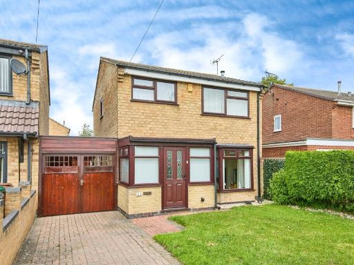 3 bedroom detached house for sale in Zetland Crescent, Stenson Fields, Derby, DE24 — £245,000 • 3 bed • 1 bath
 3 bedroom detached house for sale in Chartley Road, Derby, DE24 — £325,000 • 3 bed • 3 bath • 1386 ft²
 4 bedroom detached house for sale in Betony Close, Stenson Fields, DE24 — £425,000 • 4 bed • 3 bath • 671 ft²
 5 bedroom detached house for sale in Garth Crescent, Alvaston, DE24 — £400,000 • 5 bed • 3 bath • 1991 ft²
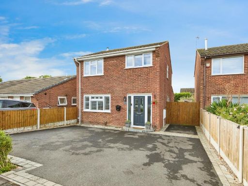 3 bedroom detached house for sale in Bicester Avenue, Stenson Fields, Derby, Derbyshire, DE24 — £300,000 • 3 bed • 2 bath • 1092 ft²
Meta
- {
"@context": "https://schema.org",
"@type": "Residence",
"name": "5 bedroom detached house for sale in Cobham Close, Stenson…",
"description": "",
"url": "https://propertypiper.co.uk/property/27398ab3-0426-4e2e-b41c-bc11b2dd2af4",
"image": "https://image-a.propertypiper.co.uk/9084e9f0-08ca-43f2-a72f-95949574dc5c-1024.jpeg",
"address": {
"@type": "PostalAddress",
"streetAddress": "2 COBHAM CLOSE STENSON FIELDS DERBY",
"postalCode": "DE24 3JL",
"addressLocality": "South Derbyshire",
"addressRegion": "South Derbyshire",
"addressCountry": "England"
},
"geo": {
"@type": "GeoCoordinates",
"latitude": 52.8771306,
"longitude": -1.5033016
},
"numberOfRooms": 5,
"numberOfBathroomsTotal": 3,
"floorSize": {
"@type": "QuantitativeValue",
"value": 649,
"unitCode": "FTK"
},
"offers": {
"@type": "Offer",
"price": 400000,
"priceCurrency": "GBP",
"availability": "https://schema.org/InStock"
},
"additionalProperty": [
{
"@type": "PropertyValue",
"name": "Feature",
"value": "modern"
},
{
"@type": "PropertyValue",
"name": "Feature",
"value": "detached"
},
{
"@type": "PropertyValue",
"name": "Feature",
"value": "two-story"
},
{
"@type": "PropertyValue",
"name": "Feature",
"value": "brick exterior"
},
{
"@type": "PropertyValue",
"name": "Feature",
"value": "garage"
},
{
"@type": "PropertyValue",
"name": "Feature",
"value": "driveway"
},
{
"@type": "PropertyValue",
"name": "Feature",
"value": "windows"
},
{
"@type": "PropertyValue",
"name": "Feature",
"value": "gabled roof"
},
{
"@type": "PropertyValue",
"name": "Feature",
"value": "modern"
},
{
"@type": "PropertyValue",
"name": "Feature",
"value": "living room"
},
{
"@type": "PropertyValue",
"name": "Feature",
"value": "conservatory"
},
{
"@type": "PropertyValue",
"name": "Feature",
"value": "standard ceiling height"
},
{
"@type": "PropertyValue",
"name": "Feature",
"value": "medium room"
},
{
"@type": "PropertyValue",
"name": "Feature",
"value": "open plan"
},
{
"@type": "PropertyValue",
"name": "Feature",
"value": "natural light"
},
{
"@type": "PropertyValue",
"name": "Feature",
"value": "family home"
}
]
}
High Res Floorplan Images
Compatible Floorplan Images
FloorplanImages Thumbnail