S72 8JR - 2 bedroom terraced house for sale in Snydale Road, Cudworth…
View on Property Piper
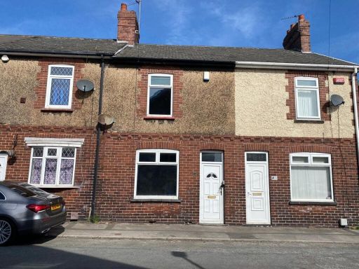
2 bedroom terraced house for sale in Snydale Road, Cudworth, Barnsley, S72
Property Details
- Price: £70000
- Bedrooms: 2
- Bathrooms: 1
- Property Type: undefined
- Property SubType: undefined
Image Descriptions
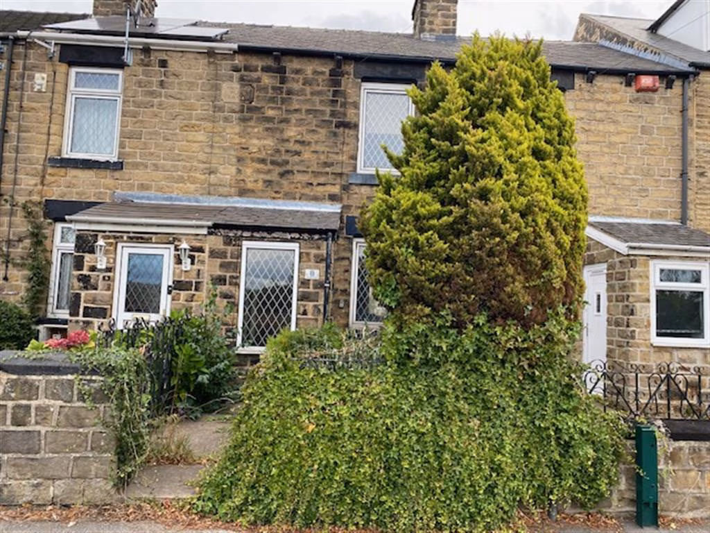
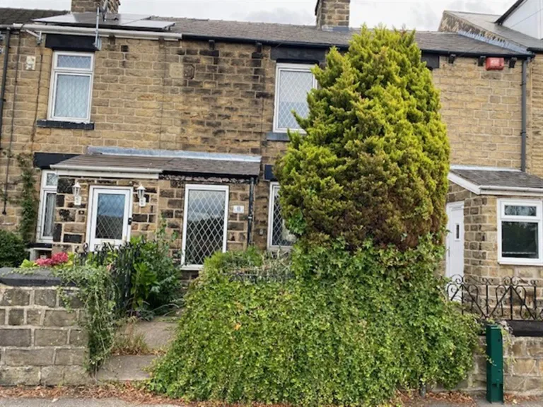
- terraced house Victorian
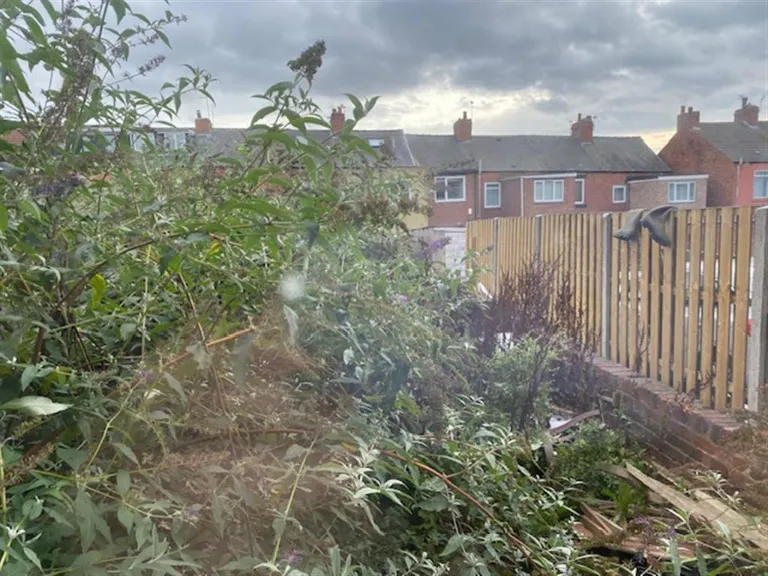
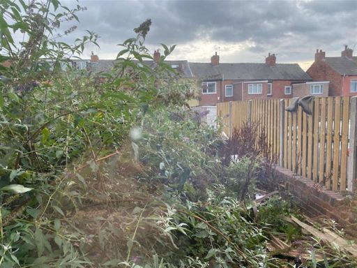
- garden Mid-20th century
Textual Property Features
Detected Visual Features
- Victorian
- terraced
- stone facade
- two-storey
- diamond leaded windows
- dense foliage
- maintenance needed
- potential damp
- dated exterior
- overgrown garden
- unkempt
- issues
- fence
- suburban
- potential
- neglected
EPC Details
- Fully double glazed
- Sandstone or limestone, as built, no insulation (assumed)
- Boiler and radiators, mains gas
- Low energy lighting in 75% of fixed outlets
- Solid, no insulation (assumed)
Nearby Schools
- St Michael and All Angels Catholic Primary School
- Birkwood Primary School
- Churchfield Primary School
- Meadstead Primary Academy
- Outwood Primary Academy Newstead Green
- Netherwood Academy
- Upperwood Academy
- The Forest Academy
- Carlton Primary Academy
- Shafton Primary Academy
- Royston St John Baptist CE Primary
- South Hiendley Primary School
- High View Primary Learning Centre
- Outwood Primary Academy Darfield
- Outwood Academy Shafton
- Summerfields Primary Academy
- Ryhill Junior, Infant and Nursery School
- Hunningley Primary Academy
- Oakhill Primary Academy
- Outwood Primary Academy Littleworth Grange
- St Helen's Primary Academy
- Milefield Primary School
- Holy Trinity Catholic and Church of England School
- Cherry Dale Primary School
- Outwood Academy Carlton
- Brierley Church of England Voluntary Controlled Primary School
- Parkside Primary Academy
Nearest Bars And Restaurants
- Id: 231499776
- Tags:
- Amenity: pub
- Building: yes
- Name: The Dards
- TagsNormalized:
- Lat: 53.5862706
- Lon: -1.4089429
- FullGeoHash: gcwbzgn49kb5
- PartitionGeoHash: gcwb
- Images:
- FoodStandards: null
- Distance: 1008.1
,- Id: 2398700631
- Tags:
- Amenity: pub
- Name: The Sawdust
- TagsNormalized:
- Lat: 53.5850806
- Lon: -1.4098884
- FullGeoHash: gcwbzfv7epp0
- PartitionGeoHash: gcwb
- Images:
- FoodStandards: null
- Distance: 862.2
,- Id: 390854651
- Tags:
- Amenity: pub
- Building: yes
- Name: The Pinfold
- TagsNormalized:
- Lat: 53.5713772
- Lon: -1.4099316
- FullGeoHash: gcwbzbm7fhwb
- PartitionGeoHash: gcwb
- Images:
- FoodStandards: null
- Distance: 776.4
,- Id: 9328375068
- Tags:
- Addr:
- City: Barnsley
- Postcode: S72 8UH
- Amenity: cafe
- Cuisine: thai
- Name: Patty's Kitchen
- Opening_hours: Mo-Su 11:00-19:30
- Phone: +44 7411 096620
- TagsNormalized:
- Lat: 53.5765366
- Lon: -1.41875
- FullGeoHash: gcwbz9qcuwr3
- PartitionGeoHash: gcwb
- Images:
- FoodStandards: null
- Distance: 316.6
,- Id: 2398691820
- Tags:
- Amenity: pub
- Name: The Star
- TagsNormalized:
- Lat: 53.5762778
- Lon: -1.4183185
- FullGeoHash: gcwbz9r0qy11
- PartitionGeoHash: gcwb
- Images:
- FoodStandards: null
- Distance: 306.5
}
Nearest General Shops
- Id: 10048137758
- Tags:
- Name: G. Haslehurst & Son Butchers
- Operator: G. Haslehurst & Son Butchers
- Shop: butcher
- TagsNormalized:
- Lat: 53.593819
- Lon: -1.4098301
- FullGeoHash: gcwbzumqsefr
- PartitionGeoHash: gcwb
- Images:
- FoodStandards: null
- Distance: 1805.3
,- Id: 1009196629
- Tags:
- Building: no
- Name: Steve Jones Brickyard
- Shop: hardware
- TagsNormalized:
- Lat: 53.5705153
- Lon: -1.4369043
- FullGeoHash: gcwbz21wvey7
- PartitionGeoHash: gcwb
- Images:
- FoodStandards: null
- Distance: 1689.3
,- Id: 1009196647
- Tags:
- Building: no
- Name: Stay Warm Solid Fuels LTD
- Shop: fuel
- TagsNormalized:
- Lat: 53.5730691
- Lon: -1.4272772
- FullGeoHash: gcwbz88twpbv
- PartitionGeoHash: gcwb
- Images:
- FoodStandards: null
- Distance: 997
}
Nearest Grocery shops
- Id: 964059139
- Tags:
- Brand: One Stop
- Brand:wikidata: Q65954217
- Building: yes
- Name: One Stop
- Shop: convenience
- TagsNormalized:
- Lat: 53.5688755
- Lon: -1.4456956
- FullGeoHash: gcwbxpgm2f5j
- PartitionGeoHash: gcwb
- Images:
- FoodStandards: null
- Distance: 2289.1
,- Id: 984676682
- Tags:
- Building: yes
- Name: Tinas Top Shop
- Shop: convenience
- TagsNormalized:
- Lat: 53.5725418
- Lon: -1.4457978
- FullGeoHash: gcwbz0e4wmx5
- PartitionGeoHash: gcwb
- Images:
- FoodStandards: null
- Distance: 2150.1
,- Id: 390945426
- Tags:
- Brand: Fulton's Foods
- Brand:wikidata: Q6112633
- Brand:wikipedia: en:Fulton's Foods
- Building: retail
- Name: Fulton's Foods
- Shop: frozen_food
- TagsNormalized:
- retail
- frozen food
- food
- shop
- Lat: 53.5784009
- Lon: -1.4154067
- FullGeoHash: gcwbzc9kf9u6
- PartitionGeoHash: gcwb
- Images:
- FoodStandards: null
- Distance: 89.5
}
Nearest Religious buildings
- Id: 231498651
- Tags:
- Amenity: place_of_worship
- Building: church
- Denomination: anglican
- Name: St John the Baptist
- Religion: christian
- Wikidata: Q105104072
- TagsNormalized:
- place of worship
- church
- anglican
- baptist
- christian
- Lat: 53.5747971
- Lon: -1.416969
- FullGeoHash: gcwbzbbpy4p3
- PartitionGeoHash: gcwb
- Images:
- FoodStandards: null
- Distance: 374.4
,- Id: 295266466
- Tags:
- Addr:
- City: Barnsley
- Postcode: S72 8JR
- Street: Snydale Road
- Amenity: school
- Contact:
- Phone: +44 1226 710523
- Website: https://www.churchfieldprimary.co.uk/
- Max_age: 11
- Min_age: 5
- Name: Churchfield Primary School
- Ref:
- Source: get-information-schools.service.gov.uk
- TagsNormalized:
- Lat: 53.5766422
- Lon: -1.4151233
- FullGeoHash: gcwbzc3d91zx
- PartitionGeoHash: gcwb
- Images:
- FoodStandards: null
- Distance: 137.8
,- Id: 388925652
- Tags:
- Amenity: place_of_worship
- Building: yes
- Name: Cudworth Methodist Church
- Religion: christian
- TagsNormalized:
- place of worship
- church
- methodist
- christian
- Lat: 53.5782071
- Lon: -1.4164076
- FullGeoHash: gcwbzc8eem9y
- PartitionGeoHash: gcwb
- Images:
- FoodStandards: null
- Distance: 135
}
Nearest Medical buildings
- Id: 355802419
- Tags:
- Amenity: clinic
- Building: yes
- Name: Lundwood Health Centre
- TagsNormalized:
- clinic
- health
- health centre
- Lat: 53.5571136
- Lon: -1.4395919
- FullGeoHash: gcwbxjz8z1d6
- PartitionGeoHash: gcwb
- Images:
- FoodStandards: null
- Distance: 2837.8
,- Id: 230903799
- Tags:
- Addr:
- City: Barnsley
- Postcode: S72 7LJ
- Street: Queensway
- Suburb: Grimethorpe
- Amenity: pharmacy
- Building: retail
- Healthcare: pharmacy
- Name: Lo's Pharmacy
- TagsNormalized:
- pharmacy
- retail
- health
- healthcare
- Lat: 53.5743264
- Lon: -1.3785585
- FullGeoHash: gcx0b8ujj623
- PartitionGeoHash: gcx0
- Images:
- FoodStandards: null
- Distance: 2402.5
,- Id: 1075298743
- Tags:
- Addr:
- City: Barnsley
- Housename: The Grimethorpe Centre
- Postcode: S72 7NZ
- Street: Acorn Way
- Suburb: Grimethorpe
- Amenity: doctors
- Building: yes
- Healthcare: doctor
- Name: Highgate Surgery
- TagsNormalized:
- doctor
- doctors
- health
- healthcare
- surgery
- Lat: 53.5739734
- Lon: -1.3789652
- FullGeoHash: gcx0b8gg5b3p
- PartitionGeoHash: gcx0
- Images:
- FoodStandards: null
- Distance: 2382.8
,- Id: 388925649
- Tags:
- Amenity: clinic
- Building: yes
- TagsNormalized:
- Lat: 53.578319
- Lon: -1.4176026
- FullGeoHash: gcwbz9xsr6wf
- PartitionGeoHash: gcwb
- Images:
- FoodStandards: null
- Distance: 214.2
}
Nearest Leisure Facilities
- Id: 1009387233
- Tags:
- Leisure: garden
- Name: St John's Garden
- TagsNormalized:
- Lat: 53.5761018
- Lon: -1.4187963
- FullGeoHash: gcwbz9nz7thz
- PartitionGeoHash: gcwb
- Images:
- FoodStandards: null
- Distance: 343.6
,- Id: 197695989
- Tags:
- Leisure: pitch
- Sport: soccer
- TagsNormalized:
- Lat: 53.5755422
- Lon: -1.4115881
- FullGeoHash: gcwbzchh5sgt
- PartitionGeoHash: gcwb
- Images:
- FoodStandards: null
- Distance: 316.7
,- Id: 911028688
- Tags:
- Leisure: pitch
- Sport: bowls
- TagsNormalized:
- Lat: 53.5779433
- Lon: -1.4188731
- FullGeoHash: gcwbz9wf1ue8
- PartitionGeoHash: gcwb
- Images:
- FoodStandards: null
- Distance: 291.1
,- Id: 1009387241
- Tags:
- Leisure: playground
- Name: Cudworth Park Playground
- TagsNormalized:
- Lat: 53.5777839
- Lon: -1.4182239
- FullGeoHash: gcwbz9x30yzd
- PartitionGeoHash: gcwb
- Images:
- FoodStandards: null
- Distance: 247.9
,- Id: 295268711
- Tags:
- Designation: common
- Leisure: park
- TagsNormalized:
- Lat: 53.5765843
- Lon: -1.4122765
- FullGeoHash: gcwbzc7d5x4q
- PartitionGeoHash: gcwb
- Images:
- FoodStandards: null
- Distance: 199.5
}
Nearest Tourist attractions
- Id: 968462884
- Tags:
- Area: yes
- Name: Monk Bretton Priory
- Operator: English Heritage
- Tourism: attraction
- Website: https://www.english-heritage.org.uk/visit/places/monk-bretton-priory/
- TagsNormalized:
- Lat: 53.553979
- Lon: -1.4379091
- FullGeoHash: gcwbxm0yw332
- PartitionGeoHash: gcwb
- Images:
- FoodStandards: null
- Distance: 3069.8
,- Id: 1097789833
- Tags:
- TagsNormalized:
- Lat: 53.6002418
- Lon: -1.4178472
- FullGeoHash: gcwbztxs1c28
- PartitionGeoHash: gcwb
- Images:
- FoodStandards: null
- Distance: 2503.2
,- Id: 993772835
- Tags:
- TagsNormalized:
- Lat: 53.5860507
- Lon: -1.4436709
- FullGeoHash: gcwbz5hc25bg
- PartitionGeoHash: gcwb
- Images:
- FoodStandards: null
- Distance: 2134
}
Nearest Train stations
- Id: 7452565686
- Tags:
- Name: Goldthorpe
- Naptan:
- Network: National Rail
- Public_transport: station
- Railway: station
- Ref:
- Wikidata: Q2537483
- Wikipedia: en:Goldthorpe railway station
- TagsNormalized:
- Lat: 53.5338284
- Lon: -1.3128969
- FullGeoHash: gcx0d1ecpkcj
- PartitionGeoHash: gcx0
- Images:
- FoodStandards: null
- Distance: 8303.1
,- Id: 7452565687
- Tags:
- Name: Thurnscoe
- Naptan:
- Network: National Rail
- Public_transport: station
- Railway: station
- Ref:
- Wikidata: Q2012147
- Wikipedia: en:Thurnscoe railway station
- TagsNormalized:
- Lat: 53.5455375
- Lon: -1.3083856
- FullGeoHash: gcx0d5xm27su
- PartitionGeoHash: gcx0
- Images:
- FoodStandards: null
- Distance: 7872.3
,- Id: 3680549066
- Tags:
- Name: Darton
- Naptan:
- Network: National Rail
- Public_transport: station
- Railway: station
- Ref:
- Source: NPE
- Wheelchair: limited
- Wikidata: Q1894541
- Wikipedia: en:Darton railway station
- TagsNormalized:
- Lat: 53.5880035
- Lon: -1.5307942
- FullGeoHash: gcwbv5mk9zvh
- PartitionGeoHash: gcwb
- Images:
- FoodStandards: null
- Distance: 7761.9
,- Id: 254512348
- Tags:
- Name: Fitzwilliam
- Naptan:
- Network: National Rail
- Public_transport: station
- Railway: station
- Ref:
- Toilets:
- Wheelchair: yes
- Wikidata: Q2666065
- Wikipedia: en:Fitzwilliam railway station
- TagsNormalized:
- Lat: 53.6326086
- Lon: -1.374636
- FullGeoHash: gcx10ex08dvh
- PartitionGeoHash: gcx1
- Images:
- FoodStandards: null
- Distance: 6635
,- Id: 254510740
- Tags:
- Name: Barnsley Interchange
- Naptan:
- Network: National Rail
- Platforms: 2
- Public_transport: station
- Railway: station
- Ref:
- Wikidata: Q2711384
- Wikipedia: en:Barnsley Interchange
- TagsNormalized:
- Lat: 53.5544108
- Lon: -1.4772984
- FullGeoHash: gcwbwmk303y2
- PartitionGeoHash: gcwb
- Images:
- FoodStandards: null
- Distance: 4898
}
Nearest Hotels
- Id: 2394584769
- Tags:
- TagsNormalized:
- Lat: 53.5919966
- Lon: -1.3597778
- FullGeoHash: gcx0ch1u4bk0
- PartitionGeoHash: gcx0
- Images:
- FoodStandards: null
- Distance: 3939.3
,- Id: 323911178
- Tags:
- Amenity: pub
- Building: yes
- Demolished: building
- Name: Black Bull Hotel
- Pub: disused
- Source: survey
- Survey:
- TagsNormalized:
- Lat: 53.5456946
- Lon: -1.4390957
- FullGeoHash: gcwbx78n68um
- PartitionGeoHash: gcwb
- Images:
- FoodStandards: null
- Distance: 3924.9
,- Id: 231760688
- Tags:
- Brand: Travelodge
- Brand:wikidata: Q9361374
- Brand:wikipedia: en:Travelodge
- Building: yes
- Internet_access: wlan
- Internet_access:fee: customers
- Internet_access:ssid: Travelodge WiFi
- Name: Travelodge Barnsley
- Tourism: hotel
- TagsNormalized:
- Lat: 53.5461906
- Lon: -1.4404519
- FullGeoHash: gcwbx5z15j3h
- PartitionGeoHash: gcwb
- Images:
- FoodStandards: null
- Distance: 3913.3
}
Tags
- Victorian
- terraced
- stone facade
- two-storey
- diamond leaded windows
- dense foliage
- maintenance needed
- potential damp
- dated exterior
- overgrown garden
- unkempt
- issues
- maintenance needed
- fence
- suburban
- potential
- neglected
Local Market Stats
- Average Price/sqft: £159
- Avg Income: £33000
- Rental Yield: 4.5%
- Social Housing: 14%
- Planning Success Rate: 89%
Similar Properties
 2 bedroom terraced house for sale in Clifford Street, Cudworth, Barnsley, S72 — £85,000 • 2 bed • 1 bath • 722 ft²
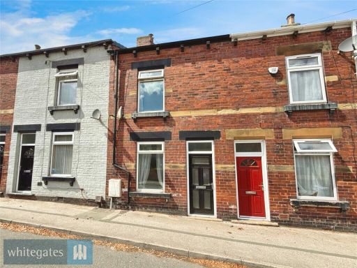 2 bedroom terraced house for sale in St. Johns Road, Cudworth, S72 — £80,000 • 2 bed • 1 bath • 850 ft²
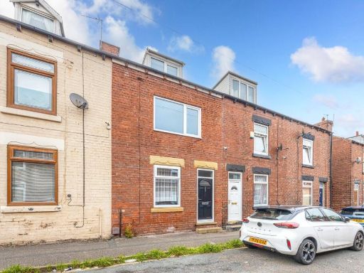 2 bedroom terraced house for sale in Charles Street, Cudworth, Barnsley, S72 — £125,000 • 2 bed • 2 bath • 1005 ft²
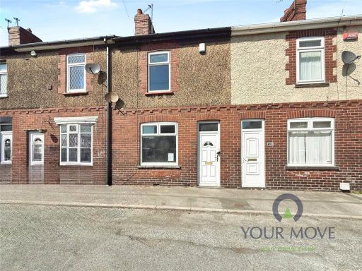 2 bedroom terraced house for sale in Clifford Street, Cudworth, Barnsley, South Yorkshire, S72 — £85,000 • 2 bed • 1 bath • 742 ft²
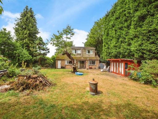 4 bedroom detached bungalow for sale in St. Johns Road, Cudworth, Barnsley, S72 — £300,000 • 4 bed • 2 bath • 1057 ft²
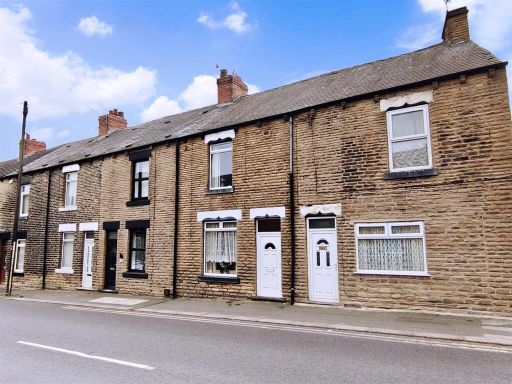 2 bedroom terraced house for sale in Pontefract Road, Cudworth, Barnsley, S72 — £90,000 • 2 bed • 1 bath • 1025 ft²
Meta
- {
"@context": "https://schema.org",
"@type": "Residence",
"name": "2 bedroom terraced house for sale in Snydale Road, Cudworth…",
"description": "",
"url": "https://propertypiper.co.uk/property/273978cd-2d58-4f6d-b2f7-67a93e224ca4",
"image": "https://image-a.propertypiper.co.uk/0707cdba-a55e-4847-95e1-a3b6844fb82e-1024.jpeg",
"address": {
"@type": "PostalAddress",
"streetAddress": "8 SNYDALE ROAD CUDWORTH BARNSLEY",
"postalCode": "S72 8JR",
"addressLocality": "Barnsley",
"addressRegion": "Barnsley East",
"addressCountry": "England"
},
"geo": {
"@type": "GeoCoordinates",
"latitude": 53.57781921659428,
"longitude": -1.4144691337804127
},
"numberOfRooms": 2,
"numberOfBathroomsTotal": 1,
"floorSize": {
"@type": "QuantitativeValue",
"value": 905,
"unitCode": "FTK"
},
"offers": {
"@type": "Offer",
"price": 70000,
"priceCurrency": "GBP",
"availability": "https://schema.org/InStock"
},
"additionalProperty": [
{
"@type": "PropertyValue",
"name": "Feature",
"value": "Victorian"
},
{
"@type": "PropertyValue",
"name": "Feature",
"value": "terraced"
},
{
"@type": "PropertyValue",
"name": "Feature",
"value": "stone facade"
},
{
"@type": "PropertyValue",
"name": "Feature",
"value": "two-storey"
},
{
"@type": "PropertyValue",
"name": "Feature",
"value": "diamond leaded windows"
},
{
"@type": "PropertyValue",
"name": "Feature",
"value": "dense foliage"
},
{
"@type": "PropertyValue",
"name": "Feature",
"value": "maintenance needed"
},
{
"@type": "PropertyValue",
"name": "Feature",
"value": "potential damp"
},
{
"@type": "PropertyValue",
"name": "Feature",
"value": "dated exterior"
},
{
"@type": "PropertyValue",
"name": "Feature",
"value": "overgrown garden"
},
{
"@type": "PropertyValue",
"name": "Feature",
"value": "unkempt"
},
{
"@type": "PropertyValue",
"name": "Feature",
"value": "issues"
},
{
"@type": "PropertyValue",
"name": "Feature",
"value": "maintenance needed"
},
{
"@type": "PropertyValue",
"name": "Feature",
"value": "fence"
},
{
"@type": "PropertyValue",
"name": "Feature",
"value": "suburban"
},
{
"@type": "PropertyValue",
"name": "Feature",
"value": "potential"
},
{
"@type": "PropertyValue",
"name": "Feature",
"value": "neglected"
}
]
}