YO13 9HT - 3 bedroom detached house for sale in Racecourse Road, East…
View on Property Piper
3 bedroom detached house for sale in Racecourse Road,
East Ayton,
Scarborough,
YO13 9HT, YO13
Property Details
- Price: £137498
- Bedrooms: 3
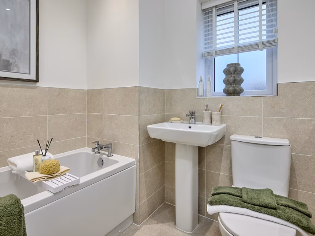
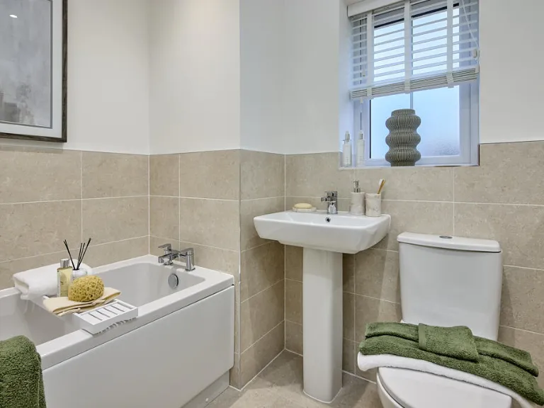
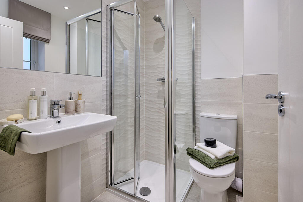
- Bathrooms: 1
- Property Type: undefined
- Property SubType: undefined
Image Descriptions
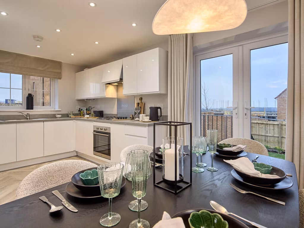
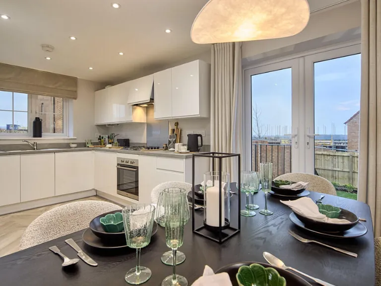
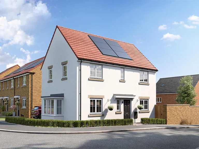
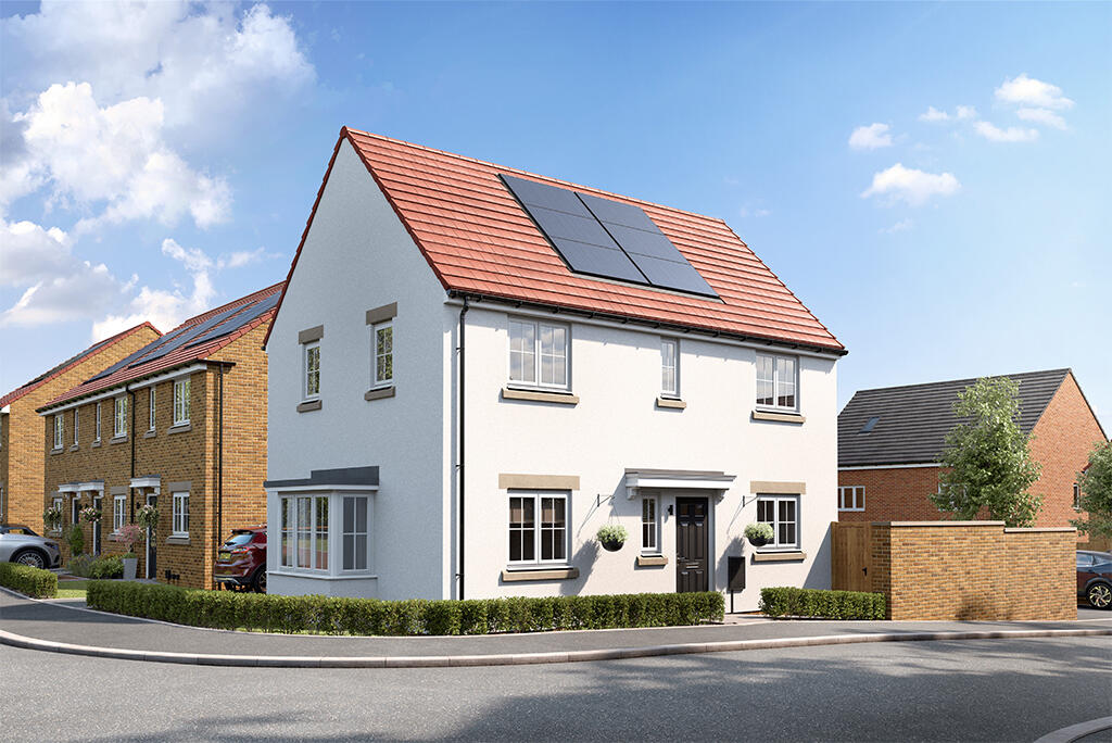
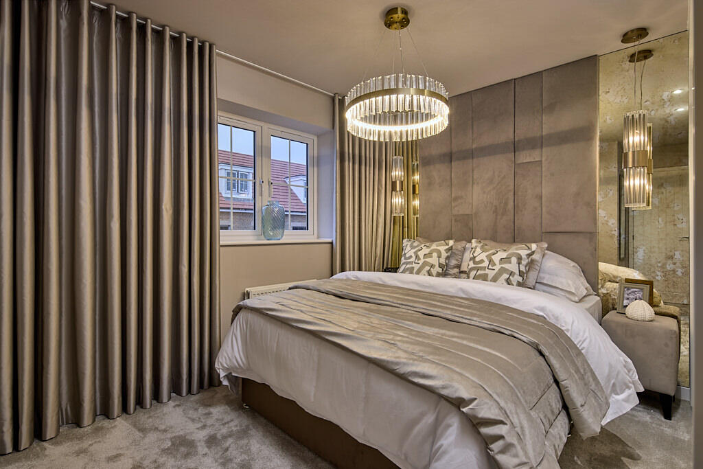
- detached house contemporary
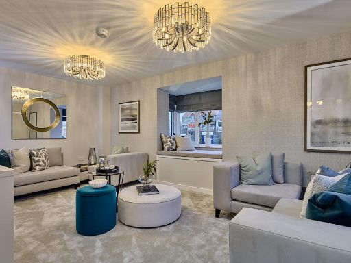
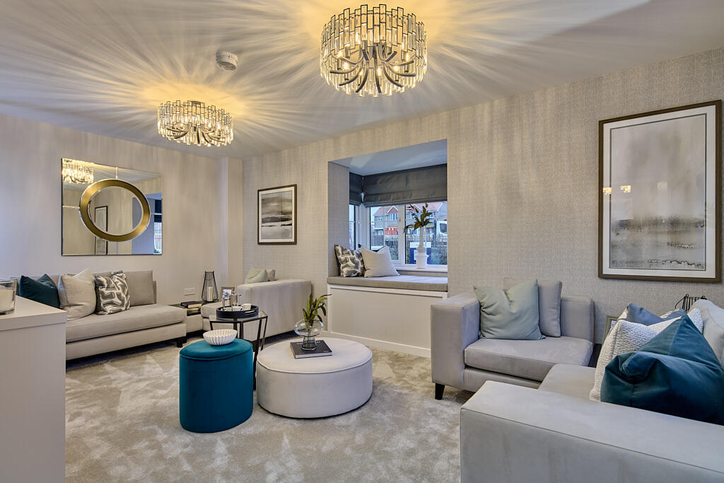
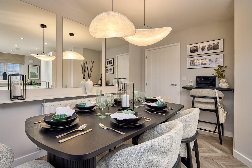
- living room contemporary
Floorplan Description
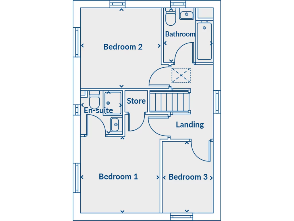
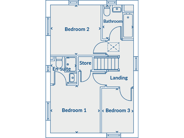
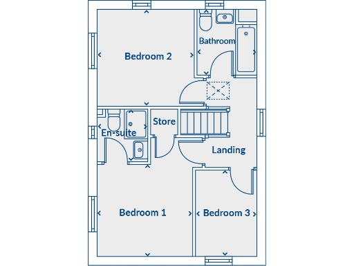
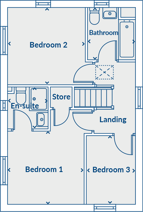
- Plan of a residential floor showing Bedroom 1, Bedroom 2, Bedroom 3, Bathroom, En-suite, Store and Landing.
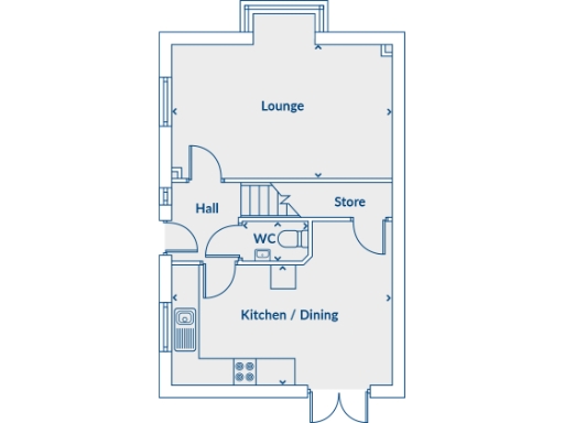
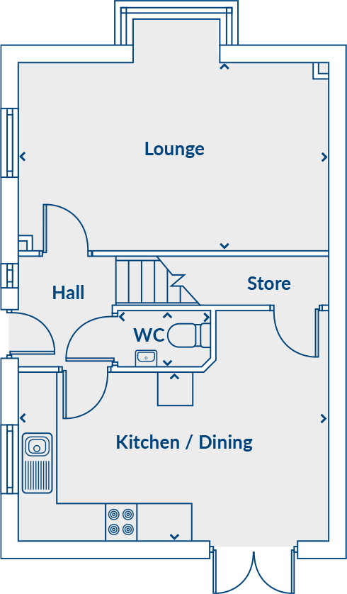
- Floorplan showing a ground-floor layout with Lounge, Kitchen / Dining, Hall, Store, and WC.
- Floor plan showing Bedroom 1, Bedroom 2, Bedroom 3, Bathroom, En-suite, Store and Landing.
- Single-floor residential layout showing Lounge, Kitchen / Dining, Hall, Store, and WC.
Rooms
- Lounge:
- Hall:
- Store:
- WC:
- Kitchen / Dining:
- Bedroom 2:
- Bathroom:
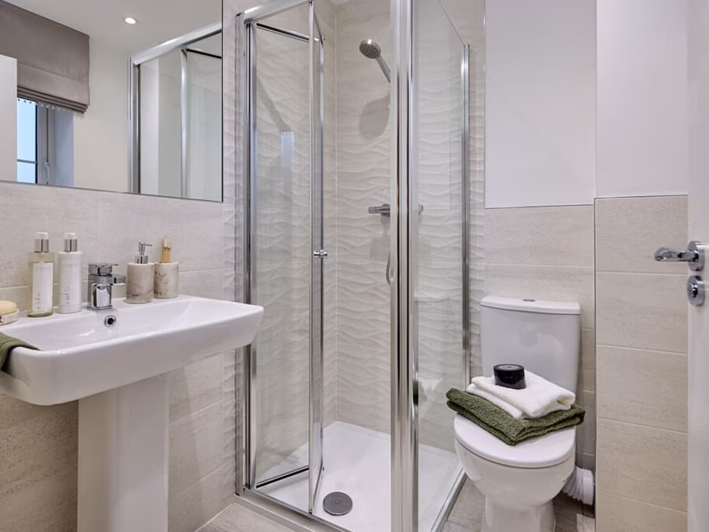
- En-suite:
- Store:
- Landing:
- Bedroom 1:
- Bedroom 3:
- Lounge:
- Hall:
- Store:
- WC:
- Kitchen / Dining:
- Bedroom 2:
- Bathroom:
- En-suite:
- Store:
- Landing:
- Bedroom 1:
- Bedroom 3:
- Lounge:
- Hall:
- Store:
- WC:
- Kitchen / Dining:
- Bedroom 2:
- Bathroom:
- En-suite:
- Store:
- Landing:
- Bedroom 1:
- Bedroom 3:
Textual Property Features
- Is Shared Ownership
- Success
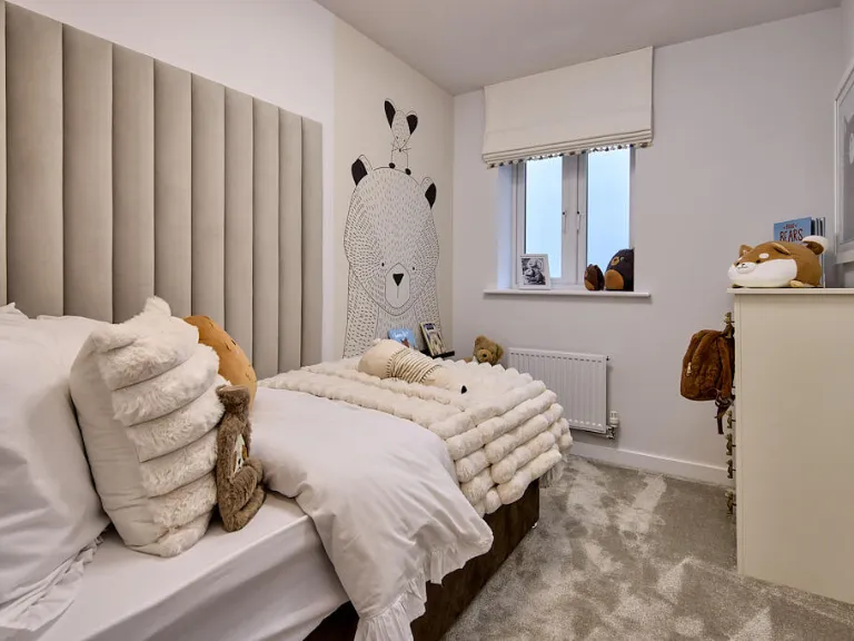
Detected Visual Features
- new build
- detached
- solar panels
- eco-friendly
- modern
- energy efficient
- family home
- garden
- suburban
- contemporary
- spacious
- living room
- ceiling lights
- decorative lighting
- window seat
- soft furnishings
Nearby Schools
- George Pindar School
- St George's Catholic Primary School - a Catholic voluntary academy
- St Augustine's Catholic School - a Catholic voluntary academy
- Graham School
- Gladstone Road Primary School
- Friarage Community Primary School
- Braeburn Primary and Nursery Academy
- East Ayton Community Primary School
- St Martin's Church of England Voluntary Aided Primary School, Scarborough
- Scarborough College
- Scarborough University Technical College
- Newby and Scalby Primary School
- Lindhead School
- Hertford Vale Church of England Voluntary Controlled Primary School, Staxton
- Brompton and Sawdon Community Primary School
- Wheatcroft Community Primary School
- St Peter's Catholic Primary School - a Catholic voluntary academy
- Scalby School
- Seamer and Irton Community Primary School
- Scarborough, Overdale Community Primary School
- Thomas Hinderwell Primary Academy
- Barrowcliff School
- Scarborough, Northstead Community Primary School
Nearest General Shops
- Id: 4238116781
- Tags:
- Addr:
- City: Scarborough
- Country: GB
- Housenumber: 68
- Postcode: YO12 4QD
- Street: Main Street
- Village: Seamer
- Amenity: post_office
- Fhrs:
- Name: Proudfoot eco Store
- Opening_hours:
- Post_office: Mo-Fr 09:00-17:30; Sa 09:00-12:30
- Ref:
- Shop: supermarket
- TagsNormalized:
- Lat: 54.2384724
- Lon: -0.4440139
- FullGeoHash: gcxstcudj8p4
- PartitionGeoHash: gcxs
- Images:
- FoodStandards:
- Id: 197195
- FHRSID: 197195
- LocalAuthorityBusinessID: PI/000016341
- BusinessName: Proudfoot
- BusinessType: Retailers - other
- BusinessTypeID: 4613
- AddressLine1: 68 Main Street
- AddressLine2: Seamer
- AddressLine3: Scarborough
- AddressLine4: North Yorkshire
- PostCode: YO12 4QD
- RatingValue: 5
- RatingKey: fhrs_5_en-GB
- RatingDate: 2022-03-28
- LocalAuthorityCode: 255
- LocalAuthorityName: Scarborough
- LocalAuthorityWebSite: https://www.scarborough.gov.uk/home/business-licensing-and-grants/food-hygiene
- LocalAuthorityEmailAddress: crt@scarborough.gov.uk
- Scores:
- Hygiene: 0
- Structural: 0
- ConfidenceInManagement: 0
- NewRatingPending: false
- Geocode:
- Longitude: -0.44380900000000
- Latitude: 54.23668600000000
- Distance: 2547
,- Id: 956538933
- Tags:
- Building: yes
- Name: Proudfoot
- Shop: supermarket
- TagsNormalized:
- Lat: 54.2384806
- Lon: -0.4440989
- FullGeoHash: gcxstcud59xg
- PartitionGeoHash: gcxs
- Images:
- FoodStandards: null
- Distance: 2542.3
,- Id: 4806389822
- Tags:
- Amenity: restaurant
- Name: Betton Farm Shop
- TagsNormalized:
- restaurant
- farm
- farm shop
- shop
- Lat: 54.2544014
- Lon: -0.4679425
- FullGeoHash: gcxstkeqb1ky
- PartitionGeoHash: gcxs
- Images:
- FoodStandards: null
- Distance: 363
}
Nearest Grocery shops
- Id: 8337907667
- Tags:
- Name: One Stop Shop
- Shop: convenience
- TagsNormalized:
- Lat: 54.2410722
- Lon: -0.4230636
- FullGeoHash: gcxsw67cjusy
- PartitionGeoHash: gcxs
- Images:
- FoodStandards: null
- Distance: 3555.5
,- Id: 4238117998
- Tags:
- Name: Seamer Stores
- Shop: convenience
- TagsNormalized:
- Lat: 54.2394847
- Lon: -0.4443682
- FullGeoHash: gcxstcurvkz1
- PartitionGeoHash: gcxs
- Images:
- FoodStandards: null
- Distance: 2456.1
,- Id: 4176360594
- Tags:
- Addr:
- City: East Ayton
- Country: GB
- Housenumber: 13,14
- Postcode: YO13 9HL
- Street: Main Street
- Brand: Spar
- Brand:wikidata: Q610492
- Brand:wikipedia: en:Spar (retailer)
- Fhrs:
- Name: Spar
- Shop: convenience
- TagsNormalized:
- Lat: 54.2497681
- Lon: -0.4821964
- FullGeoHash: gcxst5bgu18r
- PartitionGeoHash: gcxs
- Images:
- FoodStandards:
- Id: 197244
- FHRSID: 197244
- LocalAuthorityBusinessID: PI/000001296
- BusinessName: Spar Shop And Petrol Filling Station
- BusinessType: Retailers - other
- BusinessTypeID: 4613
- AddressLine1: 13-14 Main Street
- AddressLine2: East Ayton
- AddressLine3: Scarborough
- AddressLine4: North Yorkshire
- PostCode: YO13 9HL
- RatingValue: 5
- RatingKey: fhrs_5_en-GB
- RatingDate: 2022-10-05
- LocalAuthorityCode: 255
- LocalAuthorityName: Scarborough
- LocalAuthorityWebSite: https://www.scarborough.gov.uk/home/business-licensing-and-grants/food-hygiene
- LocalAuthorityEmailAddress: crt@scarborough.gov.uk
- Scores:
- Hygiene: 0
- Structural: 5
- ConfidenceInManagement: 0
- NewRatingPending: false
- Geocode:
- Longitude: -0.48135300000000
- Latitude: 54.25012600000000
- Distance: 717
}
Nearest Religious buildings
- Id: 889583373
- Tags:
- Amenity: place_of_worship
- Building: yes
- Denomination: methodist
- Name: East Ayton Methodist Church
- Religion: christian
- TagsNormalized:
- place of worship
- methodist
- church
- christian
- Lat: 54.2488218
- Lon: -0.4856246
- FullGeoHash: gcxssgwqk1k5
- PartitionGeoHash: gcxs
- Images:
- FoodStandards: null
- Distance: 959.5
,- Id: 4176360593
- Tags:
- Addr:
- City: East Ayton
- Postcode: YO13 9JE
- Street: Pickering Road
- Amenity: place_of_worship
- Denomination: methodist
- Name: East Ayton Methodist Church
- Religion: christian
- TagsNormalized:
- place of worship
- methodist
- church
- christian
- Lat: 54.2488183
- Lon: -0.4856086
- FullGeoHash: gcxssgwqk2xy
- PartitionGeoHash: gcxs
- Images:
- FoodStandards: null
- Distance: 958.9
,- Id: 390544589
- Tags:
- Amenity: place_of_worship
- Building: church
- Denomination: anglican
- Name: St John the Baptist
- Religion: christian
- Wikidata: Q17540955
- TagsNormalized:
- place of worship
- church
- anglican
- baptist
- christian
- Lat: 54.2506744
- Lon: -0.4799524
- FullGeoHash: gcxsth49069w
- PartitionGeoHash: gcxs
- Images:
- FoodStandards: null
- Distance: 540
}
Nearest Medical buildings
- Id: 229554411
- Tags:
- Addr:
- City: Scarborough
- Country: GB
- Postcode: YO12 6QL
- Street: Woodlands Drive
- Amenity: hospital
- Designation: Scarborough & North East Yorkshire NHS Hospital
- Emergency: yes
- Internet_access: wlan
- Name: Scarborough Hospital
- Opening_hours: 24/7
- Phone: +44 1723 368111
- Short_name: Scarborough Hospital
- Toilets:
- Website: https://www.yorkhospitals.nhs.uk/our-hospitals/scarborough-hospital
- Wheelchair: yes
- TagsNormalized:
- Lat: 54.2821821
- Lon: -0.4360362
- FullGeoHash: gcxsy1f2xs5u
- PartitionGeoHash: gcxs
- Images:
- FoodStandards: null
- Distance: 3993.5
,- Id: 8341897417
- Tags:
- Amenity: pharmacy
- Dispensing: yes
- Healthcare: pharmacy
- TagsNormalized:
- Lat: 54.2460747
- Lon: -0.4938009
- FullGeoHash: gcxssg0qm95r
- PartitionGeoHash: gcxs
- Images:
- FoodStandards: null
- Distance: 1571.3
,- Id: 795422822
- Tags:
- Addr:
- City: West Ayton
- Housenumber: 53
- Postcode: YO13 9JF
- Street: Pickering Road
- Amenity: doctors
- Building: yes
- Healthcare: doctor
- Name: West Ayton Surgery
- TagsNormalized:
- doctor
- doctors
- health
- healthcare
- surgery
- Lat: 54.2460049
- Lon: -0.4936088
- FullGeoHash: gcxssg0tfh4x
- PartitionGeoHash: gcxs
- Images:
- FoodStandards: null
- Distance: 1565
,- Id: 4176360601
- Tags:
- Addr:
- City: East Ayton
- Postcode: YO13 9HL
- Street: Main Street
- Amenity: pharmacy
- Name: Delivery Chemist
- TagsNormalized:
- Lat: 54.2501677
- Lon: -0.4819603
- FullGeoHash: gcxst5cn1s0r
- PartitionGeoHash: gcxs
- Images:
- FoodStandards: null
- Distance: 678.5
}
Nearest Leisure Facilities
- Id: 946523368
- Tags:
- Leisure: pitch
- Sport: tennis
- TagsNormalized:
- Lat: 54.2436748
- Lon: -0.48418
- FullGeoHash: gcxssfz2mcch
- PartitionGeoHash: gcxs
- Images:
- FoodStandards: null
- Distance: 1312.2
,- Id: 946523369
- Tags:
- Leisure: pitch
- Sport: tennis
- TagsNormalized:
- Lat: 54.2437391
- Lon: -0.4839993
- FullGeoHash: gcxssfz89vzg
- PartitionGeoHash: gcxs
- Images:
- FoodStandards: null
- Distance: 1299.9
,- Id: 390544600
- Tags:
- Leisure: pitch
- Sport: bowls
- TagsNormalized:
- Lat: 54.2480817
- Lon: -0.4849727
- FullGeoHash: gcxssgwcgr6h
- PartitionGeoHash: gcxs
- Images:
- FoodStandards: null
- Distance: 974.8
,- Id: 390544580
- Tags:
- TagsNormalized:
- Lat: 54.2493162
- Lon: -0.4818005
- FullGeoHash: gcxst5c1jjx8
- PartitionGeoHash: gcxs
- Images:
- FoodStandards: null
- Distance: 728.8
,- Id: 1087246117
- Tags:
- TagsNormalized:
- Lat: 54.2544291
- Lon: -0.465716
- FullGeoHash: gcxstksyun8g
- PartitionGeoHash: gcxs
- Images:
- FoodStandards: null
- Distance: 505.3
}
Nearest Tourist attractions
- Id: 946523379
- Tags:
- Fixme: Survey for details
- Tourism: caravan_site
- TagsNormalized:
- Lat: 54.2463697
- Lon: -0.5007255
- FullGeoHash: gcxsse72h20p
- PartitionGeoHash: gcxs
- Images:
- FoodStandards: null
- Distance: 1952.2
,- Id: 866319869
- Tags:
- Name: Riverside Caravan Park
- Tourism: camp_site
- TagsNormalized:
- Lat: 54.2445503
- Lon: -0.4790797
- FullGeoHash: gcxst4gjkth6
- PartitionGeoHash: gcxs
- Images:
- FoodStandards: null
- Distance: 1077.2
,- Id: 577968611
- Tags:
- Addr:
- City: Scarborough
- Postcode: YO13 9JD
- Street: Cockrah Road
- Name: Scarborough West Ayton Club Site
- Operator: The Caravan Club
- Tourism: caravan_site
- TagsNormalized:
- Lat: 54.2538478
- Lon: -0.4875839
- FullGeoHash: gcxssusgw6r0
- PartitionGeoHash: gcxs
- Images:
- FoodStandards: null
- Distance: 923
}
Nearest Train stations
- Id: 12709995
- Tags:
- Name: Newton Dale
- Public_transport: station
- Railway: station
- Usage: tourism
- Wikidata: Q7020211
- Wikipedia: en:Newton Dale Halt railway station
- TagsNormalized:
- Lat: 54.3424545
- Lon: -0.7177548
- FullGeoHash: gcxmpstrepep
- PartitionGeoHash: gcxm
- Images:
- FoodStandards: null
- Distance: 18680.9
,- Id: 3711894543
- Tags:
- Name: Filey
- Naptan:
- Network: National Rail
- Operator: Northern
- Platforms: 2
- Public_transport: station
- Railway: station
- Ref:
- Source: npe
- Wikipedia: en:Filey railway station
- TagsNormalized:
- Lat: 54.2098083
- Lon: -0.2938604
- FullGeoHash: gcxu3kd5089y
- PartitionGeoHash: gcxu
- Images:
- FoodStandards: null
- Distance: 12645
,- Id: 2865967713
- Tags:
- Name: Scalby Mills
- Public_transport: station
- Railway: station
- Usage: tourism
- Wheelchair: limited
- TagsNormalized:
- Lat: 54.3009398
- Lon: -0.410949
- FullGeoHash: gcxsythvbhy5
- PartitionGeoHash: gcxs
- Images:
- FoodStandards: null
- Distance: 6639.4
,- Id: 2865970573
- Tags:
- Name: Peasholm
- Public_transport: station
- Railway: station
- Usage: tourism
- TagsNormalized:
- Lat: 54.2929426
- Lon: -0.4113865
- FullGeoHash: gcxsyesrmfpc
- PartitionGeoHash: gcxs
- Images:
- FoodStandards: null
- Distance: 5940.9
,- Id: 73054111
- Tags:
- Name: Scarborough
- Naptan:
- Network: National Rail
- Operator: First Transpennine Express
- Public_transport: station
- Railway: station
- Ref:
- Toilets:
- Train: yes
- Wheelchair: yes
- Wikipedia: en:Scarborough railway station
- TagsNormalized:
- Lat: 54.2799474
- Lon: -0.4056223
- FullGeoHash: gcxsyc2es7d4
- PartitionGeoHash: gcxs
- Images:
- FoodStandards: null
- Distance: 5283.3
}
Nearest Bus stations and stops
- Id: 7881857388
- Tags:
- Bench: yes
- Bin: yes
- Bus: yes
- Highway: bus_stop
- Public_transport: platform
- Shelter: yes
- TagsNormalized:
- Lat: 54.2808422
- Lon: -0.4283323
- FullGeoHash: gcxsy380g4kk
- PartitionGeoHash: gcxs
- Images:
- FoodStandards: null
- Distance: 4207.3
,- Id: 4977707910
- Tags:
- Bus: yes
- Highway: bus_stop
- Public_transport: platform
- Shelter: yes
- TagsNormalized:
- Lat: 54.2741788
- Lon: -0.4255059
- FullGeoHash: gcxsy264hbpz
- PartitionGeoHash: gcxs
- Images:
- FoodStandards: null
- Distance: 3857.3
,- Id: 4238116776
- Tags:
- Bus: yes
- Highway: bus_stop
- Public_transport: platform
- Shelter: yes
- TagsNormalized:
- Lat: 54.239013
- Lon: -0.443743
- FullGeoHash: gcxstcuvhhc5
- PartitionGeoHash: gcxs
- Images:
- FoodStandards: null
- Distance: 2521
,- Id: 9883492614
- Tags:
- Bus: yes
- Highway: bus_stop
- Public_transport: platform
- TagsNormalized:
- Lat: 54.2409778
- Lon: -0.44361
- FullGeoHash: gcxstfkbx5h7
- PartitionGeoHash: gcxs
- Images:
- FoodStandards: null
- Distance: 2392.7
,- Id: 9883492615
- Tags:
- Bus: yes
- Highway: bus_stop
- Public_transport: platform
- TagsNormalized:
- Lat: 54.2410911
- Lon: -0.4434885
- FullGeoHash: gcxstfm13bpp
- PartitionGeoHash: gcxs
- Images:
- FoodStandards: null
- Distance: 2391.8
}
Nearest Hotels
- Id: 6226953753
- Tags:
- Addr:
- City: Scarborough
- Housenumber: 43
- Postcode: YO11 2LX
- Street: Valley Road
- Name: Ashburton Hotel
- Tourism: hotel
- TagsNormalized:
- Lat: 54.2751419
- Lon: -0.4080964
- FullGeoHash: gcxsy8qzdev2
- PartitionGeoHash: gcxs
- Images:
- FoodStandards: null
- Distance: 4867
,- Id: 6262434219
- Tags:
- Addr:
- City: Scarborough
- Postcode: YO12 4DX
- Street: West Bank
- Name: Green Gables
- Tourism: hotel
- TagsNormalized:
- Lat: 54.2736115
- Lon: -0.4186134
- FullGeoHash: gcxsy2pntw7p
- PartitionGeoHash: gcxs
- Images:
- FoodStandards: null
- Distance: 4192.7
,- Id: 174898118
- Tags:
- Addr:
- City: Wykeham
- Postcode: YO13 9QB
- Building: yes
- Name: Downe Arms Hotel
- Source: Bing
- Tourism: hotel
- TagsNormalized:
- Lat: 54.2369122
- Lon: -0.5220509
- FullGeoHash: gcxss1ebgm4x
- PartitionGeoHash: gcxs
- Images:
- FoodStandards: null
- Distance: 3669.2
}
Tags
- new build
- detached
- solar panels
- eco-friendly
- modern
- energy efficient
- family home
- garden
- suburban
- contemporary
- modern
- spacious
- living room
- ceiling lights
- decorative lighting
- window seat
- soft furnishings
Local Market Stats
- Average Price/sqft: £253
- Avg Income: £42900
- Social Housing: 3%
- Planning Success Rate: 77%
AirBnB Data
- 1km average: £84/night
- Listings in 1km: 2
Similar Properties
 3 bedroom detached house for sale in Racecourse Road,
East Ayton,
Scarborough,
YO13 9HT, YO13 — £137,498 • 3 bed • 1 bath • 954 ft²
3 bedroom detached house for sale in Racecourse Road,
East Ayton,
Scarborough,
YO13 9HT, YO13 — £137,498 • 3 bed • 1 bath • 954 ft² 3 bedroom house for sale in Racecourse Road,
East Ayton,
Scarborough,
YO13 9HT, YO13 — £124,997 • 3 bed • 1 bath • 1015 ft²
3 bedroom house for sale in Racecourse Road,
East Ayton,
Scarborough,
YO13 9HT, YO13 — £124,997 • 3 bed • 1 bath • 1015 ft²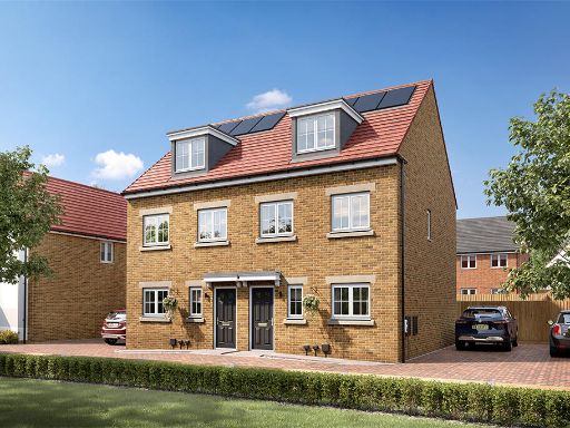 3 bedroom house for sale in Racecourse Road,
East Ayton,
Scarborough,
YO13 9HT, YO13 — £249,995 • 3 bed • 1 bath • 1015 ft²
3 bedroom house for sale in Racecourse Road,
East Ayton,
Scarborough,
YO13 9HT, YO13 — £249,995 • 3 bed • 1 bath • 1015 ft² 3 bedroom detached house for sale in Racecourse Road,
East Ayton,
Scarborough,
YO13 9HT, YO13 — £274,995 • 3 bed • 1 bath • 954 ft²
3 bedroom detached house for sale in Racecourse Road,
East Ayton,
Scarborough,
YO13 9HT, YO13 — £274,995 • 3 bed • 1 bath • 954 ft² 3 bedroom house for sale in Racecourse Road,
East Ayton,
Scarborough,
YO13 9HT, YO13 — £249,995 • 3 bed • 1 bath • 1015 ft²
3 bedroom house for sale in Racecourse Road,
East Ayton,
Scarborough,
YO13 9HT, YO13 — £249,995 • 3 bed • 1 bath • 1015 ft²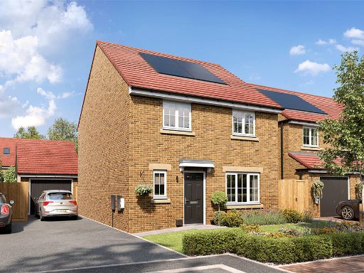 4 bedroom detached house for sale in Racecourse Road,
East Ayton,
Scarborough,
YO13 9HT, YO13 — £157,498 • 4 bed • 1 bath • 1153 ft²
4 bedroom detached house for sale in Racecourse Road,
East Ayton,
Scarborough,
YO13 9HT, YO13 — £157,498 • 4 bed • 1 bath • 1153 ft²
Meta
- {
"@context": "https://schema.org",
"@type": "Residence",
"name": "3 bedroom detached house for sale in Racecourse Road, East…",
"description": "",
"url": "https://propertypiper.co.uk/property/26eb0f89-f66b-4011-b88d-1b0a51f08f24",
"image": "https://image-a.propertypiper.co.uk/8ac0b4cc-ebff-41bb-ac48-772888b9a959-1024.jpeg",
"address": {
"@type": "PostalAddress",
"streetAddress": "61 RACECOURSE ROAD EAST AYTON SCARBOROUGH",
"postalCode": "YO13 9HT",
"addressLocality": "Scarborough",
"addressRegion": "Scarborough and Whitby",
"addressCountry": "England"
},
"geo": {
"@type": "GeoCoordinates",
"latitude": 54.2536468,
"longitude": -0.4733791
},
"numberOfRooms": 3,
"numberOfBathroomsTotal": 1,
"floorSize": {
"@type": "QuantitativeValue",
"value": 954,
"unitCode": "FTK"
},
"offers": {
"@type": "Offer",
"price": 137498,
"priceCurrency": "GBP",
"availability": "https://schema.org/InStock"
},
"additionalProperty": [
{
"@type": "PropertyValue",
"name": "Feature",
"value": "new build"
},
{
"@type": "PropertyValue",
"name": "Feature",
"value": "detached"
},
{
"@type": "PropertyValue",
"name": "Feature",
"value": "solar panels"
},
{
"@type": "PropertyValue",
"name": "Feature",
"value": "eco-friendly"
},
{
"@type": "PropertyValue",
"name": "Feature",
"value": "modern"
},
{
"@type": "PropertyValue",
"name": "Feature",
"value": "energy efficient"
},
{
"@type": "PropertyValue",
"name": "Feature",
"value": "family home"
},
{
"@type": "PropertyValue",
"name": "Feature",
"value": "garden"
},
{
"@type": "PropertyValue",
"name": "Feature",
"value": "suburban"
},
{
"@type": "PropertyValue",
"name": "Feature",
"value": "contemporary"
},
{
"@type": "PropertyValue",
"name": "Feature",
"value": "modern"
},
{
"@type": "PropertyValue",
"name": "Feature",
"value": "spacious"
},
{
"@type": "PropertyValue",
"name": "Feature",
"value": "living room"
},
{
"@type": "PropertyValue",
"name": "Feature",
"value": "ceiling lights"
},
{
"@type": "PropertyValue",
"name": "Feature",
"value": "decorative lighting"
},
{
"@type": "PropertyValue",
"name": "Feature",
"value": "window seat"
},
{
"@type": "PropertyValue",
"name": "Feature",
"value": "soft furnishings"
}
]
}
High Res Floorplan Images
Compatible Floorplan Images
FloorplanImages Thumbnail