RG8 8NY - 5 bedroom detached bungalow for sale in Emery Acres, Upper…
View on Property Piper
5 bedroom detached bungalow for sale in Emery Acres, Upper Basildon, RG8
Property Details
- Price: £865000
- Bedrooms: 5
- Bathrooms: 3
- Property Type: undefined
- Property SubType: undefined
Brochure Descriptions
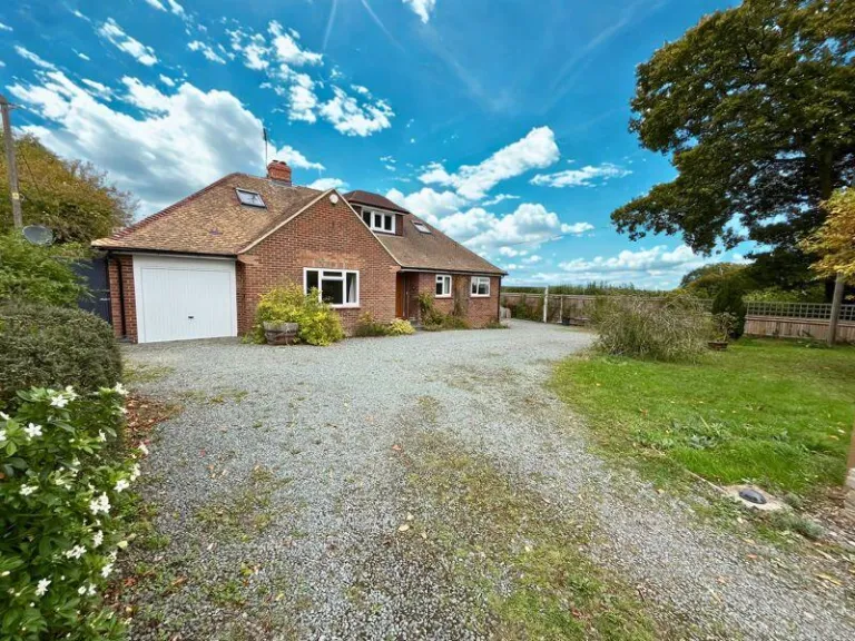
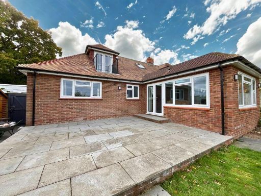
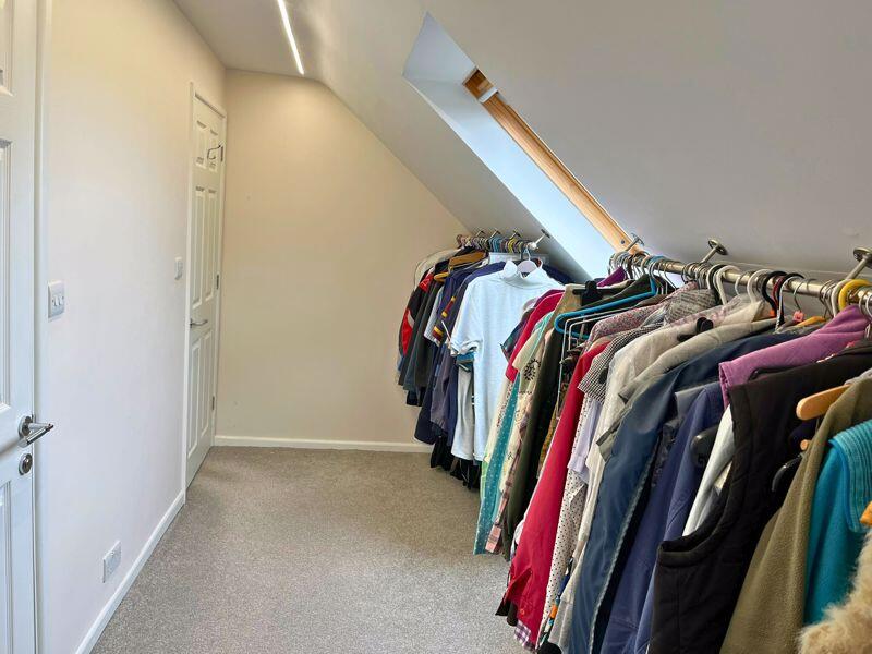
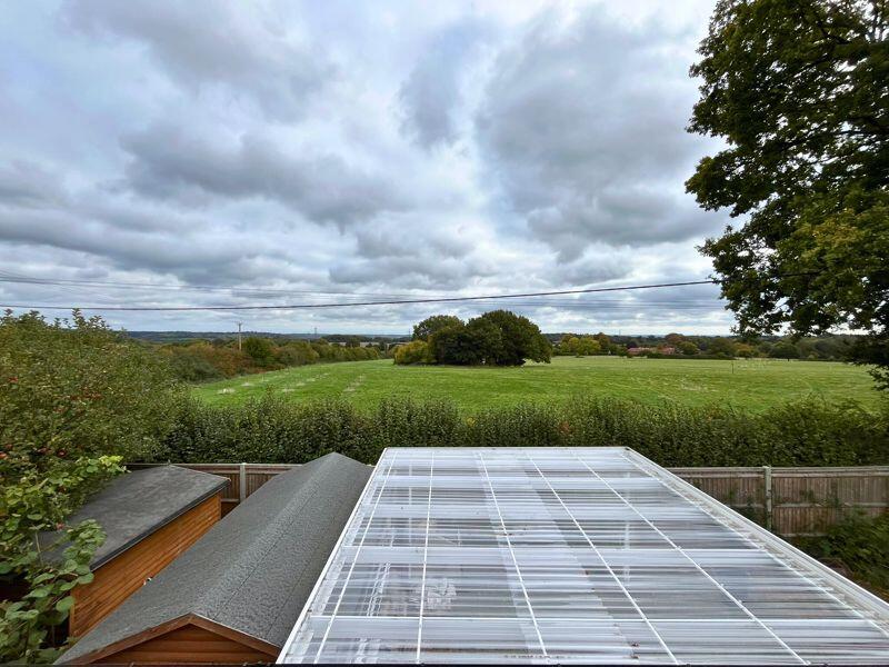
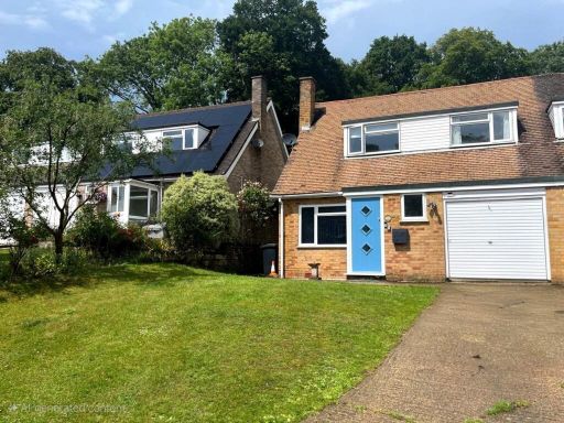
- Detached dormer-style bungalow with integral single garage set back from the lane behind a large gravel driveway and lawned front garden. The property appears to occupy a generous plot with good amenity space to the side and rear and benefits from a rural/edge-of-village aspect with open countryside views beyond the rear boundary. Brick construction with pitched tiled roof, dormer windows and attic conversions indicated by rooflights. Overall the house is likely a 2–4 bedroom adaptable family home (ground-floor principal accommodation with first-floor/dormer rooms). Plot/garden size: large; driveway/parking: substantial parking for multiple cars. Condition appears well-maintained externally but would benefit from internal inspection to confirm finish and layout before valuation.
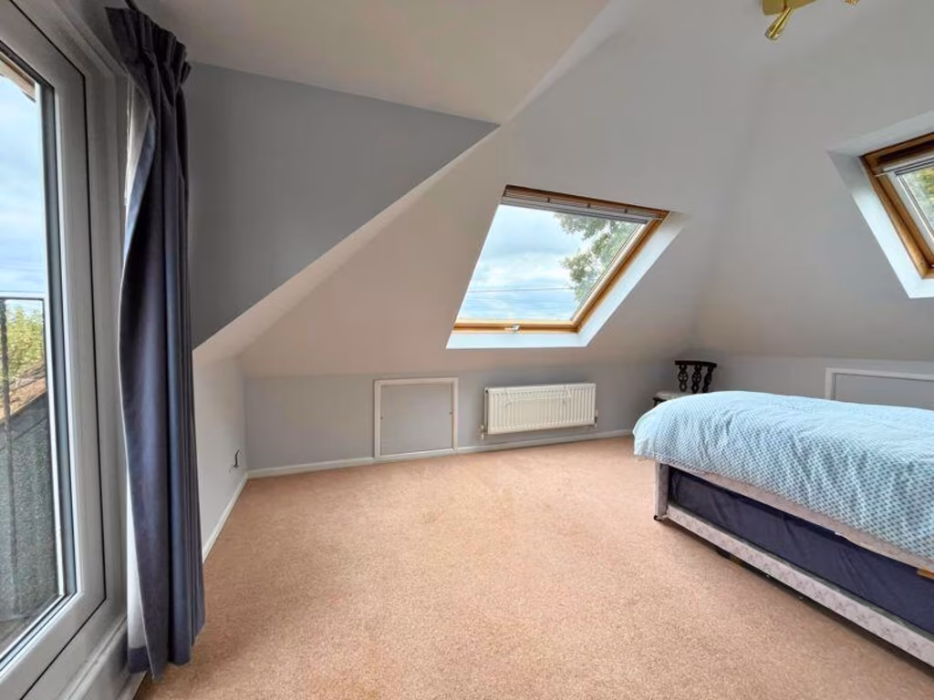
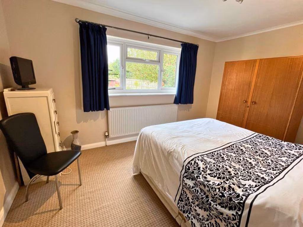
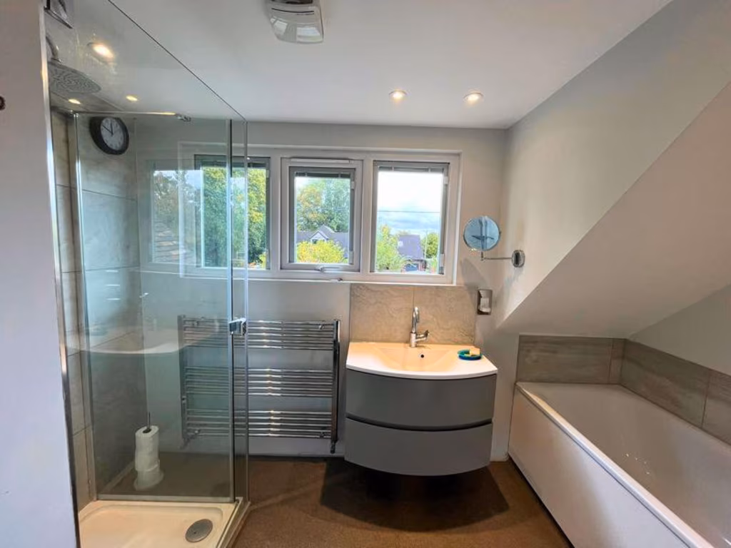
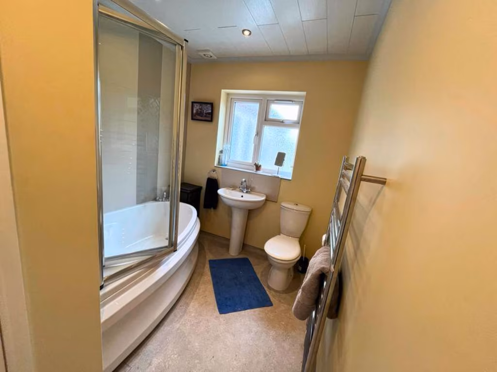
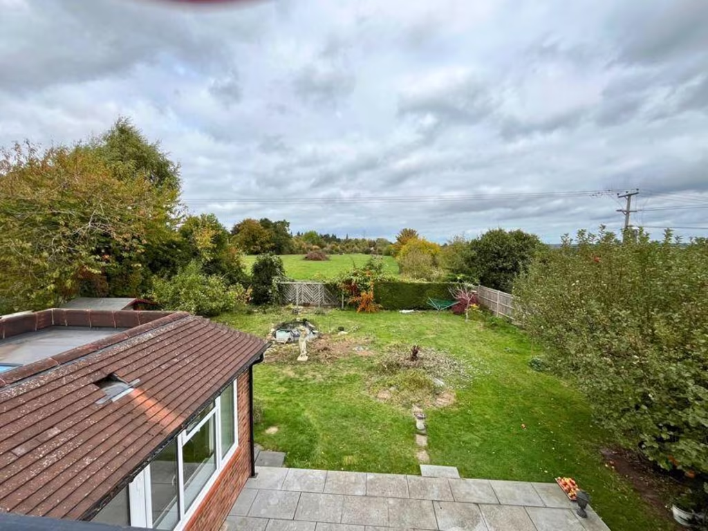
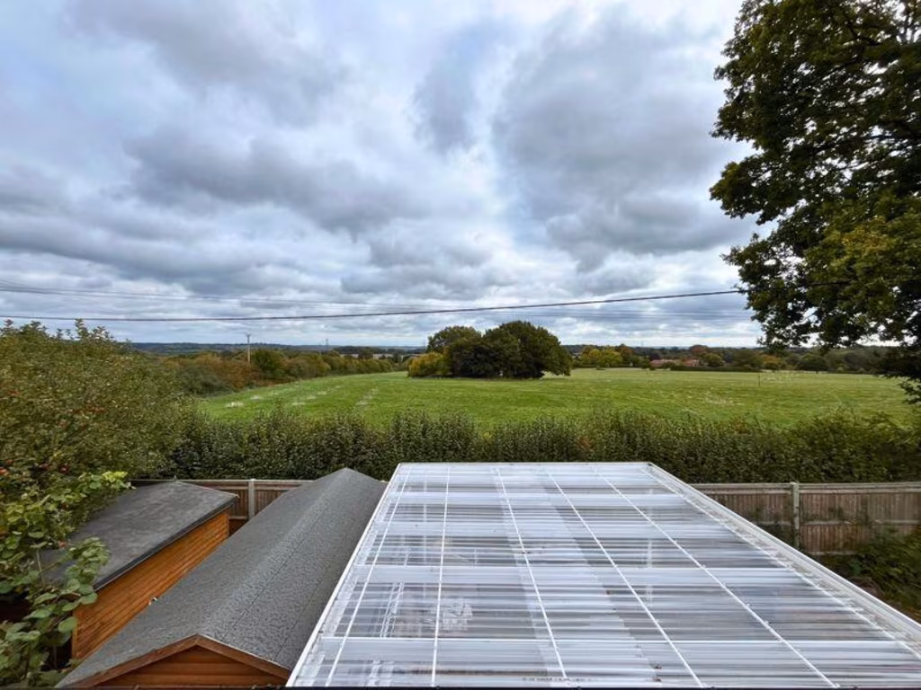
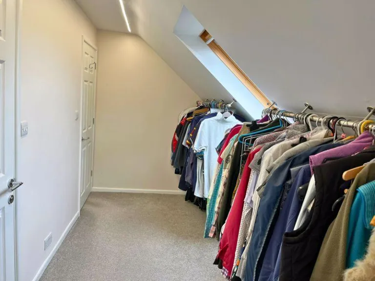
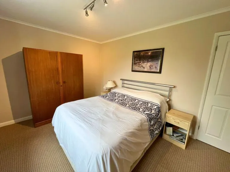
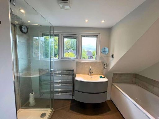
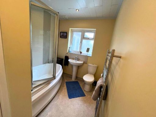
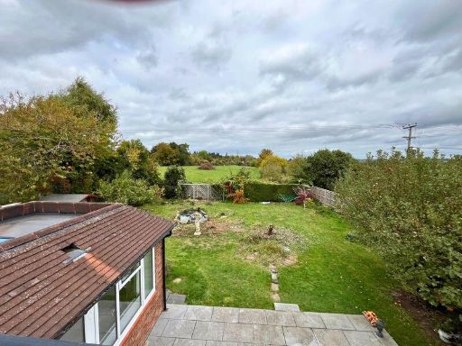
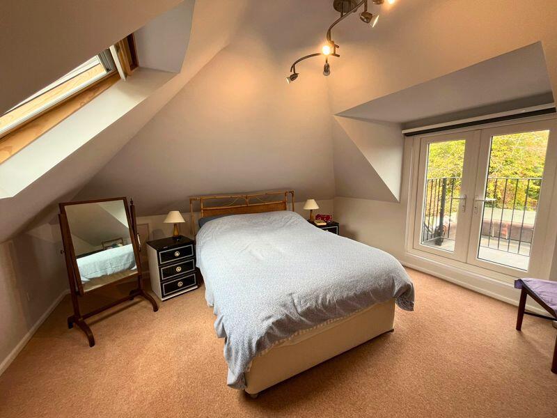
- Detached/semidetached residential dwelling presented over at least two storeys with attic accommodation. Photos show two well-proportioned double bedrooms (one within the roof space with sloped ceilings and juliette/mini balcony) finished with neutral carpets and fittings — bedrooms are medium to large in size. The principal bathroom is modern with separate walk-in shower, contemporary basin unit and separate bath. Externally the rear garden is large/very large with open outlook over fields/greenbelt, low boundary fencing and potential for landscaping or extension (subject to planning). Overall the property appears to offer comfortable family accommodation with good natural light, modern sanitary fittings and generous garden amenity — suitable for purchasers seeking a home with off-street living space and countryside views.
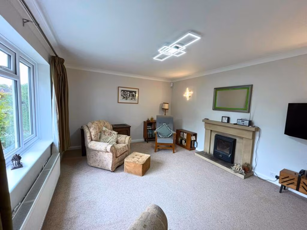
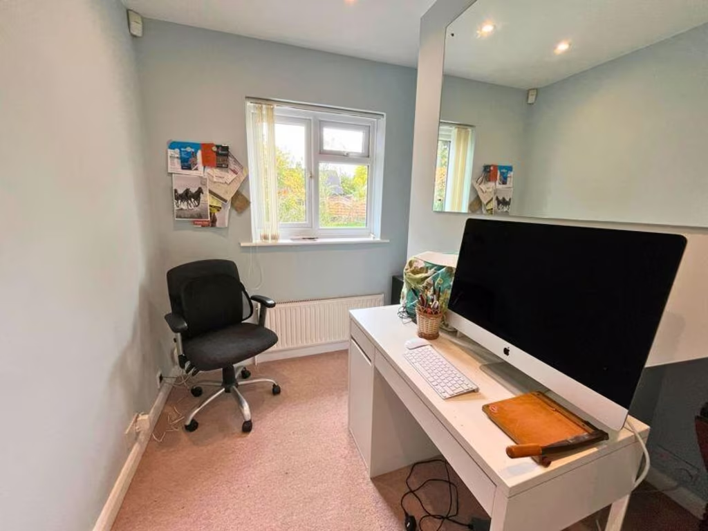
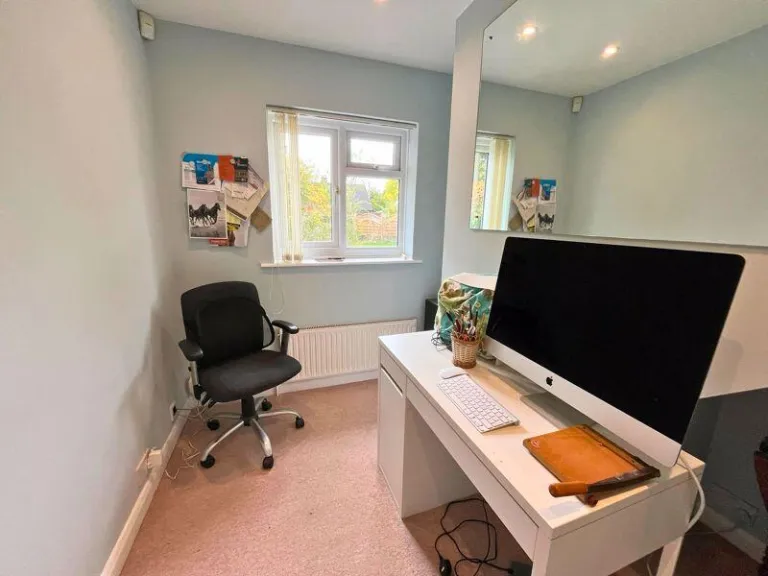
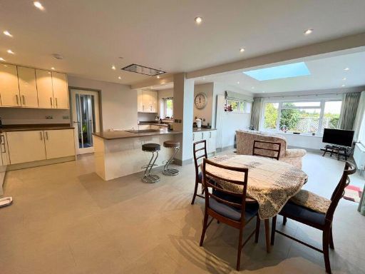
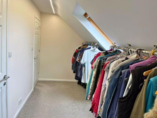
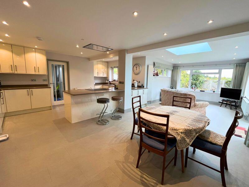
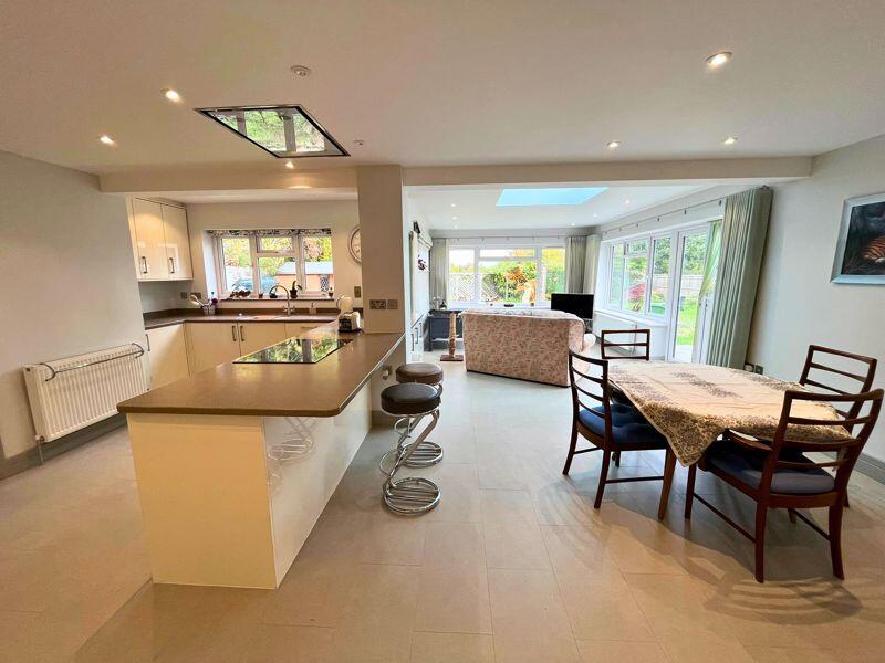
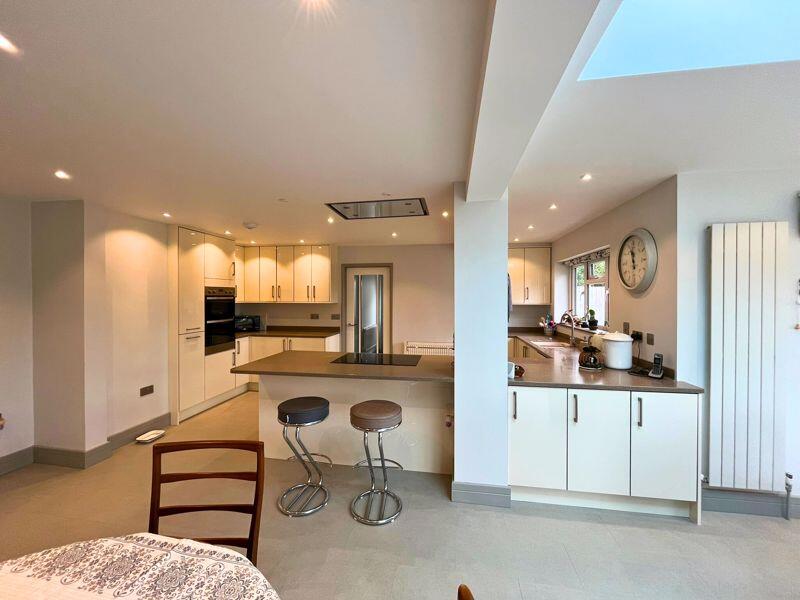
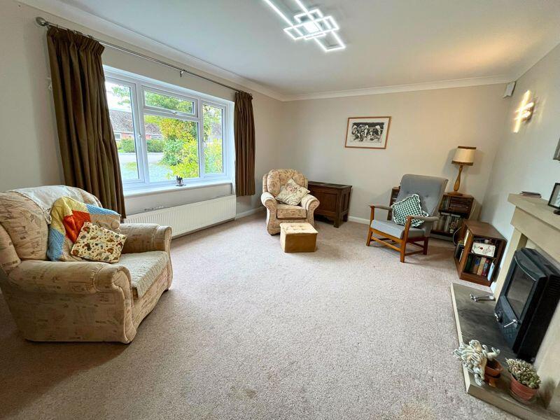
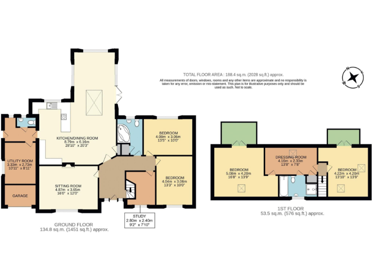
- A well-presented, thoughtfully extended 4–5 bedroom detached bungalow occupying a prominent corner plot of approximately one third of an acre (as stated). Located at the end of a quiet cul‑de‑sac in the sought‑after village of Upper Basildon, the property benefits from private, south‑west facing gardens with unspoilt scenic views. Accommodation arranged over ground and first floor provides good-sized living spaces: entrance hall, sitting room with open fireplace, large open-plan/fitted kitchen with dining and sitting areas (contemporary finish and generous footprint), utility room and cloakroom, plus a study and two double bedrooms and a bathroom on the ground floor. The first floor includes two further double bedrooms, a bathroom with separate shower and a 13' dressing room. Outside there is an attached double carport and a broad driveway providing parking for several vehicles. Overall the house presents as a substantial family home on a large plot with private gardens, modernised interiors (including UPVC double glazing and oil-fired radiator heating) and strong potential for purchasers seeking a village location with easy access to the M4 and nearby Pangbourne.
Image Descriptions
- detached house Mid-20th Century
- open plan kitchen and dining area contemporary
Rooms
- KITCHEN/DINING ROOM:
- UTILITY ROOM:
- SITTING ROOM:
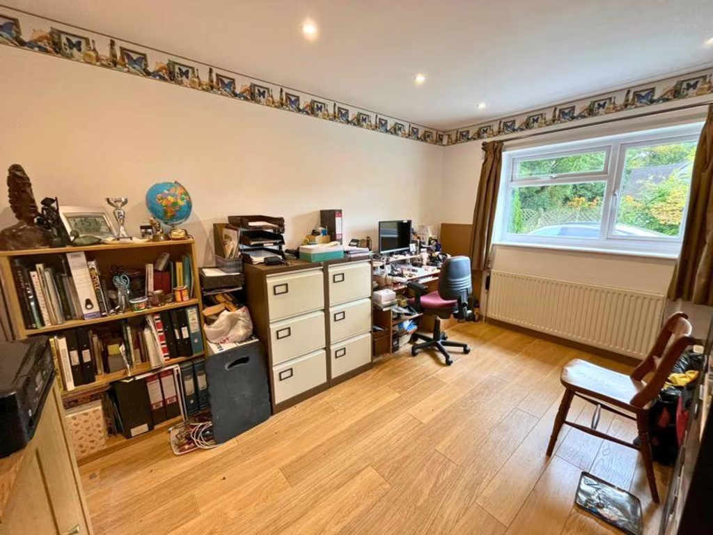
- STUDY:
- BEDROOM:
- BEDROOM:
- BEDROOM:
- DRESSING ROOM:
- BEDROOM:
Textual Property Features
Detected Visual Features
- detached
- brick
- garage
- garden
- bungalow
- driveway
- dormer
- countryside
- suburban
- contemporary
- open plan
- kitchen
- dining area
- modern
- spacious
- skylight
- natural light
- neutral colors
EPC Details
- Fully double glazed
- Cavity wall, filled cavity
- Air source heat pump, radiators, electric
- Low energy lighting in all fixed outlets
- Suspended, no insulation (assumed)
Nearby Schools
- Bradfield C.E. Primary School
- Theale C.E. Primary School
- Springfield Primary School
- Denefield School
- Long Lane Primary School
- Purley CofE Primary School
- Goring Church of England Aided Primary School
- Cranford House School Trust Limited
- St Andrew's School
- Yattendon C.E. Primary School
- Pangbourne Primary School
- Whitchurch Primary School
- Beenham Primary School
- Theale Green School
- Englefield C.E. Primary School
- Little Heath School
- Oratory Preparatory School
- The Oratory School
- South Stoke Primary School
- Bradfield College
- Downsway Primary School
- Pangbourne College
- Hampstead Norreys C.E. Primary School
- Basildon C.E. Primary School
- Streatley C.E. Voluntary Controlled School
- Langtree School
- Woodcote Primary School
- Moulsford Preparatory School
Nearest Bars And Restaurants
- Id: 353733842
- Tags:
- Addr:
- Housename: The Swan
- Place: Pangbourne
- Postcode: RG8 7DU
- Street: Shooter's Hill
- Amenity: pub
- Building: yes
- Email: info@swanpangbourne.co.uk
- Name: The Swan
- Outdoor_seating: yes
- Phone: +44 1189844494
- Website: http://www.metropolitanpubcompany.com/our-pubs/the-swan/
- Wikidata: Q26475969
- TagsNormalized:
- Lat: 51.4861179
- Lon: -1.0902356
- FullGeoHash: gcphzhy07sj2
- PartitionGeoHash: gcph
- Images:
- FoodStandards: null
- Distance: 3760.6
,- Id: 3157692145
- Tags:
- Amenity: cafe
- Cuisine: coffee_shop
- TagsNormalized:
- Lat: 51.4849685
- Lon: -1.1951657
- FullGeoHash: gcphuu99wtez
- PartitionGeoHash: gcph
- Images:
- FoodStandards: null
- Distance: 3508.3
,- Id: 57719033
- Tags:
- Amenity: cafe
- Building: yes
- TagsNormalized:
- Lat: 51.4970928
- Lon: -1.1089127
- FullGeoHash: gcphyyb823yu
- PartitionGeoHash: gcph
- Images:
- FoodStandards: null
- Distance: 2741.7
,- Id: 662618968
- Tags:
- Amenity: cafe
- Name: National Trust Tea Rooms
- Toilets:
- Wheelchair: yes
- Wheelchair:description: Ramp from front, steps from gardens, step-free from house. Inside and outside seating. Low serving counters. Toilets off courtyard seating area.
- TagsNormalized:
- Lat: 51.4991892
- Lon: -1.1215871
- FullGeoHash: gcphyrpk90sj
- PartitionGeoHash: gcph
- Images:
- FoodStandards: null
- Distance: 2137.5
,- Id: 390888511
- Tags:
- Addr:
- Amenity: pub
- Building: yes
- Name: The Red Lion
- TagsNormalized:
- Lat: 51.4808989
- Lon: -1.141798
- FullGeoHash: gcphy5b9fpje
- PartitionGeoHash: gcph
- Images:
- FoodStandards: null
- Distance: 633.9
}
Nearest General Shops
- Id: 584901476
- Tags:
- Building: yes
- Name: PR Motors
- Shop: car_repair
- TagsNormalized:
- Lat: 51.464776
- Lon: -1.1076244
- FullGeoHash: gcphybckn3x6
- PartitionGeoHash: gcph
- Images:
- FoodStandards: null
- Distance: 3505.3
,- Id: 3157692144
- Tags:
- Name: Casey Fields Farm Shop
- Shop: butcher
- TagsNormalized:
- Lat: 51.4849809
- Lon: -1.1950544
- FullGeoHash: gcphuu9cc0nc
- PartitionGeoHash: gcph
- Images:
- FoodStandards: null
- Distance: 3500.5
,- Id: 662618993
- Tags:
- Name: National Trust Shop
- Shop: kiosk
- Wheelchair: limited
- Wheelchair:description: Uneven low step entrance from courtyard with plant sales. Nearby accessible toilet not checked today.
- TagsNormalized:
- Lat: 51.5012545
- Lon: -1.1228156
- FullGeoHash: gcphyrw2s98j
- PartitionGeoHash: gcph
- Images:
- FoodStandards: null
- Distance: 2239.4
}
Nearest Grocery shops
- Id: 4927571685
- Tags:
- Name: Garlands Organic
- Shop: health_food
- Website: http://garlandsorganic.co.uk
- TagsNormalized:
- health
- health food
- food
- shop
- Lat: 51.4837382
- Lon: -1.0857649
- FullGeoHash: gcphzk36eb7h
- PartitionGeoHash: gcph
- Images:
- FoodStandards: null
- Distance: 4080.5
,- Id: 1714088214
- Tags:
- Addr:
- Housenumber: 17A
- Postcode: RG8 9AR
- Street: High Street
- Name: The Goring Grocer
- Shop: deli
- TagsNormalized:
- Lat: 51.5226502
- Lon: -1.1368959
- FullGeoHash: gcpjn5kjhqhu
- PartitionGeoHash: gcpj
- Images:
- FoodStandards: null
- Distance: 4072.4
,- Id: 3885393907
- Tags:
- Addr:
- City: Pangbourne
- Housenumber: 6-7
- Postcode: RG8 7AG
- Street: High Street
- Brand: Co-op Food
- Brand:wikidata: Q3277439
- Brand:wikipedia: en:Co-op Food
- Name: Co-op Food
- Shop: convenience
- TagsNormalized:
- co-op
- co-op food
- food
- convenience
- shop
- Lat: 51.4838964
- Lon: -1.0865405
- FullGeoHash: gcphzk2g3vbs
- PartitionGeoHash: gcph
- Images:
- FoodStandards: null
- Distance: 4025.7
}
Nearest Supermarkets
- Id: 727777519
- Tags:
- Name: Co-op
- Shop: supermarket
- TagsNormalized:
- Lat: 51.530573
- Lon: -1.0764379
- FullGeoHash: gcpjpsb5m5j9
- PartitionGeoHash: gcpj
- Images:
- FoodStandards: null
- Distance: 6812.7
,- Id: 134235251
- Tags:
- Addr:
- City: Reading
- Housename: 3 The Parade
- Postcode: RG31 6FA
- Street: Knowsley Road
- Brand: Tesco Express
- Brand:wikidata: Q98456772
- Building: yes
- Contact:
- Website: https://www.tesco.com/store-locator/reading/3-the-parade-knowsley-rd
- Name: Tesco Express
- Opening_hours: Mo-Su 07:00-22:00
- Operator: Tesco
- Shop: supermarket
- Source:
- Building: OS_OpenData_StreetView
- TagsNormalized:
- tesco
- tesco express
- supermarket
- shop
- Lat: 51.4734978
- Lon: -1.0495859
- FullGeoHash: gcpkb47wygkn
- PartitionGeoHash: gcpk
- Images:
- FoodStandards: null
- Distance: 6729.3
,- Id: 5034288021
- Tags:
- Brand: Tesco Express
- Brand:wikidata: Q98456772
- Contact:
- Website: https://www.tesco.com/store-locator/goring/gatehampton-rd
- Name: Tesco Express
- Opening_hours: Mo-Su 07:00-23:00
- Operator: Tesco
- Shop: supermarket
- TagsNormalized:
- tesco
- tesco express
- supermarket
- shop
- Lat: 51.5221464
- Lon: -1.1327337
- FullGeoHash: gcpjn5r4m2hw
- PartitionGeoHash: gcpj
- Images:
- FoodStandards: null
- Distance: 4064.9
}
Nearest Religious buildings
- Id: 220201812
- Tags:
- Addr:
- Amenity: place_of_worship
- Building: yes
- Denomination: anglican
- Name: St Bartholomew's Church
- Religion: christian
- Service_times: Redundant
- Wikidata: Q7592607
- Wikipedia: en:St Bartholomew's Church, Lower Basildon
- TagsNormalized:
- place of worship
- anglican
- church
- christian
- Lat: 51.5090048
- Lon: -1.1199817
- FullGeoHash: gcpjn8bmww3n
- PartitionGeoHash: gcpj
- Images:
- FoodStandards: null
- Distance: 3040.5
,- Id: 1365186863
- Tags:
- Amenity: place_of_worship
- Name: Falkland Islands Memorial Chapel
- Opening_hours: Mo-Su 09:00-17:00
- Religion: christian
- TagsNormalized:
- place of worship
- chapel
- christian
- church
- Lat: 51.4758372
- Lon: -1.110982
- FullGeoHash: gcphydzh2pxc
- PartitionGeoHash: gcph
- Images:
- FoodStandards: null
- Distance: 2601.1
,- Id: 390888513
- Tags:
- Amenity: place_of_worship
- Building: yes
- Denomination: anglican
- Name: St Stephens Church
- Religion: christian
- Wikidata: Q105078695
- TagsNormalized:
- place of worship
- anglican
- church
- christian
- Lat: 51.4794664
- Lon: -1.1359519
- FullGeoHash: gcphy5scdkhf
- PartitionGeoHash: gcph
- Images:
- FoodStandards: null
- Distance: 968.4
}
Nearest Medical buildings
- Id: 124983899
- Tags:
- Addr:
- City: Bradfield Southend
- Street: Cock Lane
- Amenity: doctors
- Building: yes
- Ele: 1
- Healthcare: doctor
- Healthcare:speciality: general
- Name: Bradfield Surgery
- Operator: NHS
- TagsNormalized:
- doctor
- doctors
- health
- healthcare
- general
- surgery
- Lat: 51.4337146
- Lon: -1.1439725
- FullGeoHash: gcphtgnzpe26
- PartitionGeoHash: gcph
- Images:
- FoodStandards: null
- Distance: 5851.5
,- Id: 160219581
- Tags:
- Addr:
- Postcode: RG8 9AB
- Street: High Street
- Amenity: dentist
- Building: yes
- Name: Boathouse Dental Surgery
- TagsNormalized:
- dentist
- boathouse
- dental
- surgery
- Lat: 51.5231794
- Lon: -1.1403775
- FullGeoHash: gcpjn59872bb
- PartitionGeoHash: gcpj
- Images:
- FoodStandards: null
- Distance: 4106.8
,- Id: 159709291
- Tags:
- Addr:
- Postcode: RG8 9HG
- Street: Red Cross Road
- Amenity: clinic
- Barrier: fence
- Name: Goring & Woodcote Medical Practice
- TagsNormalized:
- Lat: 51.5224039
- Lon: -1.1346298
- FullGeoHash: gcpjn5mgc0nw
- PartitionGeoHash: gcpj
- Images:
- FoodStandards: null
- Distance: 4068.8
,- Id: 4927571687
- Tags:
- Amenity: pharmacy
- Name: Lloyds Pharmacy
- TagsNormalized:
- Lat: 51.4840225
- Lon: -1.0860767
- FullGeoHash: gcphzk3hht6s
- PartitionGeoHash: gcph
- Images:
- FoodStandards: null
- Distance: 4056.8
}
Nearest Leisure Facilities
- Id: 352895691
- Tags:
- TagsNormalized:
- Lat: 51.4922833
- Lon: -1.1422221
- FullGeoHash: gcphyjbk2336
- PartitionGeoHash: gcph
- Images:
- FoodStandards: null
- Distance: 680.5
,- Id: 1022655574
- Tags:
- TagsNormalized:
- Lat: 51.4916548
- Lon: -1.1421079
- FullGeoHash: gcphyjb2dunt
- PartitionGeoHash: gcph
- Images:
- FoodStandards: null
- Distance: 614.9
,- Id: 1112415786
- Tags:
- Leisure: pitch
- Sport: tennis
- TagsNormalized:
- Lat: 51.4840726
- Lon: -1.150657
- FullGeoHash: gcphvu6h7wxz
- PartitionGeoHash: gcph
- Images:
- FoodStandards: null
- Distance: 492.4
,- Id: 1134519068
- Tags:
- Access: private
- Leisure: pitch
- Sport: tennis
- TagsNormalized:
- Lat: 51.4847705
- Lon: -1.1383854
- FullGeoHash: gcphyhe098y6
- PartitionGeoHash: gcph
- Images:
- FoodStandards: null
- Distance: 460.8
,- Id: 1134519088
- Tags:
- Access: private
- Leisure: swimming_pool
- TagsNormalized:
- swimming
- swimming pool
- pool
- leisure
- Lat: 51.4893976
- Lon: -1.1438083
- FullGeoHash: gcphvvr57r6s
- PartitionGeoHash: gcph
- Images:
- FoodStandards: null
- Distance: 344.1
}
Nearest Tourist attractions
- Id: 4228630978
- Tags:
- TagsNormalized:
- Lat: 51.5010993
- Lon: -1.1231188
- FullGeoHash: gcphyrqptktz
- PartitionGeoHash: gcph
- Images:
- FoodStandards: null
- Distance: 2212.5
,- Id: 663067513
- Tags:
- TagsNormalized:
- Lat: 51.5003587
- Lon: -1.1223369
- FullGeoHash: gcphyrqerdsy
- PartitionGeoHash: gcph
- Images:
- FoodStandards: null
- Distance: 2189.8
,- Id: 178152598
- Tags:
- Addr:
- City: Pangbourne
- Housename: Heron's Farm
- Postcode: RG8 8QA
- Building: yes
- Contact:
- Website: http://www.heronsfarm.co.uk/
- Internet_access: yes
- Internet_access:fee: no
- Name: Heron's Farm
- Tourism: guest_house
- TagsNormalized:
- Lat: 51.4687828
- Lon: -1.1330511
- FullGeoHash: gcphy1wgmuxb
- PartitionGeoHash: gcph
- Images:
- FoodStandards: null
- Distance: 2108
}
Nearest Hotels
- Id: 1612172830
- Tags:
- Amenity: pub
- Name: George Hotel
- TagsNormalized:
- Lat: 51.484172
- Lon: -1.0864631
- FullGeoHash: gcphzk2v5962
- PartitionGeoHash: gcph
- Images:
- FoodStandards: null
- Distance: 4029.1
,- Id: 245710217
- Tags:
- Amenity: parking
- Name: Elephant Hotel
- TagsNormalized:
- Lat: 51.4837212
- Lon: -1.0877792
- FullGeoHash: gcphzhrfkvjp
- PartitionGeoHash: gcph
- Images:
- FoodStandards: null
- Distance: 3941.5
,- Id: 245710216
- Tags:
- Building: yes
- Name: The Elephant Hotel
- Tourism: hotel
- TagsNormalized:
- Lat: 51.4835589
- Lon: -1.087934
- FullGeoHash: gcphzhrc3qcx
- PartitionGeoHash: gcph
- Images:
- FoodStandards: null
- Distance: 3932.2
}
Tags
- detached
- brick
- garage
- garden
- bungalow
- driveway
- dormer
- countryside
- suburban
- contemporary
- open plan
- kitchen
- dining area
- modern
- spacious
- skylight
- natural light
- neutral colors
Local Market Stats
- Average Price/sqft: £461
- Avg Income: £67200
- Rental Yield: 3.3%
- Social Housing: 7%
- Planning Success Rate: 90%
AirBnB Data
- 1km average: £88/night
- Listings in 1km: 2
Similar Properties
 3 bedroom semi-detached house for sale in Kiln Ride, Upper Basildon, Reading, Berkshire, RG8 — £450,000 • 3 bed • 1 bath • 1083 ft²
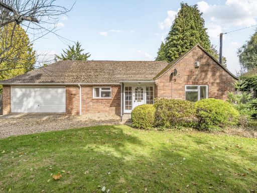 3 bedroom bungalow for sale in Aldworth Road, Upper Basildon, Reading, Berkshire, RG8 — £725,000 • 3 bed • 2 bath • 1035 ft²
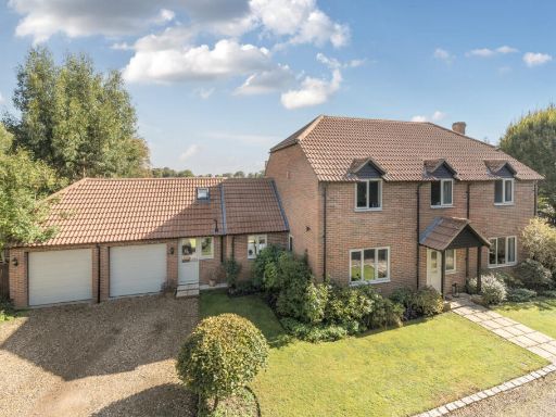 4 bedroom detached house for sale in Spring Close, Upper Basildon, Reading, Berkshire, RG8 — £950,000 • 4 bed • 2 bath • 2000 ft²
 3 bedroom semi-detached house for sale in 12 Morrison Close, Upper Basildon, RG8 — £495,000 • 3 bed • 2 bath • 1076 ft²
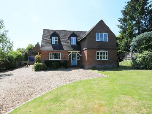 4 bedroom detached house for sale in Blandys Lane, Upper Basildon, RG8 — £995,000 • 4 bed • 2 bath • 2012 ft²
 2 bedroom semi-detached house for sale in Morrison Close, Upper Basildon, Reading, Berkshire, RG8 — £400,000 • 2 bed • 2 bath • 812 ft²
Meta
- {
"@context": "https://schema.org",
"@type": "Residence",
"name": "5 bedroom detached bungalow for sale in Emery Acres, Upper…",
"description": "",
"url": "https://propertypiper.co.uk/property/266e3566-327f-40ce-a0b8-ec387dcfc067",
"image": "https://image-a.propertypiper.co.uk/ccc2450f-da4f-47f0-b201-56eba25f1aa9-1024.jpeg",
"address": {
"@type": "PostalAddress",
"streetAddress": "16 EMERY ACRES UPPER BASILDON READING",
"postalCode": "RG8 8NY",
"addressLocality": "West Berkshire",
"addressRegion": "Newbury",
"addressCountry": "England"
},
"geo": {
"@type": "GeoCoordinates",
"latitude": 51.486337023298745,
"longitude": -1.14454649330855
},
"numberOfRooms": 5,
"numberOfBathroomsTotal": 3,
"floorSize": {
"@type": "QuantitativeValue",
"value": 2028,
"unitCode": "FTK"
},
"offers": {
"@type": "Offer",
"price": 865000,
"priceCurrency": "GBP",
"availability": "https://schema.org/InStock"
},
"additionalProperty": [
{
"@type": "PropertyValue",
"name": "Feature",
"value": "detached"
},
{
"@type": "PropertyValue",
"name": "Feature",
"value": "brick"
},
{
"@type": "PropertyValue",
"name": "Feature",
"value": "garage"
},
{
"@type": "PropertyValue",
"name": "Feature",
"value": "garden"
},
{
"@type": "PropertyValue",
"name": "Feature",
"value": "bungalow"
},
{
"@type": "PropertyValue",
"name": "Feature",
"value": "driveway"
},
{
"@type": "PropertyValue",
"name": "Feature",
"value": "dormer"
},
{
"@type": "PropertyValue",
"name": "Feature",
"value": "countryside"
},
{
"@type": "PropertyValue",
"name": "Feature",
"value": "suburban"
},
{
"@type": "PropertyValue",
"name": "Feature",
"value": "contemporary"
},
{
"@type": "PropertyValue",
"name": "Feature",
"value": "open plan"
},
{
"@type": "PropertyValue",
"name": "Feature",
"value": "kitchen"
},
{
"@type": "PropertyValue",
"name": "Feature",
"value": "dining area"
},
{
"@type": "PropertyValue",
"name": "Feature",
"value": "modern"
},
{
"@type": "PropertyValue",
"name": "Feature",
"value": "spacious"
},
{
"@type": "PropertyValue",
"name": "Feature",
"value": "skylight"
},
{
"@type": "PropertyValue",
"name": "Feature",
"value": "natural light"
},
{
"@type": "PropertyValue",
"name": "Feature",
"value": "neutral colors"
}
]
}
High Res Floorplan Images
Compatible Floorplan Images
FloorplanImages Thumbnail