SK8 6SQ - 3 bedroom semidetached house for sale in Ledge Ley, Cheadle…
View on Property Piper
3 bedroom semi-detached house for sale in Ledge Ley, Cheadle, SK8
Property Details
- Price: £315000
- Bedrooms: 3
- Bathrooms: 1
- Property Type: undefined
- Property SubType: undefined
Brochure Descriptions
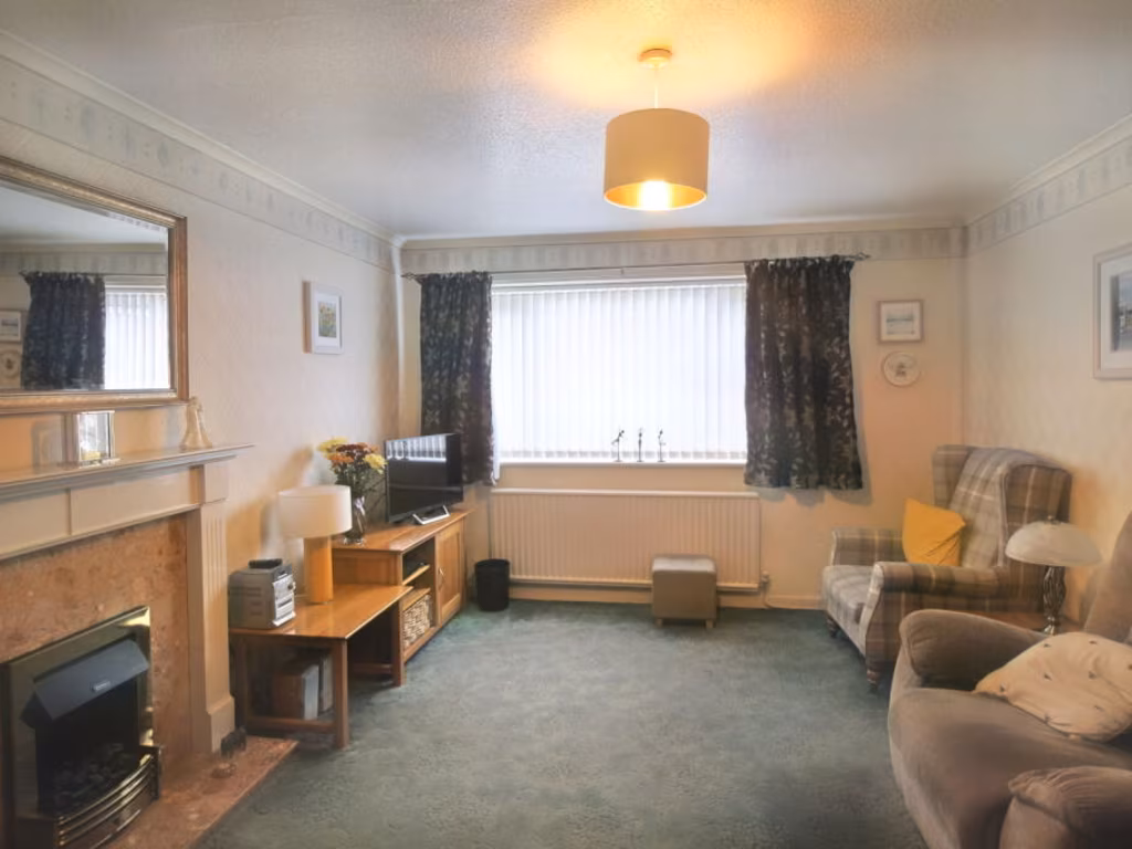
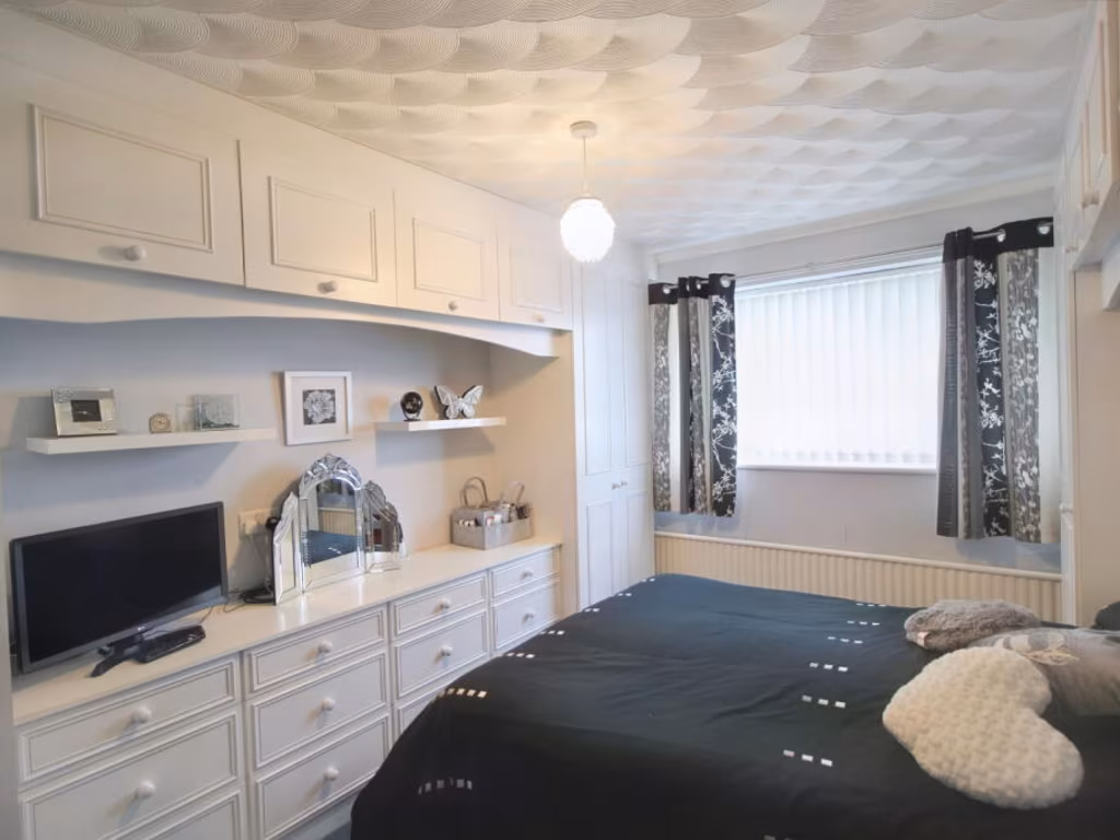
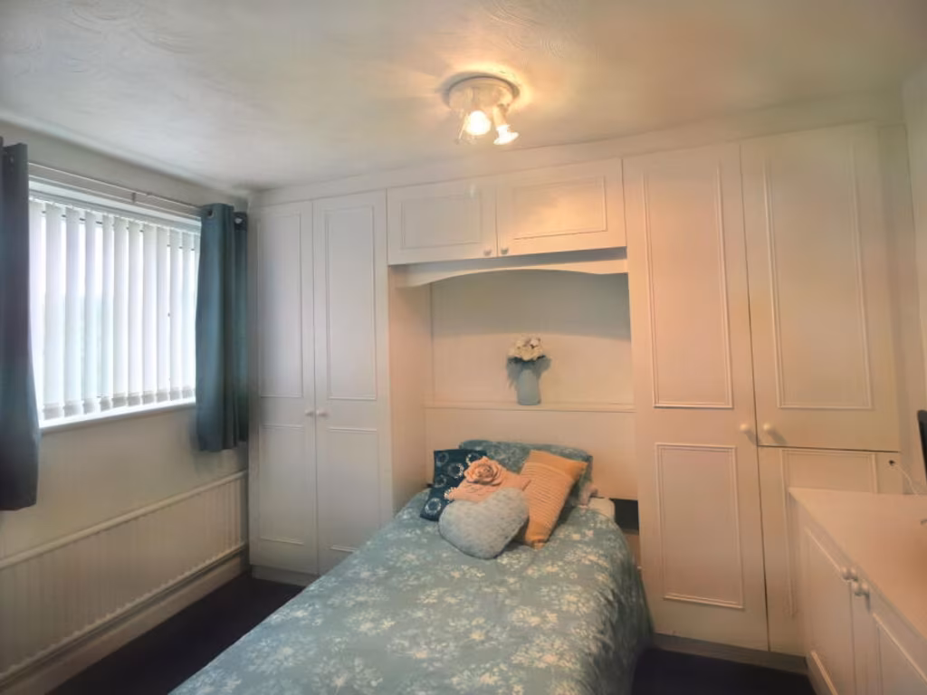
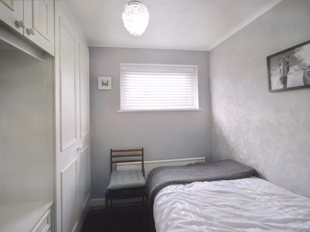
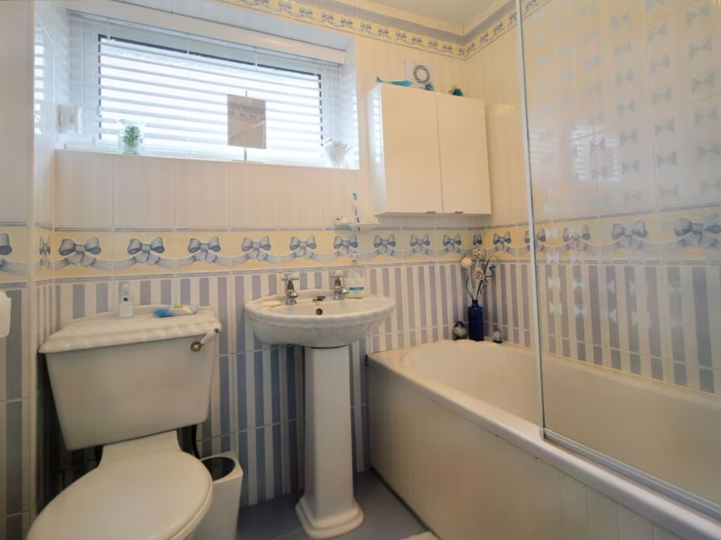
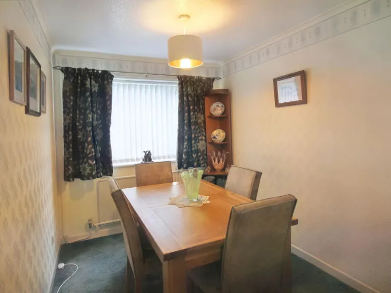
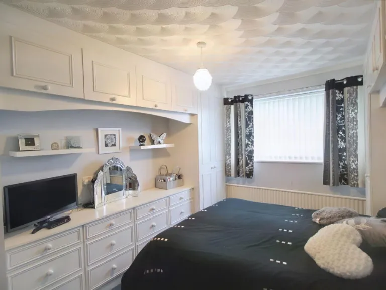
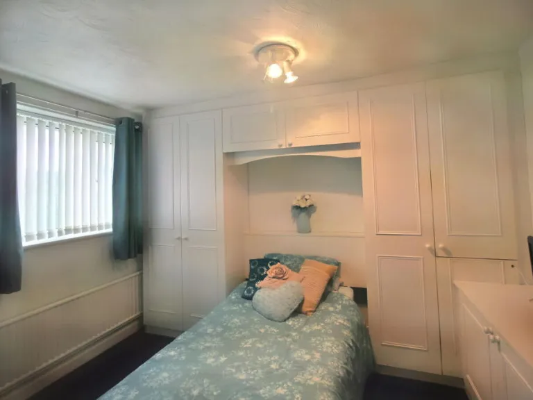
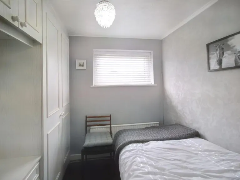
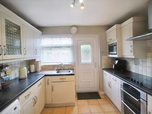
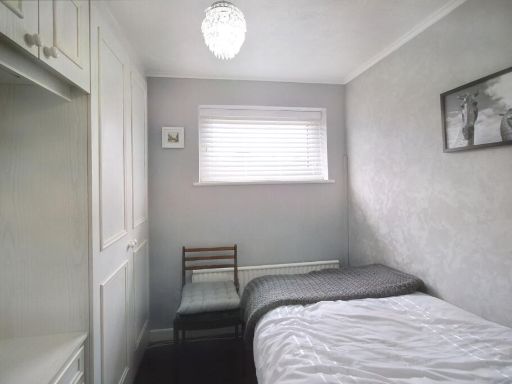
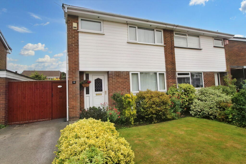
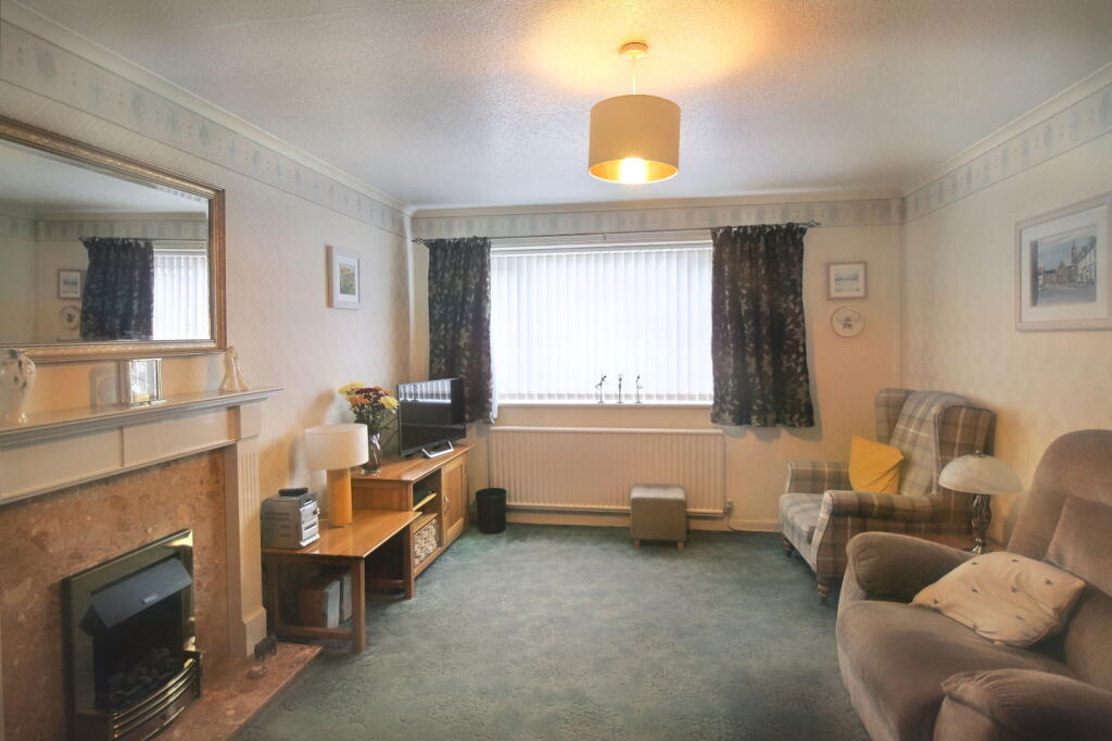
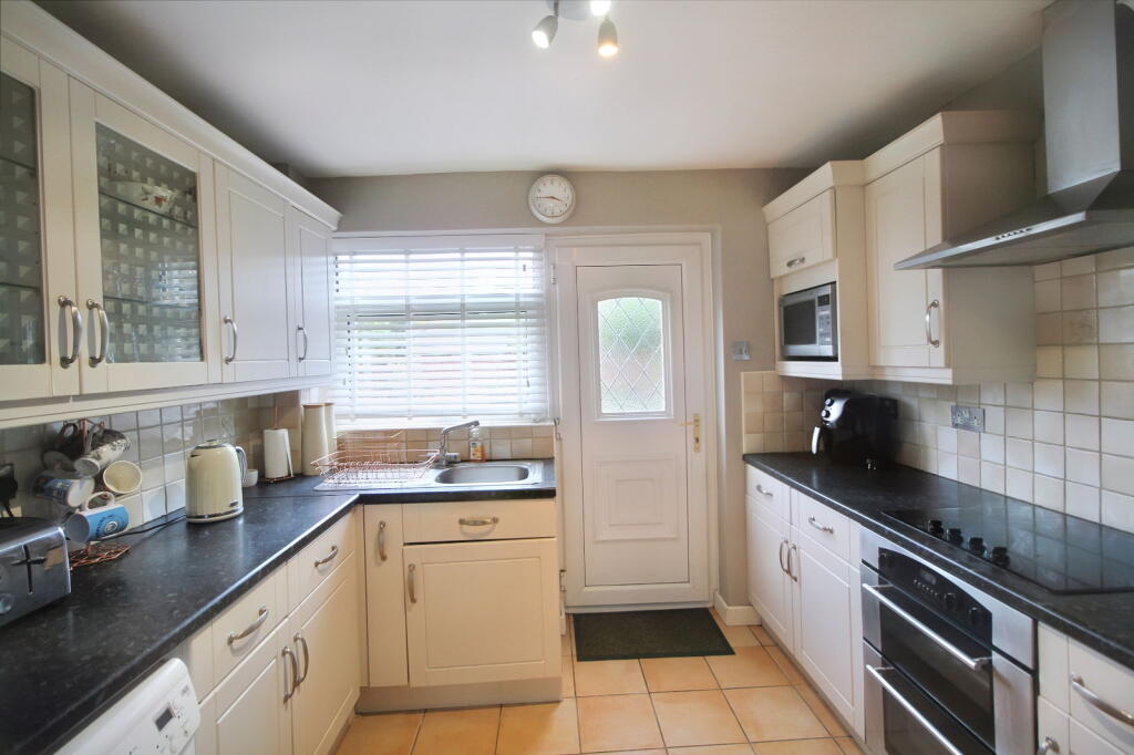
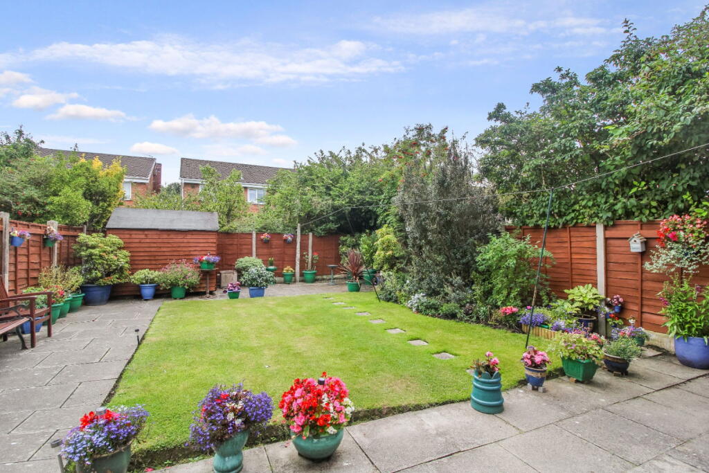
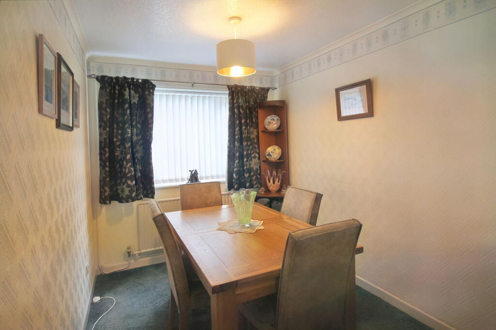
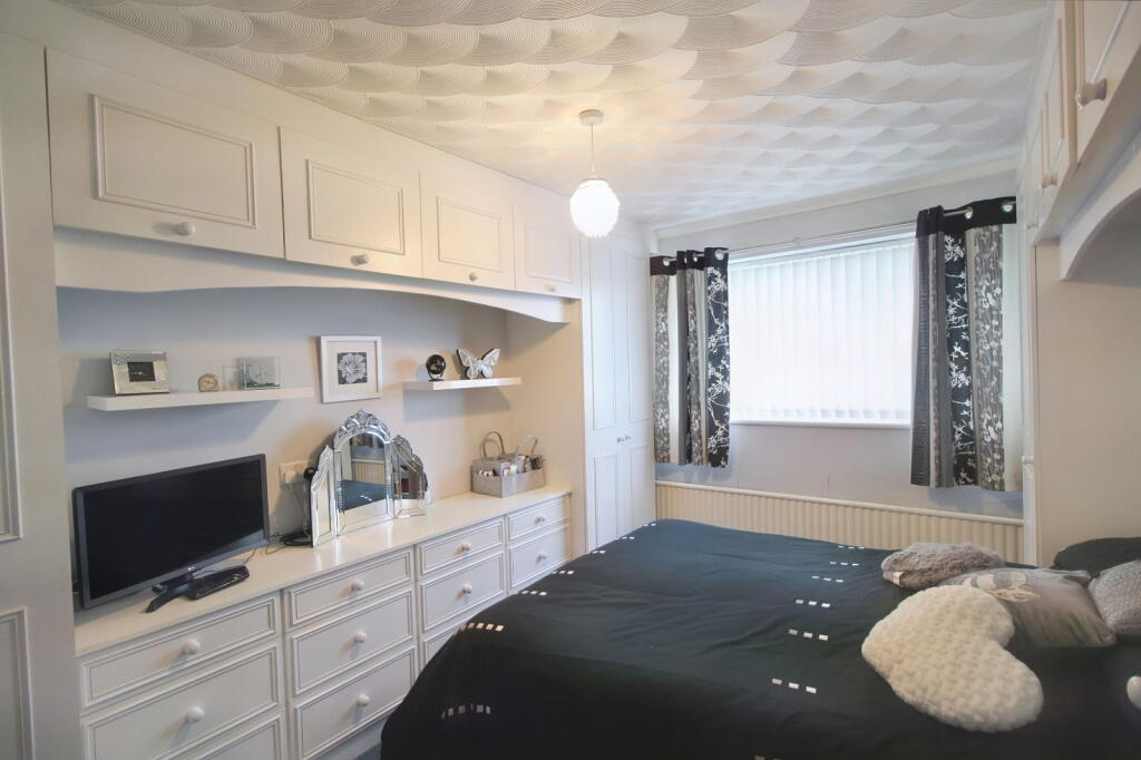
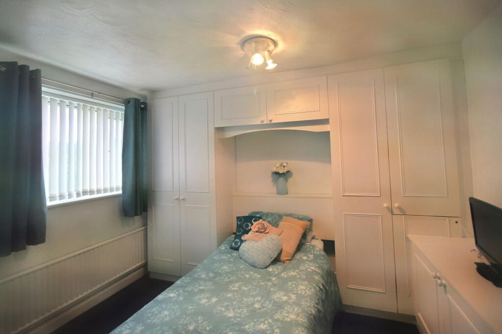
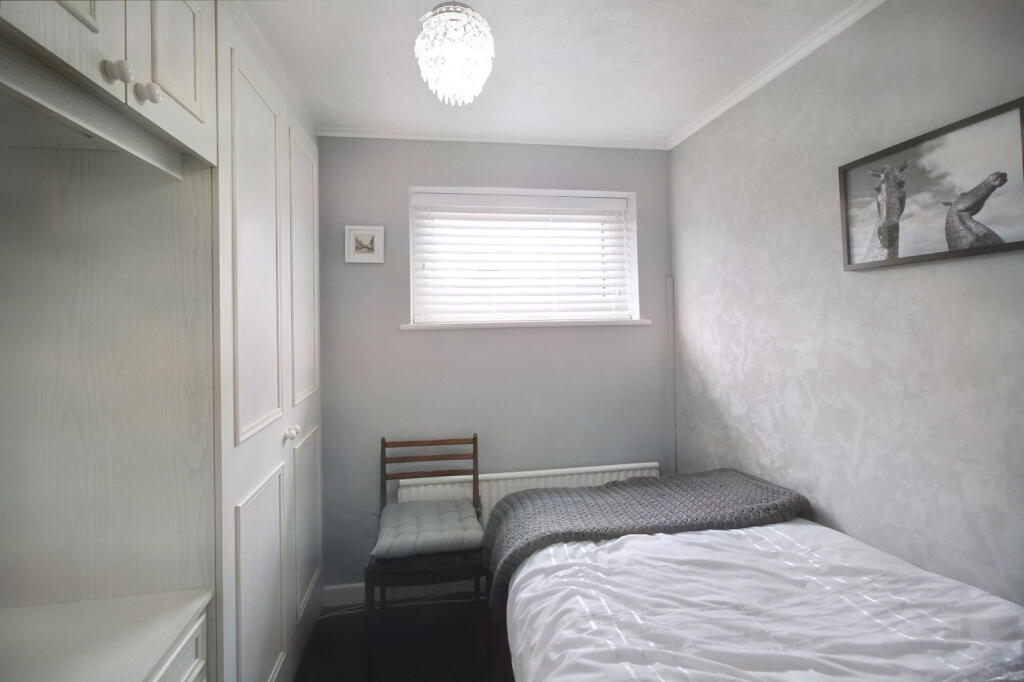
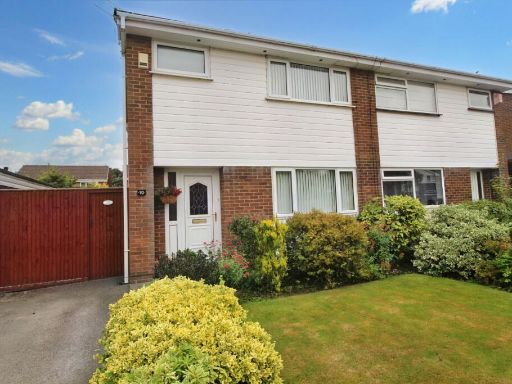
- Modern, well-presented semi-detached house in a quiet residential development in Cheadle Hulme. The property appears to offer three bedrooms, one bathroom/WC, an entrance hall, a combined living/dining room and a modern fitted kitchen. Externally there are neatly manicured front and rear lawns, mature shrub borders, a paved patio area to the rear and off-road parking to the side with a gated driveway (likely access to a garage or side parking). Features visible include double glazing and gas central heating. Overall plot and garden sizes read as average for a suburban semi-detached family home; the accommodation is practical and suited to a starter family or someone downsizing, with good local amenities and transport links nearby.
Image Descriptions
- semi-detached house 1960s-1970s
- living room 20th Century
Floorplan Description
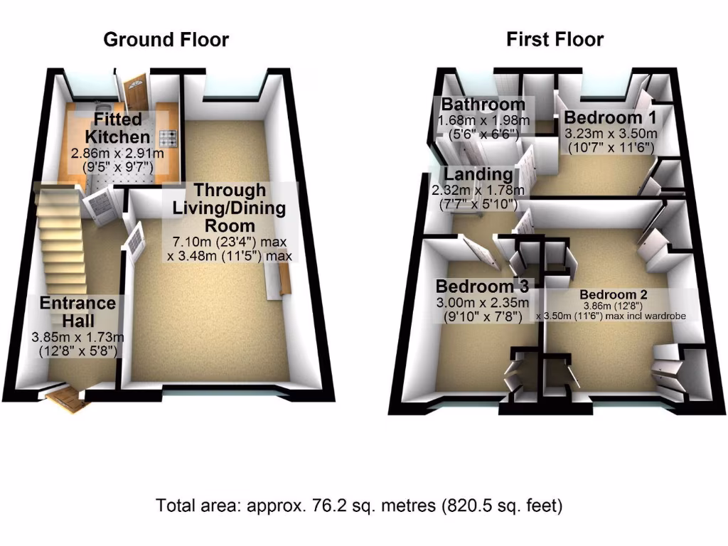
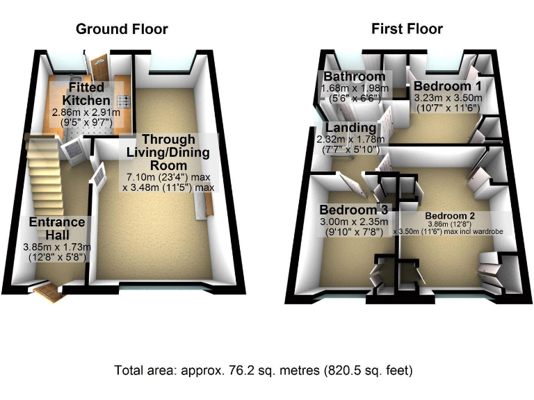
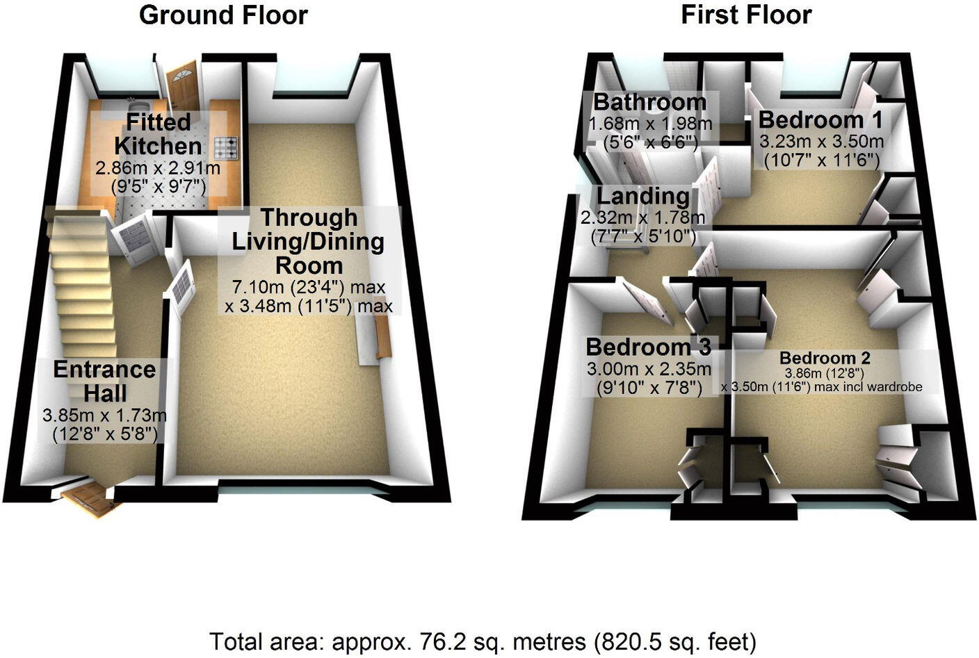
- 2-storey residential property with through living/dining room and three bedrooms
Rooms
- Fitted Kitchen:
- Through Living/Dining Room: max dimensions
- Entrance Hall:
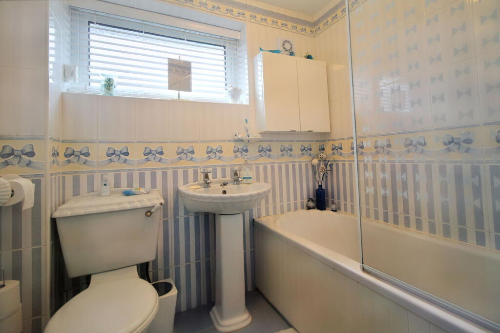
- Bathroom:
- Landing:
- Bedroom 1:
- Bedroom 2: max incl wardrobe
- Bedroom 3:
Textual Property Features
Detected Visual Features
- semi-detached
- 1960s
- 1970s
- garden
- lawn
- driveway
- brick facade
- suburban
- living room
- 20th Century
- carpet
- dated decor
- ceiling light
- mold risk
- standard ceiling
- medium space
- radiator
- window
EPC Details
- Fully double glazed
- Cavity wall, as built, no insulation (assumed)
- Boiler and radiators, mains gas
- Low energy lighting in all fixed outlets
- Solid, no insulation (assumed)
Nearby Schools
- Handforth Grange Primary School
- Thorn Grove Primary School
- Bolshaw Primary School
- Lane End Primary School
- Cheadle Hulme Primary School
- Oak Tree Primary School
- Meadowbank Primary School
- Bradshaw Hall Primary School
- Prospect Vale Primary School
- North West Hospital School
- Cheadle Catholic Junior School
- Laurus Cheadle Hulme
- Lady Barn House School
- St James' Catholic High School
- Hursthead Junior School
- Outwood Primary School
- Cheadle Hulme High School
- Cheadle Hulme School
- Greenbank Preparatory School
- Cheadle Catholic Infant School
- St Benedict's Catholic Primary School
- Hursthead Infant School
- Etchells Primary School
- North Cheshire Jewish Primary School
- Ladybridge Primary School
Nearest Bars And Restaurants
- Id: 8089330924
- Tags:
- Amenity: fast_food
- Cuisine: indian
- Name: Delhi Dream
- TagsNormalized:
- fast food
- food
- indian
- dreams
- Lat: 53.3736041
- Lon: -2.2054936
- FullGeoHash: gcqrtu65b2by
- PartitionGeoHash: gcqr
- Images:
- FoodStandards: null
- Distance: 566.6
,- Id: 8118447340
- Tags:
- Amenity: fast_food
- Cuisine: kebab
- Name: Lucky Star
- TagsNormalized:
- Lat: 53.3733549
- Lon: -2.2068275
- FullGeoHash: gcqrtu3434qp
- PartitionGeoHash: gcqr
- Images:
- FoodStandards: null
- Distance: 554.4
,- Id: 8118447342
- Tags:
- Amenity: fast_food
- Cuisine: kebab
- Name: Bonani Express
- TagsNormalized:
- Lat: 53.3733672
- Lon: -2.206686
- FullGeoHash: gcqrtu34kkz8
- PartitionGeoHash: gcqr
- Images:
- FoodStandards: null
- Distance: 553.4
,- Id: 8089330930
- Tags:
- Amenity: cafe
- Name: Turves Road Cafe
- TagsNormalized:
- Lat: 53.3734281
- Lon: -2.2061075
- FullGeoHash: gcqrtu3dcbph
- PartitionGeoHash: gcqr
- Images:
- FoodStandards: null
- Distance: 552.4
,- Id: 8118447344
- Tags:
- Addr:
- Amenity: fast_food
- Brand: Domino's
- Brand:wikidata: Q839466
- Brand:wikipedia: en:Domino's Pizza
- Contact:
- Website: https://www.dominos.co.uk/pizza-near-me/manchester/unit-a-136-turves-road
- Cuisine: pizza
- Name: Domino's
- Takeaway: yes
- TagsNormalized:
- fast food
- food
- dominos
- pizza
- takeaway
- Lat: 53.3733783
- Lon: -2.2063917
- FullGeoHash: gcqrtu367qg5
- PartitionGeoHash: gcqr
- Images:
- FoodStandards: null
- Distance: 550.4
}
Nearest General Shops
- Id: 8089330929
- Tags:
- Name: V12 Hir Boutique
- Shop: hairdresser
- TagsNormalized:
- Lat: 53.3733476
- Lon: -2.2069033
- FullGeoHash: gcqrtu2fr3js
- PartitionGeoHash: gcqr
- Images:
- FoodStandards: null
- Distance: 554.9
,- Id: 8118447341
- Tags:
- Name: Alterations Plus
- Shop: tailor
- TagsNormalized:
- Lat: 53.3733607
- Lon: -2.2067606
- FullGeoHash: gcqrtu346g84
- PartitionGeoHash: gcqr
- Images:
- FoodStandards: null
- Distance: 553.9
,- Id: 8118447339
- Tags:
- Name: Bargain World
- Shop: yes
- TagsNormalized:
- Lat: 53.3733802
- Lon: -2.2065192
- FullGeoHash: gcqrtu362rhn
- PartitionGeoHash: gcqr
- Images:
- FoodStandards: null
- Distance: 552.3
}
Nearest Grocery shops
- Id: 558195444
- Tags:
- Brand: M&S Simply Food
- Brand:wikidata: Q714491
- Brand:wikipedia: en:Marks & Spencer
- Building: yes
- Contact:
- Website: https://www.marksandspencer.com/stores/cheadle-hulme-bp-2028
- Name: M&S Simply Food
- Shop: convenience
- TagsNormalized:
- m&s simply food
- food
- convenience
- shop
- Lat: 53.3669429
- Lon: -2.1879754
- FullGeoHash: gcqrw5nubrpq
- PartitionGeoHash: gcqr
- Images:
- FoodStandards: null
- Distance: 1125.3
,- Id: 8089330926
- Tags:
- Name: International Grocers
- Shop: greengrocer
- TagsNormalized:
- Lat: 53.373497
- Lon: -2.2058574
- FullGeoHash: gcqrtu3epucx
- PartitionGeoHash: gcqr
- Images:
- FoodStandards: null
- Distance: 557.4
,- Id: 8089330931
- Tags:
- Brand: Co-op Food
- Brand:wikidata: Q3277439
- Brand:wikipedia: en:Co-op Food
- Name: Co-op Food
- Shop: convenience
- TagsNormalized:
- co-op
- co-op food
- food
- convenience
- shop
- Lat: 53.3734096
- Lon: -2.2062322
- FullGeoHash: gcqrtu36xhdj
- PartitionGeoHash: gcqr
- Images:
- FoodStandards: null
- Distance: 551.8
}
Nearest Supermarkets
- Id: 144594360
- Tags:
- Addr:
- City: Cheadle Hulme
- Postcode: SK8 5AE
- Street: Station Road
- Brand: Waitrose
- Brand:wikidata: Q771734
- Brand:wikipedia: en:Waitrose
- Building: yes
- Fhrs:
- Name: Waitrose
- Official_name: Waitrose & Partners
- Operator: Waitrose & Partners
- Roof:
- Shop: supermarket
- Source:
- TagsNormalized:
- Lat: 53.3761818
- Lon: -2.1897244
- FullGeoHash: gcqrwhv6z9rn
- PartitionGeoHash: gcqr
- Images:
- FoodStandards:
- Id: 78124
- FHRSID: 78124
- LocalAuthorityBusinessID: 18511
- BusinessName: Waitrose Ltd
- BusinessType: Retailers - supermarkets/hypermarkets
- BusinessTypeID: 7840
- AddressLine1: Station Road
- AddressLine2: Cheadle Hulme
- AddressLine3: Cheadle
- AddressLine4: Stockport
- PostCode: SK8 5AE
- RatingValue: 5
- RatingKey: fhrs_5_en-GB
- RatingDate: 2019-03-22
- LocalAuthorityCode: 428
- LocalAuthorityName: Stockport
- LocalAuthorityWebSite: http://www.stockport.gov.uk
- LocalAuthorityEmailAddress: food.safety@stockport.gov.uk
- Scores:
- Hygiene: 0
- Structural: 5
- ConfidenceInManagement: 5
- NewRatingPending: false
- Geocode:
- Longitude: -2.19012689590454
- Latitude: 53.37720870971680
- Distance: 1309.4
,- Id: 116596694
- Tags:
- Brand: Sainsbury's
- Brand:wikidata: Q152096
- Brand:wikipedia: en:Sainsbury's
- Building: retail
- Name: Sainsbury's
- Shop: supermarket
- TagsNormalized:
- sainsburys
- retail
- supermarket
- shop
- Lat: 53.376318
- Lon: -2.2159047
- FullGeoHash: gcqrtsf7tdve
- PartitionGeoHash: gcqr
- Images:
- FoodStandards: null
- Distance: 1140.2
,- Id: 287036904
- Tags:
- Brand: Co-op Food
- Brand:wikidata: Q3277439
- Building: yes
- Name: Co-op Food
- Operator: The Co-operative Group
- Operator:wikidata: Q117202
- Shop: supermarket
- TagsNormalized:
- co-op
- co-op food
- food
- supermarket
- shop
- Lat: 53.365837
- Lon: -2.1900955
- FullGeoHash: gcqrw4vnx143
- PartitionGeoHash: gcqr
- Images:
- FoodStandards: null
- Distance: 1015.9
}
Nearest Religious buildings
- Id: 918944586
- Tags:
- Access: yes
- Amenity: parking
- Fee: no
- Name: Church Road/Woods Lane Car Park
- Parking: surface
- TagsNormalized:
- Lat: 53.3660748
- Lon: -2.1880983
- FullGeoHash: gcqrw4yxvt7s
- PartitionGeoHash: gcqr
- Images:
- FoodStandards: null
- Distance: 1136.5
,- Id: 292378660
- Tags:
- Amenity: place_of_worship
- Building: yes
- Denomination: anglican
- Name: Emmanuel Church
- Religion: christian
- Wikidata: Q105094073
- TagsNormalized:
- place of worship
- anglican
- church
- christian
- Lat: 53.3727382
- Lon: -2.210341
- FullGeoHash: gcqrtsnqxrd2
- PartitionGeoHash: gcqr
- Images:
- FoodStandards: null
- Distance: 598.1
,- Id: 1148943367
- Tags:
- Amenity: community_centre
- Building: church
- Community_centre: parish_hall
- TagsNormalized:
- Lat: 53.3727121
- Lon: -2.20992
- FullGeoHash: gcqrtsny94sj
- PartitionGeoHash: gcqr
- Images:
- FoodStandards: null
- Distance: 578.8
}
Nearest Medical buildings
- Id: 1073690423
- Tags:
- Amenity: veterinary
- Building: yes
- Name: Hunt's Veterinary Clinics
- TagsNormalized:
- Lat: 53.3660182
- Lon: -2.1891787
- FullGeoHash: gcqrw4vzs6y4
- PartitionGeoHash: gcqr
- Images:
- FoodStandards: null
- Distance: 1068.7
,- Id: 9935906272
- Tags:
- Addr:
- City: Cheadle Hulme
- Housenumber: 128
- Postcode: SK8 6LQ
- Street: Hulme Hall Road
- Amenity: pharmacy
- Brand: Cohens Chemist
- Brand:wikidata: Q107998495
- Dispensing: yes
- Healthcare: pharmacy
- Name: Cohens Chemist
- Opening_hours: Mo-Fr 09:00-18:30
- TagsNormalized:
- pharmacy
- chemist
- cohens chemist
- health
- healthcare
- Lat: 53.3662585
- Lon: -2.1898947
- FullGeoHash: gcqrw5j2gz85
- PartitionGeoHash: gcqr
- Images:
- FoodStandards: null
- Distance: 1015.9
,- Id: 918944582
- Tags:
- Amenity: doctors
- Building: yes
- Healthcare: doctor
- Name: Cheadle Hulme Health Centre
- TagsNormalized:
- doctor
- doctors
- health
- healthcare
- health centre
- Lat: 53.3664012
- Lon: -2.1912877
- FullGeoHash: gcqrw5h3g61r
- PartitionGeoHash: gcqr
- Images:
- FoodStandards: null
- Distance: 922.5
,- Id: 8089330925
- Tags:
- Addr:
- City: Cheadle Hume
- Housenumber: 130
- Postcode: SK8 6AW
- Street: Turves Road
- Amenity: pharmacy
- Dispensing: yes
- Healthcare: pharmacy
- Name: Turves Road Pharmacy
- Website: https://www.nhs.uk/services/pharmacy/turves-road-pharmacy/FPL83
- TagsNormalized:
- Lat: 53.3735311
- Lon: -2.2057383
- FullGeoHash: gcqrtu3g6e66
- PartitionGeoHash: gcqr
- Images:
- FoodStandards: null
- Distance: 560.2
}
Nearest Airports
- Id: 1224469
- Tags:
- Addr:
- City: Manchester
- Country: GB
- Postcode: M90 1QX
- Aerodrome: international
- Aeroway: aerodrome
- Arp: yes
- Atis: 128.175
- Iata: MAN
- Icao: EGCC
- Name: Manchester Airport
- Note: rough sketched outline referring to Yahoo imagery - true boundary is where?
- Old_name: Ringway
- Operator: Manchester Airport PLC
- Size: 18720000
- Source:
- Tower_frequency: 118.625,119.400
- Type: multipolygon
- Website: https://www.manchesterairport.co.uk/
- Wikidata: Q8694
- Wikipedia: en:Manchester Airport
- TagsNormalized:
- airport
- international airport
- Lat: 53.3503197
- Lon: -2.2798822
- FullGeoHash: gcqrs05u4ukt
- PartitionGeoHash: gcqr
- Images:
- FoodStandards: null
- Distance: 5382.7
}
Nearest Leisure Facilities
- Id: 1149309431
- Tags:
- Access: yes
- Leisure: playground
- TagsNormalized:
- Lat: 53.3690413
- Lon: -2.2071341
- FullGeoHash: gcqrtg8c4n3e
- PartitionGeoHash: gcqr
- Images:
- FoodStandards: null
- Distance: 169.6
,- Id: 1067226219
- Tags:
- Access: yes
- Leisure: pitch
- Sport: soccer
- Surface: grass
- TagsNormalized:
- Lat: 53.3670669
- Lon: -2.2044582
- FullGeoHash: gcqrtg4v8qkf
- PartitionGeoHash: gcqr
- Images:
- FoodStandards: null
- Distance: 163.6
,- Id: 1149380200
- Tags:
- Access: yes
- Leisure: playground
- TagsNormalized:
- Lat: 53.3675621
- Lon: -2.2063043
- FullGeoHash: gcqrtg32t6sk
- PartitionGeoHash: gcqr
- Images:
- FoodStandards: null
- Distance: 150.1
,- Id: 1149380196
- Tags:
- Access: yes
- Leisure: playground
- TagsNormalized:
- Lat: 53.3681744
- Lon: -2.2065418
- FullGeoHash: gcqrtg3hpug0
- PartitionGeoHash: gcqr
- Images:
- FoodStandards: null
- Distance: 126.7
,- Id: 928476501
- Tags:
- Access: yes
- Leisure: playground
- TagsNormalized:
- Lat: 53.3693123
- Lon: -2.206013
- FullGeoHash: gcqrtg9du0vk
- PartitionGeoHash: gcqr
- Images:
- FoodStandards: null
- Distance: 121.9
}
Nearest Tourist attractions
- Id: 10006604724
- Tags:
- Addr:
- City: Stockport
- Housenumber: 13
- Postcode: SK7 2BE
- Street: Ack Lane East
- Suburb: Bramhall
- Name: Cheshire Art Gallery
- Phone: +44 161 217 0625
- Tourism: gallery
- Website: https://www.cheshireartgallery.co.uk/
- TagsNormalized:
- Lat: 53.3575507
- Lon: -2.1667948
- FullGeoHash: gcqrw9qnq02e
- PartitionGeoHash: gcqr
- Images:
- FoodStandards: null
- Distance: 2797.4
,- Id: 9144230017
- Tags:
- Addr:
- Guest_house: guest_house
- Name: Pymgate Lodge
- Tourism: guest_house
- TagsNormalized:
- Lat: 53.3796836
- Lon: -2.2382239
- FullGeoHash: gcqrtj6pjw5r
- PartitionGeoHash: gcqr
- Images:
- FoodStandards: null
- Distance: 2544.8
,- Id: 9935906278
- Tags:
- Addr:
- City: Cheadle Hulme
- Housenumber: 4
- Postcode: SK8 6NB
- Street: Gillbent Road
- Name: Wolfgang Webster Gallery
- Phone: +44 161 488 4889
- Tourism: gallery
- TagsNormalized:
- Lat: 53.3659548
- Lon: -2.1898224
- FullGeoHash: gcqrw4vrjrn0
- PartitionGeoHash: gcqr
- Images:
- FoodStandards: null
- Distance: 1029.5
}
Nearest Train stations
- Id: 25295170
- Tags:
- Name: Gatley
- Naptan:
- Network: National Rail
- Public_transport: station
- Railway: station
- Ref:
- Wikipedia: en:Gatley railway station
- TagsNormalized:
- Lat: 53.3932392
- Lon: -2.2306618
- FullGeoHash: gcqrtpzwjv4n
- PartitionGeoHash: gcqr
- Images:
- FoodStandards: null
- Distance: 3241.7
,- Id: 29689132
- Tags:
- Name: Bramhall
- Naptan:
- Network: National Rail
- Public_transport: station
- Railway: station
- Ref:
- Wikipedia: en:Bramhall railway station
- TagsNormalized:
- Lat: 53.3601721
- Lon: -2.1623117
- FullGeoHash: gcqrwccmw3p9
- PartitionGeoHash: gcqr
- Images:
- FoodStandards: null
- Distance: 2963.8
,- Id: 6416944405
- Tags:
- Name: Handforth
- Naptan:
- Network: National Rail
- Public_transport: station
- Railway: station
- Ref:
- Wikipedia: en:Handforth railway station
- TagsNormalized:
- Lat: 53.346446
- Lon: -2.2136737
- FullGeoHash: gcqrmxkj9dm3
- PartitionGeoHash: gcqr
- Images:
- FoodStandards: null
- Distance: 2526.3
,- Id: 9794768857
- Tags:
- Name: Heald Green
- Naptan:
- Network: National Rail
- Public_transport: station
- Railway: station
- Ref:
- Wikidata: Q2194508
- Wikipedia: en:Heald Green railway station
- TagsNormalized:
- Lat: 53.3694132
- Lon: -2.2366797
- FullGeoHash: gcqrt5e73edw
- PartitionGeoHash: gcqr
- Images:
- FoodStandards: null
- Distance: 2122.2
,- Id: 446424282
- Tags:
- Name: Cheadle Hulme
- Naptan:
- Network: National Rail
- Public_transport: station
- Railway: station
- Ref:
- Wikipedia: en:Cheadle Hulme railway station
- TagsNormalized:
- Lat: 53.3760261
- Lon: -2.1883499
- FullGeoHash: gcqrwhy3zu2j
- PartitionGeoHash: gcqr
- Images:
- FoodStandards: null
- Distance: 1369.4
}
Nearest Hotels
- Id: 290460182
- Tags:
- Addr:
- City: Cheadle
- Postcode: SK8 3FS
- Street: Royal Crescent
- Brand: De Vere
- Building: yes
- Internet_access: wlan
- Internet_access:fee: no
- Name: Cheadle House
- Rooms: 52
- Smoking: outside
- Tourism: hotel
- Website: https://www.cheadlehousemanchester.co.uk/partner/cheadle-house/
- TagsNormalized:
- Lat: 53.3772101
- Lon: -2.2215324
- FullGeoHash: gcqrtmn2f91k
- PartitionGeoHash: gcqr
- Images:
- FoodStandards: null
- Distance: 1474.7
,- Id: 1119686796
- Tags:
- Addr:
- City: Wilmslow
- Postcode: SK9 3LD
- Street: Stanley Road
- Suburb: Handforth
- Brand: Best Western
- Brand:wikidata: Q830334
- Fhrs:
- Landuse: commercial
- Name: Manchester Airport Stanley Hotel
- Tourism: hotel
- Website: https://www.bestwestern.co.uk/hotels/manchester-airport-stanley-hotel-bw-signature-collection-84319
- TagsNormalized:
- Lat: 53.3580575
- Lon: -2.2173861
- FullGeoHash: gcqrt9935nv5
- PartitionGeoHash: gcqr
- Images:
- FoodStandards: null
- Distance: 1435.8
,- Id: 619760042
- Tags:
- Addr:
- City: Stockport
- Housename: Bruntwood Hall
- Place: Cheadle
- Postcode: SK8 1HX
- Street: Bruntwood Park
- Building: yes
- Contact:
- Website: http://www.oddfellowsonthepark.com/
- Fhrs:
- Name: Oddfellows On The Park
- Source:
- Tourism: hotel
- TagsNormalized:
- Lat: 53.3803444
- Lon: -2.2122775
- FullGeoHash: gcqrttt541qm
- PartitionGeoHash: gcqr
- Images:
- FoodStandards: null
- Distance: 1406
}
Tags
- semi-detached
- 1960s
- 1970s
- garden
- lawn
- driveway
- brick facade
- suburban
- living room
- 20th Century
- carpet
- dated decor
- ceiling light
- mold risk
- standard ceiling
- medium space
- radiator
- window
Local Market Stats
- Average Price/sqft: £341
- Avg Income: £50100
- Rental Yield: 4.3%
- Social Housing: 7%
- Planning Success Rate: 93%
Similar Properties
 3 bedroom semi-detached house for sale in Ledge Ley, Cheadle Hulme, SK8 6SQ, SK8 — £315,000 • 3 bed • 1 bath • 821 ft²
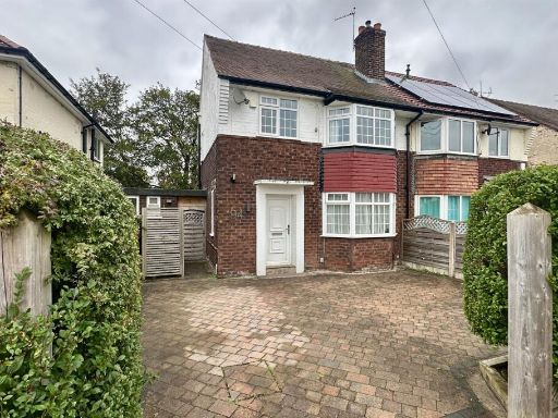 3 bedroom semi-detached house for sale in Dorset Avenue, Cheadle Hulme, SK8 — £270,000 • 3 bed • 1 bath • 757 ft²
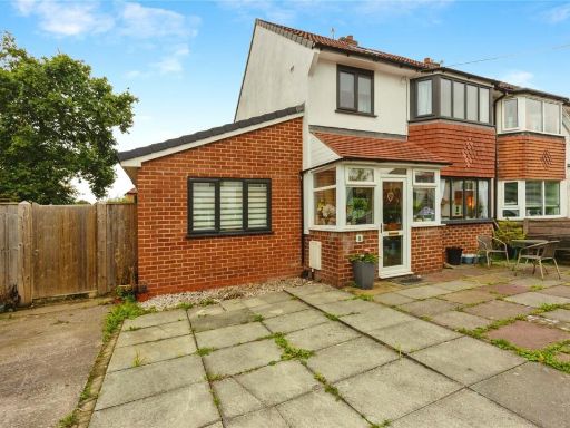 3 bedroom semi-detached house for sale in High Bent Avenue, Cheadle Hulme, Cheshire, SK8 — £450,000 • 3 bed • 1 bath • 1449 ft²
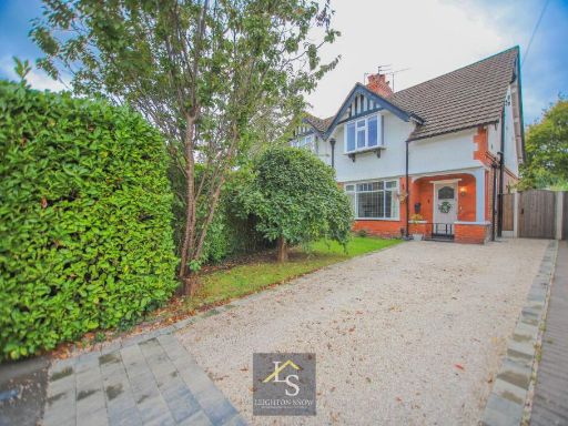 3 bedroom semi-detached house for sale in Ravenoak Park Road, Cheadle Hulme, SK8 — £575,000 • 3 bed • 1 bath • 1172 ft²
 3 bedroom detached house for sale in Lomax Gardens, Cheadle Hulme, SK8 — £350,000 • 3 bed • 3 bath • 784 ft²
 3 bedroom detached house for sale in Kingsley Drive, Cheadle Hulme, SK8 — £600,000 • 3 bed • 2 bath • 1462 ft²
Meta
- {
"@context": "https://schema.org",
"@type": "Residence",
"name": "3 bedroom semidetached house for sale in Ledge Ley, Cheadle…",
"description": "",
"url": "https://propertypiper.co.uk/property/256f9bda-eb56-4acb-9cd0-0176de33336b",
"image": "https://image-a.propertypiper.co.uk/2b089620-1f14-404c-aff9-89d2650abc20-1024.jpeg",
"address": {
"@type": "PostalAddress",
"streetAddress": "10 Ledge Ley, Cheadle Hulme",
"postalCode": "SK8 6SQ",
"addressLocality": "Stockport",
"addressRegion": "Cheadle",
"addressCountry": "England"
},
"geo": {
"@type": "GeoCoordinates",
"latitude": 53.36852938952314,
"longitude": -2.2047264467954357
},
"numberOfRooms": 3,
"numberOfBathroomsTotal": 1,
"floorSize": {
"@type": "QuantitativeValue",
"value": 820,
"unitCode": "FTK"
},
"offers": {
"@type": "Offer",
"price": 315000,
"priceCurrency": "GBP",
"availability": "https://schema.org/InStock"
},
"additionalProperty": [
{
"@type": "PropertyValue",
"name": "Feature",
"value": "semi-detached"
},
{
"@type": "PropertyValue",
"name": "Feature",
"value": "1960s"
},
{
"@type": "PropertyValue",
"name": "Feature",
"value": "1970s"
},
{
"@type": "PropertyValue",
"name": "Feature",
"value": "garden"
},
{
"@type": "PropertyValue",
"name": "Feature",
"value": "lawn"
},
{
"@type": "PropertyValue",
"name": "Feature",
"value": "driveway"
},
{
"@type": "PropertyValue",
"name": "Feature",
"value": "brick facade"
},
{
"@type": "PropertyValue",
"name": "Feature",
"value": "suburban"
},
{
"@type": "PropertyValue",
"name": "Feature",
"value": "living room"
},
{
"@type": "PropertyValue",
"name": "Feature",
"value": "20th Century"
},
{
"@type": "PropertyValue",
"name": "Feature",
"value": "carpet"
},
{
"@type": "PropertyValue",
"name": "Feature",
"value": "dated decor"
},
{
"@type": "PropertyValue",
"name": "Feature",
"value": "ceiling light"
},
{
"@type": "PropertyValue",
"name": "Feature",
"value": "mold risk"
},
{
"@type": "PropertyValue",
"name": "Feature",
"value": "standard ceiling"
},
{
"@type": "PropertyValue",
"name": "Feature",
"value": "medium space"
},
{
"@type": "PropertyValue",
"name": "Feature",
"value": "radiator"
},
{
"@type": "PropertyValue",
"name": "Feature",
"value": "window"
}
]
}
High Res Floorplan Images
Compatible Floorplan Images
FloorplanImages Thumbnail