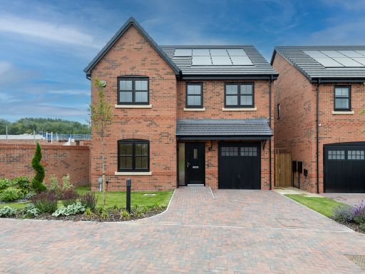
BL5 3LH - 4 bedroom detached house for sale in Off Platt Lane, Westho…
View on Property Piper
4 bedroom detached house for sale in Off Platt Lane,
Westhoughton,
Bolton,
BL5 3LH, BL5
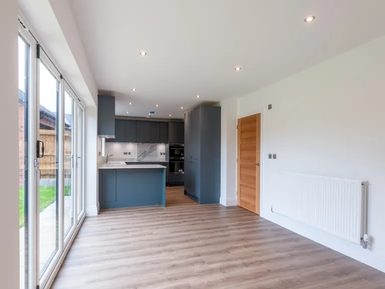
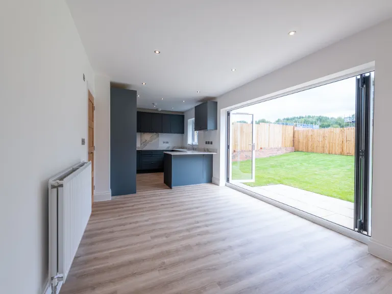
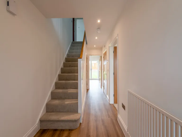
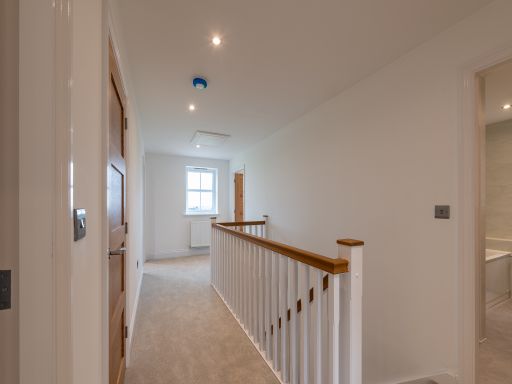
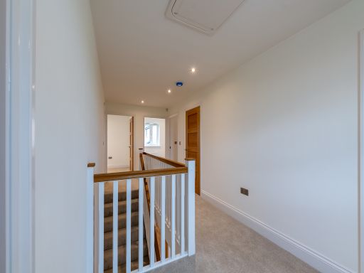
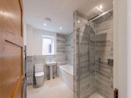
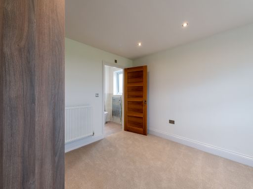
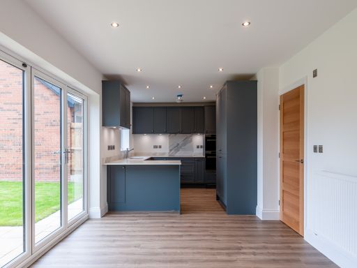
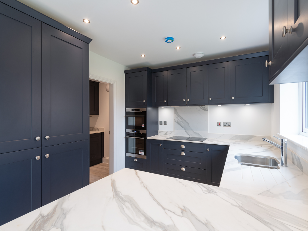
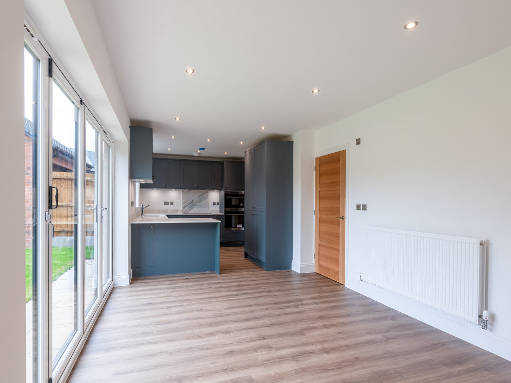
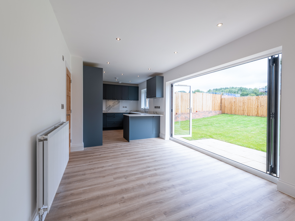
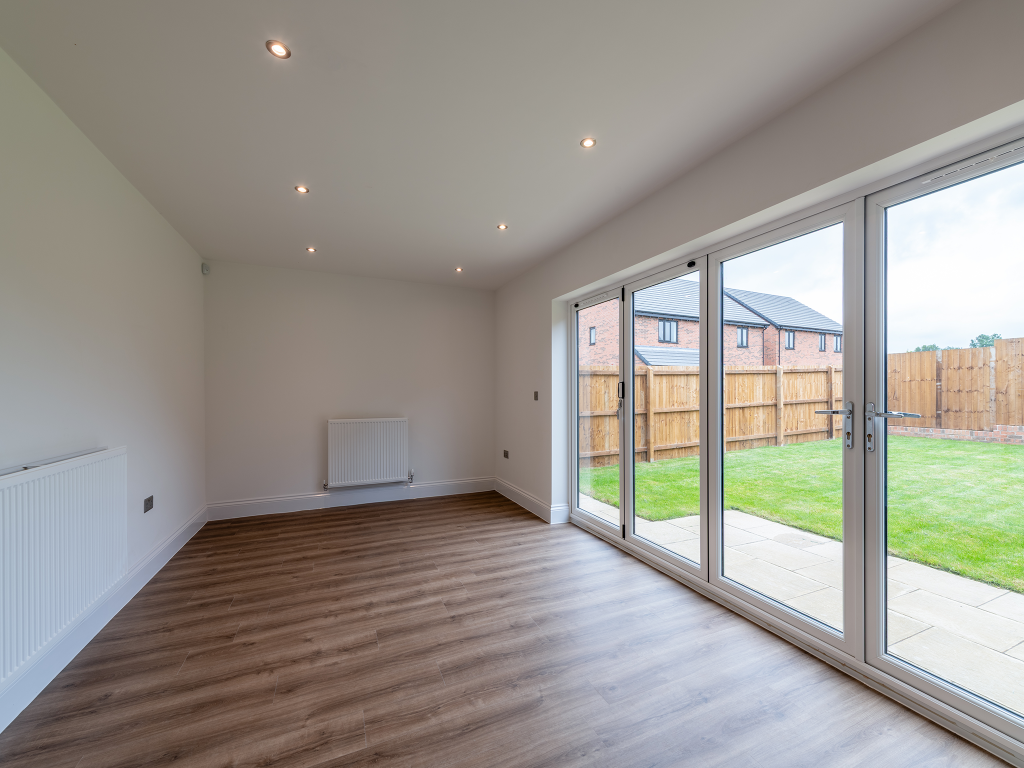
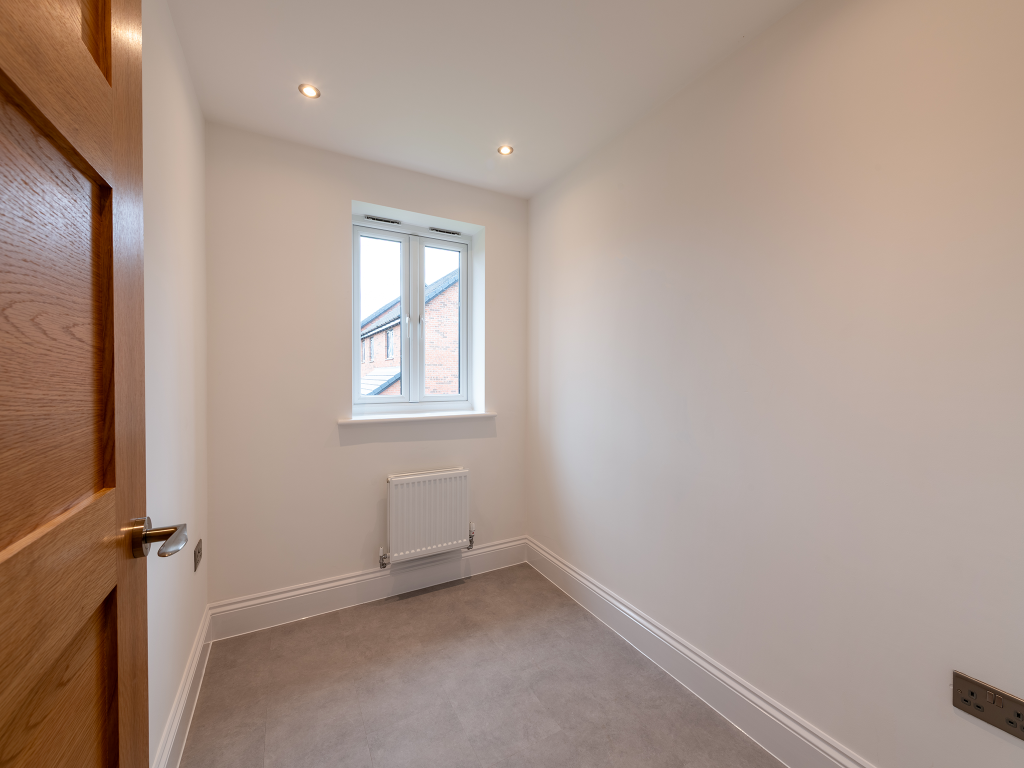
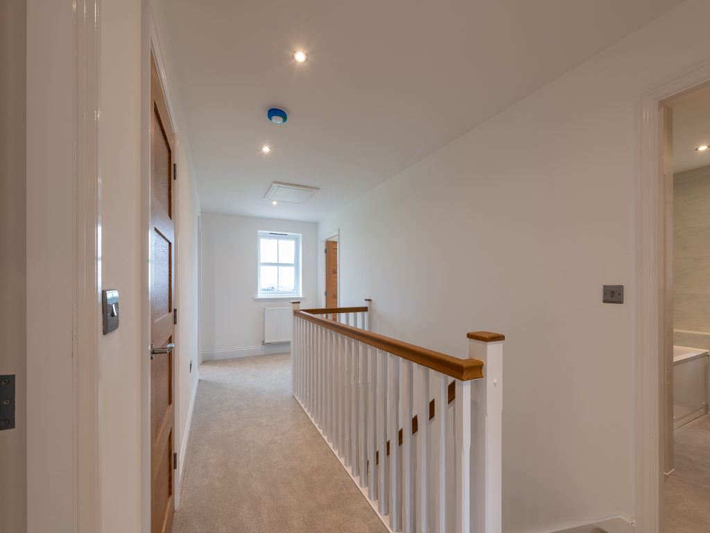
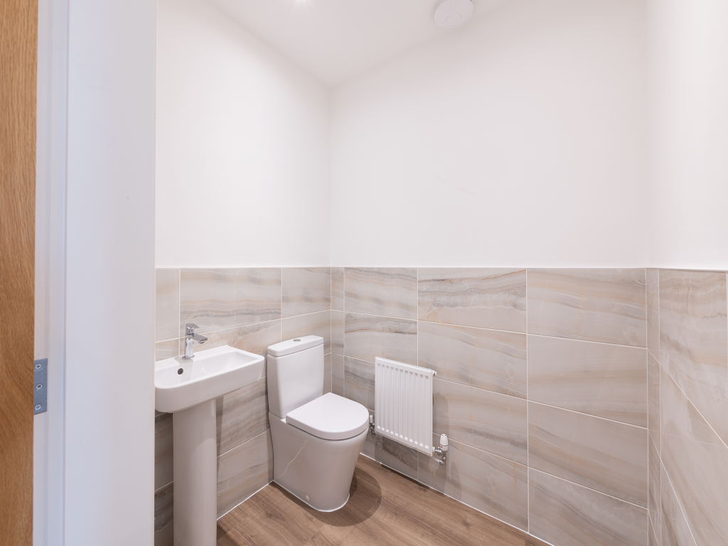
Property Details
- Price: £479995
- Bedrooms: 4
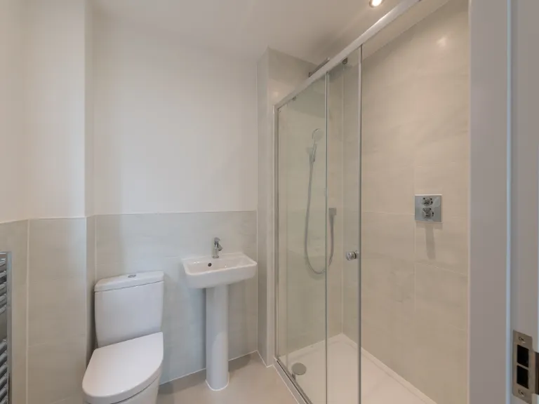
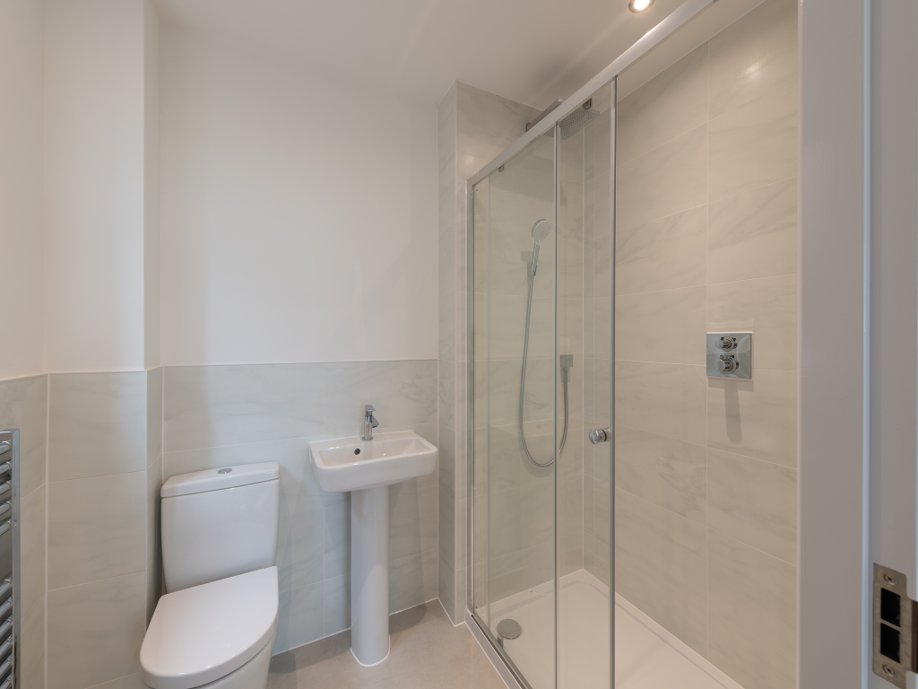
- Bathrooms: 1
- Property Type: undefined
- Property SubType: undefined
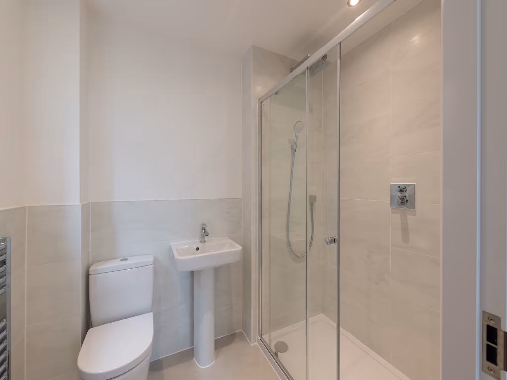
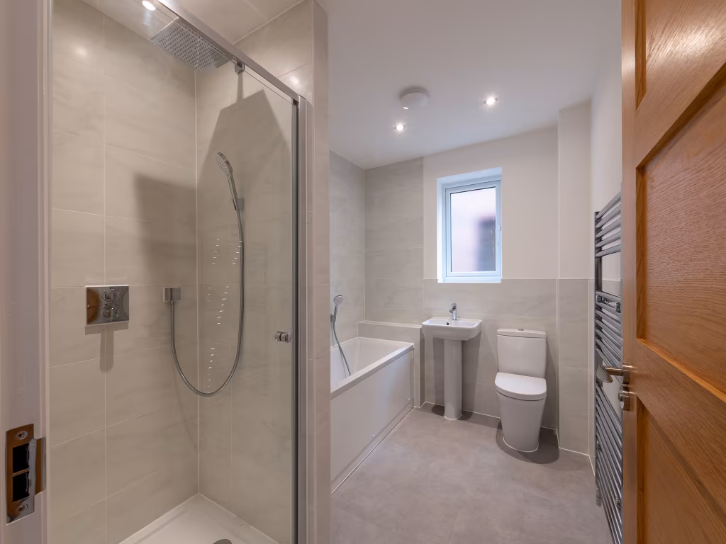
Image Descriptions
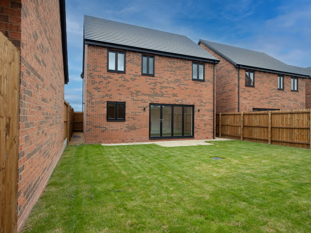
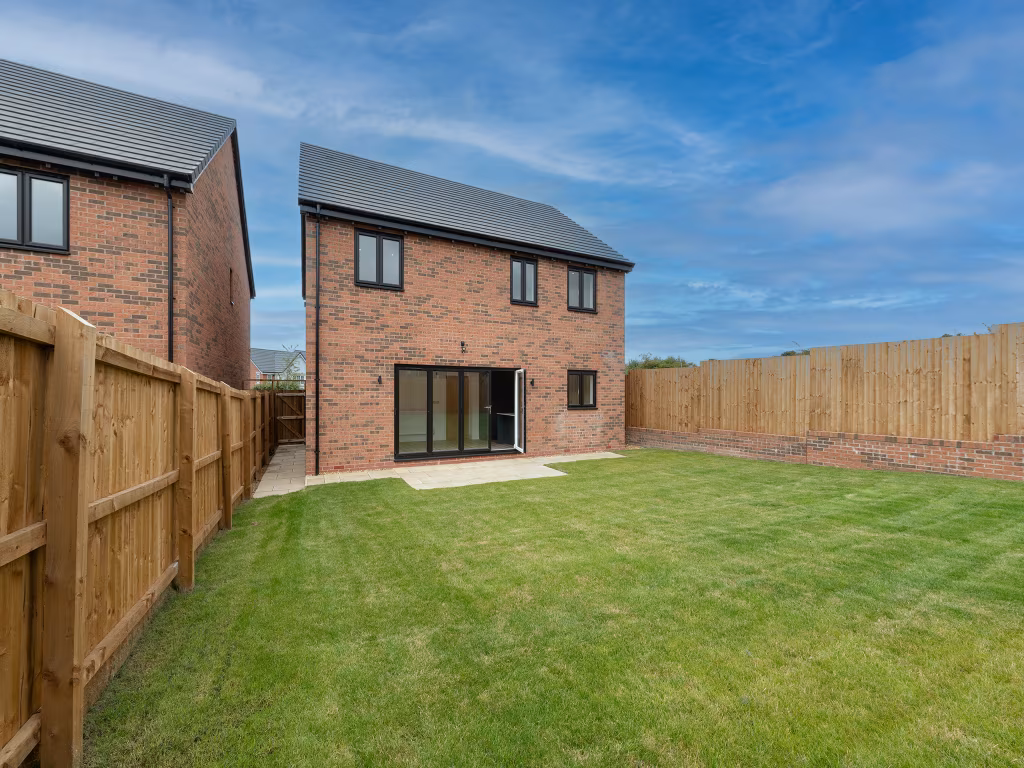
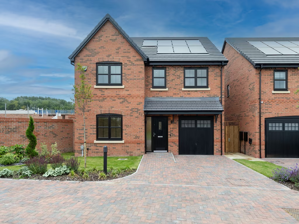
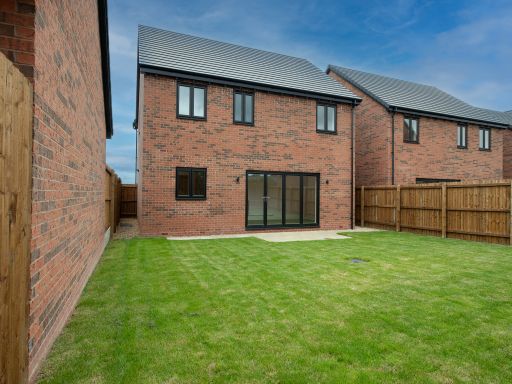
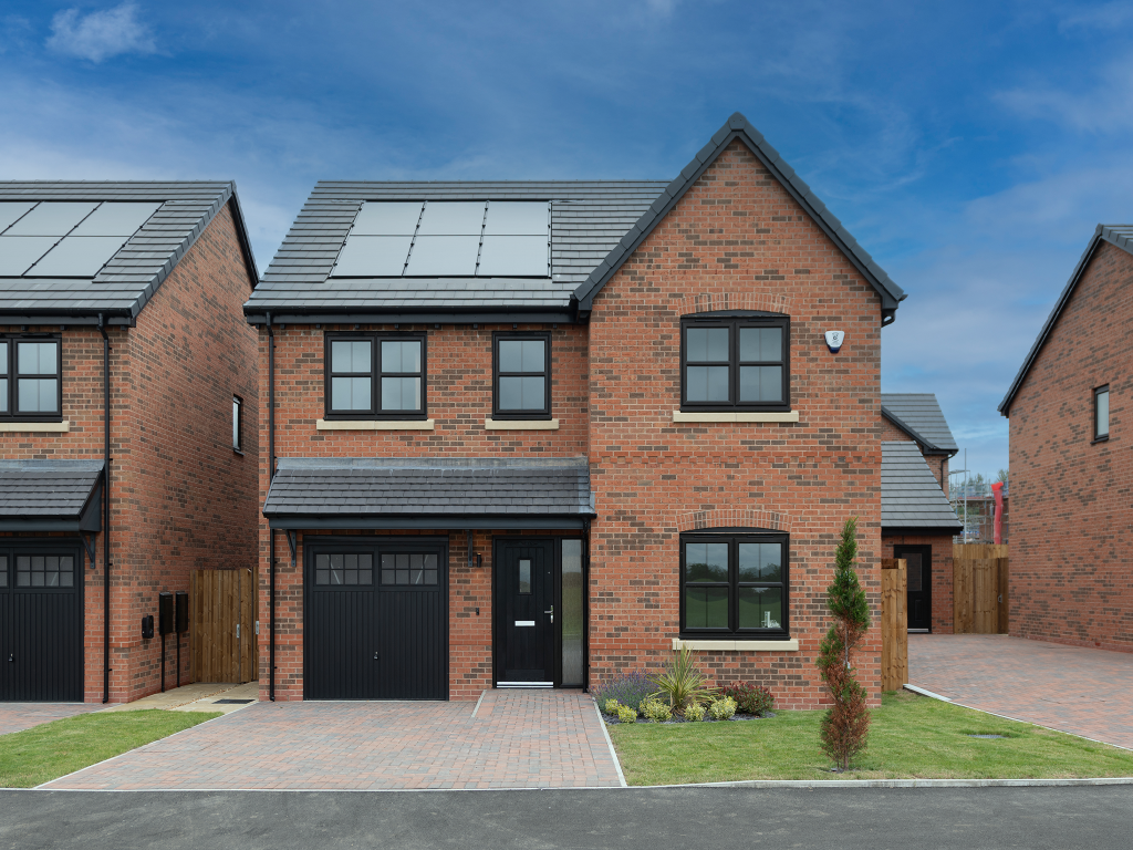
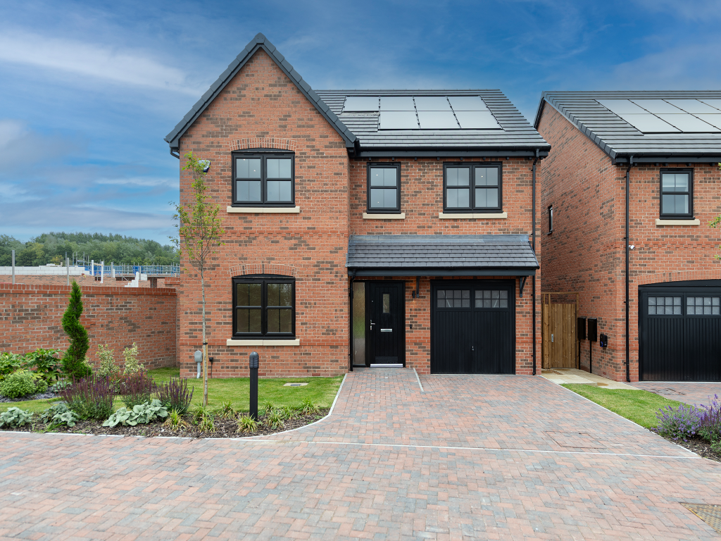
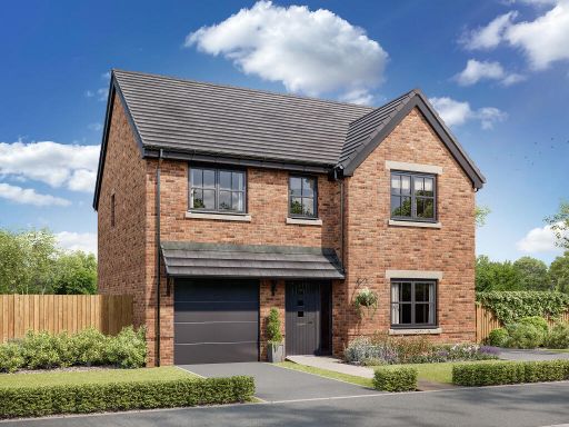
- house exterior modern
- detached house modern
Floorplan Description
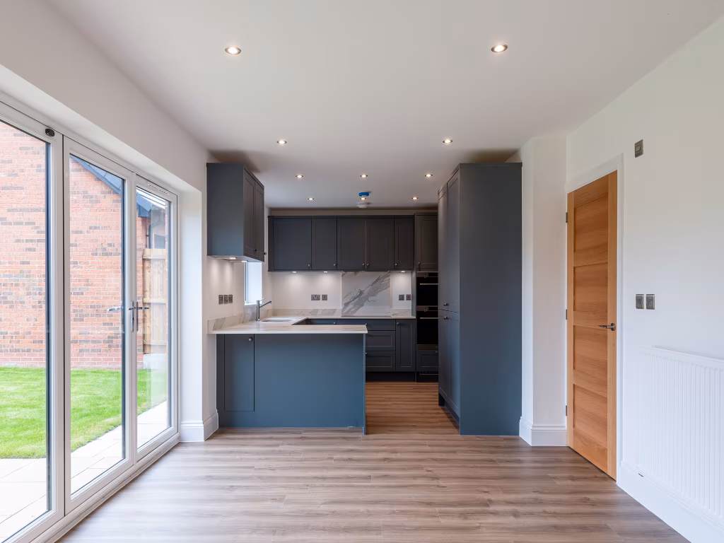
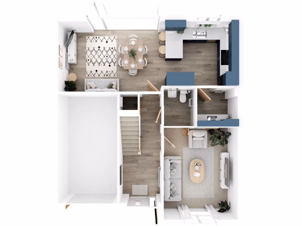
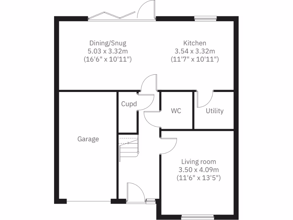
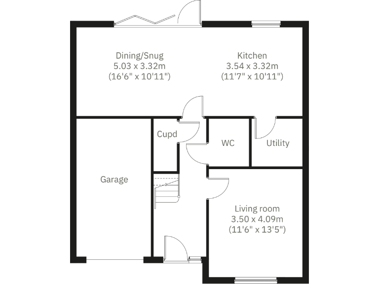
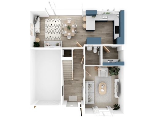
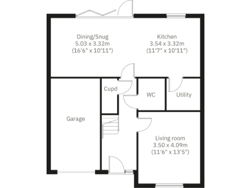
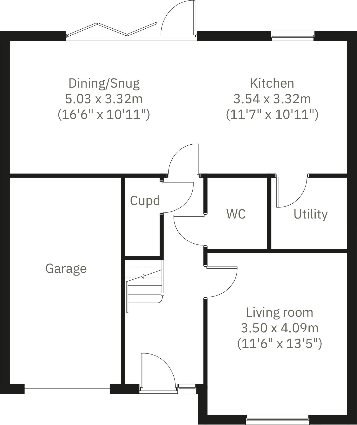
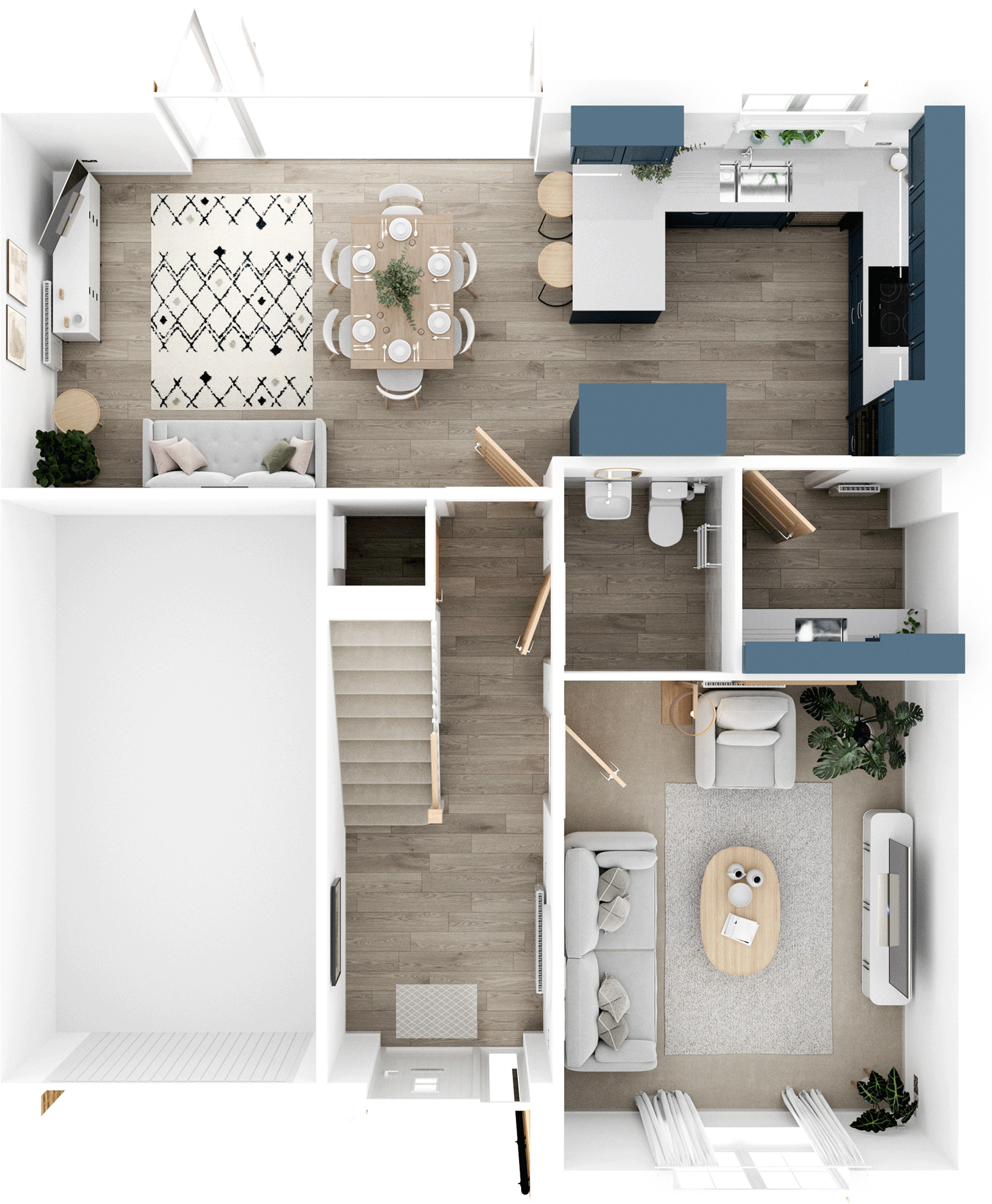
- Ground floor plan showing dining/snug, kitchen, living room and ancillary spaces
- Ground-floor plan showing Dining/Snug, Kitchen, Living room, Utility, WC and Garage (garage excluded from area).
Rooms
- Dining/Snug:
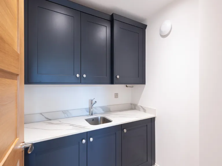
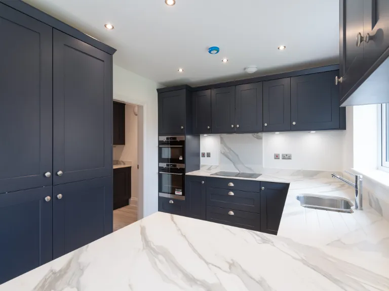
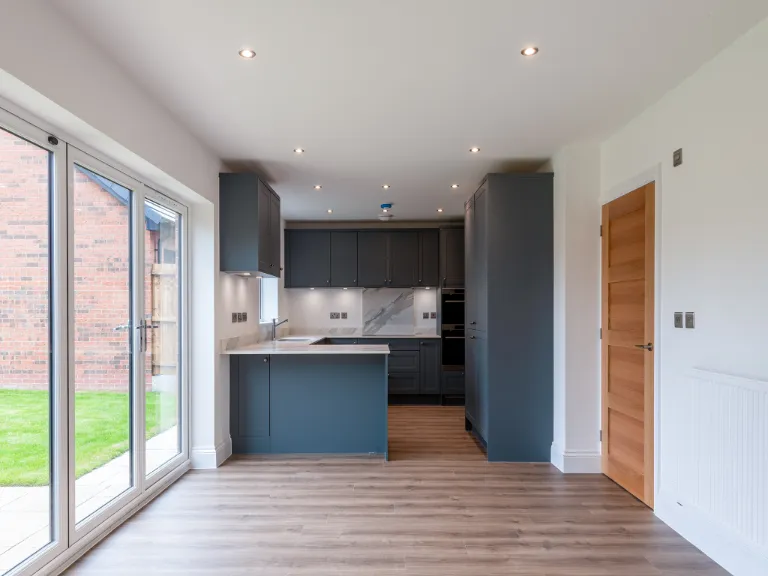
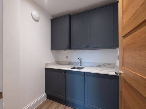
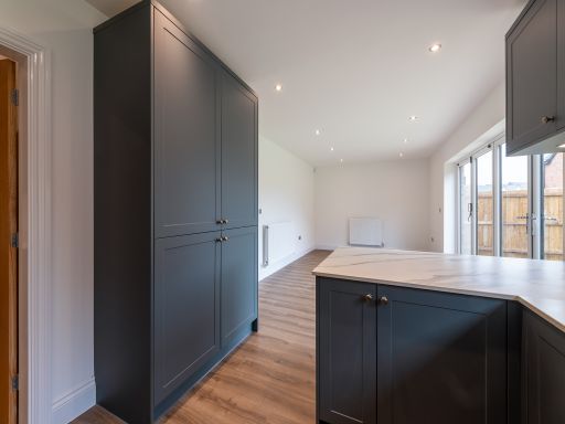
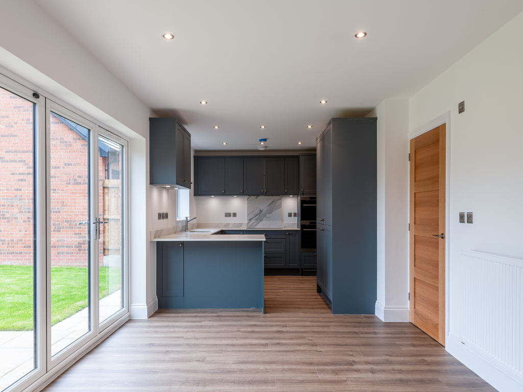
- Kitchen:
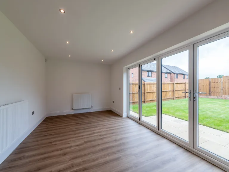
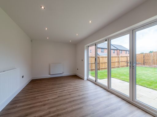
- Living room:
- Cupd:
- WC:
- Utility:
- Garage:
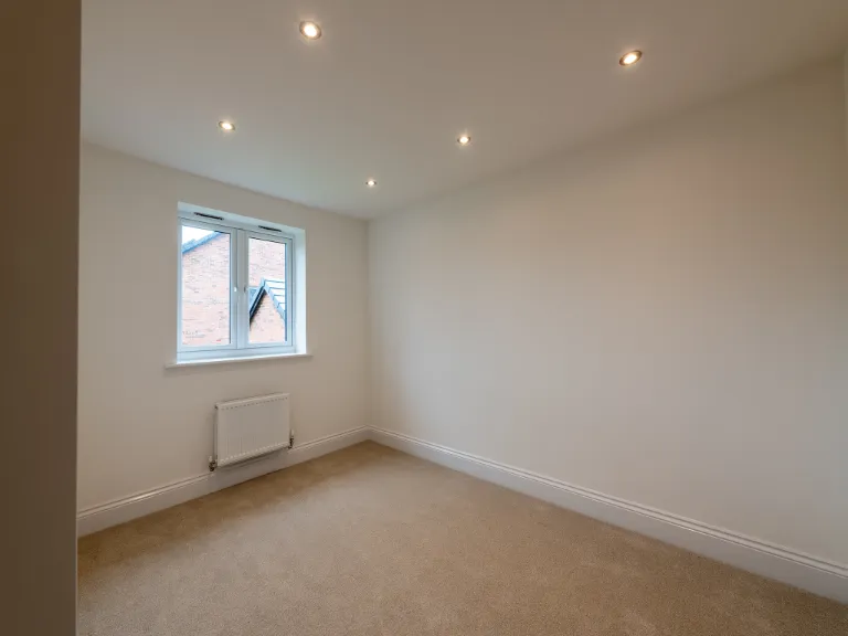
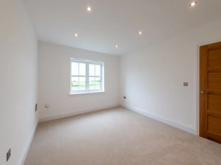
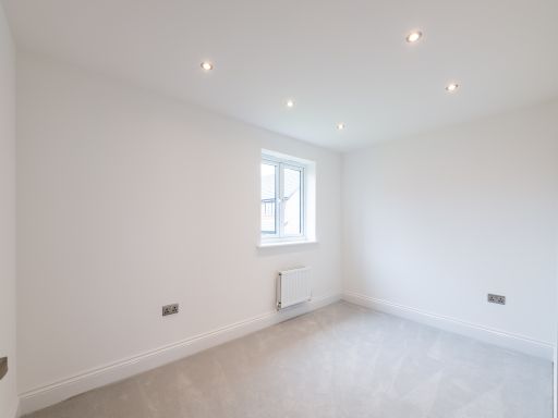
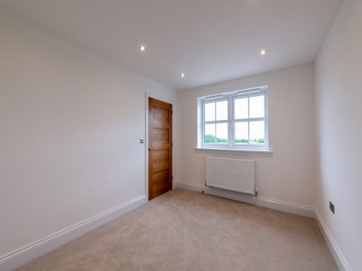
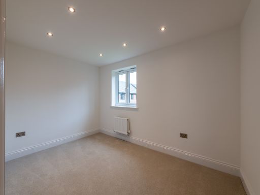
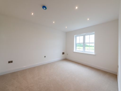
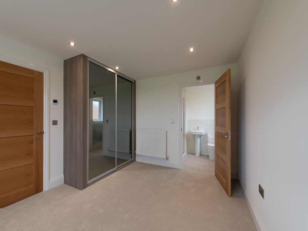
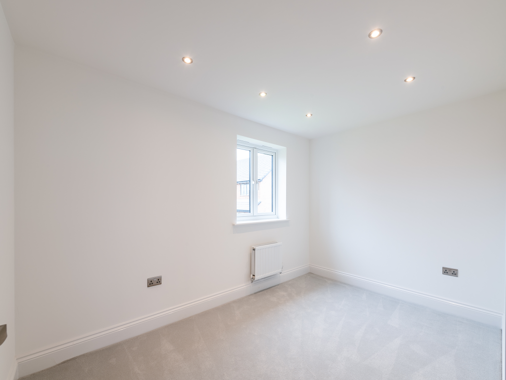
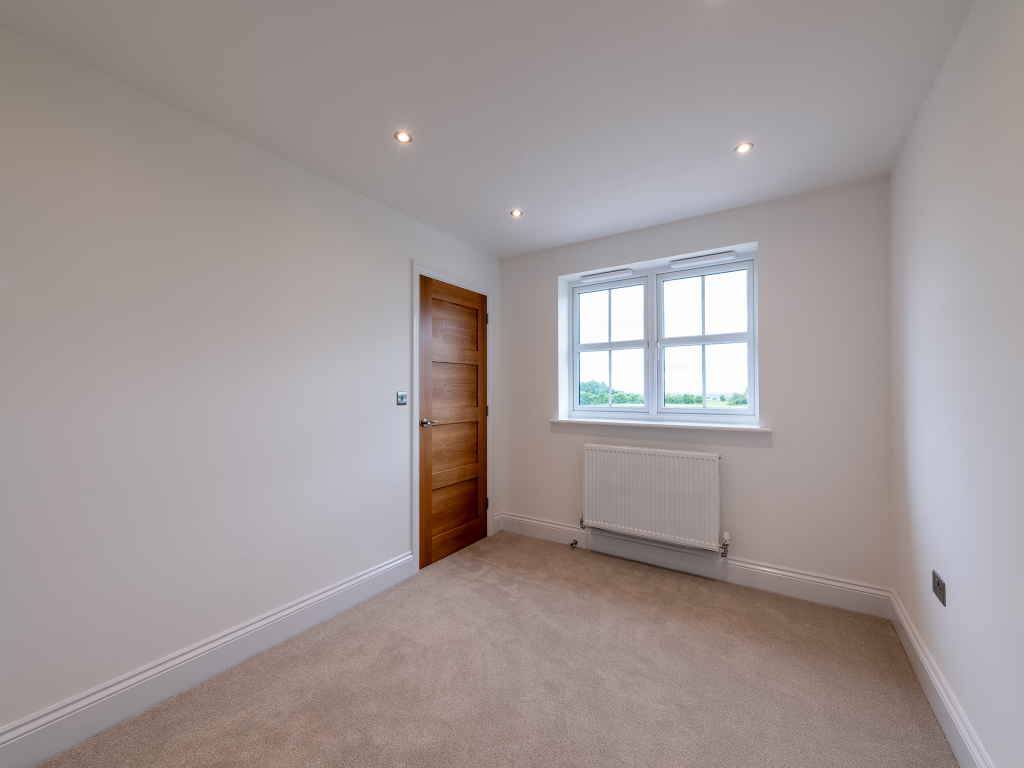
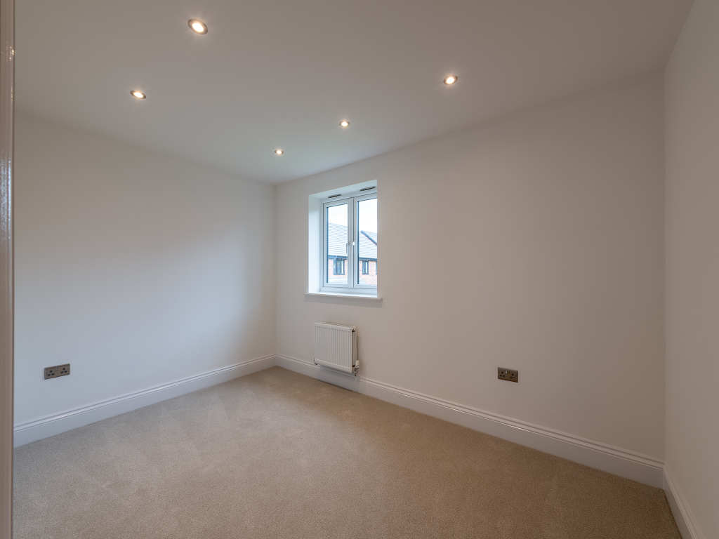
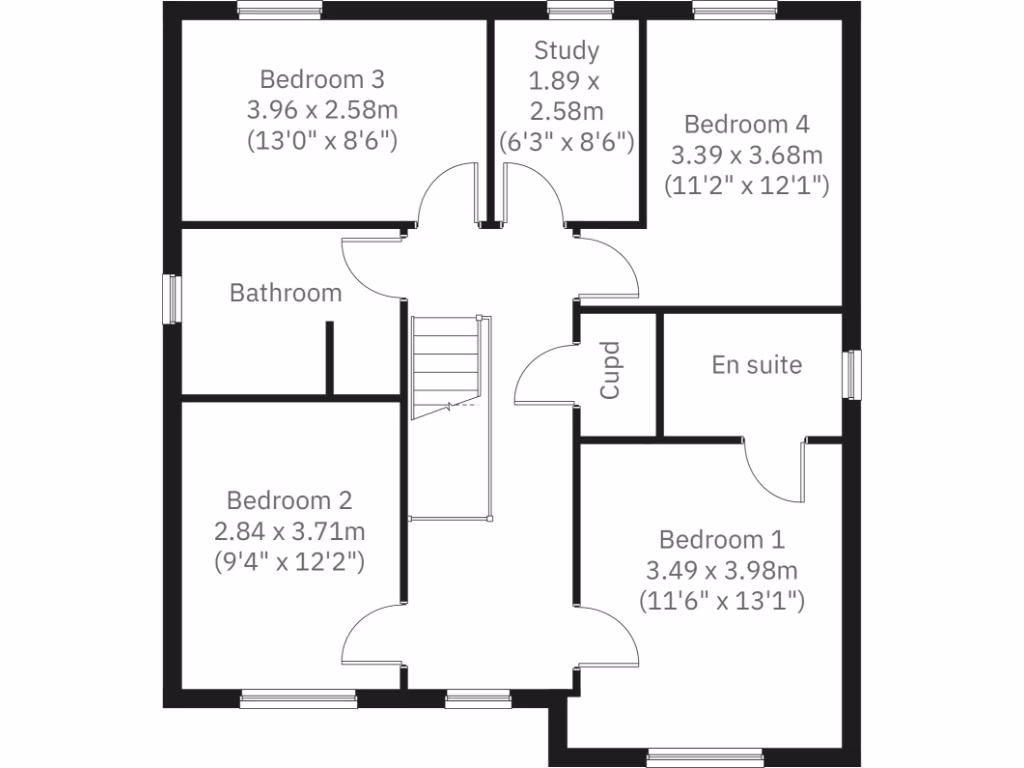
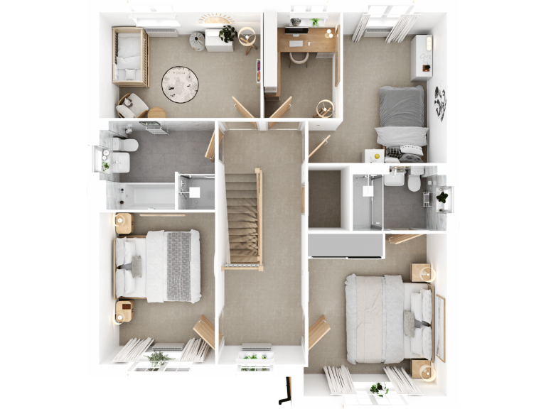
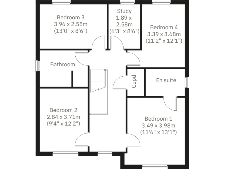
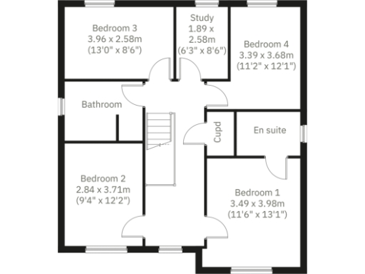
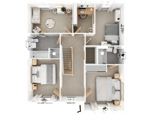
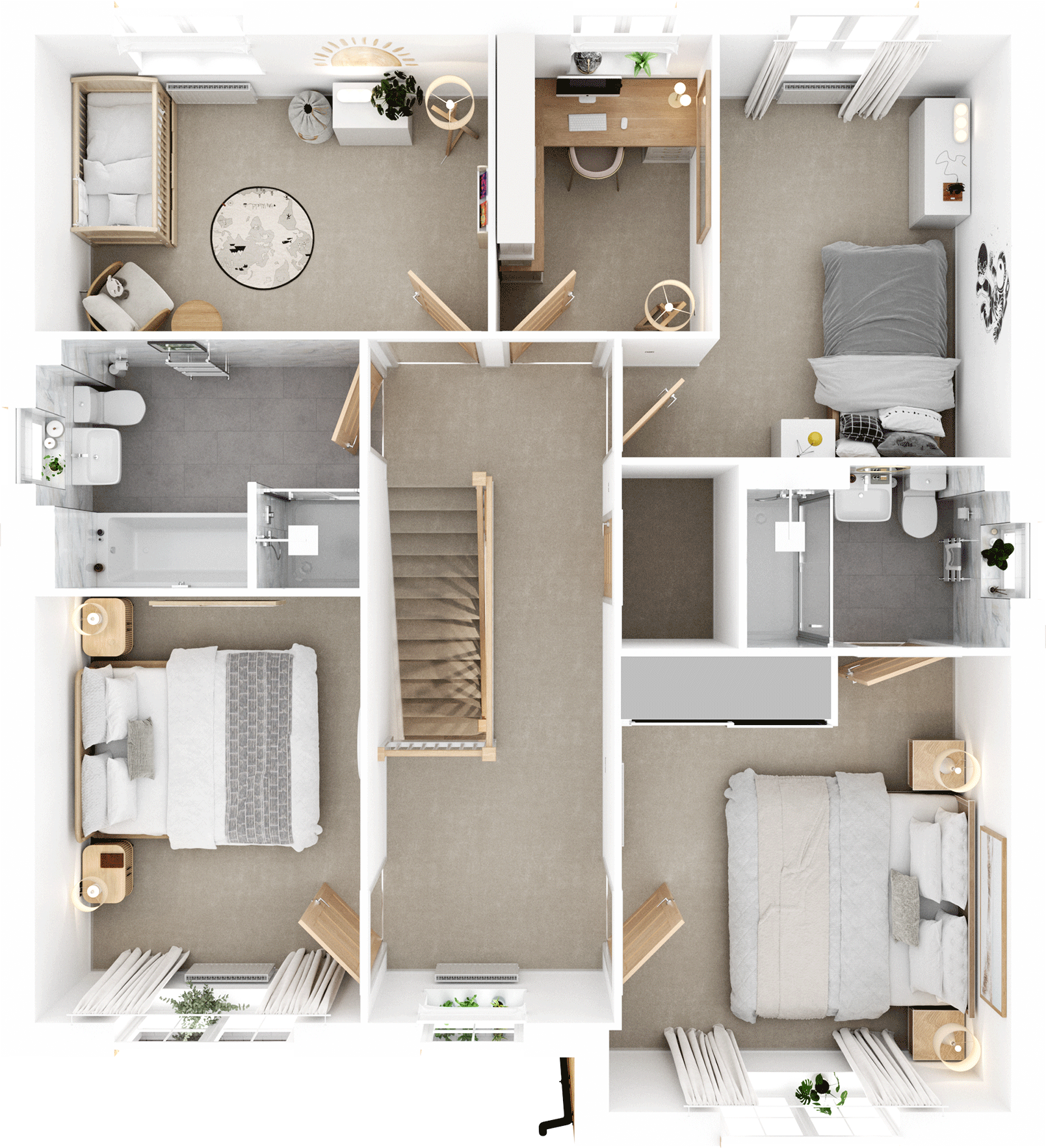
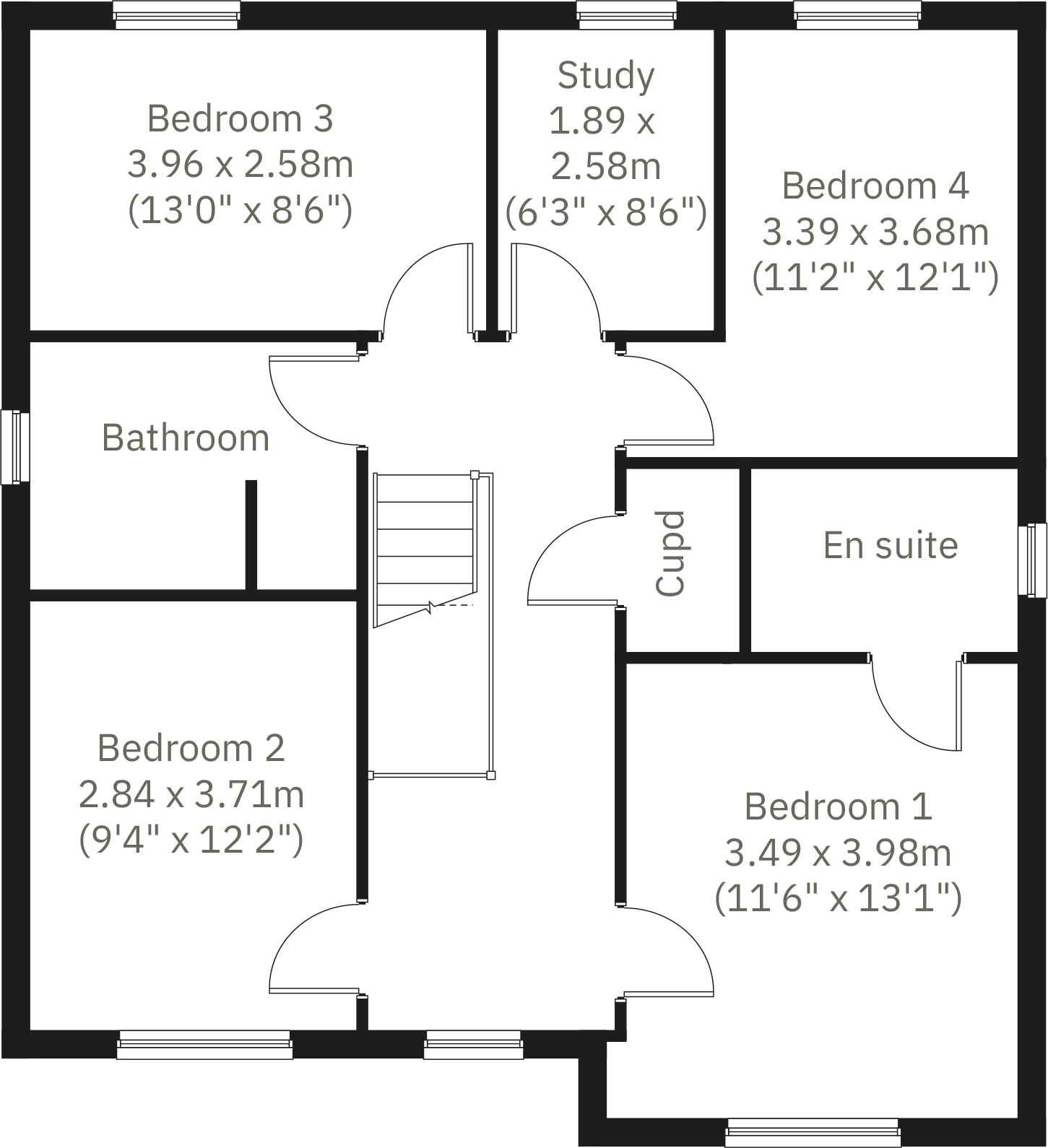
- Bedroom 3:
- Study:
- Bedroom 4:
- Bedroom 2:
- Bedroom 1:
- Dining/Snug:
- Kitchen:
- Living room:
- Garage:
- Cupd:
- WC:
- Utility:
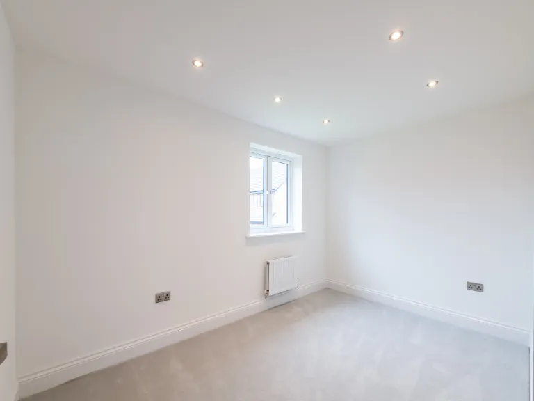
- Bedroom 3:
- Study:
- Bedroom 4:
- Bedroom 2:
- Bedroom 1:
- Dining/Snug:
- Kitchen:
- Living room:
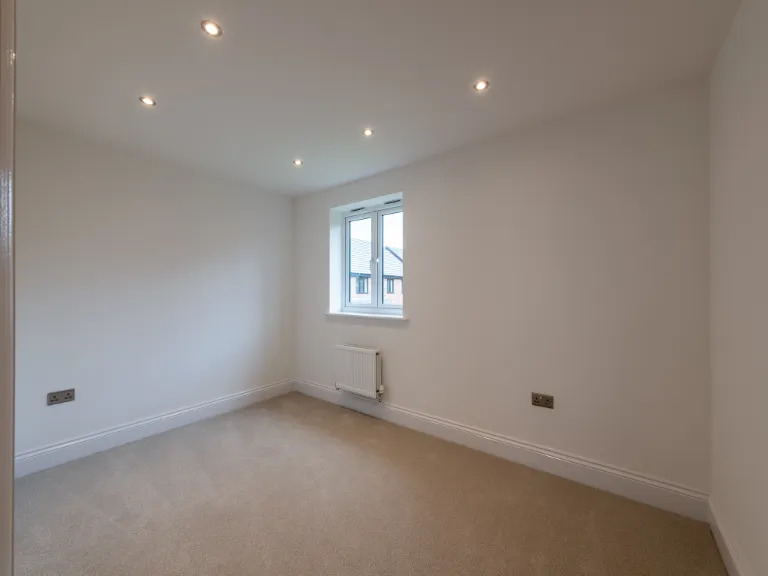
- Bedroom 3:
- Study:
- Bedroom 4:
- Bedroom 2:
- Bedroom 1:
Textual Property Features
- Is New Build
- Has Garden
- Success
Detected Visual Features
- modern
- newly built
- brick exterior
- two-story
- garage
- solar panels
- driveway
- low maintenance garden
- detached
- double glazed windows
- new build
- urban
Nearby Schools
- Sacred Heart RC Primary School
- St Richard's Roman Catholic Primary School Atherton
- Beaumont Primary School
- St George's CofE Primary School
- Sacred Heart R.C. Primary School
- Fred Longworth High School
- Hindsford CofE Primary School
- Atherton St George's CofE Primary School
- St Michael's CofE Primary School, Howe Bridge
- St James CofE Primary School, Daisy Hill
- Parklee Community School
- Chowbent Primary School
- St Philip's CofE Primary School, Atherton
- Meadowbank Primary School & Children's Centre
- St Andrew's CofE Primary School, Over Hulton
- Heathfield Primary School
- St Mary's CofE Primary School, Deane
- Ladybridge High School
- Lostock Primary School
- Eatock Primary School
- Westhoughton High School
- Atherton High School
- St Bernard's RC Primary School, Bolton
- Ladybridge Community Primary School
- St Bartholomew's CofE Primary School
- St Thomas CofE Primary School
- The Gates Primary School
Nearest General Shops
- Id: 694995883
- Tags:
- Addr:
- Housenumber: 360
- Postcode: BL5 3HX
- Street: Park Road
- Building: yes
- Name: AD3 Design
- Shop: kitchen
- TagsNormalized:
- Lat: 53.5506214
- Lon: -2.4985347
- FullGeoHash: gcw0xhsdgzm7
- PartitionGeoHash: gcw0
- Images:
- FoodStandards: null
- Distance: 498.6
,- Id: 279793693
- Tags:
- Addr:
- City: Westhoughton
- Housenumber: 5
- Street: Fairhaven Drive
- Landuse: retail
- Name: Oaklands Nursery
- Shop: garden_centre
- TagsNormalized:
- retail
- nursery
- garden centre
- shop
- Lat: 53.5495859
- Lon: -2.5074489
- FullGeoHash: gcw0wuqhunqd
- PartitionGeoHash: gcw0
- Images:
- FoodStandards: null
- Distance: 493.1
,- Id: 695586603
- Tags:
- Addr:
- Housenumber: 222
- Postcode: BL5 3HL
- Street: Park Road
- Building: yes
- Name: Pravins Off Licence
- Shop: alcohol
- TagsNormalized:
- Lat: 53.5480098
- Lon: -2.5056543
- FullGeoHash: gcw0wup7y088
- PartitionGeoHash: gcw0
- Images:
- FoodStandards: null
- Distance: 292
}
Nearest Supermarkets
- Id: 593692656
- Tags:
- Brand: Sainsbury's
- Brand:wikidata: Q152096
- Brand:wikipedia: en:Sainsbury's
- Building: yes
- Name: Sainsbury's
- Note: Petrol station shop attached to a larger store
- Shop: supermarket
- Website: https://stores.sainsburys.co.uk/2097/westhoughton
- TagsNormalized:
- sainsburys
- supermarket
- shop
- Lat: 53.5470844
- Lon: -2.5228491
- FullGeoHash: gcw0wefymk52
- PartitionGeoHash: gcw0
- Images:
- FoodStandards: null
- Distance: 1384.2
,- Id: 698963759
- Tags:
- Addr:
- Housenumber: 34-40
- Postcode: BL5 3AN
- Street: Market Street
- Brand: Co-op Food
- Brand:wikidata: Q3277439
- Brand:wikipedia: en:Co-op Food
- Building: yes
- Fhrs:
- Name: Co-op Food
- Operator: The Co-operative Group
- Operator:wikidata: Q117202
- Shop: supermarket
- Source:
- TagsNormalized:
- co-op
- co-op food
- food
- supermarket
- shop
- Lat: 53.5489768
- Lon: -2.521569
- FullGeoHash: gcw0ws7c7hvc
- PartitionGeoHash: gcw0
- Images:
- FoodStandards:
- Id: 89623
- FHRSID: 89623
- LocalAuthorityBusinessID: 2401
- BusinessName: Co-op
- BusinessType: Retailers - supermarkets/hypermarkets
- BusinessTypeID: 7840
- AddressLine1: null
- AddressLine2: 34-40 Market Street
- AddressLine3: Westhoughton
- AddressLine4: Bolton
- PostCode: BL5 3AN
- RatingValue: 4
- RatingKey: fhrs_4_en-GB
- RatingDate: 2015-03-11
- LocalAuthorityCode: 403
- LocalAuthorityName: Bolton
- LocalAuthorityWebSite: http://www.bolton.gov.uk
- LocalAuthorityEmailAddress: environmental.health@bolton.gov.uk
- Scores:
- Hygiene: 10
- Structural: 5
- ConfidenceInManagement: 0
- NewRatingPending: false
- Geocode:
- Longitude: -2.52112300000000
- Latitude: 53.54893800000000
- Distance: 1325
,- Id: 746947333
- Tags:
- Addr:
- City: Westhoughton
- Housenumber: 29
- Postcode: BL5 3DG
- Street: Bolton Road
- Brand: ALDI
- Brand:wikidata: Q41171672
- Brand:wikipedia: en:Aldi
- Building: supermarket
- Building:levels: 1
- Contact:
- Website: https://stores.aldi.co.uk/westhoughton/29-bolton-road
- Name: ALDI
- Shop: supermarket
- TagsNormalized:
- Lat: 53.5493963
- Lon: -2.5203144
- FullGeoHash: gcw0wskgb6vr
- PartitionGeoHash: gcw0
- Images:
- FoodStandards: null
- Distance: 1254.5
}
Nearest Religious buildings
- Id: 36779491
- Tags:
- Amenity: grave_yard
- Denomination: methodist
- Name: Westhoughton United Reform Church
- Religion: christian
- TagsNormalized:
- grave yard
- methodist
- church
- christian
- Lat: 53.5475852
- Lon: -2.5178345
- FullGeoHash: gcw0wsn961qe
- PartitionGeoHash: gcw0
- Images:
- FoodStandards: null
- Distance: 1057.5
,- Id: 36089487
- Tags:
- Addr:
- City: Westhoughton
- Housenumber: 18
- Postcode: BL5 2LW
- Street: Leigh Road
- Amenity: place_of_worship
- Building: yes
- Denomination: reformed
- Name: Westhoughton United Reform Church
- Religion: christian
- Source: survey
- TagsNormalized:
- place of worship
- church
- christian
- Lat: 53.5474961
- Lon: -2.5176874
- FullGeoHash: gcw0wsn8v8u0
- PartitionGeoHash: gcw0
- Images:
- FoodStandards: null
- Distance: 1046.8
,- Id: 696121883
- Tags:
- Addr:
- City: Westhoughton
- Postcode: BL5 3EF
- Street: Bolton Road
- Amenity: place_of_worship
- Building: yes
- Email: info@westhoughton.org
- Fhrs:
- Name: Westhoughton Pentecostal Church
- Phone: +44 1942 375433
- Religion: christian
- Website: http://www.westhoughton.org/
- TagsNormalized:
- place of worship
- church
- pentecostal
- christian
- Lat: 53.5538253
- Lon: -2.5107953
- FullGeoHash: gcw0wv5twhx7
- PartitionGeoHash: gcw0
- Images:
- FoodStandards:
- Id: 143449
- FHRSID: 143449
- LocalAuthorityBusinessID: 8086
- BusinessName: Westhoughton Pentecostal Church
- BusinessType: Other catering premises
- BusinessTypeID: 7841
- AddressLine1: null
- AddressLine2: Bolton Road
- AddressLine3: Westhoughton
- AddressLine4: Bolton
- PostCode: BL5 3EF
- RatingValue: 5
- RatingKey: fhrs_5_en-GB
- RatingDate: 2014-01-28
- LocalAuthorityCode: 403
- LocalAuthorityName: Bolton
- LocalAuthorityWebSite: http://www.bolton.gov.uk
- LocalAuthorityEmailAddress: environmental.health@bolton.gov.uk
- Scores:
- Hygiene: 0
- Structural: 0
- ConfidenceInManagement: 5
- NewRatingPending: false
- Geocode:
- Longitude: -2.51116000000000
- Latitude: 53.55374500000000
- Distance: 993.9
}
Nearest Medical buildings
- Id: 698963757
- Tags:
- Amenity: pharmacy
- Building: yes
- Dispensing: yes
- Healthcare: pharmacy
- Name: Numark Pharmacy
- TagsNormalized:
- Lat: 53.5490229
- Lon: -2.5218564
- FullGeoHash: gcw0ws79smrs
- PartitionGeoHash: gcw0
- Images:
- FoodStandards: null
- Distance: 1344.6
,- Id: 699109133
- Tags:
- Addr:
- City: Westhoughton
- Housenumber: 53
- Postcode: BL5 3BX
- Street: Park Road
- Amenity: dentist
- Brand: mydentist
- Brand:wikidata: Q65118035
- Brand:wikipedia: en:Mydentist
- Building: yes
- Contact:
- Website: https://www.mydentist.co.uk/dentists/practices/england/north-west-england/bolton/53-park-road
- Healthcare: dentist
- Name: mydentist
- TagsNormalized:
- Lat: 53.5478188
- Lon: -2.5174839
- FullGeoHash: gcw0wsnfdkgv
- PartitionGeoHash: gcw0
- Images:
- FoodStandards: null
- Distance: 1037.5
,- Id: 187160938
- Tags:
- Addr:
- Amenity: doctors
- Building: yes
- Healthcare: doctor
- Name: Peter House Surgery
- TagsNormalized:
- doctor
- doctors
- health
- healthcare
- surgery
- Lat: 53.5479794
- Lon: -2.5084211
- FullGeoHash: gcw0wuj7tdce
- PartitionGeoHash: gcw0
- Images:
- FoodStandards: null
- Distance: 456.1
,- Id: 187160936
- Tags:
- Amenity: pharmacy
- Brand: Rowlands Pharmacy
- Brand:wikidata: Q62663235
- Building: yes
- Dispensing: yes
- Healthcare: pharmacy
- Name: Rowlands Pharmacy
- TagsNormalized:
- pharmacy
- rowlands pharmacy
- health
- healthcare
- Lat: 53.5482538
- Lon: -2.507925
- FullGeoHash: gcw0wujv1n58
- PartitionGeoHash: gcw0
- Images:
- FoodStandards: null
- Distance: 437.2
}
Nearest Airports
- Id: 116737532
- Tags:
- Addr:
- City: Liverpool
- Country: GB
- Postcode: L24 1YD
- Street: Speke Hall Avenue
- Aerodrome: international
- Aerodrome:type: public
- Aeroway: aerodrome
- Iata: LPL
- Icao: EGGP
- Is_in: Liverpool,England,UK
- Name: Liverpool John Lennon Airport
- Old_name: Speke Airport
- Operator: Liverpool Airport plc
- Source: wikipedia
- Website: https://www.liverpoolairport.com/
- Wikidata: Q8727
- Wikipedia: en:Liverpool John Lennon Airport
- TagsNormalized:
- airport
- international airport
- Lat: 53.3357677
- Lon: -2.8518179
- FullGeoHash: gcmzrj7r7gdr
- PartitionGeoHash: gcmz
- Images:
- FoodStandards: null
- Distance: 32965.8
,- Id: 1224469
- Tags:
- Addr:
- City: Manchester
- Country: GB
- Postcode: M90 1QX
- Aerodrome: international
- Aeroway: aerodrome
- Arp: yes
- Atis: 128.175
- Iata: MAN
- Icao: EGCC
- Name: Manchester Airport
- Note: rough sketched outline referring to Yahoo imagery - true boundary is where?
- Old_name: Ringway
- Operator: Manchester Airport PLC
- Size: 18720000
- Source:
- Tower_frequency: 118.625,119.400
- Type: multipolygon
- Website: https://www.manchesterairport.co.uk/
- Wikidata: Q8694
- Wikipedia: en:Manchester Airport
- TagsNormalized:
- airport
- international airport
- Lat: 53.3503197
- Lon: -2.2798822
- FullGeoHash: gcqrs05u4ukt
- PartitionGeoHash: gcqr
- Images:
- FoodStandards: null
- Distance: 26317
}
Nearest Leisure Facilities
- Id: 958836049
- Tags:
- Hoops: 2
- Leisure: pitch
- Sport: basketball
- TagsNormalized:
- pitch
- leisure
- basketball
- sports
- Lat: 53.5482162
- Lon: -2.5156964
- FullGeoHash: gcw0wu0hunbz
- PartitionGeoHash: gcw0
- Images:
- FoodStandards: null
- Distance: 928
,- Id: 127544260
- Tags:
- Leisure: pitch
- Sport: soccer
- TagsNormalized:
- Lat: 53.5479663
- Lon: -2.5150038
- FullGeoHash: gcw0wu0es0mj
- PartitionGeoHash: gcw0
- Images:
- FoodStandards: null
- Distance: 877.9
,- Id: 285033173
- Tags:
- Leisure: nature_reserve
- Name: Hall Lee Bank Local Nature Reserve
- Source: Bing, Survey
- TagsNormalized:
- nature reserve
- leisure
- bank
- Lat: 53.5497885
- Lon: -2.5128478
- FullGeoHash: gcw0wu6nnkhf
- PartitionGeoHash: gcw0
- Images:
- FoodStandards: null
- Distance: 804.2
,- Id: 131184087
- Tags:
- Leisure: pitch
- Source: Bing
- TagsNormalized:
- Lat: 53.5499183
- Lon: -2.5042888
- FullGeoHash: gcw0xh2qvu6c
- PartitionGeoHash: gcw0
- Images:
- FoodStandards: null
- Distance: 399.8
,- Id: 131184086
- Tags:
- Leisure: pitch
- Source: Bing
- TagsNormalized:
- Lat: 53.5497875
- Lon: -2.5046631
- FullGeoHash: gcw0xh2nj5gv
- PartitionGeoHash: gcw0
- Images:
- FoodStandards: null
- Distance: 397.2
}
Nearest Tourist attractions
- Id: 938615700
- Tags:
- Addr:
- City: Tyldesley
- Housenumber: 138
- Postcode: M29 8FJ
- Street: Elliott Street
- Building: yes
- Listed_status: Grade II
- Tourism: guest_house
- TagsNormalized:
- Lat: 53.5139108
- Lon: -2.468605
- FullGeoHash: gcw0rvfmjk48
- PartitionGeoHash: gcw0
- Images:
- FoodStandards: null
- Distance: 4250.6
,- Id: 659476748
- Tags:
- Addr:
- City: Westhoughton
- Housenumber: 338
- Postcode: BL5 3QE
- Street: Church Street
- Building: yes
- Email: whitewallgallery@hotmail.com
- Name: The White Wall gallery & Framers
- Tourism: gallery
- Website: https://thewhitewallgalleryandframers.com/
- TagsNormalized:
- Lat: 53.559578
- Lon: -2.5242503
- FullGeoHash: gcw0ww1zhsyx
- PartitionGeoHash: gcw0
- Images:
- FoodStandards: null
- Distance: 2063
,- Id: 694951253
- Tags:
- Addr:
- Postcode: BL5 3JP
- Street: Manchester Road
- Building: yes
- Name: Mercury Motel
- Tourism: motel
- TagsNormalized:
- Lat: 53.5517175
- Lon: -2.503445
- FullGeoHash: gcw0xhc13e8j
- PartitionGeoHash: gcw0
- Images:
- FoodStandards: null
- Distance: 576.7
}
Nearest Train stations
- Id: 5392831639
- Tags:
- Name: Lostock
- Naptan:
- Network: National Rail
- Operator: Northern Rail
- Public_transport: station
- Railway: station
- Ref:
- Train: yes
- Wikidata: Q6684520
- Wikipedia: en:Lostock railway station
- TagsNormalized:
- Lat: 53.5727921
- Lon: -2.494764
- FullGeoHash: gcw0z0xk5u30
- PartitionGeoHash: gcw0
- Images:
- FoodStandards: null
- Distance: 2949.2
,- Id: 6581364399
- Tags:
- Name: Atherton
- Naptan:
- Network: National Rail
- Old_name: Atherton Central
- Public_transport: station
- Railway: station
- Ref:
- Source: NPE
- Train: yes
- Wheelchair: yes
- Wikidata: Q2474672
- Wikipedia: en:Atherton railway station
- TagsNormalized:
- Lat: 53.5290757
- Lon: -2.4778339
- FullGeoHash: gcw0x8etqqcn
- PartitionGeoHash: gcw0
- Images:
- FoodStandards: null
- Distance: 2516.7
,- Id: 6178577209
- Tags:
- Name: Westhoughton
- Naptan:
- Network: National Rail
- Public_transport: station
- Railway: station
- Ref:
- Source: npe
- Wikidata: Q2751556
- Wikipedia: en:Westhoughton railway station
- TagsNormalized:
- Lat: 53.5558849
- Lon: -2.523221
- FullGeoHash: gcw0wtd9ssw1
- PartitionGeoHash: gcw0
- Images:
- FoodStandards: null
- Distance: 1744.9
,- Id: 8257336106
- Tags:
- Name: Hag Fold
- Naptan:
- Network: National Rail
- Public_transport: station
- Railway: station
- Ref:
- Wikidata: Q2022284
- Wikipedia: en:Hag Fold railway station
- TagsNormalized:
- Lat: 53.5335276
- Lon: -2.4938302
- FullGeoHash: gcw0x32p3sc6
- PartitionGeoHash: gcw0
- Images:
- FoodStandards: null
- Distance: 1549.8
,- Id: 6569339484
- Tags:
- Name: Daisy Hill
- Naptan:
- Network: National Rail
- Public_transport: station
- Railway: station
- Ref:
- Train: yes
- Uic_ref: 7000641
- Wheelchair: no
- Wikidata: Q1822126
- Wikipedia: en:Daisy Hill railway station
- TagsNormalized:
- Lat: 53.539359
- Lon: -2.5151778
- FullGeoHash: gcw0wf8925gs
- PartitionGeoHash: gcw0
- Images:
- FoodStandards: null
- Distance: 1191
}
Nearest Hotels
- Id: 32940496
- Tags:
- Addr:
- Housenumber: 3
- Postcode: BL6 6LB
- Street: Arena Approach
- Brand: Premier Inn
- Brand:wikidata: Q2108626
- Brand:wikipedia: en:Premier Inn
- Building: yes
- Fhrs:
- Internet_access: wlan
- Internet_access:fee: customers
- Internet_access:operator: Virgin Media
- Internet_access:ssid: Premier Inn Free Wi-Fi
- Name: Premier Inn
- Source:
- Tourism: hotel
- TagsNormalized:
- Lat: 53.5787225
- Lon: -2.5380856
- FullGeoHash: gcw0y1xydmf1
- PartitionGeoHash: gcw0
- Images:
- FoodStandards: null
- Distance: 4296.1
,- Id: 467049486
- Tags:
- Name: Bolton Whites
- Tourism: hotel
- TagsNormalized:
- Lat: 53.5798877
- Lon: -2.5343319
- FullGeoHash: gcw0y3ft3ycp
- PartitionGeoHash: gcw0
- Images:
- FoodStandards: null
- Distance: 4274.9
,- Id: 549287108
- Tags:
- Addr:
- City: Bolton
- Postcode: BL3 4TA
- Street: Beaumont Road
- Building: yes
- Fhrs:
- Name: Britannia Hotel
- Phone: +44 871 222 0024
- Tourism: hotel
- Website: https://www.britanniahotels.com/hotels/the-britannia-bolton-hotel
- TagsNormalized:
- Lat: 53.5647863
- Lon: -2.4780355
- FullGeoHash: gcw0xx5t3xfu
- PartitionGeoHash: gcw0
- Images:
- FoodStandards: null
- Distance: 2563.5
}
Tags
- modern
- newly built
- brick exterior
- two-story
- garage
- solar panels
- driveway
- low maintenance garden
- modern
- detached
- brick exterior
- double glazed windows
- garage
- driveway
- solar panels
- new build
- urban
Local Market Stats
- Average Price/sqft: £221
- Avg Income: £43300
- Rental Yield: 4.2%
- Social Housing: 11%
- Planning Success Rate: 83%
Similar Properties
 4 bedroom detached house for sale in Bog Height Road,
Blackburn,
Lancashire,
BB3 0LL, BB3 — £422,000 • 4 bed • 1 bath • 460 ft²
4 bedroom detached house for sale in Bog Height Road,
Blackburn,
Lancashire,
BB3 0LL, BB3 — £422,000 • 4 bed • 1 bath • 460 ft² 4 bedroom detached house for sale in Bog Height Road,
Blackburn,
Lancashire,
BB3 0LL, BB3 — £415,000 • 4 bed • 1 bath • 460 ft²
4 bedroom detached house for sale in Bog Height Road,
Blackburn,
Lancashire,
BB3 0LL, BB3 — £415,000 • 4 bed • 1 bath • 460 ft² 4 bedroom detached house for sale in Bog Height Road,
Blackburn,
Lancashire,
BB3 0LL, BB3 — £418,000 • 4 bed • 1 bath • 1026 ft²
4 bedroom detached house for sale in Bog Height Road,
Blackburn,
Lancashire,
BB3 0LL, BB3 — £418,000 • 4 bed • 1 bath • 1026 ft²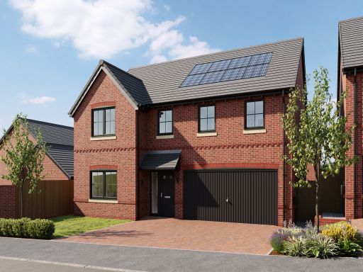 5 bedroom detached house for sale in Off Platt Lane,
Westhoughton,
Bolton,
BL5 3LH, BL5 — £579,995 • 5 bed • 1 bath • 665 ft²
5 bedroom detached house for sale in Off Platt Lane,
Westhoughton,
Bolton,
BL5 3LH, BL5 — £579,995 • 5 bed • 1 bath • 665 ft² 5 bedroom detached house for sale in Off Platt Lane,
Westhoughton,
Bolton,
BL5 3LH, BL5 — £579,995 • 5 bed • 1 bath • 664 ft²
5 bedroom detached house for sale in Off Platt Lane,
Westhoughton,
Bolton,
BL5 3LH, BL5 — £579,995 • 5 bed • 1 bath • 664 ft² 5 bedroom detached house for sale in Off Platt Lane,
Westhoughton,
Bolton,
BL5 3LH, BL5 — £579,995 • 5 bed • 1 bath • 664 ft²
5 bedroom detached house for sale in Off Platt Lane,
Westhoughton,
Bolton,
BL5 3LH, BL5 — £579,995 • 5 bed • 1 bath • 664 ft²
Meta
- {
"@context": "https://schema.org",
"@type": "Residence",
"name": "4 bedroom detached house for sale in Off Platt Lane, Westho…",
"description": "",
"url": "https://propertypiper.co.uk/property/25504ba1-ac89-48de-91d1-8735b0507610",
"image": "https://image-a.propertypiper.co.uk/8cf066a2-3914-439f-9ff0-d30b7d87d0a8-1024.jpeg",
"address": {
"@type": "PostalAddress",
"streetAddress": "6 WEST HALT DRIVE WESTHOUGHTON BOLTON",
"postalCode": "BL5 3LH",
"addressLocality": "Bolton",
"addressRegion": "Bolton West",
"addressCountry": "England"
},
"geo": {
"@type": "GeoCoordinates",
"latitude": 53.54661155989165,
"longitude": -2.5019126943321317
},
"numberOfRooms": 4,
"numberOfBathroomsTotal": 1,
"floorSize": {
"@type": "QuantitativeValue",
"value": 1480,
"unitCode": "FTK"
},
"offers": {
"@type": "Offer",
"price": 479995,
"priceCurrency": "GBP",
"availability": "https://schema.org/InStock"
},
"additionalProperty": [
{
"@type": "PropertyValue",
"name": "Feature",
"value": "modern"
},
{
"@type": "PropertyValue",
"name": "Feature",
"value": "newly built"
},
{
"@type": "PropertyValue",
"name": "Feature",
"value": "brick exterior"
},
{
"@type": "PropertyValue",
"name": "Feature",
"value": "two-story"
},
{
"@type": "PropertyValue",
"name": "Feature",
"value": "garage"
},
{
"@type": "PropertyValue",
"name": "Feature",
"value": "solar panels"
},
{
"@type": "PropertyValue",
"name": "Feature",
"value": "driveway"
},
{
"@type": "PropertyValue",
"name": "Feature",
"value": "low maintenance garden"
},
{
"@type": "PropertyValue",
"name": "Feature",
"value": "modern"
},
{
"@type": "PropertyValue",
"name": "Feature",
"value": "detached"
},
{
"@type": "PropertyValue",
"name": "Feature",
"value": "brick exterior"
},
{
"@type": "PropertyValue",
"name": "Feature",
"value": "double glazed windows"
},
{
"@type": "PropertyValue",
"name": "Feature",
"value": "garage"
},
{
"@type": "PropertyValue",
"name": "Feature",
"value": "driveway"
},
{
"@type": "PropertyValue",
"name": "Feature",
"value": "solar panels"
},
{
"@type": "PropertyValue",
"name": "Feature",
"value": "new build"
},
{
"@type": "PropertyValue",
"name": "Feature",
"value": "urban"
}
]
}
High Res Floorplan Images
Compatible Floorplan Images
FloorplanImages Thumbnail