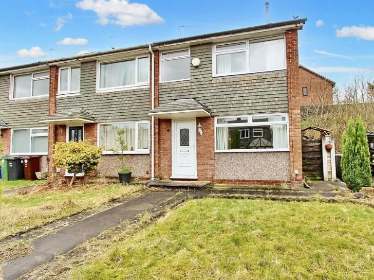
M45 6QA - 3 bedroom terraced house for sale in Nuttall Avenue, Whitef…
View on Property Piper
3 bedroom terraced house for sale in Nuttall Avenue, Whitefield, Manchester, Greater Manchester, M45 6QA, M45
Property Details
- Price: £190000
- Bedrooms: 3
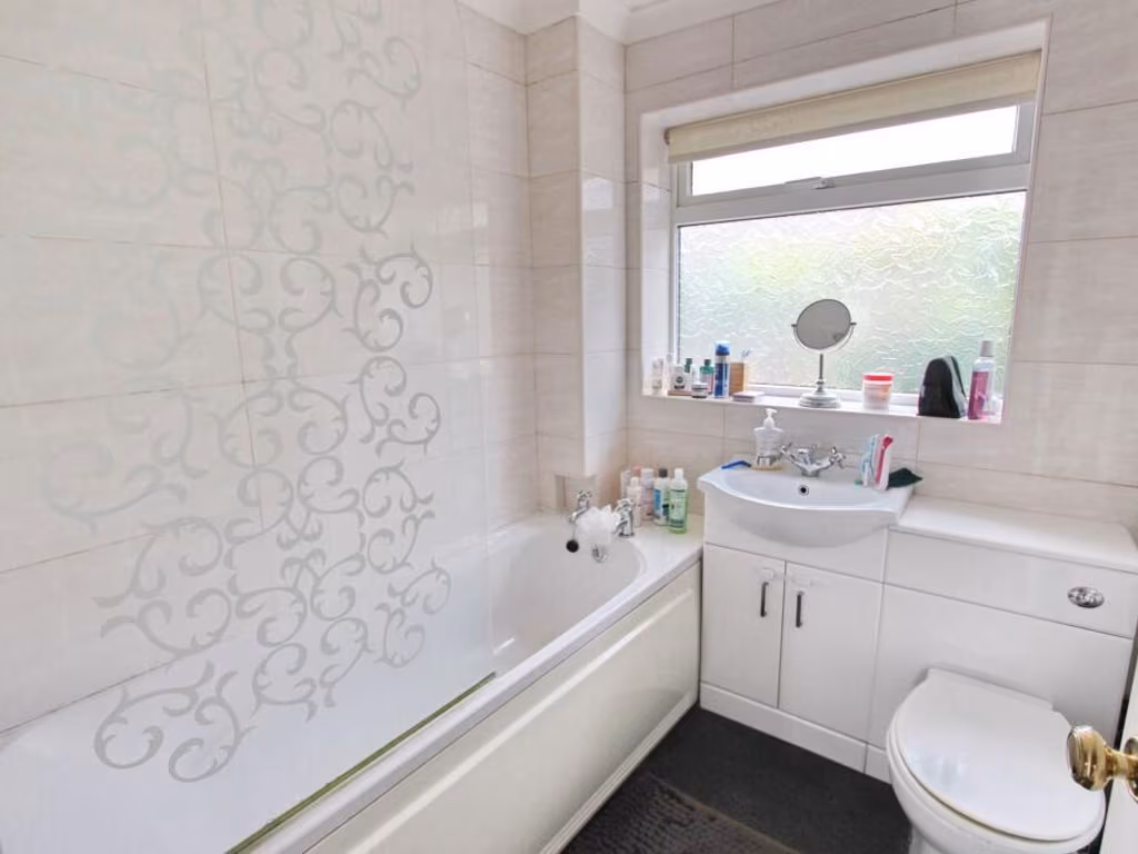
- Bathrooms: 1
- Property Type: undefined
- Property SubType: undefined
Image Descriptions
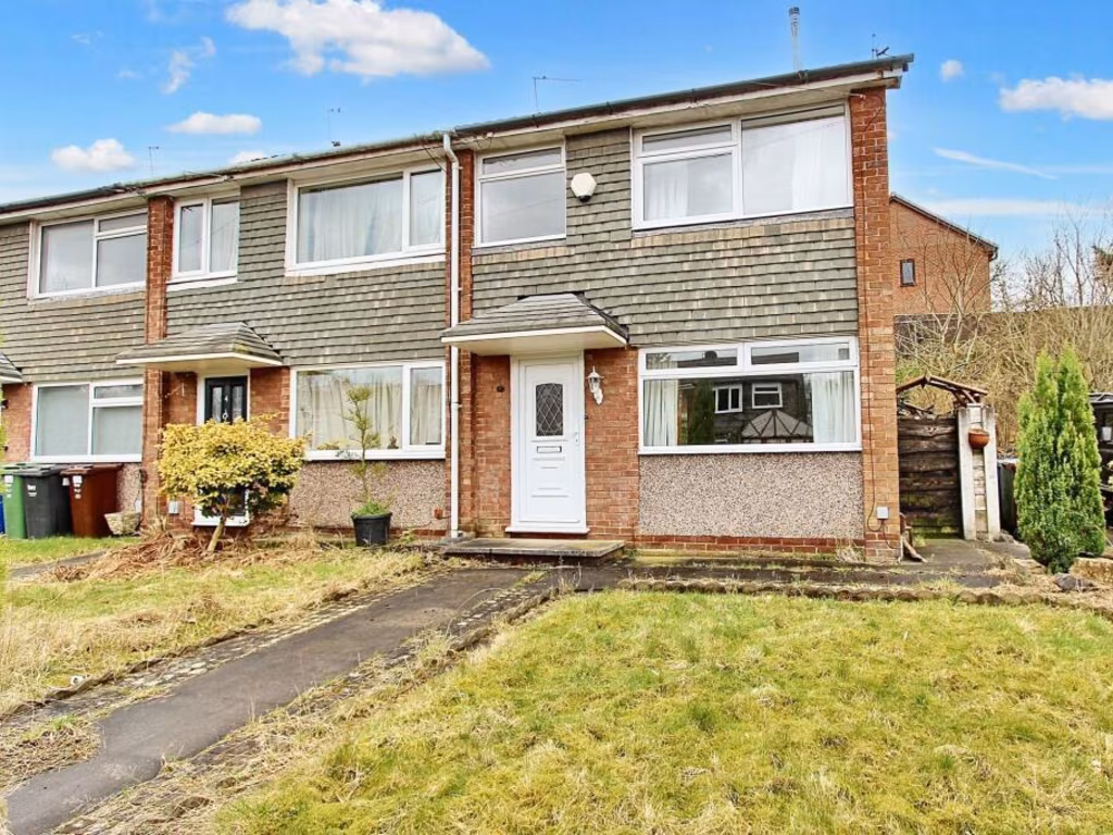
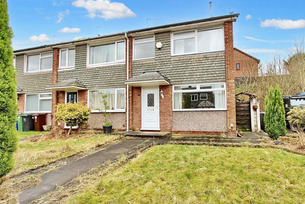
- exterior of semi-detached house 1970s semi-detached
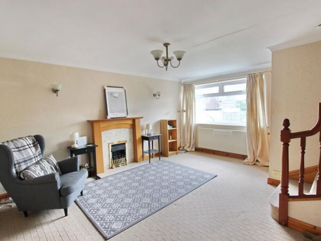
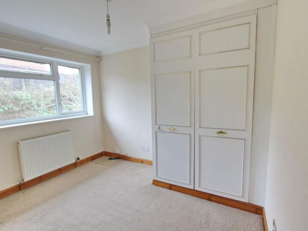
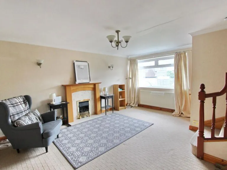
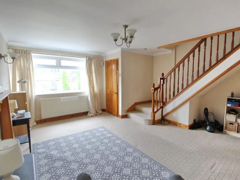
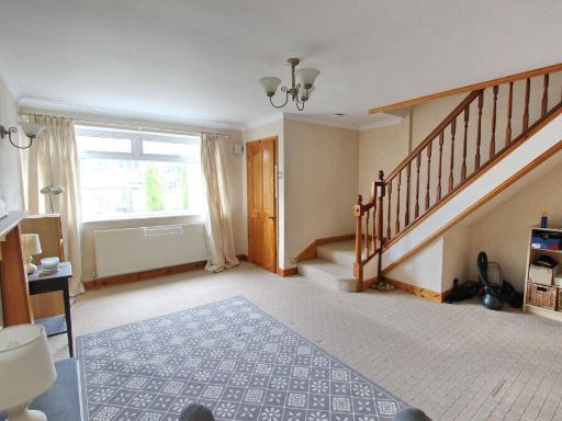
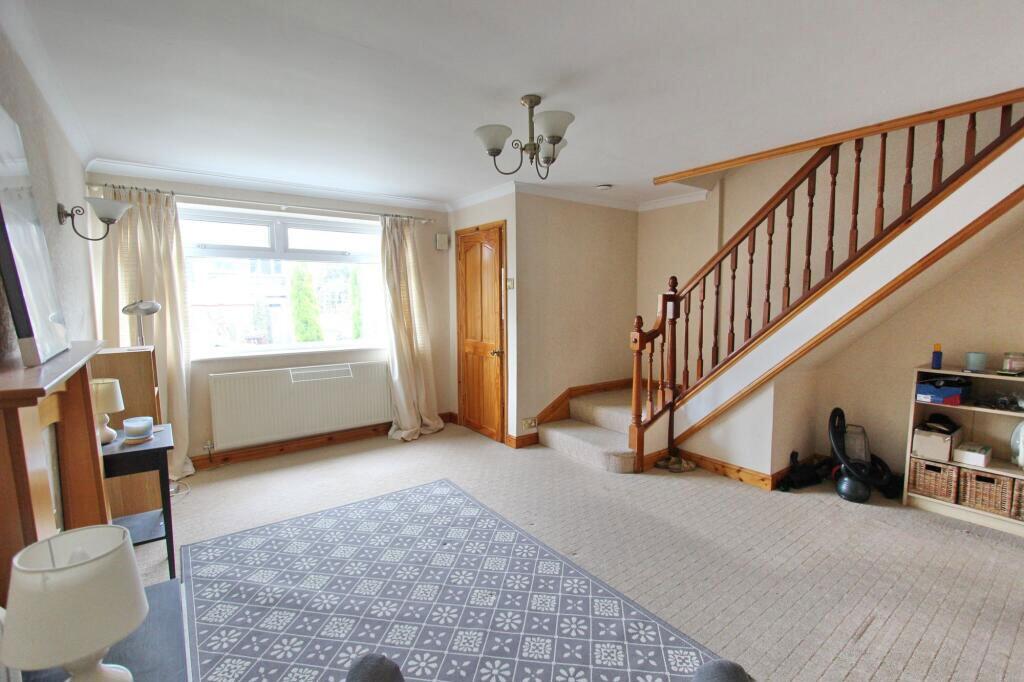
- living room 1970s semi-detached
Floorplan Description
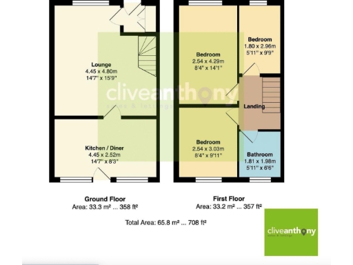
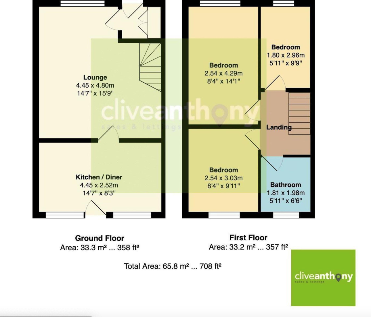
- Two-storey property with lounge, kitchen/diner, three bedrooms and a bathroom
Rooms
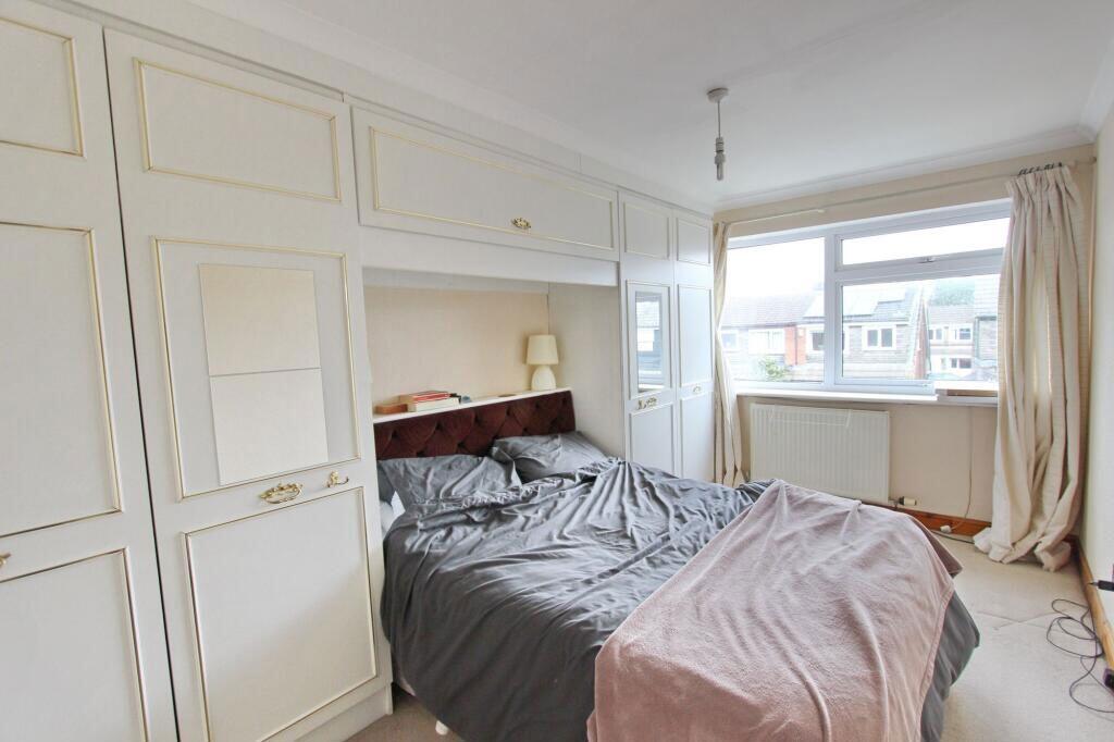
- Lounge:
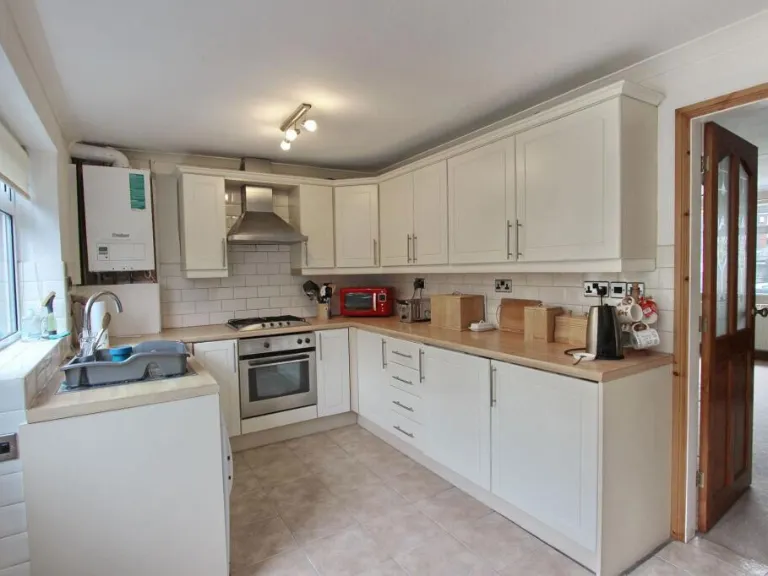
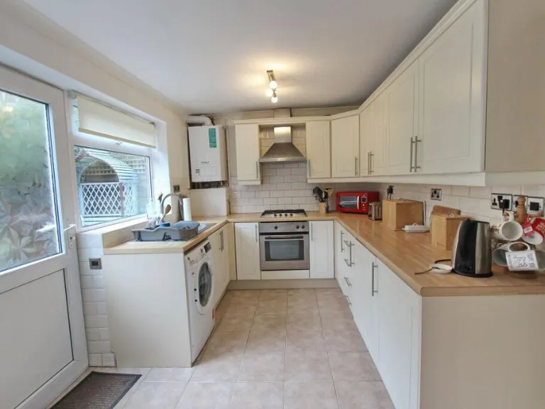
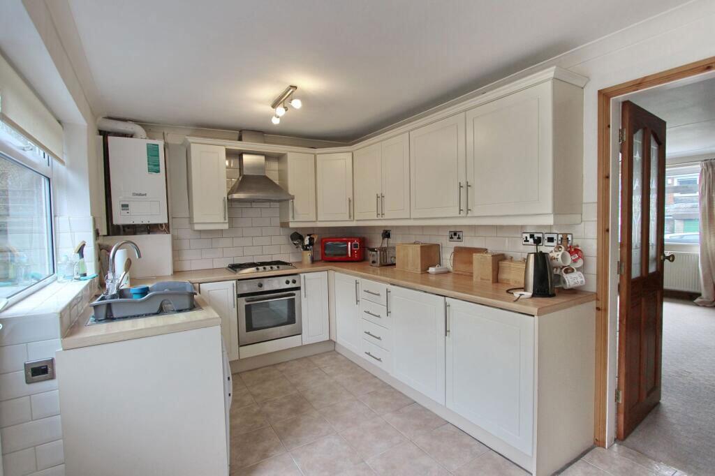
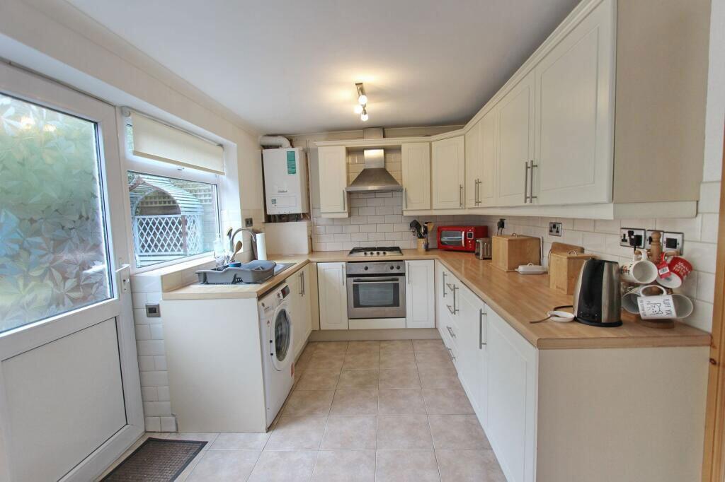
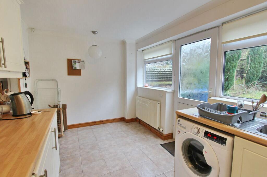
- Kitchen / Diner:
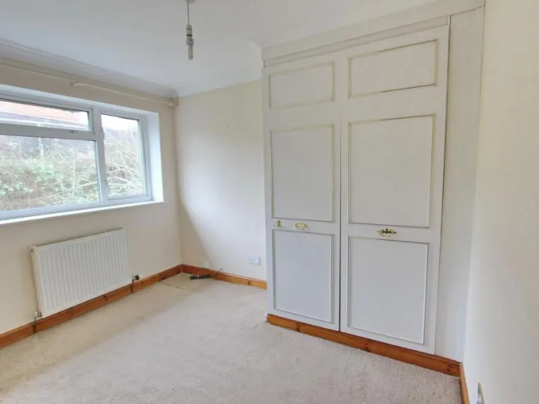
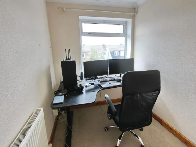
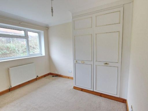
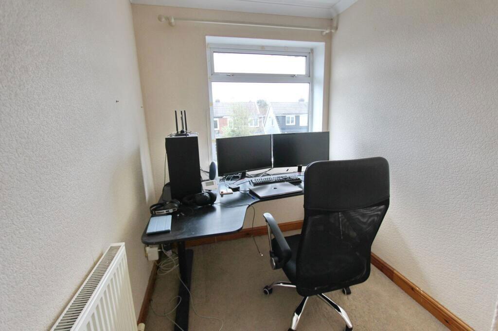
- Bedroom:
- Bedroom:
- Bedroom:
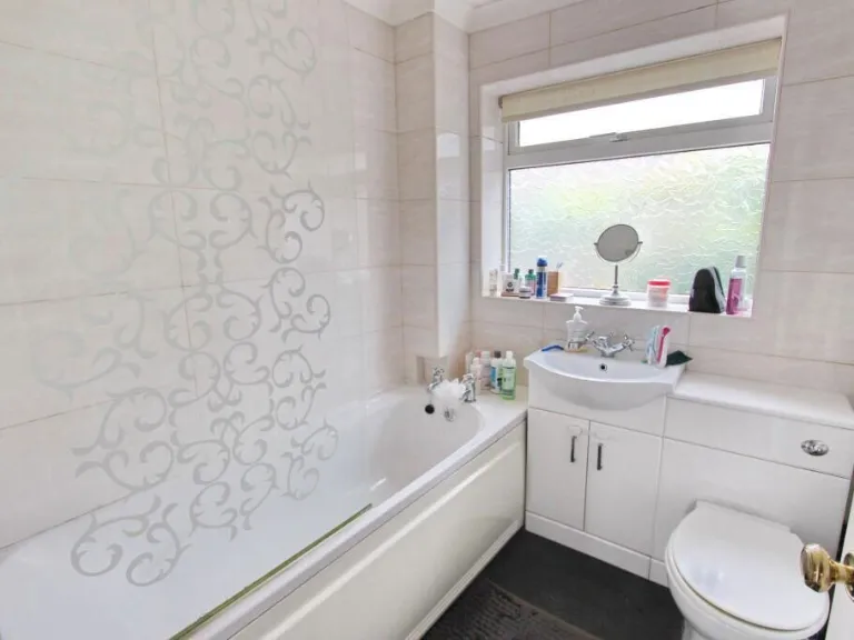
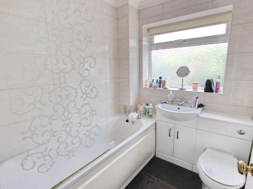
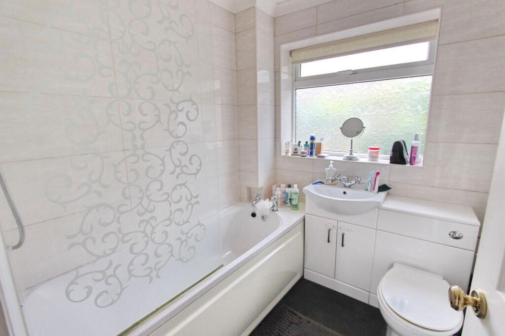
- Bathroom:
Textual Property Features
- Is Auction
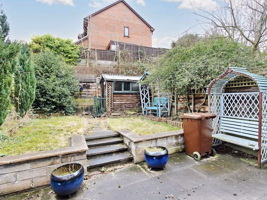
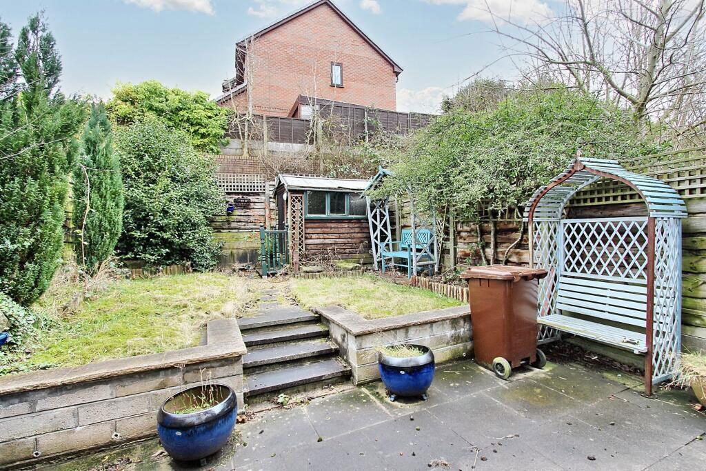
- Has Garden
- Success
Detected Visual Features
- 1970s
- semi-detached
- brick exterior
- exposed brick
- pebble dash
- three-bedroom
- two-story
- off-road parking
- garden
- living room
- fireplace
- large window
- natural light
- medium size
- standard ceiling
- neutral colors
EPC Details
- Fully double glazed
- Cavity wall, filled cavity
- Boiler and radiators, mains gas
- Low energy lighting in 78% of fixed outlets
- Solid, no insulation (assumed)
Nearby Schools
- Parrenthorn High School
- Chapelfield Primary School
- All Saints Church of England Primary School, Stand
- Unsworth Primary School
- St John's Church of England Primary School, Radcliffe
- Sunny Bank Primary School
- Hollins Grundy Primary School
- Park View Primary School
- St Mary's Church of England Aided Primary School, Prestwich
- Our Lady of Grace RC Primary School
- St Margaret's Church of England Primary School
- St Michael's Roman Catholic Primary School, a Voluntary Academy
- Bury and Whitefield Jewish Primary School
- Unsworth Academy
- Manchester Mesivta School
- The Heys School
- Prestwich Preparatory School
- Higher Lane Primary School
- Mersey Drive Community Primary School
- Radcliffe Hall Church of England Methodist Primary School
- St Peter's Church of England Primary School
Nearest Bars And Restaurants
- Id: 8853918423
- Tags:
- Addr:
- City: Whitefield
- Housenumber: 260
- Postcode: M45 8AB
- Street: Bury New Road
- Amenity: restaurant
- Contact:
- Facebook: 8manchester
- Instagram: 8_manchester
- Twitter: 8Manchester1
- Cuisine: chinese
- Email: info@8manchester.com
- Name: 8 Manchester
- Opening_hours: Mo-Th 17:00-22:30; Fr 17:00-23:00; Su 12:30-21:30
- Phone: +44 161 478 4884
- Takeaway: yes
- Website: https://8manchester.com
- TagsNormalized:
- restaurant
- chinese
- takeaway
- Lat: 53.5508851
- Lon: -2.2954082
- FullGeoHash: gcw2eu8s90e8
- PartitionGeoHash: gcw2
- Images:
- FoodStandards: null
- Distance: 274.1
,- Id: 231032894
- Tags:
- Amenity: restaurant
- Building: yes
- Name: Nat West Bank
- TagsNormalized:
- Lat: 53.5508635
- Lon: -2.2953702
- FullGeoHash: gcw2eu8s3urz
- PartitionGeoHash: gcw2
- Images:
- FoodStandards: null
- Distance: 270.6
,- Id: 8853918424
- Tags:
- Addr:
- City: Whitefield
- Housenumber: 254 - 258
- Postcode: M45 8QN
- Street: Bury New Road
- Amenity: restaurant
- Name: Hamiltons
- Phone: +44161 796 6767
- Website: https://hamiltons.co.uk
- TagsNormalized:
- Lat: 53.5506556
- Lon: -2.2952955
- FullGeoHash: gcw2eu8e5txx
- PartitionGeoHash: gcw2
- Images:
- FoodStandards: null
- Distance: 249.1
,- Id: 8853918425
- Tags:
- Addr:
- City: Manchester
- Housenumber: 1
- Postcode: M45 6QE
- Street: Moss Lane
- Amenity: restaurant
- Cuisine: tapas
- Name: Campo Blanco
- Phone: +44 161 766 6699
- Website: https://campoblanco.co.uk
- TagsNormalized:
- Lat: 53.5480162
- Lon: -2.2931384
- FullGeoHash: gcw2eu45y18n
- PartitionGeoHash: gcw2
- Images:
- FoodStandards: null
- Distance: 96.4
,- Id: 1312999976
- Tags:
- Amenity: restaurant
- Cuisine: chinese
- Name: China Lounge
- TagsNormalized:
- Lat: 53.5485444
- Lon: -2.2939385
- FullGeoHash: gcw2eu1wgk5m
- PartitionGeoHash: gcw2
- Images:
- FoodStandards: null
- Distance: 72.5
}
Nearest General Shops
- Id: 8733909388
- Tags:
- Name: Appleblinds
- Shop: yes
- TagsNormalized:
- Lat: 53.5458567
- Lon: -2.2921697
- FullGeoHash: gcw2egdzhx4k
- PartitionGeoHash: gcw2
- Images:
- FoodStandards: null
- Distance: 340.5
,- Id: 1772474586
- Tags:
- Addr:
- Housename: Cookson's Cycles
- Housenumber: 195
- Postcode: M45 6GE
- Street: Bury New Road
- Name: Cookson Cycles
- Phone: +44 161 766 2633
- Shop: bicycle
- Website: https://www.cooksoncycles.co.uk/
- Wheelchair: limited
- TagsNormalized:
- Lat: 53.5476166
- Lon: -2.293729
- FullGeoHash: gcw2eu1c2ppx
- PartitionGeoHash: gcw2
- Images:
- FoodStandards: null
- Distance: 148.5
,- Id: 174191838
- Tags:
- Addr:
- Housename: Slattery's
- Housenumber: 197
- Postcode: M45 6GE
- Street: Bury New Road
- Building: retail
- Fhrs:
- Name: Slattery's
- Shop: confectionery
- Source:
- TagsNormalized:
- Lat: 53.5482932
- Lon: -2.2944023
- FullGeoHash: gcw2eu1m2t3e
- PartitionGeoHash: gcw2
- Images:
- FoodStandards:
- Id: 129353
- FHRSID: 129353
- LocalAuthorityBusinessID: 6000
- BusinessName: Slattery
- BusinessType: Restaurant/Cafe/Canteen
- BusinessTypeID: 1
- AddressLine1: null
- AddressLine2: 197 Bury New Road
- AddressLine3: Whitefield
- AddressLine4: Greater Manchester
- PostCode: M45 6GE
- RatingValue: 5
- RatingKey: fhrs_5_en-GB
- RatingDate: 2019-04-30
- LocalAuthorityCode: 405
- LocalAuthorityName: Bury
- LocalAuthorityWebSite: http://www.bury.gov.uk
- LocalAuthorityEmailAddress: Commercial@bury.gov.uk
- Scores:
- Hygiene: 0
- Structural: 0
- ConfidenceInManagement: 0
- NewRatingPending: false
- Geocode:
- Longitude: -2.29452100000000
- Latitude: 53.54864100000000
- Distance: 113.4
}
Nearest Grocery shops
- Id: 8733909391
- Tags:
- Brand: Spar
- Brand:wikidata: Q610492
- Brand:wikipedia: en:SPAR (retailer)
- Name: Spar
- Shop: convenience
- TagsNormalized:
- Lat: 53.5401348
- Lon: -2.285054
- FullGeoHash: gcw2s48jfks0
- PartitionGeoHash: gcw2
- Images:
- FoodStandards: null
- Distance: 1104.9
,- Id: 2031534768
- Tags:
- Brand: Premier
- Brand:wikidata: Q7240340
- Brand:wikipedia: en:Premier Stores
- Name: Premier
- Shop: convenience
- TagsNormalized:
- Lat: 53.5474925
- Lon: -2.277378
- FullGeoHash: gcw2shj8v0pf
- PartitionGeoHash: gcw2
- Images:
- FoodStandards: null
- Distance: 1043.4
,- Id: 6341261272
- Tags:
- Addr:
- Housenumber: 17
- Postcode: M45 6AU
- Street: Thatch Leach Lane
- Brand: McColl's
- Brand:wikidata: Q16997477
- Brand:wikipedia: en:McColl's
- Contact:
- Website: https://www.mccolls.co.uk/storelocator/whitefield-thatch-leach/
- Fhrs:
- Name: McColl's
- Shop: convenience
- Source:
- TagsNormalized:
- Lat: 53.5429644
- Lon: -2.2861567
- FullGeoHash: gcw2egpq2eyp
- PartitionGeoHash: gcw2
- Images:
- FoodStandards:
- Id: 958420
- FHRSID: 958420
- LocalAuthorityBusinessID: 27284
- BusinessName: McColls
- BusinessType: Retailers - other
- BusinessTypeID: 4613
- AddressLine1: null
- AddressLine2: 17-19 Thatch Leach Lane
- AddressLine3: Whitefield
- AddressLine4: Manchester
- PostCode: M45 6AU
- RatingValue: 5
- RatingKey: fhrs_5_en-GB
- RatingDate: 2018-07-26
- LocalAuthorityCode: 405
- LocalAuthorityName: Bury
- LocalAuthorityWebSite: http://www.bury.gov.uk
- LocalAuthorityEmailAddress: Commercial@bury.gov.uk
- Scores:
- Hygiene: 5
- Structural: 5
- ConfidenceInManagement: 5
- NewRatingPending: false
- Geocode:
- Longitude: -2.28623720000000
- Latitude: 53.54295910000000
- Distance: 798
}
Nearest Religious buildings
- Id: 258361919
- Tags:
- Amenity: place_of_worship
- Building: church
- Denomination: methodist
- Name: Whitefield Methodist Church
- Religion: christian
- TagsNormalized:
- place of worship
- church
- methodist
- christian
- Lat: 53.5527716
- Lon: -2.2964326
- FullGeoHash: gcw2eszz90pt
- PartitionGeoHash: gcw2
- Images:
- FoodStandards: null
- Distance: 488.7
,- Id: 1666997908
- Tags:
- Amenity: place_of_worship
- Source: OS_OpenData_StreetView
- TagsNormalized:
- Lat: 53.5529619
- Lon: -2.2953596
- FullGeoHash: gcw2ev08d5xv
- PartitionGeoHash: gcw2
- Images:
- FoodStandards: null
- Distance: 480
,- Id: 258361917
- Tags:
- Amenity: place_of_worship
- Building: church
- Denomination: anglican
- Name: All Saints Church, Stand
- Religion: christian
- Source: OS_OpenData_StreetView
- Wikidata: Q4729357
- TagsNormalized:
- place of worship
- church
- anglican
- christian
- Lat: 53.5501499
- Lon: -2.2985659
- FullGeoHash: gcw2esw0px3n
- PartitionGeoHash: gcw2
- Images:
- FoodStandards: null
- Distance: 394.1
}
Nearest Medical buildings
- Id: 8853918420
- Tags:
- Amenity: pharmacy
- Brand: Well Pharmacy
- Brand:wikidata: Q7726524
- Brand:wikipedia: en:Well Pharmacy
- Dispensing: yes
- Healthcare: pharmacy
- Name: Well Pharmacy
- TagsNormalized:
- pharmacy
- well pharmacy
- health
- healthcare
- Lat: 53.5532418
- Lon: -2.2962182
- FullGeoHash: gcw2etpfnpzd
- PartitionGeoHash: gcw2
- Images:
- FoodStandards: null
- Distance: 529.7
,- Id: 8853918422
- Tags:
- Amenity: clinic
- Healthcare: clinic
- Name: The Elms Medical Centre
- TagsNormalized:
- Lat: 53.5532689
- Lon: -2.2952016
- FullGeoHash: gcw2ev0dmuvs
- PartitionGeoHash: gcw2
- Images:
- FoodStandards: null
- Distance: 509.4
,- Id: 6961482756
- Tags:
- Amenity: dentist
- Healthcare: dentist
- Name: The Smile Centre
- TagsNormalized:
- Lat: 53.5522418
- Lon: -2.2966795
- FullGeoHash: gcw2eszs7mrt
- PartitionGeoHash: gcw2
- Images:
- FoodStandards: null
- Distance: 446
,- Id: 231009584
- Tags:
- Addr:
- Housename: The Uplands Medical Practice
- Amenity: doctors
- Building: yes
- Healthcare: doctor
- Name: The Uplands Medical Practice
- TagsNormalized:
- doctor
- doctors
- health
- healthcare
- Lat: 53.5486221
- Lon: -2.2956999
- FullGeoHash: gcw2eu0r66dj
- PartitionGeoHash: gcw2
- Images:
- FoodStandards: null
- Distance: 180.8
}
Nearest Airports
- Id: 1224469
- Tags:
- Addr:
- City: Manchester
- Country: GB
- Postcode: M90 1QX
- Aerodrome: international
- Aeroway: aerodrome
- Arp: yes
- Atis: 128.175
- Iata: MAN
- Icao: EGCC
- Name: Manchester Airport
- Note: rough sketched outline referring to Yahoo imagery - true boundary is where?
- Old_name: Ringway
- Operator: Manchester Airport PLC
- Size: 18720000
- Source:
- Tower_frequency: 118.625,119.400
- Type: multipolygon
- Website: https://www.manchesterairport.co.uk/
- Wikidata: Q8694
- Wikipedia: en:Manchester Airport
- TagsNormalized:
- airport
- international airport
- Lat: 53.3503197
- Lon: -2.2798822
- FullGeoHash: gcqrs05u4ukt
- PartitionGeoHash: gcqr
- Images:
- FoodStandards: null
- Distance: 22095.9
}
Nearest Leisure Facilities
- Id: 230975451
- Tags:
- Leisure: pitch
- Sport: tennis
- TagsNormalized:
- Lat: 53.5492159
- Lon: -2.2970863
- FullGeoHash: gcw2esr6f127
- PartitionGeoHash: gcw2
- Images:
- FoodStandards: null
- Distance: 272.7
,- Id: 172841756
- Tags:
- Dog: yes
- Leisure: park
- Name: Whitefield Park
- TagsNormalized:
- Lat: 53.5513251
- Lon: -2.2931801
- FullGeoHash: gcw2eudpj48c
- PartitionGeoHash: gcw2
- Images:
- FoodStandards: null
- Distance: 272.2
,- Id: 753427967
- Tags:
- TagsNormalized:
- Lat: 53.5494893
- Lon: -2.2961991
- FullGeoHash: gcw2esruqsmf
- PartitionGeoHash: gcw2
- Images:
- FoodStandards: null
- Distance: 222.1
,- Id: 174191846
- Tags:
- Leisure: park
- Name: Hamilton Road Park
- TagsNormalized:
- Lat: 53.5493426
- Lon: -2.29626
- FullGeoHash: gcw2esrgt2br
- PartitionGeoHash: gcw2
- Images:
- FoodStandards: null
- Distance: 221.6
,- Id: 753427960
- Tags:
- TagsNormalized:
- Lat: 53.5478795
- Lon: -2.2949565
- FullGeoHash: gcw2eu0g58hr
- PartitionGeoHash: gcw2
- Images:
- FoodStandards: null
- Distance: 170.6
}
Nearest Tourist attractions
- Id: 5003621952
- Tags:
- Artwork_type: sculpture
- Description: Presented by Robert Barnes Esquire in 1859
- Name: Old Stone Sculpture
- Tourism: attraction
- TagsNormalized:
- sculpture
- attraction
- tourism
- Lat: 53.5365813
- Lon: -2.2546487
- FullGeoHash: gcw2sdn1nyh4
- PartitionGeoHash: gcw2
- Images:
- FoodStandards: null
- Distance: 2879.3
,- Id: 486787014
- Tags:
- Tourism: theme_park
- Tourism_1: attraction
- TagsNormalized:
- Lat: 53.5354271
- Lon: -2.2558206
- FullGeoHash: gcw2s9v67wfj
- PartitionGeoHash: gcw2
- Images:
- FoodStandards: null
- Distance: 2876.1
,- Id: 5358331600
- Tags:
- Description: The Animal Centre stands on the site of the 19th century glasshouse range that was demolished in the late 20th century. Animals and birds are on display here all year round.
- Name: Heaton Park Animal Centre
- Opening_hours: Mo-Su 10:00-16:00
- Tourism: zoo
- Zoo: petting_zoo
- TagsNormalized:
- Lat: 53.5364959
- Lon: -2.2562848
- FullGeoHash: gcw2sdj08y0j
- PartitionGeoHash: gcw2
- Images:
- FoodStandards: null
- Distance: 2789.4
}
Nearest Train stations
- Id: 9776991777
- Tags:
- Name: Kearsley
- Naptan:
- Network: National Rail
- Public_transport: station
- Railway: station
- Ref:
- Source: npe
- Train: yes
- Wikidata: Q3464698
- Wikipedia: en:Kearsley railway station
- TagsNormalized:
- Lat: 53.5443635
- Lon: -2.3751628
- FullGeoHash: gcw29gqqw8y3
- PartitionGeoHash: gcw2
- Images:
- FoodStandards: null
- Distance: 5451.7
,- Id: 6581364396
- Tags:
- Name: Moorside
- Naptan:
- Network: National Rail
- Public_transport: station
- Railway: station
- Ref:
- Source: npe
- Train: yes
- Wikidata: Q3466304
- Wikipedia: en:Moorside railway station
- TagsNormalized:
- Lat: 53.5163626
- Lon: -2.3527491
- FullGeoHash: gcw26qqg2vp1
- PartitionGeoHash: gcw2
- Images:
- FoodStandards: null
- Distance: 5354.2
,- Id: 27016927
- Tags:
- Name: Bury, Bolton Street
- Naptan:
- Public_transport: station
- Railway: station
- Train: yes
- Usage: tourism
- Wheelchair: yes
- Wikidata: Q5001073
- TagsNormalized:
- Lat: 53.5929094
- Lon: -2.3003018
- FullGeoHash: gcw2gskcr46t
- PartitionGeoHash: gcw2
- Images:
- FoodStandards: null
- Distance: 4919.6
,- Id: 465239559
- Tags:
- Name: Swinton (Manchester)
- Naptan:
- Network: National Rail
- Public_transport: station
- Railway: station
- Ref:
- Train: yes
- Wikidata: Q2685761
- Wikipedia: en:Swinton railway station (Greater Manchester)
- TagsNormalized:
- Lat: 53.5148082
- Lon: -2.336998
- FullGeoHash: gcw26y44rgrc
- PartitionGeoHash: gcw2
- Images:
- FoodStandards: null
- Distance: 4775.9
,- Id: 21668347
- Tags:
- Name: Clifton
- Naptan:
- Network: National Rail
- Operator: Northern
- Public_transport: station
- Railway: station
- Ref:
- Train: yes
- Wikidata: Q2708119
- Wikipedia: en:Clifton railway station (Greater Manchester)
- TagsNormalized:
- Lat: 53.5223155
- Lon: -2.3141164
- FullGeoHash: gcw27r6yj4v8
- PartitionGeoHash: gcw2
- Images:
- FoodStandards: null
- Distance: 3266.9
}
Nearest Hotels
- Id: 4893244122
- Tags:
- Addr:
- Amenity: pub
- Name: Old cross hotel
- Name:en: Old cross hotel
- TagsNormalized:
- Lat: 53.5665182
- Lon: -2.3125086
- FullGeoHash: gcw2erkpddsx
- PartitionGeoHash: gcw2
- Images:
- FoodStandards: null
- Distance: 2346.9
,- Id: 273473403
- Tags:
- Addr:
- City: Radcliffe
- Housenumber: 143
- Postcode: M26 1JR
- Street: Stand Lane
- Building: yes
- Ele: 2
- Fhrs:
- Name: Hawthorn Hotel
- Tourism: hotel
- Website: https://www.pubsgalore.co.uk/pubs/25982/
- TagsNormalized:
- Lat: 53.5553946
- Lon: -2.3192183
- FullGeoHash: gcw2ejrny31k
- PartitionGeoHash: gcw2
- Images:
- FoodStandards: null
- Distance: 1877.5
,- Id: 316877612
- Tags:
- Brand: Premier Inn
- Brand:wikidata: Q2108626
- Brand:wikipedia: en:Premier Inn
- Building: yes
- Internet_access: wlan
- Internet_access:fee: customers
- Internet_access:operator: Virgin Media
- Internet_access:ssid: Premier Inn Free Wi-Fi
- Name: Premier Inn Manchester (Prestwich)
- Operator: Premier Inn
- Tourism: hotel
- TagsNormalized:
- Lat: 53.5371776
- Lon: -2.2894059
- FullGeoHash: gcw2efhusvr0
- PartitionGeoHash: gcw2
- Images:
- FoodStandards: null
- Distance: 1322.6
}
Tags
- 1970s
- semi-detached
- brick exterior
- exposed brick
- pebble dash
- three-bedroom
- two-story
- off-road parking
- garden
- 1970s
- semi-detached
- living room
- fireplace
- large window
- natural light
- medium size
- standard ceiling
- neutral colors
Local Market Stats
- Average Price/sqft: £251
- Avg Income: £43300
- Rental Yield: 4%
- Social Housing: 11%
- Planning Success Rate: 93%
AirBnB Data
- 1km average: £108/night
- Listings in 1km: 1
Similar Properties
 3 bedroom end of terrace house for sale in Nuttall Avenue, Whitefield, M45 — £230,000 • 3 bed • 1 bath • 708 ft²
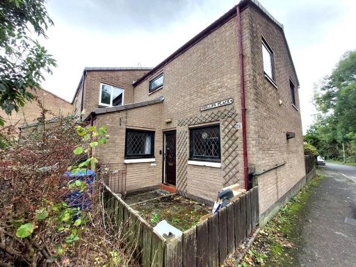 3 bedroom semi-detached house for sale in Phillips Place, Whitefield, M45 , M45 — £165,000 • 3 bed • 1 bath • 969 ft²
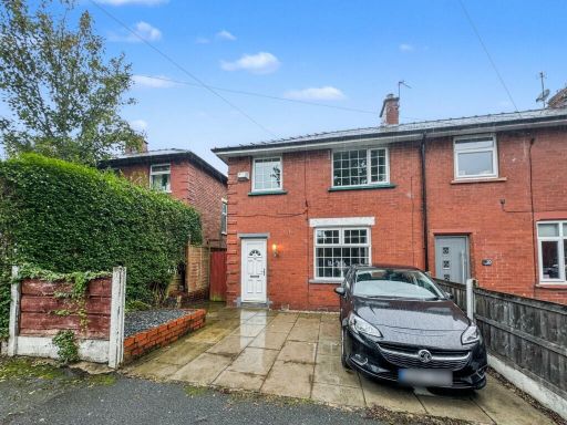 3 bedroom terraced house for sale in Oxford Avenue, Whitefield, M45 — £190,000 • 3 bed • 1 bath • 775 ft²
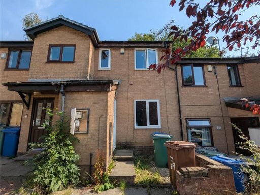 2 bedroom terraced house for sale in Conisborough Place, Whitefield, Manchester, Greater Manchester, M45 — £150,000 • 2 bed • 1 bath • 596 ft²
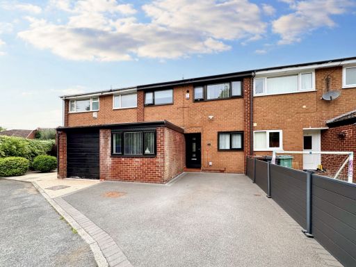 3 bedroom terraced house for sale in Kestrel Close, Whitefield, M45 — £300,000 • 3 bed • 1 bath • 904 ft²
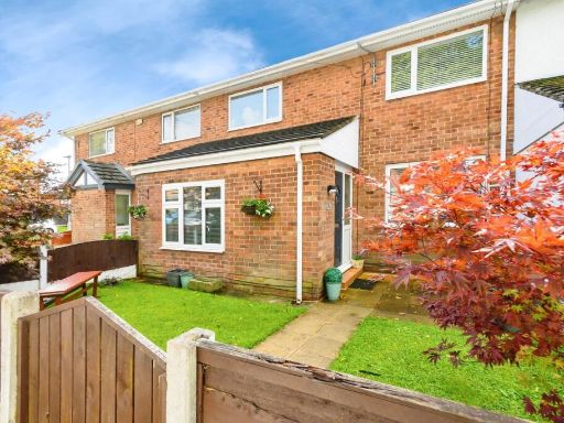 3 bedroom semi-detached house for sale in Hindburn Close, Whitefield, Manchester, Greater Manchester, M45 — £260,000 • 3 bed • 1 bath • 1168 ft²
Meta
- {
"@context": "https://schema.org",
"@type": "Residence",
"name": "3 bedroom terraced house for sale in Nuttall Avenue, Whitef…",
"description": "",
"url": "https://propertypiper.co.uk/property/250072b0-ea12-4833-a914-6264c606e1c7",
"image": "https://image-a.propertypiper.co.uk/1324f0a5-2b2a-45f1-818d-133ff1989ef3-1024.jpeg",
"address": {
"@type": "PostalAddress",
"streetAddress": "Nuttall Avenue, Whitefield, Manchester, Greater Manchester, M45 6QA",
"postalCode": "M45 6QA",
"addressLocality": "Bury",
"addressRegion": "Bury South",
"addressCountry": "England"
},
"geo": {
"@type": "GeoCoordinates",
"latitude": 53.54887924157289,
"longitude": -2.2929977101084273
},
"numberOfRooms": 3,
"numberOfBathroomsTotal": 1,
"floorSize": {
"@type": "QuantitativeValue",
"value": 708,
"unitCode": "FTK"
},
"offers": {
"@type": "Offer",
"price": 190000,
"priceCurrency": "GBP",
"availability": "https://schema.org/InStock"
},
"additionalProperty": [
{
"@type": "PropertyValue",
"name": "Feature",
"value": "1970s"
},
{
"@type": "PropertyValue",
"name": "Feature",
"value": "semi-detached"
},
{
"@type": "PropertyValue",
"name": "Feature",
"value": "brick exterior"
},
{
"@type": "PropertyValue",
"name": "Feature",
"value": "exposed brick"
},
{
"@type": "PropertyValue",
"name": "Feature",
"value": "pebble dash"
},
{
"@type": "PropertyValue",
"name": "Feature",
"value": "three-bedroom"
},
{
"@type": "PropertyValue",
"name": "Feature",
"value": "two-story"
},
{
"@type": "PropertyValue",
"name": "Feature",
"value": "off-road parking"
},
{
"@type": "PropertyValue",
"name": "Feature",
"value": "garden"
},
{
"@type": "PropertyValue",
"name": "Feature",
"value": "1970s"
},
{
"@type": "PropertyValue",
"name": "Feature",
"value": "semi-detached"
},
{
"@type": "PropertyValue",
"name": "Feature",
"value": "living room"
},
{
"@type": "PropertyValue",
"name": "Feature",
"value": "fireplace"
},
{
"@type": "PropertyValue",
"name": "Feature",
"value": "large window"
},
{
"@type": "PropertyValue",
"name": "Feature",
"value": "natural light"
},
{
"@type": "PropertyValue",
"name": "Feature",
"value": "medium size"
},
{
"@type": "PropertyValue",
"name": "Feature",
"value": "standard ceiling"
},
{
"@type": "PropertyValue",
"name": "Feature",
"value": "neutral colors"
}
]
}
High Res Floorplan Images
Compatible Floorplan Images
FloorplanImages Thumbnail