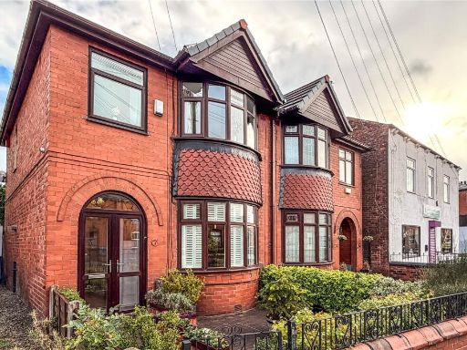
M35 9PT - 3 bedroom semidetached house for sale in Ashton Road East,…
View on Property Piper
3 bedroom semi-detached house for sale in Ashton Road East, Failsworth, Manchester, Greater Manchester, M35
Property Details
- Price: £210000
- Bedrooms: 3
- Bathrooms: 2
- Property Type: undefined
- Property SubType: undefined
Image Descriptions
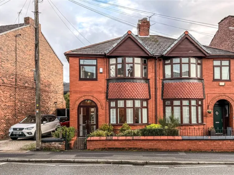
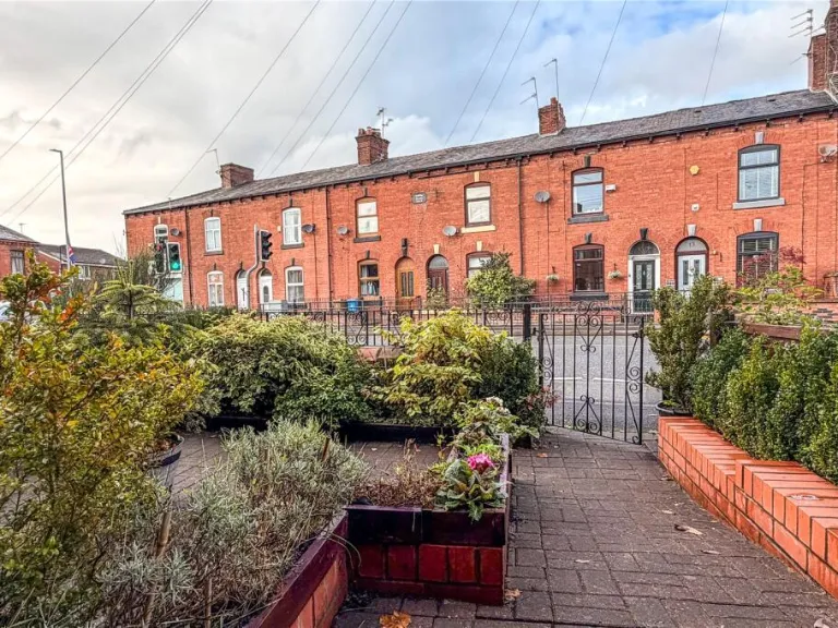
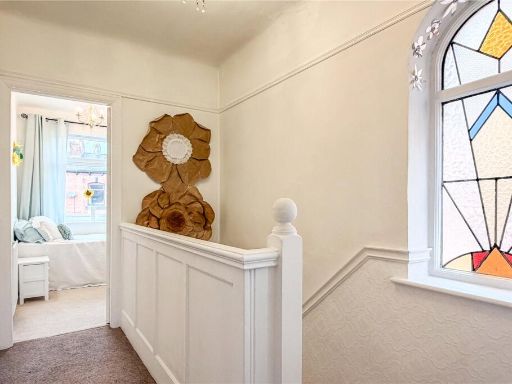
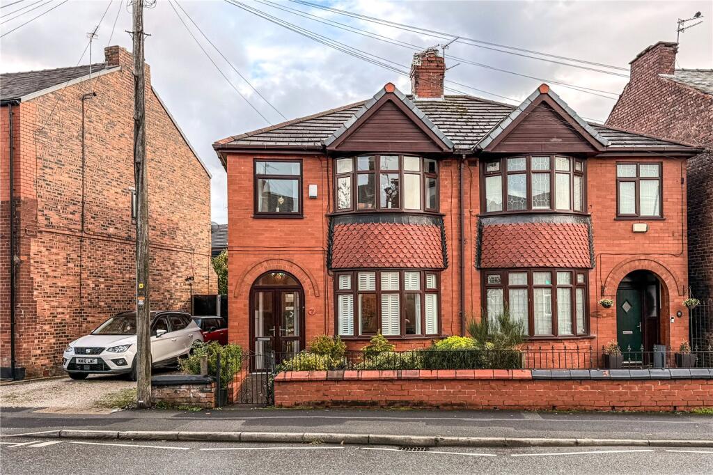
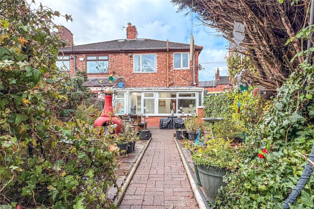
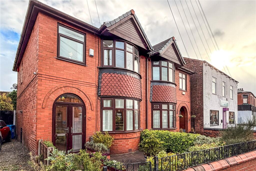
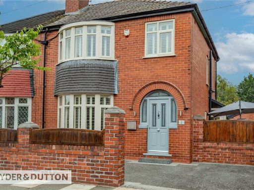
- an exterior facade of a residential property Edwardian
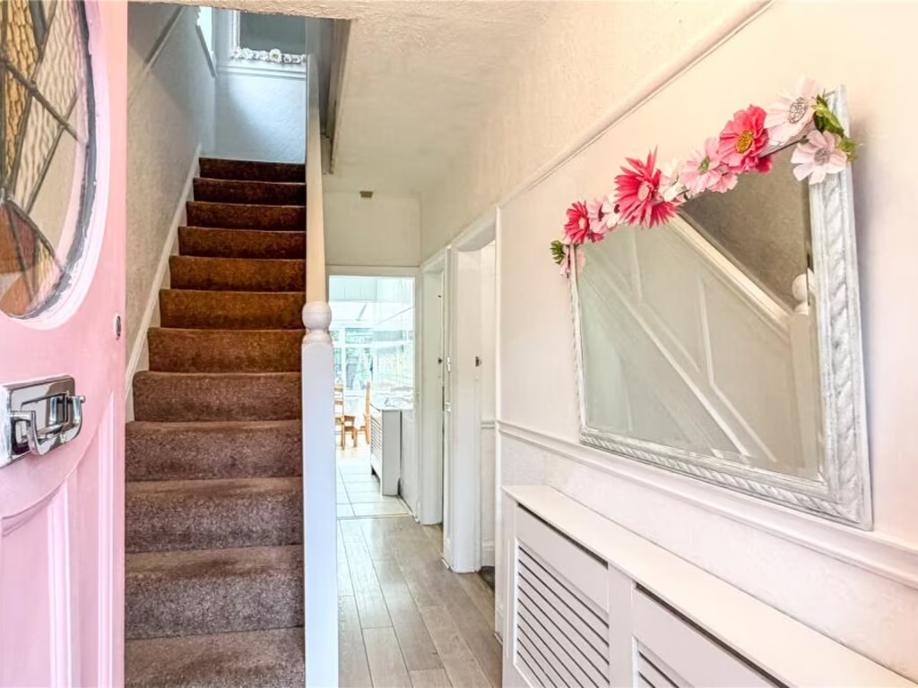
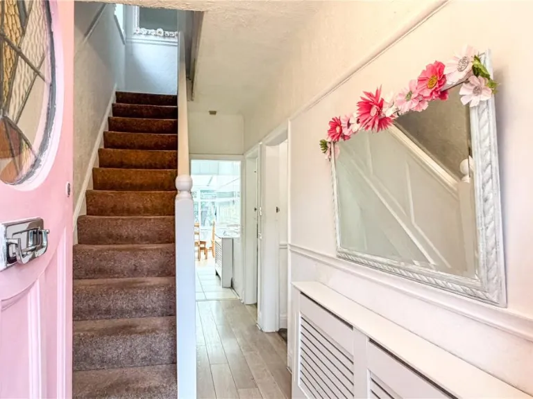
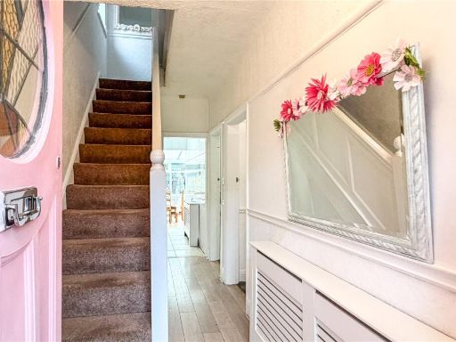
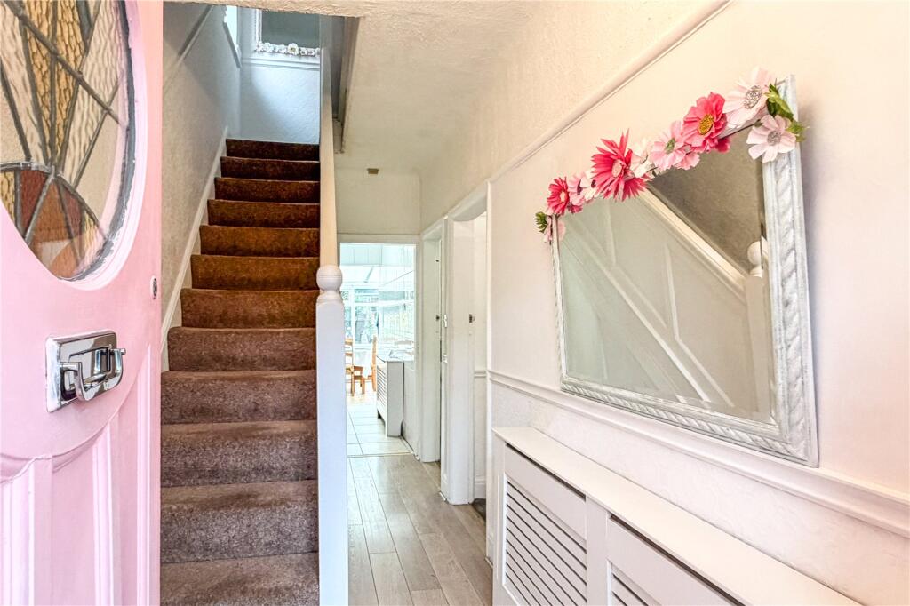
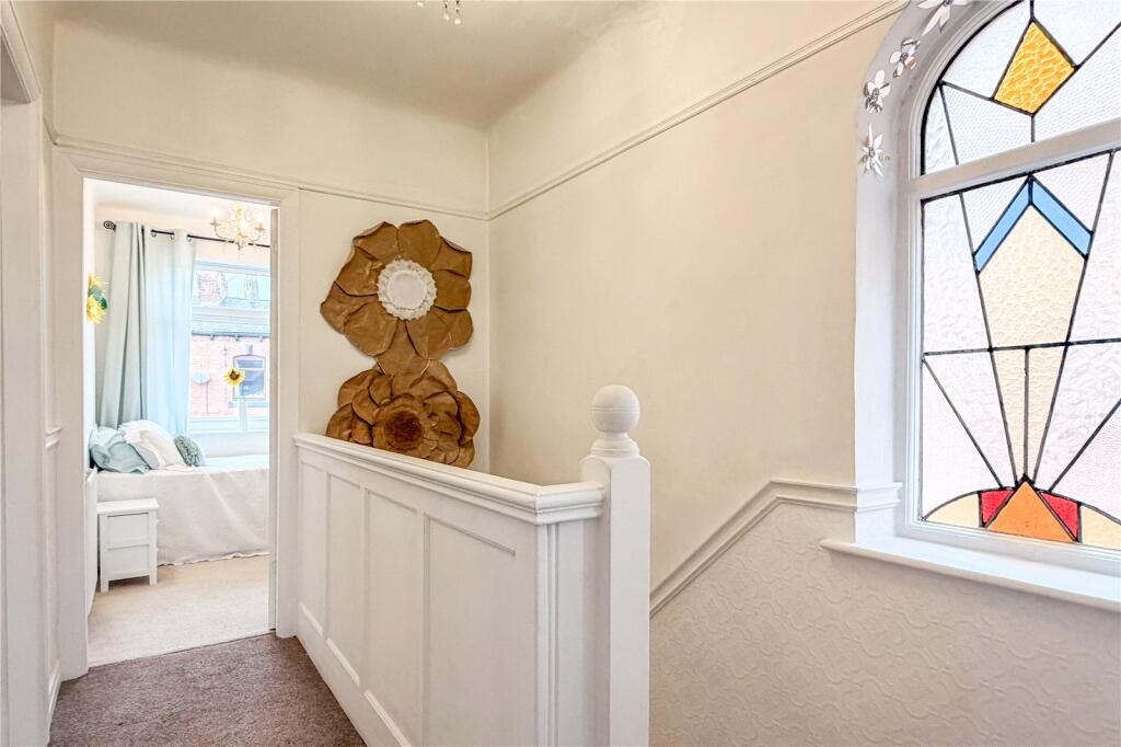
- entryway and stairwell Mid-20th Century
Floorplan Description
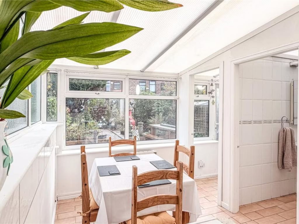
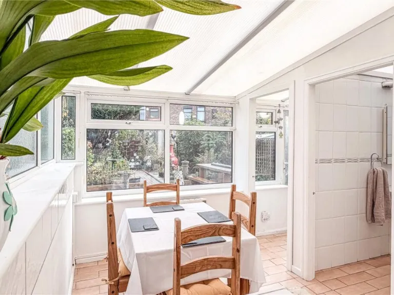
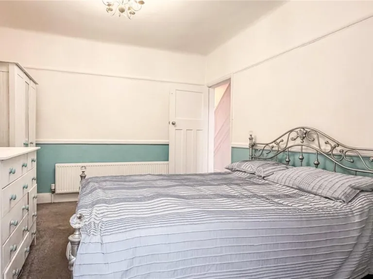
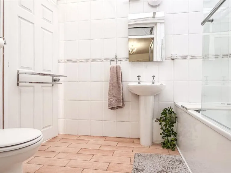
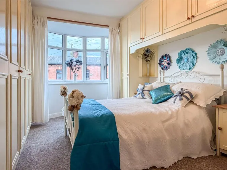
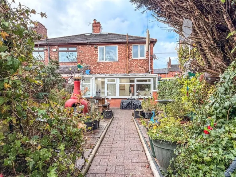
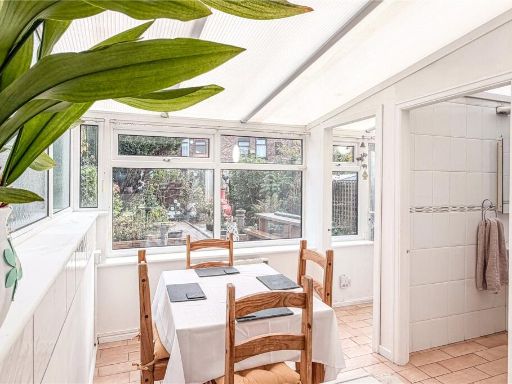
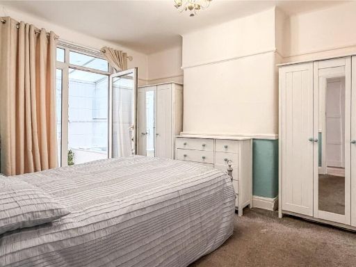
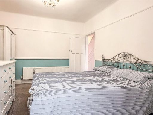
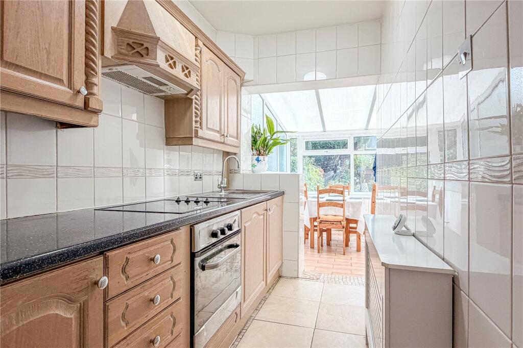
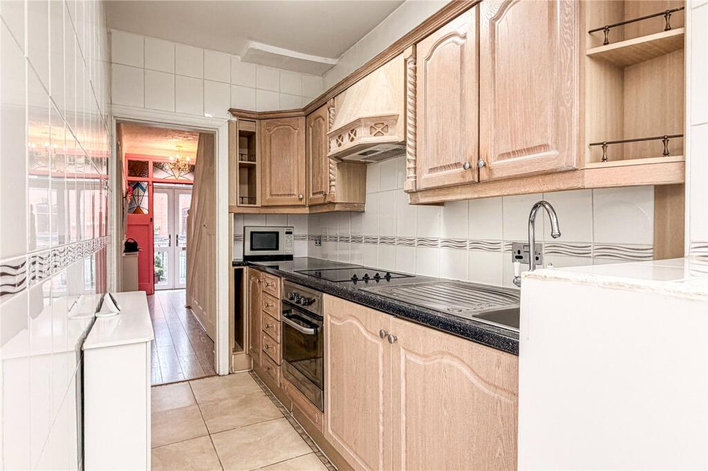
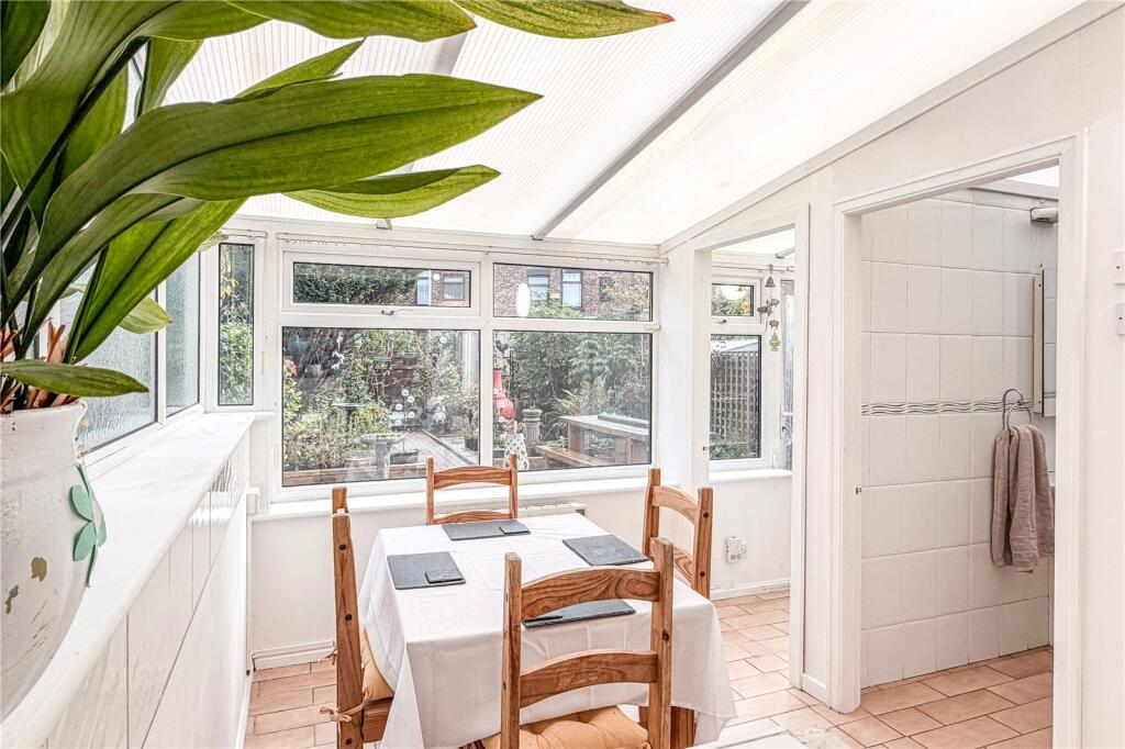
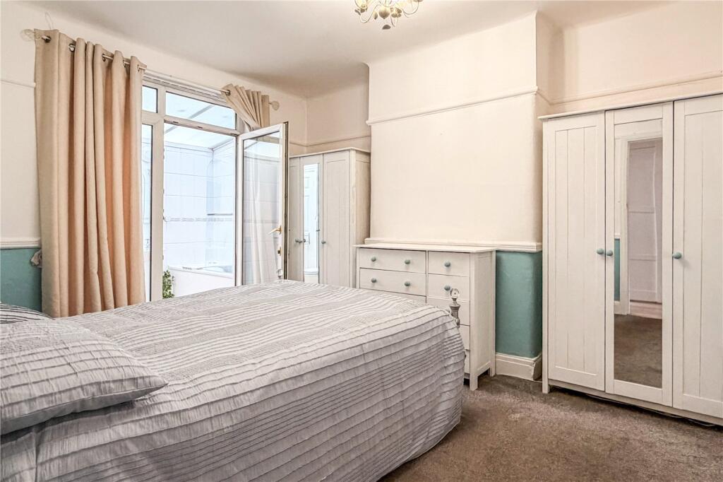
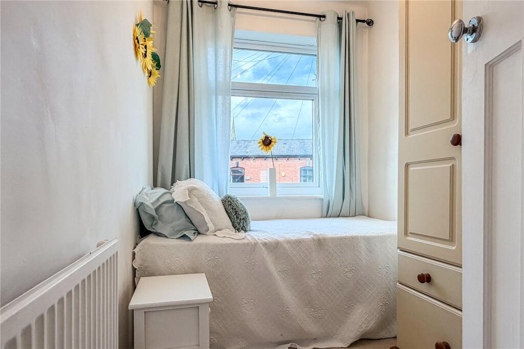
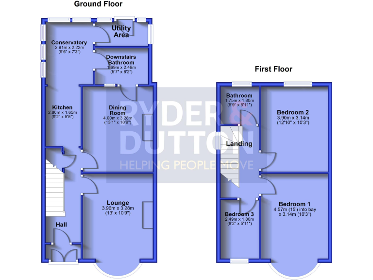
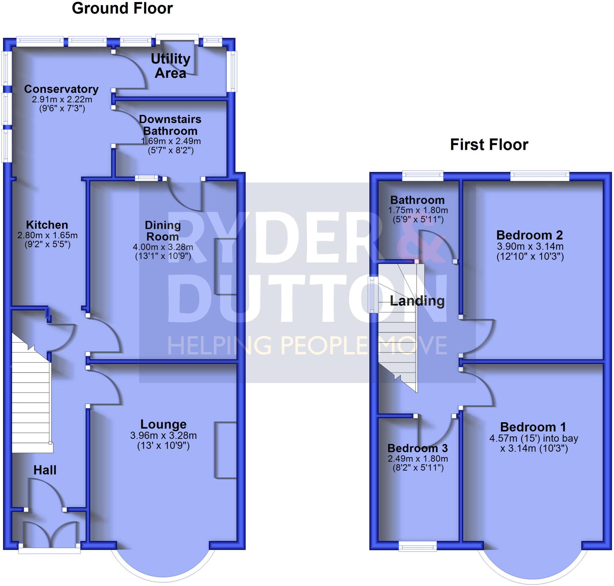
- Two-storey house with lounge, dining room, kitchen, conservatory, utility and bathrooms; three bedrooms upstairs.
Rooms
- Conservatory:
- Utility Area:
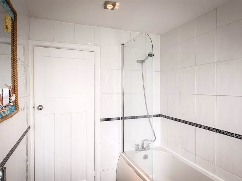
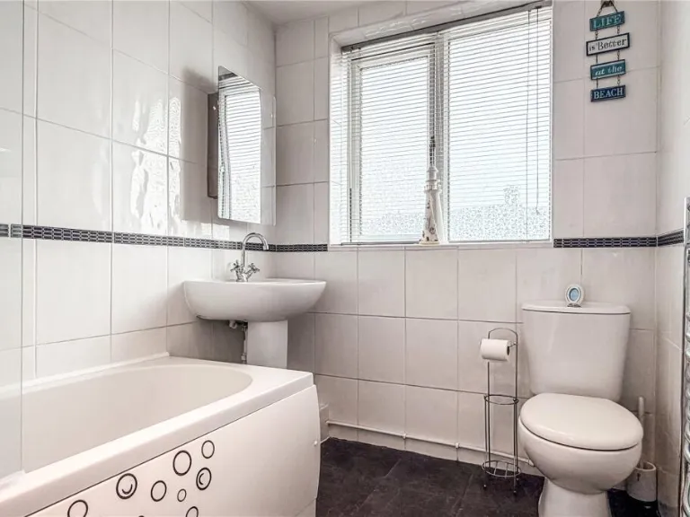
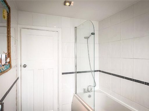
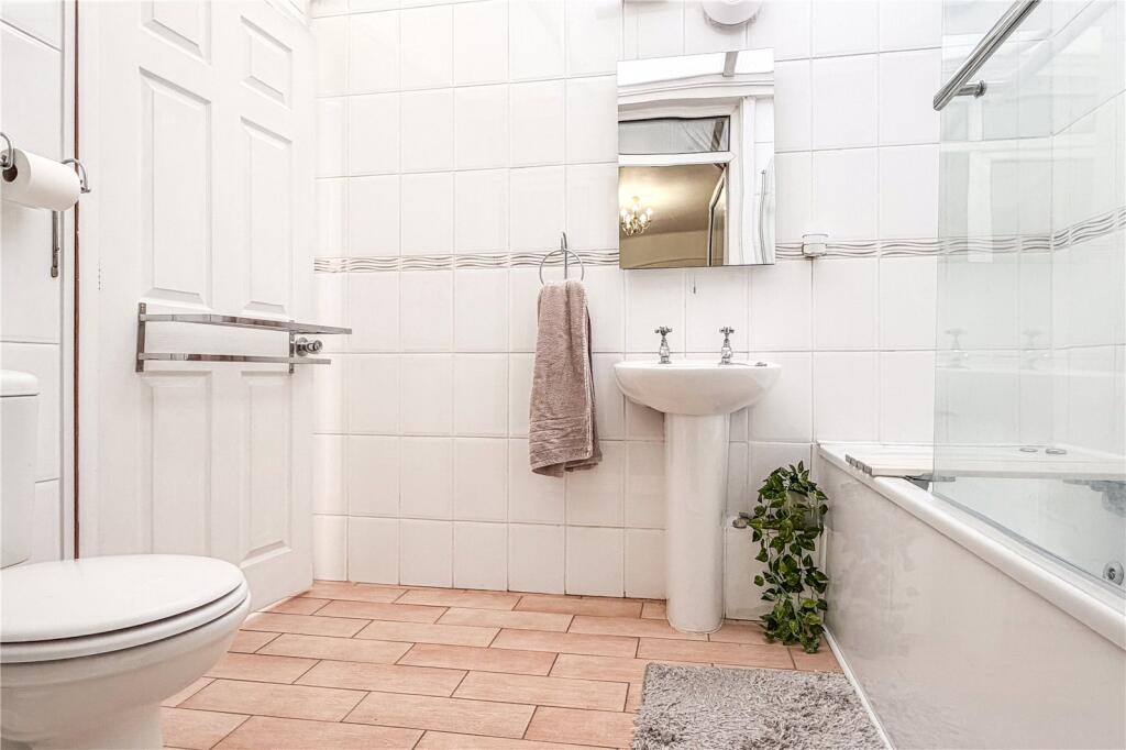
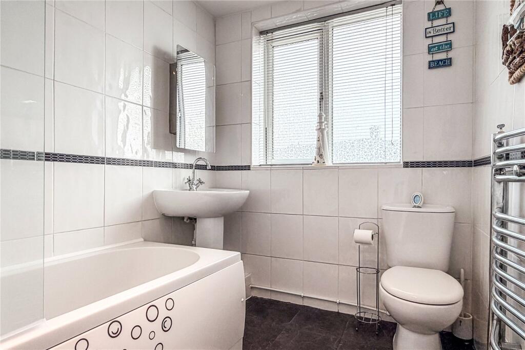
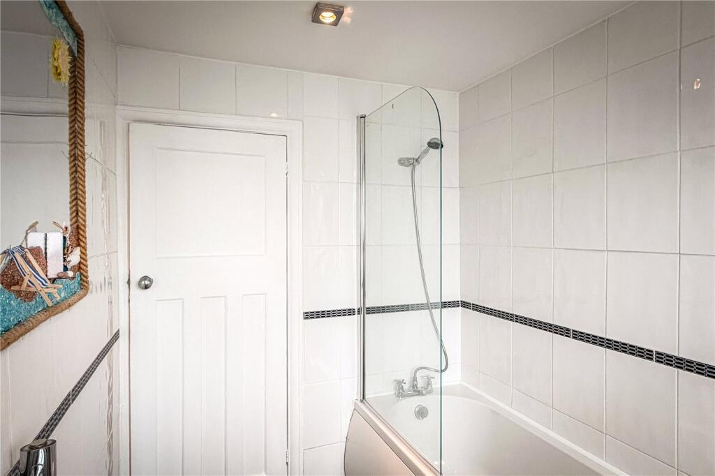
- Downstairs Bathroom:
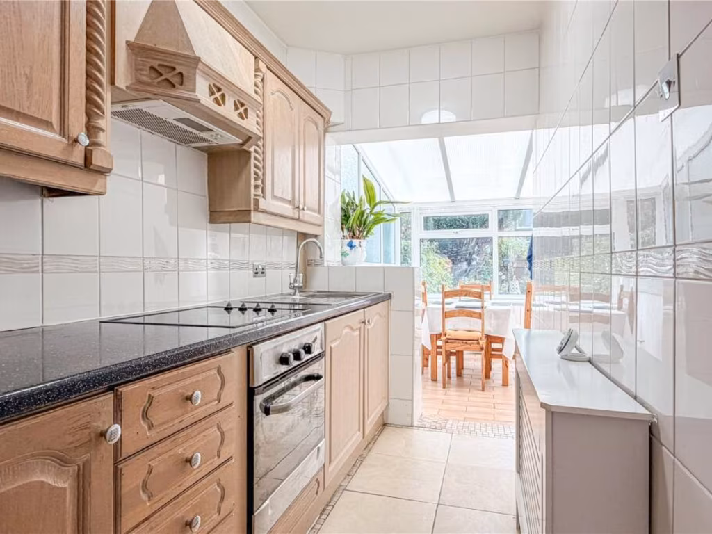
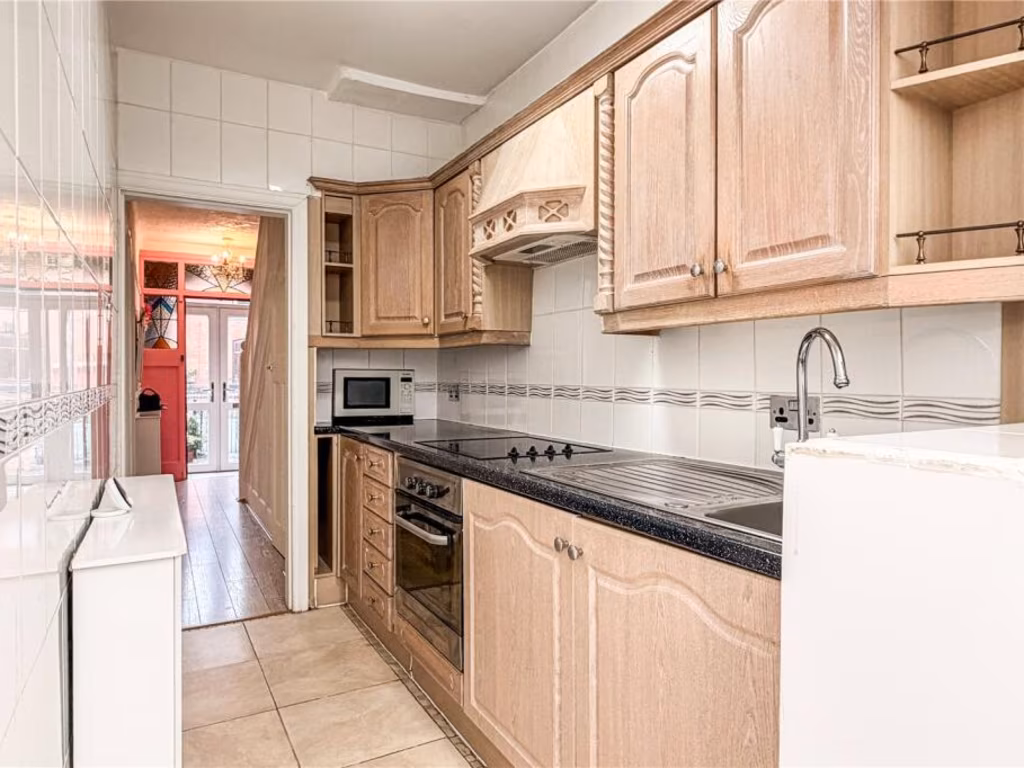
- Kitchen:
- Dining Room:
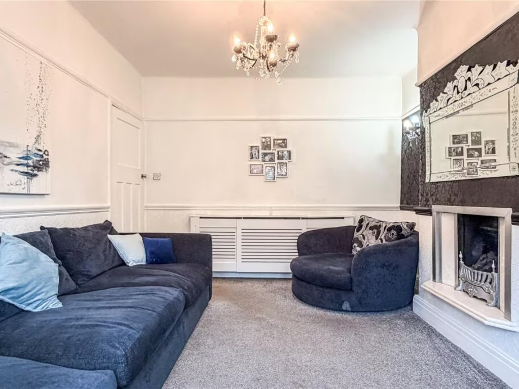
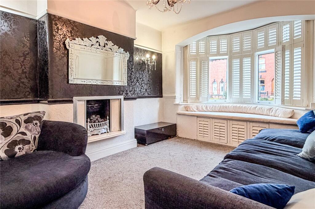
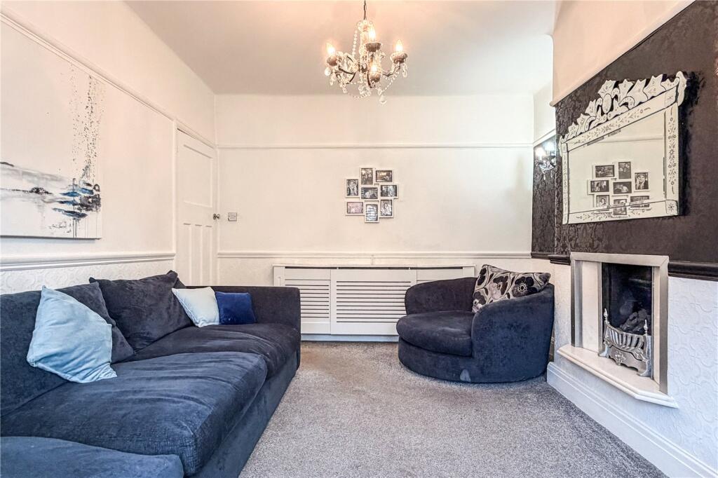
- Lounge:
- Hall:
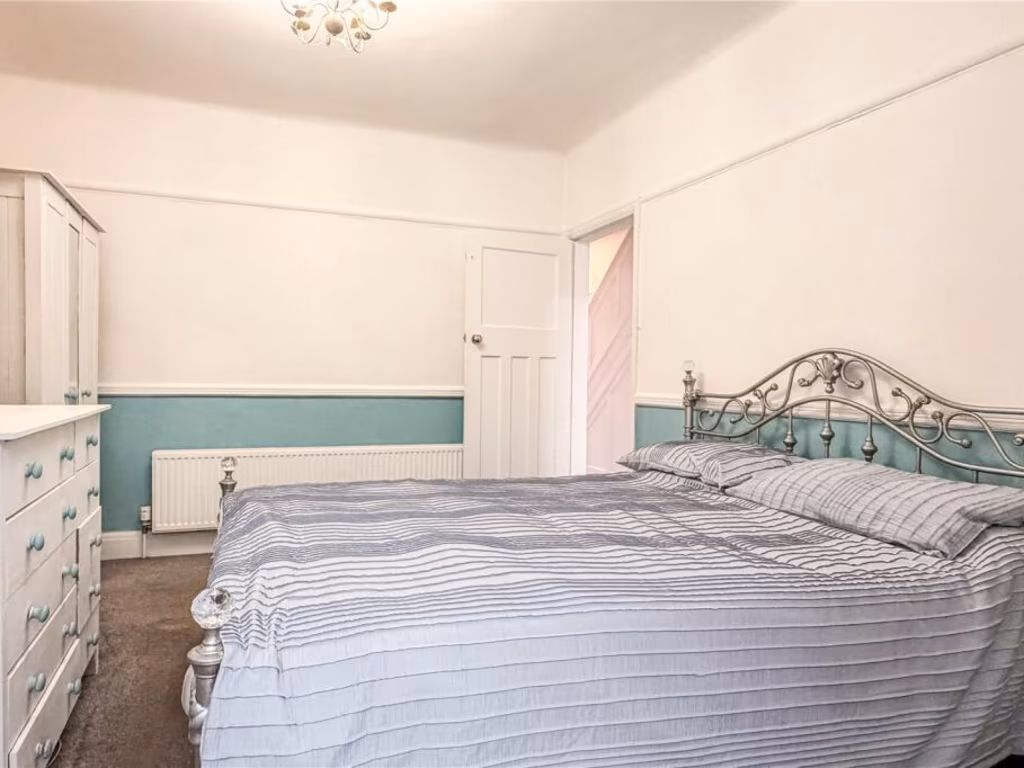
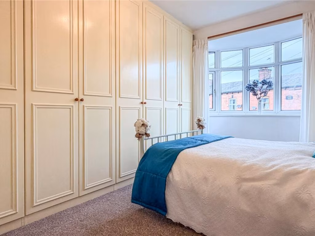
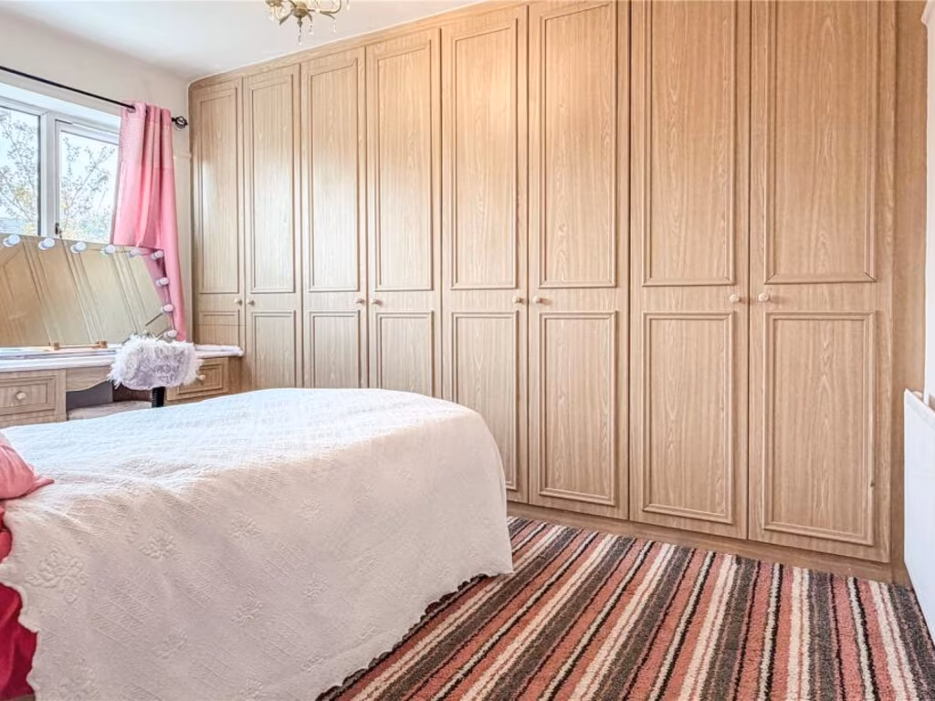
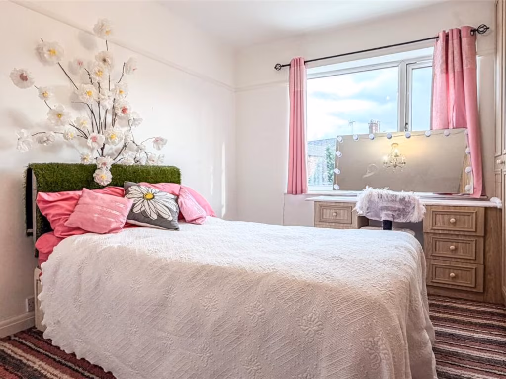
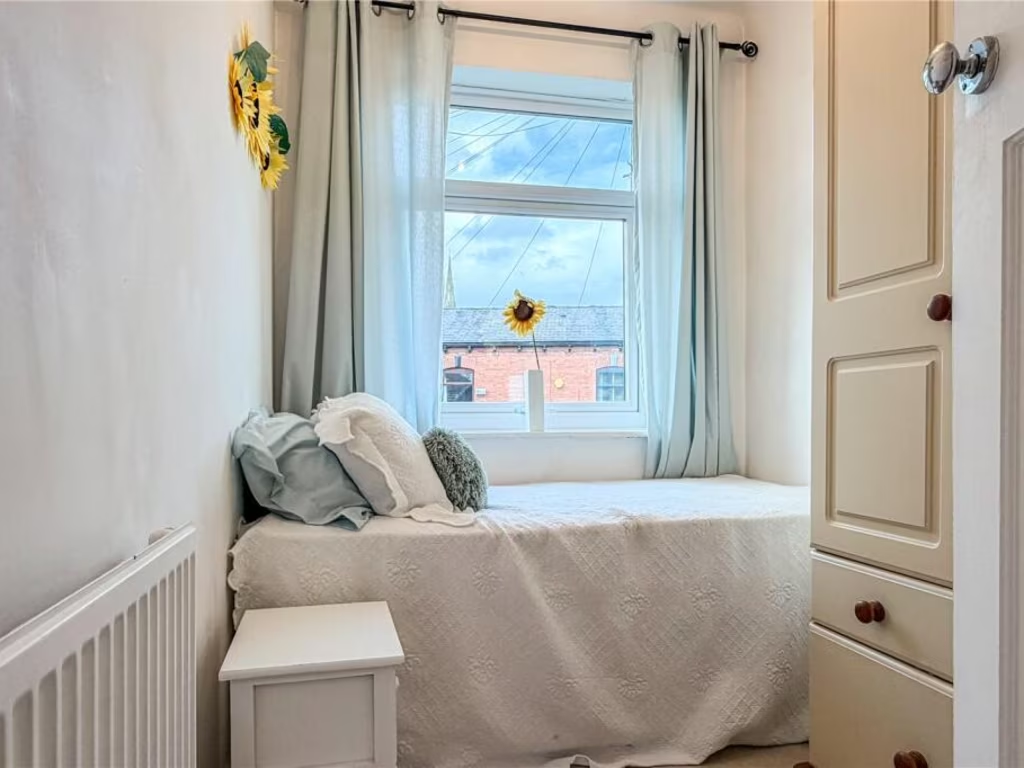
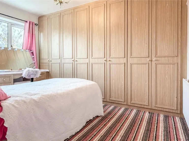
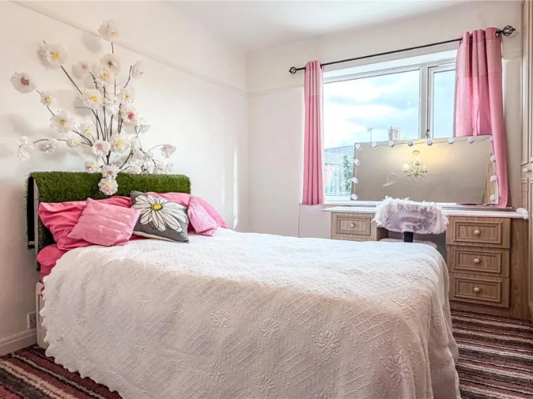
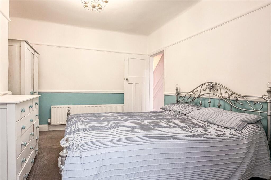
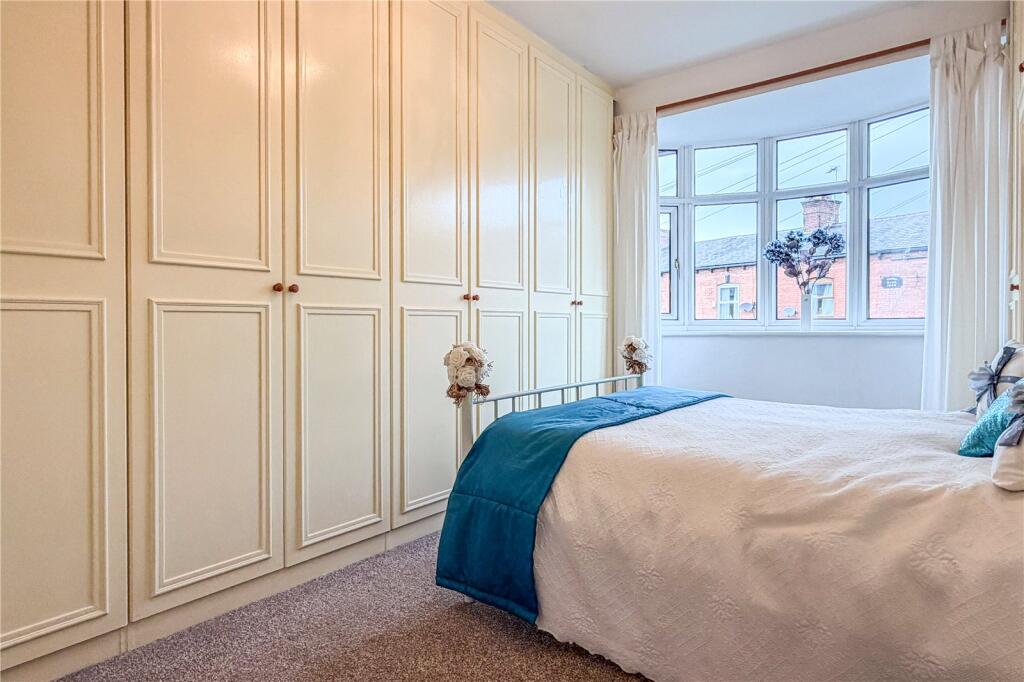
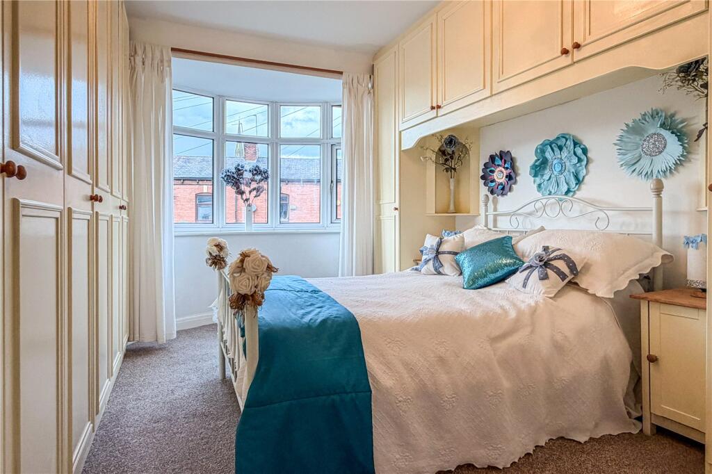
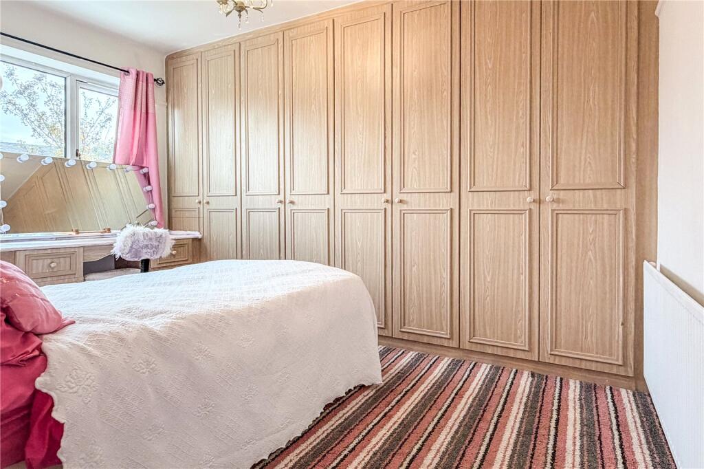
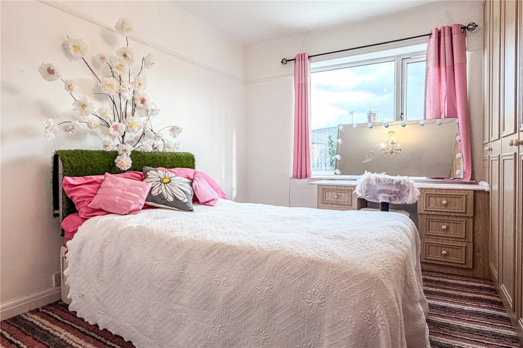
- Bedroom 1:
- Bedroom 2:
- Bedroom 3:
- Bathroom:
- Landing:
Textual Property Features
Detected Visual Features
- Edwardian
- red brick
- double-glazing
- bay windows
- period property
- residential
- family home
- mid-20th century
- entryway
- stairwell
- narrow staircase
- standard ceiling
- hallway
- interior
- fixer-upper
EPC Details
- Fully double glazed
- Cavity wall, filled cavity
- Boiler and radiators, mains gas
- Low energy lighting in 86% of fixed outlets
- Suspended, no insulation (assumed)
Nearby Schools
- Greater Manchester Independent School
- St Mary's RC Primary School
- Propps Hall Junior Infant and Nursery School
- Co-op Academy Failsworth
- St John's Church of England Primary School
- Oasis Academy Limeside
- St Matthew's RC High School
- St Margaret's CofE Junior Infant and Nursery School
- Whitegate End Primary and Nursery School
- St Margaret Mary's RC Primary School Manchester
- Yew Tree Community School
- Higher Failsworth Primary School
- St Wilfrid's CofE Junior and Infant School
- Stanley Road Primary School
- Greenside Primary School
- South Failsworth Community Primary School
- Woodhouses Voluntary Primary School
- Mather Street Primary School
- New Moston Primary School
- Corpus Christi RC Primary School
- Laurus Ryecroft
Nearest Bars And Restaurants
- Id: 286954159
- Tags:
- Amenity: pub
- Name: Dutch Birds Inn
- TagsNormalized:
- Lat: 53.5144687
- Lon: -2.1509784
- FullGeoHash: gcw2rn18qs42
- PartitionGeoHash: gcw2
- Images:
- FoodStandards: null
- Distance: 505.2
,- Id: 286954153
- Tags:
- Amenity: pub
- Name: Sun Inn
- TagsNormalized:
- Lat: 53.5138818
- Lon: -2.1519011
- FullGeoHash: gcw2rjchcnd5
- PartitionGeoHash: gcw2
- Images:
- FoodStandards: null
- Distance: 425.9
,- Id: 3566918619
- Tags:
- Alt_name: Kentucky Fried Chicken
- Amenity: fast_food
- Brand: KFC
- Brand:wikidata: Q524757
- Brand:wikipedia: en:KFC
- Contact:
- Website: https://www.kfc.co.uk/kfc-near-me/oldham-sisson-street
- Cuisine: chicken
- Delivery: no
- Drive_through: yes
- Name: KFC
- Takeaway: yes
- TagsNormalized:
- fast food
- food
- kfc
- chicken
- drive through
- takeaway
- Lat: 53.5093598
- Lon: -2.1594143
- FullGeoHash: gcw2qv5d9gxu
- PartitionGeoHash: gcw2
- Images:
- FoodStandards: null
- Distance: 411
,- Id: 287027072
- Tags:
- Amenity: pub
- Name: Crown & Cushion
- TagsNormalized:
- Lat: 53.5110199
- Lon: -2.156378
- FullGeoHash: gcw2qvmu2c05
- PartitionGeoHash: gcw2
- Images:
- FoodStandards: null
- Distance: 222.9
,- Id: 286954151
- Tags:
- Amenity: pub
- Name: Royal Oak
- TagsNormalized:
- Lat: 53.5114347
- Lon: -2.1555946
- FullGeoHash: gcw2qvqqen2j
- PartitionGeoHash: gcw2
- Images:
- FoodStandards: null
- Distance: 206.5
}
Nearest General Shops
- Id: 35963806
- Tags:
- Building: yes
- Name: Housing Units
- Shop: furniture
- TagsNormalized:
- Lat: 53.5157268
- Lon: -2.1527846
- FullGeoHash: gcw2rn0rsqx3
- PartitionGeoHash: gcw2
- Images:
- FoodStandards: null
- Distance: 621.4
,- Id: 287027024
- Tags:
- Name: Cooperative
- Shop: supermarket
- TagsNormalized:
- Lat: 53.5148479
- Lon: -2.1505149
- FullGeoHash: gcw2rn4496ey
- PartitionGeoHash: gcw2
- Images:
- FoodStandards: null
- Distance: 555
,- Id: 3849675526
- Tags:
- Brand: Coral
- Brand:wikidata: Q54621344
- Brand:wikipedia: en:Coral (bookmaker)
- Name: Coral
- Shop: bookmaker
- TagsNormalized:
- Lat: 53.5095363
- Lon: -2.1585599
- FullGeoHash: gcw2qvh5tut1
- PartitionGeoHash: gcw2
- Images:
- FoodStandards: null
- Distance: 351.7
}
Nearest Grocery shops
- Id: 9888127197
- Tags:
- Brand: Premier
- Brand:wikidata: Q7240340
- Name: Premier
- Shop: convenience
- TagsNormalized:
- Lat: 53.5083179
- Lon: -2.1791521
- FullGeoHash: gcw2qkvhw16m
- PartitionGeoHash: gcw2
- Images:
- FoodStandards: null
- Distance: 1718.8
,- Id: 904847028
- Tags:
- Addr:
- Postcode: OL8 3RB
- Street: Manchester Road
- Brand: Spar
- Brand:wikidata: Q610492
- Building: yes
- Fhrs:
- Name: Spar
- Shop: convenience
- Source:
- Start_date: 2018-11-15
- TagsNormalized:
- Lat: 53.5188771
- Lon: -2.1444184
- FullGeoHash: gcw2rny6p3v9
- PartitionGeoHash: gcw2
- Images:
- FoodStandards:
- Id: 1102017
- FHRSID: 1102017
- LocalAuthorityBusinessID: 65137
- BusinessName: Esso - Hollinwood Service Station
- BusinessType: Retailers - other
- BusinessTypeID: 4613
- AddressLine1: Euro Garages Ltd
- AddressLine2: Hollinwood Service Station
- AddressLine3: A 62 Manchester Road
- AddressLine4: Oldham
- PostCode: OL8 3RB
- RatingValue: 5
- RatingKey: fhrs_5_en-GB
- RatingDate: 2020-10-28
- LocalAuthorityCode: 418
- LocalAuthorityName: Oldham
- LocalAuthorityWebSite: https://www.oldham.gov.uk
- LocalAuthorityEmailAddress: FHRS@oldham.gov.uk
- Scores:
- Hygiene: 0
- Structural: 0
- ConfidenceInManagement: 0
- NewRatingPending: false
- Geocode:
- Longitude: -2.14556002616882
- Latitude: 53.51821899414060
- Distance: 1135.8
,- Id: 3075742989
- Tags:
- Brand: Morrisons
- Brand:wikidata: Q922344
- Brand:wikipedia: en:Morrisons
- Name: Morrisons
- Note: Petrol station shop attached to larger store (located about 750m SW)
- Shop: convenience
- Website: https://my.morrisons.com/storefinder/22
- TagsNormalized:
- Lat: 53.5096995
- Lon: -2.1611085
- FullGeoHash: gcw2qv4kddbw
- PartitionGeoHash: gcw2
- Images:
- FoodStandards: null
- Distance: 516
}
Nearest Supermarkets
- Id: 166300578
- Tags:
- Brand: Morrisons
- Brand:wikidata: Q922344
- Brand:wikipedia: en:Morrisons
- Contact:
- Website: https://my.morrisons.com/storefinder/57
- Name: Morrisons
- Shop: supermarket
- TagsNormalized:
- Lat: 53.5213768
- Lon: -2.1536829
- FullGeoHash: gcw2qzr8xec8
- PartitionGeoHash: gcw2
- Images:
- FoodStandards: null
- Distance: 1248.7
,- Id: 303377113
- Tags:
- Brand: Tesco Extra
- Brand:wikidata: Q25172225
- Brand:wikipedia: en:Tesco Extra
- Building: retail
- Contact:
- Website: https://www.tesco.com/store-locator/manchester/ashton-road
- Name: Tesco Extra
- Shop: supermarket
- Source: Bing
- TagsNormalized:
- tesco
- tesco extra
- retail
- supermarket
- shop
- Lat: 53.5085325
- Lon: -2.1587067
- FullGeoHash: gcw2quujf3rt
- PartitionGeoHash: gcw2
- Images:
- FoodStandards: null
- Distance: 397.7
,- Id: 381802171
- Tags:
- Brand: ALDI
- Brand:wikidata: Q41171672
- Brand:wikipedia: en:Aldi
- Building: yes
- Contact:
- Website: https://stores.aldi.co.uk/failsworth/sisson-street
- Name: Aldi
- Shop: supermarket
- TagsNormalized:
- Lat: 53.5099764
- Lon: -2.1588876
- FullGeoHash: gcw2qv5ynq8d
- PartitionGeoHash: gcw2
- Images:
- FoodStandards: null
- Distance: 367.2
}
Nearest Religious buildings
- Id: 286954152
- Tags:
- Amenity: pub
- Name: Church Inn
- TagsNormalized:
- Lat: 53.5123028
- Lon: -2.1549453
- FullGeoHash: gcw2qvwgf0k2
- PartitionGeoHash: gcw2
- Images:
- FoodStandards: null
- Distance: 261.9
,- Id: 449260421
- Tags:
- Addr:
- City: Manchester
- Country: GB
- Postcode: M35 9PY
- Street: James Street
- Amenity: school
- Name: St John's Church of England Primary School
- Phone: +44 161 681 5713
- Ref:
- Source:
- Addr: edubase
- Geometry: OS_Open_Map_Local_FunctionalSite
- Name: edubase
- Website: www.stjohns.oldham.sch.uk
- Wikidata: Q67151309
- TagsNormalized:
- Lat: 53.5088419
- Lon: -2.1507651
- FullGeoHash: gcw2rhczee17
- PartitionGeoHash: gcw2
- Images:
- FoodStandards: null
- Distance: 224
,- Id: 303377124
- Tags:
- Amenity: place_of_worship
- Building: church
- Denomination: anglican
- Name: St John the Evangelist (Failsworth Parish Church)
- Religion: christian
- Source: survey
- Source:geometry: Bing
- Wikidata: Q26639076
- TagsNormalized:
- place of worship
- church
- anglican
- evangelist
- parish
- christian
- Lat: 53.5117199
- Lon: -2.1546044
- FullGeoHash: gcw2qvx065dd
- PartitionGeoHash: gcw2
- Images:
- FoodStandards: null
- Distance: 193.6
}
Nearest Medical buildings
- Id: 655056448
- Tags:
- Addr:
- Housenumber: 872-874
- Postcode: OL8 4SR
- Street: Hollins Road
- Amenity: dentist
- Building: yes
- Healthcare: dentist
- Old_amenity: pub
- Old_fhrs:
- Old_name: Gardener's Arms
- Source:
- Addr: FHRS Open Data
- Old_amenity: FHRS Open Data;Bing;Naptan
- TagsNormalized:
- Lat: 53.5199715
- Lon: -2.1396876
- FullGeoHash: gcw2rr1bmtv3
- PartitionGeoHash: gcw2
- Images:
- FoodStandards: null
- Distance: 1417.1
,- Id: 287027171
- Tags:
- Amenity: dentist
- Healthcare: dentist
- TagsNormalized:
- Lat: 53.5085959
- Lon: -2.1632816
- FullGeoHash: gcw2qubwpvhr
- PartitionGeoHash: gcw2
- Images:
- FoodStandards: null
- Distance: 679.6
,- Id: 3566930658
- Tags:
- Amenity: pharmacy
- Healthcare: pharmacy
- TagsNormalized:
- Lat: 53.5098798
- Lon: -2.1569199
- FullGeoHash: gcw2qvjmshef
- PartitionGeoHash: gcw2
- Images:
- FoodStandards: null
- Distance: 238.5
,- Id: 3566928911
- Tags:
- Amenity: doctors
- Healthcare: doctor
- TagsNormalized:
- doctor
- doctors
- health
- healthcare
- Lat: 53.5096916
- Lon: -2.1567321
- FullGeoHash: gcw2qvjs83rz
- PartitionGeoHash: gcw2
- Images:
- FoodStandards: null
- Distance: 229.8
}
Nearest Airports
- Id: 1224469
- Tags:
- Addr:
- City: Manchester
- Country: GB
- Postcode: M90 1QX
- Aerodrome: international
- Aeroway: aerodrome
- Arp: yes
- Atis: 128.175
- Iata: MAN
- Icao: EGCC
- Name: Manchester Airport
- Note: rough sketched outline referring to Yahoo imagery - true boundary is where?
- Old_name: Ringway
- Operator: Manchester Airport PLC
- Size: 18720000
- Source:
- Tower_frequency: 118.625,119.400
- Type: multipolygon
- Website: https://www.manchesterairport.co.uk/
- Wikidata: Q8694
- Wikipedia: en:Manchester Airport
- TagsNormalized:
- airport
- international airport
- Lat: 53.3503197
- Lon: -2.2798822
- FullGeoHash: gcqrs05u4ukt
- PartitionGeoHash: gcqr
- Images:
- FoodStandards: null
- Distance: 19650.2
}
Nearest Leisure Facilities
- Id: 10689140210
- Tags:
- TagsNormalized:
- picnic
- picnic table
- leisure
- Lat: 53.5065563
- Lon: -2.146359
- FullGeoHash: gcw2rht461n8
- PartitionGeoHash: gcw2
- Images:
- FoodStandards: null
- Distance: 610.6
,- Id: 912939655
- Tags:
- Leisure: pitch
- Sport: bowls
- Surface: grass
- TagsNormalized:
- Lat: 53.5147539
- Lon: -2.1564987
- FullGeoHash: gcw2qyjdjcnj
- PartitionGeoHash: gcw2
- Images:
- FoodStandards: null
- Distance: 553
,- Id: 381926791
- Tags:
- Leisure: sports_centre
- Name: Failsworth Soccer Centre
- Sport: soccer
- TagsNormalized:
- sports
- sports centre
- leisure
- soccer
- Lat: 53.5082118
- Lon: -2.1495457
- FullGeoHash: gcw2rhfezvws
- PartitionGeoHash: gcw2
- Images:
- FoodStandards: null
- Distance: 330.8
,- Id: 613779739
- Tags:
- Leisure: park
- Name: Higher Memorial Park
- TagsNormalized:
- Lat: 53.5123315
- Lon: -2.1508704
- FullGeoHash: gcw2rj9gcjdg
- PartitionGeoHash: gcw2
- Images:
- FoodStandards: null
- Distance: 292.6
,- Id: 439225050
- Tags:
- Leisure: pitch
- Sport: bowls
- TagsNormalized:
- Lat: 53.5119843
- Lon: -2.1507589
- FullGeoHash: gcw2rj9cgsvu
- PartitionGeoHash: gcw2
- Images:
- FoodStandards: null
- Distance: 266.2
}
Nearest Tourist attractions
- Id: 380800562
- Tags:
- TagsNormalized:
- Lat: 53.4958601
- Lon: -2.1284094
- FullGeoHash: gcw2rdd5urng
- PartitionGeoHash: gcw2
- Images:
- FoodStandards: null
- Distance: 2289.9
,- Id: 430960765
- Tags:
- TagsNormalized:
- Lat: 53.4914734
- Lon: -2.1672678
- FullGeoHash: gcw2q9vf6vrg
- PartitionGeoHash: gcw2
- Images:
- FoodStandards: null
- Distance: 2271.7
,- Id: 430960768
- Tags:
- TagsNormalized:
- Lat: 53.4920869
- Lon: -2.1682959
- FullGeoHash: gcw2q9vjgp9r
- PartitionGeoHash: gcw2
- Images:
- FoodStandards: null
- Distance: 2238.7
}
Nearest Hotels
- Id: 424062544
- Tags:
- Amenity: pub
- Building: pub
- Name: Gardeners Arms Hotel
- Operator: WM Lees
- Real_ale: yes
- TagsNormalized:
- Lat: 53.5250548
- Lon: -2.1763766
- FullGeoHash: gcw2qrznn9ru
- PartitionGeoHash: gcw2
- Images:
- FoodStandards: null
- Distance: 2250.9
,- Id: 166164543
- Tags:
- Brand: Travelodge
- Brand:wikidata: Q9361374
- Brand:wikipedia: en:Travelodge UK
- Building: motel
- Internet_access: wlan
- Internet_access:fee: customers
- Internet_access:ssid: Travelodge WiFi
- Name: Travelodge
- Tourism: hotel
- TagsNormalized:
- Lat: 53.5283191
- Lon: -2.1600418
- FullGeoHash: gcw2wbe153uj
- PartitionGeoHash: gcw2
- Images:
- FoodStandards: null
- Distance: 2068.4
,- Id: 646934397
- Tags:
- Brand: Premier Inn
- Brand:wikidata: Q2108626
- Building: yes
- Building:levels: 1.5
- Internet_access: wlan
- Internet_access:fee: customers
- Internet_access:operator: Virgin Media
- Internet_access:ssid: Premier Inn Free Wi-Fi
- Name: Premier Inn
- Roof:
- Levels: 0.25
- Shape: hipped
- Tourism: hotel
- TagsNormalized:
- Lat: 53.5228004
- Lon: -2.1641629
- FullGeoHash: gcw2qz80gm5h
- PartitionGeoHash: gcw2
- Images:
- FoodStandards: null
- Distance: 1578.3
}
Tags
- Edwardian
- red brick
- double-glazing
- bay windows
- period property
- residential
- family home
- mid-20th century
- entryway
- stairwell
- narrow staircase
- standard ceiling
- hallway
- interior
- fixer-upper
Local Market Stats
- Average Price/sqft: £216
- Avg Income: £36400
- Rental Yield: 5.1%
- Social Housing: 11%
- Planning Success Rate: 95%
Similar Properties
 3 bedroom semi-detached house for sale in Tatchbury Road, Failsworth, Manchester, M35 — £375,000 • 3 bed • 1 bath • 763 ft²
 4 bedroom semi-detached house for sale in Cambridge Road, Failsworth, Manchester, Greater Manchester, M35 — £310,000 • 4 bed • 1 bath • 832 ft²
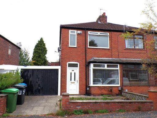 2 bedroom semi-detached house for sale in Farm Street, Failsworth, Manchester, M35 — £189,950 • 2 bed • 1 bath • 608 ft²
 3 bedroom semi-detached house for sale in Massey Avenue, Failsworth, Manchester, M35 — £260,000 • 3 bed • 1 bath • 813 ft²
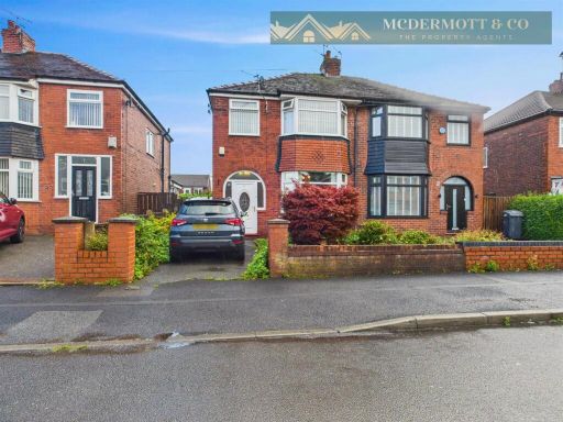 3 bedroom semi-detached house for sale in Clifton Street, Failsworth, M35 — £239,950 • 3 bed • 1 bath • 787 ft²
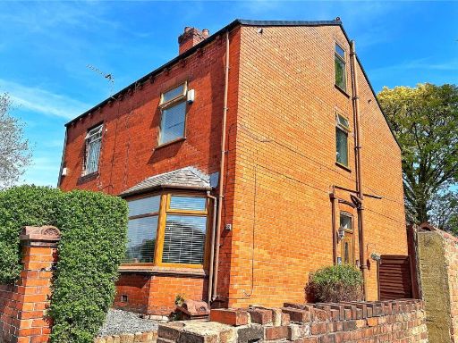 2 bedroom semi-detached house for sale in Lord Lane, Failsworth, Manchester, Greater Manchester, M35 — £200,000 • 2 bed • 1 bath • 1019 ft²
Meta
- {
"@context": "https://schema.org",
"@type": "Residence",
"name": "3 bedroom semidetached house for sale in Ashton Road East,…",
"description": "",
"url": "https://propertypiper.co.uk/property/24b3ade1-49d2-4952-bb69-86e5a97c5e0a",
"image": "https://image-a.propertypiper.co.uk/72e9f0dd-15d7-45a0-af1f-05dafe37bb8b-1024.jpeg",
"address": {
"@type": "PostalAddress",
"streetAddress": "8 Ashton Road East, Failsworth",
"postalCode": "M35 9PT",
"addressLocality": "Oldham",
"addressRegion": "Ashton-under-Lyne",
"addressCountry": "England"
},
"geo": {
"@type": "GeoCoordinates",
"latitude": 53.510148580229966,
"longitude": -2.153342282230388
},
"numberOfRooms": 3,
"numberOfBathroomsTotal": 2,
"floorSize": {
"@type": "QuantitativeValue",
"value": 813,
"unitCode": "FTK"
},
"offers": {
"@type": "Offer",
"price": 210000,
"priceCurrency": "GBP",
"availability": "https://schema.org/InStock"
},
"additionalProperty": [
{
"@type": "PropertyValue",
"name": "Feature",
"value": "Edwardian"
},
{
"@type": "PropertyValue",
"name": "Feature",
"value": "red brick"
},
{
"@type": "PropertyValue",
"name": "Feature",
"value": "double-glazing"
},
{
"@type": "PropertyValue",
"name": "Feature",
"value": "bay windows"
},
{
"@type": "PropertyValue",
"name": "Feature",
"value": "period property"
},
{
"@type": "PropertyValue",
"name": "Feature",
"value": "residential"
},
{
"@type": "PropertyValue",
"name": "Feature",
"value": "family home"
},
{
"@type": "PropertyValue",
"name": "Feature",
"value": "mid-20th century"
},
{
"@type": "PropertyValue",
"name": "Feature",
"value": "entryway"
},
{
"@type": "PropertyValue",
"name": "Feature",
"value": "stairwell"
},
{
"@type": "PropertyValue",
"name": "Feature",
"value": "narrow staircase"
},
{
"@type": "PropertyValue",
"name": "Feature",
"value": "standard ceiling"
},
{
"@type": "PropertyValue",
"name": "Feature",
"value": "hallway"
},
{
"@type": "PropertyValue",
"name": "Feature",
"value": "interior"
},
{
"@type": "PropertyValue",
"name": "Feature",
"value": "fixer-upper"
}
]
}
High Res Floorplan Images
Compatible Floorplan Images
FloorplanImages Thumbnail