OX11 6DE - 3 bedroom link detached house for sale in The Poplars, Harw…
View on Property Piper
3 bedroom link detached house for sale in The Poplars, Harwell, Didcot, Oxfordshire, OX11
Property Details
- Price: £425000
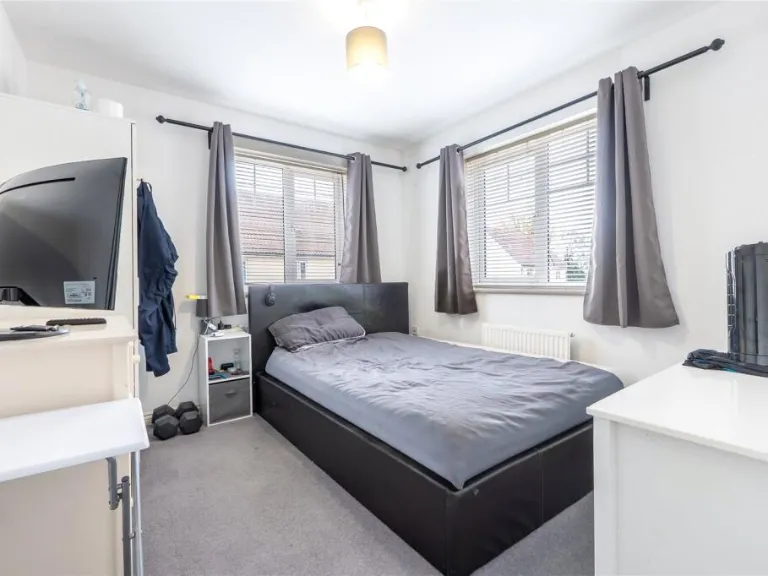
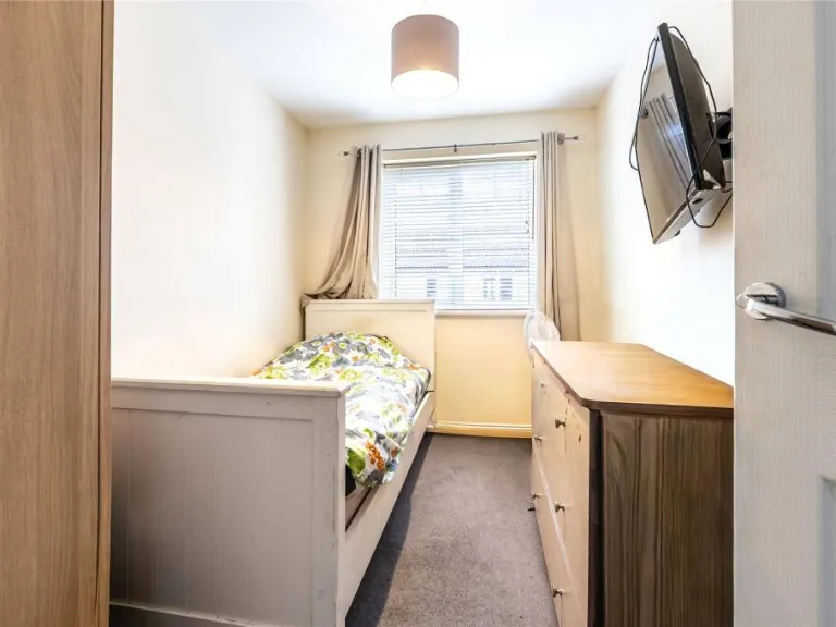
- Bedrooms: 3
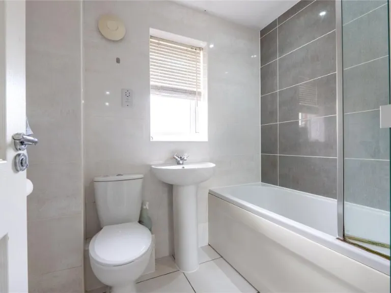
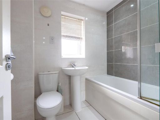
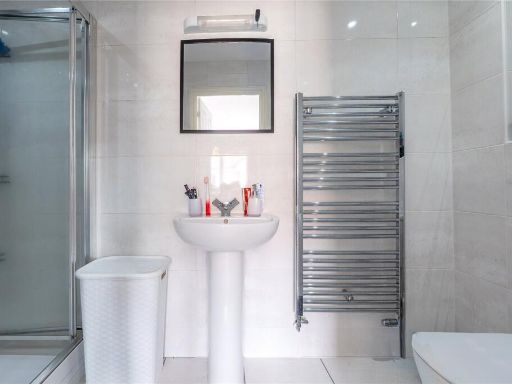
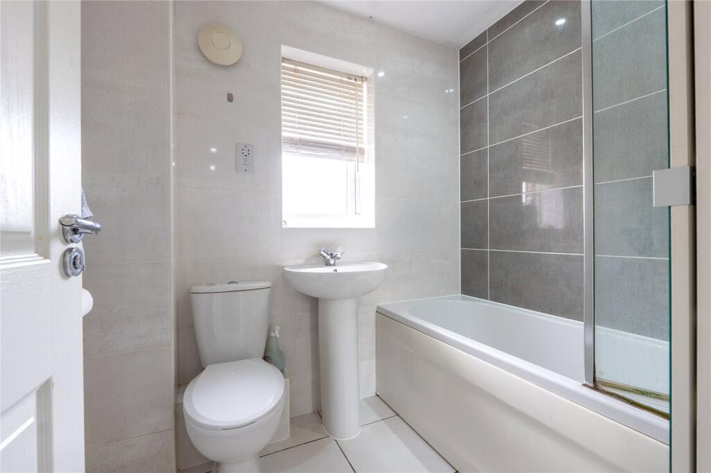
- Bathrooms: 2
- Property Type: undefined
- Property SubType: undefined
Brochure Descriptions
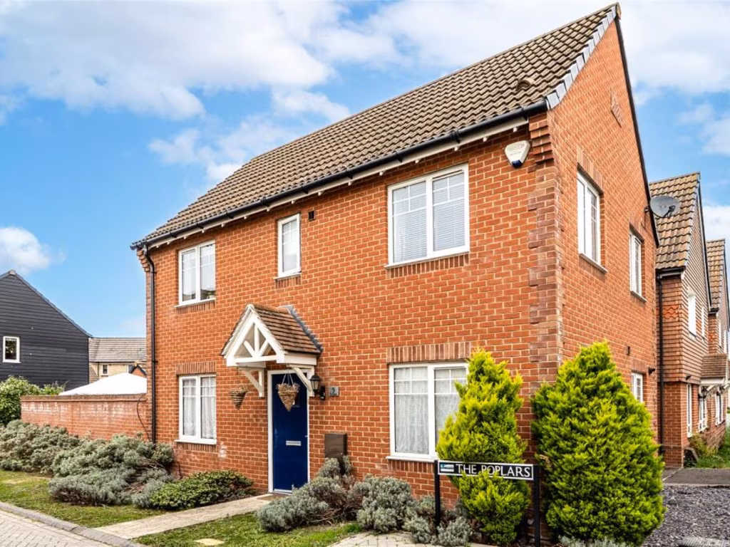
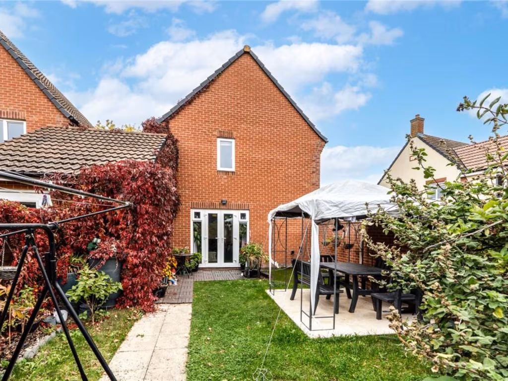
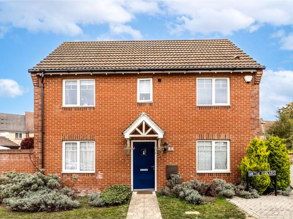
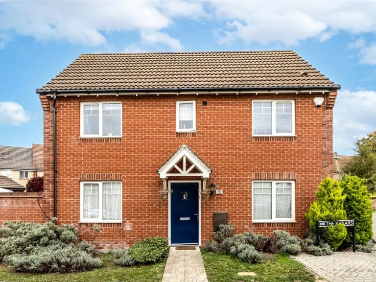
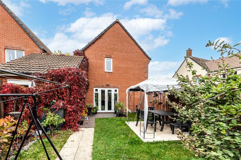
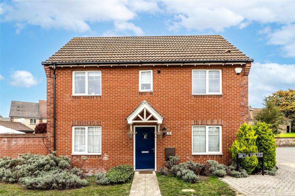
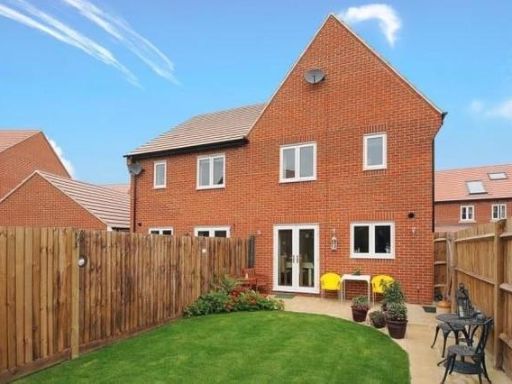
- Two-storey red-brick corner property (end-of-terrace/semi style) set on a residential street. The building appears modern with a tiled roof, white-framed windows and a sheltered porch over the principal entrance. The property occupies a corner plot with a small to average front garden and low-maintenance planted beds; there is pedestrian access from the pavement and what appears to be a parking/drive area to the side. The overall plot and building footprint suggest a medium-sized family home (likely 2–3 bedroom accommodation) with typical room proportions for a modern suburban dwelling. The immediate outlook is onto neighbouring residential properties and street-scape; no notable long-distance or waterfront views are visible. Presentation is well kept externally, indicating good curb appeal and low immediate external maintenance liability.
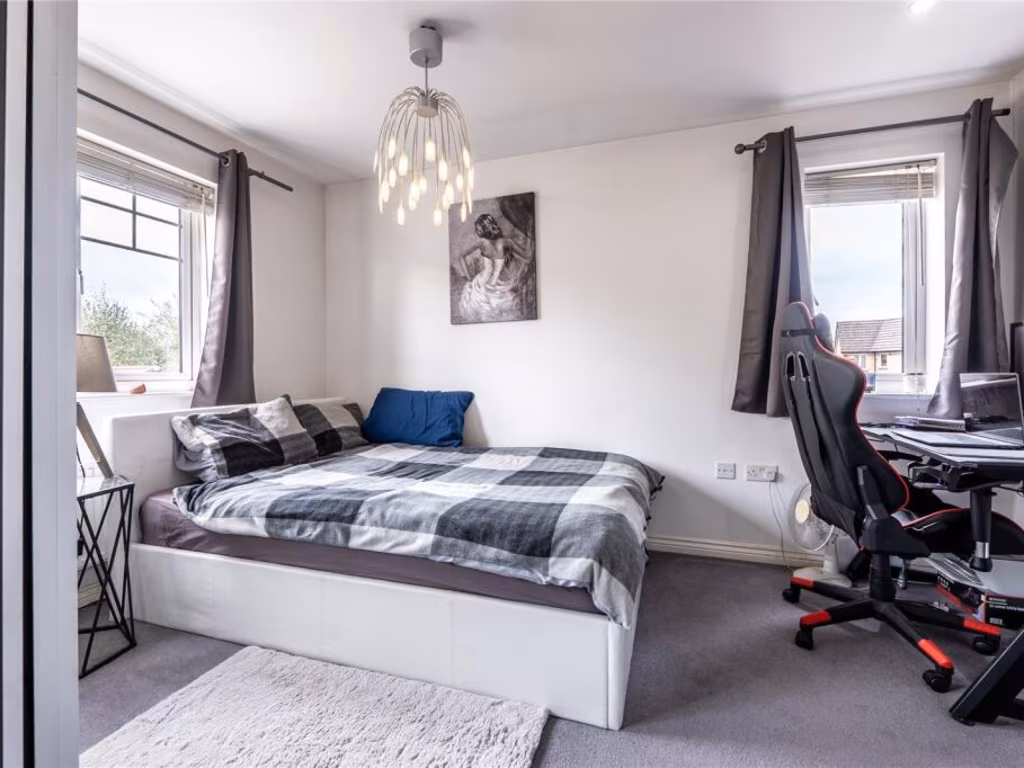
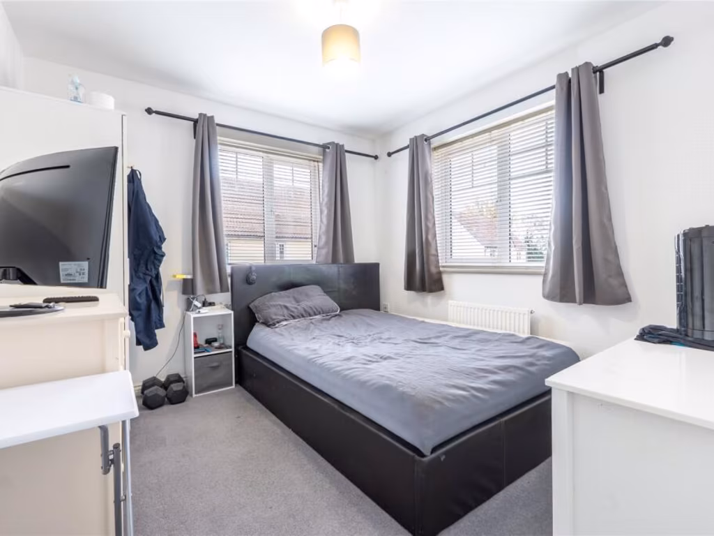
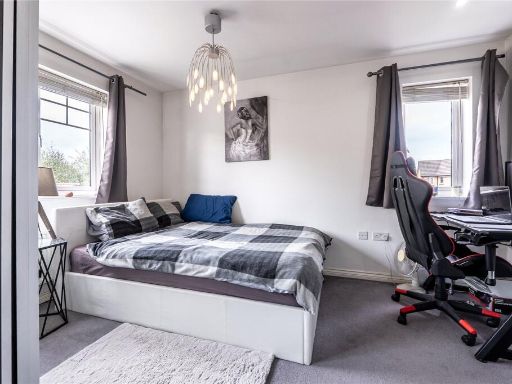
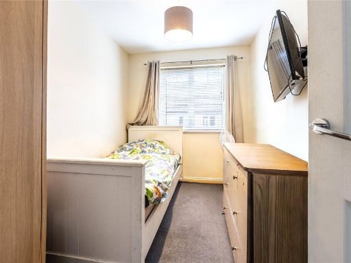
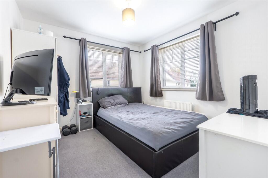
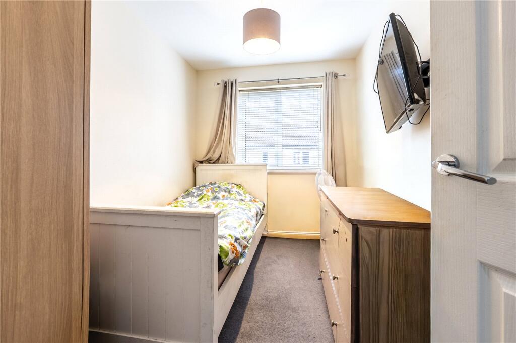
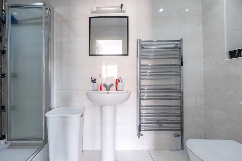
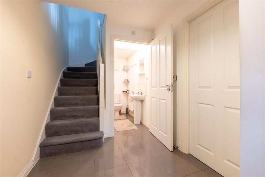
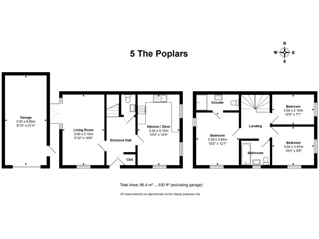
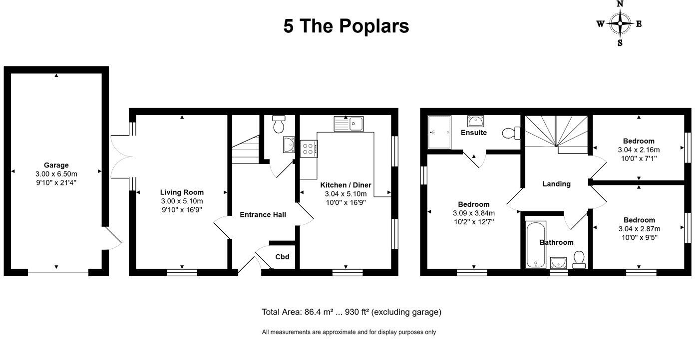
- Semi-detached / mid-terrace style two-storey dwelling shown on floorplan as '5 The Poplars'. Accommodation comprises ground floor entrance hall, living room, kitchen/diner and separate garage (detached or single-storey to side), with three bedrooms to the first floor including one en-suite and a family bathroom. Total internal area shown as c.86.4 m² (930 ft²) excluding the garage. The plan suggests a modest/average sized family home with an average-sized garden likely to the rear (not depicted in detail). No notable external views are indicated on the plan. Overall property footprint and accommodation are typical of a medium-sized family home suitable for 2–4 occupants; room sizes appear average rather than oversized.
Image Descriptions
- house exterior contemporary
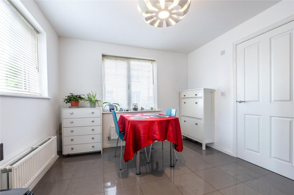
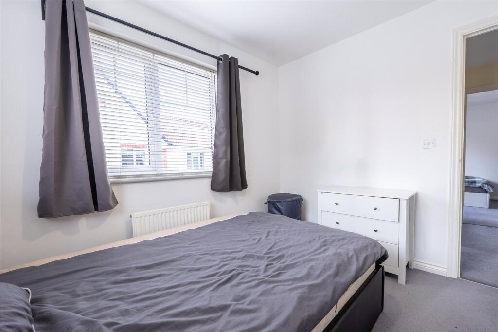
- living room Contemporary
Rooms
- Living Room:
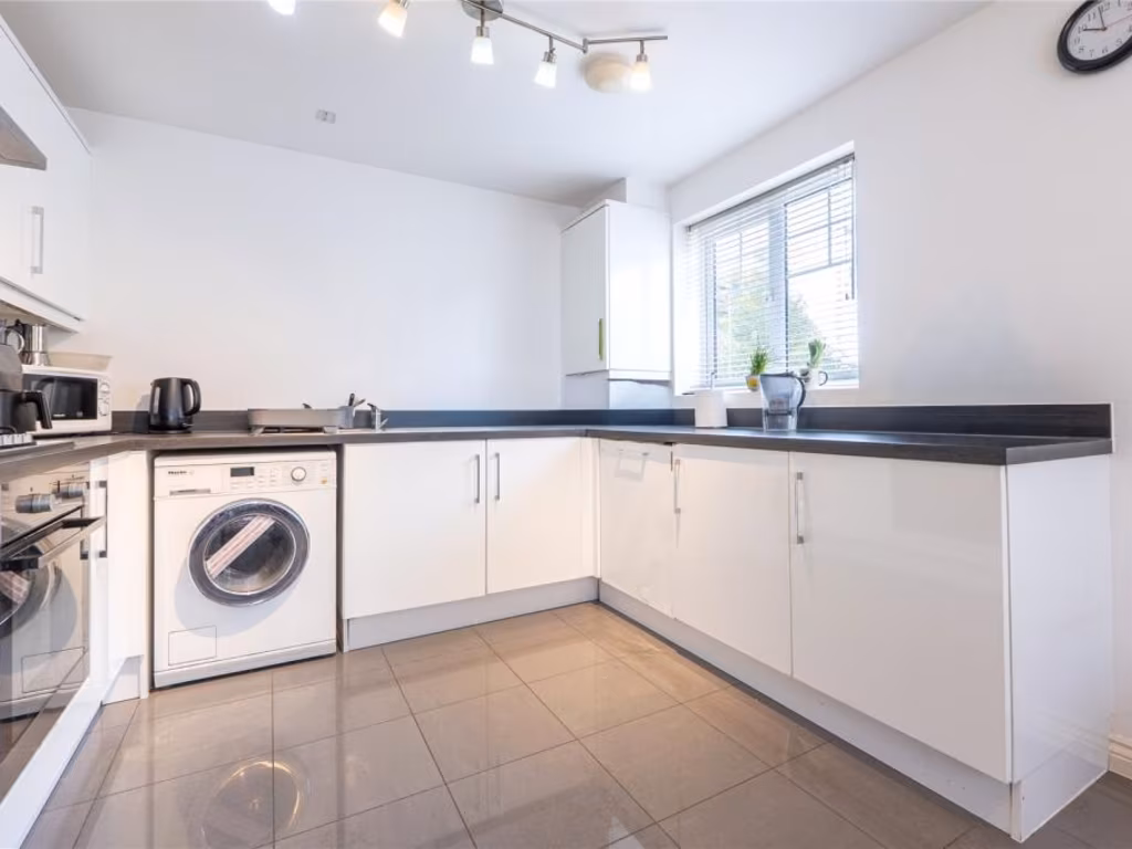
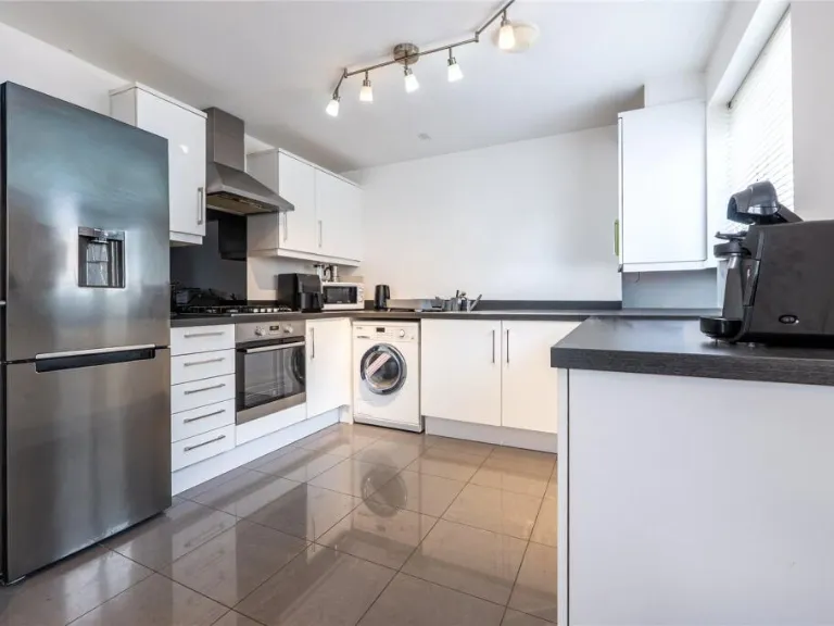
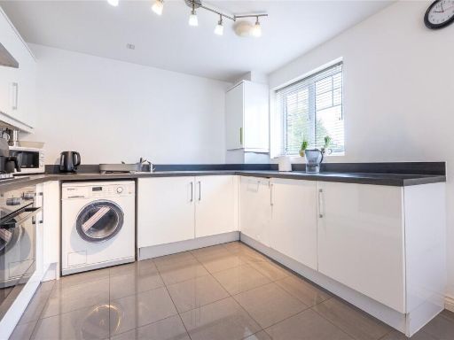
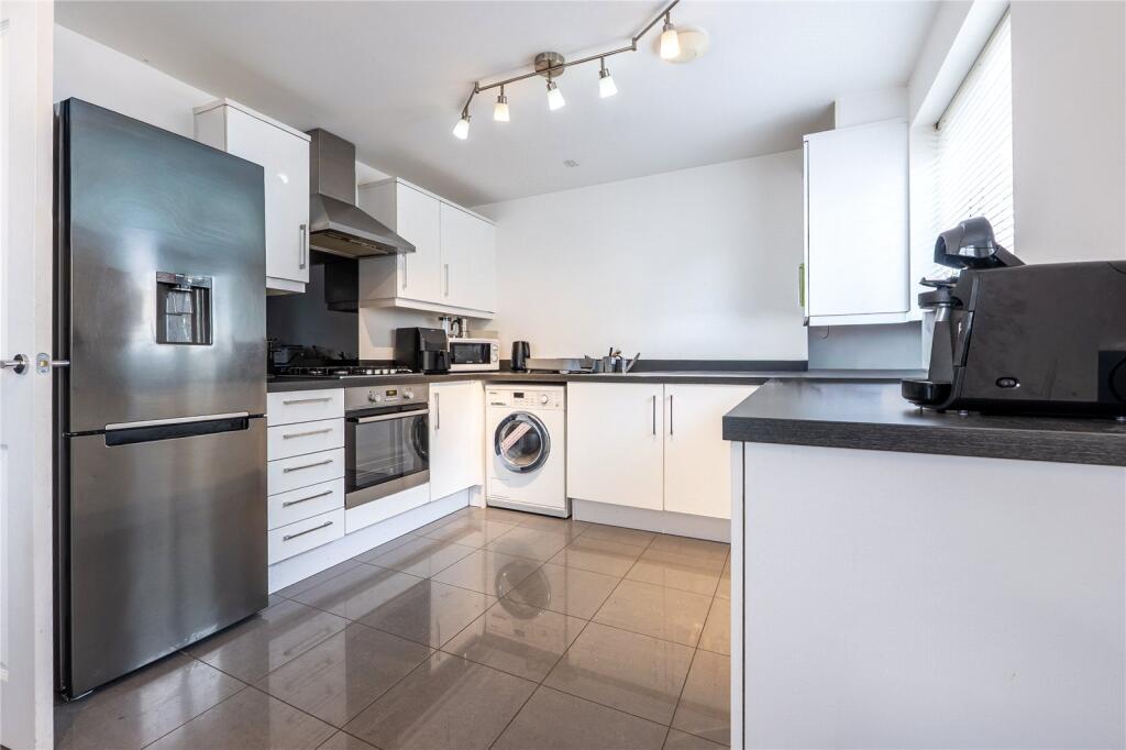
- Kitchen / Diner:
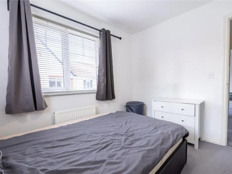
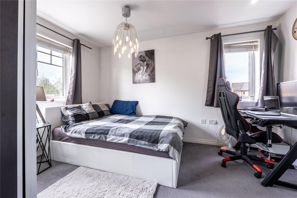
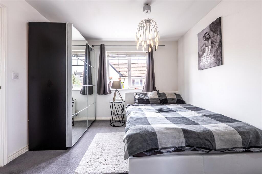
- Bedroom:
- Bedroom:
- Bedroom:
Textual Property Features
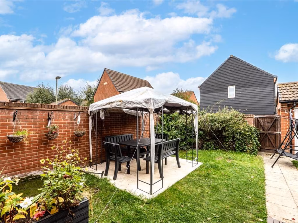
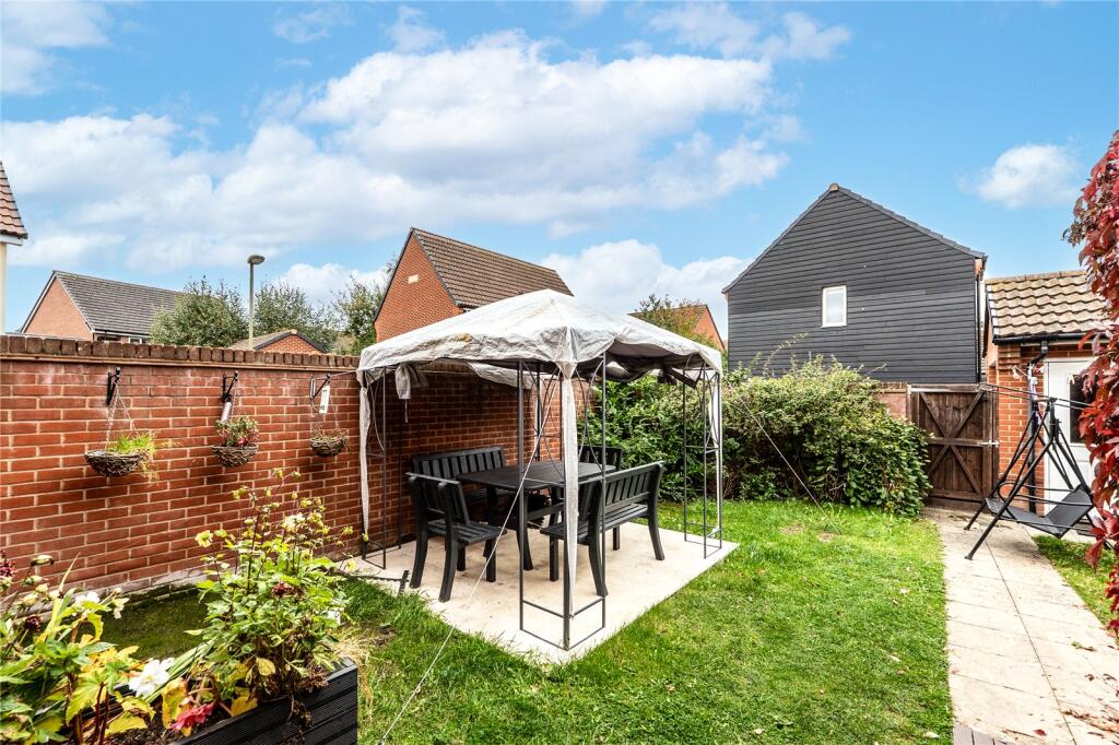
- Has Garden
- Chain Free
- Success
Detected Visual Features
- contemporary
- brick
- two-story
- detached
- residential
- modern
- well-maintained
- living room
- wooden flooring
- French doors
- natural light
- wall radiator
- neutral colors
- plants
- semi-detached
EPC Details
- Fully double glazed
- Cavity wall, as built, insulated (assumed)
- Boiler and radiators, mains gas
- Low energy lighting in all fixed outlets
- Solid, insulated (assumed)
Nearby Schools
- Harwell Primary School
- St Birinus School
- Aureus Primary School
- UTC Oxfordshire
- Abingdon School
- Blewbury Church of England Primary School
- Northbourne Church of England Primary School
- Willowcroft Community School
- Manor Primary School
- Ladygrove Park Primary School
- Sires Hill Primary Academy
- Caldecott Primary School
- Our Lady's Abingdon
- Chilton County Primary School
- Aureus School
- St Blaise CofE Primary School
- Long Wittenham (Church of England) Primary School
- Drayton Community Primary School
- Europa School UK
- St Edmund's Catholic Primary School
- Didcot Primary Academy
- Didcot Girls' School
- All Saints Church of England Primary School
- Sutton Courtenay Church of England Primary School
- Thameside Primary School
- Carswell Community Primary School
Nearest Bars And Restaurants
- Id: 599714489
- Tags:
- Amenity: fast_food
- Name: Smarts
- TagsNormalized:
- Lat: 51.6087772
- Lon: -1.2620953
- FullGeoHash: gcpje70fzj3e
- PartitionGeoHash: gcpj
- Images:
- FoodStandards: null
- Distance: 538.1
,- Id: 986984817
- Tags:
- Amenity: fast_food
- Changing_table: no
- Cuisine: chinese
- Level: 0
- Name: Fort Woks
- Opening_hours: Mo,We-Th,Su 17:00-22:00; Fr-Sa 17:00-23:00
- Takeaway: only
- Website: https://www.fortwoks.com
- TagsNormalized:
- fast food
- food
- chinese
- takeaway
- Lat: 51.6051407
- Lon: -1.2715825
- FullGeoHash: gcpje46j9zrr
- PartitionGeoHash: gcpj
- Images:
- FoodStandards: null
- Distance: 377.4
,- Id: 10589178005
- Tags:
- Addr:
- Postcode: OX11 6JX
- Street: Greenwood Way
- Amenity: cafe
- Cuisine: breakfast;cake;coffee_shop;tea
- Email: enquiries@bizzybeescafe.co.uk
- Name: Bizzy Bees Cafe & Bistro
- Opening_hours: Mo-Sa 09:30-16:30
- Website: https://bizzybeescafebistro.co.uk/
- TagsNormalized:
- Lat: 51.6054617
- Lon: -1.2712606
- FullGeoHash: gcpje46r97r3
- PartitionGeoHash: gcpj
- Images:
- FoodStandards: null
- Distance: 362.6
,- Id: 986984826
- Tags:
- Amenity: cafe
- Brand: Costa
- Brand:wikidata: Q608845
- Brand:wikipedia: en:Costa Coffee
- Cuisine: coffee_shop
- Level: 0
- Name: Costa
- Takeaway: yes
- TagsNormalized:
- Lat: 51.6045797
- Lon: -1.2714071
- FullGeoHash: gcpje464qnfh
- PartitionGeoHash: gcpj
- Images:
- FoodStandards: null
- Distance: 361.5
,- Id: 540282276
- Tags:
- Amenity: pub
- Building: yes
- Name: The Station Garden
- Operator: Marstons
- Phone: +44 1235 250251
- Website: https://www.stationgardenpub.co.uk/
- TagsNormalized:
- Lat: 51.6044564
- Lon: -1.2706261
- FullGeoHash: gcpje46c8rbt
- PartitionGeoHash: gcpj
- Images:
- FoodStandards: null
- Distance: 308.3
}
Nearest General Shops
- Id: 986984820
- Tags:
- Building: retail
- Building:levels: 1
- Name: The Cutting Bar
- Shop: hairdresser
- TagsNormalized:
- Lat: 51.604818
- Lon: -1.2717031
- FullGeoHash: gcpje43gz5m6
- PartitionGeoHash: gcpj
- Images:
- FoodStandards: null
- Distance: 382.3
,- Id: 986984818
- Tags:
- TagsNormalized:
- Lat: 51.6049317
- Lon: -1.271515
- FullGeoHash: gcpje46he898
- PartitionGeoHash: gcpj
- Images:
- FoodStandards: null
- Distance: 370.2
,- Id: 10589178105
- Tags:
- Addr:
- Email: TheHairLounge@email.com
- Name: The Hair Lounge
- Opening_hours: Tu-Fr 09:00-17:00; Sa 09:00-15:00
- Shop: hairdresser
- TagsNormalized:
- Lat: 51.6056999
- Lon: -1.2712388
- FullGeoHash: gcpje4d2czxw
- PartitionGeoHash: gcpj
- Images:
- FoodStandards: null
- Distance: 368.6
}
Nearest Grocery shops
- Id: 367964536
- Tags:
- Building: yes
- Name: The Co-operative Food
- Operator: Midcounties Co-operative Society
- Shop: supermarket
- TagsNormalized:
- the co-operative food
- food
- shop
- Lat: 51.6056645
- Lon: -1.2558475
- FullGeoHash: gcpje6t8b9h5
- PartitionGeoHash: gcpj
- Images:
- FoodStandards: null
- Distance: 721.9
,- Id: 482883767
- Tags:
- Addr:
- City: Didcot
- Street: Sir Frank Williams Avenue
- Brand: Best-one
- Brand:wikidata: Q4896532
- Level: 0
- Name: Best-one
- Shop: convenience
- TagsNormalized:
- Lat: 51.6109918
- Lon: -1.267039
- FullGeoHash: gcpje5mrgf5n
- PartitionGeoHash: gcpj
- Images:
- FoodStandards: null
- Distance: 707.3
,- Id: 771144107
- Tags:
- Brand: Sainsbury's Local
- Brand:wikidata: Q13218434
- Brand:wikipedia: en:Sainsbury's Local
- Building: yes
- Name: Sainsbury's Local
- Shop: convenience
- TagsNormalized:
- sainsburys
- sainsburys local
- convenience
- shop
- Lat: 51.6050527
- Lon: -1.2563081
- FullGeoHash: gcpje6mjjzhf
- PartitionGeoHash: gcpj
- Images:
- FoodStandards: null
- Distance: 682.8
}
Nearest Religious buildings
- Id: 940205605
- Tags:
- Amenity: place_of_worship
- Building: church
- Denomination: baptist
- Name: Didcot Baptist Church Centre
- Religion: christian
- TagsNormalized:
- place of worship
- church
- baptist
- christian
- Lat: 51.6051655
- Lon: -1.2544719
- FullGeoHash: gcpje6qtbsjf
- PartitionGeoHash: gcpj
- Images:
- FoodStandards: null
- Distance: 810.1
,- Id: 986984819
- Tags:
- Amenity: fast_food
- Cuisine: fish_and_chips
- Level: 0
- Name: Churchill's
- TagsNormalized:
- Lat: 51.60485
- Lon: -1.2714886
- FullGeoHash: gcpje46hh1m2
- PartitionGeoHash: gcpj
- Images:
- FoodStandards: null
- Distance: 367.7
,- Id: 492140201
- Tags:
- Amenity: place_of_worship
- Building: church
- Contact:
- Website: https://www.plymouthbrethrenchristianchurch.org
- Denomination: plymouth_brethren
- Operator: Plymouth Brethren Christian Church
- Religion: christian
- Source: OS VectorMap District
- TagsNormalized:
- place of worship
- church
- christian
- Lat: 51.603395
- Lon: -1.2686186
- FullGeoHash: gcpje4h5x413
- PartitionGeoHash: gcpj
- Images:
- FoodStandards: null
- Distance: 219.3
}
Nearest Medical buildings
- Id: 350405002
- Tags:
- Amenity: hospital
- Emergency: no
- Healthcare: hospital
- Name: Didcot Hospital
- Source: OS OpenMap Local
- TagsNormalized:
- Lat: 51.6041034
- Lon: -1.2596105
- FullGeoHash: gcpje64z8yn7
- PartitionGeoHash: gcpj
- Images:
- FoodStandards: null
- Distance: 457.4
,- Id: 939552145
- Tags:
- Amenity: hospital
- Healthcare: hospital
- Name: Ridgeway Community Mental Health Team
- TagsNormalized:
- Lat: 51.6041599
- Lon: -1.2604575
- FullGeoHash: gcpje660j0wu
- PartitionGeoHash: gcpj
- Images:
- FoodStandards: null
- Distance: 398.6
,- Id: 986984816
- Tags:
- Amenity: pharmacy
- Brand: Day Lewis Pharmacy
- Brand:wikidata: Q62563772
- Healthcare: pharmacy
- Level: 0
- Name: Day Lewis Pharmacy
- TagsNormalized:
- pharmacy
- day lewis pharmacy
- health
- healthcare
- Lat: 51.6052263
- Lon: -1.2716102
- FullGeoHash: gcpje46n1r6t
- PartitionGeoHash: gcpj
- Images:
- FoodStandards: null
- Distance: 380.8
,- Id: 986984824
- Tags:
- Amenity: dentist
- Healthcare: dentist
- Level: 0
- Name: Your Dentist
- TagsNormalized:
- Lat: 51.6042462
- Lon: -1.2712994
- FullGeoHash: gcpje46288dr
- PartitionGeoHash: gcpj
- Images:
- FoodStandards: null
- Distance: 356.9
}
Nearest Leisure Facilities
- Id: 939520620
- Tags:
- Leisure: pitch
- Source: Bing
- Sport: soccer
- Surface: grass
- TagsNormalized:
- Lat: 51.6075518
- Lon: -1.2669893
- FullGeoHash: gcpje4v7v0bm
- PartitionGeoHash: gcpj
- Images:
- FoodStandards: null
- Distance: 327.2
,- Id: 755448396
- Tags:
- Barrier: fence
- Leisure: playground
- TagsNormalized:
- Lat: 51.6026572
- Lon: -1.2679335
- FullGeoHash: gcpje1uxr082
- PartitionGeoHash: gcpj
- Images:
- FoodStandards: null
- Distance: 253.1
,- Id: 496901079
- Tags:
- TagsNormalized:
- Lat: 51.6055216
- Lon: -1.2690905
- FullGeoHash: gcpje47zun3x
- PartitionGeoHash: gcpj
- Images:
- FoodStandards: null
- Distance: 223.4
,- Id: 755448401
- Tags:
- TagsNormalized:
- Lat: 51.6036537
- Lon: -1.2645914
- FullGeoHash: gcpje4pjhfk2
- PartitionGeoHash: gcpj
- Images:
- FoodStandards: null
- Distance: 155.9
,- Id: 755448402
- Tags:
- TagsNormalized:
- Lat: 51.6042639
- Lon: -1.264483
- FullGeoHash: gcpje4r0xkj0
- PartitionGeoHash: gcpj
- Images:
- FoodStandards: null
- Distance: 124.5
}
Nearest Tourist attractions
- Id: 835593627
- Tags:
- Building: yes
- Fee: no
- Name: GWR Museum
- Tourism: museum
- TagsNormalized:
- Lat: 51.6134923
- Lon: -1.244937
- FullGeoHash: gcpjeevqqu7d
- PartitionGeoHash: gcpj
- Images:
- FoodStandards: null
- Distance: 1765.4
,- Id: 1057665608
- Tags:
- Building: yes
- Fee: no
- Name: The Signalling Centre
- Tourism: museum
- TagsNormalized:
- Lat: 51.6136283
- Lon: -1.2450946
- FullGeoHash: gcpjeevr5jwj
- PartitionGeoHash: gcpj
- Images:
- FoodStandards: null
- Distance: 1764.8
,- Id: 940205611
- Tags:
- Landuse: commercial
- Name: Southern Wood B&B
- Source: survey
- Tourism: guest_house
- TagsNormalized:
- Lat: 51.6030299
- Lon: -1.2542778
- FullGeoHash: gcpje6n9mjyx
- PartitionGeoHash: gcpj
- Images:
- FoodStandards: null
- Distance: 841.2
}
Nearest Train stations
- Id: 3859688699
- Tags:
- Name: Oxford Road
- Public_transport: station
- Railway: station
- Railway:preserved: yes
- Usage: tourism
- Wheelchair: limited
- TagsNormalized:
- Lat: 51.6175522
- Lon: -1.2453816
- FullGeoHash: gcpjestnh90h
- PartitionGeoHash: gcpj
- Images:
- FoodStandards: null
- Distance: 2029.4
,- Id: 5455448905
- Tags:
- Name: Burlescombe
- Public_transport: station
- Railway: station
- Railway:preserved: yes
- Usage: tourism
- TagsNormalized:
- Lat: 51.6174907
- Lon: -1.2459129
- FullGeoHash: gcpjessv8jsj
- PartitionGeoHash: gcpj
- Images:
- FoodStandards: null
- Distance: 1998.7
,- Id: 5784071207
- Tags:
- Name: Main Line Platform
- Naptan:
- Operator: Didcot Railway Centre
- Public_transport: station
- Railway: station
- Railway:preserved: yes
- Usage: tourism
- TagsNormalized:
- Lat: 51.6118363
- Lon: -1.2419808
- FullGeoHash: gcpjeexsexxg
- PartitionGeoHash: gcpj
- Images:
- FoodStandards: null
- Distance: 1851.8
,- Id: 5784073934
- Tags:
- Name: Didcot Halt
- Operator: Didcot Railway Centre
- Public_transport: station
- Railway: station
- Service: preserved
- Usage: tourism
- Wheelchair: limited
- TagsNormalized:
- Lat: 51.6143946
- Lon: -1.2458686
- FullGeoHash: gcpjeshg9ht0
- PartitionGeoHash: gcpj
- Images:
- FoodStandards: null
- Distance: 1771.8
,- Id: 6605149662
- Tags:
- Addr:
- City: Didcot
- Postcode: OX11 7NR
- Street: Station Road
- Name: Didcot Parkway
- Naptan:
- Network: National Rail
- Public_transport: station
- Railway: station
- Ref:
- Uic_ref: 7000651
- Wikipedia: en:Didcot Parkway railway station
- TagsNormalized:
- Lat: 51.6109222
- Lon: -1.24295
- FullGeoHash: gcpjeeqzmjjr
- PartitionGeoHash: gcpj
- Images:
- FoodStandards: null
- Distance: 1748.7
}
Nearest Bus stations and stops
- Id: 533870682
- Tags:
- Bus: yes
- Highway: bus_stop
- Name: Community Hospital
- Naptan:
- AtcoCode: 340000444OUT
- Bearing: W
- CommonName: Community Hospital
- Indicator: Outside
- Landmark: Community Hospital
- NaptanCode: oxfaptgd
- Street: Wantage Road
- Verified: no
- Public_transport: platform
- Source: naptan_import
- TagsNormalized:
- Lat: 51.6047569
- Lon: -1.2603452
- FullGeoHash: gcpje665rzft
- PartitionGeoHash: gcpj
- Images:
- FoodStandards: null
- Distance: 402.7
,- Id: 9015398353
- Tags:
- Bus: yes
- Highway: bus_stop
- Public_transport: platform
- Shelter: yes
- TagsNormalized:
- Lat: 51.6044517
- Lon: -1.2711779
- FullGeoHash: gcpje463erj0
- PartitionGeoHash: gcpj
- Images:
- FoodStandards: null
- Distance: 346.3
,- Id: 9015398354
- Tags:
- Bus: yes
- Highway: bus_stop
- Public_transport: platform
- Shelter: yes
- TagsNormalized:
- Lat: 51.6051009
- Lon: -1.2711176
- FullGeoHash: gcpje46msb41
- PartitionGeoHash: gcpj
- Images:
- FoodStandards: null
- Distance: 345
,- Id: 533873511
- Tags:
- Bus: yes
- Highway: bus_stop
- Name: Holly Lane
- Naptan:
- AtcoCode: 340001124EAS
- Bearing: E
- CommonName: Didcot Road Bungalows
- Indicator: Opp Eunice
- Landmark: Bungalows
- NaptanCode: oxfadgtj
- Street: Didcot Road
- Verified: no
- Public_transport: platform
- Source: naptan_import
- TagsNormalized:
- Lat: 51.6039217
- Lon: -1.2679767
- FullGeoHash: gcpje4hwwh0p
- PartitionGeoHash: gcpj
- Images:
- FoodStandards: null
- Distance: 148.8
,- Id: 533873513
- Tags:
- Bus: yes
- Highway: bus_stop
- Name: Holly Lane
- Naptan:
- AtcoCode: 340001124WES
- Bearing: W
- CommonName: Didcot Road Bungalows
- Indicator: O/S Bethella
- Landmark: Bungalows
- NaptanCode: oxfadgtg
- Street: Didcot Road
- Verified: no
- Public_transport: platform
- Source: naptan_import
- TagsNormalized:
- Lat: 51.6038376
- Lon: -1.2676149
- FullGeoHash: gcpje4hynktc
- PartitionGeoHash: gcpj
- Images:
- FoodStandards: null
- Distance: 134.7
}
Nearest Hotels
- Id: 947493069
- Tags:
- Contact:
- Website: https://www.marriott.co.uk/hotels/travel/oxfcx-courtyard-oxford-south/
- Landuse: commercial
- Name: Courtyard by Marriott Oxford South
- Tourism: hotel
- Wikidata: Q111874206
- TagsNormalized:
- Lat: 51.6198837
- Lon: -1.3010521
- FullGeoHash: gcpjdmhee7c0
- PartitionGeoHash: gcpj
- Images:
- FoodStandards: null
- Distance: 2944.2
,- Id: 947460116
- Tags:
- Brand: Premier Inn
- Brand:wikidata: Q2108626
- Landuse: commercial
- Name: Premier Inn Oxford South (Didcot)
- Tourism: hotel
- TagsNormalized:
- Lat: 51.6187942
- Lon: -1.2984423
- FullGeoHash: gcpjdkyt20ej
- PartitionGeoHash: gcpj
- Images:
- FoodStandards: null
- Distance: 2727.1
,- Id: 1044591479
- Tags:
- Landuse: commercial
- Name: The Kingswell Hotel
- Payment:
- Cryptocurrencies: no
- Electronic_purses: no
- Tourism: hotel
- Website: https://kingswell-hotel.com/
- TagsNormalized:
- Lat: 51.5914725
- Lon: -1.2809617
- FullGeoHash: gcpj6zgnp7t9
- PartitionGeoHash: gcpj
- Images:
- FoodStandards: null
- Distance: 1786.5
}
Tags
- contemporary
- brick
- two-story
- detached
- residential
- modern
- well-maintained
- contemporary
- living room
- wooden flooring
- French doors
- natural light
- wall radiator
- neutral colors
- plants
- semi-detached
Local Market Stats
- Average Price/sqft: £381
- Avg Income: £64500
- Rental Yield: 4.7%
- Social Housing: 8%
- Planning Success Rate: 94%
AirBnB Data
- 1km average: £104/night
- Listings in 1km: 10
Similar Properties
 3 bedroom semi-detached house for sale in Olaf Schmid Mews, Didcot, OX11 — £385,000 • 3 bed • 2 bath • 984 ft²
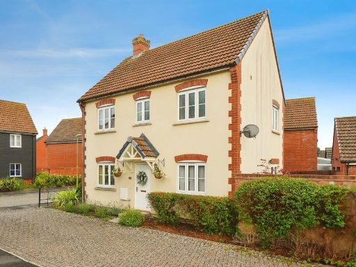 3 bedroom detached house for sale in Damson Drive, DIDCOT, OX11 — £425,000 • 3 bed • 2 bath • 696 ft²
 3 bedroom semi-detached house for sale in Cherry Tree Road, Harwell, OX11 — £375,000 • 3 bed • 2 bath • 850 ft²
 3 bedroom semi-detached house for sale in Bluebell Lane, Didcot, Oxfordshire, OX11 — £385,000 • 3 bed • 2 bath • 871 ft²
 3 bedroom link detached house for sale in Bluebell Lane, Didcot, Oxfordshire, OX11 — £425,000 • 3 bed • 2 bath • 865 ft²
 4 bedroom detached house for sale in Guelder Rose, Didcot, OX11 — £625,000 • 4 bed • 2 bath • 1899 ft²
Meta
- {
"@context": "https://schema.org",
"@type": "Residence",
"name": "3 bedroom link detached house for sale in The Poplars, Harw…",
"description": "",
"url": "https://propertypiper.co.uk/property/234c53b5-917e-4727-bffe-efedfe6c57d2",
"image": "https://image-a.propertypiper.co.uk/4ff952fb-ddec-46f2-9466-0258cd62491e-1024.jpeg",
"address": {
"@type": "PostalAddress",
"streetAddress": "12 The Poplars, Harwell",
"postalCode": "OX11 6DE",
"addressLocality": "Vale of White Horse",
"addressRegion": "Wantage",
"addressCountry": "England"
},
"geo": {
"@type": "GeoCoordinates",
"latitude": 51.60465354430683,
"longitude": -1.2661736434458222
},
"numberOfRooms": 3,
"numberOfBathroomsTotal": 2,
"floorSize": {
"@type": "QuantitativeValue",
"value": 930,
"unitCode": "FTK"
},
"offers": {
"@type": "Offer",
"price": 425000,
"priceCurrency": "GBP",
"availability": "https://schema.org/InStock"
},
"additionalProperty": [
{
"@type": "PropertyValue",
"name": "Feature",
"value": "contemporary"
},
{
"@type": "PropertyValue",
"name": "Feature",
"value": "brick"
},
{
"@type": "PropertyValue",
"name": "Feature",
"value": "two-story"
},
{
"@type": "PropertyValue",
"name": "Feature",
"value": "detached"
},
{
"@type": "PropertyValue",
"name": "Feature",
"value": "residential"
},
{
"@type": "PropertyValue",
"name": "Feature",
"value": "modern"
},
{
"@type": "PropertyValue",
"name": "Feature",
"value": "well-maintained"
},
{
"@type": "PropertyValue",
"name": "Feature",
"value": "contemporary"
},
{
"@type": "PropertyValue",
"name": "Feature",
"value": "living room"
},
{
"@type": "PropertyValue",
"name": "Feature",
"value": "wooden flooring"
},
{
"@type": "PropertyValue",
"name": "Feature",
"value": "French doors"
},
{
"@type": "PropertyValue",
"name": "Feature",
"value": "natural light"
},
{
"@type": "PropertyValue",
"name": "Feature",
"value": "wall radiator"
},
{
"@type": "PropertyValue",
"name": "Feature",
"value": "neutral colors"
},
{
"@type": "PropertyValue",
"name": "Feature",
"value": "plants"
},
{
"@type": "PropertyValue",
"name": "Feature",
"value": "semi-detached"
}
]
}
High Res Floorplan Images
Compatible Floorplan Images
FloorplanImages Thumbnail