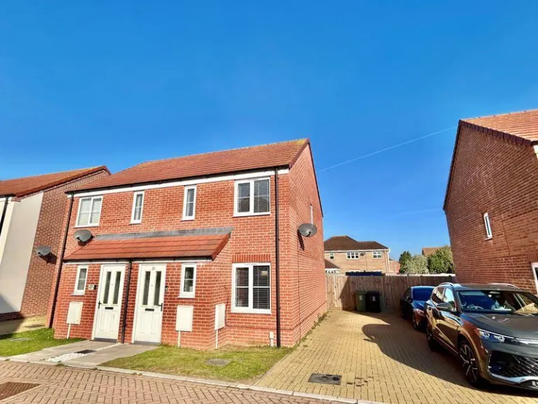
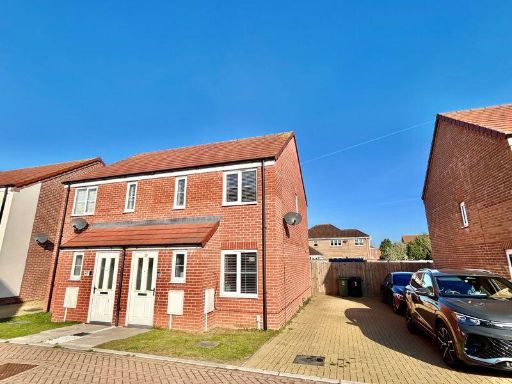
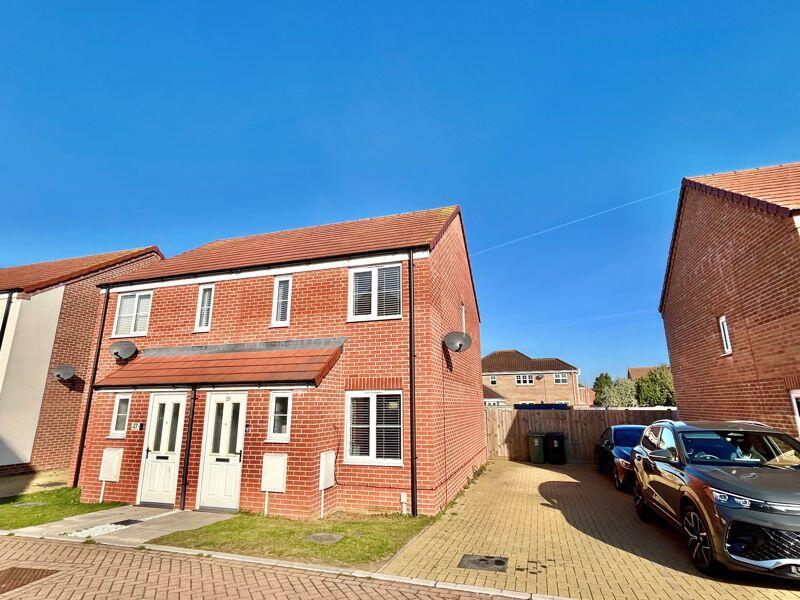
NR31 9XY - 2 bedroom semidetached house for sale in Adams Drive, Bradw…
View on Property Piper
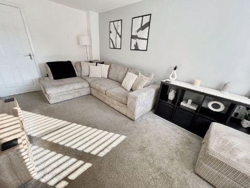
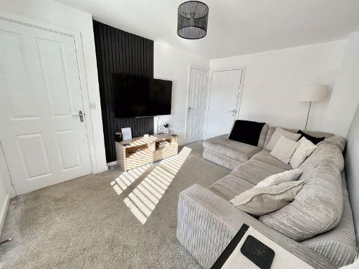
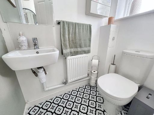
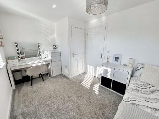
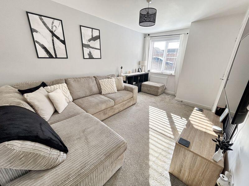
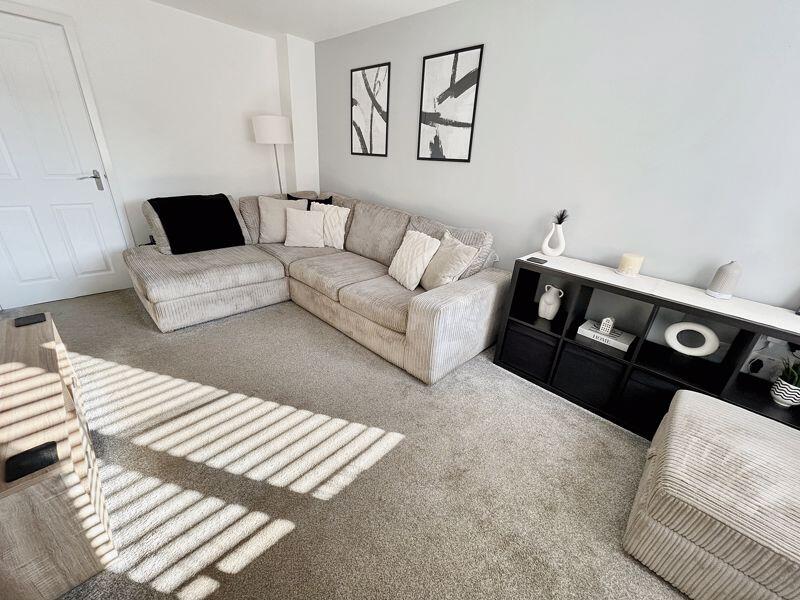
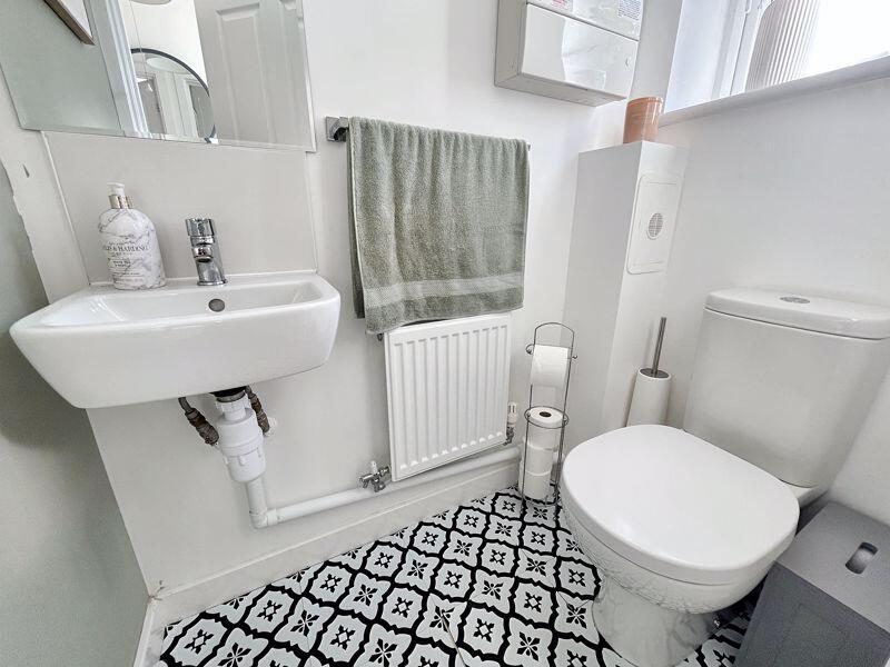
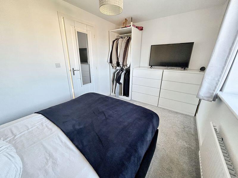
2 bedroom semi-detached house for sale in Adams Drive, Bradwell, NR31
Property Details
- Price: £220000
- Bedrooms: 2
- Bathrooms: 1
- Property Type: undefined
- Property SubType: undefined
Image Descriptions
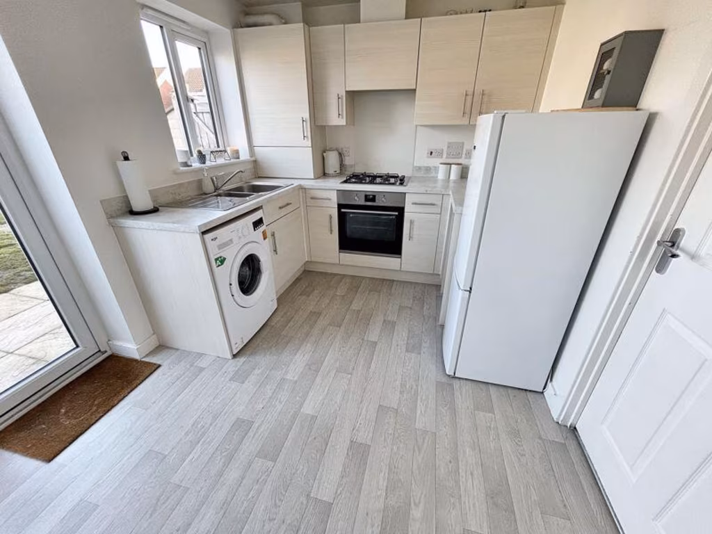
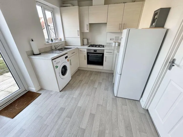
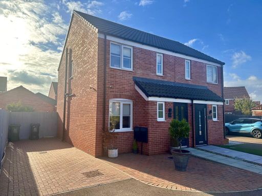
- semi-detached house modern
- kitchen modern
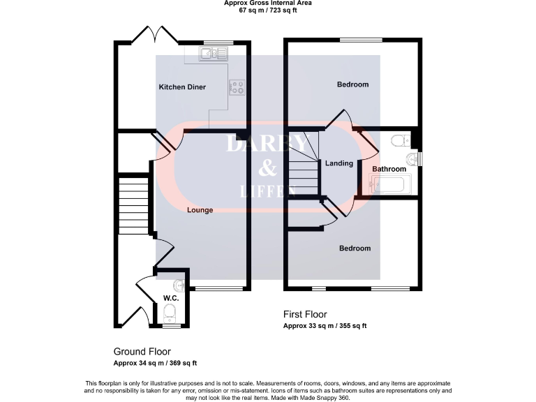
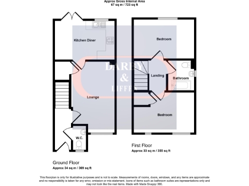
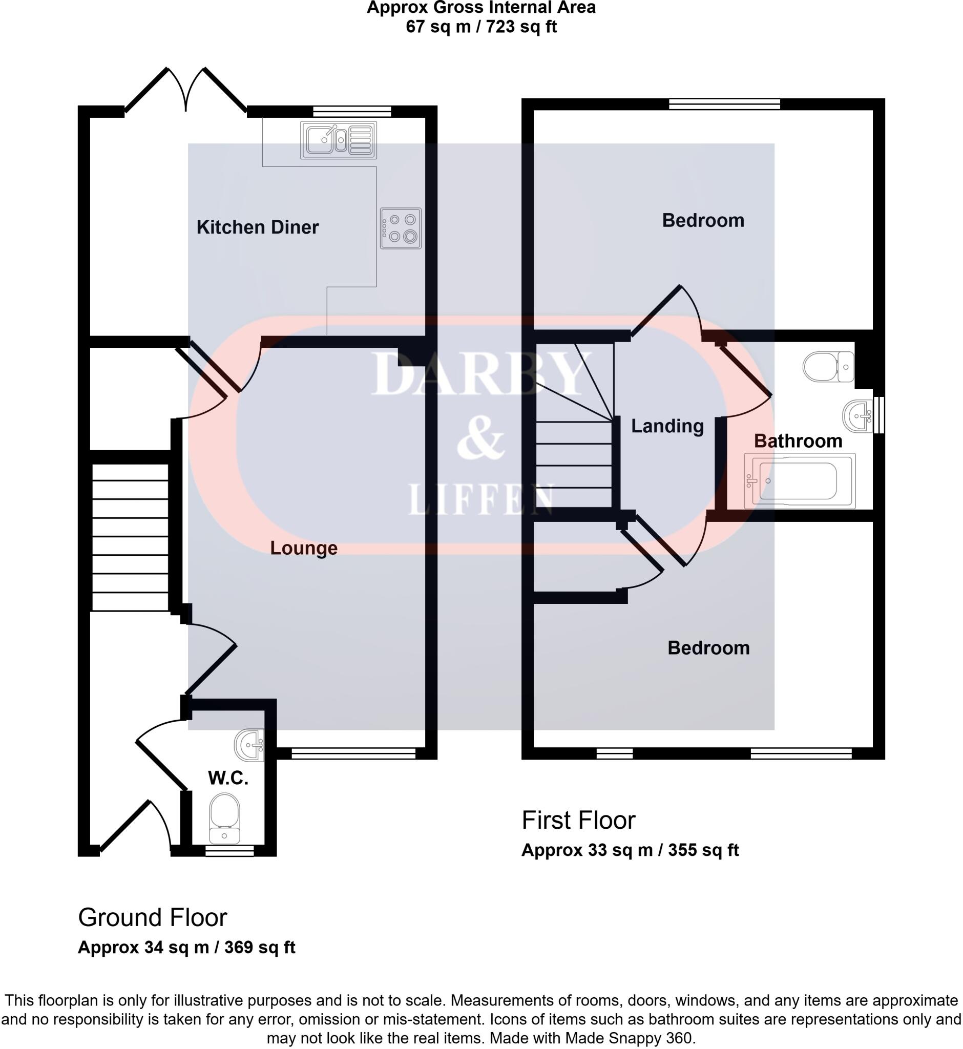
Rooms
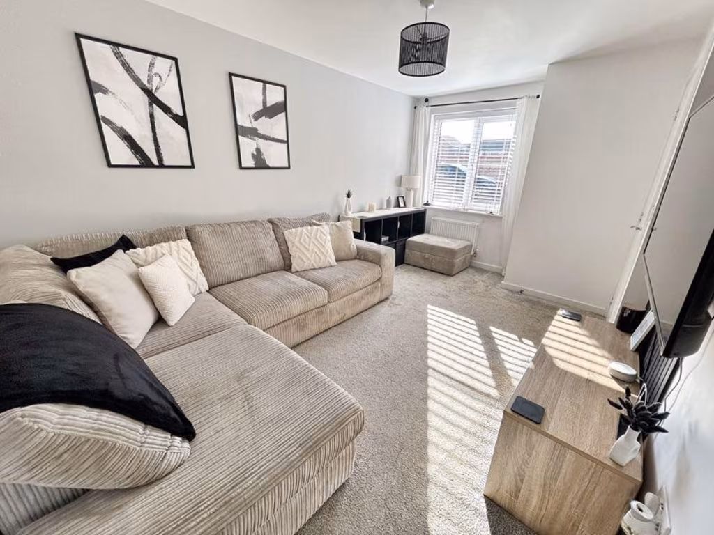
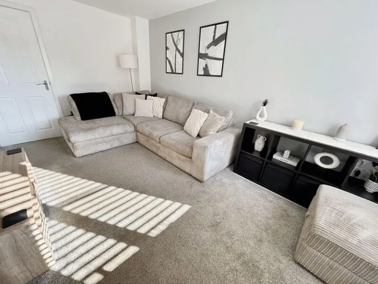
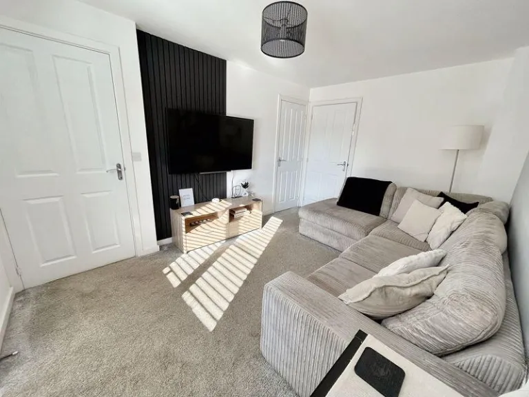
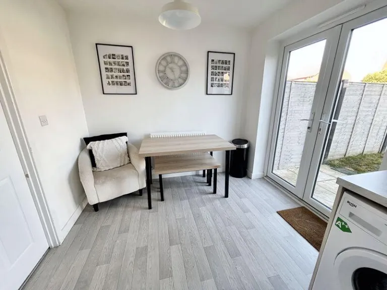
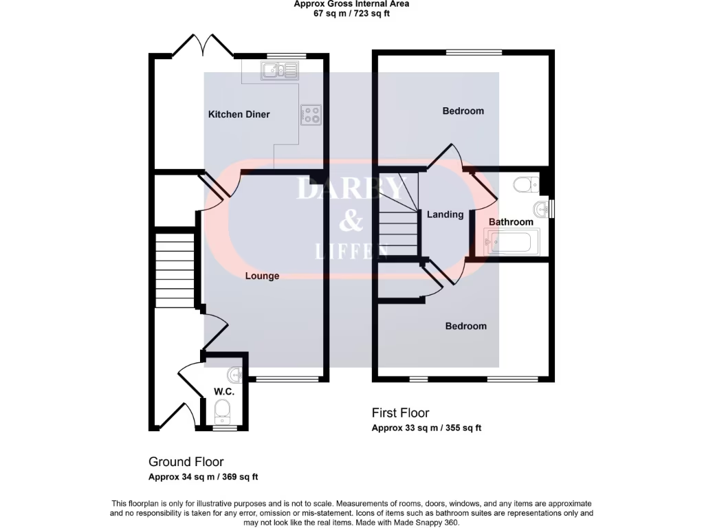
- Kitchen Diner:
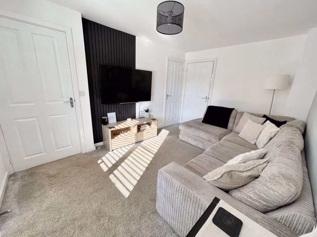
- Lounge:
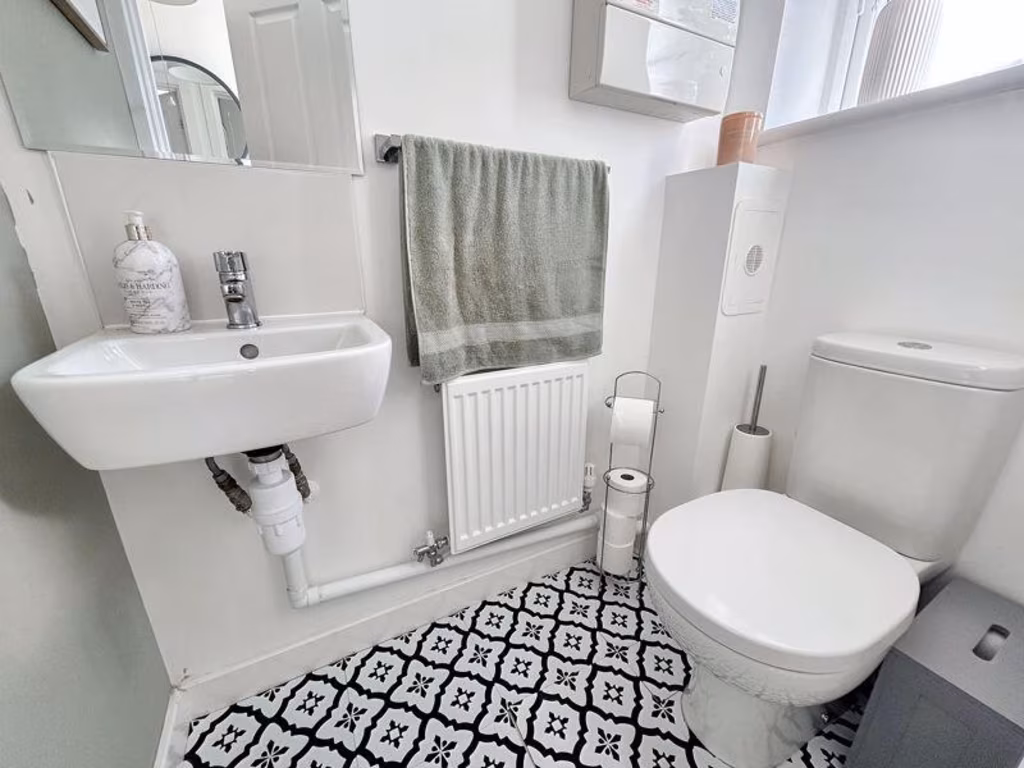
- W.C.:
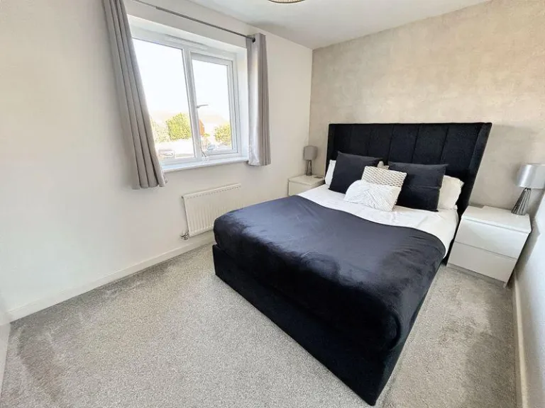
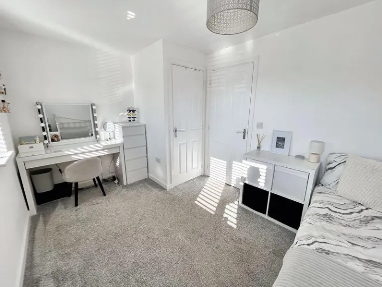
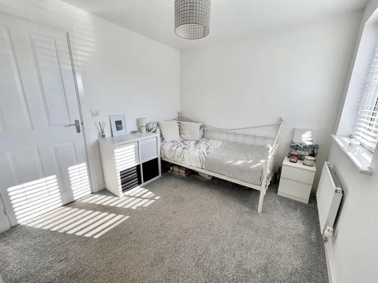
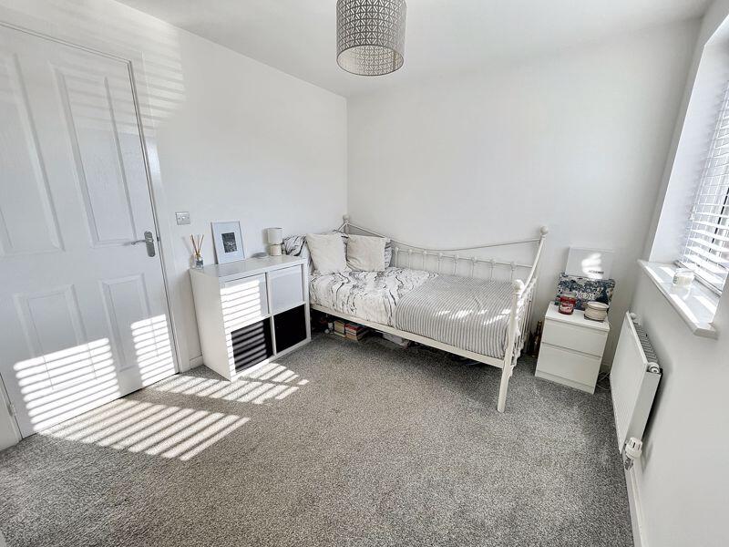
- Bedroom:
- Bedroom:
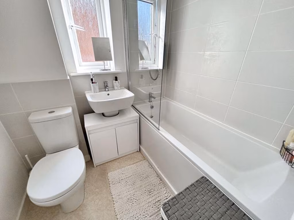
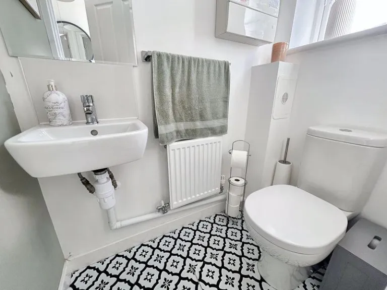
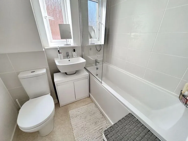
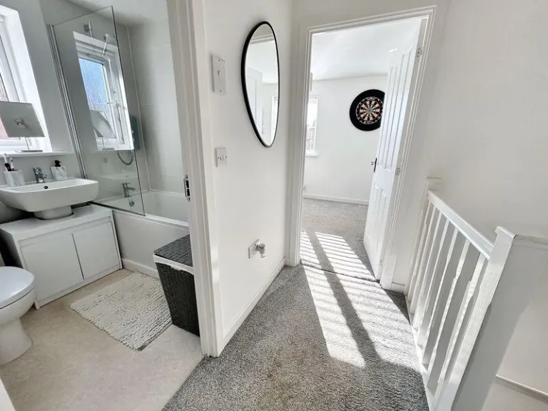
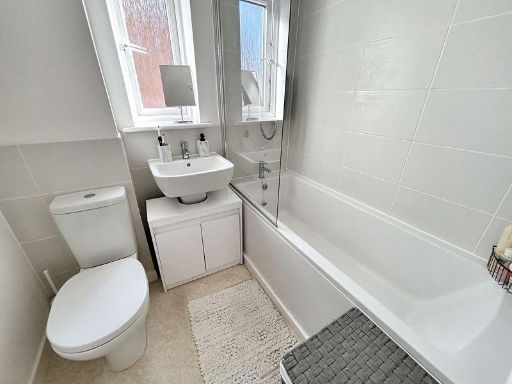
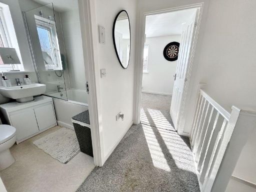
- Bathroom:
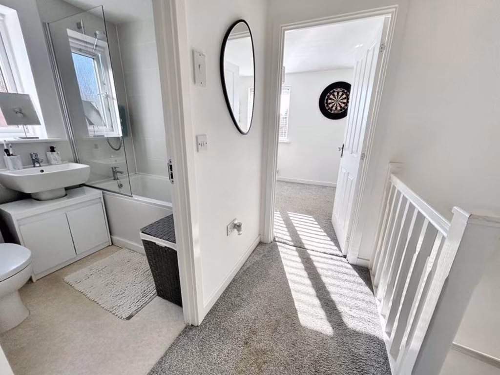
- Landing:
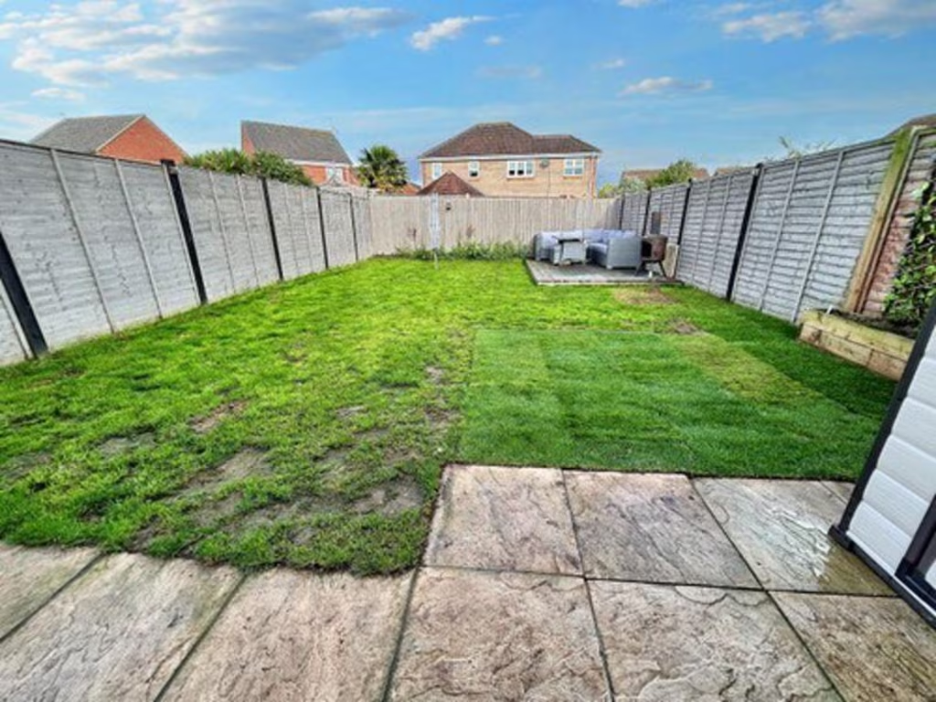
Textual Property Features
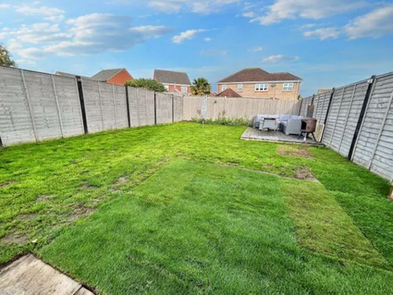
Detected Visual Features
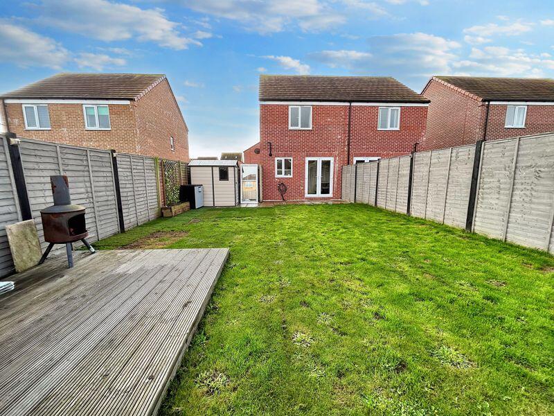
- semi-detached
- modern style
- brick exterior
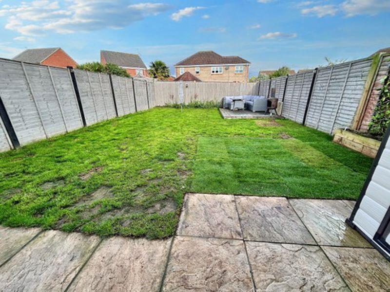
- driveway
- low maintenance
- suburban
- modern kitchen
- laminate flooring
- white cabinets
- integrated appliances
- small room
- bright
- ventilation
- clean
EPC Details
- High performance glazing
- Average thermal transmittance 0.28 W/m-¦K
- Boiler and radiators, mains gas
- Low energy lighting in all fixed outlets
- Average thermal transmittance 0.22 W/m-¦K
Nearby Schools
- Blundeston Church of England Voluntary Controlled Primary School
- Ormiston Cliff Park Primary Academy
- Cliff Park Ormiston Academy
- Moorlands CofE Primary Academy
- Woodlands Primary Academy
- Hillside Primary School
- Lynn Grove Academy
- St Nicholas Priory CofE VA Primary School
- Hopton Church of England Primary Academy
- St Mary and St Peter Catholic Primary School
- Cobholm Primary Academy
- Northgate Primary School
- Ormiston Venture Academy
- Peterhouse CofE Primary Academy
- Homefield VC CofE Primary School
- Wroughton Infant Academy
- Wroughton Junior Academy
- Great Yarmouth Primary Academy
- Edward Worlledge Ormiston Academy
- Southtown Primary School
- St George's Primary School & St. George's Nursery School, Great Yarmouth
- Great Yarmouth Charter Academy
- Somerleyton Primary School
- Ormiston Herman Academy
- Stradbroke Primary Academy
Nearest Grocery shops
- Id: 2286053094
- Tags:
- Addr:
- City: Great Yarmouth
- Country: GB
- Housenumber: 87-89
- Postcode: NR31 7AA
- Street: Magdalen Way
- Town: Gorleston
- Brand: Morrisons Daily
- Brand:wikidata: Q99752411
- Contact:
- Website: https://my.morrisons.com/storefinder/36349
- Fhrs:
- Name: Morrisons Daily
- Operator: McColl's
- Operator:website: https://www.mccolls.co.uk/storelocator/gorleston-on-sea-magdalen/
- Operator:wikidata: Q16997477
- Shop: convenience
- Wheelchair: yes
- TagsNormalized:
- morrisons
- morrisons daily
- convenience
- shop
- Lat: 52.573603
- Lon: 1.7145827
- FullGeoHash: u135p48x2tvt
- PartitionGeoHash: u135
- Images:
- FoodStandards:
- Id: 621797
- FHRSID: 621797
- LocalAuthorityBusinessID: 35123
- BusinessName: Morrisons Daily
- BusinessType: Retailers - other
- BusinessTypeID: 4613
- AddressLine1: null
- AddressLine2: 87-89 Magdalen Way
- AddressLine3: Gorleston
- AddressLine4: Great Yarmouth, Norfolk
- PostCode: NR31 7AA
- RatingValue: 5
- RatingKey: fhrs_5_en-GB
- RatingDate: 2022-05-07
- LocalAuthorityCode: 229
- LocalAuthorityName: Great Yarmouth
- LocalAuthorityWebSite: http://www.great-yarmouth.gov.uk/live/index.htm
- LocalAuthorityEmailAddress: health@great-yarmouth.gov.uk
- Scores:
- Hygiene: 0
- Structural: 5
- ConfidenceInManagement: 0
- NewRatingPending: false
- Geocode:
- Longitude: 1.71463000000000
- Latitude: 52.57371500000000
- Distance: 1254.2
,- Id: 1565015481
- Tags:
- Name: Mini Mart
- Shop: convenience
- TagsNormalized:
- Lat: 52.5786742
- Lon: 1.7067992
- FullGeoHash: u135ngdugr38
- PartitionGeoHash: u135
- Images:
- FoodStandards: null
- Distance: 1238.3
,- Id: 228035389
- Tags:
- Brand: Premier
- Brand:wikidata: Q7240340
- Brand:wikipedia: en:Premier Stores
- Building: yes
- Name: Prajco Stores
- Opening_hours: 06:30-21:00
- Shop: convenience
- TagsNormalized:
- Lat: 52.5749818
- Lon: 1.6964491
- FullGeoHash: u135ndgr6nun
- PartitionGeoHash: u135
- Images:
- FoodStandards: null
- Distance: 665.5
}
Nearest Religious buildings
- Id: 228033538
- Tags:
- Amenity: school
- Email: office@homefield.norfolk.sch.uk
- Max_age: 11
- Min_age: 3
- Name: Homefield Church of England Primary School
- Ref:
- Website: https://www.homefield.norfolk.sch.uk/
- Wikidata: Q66163494
- TagsNormalized:
- Lat: 52.5758163
- Lon: 1.697545
- FullGeoHash: u135nehh7dt2
- PartitionGeoHash: u135
- Images:
- FoodStandards: null
- Distance: 753.7
,- Id: 323088
- Tags:
- Name: Chapel Lane
- Naptan:
- StopAreaCode: 290G2030
- StopAreaType: GPBS
- Verified: no
- Public_transport: stop_area
- Source: naptan_import
- Type: public_transport
- TagsNormalized:
- Lat: 52.5754404
- Lon: 1.7004866
- FullGeoHash: u135nen60hqw
- PartitionGeoHash: u135
- Images:
- FoodStandards: null
- Distance: 737.9
,- Id: 228034621
- Tags:
- Amenity: place_of_worship
- Building: church
- Denomination: anglican
- Listed_status: Grade II*
- Material: stone
- Name: Saint Nicholas
- Religion: christian
- Tower: round
- Website: http://www.stnicholasbradwell.co.uk/
- Wikidata: Q17554388
- TagsNormalized:
- place of worship
- church
- anglican
- christian
- Lat: 52.5749364
- Lon: 1.6929198
- FullGeoHash: u135ndbxpykr
- PartitionGeoHash: u135
- Images:
- FoodStandards: null
- Distance: 728.4
}
Nearest Leisure Facilities
- Id: 228035950
- Tags:
- Leisure: pitch
- Name: Multi-purpose court
- TagsNormalized:
- Lat: 52.5723148
- Lon: 1.6937228
- FullGeoHash: u135nd3rftg3
- PartitionGeoHash: u135
- Images:
- FoodStandards: null
- Distance: 449.2
,- Id: 461871353
- Tags:
- Leisure: pitch
- Sport: rugby_union
- TagsNormalized:
- pitch
- leisure
- rugby
- rugby union
- sports
- Lat: 52.5698984
- Lon: 1.704045
- FullGeoHash: u135nf0cg5k4
- PartitionGeoHash: u135
- Images:
- FoodStandards: null
- Distance: 445.1
,- Id: 469210962
- Tags:
- TagsNormalized:
- Lat: 52.571559
- Lon: 1.7019908
- FullGeoHash: u135ndr7e2bk
- PartitionGeoHash: u135
- Images:
- FoodStandards: null
- Distance: 407.6
,- Id: 964080625
- Tags:
- TagsNormalized:
- Lat: 52.572074
- Lon: 1.6999973
- FullGeoHash: u135ndmysbcu
- PartitionGeoHash: u135
- Images:
- FoodStandards: null
- Distance: 374
,- Id: 156313234
- Tags:
- TagsNormalized:
- Lat: 52.571132
- Lon: 1.6979971
- FullGeoHash: u135ndk3n1q3
- PartitionGeoHash: u135
- Images:
- FoodStandards: null
- Distance: 234.2
}
Nearest Tourist attractions
- Id: 1086047928
- Tags:
- Addr:
- City: Great Yarmouth
- Housenumber: 19
- Street: Marine Parade
- Town: Gorleston
- Building: yes
- Name: Midway Holiday Flats
- Source:
- Tourism: apartment
- Website: https://www.midwayholidayflats.com/
- TagsNormalized:
- Lat: 52.5665001
- Lon: 1.729583
- FullGeoHash: u135p37qn1ye
- PartitionGeoHash: u135
- Images:
- FoodStandards: null
- Distance: 2179.2
,- Id: 222380668
- Tags:
- Brand: Parkdean Resorts
- Brand:wikidata: Q7138226
- Contact:
- Website: https://www.parkdeanresorts.co.uk/location/east-anglia-lincolnshire/cherry-tree/
- Name: Cherry Tree Holiday Park
- Operator: Parkdean Resorts UK Limited
- Tourism: caravan_site
- Wheelchair: limited
- TagsNormalized:
- Lat: 52.5808306
- Lon: 1.6740829
- FullGeoHash: u135nh518cnx
- PartitionGeoHash: u135
- Images:
- FoodStandards: null
- Distance: 2060.9
,- Id: 1124220973
- Tags:
- TagsNormalized:
- Lat: 52.5726542
- Lon: 1.674473
- FullGeoHash: u135n4e3fj19
- PartitionGeoHash: u135
- Images:
- FoodStandards: null
- Distance: 1614.6
}
Nearest Train stations
- Id: 252753813
- Tags:
- Name: Lowestoft
- Naptan:
- Network: National Rail
- Old_name: Lowestoft Central
- Public_transport: station
- Railway: station
- Ref:
- Wheelchair: yes
- Wikidata: Q2008297
- Wikipedia: en:Lowestoft railway station
- TagsNormalized:
- Lat: 52.47424
- Lon: 1.7499873
- FullGeoHash: u134xbdk9em4
- PartitionGeoHash: u134
- Images:
- FoodStandards: null
- Distance: 11120.8
,- Id: 263373872
- Tags:
- Name: Oulton Broad South
- Naptan:
- Network: National Rail
- Old_name: Carlton Colville
- Public_transport: station
- Railway: station
- Ref:
- Wikidata: Q1870239
- Wikipedia: en:Oulton Broad South railway station
- TagsNormalized:
- Lat: 52.4695869
- Lon: 1.7074886
- FullGeoHash: u134qzg37rgv
- PartitionGeoHash: u134
- Images:
- FoodStandards: null
- Distance: 11078.7
,- Id: 252745593
- Tags:
- Name: Oulton Broad North
- Naptan:
- Network: National Rail
- Public_transport: station
- Railway: station
- Ref:
- Source: NPE
- Wikidata: Q2854239
- Wikipedia: en:Oulton Broad North railway station
- TagsNormalized:
- Lat: 52.4777293
- Lon: 1.7161761
- FullGeoHash: u134x138vvc8
- PartitionGeoHash: u134
- Images:
- FoodStandards: null
- Distance: 10230.5
,- Id: 263373156
- Tags:
- Name: Somerleyton
- Naptan:
- Network: National Rail
- Public_transport: station
- Railway: station
- Ref:
- Source: NPE
- Wikidata: Q1920909
- Wikipedia: en:Somerleyton railway station
- TagsNormalized:
- Lat: 52.5101587
- Lon: 1.6521998
- FullGeoHash: u134tx5jg513
- PartitionGeoHash: u134
- Images:
- FoodStandards: null
- Distance: 7231.7
,- Id: 1699243929
- Tags:
- Name: Great Yarmouth
- Name:lt: Didysis Jarmutas
- Naptan:
- Network: National Rail
- Operator: Greater Anglia
- Platforms: 4
- Public_transport: station
- Railway: station
- Ref:
- Wikidata: Q280999
- Wikipedia: en:Great Yarmouth railway station
- TagsNormalized:
- Lat: 52.6119213
- Lon: 1.7206879
- FullGeoHash: u135r1sywuvz
- PartitionGeoHash: u135
- Images:
- FoodStandards: null
- Distance: 5016.7
}
Nearest Hotels
- Id: 182378351
- Tags:
- Addr:
- City: Great Yarmouth
- Place: South Pier
- Postcode: NR31 6PL
- Town: Gorleston
- Building: hotel
- Fhrs:
- Name: The Pier Hotel
- Source:
- Tourism: hotel
- Wheelchair: yes
- Wheelchair:description: car park has 2 blue badge spaces
- TagsNormalized:
- Lat: 52.5709988
- Lon: 1.7338326
- FullGeoHash: u135p6q830rr
- PartitionGeoHash: u135
- Images:
- FoodStandards: null
- Distance: 2457.6
,- Id: 223804728
- Tags:
- Addr:
- City: Great Yarmouth
- Postcode: NR31 6DH
- Street: Cliff Hill
- Town: Gorleston-On-Sea
- Building: yes
- Name: Cliff Hotel
- Tourism: hotel
- Website: https://www.thecliffhotel.co.uk/
- Wheelchair: yes
- TagsNormalized:
- Lat: 52.5707166
- Lon: 1.7310896
- FullGeoHash: u135p6hw97cg
- PartitionGeoHash: u135
- Images:
- FoodStandards: null
- Distance: 2270.2
,- Id: 207742637
- Tags:
- Addr:
- Brand: Travelodge
- Brand:wikidata: Q9361374
- Brand:wikipedia: en:Travelodge UK
- Building: hotel
- Fhrs:
- Internet_access: wlan
- Internet_access:fee: customers
- Internet_access:ssid: Travelodge WiFi
- Name: Travelodge
- Tourism: hotel
- TagsNormalized:
- Lat: 52.556437
- Lon: 1.7152648
- FullGeoHash: u134zp952tfn
- PartitionGeoHash: u134
- Images:
- FoodStandards: null
- Distance: 1840.4
}
Tags
- semi-detached
- modern style
- brick exterior
- driveway
- low maintenance
- suburban
- modern kitchen
- laminate flooring
- white cabinets
- integrated appliances
- small room
- bright
- ventilation
- clean
Local Market Stats
- Average Price/sqft: £237
- Avg Income: £36700
- Rental Yield: 4.1%
- Social Housing: 6%
- Planning Success Rate: 86%
Similar Properties
 2 bedroom semi-detached house for sale in Colby Drive, Bradwell, NR31 — £195,000 • 2 bed • 1 bath • 446 ft²
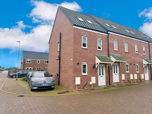 3 bedroom end of terrace house for sale in Marler Close, Bradwell, Great Yarmouth, NR31 — £210,000 • 3 bed • 1 bath • 558 ft²
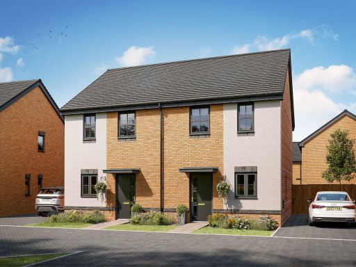 2 bedroom semi-detached house for sale in Bluebell Meadow
Wiltshire Drive,
Bradwell,
Great Yarmouth,
NR31 9FP, NR31 — £218,000 • 2 bed • 1 bath • 1077 ft²
2 bedroom semi-detached house for sale in Bluebell Meadow
Wiltshire Drive,
Bradwell,
Great Yarmouth,
NR31 9FP, NR31 — £218,000 • 2 bed • 1 bath • 1077 ft²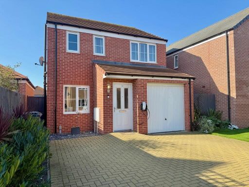 3 bedroom detached house for sale in Breeze Close, Bradwell, Great Yarmouth, NR31 — £265,000 • 3 bed • 2 bath • 862 ft²
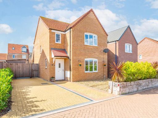 3 bedroom detached house for sale in Adams Drive, Bradwell, NR31 — £290,000 • 3 bed • 1 bath • 915 ft²
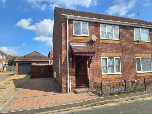 3 bedroom semi-detached house for sale in El Alamein Way, Bradwell, NR31 — £210,000 • 3 bed • 1 bath • 688 ft²
Meta
- {
"@context": "https://schema.org",
"@type": "Residence",
"name": "2 bedroom semidetached house for sale in Adams Drive, Bradw…",
"description": "",
"url": "https://propertypiper.co.uk/property/22aba5db-0682-423f-9ed9-31eef20593bf",
"image": "https://image-a.propertypiper.co.uk/02881f89-aee5-418d-a065-7573ce686fad-1024.jpeg",
"address": {
"@type": "PostalAddress",
"streetAddress": "Adams Drive, Bradwell",
"postalCode": "NR31 9XY",
"addressLocality": "Great Yarmouth",
"addressRegion": "Great Yarmouth",
"addressCountry": "England"
},
"geo": {
"@type": "GeoCoordinates",
"latitude": 52.56903866807867,
"longitude": 1.6976121871609569
},
"numberOfRooms": 2,
"numberOfBathroomsTotal": 1,
"floorSize": {
"@type": "QuantitativeValue",
"value": 723,
"unitCode": "FTK"
},
"offers": {
"@type": "Offer",
"price": 220000,
"priceCurrency": "GBP",
"availability": "https://schema.org/InStock"
},
"additionalProperty": [
{
"@type": "PropertyValue",
"name": "Feature",
"value": "semi-detached"
},
{
"@type": "PropertyValue",
"name": "Feature",
"value": "modern style"
},
{
"@type": "PropertyValue",
"name": "Feature",
"value": "brick exterior"
},
{
"@type": "PropertyValue",
"name": "Feature",
"value": "driveway"
},
{
"@type": "PropertyValue",
"name": "Feature",
"value": "low maintenance"
},
{
"@type": "PropertyValue",
"name": "Feature",
"value": "suburban"
},
{
"@type": "PropertyValue",
"name": "Feature",
"value": "modern kitchen"
},
{
"@type": "PropertyValue",
"name": "Feature",
"value": "laminate flooring"
},
{
"@type": "PropertyValue",
"name": "Feature",
"value": "white cabinets"
},
{
"@type": "PropertyValue",
"name": "Feature",
"value": "integrated appliances"
},
{
"@type": "PropertyValue",
"name": "Feature",
"value": "small room"
},
{
"@type": "PropertyValue",
"name": "Feature",
"value": "bright"
},
{
"@type": "PropertyValue",
"name": "Feature",
"value": "ventilation"
},
{
"@type": "PropertyValue",
"name": "Feature",
"value": "clean"
}
]
}
High Res Floorplan Images
Compatible Floorplan Images
FloorplanImages Thumbnail