BD20 6PJ - 3 bedroom semidetached house for sale in Coppy Road, Steeto…
View on Property Piper
3 bedroom semi-detached house for sale in Coppy Road, Steeton, BD20
Property Details
- Price: £220000
- Bedrooms: 3
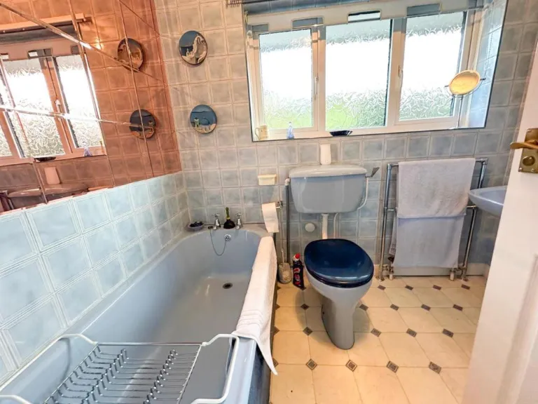
- Bathrooms: 1
- Property Type: undefined
- Property SubType: undefined
Brochure Descriptions
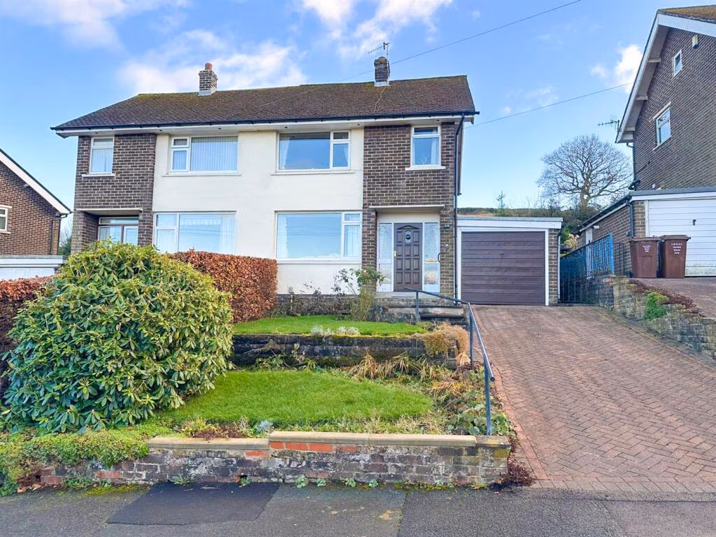
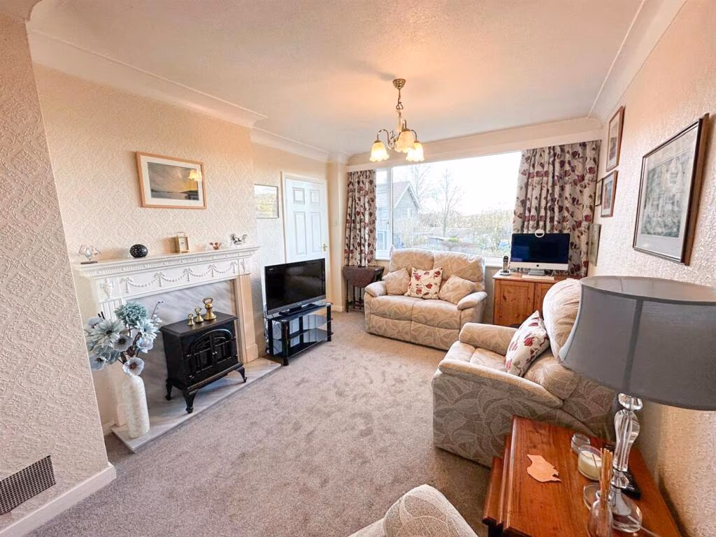
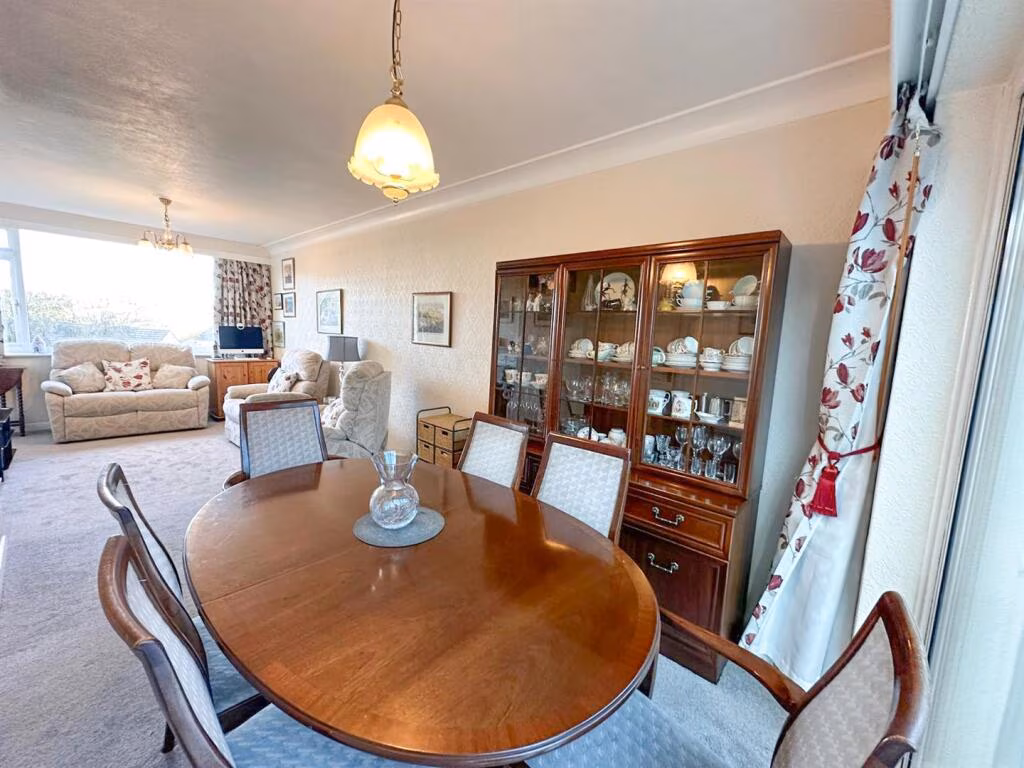
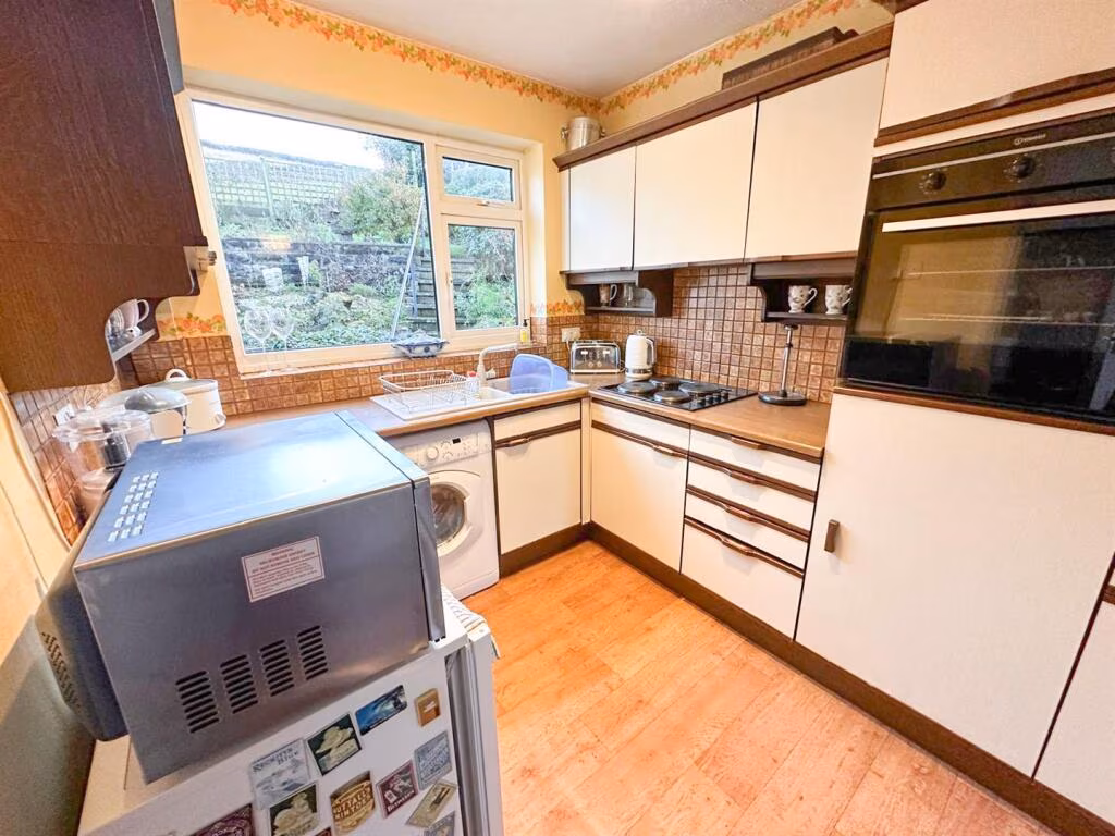
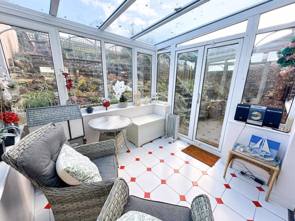
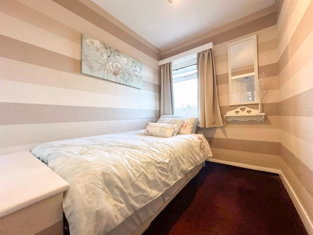
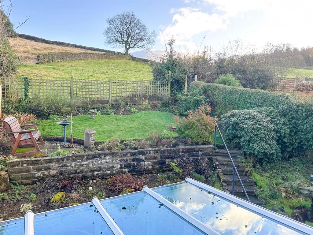
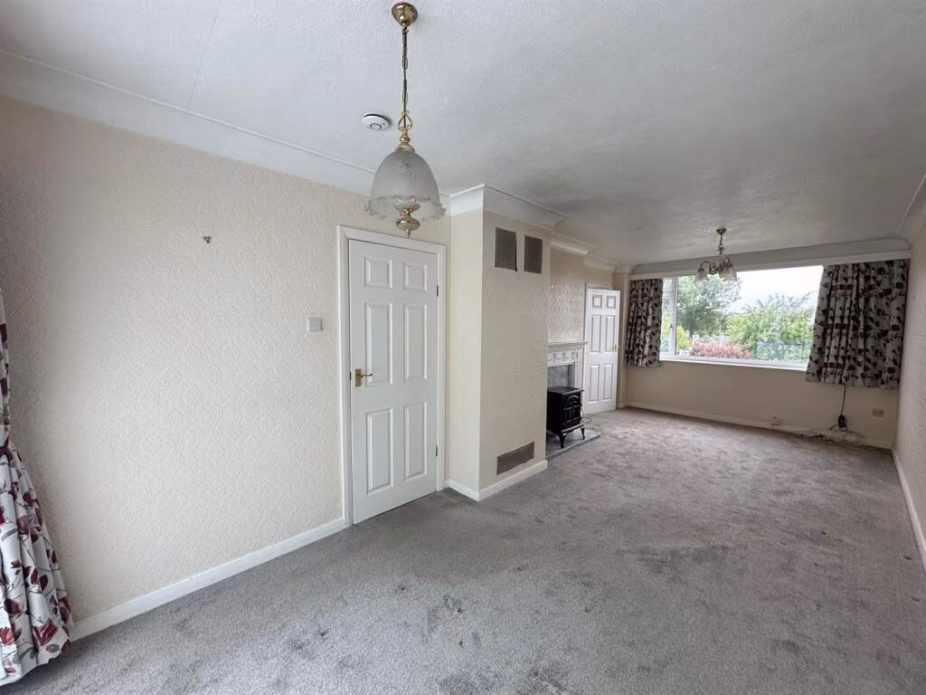
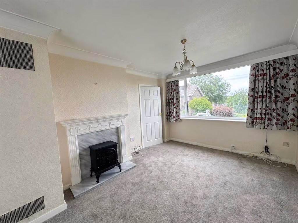
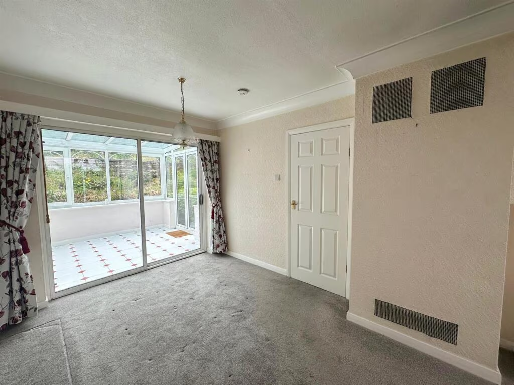
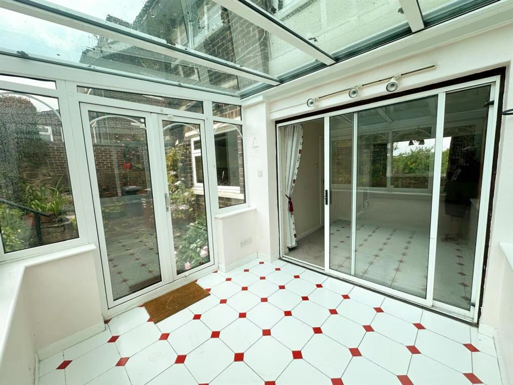
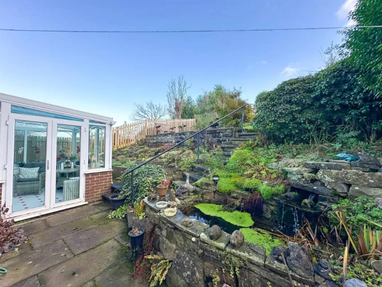
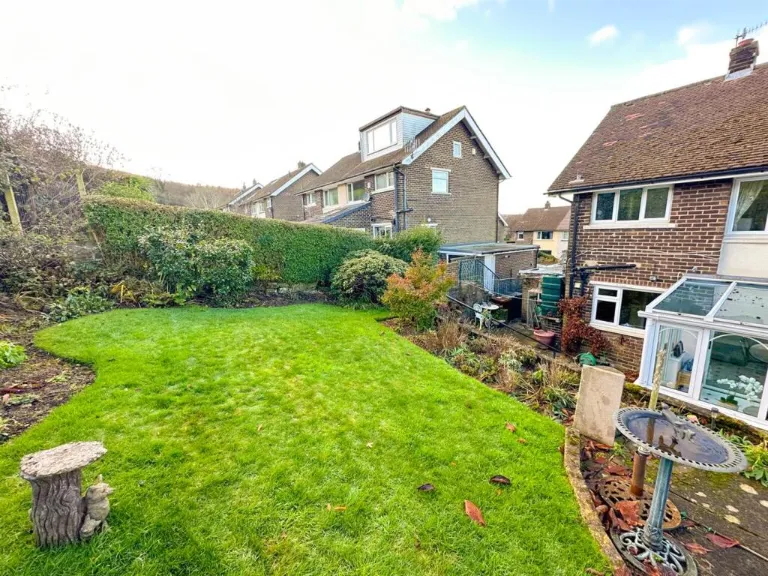
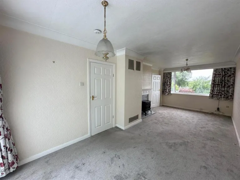
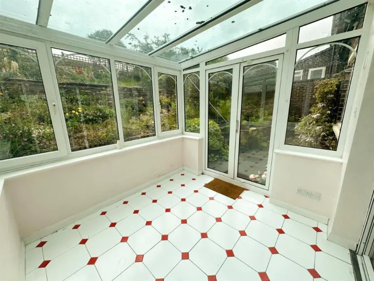
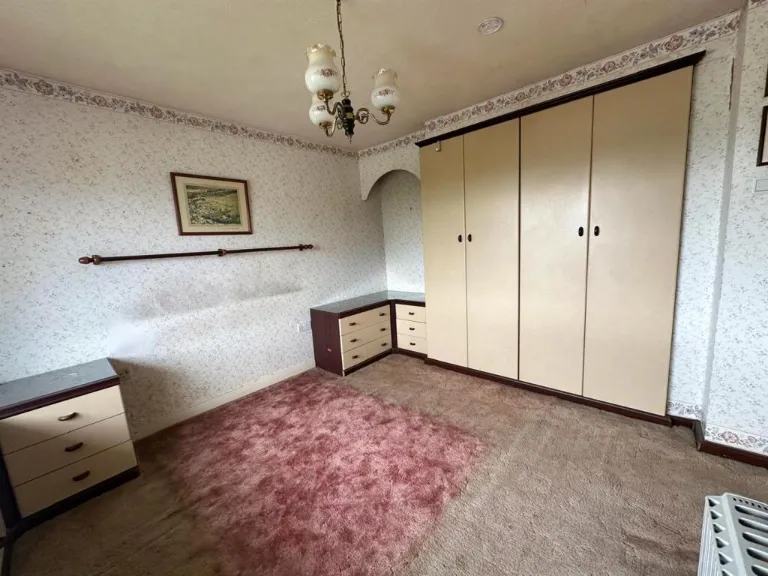
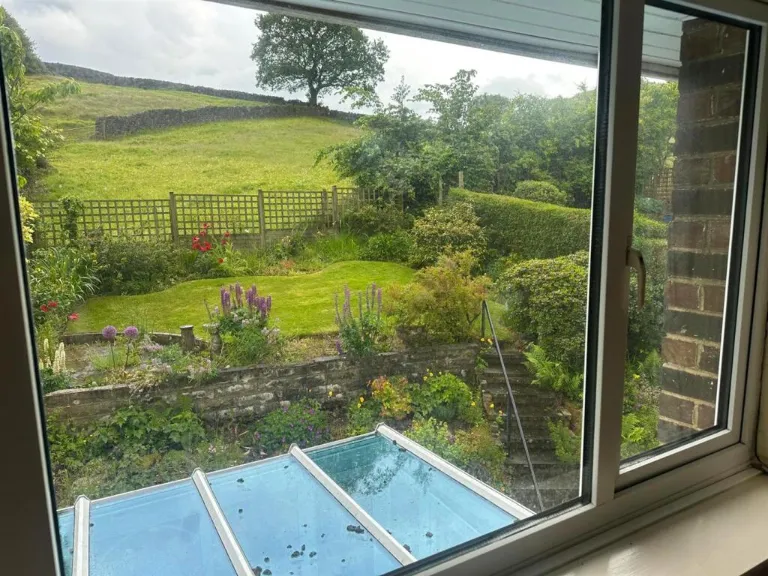
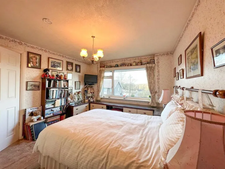
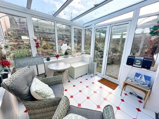
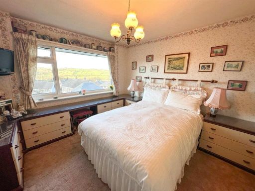
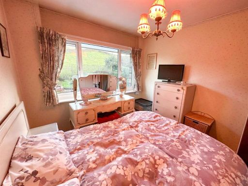
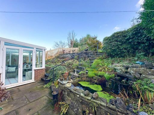
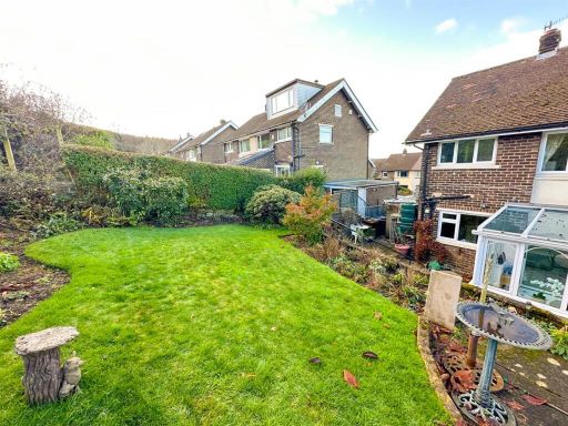
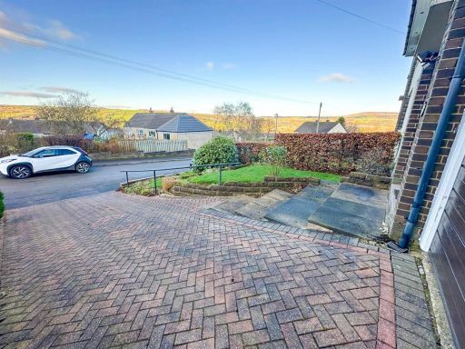
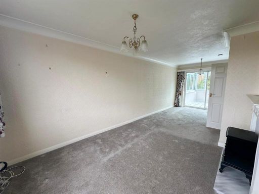
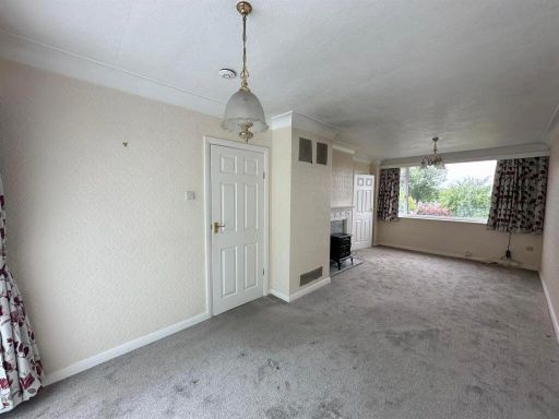
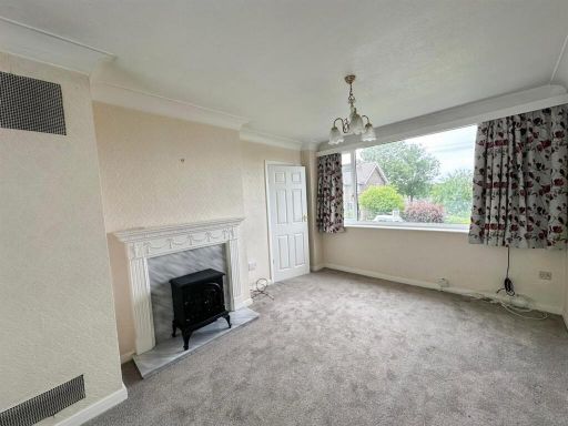
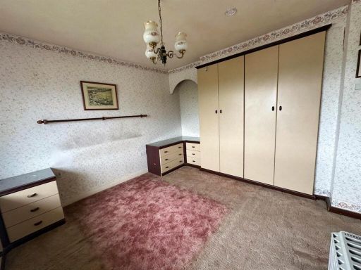
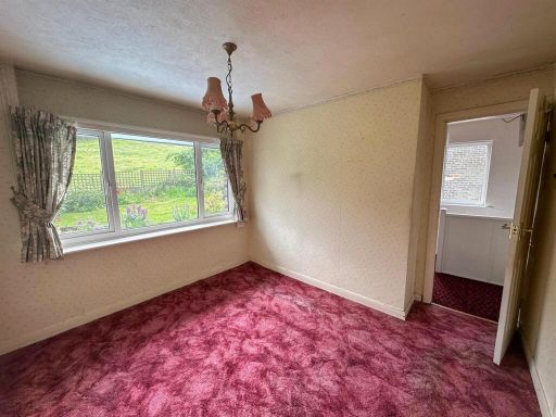
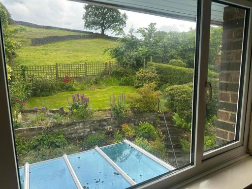
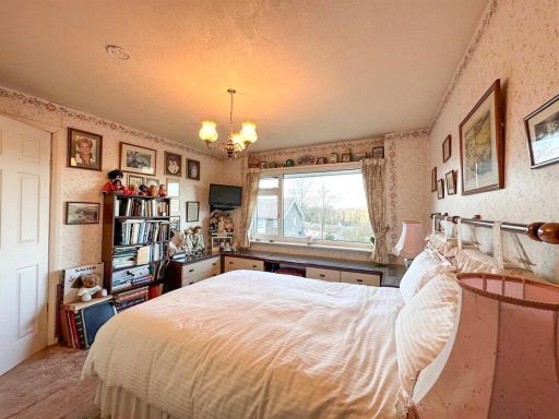
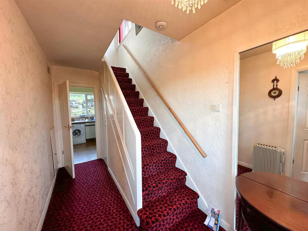
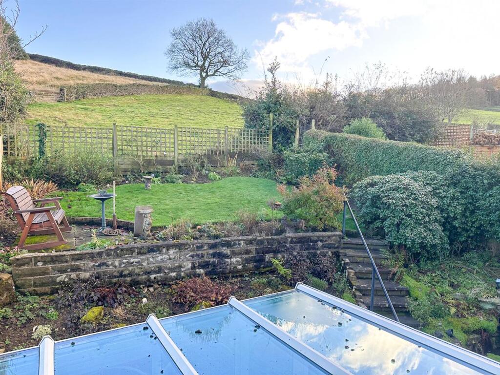
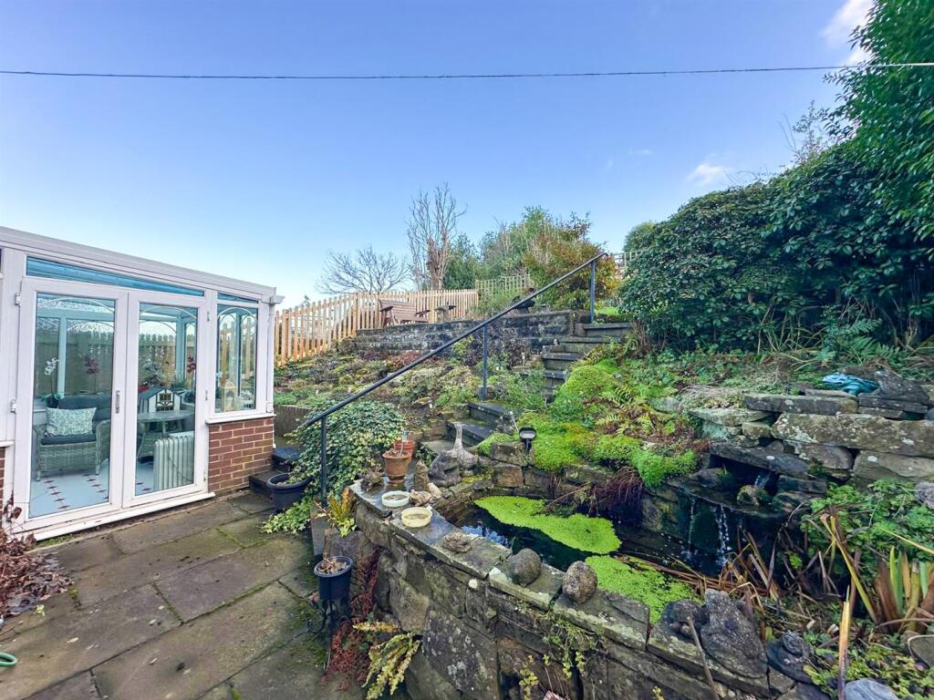
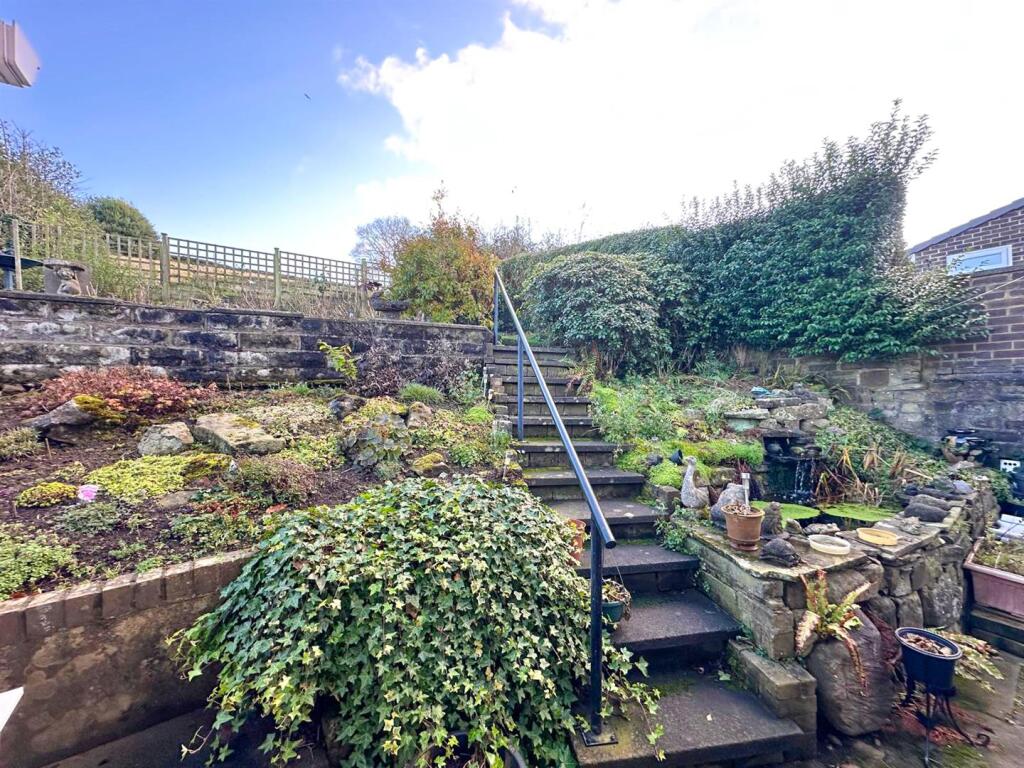
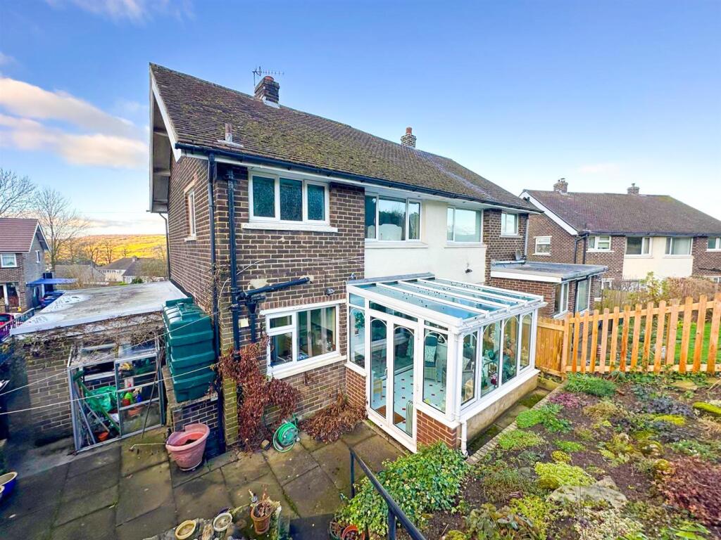
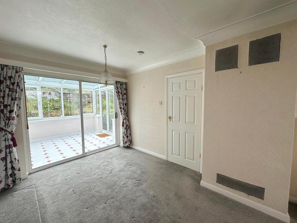
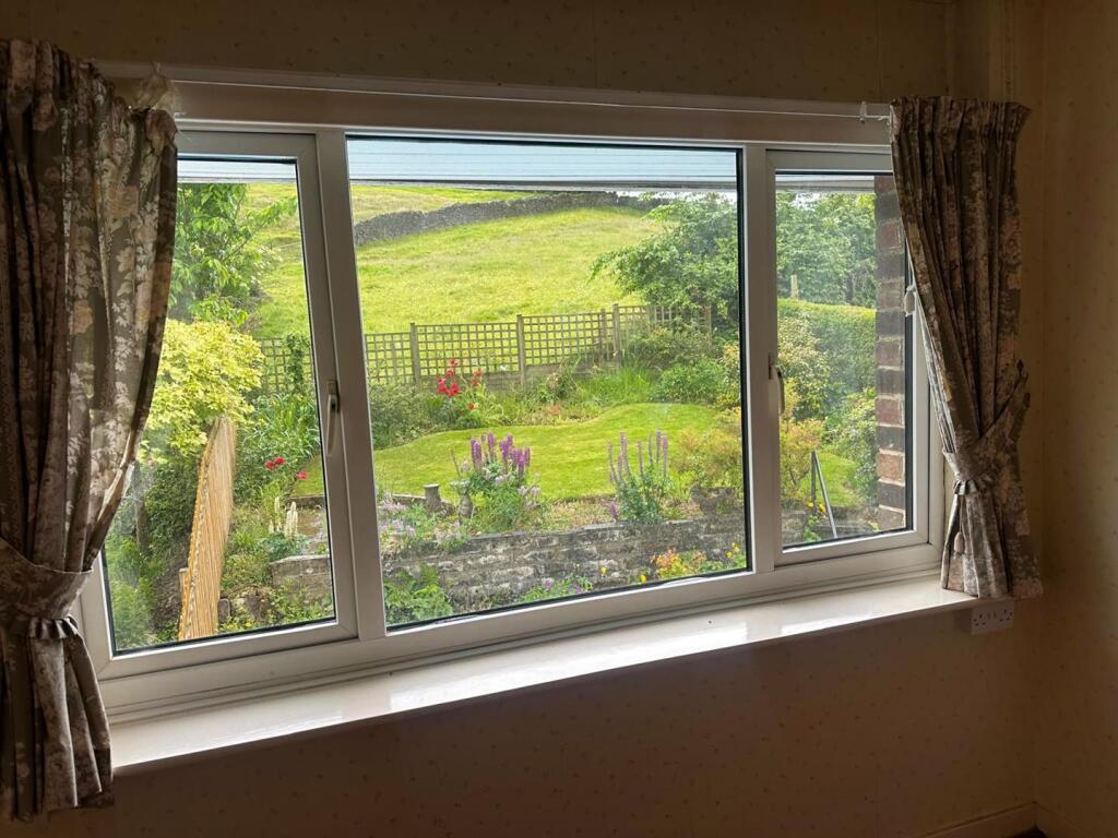
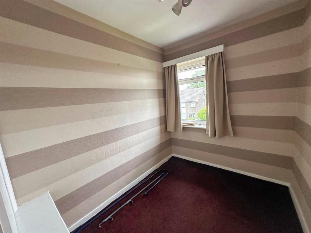
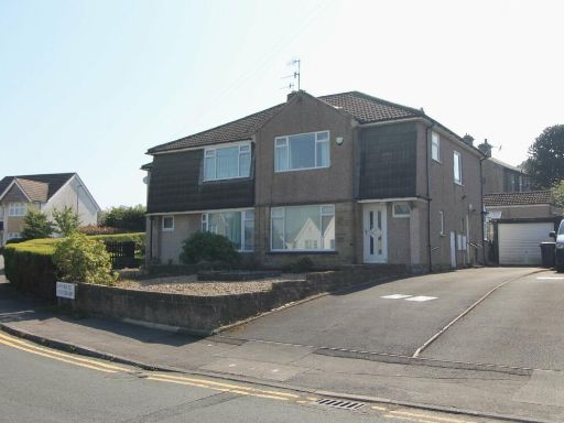
- The property is a charming semi-detached house situated on a suburban road. The exterior presents a classic and clean facade with dual-level construction and a well-maintained front garden adding an appealing curb appeal. It boasts a private driveway leading to a single garage. Inside, the rooms are average-sized, providing a balance of space and comfort. The living room is spacious, offering a cozy feel with a view towards the front garden. The kitchen, while compact, is efficiently laid out with modern fittings. The property includes three bedrooms, suitable for a family, and features a conservatory that provides additional living space. The garden at the back is sizeable, matching the property's comfortable living space, and offers privacy with views backing on to open fields.
Image Descriptions
- semi-detached house Post-war
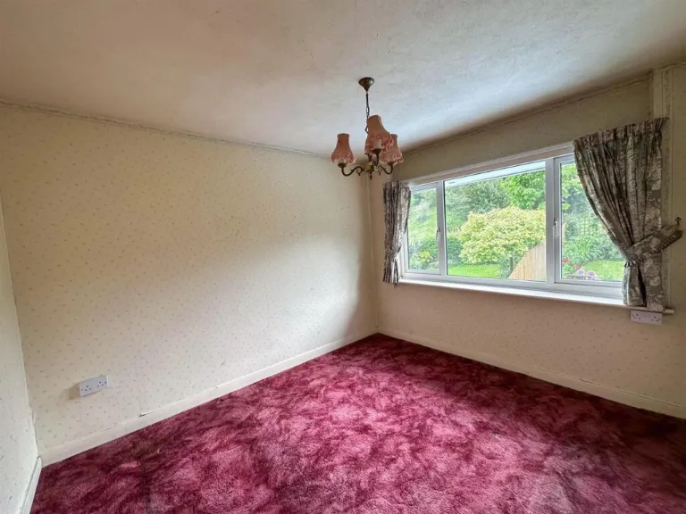
- living room traditional
Floorplan Description
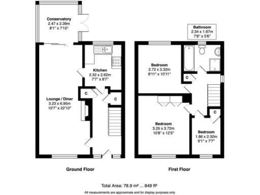
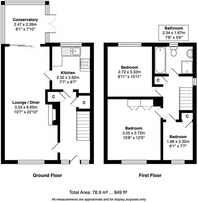
- A two-story property with three bedrooms and a conservatory
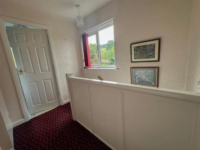
Rooms
- Conservatory: Average
- Kitchen: Small
- Lounge / Diner: Large
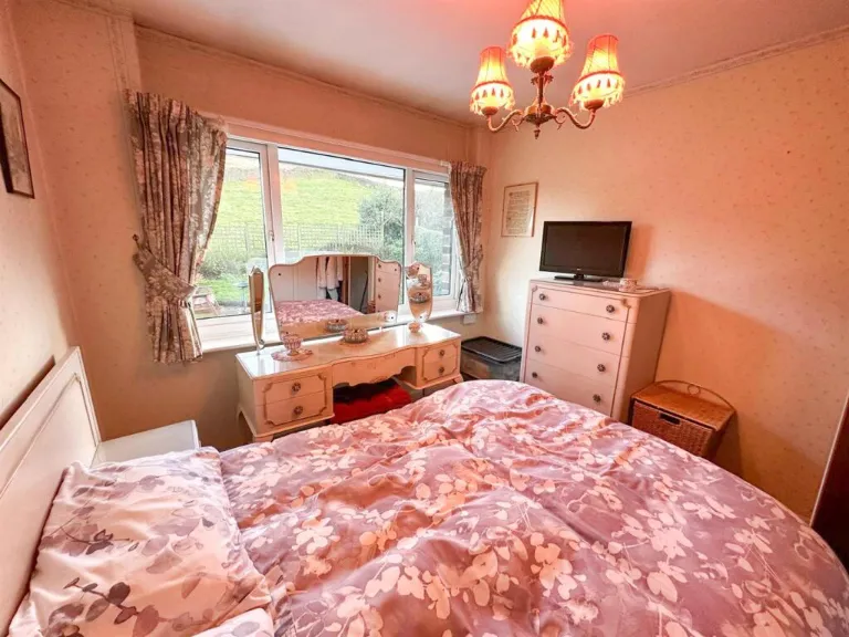
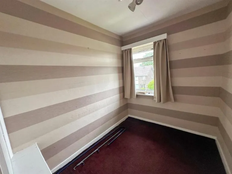
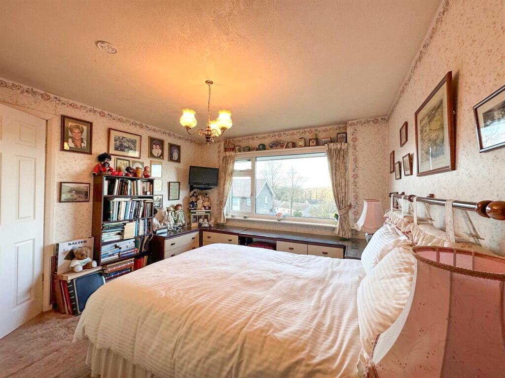
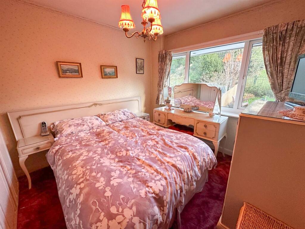
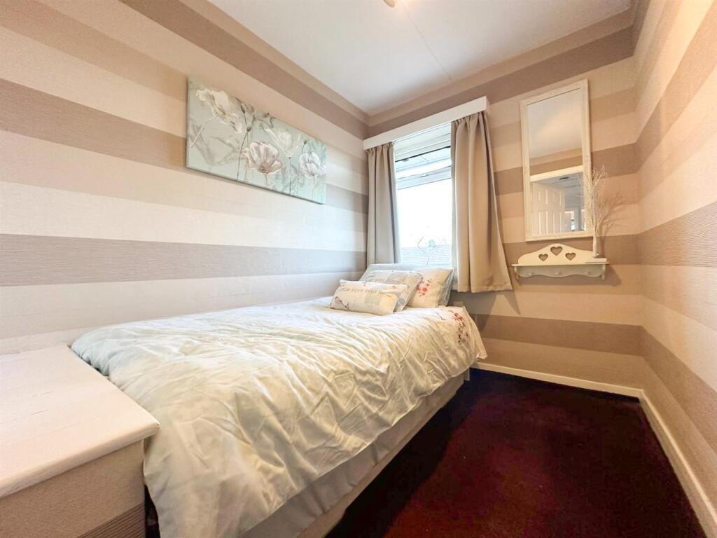
- Bedroom: Average
- Bedroom: Large
- Bedroom: Small
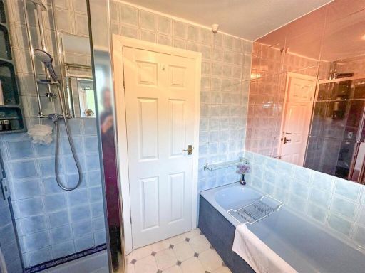
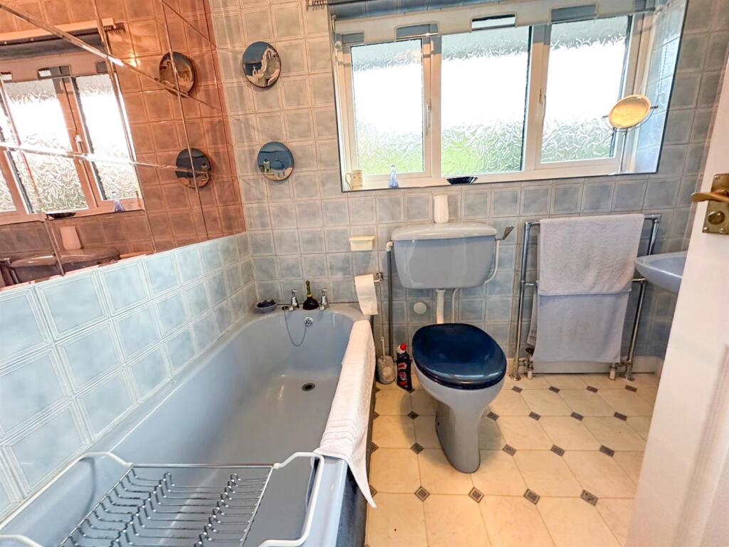
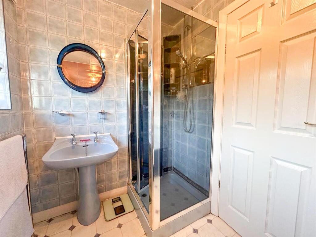
- Bathroom: Small
Textual Property Features
- Has Garden
- Chain Free
- Success
Detected Visual Features
- semi-detached
- Post-war
- brick
- garage
- garden
- driveway
- family home
- residential area
- traditional style
- neutral decor
- living room
- fireplace
- bright room
- natural light
- medium room size
EPC Details
- Fully double glazed
- Cavity wall, filled cavity
- Boiler and radiators, mains gas
- Low energy lighting in 89% of fixed outlets
- Suspended, no insulation (assumed)
Nearby Schools
- Oakworth Primary School
- St Anne's Catholic Primary School
- Sutton-in-Craven Community Primary School
- Steeton Primary School
- South Craven School
- Kildwick Church of England Voluntary Controlled Primary School
- Silsden Primary School
- Lees Primary School
- Beckfoot Oakbank
- Ingrow Primary School
- St Joseph's Catholic Primary School
- Holycroft Primary School
- Keighley St Andrew's CofE Primary School and Nursery
- Merlin Top Primary Academy
- Victoria Primary School
- Eastwood Community School
- The Holy Family Catholic School, a Voluntary Academy
- Carlton Keighley
- Haworth Primary School
- Beckfoot Nessfield
- Bradleys Both Community Primary School
- Worth Valley Primary School
- Parkwood Primary School
- Laycock Primary School
- Our Lady of Victories Catholic School
- Glusburn Community Primary School
Nearest Grocery shops
- Id: 548193893
- Tags:
- Brand: Co-op Food
- Brand:wikidata: Q3277439
- Brand:wikipedia: en:Co-op Food
- Building: yes
- Name: Co-op Food
- Opening_hours: Mo-Su 05:00-23:00
- Operator: The Co-operative Group
- Operator:wikidata: Q117202
- Shop: convenience
- Wheelchair: limited
- TagsNormalized:
- co-op
- co-op food
- food
- convenience
- shop
- Lat: 53.9063468
- Lon: -1.985405
- FullGeoHash: gcwddv670xqs
- PartitionGeoHash: gcwd
- Images:
- FoodStandards: null
- Distance: 2304.3
,- Id: 2971244390
- Tags:
- Addr:
- City: Keighley
- Housenumber: 4
- Postcode: BD20 6SE
- Street: Elmsley Street
- Village: Steeton With Eastburn
- Fhrs:
- Name: The Fruit Bowl
- Shop: greengrocer
- Source:
- TagsNormalized:
- bowls
- greengrocer
- grocer
- shop
- Lat: 53.8961599
- Lon: -1.9510933
- FullGeoHash: gcwdee7rbhrk
- PartitionGeoHash: gcwd
- Images:
- FoodStandards:
- Id: 326801
- FHRSID: 326801
- LocalAuthorityBusinessID: 47755
- BusinessName: The Fruit Bowl
- BusinessType: Retailers - other
- BusinessTypeID: 4613
- AddressLine1: null
- AddressLine2: 4 Elmsley Street
- AddressLine3: Steeton With Eastburn
- AddressLine4: null
- PostCode: BD20 6SE
- RatingValue: 5
- RatingKey: fhrs_5_en-GB
- RatingDate: 2013-01-17
- LocalAuthorityCode: 404
- LocalAuthorityName: Bradford
- LocalAuthorityWebSite: http://www.bradford.gov.uk
- LocalAuthorityEmailAddress: eh.admin@bradford.gov.uk
- Scores:
- Hygiene: 0
- Structural: 5
- ConfidenceInManagement: 5
- NewRatingPending: false
- Geocode:
- Longitude: -1.95139000000000
- Latitude: 53.89658200000000
- Distance: 405.6
,- Id: 2971244421
- Tags:
- Addr:
- City: Keighley
- Housenumber: 1-3
- Postcode: BD20 6SE
- Street: Elmsley Street
- Village: Steeton With Eastburn
- Fhrs:
- Name: Steeton Newsagents
- Shop: convenience
- Source:
- TagsNormalized:
- Lat: 53.8960824
- Lon: -1.9514556
- FullGeoHash: gcwdee6zrvcn
- PartitionGeoHash: gcwd
- Images:
- FoodStandards: null
- Distance: 380.6
}
Nearest Religious buildings
- Id: 749239470
- Tags:
- Amenity: place_of_worship
- Building: church
- Denomination: anglican
- Name: St Thomas
- Religion: christian
- Wikidata: Q26603279
- TagsNormalized:
- place of worship
- church
- anglican
- christian
- Lat: 53.893506
- Lon: -1.9903932
- FullGeoHash: gcwdden8kmxm
- PartitionGeoHash: gcwd
- Images:
- FoodStandards: null
- Distance: 2218.2
,- Id: 352650834
- Tags:
- Addr:
- City: Keighley
- Postcode: BD20 6SB
- Street: St Stephen's Road
- Village: Steeton
- Amenity: place_of_worship
- Building: church
- Denomination: anglican
- Name: St. Stephen
- Religion: christian
- Wikidata: Q26517608
- TagsNormalized:
- place of worship
- church
- anglican
- christian
- Lat: 53.8968041
- Lon: -1.9498644
- FullGeoHash: gcwdees5su7x
- PartitionGeoHash: gcwd
- Images:
- FoodStandards: null
- Distance: 510.8
,- Id: 297521092
- Tags:
- Addr:
- City: Keighley
- Postcode: BD20 6PD
- Street: Skipton Road
- Village: Steeton
- Amenity: place_of_worship
- Building: church
- Denomination: methodist
- Name: Steeton Methodist Church
- Religion: christian
- Website: www.airedalemethodists.org/Steeton
- TagsNormalized:
- place of worship
- church
- methodist
- christian
- Lat: 53.8956326
- Lon: -1.9551749
- FullGeoHash: gcwdee2kc45g
- PartitionGeoHash: gcwd
- Images:
- FoodStandards: null
- Distance: 158.6
}
Nearest Airports
- Id: 11519546
- Tags:
- Addr:
- City: Leeds
- Postcode: LS19 7TU
- Aerodrome: international
- Aerodrome:type: public
- Aeroway: aerodrome
- Iata: LBA
- Icao: EGNM
- Name: Leeds Bradford Airport
- Operator: Leeds Bradford Airport Limited
- Operator:type: private
- Ref: LBA
- Type: multipolygon
- Website: https://www.leedsbradfordairport.co.uk/
- Wikidata: Q8699
- Wikipedia: en:Leeds Bradford Airport
- TagsNormalized:
- airport
- international airport
- Lat: 53.8667047
- Lon: -1.660138
- FullGeoHash: gcwf6nph7cx3
- PartitionGeoHash: gcwf
- Images:
- Q8699-1
- Q8699-2
- Q8699-3
- Q8699-4
- FoodStandards: null
- Distance: 19674.4
}
Nearest Leisure Facilities
- Id: 228003998
- Tags:
- Leisure: pitch
- Sport: cricket
- TagsNormalized:
- pitch
- leisure
- cricket
- sports
- Lat: 53.8970575
- Lon: -1.9431828
- FullGeoHash: gcwdeg9j0e9z
- PartitionGeoHash: gcwd
- Images:
- FoodStandards: null
- Distance: 923.7
,- Id: 293516167
- Tags:
- TagsNormalized:
- Lat: 53.8953548
- Lon: -1.9468337
- FullGeoHash: gcwdeeq75qrd
- PartitionGeoHash: gcwd
- Images:
- FoodStandards: null
- Distance: 646.2
,- Id: 2971244416
- Tags:
- TagsNormalized:
- Lat: 53.8952969
- Lon: -1.9471882
- FullGeoHash: gcwdeeq4g5x0
- PartitionGeoHash: gcwd
- Images:
- FoodStandards: null
- Distance: 622.2
,- Id: 157936203
- Tags:
- TagsNormalized:
- Lat: 53.8955102
- Lon: -1.9475461
- FullGeoHash: gcwdeemu4gk3
- PartitionGeoHash: gcwd
- Images:
- FoodStandards: null
- Distance: 603.1
,- Id: 293516168
- Tags:
- Leisure: pitch
- Name: Steeton-With-Eastburn Crown Green Bowls Club
- Sport: bowls
- TagsNormalized:
- pitch
- leisure
- bowls
- club
- sports
- Lat: 53.8963775
- Lon: -1.9534136
- FullGeoHash: gcwdee994hvn
- PartitionGeoHash: gcwd
- Images:
- FoodStandards: null
- Distance: 296.6
}
Nearest Tourist attractions
- Id: 9060095424
- Tags:
- Addr:
- City: Silsden
- Country: GB
- Housename: Pickersgill Manor Farm
- Postcode: BD20 9JH
- Street: Low Lane
- Fhrs:
- Name: Pickersgill Manor Farm
- Tourism: guest_house
- TagsNormalized:
- Lat: 53.9297303
- Lon: -1.9469351
- FullGeoHash: gcwdg9w73n7u
- PartitionGeoHash: gcwd
- Images:
- FoodStandards:
- Id: 326972
- FHRSID: 326972
- LocalAuthorityBusinessID: 52679
- BusinessName: Pickersgill Manor Farm
- BusinessType: Hotel/bed & breakfast/guest house
- BusinessTypeID: 7842
- AddressLine1: Pickersgill Manor Farm
- AddressLine2: Low Lane
- AddressLine3: Silsden
- AddressLine4: null
- PostCode: BD20 9JH
- RatingValue: 5
- RatingKey: fhrs_5_en-GB
- RatingDate: 2018-10-26
- LocalAuthorityCode: 404
- LocalAuthorityName: Bradford
- LocalAuthorityWebSite: http://www.bradford.gov.uk
- LocalAuthorityEmailAddress: eh.admin@bradford.gov.uk
- Scores:
- Hygiene: 0
- Structural: 0
- ConfidenceInManagement: 0
- NewRatingPending: false
- Geocode:
- Longitude: -1.94638400000000
- Latitude: 53.93167600000000
- Distance: 3971.1
,- Id: 9919628264
- Tags:
- Addr:
- City: Silsden
- Postcode: BD20 9HW
- Street: Heights Lane
- Name: Honeymans Cottage
- Tourism: chalet
- Website: https://www.lastminute-cottages.co.uk/properties/united-kingdom/england/yorkshire-and-the-humber/bradford/silsden/charming-silsden-rental-s11035
- TagsNormalized:
- Lat: 53.9275308
- Lon: -1.9605934
- FullGeoHash: gcwdg3hqdu7e
- PartitionGeoHash: gcwd
- Images:
- FoodStandards: null
- Distance: 3685.4
,- Id: 357477635
- Tags:
- Name: Cliffe Castle
- Tourism: museum
- Wheelchair: limited
- Wikidata: Q5132823
- Wikipedia: en:Cliffe Castle Museum
- TagsNormalized:
- Lat: 53.8751275
- Lon: -1.9136767
- FullGeoHash: gcwdkrwt25ej
- PartitionGeoHash: gcwd
- Images:
- FoodStandards: null
- Distance: 3540.3
}
Nearest Train stations
- Id: 5061764050
- Tags:
- Name: Skipton
- Naptan:
- Network: National Rail
- Operator: Northern
- Public_transport: station
- Railway: station
- Ref:
- Train: yes
- Wheelchair: yes
- Wikidata: Q2477336
- Wikipedia: en:Skipton railway station
- TagsNormalized:
- Lat: 53.9584308
- Lon: -2.0260314
- FullGeoHash: gcwdcyudwh93
- PartitionGeoHash: gcwd
- Images:
- FoodStandards: null
- Distance: 8441.4
,- Id: 21652987
- Tags:
- Name: Haworth
- Naptan:
- Public_transport: station
- Railway: station
- Usage: tourism
- Wikidata: Q5685412
- Wikipedia: en:Haworth railway station
- TagsNormalized:
- Lat: 53.8313183
- Lon: -1.9488416
- FullGeoHash: gcwd5xsyhtn3
- PartitionGeoHash: gcwd
- Images:
- FoodStandards: null
- Distance: 7040.7
,- Id: 21652997
- Tags:
- Name: Oakworth
- Naptan:
- Public_transport: station
- Railway: station
- Source: OS 1:25k
- Usage: tourism
- Wikidata: Q7074337
- Wikipedia: en:Oakworth railway station
- TagsNormalized:
- Lat: 53.8413266
- Lon: -1.9419575
- FullGeoHash: gcwd7c9bmnex
- PartitionGeoHash: gcwd
- Images:
- FoodStandards: null
- Distance: 5986.7
,- Id: 21653016
- Tags:
- Name: Ingrow (West)
- Naptan:
- Public_transport: station
- Railway: station
- Usage: tourism
- Wikidata: Q6033350
- Wikipedia: en:Ingrow (West) railway station
- TagsNormalized:
- Lat: 53.8536646
- Lon: -1.9151443
- FullGeoHash: gcwdk7v2mfsy
- PartitionGeoHash: gcwd
- Images:
- FoodStandards: null
- Distance: 5288.5
,- Id: 3713706488
- Tags:
- Name: Keighley
- Naptan:
- Network: National Rail
- Public_transport: station
- Railway: station
- Ref:
- Wheelchair: limited
- Wikidata: Q518724
- Wikipedia: en:Keighley railway station
- TagsNormalized:
- Lat: 53.867932
- Lon: -1.9013628
- FullGeoHash: gcwdkwr7rn34
- PartitionGeoHash: gcwd
- Images:
- FoodStandards: null
- Distance: 4669.9
}
Nearest Bus stations and stops
- Id: 7744179585
- Tags:
- Highway: bus_stop
- Name: Forge View
- Public_transport: platform
- TagsNormalized:
- Lat: 53.8959936
- Lon: -1.9510288
- FullGeoHash: gcwdee7qctrk
- PartitionGeoHash: gcwd
- Images:
- FoodStandards: null
- Distance: 401.2
,- Id: 7744179593
- Tags:
- Bench: yes
- Bin: yes
- Highway: bus_stop
- Lit: yes
- Name: Airedale Hospital
- Public_transport: platform
- Shelter: yes
- Tactile_paving: no
- TagsNormalized:
- Lat: 53.8961141
- Lon: -1.9608819
- FullGeoHash: gcwde7kps5u7
- PartitionGeoHash: gcwd
- Images:
- FoodStandards: null
- Distance: 335.8
,- Id: 7744179586
- Tags:
- Bench: no
- Highway: bus_stop
- Lit: yes
- Name: Clough Avenue
- Public_transport: platform
- Shelter: no
- Tactile_paving: no
- TagsNormalized:
- Lat: 53.8959872
- Lon: -1.952455
- FullGeoHash: gcwdee6qbs0n
- PartitionGeoHash: gcwd
- Images:
- FoodStandards: null
- Distance: 318.5
,- Id: 7744179588
- Tags:
- Bench: yes
- Bin: yes
- Highway: bus_stop
- Lit: yes
- Name: Thornhill Road
- Public_transport: platform
- Shelter: yes
- Tactile_paving: no
- TagsNormalized:
- Lat: 53.8959461
- Lon: -1.9579878
- FullGeoHash: gcwde7qnxsd3
- PartitionGeoHash: gcwd
- Images:
- FoodStandards: null
- Distance: 188.1
,- Id: 7744179587
- Tags:
- Bench: no
- Bin: yes
- Highway: bus_stop
- Lit: yes
- Name: Thornhill Road
- Public_transport: platform
- Shelter: yes
- Tactile_paving: no
- TagsNormalized:
- Lat: 53.8959568
- Lon: -1.9573735
- FullGeoHash: gcwde7qwtys9
- PartitionGeoHash: gcwd
- Images:
- FoodStandards: null
- Distance: 173.1
}
Nearest Hotels
- Id: 919626989
- Tags:
- Addr:
- City: Keighley
- Country: GB
- Housenumber: 406
- Postcode: BD20 6HP
- Street: Skipton Road
- Amenity: restaurant
- Building: yes
- Fhrs:
- Name: Dalesgate Hotel
- Tourism: hotel
- TagsNormalized:
- Lat: 53.8821944
- Lon: -1.9210295
- FullGeoHash: gcwds2cnsc09
- PartitionGeoHash: gcwd
- Images:
- FoodStandards: null
- Distance: 2700.3
,- Id: 556701254
- Tags:
- Addr:
- City: Keighley
- District: Kildwick
- Postcode: BD20 9BH
- Street: Priest Bank Road
- Amenity: pub
- Building: yes
- Fhrs:
- Name: The White Lion Hotel
- Outdoor_seating: yes
- Source:
- TagsNormalized:
- Lat: 53.9085709
- Lon: -1.9842499
- FullGeoHash: gcwddvg05tup
- PartitionGeoHash: gcwd
- Images:
- FoodStandards: null
- Distance: 2396.6
,- Id: 352651760
- Tags:
- Addr:
- City: Keighley
- Postcode: BD20 6RY
- Street: Station Road
- Village: Steeton With Eastburn
- Fhrs:
- Name: Steeton Hall
- Source:
- Tourism: hotel
- TagsNormalized:
- Lat: 53.8983628
- Lon: -1.947491
- FullGeoHash: gcwdeevuspj3
- PartitionGeoHash: gcwd
- Images:
- FoodStandards: null
- Distance: 736.1
}
Tags
- semi-detached
- Post-war
- brick
- garage
- garden
- driveway
- family home
- residential area
- traditional style
- neutral decor
- semi-detached
- living room
- fireplace
- bright room
- natural light
- medium room size
- family home
Local Market Stats
- Average Price/sqft: £234
- Avg Income: £42900
- Rental Yield: 3.6%
- Social Housing: 6%
- Planning Success Rate: 84%
Similar Properties
 3 bedroom semi-detached house for sale in Elm View, Steeton, Keighley, BD20 — £259,500 • 3 bed • 1 bath • 719 ft²
 3 bedroom semi-detached house for sale in Thornhill Road Steeton, Keighley, BD20 — £225,000 • 3 bed • 1 bath • 922 ft²
 3 bedroom terraced house for sale in Stone Grove, Steeton, Keighley, BD20 — £187,500 • 3 bed • 1 bath • 743 ft²
 3 bedroom semi-detached house for sale in Summerhill Drive, Steeton, Keighley, West Yorkshire, BD20 — £299,950 • 3 bed • 1 bath • 861 ft²
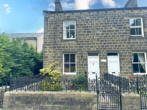 3 bedroom semi-detached house for sale in Harewood Cottage Skipton Road, Steeton, BD20 — £209,950 • 3 bed • 1 bath • 1084 ft²
 3 bedroom detached house for sale in Ghyll Close, Steeton, West Yorkshire, BD20 — £375,000 • 3 bed • 1 bath • 1162 ft²
Meta
- {
"@context": "https://schema.org",
"@type": "Residence",
"name": "3 bedroom semidetached house for sale in Coppy Road, Steeto…",
"description": "",
"url": "https://propertypiper.co.uk/property/22971592-1d41-41d7-bb72-1bb6cb482827",
"image": "https://image-a.propertypiper.co.uk/c15f895c-12b4-4625-bc8e-fc7c79ad0eff-1024.jpeg",
"address": {
"@type": "PostalAddress",
"streetAddress": "11, COPPY ROAD",
"postalCode": "BD20 6PJ",
"addressLocality": "Bradford",
"addressRegion": "Keighley",
"addressCountry": "England"
},
"geo": {
"@type": "GeoCoordinates",
"latitude": 53.894471764813765,
"longitude": -1.9565806719072876
},
"numberOfRooms": 3,
"numberOfBathroomsTotal": 1,
"floorSize": {
"@type": "QuantitativeValue",
"value": 849,
"unitCode": "FTK"
},
"offers": {
"@type": "Offer",
"price": 220000,
"priceCurrency": "GBP",
"availability": "https://schema.org/InStock"
},
"additionalProperty": [
{
"@type": "PropertyValue",
"name": "Feature",
"value": "semi-detached"
},
{
"@type": "PropertyValue",
"name": "Feature",
"value": "Post-war"
},
{
"@type": "PropertyValue",
"name": "Feature",
"value": "brick"
},
{
"@type": "PropertyValue",
"name": "Feature",
"value": "garage"
},
{
"@type": "PropertyValue",
"name": "Feature",
"value": "garden"
},
{
"@type": "PropertyValue",
"name": "Feature",
"value": "driveway"
},
{
"@type": "PropertyValue",
"name": "Feature",
"value": "family home"
},
{
"@type": "PropertyValue",
"name": "Feature",
"value": "residential area"
},
{
"@type": "PropertyValue",
"name": "Feature",
"value": "traditional style"
},
{
"@type": "PropertyValue",
"name": "Feature",
"value": "neutral decor"
},
{
"@type": "PropertyValue",
"name": "Feature",
"value": "semi-detached"
},
{
"@type": "PropertyValue",
"name": "Feature",
"value": "living room"
},
{
"@type": "PropertyValue",
"name": "Feature",
"value": "fireplace"
},
{
"@type": "PropertyValue",
"name": "Feature",
"value": "bright room"
},
{
"@type": "PropertyValue",
"name": "Feature",
"value": "natural light"
},
{
"@type": "PropertyValue",
"name": "Feature",
"value": "medium room size"
},
{
"@type": "PropertyValue",
"name": "Feature",
"value": "family home"
}
]
}
High Res Floorplan Images
Compatible Floorplan Images
FloorplanImages Thumbnail