CV13 6AA - 4 bedroom semidetached house for sale in Wood Lane, HighamO…
View on Property Piper
4 bedroom semi-detached house for sale in Wood Lane,
Higham-On-The-Hill,
Leicestershire,
CV13 6AA, CV13
Property Details
- Price: £359995
- Bedrooms: 4
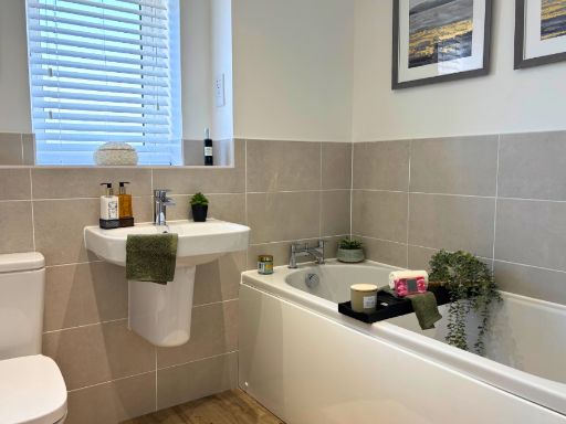
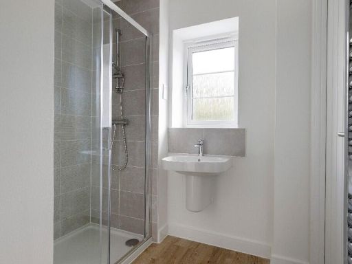
- Bathrooms: 2
- Property Type: undefined
- Property SubType: undefined
Brochure Descriptions
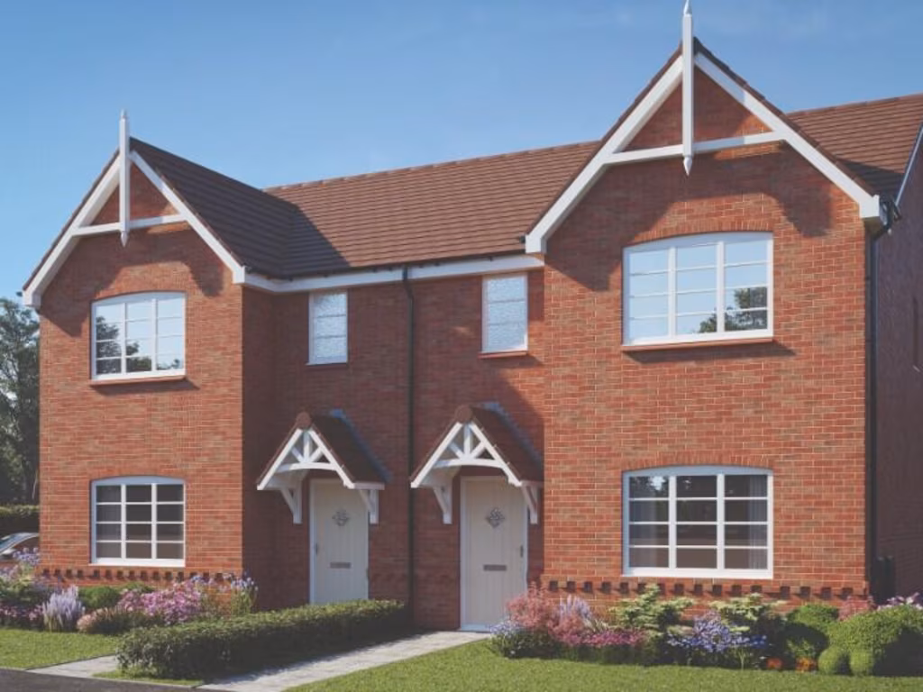
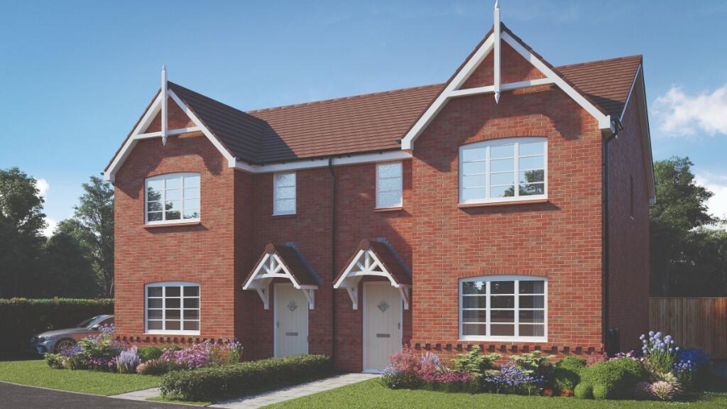
- The property named Linden Walk appears to be located in the village of Higham on the Hill. No further visual details of the property (size, rooms, or views) are available from this image. No information about garden or property size can be inferred. Only the name and general location are given.
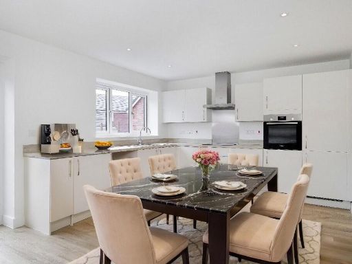
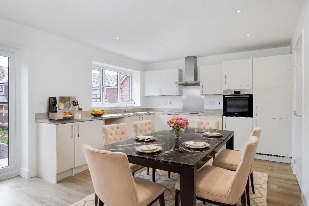
- The property for sale features a modern kitchen with clean lines and integrated appliances, including a double oven, induction hob, and contemporary extractor fan. The cabinetry is matte dark grey, paired with a light marble-effect countertop and backsplash, offering a sleek, contemporary aesthetic. The layout suggests a spacious kitchen, likely suitable for a family home or upscale apartment. The flooring appears to be wood or high-end laminate suitable for durability. Overall, the kitchen area indicates a modern build with average to large room proportions, designed to appeal to buyers seeking style, practicality, and potentially new construction standards. No views are visible from the image.
Image Descriptions
- exterior of a semi-detached house modern
- modern kitchen modern
Floorplan Description
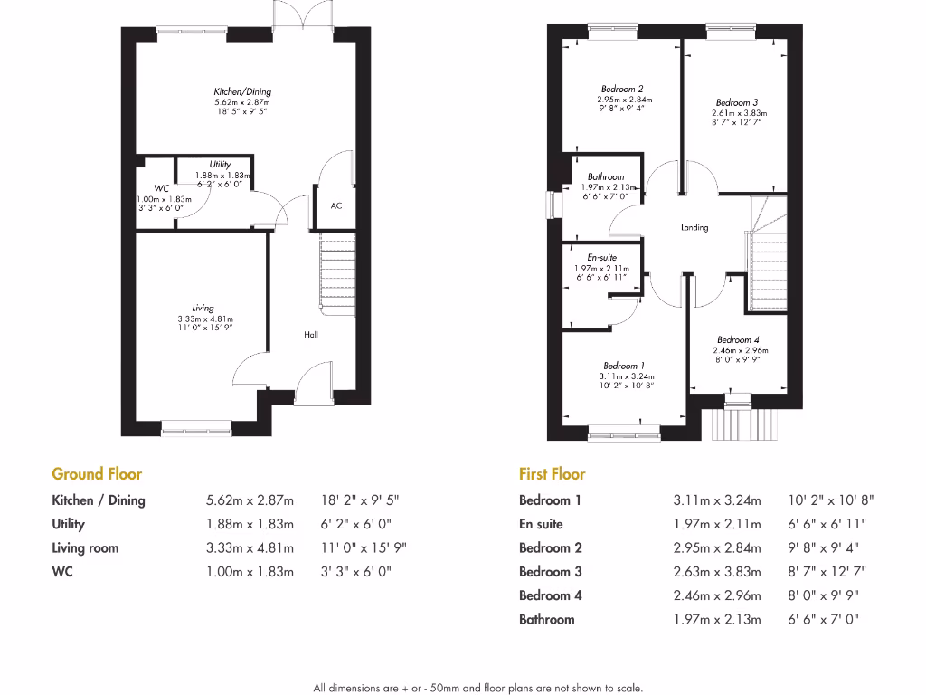
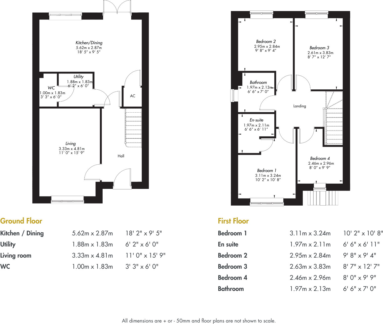
- A multi-story house with four bedrooms and two bathrooms.
Rooms
- Kitchen / Dining: average
- Utility: small
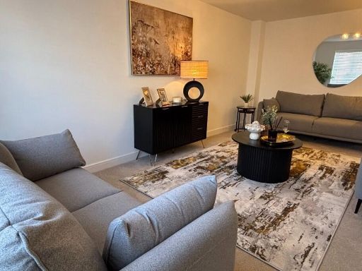
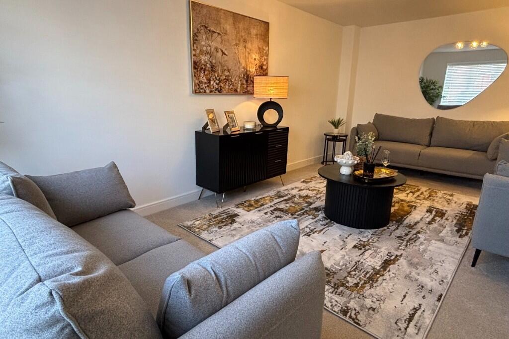
- Living room: large
- WC: small
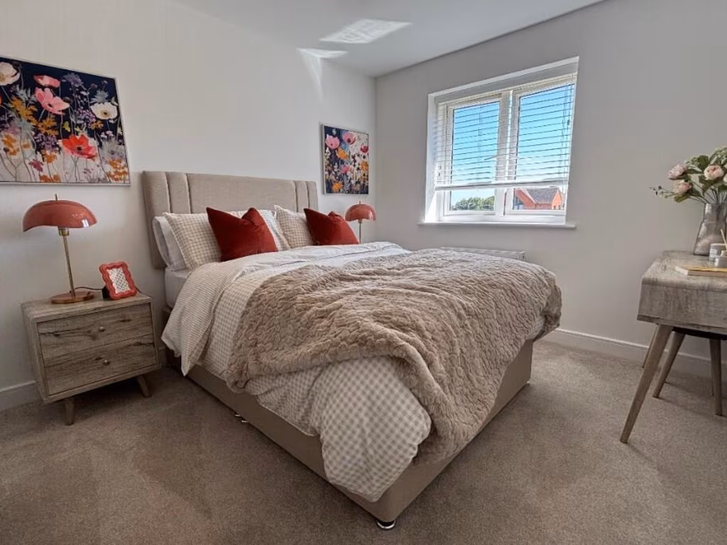
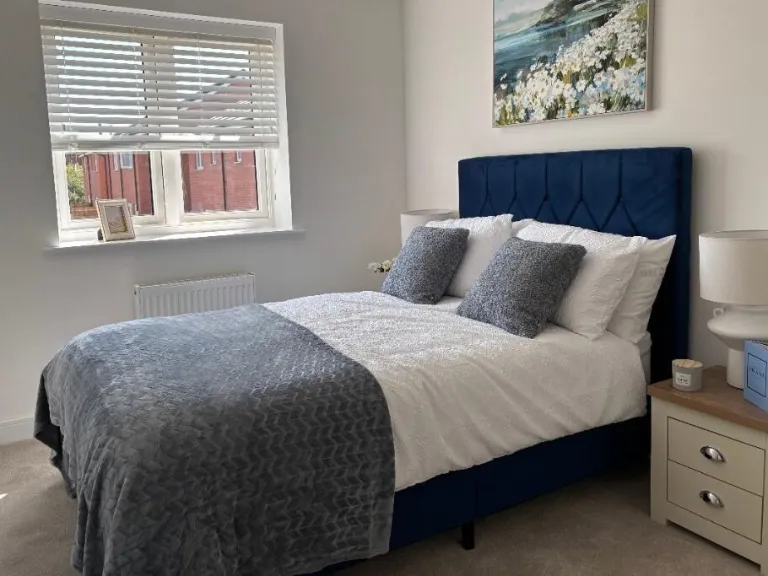
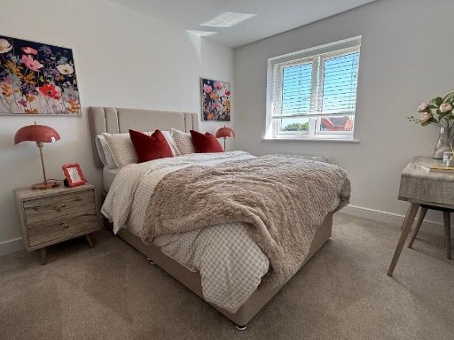
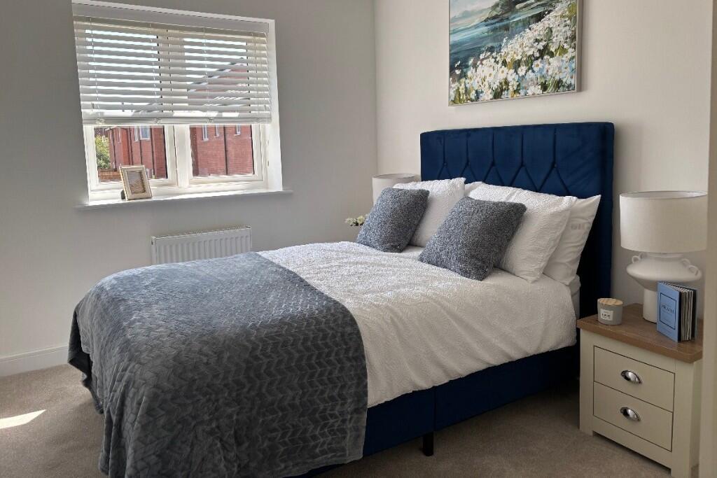
- Bedroom 1: average
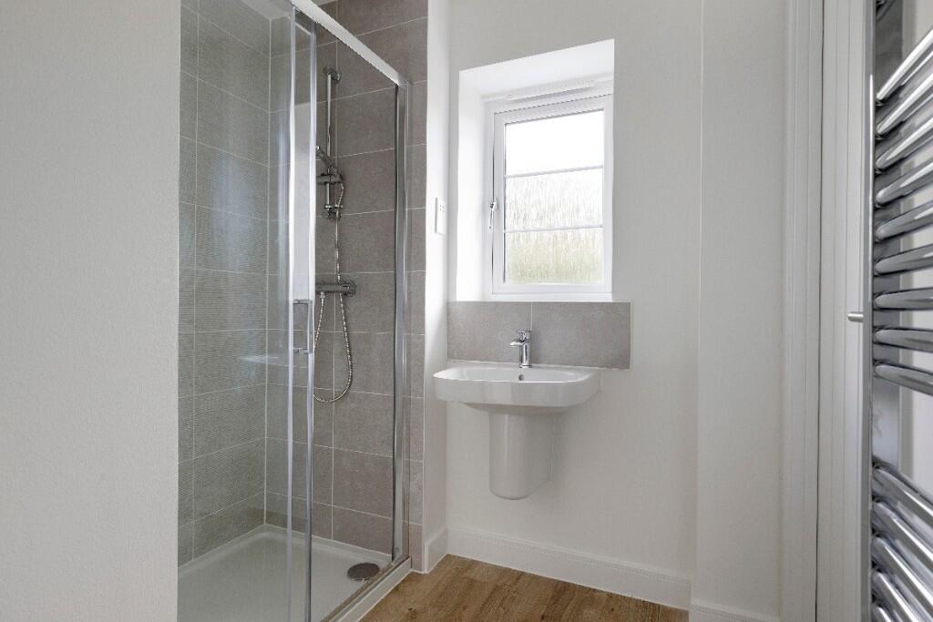
- En suite: small
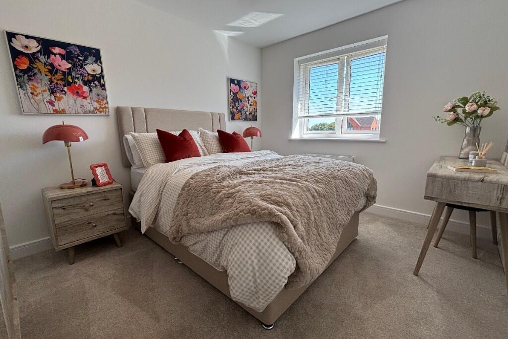
- Bedroom 2: average
- Bedroom 3: average
- Bedroom 4: average
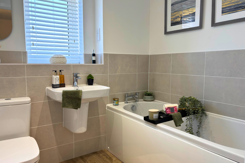
- Bathroom: small
Textual Property Features
- Is New Build
- Has Garden
- Success
Detected Visual Features
- semi-detached
- modern
- red brick
- pitched roof
- double glazed windows
- low maintenance garden
- residential
- suburban
- kitchen
- newly renovated
- bright
- open-plan
- marble countertops
- integrated appliances
Nearby Schools
- Chetwynd Junior School
- Middlemarch School
- Queen's Church of England Academy
- St Nicolas CofE Academy
- Higham Lane School
- Milby Primary School
- St Margaret's Church of England Primary School, Stoke Golding
- Saint Martin's Catholic Voluntary Academy
- Whitestone Infant School
- Chilvers Coton Community Infant School
- Croft Junior School
- Abbey CofE Infant School
- Camp Hill Primary School
- Lower Farm Academy
- Battling Brook Primary School
- Higham-on-the-Hill Church of England Primary School
- George Eliot Academy
- All Saints CofE Primary School and Nursery, Nuneaton
- Wembrook Primary School
- Our Lady & St. Joseph Catholic Academy
- Hollycroft Primary School
- St Anne's Catholic Academy
- St Thomas More Catholic School and Sixth Form College
- Etone College
- Weddington Primary School
Nearest Bars And Restaurants
- Id: 609020501
- Tags:
- Amenity: parking
- Name: George & Dragon Pub Parking
- TagsNormalized:
- Lat: 52.570973
- Lon: -1.4148268
- FullGeoHash: gcqgpf3b05st
- PartitionGeoHash: gcqg
- Images:
- FoodStandards: null
- Distance: 2677.1
,- Id: 274538773
- Tags:
- Amenity: pub
- Building: yes
- Name: George and Dragon
- TagsNormalized:
- Lat: 52.5708202
- Lon: -1.4148155
- FullGeoHash: gcqgpf1z0rjj
- PartitionGeoHash: gcqg
- Images:
- FoodStandards: null
- Distance: 2667.3
,- Id: 271827733
- Tags:
- Amenity: pub
- Name: The Royal Redgate
- TagsNormalized:
- Lat: 52.5590482
- Lon: -1.4829183
- FullGeoHash: gcqgn204tkxy
- PartitionGeoHash: gcqg
- Images:
- FoodStandards: null
- Distance: 2508.5
,- Id: 557263449
- Tags:
- Amenity: pub
- Building: yes
- Name: Conniston Tavern
- TagsNormalized:
- Lat: 52.5364999
- Lon: -1.442996
- FullGeoHash: gcqfz5vprc2j
- PartitionGeoHash: gcqf
- Images:
- FoodStandards: null
- Distance: 2201.3
,- Id: 574633883
- Tags:
- Addr:
- City: Higham on the Hill
- Housenumber: 25
- Postcode: CV13 6AE
- Street: Main Street
- Amenity: pub
- Beer_garden: yes
- Building: yes
- Building:levels: 3
- Food: yes
- Name: The Oddfellows Arms
- Outdoor_seating: yes
- TagsNormalized:
- Lat: 52.5555143
- Lon: -1.4406326
- FullGeoHash: gcqfzpqyncfq
- PartitionGeoHash: gcqf
- Images:
- FoodStandards: null
- Distance: 378
}
Nearest General Shops
- Id: 5373606594
- Tags:
- Name: Bloomers
- Shop: florist
- TagsNormalized:
- Lat: 52.5359324
- Lon: -1.445928
- FullGeoHash: gcqfz5g5grtg
- PartitionGeoHash: gcqf
- Images:
- FoodStandards: null
- Distance: 2254.3
,- Id: 557263446
- Tags:
- TagsNormalized:
- Lat: 52.5359362
- Lon: -1.4457503
- FullGeoHash: gcqfz5ghp866
- PartitionGeoHash: gcqf
- Images:
- FoodStandards: null
- Distance: 2254
,- Id: 557263447
- Tags:
- TagsNormalized:
- Lat: 52.5361046
- Lon: -1.4453042
- FullGeoHash: gcqfz5gsczxn
- PartitionGeoHash: gcqf
- Images:
- FoodStandards: null
- Distance: 2235.8
}
Nearest Grocery shops
- Id: 6727560961
- Tags:
- Brand: One Stop
- Brand:wikidata: Q65954217
- Name: One Stop
- Shop: convenience
- TagsNormalized:
- Lat: 52.5330747
- Lon: -1.466165
- FullGeoHash: gcqfyek77fuh
- PartitionGeoHash: gcqf
- Images:
- FoodStandards: null
- Distance: 2907.8
,- Id: 793654391
- Tags:
- Name: Middle Stores
- Shop: convenience
- TagsNormalized:
- Lat: 52.5708622
- Lon: -1.4144482
- FullGeoHash: gcqgpf4p2znb
- PartitionGeoHash: gcqg
- Images:
- FoodStandards: null
- Distance: 2689.8
,- Id: 574633885
- Tags:
- Building: yes
- Name: Sehmbi Stores
- Shop: convenience
- TagsNormalized:
- Lat: 52.5553871
- Lon: -1.4399618
- FullGeoHash: gcqfzprmq6nx
- PartitionGeoHash: gcqf
- Images:
- FoodStandards: null
- Distance: 425.3
}
Nearest Supermarkets
- Id: 513611852
- Tags:
- Brand: ALDI
- Brand:wikidata: Q41171672
- Brand:wikipedia: en:Aldi
- Building: yes
- Contact:
- Website: https://stores.aldi.co.uk/nuneaton/weddington-road
- Name: ALDI
- Shop: supermarket
- Source: Warwicks CC Aerial Imagery 2013
- TagsNormalized:
- Lat: 52.5297761
- Lon: -1.4639456
- FullGeoHash: gcqfydvbps50
- PartitionGeoHash: gcqf
- Images:
- FoodStandards: null
- Distance: 3176.8
,- Id: 365335109
- Tags:
- Brand: ALDI
- Brand:wikidata: Q41171672
- Brand:wikipedia: en:Aldi
- Building: yes
- Contact:
- Website: https://stores.aldi.co.uk/hinckley/watling-street
- Name: ALDI
- Shop: supermarket
- Wheelchair: yes
- TagsNormalized:
- Lat: 52.536474
- Lon: -1.4168585
- FullGeoHash: gcqfzgbr0u9d
- PartitionGeoHash: gcqf
- Images:
- FoodStandards: null
- Distance: 2953.9
,- Id: 5373124552
- Tags:
- Brand: Co-op Food
- Brand:wikidata: Q3277439
- Brand:wikipedia: en:Co-op Food
- Name: Co-op Food
- Shop: supermarket
- TagsNormalized:
- co-op
- co-op food
- food
- supermarket
- shop
- Lat: 52.5361548
- Lon: -1.4452525
- FullGeoHash: gcqfz5gt71jd
- PartitionGeoHash: gcqf
- Images:
- FoodStandards: null
- Distance: 2230.3
}
Nearest Religious buildings
- Id: 557263448
- Tags:
- Amenity: place_of_worship
- Building: yes
- Denomination: protestant
- Name: Nuneaton Christian Fellowship
- Religion: christian
- TagsNormalized:
- place of worship
- protestant
- christian
- church
- Lat: 52.5355978
- Lon: -1.4438463
- FullGeoHash: gcqfz5ud5cnp
- PartitionGeoHash: gcqf
- Images:
- FoodStandards: null
- Distance: 2296.6
,- Id: 326931078
- Tags:
- Amenity: place_of_worship
- Building: church
- Denomination: anglican
- Heritage: 2
- Heritage:operator: Historic England
- Listed_status: Grade II*
- Name: St Peters Church
- Religion: christian
- Wikidata: Q17540923
- TagsNormalized:
- place of worship
- church
- anglican
- christian
- Lat: 52.5565565
- Lon: -1.4369143
- FullGeoHash: gcqfzr9sjkpp
- PartitionGeoHash: gcqf
- Images:
- FoodStandards: null
- Distance: 622.7
,- Id: 387297037
- Tags:
- Amenity: place_of_worship
- Building: church
- Denomination: methodist
- Heritage: 2
- Heritage:operator: Historic England
- Listed_status: Grade II
- Name: Higham on the Hill Methodist Church
- Religion: christian
- Source: Warwicks CC aerialimagery 2013
- Wikidata: Q26472898
- TagsNormalized:
- place of worship
- church
- methodist
- christian
- Lat: 52.5555498
- Lon: -1.4387443
- FullGeoHash: gcqfzr2q6bd6
- PartitionGeoHash: gcqf
- Images:
- FoodStandards: null
- Distance: 503.1
}
Nearest Medical buildings
- Id: 520746629
- Tags:
- Amenity: hospital
- Emergency: no
- Healthcare: hospital
- Name: The Manor
- TagsNormalized:
- Lat: 52.5273556
- Lon: -1.4786459
- FullGeoHash: gcqfy67610c9
- PartitionGeoHash: gcqf
- Images:
- FoodStandards: null
- Distance: 3890.2
,- Id: 7522476261
- Tags:
- Amenity: pharmacy
- Brand: Asda
- Brand:wikidata: Q297410
- Brand:wikipedia: en:Asda
- Contact:
- Phone: +44 1782 622665
- Website: https://storelocator.asda.com/west-midlands/newcastle-under-lyme/wolstanton-retail-park/pharmacy
- Fixme: Location not accurate
- Healthcare: pharmacy
- Name: Asda
- Operator: Asda Stores Ltd
- TagsNormalized:
- pharmacy
- asda
- health
- healthcare
- Lat: 52.5270216
- Lon: -1.4670181
- FullGeoHash: gcqfyd7b0480
- PartitionGeoHash: gcqf
- Images:
- FoodStandards: null
- Distance: 3539.9
,- Id: 793616985
- Tags:
- Amenity: doctors
- Healthcare: doctor
- TagsNormalized:
- doctor
- doctors
- health
- healthcare
- Lat: 52.5698207
- Lon: -1.4078088
- FullGeoHash: gcqgpfnc7sve
- PartitionGeoHash: gcqg
- Images:
- FoodStandards: null
- Distance: 2998.9
,- Id: 5373606425
- Tags:
- Amenity: pharmacy
- Brand: Boots
- Brand:wikidata: Q6123139
- Brand:wikipedia: en:Boots (company)
- Healthcare: pharmacy
- Name: Boots
- TagsNormalized:
- pharmacy
- boots
- health
- healthcare
- Lat: 52.5360183
- Lon: -1.445307
- FullGeoHash: gcqfz5gs3zsu
- PartitionGeoHash: gcqf
- Images:
- FoodStandards: null
- Distance: 2245.4
}
Nearest Airports
- Id: 2437117
- Tags:
- Aerodrome: international
- Aerodrome:type: public
- Aeroway: aerodrome
- Ele: 104
- Iata: BHX
- Icao: EGBB
- Internet_access: wlan
- Is_in: Birmingham,England,UK
- Name: Birmingham Airport
- Ref: BHX
- Type: multipolygon
- Website: https://www.birminghamairport.co.uk/
- Wikidata: Q8719
- Wikipedia: en:Birmingham Airport
- TagsNormalized:
- airport
- international airport
- Lat: 52.4543817
- Lon: -1.7468974
- FullGeoHash: gcqf2jpbym6y
- PartitionGeoHash: gcqf
- Images:
- FoodStandards: null
- Distance: 23295
}
Nearest Leisure Facilities
- Id: 574633888
- Tags:
- Access: customers
- Capacity: 30
- Landcover: grass
- Leisure: outdoor_seating
- Operator: The Oddfellows Arms
- Outdoor_seating: garden
- Outdoor_seating:comfort: bench
- TagsNormalized:
- outdoor
- outdoor seating
- leisure
- Lat: 52.5558908
- Lon: -1.4409032
- FullGeoHash: gcqfzpwb280s
- PartitionGeoHash: gcqf
- Images:
- FoodStandards: null
- Distance: 353.5
,- Id: 549439079
- Tags:
- Leisure: pitch
- Lit: no
- Sport: skateboard
- Sport_1: bmx
- Surface: asphalt
- TagsNormalized:
- pitch
- leisure
- skateboard
- sports
- Lat: 52.5559934
- Lon: -1.4417837
- FullGeoHash: gcqfzpw0u520
- PartitionGeoHash: gcqf
- Images:
- FoodStandards: null
- Distance: 293.2
,- Id: 549655543
- Tags:
- Access: yes
- Leisure: pitch
- Lit: no
- Sport: basketball
- Surface: asphalt
- TagsNormalized:
- pitch
- leisure
- basketball
- sports
- Lat: 52.5563276
- Lon: -1.4419344
- FullGeoHash: gcqfzpw4b3xc
- PartitionGeoHash: gcqf
- Images:
- FoodStandards: null
- Distance: 282.4
,- Id: 64516224
- Tags:
- TagsNormalized:
- Lat: 52.5559027
- Lon: -1.4420745
- FullGeoHash: gcqfzptbm4r7
- PartitionGeoHash: gcqf
- Images:
- FoodStandards: null
- Distance: 274.7
,- Id: 549439077
- Tags:
- Access: yes
- Leisure: playground
- TagsNormalized:
- Lat: 52.5556515
- Lon: -1.4425773
- FullGeoHash: gcqfzpmwce82
- PartitionGeoHash: gcqf
- Images:
- FoodStandards: null
- Distance: 246.5
}
Nearest Tourist attractions
- Id: 50728114
- Tags:
- Area: yes
- Date: 1485 Field
- Fixme: when battlefield boundaries are released, update area
- Historic: battlefield
- Name: Battle of Bosworth 1485
- Name:da: Slaget ved Bosworth
- Name:el: Μάχη του Μπόσγουορθ
- Name:ru: Битва при Босворте
- Note: approximate position (http://news.bbc.co.uk/1/hi/england/leicestershire/8523386.stm)
- Tourism: attraction
- Wikidata: Q222013
- Wikipedia: en:Battle of Bosworth Field
- TagsNormalized:
- Lat: 52.5768254
- Lon: -1.4400908
- FullGeoHash: gcqgp5r65qwk
- PartitionGeoHash: gcqg
- Images:
- FoodStandards: null
- Distance: 2328.6
,- Id: 285962154
- Tags:
- TagsNormalized:
- Lat: 52.5607469
- Lon: -1.4212068
- FullGeoHash: gcqgp8mhe3rk
- PartitionGeoHash: gcqg
- Images:
- FoodStandards: null
- Distance: 1757.4
,- Id: 793216607
- Tags:
- Addr:
- City: Higham-On-The-Hill
- Street: Stoke Lane
- Contact:
- Email: valefarm@gmail.com
- Fax: +44 1455 212236
- Internet_access: wlan
- Name: Vale Farm B & B
- Operator: Terry & Ethel Preston
- Phone: +44 1455 212236
- Source: survey
- Tourism: guest_house
- Website: https://www.valefarm-bed-and-breakfast.co.uk/
- TagsNormalized:
- Lat: 52.558829
- Lon: -1.434321
- FullGeoHash: gcqgp2593gue
- PartitionGeoHash: gcqg
- Images:
- FoodStandards: null
- Distance: 848.5
}
Nearest Hotels
- Id: 725984159
- Tags:
- Area: yes
- Building: yes
- Name: The Manor Hotel
- Tourism: hotel
- TagsNormalized:
- Lat: 52.5273887
- Lon: -1.4761689
- FullGeoHash: gcqfy6m44ybw
- PartitionGeoHash: gcqf
- Images:
- FoodStandards: null
- Distance: 3794.8
,- Id: 513821557
- Tags:
- Building: yes
- Name: The Chase
- Source: Warwicks CC Aerial Imagery 2013
- Tourism: hotel
- TagsNormalized:
- Lat: 52.5305562
- Lon: -1.4534006
- FullGeoHash: gcqfyfvstm3v
- PartitionGeoHash: gcqf
- Images:
- FoodStandards: null
- Distance: 2894.4
,- Id: 365338974
- Tags:
- Building: yes
- Name: Longshoot Hotel
- Tourism: hotel
- TagsNormalized:
- Lat: 52.5362451
- Lon: -1.4200256
- FullGeoHash: gcqfzevvz1bj
- PartitionGeoHash: gcqf
- Images:
- FoodStandards: null
- Distance: 2834.9
}
Tags
- semi-detached
- modern
- red brick
- pitched roof
- double glazed windows
- low maintenance garden
- residential
- suburban
- modern
- kitchen
- newly renovated
- bright
- open-plan
- marble countertops
- integrated appliances
Local Market Stats
- Average Price/sqft: £299
- Avg Income: £46400
- Rental Yield: 3.2%
- Social Housing: 4%
- Planning Success Rate: 100%
Similar Properties
 4 bedroom semi-detached house for sale in Wood Lane,
Higham-On-The-Hill,
Leicestershire,
CV13 6AA, CV13 — £362,500 • 4 bed • 2 bath • 1124 ft²
4 bedroom semi-detached house for sale in Wood Lane,
Higham-On-The-Hill,
Leicestershire,
CV13 6AA, CV13 — £362,500 • 4 bed • 2 bath • 1124 ft²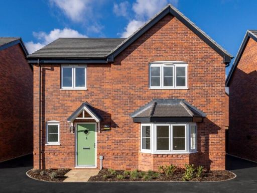 4 bedroom detached house for sale in Wood Lane,
Higham-On-The-Hill,
Leicestershire,
CV13 6AA, CV13 — £484,950 • 4 bed • 2 bath • 1510 ft²
4 bedroom detached house for sale in Wood Lane,
Higham-On-The-Hill,
Leicestershire,
CV13 6AA, CV13 — £484,950 • 4 bed • 2 bath • 1510 ft²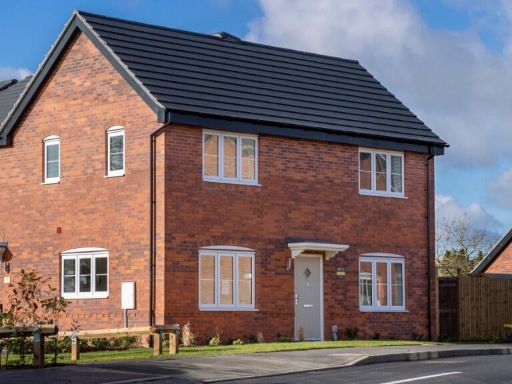 3 bedroom semi-detached house for sale in Wood Lane,
Higham-On-The-Hill,
Leicestershire,
CV13 6AA, CV13 — £325,000 • 3 bed • 1 bath • 920 ft²
3 bedroom semi-detached house for sale in Wood Lane,
Higham-On-The-Hill,
Leicestershire,
CV13 6AA, CV13 — £325,000 • 3 bed • 1 bath • 920 ft²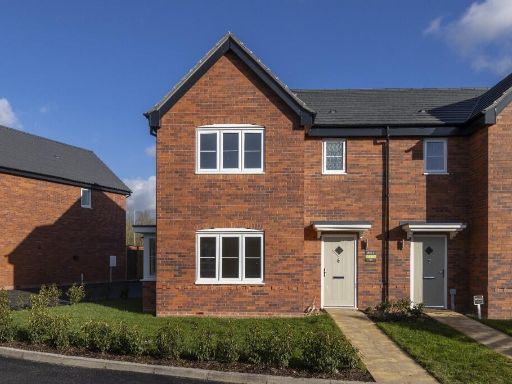 3 bedroom semi-detached house for sale in Wood Lane,
Higham-On-The-Hill,
Leicestershire,
CV13 6AA, CV13 — £309,995 • 3 bed • 2 bath • 1124 ft²
3 bedroom semi-detached house for sale in Wood Lane,
Higham-On-The-Hill,
Leicestershire,
CV13 6AA, CV13 — £309,995 • 3 bed • 2 bath • 1124 ft² 3 bedroom semi-detached house for sale in Wood Lane,
Higham-On-The-Hill,
Leicestershire,
CV13 6AA, CV13 — £325,000 • 3 bed • 1 bath • 911 ft²
3 bedroom semi-detached house for sale in Wood Lane,
Higham-On-The-Hill,
Leicestershire,
CV13 6AA, CV13 — £325,000 • 3 bed • 1 bath • 911 ft²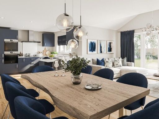 4 bedroom detached house for sale in Wood Lane,
Higham-On-The-Hill,
Leicestershire,
CV13 6AA, CV13 — £564,950 • 4 bed • 3 bath • 1680 ft²
4 bedroom detached house for sale in Wood Lane,
Higham-On-The-Hill,
Leicestershire,
CV13 6AA, CV13 — £564,950 • 4 bed • 3 bath • 1680 ft²
Meta
- {
"@context": "https://schema.org",
"@type": "Residence",
"name": "4 bedroom semidetached house for sale in Wood Lane, HighamO…",
"description": "",
"url": "https://propertypiper.co.uk/property/21a90ac7-8f69-41fe-b74a-907bb6438305",
"image": "https://image-a.propertypiper.co.uk/00a82893-c343-49f1-a9b5-5fd7e1dcc2aa-1024.jpeg",
"address": {
"@type": "PostalAddress",
"streetAddress": "Wood Lane,\r\nHigham-On-The-Hill,\r\nLeicestershire,\r\nCV13 6AA",
"postalCode": "CV13 6AA",
"addressLocality": "Hinckley and Bosworth",
"addressRegion": "Bosworth",
"addressCountry": "England"
},
"geo": {
"@type": "GeoCoordinates",
"latitude": 52.556205767332294,
"longitude": -1.4461070410488759
},
"numberOfRooms": 4,
"numberOfBathroomsTotal": 2,
"floorSize": {
"@type": "QuantitativeValue",
"value": 1124,
"unitCode": "FTK"
},
"offers": {
"@type": "Offer",
"price": 359995,
"priceCurrency": "GBP",
"availability": "https://schema.org/InStock"
},
"additionalProperty": [
{
"@type": "PropertyValue",
"name": "Feature",
"value": "semi-detached"
},
{
"@type": "PropertyValue",
"name": "Feature",
"value": "modern"
},
{
"@type": "PropertyValue",
"name": "Feature",
"value": "red brick"
},
{
"@type": "PropertyValue",
"name": "Feature",
"value": "pitched roof"
},
{
"@type": "PropertyValue",
"name": "Feature",
"value": "double glazed windows"
},
{
"@type": "PropertyValue",
"name": "Feature",
"value": "low maintenance garden"
},
{
"@type": "PropertyValue",
"name": "Feature",
"value": "residential"
},
{
"@type": "PropertyValue",
"name": "Feature",
"value": "suburban"
},
{
"@type": "PropertyValue",
"name": "Feature",
"value": "modern"
},
{
"@type": "PropertyValue",
"name": "Feature",
"value": "kitchen"
},
{
"@type": "PropertyValue",
"name": "Feature",
"value": "newly renovated"
},
{
"@type": "PropertyValue",
"name": "Feature",
"value": "bright"
},
{
"@type": "PropertyValue",
"name": "Feature",
"value": "open-plan"
},
{
"@type": "PropertyValue",
"name": "Feature",
"value": "marble countertops"
},
{
"@type": "PropertyValue",
"name": "Feature",
"value": "integrated appliances"
}
]
}
High Res Floorplan Images
Compatible Floorplan Images
FloorplanImages Thumbnail