ME5 9BX - 4 bedroom detached house for sale in Hurst Hill, Walderslad…
View on Property Piper
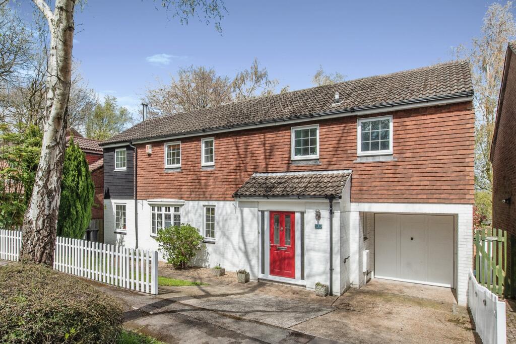
4 bedroom detached house for sale in Hurst Hill, Walderslade Woods, Chatham, ME5
Property Details
- Price: £530000
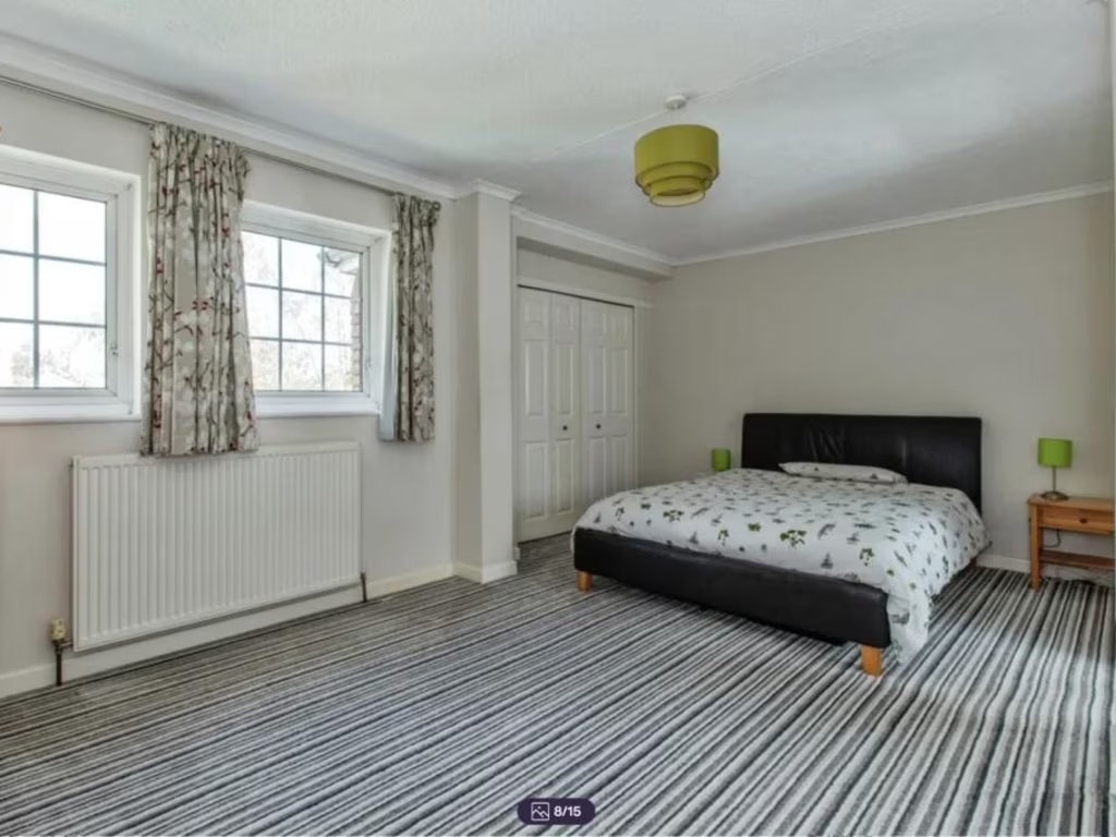
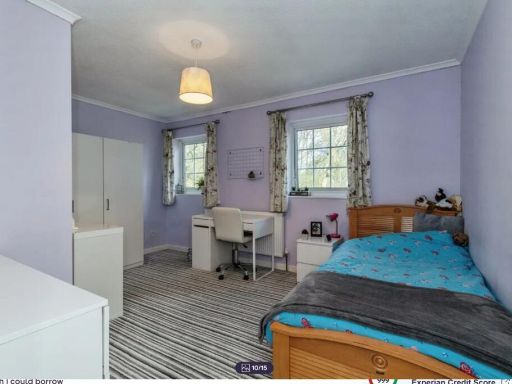
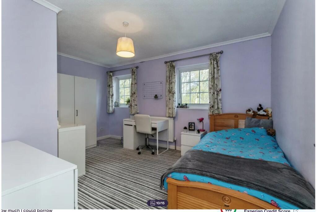
- Bedrooms: 4
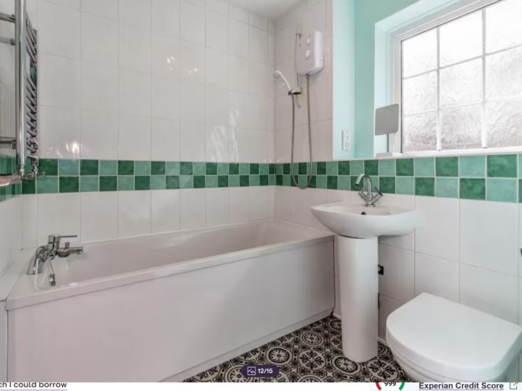
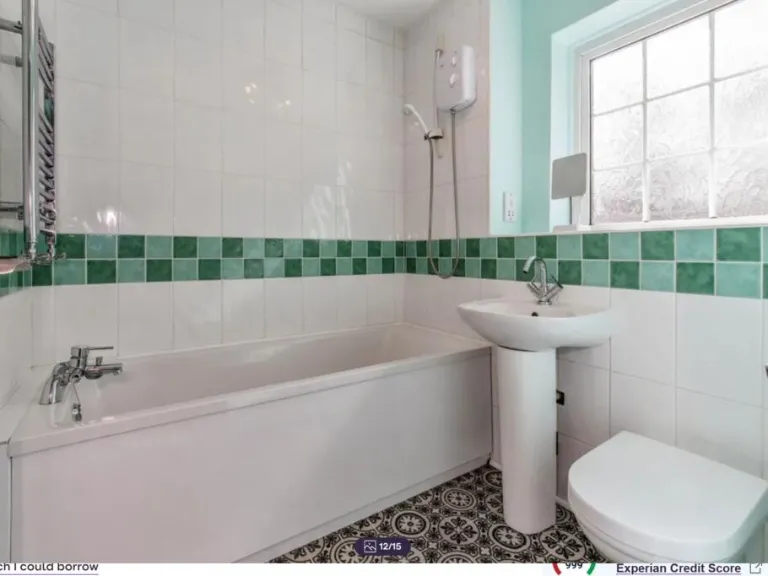
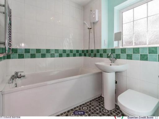
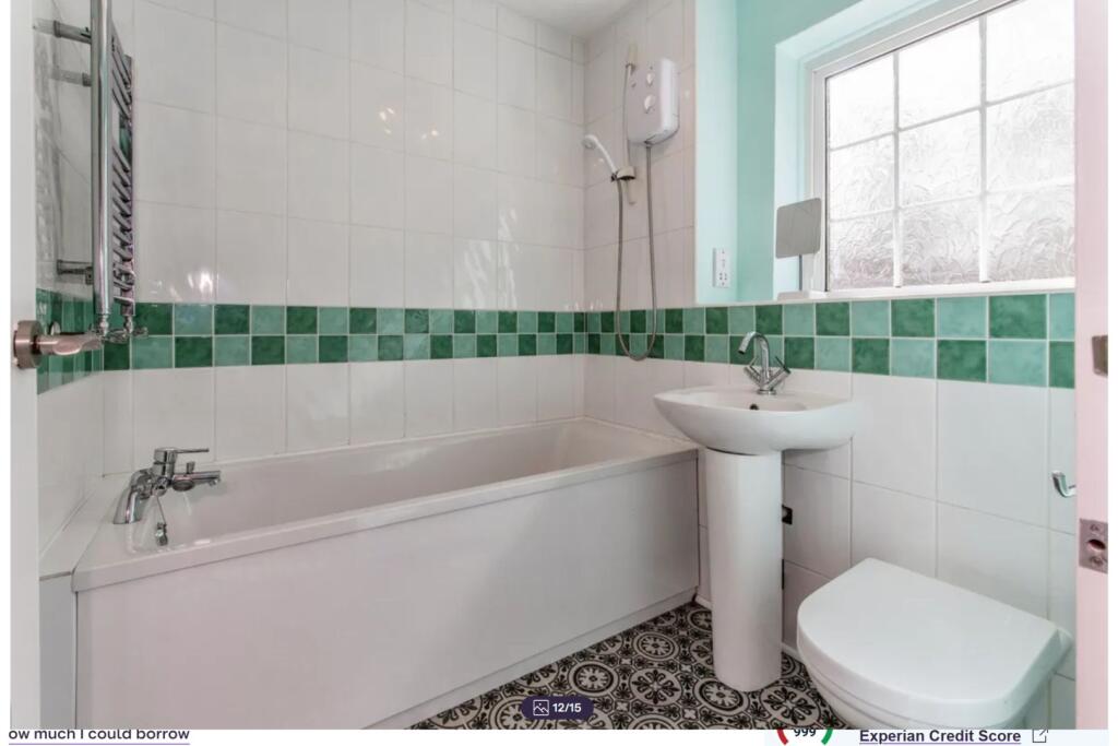
- Bathrooms: 2
- Property Type: undefined
- Property SubType: undefined
Image Descriptions
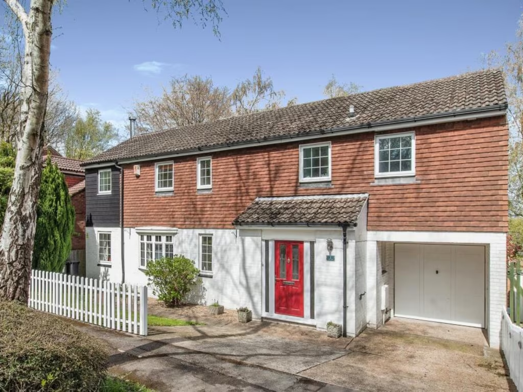
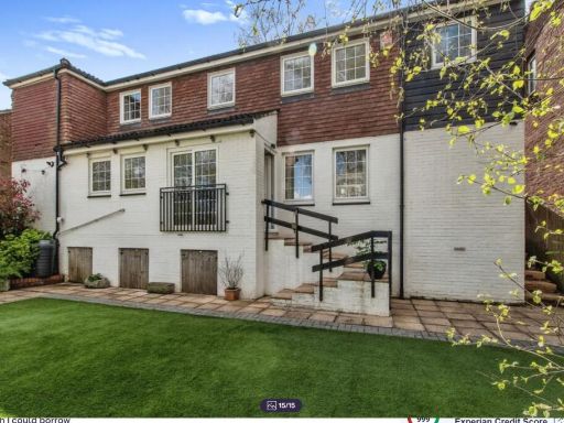
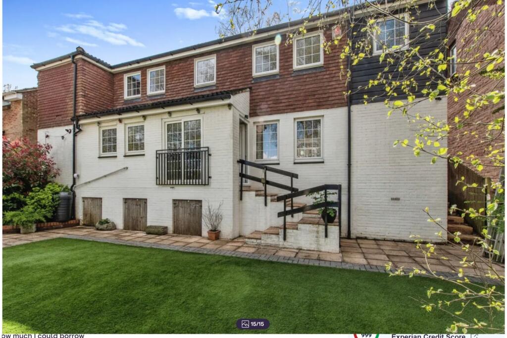
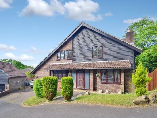
- semi-detached house mid-century suburban
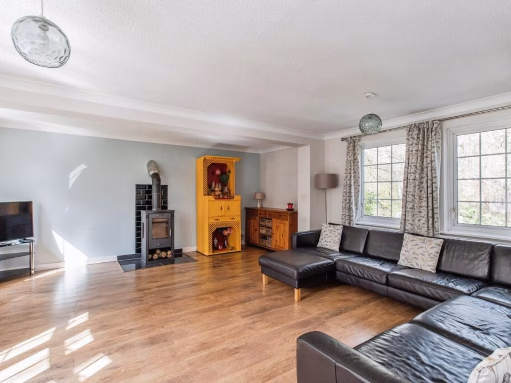
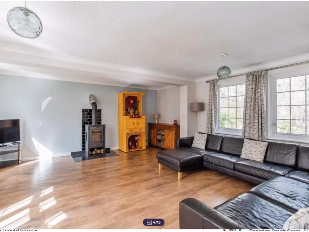
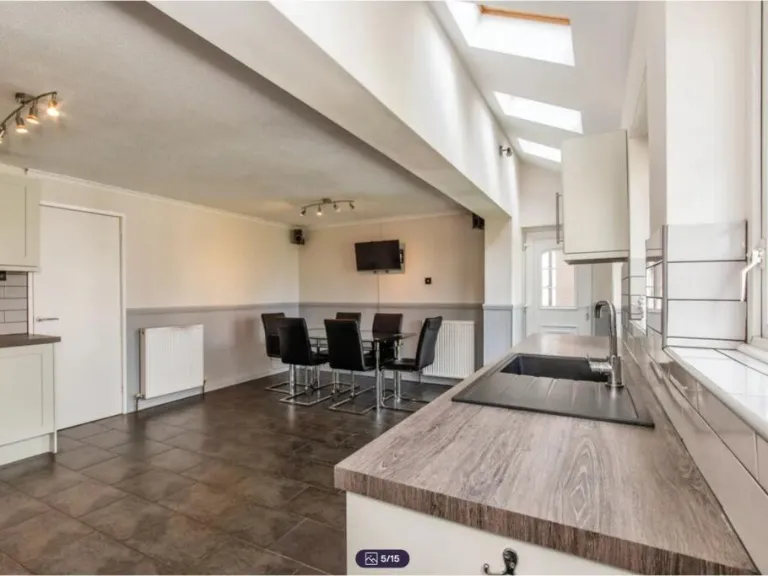
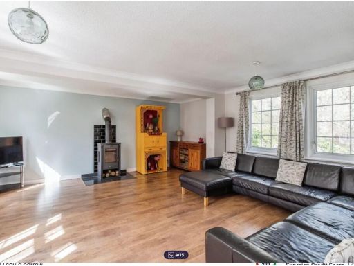
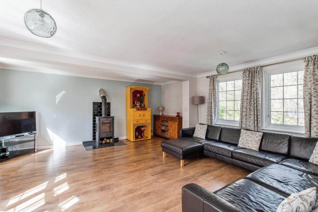
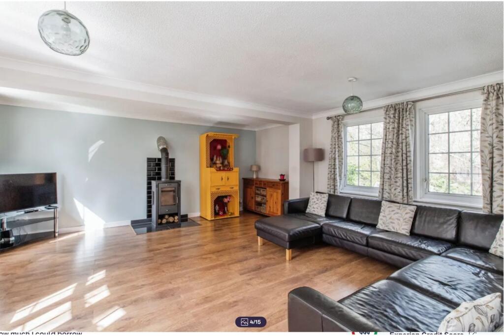
- living room modern
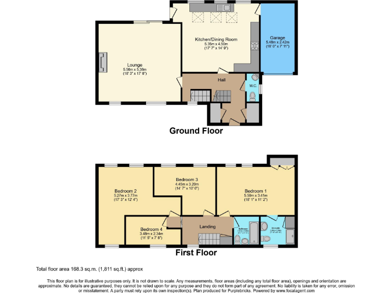
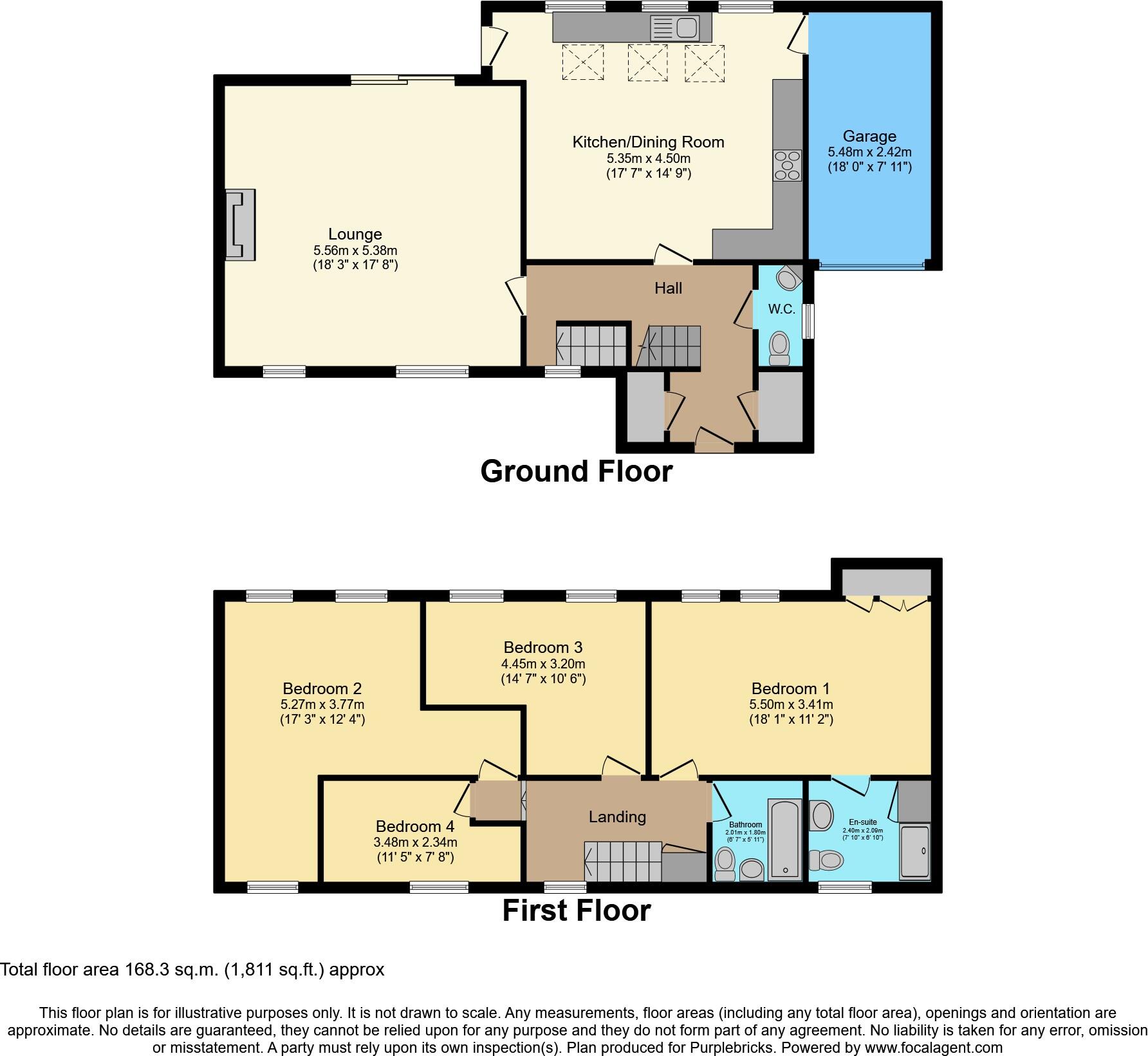
Floorplan Description
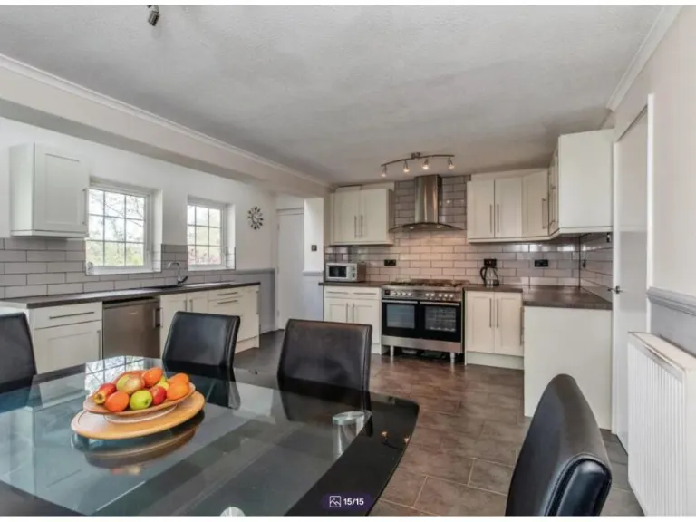
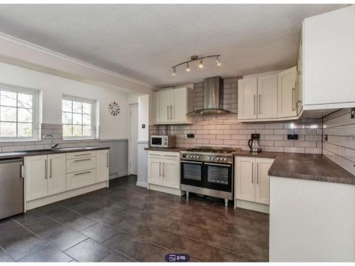
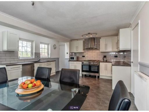
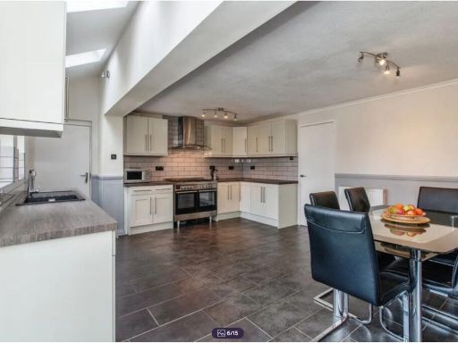
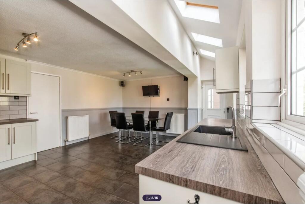
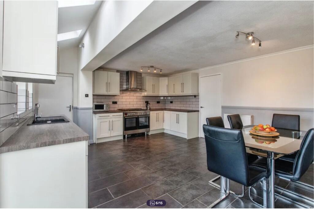
- Two-storey house with lounge, kitchen/dining room, four bedrooms and garage
Rooms
- Lounge:
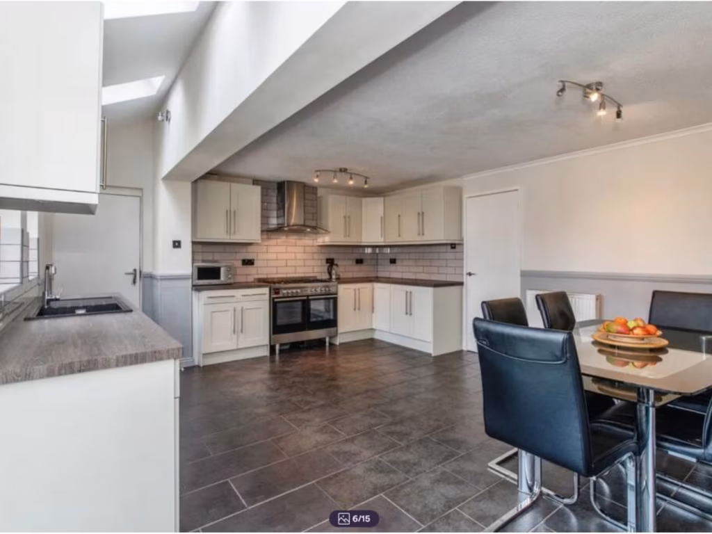
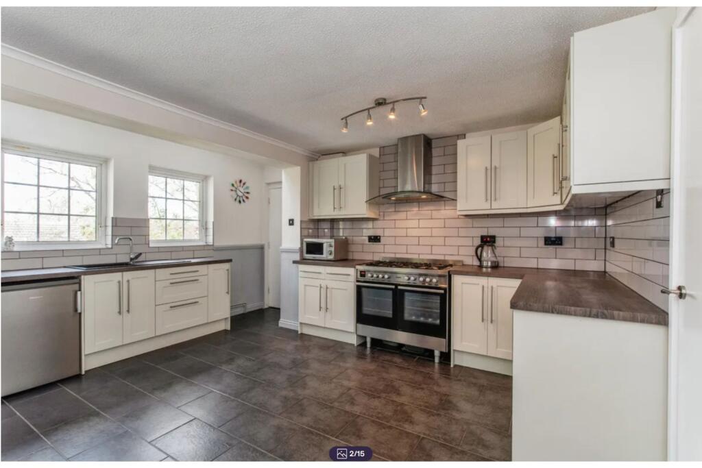
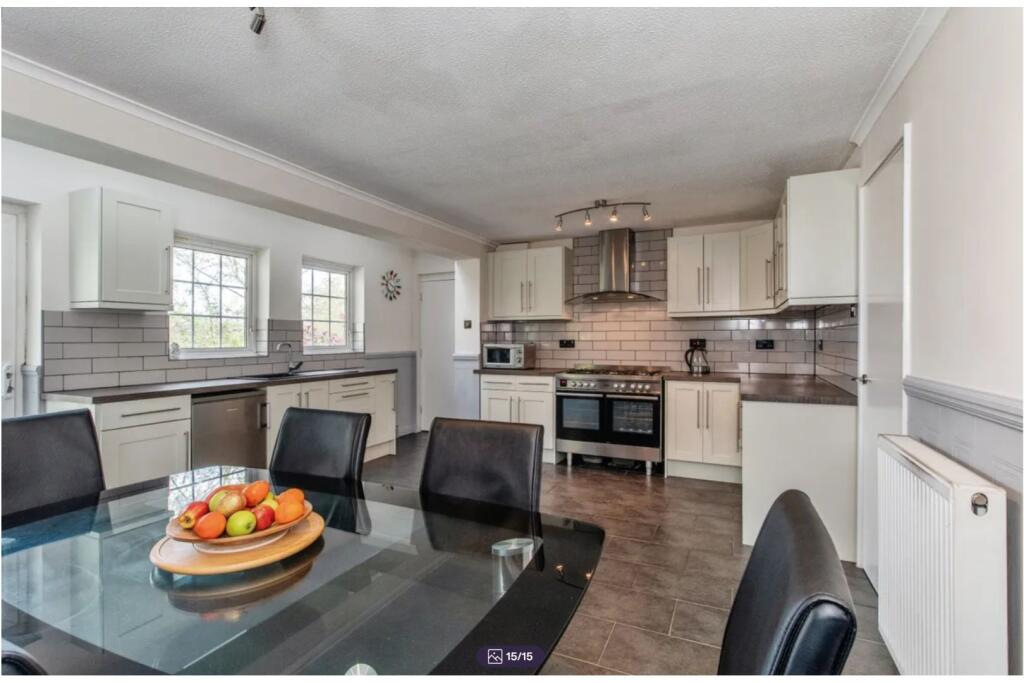
- Kitchen/Dining Room:
- Garage:
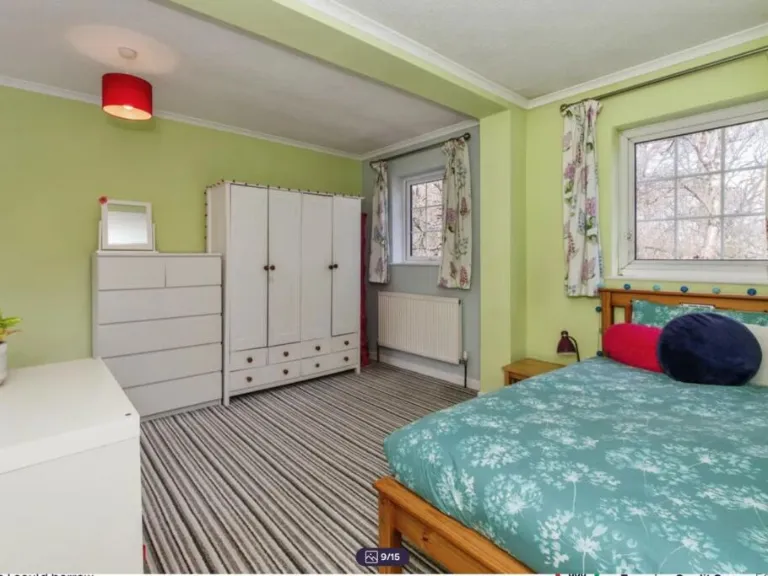
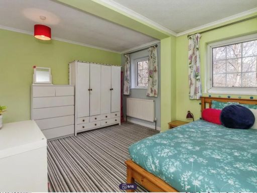
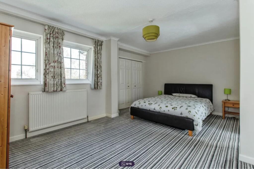
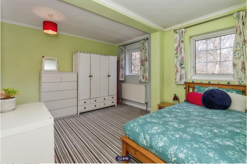
- Bedroom 2:
- Bedroom 3:
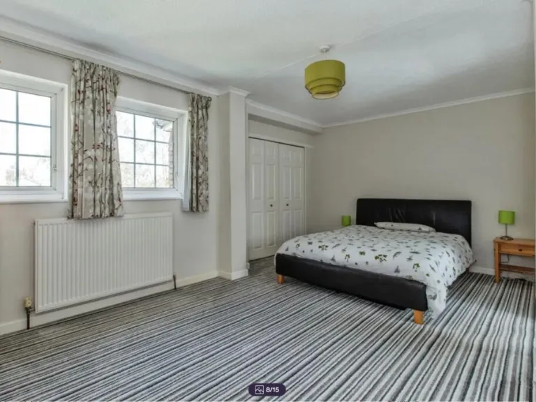
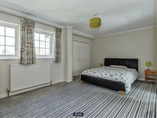
- Bedroom 1:
- Bedroom 4:
Textual Property Features
Detected Visual Features
- semi-detached
- suburban
- mid-century
- tiled roof
- white fence
- garage
- driveway
- dual-tone facade
- modern living room
- laminate flooring
- wood-burning stove
- large window
- natural light
Nearby Schools
- Tunbury Primary School
- Walderslade Primary School
- St Thomas More Roman Catholic Primary School
- The Thomas Aveling School
- Balfour Infant School
- Delce Academy
- The Rochester Grammar School
- Burham Church of England Primary School
- St Benedict's Catholic Primary School
- Oaklands School
- Maundene School
- Wayfield Primary School
- New Horizons Children's Academy
- Swingate Primary School
- Lordswood School
- Horsted Junior School
- Warren Wood Primary Academy
- The Victory Academy
- Crest Infant School
- Horsted Infant School
- Kingfisher Community Primary School
- Holcombe Grammar School
- Balfour Junior School
- Sir Joseph Williamson's Mathematical School
Nearest Bars And Restaurants
- Id: 7098684703
- Tags:
- Amenity: cafe
- Name: 363 Coffee Shop
- TagsNormalized:
- Lat: 51.3405186
- Lon: 0.5262642
- FullGeoHash: u10k5fr0ny74
- PartitionGeoHash: u10k
- Images:
- FoodStandards: null
- Distance: 946.7
,- Id: 8393925153
- Tags:
- Addr:
- City: Chatham
- Housename: 1 Walderslade Centre
- Postcode: ME5 9UD
- Street: Walderslade Road
- Amenity: restaurant
- Cuisine: indian
- Name: Taj Cuisine
- Opening_hours: Mo-Su 12:00-14:00, 17:00-22:00
- Opening_hours:covid19: Mo-Su 17:00-22:00
- Phone: +441634686648
- Website: https://tajcuisine-chatham.co.uk/
- TagsNormalized:
- Lat: 51.3393914
- Lon: 0.526226
- FullGeoHash: u10k5fp1tunw
- PartitionGeoHash: u10k
- Images:
- FoodStandards: null
- Distance: 895.4
,- Id: 8393925149
- Tags:
- Addr:
- Housename: Unit 1a Sherwood House
- Street: Walderslade Road
- Amenity: fast_food
- Cuisine: kebab
- Name: O K Kebabs
- Opening_hours: Mo-Sa 14:00-23:00; Su 16:00-23:00
- Phone: +441634868360
- TagsNormalized:
- Lat: 51.3393764
- Lon: 0.5261417
- FullGeoHash: u10k5fp1ecrt
- PartitionGeoHash: u10k
- Images:
- FoodStandards: null
- Distance: 889.4
,- Id: 8393925147
- Tags:
- Addr:
- City: Chatham
- Housename: Unit 4 Sherwood house
- Postcode: ME5 9UD
- Street: Walderslade Road
- Amenity: fast_food
- Cuisine: chinese
- Name: Chan's
- Opening_hours: Su-Th 17:00-22:30; Fr-Sa 17:00-23:00
- Phone: +441634868138
- Website: https://chans-takeaway.business.site/
- TagsNormalized:
- Lat: 51.3393246
- Lon: 0.5259428
- FullGeoHash: u10k5fncprg2
- PartitionGeoHash: u10k
- Images:
- FoodStandards: null
- Distance: 874.4
,- Id: 8393925146
- Tags:
- Addr:
- City: Chatham
- Housename: Unit 5 Sherwood House
- Postcode: ME5 9UD
- Street: Walderslade Road
- Amenity: fast_food
- Cuisine: fish_and_chips
- Drive_through: no
- Name: Moby Dick's
- Opening_hours: Mo-Th 12:00-20:30; Fr-Sa 12:00-21:00
- Phone: +441634869100
- TagsNormalized:
- Lat: 51.339302
- Lon: 0.525872
- FullGeoHash: u10k5fncjew9
- PartitionGeoHash: u10k
- Images:
- FoodStandards: null
- Distance: 869
}
Nearest General Shops
- Id: 8393925150
- Tags:
- Addr:
- City: Chatham
- Housename: Unit 2 Sherwood House
- Postcode: ME5 9UD
- Street: Walderslade Road
- Name: The Salon
- Opening_hours: Tu-We 09:00-17:30; Th 09:00-19:00; Fr 09:00-17:30; Sa 08:00-16:30
- Opening_hours:covid19: closed
- Phone: +441634672331
- Shop: hairdresser
- TagsNormalized:
- Lat: 51.3393613
- Lon: 0.5260784
- FullGeoHash: u10k5fp16w87
- PartitionGeoHash: u10k
- Images:
- FoodStandards: null
- Distance: 884.7
,- Id: 8393925148
- Tags:
- Addr:
- City: Chatham
- Housename: Unit 3 Sherwood House
- Postcode: ME5 9UD
- Street: Walderslade Road
- Name: Prestige Dry Cleaners
- Opening_hours: Mo-Sa 09:00-17:30
- Phone: +441634672112
- Shop: dry_cleaning
- Website: http://www.prestigedry-cleaners.co.uk/
- TagsNormalized:
- Lat: 51.3393406
- Lon: 0.5260076
- FullGeoHash: u10k5fp12fex
- PartitionGeoHash: u10k
- Images:
- FoodStandards: null
- Distance: 879.3
,- Id: 8393925151
- Tags:
- Addr:
- City: Chatham
- Housename: Unit 6 Sherwood House
- Postcode: ME5 9UD
- Street: Walderslade Road
- Beauty: nails
- Name: Nail Sense
- Opening_hours: Mo-Sa 09:45-18:30
- Opening_hours:covid19: closed
- Phone: +441634682846
- Shop: beauty
- Website: http://www.nailsense.co.uk/
- TagsNormalized:
- Lat: 51.3392832
- Lon: 0.5257922
- FullGeoHash: u10k5fnc5b51
- PartitionGeoHash: u10k
- Images:
- FoodStandards: null
- Distance: 863
}
Nearest Grocery shops
- Id: 759893864
- Tags:
- Addr:
- City: Chatham
- Place: Walderslade
- Postcode: ME5 9LL
- Street: Walderslade Road
- Brand: Premier
- Brand:wikidata: Q7240340
- Brand:wikipedia: en:Premier Stores
- Building: retail
- Name: Premier
- Shop: convenience
- Source:
- Addr: FHRS Open Data;interpolation
- TagsNormalized:
- premier
- retail
- convenience
- shop
- Lat: 51.3404043
- Lon: 0.5264806
- FullGeoHash: u10k5fprech2
- PartitionGeoHash: u10k
- Images:
- FoodStandards: null
- Distance: 954.6
,- Id: 656388834
- Tags:
- Brand: Spar
- Brand:wikidata: Q610492
- Brand:wikipedia: en:Spar (retailer)
- Name: Spar
- Shop: convenience
- TagsNormalized:
- Lat: 51.3389197
- Lon: 0.5270127
- FullGeoHash: u10k5czybk30
- PartitionGeoHash: u10k
- Images:
- FoodStandards: null
- Distance: 932.2
,- Id: 4958865410
- Tags:
- Addr:
- City: Chatham
- Housenumber: 1
- Postcode: ME5 9EL
- Street: Victoria Road
- Fhrs:
- Authority: Medway
- Id: 705284
- Inspectiondate: 2014-09-08
- Rating: 5
- Level: 0
- Name: Manak General Store & Off Licence
- Shop: convenience
- TagsNormalized:
- Lat: 51.3393524
- Lon: 0.5199433
- FullGeoHash: u10k5f497scy
- PartitionGeoHash: u10k
- Images:
- FoodStandards:
- Id: 705284
- FHRSID: 705284
- LocalAuthorityBusinessID: PI/000180664
- BusinessName: Manak General Store
- BusinessType: Retailers - other
- BusinessTypeID: 4613
- AddressLine1: 1 Victoria Road
- AddressLine2: Walderslade
- AddressLine3: Chatham
- AddressLine4: Kent
- PostCode: ME5 9EL
- RatingValue: 5
- RatingKey: fhrs_5_en-GB
- RatingDate: 2014-09-08
- LocalAuthorityCode: 896
- LocalAuthorityName: Medway
- LocalAuthorityWebSite: http://www.medway.gov.uk/
- LocalAuthorityEmailAddress: foodandsafety@medway.gov.uk
- Scores:
- Hygiene: 0
- Structural: 0
- ConfidenceInManagement: 5
- NewRatingPending: false
- Geocode:
- Longitude: 0.51982802152634
- Latitude: 51.33925247192380
- Distance: 502
}
Nearest Religious buildings
- Id: 769849054
- Tags:
- Amenity: place_of_worship
- Name: Chapel of Meditation
- Node_id: 769849054
- Source: OS OpenData StreetView
- Source:name: OS Open Local Important Buildings Layer
- TagsNormalized:
- Lat: 51.3314334
- Lon: 0.5106335
- FullGeoHash: u10k58eg68ez
- PartitionGeoHash: u10k
- Images:
- FoodStandards: null
- Distance: 635.3
,- Id: 274731505
- Tags:
- Amenity: place_of_worship
- Building: church
- Denomination: baptist
- Name: Walderslade Baptist Church
- Religion: christian
- Source: OS_Open_StreetView
- TagsNormalized:
- place of worship
- church
- baptist
- christian
- Lat: 51.3331516
- Lon: 0.5207877
- FullGeoHash: u10k5bgjr1p2
- PartitionGeoHash: u10k
- Images:
- FoodStandards: null
- Distance: 613.9
,- Id: 878915574
- Tags:
- Amenity: place_of_worship
- Building: church
- Denomination: anglican
- Name: St Alban's Church
- Religion: christian
- Source: OS OpenData StreetView
- Wikidata: Q105089688
- TagsNormalized:
- place of worship
- church
- anglican
- christian
- Lat: 51.334176
- Lon: 0.508532
- FullGeoHash: u10k59471xuz
- PartitionGeoHash: u10k
- Images:
- FoodStandards: null
- Distance: 477.6
}
Nearest Medical buildings
- Id: 230272445
- Tags:
- Addr:
- City: Chatham
- Country: GB
- Postcode: ME5 9PG
- Street: Impton Lane
- Suburb: Walderslade
- Amenity: hospital
- Building: hospital
- Contact:
- Phone: +44 1634 934245
- Website: https://www.spirehealthcare.com/spire-alexandra-hospital/
- Emergency: no
- Name: Spire Alexandra Hospital
- Operator: Spire Healthcare Group PLC
- TagsNormalized:
- Lat: 51.3280016
- Lon: 0.5264948
- FullGeoHash: u107gzzrk0yz
- PartitionGeoHash: u107
- Images:
- FoodStandards: null
- Distance: 1299.4
,- Id: 4958865412
- Tags:
- Amenity: pharmacy
- Dispensing: yes
- Level: 0
- Name: Merlin Pharmacy
- TagsNormalized:
- Lat: 51.3468478
- Lon: 0.5209232
- FullGeoHash: u10k5g7m46hm
- PartitionGeoHash: u10k
- Images:
- FoodStandards: null
- Distance: 1221.8
,- Id: 7508782885
- Tags:
- Amenity: pharmacy
- Brand: Asda
- Brand:wikidata: Q297410
- Brand:wikipedia: en:Asda
- Contact:
- Phone: +44 1634 666112
- Website: https://storelocator.asda.com/south-east/chatham/387-maidstone-road/pharmacy
- Fixme: Location not accurate
- Healthcare: pharmacy
- Name: Asda
- Opening_hours: Mo 07:00-24:00; Tu-Fr 00:00-24:00; Sa 00:00-22:00; Su 10:00-16:00
- Operator: Asda Stores Ltd
- TagsNormalized:
- pharmacy
- asda
- health
- healthcare
- Lat: 51.3450436
- Lon: 0.5093679
- FullGeoHash: u10k5e4ft1u5
- PartitionGeoHash: u10k
- Images:
- FoodStandards: null
- Distance: 980.1
,- Id: 7574678822
- Tags:
- Addr:
- City: Chatham
- Country: GB
- County: Kent
- Housename: Walderslade Centre
- Housenumber: 9-10
- Place: Walderslade
- Postcode: ME5 9LR
- Amenity: pharmacy
- Dispensing: yes
- Email: walderslade@paydens.com
- Name: Fenns Chemist
- Opening_hours: Mo-Fr 09:00-18:00; Sa 09:00-16:00
- Operator: Paydens Ltd
- Phone: +44 1634 863819
- Website: http://www.paydens.com/
- TagsNormalized:
- Lat: 51.339547
- Lon: 0.52676
- FullGeoHash: u10k5fpdd3hw
- PartitionGeoHash: u10k
- Images:
- FoodStandards: null
- Distance: 936.2
}
Nearest Airports
- Id: 103894219
- Tags:
- Aerodrome: international
- Aeroway: aerodrome
- Iata: SEN
- Icao: EGMC
- Name: London Southend Airport
- Old_name: Southend Municipal Airport
- Ref: SEN
- Wikidata: Q1415441
- TagsNormalized:
- airport
- international airport
- Lat: 51.5701749
- Lon: 0.6924624
- FullGeoHash: u10mru04p937
- PartitionGeoHash: u10m
- Images:
- FoodStandards: null
- Distance: 28751
,- Id: 121158889
- Tags:
- Aerodrome: continental
- Aeroway: aerodrome
- Fhrs:
- Authority: City of London Corporation
- Iata: LCY
- Icao: EGLC
- Name: London City Airport
- Operator: London City Airport Limited
- Ref: LCY
- Website: https://www.londoncityairport.com/
- Wikidata: Q8982
- Wikipedia: en:London City Airport
- TagsNormalized:
- airport
- continental airport
- Lat: 51.5042658
- Lon: 0.0539987
- FullGeoHash: u10j10p64702
- PartitionGeoHash: u10j
- Images:
- FoodStandards: null
- Distance: 36942.1
}
Nearest Leisure Facilities
- Id: 92229024
- Tags:
- Landuse: recreation_ground
- Leisure: park
- Name: Tunbury Park and Playground
- Source: Bing
- TagsNormalized:
- recreation ground
- leisure
- playground
- Lat: 51.3338284
- Lon: 0.5190233
- FullGeoHash: u10k5c1cnp5y
- PartitionGeoHash: u10k
- Images:
- FoodStandards: null
- Distance: 472.3
,- Id: 543996373
- Tags:
- Leisure: pitch
- Sport: soccer
- TagsNormalized:
- Lat: 51.3345164
- Lon: 0.5197299
- FullGeoHash: u10k5c4mnx6w
- PartitionGeoHash: u10k
- Images:
- FoodStandards: null
- Distance: 464.5
,- Id: 543996371
- Tags:
- Leisure: pitch
- Sport: soccer
- TagsNormalized:
- Lat: 51.333946
- Lon: 0.5189554
- FullGeoHash: u10k5c1cut15
- PartitionGeoHash: u10k
- Images:
- FoodStandards: null
- Distance: 459.9
,- Id: 824931750
- Tags:
- TagsNormalized:
- swimming
- swimming pool
- pool
- leisure
- Lat: 51.340309
- Lon: 0.5173109
- FullGeoHash: u10k5f0wypqb
- PartitionGeoHash: u10k
- Images:
- FoodStandards: null
- Distance: 457.5
,- Id: 1070722231
- Tags:
- Access: yes
- Leisure: playground
- TagsNormalized:
- Lat: 51.3338656
- Lon: 0.5182493
- FullGeoHash: u10k5c13kn4s
- PartitionGeoHash: u10k
- Images:
- FoodStandards: null
- Distance: 431.5
}
Nearest Tourist attractions
- Id: 1069257105
- Tags:
- TagsNormalized:
- Lat: 51.3419075
- Lon: 0.501821
- FullGeoHash: u10k56t2m30z
- PartitionGeoHash: u10k
- Images:
- FoodStandards: null
- Distance: 1026.7
,- Id: 1010945162
- Tags:
- Name: D3
- Tourism: camp_pitch
- TagsNormalized:
- Lat: 51.3406059
- Lon: 0.5012306
- FullGeoHash: u10k56kbxw8e
- PartitionGeoHash: u10k
- Images:
- FoodStandards: null
- Distance: 989.9
,- Id: 1010945156
- Tags:
- Ref: A2
- Tourism: camp_pitch
- TagsNormalized:
- Lat: 51.3412463
- Lon: 0.5034827
- FullGeoHash: u10k56qs7vzz
- PartitionGeoHash: u10k
- Images:
- FoodStandards: null
- Distance: 889.9
}
Nearest Train stations
- Id: 6688355482
- Tags:
- Name: Aylesford
- Naptan:
- Network: National Rail
- Public_transport: station
- Railway: station
- Ref:
- Source: NPE
- Train: yes
- Wikidata: Q2578339
- Wikipedia: en:Aylesford railway station
- TagsNormalized:
- Lat: 51.3015328
- Lon: 0.4657666
- FullGeoHash: u107fe5jj4ue
- PartitionGeoHash: u107
- Images:
- FoodStandards: null
- Distance: 5155.7
,- Id: 6688385685
- Tags:
- Name: Halling
- Naptan:
- Network: National Rail
- Public_transport: station
- Railway: station
- Ref:
- Wikidata: Q2122913
- Wikipedia: en:Halling railway station
- TagsNormalized:
- Lat: 51.3523741
- Lon: 0.4451218
- FullGeoHash: u10k4hkjk06g
- PartitionGeoHash: u10k
- Images:
- FoodStandards: null
- Distance: 5094.3
,- Id: 6688355483
- Tags:
- Name: New Hythe
- Naptan:
- Network: National Rail
- Postal_code: ME20 6XJ
- Public_transport: station
- Railway: station
- Ref:
- Wikidata: Q2244436
- Wikipedia: en:New Hythe railway station
- TagsNormalized:
- Lat: 51.3128389
- Lon: 0.4551387
- FullGeoHash: u107fm5qvw2n
- PartitionGeoHash: u107
- Images:
- FoodStandards: null
- Distance: 4880.6
,- Id: 6689800305
- Tags:
- Name: Chatham
- Naptan:
- Network: National Rail
- Public_transport: station
- Railway: station
- Ref:
- Source: NPE
- Wheelchair: yes
- Wikidata: Q2636404
- Wikipedia: en:Chatham railway station (Kent)
- TagsNormalized:
- Lat: 51.3803092
- Lon: 0.5212081
- FullGeoHash: u10k7c7xcpbf
- PartitionGeoHash: u10k
- Images:
- FoodStandards: null
- Distance: 4871.1
,- Id: 6688355484
- Tags:
- Name: Snodland
- Naptan:
- Network: National Rail
- Public_transport: station
- Railway: station
- Ref:
- Train: yes
- Wikipedia: en:Snodland railway station
- TagsNormalized:
- Lat: 51.3302228
- Lon: 0.4484399
- FullGeoHash: u10k40qs1rj1
- PartitionGeoHash: u10k
- Images:
- FoodStandards: null
- Distance: 4615.9
}
Nearest Hotels
- Id: 152836964
- Tags:
- Addr:
- Brand: Premier Inn
- Brand:wikidata: Q2108626
- Brand:wikipedia: en:Premier Inn
- Building: yes
- Internet_access: wlan
- Internet_access:fee: customers
- Internet_access:operator: Virgin Media
- Internet_access:ssid: Premier Inn Free Wi-Fi
- Name: Premier Inn
- Tourism: hotel
- TagsNormalized:
- Lat: 51.2962333
- Lon: 0.5076943
- FullGeoHash: u107gd1wnnuq
- PartitionGeoHash: u107
- Images:
- FoodStandards: null
- Distance: 4524.8
,- Id: 92130240
- Tags:
- Addr:
- Country: GB
- Postcode: ME5 9SF
- Street: Maidstone Road
- Brand: Holiday Inn
- Brand:wikidata: Q2717882
- Brand:wikipedia: en:Holiday Inn
- Building: hotel
- Email: reservations@hirochesterhotel.co.uk
- Fhrs:
- Authority: Medway
- Id: 605606
- Name: Holiday Inn (Traders Bar And Grill)
- Name: Holiday Inn Rochester
- Payment:
- American_express: yes
- Diners_club: yes
- Discover_card: yes
- Mastercard: yes
- Visa: yes
- Visa_debit: yes
- Phone: +44 871 9429069
- Source: Bing
- Tourism: hotel
- Website: https://www.ihg.com/holidayinn/hotels/gb/en/rochester/rcske/hoteldetail
- TagsNormalized:
- Lat: 51.3490515
- Lon: 0.5071607
- FullGeoHash: u10k5ec3csyr
- PartitionGeoHash: u10k
- Images:
- FoodStandards: null
- Distance: 1451.4
,- Id: 958603735
- Tags:
- Addr:
- City: Chatham
- Country: GB
- Postcode: ME5 9AX
- Street: Walderslade Woods
- Building: hotel
- Name: Bridgewood Manor Hotel
- Tourism: hotel
- TagsNormalized:
- Lat: 51.3430493
- Lon: 0.508584
- FullGeoHash: u10k5ddqfy5d
- PartitionGeoHash: u10k
- Images:
- FoodStandards: null
- Distance: 799
}
Tags
- semi-detached
- suburban
- mid-century
- tiled roof
- white fence
- garage
- driveway
- dual-tone facade
- modern living room
- laminate flooring
- wood-burning stove
- large window
- natural light
Local Market Stats
- Average Price/sqft: £346
- Avg Income: £48300
- Rental Yield: 4.7%
- Social Housing: 10%
- Planning Success Rate: 70%
Similar Properties
 5 bedroom detached house for sale in Feldspar Close, Chatham, ME5 — £550,000 • 5 bed • 2 bath • 1803 ft²
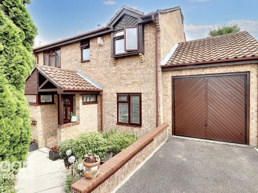 4 bedroom detached house for sale in Bracken Hill, Chatham, ME5 — £525,000 • 4 bed • 3 bath
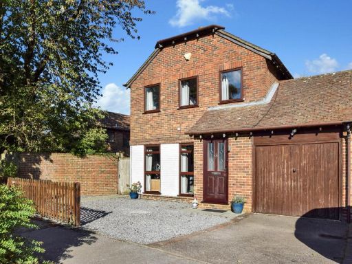 3 bedroom link detached house for sale in Forestdale Road, Walderslade Woods, Chatham, ME5 — £400,000 • 3 bed • 1 bath • 932 ft²
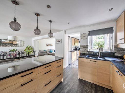 4 bedroom detached house for sale in Hurst Hill, Chatham, Kent, ME5 — £500,000 • 4 bed • 2 bath • 1278 ft²
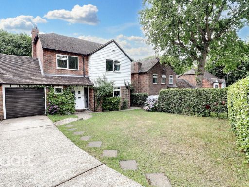 4 bedroom detached house for sale in Sadlers Close, Chatham, ME5 — £550,000 • 4 bed • 1 bath • 1163 ft²
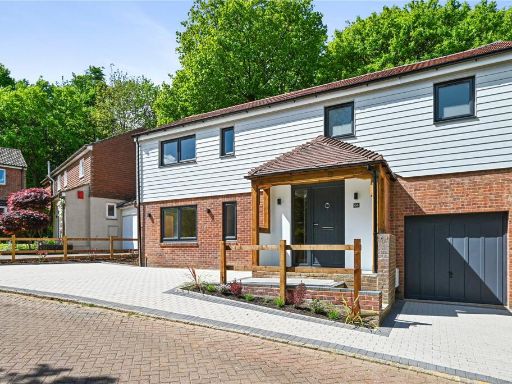 4 bedroom detached house for sale in Hurst Hill, Walderslade Woods, Kent, ME5 — £600,000 • 4 bed • 2 bath • 1534 ft²
Meta
- {
"@context": "https://schema.org",
"@type": "Residence",
"name": "4 bedroom detached house for sale in Hurst Hill, Walderslad…",
"description": "",
"url": "https://propertypiper.co.uk/property/2118997d-8e5c-4885-b885-dcdcab6fd3d1",
"image": "https://image-a.propertypiper.co.uk/42fa9055-c4b6-4a51-b8f6-3da68026ecc9-1024.jpeg",
"address": {
"@type": "PostalAddress",
"streetAddress": "3 HURST HILL CHATHAM ",
"postalCode": "ME5 9BX",
"addressLocality": "Tonbridge and Malling",
"addressRegion": "Chatham and Aylesford",
"addressCountry": "England"
},
"geo": {
"@type": "GeoCoordinates",
"latitude": 51.336730552590446,
"longitude": 0.5140595771454797
},
"numberOfRooms": 4,
"numberOfBathroomsTotal": 2,
"floorSize": {
"@type": "QuantitativeValue",
"value": 1811,
"unitCode": "FTK"
},
"offers": {
"@type": "Offer",
"price": 530000,
"priceCurrency": "GBP",
"availability": "https://schema.org/InStock"
},
"additionalProperty": [
{
"@type": "PropertyValue",
"name": "Feature",
"value": "semi-detached"
},
{
"@type": "PropertyValue",
"name": "Feature",
"value": "suburban"
},
{
"@type": "PropertyValue",
"name": "Feature",
"value": "mid-century"
},
{
"@type": "PropertyValue",
"name": "Feature",
"value": "tiled roof"
},
{
"@type": "PropertyValue",
"name": "Feature",
"value": "white fence"
},
{
"@type": "PropertyValue",
"name": "Feature",
"value": "garage"
},
{
"@type": "PropertyValue",
"name": "Feature",
"value": "driveway"
},
{
"@type": "PropertyValue",
"name": "Feature",
"value": "dual-tone facade"
},
{
"@type": "PropertyValue",
"name": "Feature",
"value": "modern living room"
},
{
"@type": "PropertyValue",
"name": "Feature",
"value": "laminate flooring"
},
{
"@type": "PropertyValue",
"name": "Feature",
"value": "wood-burning stove"
},
{
"@type": "PropertyValue",
"name": "Feature",
"value": "large window"
},
{
"@type": "PropertyValue",
"name": "Feature",
"value": "natural light"
}
]
}
High Res Floorplan Images
Compatible Floorplan Images
FloorplanImages Thumbnail