BB2 5AS - 4 bedroom detached house for sale in Thistle Trail, Blackbu…
View on Property Piper
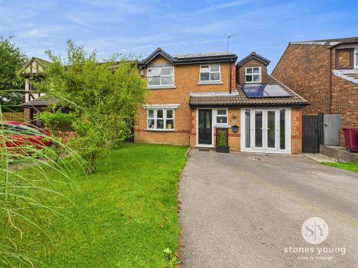
4 bedroom detached house for sale in Thistle Trail, Blackburn, Lancashire, BB2
Property Details
- Price: £255000
- Bedrooms: 4
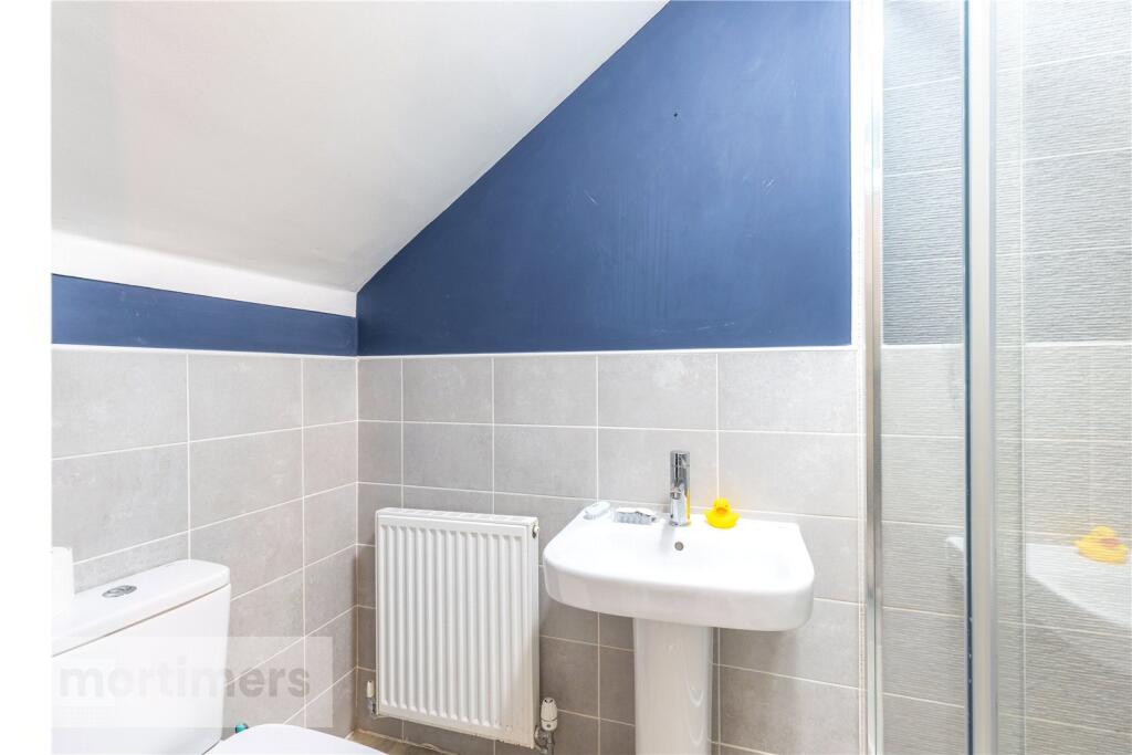
- Bathrooms: 1
- Property Type: undefined
- Property SubType: undefined
Image Descriptions
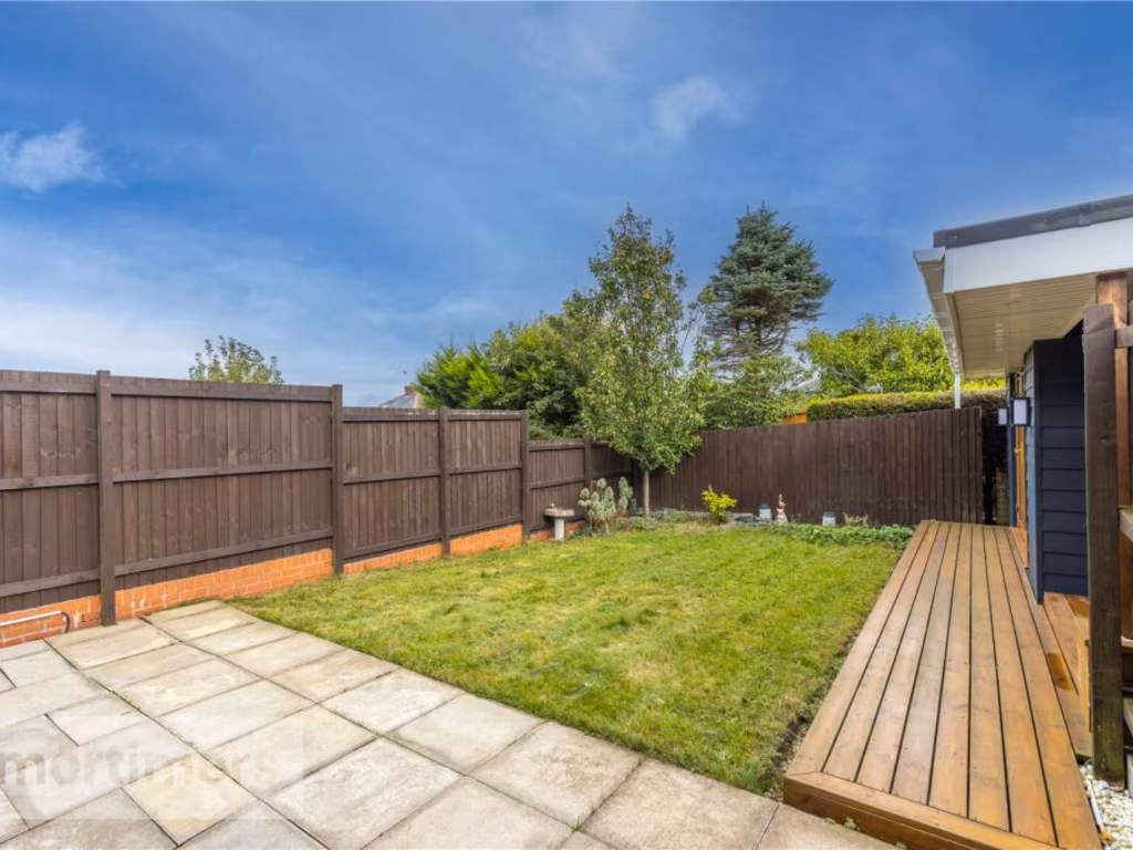
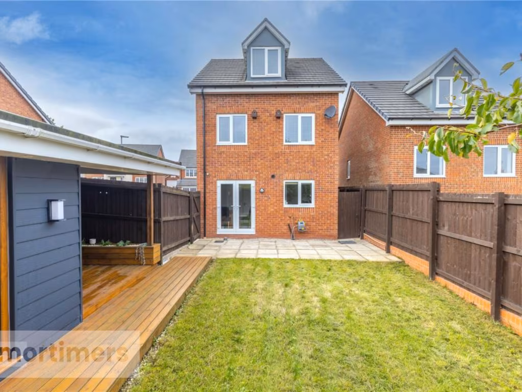
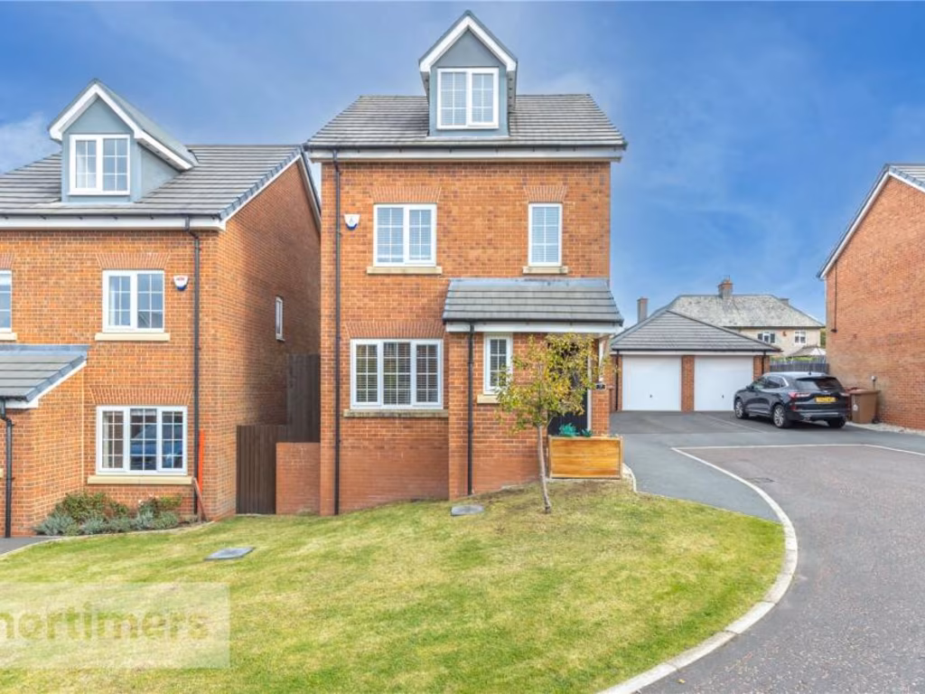
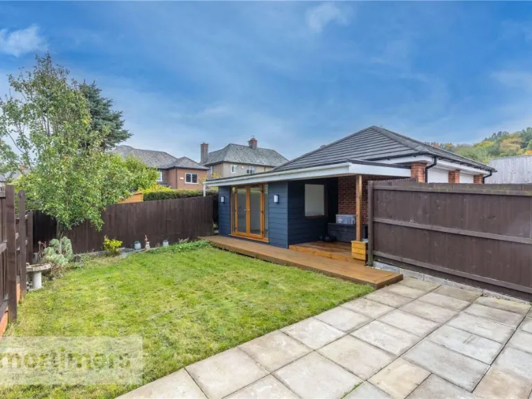
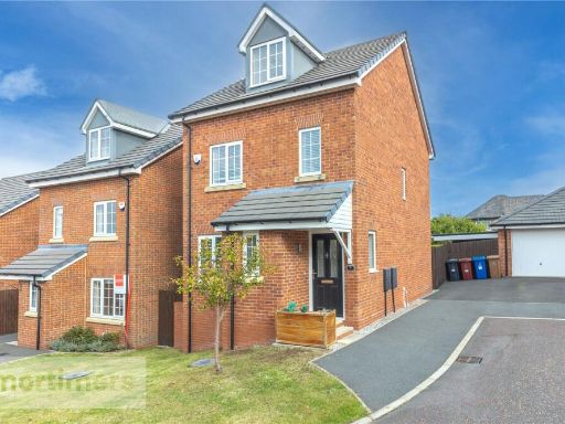
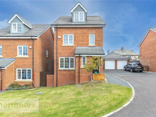
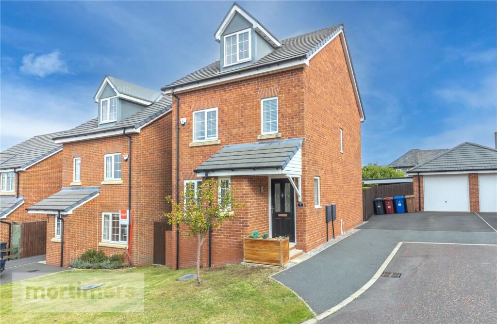
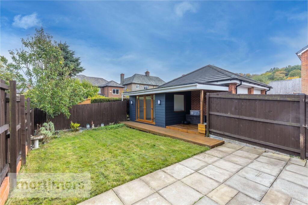
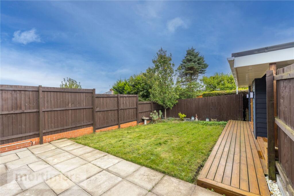
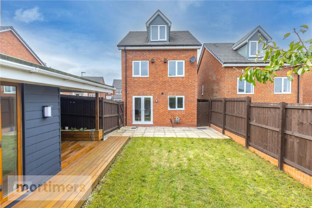
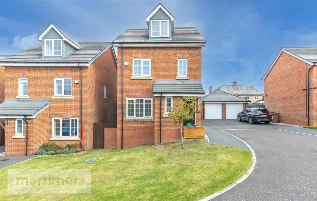
- a modern brick house modern
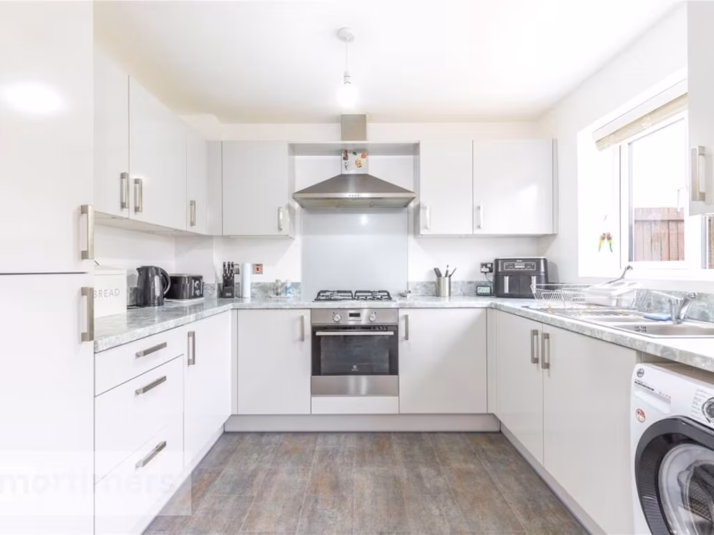
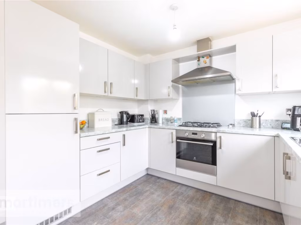
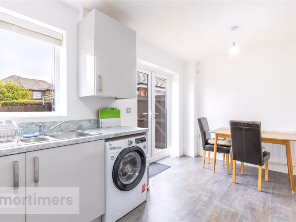
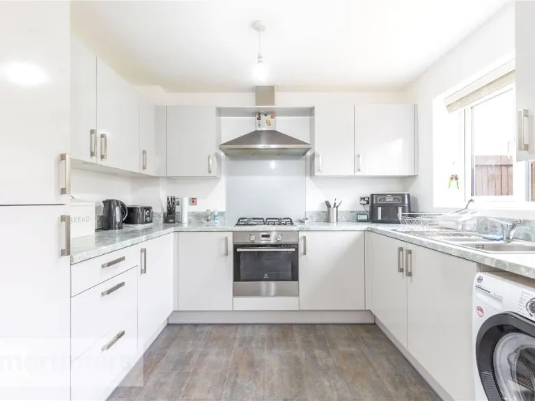
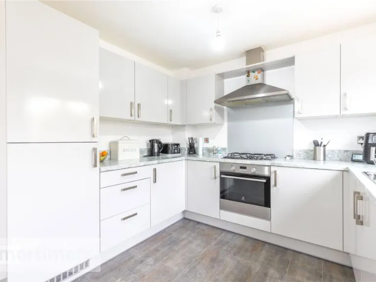
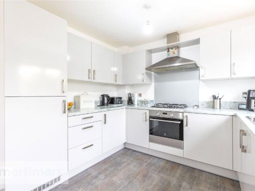
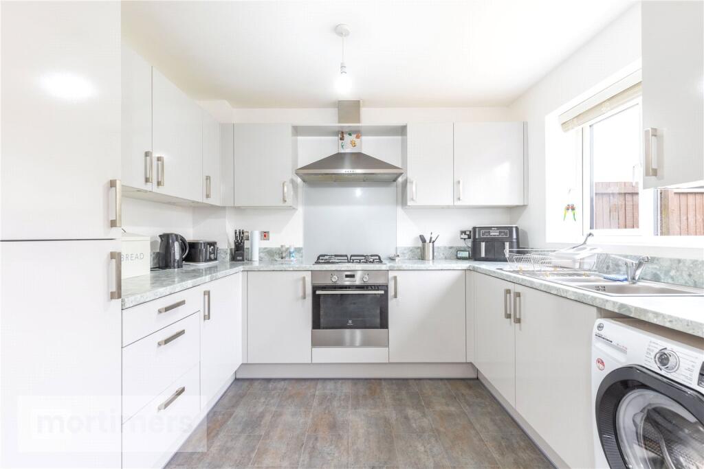
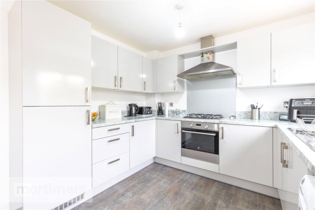
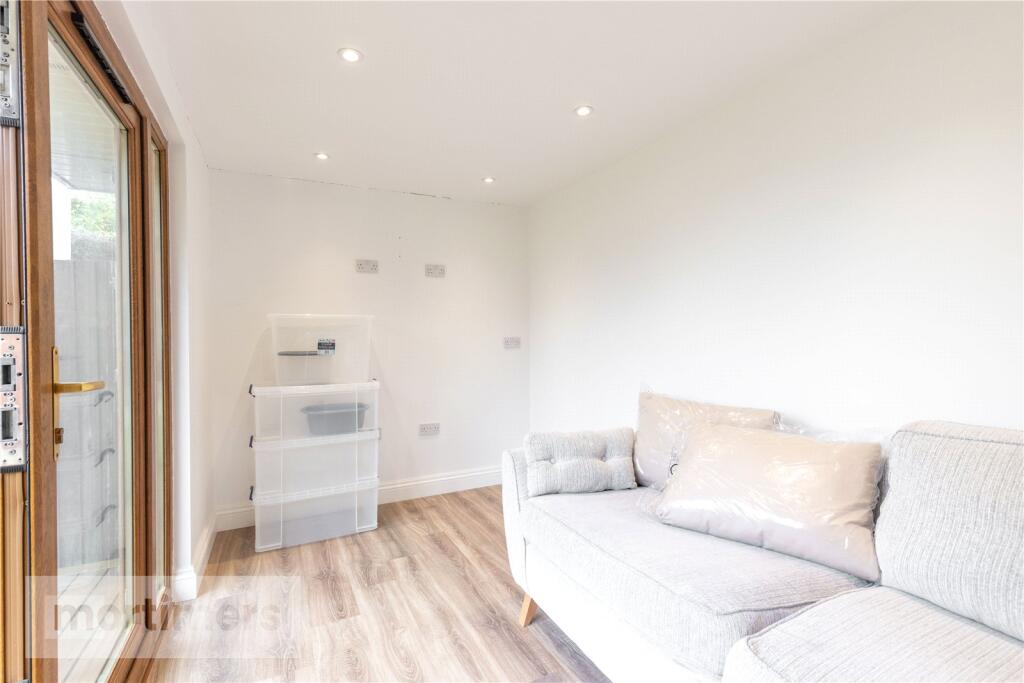
- kitchen modern
Floorplan Description
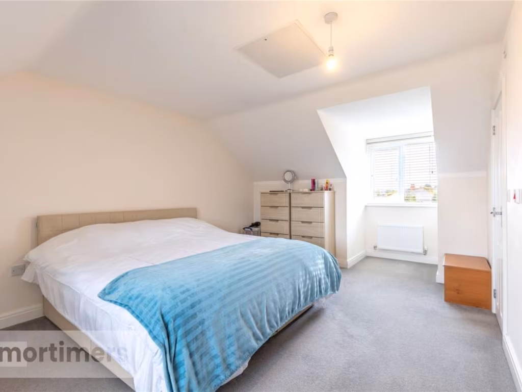
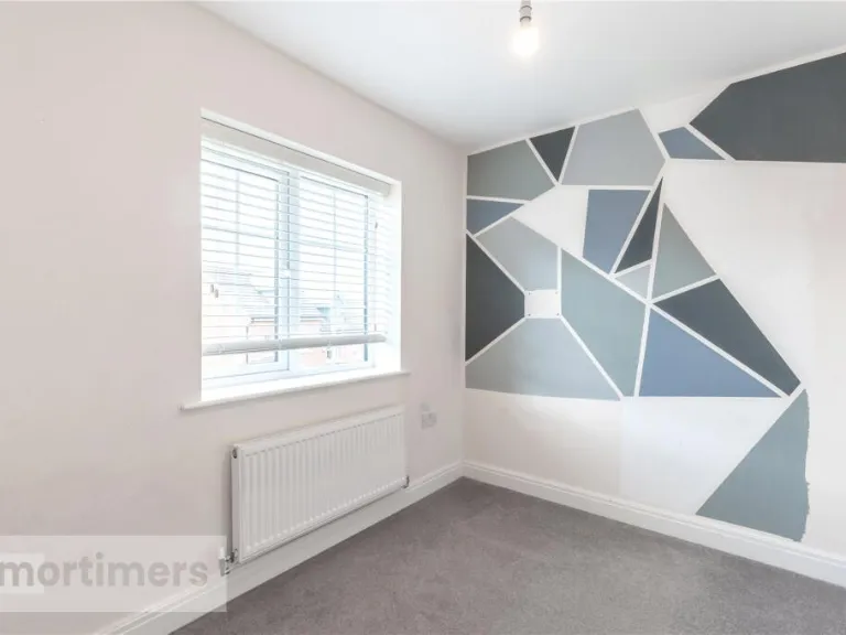
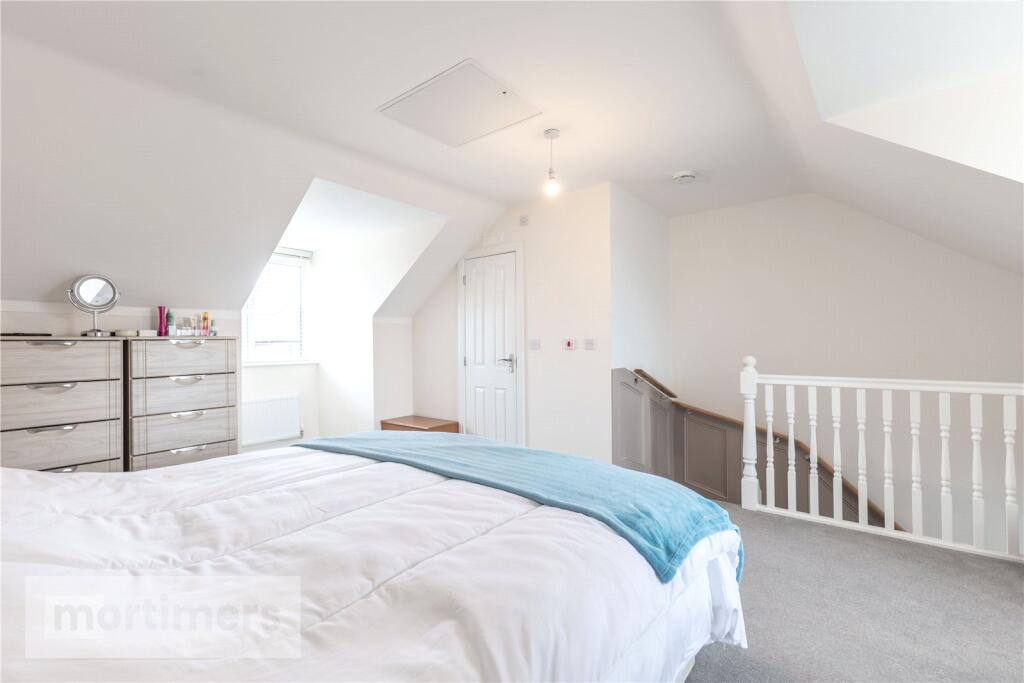
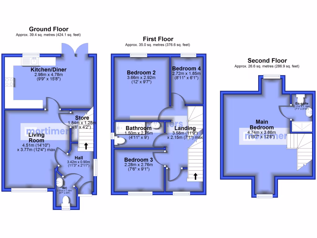
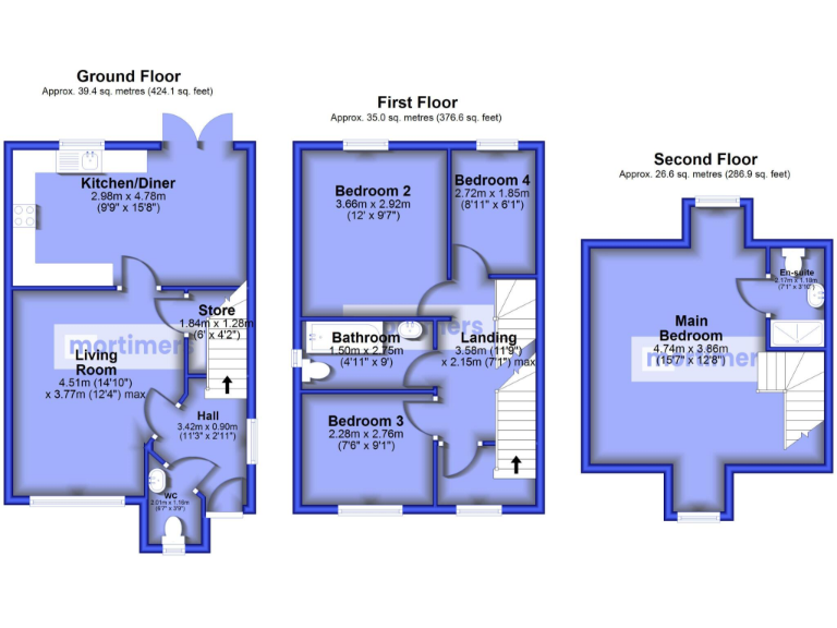
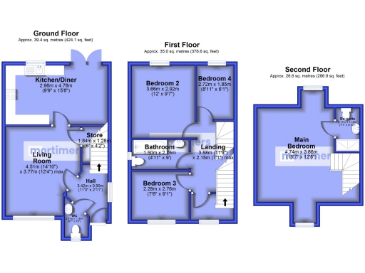
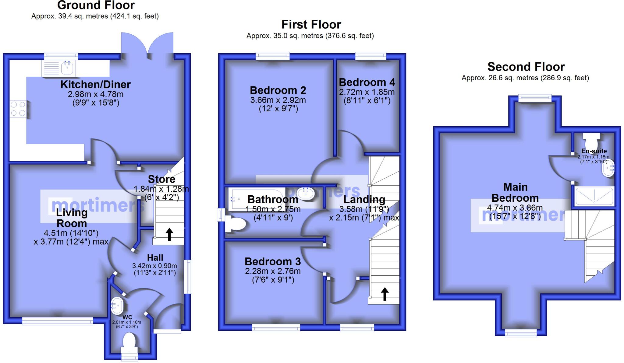
- Three-storey property with Main Bedroom and three additional bedrooms.
Rooms
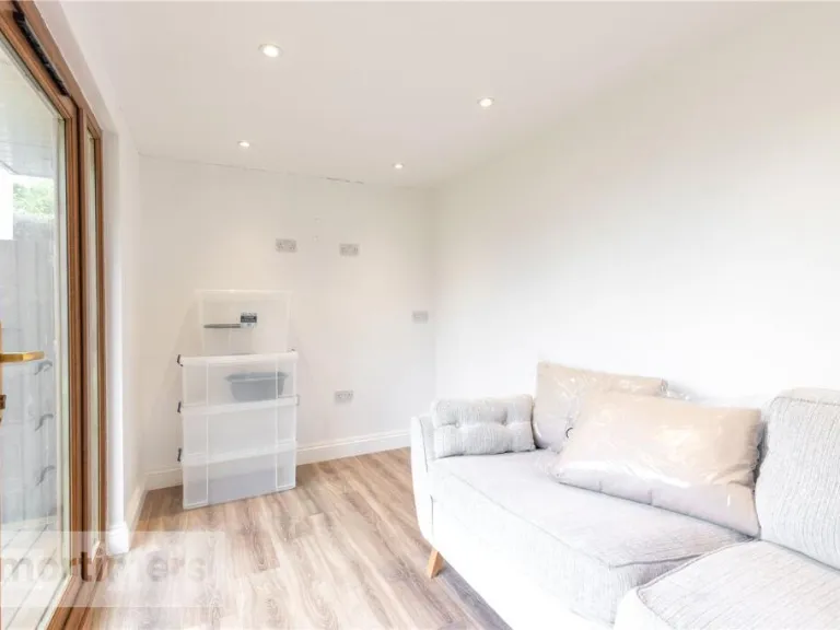
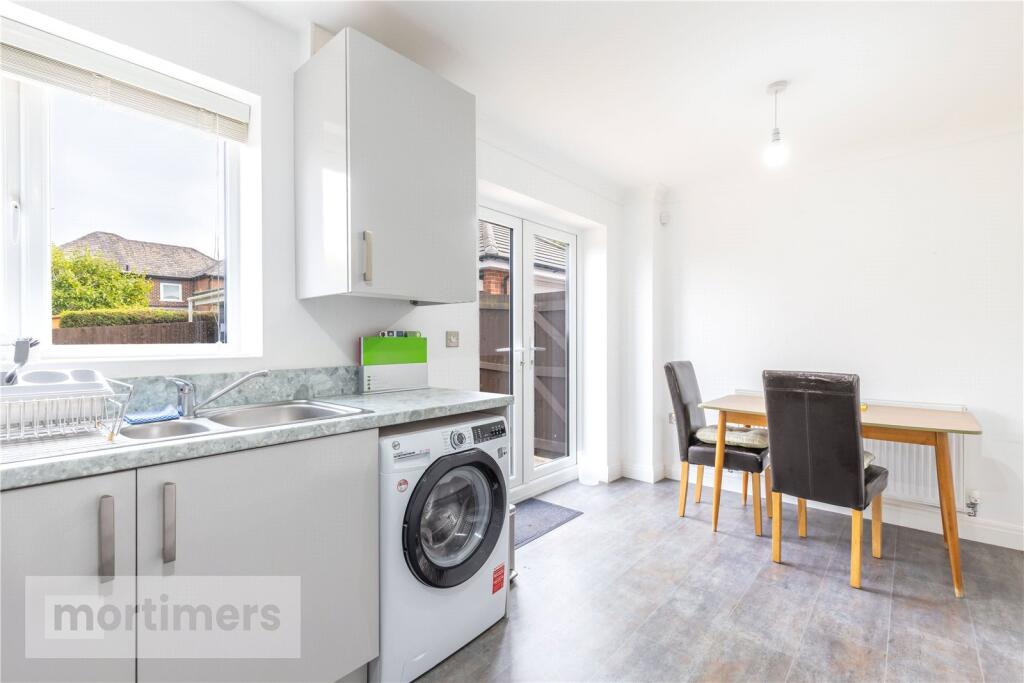
- Kitchen/Diner:
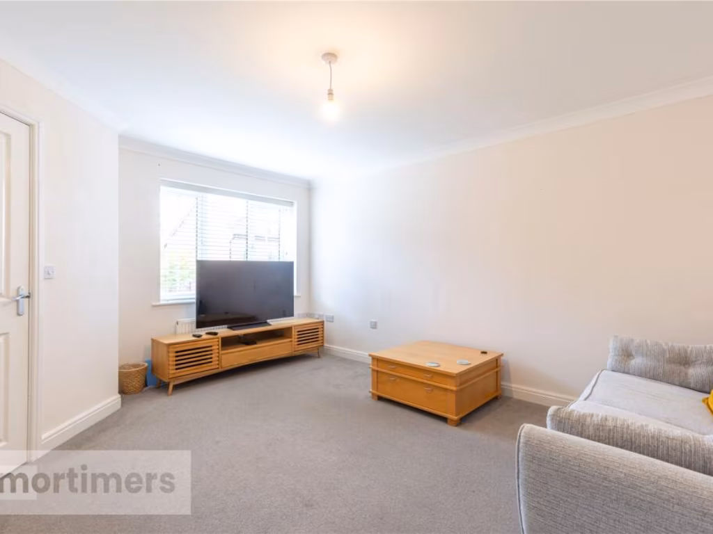
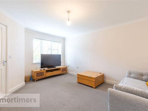
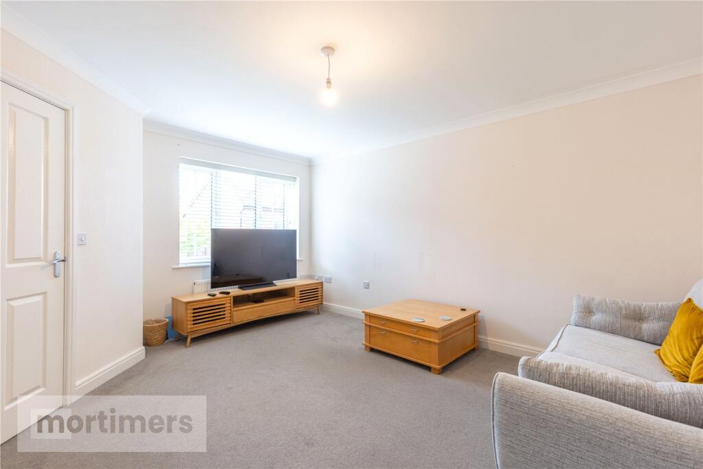
- Living Room:
- Store:
- Hall:
- WC:
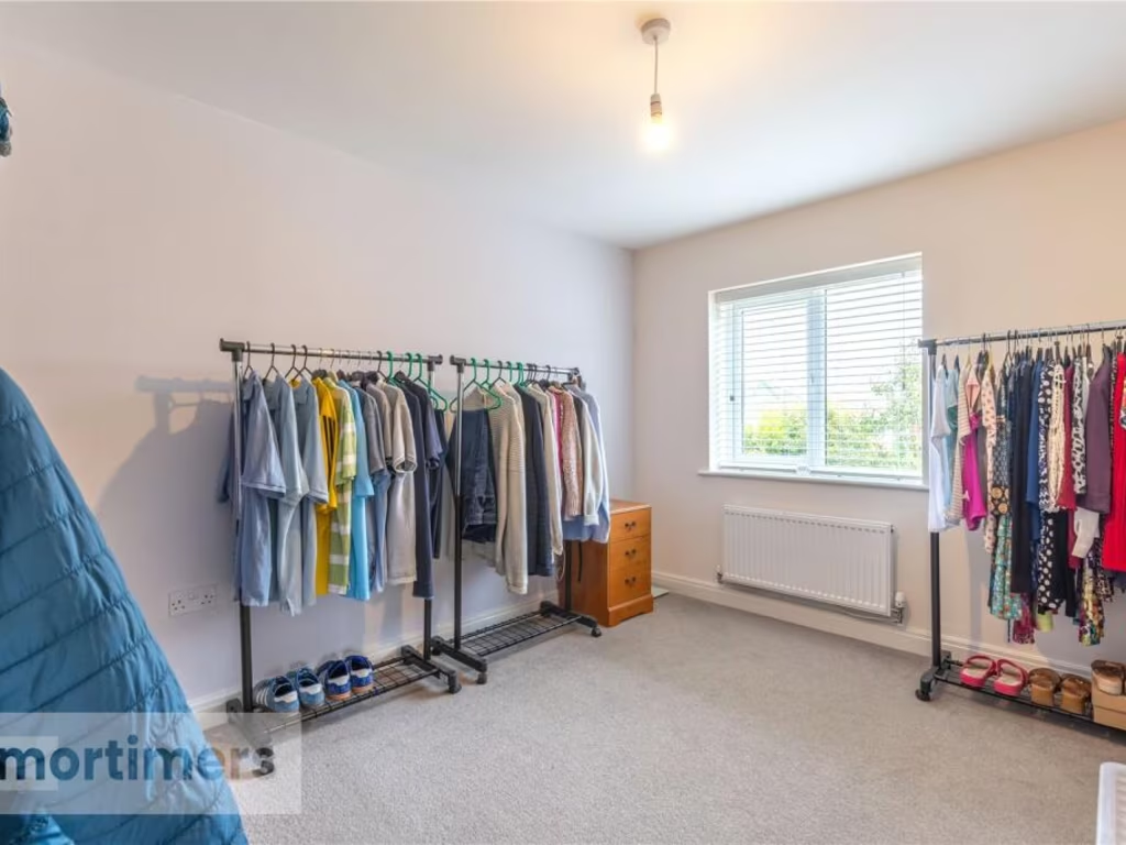
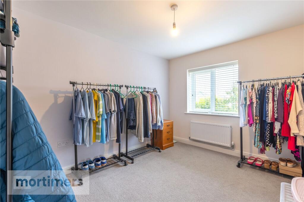
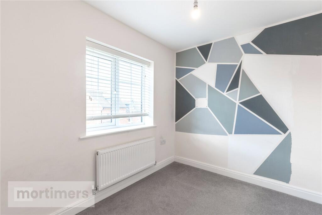
- Bedroom 2:
- Bedroom 4:
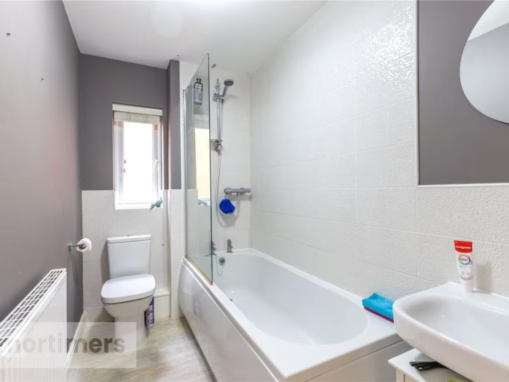
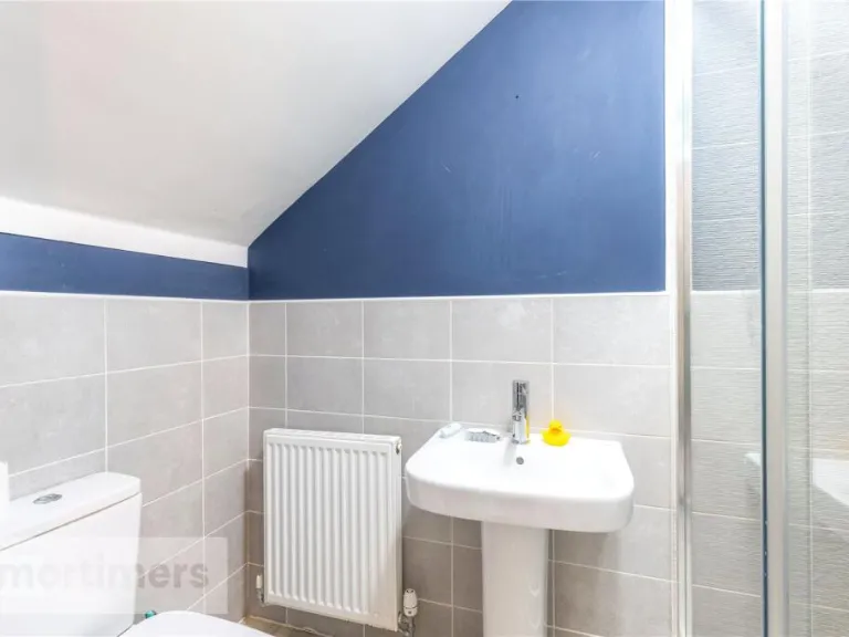
- Bathroom:
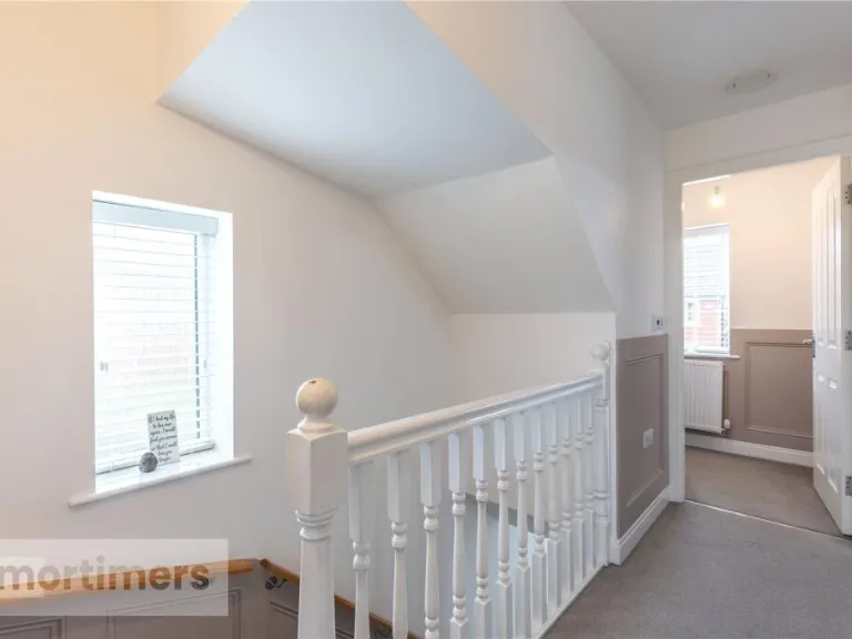
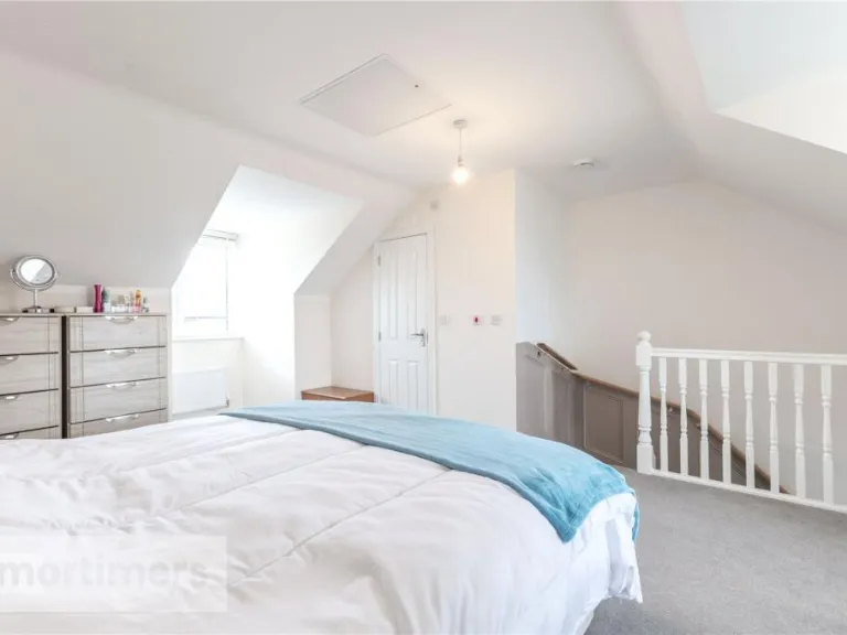
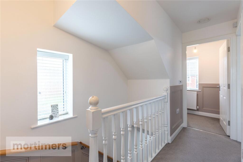
- Landing:
- Bedroom 3:
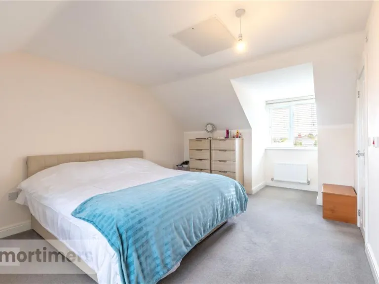
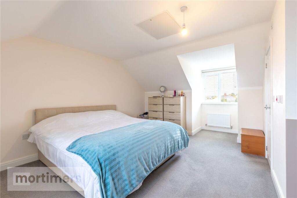
- Main Bedroom:
- En-suite:
Textual Property Features
Detected Visual Features
- modern
- two-storey
- brick exterior
- gable roof
- dormer windows
- semi-detached
- driveway
- front garden
- suburban
- new build
- modern kitchen
- white cabinets
- integrated appliances
- gray countertops
- stainless steel range hood
- tile flooring
- u-shaped layout
- bright
- clean
EPC Details
- High performance glazing
- Average thermal transmittance 0.26 W/m-¦K
- Boiler and radiators, mains gas
- Low energy lighting in all fixed outlets
- Average thermal transmittance 0.14 W/m-¦K
Nearby Schools
- Blackburn the Redeemer CofE Primary
- Longshaw Community Junior School
- St Wilfrid's Church of England Academy
- Queen Elizabeth's Grammar School
- Griffin Park Primary School
- Witton Park Academy
- Wensley Fold CofE Primary Academy
- The Olive School Blackburn
- Longshaw Infant School
- St Stephen's Tockholes CofE Primary School
- Feniscowles Primary School
- St Bede's Roman Catholic High School, Blackburn
- St Paul's Roman Catholic Primary School, Feniscowles, Blackburn
- Dar Ul Madinah
- Westholme School
- Darwen Vale High School
- St Luke and St Philips Church of England Primary School
- Tauheedul Islam Boys' High School
- Queen Elizabeth's Primary School
- St Silas's CofE Primary School
- The Heights Blackburn
- St Barnabas and St Paul's Church of England Voluntary Aided Primary School
- Meadowhead Junior School
- Livesey Saint Francis' Church of England School
- Meadowhead Community Infant School and Nursery
- St Aidan's Primary School - A Church of England Academy
- St Peter's Roman Catholic Primary School, Blackburn
- Sacred Heart Roman Catholic Primary School Blackburn
- Tauheedul Islam Girls' High School
Nearest General Shops
- Id: 1914241794
- Tags:
- Name: The Holiday Shop
- Phone: +44 1254 727333
- Shop: travel_agency
- TagsNormalized:
- Lat: 53.72293
- Lon: -2.5312628
- FullGeoHash: gcw1w7uyc218
- PartitionGeoHash: gcw1
- Images:
- FoodStandards: null
- Distance: 1090.1
,- Id: 1914241792
- Tags:
- Name: Station Garage
- Phone: +44 1254 201681
- Shop: car_repair
- TagsNormalized:
- Lat: 53.7229863
- Lon: -2.5311356
- FullGeoHash: gcw1w7uzh688
- PartitionGeoHash: gcw1
- Images:
- FoodStandards: null
- Distance: 1080.3
,- Id: 59978943
- Tags:
- TagsNormalized:
- Lat: 53.735111
- Lon: -2.5177791
- FullGeoHash: gcw1wwnteqxy
- PartitionGeoHash: gcw1
- Images:
- FoodStandards: null
- Distance: 1077.9
}
Nearest Religious buildings
- Id: 844006649
- Tags:
- Amenity: place_of_worship
- Building: church
- Denomination: anglican
- Name: St Andrew
- Religion: christian
- Wikidata: Q7592328
- TagsNormalized:
- place of worship
- church
- anglican
- christian
- Lat: 53.7283719
- Lon: -2.5012551
- FullGeoHash: gcw1xhfwkw3n
- PartitionGeoHash: gcw1
- Images:
- FoodStandards: null
- Distance: 975.7
,- Id: 59977027
- Tags:
- Amenity: place_of_worship
- Created_by: JOSM
- Religion: christian
- TagsNormalized:
- place of worship
- christian
- church
- Lat: 53.7310024
- Lon: -2.5230976
- FullGeoHash: gcw1wt6tz8f4
- PartitionGeoHash: gcw1
- Images:
- FoodStandards: null
- Distance: 796.4
,- Id: 428001826
- Tags:
- Addr:
- Postcode: BB2 5NX
- Street: Cherry Tree Lane
- Amenity: school
- Capacity: 210
- Denomination: anglican
- Diocese: Diocese of Blackburn
- Fhrs:
- Isced:
- Max_age: 11
- Min_age: 5
- Name: Livesey Saint Francis' Church of England School
- Phone: +44 1254 201419
- Ref:
- Religion: christian
- School:
- Boarding: no
- Gender: mixed
- Selective: no
- Trust: no
- Type: voluntary_aided
- Website: https://www.stfranciscep.co.uk/
- Wikidata: Q66137633
- TagsNormalized:
- school
- anglican
- church
- christian
- Lat: 53.7294753
- Lon: -2.5241204
- FullGeoHash: gcw1wt1uzspk
- PartitionGeoHash: gcw1
- Images:
- FoodStandards:
- Id: 212180
- FHRSID: 212180
- LocalAuthorityBusinessID: 1148
- BusinessName: St Francis C Of E School (LCC)
- BusinessType: School/college/university
- BusinessTypeID: 7845
- AddressLine1: St Francis C Of E School
- AddressLine2: Cherry Tree Lane
- AddressLine3: null
- AddressLine4: Livesey
- PostCode: BB2 5NX
- RatingValue: 5
- RatingKey: fhrs_5_en-GB
- RatingDate: 2021-09-24
- LocalAuthorityCode: 897
- LocalAuthorityName: Blackburn
- LocalAuthorityWebSite: http://www.blackburn.gov.uk
- LocalAuthorityEmailAddress: publicprotection@blackburn.gov.uk
- Scores:
- Hygiene: 5
- Structural: 5
- ConfidenceInManagement: 5
- NewRatingPending: false
- Geocode:
- Longitude: -2.52595900000000
- Latitude: 53.72929400000000
- Distance: 728.1
}
Nearest Medical buildings
- Id: 8252205687
- Tags:
- Addr:
- City: Blackburn
- Housenumber: 33
- Place: Witton
- Postcode: BB2 2SU
- Street: Preston Old Road
- Amenity: pharmacy
- Dispensing: yes
- Name: Cohens Chemist
- TagsNormalized:
- pharmacy
- chemist
- cohens chemist
- Lat: 53.7401959
- Lon: -2.5076669
- FullGeoHash: gcw1wzjgr4s5
- PartitionGeoHash: gcw1
- Images:
- FoodStandards: null
- Distance: 1706.1
,- Id: 9688152386
- Tags:
- Addr:
- City: Blackburn
- Housenumber: 696
- Postcode: BB2 5EP
- Street: Preston Old Road
- Suburb: Feniscowles
- Amenity: doctors
- Name: Feniscowles Surgery
- Opening_hours: Mo,We,Fr 09:00-13:00, 14:00-17:00
- TagsNormalized:
- Lat: 53.7271276
- Lon: -2.5375092
- FullGeoHash: gcw1wk8ppy2p
- PartitionGeoHash: gcw1
- Images:
- FoodStandards: null
- Distance: 1472.7
,- Id: 59977560
- Tags:
- Amenity: pharmacy
- Created_by: JOSM
- Name: Cohens
- TagsNormalized:
- Lat: 53.7350233
- Lon: -2.5178087
- FullGeoHash: gcw1wwnt4y3g
- PartitionGeoHash: gcw1
- Images:
- FoodStandards: null
- Distance: 1068.6
,- Id: 558443665
- Tags:
- Amenity: pharmacy
- Building: yes
- Healthcare: pharmacy
- Name: Manor Pharmacy
- Phone: +44 1254 200094
- TagsNormalized:
- Lat: 53.7259639
- Lon: -2.5242303
- FullGeoHash: gcw1ws9bmjt6
- PartitionGeoHash: gcw1
- Images:
- FoodStandards: null
- Distance: 590.3
}
Nearest Leisure Facilities
- Id: 1084736610
- Tags:
- Leisure: pitch
- Sport: soccer
- TagsNormalized:
- Lat: 53.7304385
- Lon: -2.516364
- FullGeoHash: gcw1wtrdkrxn
- PartitionGeoHash: gcw1
- Images:
- FoodStandards: null
- Distance: 550.4
,- Id: 1084736609
- Tags:
- Leisure: pitch
- Sport: soccer
- TagsNormalized:
- Lat: 53.7301236
- Lon: -2.5163842
- FullGeoHash: gcw1wtr8euzz
- PartitionGeoHash: gcw1
- Images:
- FoodStandards: null
- Distance: 515.9
,- Id: 10224592489
- Tags:
- TagsNormalized:
- Lat: 53.7287421
- Lon: -2.5102083
- FullGeoHash: gcw1wvh0egmn
- PartitionGeoHash: gcw1
- Images:
- FoodStandards: null
- Distance: 489.1
,- Id: 1084736612
- Tags:
- Leisure: pitch
- Sport: basketball; football
- TagsNormalized:
- pitch
- leisure
- basketball
- football
- sports
- Lat: 53.7297199
- Lon: -2.5153907
- FullGeoHash: gcw1wv0q71sz
- PartitionGeoHash: gcw1
- Images:
- FoodStandards: null
- Distance: 466
,- Id: 1084736613
- Tags:
- TagsNormalized:
- Lat: 53.7293829
- Lon: -2.515554
- FullGeoHash: gcw1wv0hr6fv
- PartitionGeoHash: gcw1
- Images:
- FoodStandards: null
- Distance: 428.8
}
Nearest Tourist attractions
- Id: 5299457122
- Tags:
- Name: Highfield Court
- Tourism: apartment
- TagsNormalized:
- Lat: 53.6939654
- Lon: -2.4473317
- FullGeoHash: gcw32q9yj095
- PartitionGeoHash: gcw3
- Images:
- FoodStandards: null
- Distance: 5685.2
,- Id: 4714502
- Tags:
- Building: house
- Name: Hoghton Tower
- Tourism: attraction
- Type: multipolygon
- Wikidata: Q5877308
- Wikipedia: en:Hoghton Tower
- TagsNormalized:
- Lat: 53.7328701
- Lon: -2.5734828
- FullGeoHash: gcw1tmy09sbp
- PartitionGeoHash: gcw1
- Images:
- FoodStandards: null
- Distance: 3914.3
,- Id: 294440013
- Tags:
- Building: yes
- Name: Blackburn Museum and Art Gallery
- Operator: Blackburn with Darwen Borough Council
- Tourism: museum
- Website: http://www.blackburn.gov.uk/Pages/Museum-and-art-gallery.aspx
- Wikidata: Q15199595
- TagsNormalized:
- Lat: 53.7504135
- Lon: -2.483967
- FullGeoHash: gcw1z2znz77c
- PartitionGeoHash: gcw1
- Images:
- FoodStandards: null
- Distance: 3449.5
}
Nearest Train stations
- Id: 21665807
- Tags:
- Name: Darwen
- Name:lt: Darvenas
- Naptan:
- Network: National Rail
- Public_transport: station
- Railway: station
- Ref:
- Source: NPE
- Wikidata: Q2248104
- Wikipedia: en:Darwen railway station
- TagsNormalized:
- Lat: 53.6979355
- Lon: -2.4642693
- FullGeoHash: gcw1rzmt4kew
- PartitionGeoHash: gcw1
- Images:
- FoodStandards: null
- Distance: 4548.4
,- Id: 4977730957
- Tags:
- Name: Blackburn
- Naptan:
- Network: National Rail
- Operator: Northern
- Public_transport: station
- Railway: station
- Ref:
- Train: yes
- Wikidata: Q2726049
- Wikipedia: en:Blackburn railway station
- TagsNormalized:
- Lat: 53.7463745
- Lon: -2.4790853
- FullGeoHash: gcw1z84z34kh
- PartitionGeoHash: gcw1
- Images:
- FoodStandards: null
- Distance: 3323
,- Id: 3711617684
- Tags:
- Name: Pleasington
- Naptan:
- Network: National Rail
- Public_transport: station
- Railway: station
- Ref:
- Request_stop: yes
- Train: yes
- Wikidata: Q3306245
- Wikipedia: en:Pleasington railway station
- TagsNormalized:
- Lat: 53.7310487
- Lon: -2.5440104
- FullGeoHash: gcw1wj7w032q
- PartitionGeoHash: gcw1
- Images:
- FoodStandards: null
- Distance: 1986.7
,- Id: 4978846110
- Tags:
- Name: Mill Hill
- Naptan:
- Network: National Rail
- Public_transport: station
- Railway: station
- Ref:
- Source: npe
- Train: yes
- Wikidata: Q654882
- Wikipedia: en:Mill Hill railway station (Lancashire)
- TagsNormalized:
- Lat: 53.735339
- Lon: -2.5019404
- FullGeoHash: gcw1xn4ph94n
- PartitionGeoHash: gcw1
- Images:
- FoodStandards: null
- Distance: 1400.2
,- Id: 4978846098
- Tags:
- Name: Cherry Tree
- Naptan:
- Network: National Rail
- Public_transport: station
- Railway: station
- Ref:
- Source: npe
- Train: yes
- Wikidata: Q2389820
- Wikipedia: en:Cherry Tree railway station
- TagsNormalized:
- Lat: 53.7331819
- Lon: -2.5186399
- FullGeoHash: gcw1wtvfrrjg
- PartitionGeoHash: gcw1
- Images:
- FoodStandards: null
- Distance: 879
}
Nearest Bus stations and stops
- Id: 60469329
- Tags:
- Highway: bus_stop
- Public_transport: platform
- TagsNormalized:
- Lat: 53.7250857
- Lon: -2.5060599
- FullGeoHash: gcw1wur5k9f7
- PartitionGeoHash: gcw1
- Images:
- FoodStandards: null
- Distance: 609.1
,- Id: 4307397893
- Tags:
- Highway: bus_stop
- Name: Tesco
- Operator: Transdev
- Public_transport: platform
- TagsNormalized:
- Lat: 53.725622
- Lon: -2.5237548
- FullGeoHash: gcw1ws6q2mb4
- PartitionGeoHash: gcw1
- Images:
- FoodStandards: null
- Distance: 557.1
,- Id: 78266482
- Tags:
- Highway: bus_stop
- Public_transport: platform
- TagsNormalized:
- Lat: 53.7296713
- Lon: -2.5148061
- FullGeoHash: gcw1wv0y0b8t
- PartitionGeoHash: gcw1
- Images:
- FoodStandards: null
- Distance: 461.6
,- Id: 78266483
- Tags:
- Highway: bus_stop
- Public_transport: platform
- TagsNormalized:
- Lat: 53.7273554
- Lon: -2.5136353
- FullGeoHash: gcw1wuc8s0cw
- PartitionGeoHash: gcw1
- Images:
- FoodStandards: null
- Distance: 230.3
,- Id: 78266484
- Tags:
- Highway: bus_stop
- Public_transport: platform
- TagsNormalized:
- Lat: 53.7267672
- Lon: -2.5154087
- FullGeoHash: gcw1wu8m4er6
- PartitionGeoHash: gcw1
- Images:
- FoodStandards: null
- Distance: 137.8
}
Nearest Hotels
- Id: 766573379
- Tags:
- TagsNormalized:
- Lat: 53.7127356
- Lon: -2.4772144
- FullGeoHash: gcw1xdh5kexh
- PartitionGeoHash: gcw1
- Images:
- FoodStandards: null
- Distance: 2880.9
,- Id: 4489489392
- Tags:
- Addr:
- City: Darwen
- Postcode: BB3 0AB
- Street: Blackburn Road
- Amenity: pub
- Fhrs:
- Name: Anchor Hotel
- Name:en: Anchor
- Source:
- TagsNormalized:
- Lat: 53.7100627
- Lon: -2.4810094
- FullGeoHash: gcw1x997u337
- PartitionGeoHash: gcw1
- Images:
- FoodStandards: null
- Distance: 2836.4
,- Id: 297184685
- Tags:
- Brand: Premier Inn
- Brand:wikidata: Q2108626
- Name: Premier Inn Blackburn Central
- Tourism: hotel
- TagsNormalized:
- Lat: 53.7175824
- Lon: -2.4746407
- FullGeoHash: gcw1xdyp8enh
- PartitionGeoHash: gcw1
- Images:
- FoodStandards: null
- Distance: 2816.6
}
Tags
- modern
- two-storey
- brick exterior
- gable roof
- dormer windows
- semi-detached
- driveway
- front garden
- suburban
- new build
- modern kitchen
- white cabinets
- integrated appliances
- gray countertops
- stainless steel range hood
- tile flooring
- u-shaped layout
- bright
- clean
Local Market Stats
- Average Price/sqft: £159
- Avg Income: £38200
- Rental Yield: 4.1%
- Social Housing: 7%
- Planning Success Rate: 89%
Similar Properties
 4 bedroom detached house for sale in Heyworth Avenue, Blackburn, BB2 — £315,000 • 4 bed • 2 bath • 1391 ft²
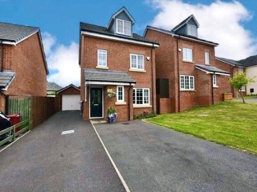 4 bedroom town house for sale in Thistle Trail, Off Gib Lane, Blackburn, Lancashire, BB2 — £275,000 • 4 bed • 3 bath • 1134 ft²
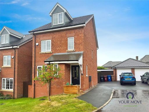 4 bedroom detached house for sale in Thistle Trail, Blackburn, Lancashire, BB2 — £260,000 • 4 bed • 2 bath • 1022 ft²
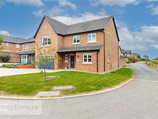 5 bedroom detached house for sale in Bluebell Way, Blackburn, Lancashire, BB2 — £450,000 • 5 bed • 3 bath • 2032 ft²
 3 bedroom semi-detached house for sale in Livesey Branch Road, Blackburn, BB2 — £220,000 • 3 bed • 1 bath • 1269 ft²
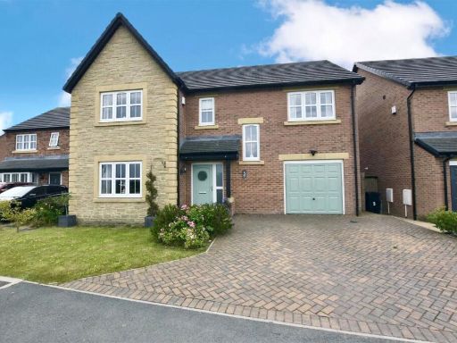 4 bedroom detached house for sale in Aspen Close, Off Gib Lane, Blackburn, Lancashire, BB2 — £395,000 • 4 bed • 3 bath • 1900 ft²
Meta
- {
"@context": "https://schema.org",
"@type": "Residence",
"name": "4 bedroom detached house for sale in Thistle Trail, Blackbu…",
"description": "",
"url": "https://propertypiper.co.uk/property/20a9bddb-0a10-4257-9eb3-052a393c26c1",
"image": "https://image-a.propertypiper.co.uk/0f946cd1-8579-43fb-8e31-6f3818134c64-1024.jpeg",
"address": {
"@type": "PostalAddress",
"streetAddress": "Thistle Trail, Blackburn, Lancashire, BB2",
"postalCode": "BB2 5AS",
"addressLocality": "Blackburn with Darwen",
"addressRegion": "Blackburn",
"addressCountry": "England"
},
"geo": {
"@type": "GeoCoordinates",
"latitude": 53.725529829989384,
"longitude": -2.515287642754208
},
"numberOfRooms": 4,
"numberOfBathroomsTotal": 1,
"floorSize": {
"@type": "QuantitativeValue",
"value": 1087,
"unitCode": "FTK"
},
"offers": {
"@type": "Offer",
"price": 255000,
"priceCurrency": "GBP",
"availability": "https://schema.org/InStock"
},
"additionalProperty": [
{
"@type": "PropertyValue",
"name": "Feature",
"value": "modern"
},
{
"@type": "PropertyValue",
"name": "Feature",
"value": "two-storey"
},
{
"@type": "PropertyValue",
"name": "Feature",
"value": "brick exterior"
},
{
"@type": "PropertyValue",
"name": "Feature",
"value": "gable roof"
},
{
"@type": "PropertyValue",
"name": "Feature",
"value": "dormer windows"
},
{
"@type": "PropertyValue",
"name": "Feature",
"value": "semi-detached"
},
{
"@type": "PropertyValue",
"name": "Feature",
"value": "driveway"
},
{
"@type": "PropertyValue",
"name": "Feature",
"value": "front garden"
},
{
"@type": "PropertyValue",
"name": "Feature",
"value": "suburban"
},
{
"@type": "PropertyValue",
"name": "Feature",
"value": "new build"
},
{
"@type": "PropertyValue",
"name": "Feature",
"value": "modern kitchen"
},
{
"@type": "PropertyValue",
"name": "Feature",
"value": "white cabinets"
},
{
"@type": "PropertyValue",
"name": "Feature",
"value": "integrated appliances"
},
{
"@type": "PropertyValue",
"name": "Feature",
"value": "gray countertops"
},
{
"@type": "PropertyValue",
"name": "Feature",
"value": "stainless steel range hood"
},
{
"@type": "PropertyValue",
"name": "Feature",
"value": "tile flooring"
},
{
"@type": "PropertyValue",
"name": "Feature",
"value": "u-shaped layout"
},
{
"@type": "PropertyValue",
"name": "Feature",
"value": "bright"
},
{
"@type": "PropertyValue",
"name": "Feature",
"value": "clean"
}
]
}
High Res Floorplan Images
Compatible Floorplan Images
FloorplanImages Thumbnail