RG26 3BA - 3 bedroom detached house for sale in Droxford Crescent, Tad…
View on Property Piper
3 bedroom detached house for sale in Droxford Crescent, Tadley, Hampshire, RG26
Property Details
- Price: £525000
- Bedrooms: 3
- Bathrooms: 2
- Property Type: undefined
- Property SubType: undefined
Image Descriptions
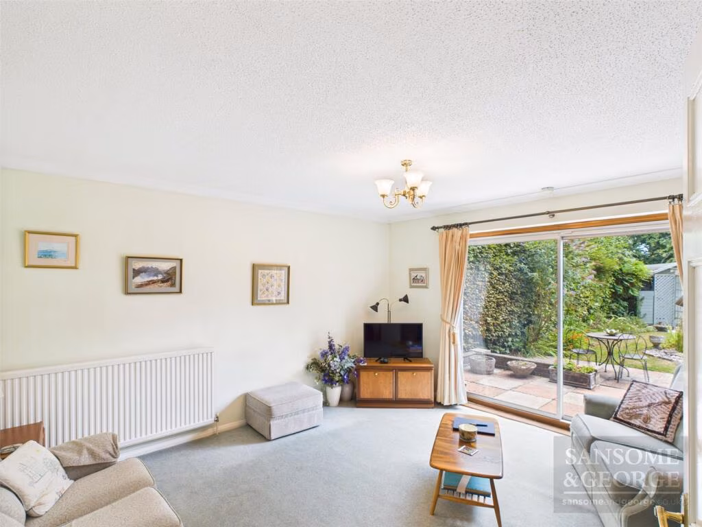
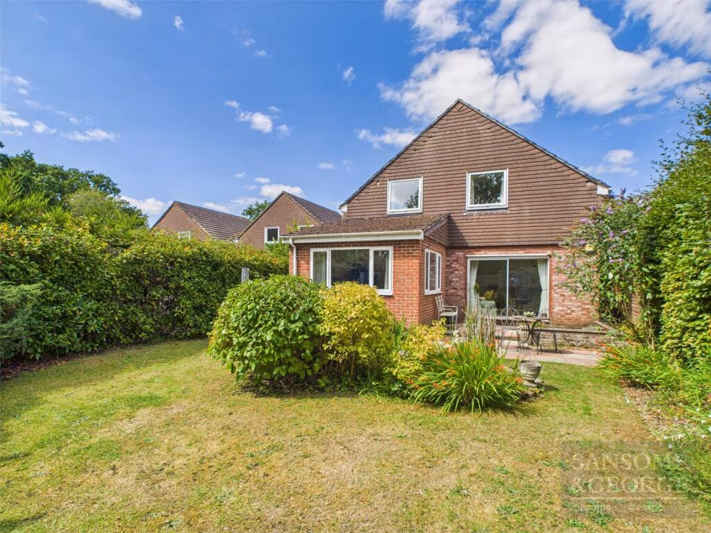
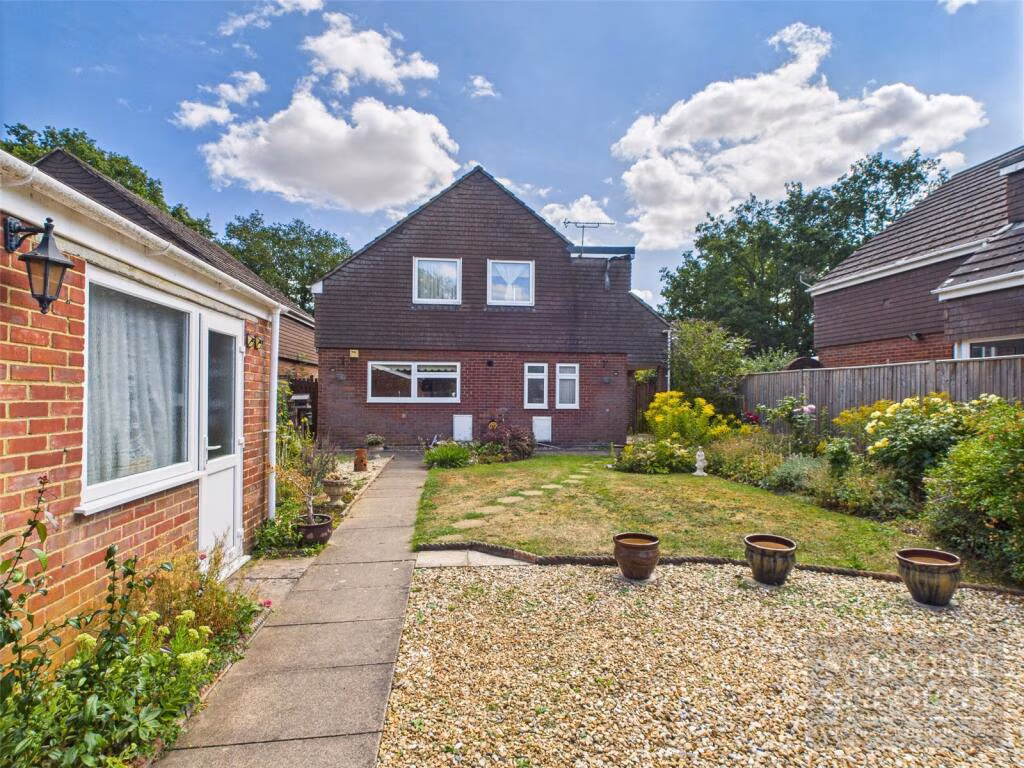
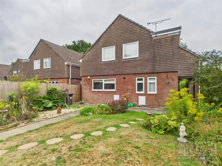
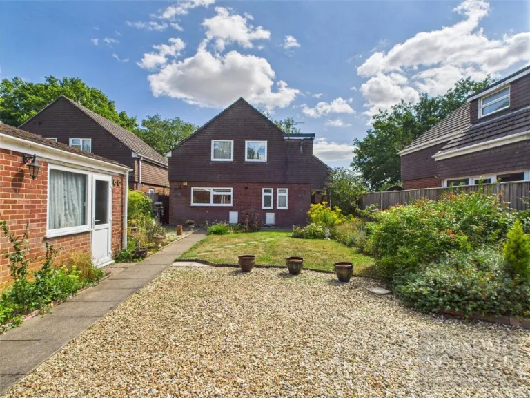
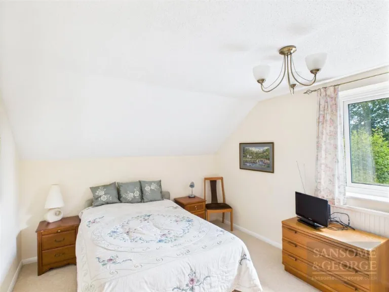
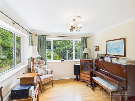
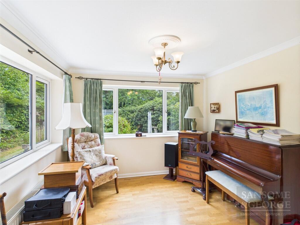
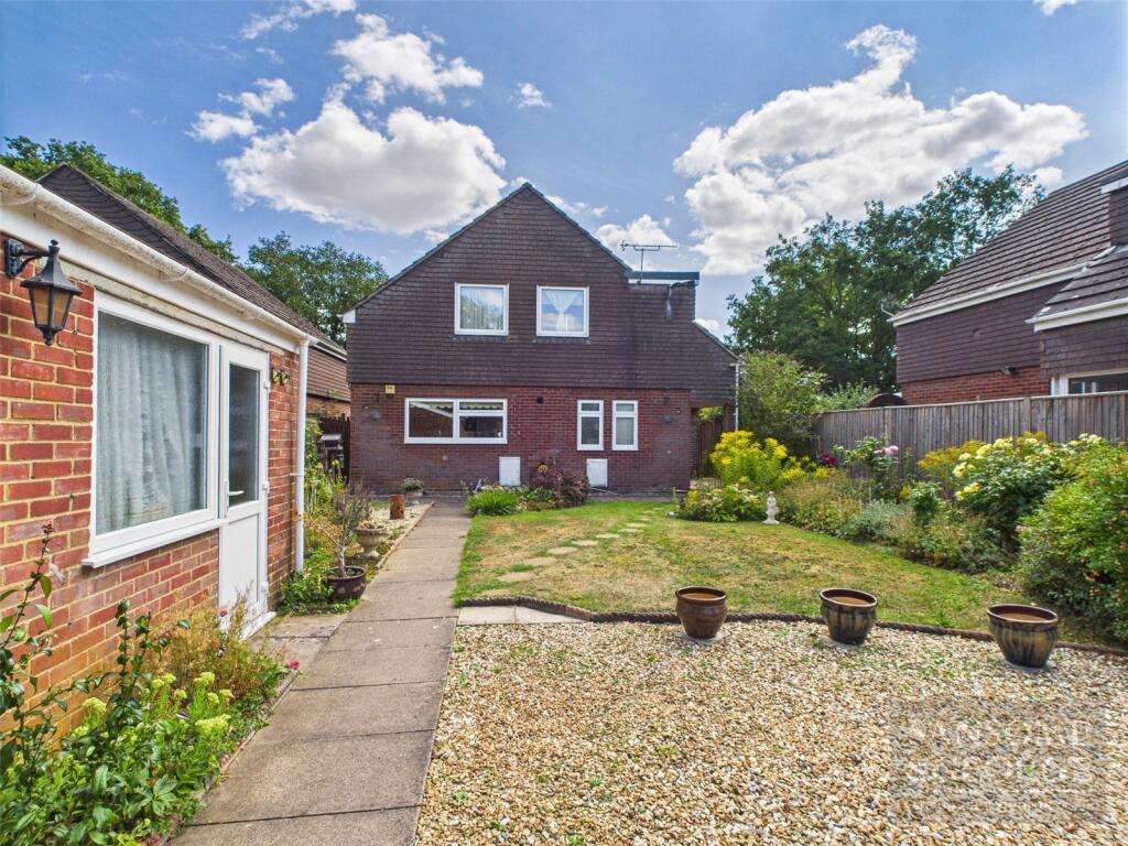
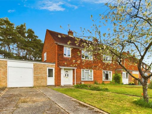
- semi-detached house 1970s
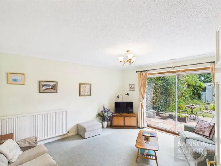
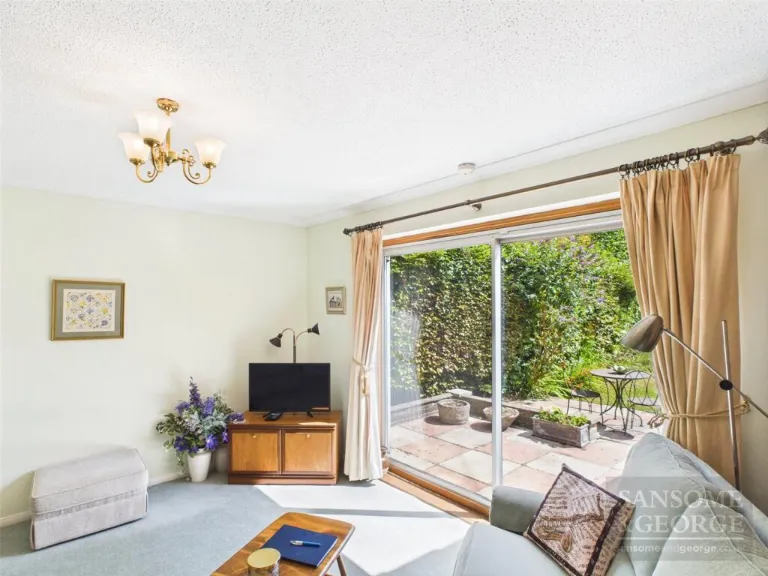
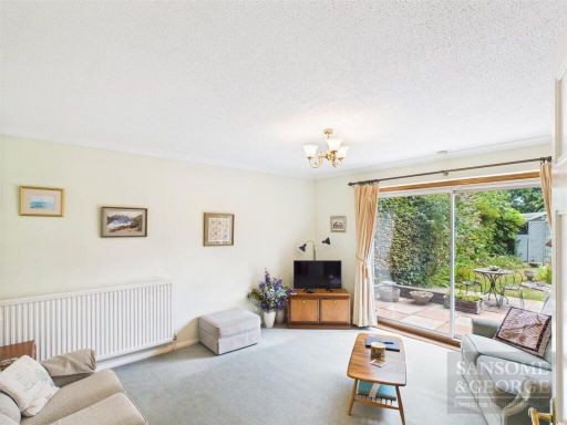
- living room 1970s
Floorplan Description
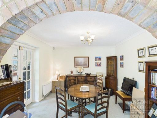
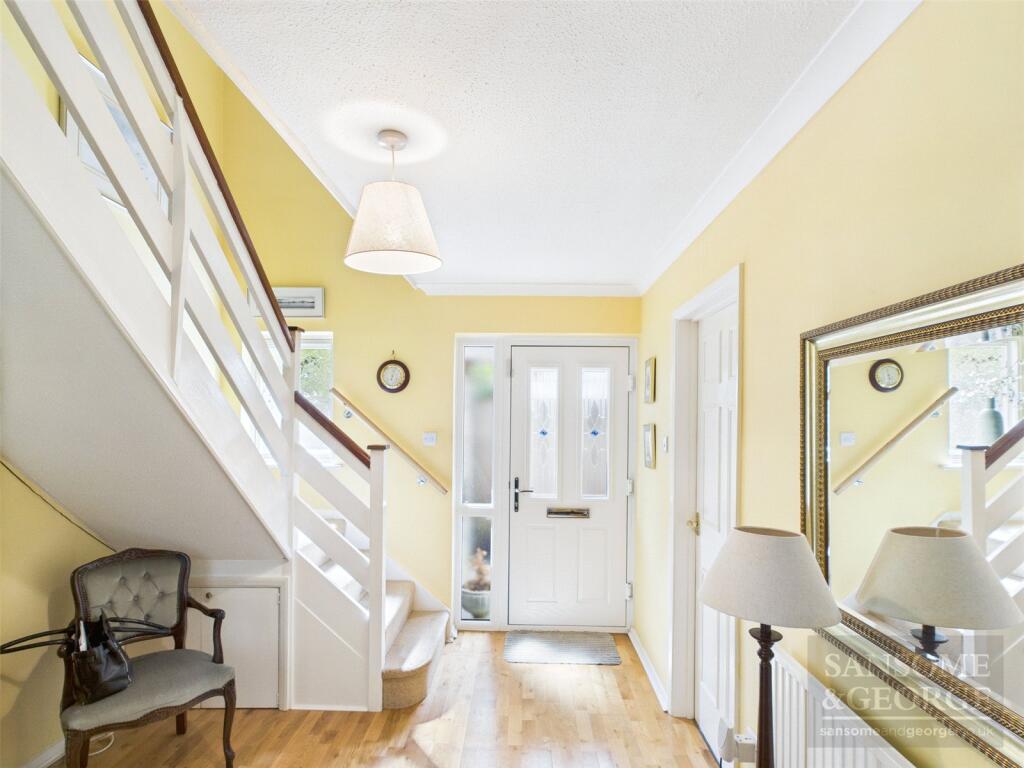
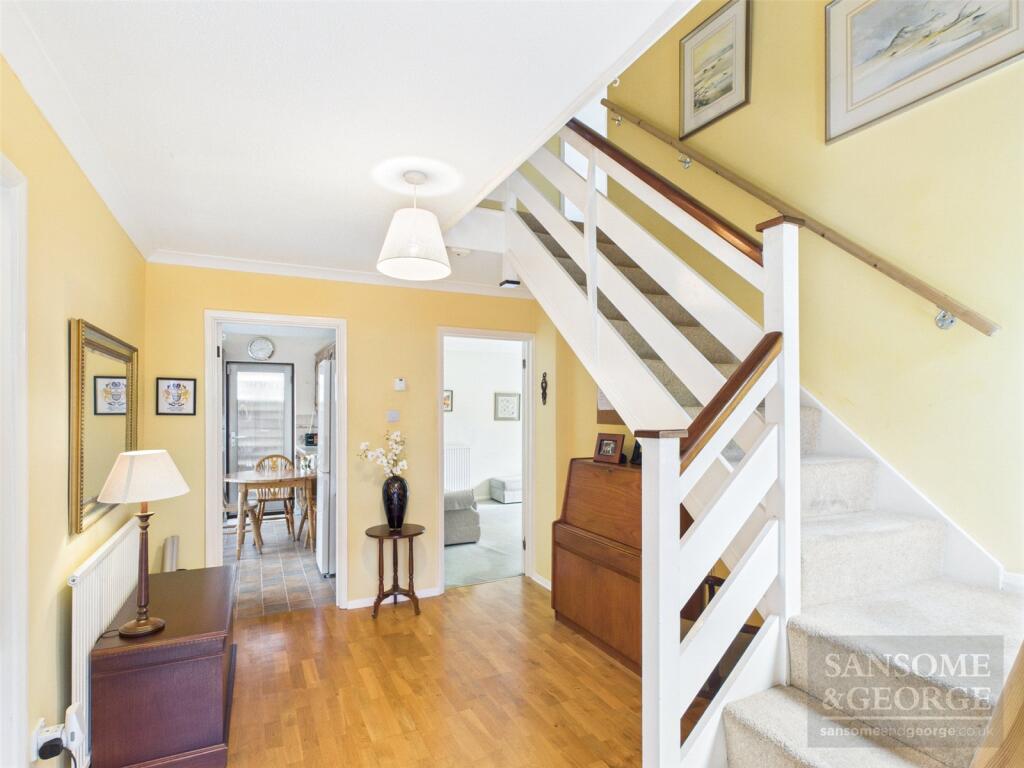
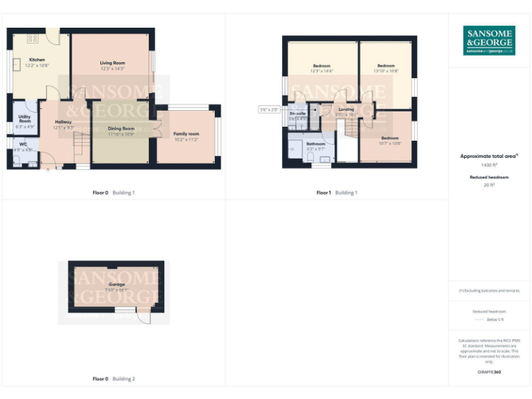
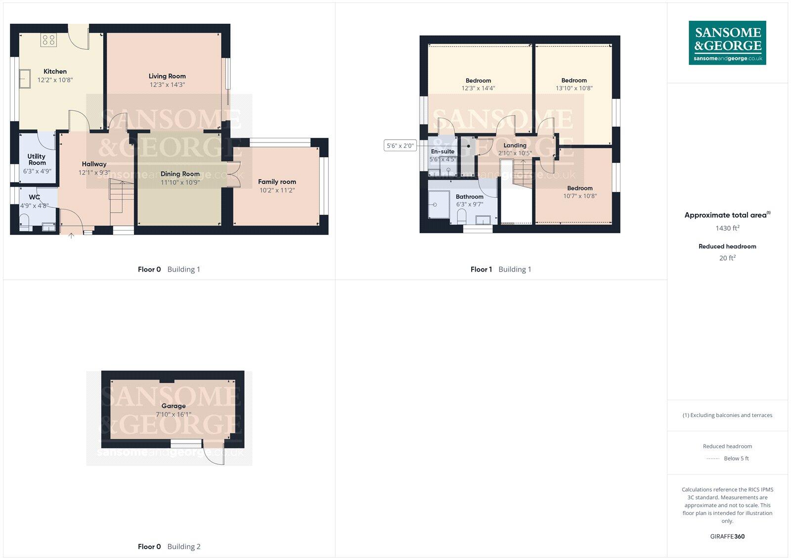
- A multi-story property with three bedrooms, living and dining areas, and a separate garage.
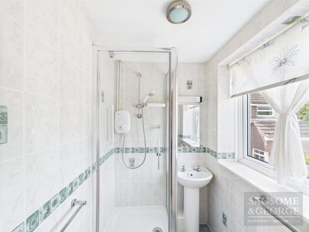
Rooms
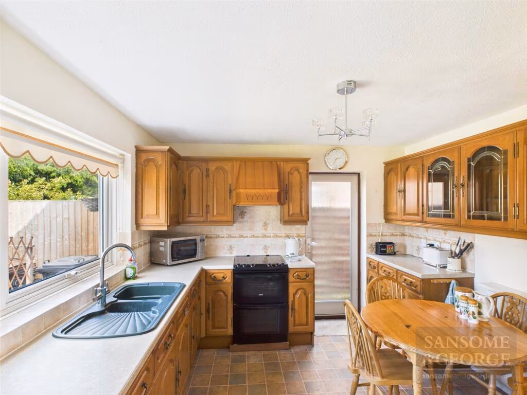
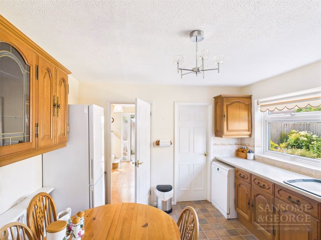
- Kitchen:
- Living Room:
- Utility Room:
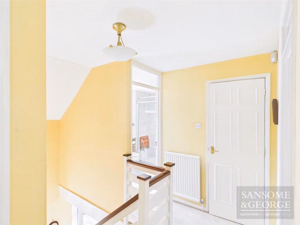
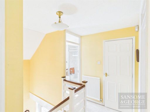
- Hallway:
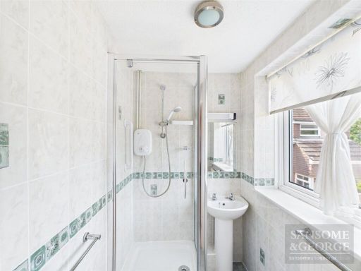
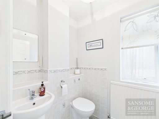
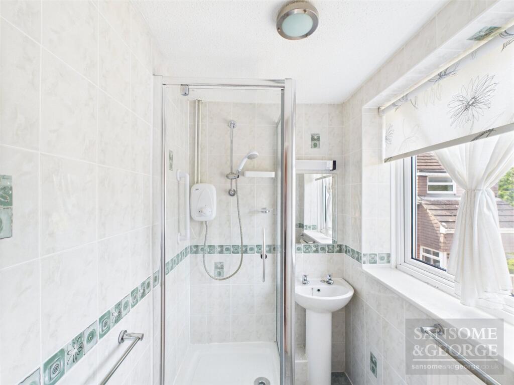
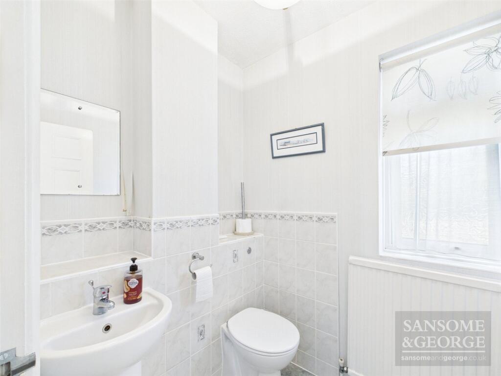
- WC:
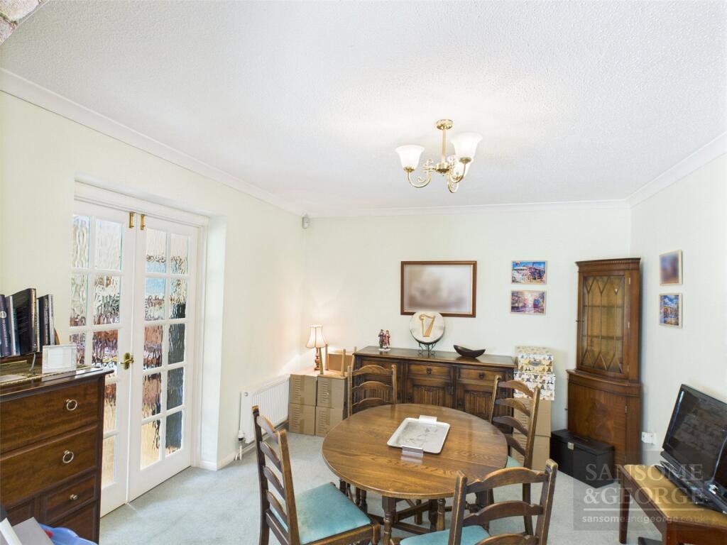
- Dining Room:
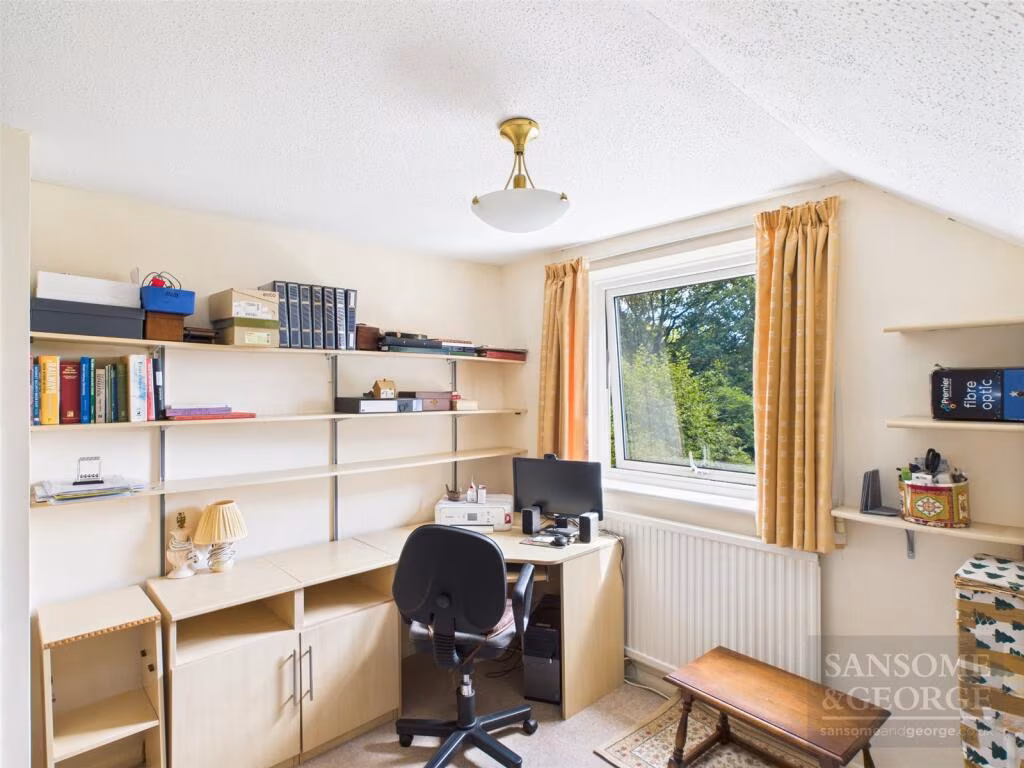
- Family Room:
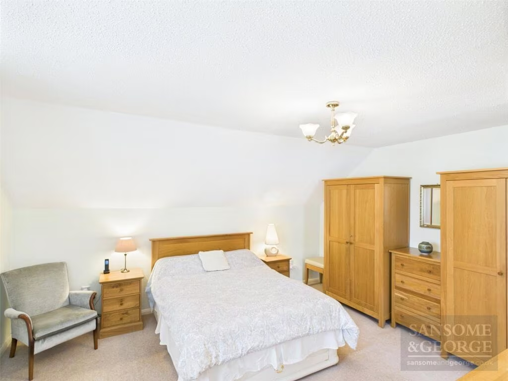
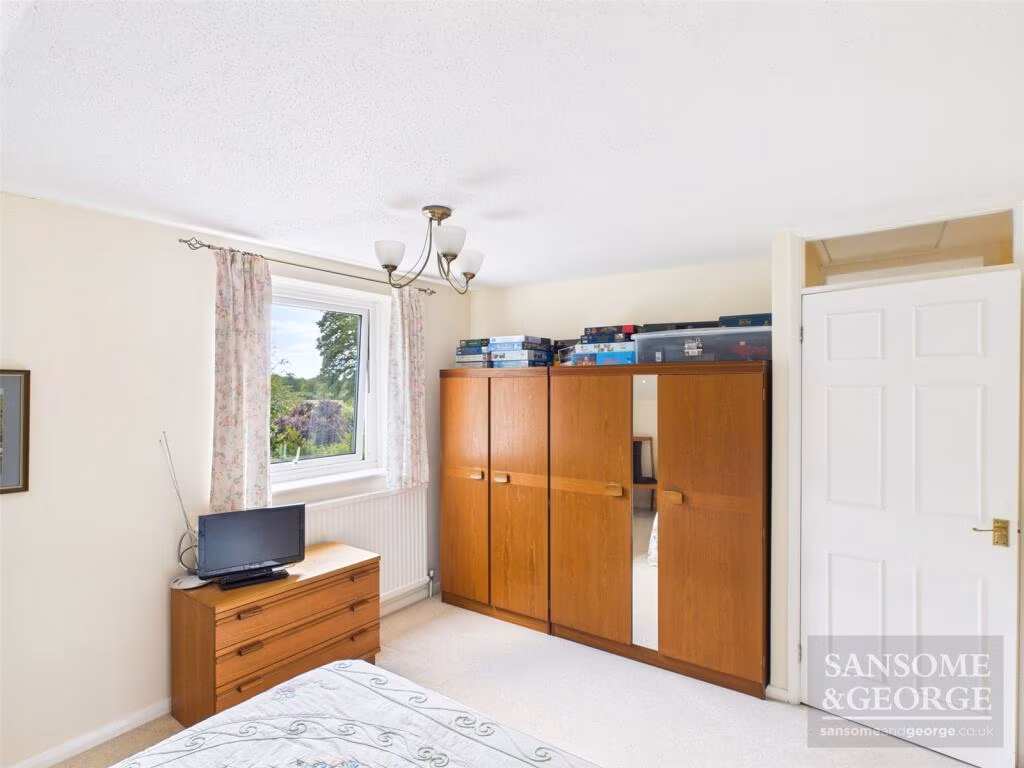
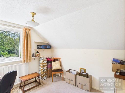
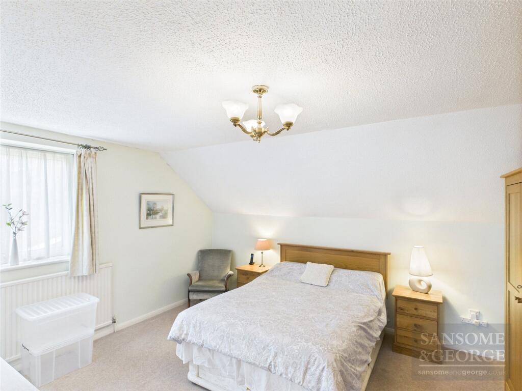
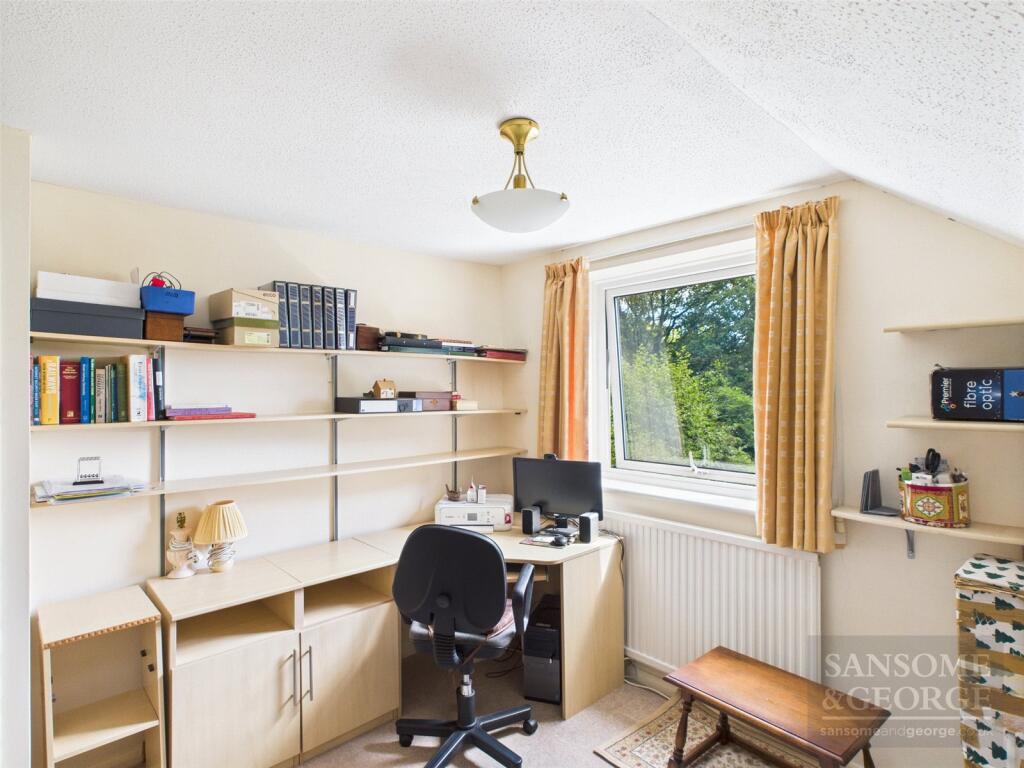
- Bedroom:
- Bedroom:
- Landing:
- Bedroom:
Textual Property Features
Detected Visual Features
- semi-detached
- 1970s
- brick construction
- asphalt shingle roof
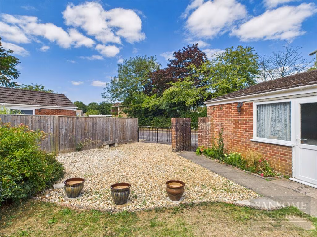
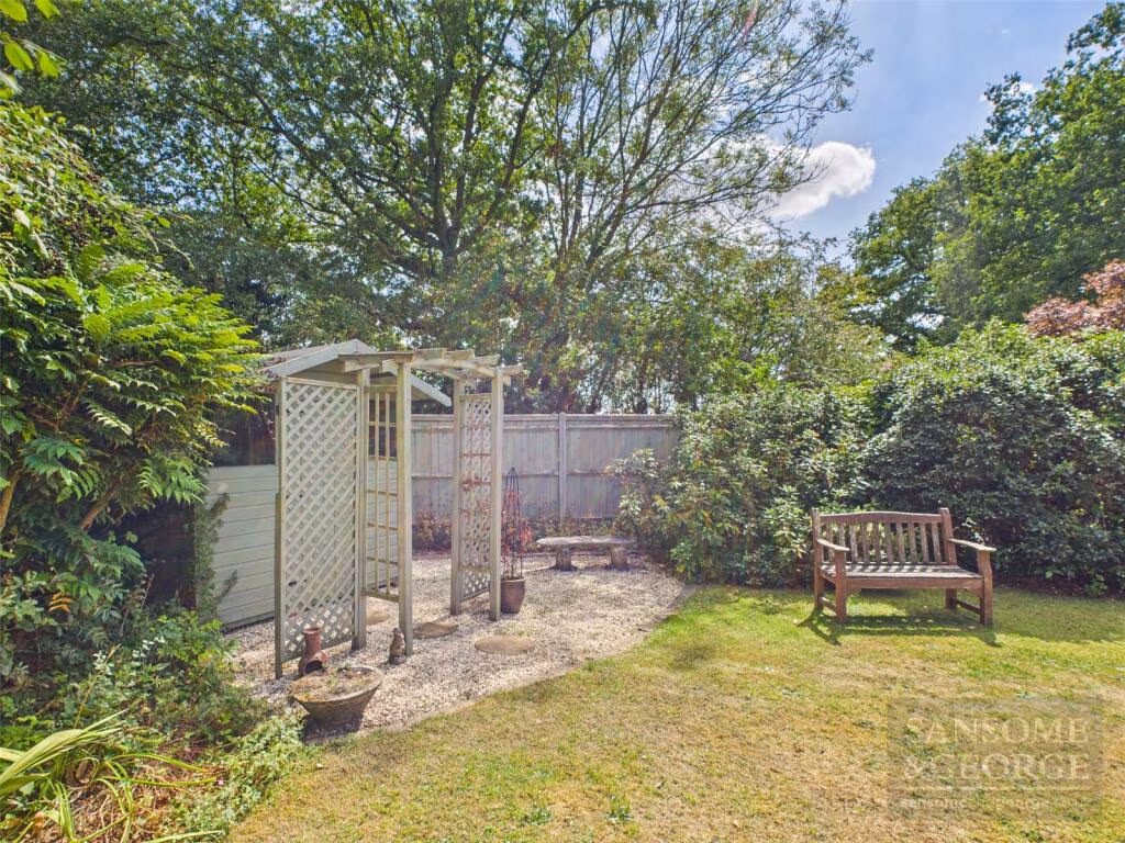
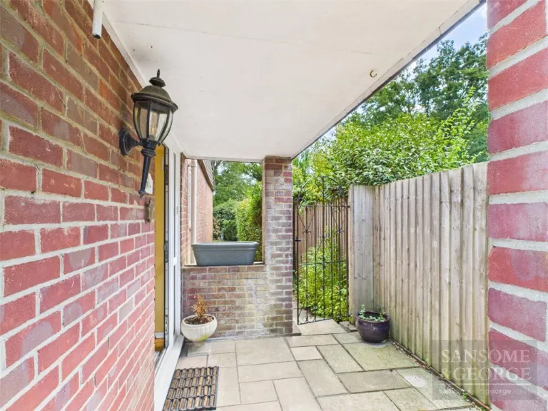
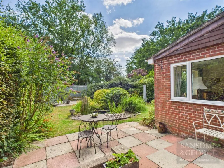
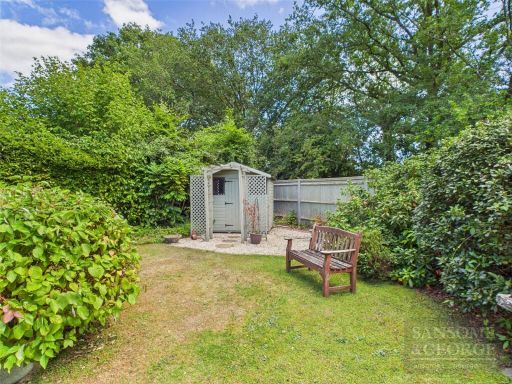
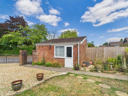
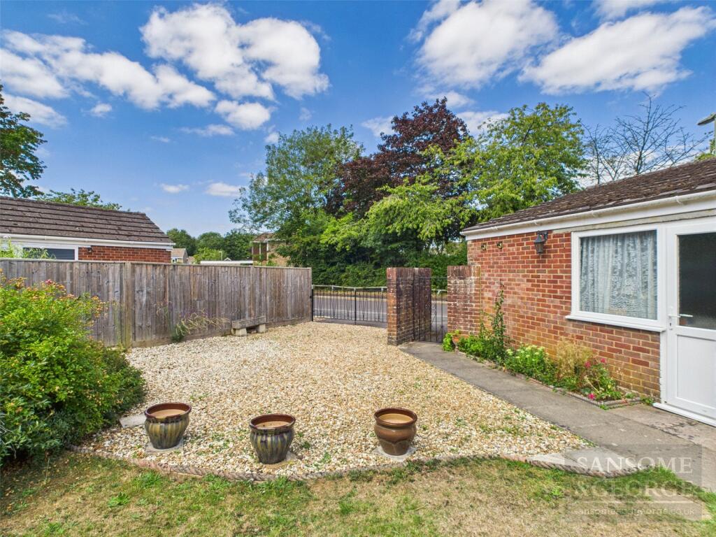
- garden
- residential neighborhood
- family home
- living room
- standard ceiling
- medium-sized room
- dated
- garden access
- sliding glass doors
- patio view
EPC Details
- Fully double glazed
- Cavity wall, filled cavity
- Boiler and radiators, mains gas
- Low energy lighting in 44% of fixed outlets
- Solid, no insulation (assumed)
Nearby Schools
- Bramley Church of England Primary School
- Tadley Community Primary School
- Mortimer St. John's C.E. Infant School
- Brimpton C.E. Primary School
- Marnel Community Infant School
- Everest Community Academy
- Sherborne St John Church of England Primary School
- Ashford Hill Primary School
- Silchester Church of England Primary School
- Aldermaston C.E. Primary School
- Elstree School
- Oakridge Infant School
- Merton Infant School
- Merton Junior School
- The Priory Primary School
- Bishopswood Junior School
- Bishopswood Infant School
- The Willink School
- Sulhamstead and Ufton Nervet School
- Woolhampton C.E. Primary School
- Beenham Primary School
- Oakridge Junior School
- St Bede's Catholic Primary School
- Grantham Farm Montessori School
- Burnham Copse Primary School
- The Hurst School
- Padworth College
Nearest Bars And Restaurants
- Id: 3118440474
- Tags:
- Addr:
- City: Tadley
- Housename: 3 The Parade
- Postcode: RG26 3LG
- Street: Mulfords Hill
- Amenity: restaurant
- Name: Ali Baba Takeaway
- TagsNormalized:
- Lat: 51.3547083
- Lon: -1.1418148
- FullGeoHash: gcphnhbdcg3p
- PartitionGeoHash: gcph
- Images:
- FoodStandards: null
- Distance: 965.7
,- Id: 4396559088
- Tags:
- Addr:
- City: Tadley
- Housename: 4 The Parade
- Postcode: RG26 3LG
- Street: Mulfords Hill
- Amenity: cafe
- Name: Cafe retreat
- TagsNormalized:
- Lat: 51.3546301
- Lon: -1.141741
- FullGeoHash: gcphnhbd7sbj
- PartitionGeoHash: gcph
- Images:
- FoodStandards: null
- Distance: 960.5
,- Id: 4134152756
- Tags:
- Amenity: restaurant
- Name: Tadley Tandoori
- TagsNormalized:
- Lat: 51.3545648
- Lon: -1.1422289
- FullGeoHash: gcphnhb600sr
- PartitionGeoHash: gcph
- Images:
- FoodStandards: null
- Distance: 938.1
,- Id: 5885959139
- Tags:
- Amenity: fast_food
- Brand: Greggs
- Brand:wikidata: Q3403981
- Brand:wikipedia: en:Greggs
- Contact:
- Website: https://www.greggs.co.uk/shop-finder?shop-code=3611
- Cuisine: sandwich;bakery
- Name: Greggs
- Takeaway: yes
- TagsNormalized:
- fast food
- food
- greggs
- sandwich
- bakery
- takeaway
- Lat: 51.3515399
- Lon: -1.1394972
- FullGeoHash: gcphnh60ruc7
- PartitionGeoHash: gcph
- Images:
- FoodStandards: null
- Distance: 794.5
,- Id: 5885959140
- Tags:
- Amenity: fast_food
- Brand: Subway
- Brand:wikidata: Q244457
- Brand:wikipedia: en:Subway (restaurant)
- Cuisine: sandwich
- Name: Subway
- Takeaway: yes
- TagsNormalized:
- fast food
- food
- sandwich
- takeaway
- Lat: 51.3514712
- Lon: -1.1394382
- FullGeoHash: gcphnh6210j3
- PartitionGeoHash: gcph
- Images:
- FoodStandards: null
- Distance: 792.9
}
Nearest General Shops
- Id: 4386372490
- Tags:
- Name: Snips
- Name:en: Snips
- Shop: hairdresser
- TagsNormalized:
- Lat: 51.3545859
- Lon: -1.1417039
- FullGeoHash: gcphnhbdhkev
- PartitionGeoHash: gcph
- Images:
- FoodStandards: null
- Distance: 957.4
,- Id: 408286354
- Tags:
- Addr:
- Building: yes
- Shop: yes
- TagsNormalized:
- Lat: 51.3540153
- Lon: -1.1412367
- FullGeoHash: gcphnh8yz621
- PartitionGeoHash: gcph
- Images:
- FoodStandards: null
- Distance: 919.7
,- Id: 618443458
- Tags:
- Fixme: building extents would be nice
- Name: Reading Warehouses
- Shop: electronics
- TagsNormalized:
- Lat: 51.3482807
- Lon: -1.1407396
- FullGeoHash: gcphn59m6v6c
- PartitionGeoHash: gcph
- Images:
- FoodStandards: null
- Distance: 549.9
}
Nearest Grocery shops
- Id: 419867186
- Tags:
- Building: yes
- Name: The Co-operative
- Shop: convenience
- TagsNormalized:
- Lat: 51.3570976
- Lon: -1.1521383
- FullGeoHash: gcphjv30c0zk
- PartitionGeoHash: gcph
- Images:
- FoodStandards: null
- Distance: 1145.2
,- Id: 224599973
- Tags:
- Brand: McColl's
- Brand:wikidata: Q16997477
- Brand:wikipedia: en:McColl's
- Contact:
- Website: https://www.mccolls.co.uk/storelocator/basingstoke-giles-court/
- Name: McColl's
- Shop: convenience
- TagsNormalized:
- Lat: 51.3503304
- Lon: -1.1337903
- FullGeoHash: gcphnhn3kg2s
- PartitionGeoHash: gcph
- Images:
- FoodStandards: null
- Distance: 1078.6
,- Id: 133303285
- Tags:
- Created_by: Potlatch 0.5d
- Name: Koala Store
- Shop: convenience
- TagsNormalized:
- Lat: 51.3473775
- Lon: -1.1395187
- FullGeoHash: gcphn5d0pkcm
- PartitionGeoHash: gcph
- Images:
- FoodStandards: null
- Distance: 618.8
}
Nearest Supermarkets
- Id: 221442519
- Tags:
- Addr:
- City: Burghfield Common
- Postcode: RG7 3JB
- Street: Reading Road
- Alt_name: Tesco Burghfield Common Express
- Brand: Tesco Express
- Brand:wikidata: Q98456772
- Brand:wikipedia: en:Tesco
- Building: yes
- Contact:
- Website: https://www.tesco.com/store-locator/burghfield-common/reading-rd
- Name: Tesco Express
- Opening_hours: Mo-Su 06:00-23:00
- Operator: Tesco
- Payment:
- All: yes
- Cash: yes
- Debit_cards: yes
- Visa: yes
- Shop: supermarket
- Source:
- Building: OS_OpenData_StreetView
- TagsNormalized:
- tesco
- tesco express
- supermarket
- shop
- Lat: 51.3933159
- Lon: -1.0665632
- FullGeoHash: gcphrez7g22y
- PartitionGeoHash: gcph
- Images:
- FoodStandards: null
- Distance: 7663.8
,- Id: 224687495
- Tags:
- Brand: Tesco Express
- Brand:wikidata: Q98456772
- Contact:
- Website: https://www.tesco.com/store-locator/tadley/heath-end-rd
- Name: Tesco Express
- Opening_hours: Mo-Su 06:00-22:00
- Shop: supermarket
- TagsNormalized:
- tesco
- tesco express
- supermarket
- shop
- Lat: 51.3565088
- Lon: -1.1661783
- FullGeoHash: gcphjmnv6547
- PartitionGeoHash: gcph
- Images:
- FoodStandards: null
- Distance: 1620.1
,- Id: 236370652
- Tags:
- Addr:
- Housenumber: 30a
- Postcode: RG26 3JE
- Street: Mulfords Hill
- Alt_name: Sainsbury's Tadley Superstore
- Brand: Sainsbury's
- Brand:wikidata: Q152096
- Building: yes
- Name: Sainsbury's
- Opening_hours: Mo-Sa 07:00-22:00; Su 10:00-16:00
- Shop: supermarket
- Source: Bing
- Wheelchair: yes
- TagsNormalized:
- sainsburys
- supermarket
- shop
- Lat: 51.3557108
- Lon: -1.1413756
- FullGeoHash: gcphnj0bsn2e
- PartitionGeoHash: gcph
- Images:
- FoodStandards: null
- Distance: 1078.6
}
Nearest Religious buildings
- Id: 414226462
- Tags:
- Amenity: place_of_worship
- Building: yes
- Denomination: anglican
- Name: Saint Mary's Church
- Religion: christian
- Wikidata: Q105104490
- TagsNormalized:
- place of worship
- anglican
- church
- christian
- Lat: 51.3545918
- Lon: -1.1541931
- FullGeoHash: gcphjszd1mg0
- PartitionGeoHash: gcph
- Images:
- FoodStandards: null
- Distance: 928.3
,- Id: 414215987
- Tags:
- Amenity: place_of_worship
- Building: yes
- Name: Tadley Common Methodist Church
- Religion: christian
- TagsNormalized:
- place of worship
- church
- common
- methodist
- christian
- Lat: 51.3546994
- Lon: -1.1524135
- FullGeoHash: gcphjubffcf4
- PartitionGeoHash: gcph
- Images:
- FoodStandards: null
- Distance: 893.3
,- Id: 404634331
- Tags:
- Addr:
- City: Tadley
- Country: GB
- Postcode: RG26 3LJ
- Street: Mullfords Hill
- Amenity: place_of_worship
- Building: yes
- Name: Salvation Army Church Tadley
- Religion: christian
- TagsNormalized:
- place of worship
- church
- salvation army
- christian
- Lat: 51.3516171
- Lon: -1.1383193
- FullGeoHash: gcphnh70g5px
- PartitionGeoHash: gcph
- Images:
- FoodStandards: null
- Distance: 864.8
}
Nearest Medical buildings
- Id: 414216376
- Tags:
- Amenity: veterinary
- Building: yes
- Name: Donnington Grove Veterinary Surgery
- TagsNormalized:
- Lat: 51.3544854
- Lon: -1.1529696
- FullGeoHash: gcphjub3tcgt
- PartitionGeoHash: gcph
- Images:
- FoodStandards: null
- Distance: 883.8
,- Id: 112717408
- Tags:
- Amenity: pharmacy
- Dispensing: yes
- Healthcare: pharmacy
- Name: Morland Pharmacy
- TagsNormalized:
- Lat: 51.348428
- Lon: -1.1401666
- FullGeoHash: gcphn59y20y0
- PartitionGeoHash: gcph
- Images:
- FoodStandards: null
- Distance: 592.5
,- Id: 112717413
- Tags:
- Amenity: doctors
- Healthcare: doctor
- Name: Morland Surgery
- TagsNormalized:
- doctor
- doctors
- health
- healthcare
- surgery
- Lat: 51.3484129
- Lon: -1.1402387
- FullGeoHash: gcphn59wntbq
- PartitionGeoHash: gcph
- Images:
- FoodStandards: null
- Distance: 587.3
,- Id: 403182930
- Tags:
- Amenity: doctors
- Building: yes
- TagsNormalized:
- Lat: 51.348487
- Lon: -1.1403378
- FullGeoHash: gcphn59ws5y8
- PartitionGeoHash: gcph
- Images:
- FoodStandards: null
- Distance: 582.8
}
Nearest Leisure Facilities
- Id: 6844986636
- Tags:
- Fitness_station: exercise_bike
- Leisure: fitness_station
- Sport: fitness
- TagsNormalized:
- fitness
- fitness station
- station
- leisure
- sports
- Lat: 51.3459358
- Lon: -1.1414174
- FullGeoHash: gcphn50zg01m
- PartitionGeoHash: gcph
- Images:
- FoodStandards: null
- Distance: 501.9
,- Id: 6844986637
- Tags:
- Fitness_station: chest_press
- Leisure: fitness_station
- Sport: fitness
- TagsNormalized:
- fitness
- fitness station
- station
- leisure
- sports
- Lat: 51.3459049
- Lon: -1.1414713
- FullGeoHash: gcphn50z9f3m
- PartitionGeoHash: gcph
- Images:
- FoodStandards: null
- Distance: 499.1
,- Id: 6844986638
- Tags:
- Fitness_station: horizontal_bar
- Leisure: fitness_station
- Sport: fitness
- TagsNormalized:
- fitness
- fitness station
- station
- leisure
- sports
- Lat: 51.3458684
- Lon: -1.1415455
- FullGeoHash: gcphn50z259g
- PartitionGeoHash: gcph
- Images:
- FoodStandards: null
- Distance: 495.2
,- Id: 6844986639
- Tags:
- Fitness_station: surfer
- Leisure: fitness_station
- Sport: fitness
- TagsNormalized:
- fitness
- fitness station
- station
- leisure
- sports
- Lat: 51.3458249
- Lon: -1.1416062
- FullGeoHash: gcphn50xnes8
- PartitionGeoHash: gcph
- Images:
- FoodStandards: null
- Distance: 492.5
,- Id: 19788470
- Tags:
- TagsNormalized:
- Lat: 51.3459306
- Lon: -1.1416918
- FullGeoHash: gcphn50xsxhy
- PartitionGeoHash: gcph
- Images:
- FoodStandards: null
- Distance: 483.6
}
Nearest Hotels
- Id: 203707176
- Tags:
- Addr:
- City: Kingsclere
- Postcode: RG26 5RT
- Description: 9 hole Par 34 Park Course & 9 hole Par 36 Woods Course & 9 hole Par 35 Lakes Course
- Email: info@sandfordspringsgolf.co.uk
- Golf:
- Course: 27_hole
- Par: 34 + 36 + 35
- Leisure: golf_course
- Name: Sandford Springs Hotel & Golf Club
- Phone: +44 1635 296800
- Source: Bing
- Website: https://www.sandfordsprings.co.uk/
- Wikidata: Q7416218
- Wikipedia: en:Sandford Springs Golf Club
- TagsNormalized:
- golf
- golf course
- leisure
- hotel
- club
- Lat: 51.3250451
- Lon: -1.2250729
- FullGeoHash: gcp5up7yj9z7
- PartitionGeoHash: gcp5
- Images:
- FoodStandards: null
- Distance: 5861.3
,- Id: 420869150
- Tags:
- Amenity: restaurant
- Building: yes
- Name: Broomsquire Hotel
- TagsNormalized:
- Lat: 51.3572336
- Lon: -1.1370786
- FullGeoHash: gcphnjk184hx
- PartitionGeoHash: gcph
- Images:
- FoodStandards: null
- Distance: 1377.8
,- Id: 207518955
- Tags:
- Created_by: JOSM
- Name: The Broomsquire Hotel
- Old_name: Treacle Mine
- Tourism: hotel
- TagsNormalized:
- Lat: 51.3572355
- Lon: -1.1372051
- FullGeoHash: gcphnj7ct4w6
- PartitionGeoHash: gcph
- Images:
- FoodStandards: null
- Distance: 1373
}
Tags
- semi-detached
- 1970s
- brick construction
- asphalt shingle roof
- garden
- residential neighborhood
- family home
- 1970s
- living room
- standard ceiling
- medium-sized room
- dated
- garden access
- sliding glass doors
- patio view
Local Market Stats
- Average Price/sqft: £374
- Avg Income: £58300
- Rental Yield: 3.2%
- Social Housing: 7%
- Planning Success Rate: 87%
Similar Properties
 3 bedroom semi-detached house for sale in Portway, Baughurst, Tadley, Hampshire, RG26 — £400,000 • 3 bed • 2 bath • 1240 ft²
 3 bedroom terraced house for sale in Stephens Road, Tadley, Hampshire, RG26 — £270,000 • 3 bed • 1 bath • 729 ft²
 3 bedroom detached house for sale in Aldermaston Road, Pamber Green, Tadley, Hampshire, RG26 — £525,000 • 3 bed • 2 bath • 1174 ft²
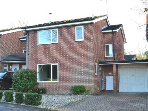 3 bedroom detached house for sale in Woolton Hill, Newbury, Hampshire, RG20 — £465,000 • 3 bed • 1 bath • 950 ft²
 3 bedroom detached house for sale in Mariners Close, Tadley, Hampshire, RG26 — £600,000 • 3 bed • 2 bath • 1454 ft²
 5 bedroom detached house for sale in Crabtree Way, Old Basing, Basingstoke, RG24 — £875,000 • 5 bed • 3 bath • 2369 ft²
Meta
- {
"@context": "https://schema.org",
"@type": "Residence",
"name": "3 bedroom detached house for sale in Droxford Crescent, Tad…",
"description": "",
"url": "https://propertypiper.co.uk/property/1fb9368e-e117-494c-b12a-add85c8ffcdf",
"image": "https://image-a.propertypiper.co.uk/14db9446-5963-4c3a-bb2e-a0b7b5e39474-1024.jpeg",
"address": {
"@type": "PostalAddress",
"streetAddress": "Droxford Crescent, Tadley, Hampshire, RG26",
"postalCode": "RG26 3BA",
"addressLocality": "Basingstoke and Deane",
"addressRegion": "North West Hampshire",
"addressCountry": "England"
},
"geo": {
"@type": "GeoCoordinates",
"latitude": 51.3470642,
"longitude": -1.1484143
},
"numberOfRooms": 3,
"numberOfBathroomsTotal": 2,
"floorSize": {
"@type": "QuantitativeValue",
"value": 1430,
"unitCode": "FTK"
},
"offers": {
"@type": "Offer",
"price": 525000,
"priceCurrency": "GBP",
"availability": "https://schema.org/InStock"
},
"additionalProperty": [
{
"@type": "PropertyValue",
"name": "Feature",
"value": "semi-detached"
},
{
"@type": "PropertyValue",
"name": "Feature",
"value": "1970s"
},
{
"@type": "PropertyValue",
"name": "Feature",
"value": "brick construction"
},
{
"@type": "PropertyValue",
"name": "Feature",
"value": "asphalt shingle roof"
},
{
"@type": "PropertyValue",
"name": "Feature",
"value": "garden"
},
{
"@type": "PropertyValue",
"name": "Feature",
"value": "residential neighborhood"
},
{
"@type": "PropertyValue",
"name": "Feature",
"value": "family home"
},
{
"@type": "PropertyValue",
"name": "Feature",
"value": "1970s"
},
{
"@type": "PropertyValue",
"name": "Feature",
"value": "living room"
},
{
"@type": "PropertyValue",
"name": "Feature",
"value": "standard ceiling"
},
{
"@type": "PropertyValue",
"name": "Feature",
"value": "medium-sized room"
},
{
"@type": "PropertyValue",
"name": "Feature",
"value": "dated"
},
{
"@type": "PropertyValue",
"name": "Feature",
"value": "garden access"
},
{
"@type": "PropertyValue",
"name": "Feature",
"value": "sliding glass doors"
},
{
"@type": "PropertyValue",
"name": "Feature",
"value": "patio view"
}
]
}
High Res Floorplan Images
Compatible Floorplan Images
FloorplanImages Thumbnail