FK4 1DP - 3 bedroom detached bungalow for sale in Duncan Street, Bonn…
View on Property Piper
3 bedroom detached bungalow for sale in Duncan Street, Bonnybridge, Stirlingshire, FK4
Property Details
- Price: £249500
- Bedrooms: 3
- Bathrooms: 1
- Property Type: undefined
- Property SubType: undefined
Brochure Descriptions
- Document cover for a Home Report for a residential property at 19 Duncan Street, Bonnybridge (FK4 1DP). The image shows only the report cover — there are no photographs of the property itself — so internal layout, construction, and external features cannot be confirmed. In valuator style: likely a standard town/semidetached/terraced dwelling typical of Bonnybridge; location suggests easy access to local amenities. No reliable evidence of number of bedrooms, presence or size of garden, parking, special views (sea/river/forest/city) or overall footprint from this image. Recommend on-site inspection or review of the full Home Report for accurate room sizes, floor area and condition assessment.
- No photographs of the property are included in this document — this is a completed property questionnaire/declaration page. The only property-specific information visible is the residential address (19 Duncan Street, Bonnybridge, FK4 1DP). No internal or external images or details about number of rooms, construction, condition, or plot/garden size are provided, so a valuator-style assessment cannot be made from the image alone. Recommend requesting photographs, floor plans and gross internal area to prepare a formal valuation.
Image Descriptions
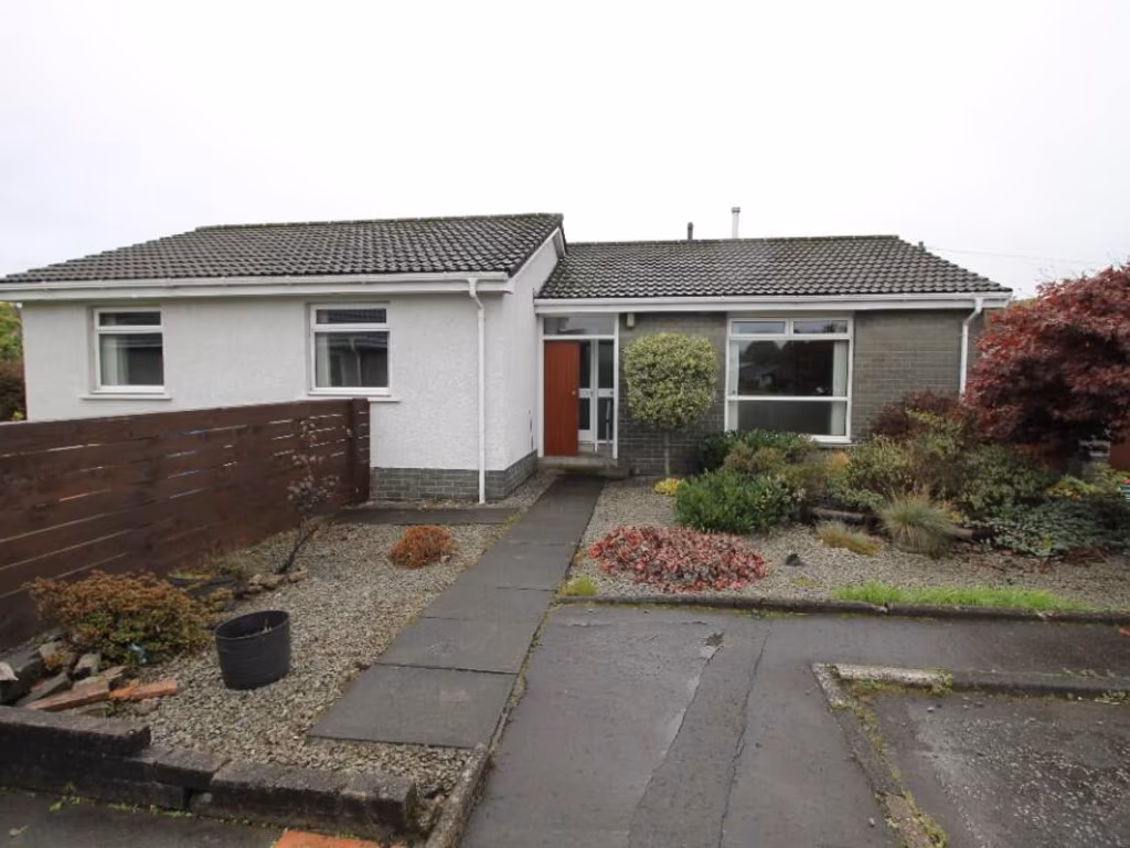
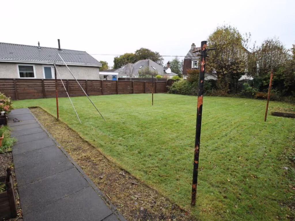
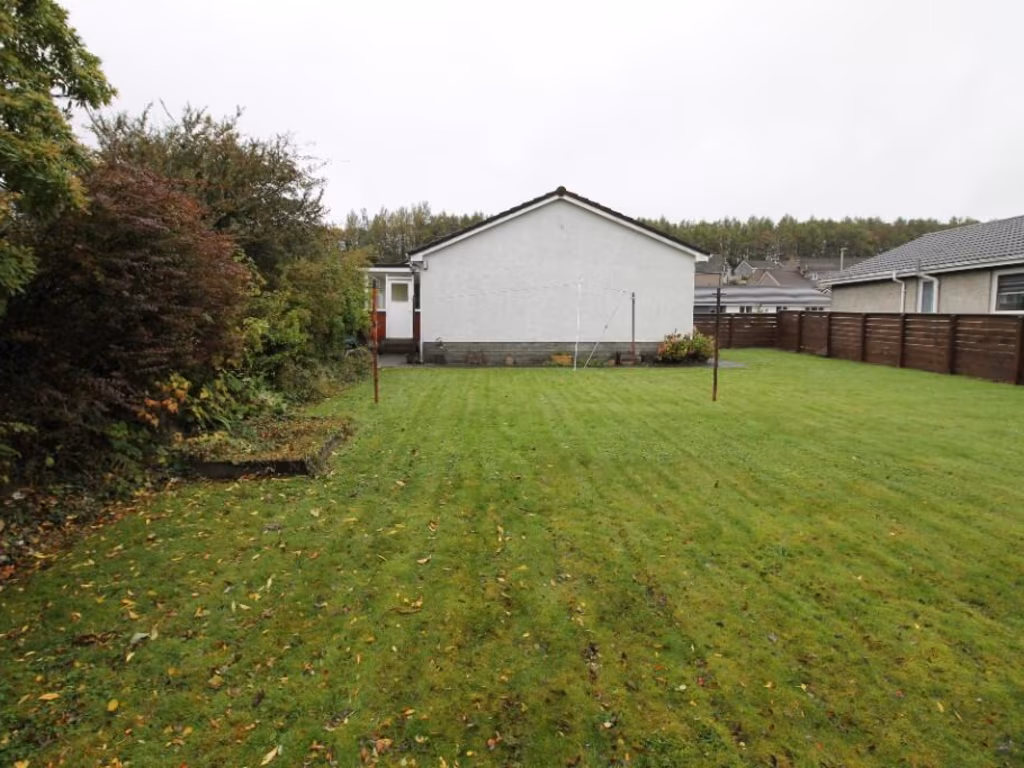
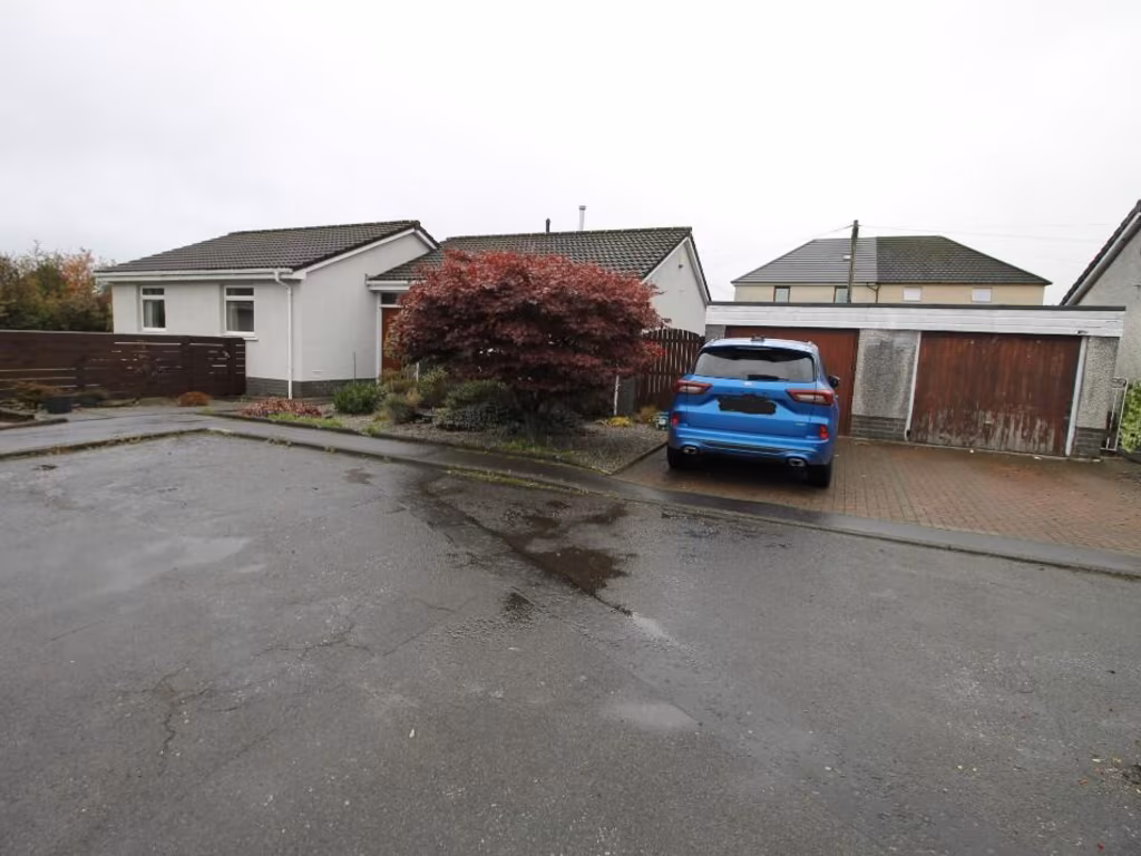
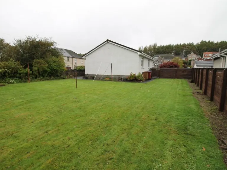
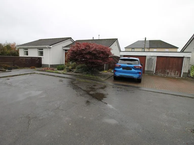
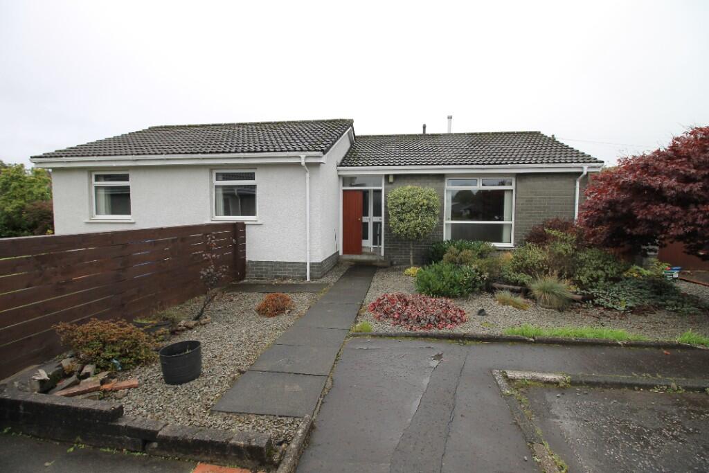
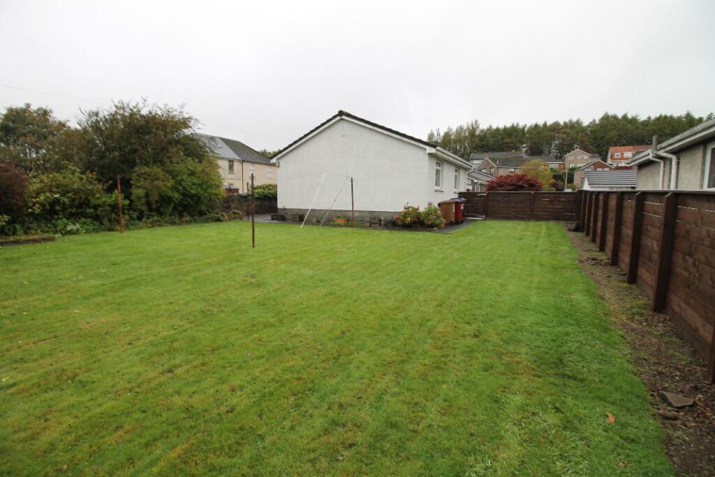
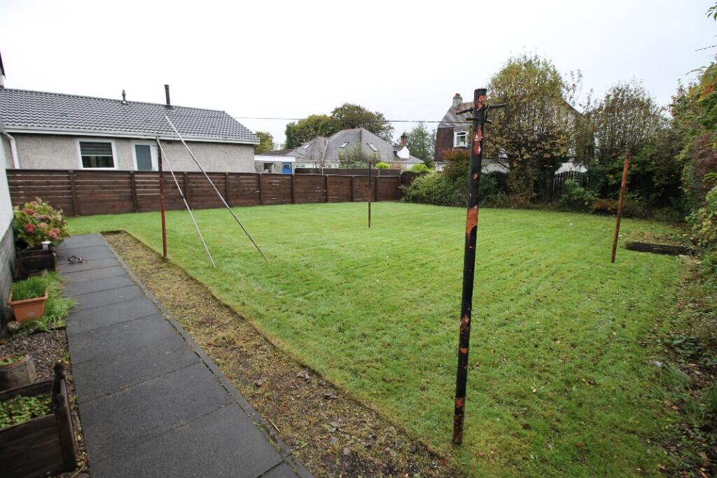
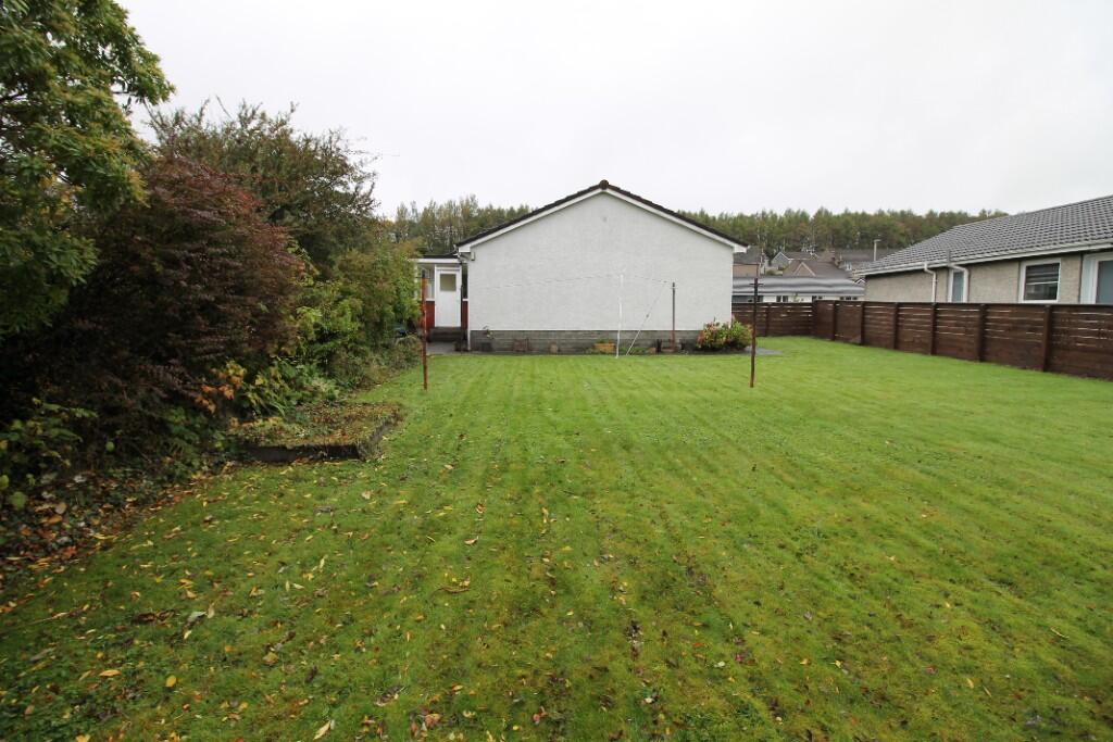
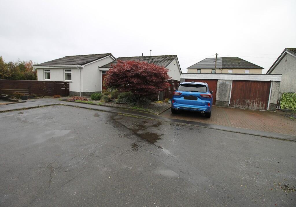
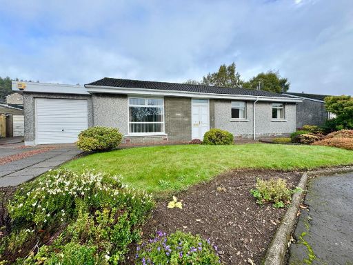
- exterior of a detached 1970s bungalow 1970s bungalow
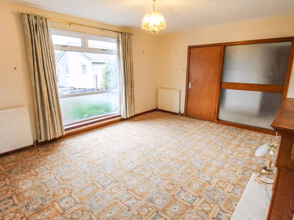
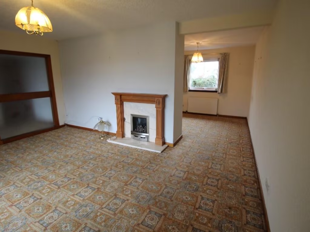
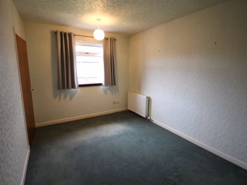
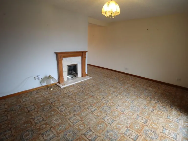
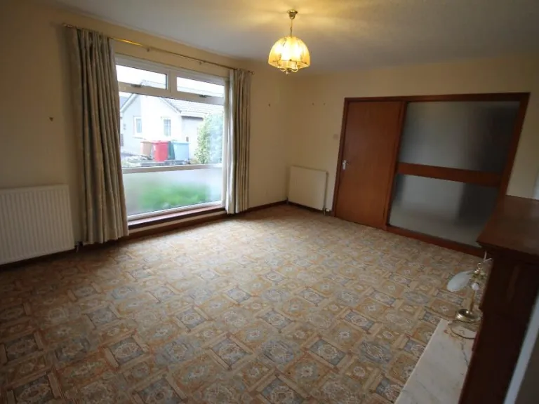
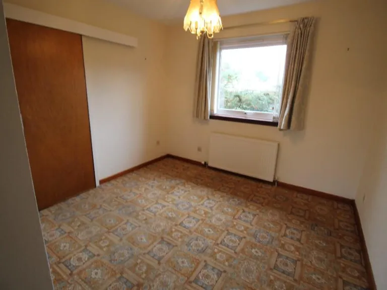
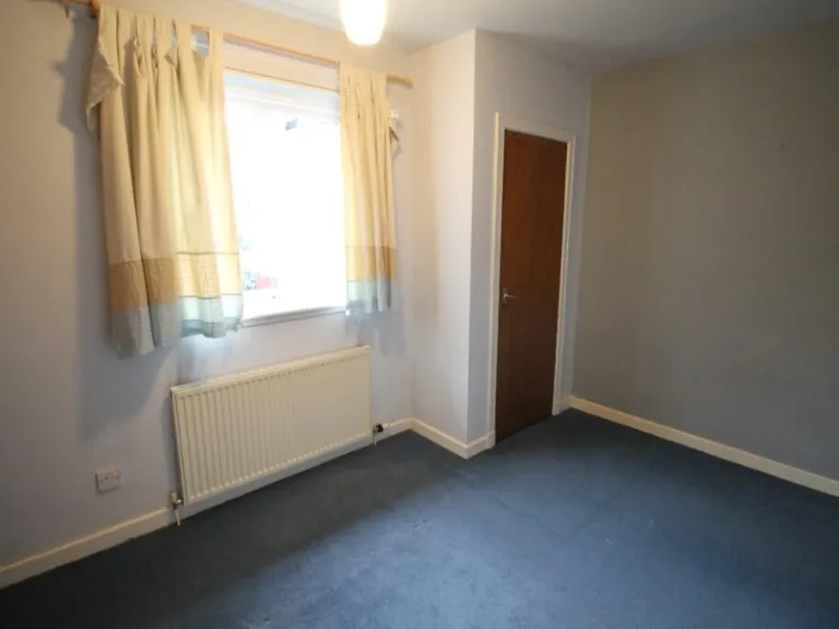
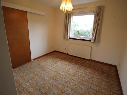
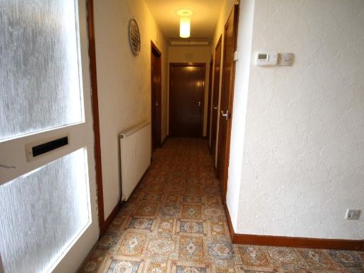
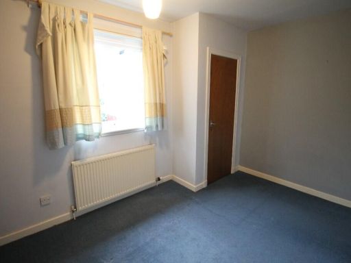
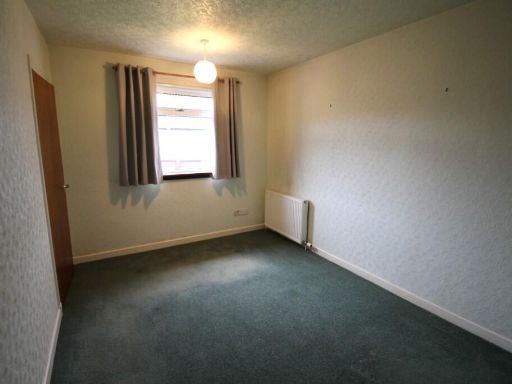
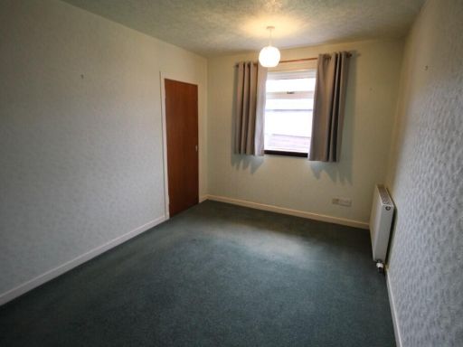
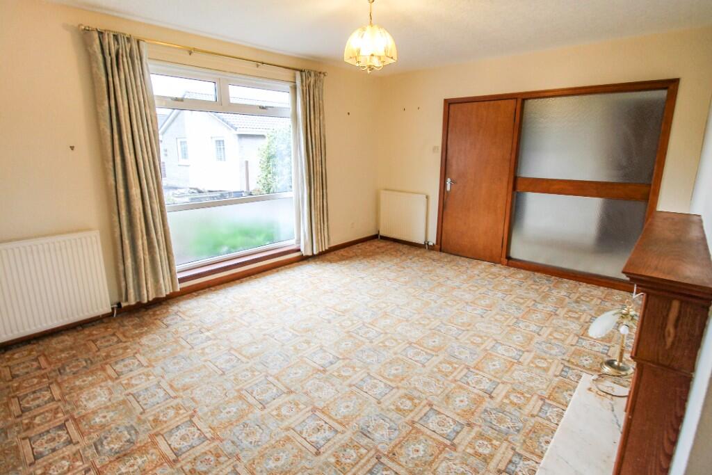
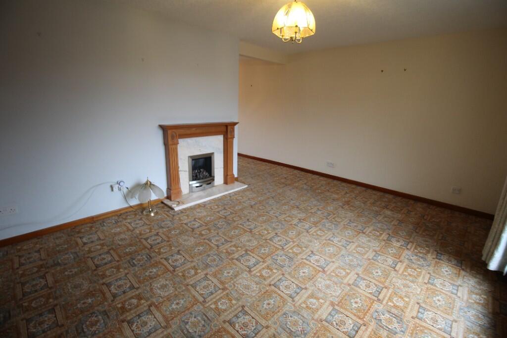
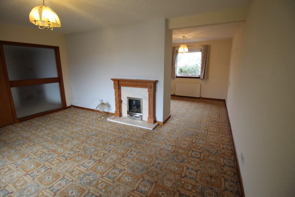
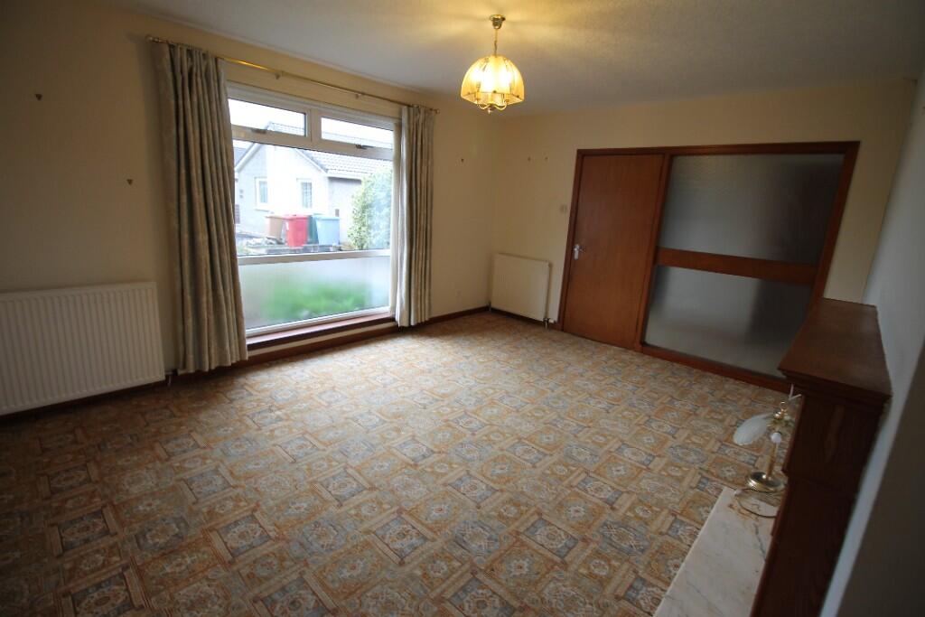
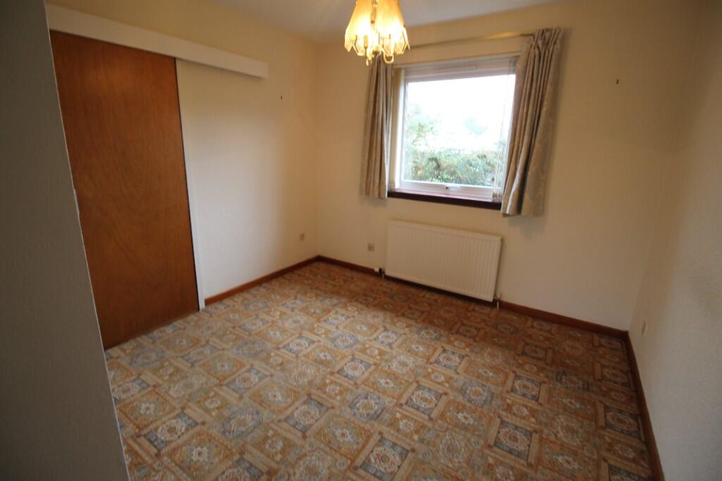
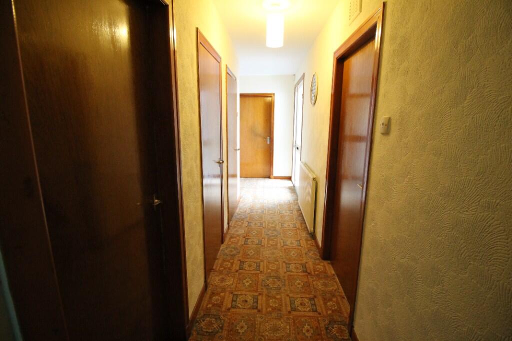
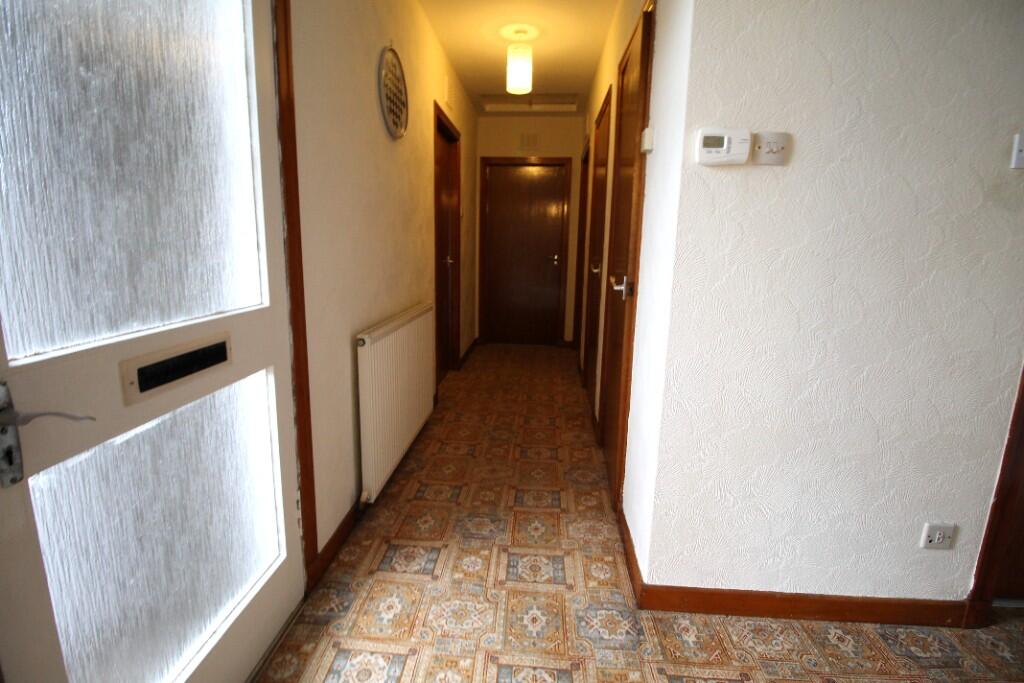
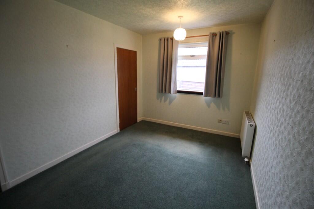
- living room mid-20th century
Floorplan Description
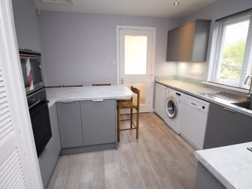
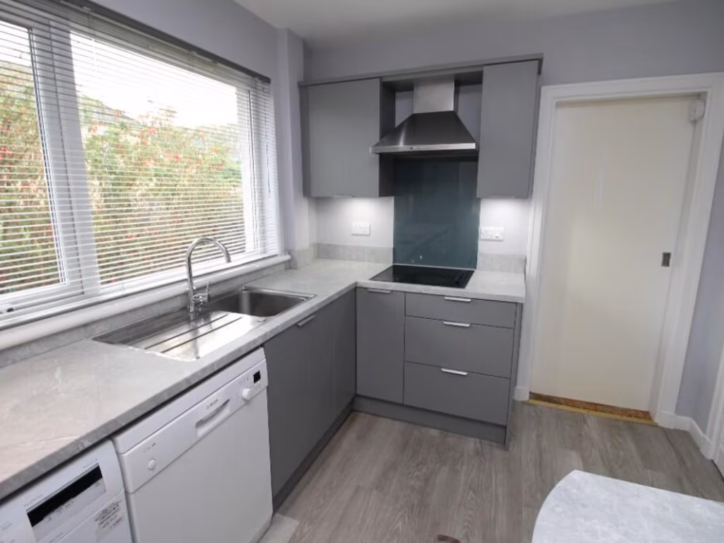
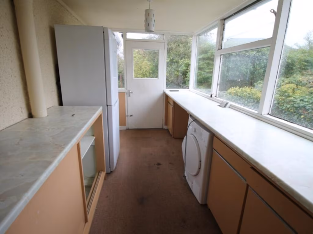
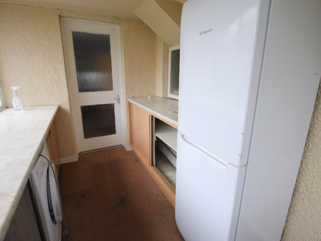
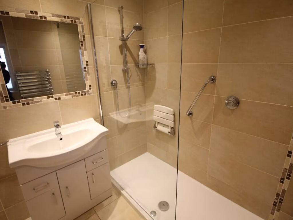
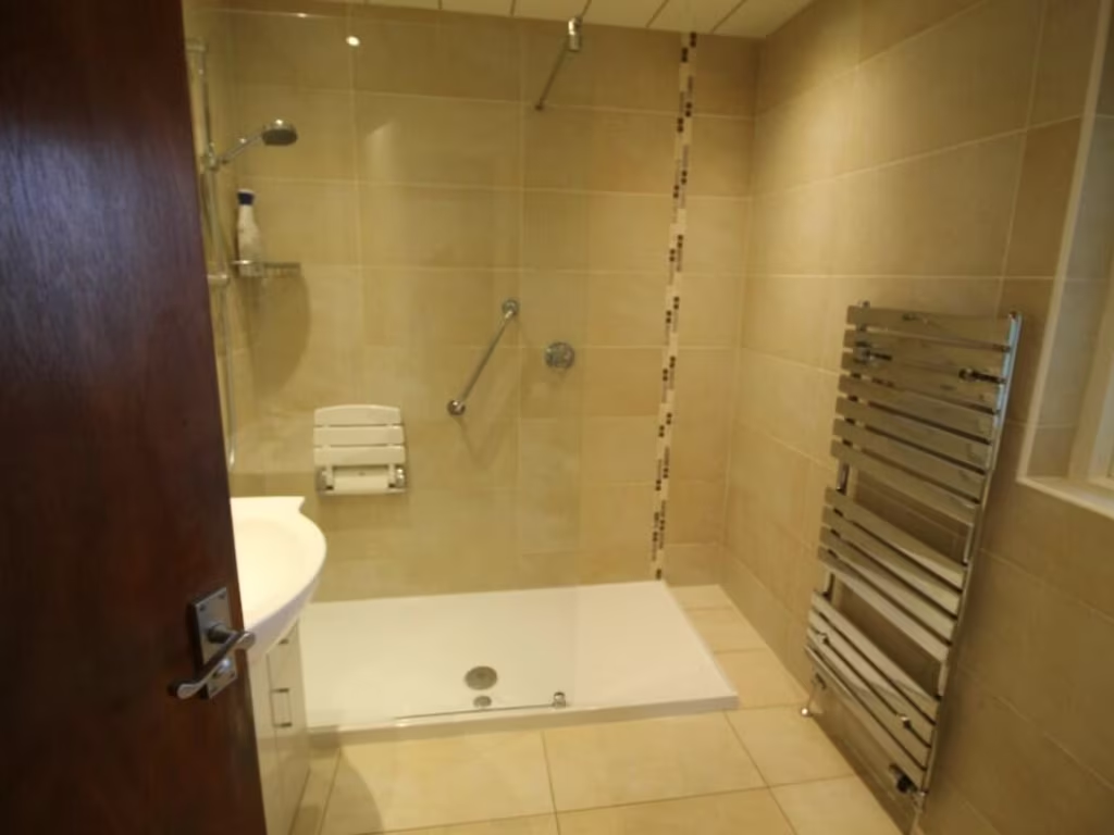
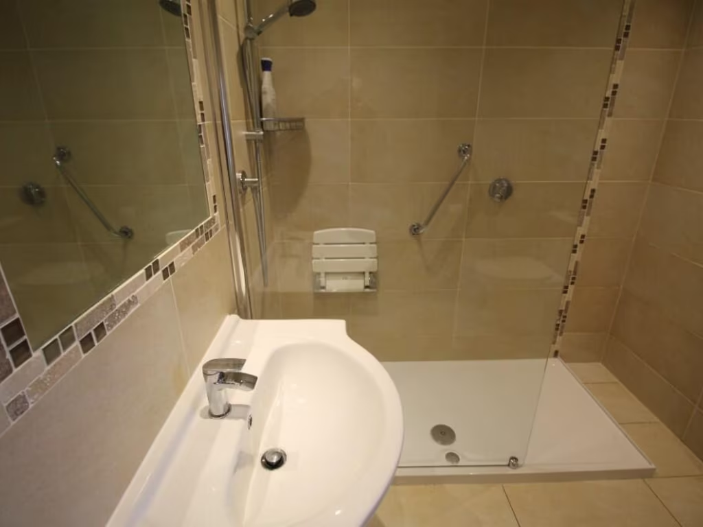
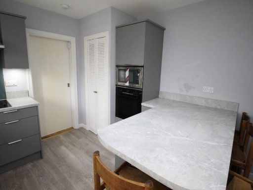
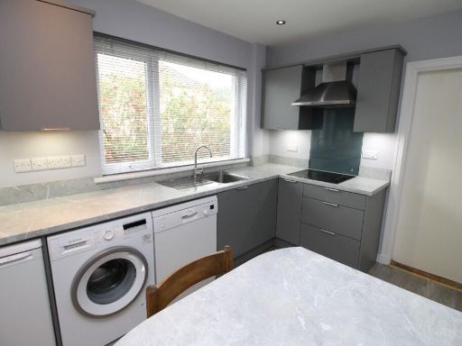
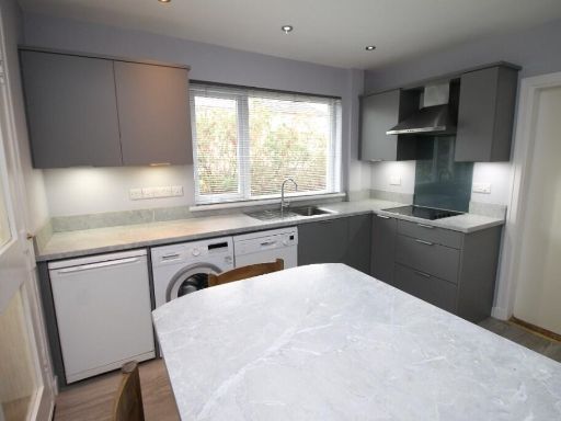
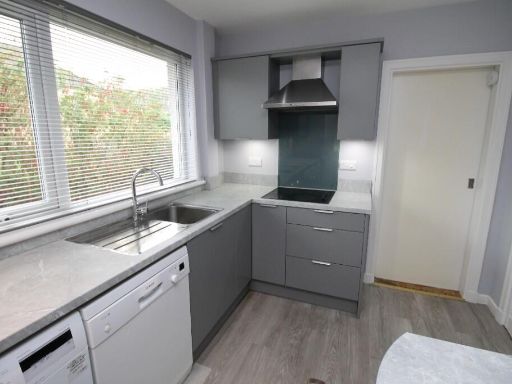
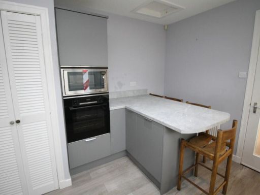
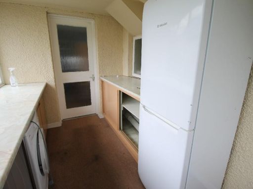
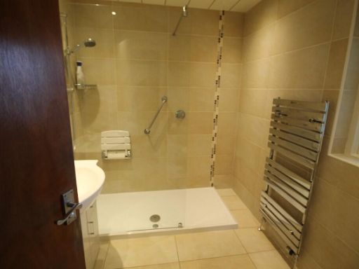
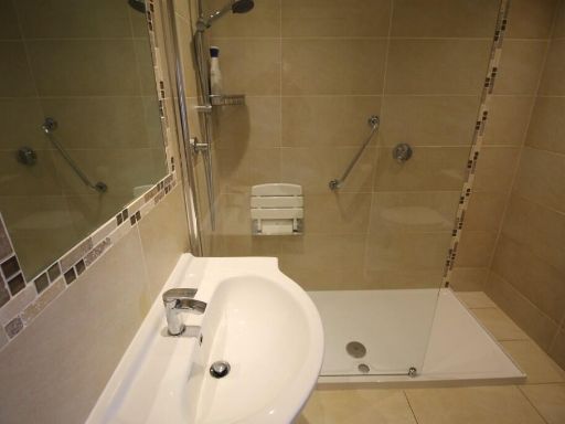
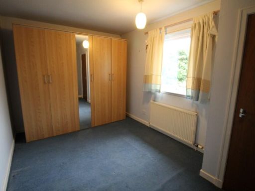
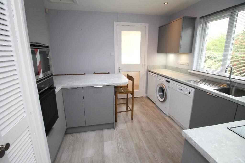
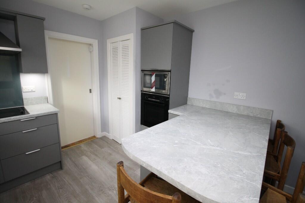
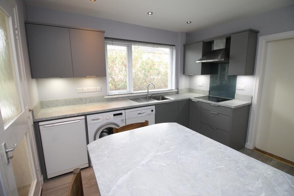
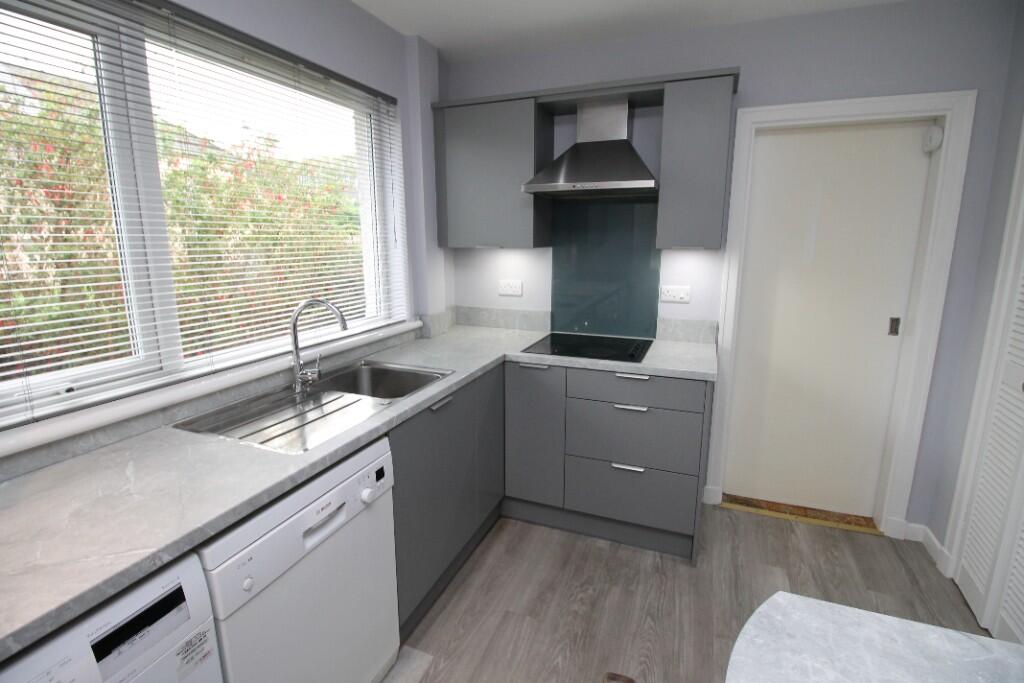
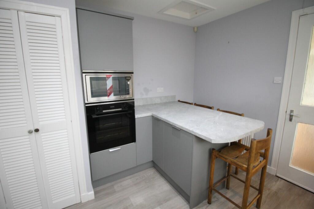
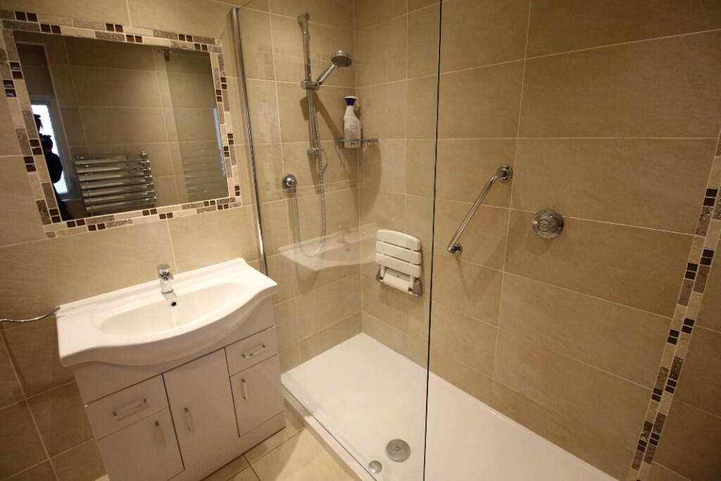
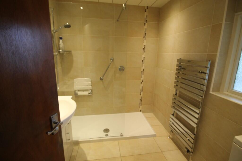
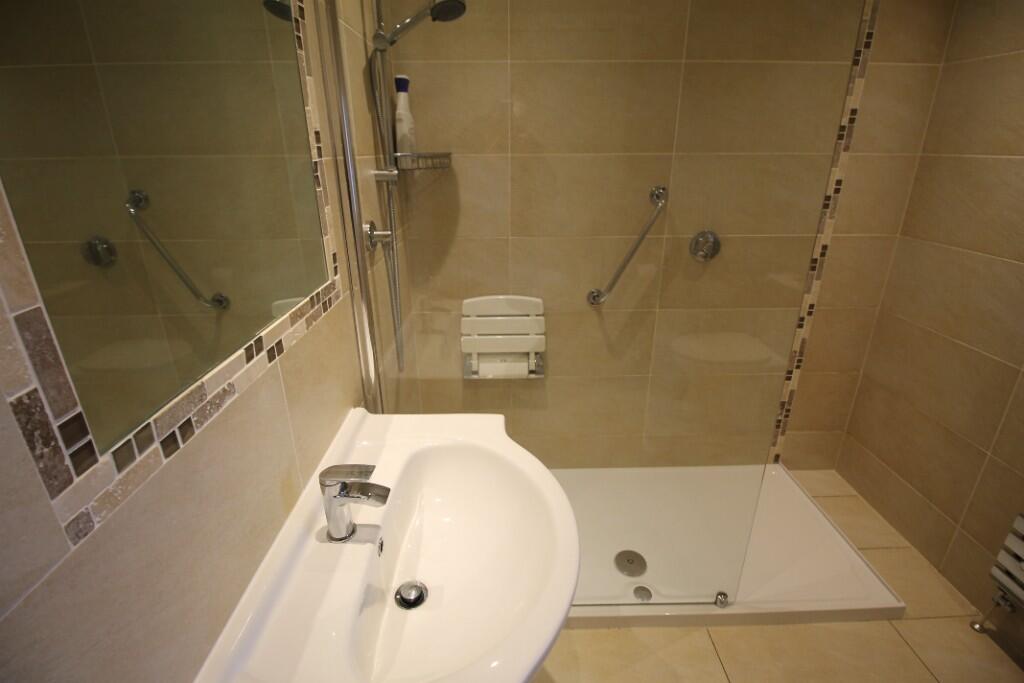
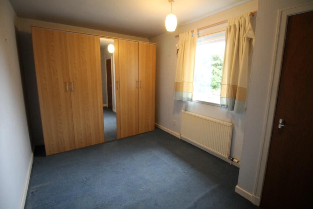
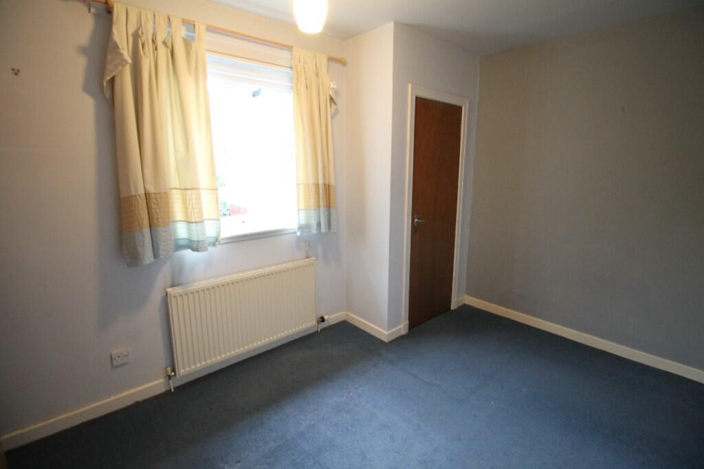
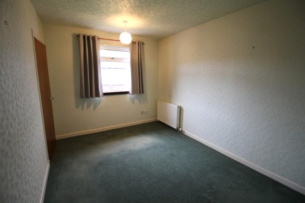
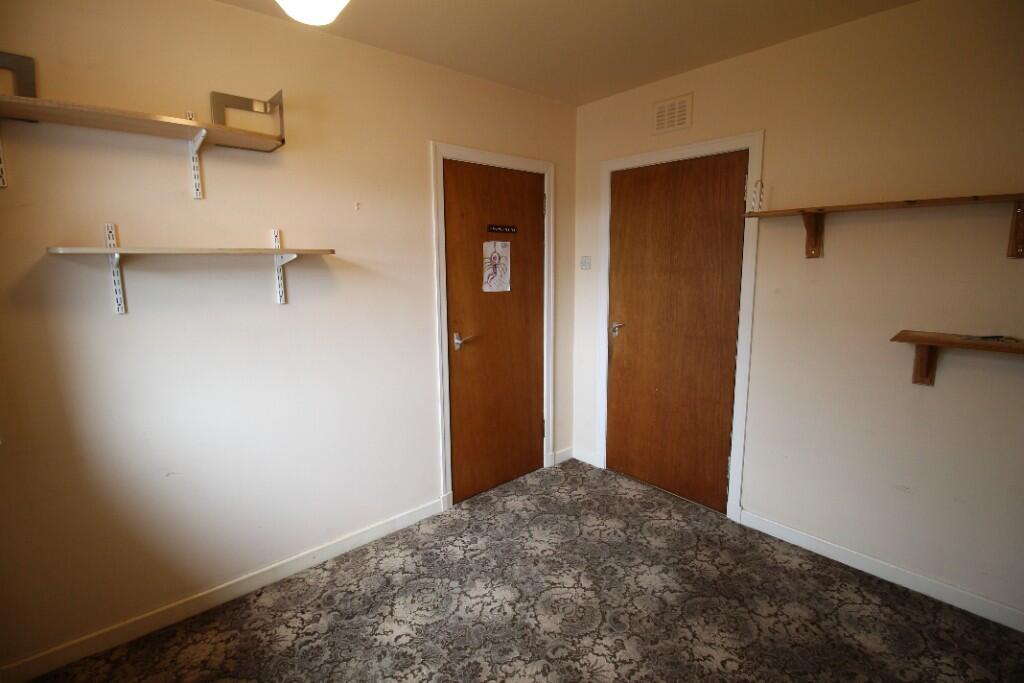
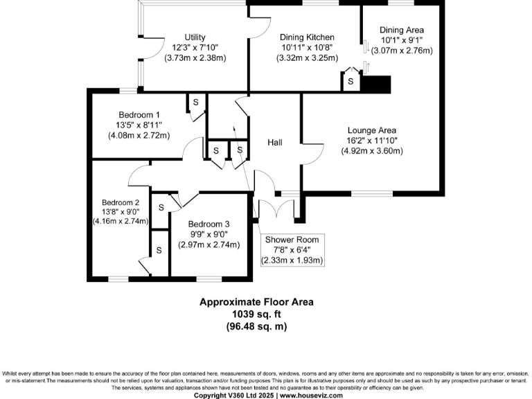
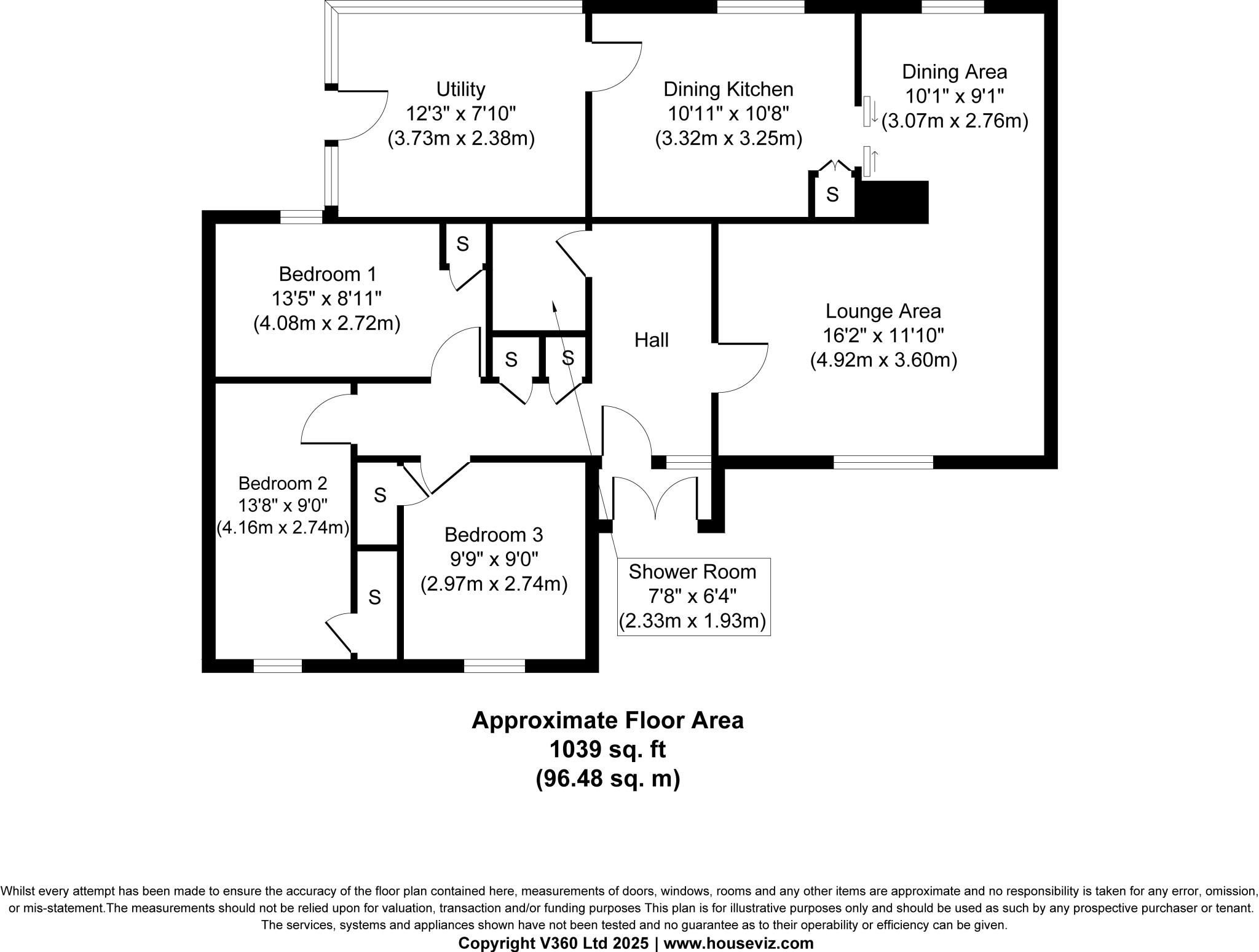
- Single-storey property with lounge, dining/kitchen, three bedrooms, utility and shower room
Rooms
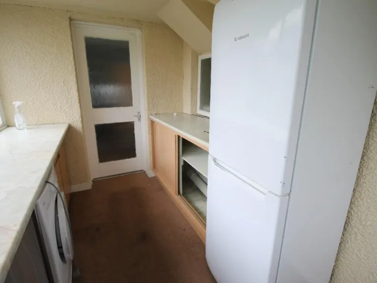
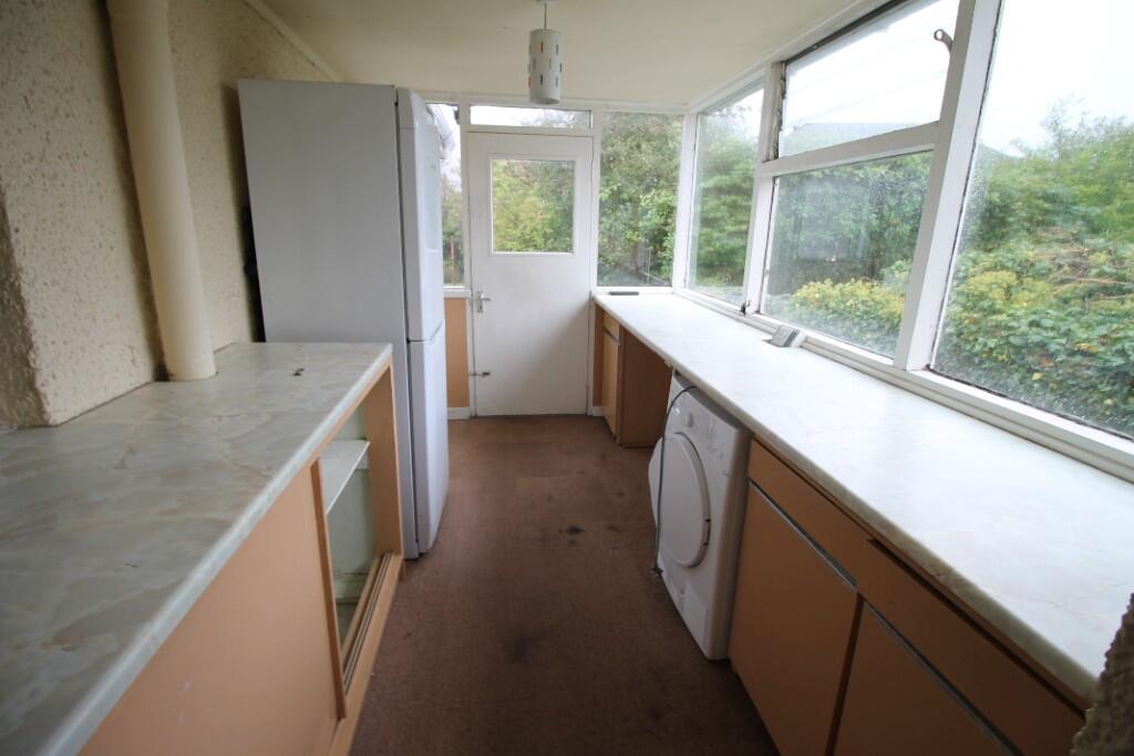
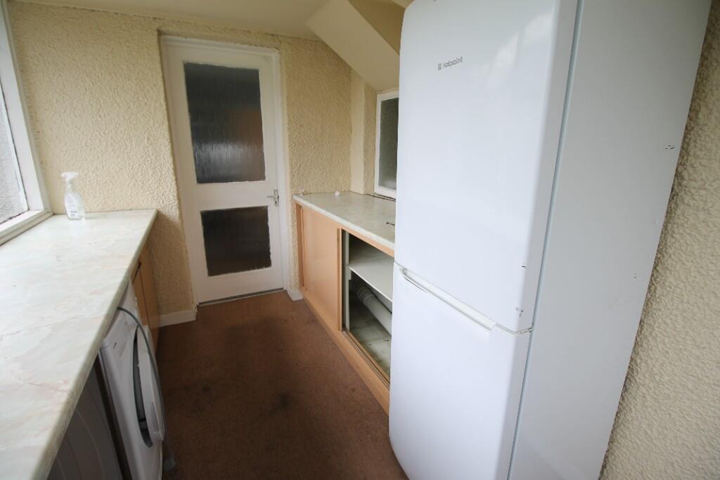
- Utility:
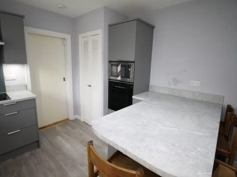
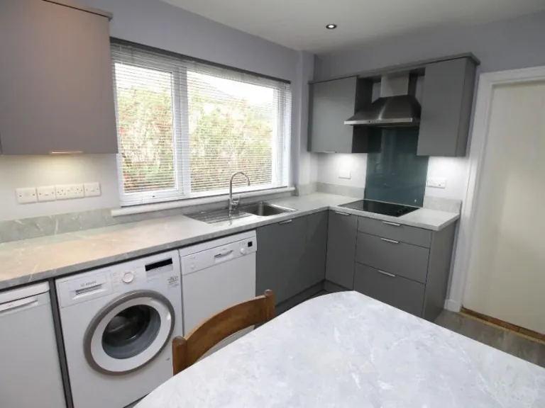
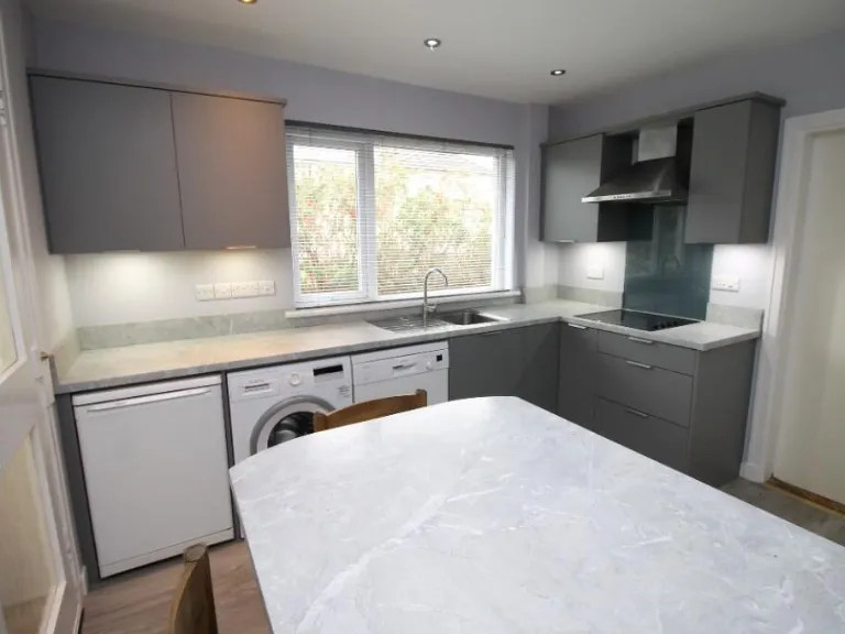
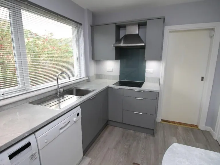
- Dining Kitchen:
- Dining Area:
- Lounge Area:
- Bedroom 1:
- Bedroom 2:
- Bedroom 3:
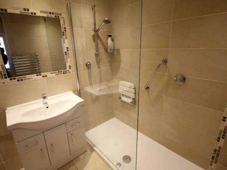
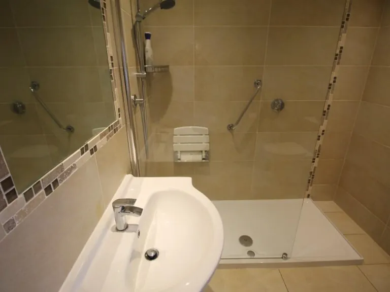
- Shower Room:
Textual Property Features
Detected Visual Features
- 1970s
- bungalow
- single-story
- detached
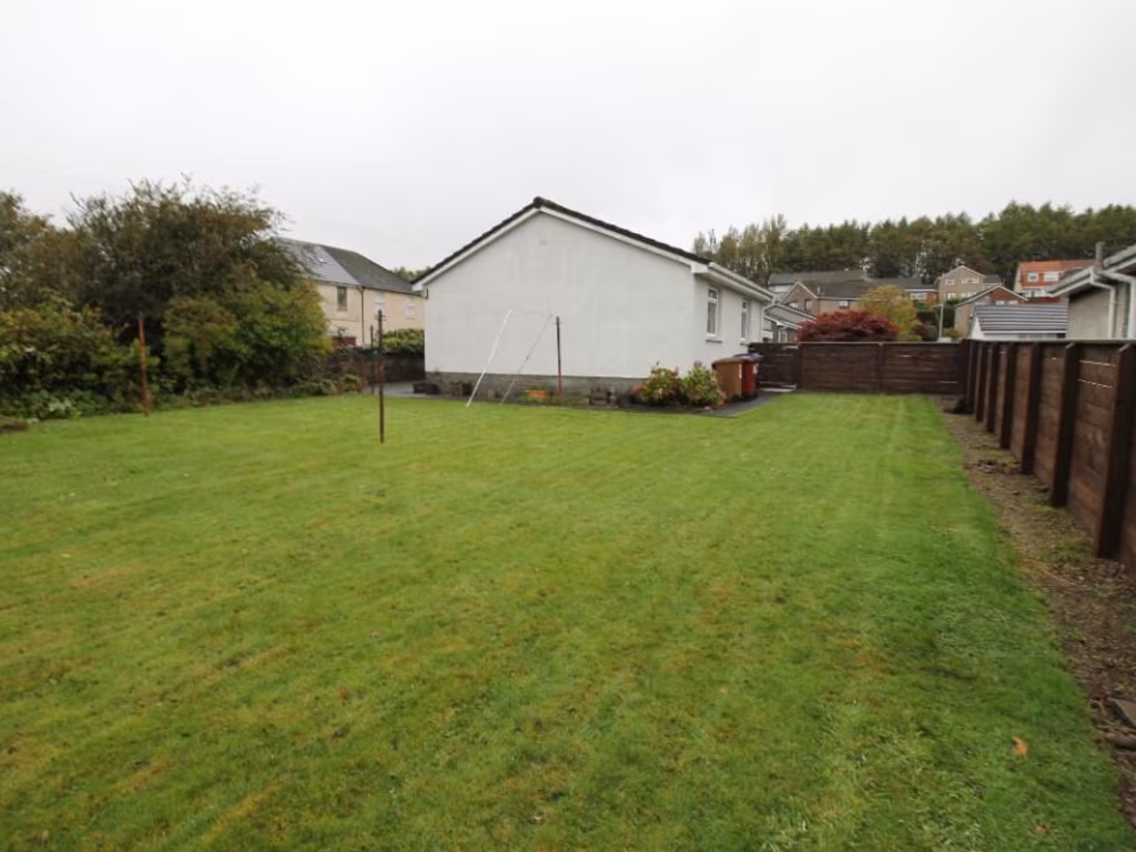
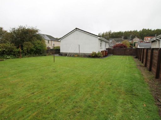
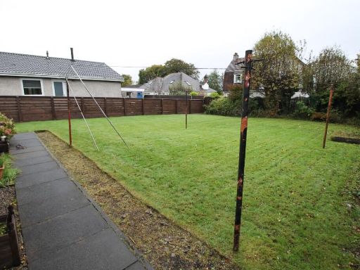
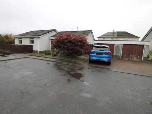
- front garden
- sloped roof
- pebble pathway
- landscaping
- needs updating
- wear
- dated exterior
- mid-20th century
- living room
- large window
- dated interior
- frosted lower window
- glass door
- carpet
- radiator
- property needs modernization
- potential damp
- neutral walls
Nearest Bars And Restaurants
- Id: 910501125
- Tags:
- Amenity: fast_food
- Building: yes
- Cuisine: chinese
- Name: Beijing Cuisine
- Takeaway: only
- TagsNormalized:
- fast food
- food
- chinese
- takeaway
- Lat: 56.0016673
- Lon: -3.8881304
- FullGeoHash: gcvnxdb9rgrv
- PartitionGeoHash: gcvn
- Images:
- FoodStandards: null
- Distance: 760.7
,- Id: 1138974053
- Tags:
- Amenity: cafe
- Building: yes
- Name: The Wee Cafe
- TagsNormalized:
- Lat: 56.0017203
- Lon: -3.8882425
- FullGeoHash: gcvnxdb9tmk3
- PartitionGeoHash: gcvn
- Images:
- FoodStandards: null
- Distance: 753.3
,- Id: 910501127
- Tags:
- Amenity: fast_food
- Building: yes
- Cuisine: indian;pizza;burger;kebab
- Name: Kismet
- Takeaway: only
- TagsNormalized:
- fast food
- food
- indian
- pizza
- burgers
- kebab
- takeaway
- Lat: 56.0014343
- Lon: -3.8889176
- FullGeoHash: gcvnxd8pvxuz
- PartitionGeoHash: gcvn
- Images:
- FoodStandards: null
- Distance: 714.5
,- Id: 910501129
- Tags:
- Addr:
- Amenity: fast_food
- Brand: Domino's
- Brand:wikidata: Q839466
- Brand:wikipedia: en:Domino's Pizza
- Building: yes
- Contact:
- Website: https://www.dominos.co.uk/pizza-near-me/bonnybridge/24-high-street
- Cuisine: pizza
- Name: Domino's
- Takeaway: yes
- TagsNormalized:
- fast food
- food
- dominos
- pizza
- takeaway
- Lat: 56.0019898
- Lon: -3.8897882
- FullGeoHash: gcvnx6ze1re9
- PartitionGeoHash: gcvn
- Images:
- FoodStandards: null
- Distance: 655.8
,- Id: 910082375
- Tags:
- Amenity: pub
- Building: yes
- Name: The Cornhill Inn
- TagsNormalized:
- Lat: 56.0020485
- Lon: -3.8912652
- FullGeoHash: gcvnx6y7wfqr
- PartitionGeoHash: gcvn
- Images:
- FoodStandards: null
- Distance: 563.8
}
Nearest General Shops
- Id: 910501131
- Tags:
- Building: yes
- Name: Underworld Tattoo
- Shop: tattoo
- TagsNormalized:
- Lat: 56.0018703
- Lon: -3.8894803
- FullGeoHash: gcvnx6zf8932
- PartitionGeoHash: gcvn
- Images:
- FoodStandards: null
- Distance: 675.5
,- Id: 910501130
- Tags:
- Building: yes
- Name: Style without Limits
- Shop: hairdresser
- TagsNormalized:
- Lat: 56.0019083
- Lon: -3.8896218
- FullGeoHash: gcvnx6zdv0rg
- PartitionGeoHash: gcvn
- Images:
- FoodStandards: null
- Distance: 666.5
,- Id: 910501133
- Tags:
- Building: yes
- Name: W H Tyres
- Shop: tyres
- TagsNormalized:
- Lat: 56.0023087
- Lon: -3.8910316
- FullGeoHash: gcvnx6yth6ux
- PartitionGeoHash: gcvn
- Images:
- FoodStandards: null
- Distance: 578.2
}
Nearest Grocery shops
- Id: 910501126
- Tags:
- Brand: Premier
- Brand:wikidata: Q7240340
- Brand:wikipedia: en:Premier Stores
- Building: yes
- Name: Premier
- Operator: Padda Store
- Shop: convenience
- TagsNormalized:
- Lat: 56.0014084
- Lon: -3.8887966
- FullGeoHash: gcvnxd8rb7pj
- PartitionGeoHash: gcvn
- Images:
- FoodStandards: null
- Distance: 722.4
,- Id: 9440534348
- Tags:
- Brand: Scotmid
- Brand:wikidata: Q7435719
- Brand:wikipedia: en:Scotmid
- Name: Scotmid
- Shop: convenience
- TagsNormalized:
- Lat: 56.0062404
- Lon: -3.9075083
- FullGeoHash: gcvnx5deuryt
- PartitionGeoHash: gcvn
- Images:
- FoodStandards: null
- Distance: 633.7
,- Id: 910501170
- Tags:
- Addr:
- City: Bonnybridge
- Housenumber: 1
- Postcode: FK4 1PN
- Street: Wheatlands Avenue
- Brand: Scotmid
- Brand:wikidata: Q7435719
- Brand:wikipedia: en:Scotmid
- Building: yes
- Fhrs:
- Name: Scotmid
- Shop: convenience
- TagsNormalized:
- Lat: 56.0049382
- Lon: -3.8915916
- FullGeoHash: gcvnx7qhrm4v
- PartitionGeoHash: gcvn
- Images:
- FoodStandards:
- Id: 549644
- FHRSID: 549644
- LocalAuthorityBusinessID: PI/000074785
- BusinessName: Scotmid
- BusinessType: Retailers - other
- BusinessTypeID: 4613
- AddressLine1: null
- AddressLine2: 1 Wheatlands Avenue
- AddressLine3: null
- AddressLine4: Bonnybridge
- PostCode: FK4 1PN
- RatingValue: Pass
- RatingKey: fhis_pass_en-GB
- RatingDate: 2018-12-20
- LocalAuthorityCode: 774
- LocalAuthorityName: Falkirk
- LocalAuthorityWebSite: http://www.falkirk.gov.uk/
- LocalAuthorityEmailAddress: fs@falkirk.gov.uk
- Scores:
- Hygiene: null
- Structural: null
- ConfidenceInManagement: null
- NewRatingPending: false
- Geocode:
- Longitude: -3.88988600000000
- Latitude: 56.00555000000000
- Distance: 623
}
Nearest Religious buildings
- Id: 672320090
- Tags:
- Amenity: place_of_worship
- Building: yes
- Denomination: church_of_scotland
- Name: Denny Old Parish Church
- Religion: christian
- TagsNormalized:
- place of worship
- church
- church of scotland
- parish
- christian
- Lat: 56.0228439
- Lon: -3.9082745
- FullGeoHash: gcvnxndhdx53
- PartitionGeoHash: gcvn
- Images:
- FoodStandards: null
- Distance: 2348.6
,- Id: 406590545
- Tags:
- Addr:
- City: Bonnybridge
- Street: Broomhill Road
- Amenity: place_of_worship
- Building: yes
- Denomination: roman_catholic
- Name: St Joseph's
- Religion: christian
- TagsNormalized:
- place of worship
- catholic
- roman catholic
- christian
- church
- Lat: 55.9957502
- Lon: -3.8811217
- FullGeoHash: gcvnx9tygk3u
- PartitionGeoHash: gcvn
- Images:
- FoodStandards: null
- Distance: 1392.8
,- Id: 910082377
- Tags:
- Amenity: place_of_worship
- Building: church
- Denomination: church_of_scotland
- Name: Bonnybridge St. Helen's Church
- Religion: christian
- Service_times: Su 11:00
- TagsNormalized:
- place of worship
- church
- church of scotland
- christian
- Lat: 56.0020841
- Lon: -3.892671
- FullGeoHash: gcvnx6v7y1nh
- PartitionGeoHash: gcvn
- Images:
- FoodStandards: null
- Distance: 476.3
}
Nearest Medical buildings
- Id: 546425847
- Tags:
- Amenity: dentist
- Building: yes
- Healthcare: dentist
- Name: Bonnybridge Dental Practice
- TagsNormalized:
- dentist
- health
- healthcare
- dental
- Lat: 56.0009553
- Lon: -3.8870683
- FullGeoHash: gcvnxd9t0wxy
- PartitionGeoHash: gcvn
- Images:
- FoodStandards: null
- Distance: 835.9
,- Id: 910501165
- Tags:
- Amenity: doctors
- Building: yes
- Healthcare: doctor
- Name: Antonine Medical Practice
- TagsNormalized:
- doctor
- doctors
- health
- healthcare
- Lat: 56.0037798
- Lon: -3.8929275
- FullGeoHash: gcvnx7jm8jnz
- PartitionGeoHash: gcvn
- Images:
- FoodStandards: null
- Distance: 492.8
,- Id: 910501163
- Tags:
- Amenity: pharmacy
- Building: yes
- Dispensing: yes
- Healthcare: pharmacy
- Name: Lindsay & Gilmour
- TagsNormalized:
- Lat: 56.003659
- Lon: -3.8930824
- FullGeoHash: gcvnx7jhuweq
- PartitionGeoHash: gcvn
- Images:
- FoodStandards: null
- Distance: 479.1
,- Id: 910501164
- Tags:
- Amenity: doctors
- Building: yes
- Healthcare: doctor
- Name: Bonnybank Medical Practice
- TagsNormalized:
- doctor
- doctors
- health
- healthcare
- Lat: 56.00366
- Lon: -3.8932947
- FullGeoHash: gcvnx7huzwvh
- PartitionGeoHash: gcvn
- Images:
- FoodStandards: null
- Distance: 466.7
}
Nearest Airports
- Id: 1100796130
- Tags:
- Addr:
- City: Paisley
- Postcode: PA3 2SW
- Aerodrome: international
- Aerodrome:type: public
- Aeroway: aerodrome
- Iata: GLA
- Icao: EGPF
- Ifr: yes
- Is_in: Paisley, Scotland, UK
- Name: Glasgow Airport
- Operator: Glasgow Airport Limited
- Phone: +44 141 887 1111
- Ref: GLA
- Source: CAA AIP
- Wikidata: Q8721
- Wikipedia: en:Glasgow Airport
- TagsNormalized:
- airport
- international airport
- Lat: 55.8705835
- Lon: -4.4351667
- FullGeoHash: gcuvg4fmtpsh
- PartitionGeoHash: gcuv
- Images:
- FoodStandards: null
- Distance: 36383.5
,- Id: 4519551
- Tags:
- Aerodrome: international
- Name: Glasgow International Airport
- Type: site
- Wikidata: Q8721
- TagsNormalized:
- airport
- international airport
- Lat: 55.8705829
- Lon: -4.4355768
- FullGeoHash: gcuvg4fjexd0
- PartitionGeoHash: gcuv
- Images:
- FoodStandards: null
- Distance: 36406.9
}
Nearest Leisure Facilities
- Id: 1018910144
- Tags:
- TagsNormalized:
- Lat: 56.0008346
- Lon: -3.8929836
- FullGeoHash: gcvnx6thwbjn
- PartitionGeoHash: gcvn
- Images:
- FoodStandards: null
- Distance: 481.1
,- Id: 188488267
- Tags:
- Alt_name: Bonnyfield Nature Park;Bonnyfield LNR
- Leisure: nature_reserve
- Name: Bonnyfield Local Nature Reserve
- TagsNormalized:
- Lat: 55.9983342
- Lon: -3.8975773
- FullGeoHash: gcvnx61vgy5e
- PartitionGeoHash: gcvn
- Images:
- FoodStandards: null
- Distance: 462.1
,- Id: 910026506
- Tags:
- TagsNormalized:
- Lat: 55.9998769
- Lon: -3.896744
- FullGeoHash: gcvnx66qzm9j
- PartitionGeoHash: gcvn
- Images:
- FoodStandards: null
- Distance: 340.8
,- Id: 546425818
- Tags:
- Leisure: pitch
- Name: Bonnybridge Bowling Club
- Sport: bowls
- TagsNormalized:
- pitch
- leisure
- bowling
- club
- bowls
- sports
- Lat: 56.0027737
- Lon: -3.8955271
- FullGeoHash: gcvnx6grg9sm
- PartitionGeoHash: gcvn
- Images:
- FoodStandards: null
- Distance: 305.4
,- Id: 910026505
- Tags:
- TagsNormalized:
- Lat: 56.0024484
- Lon: -3.9038231
- FullGeoHash: gcvnx4vmfm49
- PartitionGeoHash: gcvn
- Images:
- FoodStandards: null
- Distance: 219.1
}
Nearest Tourist attractions
- Id: 753847131
- Tags:
- Name: Wheel Caravan park
- Name:en: Wheel Caravan park
- Tourism: caravan_site
- TagsNormalized:
- Lat: 55.9923854
- Lon: -3.8433675
- FullGeoHash: gcvq8917711m
- PartitionGeoHash: gcvq
- Images:
- FoodStandards: null
- Distance: 3706.2
,- Id: 32466476
- Tags:
- Boat: yes
- Lock_name: Falkirk Wheel
- Name: Falkirk Wheel
- Source: OS_OpenData_StreetView
- Tourism: attraction
- Waterway: boat_lift
- Website: http://www.thefalkirkwheel.co.uk/
- Wheelchair: yes
- Wikidata: Q99327
- Wikipedia: en:Falkirk Wheel
- TagsNormalized:
- Lat: 56.0003559
- Lon: -3.841725
- FullGeoHash: gcvq8dd99qfn
- PartitionGeoHash: gcvq
- Images:
- FoodStandards: null
- Distance: 3649.6
,- Id: 1126545849
- Tags:
- TagsNormalized:
- Lat: 56.0216792
- Lon: -3.8880909
- FullGeoHash: gcvnxw2vbvvm
- PartitionGeoHash: gcvn
- Images:
- FoodStandards: null
- Distance: 2296.2
}
Nearest Bus stations and stops
- Id: 6917070288
- Tags:
- Bus: yes
- Highway: bus_stop
- Public_transport: platform
- TagsNormalized:
- Lat: 56.022336
- Lon: -3.9075269
- FullGeoHash: gcvnxnd9u02g
- PartitionGeoHash: gcvn
- Images:
- FoodStandards: null
- Distance: 2283.9
,- Id: 6917070296
- Tags:
- Bus: yes
- Highway: bus_stop
- Public_transport: platform
- TagsNormalized:
- Lat: 56.0220082
- Lon: -3.9072673
- FullGeoHash: gcvnxn6zf54r
- PartitionGeoHash: gcvn
- Images:
- FoodStandards: null
- Distance: 2245
,- Id: 6725187020
- Tags:
- Bus: yes
- Highway: bus_stop
- Public_transport: platform
- TagsNormalized:
- Lat: 56.0121243
- Lon: -3.9109107
- FullGeoHash: gcvnxh8nm0v8
- PartitionGeoHash: gcvn
- Images:
- FoodStandards: null
- Distance: 1285.2
,- Id: 6725187019
- Tags:
- Bus: yes
- Highway: bus_stop
- Public_transport: platform
- TagsNormalized:
- Lat: 56.0123726
- Lon: -3.908793
- FullGeoHash: gcvnxh9xwx09
- PartitionGeoHash: gcvn
- Images:
- FoodStandards: null
- Distance: 1248.1
,- Id: 9178943114
- Tags:
- Bus: yes
- Highway: bus_stop
- Public_transport: platform
- TagsNormalized:
- Lat: 56.0033578
- Lon: -3.9081463
- FullGeoHash: gcvnx545jwdc
- PartitionGeoHash: gcvn
- Images:
- FoodStandards: null
- Distance: 503
}
Nearest Hotels
- Id: 237572630
- Tags:
- Building: yes
- Name: Castlecary Hotel
- Tourism: hotel
- TagsNormalized:
- Lat: 55.9800974
- Lon: -3.9475146
- FullGeoHash: gcvnqnve8nxb
- PartitionGeoHash: gcvn
- Images:
- FoodStandards: null
- Distance: 3827.5
,- Id: 910522730
- Tags:
- Amenity: pub
- Building: yes
- Name: The Crown Hotel
- TagsNormalized:
- Lat: 55.998823
- Lon: -3.910811
- FullGeoHash: gcvnx420z3py
- PartitionGeoHash: gcvn
- Images:
- FoodStandards: null
- Distance: 751.9
,- Id: 910082374
- Tags:
- Amenity: pub
- Building: yes
- Building:levels: 3
- Name: The Royal Hotel
- TagsNormalized:
- Lat: 56.002029
- Lon: -3.8901382
- FullGeoHash: gcvnx6z73nye
- PartitionGeoHash: gcvn
- Images:
- FoodStandards: null
- Distance: 633.9
}
Tags
- 1970s
- bungalow
- single-story
- detached
- front garden
- sloped roof
- pebble pathway
- landscaping
- needs updating
- wear
- dated exterior
- mid-20th century
- living room
- large window
- dated interior
- frosted lower window
- glass door
- carpet
- radiator
- property needs modernization
- potential damp
- neutral walls
Local Market Stats
- Average Price/sqft: £166
- Planning Success Rate: 99%
Similar Properties
 4 bedroom detached bungalow for sale in Duncan Street,Bonnybridge,FK4 1DP, FK4 — £245,000 • 4 bed • 1 bath • 911 ft²
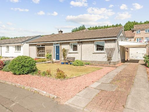 3 bedroom detached bungalow for sale in 26 Duncan Street, Bonnybridge, Stirlingshire, FK4 1DP, FK4 — £249,000 • 3 bed • 1 bath • 1027 ft²
 2 bedroom semi-detached house for sale in Millar Place,High Bonnybridge,Bonnybridge,FK4 2AR, FK4 — £125,000 • 2 bed • 1 bath • 649 ft²
 3 bedroom detached house for sale in Albert Road, Falkirk, FK1 — £358,000 • 3 bed • 1 bath • 1300 ft²
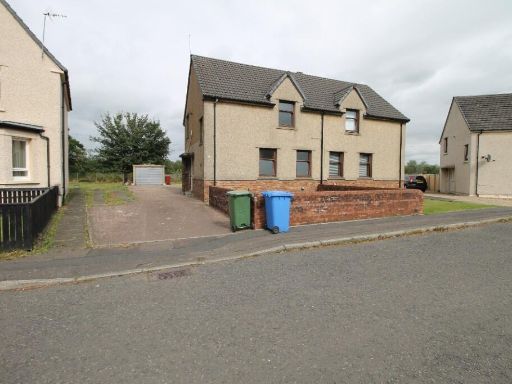 3 bedroom semi-detached house for sale in Gateside Avenue, Bonnybridge, Stirlingshire, FK4 — £144,500 • 3 bed • 1 bath • 990 ft²
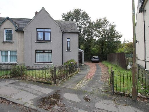 3 bedroom end of terrace house for sale in Bridge Crescent, Denny, Stirlingshire, FK6 — £119,500 • 3 bed • 2 bath • 1044 ft²
Meta
- {
"@context": "https://schema.org",
"@type": "Residence",
"name": "3 bedroom detached bungalow for sale in Duncan Street, Bonn…",
"description": "",
"url": "https://propertypiper.co.uk/property/1bb27d30-e061-4615-9191-7e92af95f7e2",
"image": "https://image-a.propertypiper.co.uk/7b9cb1ac-5caa-4f65-8f11-e46b333c7dcf-1024.jpeg",
"address": {
"@type": "PostalAddress",
"streetAddress": "19, DUNCAN STREET, BONNYBRIDGE",
"postalCode": "FK4 1DP",
"addressLocality": "Falkirk",
"addressRegion": "Falkirk",
"addressCountry": "Scotland"
},
"geo": {
"@type": "GeoCoordinates",
"latitude": 56.0021947,
"longitude": -3.900329
},
"numberOfRooms": 3,
"numberOfBathroomsTotal": 1,
"floorSize": {
"@type": "QuantitativeValue",
"value": 1033,
"unitCode": "FTK"
},
"offers": {
"@type": "Offer",
"price": 249500,
"priceCurrency": "GBP",
"availability": "https://schema.org/InStock"
},
"additionalProperty": [
{
"@type": "PropertyValue",
"name": "Feature",
"value": "1970s"
},
{
"@type": "PropertyValue",
"name": "Feature",
"value": "bungalow"
},
{
"@type": "PropertyValue",
"name": "Feature",
"value": "single-story"
},
{
"@type": "PropertyValue",
"name": "Feature",
"value": "detached"
},
{
"@type": "PropertyValue",
"name": "Feature",
"value": "front garden"
},
{
"@type": "PropertyValue",
"name": "Feature",
"value": "sloped roof"
},
{
"@type": "PropertyValue",
"name": "Feature",
"value": "pebble pathway"
},
{
"@type": "PropertyValue",
"name": "Feature",
"value": "landscaping"
},
{
"@type": "PropertyValue",
"name": "Feature",
"value": "needs updating"
},
{
"@type": "PropertyValue",
"name": "Feature",
"value": "wear"
},
{
"@type": "PropertyValue",
"name": "Feature",
"value": "dated exterior"
},
{
"@type": "PropertyValue",
"name": "Feature",
"value": "mid-20th century"
},
{
"@type": "PropertyValue",
"name": "Feature",
"value": "living room"
},
{
"@type": "PropertyValue",
"name": "Feature",
"value": "large window"
},
{
"@type": "PropertyValue",
"name": "Feature",
"value": "dated interior"
},
{
"@type": "PropertyValue",
"name": "Feature",
"value": "frosted lower window"
},
{
"@type": "PropertyValue",
"name": "Feature",
"value": "glass door"
},
{
"@type": "PropertyValue",
"name": "Feature",
"value": "carpet"
},
{
"@type": "PropertyValue",
"name": "Feature",
"value": "radiator"
},
{
"@type": "PropertyValue",
"name": "Feature",
"value": "property needs modernization"
},
{
"@type": "PropertyValue",
"name": "Feature",
"value": "potential damp"
},
{
"@type": "PropertyValue",
"name": "Feature",
"value": "neutral walls"
}
]
}
High Res Floorplan Images
Compatible Floorplan Images
FloorplanImages Thumbnail