EN3 6QJ - 2 bedroom terraced house for sale in Holmwood Road, Enfield…
View on Property Piper
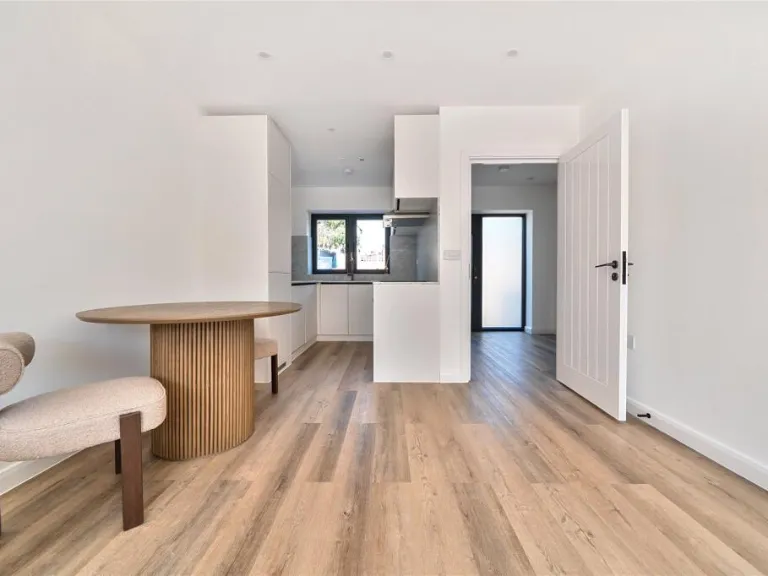
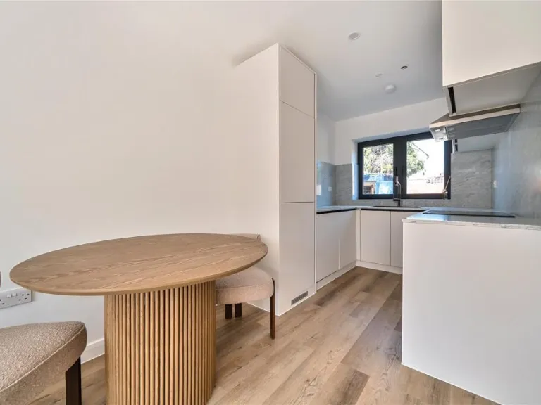
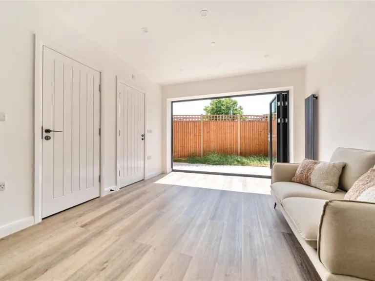
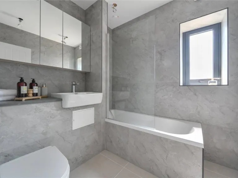
2 bedroom terraced house for sale in Holmwood Road, Enfield, EN3
Property Details
- Price: £450000
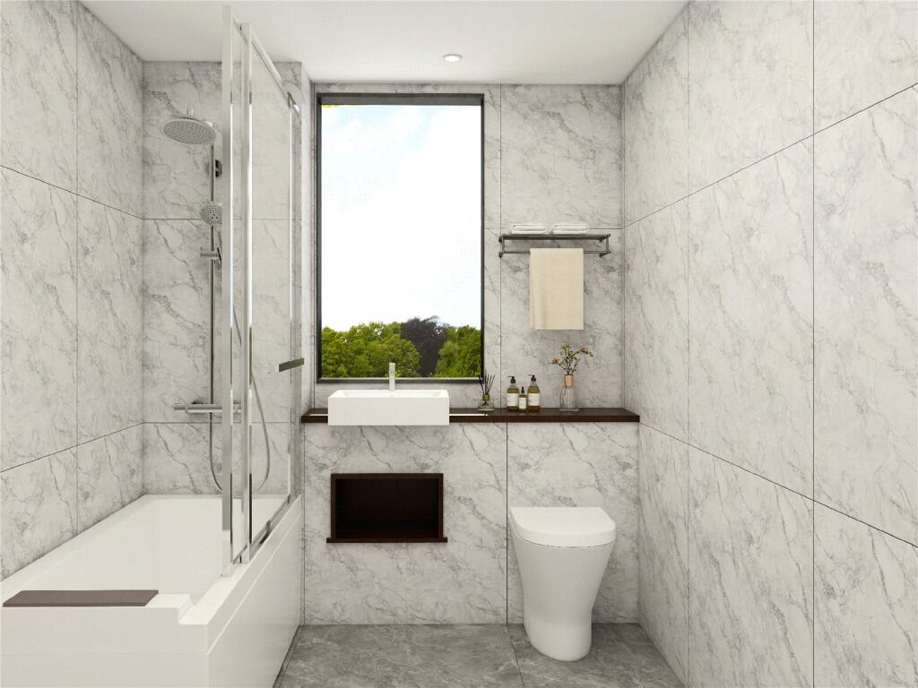
- Bedrooms: 2
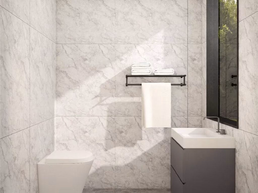
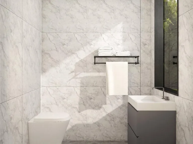
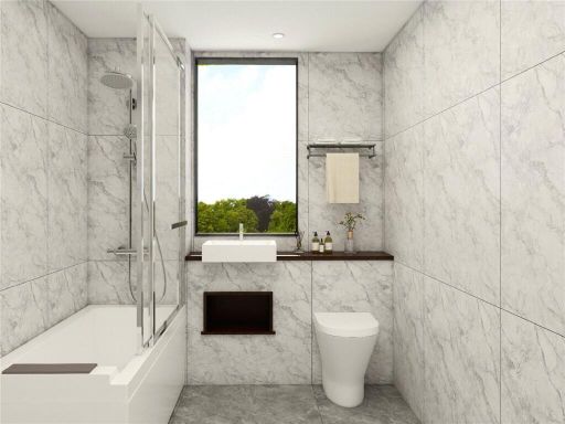
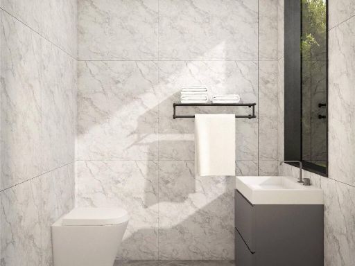
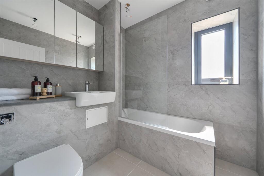
- Bathrooms: 2
- Property Type: undefined
- Property SubType: undefined
Image Descriptions
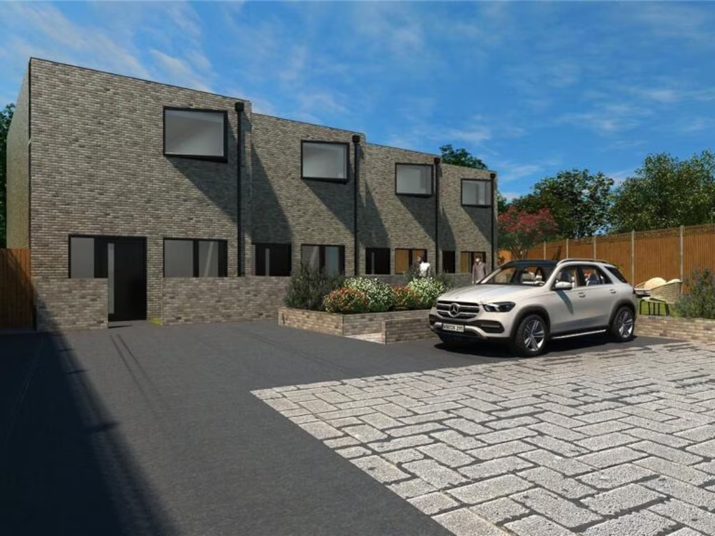
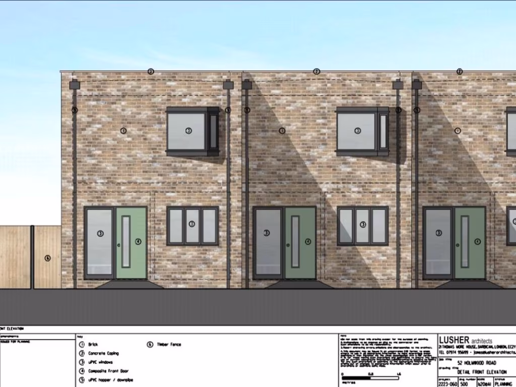
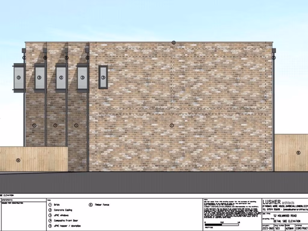
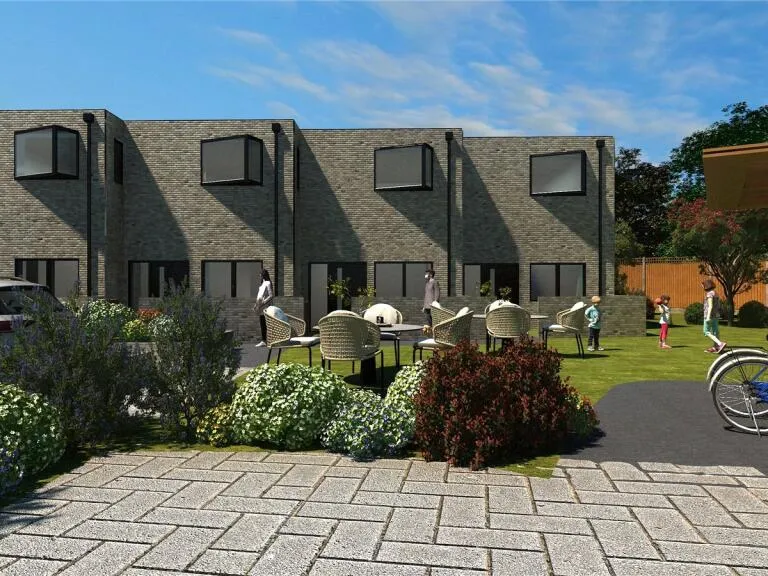
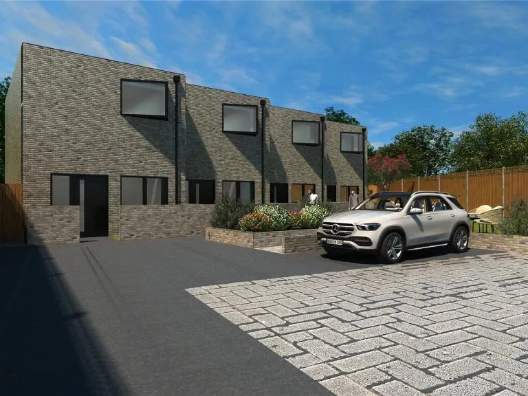
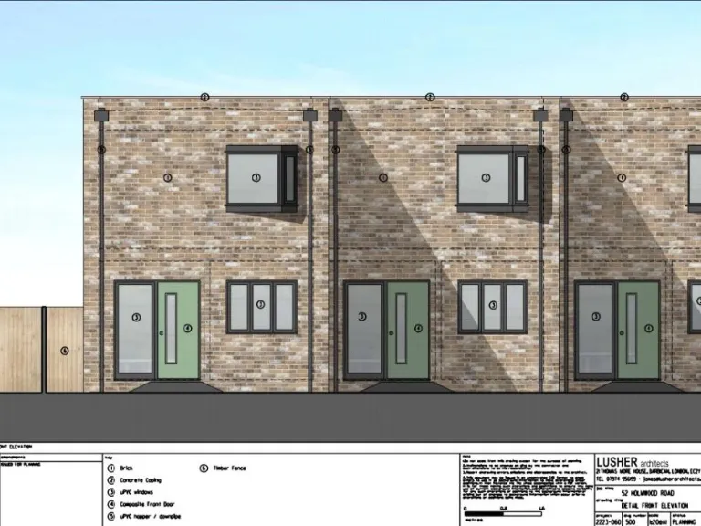
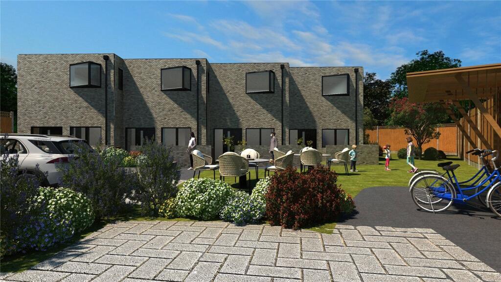
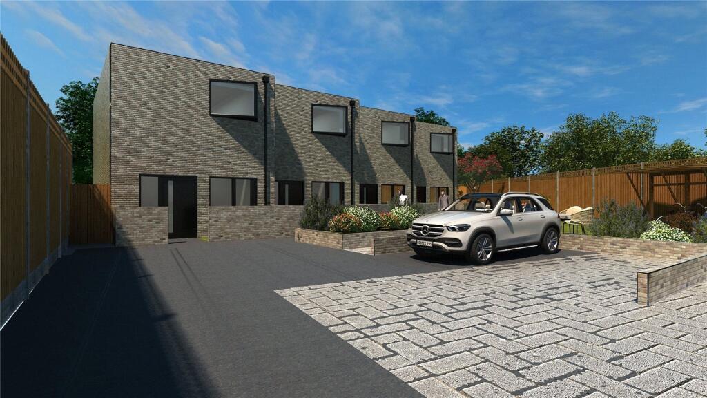
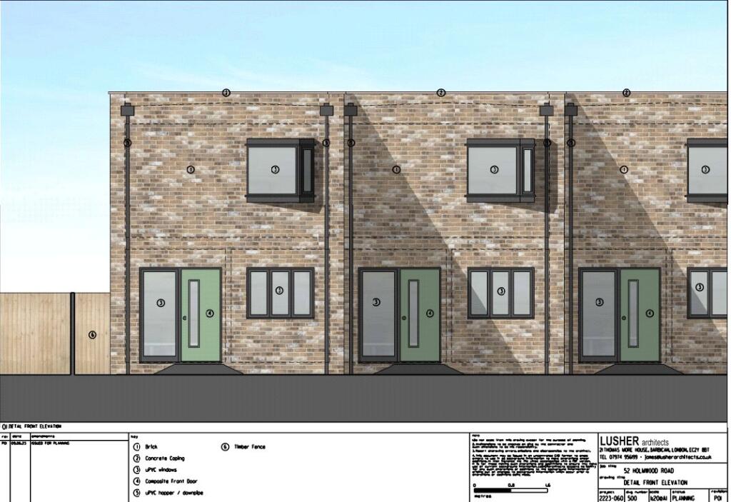
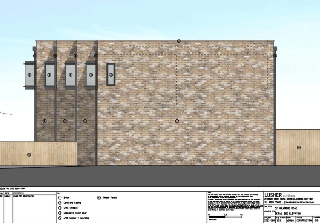
- modern townhouse contemporary
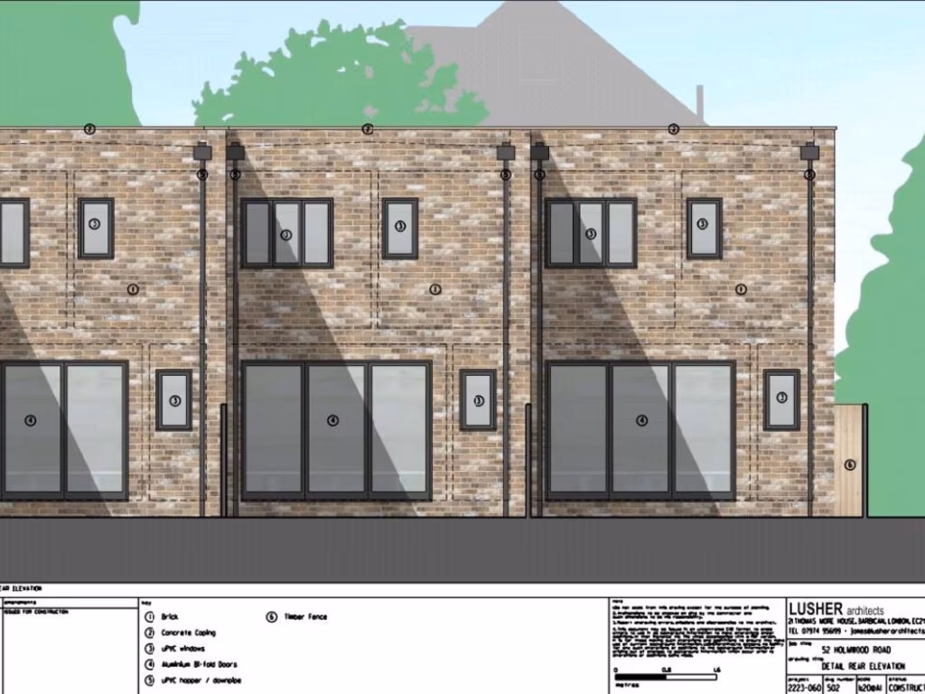
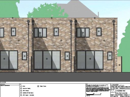
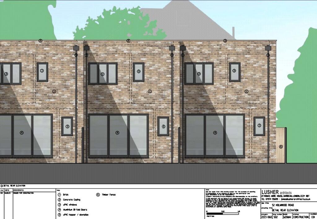
- row of modern townhouses modern
Floorplan Description
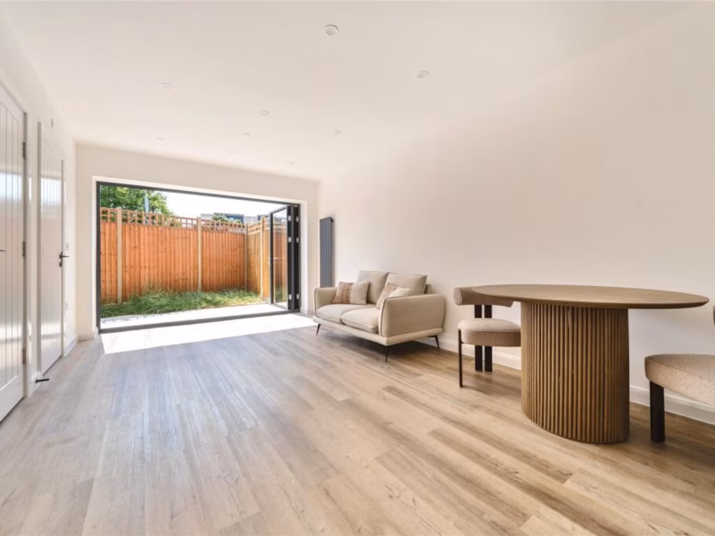
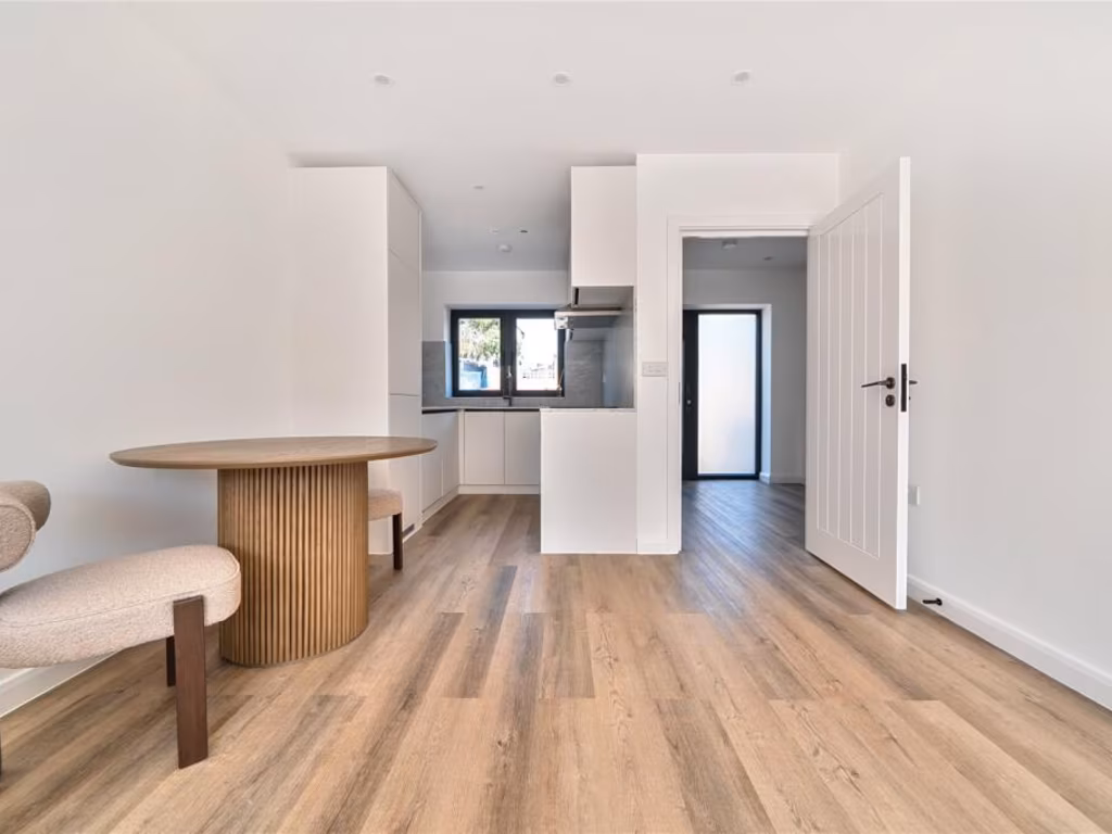
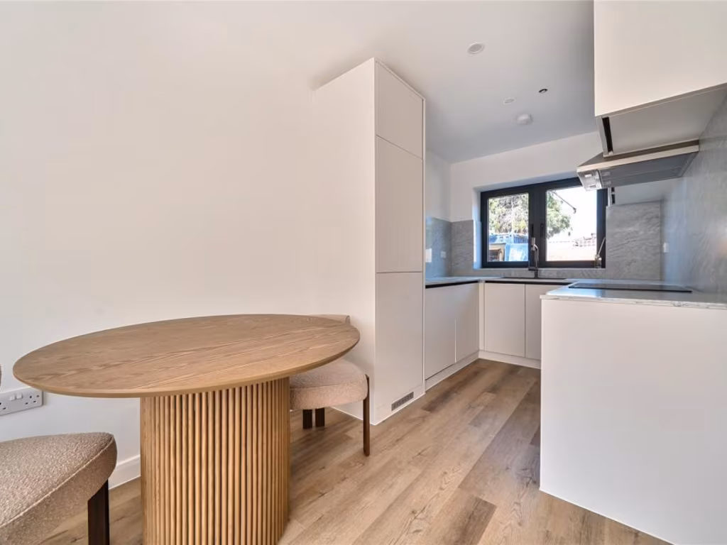
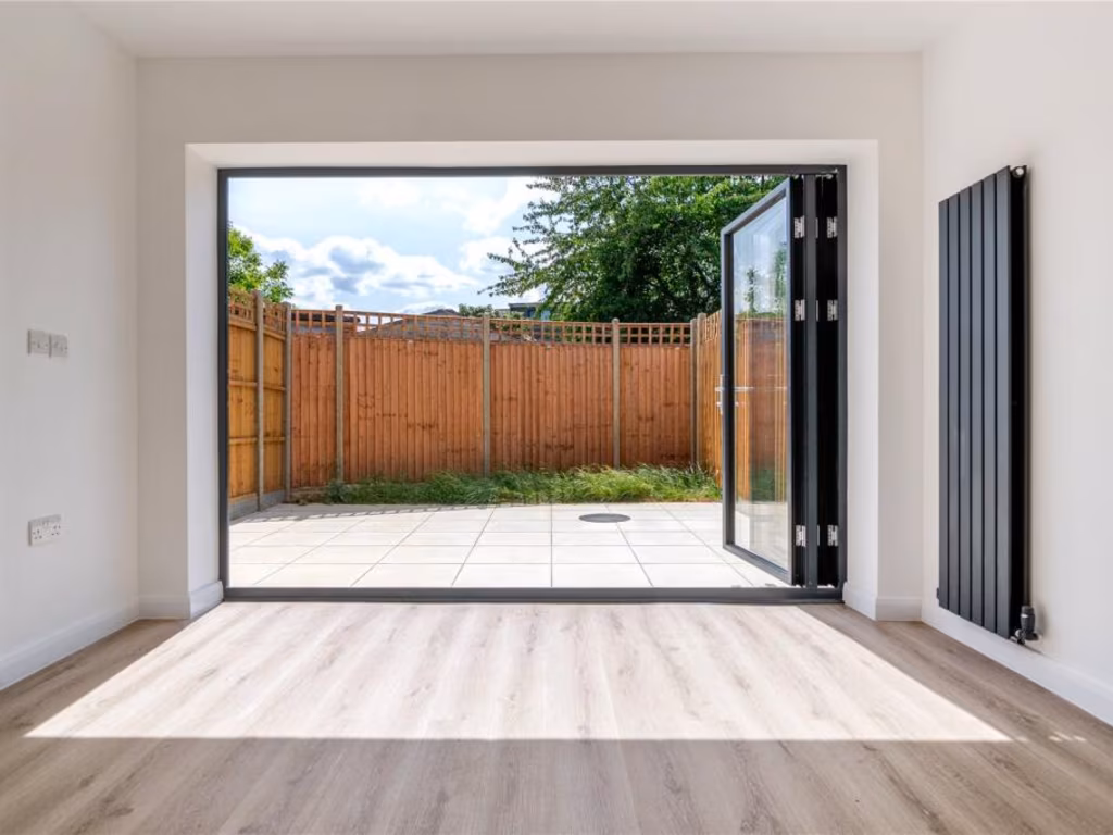
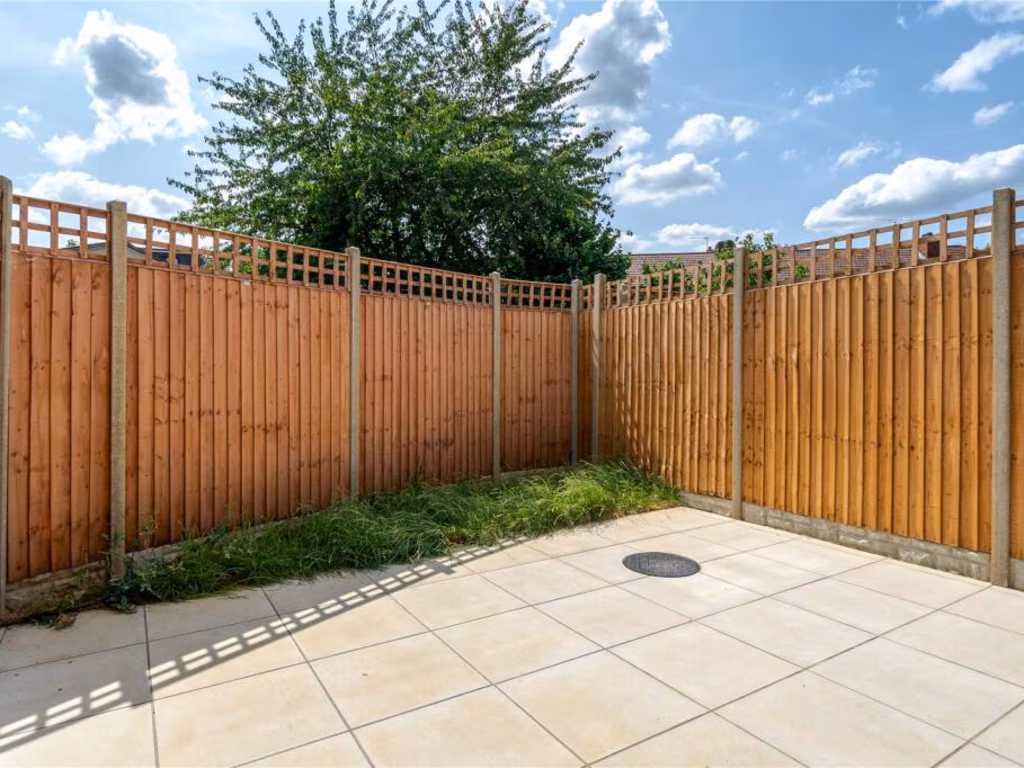
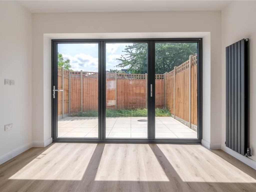
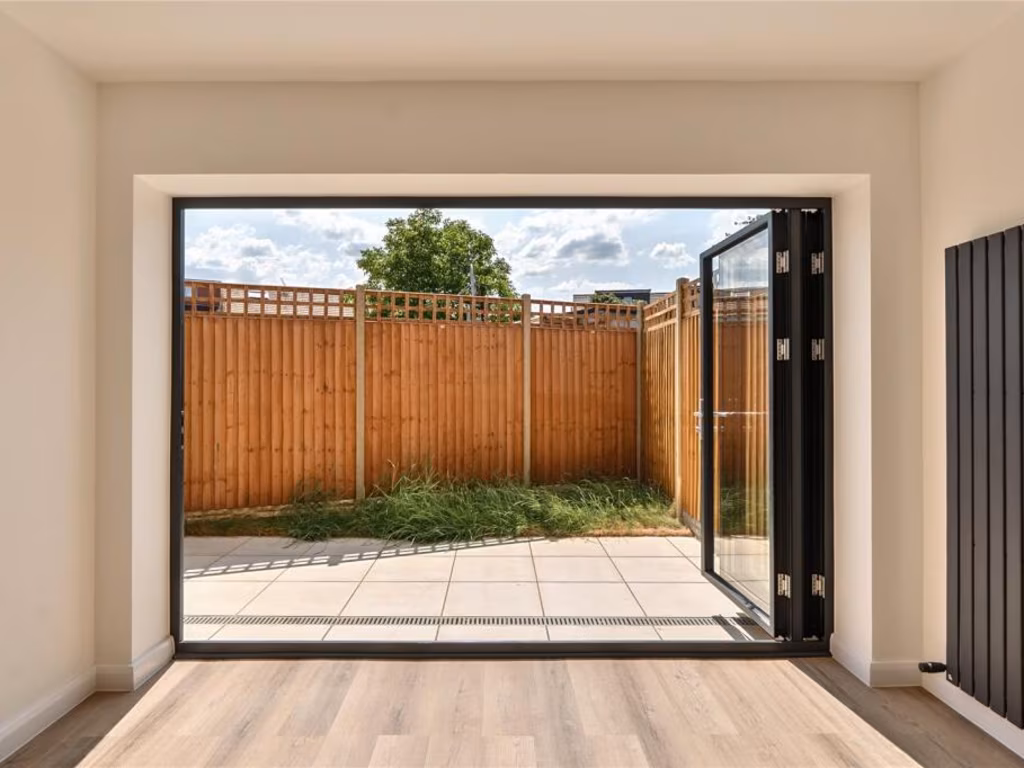
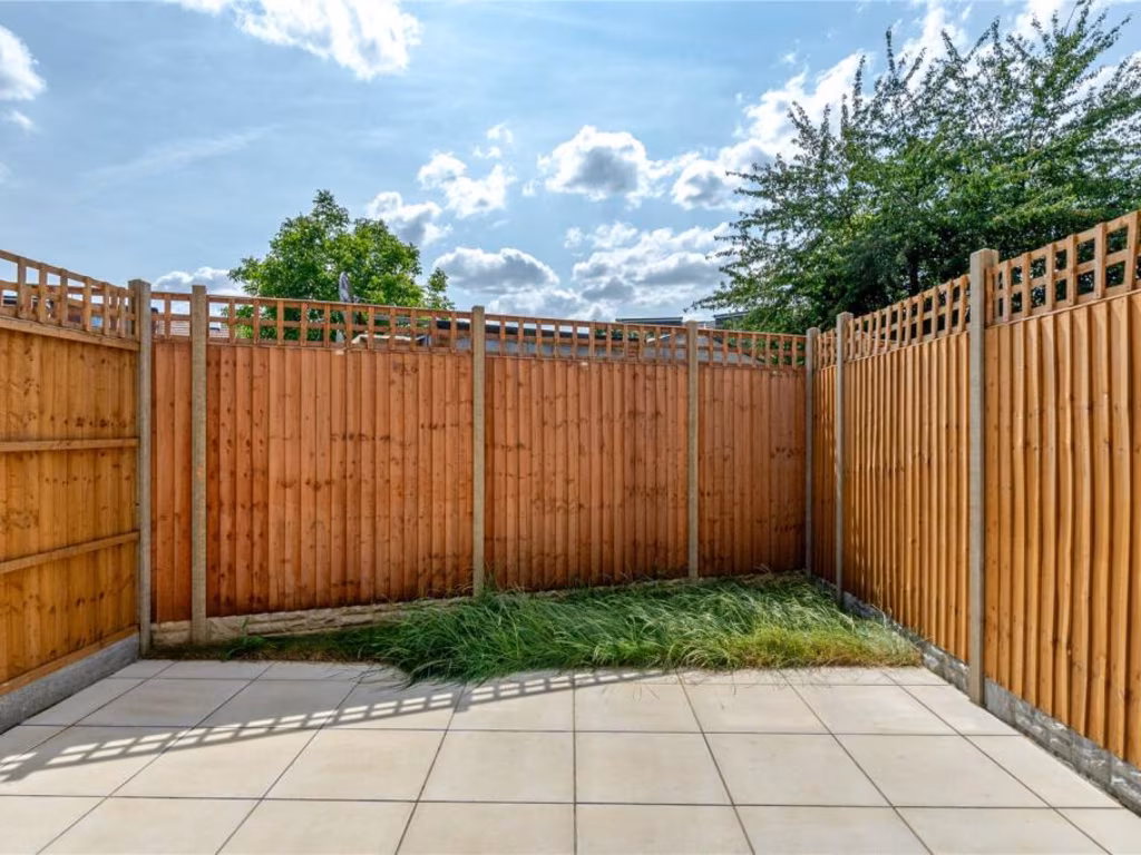
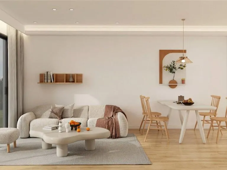
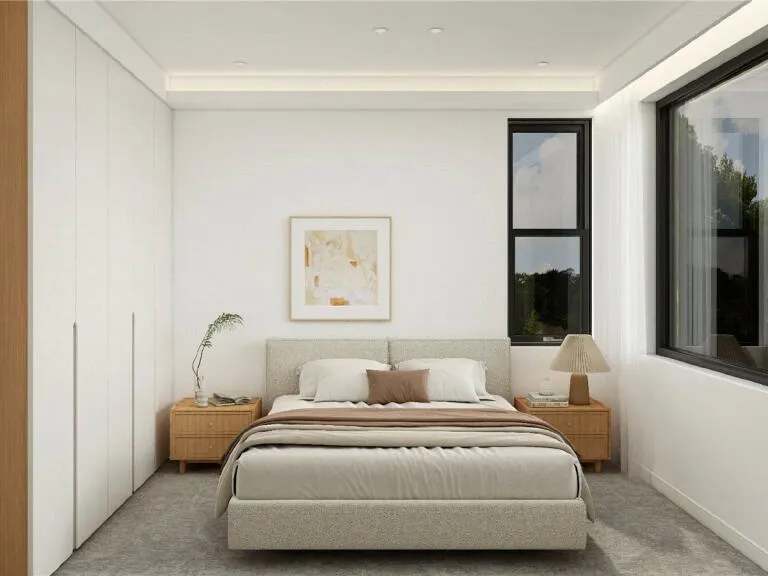
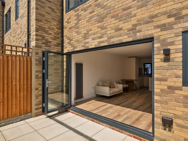
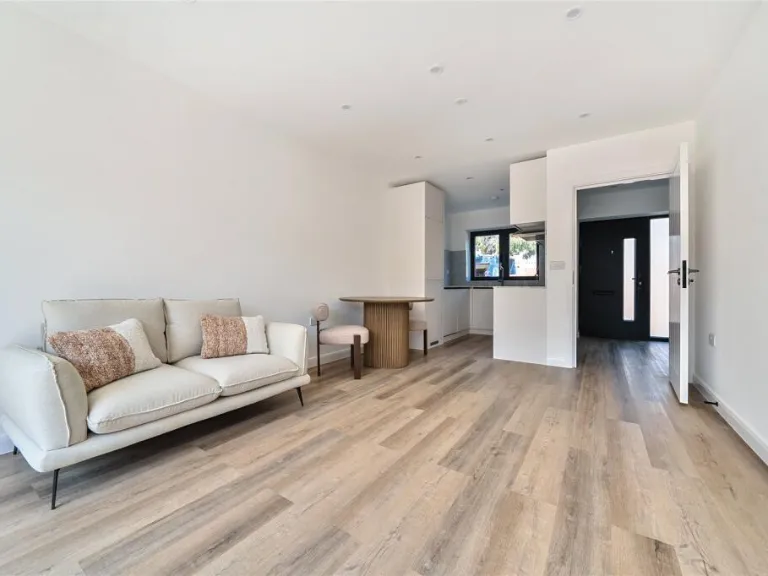
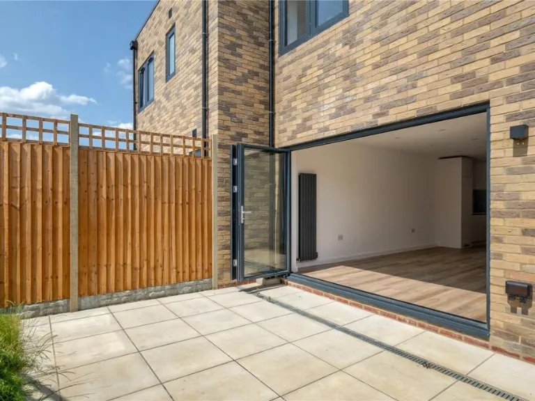
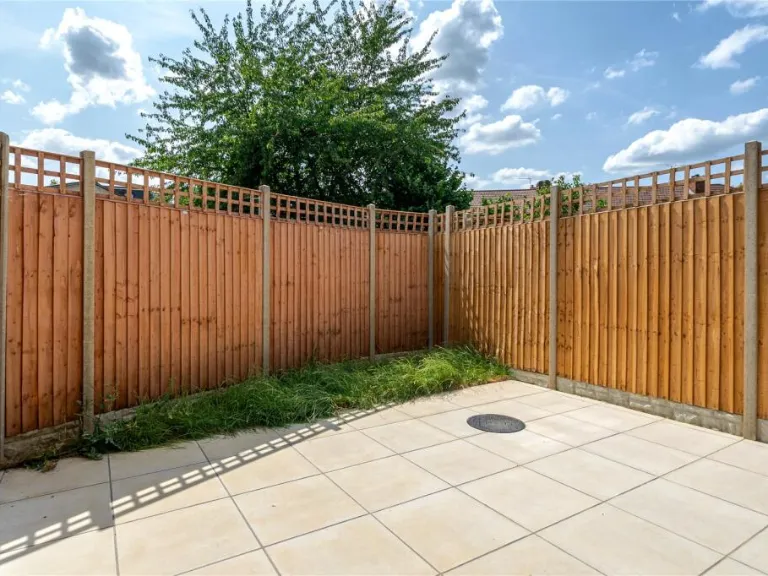
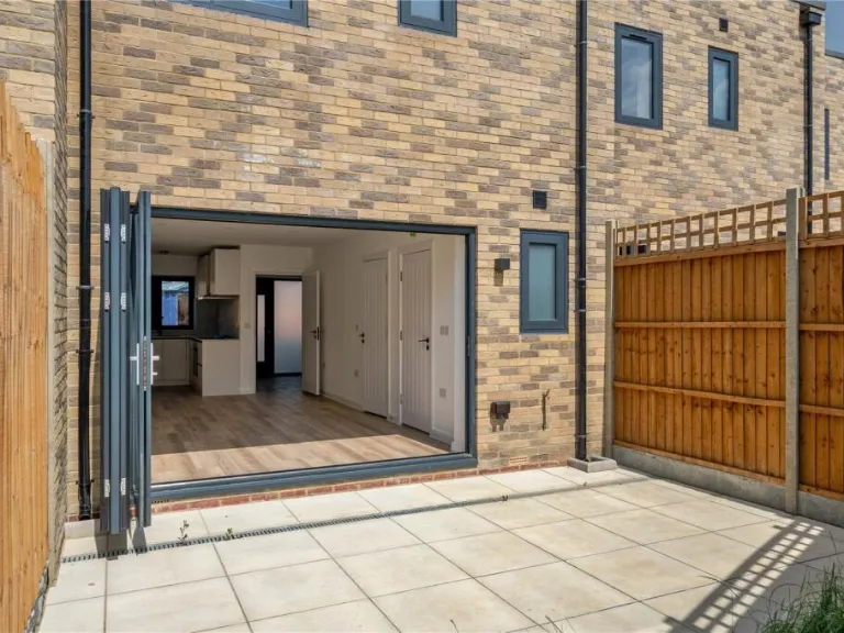
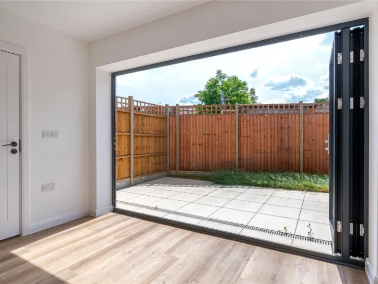
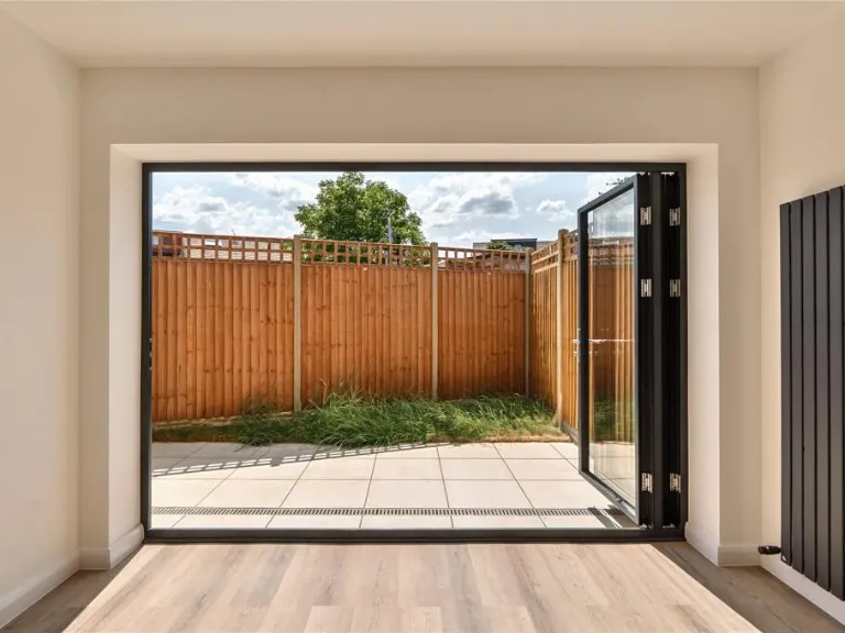
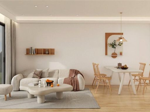
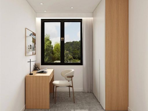
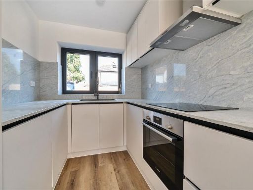
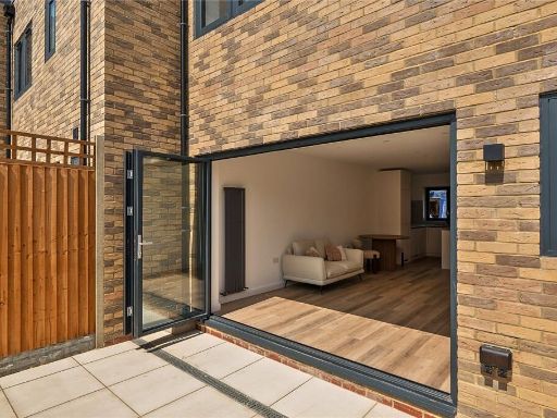
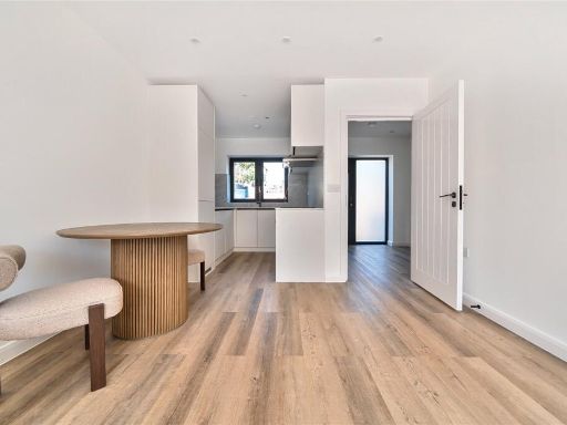
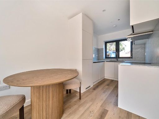
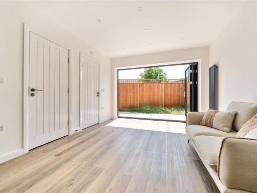
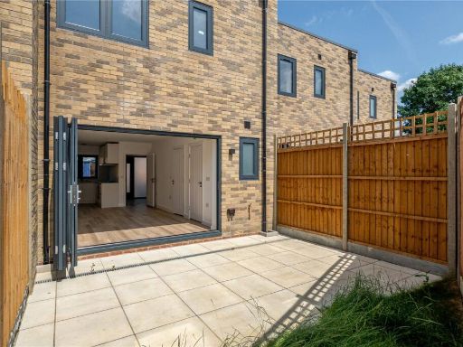
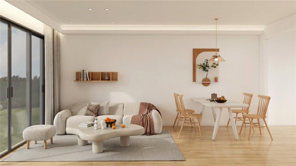
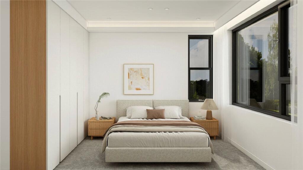
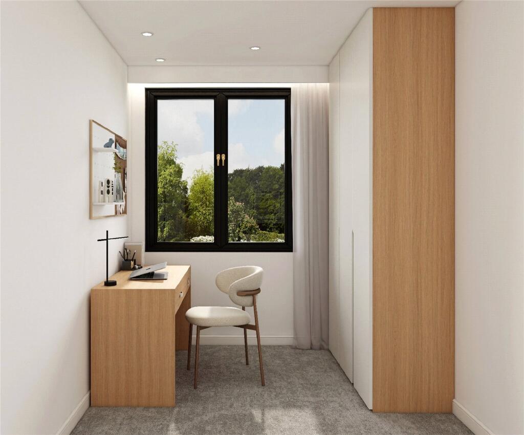
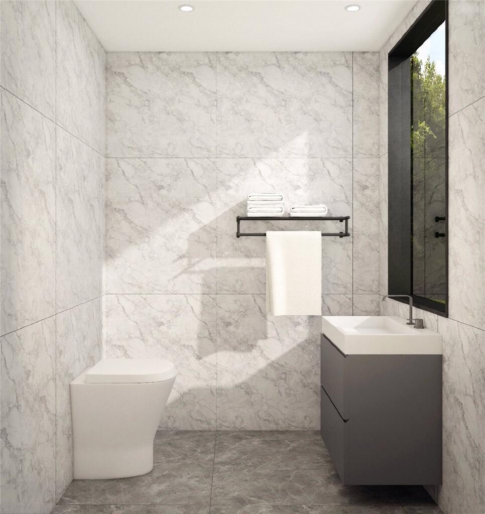
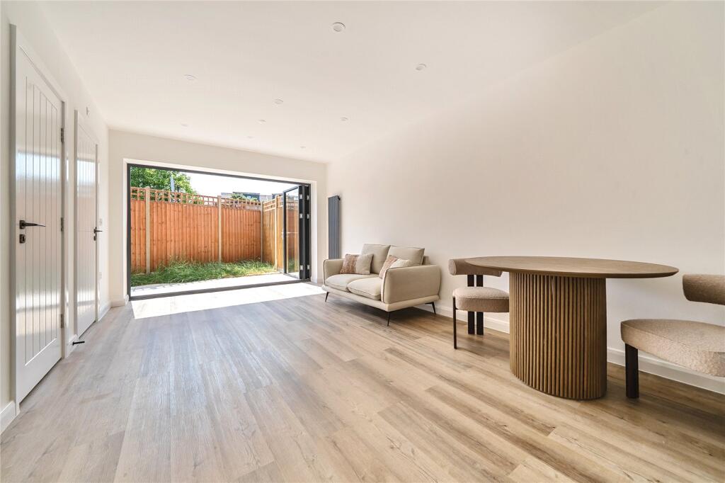
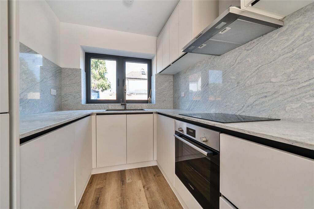
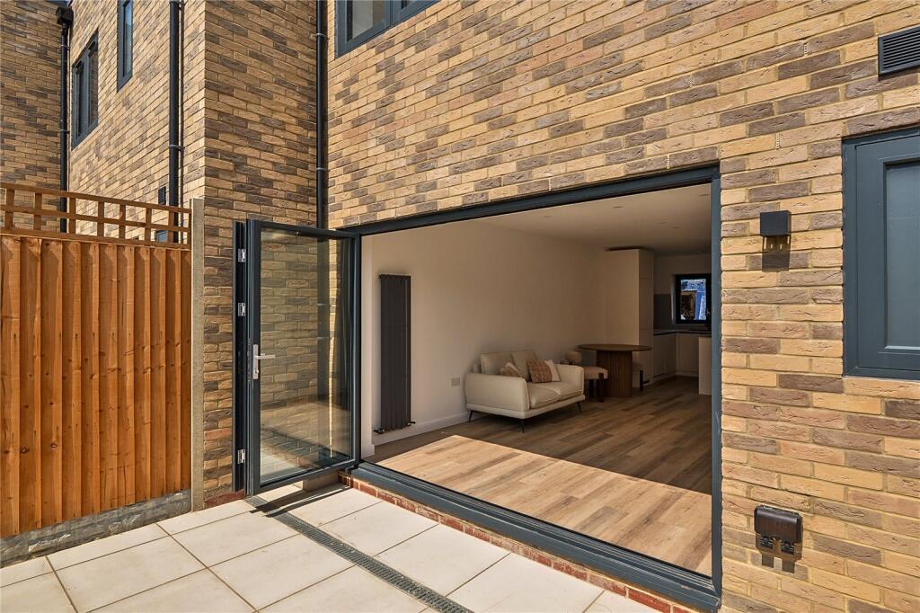
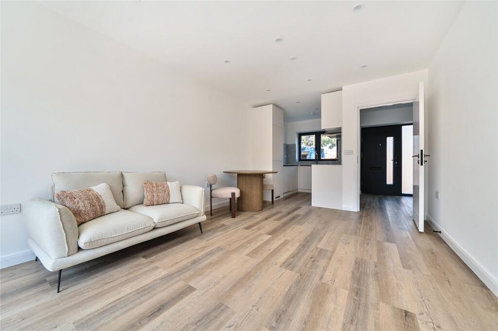
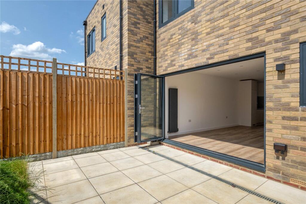
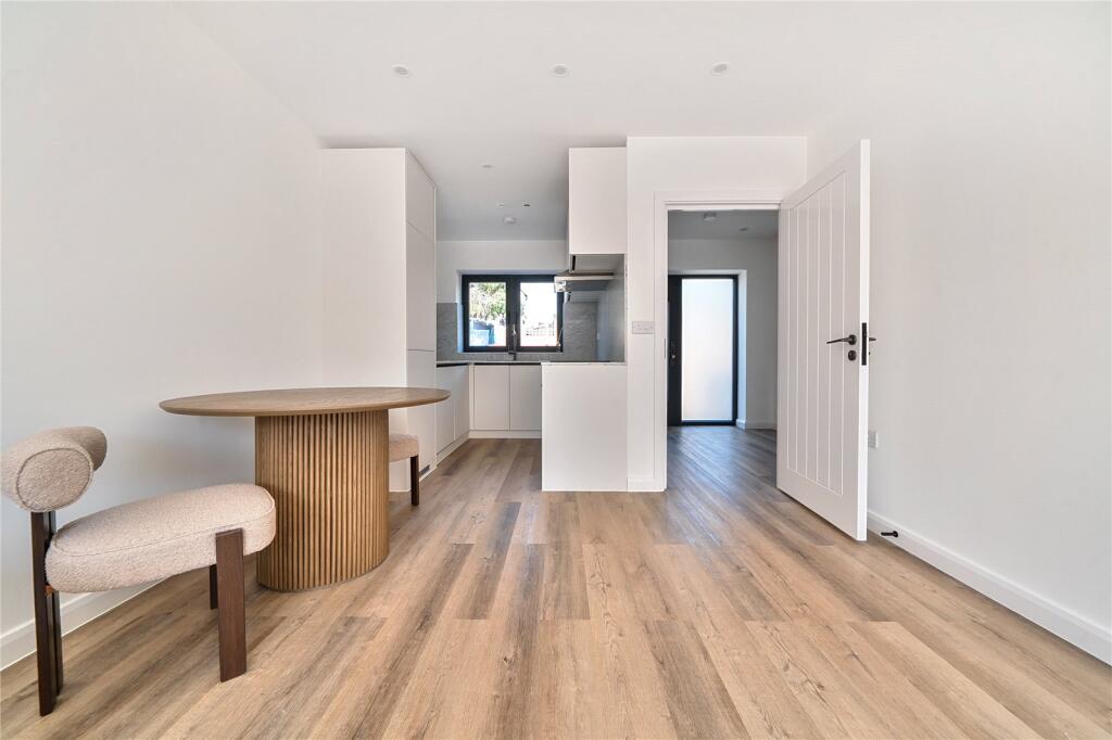
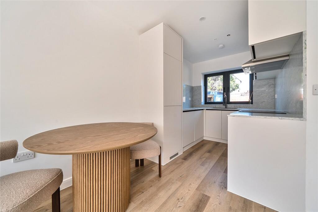
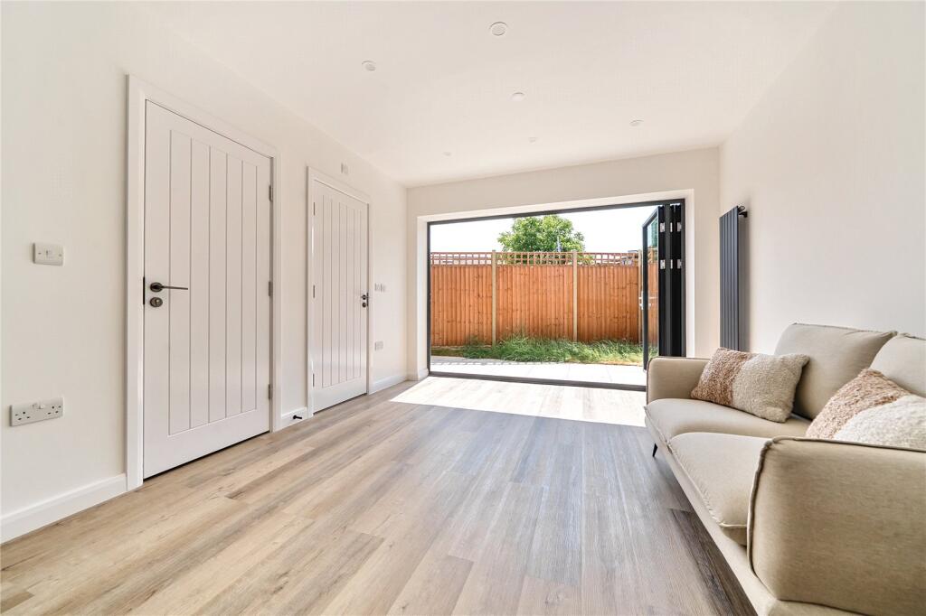
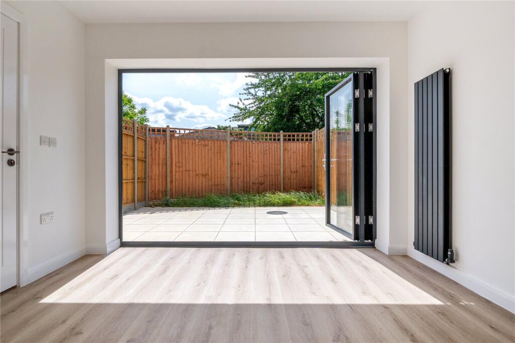
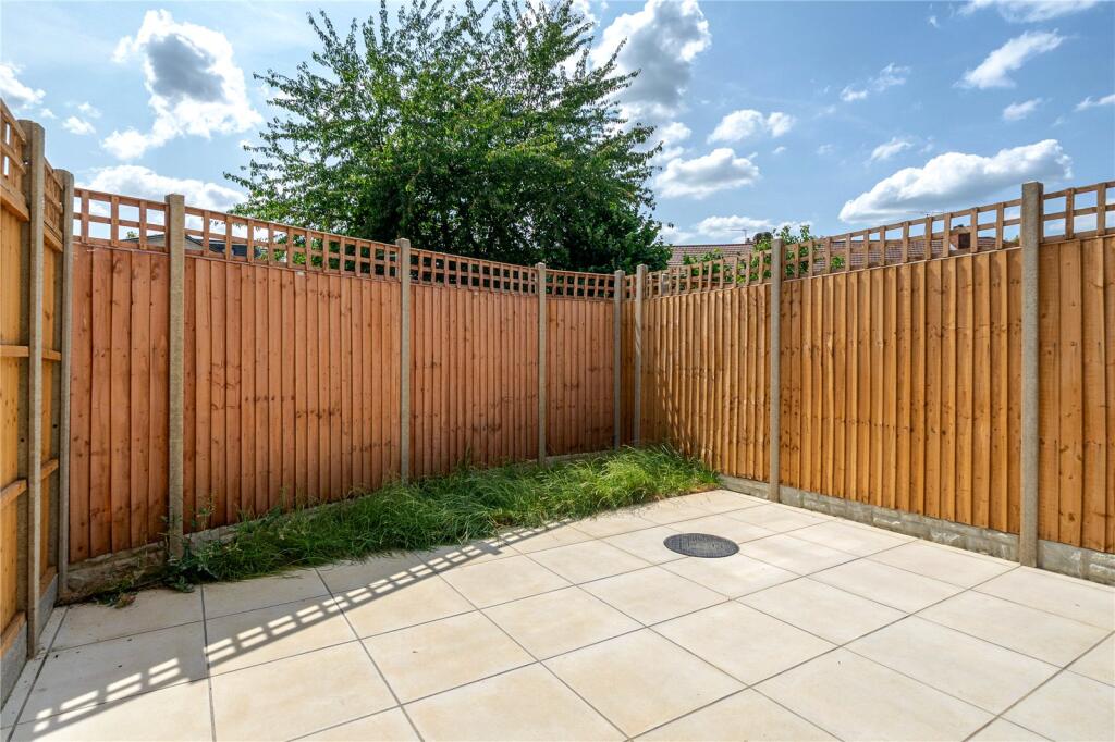
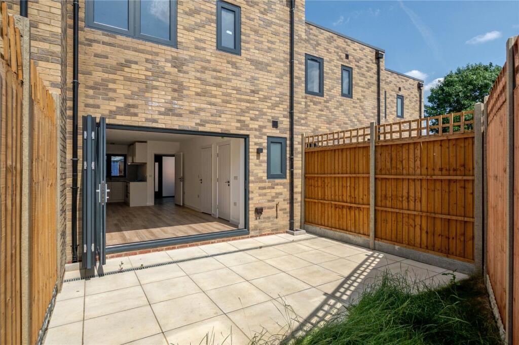
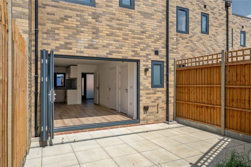
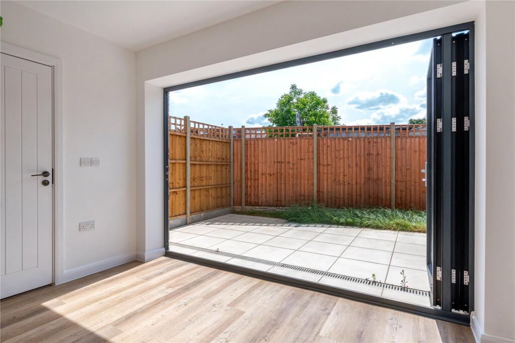
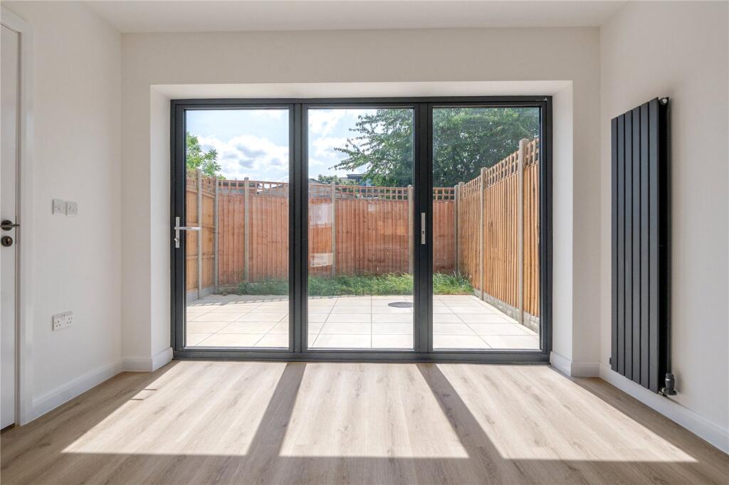
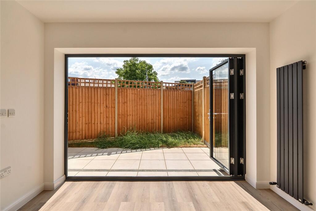
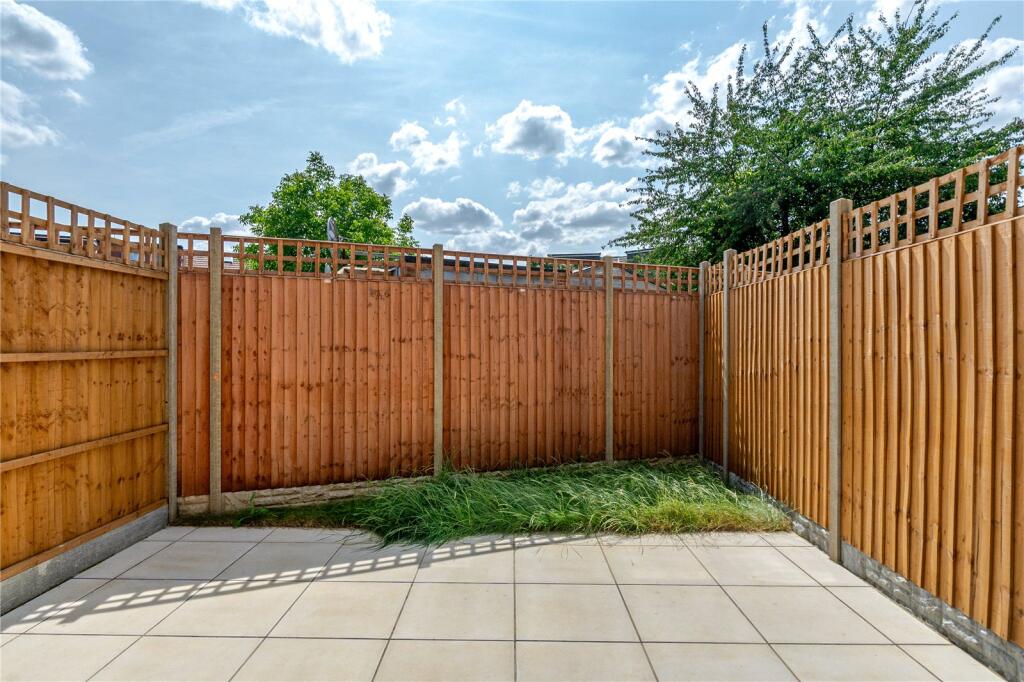
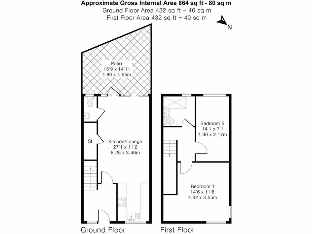
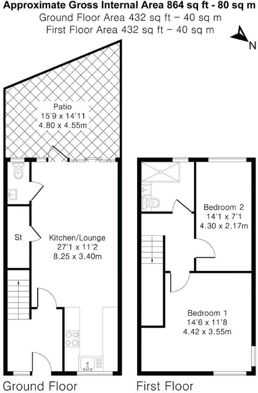
- A modern property with a garden patio and an open-plan kitchen/lounge area.
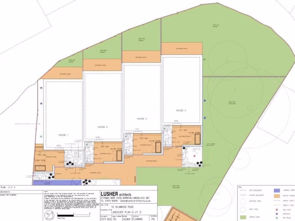
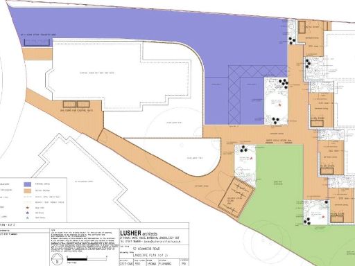
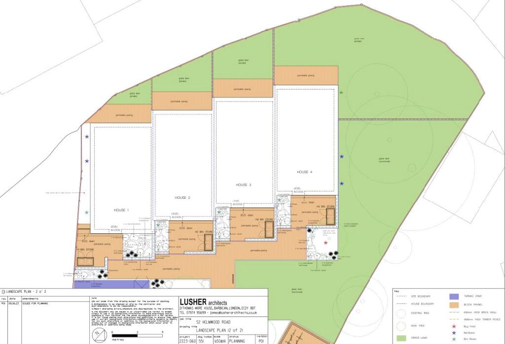
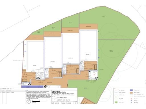
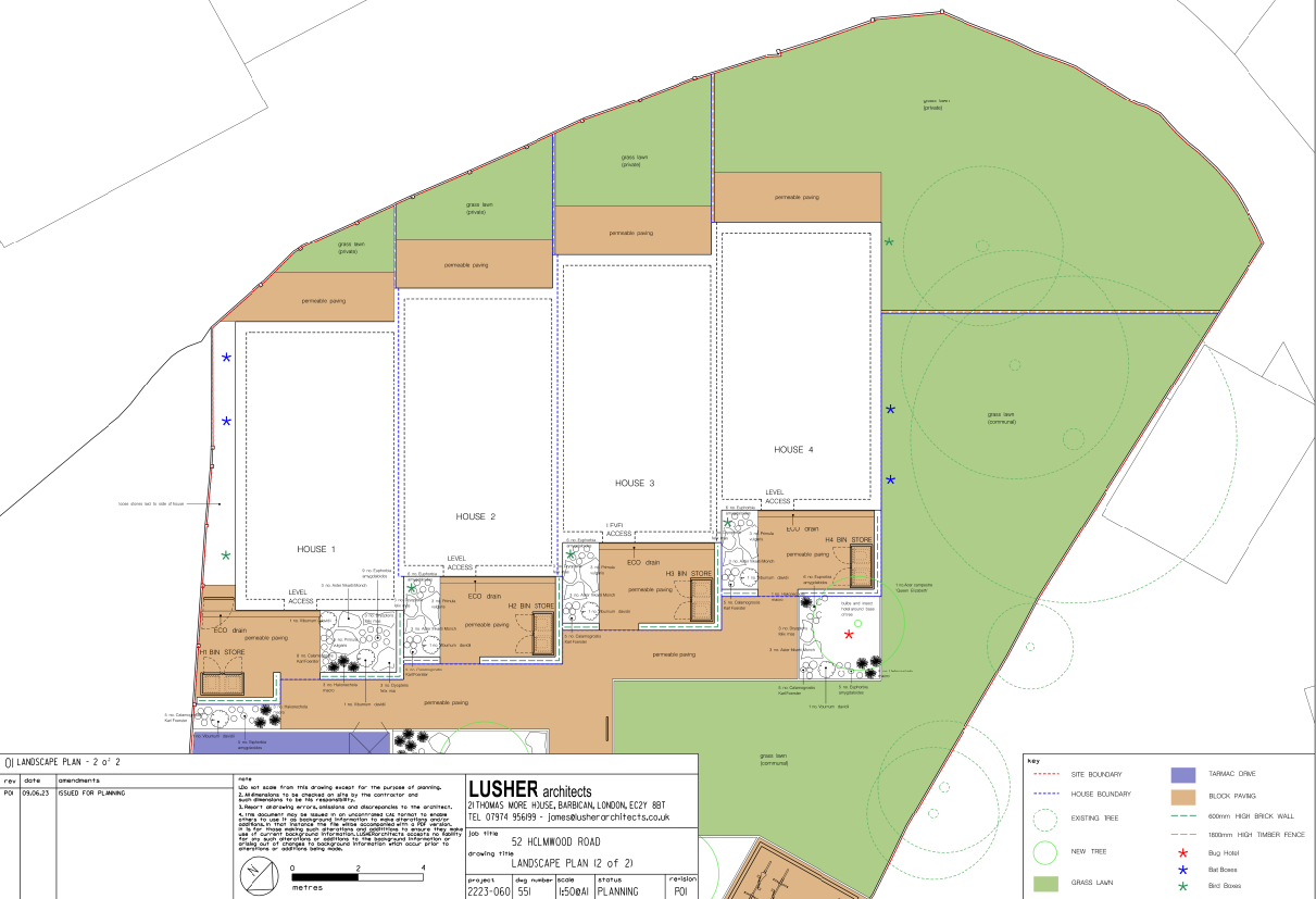
- A property with four separate houses and spacious green lawns.
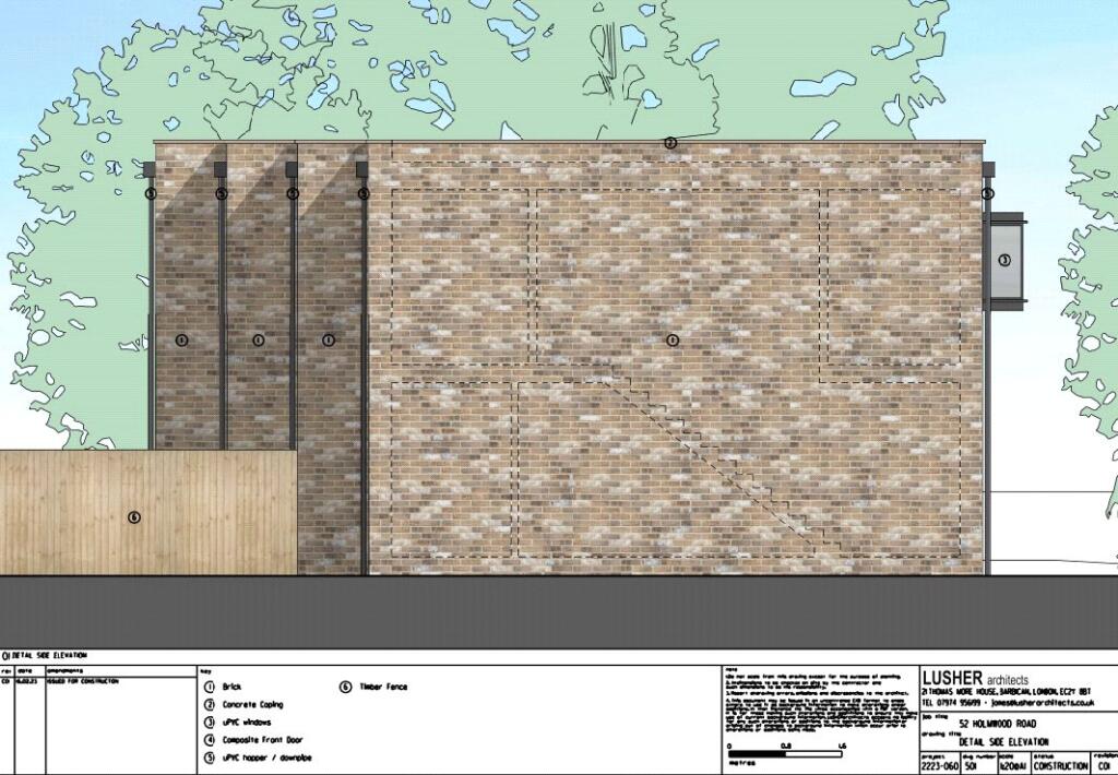
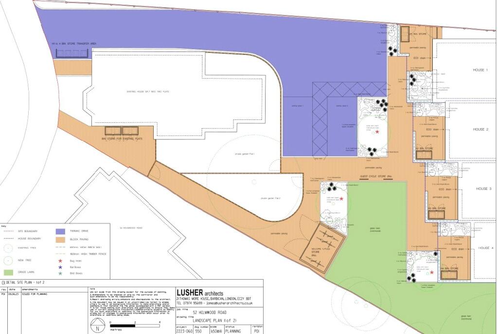
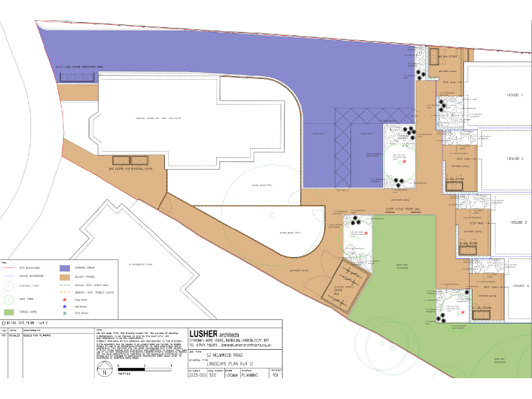
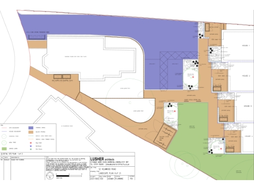
- Site plan showing an existing house split into two flats, with new houses and gardens laid out across the property.
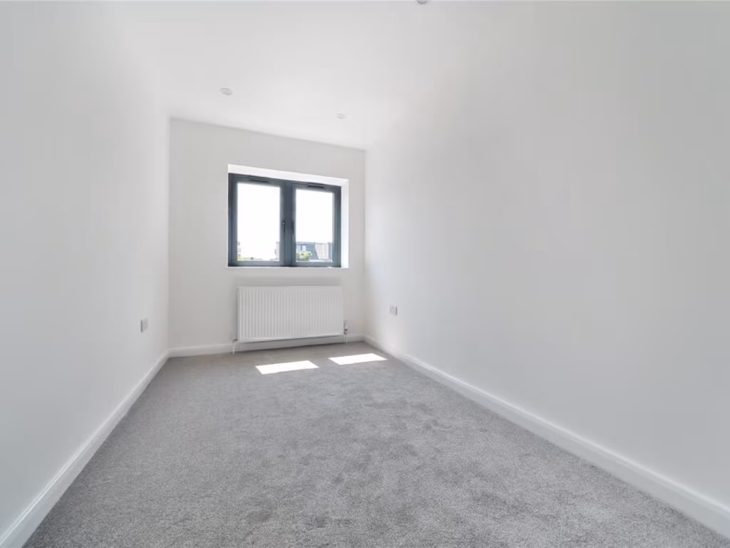
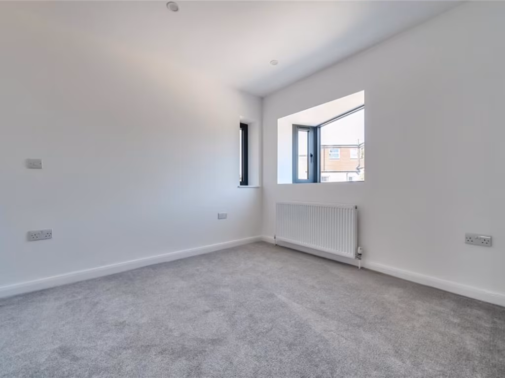
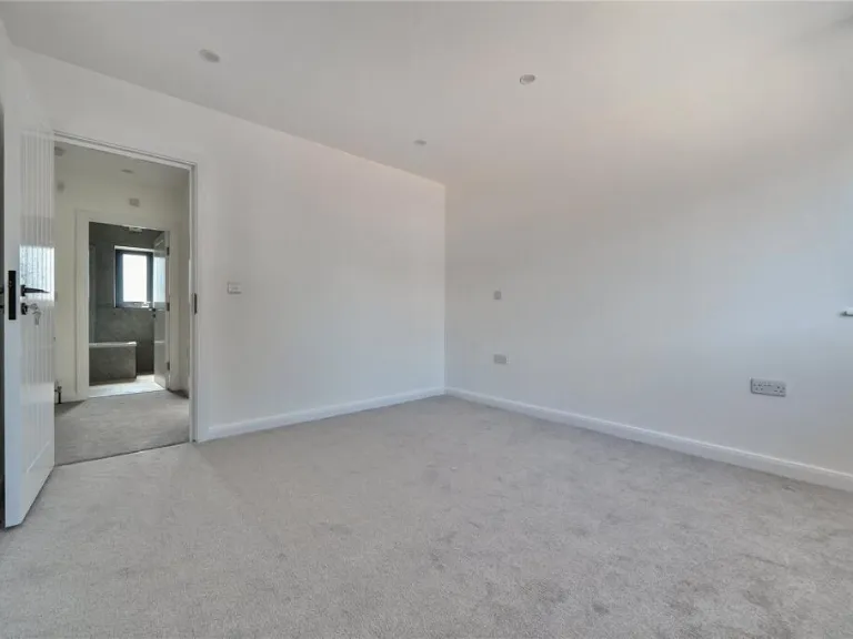
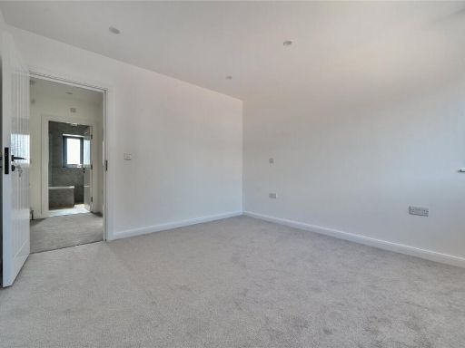
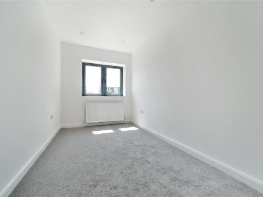
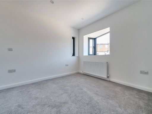
Rooms
- Kitchen/Lounge: large
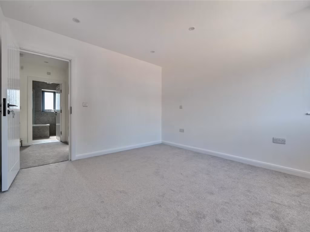
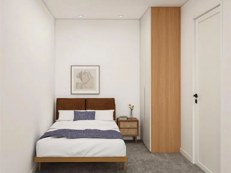
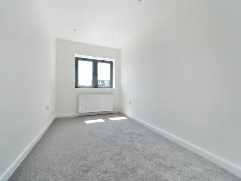
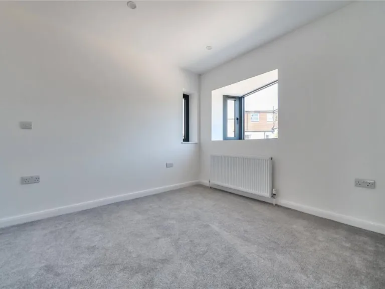
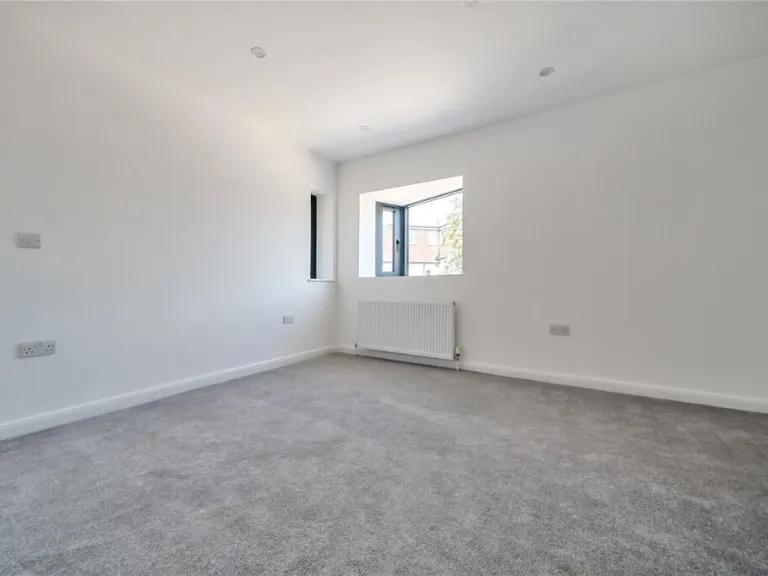
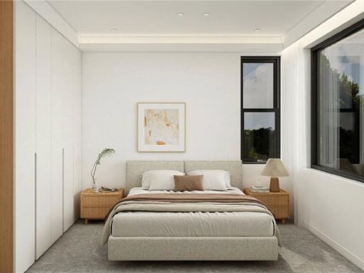
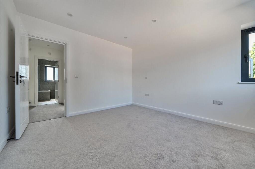
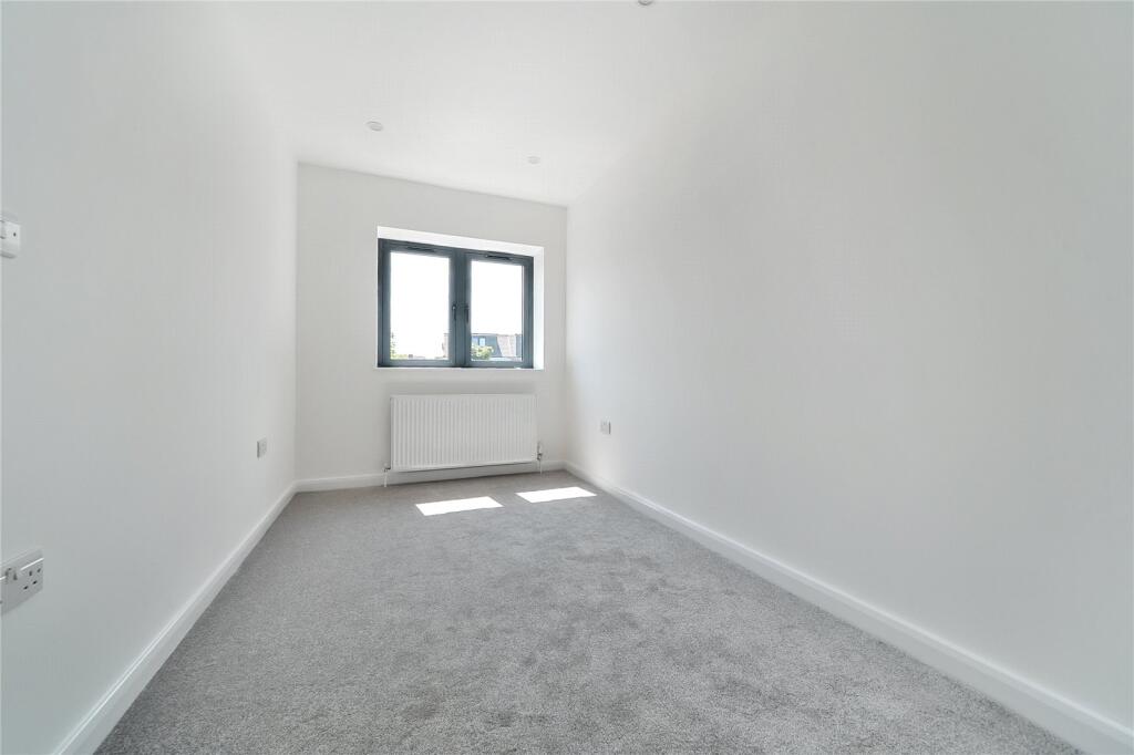
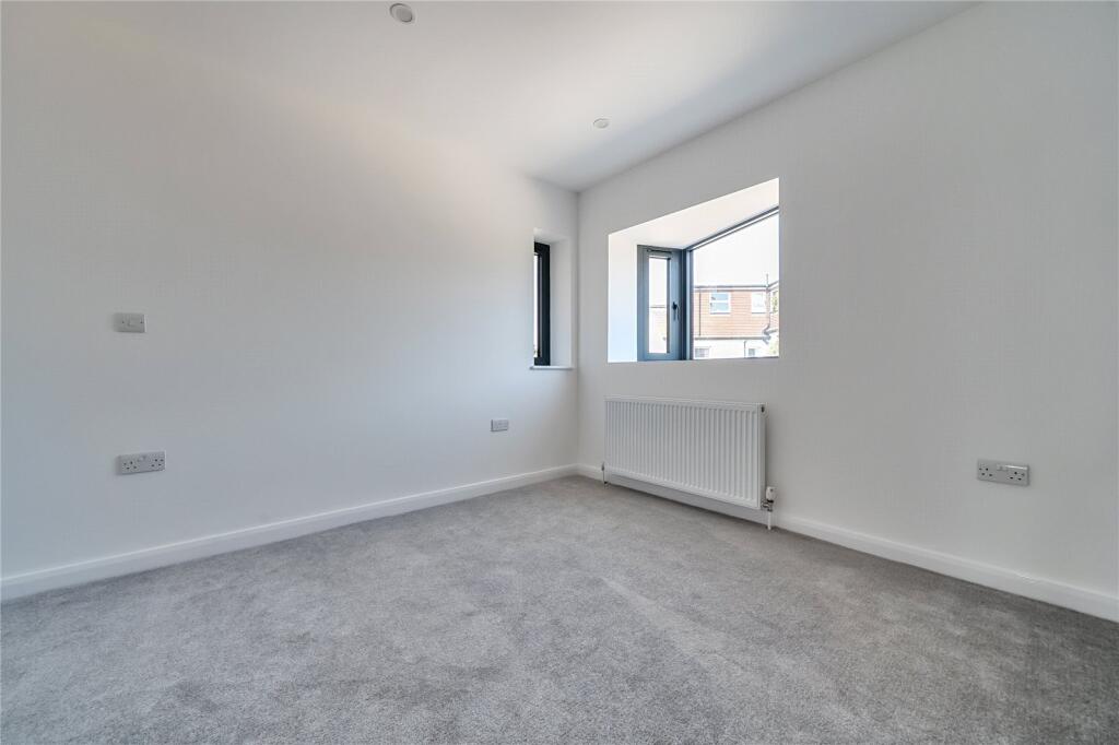
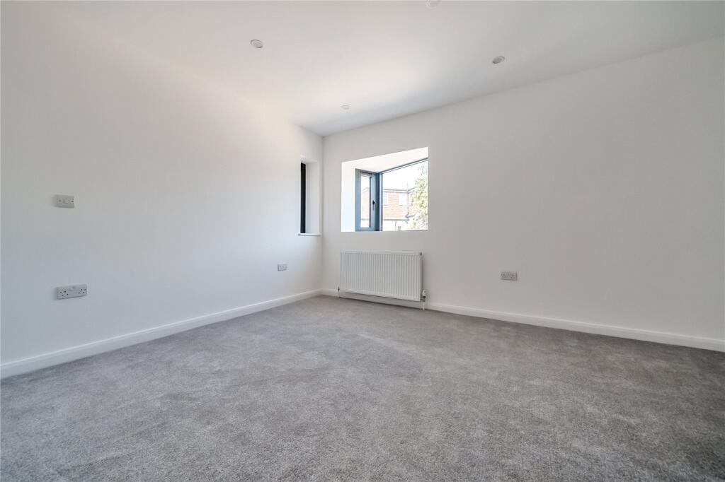
- Bedroom 1: large
- Bedroom 2: average
Textual Property Features
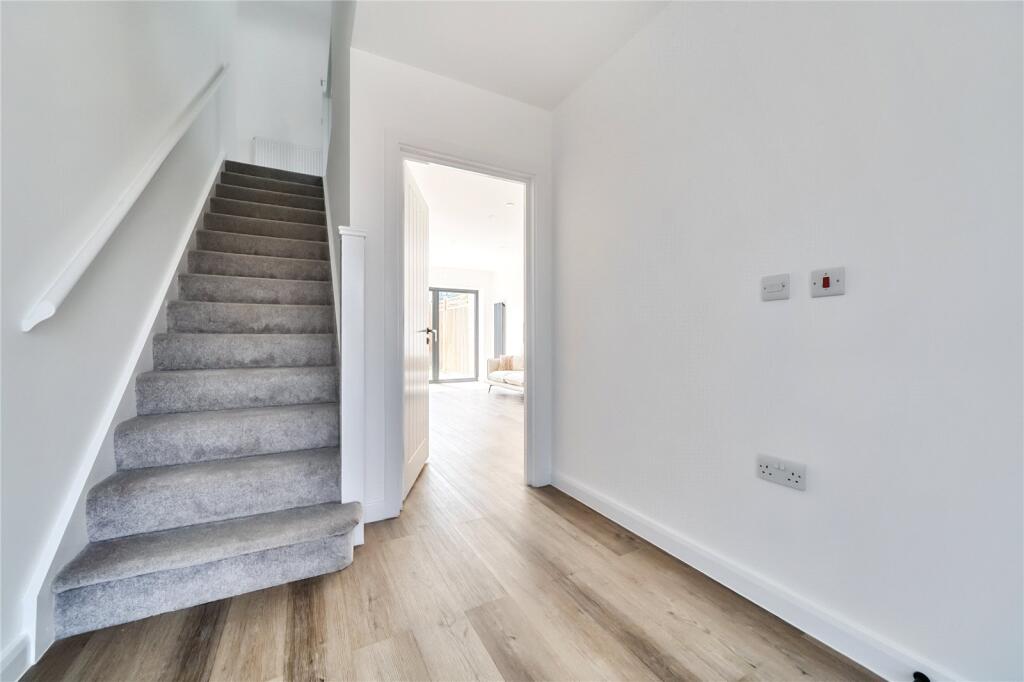
- Is New Build
- Has Garden
- Success
Detected Visual Features
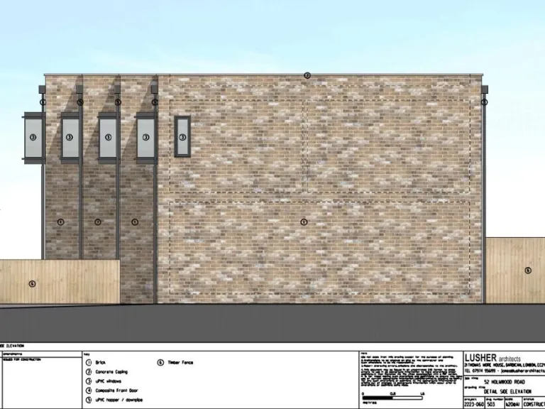
- contemporary
- modern townhouse
- new build
- stone facade
- boxy windows
- garden
- outdoor space
- family-friendly
- terrace
- modern
- townhouse
- low-maintenance
- energy-efficient
- urban
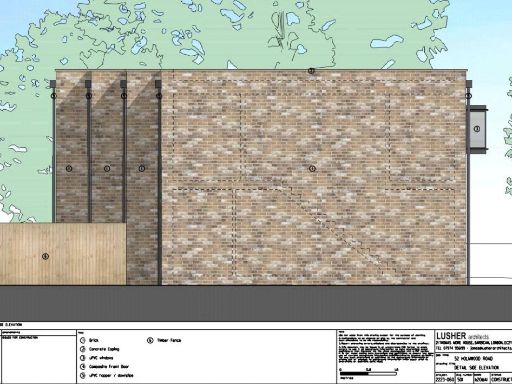
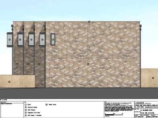
EPC Details
- Fully double glazed
- Solid brick, as built, no insulation (assumed)
- Boiler and radiators, mains gas
- Low energy lighting in all fixed outlets
- (another dwelling below)
Nearby Schools
- Carterhatch Infant School
- Prince of Wales Primary School
- Oasis Academy Enfield
- Holdbrook Primary School and Nursery
- St Joseph's Catholic Primary School (Wx)
- Holy Trinity Church of England Primary School
- Downfield Primary School
- St James CofE Primary School
- Carterhatch Junior School
- Ark John Keats Academy
- St Ignatius College
- Keys Meadow Primary School
- Hurst Drive Primary School
- Brimsdown Primary School
- Enfield Heights Academy
- Freshsteps Independent school
- Honilands Primary School
- Four Swannes Primary School
- Suffolks Primary School
- Eastfield Primary School
- Chesterfield Primary School
- Forty Hill CofE Primary School
- Freezywater St George's CofE VA Primary School
- Capel Manor Primary School
- The Lea Valley Academy
Nearest Bars And Restaurants
- Id: 104168253
- Tags:
- Addr:
- Housenumber: 611
- Postcode: EN3 6UP
- Street: Hertford Road
- Amenity: pub
- Building: residential
- Name: The Prince Albert
- Source: photo 2020-10-16
- TagsNormalized:
- Lat: 51.6713465
- Lon: -0.0401883
- FullGeoHash: gcpvzn6xrt17
- PartitionGeoHash: gcpv
- Images:
- FoodStandards: null
- Distance: 575.2
,- Id: 860447255
- Tags:
- Addr:
- Housenumber: 621,623
- Street: Hertford Road
- Amenity: cafe
- Building: residential
- Name: Silver Service Cafe
- Source: photo 2020-10-16
- TagsNormalized:
- Lat: 51.6716423
- Lon: -0.0399683
- FullGeoHash: gcpvzndchsm2
- PartitionGeoHash: gcpv
- Images:
- FoodStandards: null
- Distance: 539.9
,- Id: 99491561
- Tags:
- Addr:
- Amenity: fast_food
- Building: residential
- Cuisine: pizza
- Name: Farmhouse Pizza
- Source: Bing
- Website: https://www.farmhouseenfield.co.uk/
- TagsNormalized:
- fast food
- food
- residential
- pizza
- Lat: 51.6778226
- Lon: -0.0348414
- FullGeoHash: gcpvzpwthhk7
- PartitionGeoHash: gcpv
- Images:
- FoodStandards: null
- Distance: 293.8
,- Id: 867842032
- Tags:
- Addr:
- Amenity: fast_food
- Building: retail
- Cuisine: kebab
- Name: Zee Best Doner
- Source: Bing
- TagsNormalized:
- Lat: 51.6771465
- Lon: -0.0352882
- FullGeoHash: gcpvzpw31wr4
- PartitionGeoHash: gcpv
- Images:
- FoodStandards: null
- Distance: 232.2
,- Id: 867842034
- Tags:
- Addr:
- Amenity: cafe
- Building: retail
- Cuisine: english;american
- Name: Mellow Mustard
- Note: unnamed but open in photo 2020-11-04
- Source: Bing
- TagsNormalized:
- Lat: 51.6770756
- Lon: -0.0353403
- FullGeoHash: gcpvzpw2b907
- PartitionGeoHash: gcpv
- Images:
- FoodStandards: null
- Distance: 226.2
}
Nearest General Shops
- Id: 103444607
- Tags:
- Addr:
- Building: residential
- Name: New Image
- Shop: dry_cleaning
- Source: Bing
- TagsNormalized:
- residential
- dry cleaning
- shop
- Lat: 51.6766234
- Lon: -0.0350064
- FullGeoHash: gcpvzpqw0kc3
- PartitionGeoHash: gcpv
- Images:
- FoodStandards: null
- Distance: 237.8
,- Id: 867842033
- Tags:
- Addr:
- Brand: William Hill
- Brand:wikidata: Q4053147
- Brand:wikipedia: en:William Hill (bookmaker)
- Building: retail
- Name: William Hill
- Shop: bookmaker
- Source: Bing
- Website: https://shoplocator.williamhill/enfield/hertford-road/en3-6ua
- TagsNormalized:
- william hill
- retail
- bookmaker
- shop
- Lat: 51.6771125
- Lon: -0.0353148
- FullGeoHash: gcpvzpw2cpgr
- PartitionGeoHash: gcpv
- Images:
- FoodStandards: null
- Distance: 229.2
,- Id: 867842035
- Tags:
- Addr:
- Postcode: EN3 6UE
- Street: Hertford Road
- Building: retail
- Name: Vintage Cuts
- Shop: hairdresser
- Source: Bing
- Unisex: yes
- Website: https://www.thevintagecuts.co.uk/
- TagsNormalized:
- Lat: 51.6770372
- Lon: -0.0353748
- FullGeoHash: gcpvzpw0x9yw
- PartitionGeoHash: gcpv
- Images:
- FoodStandards: null
- Distance: 222.5
}
Nearest Grocery shops
- Id: 867856682
- Tags:
- Addr:
- Brand: Tesco Express
- Brand:wikidata: Q98456772
- Building: yes
- Contact:
- Website: https://www.tesco.com/store-locator/waltham-cross/3-bullsmoor-ln
- Name: Tesco Express
- Shop: convenience
- Source: Bing
- TagsNormalized:
- tesco
- tesco express
- convenience
- shop
- Lat: 51.6805242
- Lon: -0.0344397
- FullGeoHash: gcpyp0nuv7zz
- PartitionGeoHash: gcpy
- Images:
- FoodStandards: null
- Distance: 534.7
,- Id: 99490467
- Tags:
- Building: retail
- Name: Oncu Food Centre
- Shop: supermarket
- Source: Bing
- TagsNormalized:
- Lat: 51.6780945
- Lon: -0.0348745
- FullGeoHash: gcpvzpwwer59
- PartitionGeoHash: gcpv
- Images:
- FoodStandards: null
- Distance: 309.3
,- Id: 867842031
- Tags:
- Addr:
- Building: retail
- Name: Enfield News
- Shop: convenience
- Source: Bing
- TagsNormalized:
- Lat: 51.6772022
- Lon: -0.0352949
- FullGeoHash: gcpvzpw398dn
- PartitionGeoHash: gcpv
- Images:
- FoodStandards: null
- Distance: 234.1
}
Nearest Religious buildings
- Id: 103717681
- Tags:
- Amenity: place_of_worship
- Building: yes
- Denomination: methodist
- Name: Ordnance Road Methodist Church
- Religion: christian
- Source: Bing
- TagsNormalized:
- place of worship
- methodist
- church
- christian
- Lat: 51.6717313
- Lon: -0.0346349
- FullGeoHash: gcpvznwc8uy7
- PartitionGeoHash: gcpv
- Images:
- FoodStandards: null
- Distance: 581.9
,- Id: 103712540
- Tags:
- Amenity: place_of_worship
- Building: yes
- Denomination: baptist
- Name: Totteridge Road Baptist Church
- Religion: christian
- Source: Bing
- TagsNormalized:
- place of worship
- baptist
- church
- christian
- Lat: 51.6726928
- Lon: -0.0363185
- FullGeoHash: gcpvzntx38nf
- PartitionGeoHash: gcpv
- Images:
- FoodStandards: null
- Distance: 437.7
,- Id: 59428155
- Tags:
- Addr:
- Amenity: place_of_worship
- Building: church
- Denomination: anglican
- Name: St George's Church
- Religion: christian
- Source: OS_OpenData_StreetView
- Wikidata: Q105100004
- TagsNormalized:
- place of worship
- church
- anglican
- christian
- Lat: 51.6737909
- Lon: -0.0391345
- FullGeoHash: gcpvzngt8hg1
- PartitionGeoHash: gcpv
- Images:
- FoodStandards: null
- Distance: 294.5
}
Nearest Medical buildings
- Id: 866958430
- Tags:
- Addr:
- Amenity: pharmacy
- Brand: Boots
- Brand:wikidata: Q6123139
- Brand:wikipedia: en:Boots UK
- Building: yes
- Healthcare: pharmacy
- Name: Boots
- Website: https://www.boots.com/stores/1457-waltham-cross-the-pavilion-en8-7bz
- TagsNormalized:
- pharmacy
- boots
- health
- healthcare
- Lat: 51.6864202
- Lon: -0.0322368
- FullGeoHash: gcpyp30x0z46
- PartitionGeoHash: gcpy
- Images:
- FoodStandards: null
- Distance: 1193
,- Id: 860447254
- Tags:
- Addr:
- Housenumber: 617-619
- Street: Hertford Road
- Amenity: pharmacy
- Building: retail
- Healthcare: pharmacy
- Name: Ronchetti Pharmacy
- Source: photo 2020-10-16
- Website: https://www.hyperchem.co.uk/my-pharmacy/
- TagsNormalized:
- pharmacy
- retail
- health
- healthcare
- Lat: 51.6715587
- Lon: -0.0400218
- FullGeoHash: gcpvzndbektt
- PartitionGeoHash: gcpv
- Images:
- FoodStandards: null
- Distance: 549.7
,- Id: 3906585771
- Tags:
- Amenity: dentist
- Healthcare: dentist
- Name: Haverstock Healthcare
- Website: https://www.haverstockhealth.com/services/gp-services/ordnance-unity-centre-for-health/
- TagsNormalized:
- Lat: 51.6720886
- Lon: -0.0392455
- FullGeoHash: gcpvzne7tx2q
- PartitionGeoHash: gcpv
- Images:
- FoodStandards: null
- Distance: 483.1
,- Id: 3906585769
- Tags:
- Amenity: clinic
- Healthcare: clinic
- Name: Ordnance Unity Centre for Health
- Website: https://www.ouch.surgery/
- TagsNormalized:
- Lat: 51.6721085
- Lon: -0.039334
- FullGeoHash: gcpvzne7g7nm
- PartitionGeoHash: gcpv
- Images:
- FoodStandards: null
- Distance: 481.6
}
Nearest Airports
- Id: 121158889
- Tags:
- Aerodrome: continental
- Aeroway: aerodrome
- Fhrs:
- Authority: City of London Corporation
- Iata: LCY
- Icao: EGLC
- Name: London City Airport
- Operator: London City Airport Limited
- Ref: LCY
- Website: https://www.londoncityairport.com/
- Wikidata: Q8982
- Wikipedia: en:London City Airport
- TagsNormalized:
- airport
- continental airport
- Lat: 51.5042658
- Lon: 0.0539987
- FullGeoHash: u10j10p64702
- PartitionGeoHash: u10j
- Images:
- FoodStandards: null
- Distance: 20177.9
,- Id: 14001268
- Tags:
- Access: yes
- Aerodrome: international
- Aerodrome:type: public
- Aeroway: aerodrome
- Alt_name: London Heathrow
- Alt_name_2: London Heathrow Airport
- Ele: 25
- Iata: LHR
- Icao: EGLL
- Int_name: Heathrow Airport
- Name: London Heathrow Airport
- Note: area still approx
- Old_name: London Airport
- Operator: Heathrow Airport Limited
- Rank_aci:
- Ref: LHR
- Short_name: Heathrow
- Type: multipolygon
- Website: https://www.heathrow.com/
- Wikidata: Q8691
- Wikipedia: en:Heathrow Airport
- TagsNormalized:
- airport
- international airport
- Lat: 51.4677522
- Lon: -0.4547736
- FullGeoHash: gcpsv9kv7h2h
- PartitionGeoHash: gcps
- Images:
- FoodStandards: null
- Distance: 36962
}
Nearest Leisure Facilities
- Id: 226449430
- Tags:
- Leisure: park
- Name: Painters Lane Neighbourhood Park
- TagsNormalized:
- Lat: 51.6794699
- Lon: -0.0336918
- FullGeoHash: gcpvzpzqwzmt
- PartitionGeoHash: gcpv
- Images:
- FoodStandards: null
- Distance: 472.5
,- Id: 430101470
- Tags:
- Landuse: shrubs
- Leisure: garden
- TagsNormalized:
- Lat: 51.6722058
- Lon: -0.0394276
- FullGeoHash: gcpvznek3m29
- PartitionGeoHash: gcpv
- Images:
- FoodStandards: null
- Distance: 471.8
,- Id: 24004528
- Tags:
- TagsNormalized:
- Lat: 51.6764892
- Lon: -0.0444843
- FullGeoHash: gcpvyzrt77y1
- PartitionGeoHash: gcpv
- Images:
- FoodStandards: null
- Distance: 417.1
,- Id: 96240949
- Tags:
- TagsNormalized:
- Lat: 51.6792913
- Lon: -0.0414165
- FullGeoHash: gcpvzpcvdyjs
- PartitionGeoHash: gcpv
- Images:
- FoodStandards: null
- Distance: 381.2
,- Id: 22754236
- Tags:
- Created_by: Potlatch 0.6c
- Leisure: pitch
- TagsNormalized:
- Lat: 51.6784169
- Lon: -0.0424993
- FullGeoHash: gcpvzpc09enh
- PartitionGeoHash: gcpv
- Images:
- FoodStandards: null
- Distance: 358.6
}
Nearest Tourist attractions
- Id: 219913410
- Tags:
- Name: Theobalds Park Maze
- Tourism: maze
- TagsNormalized:
- Lat: 51.690978
- Lon: -0.0414736
- FullGeoHash: gcpyp41cc8en
- PartitionGeoHash: gcpy
- Images:
- FoodStandards: null
- Distance: 1634.1
,- Id: 3592353865
- Tags:
- Source: gps+mapnoter
- Tourism: picnic_site
- TagsNormalized:
- Lat: 51.690872
- Lon: -0.042159
- FullGeoHash: gcpyp4131sgy
- PartitionGeoHash: gcpy
- Images:
- FoodStandards: null
- Distance: 1629.1
,- Id: 974444178
- Tags:
- TagsNormalized:
- Lat: 51.6820364
- Lon: -0.0550325
- FullGeoHash: gcpyn8rvttug
- PartitionGeoHash: gcpy
- Images:
- FoodStandards: null
- Distance: 1304.5
}
Nearest Hotels
- Id: 237602085
- Tags:
- Brand: Premier Inn
- Brand:wikidata: Q2108626
- Building: yes
- Name: Premier Inn
- Operator: Premier Inn
- Tourism: hotel
- TagsNormalized:
- Lat: 51.6684023
- Lon: 0.0028548
- FullGeoHash: u10jbjfn6829
- PartitionGeoHash: u10j
- Images:
- FoodStandards: null
- Distance: 2983.1
,- Id: 55114342
- Tags:
- Building: yes
- Name: Travelodge Cheshunt
- Operator: Travelodge
- Tourism: hotel
- TagsNormalized:
- Lat: 51.6885774
- Lon: -0.0446708
- FullGeoHash: gcpyncx7z15n
- PartitionGeoHash: gcpy
- Images:
- FoodStandards: null
- Distance: 1420.3
,- Id: 12349799
- Tags:
- Addr:
- City: Enfield
- Postcode: EN3 7XY
- Street: Solar Way
- Brand: Premier Inn
- Brand:wikidata: Q2108626
- Brand:wikipedia: en:Premier Inn
- Building: hotel
- Internet_access: wlan
- Internet_access:fee: customers
- Internet_access:operator: Virgin Media
- Internet_access:ssid: Premier Inn Free Wi-Fi
- Name: Premier Inn
- Tourism: hotel
- TagsNormalized:
- Lat: 51.6753543
- Lon: -0.0195506
- FullGeoHash: gcpvzx1yb2np
- PartitionGeoHash: gcpv
- Images:
- FoodStandards: null
- Distance: 1307.4
}
Tags
- contemporary
- modern townhouse
- new build
- stone facade
- boxy windows
- garden
- outdoor space
- family-friendly
- terrace
- modern
- townhouse
- new build
- low-maintenance
- energy-efficient
- urban
- contemporary
Similar Properties
 2 bedroom end of terrace house for sale in Holmwood Road, Enfield, EN3 — £450,000 • 2 bed • 2 bath • 864 ft²
 2 bedroom terraced house for sale in Holmwood Road, Enfield, EN3 — £450,000 • 2 bed • 2 bath • 864 ft²
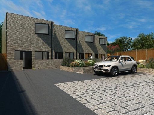 2 bedroom end of terrace house for sale in Holmwood Road, Enfield, EN3 — £450,000 • 2 bed • 2 bath • 864 ft²
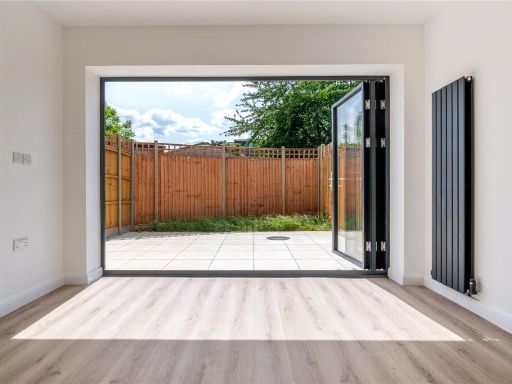 2 bedroom terraced house for sale in Holmwood Road, Enfield, EN3 — £450,000 • 2 bed • 1 bath • 771 ft²
 2 bedroom house for sale in Farorna Walk, Enfield, EN2 — £575,000 • 2 bed • 1 bath • 764 ft²
 4 bedroom town house for sale in Colgate Place, Enfield, EN3 — £500,000 • 4 bed • 2 bath • 1491 ft²
Meta
- {
"@context": "https://schema.org",
"@type": "Residence",
"name": "2 bedroom terraced house for sale in Holmwood Road, Enfield…",
"description": "",
"url": "https://propertypiper.co.uk/property/1bab402c-144e-4866-9d0c-93f66e5c6451",
"image": "https://image-a.propertypiper.co.uk/48a08db0-305c-4513-a367-1bc2082c18f8-1024.jpeg",
"address": {
"@type": "PostalAddress",
"streetAddress": "52 HOLMWOOD ROAD ENFIELD",
"postalCode": "EN3 6QJ",
"addressLocality": "Enfield",
"addressRegion": "Enfield North",
"addressCountry": "England"
},
"geo": {
"@type": "GeoCoordinates",
"latitude": 51.6764037,
"longitude": -0.0384362
},
"numberOfRooms": 2,
"numberOfBathroomsTotal": 2,
"floorSize": {
"@type": "QuantitativeValue",
"value": 864,
"unitCode": "FTK"
},
"offers": {
"@type": "Offer",
"price": 450000,
"priceCurrency": "GBP",
"availability": "https://schema.org/InStock"
},
"additionalProperty": [
{
"@type": "PropertyValue",
"name": "Feature",
"value": "contemporary"
},
{
"@type": "PropertyValue",
"name": "Feature",
"value": "modern townhouse"
},
{
"@type": "PropertyValue",
"name": "Feature",
"value": "new build"
},
{
"@type": "PropertyValue",
"name": "Feature",
"value": "stone facade"
},
{
"@type": "PropertyValue",
"name": "Feature",
"value": "boxy windows"
},
{
"@type": "PropertyValue",
"name": "Feature",
"value": "garden"
},
{
"@type": "PropertyValue",
"name": "Feature",
"value": "outdoor space"
},
{
"@type": "PropertyValue",
"name": "Feature",
"value": "family-friendly"
},
{
"@type": "PropertyValue",
"name": "Feature",
"value": "terrace"
},
{
"@type": "PropertyValue",
"name": "Feature",
"value": "modern"
},
{
"@type": "PropertyValue",
"name": "Feature",
"value": "townhouse"
},
{
"@type": "PropertyValue",
"name": "Feature",
"value": "new build"
},
{
"@type": "PropertyValue",
"name": "Feature",
"value": "low-maintenance"
},
{
"@type": "PropertyValue",
"name": "Feature",
"value": "energy-efficient"
},
{
"@type": "PropertyValue",
"name": "Feature",
"value": "urban"
},
{
"@type": "PropertyValue",
"name": "Feature",
"value": "contemporary"
}
]
}
High Res Floorplan Images
Compatible Floorplan Images
FloorplanImages Thumbnail