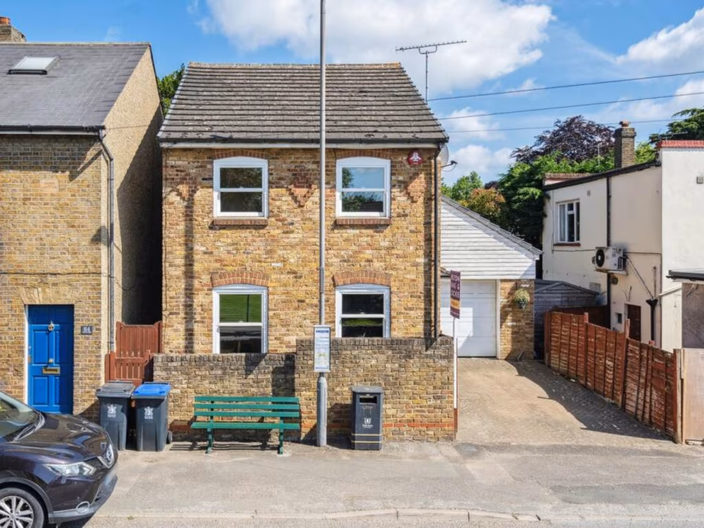
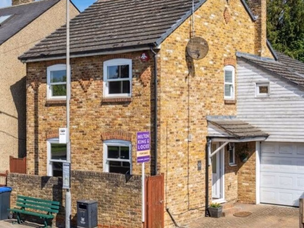
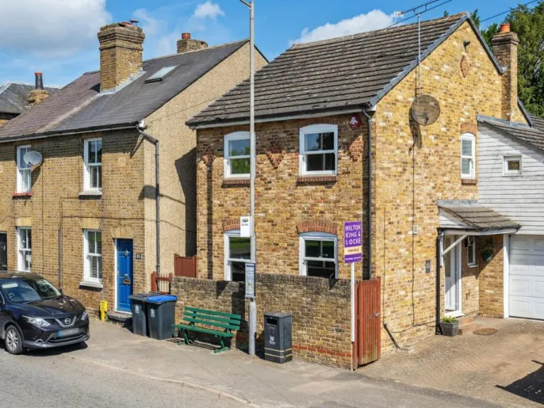
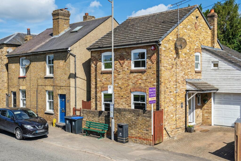
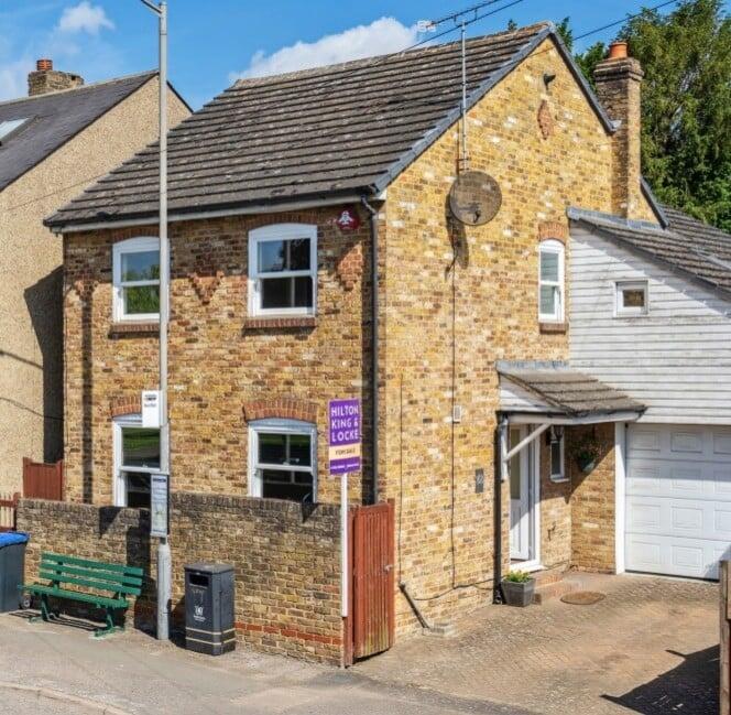
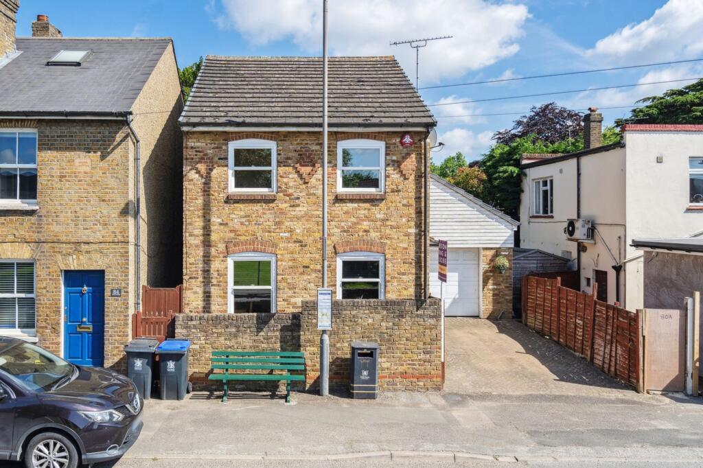
SL0 9PJ - 3 bedroom detached house for sale in High Street, Iver, SL0
View on Property Piper
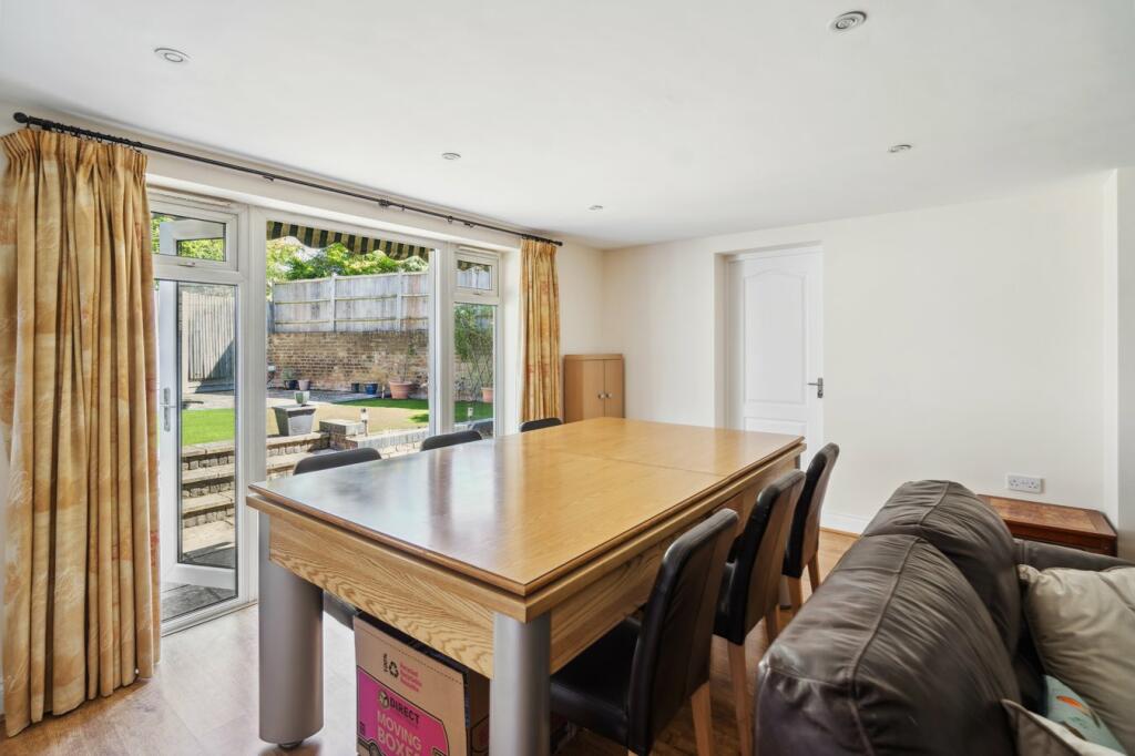
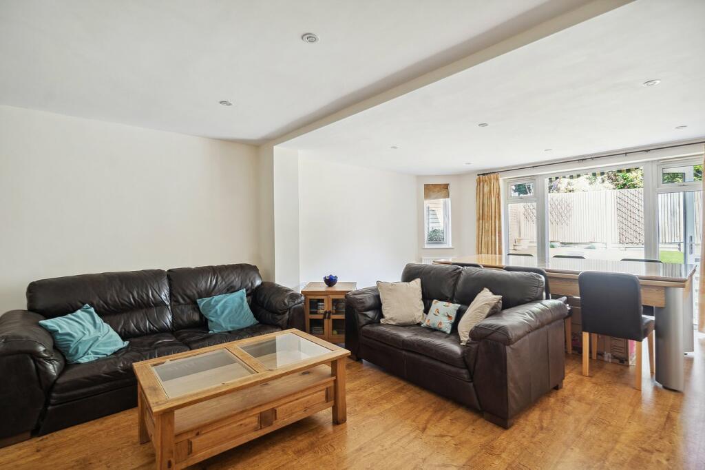
3 bedroom detached house for sale in High Street, Iver, SL0
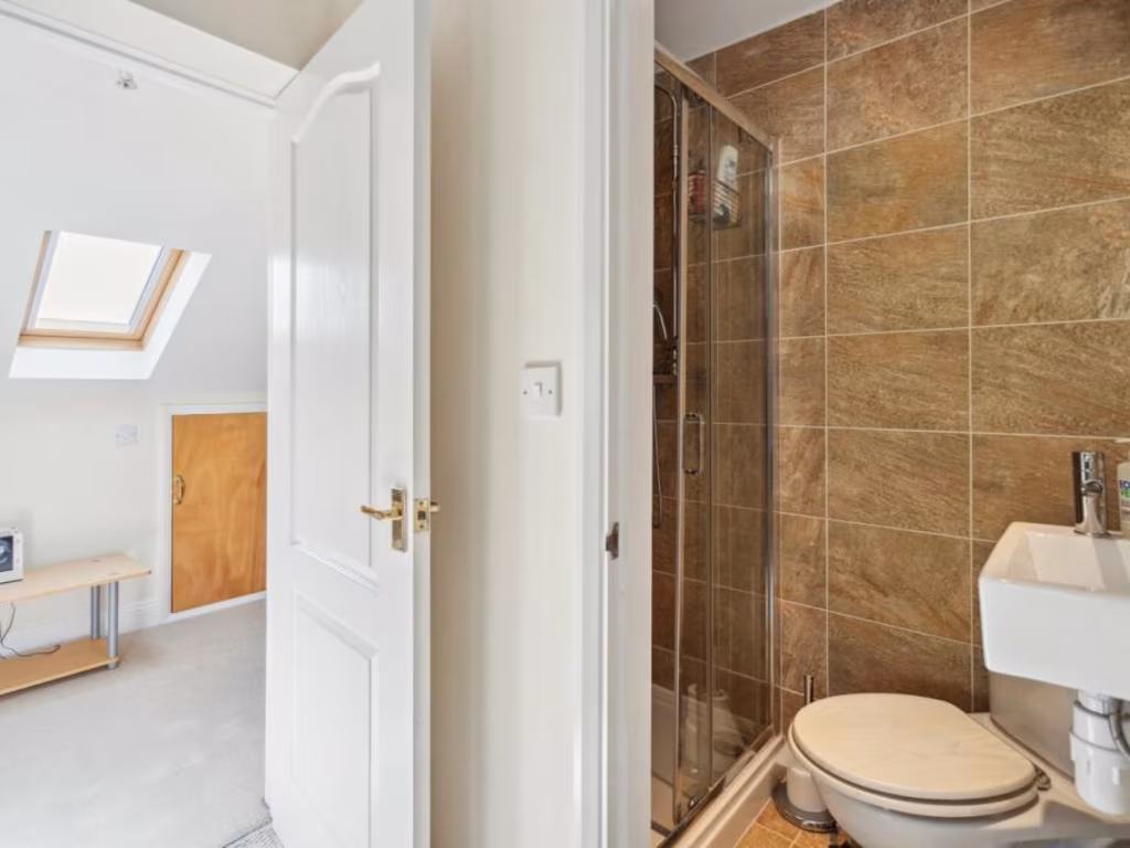
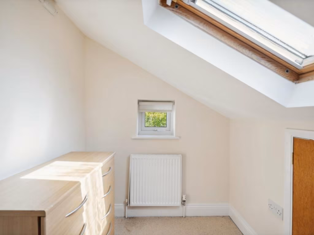
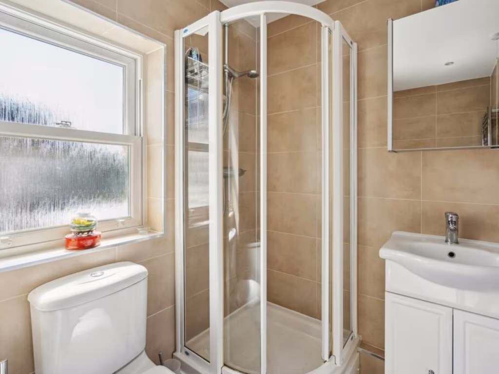
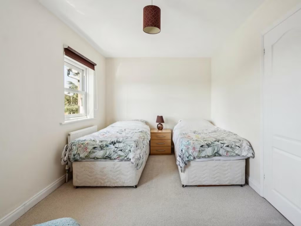
Property Details
- Price: £600000
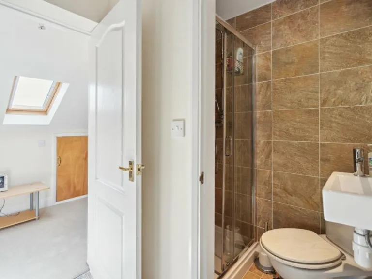
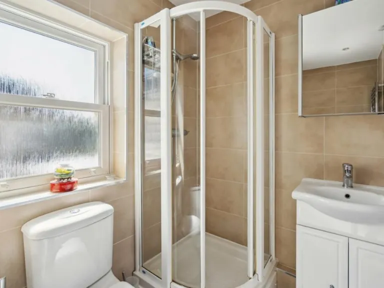
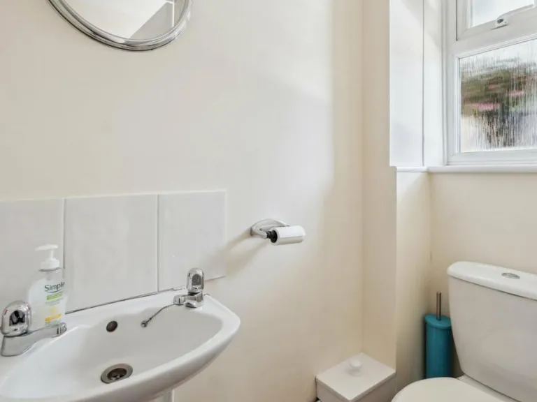
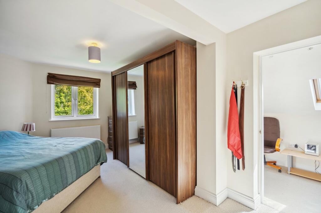
- Bedrooms: 3
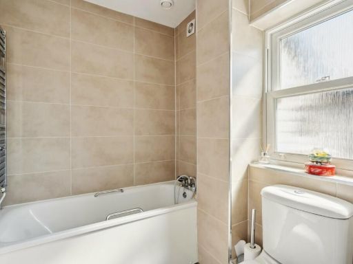
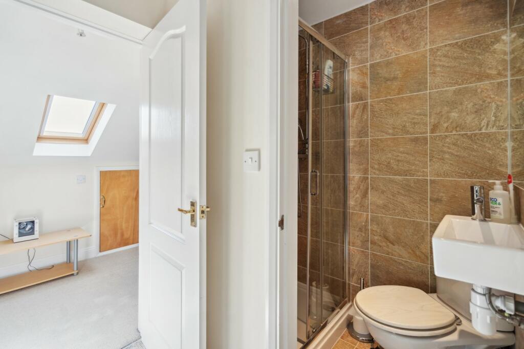
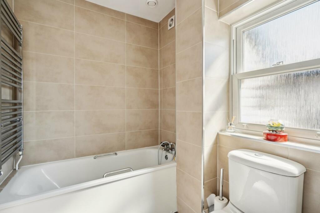
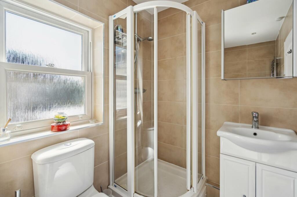
- Bathrooms: 3
- Property Type: undefined
- Property SubType: undefined
Image Descriptions
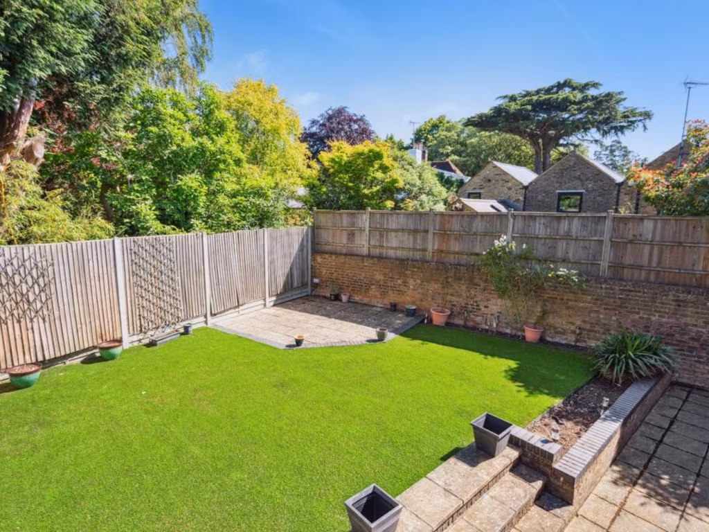
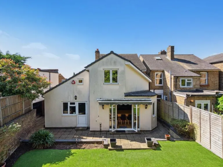
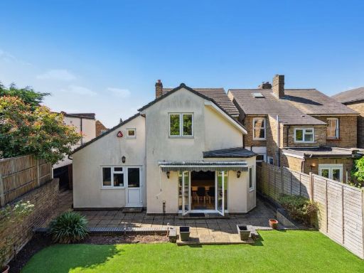
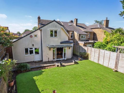
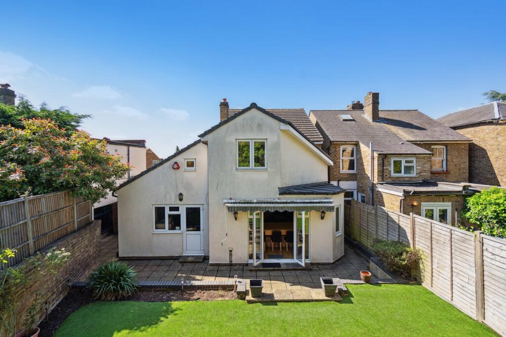
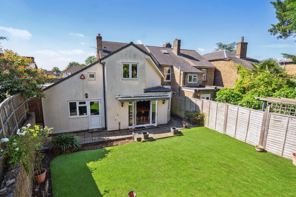
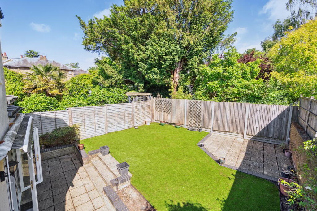
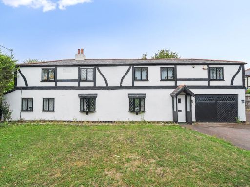
- back exterior of a house Contemporary
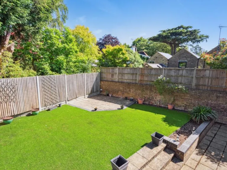
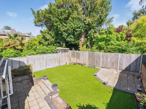
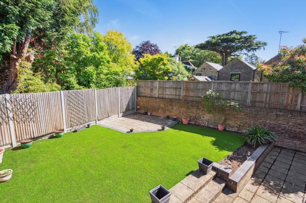
- backyard modern
- garden modern
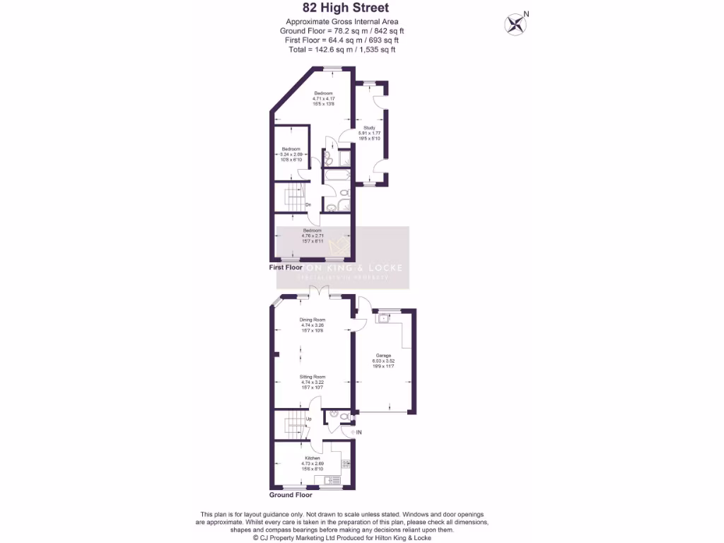
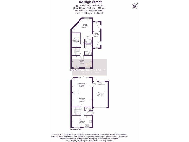
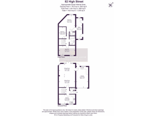
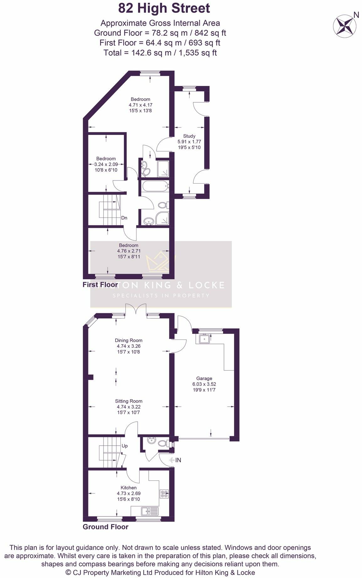
Floorplan Description
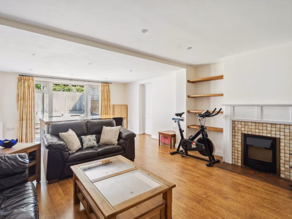
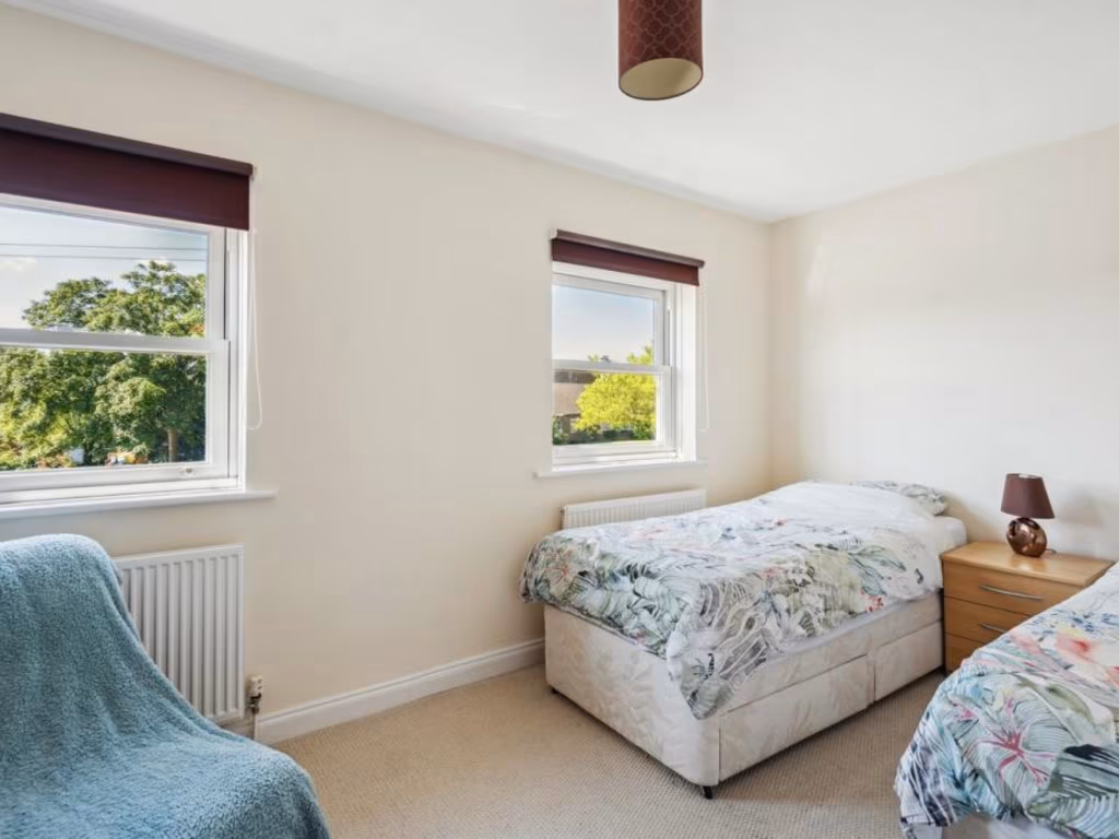
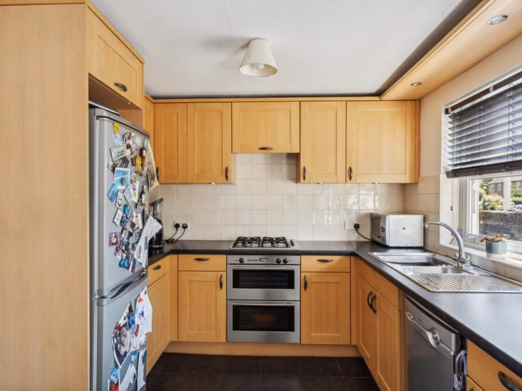
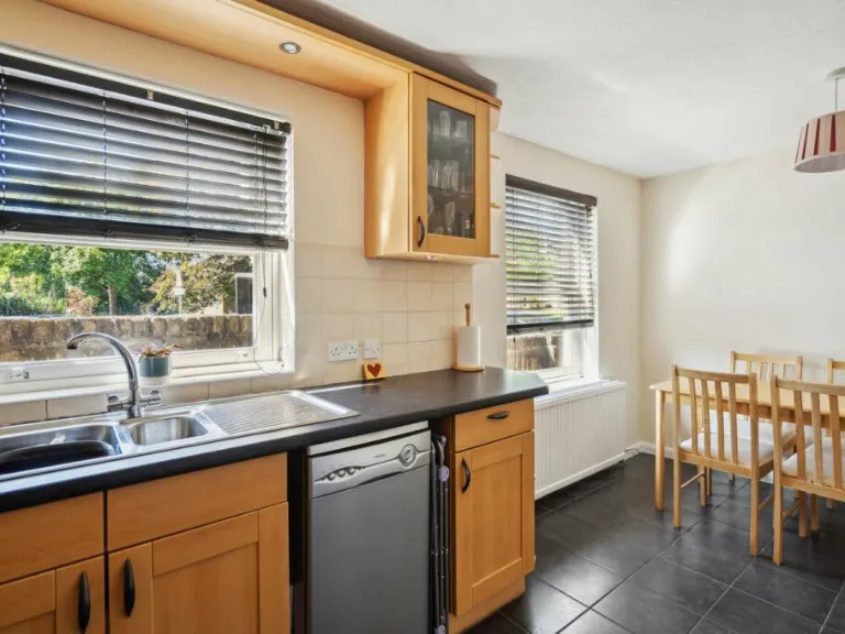
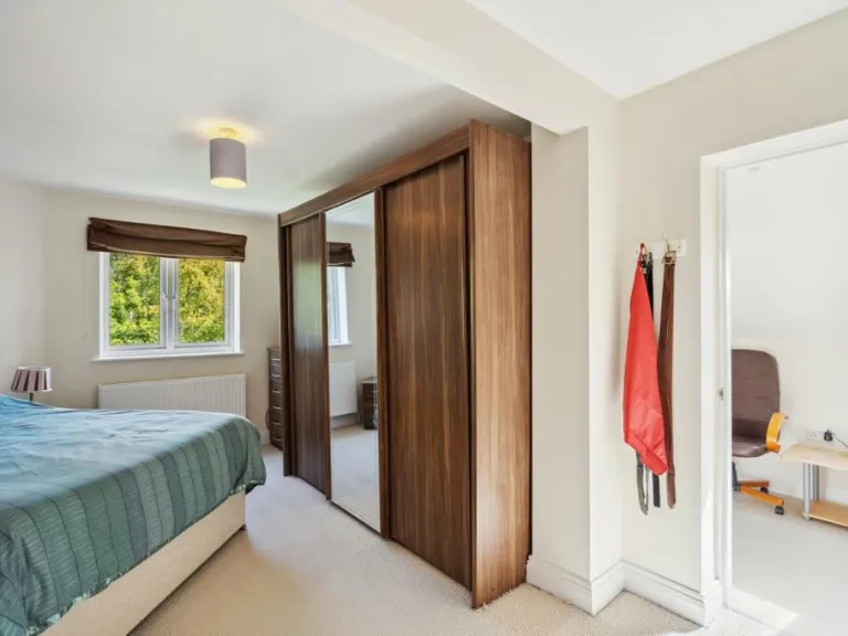
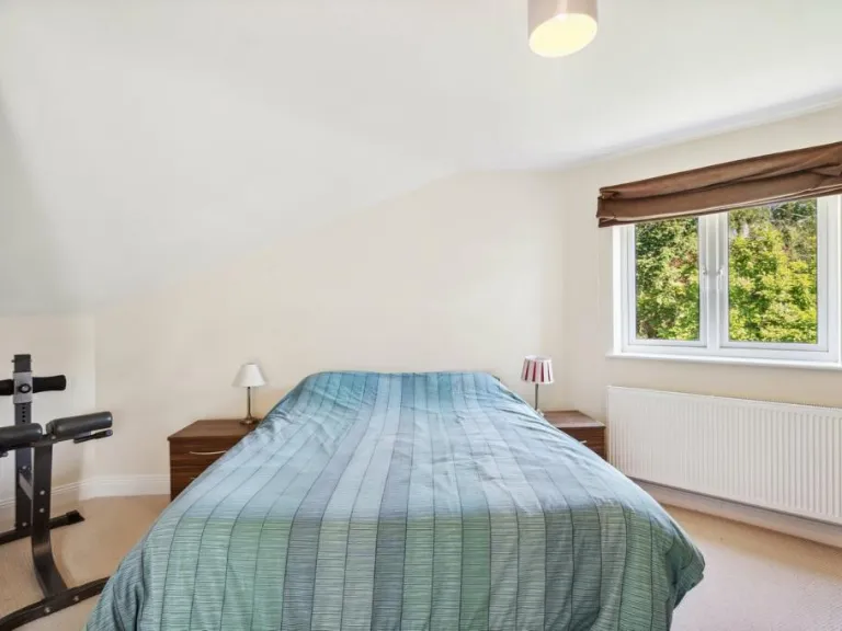
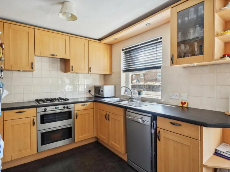
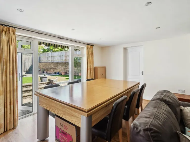
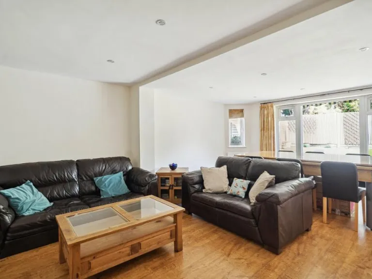
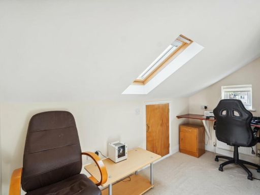
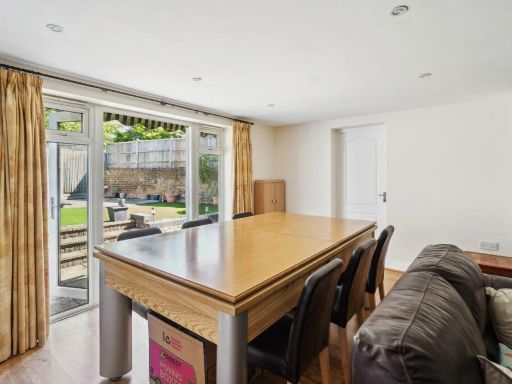
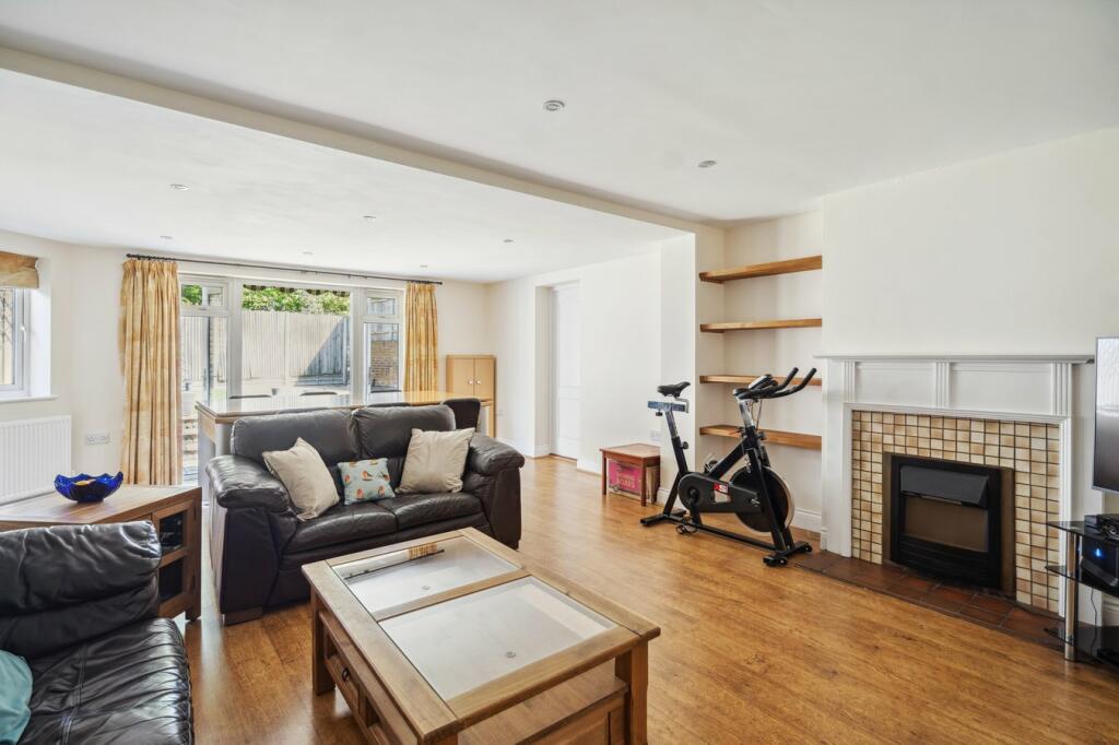
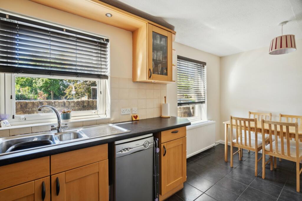
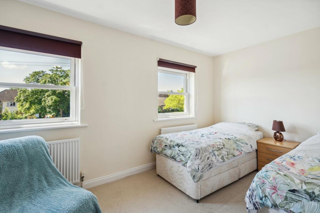
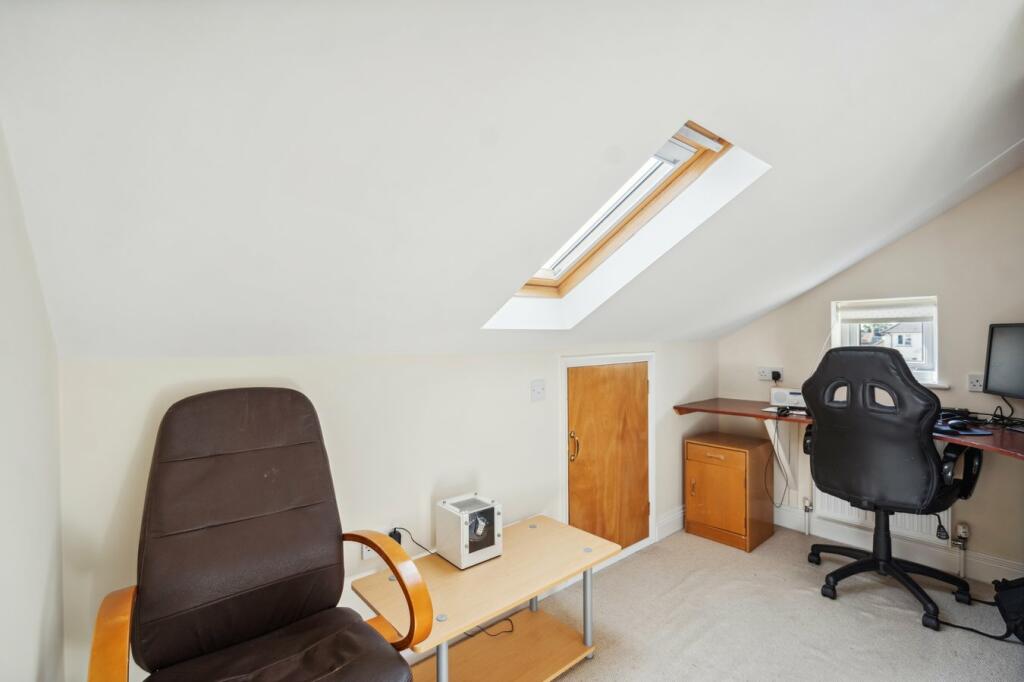
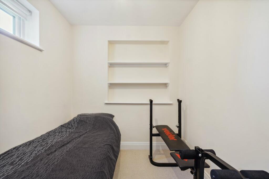
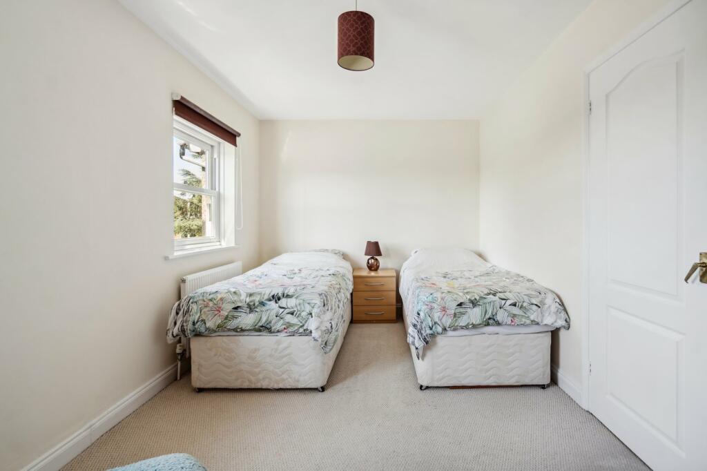
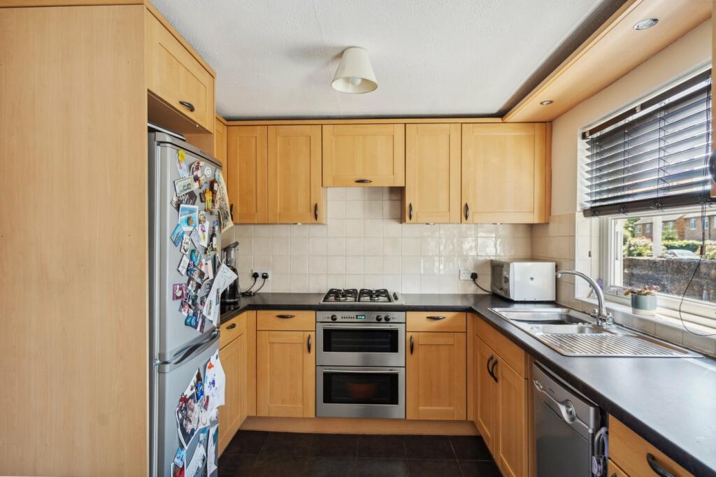
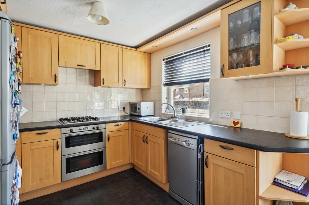
- A multi-story house with three bedrooms, study, dining room, sitting room, and kitchen.
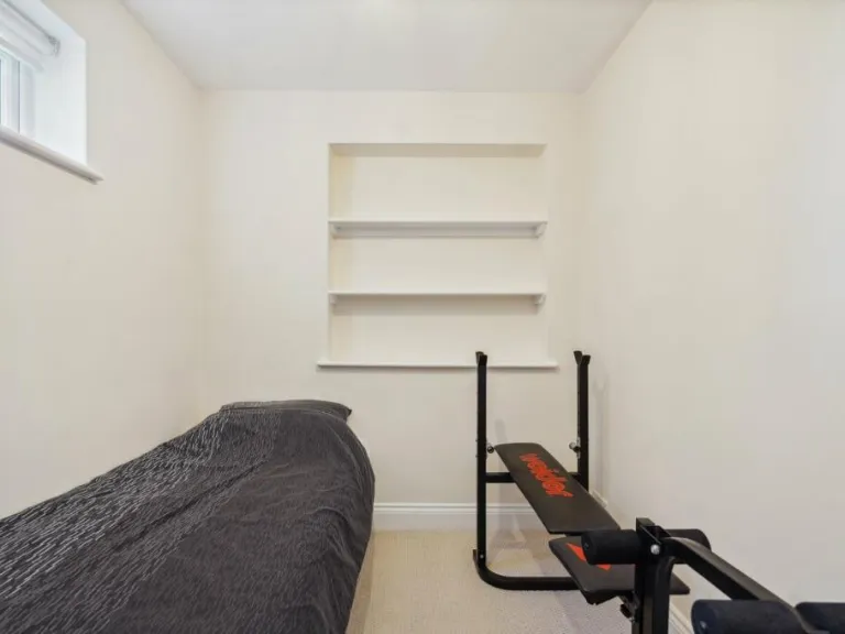
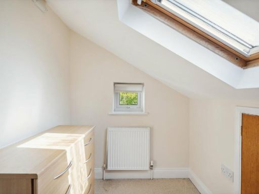
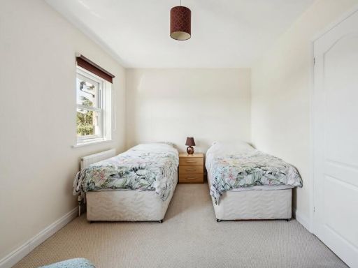
Rooms
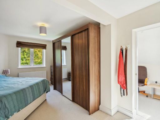
- Bedroom: Large
- Study: Average
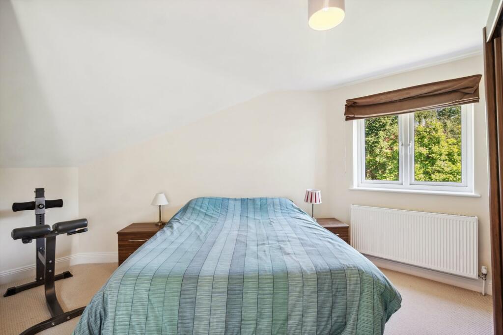
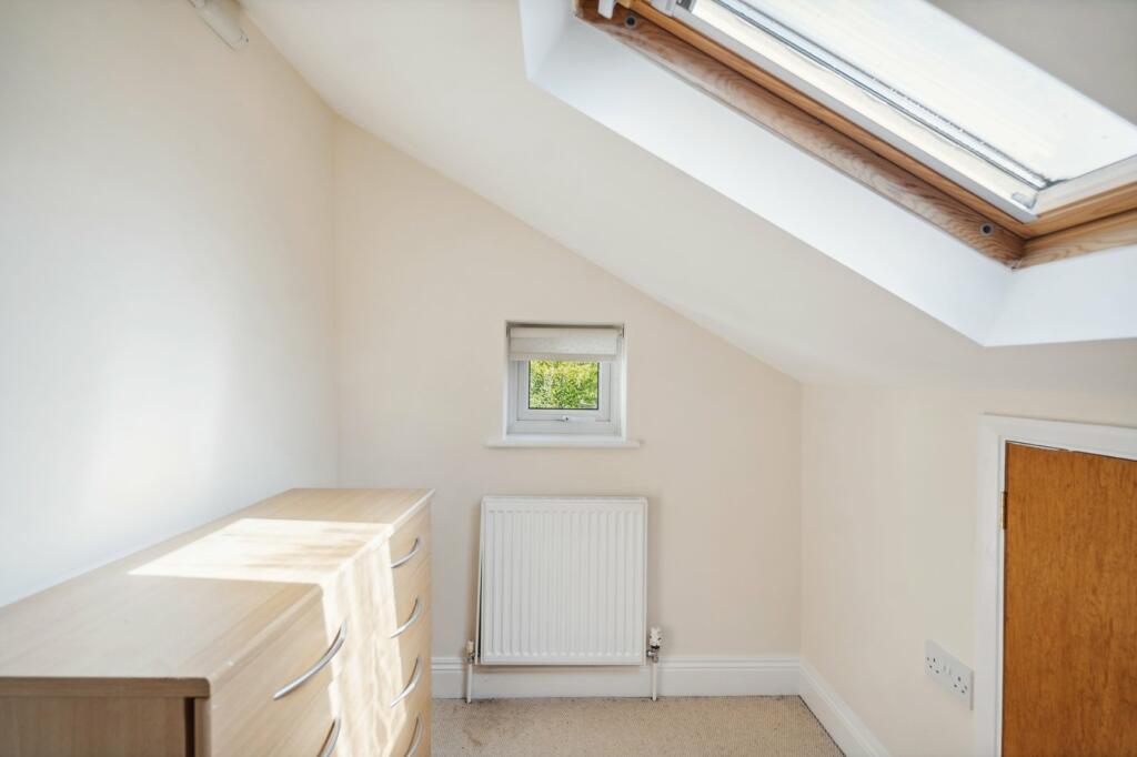
- Bedroom: Average
- Bedroom: Average
- Dining Room: Average
- Sitting Room: Average
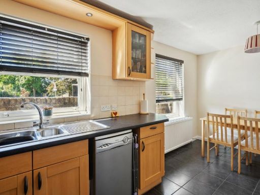
- Kitchen: Average
Textual Property Features
Detected Visual Features
- garden
- patio
- modern exterior
- two-story
- windows
- roof
- awnings
- fence
- backyard
- modern
- detached
- patio doors
- chimney
- lawn
- outdoor
- landscaped
- plants
Nearby Schools
- Rabbsfarm Primary School
- Cowley St Laurence CofE Primary School
- St Andrew's C of E Primary School
- Harmondsworth Primary School
- Marish Primary School
- The Langley Heritage Primary
- Colnbrook Church of England Primary School
- St Catherine Catholic Primary School
- Whitehall Junior School
- Iver Village Infant Academy
- Iver Heath Infant School and Nursery
- Foxborough Primary School
- St Matthew's CofE Primary School
- The Skills Hub
- Uxbridge High School
- Whitehall Infant School
- St Mary's Catholic Primary School
- Hermitage Primary School
- The Eden SDA School
- St Martin's Church of England Primary School
- Iver Heath Junior School
- Pippins School
- Laurel Lane Primary School
- West Drayton Academy
- Langley Hall Primary Academy
- Langley Hall Arts Academy
- The Iver Village Junior School
Nearest Bars And Restaurants
- Id: 1413502750
- Tags:
- Amenity: restaurant
- Name: Curry Paradise
- TagsNormalized:
- Lat: 51.5055566
- Lon: -0.5025413
- FullGeoHash: gcpth8619gwh
- PartitionGeoHash: gcpt
- Images:
- FoodStandards: null
- Distance: 1739.5
,- Id: 1046484836
- Tags:
- Amenity: pub
- Building: yes
- Food: yes
- Name: The Red Lion
- Toilets: yes
- Toilets:access: customers
- TagsNormalized:
- Lat: 51.5189041
- Lon: -0.5269464
- FullGeoHash: gcpth48r37b3
- PartitionGeoHash: gcpt
- Images:
- FoodStandards: null
- Distance: 1308.1
,- Id: 8499524335
- Tags:
- TagsNormalized:
- Lat: 51.5174456
- Lon: -0.495633
- FullGeoHash: gcpthdrnfgvj
- PartitionGeoHash: gcpt
- Images:
- FoodStandards: null
- Distance: 950.9
,- Id: 540426530
- Tags:
- Amenity: pub
- Name: The Swan
- Wikidata: Q26417434
- TagsNormalized:
- Lat: 51.5201894
- Lon: -0.5037862
- FullGeoHash: gcpthdcnugmu
- PartitionGeoHash: gcpt
- Images:
- FoodStandards: null
- Distance: 318.2
,- Id: 266979954
- Tags:
- TagsNormalized:
- Lat: 51.5206548
- Lon: -0.5122801
- FullGeoHash: gcpth74cx40k
- PartitionGeoHash: gcpt
- Images:
- FoodStandards: null
- Distance: 276.8
}
Nearest General Shops
- Id: 1412499942
- Tags:
- TagsNormalized:
- Lat: 51.5202356
- Lon: -0.5166009
- FullGeoHash: gcpth4zz4k42
- PartitionGeoHash: gcpt
- Images:
- FoodStandards: null
- Distance: 578.7
,- Id: 229258475
- Tags:
- Addr:
- Housenumber: 9
- Postcode: SL0 9ND
- Street: High Street
- Building: yes
- Email: info@fontain.co.uk
- Name: Fontain Motors
- Phone: +44 1753 650909
- Service_industry: repair:vehicle
- Shop: vehicle
- Vehicle:
- TagsNormalized:
- Lat: 51.5198178
- Lon: -0.504725
- FullGeoHash: gcpthdbkxn1u
- PartitionGeoHash: gcpt
- Images:
- FoodStandards: null
- Distance: 268.8
,- Id: 1412543064
- Tags:
- TagsNormalized:
- Lat: 51.5201537
- Lon: -0.5059095
- FullGeoHash: gcpth6zwekwx
- PartitionGeoHash: gcpt
- Images:
- FoodStandards: null
- Distance: 178.7
}
Nearest Grocery shops
- Id: 8018252386
- Tags:
- Addr:
- Housenumber: 30
- Postcode: UB8 2HL
- Street: Cowley High Road
- Name: Bal's Convenience Store
- Shop: convenience
- TagsNormalized:
- Lat: 51.5224773
- Lon: -0.4811904
- FullGeoHash: gcptj53s5myk
- PartitionGeoHash: gcpt
- Images:
- FoodStandards: null
- Distance: 1884
,- Id: 1412492012
- Tags:
- Addr:
- Street: Langley Park Road
- Name: Wingrove's Farm
- Shop: greengrocer
- Source: Local Knowledge
- Url: http://www.wingrovesfarmshop.co.uk/
- TagsNormalized:
- farm
- greengrocer
- grocer
- shop
- Lat: 51.5189889
- Lon: -0.5215312
- FullGeoHash: gcpth4spz7w5
- PartitionGeoHash: gcpt
- Images:
- FoodStandards: null
- Distance: 938.1
,- Id: 392181939
- Tags:
- TagsNormalized:
- Lat: 51.5202712
- Lon: -0.5164277
- FullGeoHash: gcpth4zzq6es
- PartitionGeoHash: gcpt
- Images:
- FoodStandards: null
- Distance: 566.3
}
Nearest Religious buildings
- Id: 127674334
- Tags:
- Amenity: grave_yard
- Name: St Peters Church Graveyard
- TagsNormalized:
- Lat: 51.5198266
- Lon: -0.5022956
- FullGeoHash: gcpthdfhxxv2
- PartitionGeoHash: gcpt
- Images:
- FoodStandards: null
- Distance: 427.9
,- Id: 360910346
- Tags:
- Amenity: place_of_worship
- Building: church
- Denomination: anglican
- Name: St Peter
- Religion: christian
- Source: Local Knowledge
- Wikidata: Q17524672
- TagsNormalized:
- place of worship
- church
- anglican
- christian
- Lat: 51.5199114
- Lon: -0.5027807
- FullGeoHash: gcpthdcvhred
- PartitionGeoHash: gcpt
- Images:
- FoodStandards: null
- Distance: 393
,- Id: 1412549004
- Tags:
- Addr:
- City: Iver
- Housename: Kings Church
- Postcode: SL0 9NW
- Street: High Street
- Amenity: place_of_worship
- Denomination: independent_baptist
- Email: office@kingschurchiver.org
- Name: Kings Church Iver
- Phone: +44 1753 651178
- Religion: christian
- Service_times: Sunday: 10:30
- Website: https://kingschurchiver.org/
- TagsNormalized:
- place of worship
- baptist
- church
- christian
- Lat: 51.520454
- Lon: -0.5084308
- FullGeoHash: gcpth7jb2swx
- PartitionGeoHash: gcpt
- Images:
- FoodStandards: null
- Distance: 38.3
}
Nearest Medical buildings
- Id: 48830405
- Tags:
- Amenity: doctors
- Building: yes
- Name: Iver Heath Doctor's Surgery
- TagsNormalized:
- doctor
- doctors
- heath
- surgery
- Lat: 51.5381107
- Lon: -0.5219267
- FullGeoHash: gcpthn5zq0pj
- PartitionGeoHash: gcpt
- Images:
- FoodStandards: null
- Distance: 2145.1
,- Id: 9016341672
- Tags:
- Amenity: pharmacy
- Dispensing: yes
- Healthcare: pharmacy
- Name: Mango Pharmacy
- TagsNormalized:
- Lat: 51.5268111
- Lon: -0.4821132
- FullGeoHash: gcptjh0vmvy2
- PartitionGeoHash: gcpt
- Images:
- FoodStandards: null
- Distance: 1930.6
,- Id: 9053474985
- Tags:
- Addr:
- City: Iver
- Housenumber: 16
- Street: Thorney Lane South
- Amenity: dentist
- Healthcare: dentist
- Name: Dental Wellbeing
- Website: http://www.dentalwellbeing.co.uk/
- TagsNormalized:
- dentist
- health
- healthcare
- dental
- Lat: 51.5052244
- Lon: -0.5023784
- FullGeoHash: gcpth84pttxx
- PartitionGeoHash: gcpt
- Images:
- FoodStandards: null
- Distance: 1778
,- Id: 1412549046
- Tags:
- Addr:
- City: Iver
- Postcode: SL0 9NU
- Street: High Street
- Amenity: doctors
- Emergency: no
- Healthcare: doctor
- Name: Iver Medical Centre
- Phone: +44 1753653008
- TagsNormalized:
- doctor
- doctors
- health
- healthcare
- Lat: 51.5203872
- Lon: -0.5095895
- FullGeoHash: gcpth7hbj8q8
- PartitionGeoHash: gcpt
- Images:
- FoodStandards: null
- Distance: 100.6
}
Nearest Airports
- Id: 14001268
- Tags:
- Access: yes
- Aerodrome: international
- Aerodrome:type: public
- Aeroway: aerodrome
- Alt_name: London Heathrow
- Alt_name_2: London Heathrow Airport
- Ele: 25
- Iata: LHR
- Icao: EGLL
- Int_name: Heathrow Airport
- Name: London Heathrow Airport
- Note: area still approx
- Old_name: London Airport
- Operator: Heathrow Airport Limited
- Rank_aci:
- Ref: LHR
- Short_name: Heathrow
- Type: multipolygon
- Website: https://www.heathrow.com/
- Wikidata: Q8691
- Wikipedia: en:Heathrow Airport
- TagsNormalized:
- airport
- international airport
- Lat: 51.4677522
- Lon: -0.4547736
- FullGeoHash: gcpsv9kv7h2h
- PartitionGeoHash: gcps
- Images:
- FoodStandards: null
- Distance: 6964.1
}
Nearest Leisure Facilities
- Id: 1093100651
- Tags:
- TagsNormalized:
- Lat: 51.5182875
- Lon: -0.5123716
- FullGeoHash: gcpth6dgubu5
- PartitionGeoHash: gcpt
- Images:
- FoodStandards: null
- Distance: 396.4
,- Id: 1093100650
- Tags:
- TagsNormalized:
- Lat: 51.5186459
- Lon: -0.5122408
- FullGeoHash: gcpth6dvzgtt
- PartitionGeoHash: gcpt
- Images:
- FoodStandards: null
- Distance: 362.7
,- Id: 1093100649
- Tags:
- TagsNormalized:
- Lat: 51.5189958
- Lon: -0.5123375
- FullGeoHash: gcpth6dzvsvk
- PartitionGeoHash: gcpt
- Images:
- FoodStandards: null
- Distance: 343.9
,- Id: 1093100648
- Tags:
- TagsNormalized:
- Lat: 51.5192782
- Lon: -0.5122354
- FullGeoHash: gcpth6g18199
- PartitionGeoHash: gcpt
- Images:
- FoodStandards: null
- Distance: 320.7
,- Id: 1093097346
- Tags:
- TagsNormalized:
- Lat: 51.5193216
- Lon: -0.511728
- FullGeoHash: gcpth6g3gceu
- PartitionGeoHash: gcpt
- Images:
- FoodStandards: null
- Distance: 288.6
}
Nearest Tourist attractions
- Id: 127677288
- Tags:
- Addr:
- Housename: Iver Environment Centre
- Postcode: SL0 0EB
- Street: Slough Road
- Name: Iver Environment Centre
- Old_name: Iver Nature Study Centre
- Tourism: attraction
- TagsNormalized:
- Lat: 51.543256
- Lon: -0.5006236
- FullGeoHash: gcpthx5mnx7f
- PartitionGeoHash: gcpt
- Images:
- FoodStandards: null
- Distance: 2554.1
,- Id: 2460874583
- Tags:
- TagsNormalized:
- Lat: 51.5218003
- Lon: -0.5355831
- FullGeoHash: gcpt5g600p8q
- PartitionGeoHash: gcpt
- Images:
- FoodStandards: null
- Distance: 1892.1
,- Id: 913251587
- Tags:
- TagsNormalized:
- Lat: 51.522814
- Lon: -0.4895385
- FullGeoHash: gcpthg7w0utt
- PartitionGeoHash: gcpt
- Images:
- FoodStandards: null
- Distance: 1316.4
}
Nearest Bus stations and stops
- Id: 469764651
- Tags:
- Highway: bus_stop
- Local_ref: Q
- Name: Benbow Waye
- Naptan:
- AtcoCode: 490003887S
- Bearing: S
- CommonName: Benbow Waye
- Indicator: Stop Q
- Verified: no
- Public_transport: platform
- TagsNormalized:
- Lat: 51.5255579
- Lon: -0.4824765
- FullGeoHash: gcptj5bwjkpm
- PartitionGeoHash: gcpt
- Images:
- FoodStandards: null
- Distance: 1862.7
,- Id: 1177286668
- Tags:
- Bench: yes
- Bus: yes
- Covered: yes
- Highway: bus_stop
- Local_ref: E
- Name: Sefton Way
- Network: London Buses
- Operator: Transport for London
- Public_transport: platform
- Ref: 71813
- Shelter: yes
- TagsNormalized:
- Lat: 51.5222154
- Lon: -0.4815397
- FullGeoHash: gcptj536em1f
- PartitionGeoHash: gcpt
- Images:
- FoodStandards: null
- Distance: 1857.2
,- Id: 469764652
- Tags:
- Highway: bus_stop
- Local_ref: F
- Name: Benbow Waye
- Naptan:
- AtcoCode: 490003887W
- Bearing: W
- CommonName: Benbow Waye
- Indicator: Stop F
- Verified: no
- Public_transport: platform
- TagsNormalized:
- Lat: 51.5260072
- Lon: -0.4828926
- FullGeoHash: gcptjh02ezcj
- PartitionGeoHash: gcpt
- Images:
- FoodStandards: null
- Distance: 1850.2
,- Id: 8615163091
- Tags:
- Highway: bus_stop
- Name: Thorney Lane South
- Public_transport: platform
- TagsNormalized:
- Lat: 51.5048451
- Lon: -0.5023536
- FullGeoHash: gcpth84jqr40
- PartitionGeoHash: gcpt
- Images:
- FoodStandards: null
- Distance: 1819.5
,- Id: 8615163089
- Tags:
- Highway: bus_stop
- Name: Thorney Lane South
- Public_transport: platform
- TagsNormalized:
- Lat: 51.5048685
- Lon: -0.5025608
- FullGeoHash: gcpth84j97rs
- PartitionGeoHash: gcpt
- Images:
- FoodStandards: null
- Distance: 1813.7
}
Nearest Hotels
- Id: 407503595
- Tags:
- Addr:
- City: Uxbridge
- Postcode: UB8 2YF
- Street: Riverside Way
- Brand: Premier Inn
- Brand:wikidata: Q2108626
- Brand:wikipedia: en:Premier Inn
- Building: hotel
- Internet_access: wlan
- Internet_access:fee: customers
- Internet_access:operator: Virgin Media
- Internet_access:ssid: Premier Inn Free Wi-Fi
- Name: Premier Inn
- Tourism: hotel
- TagsNormalized:
- Lat: 51.5423498
- Lon: -0.4902893
- FullGeoHash: gcpthyfzzqmu
- PartitionGeoHash: gcpt
- Images:
- FoodStandards: null
- Distance: 2701.6
,- Id: 8395534387
- Tags:
- Name: Riverside Hotel
- Tourism: hotel
- TagsNormalized:
- Lat: 51.5148185
- Lon: -0.4814215
- FullGeoHash: gcptj1crw44n
- PartitionGeoHash: gcpt
- Images:
- FoodStandards: null
- Distance: 1973.6
,- Id: 1413502746
- Tags:
- Name: The Tower Arms
- Tourism: hotel
- TagsNormalized:
- Lat: 51.5045315
- Lon: -0.5019834
- FullGeoHash: gcpth847wuw1
- PartitionGeoHash: gcpt
- Images:
- FoodStandards: null
- Distance: 1859.3
}
Tags
- garden
- patio
- modern exterior
- two-story
- windows
- roof
- awnings
- fence
- backyard
- modern
- detached
- two-story
- patio doors
- garden
- fence
- chimney
- lawn
- garden
- modern
- outdoor
- landscaped
- fence
- lawn
- patio
- plants
Local Market Stats
- Average Price/sqft: £509
- Avg Income: £62000
- Rental Yield: 3.6%
- Social Housing: 7%
- Planning Success Rate: 82%
AirBnB Data
- 1km average: £88/night
- Listings in 1km: 1
Similar Properties
 4 bedroom detached house for sale in Swallow Street, Iver, Buckinghamshire, SL0 — £900,000 • 4 bed • 2 bath • 2549 ft²
 3 bedroom detached house for sale in Swallow Fields, Iver, SL0 — £725,000 • 3 bed • 2 bath • 1174 ft²
 4 bedroom detached house for sale in Cecil Road, Iver, SL0 — £950,000 • 4 bed • 2 bath • 1914 ft²
 3 bedroom semi-detached house for sale in Chequers Orchard, Iver, SL0 — £550,000 • 3 bed • 2 bath • 1096 ft²
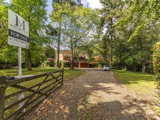 5 bedroom detached house for sale in Old Slade Lane, Iver, SL0 — £2,000,000 • 5 bed • 1 bath • 3154 ft²
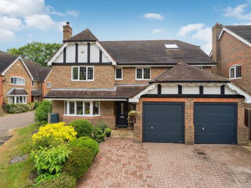 6 bedroom detached house for sale in Firs Close, Iver, Buckinghamshire, SL0 — £1,100,000 • 6 bed • 3 bath • 2630 ft²
Meta
- {
"@context": "https://schema.org",
"@type": "Residence",
"name": "3 bedroom detached house for sale in High Street, Iver, SL0",
"description": "",
"url": "https://propertypiper.co.uk/property/1a05798c-bfcc-40f2-8b80-df23e44af5d2",
"image": "https://image-a.propertypiper.co.uk/0c292740-92e5-4060-891e-36ad606a8fde-1024.jpeg",
"address": {
"@type": "PostalAddress",
"streetAddress": "82 HIGH STREET IVER ",
"postalCode": "SL0 9PJ",
"addressLocality": "Buckinghamshire",
"addressRegion": "Beaconsfield",
"addressCountry": "England"
},
"geo": {
"@type": "GeoCoordinates",
"latitude": 51.520786206216435,
"longitude": -0.5082845334585596
},
"numberOfRooms": 3,
"numberOfBathroomsTotal": 3,
"floorSize": {
"@type": "QuantitativeValue",
"value": 1535,
"unitCode": "FTK"
},
"offers": {
"@type": "Offer",
"price": 600000,
"priceCurrency": "GBP",
"availability": "https://schema.org/InStock"
},
"additionalProperty": [
{
"@type": "PropertyValue",
"name": "Feature",
"value": "garden"
},
{
"@type": "PropertyValue",
"name": "Feature",
"value": "patio"
},
{
"@type": "PropertyValue",
"name": "Feature",
"value": "modern exterior"
},
{
"@type": "PropertyValue",
"name": "Feature",
"value": "two-story"
},
{
"@type": "PropertyValue",
"name": "Feature",
"value": "windows"
},
{
"@type": "PropertyValue",
"name": "Feature",
"value": "roof"
},
{
"@type": "PropertyValue",
"name": "Feature",
"value": "awnings"
},
{
"@type": "PropertyValue",
"name": "Feature",
"value": "fence"
},
{
"@type": "PropertyValue",
"name": "Feature",
"value": "backyard"
},
{
"@type": "PropertyValue",
"name": "Feature",
"value": "modern"
},
{
"@type": "PropertyValue",
"name": "Feature",
"value": "detached"
},
{
"@type": "PropertyValue",
"name": "Feature",
"value": "two-story"
},
{
"@type": "PropertyValue",
"name": "Feature",
"value": "patio doors"
},
{
"@type": "PropertyValue",
"name": "Feature",
"value": "garden"
},
{
"@type": "PropertyValue",
"name": "Feature",
"value": "fence"
},
{
"@type": "PropertyValue",
"name": "Feature",
"value": "chimney"
},
{
"@type": "PropertyValue",
"name": "Feature",
"value": "lawn"
},
{
"@type": "PropertyValue",
"name": "Feature",
"value": "garden"
},
{
"@type": "PropertyValue",
"name": "Feature",
"value": "modern"
},
{
"@type": "PropertyValue",
"name": "Feature",
"value": "outdoor"
},
{
"@type": "PropertyValue",
"name": "Feature",
"value": "landscaped"
},
{
"@type": "PropertyValue",
"name": "Feature",
"value": "fence"
},
{
"@type": "PropertyValue",
"name": "Feature",
"value": "lawn"
},
{
"@type": "PropertyValue",
"name": "Feature",
"value": "patio"
},
{
"@type": "PropertyValue",
"name": "Feature",
"value": "plants"
}
]
}
High Res Floorplan Images
Compatible Floorplan Images
FloorplanImages Thumbnail