WA3 7EN - 4 bedroom detached house for sale in Deacons Close, Croft,…
View on Property Piper
4 bedroom detached house for sale in Deacons Close,
Croft,
Warrington,
WA3
Property Details
- Price: £569995
- Bedrooms: 4
- Bathrooms: 1
- Property Type: undefined
- Property SubType: undefined
Brochure Descriptions
- Large new-build residential development site comprising a mix of 2-, 3- and 4-bedroom homes arranged around a looped estate road with several cul-de-sacs. The site plan shows a variety of house types (coloured key) including smaller 2-bed and 2–3 bed ‘affordable’ units and larger 3–4 bed family homes. Plots are arranged with front gardens facing the internal road and private rear gardens of small-to-medium size. Property footprints are generally modest to medium, suitable for family use; overall the development footprint is large (estate-scale) with landscaped verges, tree-planting and pedestrian paths. The plan also indicates a nearby primary school (Croft Primary School) and an existing development to the west. No individual house square footage is provided on the plan.
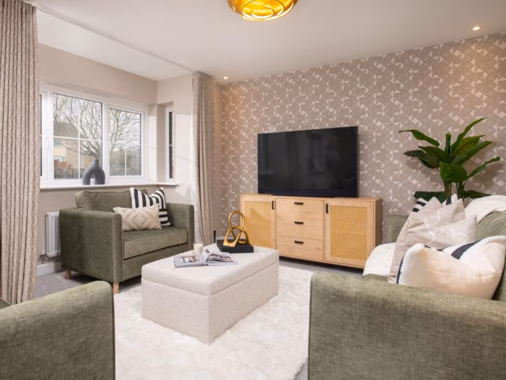
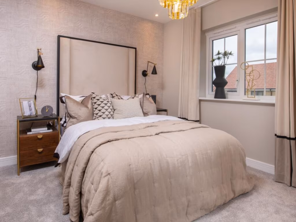
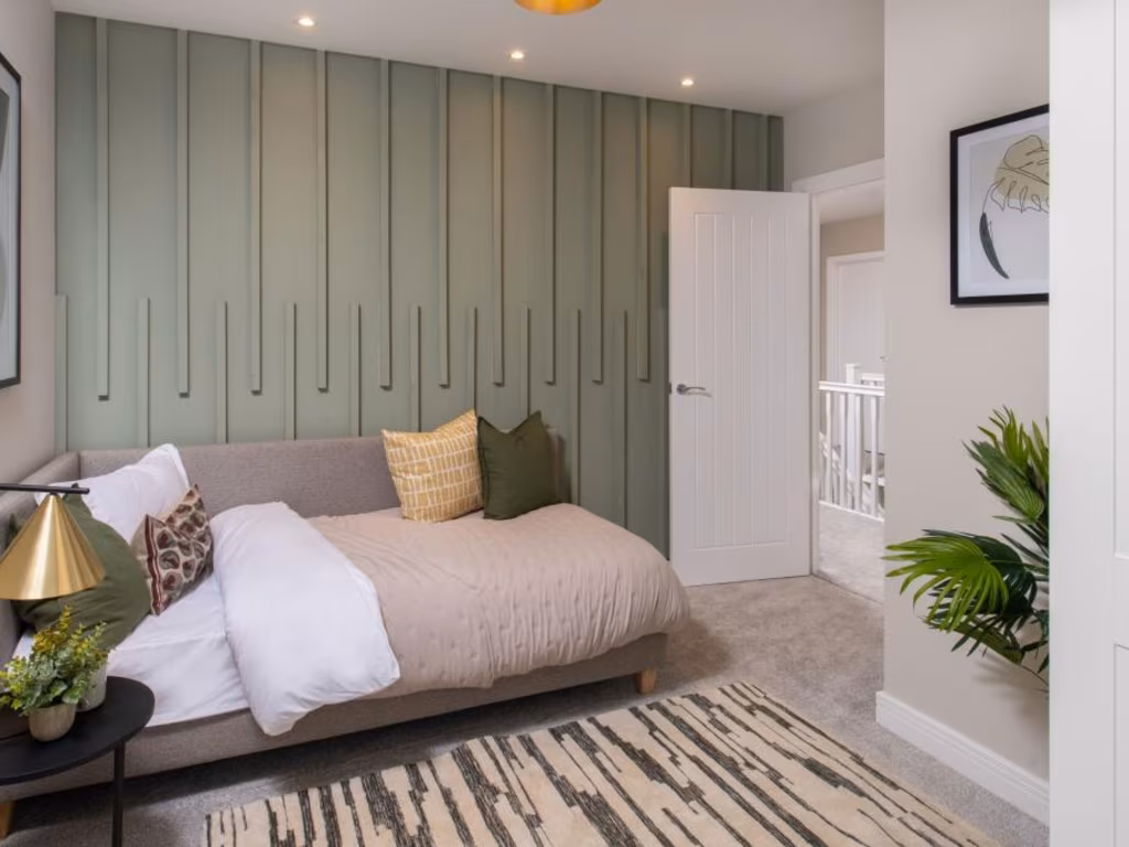
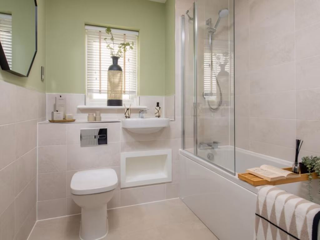
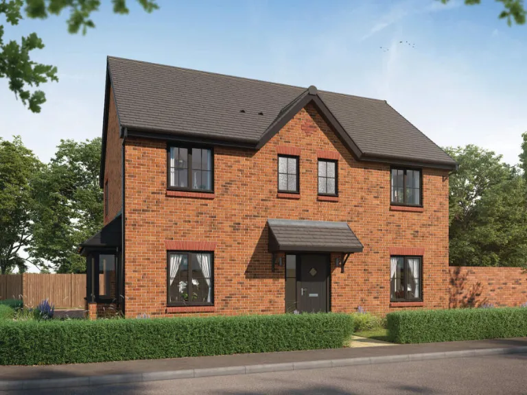
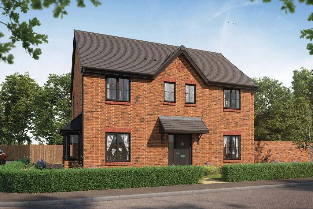
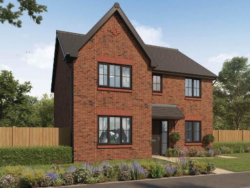
- Modern suburban development of new-build red-brick two-storey houses. The image shows a row of semi-detached/terraced family homes with pitched roofs and modest front gardens bounded by low hedging and planted borders. Properties appear to have standard-sized ground-floor windows and first-floor bedrooms, with private front entrances directly onto a quiet residential street. Landscaping includes small specimen trees and low-maintenance shrubbery; the immediate outlook is onto the road and landscaped verges with additional greenery beyond. Overall lot sizes appear typical for a medium-density housing estate (garden and frontage small-to-average); the dwellings themselves are likely average-sized family homes rather than large or detached country houses.
- No photographs or floorplans of the actual dwelling are present in this image — it is a branded Bellway information/back cover page showing the developer's contact details. Therefore no reliable description of the property for sale (type, number of rooms, internal condition, garden size or views) can be provided from this image alone.
- Planned new-build residential development shown as a site plan with a mix of 2-, 3- and 4-bedroom detached, semi-detached and terraced houses. The layout comprises several short roads and cul-de-sacs with private front and rear gardens on medium to large plots (plots vary; many are average-sized with a number of larger corner/edge plots). The scheme includes communal landscaping strips, tree-lined pedestrian routes and a recreational/trim-trail green corridor along the eastern boundary. The site sits immediately adjacent to Croft Primary School and includes an internal loop road providing access to all plots. Overall impression: suburban family-oriented development with good green amenity, varied house types suitable for families, and several larger plots positioned on the site edges offering slightly enhanced privacy and potential value uplift. No internal floor areas or total gross internal area are shown on the plan.
Image Descriptions
- detached house modern
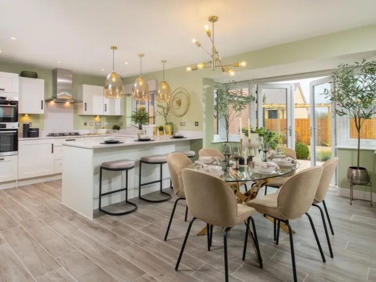
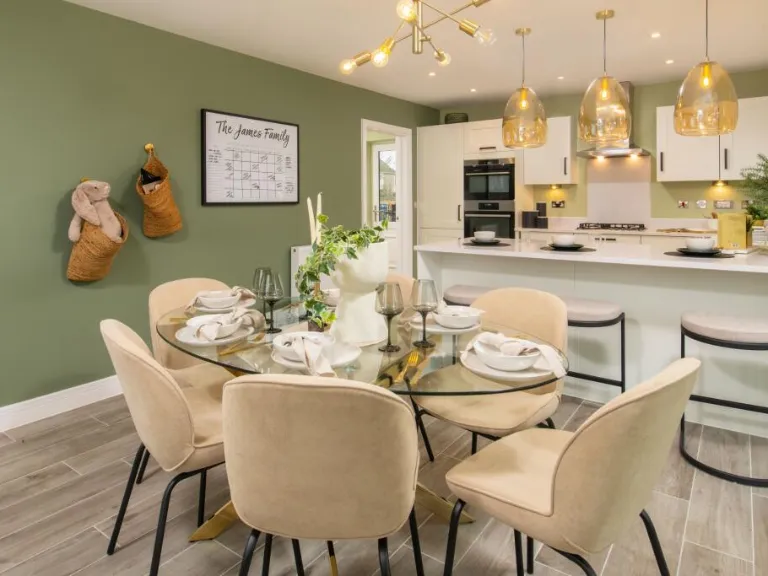
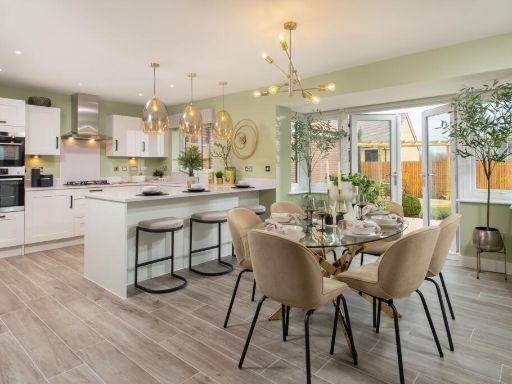
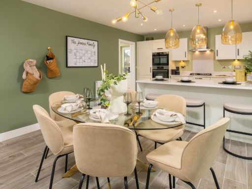
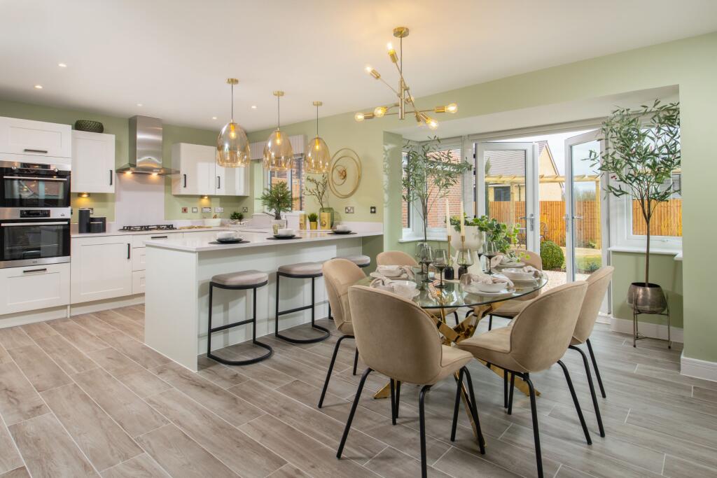
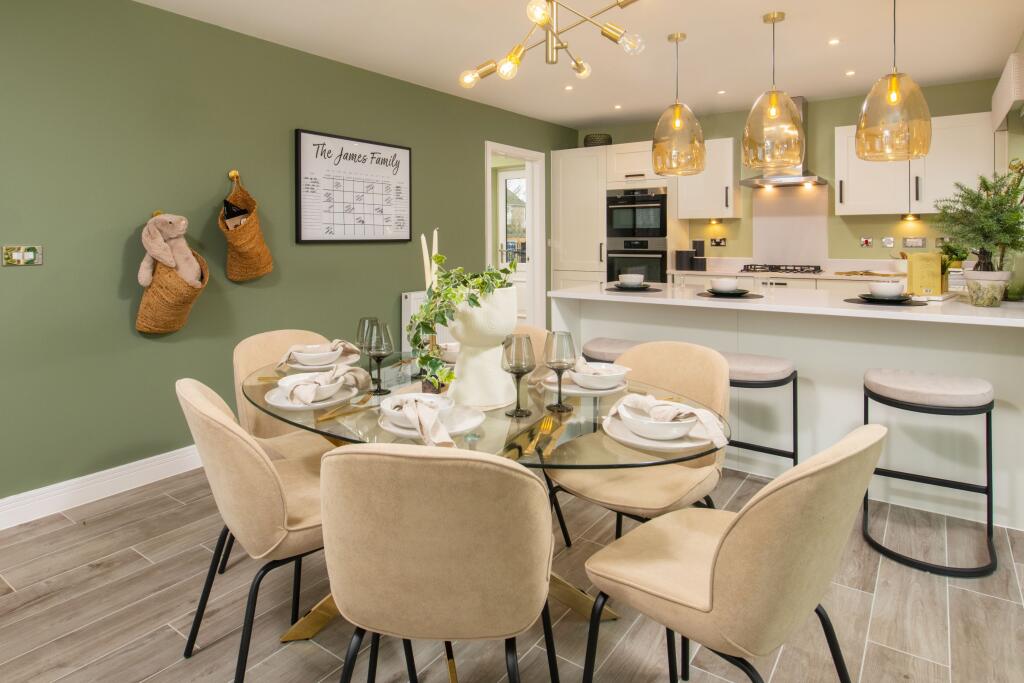
- modern open-plan kitchen dining area Contemporary
Floorplan Description
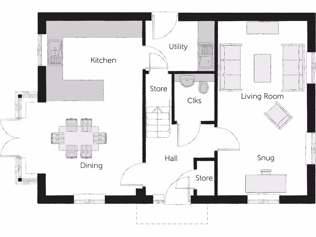
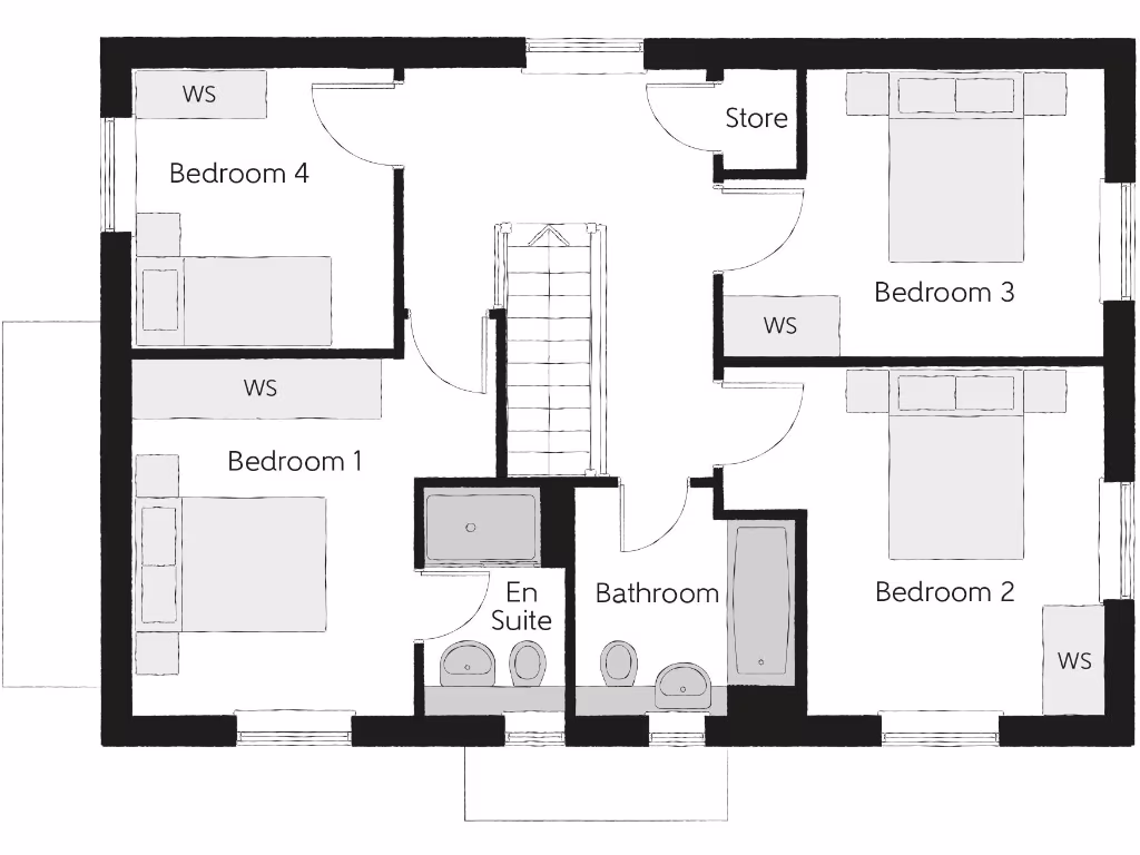
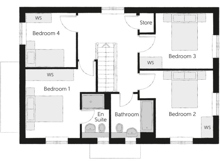
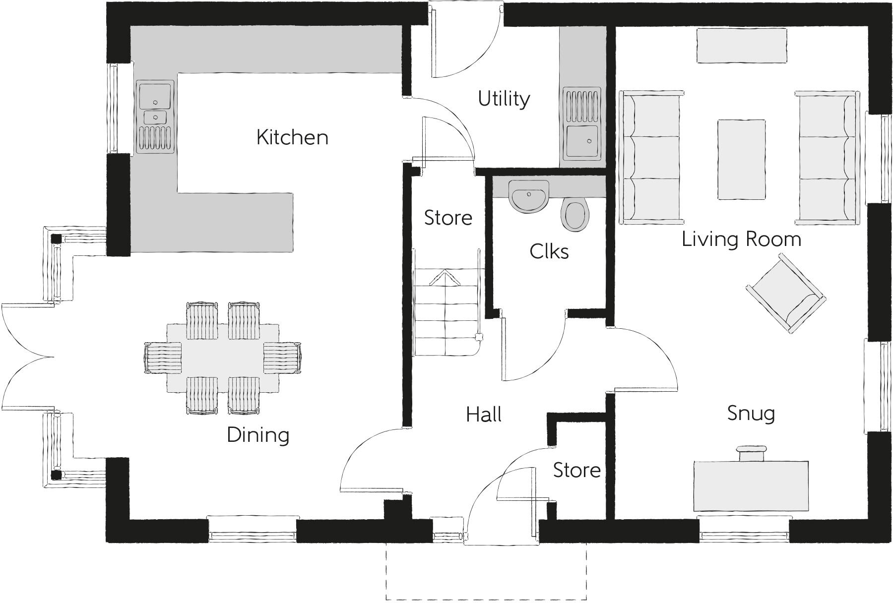
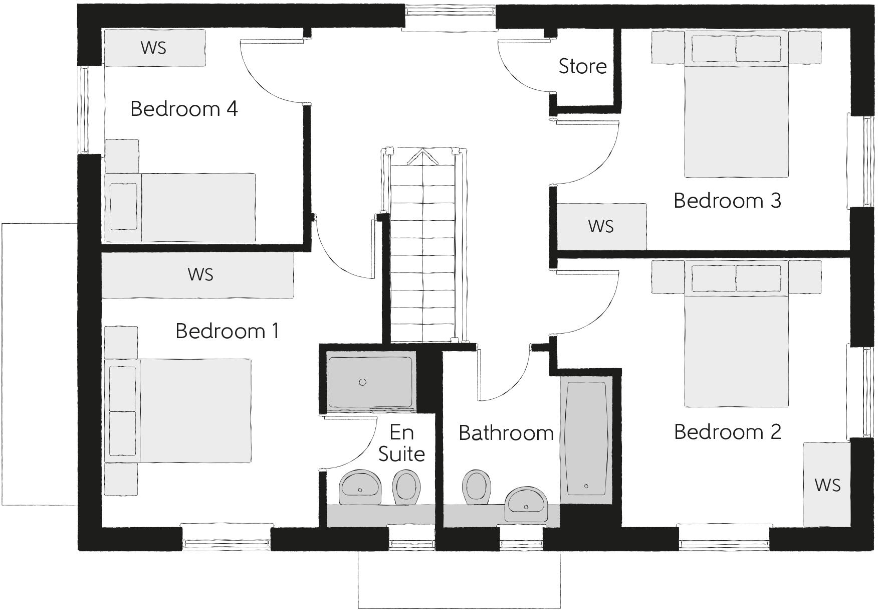
- Floor plan showing four bedrooms, an en suite, a bathroom and a store.
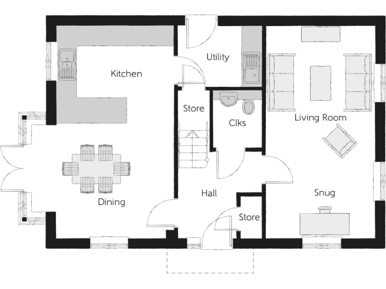
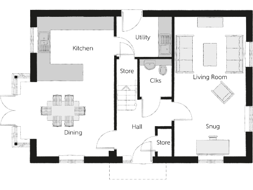
Rooms
- Kitchen:
- Dining:
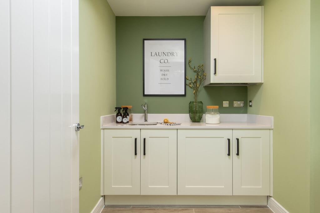
- Utility:
- Store:
- Clks:
- Living Room:
- Hall:
- Store:
- Snug:
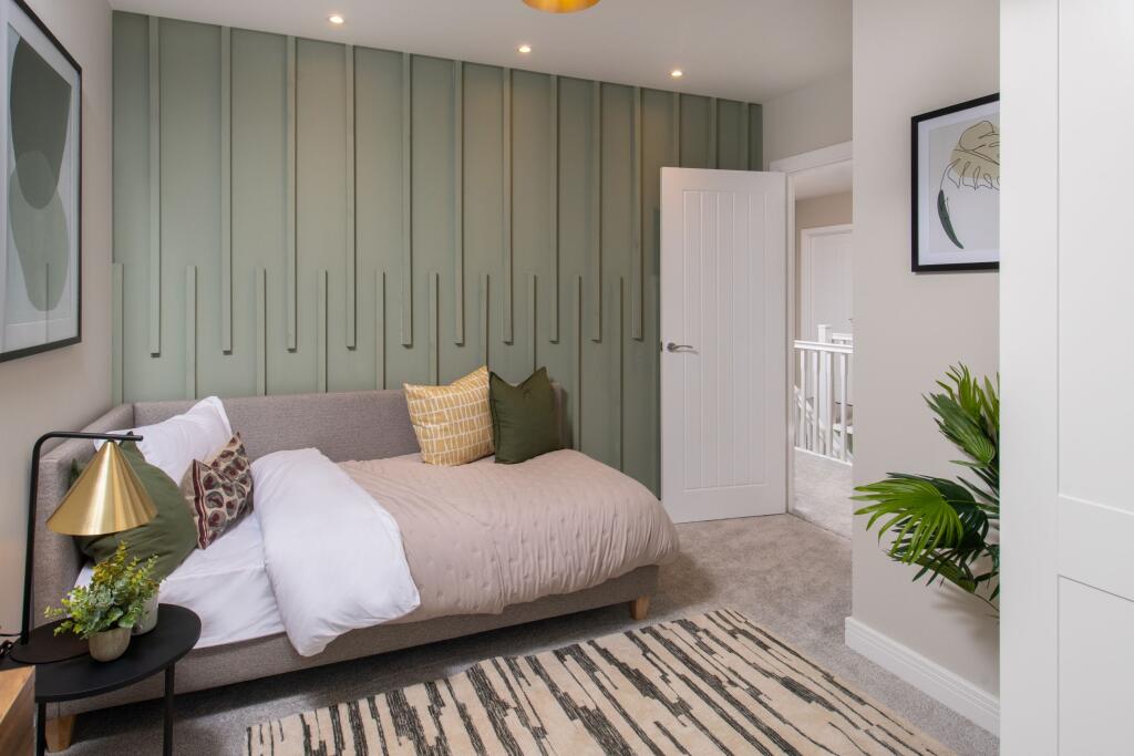
- Bedroom 4:
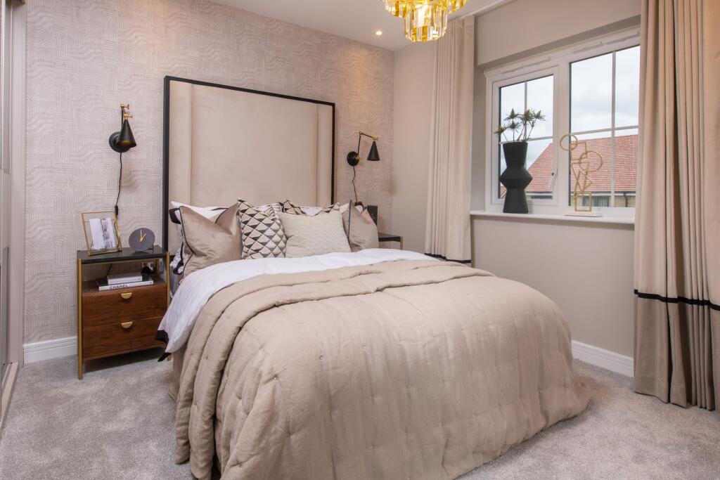
- Bedroom 1:
- Bedroom 3:
- Bedroom 2:
- En Suite:
- Bathroom:
- Store:
Textual Property Features
- Is New Build
- Chain Free
- Success
Detected Visual Features
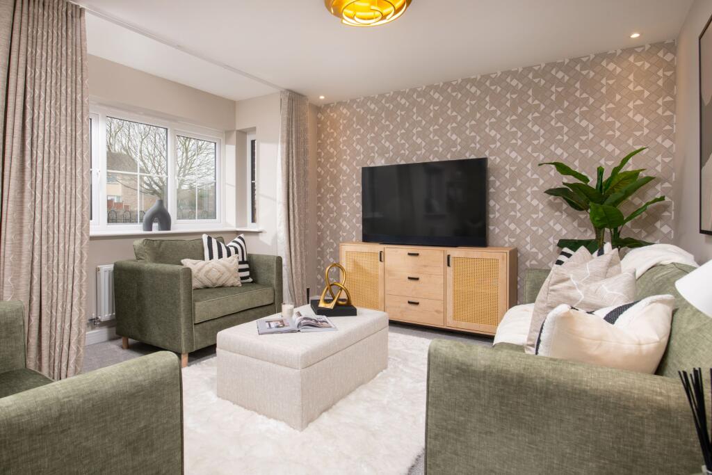
- detached house
- modern architecture
- two-story
- brick exterior
- new build
- residential
- suburban
- modern kitchen
- open-plan
- dining area
- contemporary
- large windows
- natural light
- island counter
- pendant lights
- indoor-outdoor flow
Nearby Schools
- St Peter's Catholic Primary School
- Cinnamon Brow CofE Primary School
- Croft Primary School
- St Lewis Catholic Primary School
- Lowton Junior and Infant School
- Lowton St Mary's CofE (Voluntary Aided) Primary School
- Gilded Hollins Community School
- Bruche Primary School Academy
- Padgate Academy
- St Bridget's Catholic Primary School
- Newchurch Community Primary School
- Twiss Green Community Primary School
- St Luke's CofE Primary School
- St Catherine's Catholic Primary School, Lowton
- Lowton Church of England High School
- Woolston Community Primary School
- St Oswald's Catholic Primary School
- Woolston CofE Aided Primary School
- King's Leadership Academy Warrington
- Christ Church CofE Primary School Padgate
- St Andrew's CofE Primary School
- Birchwood Community High School
- Green Meadow Independent Primary School
Nearest General Shops
- Id: 3487680364
- Tags:
- Name: Kenyon Hall Farm Shop
- Opening_hours: 09:30-05:30
- Shop: farm
- TagsNormalized:
- Lat: 53.4503684
- Lon: -2.5729728
- FullGeoHash: gcw0j6q6vqu6
- PartitionGeoHash: gcw0
- Images:
- FoodStandards: null
- Distance: 1843.3
,- Id: 3487678959
- Tags:
- Name: Kenyon Hall Plant Centre
- Opening_hours: 09:30-05:30
- Shop: garden_centre
- TagsNormalized:
- Lat: 53.4503584
- Lon: -2.5722834
- FullGeoHash: gcw0j6qfvkyr
- PartitionGeoHash: gcw0
- Images:
- FoodStandards: null
- Distance: 1808.6
,- Id: 970425772
- Tags:
- Building: yes
- Shop: fishing
- TagsNormalized:
- Lat: 53.4463642
- Lon: -2.5314464
- FullGeoHash: gcw0n3seth2v
- PartitionGeoHash: gcw0
- Images:
- FoodStandards: null
- Distance: 1574.7
}
Nearest Religious buildings
- Id: 98181004
- Tags:
- Addr:
- Postcode: WA3 7PH
- Street: Glover Road
- Amenity: place_of_worship
- Building: yes
- Fhrs:
- Name: Thomas Risley
- Religion: christian
- Source:
- TagsNormalized:
- place of worship
- christian
- church
- Lat: 53.4221376
- Lon: -2.5349891
- FullGeoHash: gcqpym4nd2pp
- PartitionGeoHash: gcqp
- Images:
- FoodStandards:
- Id: 420498
- FHRSID: 420498
- LocalAuthorityBusinessID: 49243
- BusinessName: Thomas Risley Church
- BusinessType: Other catering premises
- BusinessTypeID: 7841
- AddressLine1: null
- AddressLine2: Glover Road
- AddressLine3: null
- AddressLine4: Warrington
- PostCode: WA3 7PH
- RatingValue: 5
- RatingKey: fhrs_5_en-GB
- RatingDate: 2018-05-24
- LocalAuthorityCode: 890
- LocalAuthorityName: Warrington
- LocalAuthorityWebSite: http://www.warrington.gov.uk
- LocalAuthorityEmailAddress: environmental.health@warrington.gov.uk
- Scores:
- Hygiene: 5
- Structural: 5
- ConfidenceInManagement: 5
- NewRatingPending: false
- Geocode:
- Longitude: -2.53509900000000
- Latitude: 53.42209300000000
- Distance: 2228.5
,- Id: 368556584
- Tags:
- Amenity: place_of_worship
- Religion: christian
- TagsNormalized:
- place of worship
- christian
- church
- Lat: 53.4443903
- Lon: -2.5439826
- FullGeoHash: gcw0n1780umn
- PartitionGeoHash: gcw0
- Images:
- FoodStandards: null
- Distance: 775.6
,- Id: 61113204
- Tags:
- Amenity: place_of_worship
- Building: church
- Denomination: anglican
- Name: Christ Church
- Religion: christian
- Wikidata: Q5108679
- Wikipedia: en:Christ Church, Croft
- TagsNormalized:
- place of worship
- church
- anglican
- christian
- Lat: 53.4374937
- Lon: -2.5433221
- FullGeoHash: gcqpypupbqcd
- PartitionGeoHash: gcqp
- Images:
- FoodStandards: null
- Distance: 620.1
}
Nearest Airports
- Id: 116737532
- Tags:
- Addr:
- City: Liverpool
- Country: GB
- Postcode: L24 1YD
- Street: Speke Hall Avenue
- Aerodrome: international
- Aerodrome:type: public
- Aeroway: aerodrome
- Iata: LPL
- Icao: EGGP
- Is_in: Liverpool,England,UK
- Name: Liverpool John Lennon Airport
- Old_name: Speke Airport
- Operator: Liverpool Airport plc
- Source: wikipedia
- Website: https://www.liverpoolairport.com/
- Wikidata: Q8727
- Wikipedia: en:Liverpool John Lennon Airport
- TagsNormalized:
- airport
- international airport
- Lat: 53.3357677
- Lon: -2.8518179
- FullGeoHash: gcmzrj7r7gdr
- PartitionGeoHash: gcmz
- Images:
- FoodStandards: null
- Distance: 22972.2
,- Id: 1224469
- Tags:
- Addr:
- City: Manchester
- Country: GB
- Postcode: M90 1QX
- Aerodrome: international
- Aeroway: aerodrome
- Arp: yes
- Atis: 128.175
- Iata: MAN
- Icao: EGCC
- Name: Manchester Airport
- Note: rough sketched outline referring to Yahoo imagery - true boundary is where?
- Old_name: Ringway
- Operator: Manchester Airport PLC
- Size: 18720000
- Source:
- Tower_frequency: 118.625,119.400
- Type: multipolygon
- Website: https://www.manchesterairport.co.uk/
- Wikidata: Q8694
- Wikipedia: en:Manchester Airport
- TagsNormalized:
- airport
- international airport
- Lat: 53.3503197
- Lon: -2.2798822
- FullGeoHash: gcqrs05u4ukt
- PartitionGeoHash: gcqr
- Images:
- FoodStandards: null
- Distance: 20589.6
}
Nearest Leisure Facilities
- Id: 236635679
- Tags:
- Leisure: park
- Name: Croft Playing Fields
- TagsNormalized:
- Lat: 53.4366326
- Lon: -2.5564149
- FullGeoHash: gcqpvzf6znqc
- PartitionGeoHash: gcqp
- Images:
- FoodStandards: null
- Distance: 417.1
,- Id: 236635680
- Tags:
- Leisure: playground
- Name: Croft Playground
- TagsNormalized:
- Lat: 53.4371401
- Lon: -2.5561051
- FullGeoHash: gcqpvzftykvv
- PartitionGeoHash: gcqp
- Images:
- FoodStandards: null
- Distance: 362.5
,- Id: 570096410
- Tags:
- Leisure: pitch
- Sport: tennis
- TagsNormalized:
- Lat: 53.4421638
- Lon: -2.5507074
- FullGeoHash: gcw0jbyehjqs
- PartitionGeoHash: gcw0
- Images:
- FoodStandards: null
- Distance: 323.4
,- Id: 103700535
- Tags:
- Leisure: horse_riding
- Name: Heathcroft Stud
- TagsNormalized:
- Lat: 53.4391679
- Lon: -2.5501198
- FullGeoHash: gcw0jbr19yuv
- PartitionGeoHash: gcw0
- Images:
- FoodStandards: null
- Distance: 135.4
,- Id: 9177013468
- Tags:
- TagsNormalized:
- outdoor
- outdoor seating
- leisure
- Lat: 53.4396042
- Lon: -2.5528439
- FullGeoHash: gcw0jbmh62m8
- PartitionGeoHash: gcw0
- Images:
- FoodStandards: null
- Distance: 53.3
}
Nearest Tourist attractions
- Id: 10679132531
- Tags:
- Name: Safari Swings
- Tourism: attraction
- TagsNormalized:
- Lat: 53.4064868
- Lon: -2.6146579
- FullGeoHash: gcqpud25649z
- PartitionGeoHash: gcqp
- Images:
- FoodStandards: null
- Distance: 5526.7
,- Id: 1089753964
- Tags:
- Addr:
- City: Wigan
- Street: Kenyon Lane
- Building: yes
- Guest_house: bed_and_breakfast
- Name: Five Acres
- Tourism: guest_house
- Website: https://www.facebook.com/Five-Acres-Guest-House-281864578622171/
- TagsNormalized:
- Lat: 53.4627824
- Lon: -2.5628212
- FullGeoHash: gcw0jstg3byp
- PartitionGeoHash: gcw0
- Images:
- FoodStandards: null
- Distance: 2696.6
,- Id: 9469577972
- Tags:
- Amenity: clock
- Artwork_type: installation
- Name: The Millennium Garden
- Tourism: artwork
- TagsNormalized:
- Lat: 53.4522067
- Lon: -2.5193827
- FullGeoHash: gcw0ndtmwjs0
- PartitionGeoHash: gcw0
- Images:
- FoodStandards: null
- Distance: 2595.7
}
Nearest Bus stations and stops
- Id: 8754427281
- Tags:
- Bus: yes
- Departures_board: timetable
- Highway: bus_stop
- Name: The Horseshoe
- Public_transport: platform
- Shelter: yes
- TagsNormalized:
- Lat: 53.4374613
- Lon: -2.5566176
- FullGeoHash: gcqpvzfrf2z9
- PartitionGeoHash: gcqp
- Images:
- FoodStandards: null
- Distance: 365.9
,- Id: 9032798109
- Tags:
- Bus: yes
- Departures_board: no
- Highway: bus_stop
- Name: The Horseshoe
- Public_transport: platform
- Shelter: no
- TagsNormalized:
- Lat: 53.4371975
- Lon: -2.5555303
- FullGeoHash: gcqpvzgn5zd7
- PartitionGeoHash: gcqp
- Images:
- FoodStandards: null
- Distance: 331.2
,- Id: 8754427284
- Tags:
- Bus: yes
- Departures_board: timetable
- Highway: bus_stop
- Name: The Horseshoe
- Public_transport: platform
- Shelter: yes
- TagsNormalized:
- Lat: 53.4378963
- Lon: -2.5554499
- FullGeoHash: gcw0jb54m9yk
- PartitionGeoHash: gcw0
- Images:
- FoodStandards: null
- Distance: 274.9
,- Id: 8754427287
- Tags:
- Bus: yes
- Departures_board: no
- Highway: bus_stop
- Name: General Elliot
- Public_transport: platform
- Shelter: no
- TagsNormalized:
- Lat: 53.4401179
- Lon: -2.5521192
- FullGeoHash: gcw0jbmx721b
- PartitionGeoHash: gcw0
- Images:
- FoodStandards: null
- Distance: 81.9
,- Id: 8754427288
- Tags:
- Bus: yes
- Departures_board: no
- Highway: bus_stop
- Name: General Elliot
- Public_transport: platform
- Shelter: no
- TagsNormalized:
- Lat: 53.4400683
- Lon: -2.5520427
- FullGeoHash: gcw0jbmwvng0
- PartitionGeoHash: gcw0
- Images:
- FoodStandards: null
- Distance: 76.6
}
Nearest Hotels
- Id: 267439228
- Tags:
- Addr:
- City: Lane Head
- Housenumber: 322
- Postcode: WA3 1HD
- Street: Newton Road
- Brand: Travelodge
- Brand:wikidata: Q9361374
- Brand:wikipedia: en:Travelodge UK
- Building: yes
- Internet_access: wlan
- Internet_access:fee: customers
- Internet_access:ssid: Travelodge WiFi
- Name: Travelodge
- Phone: 0871 559 1851
- Tourism: hotel
- Wheelchair: limited
- TagsNormalized:
- Lat: 53.4668019
- Lon: -2.5694911
- FullGeoHash: gcw0jt2fww28
- PartitionGeoHash: gcw0
- Images:
- FoodStandards: null
- Distance: 3258.5
,- Id: 291568218
- Tags:
- Brand: Premier Inn
- Brand:wikidata: Q2108626
- Brand:wikipedia: en:Premier Inn
- Building: yes
- Building:levels: 2
- Building:material: brick
- Internet_access: wlan
- Internet_access:fee: customers
- Internet_access:operator: Virgin Media
- Internet_access:ssid: Premier Inn Free Wi-Fi
- Name: Premier Inn, Warrington North East
- Roof:
- Tourism: hotel
- TagsNormalized:
- Lat: 53.4299367
- Lon: -2.5964222
- FullGeoHash: gcqpuyt7fyp7
- PartitionGeoHash: gcqp
- Images:
- FoodStandards: null
- Distance: 3116.3
,- Id: 60305166
- Tags:
- Addr:
- City: Warrington
- Housename: Birchwood Business Park
- Postcode: WA3 6ZN
- Street: Aston Avenue
- Air_conditioning: yes
- Bar: yes
- Brand: Penta Hotels
- Building: yes
- Email: info.warrington@pentahotels.com
- Fhrs:
- Internet_access: wlan
- Name: Pentahotel Warrington
- Phone: +44 1925 847 050
- Tourism: hotel
- Website: https://www.pentahotels.com/hotels-destinations/united-kingdom/warrington
- TagsNormalized:
- Lat: 53.4228373
- Lon: -2.5204944
- FullGeoHash: gcqpytkds4xj
- PartitionGeoHash: gcqp
- Images:
- FoodStandards: null
- Distance: 2788.8
}
Tags
- detached house
- modern architecture
- two-story
- brick exterior
- new build
- residential
- suburban
- modern kitchen
- open-plan
- dining area
- contemporary
- large windows
- natural light
- island counter
- pendant lights
- indoor-outdoor flow
Local Market Stats
- Average Price/sqft: £244
- Avg Income: £43400
- Rental Yield: 4%
- Social Housing: 6%
- Planning Success Rate: 81%
AirBnB Data
- 1km average: £72/night
- Listings in 1km: 1
Similar Properties
 4 bedroom detached house for sale in Deacons Close,
Croft,
Warrington,
WA3 — £599,995 • 4 bed • 1 bath • 1489 ft²
4 bedroom detached house for sale in Deacons Close,
Croft,
Warrington,
WA3 — £599,995 • 4 bed • 1 bath • 1489 ft²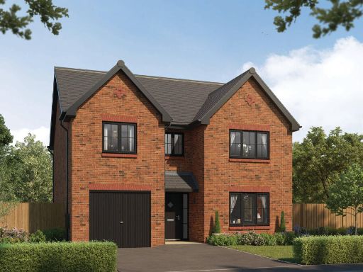 4 bedroom detached house for sale in Deacons Close,
Croft,
Warrington,
WA3 — £599,995 • 4 bed • 1 bath • 1528 ft²
4 bedroom detached house for sale in Deacons Close,
Croft,
Warrington,
WA3 — £599,995 • 4 bed • 1 bath • 1528 ft²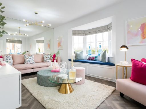 3 bedroom semi-detached house for sale in Deacons Close,
Croft,
Warrington,
WA3 — £379,995 • 3 bed • 1 bath • 905 ft²
3 bedroom semi-detached house for sale in Deacons Close,
Croft,
Warrington,
WA3 — £379,995 • 3 bed • 1 bath • 905 ft²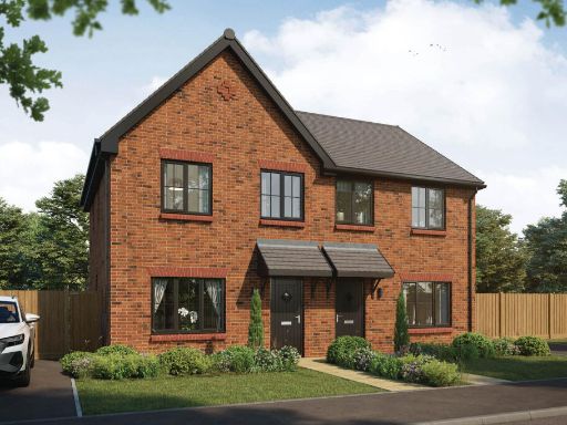 3 bedroom semi-detached house for sale in Deacons Close,
Croft,
Warrington,
WA3 — £354,995 • 3 bed • 1 bath • 852 ft²
3 bedroom semi-detached house for sale in Deacons Close,
Croft,
Warrington,
WA3 — £354,995 • 3 bed • 1 bath • 852 ft²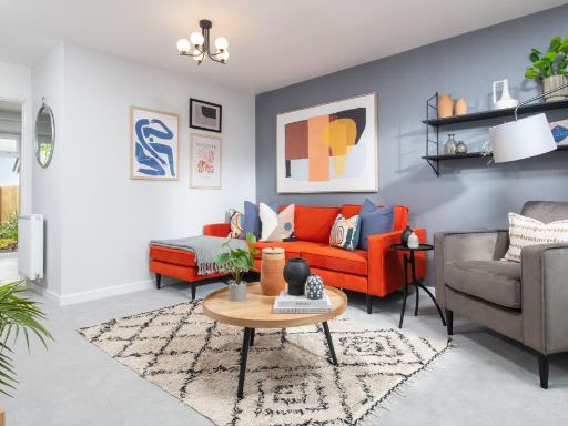 3 bedroom semi-detached house for sale in Deacons Close,
Croft,
Warrington,
WA3 — £369,995 • 3 bed • 1 bath • 852 ft²
3 bedroom semi-detached house for sale in Deacons Close,
Croft,
Warrington,
WA3 — £369,995 • 3 bed • 1 bath • 852 ft² 3 bedroom semi-detached house for sale in Deacons Close,
Croft,
Warrington,
WA3 — £359,995 • 3 bed • 1 bath • 852 ft²
3 bedroom semi-detached house for sale in Deacons Close,
Croft,
Warrington,
WA3 — £359,995 • 3 bed • 1 bath • 852 ft²
Meta
- {
"@context": "https://schema.org",
"@type": "Residence",
"name": "4 bedroom detached house for sale in Deacons Close, Croft,…",
"description": "",
"url": "https://propertypiper.co.uk/property/19c86cf6-48a6-4eff-83b0-27e5cd6a30ad",
"image": "https://image-a.propertypiper.co.uk/8191e33d-4a86-4034-a30c-0d478577200f-1024.jpeg",
"address": {
"@type": "PostalAddress",
"streetAddress": "Deacons Close,\r\nCroft,\r\nWarrington,\r\nWA3",
"postalCode": "WA3 7EN",
"addressLocality": "Warrington",
"addressRegion": "Warrington North",
"addressCountry": "England"
},
"geo": {
"@type": "GeoCoordinates",
"latitude": 53.43938161346384,
"longitude": -2.5521316280713635
},
"numberOfRooms": 4,
"numberOfBathroomsTotal": 1,
"floorSize": {
"@type": "QuantitativeValue",
"value": 1377,
"unitCode": "FTK"
},
"offers": {
"@type": "Offer",
"price": 569995,
"priceCurrency": "GBP",
"availability": "https://schema.org/InStock"
},
"additionalProperty": [
{
"@type": "PropertyValue",
"name": "Feature",
"value": "detached house"
},
{
"@type": "PropertyValue",
"name": "Feature",
"value": "modern architecture"
},
{
"@type": "PropertyValue",
"name": "Feature",
"value": "two-story"
},
{
"@type": "PropertyValue",
"name": "Feature",
"value": "brick exterior"
},
{
"@type": "PropertyValue",
"name": "Feature",
"value": "new build"
},
{
"@type": "PropertyValue",
"name": "Feature",
"value": "residential"
},
{
"@type": "PropertyValue",
"name": "Feature",
"value": "suburban"
},
{
"@type": "PropertyValue",
"name": "Feature",
"value": "modern kitchen"
},
{
"@type": "PropertyValue",
"name": "Feature",
"value": "open-plan"
},
{
"@type": "PropertyValue",
"name": "Feature",
"value": "dining area"
},
{
"@type": "PropertyValue",
"name": "Feature",
"value": "contemporary"
},
{
"@type": "PropertyValue",
"name": "Feature",
"value": "large windows"
},
{
"@type": "PropertyValue",
"name": "Feature",
"value": "natural light"
},
{
"@type": "PropertyValue",
"name": "Feature",
"value": "island counter"
},
{
"@type": "PropertyValue",
"name": "Feature",
"value": "pendant lights"
},
{
"@type": "PropertyValue",
"name": "Feature",
"value": "indoor-outdoor flow"
}
]
}
High Res Floorplan Images
Compatible Floorplan Images
FloorplanImages Thumbnail