S43 4AR - 2 bedroom detached bungalow for sale in Cavendish Drive, Cl…
View on Property Piper
2 bedroom detached bungalow for sale in Cavendish Drive, Clowne, Chesterfield, S43
Property Details
- Price: £230000
- Bedrooms: 2
- Bathrooms: 1
- Property Type: undefined
- Property SubType: undefined
Brochure Descriptions
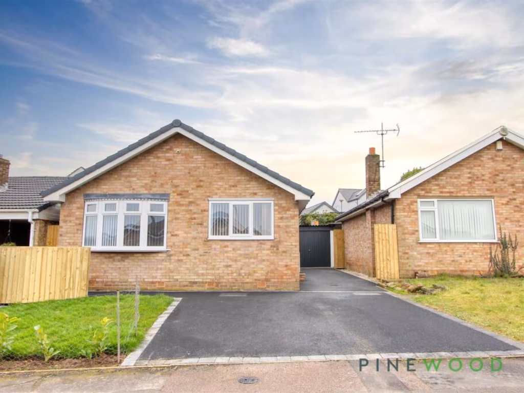
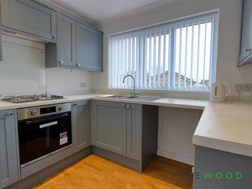
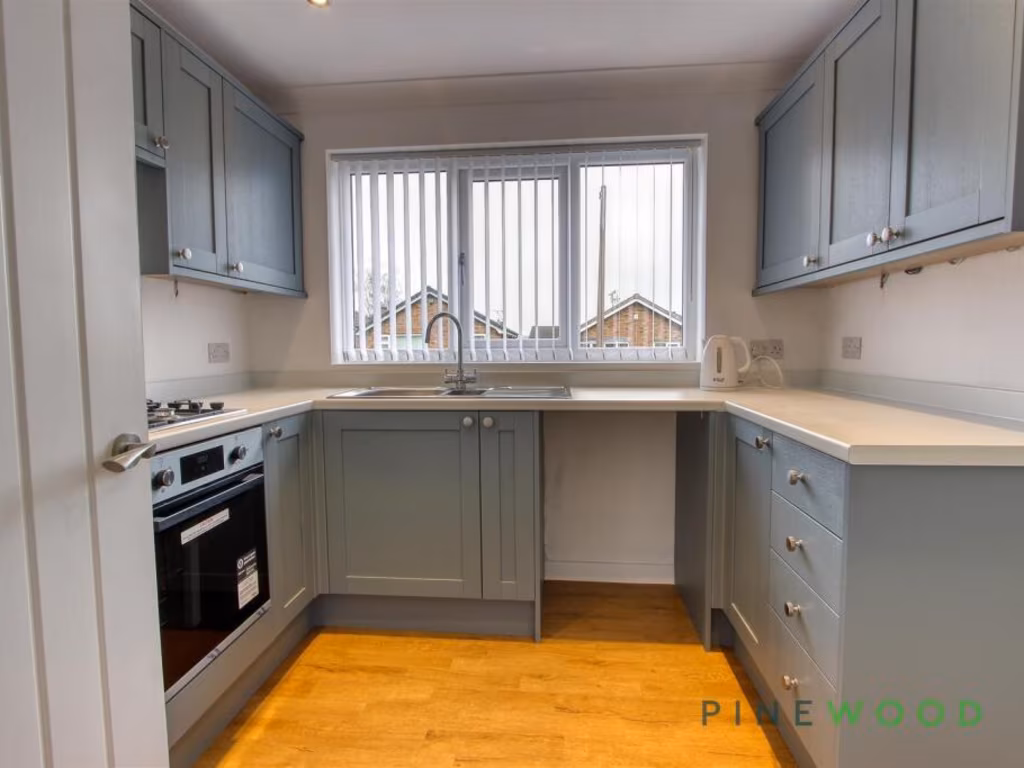
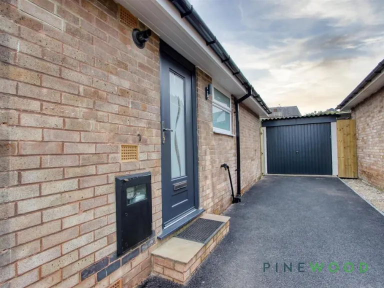
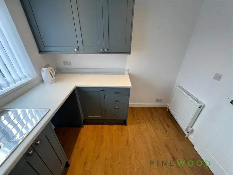
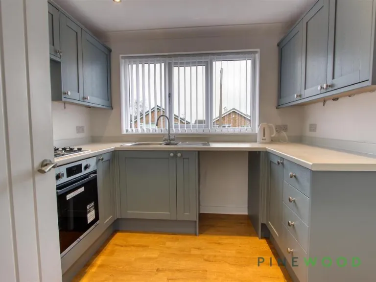
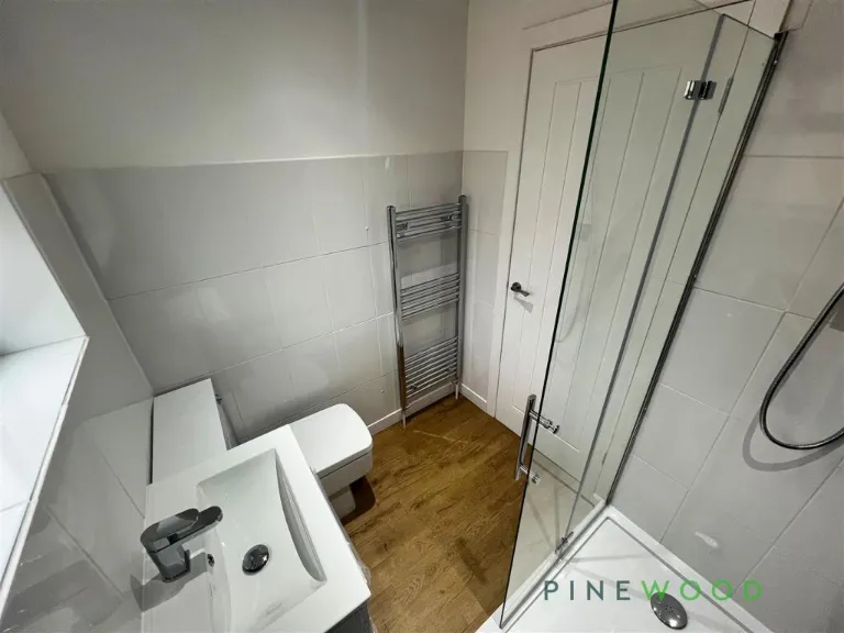
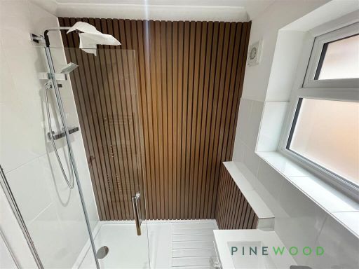
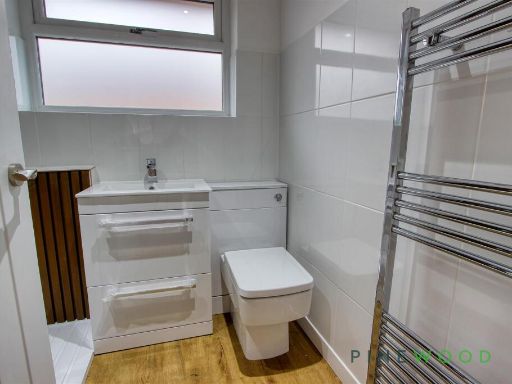
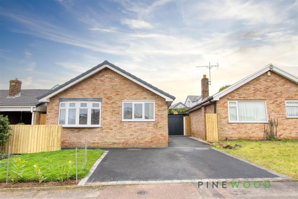
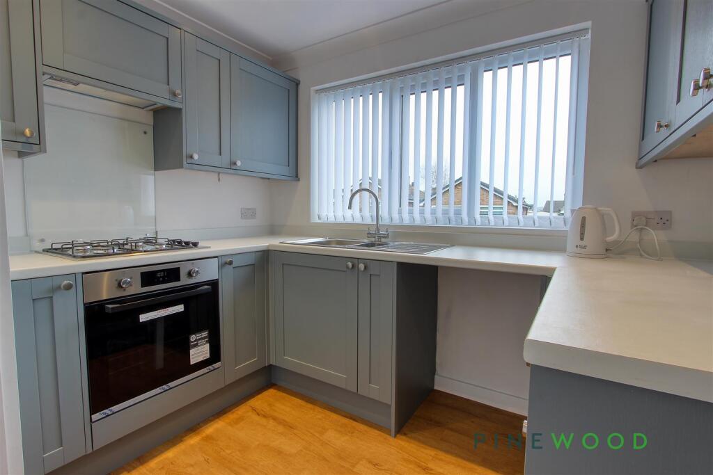
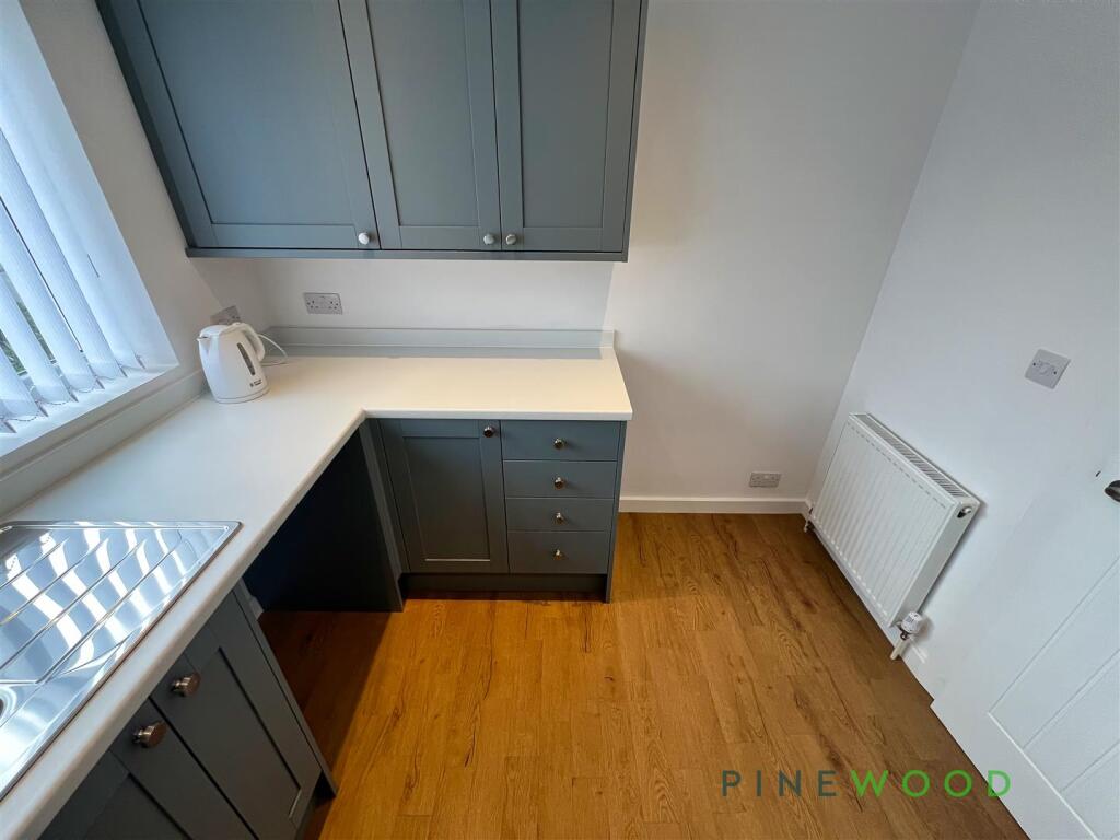
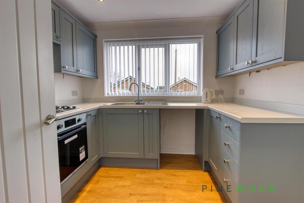
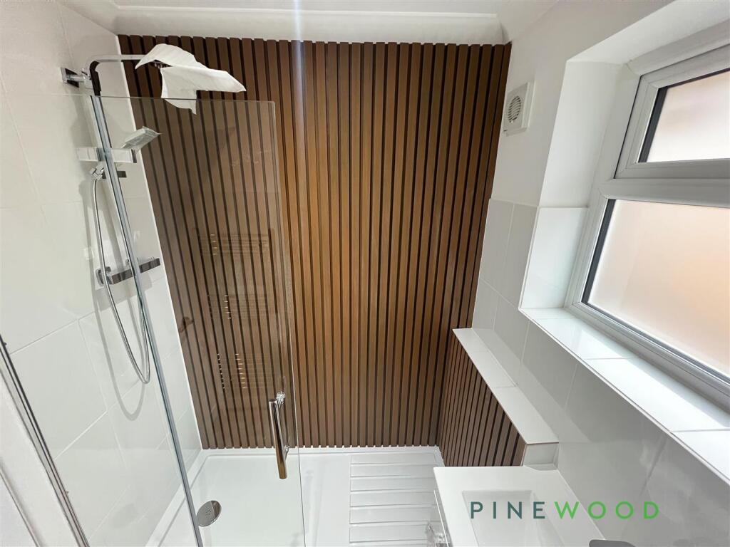
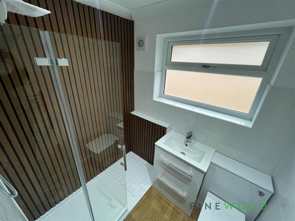
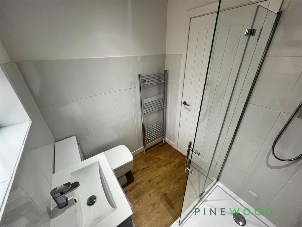
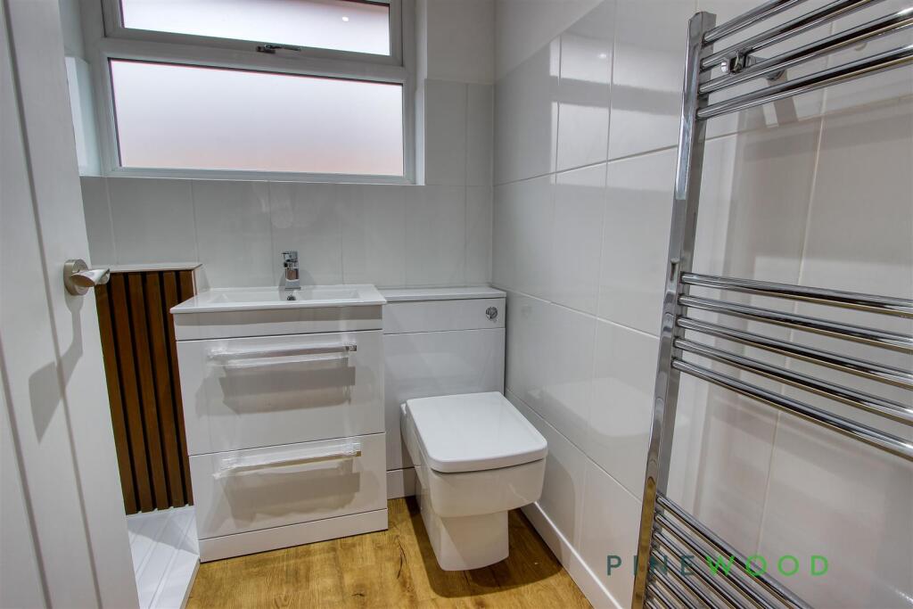
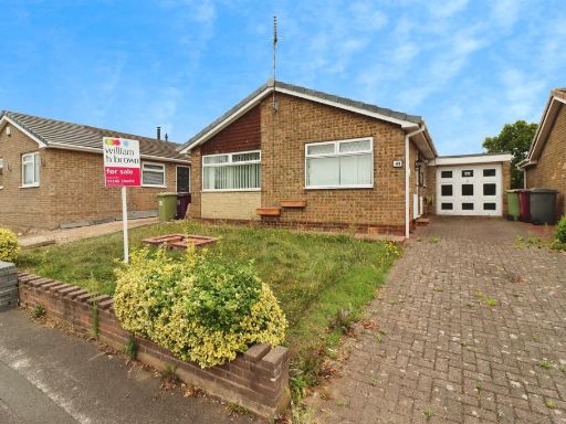
- The property is a single-story brick bungalow with a traditional design, featuring a small front garden and paved driveway, offering off-street parking. The kitchen is modern with ample cabinetry and integrated appliances. The bathroom features contemporary fixtures with a sleek shower area and warm wooden accents. The overall property is modestly sized, suitable for a small family or couple, with well-maintained interior spaces and a cozy exterior.
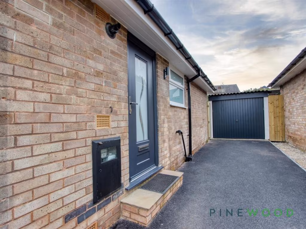
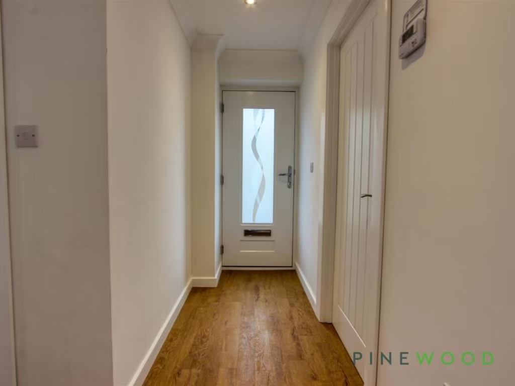
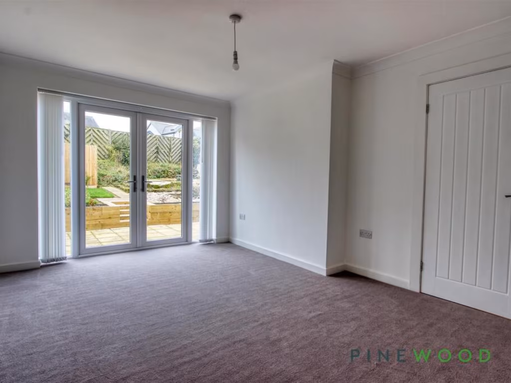
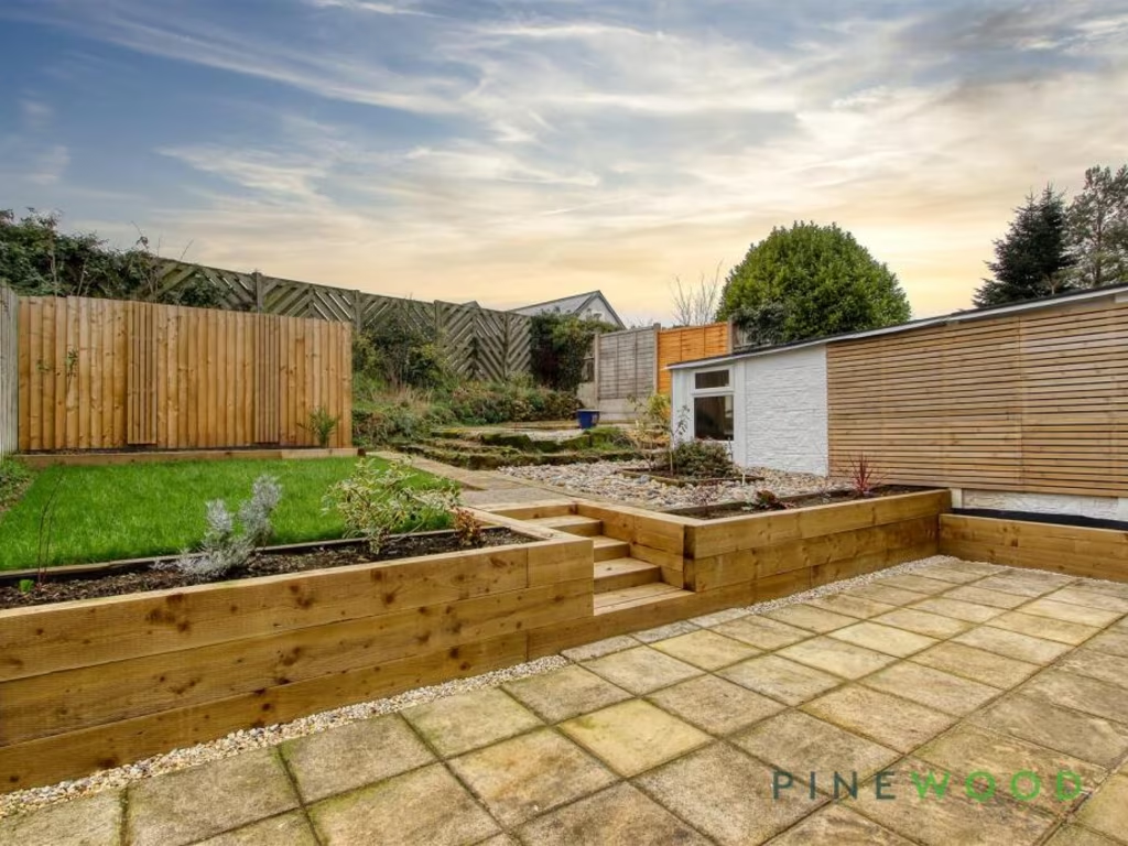
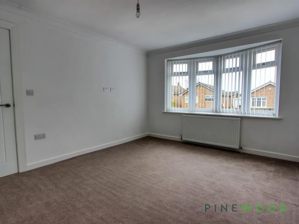
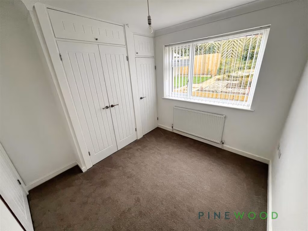
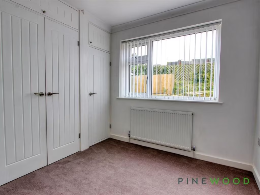
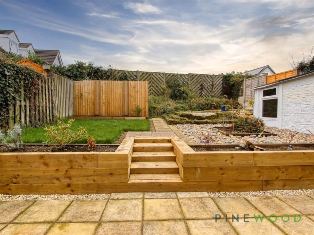
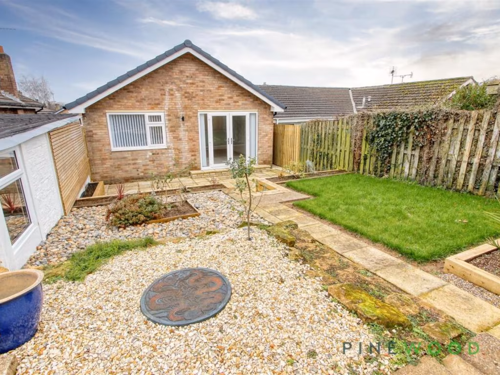
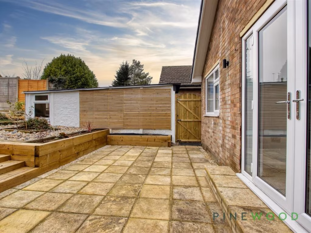
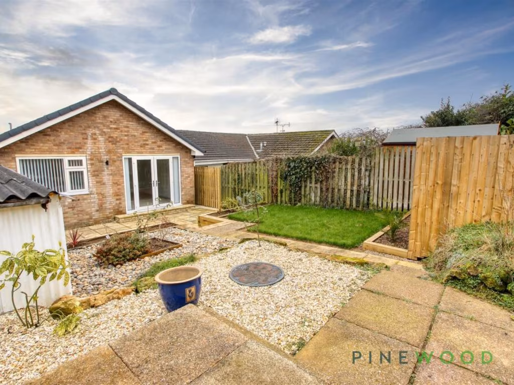
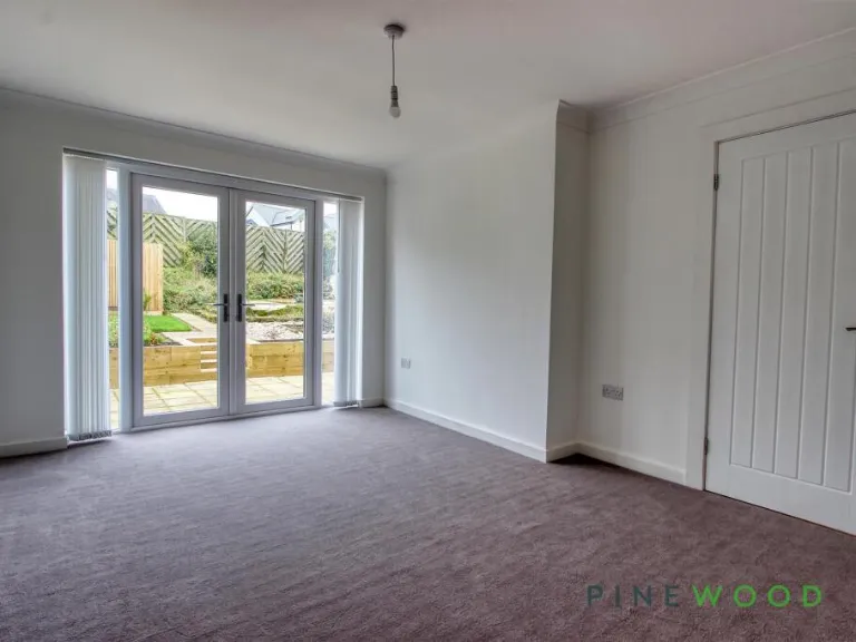
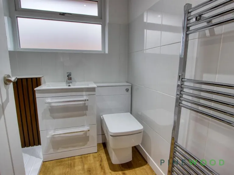
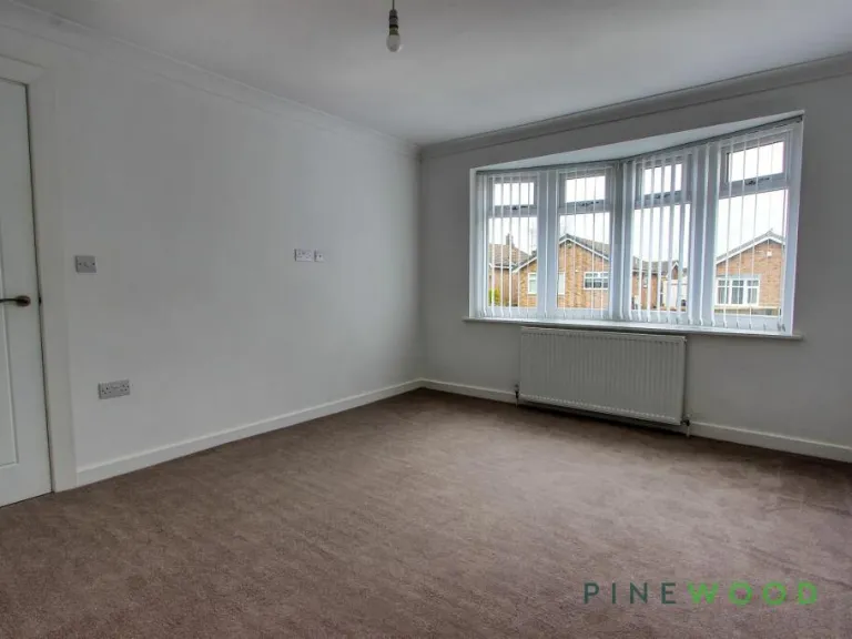
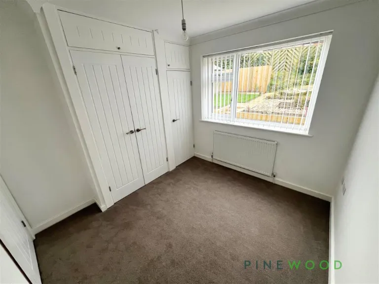
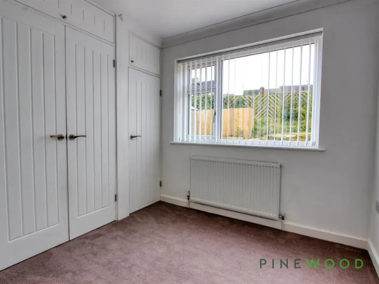
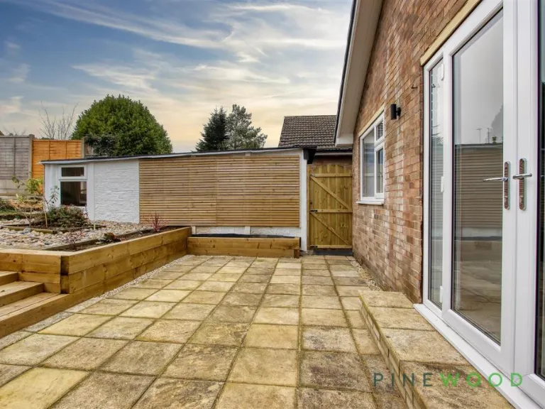
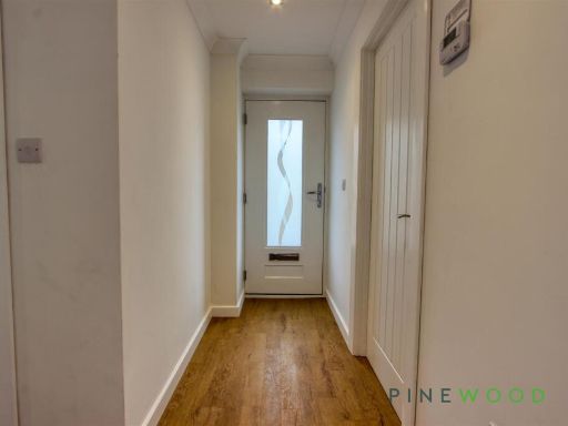
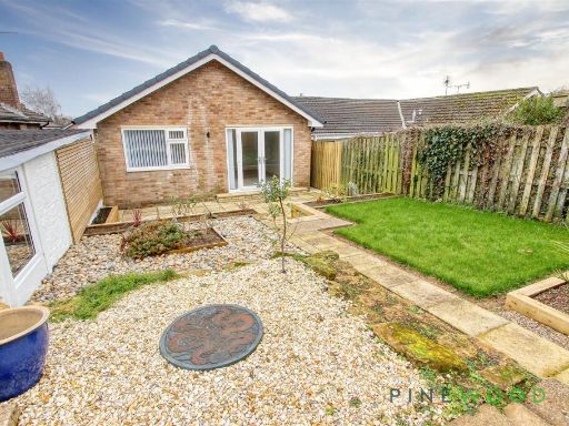
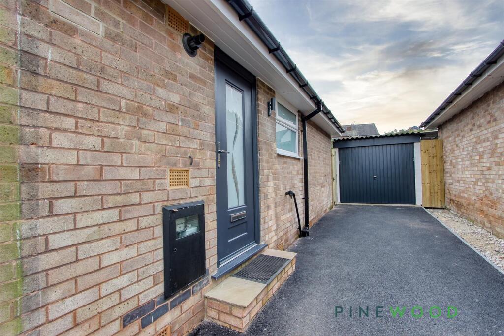
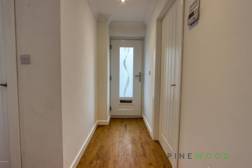
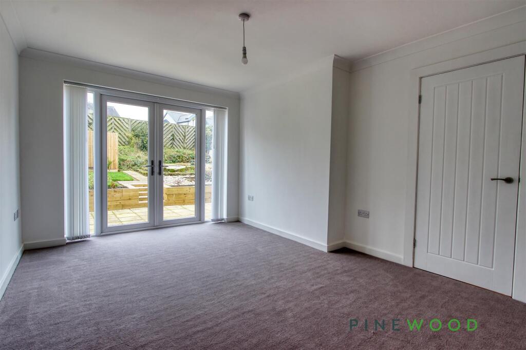
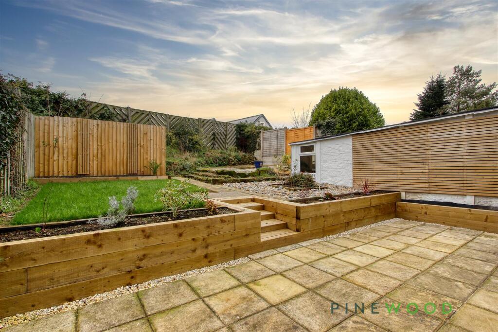
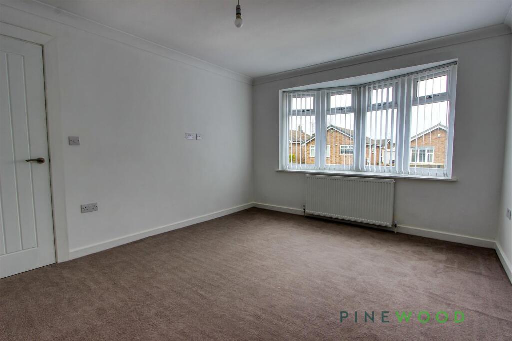
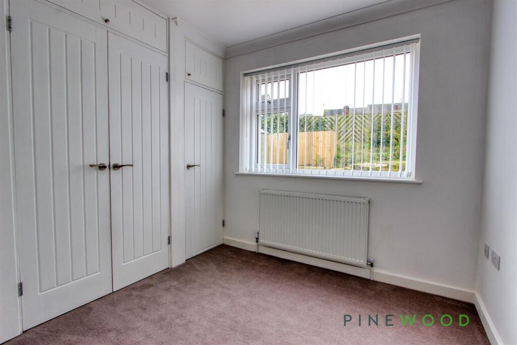
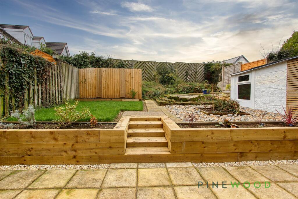
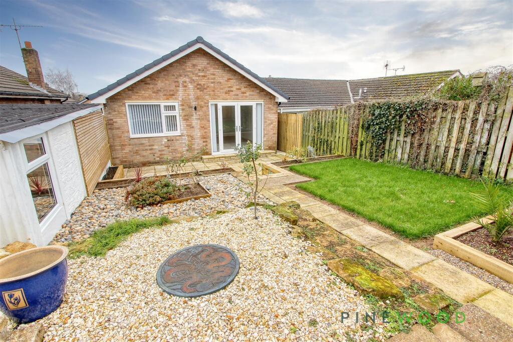
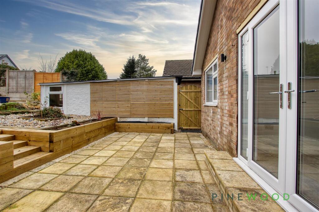
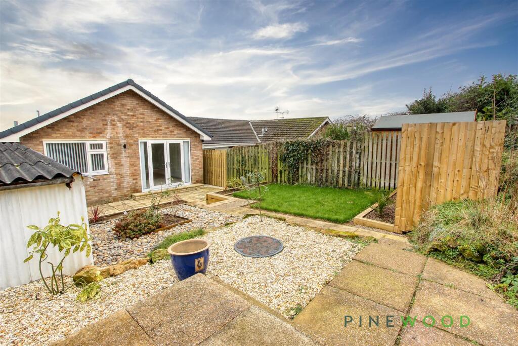
- The property is a single-story residence featuring a compact but well-planned layout. It includes two bedrooms with sizes that are moderately spacious, a lounge area with a patio access offering a view of the maintained garden, and a modern fitted shower room. The kitchen is efficiently designed and sits adjacent to the entrance hall. The outdoor space is notable with a rare garden that has multiple levels, providing privacy and multiple seating areas for relaxation. Additionally, the property features a detached garage with additional storage space and private gated side entrance for convenience. The overall property offers average-sized rooms and outdoor areas ideal for a small family or couple.
- This property is a two-bedroom detached bungalow located in a peaceful setting with a contemporary design both internally and externally. The home features a modern shaker-style kitchen and a spacious lounge, providing a comfortable living space. The shower room is stylishly appointed with contemporary fixtures. The rear garden is beautifully landscaped, offering both a raised deck area and a lawn, ideal for outdoor entertaining or relaxation. A detached garage offers convenient storage, alongside ample parking space, making it well-suited for families or those with multiple vehicles. Overall, the property appears to be of average size for a bungalow and is ideal for those seeking a low-maintenance lifestyle.
Image Descriptions
- bungalow modern
- exterior front view showing entrance and garage modern
Floorplan Description
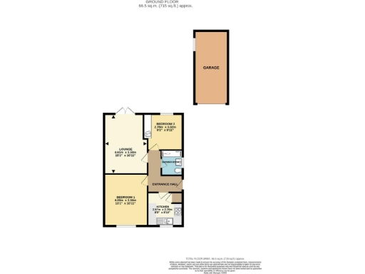
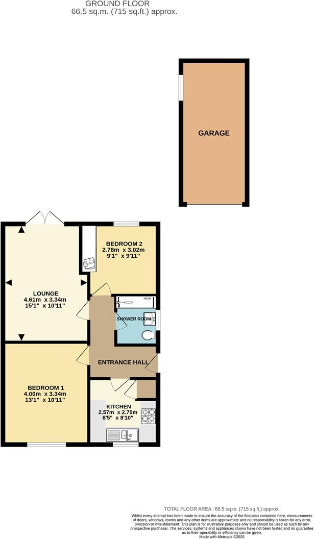
- A single-story property with a garage and two bedrooms.
Rooms
- Lounge: large
- Bedroom 1: average
- Bedroom 2: small
- Kitchen: small
- Shower Room: small
Textual Property Features
Detected Visual Features
- bungalow
- modern style
- single story
- driveway
- suburban
- brick exterior
- detached
- modern
- single-story
- garage
- front entrance
- residential
EPC Details
- Fully double glazed
- Cavity wall, as built, partial insulation (assumed)
- Boiler and radiators, mains gas
- Low energy lighting in 78% of fixed outlets
- Suspended, no insulation (assumed)
Nearby Schools
- The Park Junior School
- The Bolsover School
- Whaley Thorns Primary School
- Clowne Infant and Nursery School
- Barlborough Primary School
- Kiveton Park Meadows Junior School
- New Bolsover Primary and Nursery School
- Langwith Bassett Junior Academy
- Bolsover Church of England Junior School
- Brockley Primary School
- Creswell Junior School
- Clowne Junior School
- Heritage High School
- Whitwell Primary School
- Kiveton Park Infant School
- Anston Hillcrest Primary School
- The Park Infant & Nursery School
- Shirebrook Academy
- Brookfield Primary School
- Scarcliffe Primary School
- Bolsover Infant School
- Creswell CofE Controlled Infant and Nursery
- Hodthorpe Primary School
- Barlborough Hall School
- Harthill Primary School
- Wales Primary School
- Wales High School
Nearest Bars And Restaurants
- Id: 289558597
- Tags:
- Amenity: pub
- Name: The Angel
- Operator: Marston's
- Outdoor_seating: yes
- Parking: yes
- Real_ale: no
- TagsNormalized:
- Lat: 53.2726233
- Lon: -1.2664651
- FullGeoHash: gcrp51vz90z0
- PartitionGeoHash: gcrp
- Images:
- FoodStandards: null
- Distance: 1299.9
,- Id: 288774565
- Tags:
- Amenity: pub
- Building: yes
- Description:
- Name: Anchor Inn
- Real_ale: Doom Bar (may vary)
- Sky: yes
- TagsNormalized:
- Lat: 53.2738619
- Lon: -1.2645879
- FullGeoHash: gcrp54pnszwu
- PartitionGeoHash: gcrp
- Images:
- FoodStandards: null
- Distance: 1142.5
,- Id: 289560617
- Tags:
- Amenity: fast_food
- Building: yes
- Cuisine: fish_and_chips
- TagsNormalized:
- Lat: 53.2739112
- Lon: -1.2641265
- FullGeoHash: gcrp54prp8yf
- PartitionGeoHash: gcrp
- Images:
- FoodStandards: null
- Distance: 1111.4
,- Id: 944028664
- Tags:
- Addr:
- City: Chesterfield
- Postcode: S43 4JH
- Street: North Road
- Amenity: pub
- Brewery: Thwaites
- Building: yes
- Name: Nags Head
- Opening_hours: Mo-Th 12:00-22:00 Fr-Sa 12:00-01:00
- Smoking: outside
- TagsNormalized:
- Lat: 53.2756783
- Lon: -1.2625451
- FullGeoHash: gcrp5689kd4p
- PartitionGeoHash: gcrp
- Images:
- FoodStandards: null
- Distance: 978.1
,- Id: 123186185
- Tags:
- Addr:
- Housenumber: 52
- Postcode: S43 4LT
- Street: Creswell Road
- Amenity: pub
- Building: yes
- Fhrs:
- Name: Travellers Rest
- Source: Bing;survey
- Source:addr: FHRS Open Data
- TagsNormalized:
- Lat: 53.2776281
- Lon: -1.253449
- FullGeoHash: gcrp56zk8t8w
- PartitionGeoHash: gcrp
- Images:
- FoodStandards: null
- Distance: 403.4
}
Nearest General Shops
- Id: 289558601
- Tags:
- Building: yes
- Name: The Cutting Studio
- Shop: hairdresser
- TagsNormalized:
- Lat: 53.2729379
- Lon: -1.2667165
- FullGeoHash: gcrp54j9777s
- PartitionGeoHash: gcrp
- Images:
- FoodStandards: null
- Distance: 1305.6
,- Id: 259616275
- Tags:
- Brand:
- Building: yes
- Contact:
- Website: https://stores.wilko.com/gb/derbyshire/clowne/7-mill-green-way
- Name: Wilko
- Shop: houseware
- Source: View from South;Bing
- Wikidata: Q21072918
- Wikipedia: en:Wilko
- TagsNormalized:
- Lat: 53.2760799
- Lon: -1.2648693
- FullGeoHash: gcrp54wgwmj5
- PartitionGeoHash: gcrp
- Images:
- FoodStandards: null
- Distance: 1131
,- Id: 2923310422
- Tags:
- Name: Church Street Antiques and Collectibles
- Shop: antiques
- TagsNormalized:
- Lat: 53.2736049
- Lon: -1.2639177
- FullGeoHash: gcrp54pthxdx
- PartitionGeoHash: gcrp
- Images:
- FoodStandards: null
- Distance: 1106.4
}
Nearest Grocery shops
- Id: 4156978608
- Tags:
- Name: Go Local
- Shop: convenience
- TagsNormalized:
- Lat: 53.2606752
- Lon: -1.2212277
- FullGeoHash: gcrnupy9zm6w
- PartitionGeoHash: gcrn
- Images:
- FoodStandards: null
- Distance: 2474.4
,- Id: 414958584
- Tags:
- Building: yes
- Name: Hillside Off Licence and Confectionery
- Shop: convenience
- TagsNormalized:
- confectionery
- convenience
- shop
- Lat: 53.2810226
- Lon: -1.2134856
- FullGeoHash: gcrph7s27wrx
- PartitionGeoHash: gcrp
- Images:
- FoodStandards: null
- Distance: 2347.2
,- Id: 259587987
- Tags:
- Brand: Tesco
- Brand:wikidata: Q487494
- Brand:wikipedia: en:Tesco
- Building: yes
- Name: Tesco
- Note: Petrol station shop attached to larger store.
- Shop: convenience
- Website: https://www.tesco.com/store-locator/chesterfield/mill-street
- TagsNormalized:
- Lat: 53.2751114
- Lon: -1.2638543
- FullGeoHash: gcrp54rwn09f
- PartitionGeoHash: gcrp
- Images:
- FoodStandards: null
- Distance: 1070.4
}
Nearest Supermarkets
- Id: 1073298598
- Tags:
- Brand: Morrisons
- Brand:wikidata: Q922344
- Building: yes
- Name: Morrisons
- Shop: supermarket
- TagsNormalized:
- Lat: 53.2306533
- Lon: -1.2903647
- FullGeoHash: gcrnfdk7h2fr
- PartitionGeoHash: gcrn
- Images:
- FoodStandards: null
- Distance: 5801.9
,- Id: 147132675
- Tags:
- Brand: Tesco
- Brand:wikidata: Q487494
- Brand:wikipedia: en:Tesco
- Building: yes
- Name: Tesco
- Shop: supermarket
- Source: Bing;local_knowledge
- Website: https://www.tesco.com/store-locator/chesterfield/mill-street
- TagsNormalized:
- Lat: 53.274555
- Lon: -1.2651045
- FullGeoHash: gcrp54qfbbve
- PartitionGeoHash: gcrp
- Images:
- FoodStandards: null
- Distance: 1161.3
,- Id: 288722054
- Tags:
- Addr:
- City: Clowne
- Housenumber: 8
- Postcode: S43 4LJ
- Street: Mill Green Way
- Brand: ALDI
- Brand:wikidata: Q41171672
- Brand:wikipedia: en:Aldi
- Building: yes
- Contact:
- Website: https://stores.aldi.co.uk/clowne/8-mill-green-way
- Name: ALDI
- Opening_hours: Mo-Sa 08:00-20:00
- Operator: Aldi
- Phone: +44 20 0137 8368
- Shop: supermarket
- TagsNormalized:
- Lat: 53.2755874
- Lon: -1.2636407
- FullGeoHash: gcrp54xbg131
- PartitionGeoHash: gcrp
- Images:
- FoodStandards: null
- Distance: 1051.5
}
Nearest Religious buildings
- Id: 370359492
- Tags:
- Amenity: place_of_worship
- Building: church
- Denomination: anglican
- Name: St Peter
- Religion: christian
- Wikidata: Q17545251
- TagsNormalized:
- place of worship
- church
- anglican
- christian
- Lat: 53.2557035
- Lon: -1.2480319
- FullGeoHash: gcrngwghywxv
- PartitionGeoHash: gcrn
- Images:
- FoodStandards: null
- Distance: 2280.8
,- Id: 9105667302
- Tags:
- Addr:
- City: Clowne
- Country: GB
- Postcode: S43 4JS
- Street: Church Street
- Amenity: place_of_worship
- Denomination: salvation_army
- Name: The Salvation Army - Clowne
- Religion: christian
- TagsNormalized:
- place of worship
- salvation army
- the salvation army
- christian
- church
- Lat: 53.2735944
- Lon: -1.262953
- FullGeoHash: gcrp560m5jcc
- PartitionGeoHash: gcrp
- Images:
- FoodStandards: null
- Distance: 1044.9
,- Id: 777691389
- Tags:
- Amenity: place_of_worship
- Building: church
- Denomination: anglican
- Name: St John the Baptist
- Religion: christian
- Wikidata: Q17545194
- TagsNormalized:
- place of worship
- church
- anglican
- baptist
- christian
- Lat: 53.2722913
- Lon: -1.2543502
- FullGeoHash: gcrp53ytedbe
- PartitionGeoHash: gcrp
- Images:
- FoodStandards: null
- Distance: 613.6
}
Nearest Medical buildings
- Id: 376954718
- Tags:
- Amenity: clinic
- Building: yes
- Healthcare: clinic
- Name: Whitwell Health Centre
- TagsNormalized:
- clinic
- health
- healthcare
- health centre
- Lat: 53.2843086
- Lon: -1.2063748
- FullGeoHash: gcrphs1e97jc
- PartitionGeoHash: gcrp
- Images:
- FoodStandards: null
- Distance: 2901.3
,- Id: 4162303737
- Tags:
- Amenity: pharmacy
- Healthcare: pharmacy
- TagsNormalized:
- Lat: 53.2624133
- Lon: -1.2175862
- FullGeoHash: gcrph21kh1mz
- PartitionGeoHash: gcrp
- Images:
- FoodStandards: null
- Distance: 2531.5
,- Id: 4156982090
- Tags:
- Amenity: dentist
- Healthcare: dentist
- Name: Creswell Dental Practice
- TagsNormalized:
- dentist
- health
- healthcare
- dental
- Lat: 53.2616748
- Lon: -1.2194387
- FullGeoHash: gcrnurbp9pb9
- PartitionGeoHash: gcrn
- Images:
- FoodStandards: null
- Distance: 2487.3
,- Id: 319227318
- Tags:
- Addr:
- Housenumber: 2
- Postcode: S43 4XE
- Street: Lindrick Way
- Amenity: hospital
- Fhrs:
- Name: Barlborough NHS Treatment Centre
- Source: OS OpenData StreetView
- Source:geometry: Bing
- Source:name: FHRS Open Data
- Website: http://www.barlboroughtreatmentcentre.nhs.uk/
- TagsNormalized:
- Lat: 53.2819978
- Lon: -1.2831462
- FullGeoHash: gcrp4g9whs2c
- PartitionGeoHash: gcrp
- Images:
- FoodStandards:
- Id: 197608
- FHRSID: 197608
- LocalAuthorityBusinessID: 11/00092/COMM
- BusinessName: Barlborough Hospital (NHS)
- BusinessType: Hospitals/Childcare/Caring Premises
- BusinessTypeID: 5
- AddressLine1: 2 Lindrick Way
- AddressLine2: Barlborough
- AddressLine3: Chesterfield
- AddressLine4: null
- PostCode: S43 4XE
- RatingValue: 5
- RatingKey: fhrs_5_en-GB
- RatingDate: 2022-05-16
- LocalAuthorityCode: 063
- LocalAuthorityName: Bolsover
- LocalAuthorityWebSite: http://www.bolsover.gov.uk/
- LocalAuthorityEmailAddress: enquiries@bolsover.gov.uk
- Scores:
- Hygiene: 0
- Structural: 0
- ConfidenceInManagement: 5
- NewRatingPending: false
- Geocode:
- Longitude: -1.28221900000000
- Latitude: 53.28151400000000
- Distance: 2432.5
}
Nearest Airports
- Id: 100889514
- Tags:
- Addr:
- Aerodrome: international
- Aerodrome:type: public
- Area: yes
- Cities_served: Doncaster, Sheffield
- Closest_town: Doncaster
- Disused:
- Ele: 17
- Iata: DSA
- Icao: EGCN
- Ifr: yes
- Is_in: Finningley
- Name: Doncaster Sheffield Airport
- Old_iata: FNY
- Old_icao: EGXI
- Old_name: RAF Finningley
- Old_operator: Royal Air Force
- Old_type: military
- Operator: Doncaster Sheffield Airport Limited/Peel Airports
- Source: wikipedia
- Tower_frequency: 128.775
- Vfr: yes
- Website: https://www.robinhoodairport.com/
- Wikidata: Q8996
- Wikipedia: en:Robin Hood Airport Doncaster Sheffield
- TagsNormalized:
- airport
- international airport
- Lat: 53.4761577
- Lon: -1.0054086
- FullGeoHash: gcx21p5chq34
- PartitionGeoHash: gcx2
- Images:
- FoodStandards: null
- Distance: 27439.9
}
Nearest Leisure Facilities
- Id: 237048554
- Tags:
- Leisure: pitch
- Source: Bing
- Sport: soccer
- TagsNormalized:
- Lat: 53.2704803
- Lon: -1.2674945
- FullGeoHash: gcrp51t511r8
- PartitionGeoHash: gcrp
- Images:
- FoodStandards: null
- Distance: 1452.9
,- Id: 4053847241
- Tags:
- TagsNormalized:
- Lat: 53.2720691
- Lon: -1.2673788
- FullGeoHash: gcrp51vh7cmy
- PartitionGeoHash: gcrp
- Images:
- FoodStandards: null
- Distance: 1377.2
,- Id: 4053847490
- Tags:
- TagsNormalized:
- Lat: 53.2770124
- Lon: -1.2648575
- FullGeoHash: gcrp54ycndvy
- PartitionGeoHash: gcrp
- Images:
- FoodStandards: null
- Distance: 1133.5
,- Id: 288719502
- Tags:
- Leisure: pitch
- Name: The Sidings
- Sport: skateboard
- TagsNormalized:
- pitch
- leisure
- skateboard
- sports
- Lat: 53.2754872
- Lon: -1.2614426
- FullGeoHash: gcrp5692nq8h
- PartitionGeoHash: gcrp
- Images:
- FoodStandards: null
- Distance: 906.6
,- Id: 288398533
- Tags:
- Leisure: park
- Source: View from north;Bing
- TagsNormalized:
- Lat: 53.2805798
- Lon: -1.2502872
- FullGeoHash: gcrp5e3tf5yq
- PartitionGeoHash: gcrp
- Images:
- FoodStandards: null
- Distance: 511.5
}
Nearest Tourist attractions
- Id: 123387963
- Tags:
- Area: yes
- Historic: archaeological_site
- Name: Creswell Crags
- Note: Approximate area
- Tourism: attraction
- Website: https://www.creswell-crags.org.uk/
- Wikidata: Q2580424
- Wikipedia: en:Creswell Crags
- TagsNormalized:
- Lat: 53.2619944
- Lon: -1.1996207
- FullGeoHash: gcrph8n3wg3u
- PartitionGeoHash: gcrp
- Images:
- FoodStandards: null
- Distance: 3576.6
,- Id: 248492395
- Tags:
- Direction: clockwise
- Highway: mini_roundabout
- Tourism: attraction
- TagsNormalized:
- Lat: 53.2612166
- Lon: -1.2083993
- FullGeoHash: gcrnuxbj462h
- PartitionGeoHash: gcrn
- Images:
- FoodStandards: null
- Distance: 3109.4
,- Id: 9796810717
- Tags:
- Name: Cemetery?
- Tourism: attraction
- TagsNormalized:
- cemetery
- attraction
- tourism
- Lat: 53.2811309
- Lon: -1.2748946
- FullGeoHash: gcrp4gx9hf9t
- PartitionGeoHash: gcrp
- Images:
- FoodStandards: null
- Distance: 1878.6
}
Nearest Train stations
- Id: 3157350618
- Tags:
- Name: Kiveton Bridge
- Naptan:
- Network: National Rail
- Operator: Northern Rail
- Public_transport: station
- Railway: station
- Ref:
- Source: wikipedia
- Wikidata: Q3448631
- Wikipedia: en:Kiveton Bridge railway station
- TagsNormalized:
- Lat: 53.3409362
- Lon: -1.2670815
- FullGeoHash: gcrp7nmm6z5w
- PartitionGeoHash: gcrp
- Images:
- FoodStandards: null
- Distance: 7309.1
,- Id: 7170486847
- Tags:
- Name: Kiveton Park
- Naptan:
- Network: National Rail
- Operator: Northern Rail
- Public_transport: station
- Railway: station
- Ref:
- Source: NPE
- Wikidata: Q2323319
- Wikipedia: en:Kiveton Park railway station
- TagsNormalized:
- Lat: 53.3367636
- Lon: -1.2395678
- FullGeoHash: gcrp7v9m5vr7
- PartitionGeoHash: gcrp
- Images:
- FoodStandards: null
- Distance: 6755.2
,- Id: 3170172466
- Tags:
- Name: Langwith-Whaley Thorns
- Naptan:
- Network: National Rail
- Public_transport: station
- Railway: station
- Ref:
- Train: yes
- Wikidata: Q2400406
- Wikipedia: en:Langwith-Whaley Thorns railway station
- TagsNormalized:
- Lat: 53.2327375
- Lon: -1.2092803
- FullGeoHash: gcrnu6xrjtx2
- PartitionGeoHash: gcrn
- Images:
- FoodStandards: null
- Distance: 5473.5
,- Id: 5592966950
- Tags:
- Name: Whitwell
- Naptan:
- Network: National Rail
- Public_transport: station
- Railway: station
- Ref:
- Source: NPE
- Train: yes
- Wikidata: Q1945536
- Wikipedia: en:Whitwell railway station
- TagsNormalized:
- Lat: 53.2799663
- Lon: -1.2002363
- FullGeoHash: gcrpheq423wf
- PartitionGeoHash: gcrp
- Images:
- FoodStandards: null
- Distance: 3193.8
,- Id: 3170172463
- Tags:
- Name: Creswell
- Naptan:
- Network: National Rail
- Public_transport: station
- Railway: station
- Ref:
- Source: NPE
- Train: yes
- Wikidata: Q1967041
- Wikipedia: en:Creswell railway station
- TagsNormalized:
- Lat: 53.263919
- Lon: -1.2164106
- FullGeoHash: gcrph26hzd4t
- PartitionGeoHash: gcrp
- Images:
- FoodStandards: null
- Distance: 2498.7
}
Nearest Bus stations and stops
- Id: 9959763998
- Tags:
- Bus: yes
- Highway: bus_stop
- Public_transport: platform
- TagsNormalized:
- Lat: 53.2767912
- Lon: -1.2632572
- FullGeoHash: gcrp568pgcxn
- PartitionGeoHash: gcrp
- Images:
- FoodStandards: null
- Distance: 1025.7
,- Id: 9959763967
- Tags:
- Bus: yes
- Highway: bus_stop
- Public_transport: platform
- TagsNormalized:
- Lat: 53.2754432
- Lon: -1.2627118
- FullGeoHash: gcrp562xbwmv
- PartitionGeoHash: gcrp
- Images:
- FoodStandards: null
- Distance: 991.1
,- Id: 9959771322
- Tags:
- Bus: yes
- Highway: bus_stop
- Public_transport: platform
- TagsNormalized:
- Lat: 53.2788295
- Lon: -1.2619749
- FullGeoHash: gcrp57159vem
- PartitionGeoHash: gcrp
- Images:
- FoodStandards: null
- Distance: 982.4
,- Id: 9959771326
- Tags:
- Bus: yes
- Highway: bus_stop
- Public_transport: platform
- TagsNormalized:
- Lat: 53.2779177
- Lon: -1.2540703
- FullGeoHash: gcrp56yy659q
- PartitionGeoHash: gcrp
- Images:
- FoodStandards: null
- Distance: 454.2
,- Id: 444639505
- Tags:
- Bus: yes
- Highway: bus_stop
- Public_transport: platform
- TagsNormalized:
- Lat: 53.2762004
- Lon: -1.2442548
- FullGeoHash: gcrp5dtuqg86
- PartitionGeoHash: gcrp
- Images:
- FoodStandards: null
- Distance: 239.8
}
Nearest Hotels
- Id: 68751050
- Tags:
- Addr:
- City: Rotherham
- Housename: Woodall Motorway Service Area
- Postcode: S26 7XR
- Brand: Days Inn
- Brand:wikidata: Q1047239
- Building: yes
- Fhrs:
- Name: Days Inn
- Operator: Welcome Break
- Tourism: hotel
- TagsNormalized:
- Lat: 53.3136185
- Lon: -1.2812954
- FullGeoHash: gcrp6c6yrduf
- PartitionGeoHash: gcrp
- Images:
- FoodStandards: null
- Distance: 4715.5
,- Id: 319226078
- Tags:
- Addr:
- Housenumber: 3
- Postcode: S43 4WP
- Street: Tallys End
- Building: hotel
- Fhrs:
- Name: Ibis
- Source: Bing;survey
- Source:addr: FHRS Open Data
- Source:name: FHRS Open Data
- Tourism: hotel
- TagsNormalized:
- Lat: 53.283865
- Lon: -1.2897098
- FullGeoHash: gcrp4shc586e
- PartitionGeoHash: gcrp
- Images:
- FoodStandards: null
- Distance: 2909.4
,- Id: 332943871
- Tags:
- Building: yes
- Name: Hotel Van Dyk
- Tourism: hotel
- TagsNormalized:
- Lat: 53.2885957
- Lon: -1.2543399
- FullGeoHash: gcrp5kysef0r
- PartitionGeoHash: gcrp
- Images:
- FoodStandards: null
- Distance: 1442.5
}
Tags
- bungalow
- modern style
- single story
- driveway
- suburban
- brick exterior
- detached
- modern
- brick exterior
- single-story
- garage
- driveway
- front entrance
- residential
Local Market Stats
- Average Price/sqft: £204
- Avg Income: £35600
- Rental Yield: 4.2%
- Social Housing: 15%
- Planning Success Rate: 97%
Similar Properties
 2 bedroom detached bungalow for sale in Bentinck Drive, Clowne, Chesterfield, S43 — £160,000 • 2 bed • 1 bath • 624 ft²
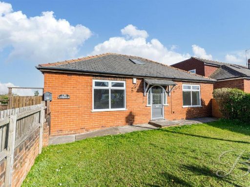 4 bedroom bungalow for sale in Boughton Lane, Clowne, Chesterfield, S43 — £265,000 • 4 bed • 2 bath • 1148 ft²
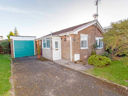 2 bedroom detached bungalow for sale in Thoresby Avenue, Clowne, S43 — £179,950 • 2 bed • 1 bath • 570 ft²
 3 bedroom detached bungalow for sale in Offridge Close, Clowne, S43 — £299,950 • 3 bed • 1 bath • 909 ft²
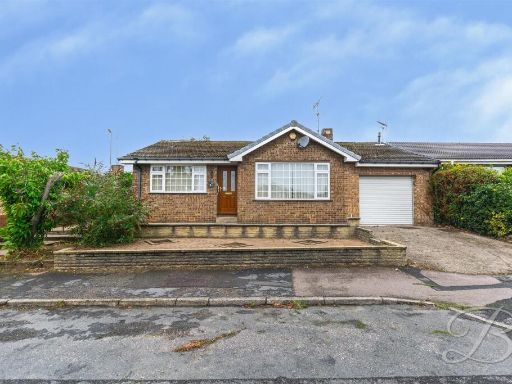 2 bedroom detached bungalow for sale in Cavendish Drive, Clowne, Chesterfield, S43 — £200,000 • 2 bed • 1 bath • 1077 ft²
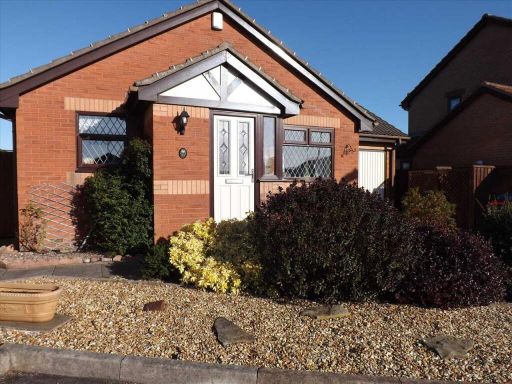 2 bedroom bungalow for sale in Ash Tree Road, Clowne, Chesterfield, S43 — £234,995 • 2 bed • 1 bath • 602 ft²
Meta
- {
"@context": "https://schema.org",
"@type": "Residence",
"name": "2 bedroom detached bungalow for sale in Cavendish Drive, Cl…",
"description": "",
"url": "https://propertypiper.co.uk/property/18d78260-add9-40e5-a9cc-870139e8df84",
"image": "https://image-a.propertypiper.co.uk/81fd9988-e517-4f6b-9cf6-dc1a0f840a22-1024.jpeg",
"address": {
"@type": "PostalAddress",
"streetAddress": "Cavendish Drive, Clowne, Chesterfield",
"postalCode": "S43 4AR",
"addressLocality": "Bolsover",
"addressRegion": "Bolsover",
"addressCountry": "England"
},
"geo": {
"@type": "GeoCoordinates",
"latitude": 53.276214796426466,
"longitude": -1.2478614088602697
},
"numberOfRooms": 2,
"numberOfBathroomsTotal": 1,
"floorSize": {
"@type": "QuantitativeValue",
"value": 715,
"unitCode": "FTK"
},
"offers": {
"@type": "Offer",
"price": 230000,
"priceCurrency": "GBP",
"availability": "https://schema.org/InStock"
},
"additionalProperty": [
{
"@type": "PropertyValue",
"name": "Feature",
"value": "bungalow"
},
{
"@type": "PropertyValue",
"name": "Feature",
"value": "modern style"
},
{
"@type": "PropertyValue",
"name": "Feature",
"value": "single story"
},
{
"@type": "PropertyValue",
"name": "Feature",
"value": "driveway"
},
{
"@type": "PropertyValue",
"name": "Feature",
"value": "suburban"
},
{
"@type": "PropertyValue",
"name": "Feature",
"value": "brick exterior"
},
{
"@type": "PropertyValue",
"name": "Feature",
"value": "detached"
},
{
"@type": "PropertyValue",
"name": "Feature",
"value": "modern"
},
{
"@type": "PropertyValue",
"name": "Feature",
"value": "brick exterior"
},
{
"@type": "PropertyValue",
"name": "Feature",
"value": "single-story"
},
{
"@type": "PropertyValue",
"name": "Feature",
"value": "garage"
},
{
"@type": "PropertyValue",
"name": "Feature",
"value": "driveway"
},
{
"@type": "PropertyValue",
"name": "Feature",
"value": "front entrance"
},
{
"@type": "PropertyValue",
"name": "Feature",
"value": "residential"
}
]
}
High Res Floorplan Images
Compatible Floorplan Images
FloorplanImages Thumbnail