NR28 0DJ - 4 bedroom detached house for sale in Crow Road, North Walsh…
View on Property Piper
4 bedroom detached house for sale in Crow Road, North Walsham, NR28
Property Details
- Price: £475000
- Bedrooms: 4
- Bathrooms: 2
- Property Type: undefined
- Property SubType: undefined
Brochure Descriptions
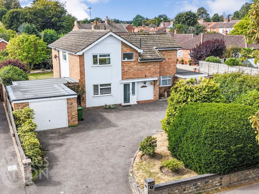
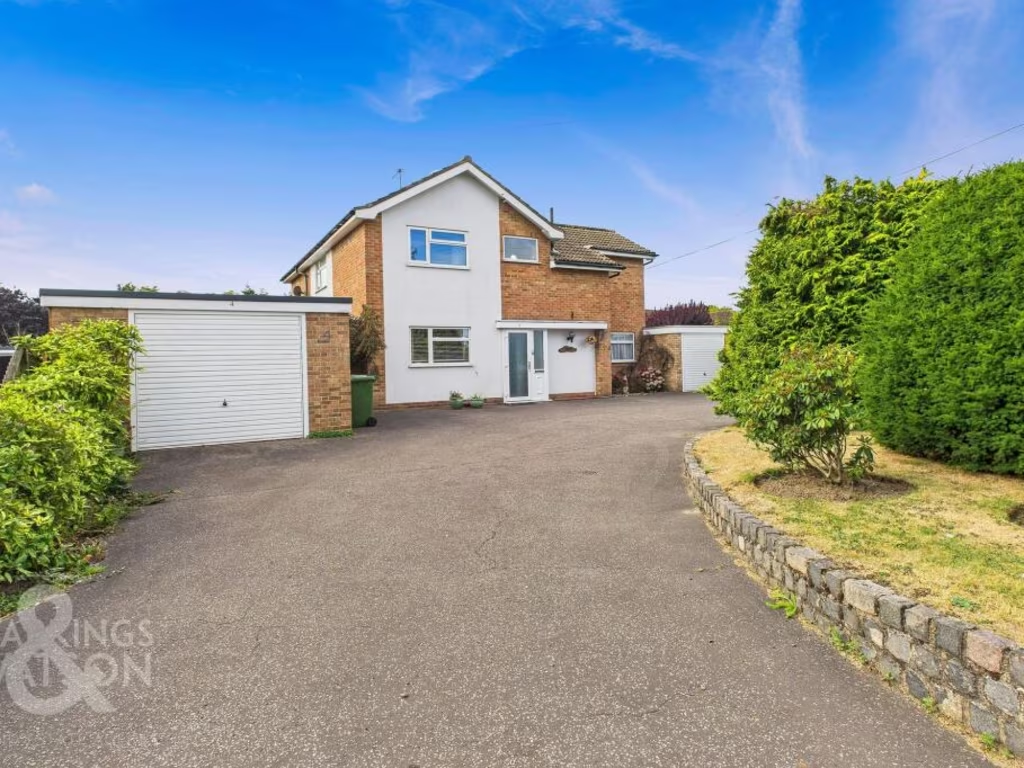
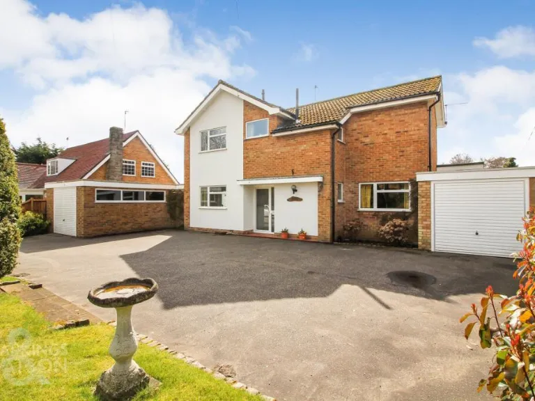
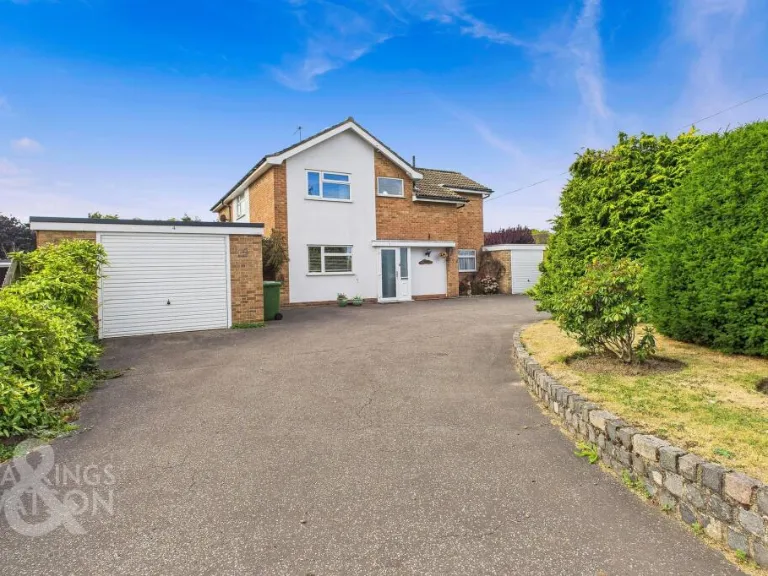
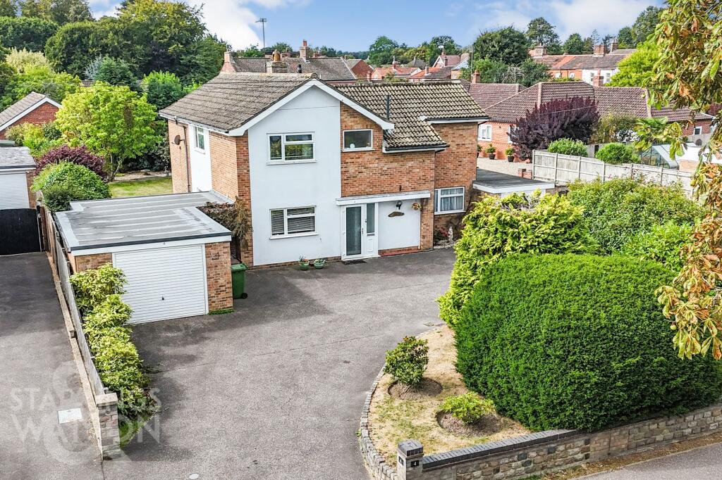
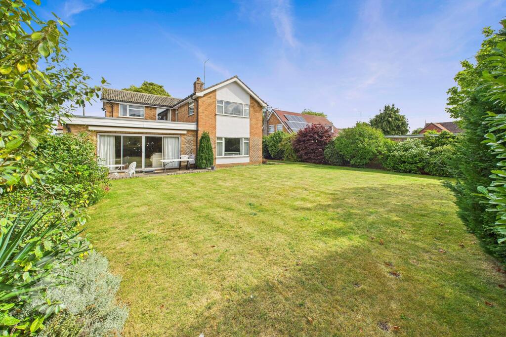
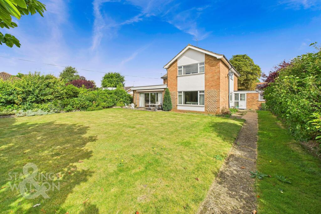
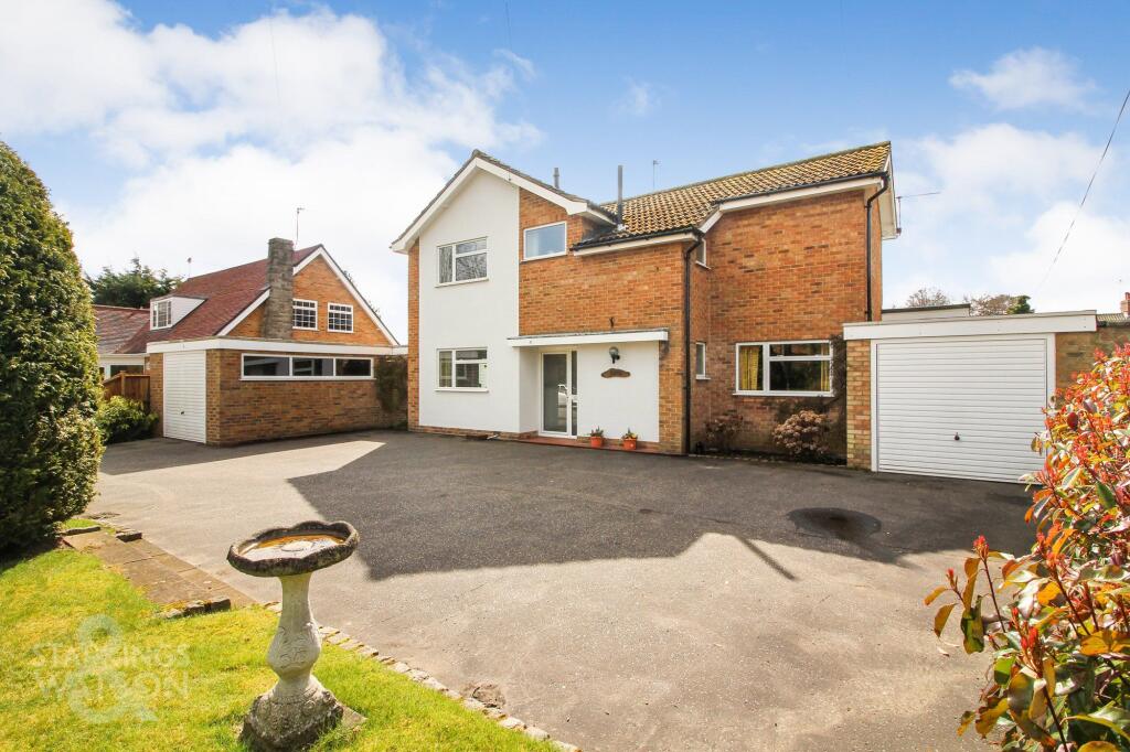
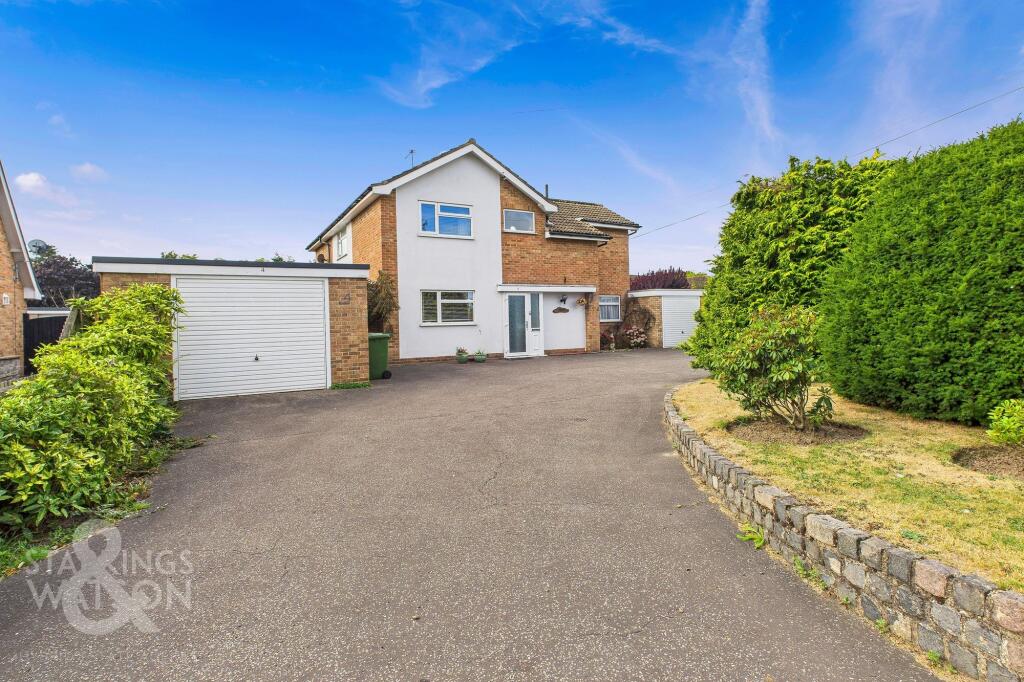
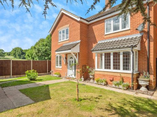
- Detached two-storey family house with an attached single garage and substantial forecourt providing parking for several vehicles. Brick and rendered exterior with a pitched tiled roof. Mature hedging and shrub beds to the front create privacy; small formal front lawn/planting area. Property appears to sit on an average-to-large urban plot with neighbouring residential properties visible to the rear and treed backdrop. Overall impression: spacious driveway/parking provision, private frontage, and a modest garden area — suitable for a 3–4 bedroom family home (number of rooms not confirmed from image).
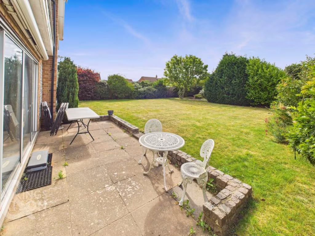
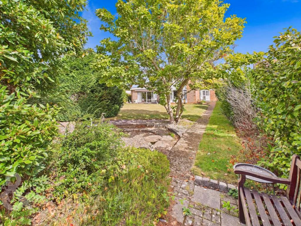
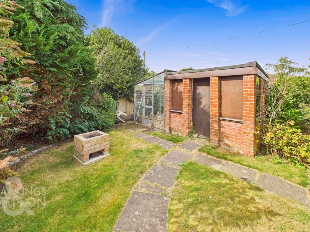
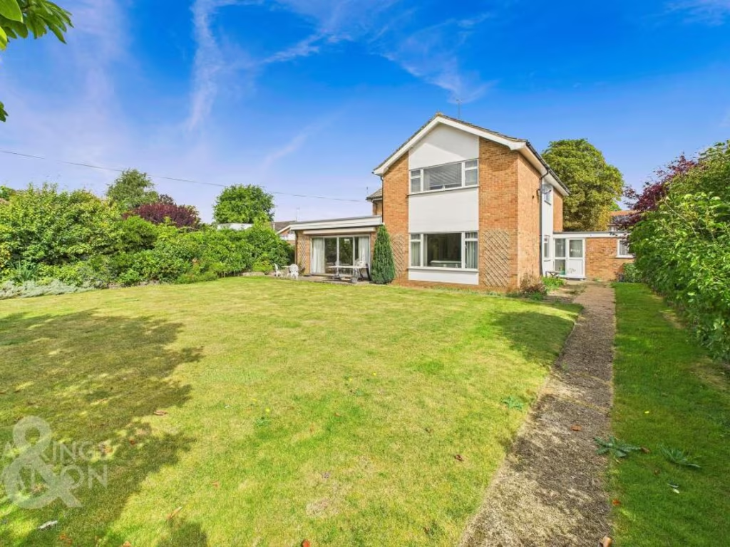
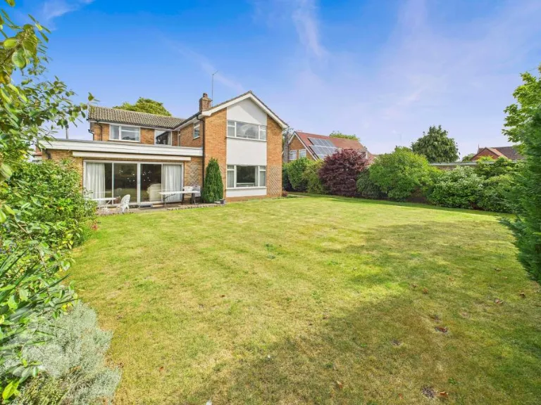
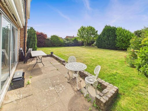
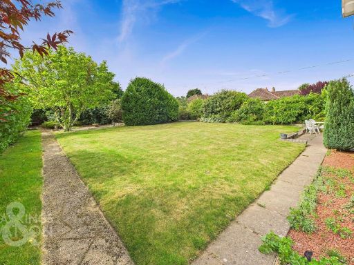
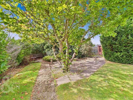
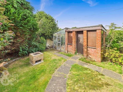
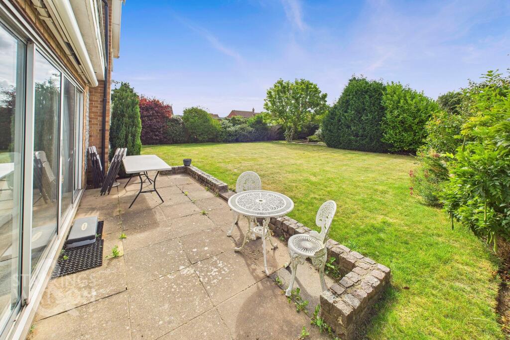
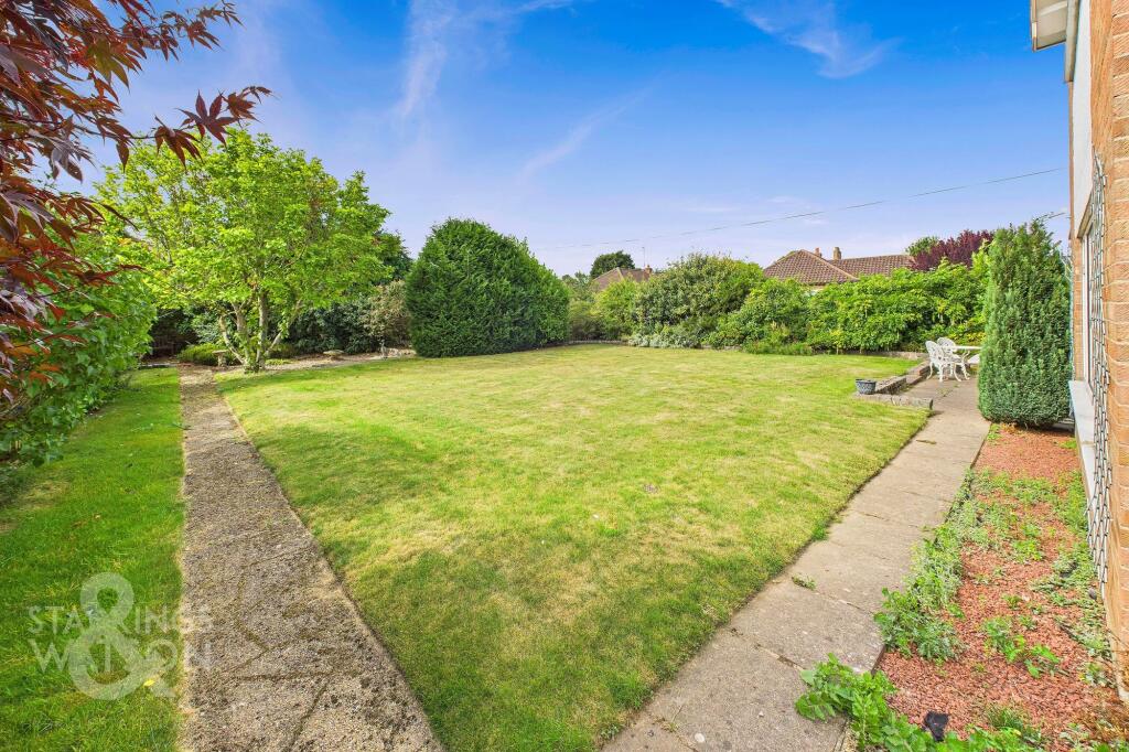
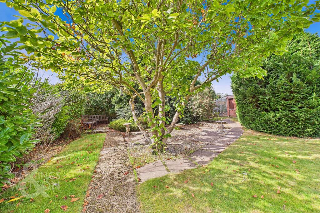
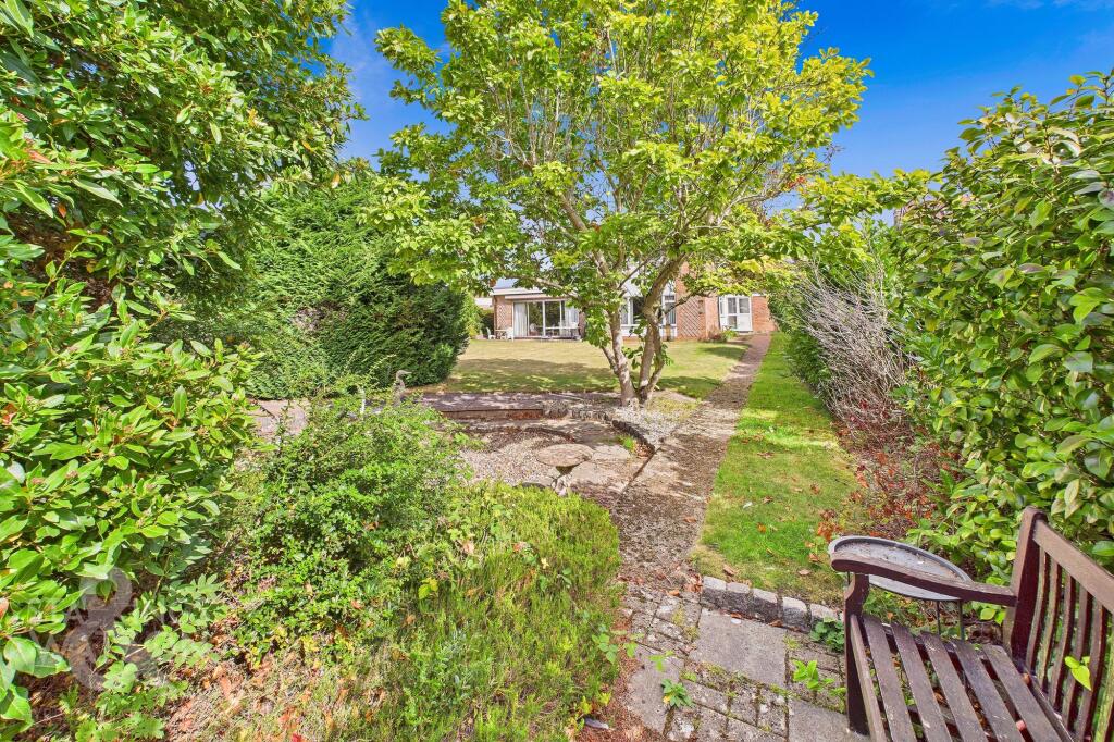
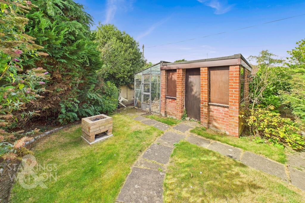
- Large rear garden associated with a suburban detached property (property itself not shown in full). The landscaped garden features a paved patio immediately adjacent to the house with a low retaining brick edge, mature hedges and specimen trees providing strong boundary screening and privacy. Lawn area is extensive and appears flat and well maintained — overall garden size: large. The setting suggests a sizeable plot and good outdoor amenity suitable for family use; likely benefits include direct access from ground-floor living spaces (sliding doors visible) and potential for landscaping or extension subject to planning. No interior details or exact number of rooms visible. Views: private garden/fencing and mature planting; no notable distant views (sea/city/river) visible.
Image Descriptions
- detached house 1960s-1970s suburban
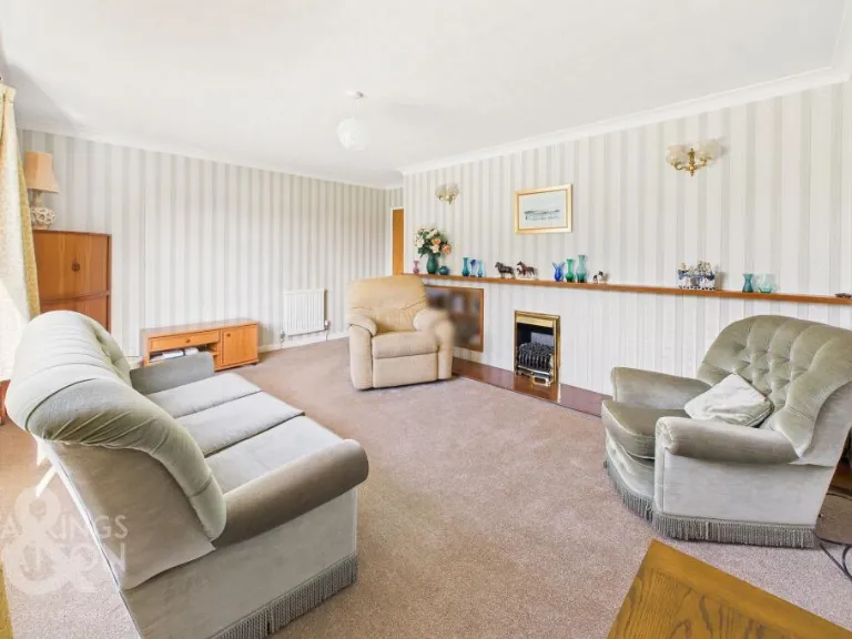
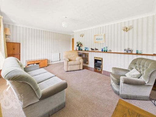
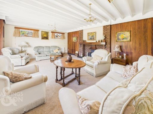
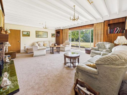
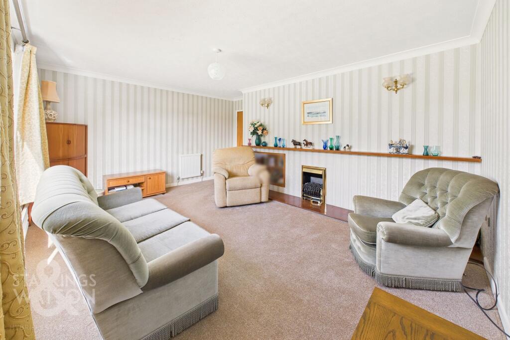
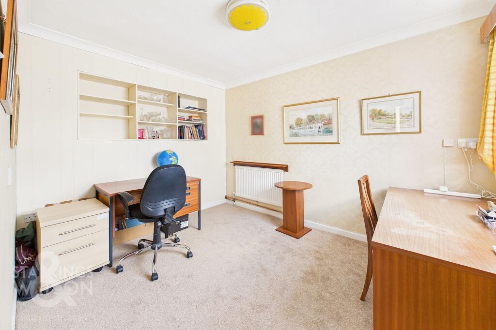
- living room Mid to late 20th-century
Floorplan Description
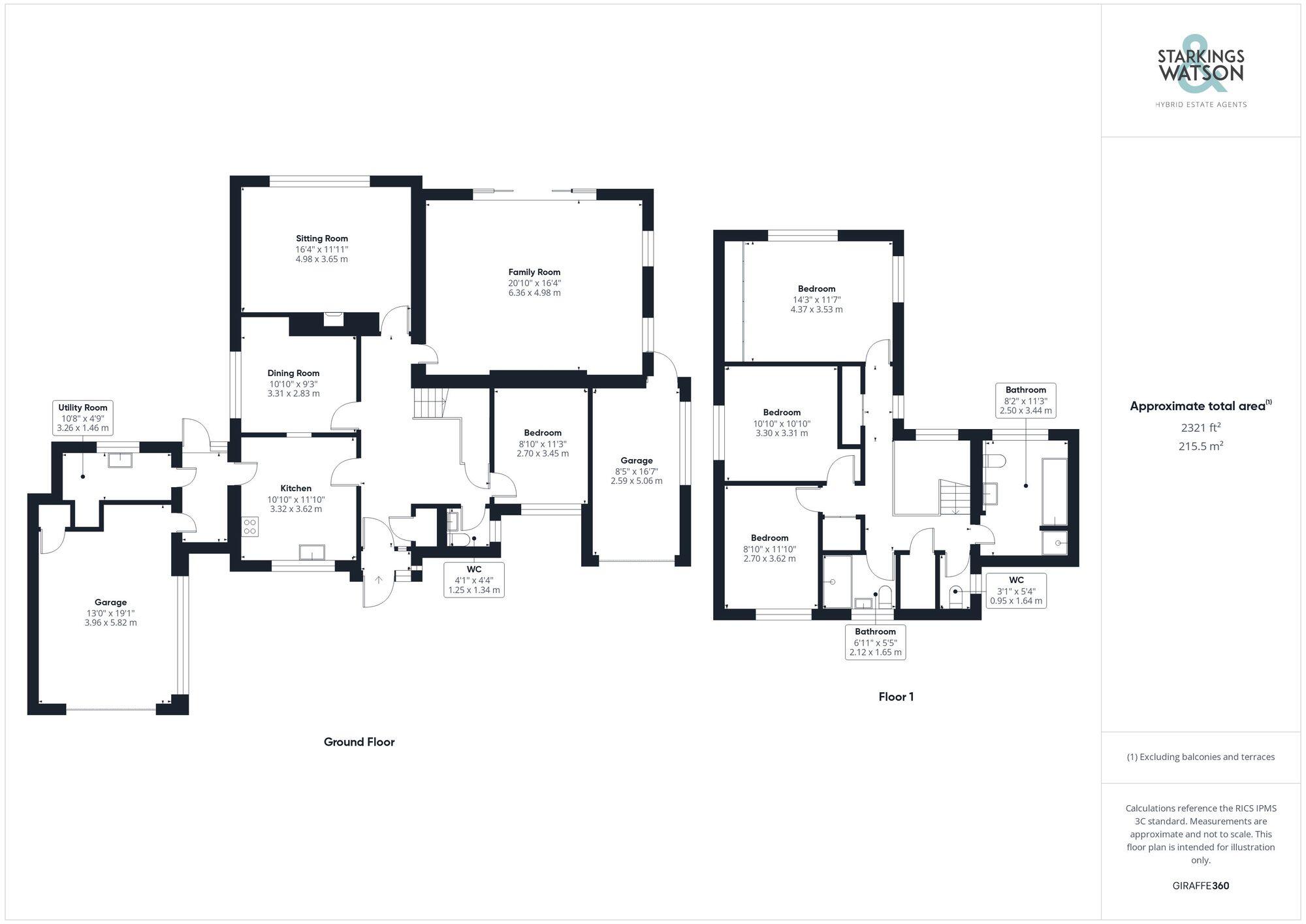
- Two-storey residential property floorplan
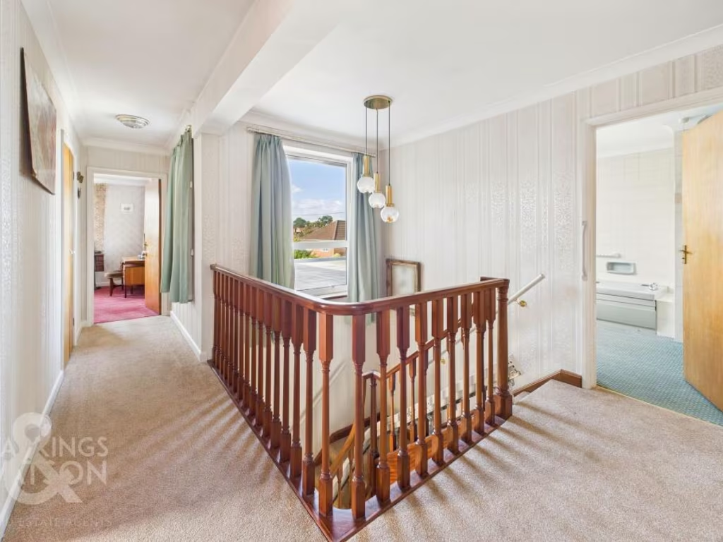
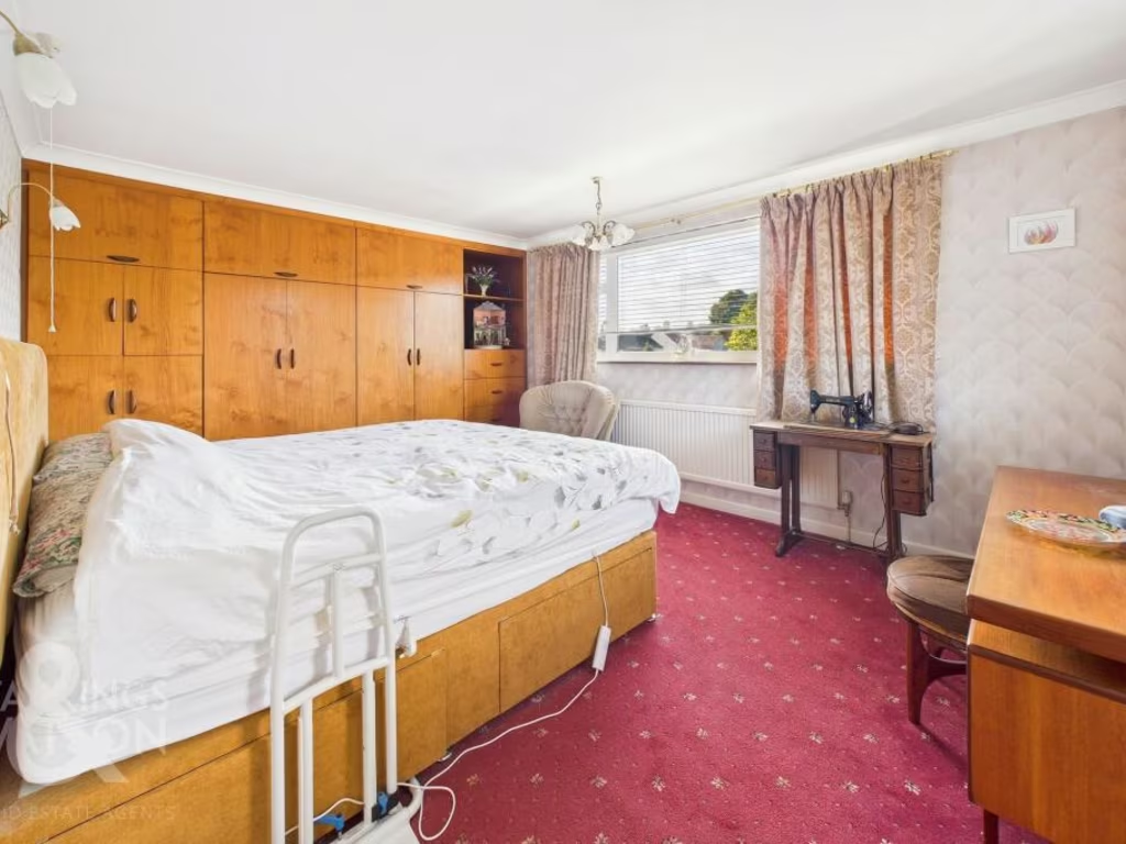
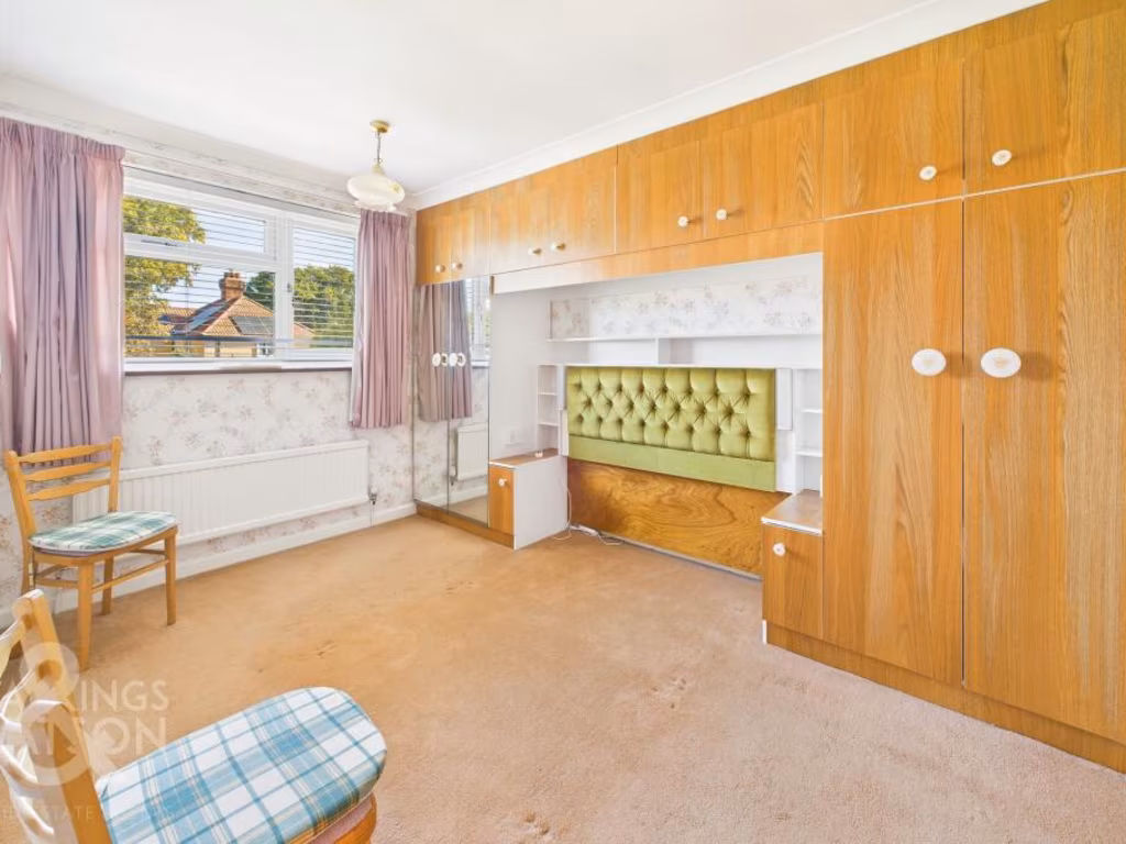
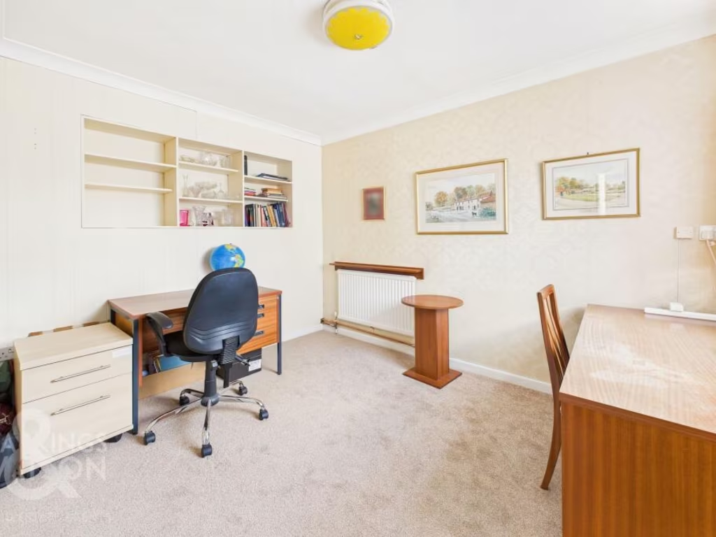
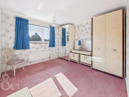
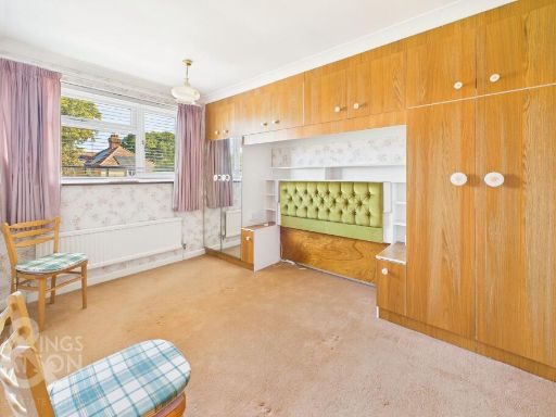
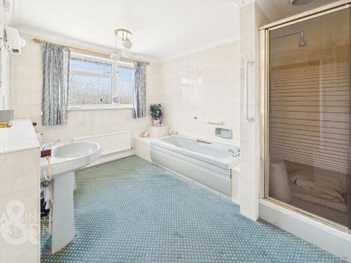
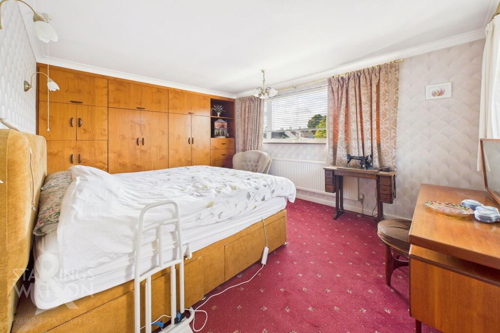
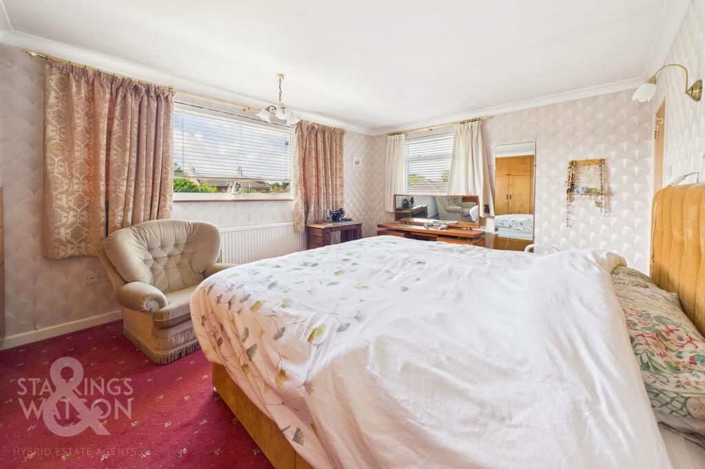
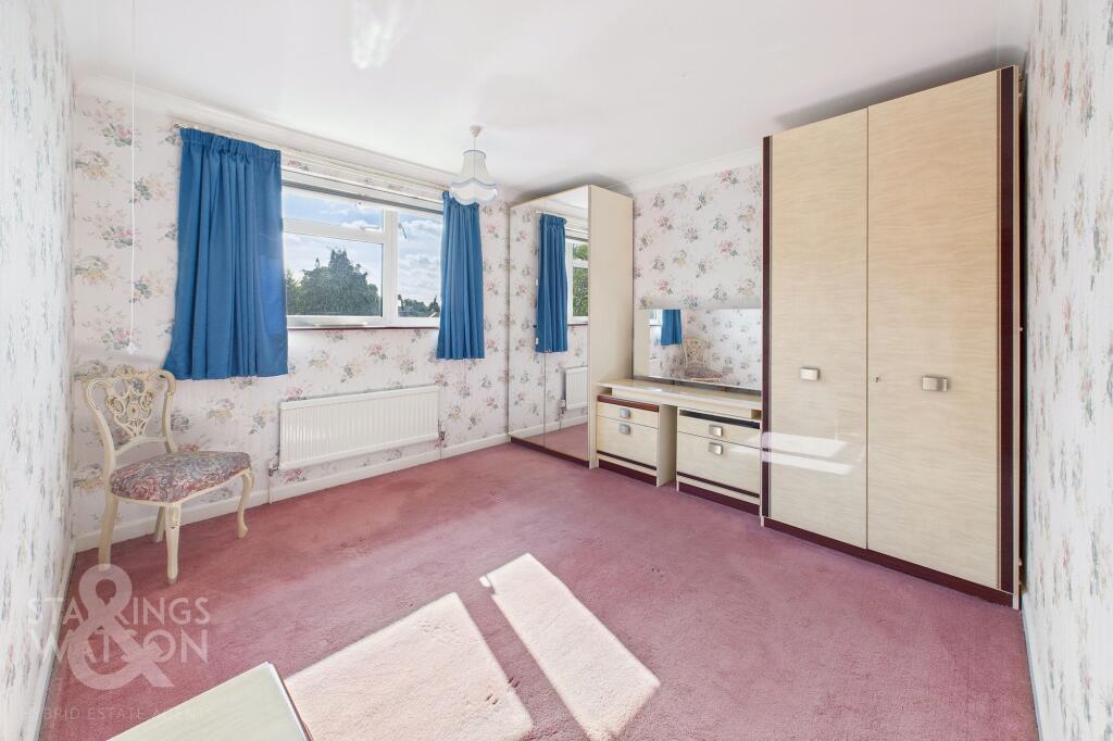
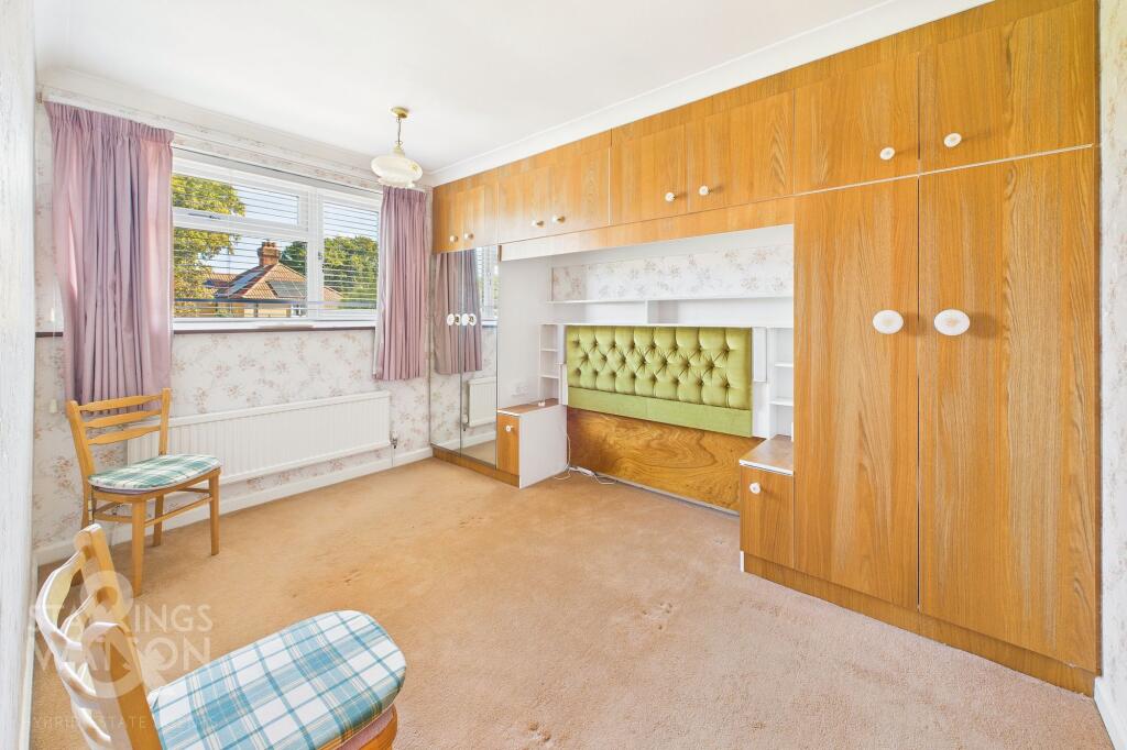
Rooms
- Sitting Room:
- Family Room:
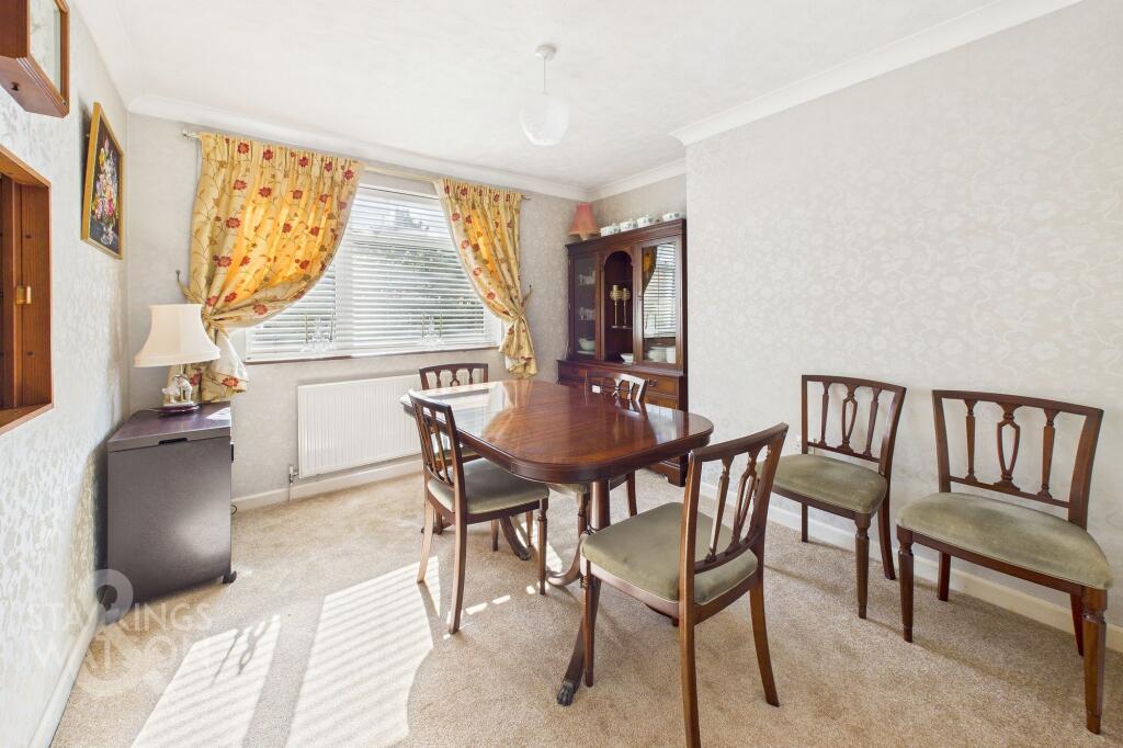
- Dining Room:
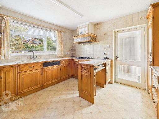
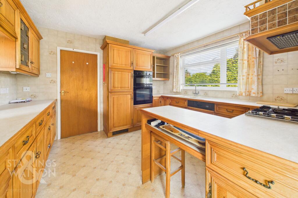
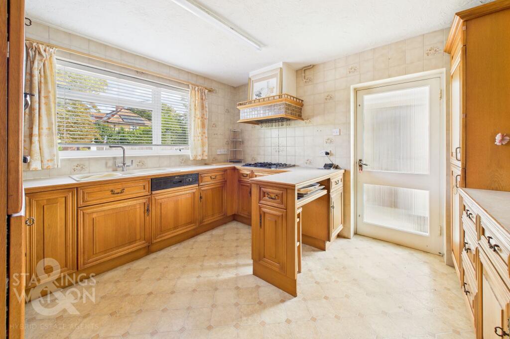
- Kitchen:
- Utility Room:
- Garage:
- Garage:
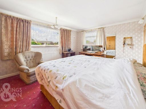
- Bedroom:
- WC:
- Bedroom:
- Bedroom:
- Bedroom:
- Bathroom:
- Bathroom:
- WC:
Textual Property Features
- Has Garden
- Chain Free
- Success
Detected Visual Features
- detached house
- suburban
- 1960s style
- 1970s style
- brick facade
- driveway
- garage
- garden
- residential area
- low-rise
- living room
- mid to late 20th century
- striped wallpaper
- standard ceiling
- gas fireplace
- built-in shelf
- coving
- neutral colors
EPC Details
- Fully double glazed
- Cavity wall, as built, no insulation (assumed)
- Boiler and radiators, mains gas
- Low energy lighting in 8% of fixed outlets
- Solid, no insulation (assumed)
Nearby Schools
- Buxton Primary School
- North Walsham Junior School
- East Ruston Infant School & Nursery
- Millfield Primary School
- Mundesley Infant School
- Mundesley Junior School
- Swanton Abbott Community Primary School
- Worstead Church of England Primary School
- Colby Primary School
- North Walsham Infant School
- Bacton Primary School
- North Walsham High School
- Antingham and Southrepps Primary School
Nearest General Shops
- Id: 99594998
- Tags:
- Addr:
- City: North Walsham
- Housename: Roys of North Walsham
- Housenumber: 10
- Postcode: NR28 9BW
- Street: Yarmouth Road
- Brand:
- Building: yes
- Building:levels: 2
- Fhrs:
- Height: 7
- Name: Roys
- Opening_hours: Mo-Tu 09:00-17:30; We-Fr 09:00-20:00; Sa 09:00-18:00; Su 10:00-16:00
- Roof:
- Shop: department_store
- TagsNormalized:
- Lat: 52.8204179
- Lon: 1.3879615
- FullGeoHash: u12urxdtjze1
- PartitionGeoHash: u12u
- Images:
- FoodStandards:
- Id: 689755
- FHRSID: 689755
- LocalAuthorityBusinessID: PI/000058484
- BusinessName: Roys (Wroxham) Ltd
- BusinessType: Retailers - other
- BusinessTypeID: 4613
- AddressLine1: Roys of North Walsham
- AddressLine2: 10 Yarmouth Road
- AddressLine3: North Walsham
- AddressLine4: null
- PostCode: NR28 9BW
- RatingValue: AwaitingInspection
- RatingKey: fhrs_awaitinginspection_en-GB
- RatingDate: null
- LocalAuthorityCode: 231
- LocalAuthorityName: North Norfolk
- LocalAuthorityWebSite: http://www.northnorfolk.gov.uk
- LocalAuthorityEmailAddress: commercial@north-norfolk.gov.uk
- Scores:
- Hygiene: null
- Structural: null
- ConfidenceInManagement: null
- NewRatingPending: false
- Geocode:
- Longitude: 1.38795610000000
- Latitude: 52.82043630000000
- Distance: 813.2
,- Id: 3625388022
- Tags:
- Name: BareKnuckle Tattoos
- Shop: tattoo
- TagsNormalized:
- Lat: 52.8260141
- Lon: 1.3969007
- FullGeoHash: u12uxb9jy4u8
- PartitionGeoHash: u12u
- Images:
- FoodStandards: null
- Distance: 368.4
,- Id: 357213979
- Tags:
- Addr:
- City: Norwich
- Country: GB
- Housenumber: 23
- Postcode: NR28 9EW
- Street: Stanley Road
- Building: yes
- Email: peartreehair@gmail.com
- Name: The Pear Tree
- Opening_hours: Mo,We 10:00-14:30; Tu,Th-Fr 10:00-17:00; Sa 10:00-18:00; Su off
- Phone: +44 1692 407700
- Shop: hairdresser
- Website: http://www.peartreehair.com/
- TagsNormalized:
- Lat: 52.8260154
- Lon: 1.3967715
- FullGeoHash: u12uxb9jg5h2
- PartitionGeoHash: u12u
- Images:
- FoodStandards: null
- Distance: 360.4
}
Nearest Religious buildings
- Id: 98926167
- Tags:
- Amenity: place_of_worship
- Building: yes
- Denomination: congregational
- Name: North Walsham Congregational Church
- Religion: christian
- TagsNormalized:
- place of worship
- congregational
- church
- christian
- Lat: 52.8224608
- Lon: 1.3834114
- FullGeoHash: u12ux2p35u6k
- PartitionGeoHash: u12u
- Images:
- FoodStandards: null
- Distance: 785.9
,- Id: 88282183
- Tags:
- Amenity: place_of_worship
- Building: church
- Building:levels: 2
- Denomination: anglican
- Height: 12
- Listed_status: Grade I
- Material: stone
- Name: Saint Nicholas
- Religion: christian
- Roof:
- Tower: facade
- Website: https://www.saint-nicholas.org.uk/
- Wikidata: Q17536711
- TagsNormalized:
- place of worship
- church
- anglican
- christian
- Lat: 52.8215588
- Lon: 1.3873752
- FullGeoHash: u12urxf7bhjz
- PartitionGeoHash: u12u
- Images:
- FoodStandards: null
- Distance: 710.3
,- Id: 106797196
- Tags:
- Addr:
- City: North Walsham
- Country: GB
- Postcode: NR28 9DT
- Street: Hall Lane
- Amenity: place_of_worship
- Building: yes
- Denomination: salvation_army
- Fhrs:
- Name: North Walsham Salvation Army
- Religion: christian
- TagsNormalized:
- place of worship
- salvation army
- christian
- church
- Lat: 52.8217671
- Lon: 1.3892962
- FullGeoHash: u12urxgthgn6
- PartitionGeoHash: u12u
- Images:
- FoodStandards:
- Id: 687363
- FHRSID: 687363
- LocalAuthorityBusinessID: PI/000063536
- BusinessName: Salvation Army
- BusinessType: Other catering premises
- BusinessTypeID: 7841
- AddressLine1: Hall Lane
- AddressLine2: North Walsham
- AddressLine3: Norfolk
- AddressLine4: null
- PostCode: NR28 9DT
- RatingValue: 5
- RatingKey: fhrs_5_en-GB
- RatingDate: 2019-12-09
- LocalAuthorityCode: 231
- LocalAuthorityName: North Norfolk
- LocalAuthorityWebSite: http://www.northnorfolk.gov.uk
- LocalAuthorityEmailAddress: commercial@north-norfolk.gov.uk
- Scores:
- Hygiene: 0
- Structural: 5
- ConfidenceInManagement: 5
- NewRatingPending: false
- Geocode:
- Longitude: 1.38964700000000
- Latitude: 52.82181000000000
- Distance: 643.3
}
Nearest Medical buildings
- Id: 1031846945
- Tags:
- Amenity: doctors
- Name: Paston Surgery
- TagsNormalized:
- Lat: 52.8198573
- Lon: 1.3835614
- FullGeoHash: u12urrx3zr41
- PartitionGeoHash: u12u
- Images:
- FoodStandards: null
- Distance: 1002
,- Id: 1031846988
- Tags:
- Amenity: doctors
- Name: Birchwood Medical Practice
- TagsNormalized:
- Lat: 52.820504
- Lon: 1.3826843
- FullGeoHash: u12urrwvdzs5
- PartitionGeoHash: u12u
- Images:
- FoodStandards: null
- Distance: 979.3
,- Id: 1022935294
- Tags:
- Amenity: pharmacy
- Brand: Boots
- Brand:wikidata: Q6123139
- Brand:wikipedia: en:Boots UK
- Healthcare: pharmacy
- Name: Boots
- TagsNormalized:
- pharmacy
- boots
- health
- healthcare
- Lat: 52.8211313
- Lon: 1.3867405
- FullGeoHash: u12urxcc3ks9
- PartitionGeoHash: u12u
- Images:
- FoodStandards: null
- Distance: 771.7
,- Id: 1022935307
- Tags:
- Addr:
- City: North Walsham
- Housenumber: 11
- Postcode: NR28 9BP
- Street: Market Place
- Amenity: pharmacy
- Dispensing: yes
- Fhrs:
- Healthcare: pharmacy
- Name: Co-operative
- Source:
- TagsNormalized:
- Lat: 52.8211312
- Lon: 1.3870752
- FullGeoHash: u12urxf13hw0
- PartitionGeoHash: u12u
- Images:
- FoodStandards:
- Id: 689873
- FHRSID: 689873
- LocalAuthorityBusinessID: PI/000102476
- BusinessName: The Co-operative Pharmacy
- BusinessType: Retailers - other
- BusinessTypeID: 4613
- AddressLine1: 11 Market Place
- AddressLine2: North Walsham
- AddressLine3: Norfolk
- AddressLine4: null
- PostCode: NR28 9BP
- RatingValue: AwaitingInspection
- RatingKey: fhrs_awaitinginspection_en-GB
- RatingDate: null
- LocalAuthorityCode: 231
- LocalAuthorityName: North Norfolk
- LocalAuthorityWebSite: http://www.northnorfolk.gov.uk
- LocalAuthorityEmailAddress: commercial@north-norfolk.gov.uk
- Scores:
- Hygiene: null
- Structural: null
- ConfidenceInManagement: null
- NewRatingPending: false
- Geocode:
- Longitude: 1.38681300000000
- Latitude: 52.82106300000000
- Distance: 761.9
}
Nearest Leisure Facilities
- Id: 973274233
- Tags:
- TagsNormalized:
- Lat: 52.8257038
- Lon: 1.3967482
- FullGeoHash: u12uxb9h48fv
- PartitionGeoHash: u12u
- Images:
- FoodStandards: null
- Distance: 374.5
,- Id: 1157677864
- Tags:
- TagsNormalized:
- Lat: 52.8284394
- Lon: 1.395725
- FullGeoHash: u12uxc07fwzu
- PartitionGeoHash: u12u
- Images:
- FoodStandards: null
- Distance: 286.2
,- Id: 751167926
- Tags:
- Leisure: park
- Name: Acorn Road Play Park and Recreational Area
- Surface: grass
- TagsNormalized:
- Lat: 52.8282554
- Lon: 1.3958554
- FullGeoHash: u12uxc06vu94
- PartitionGeoHash: u12u
- Images:
- FoodStandards: null
- Distance: 286.2
,- Id: 1013008857
- Tags:
- Access: customers
- Fee: no
- Garden:
- Leisure: garden
- Name: The Orchard Garden
- TagsNormalized:
- Lat: 52.8250876
- Lon: 1.390121
- FullGeoHash: u12ux8s22nj3
- PartitionGeoHash: u12u
- Images:
- FoodStandards: null
- Distance: 276.7
,- Id: 973274386
- Tags:
- TagsNormalized:
- Lat: 52.8265961
- Lon: 1.3890915
- FullGeoHash: u12ux8g90pm8
- PartitionGeoHash: u12u
- Images:
- FoodStandards: null
- Distance: 204.4
}
Nearest Tourist attractions
- Id: 522884000
- Tags:
- Tourism: camp_site
- Website: http://www.mikethurston.org.uk
- TagsNormalized:
- Lat: 52.8323164
- Lon: 1.4060862
- FullGeoHash: u12uxczfs1tg
- PartitionGeoHash: u12u
- Images:
- FoodStandards: null
- Distance: 1103.6
,- Id: 357213959
- Tags:
- Name: Norfolk Park
- Tourism: caravan_site
- Website: https://www.thedreamlodgegroup.co.uk/our-locations/norfolk-park/overview/
- TagsNormalized:
- Lat: 52.8268664
- Lon: 1.4027643
- FullGeoHash: u12uxbv6yc8u
- PartitionGeoHash: u12u
- Images:
- FoodStandards: null
- Distance: 733.5
,- Id: 92900171
- Tags:
- Amenity: townhall
- Building: yes
- Information: office
- Name: North Walsham Town Council
- Tourism: information
- TagsNormalized:
- townhall
- information
- tourism
- Lat: 52.8211579
- Lon: 1.3886802
- FullGeoHash: u12urxg1w9e0
- PartitionGeoHash: u12u
- Images:
- FoodStandards: null
- Distance: 720
}
Nearest Hotels
- Id: 353684140
- Tags:
- Addr:
- City: Norwich
- Housenumber: 30
- Postcode: NR11 8BN
- Street: Paston Road
- Village: Mundesley
- Building: yes
- Fhrs:
- Name: Royal Hotel
- Source:
- Addr: FHRS Open Data
- Outline: Bing
- Tourism: hostel
- TagsNormalized:
- Lat: 52.8746193
- Lon: 1.4393002
- FullGeoHash: u13hbc80fpkj
- PartitionGeoHash: u13h
- Images:
- FoodStandards: null
- Distance: 6146.7
,- Id: 321967
- Tags:
- Name: Royal Hotel
- Naptan:
- StopAreaCode: 290G683
- StopAreaType: GPBS
- Verified: no
- Public_transport: stop_area
- Source: naptan_import
- Type: public_transport
- TagsNormalized:
- Lat: 52.8744248
- Lon: 1.4394349
- FullGeoHash: u13hbc2pv70m
- PartitionGeoHash: u13h
- Images:
- FoodStandards: null
- Distance: 6132.9
,- Id: 354690929
- Tags:
- Addr:
- City: North Walsham
- Country: GB
- Housename: Kings Arms Hotel
- Postcode: NR28 9JX
- Street: Kings Arms Street
- Amenity: pub
- Building: yes
- Description: Pub and Hotel
- Fax: +44 1692 500095
- Fhrs:
- Internet_access: wlan
- Internet_access:fee: no
- Name: Kings Arms Hotel
- Phone: +44 1692 403054
- Source:
- Tourism: hotel
- Website: http://www.thekingsarmshotel.co.uk/
- Wikidata: Q26499833
- TagsNormalized:
- Lat: 52.8210785
- Lon: 1.3858987
- FullGeoHash: u12urxc1jf8y
- PartitionGeoHash: u12u
- Images:
- FoodStandards: null
- Distance: 803.6
}
Tags
- detached house
- suburban
- 1960s style
- 1970s style
- brick facade
- driveway
- garage
- garden
- residential area
- low-rise
- living room
- mid to late 20th century
- striped wallpaper
- standard ceiling
- gas fireplace
- built-in shelf
- coving
- neutral colors
Local Market Stats
- Average Price/sqft: £286
- Avg Income: £38400
- Social Housing: 11%
- Planning Success Rate: 91%
AirBnB Data
- 1km average: £104/night
- Listings in 1km: 1
Similar Properties
 4 bedroom detached house for sale in Chestnut Avenue, North Walsham, NR28 — £400,000 • 4 bed • 2 bath • 797 ft²
 3 bedroom detached house for sale in Aylsham Road, North Walsham, Norfolk, NR28 — £500,000 • 3 bed • 2 bath • 1478 ft²
 5 bedroom character property for sale in Cromer Road, North Walsham, NR28 — £725,000 • 5 bed • 3 bath • 3000 ft²
 4 bedroom detached house for sale in Valley Gardens, North Walsham, NR28 — £290,000 • 4 bed • 1 bath • 822 ft²
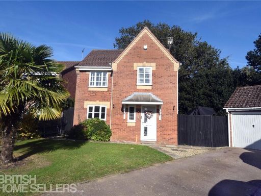 3 bedroom detached house for sale in Wharton Drive, North Walsham, Norfolk, NR28 — £330,000 • 3 bed • 2 bath
 3 bedroom link detached house for sale in Kimberley Road, North Walsham, NR28 — £245,000 • 3 bed • 1 bath • 1001 ft²
Meta
- {
"@context": "https://schema.org",
"@type": "Residence",
"name": "4 bedroom detached house for sale in Crow Road, North Walsh…",
"description": "",
"url": "https://propertypiper.co.uk/property/1856a992-4fbd-4e2b-9482-014bdd6f0f2f",
"image": "https://image-a.propertypiper.co.uk/dd6e737d-f628-4dd5-82a3-f2cdf1edce27-1024.jpeg",
"address": {
"@type": "PostalAddress",
"streetAddress": "4 CROW ROAD NORTH WALSHAM",
"postalCode": "NR28 0DJ",
"addressLocality": "North Norfolk",
"addressRegion": "North Norfolk",
"addressCountry": "England"
},
"geo": {
"@type": "GeoCoordinates",
"latitude": 52.827338732354136,
"longitude": 1.3918750162146731
},
"numberOfRooms": 4,
"numberOfBathroomsTotal": 2,
"floorSize": {
"@type": "QuantitativeValue",
"value": 2320,
"unitCode": "FTK"
},
"offers": {
"@type": "Offer",
"price": 475000,
"priceCurrency": "GBP",
"availability": "https://schema.org/InStock"
},
"additionalProperty": [
{
"@type": "PropertyValue",
"name": "Feature",
"value": "detached house"
},
{
"@type": "PropertyValue",
"name": "Feature",
"value": "suburban"
},
{
"@type": "PropertyValue",
"name": "Feature",
"value": "1960s style"
},
{
"@type": "PropertyValue",
"name": "Feature",
"value": "1970s style"
},
{
"@type": "PropertyValue",
"name": "Feature",
"value": "brick facade"
},
{
"@type": "PropertyValue",
"name": "Feature",
"value": "driveway"
},
{
"@type": "PropertyValue",
"name": "Feature",
"value": "garage"
},
{
"@type": "PropertyValue",
"name": "Feature",
"value": "garden"
},
{
"@type": "PropertyValue",
"name": "Feature",
"value": "residential area"
},
{
"@type": "PropertyValue",
"name": "Feature",
"value": "low-rise"
},
{
"@type": "PropertyValue",
"name": "Feature",
"value": "living room"
},
{
"@type": "PropertyValue",
"name": "Feature",
"value": "mid to late 20th century"
},
{
"@type": "PropertyValue",
"name": "Feature",
"value": "striped wallpaper"
},
{
"@type": "PropertyValue",
"name": "Feature",
"value": "standard ceiling"
},
{
"@type": "PropertyValue",
"name": "Feature",
"value": "gas fireplace"
},
{
"@type": "PropertyValue",
"name": "Feature",
"value": "built-in shelf"
},
{
"@type": "PropertyValue",
"name": "Feature",
"value": "coving"
},
{
"@type": "PropertyValue",
"name": "Feature",
"value": "neutral colors"
}
]
}
High Res Floorplan Images
Compatible Floorplan Images
FloorplanImages Thumbnail