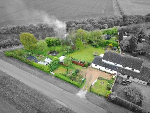
CB21 5JH - 4 bedroom detached house for sale in Toft Lane, Great Wilbr…
View on Property Piper
4 bedroom detached house for sale in Toft Lane, Great Wilbraham, Cambridge, CB21
Property Details
- Price: £785000
- Bedrooms: 4
- Bathrooms: 3
- Property Type: undefined
- Property SubType: undefined
Image Descriptions
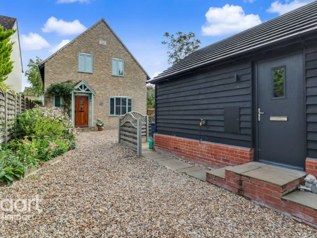
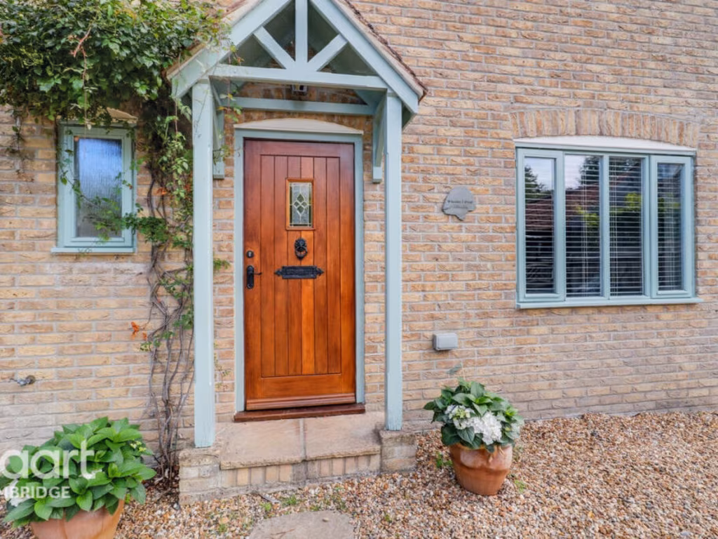
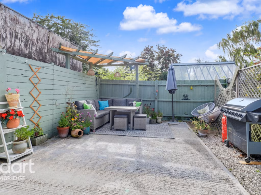
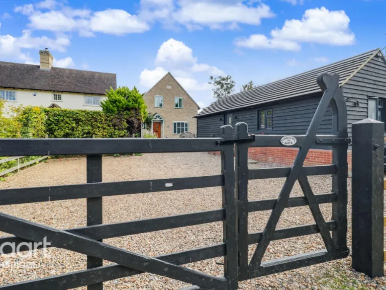
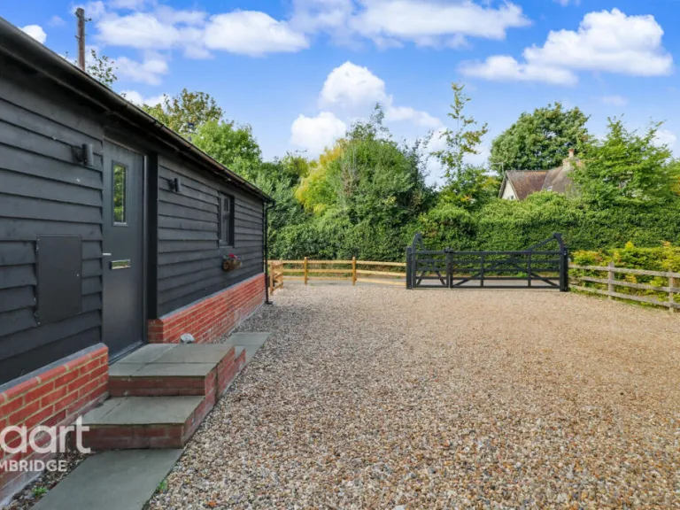
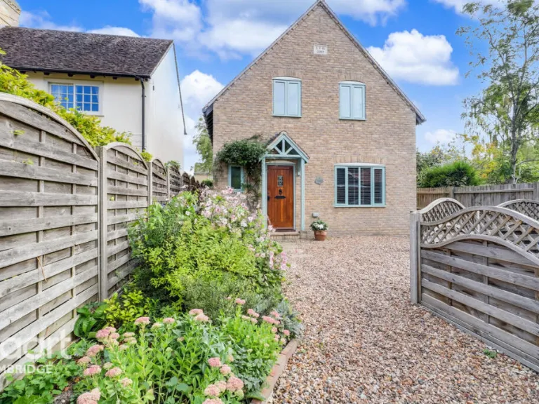
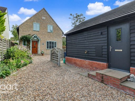
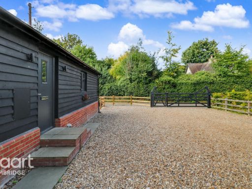
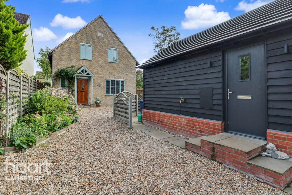
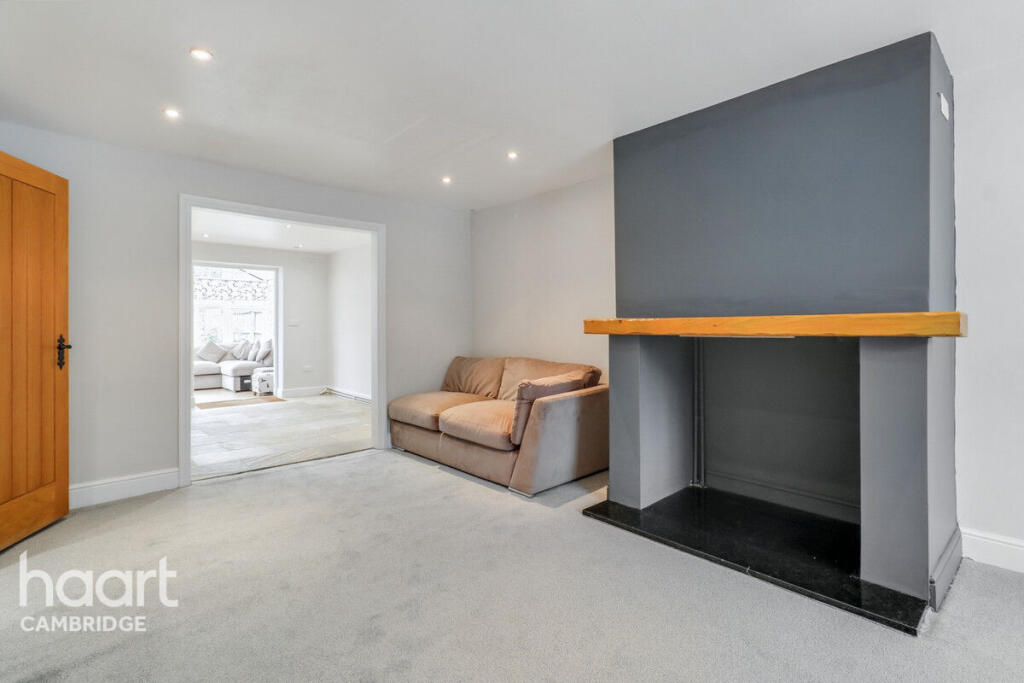
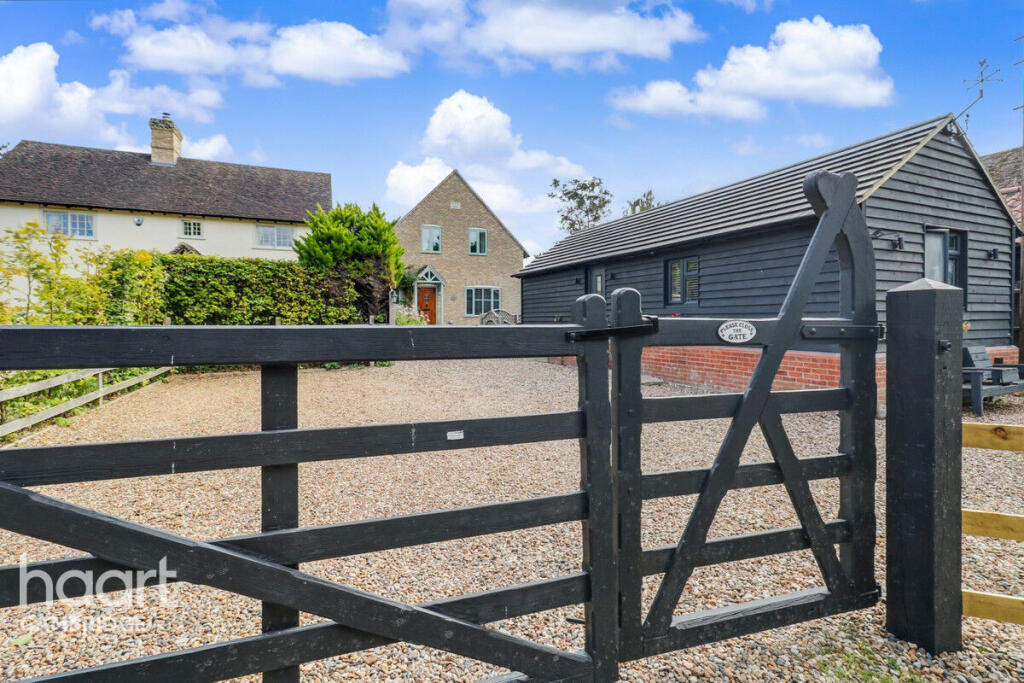
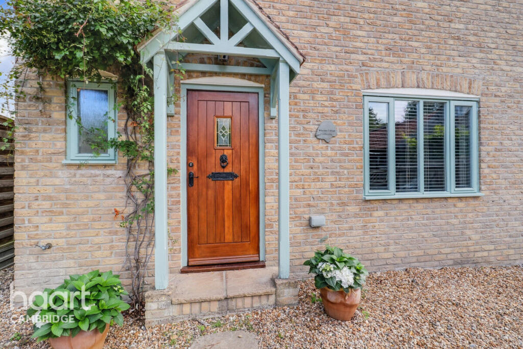
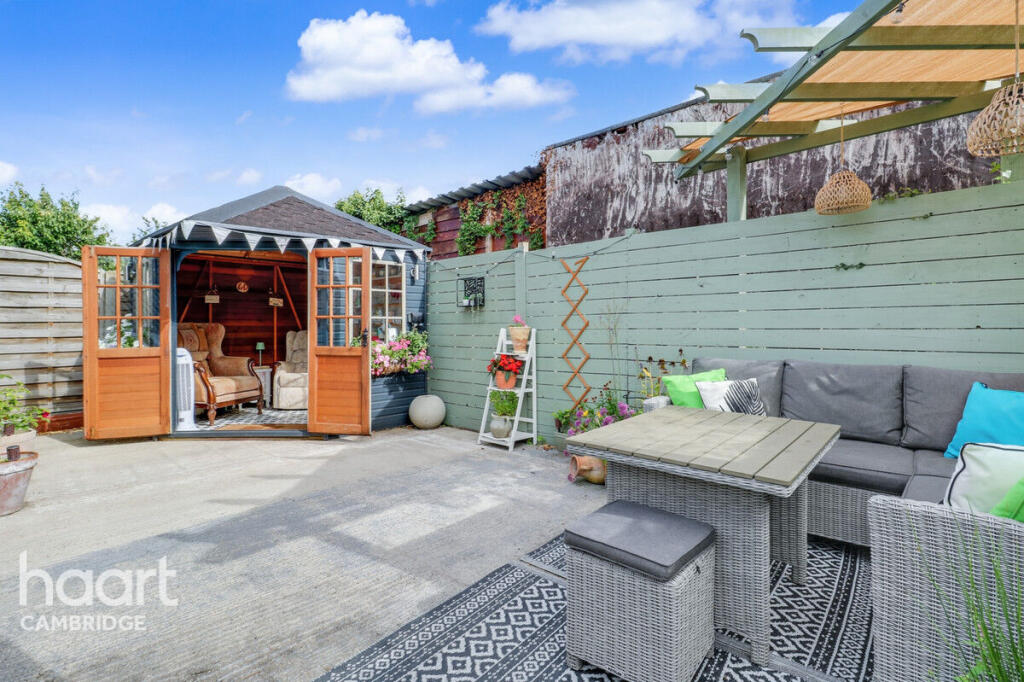
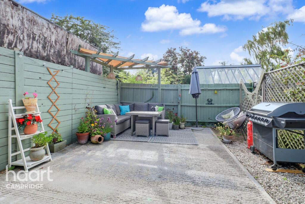
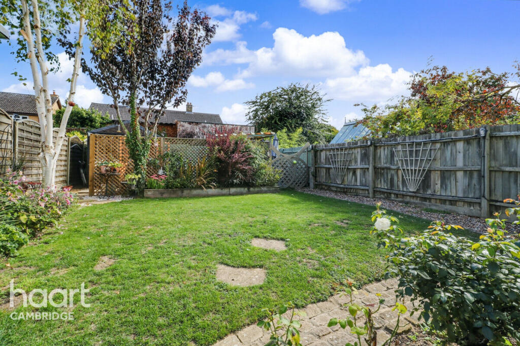
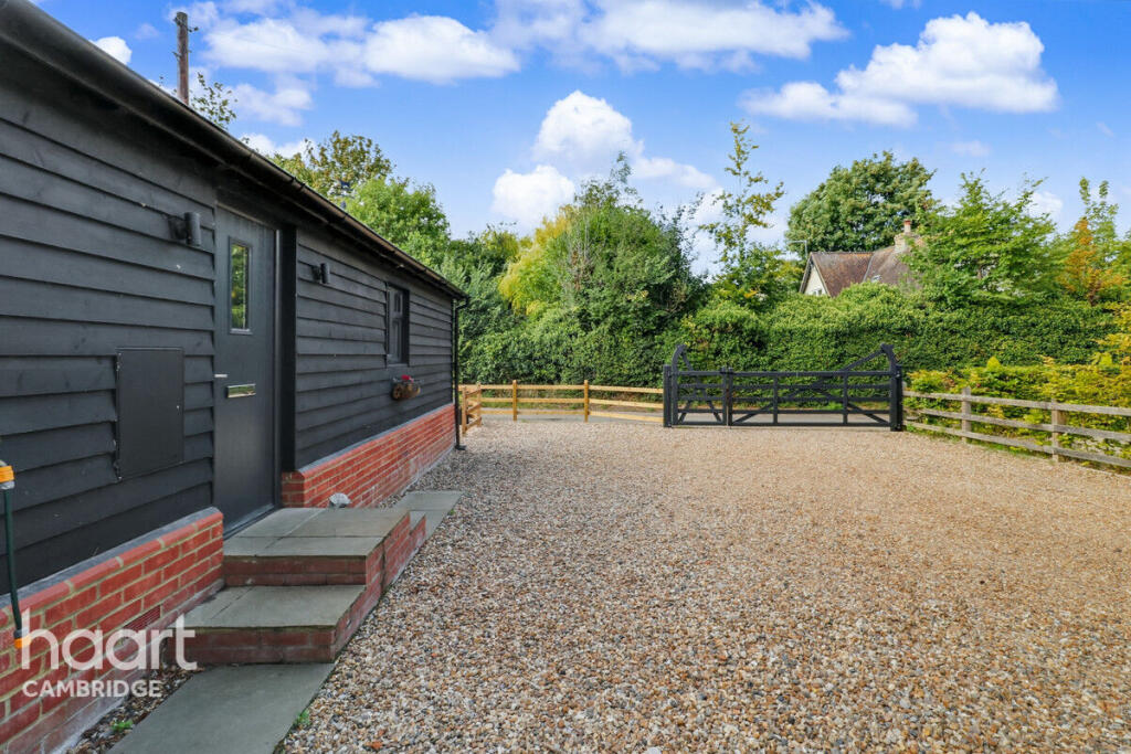
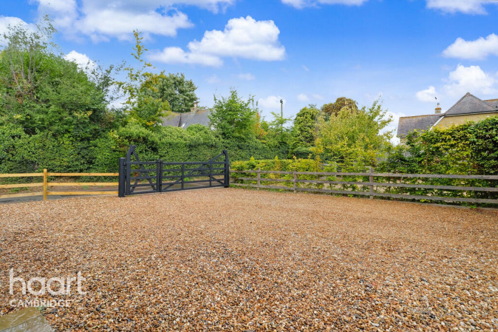
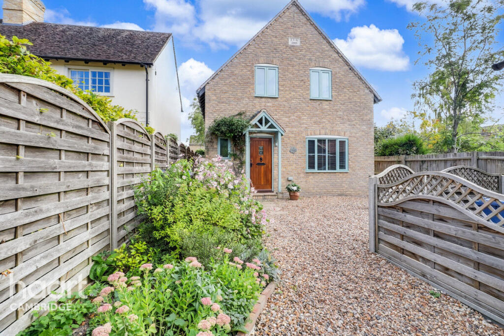
- exterior modern country
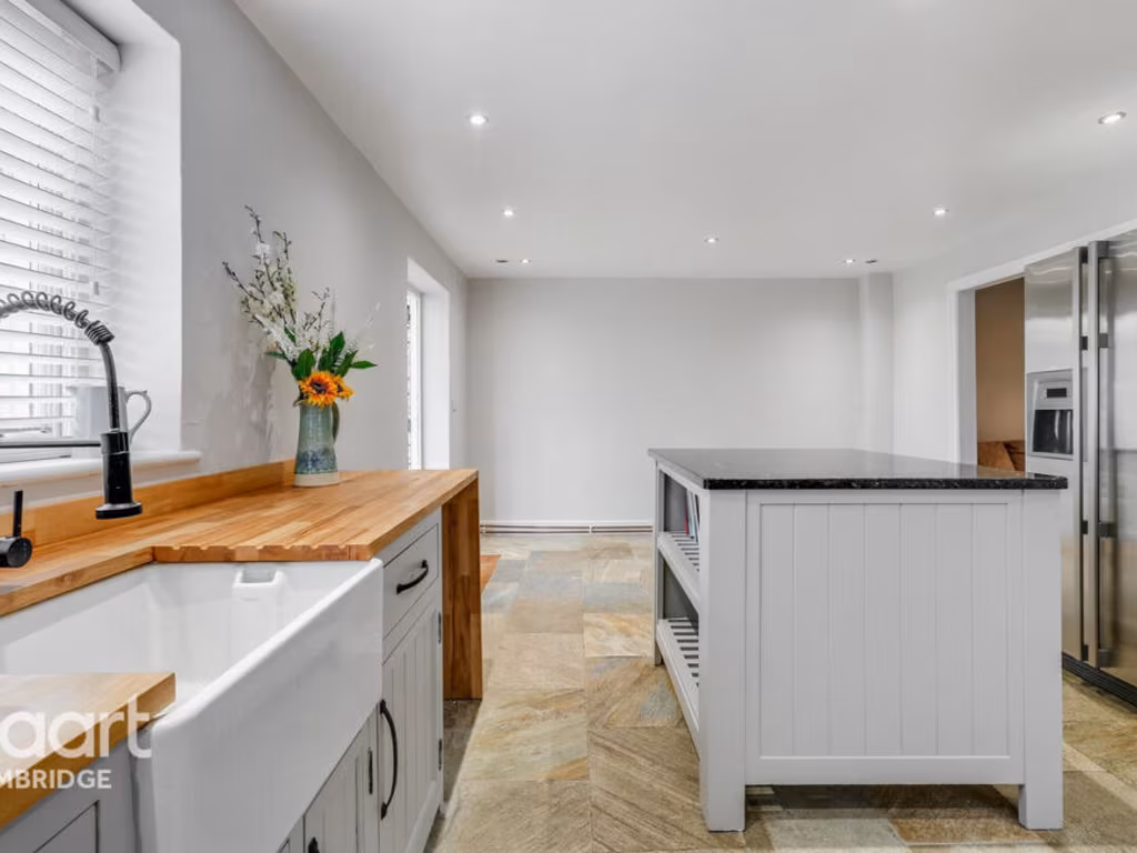
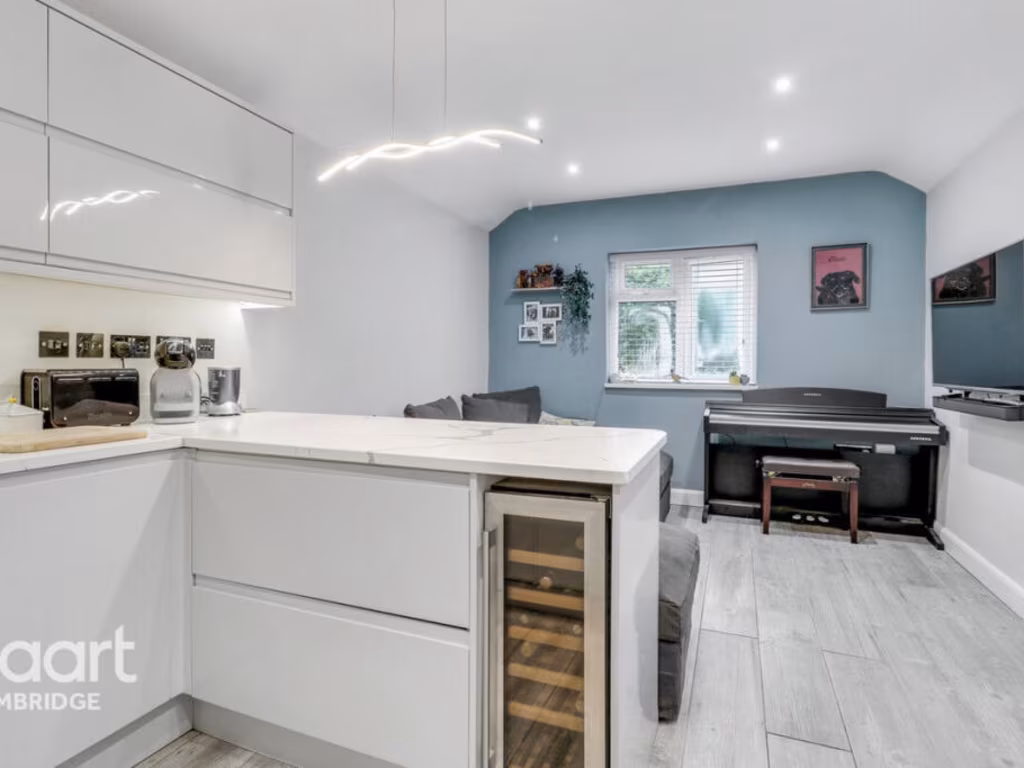
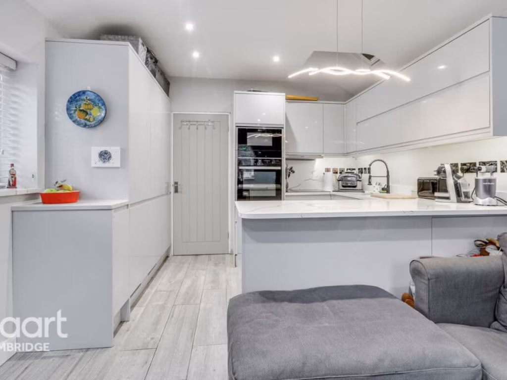
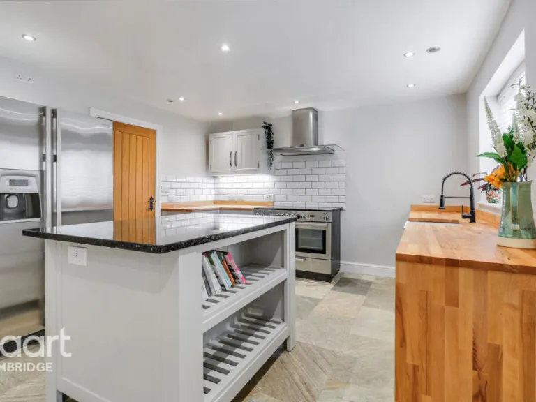
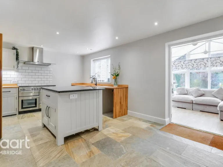
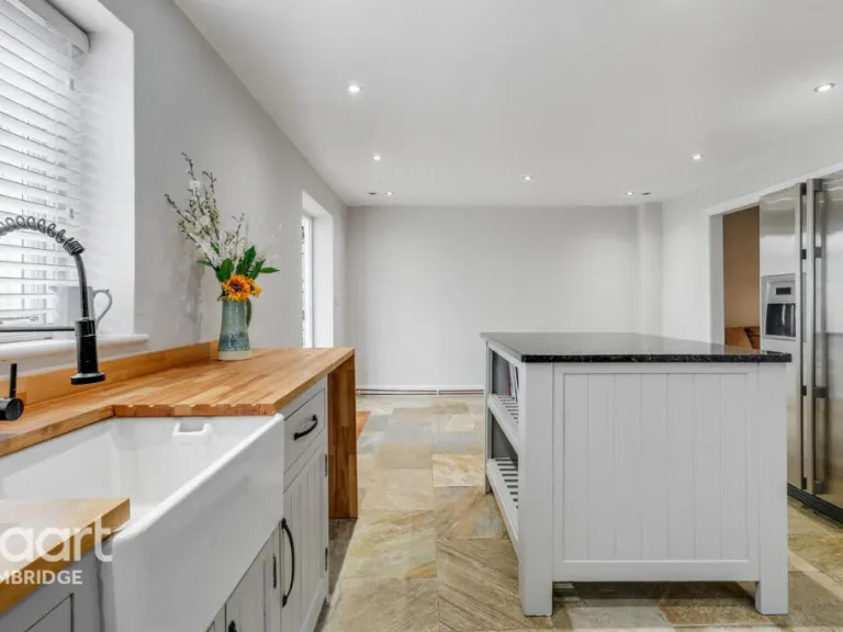
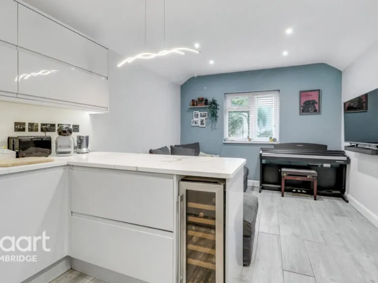
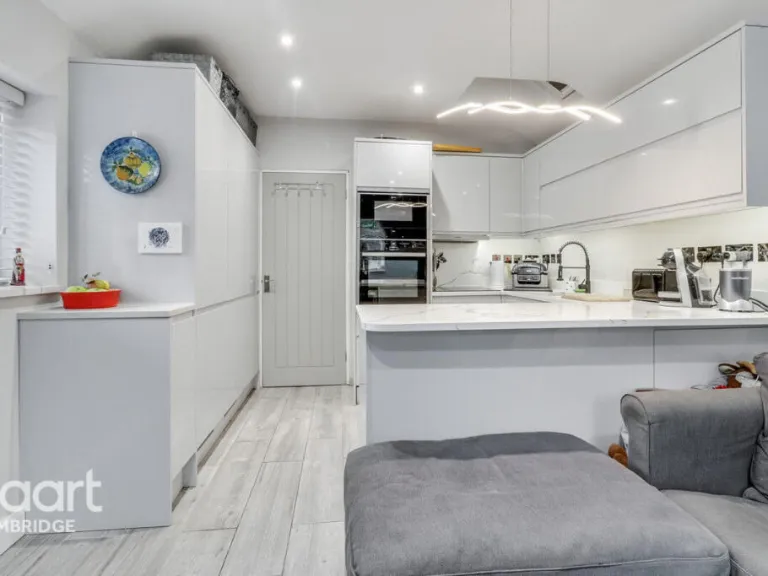
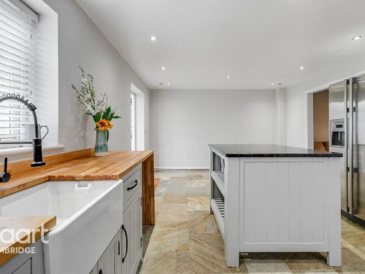
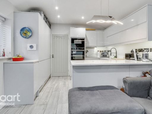
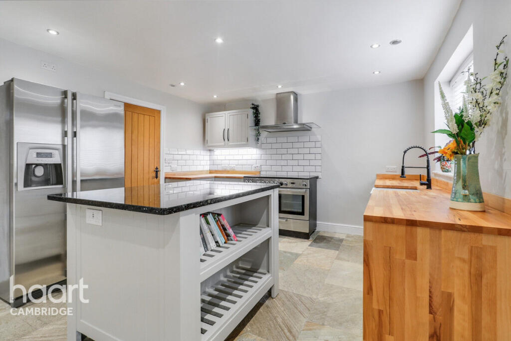
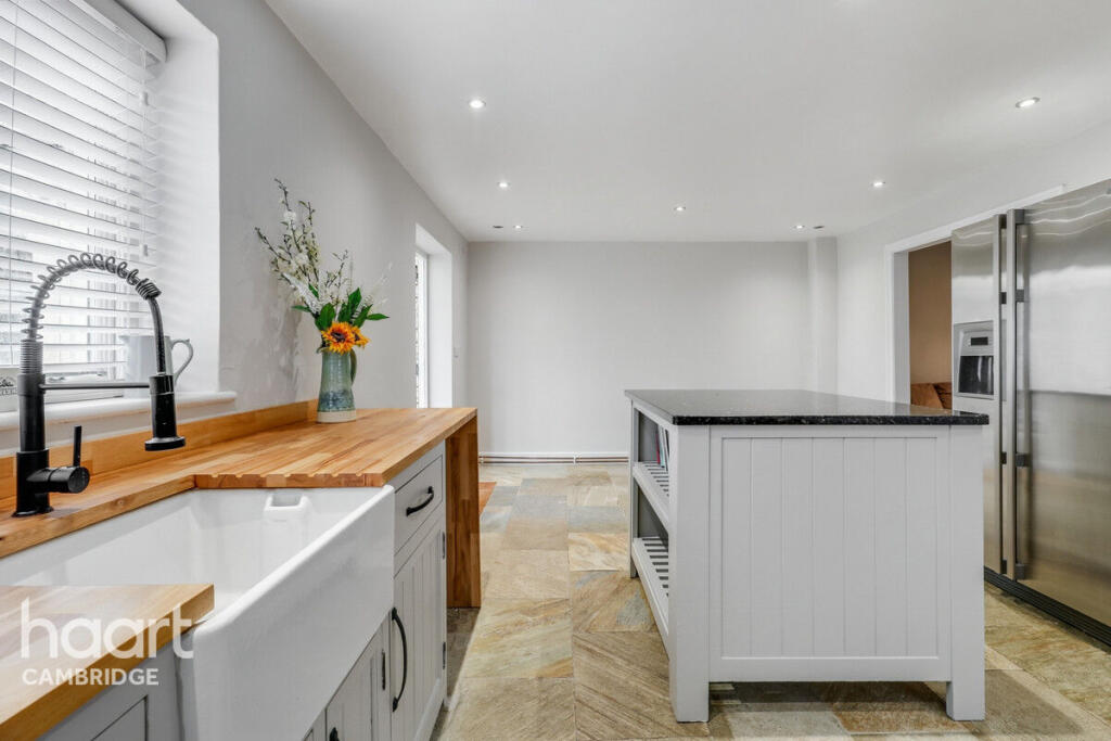
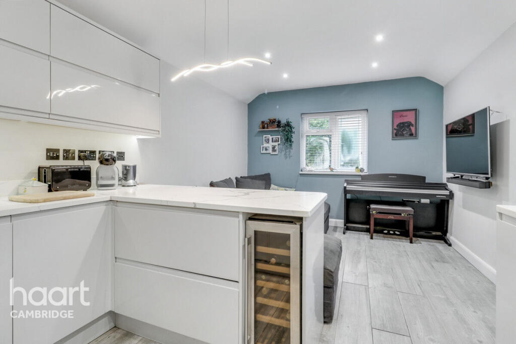
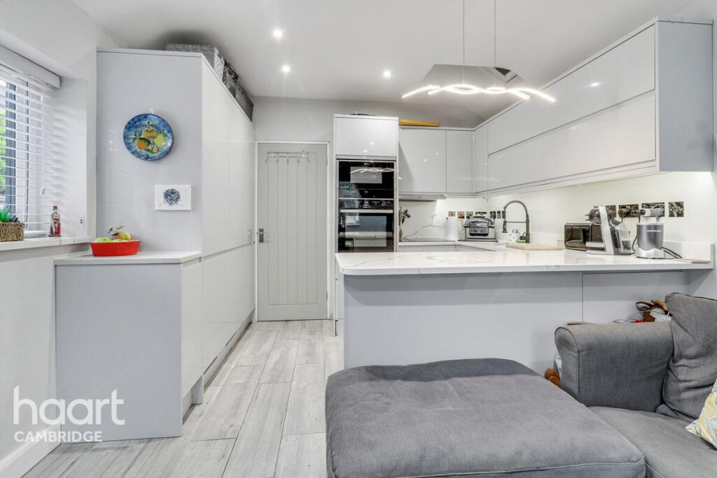
- kitchen modern
Floorplan Description
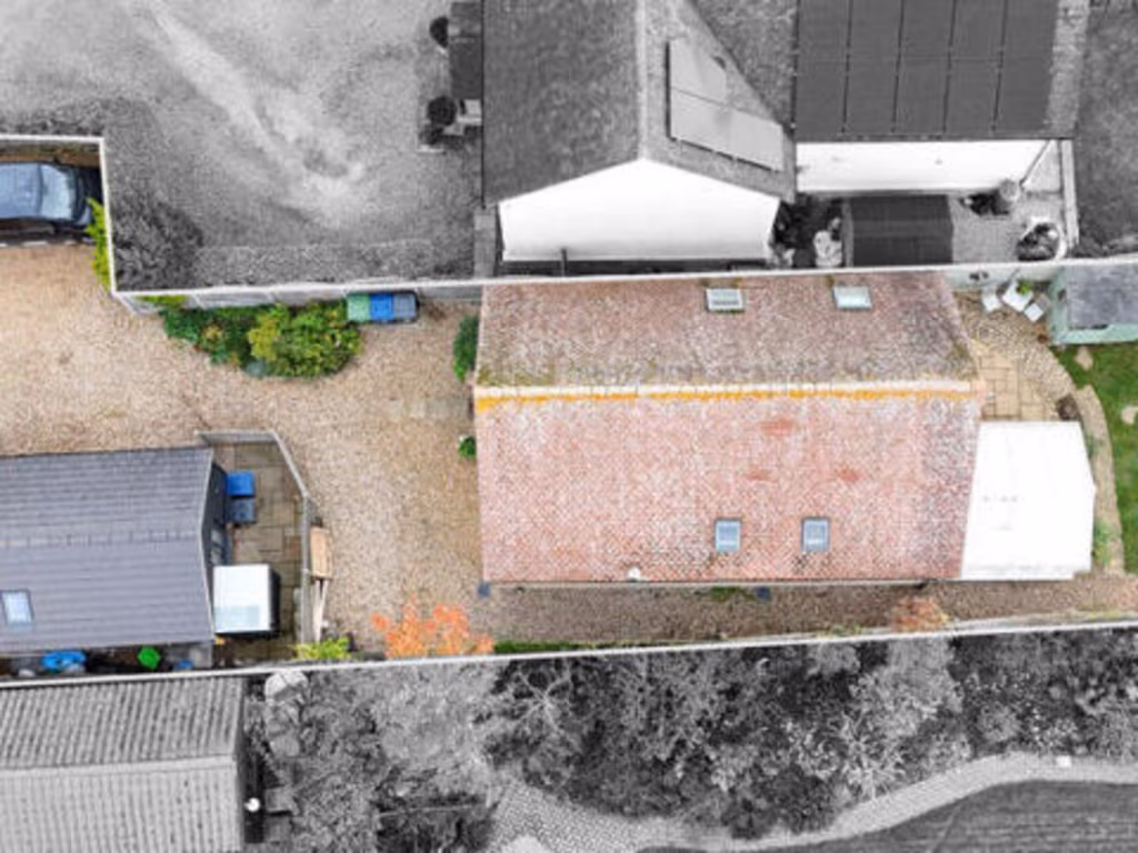
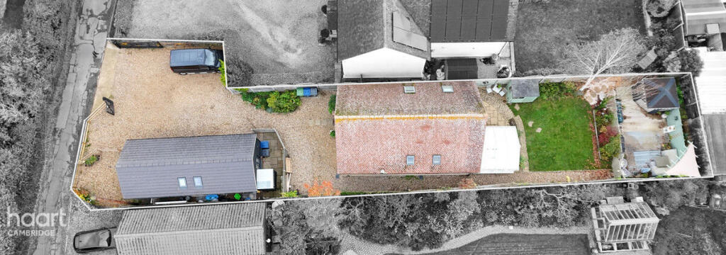
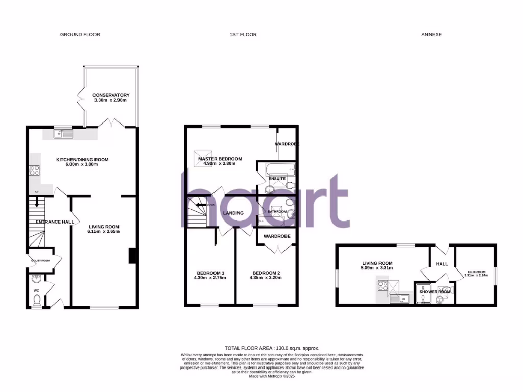
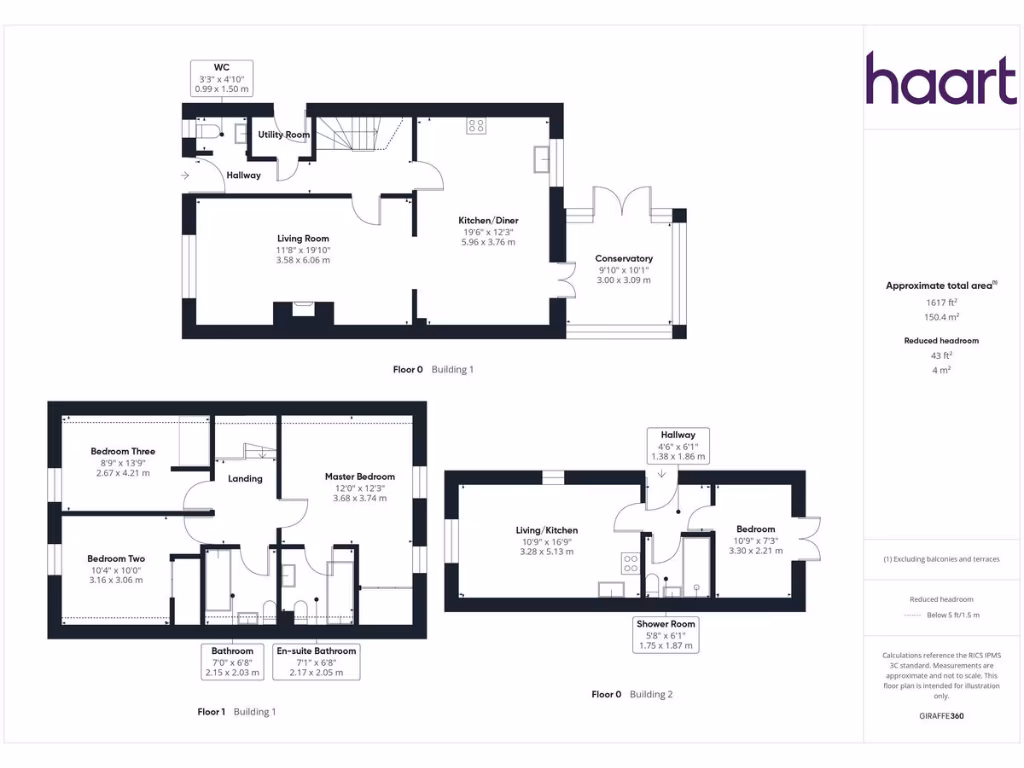
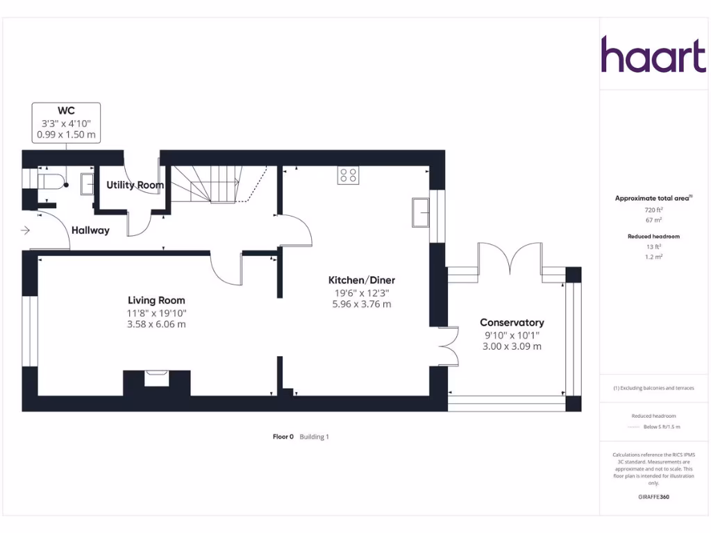
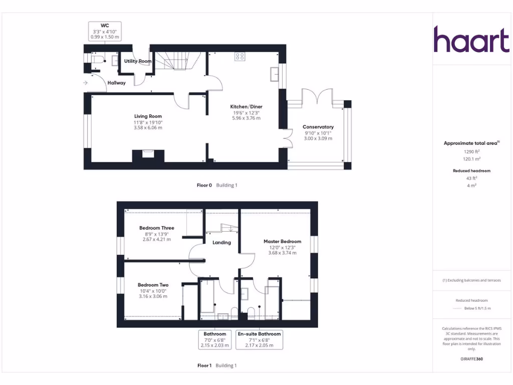
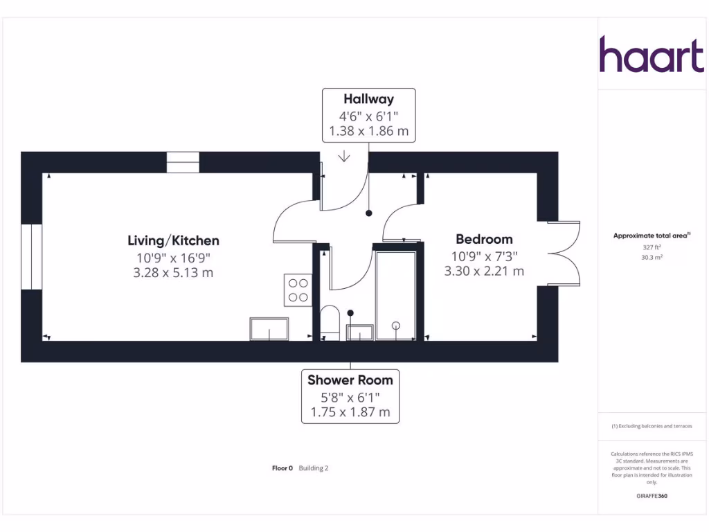
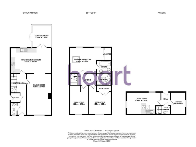
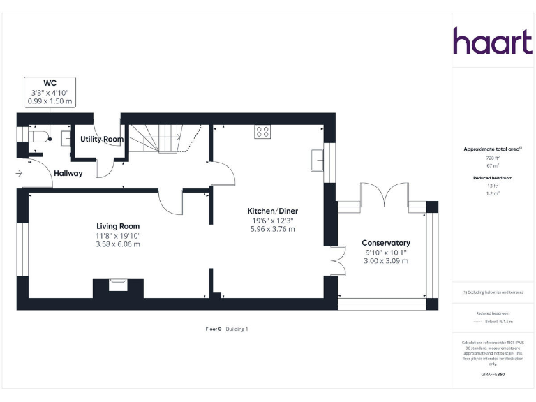
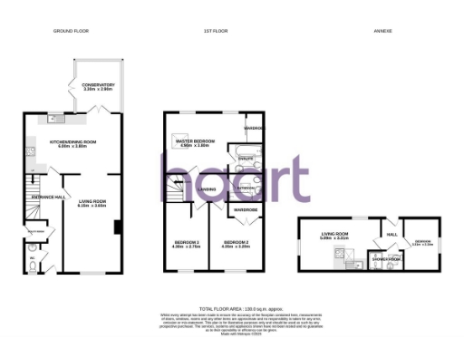
- Two-storey main house with separate annexe; total internal area shown.
- Floor plan showing two buildings with multiple rooms across Ground and First floors.
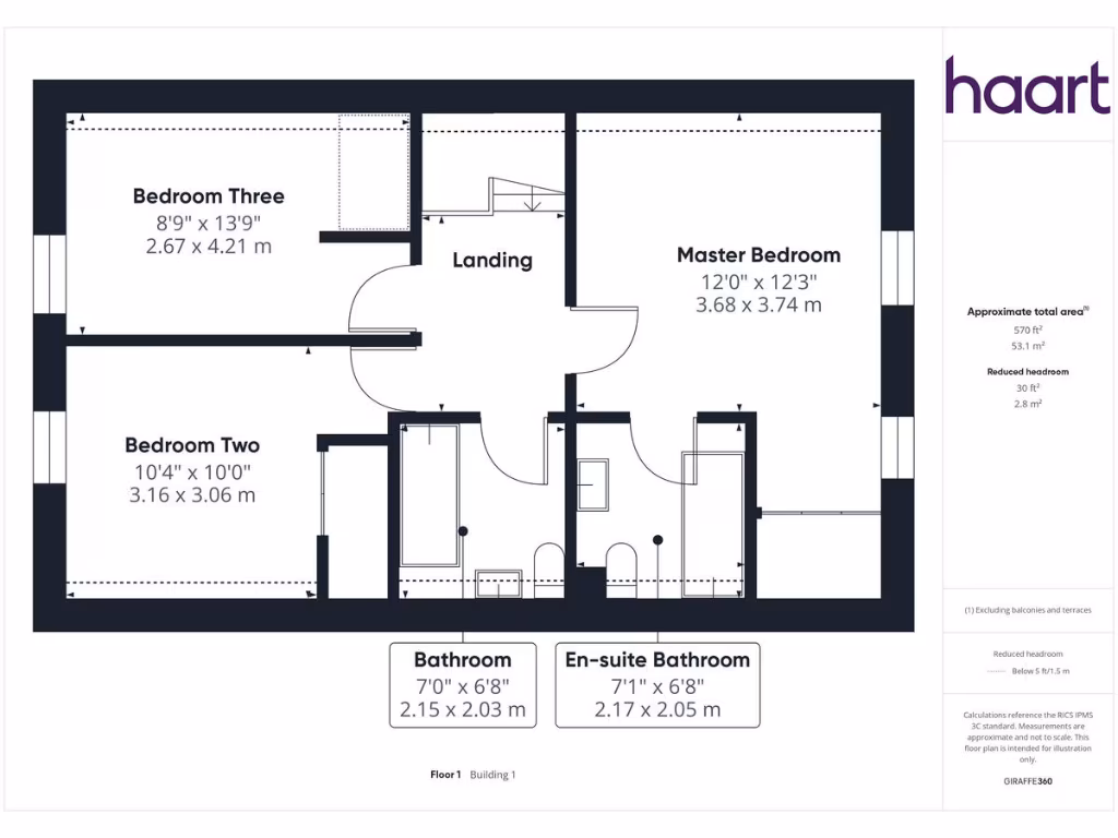
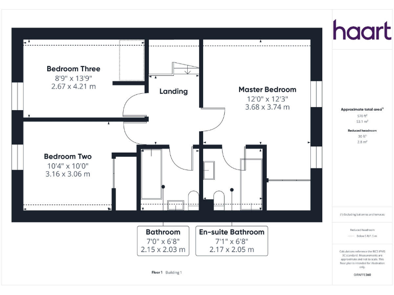
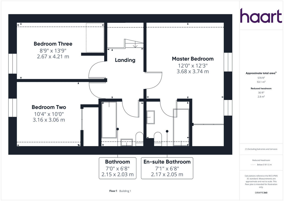
- First floor with three bedrooms and two bathrooms.
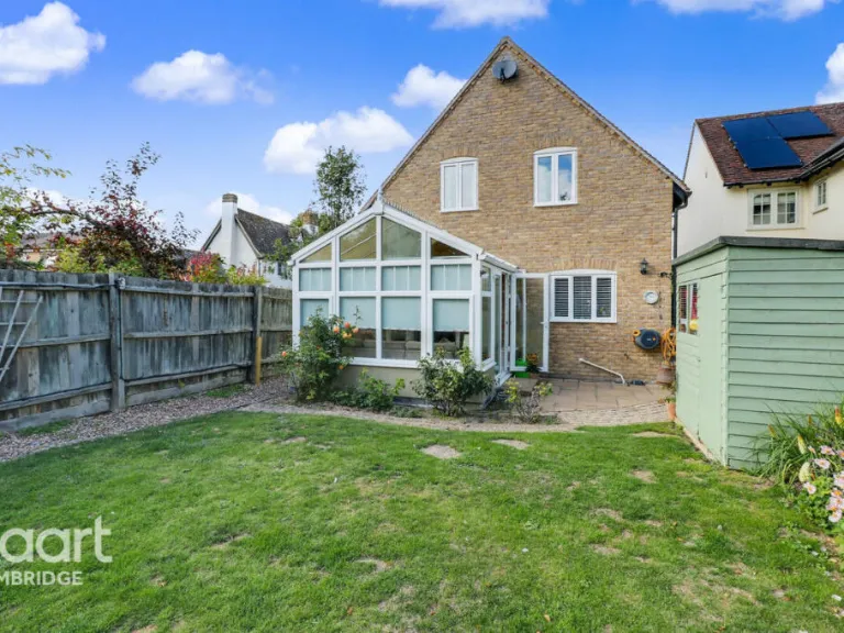
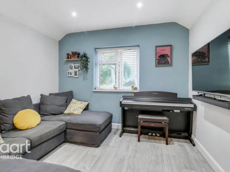
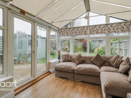
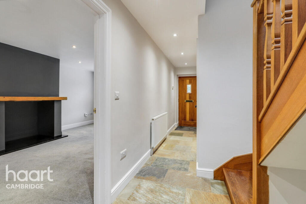
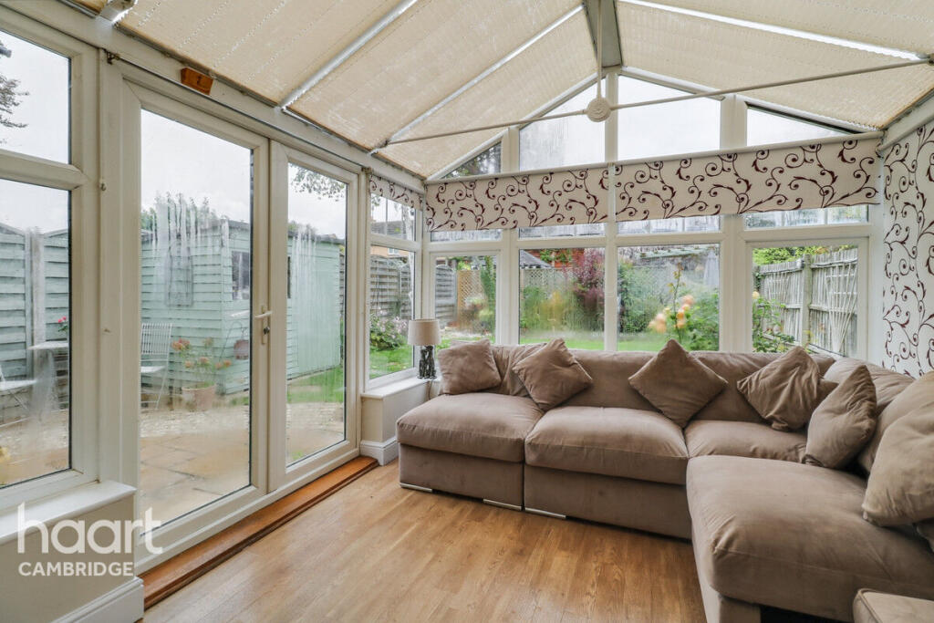
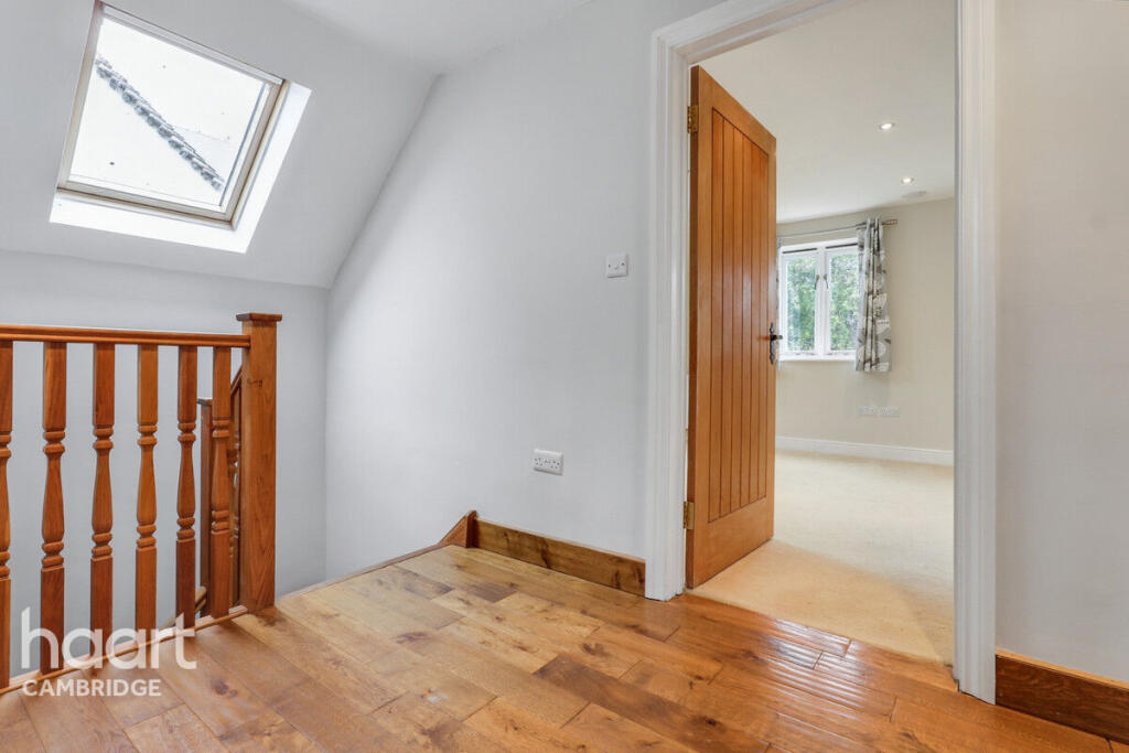
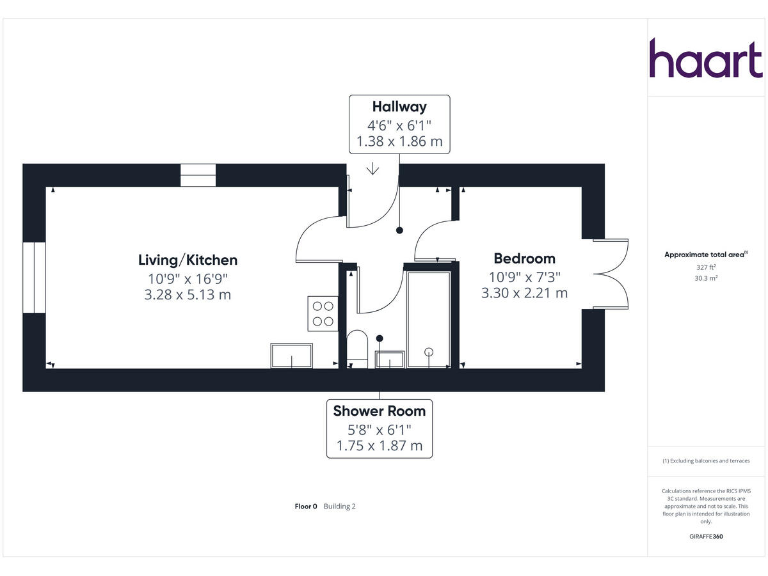
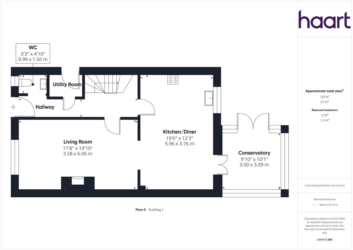
- Two-storey residential property with living room, kitchen/diner, conservatory and three bedrooms
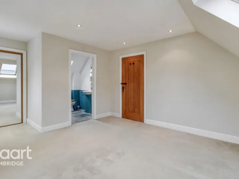
Rooms
- CONSERVATORY:
- KITCHEN/DINING ROOM:
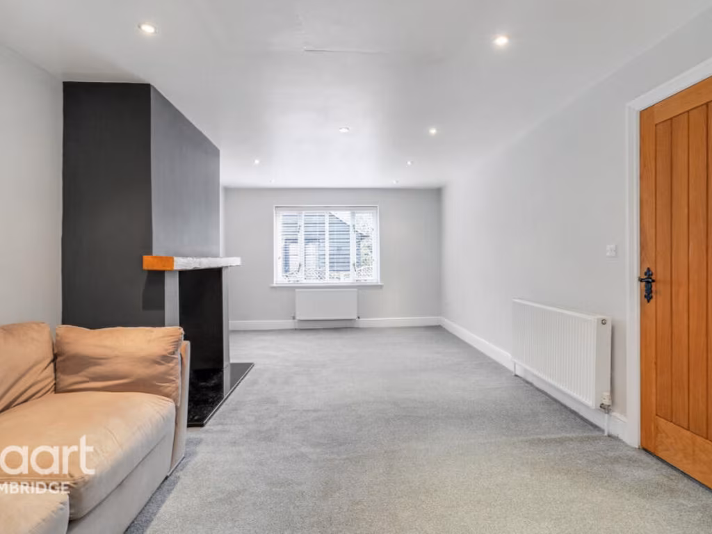
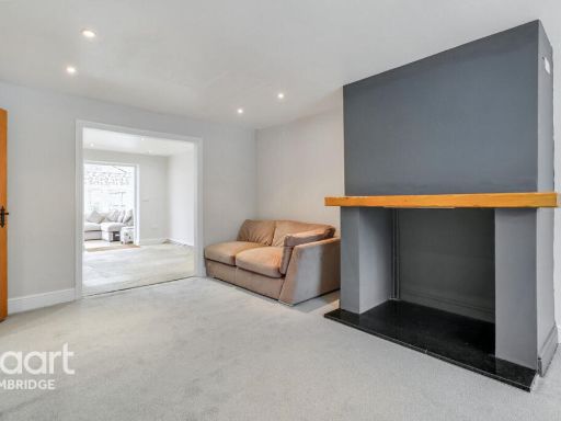
- LIVING ROOM:
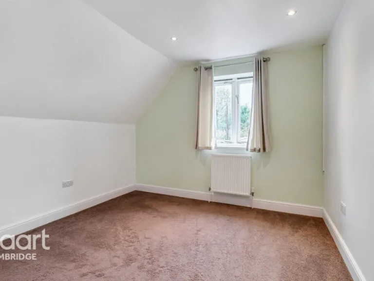
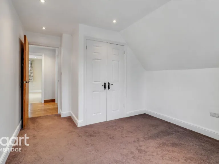
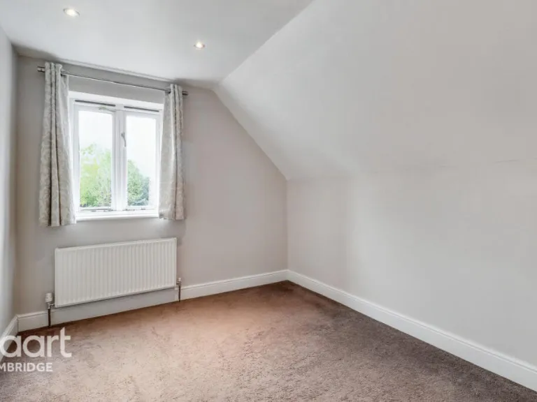
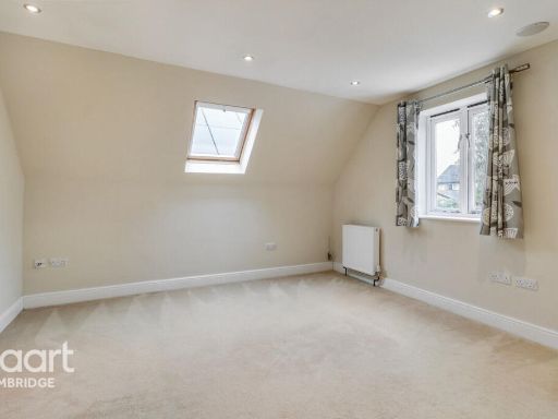
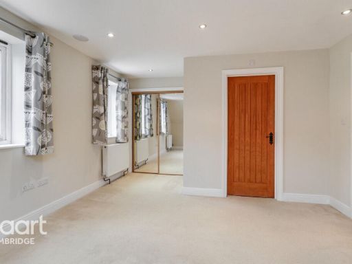
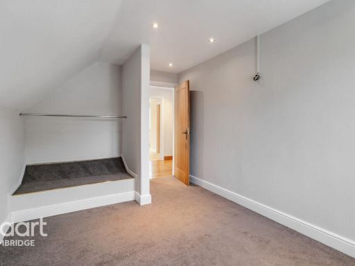
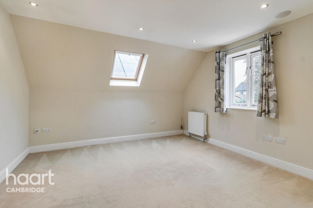
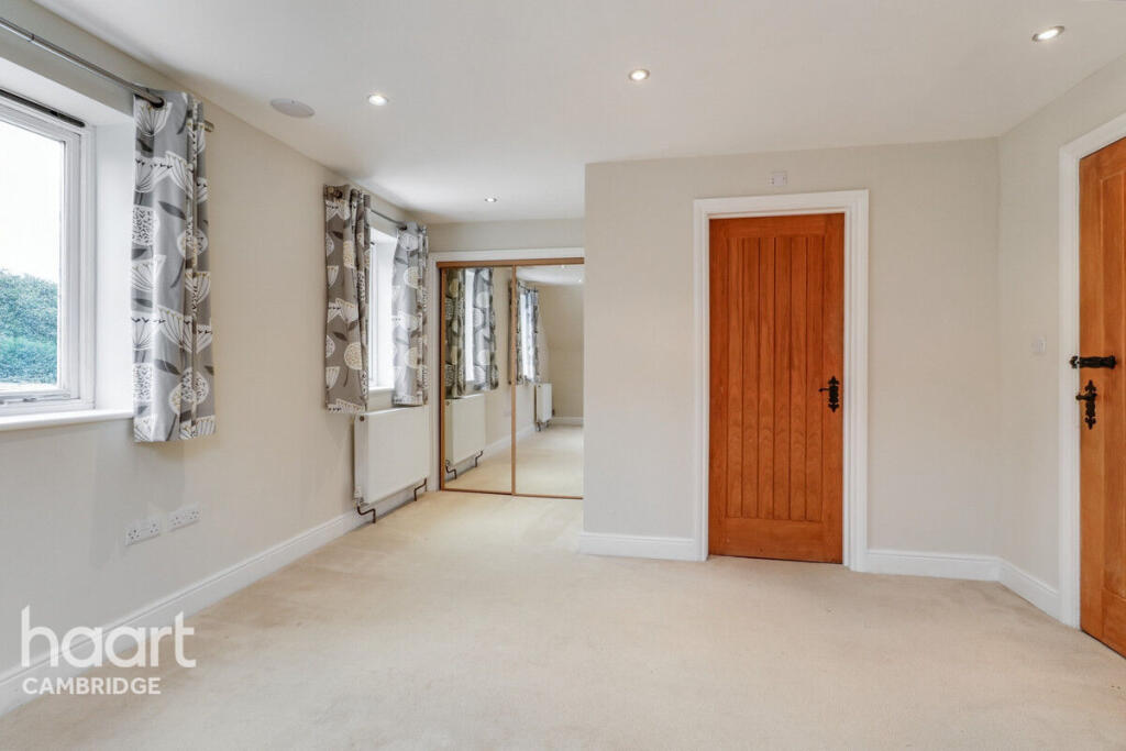
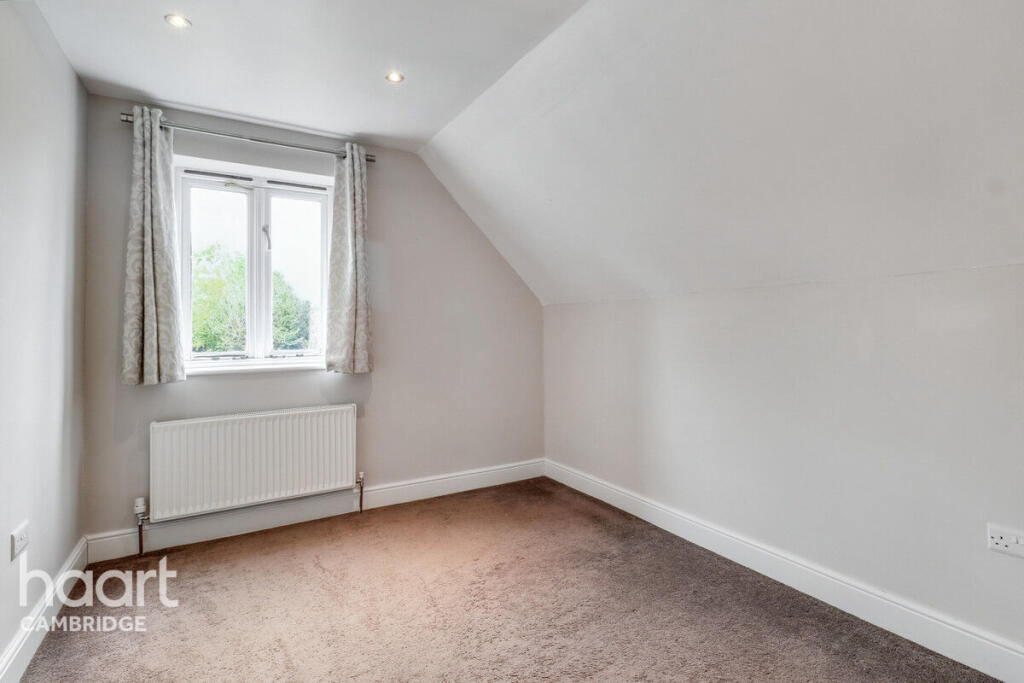
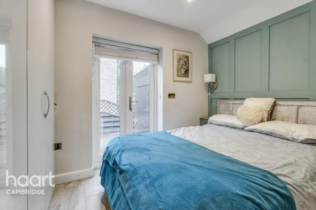
- MASTER BEDROOM:
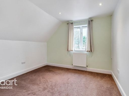
- BEDROOM 3:
- BEDROOM 2:
- LIVING ROOM:
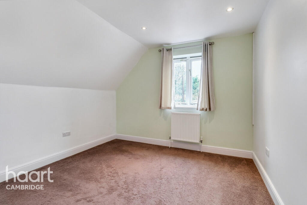
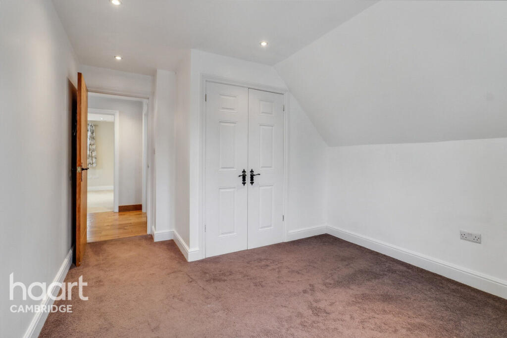
- BEDROOM:
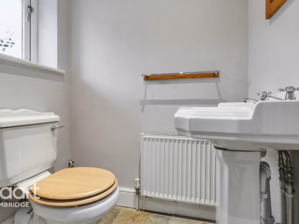
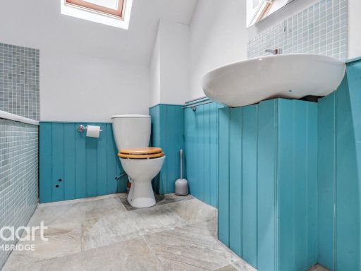
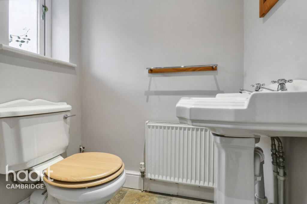
- WC:
- Living Room:
- Kitchen/Diner:
- Conservatory:
- Bedroom Three:
- Master Bedroom:
- Bedroom Two:
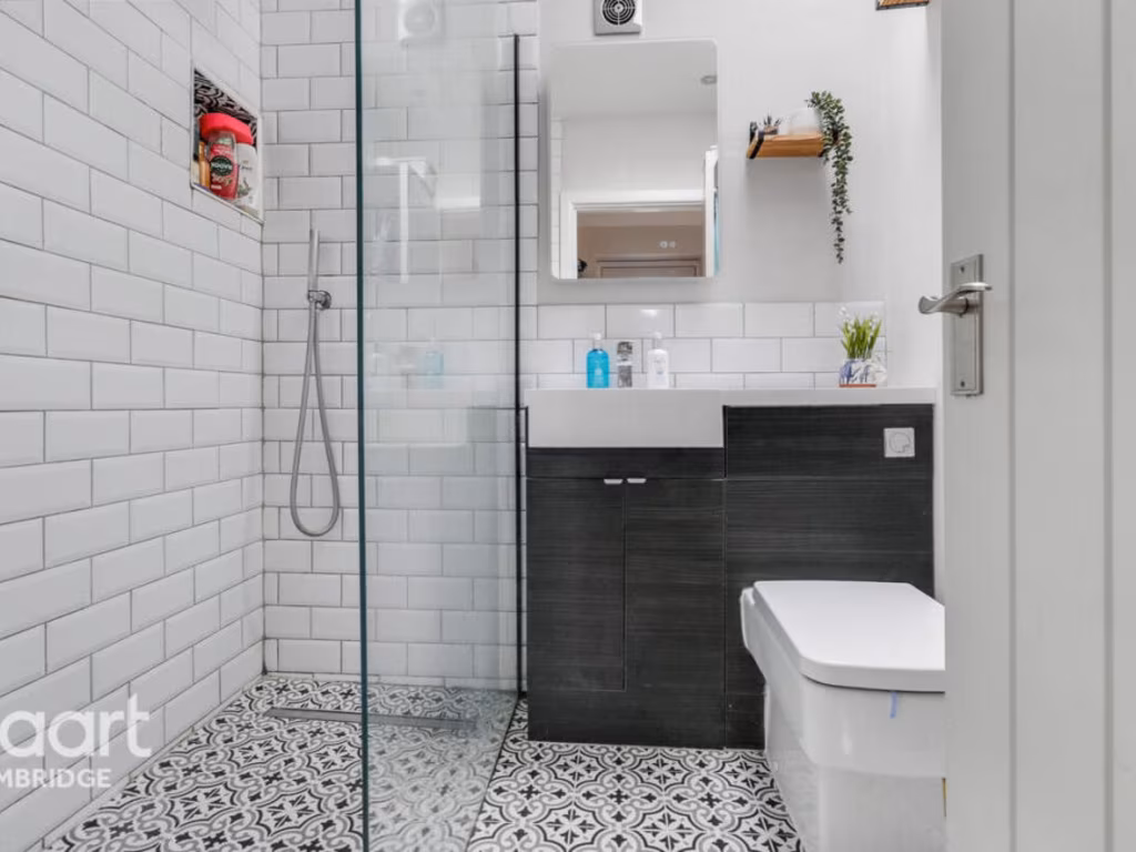
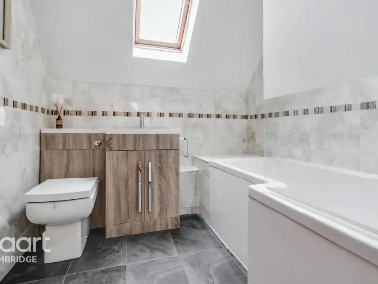
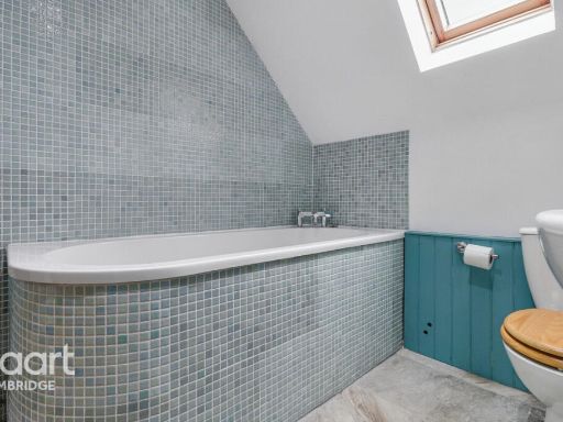
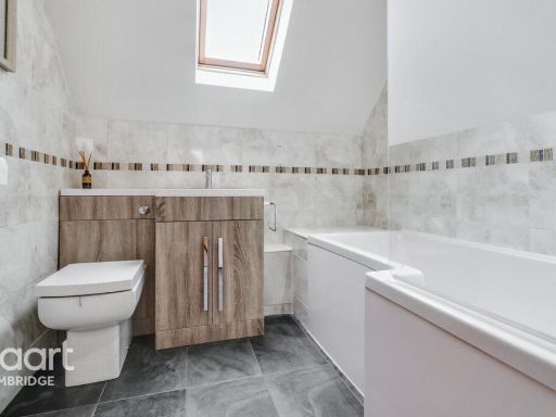
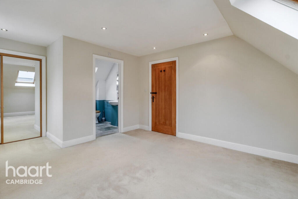
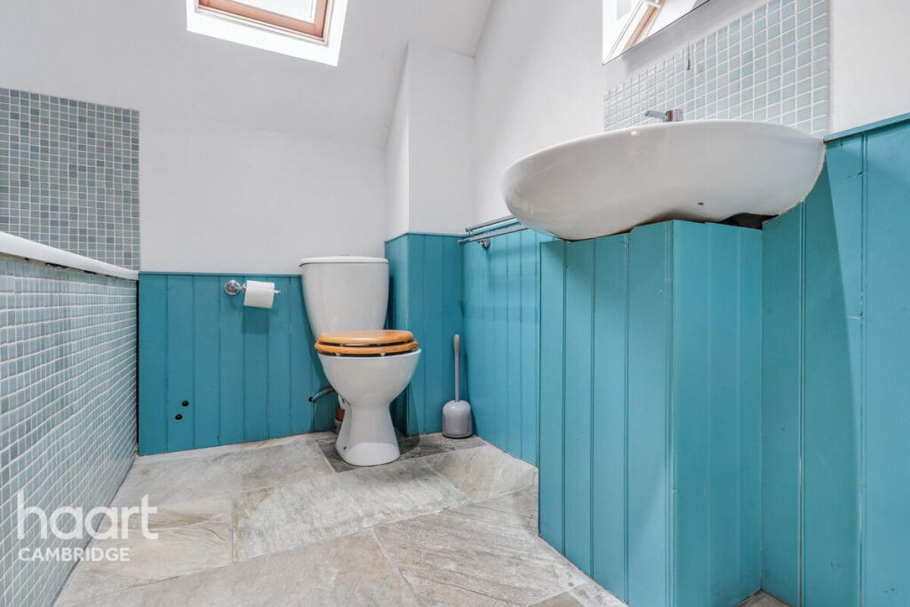
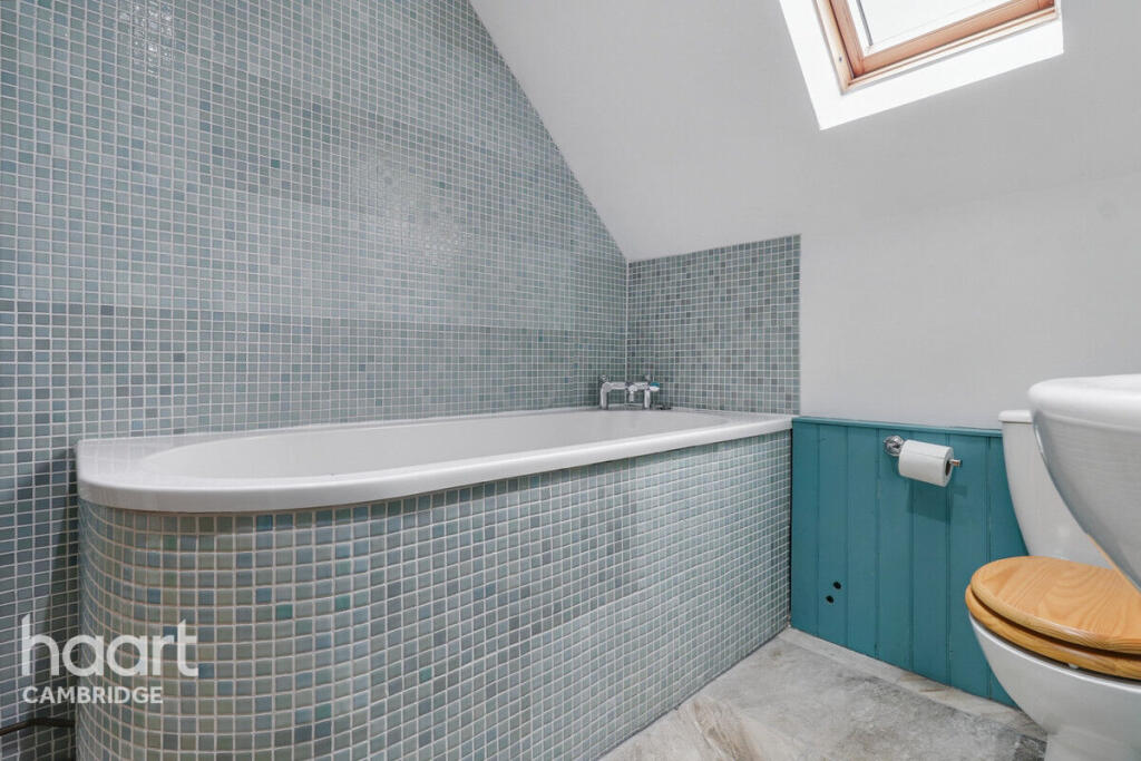
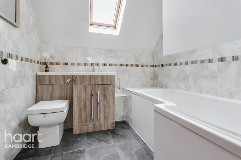
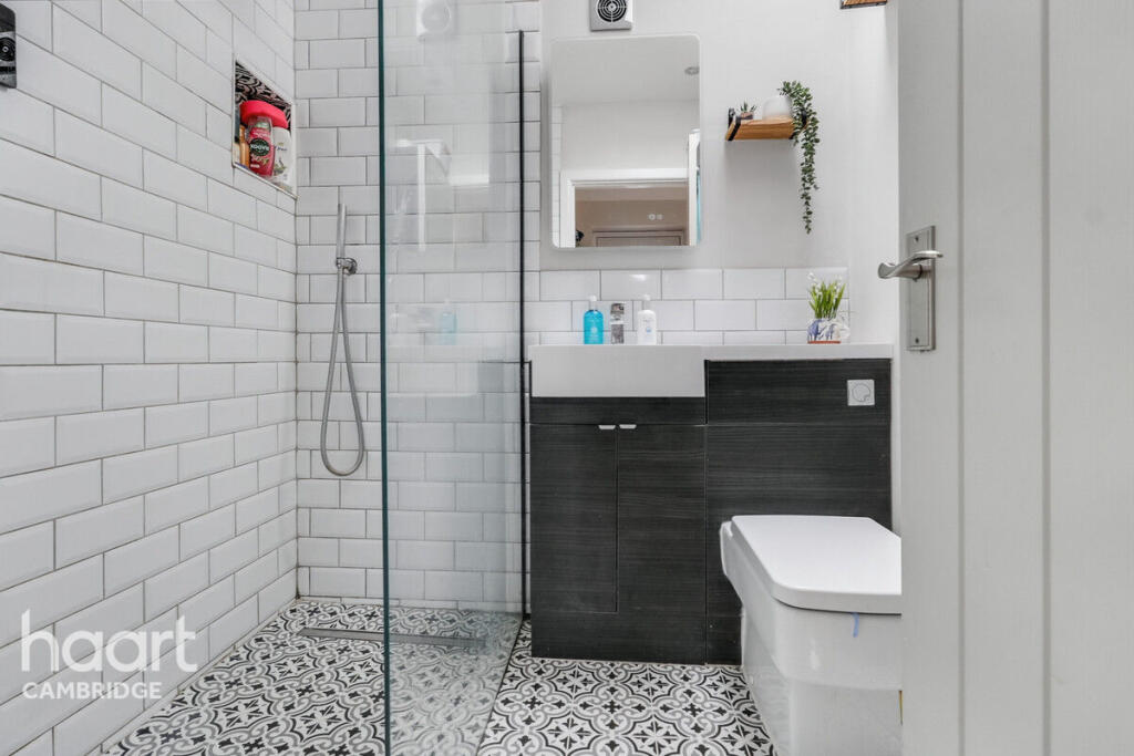
- Bathroom:
- En-suite Bathroom:
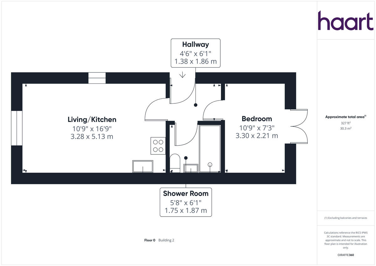
- Living/Kitchen:
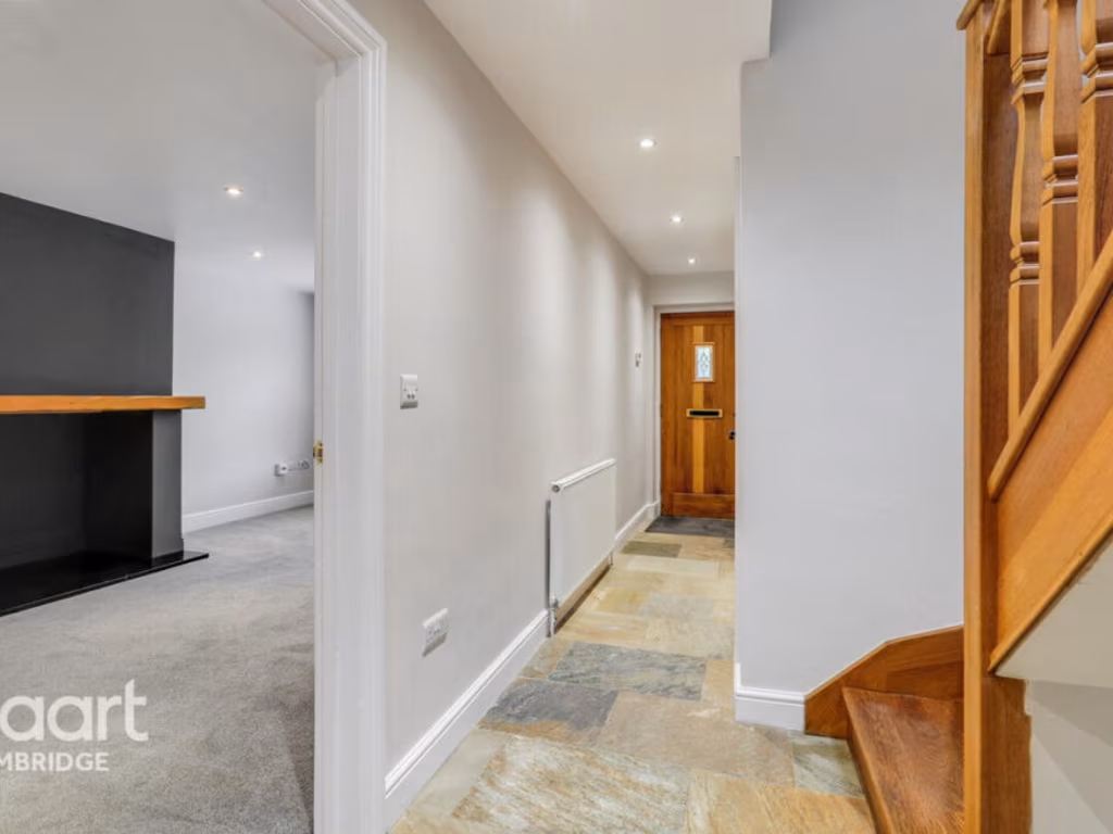
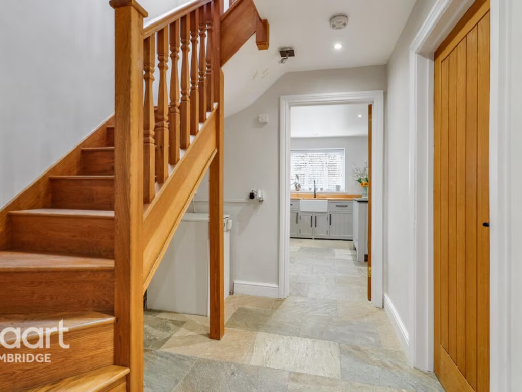
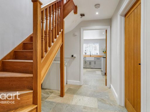
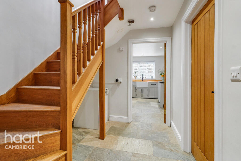
- Hallway:
- Bedroom:
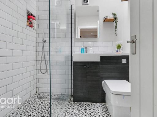
- Shower Room:
- WC:
- Utility Room:
- Hallway:
- Living Room:
- Kitchen/Diner:
- Conservatory:
- Bedroom Three:
- Bedroom Two:
- Master Bedroom:
- Bathroom:
- En-suite Bathroom:
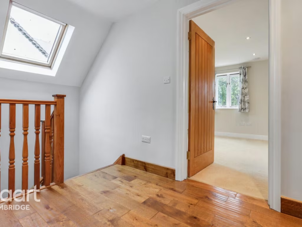
- Landing:
- WC:
- Living Room:
- Kitchen / Diner:
- Conservatory:
- Bedroom Three:
- Bedroom Two:
- Master Bedroom:
- Bathroom:
- En-suite Bathroom:
- Living/Kitchen:
- Hallway:
- Bedroom:
- Shower Room:
Textual Property Features
Detected Visual Features
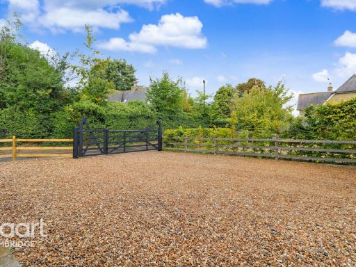
- modern country
- brick facade
- wood cladding
- gable roof
- two-story
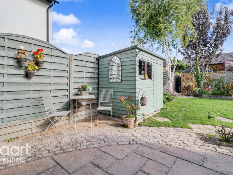
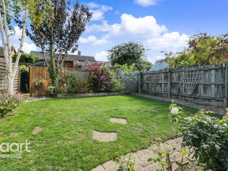
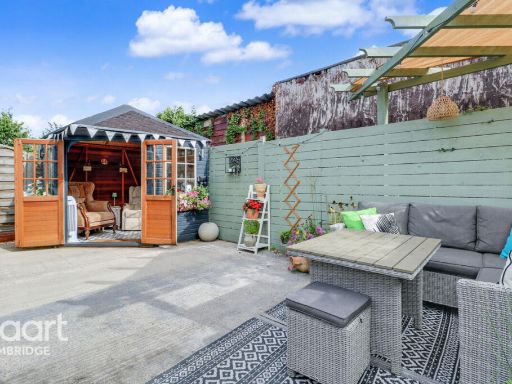
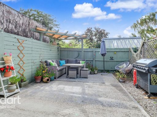
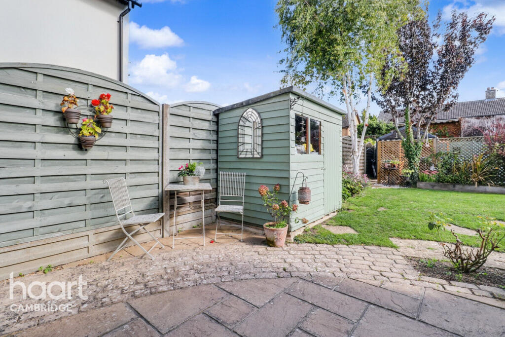
- garden
- garage
- gravel driveway
- modern
- kitchen
- island
- stainless steel
- tile floor
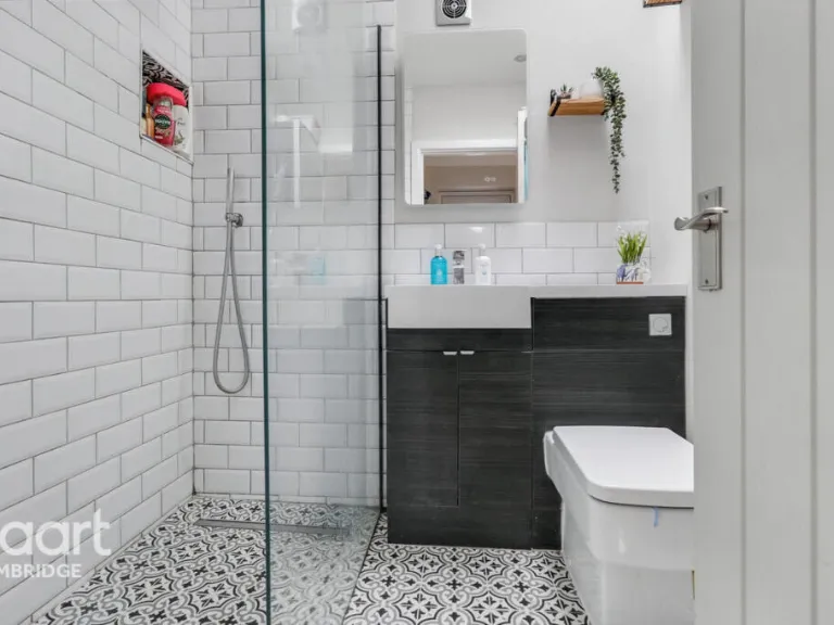
- white subway tiles
- wood counter
- neutral colors
- lighting
- open plan
EPC Details
- Fully double glazed
- Cavity wall, as built, insulated (assumed)
- Boiler and radiators, oil
- Low energy lighting in 31% of fixed outlets
- Solid, no insulation (assumed)
Nearby Schools
- The Icknield Primary School
- Meadow Primary School
- St Bede's Inter-Church School
- Ridgefield Primary School
- Marleigh Primary Academy
- Bottisham Village College
- The Netherhall School
- Queen Edith Primary School
- Landmark International School
- Bewick Bridge Community Primary School
- Swaffham Prior Church of England Primary School
- Fulbourn Primary School
- Queen Emma Primary School
- Cherry Hinton Church of England Voluntary Controlled Primary School
- The Spinney Primary School
- Coleridge Community College
- The Galfrid School
- Red Balloon Learner Centre - Cambridge
- Babraham CofE (VC) Primary School
- Cambridge Steiner School
- Cambridge International School
- Colville Primary School
- Great Wilbraham CofE Primary Academy
- St Philip's CofE Aided Primary School
- Teversham CofE VA Primary School
- Bottisham Community Primary School
- Fen Ditton Primary School
- Swaffham Bulbeck Church of England Primary School
Nearest General Shops
- Id: 9778141249
- Tags:
- Addr:
- City: Fulbourn
- Housenumber: 4b
- Street: High Street
- Name: Look Ahead
- Shop: hairdresser
- TagsNormalized:
- Lat: 52.183388
- Lon: 0.222184
- FullGeoHash: u120v59y3286
- PartitionGeoHash: u120
- Images:
- FoodStandards: null
- Distance: 3009.3
,- Id: 521577133
- Tags:
- Addr:
- City: Fulbourn
- Housenumber: 4
- Street: High Street
- Name: Woodland Wishes
- Shop: funeral_directors
- Website: https://woodlandwishes.co.uk/
- TagsNormalized:
- funeral
- funeral directors
- shop
- Lat: 52.1833693
- Lon: 0.2222372
- FullGeoHash: u120v59y4t04
- PartitionGeoHash: u120
- Images:
- FoodStandards: null
- Distance: 3006.8
,- Id: 9778141274
- Tags:
- Name: Ernest Doe & Sons Ltd
- Shop: agrarian
- TagsNormalized:
- Lat: 52.1887843
- Lon: 0.2283478
- FullGeoHash: u120vhwm8ys2
- PartitionGeoHash: u120
- Images:
- FoodStandards: null
- Distance: 2427.1
}
Nearest Grocery shops
- Id: 428843044
- Tags:
- Addr:
- City: Fulbourn
- Housenumber: 11
- Street: High Street
- Brand: Co-op Food
- Brand:wikidata: Q3277439
- Brand:wikipedia: en:Co-op Food
- Fhrs:
- Name: Co-op Food
- Operator: The Co-operative Group
- Operator:wikidata: Q117202
- Shop: convenience
- TagsNormalized:
- co-op
- co-op food
- food
- convenience
- shop
- Lat: 52.1835405
- Lon: 0.2214885
- FullGeoHash: u120v59r1j1b
- PartitionGeoHash: u120
- Images:
- FoodStandards:
- Id: 1432895
- FHRSID: 1432895
- LocalAuthorityBusinessID: 9137693
- BusinessName: Co-Operative Retail Services Ltd
- BusinessType: Retailers - supermarkets/hypermarkets
- BusinessTypeID: 7840
- AddressLine1: 11 High Street
- AddressLine2: null
- AddressLine3: Fulbourn
- AddressLine4: Cambridgeshire
- PostCode: CB21 5DH
- RatingValue: 5
- RatingKey: fhrs_5_en-GB
- RatingDate: 2021-03-19
- LocalAuthorityCode: 032
- LocalAuthorityName: South Cambridgeshire
- LocalAuthorityWebSite: http://www.scambs.gov.uk/
- LocalAuthorityEmailAddress: commercial.envhealth@scambs.gov.uk
- Scores:
- Hygiene: 5
- Structural: 5
- ConfidenceInManagement: 0
- NewRatingPending: false
- Geocode:
- Longitude: 0.22147020000000
- Latitude: 52.18345400000000
- Distance: 3047.1
,- Id: 128419614
- Tags:
- Addr:
- City: Six Mile Bottom
- Housename: The Old Post Office
- Postcode: CB8 0UA
- Street: London Road
- Brand: Spar
- Brand:wikidata: Q610492
- Brand:wikipedia: en:Spar (retailer)
- Building: retail
- Name: Spar
- Opening_hours: Mo-Su 07:00-21:00
- Shop: convenience
- TagsNormalized:
- spar
- retail
- convenience
- shop
- Lat: 52.1878954
- Lon: 0.306792
- FullGeoHash: u120yux2sbbd
- PartitionGeoHash: u120
- Images:
- FoodStandards: null
- Distance: 3044.9
,- Id: 127563499
- Tags:
- Amenity: post_office
- Building: yes
- Name: Great Wilbraham Post Office
- Shop: convenience
- TagsNormalized:
- office
- post office
- convenience
- shop
- Lat: 52.1953027
- Lon: 0.2665384
- FullGeoHash: u120yjf5dv9k
- PartitionGeoHash: u120
- Images:
- FoodStandards: null
- Distance: 304.5
}
Nearest Supermarkets
- Id: 143735534
- Tags:
- Addr:
- City: Cambridge
- Full: Adkins Corner, Perne Road
- Housenumber: 6
- Postcode: CB1 3RU
- Street: Adkins Corner
- Brand: Co-op Food
- Brand:wikidata: Q3277439
- Brand:wikipedia: en:Co-op Food
- Building: retail
- Name: Co-op Food
- Note: Sign suggests being redeveloped as a Co-Op. Not sure if the shops to west will survive. Update - Now opened 21/11/2019
- Old_name: Budgens
- Old_shop: supermarket
- Opening_hours: Mo-Sa 07:00-22:00; Su 10:00-16:00
- Shop: supermarket
- Source: survey
- TagsNormalized:
- co-op
- co-op food
- food
- retail
- supermarket
- shop
- Lat: 52.1871331
- Lon: 0.1531883
- FullGeoHash: u120gkrs1d9q
- PartitionGeoHash: u120
- Images:
- FoodStandards: null
- Distance: 7525.7
,- Id: 132570256
- Tags:
- Addr:
- City: Cambridge
- Postcode: CB1 3HP
- Street: Brooks Road
- Brand: Sainsbury's
- Brand:wikidata: Q152096
- Brand:wikipedia: en:Sainsbury's
- Building: retail
- Name: Sainsbury's Coldhams Lane
- Nohousenumber: yes
- Opening_hours: Mo-Fr 07:00-23:00; Sa 07:00-22:00; Su 10:00-16:00
- Operator: Sainsbury's Supermarkets Ltd
- Phone: +44 1223 246183
- Shop: supermarket
- Source: https://stores.sainsburys.co.uk/
- Website: https://stores.sainsburys.co.uk/0815/coldhams-lane
- Wheelchair: yes
- TagsNormalized:
- sainsburys
- retail
- supermarket
- shop
- Lat: 52.1991072
- Lon: 0.1575248
- FullGeoHash: u120gwd9ydg5
- PartitionGeoHash: u120
- Images:
- FoodStandards: null
- Distance: 7221.5
,- Id: 3753306
- Tags:
- Addr:
- City: Cambridge
- Postcode: CB1 9BF
- Brand: Tesco
- Brand:wikidata: Q487494
- Brand:wikipedia: en:Tesco
- Building: yes
- Contact:
- Website: https://www.tesco.com/store-locator/cambridge/yarrow-rd
- Landuse: retail
- Name: Tesco
- Operator: Tesco Stores Ltd
- Shop: supermarket
- Wheelchair: yes
- TagsNormalized:
- tesco
- retail
- supermarket
- shop
- Lat: 52.1868262
- Lon: 0.1880219
- FullGeoHash: u120uk2fm1x2
- PartitionGeoHash: u120
- Images:
- FoodStandards: null
- Distance: 5171.7
}
Nearest Religious buildings
- Id: 127563465
- Tags:
- Addr:
- City: Cambridge
- Country: GB
- Housenumber: 84
- Postcode: CB21 5JG
- Street: Angle End
- Amenity: dentist
- Building: yes
- Healthcare: dentist
- Name: Chapel Dental
- Phone: +44 1223 811844
- Website: http://www.chapel.dental/
- TagsNormalized:
- dentist
- health
- healthcare
- chapel
- dental
- Lat: 52.1971006
- Lon: 0.2649906
- FullGeoHash: u120yn0ynsz3
- PartitionGeoHash: u120
- Images:
- FoodStandards: null
- Distance: 414.2
,- Id: 125954127
- Tags:
- Amenity: grave_yard
- Name: Great Wilbraham Churchyard
- TagsNormalized:
- Lat: 52.1965416
- Lon: 0.2645209
- FullGeoHash: u120yn0dgu94
- PartitionGeoHash: u120
- Images:
- FoodStandards: null
- Distance: 345.4
,- Id: 125954122
- Tags:
- Amenity: place_of_worship
- Building: church
- Denomination: anglican
- Name: Saint Nicholas (Great Wilbraham Parish Church)
- Religion: christian
- Wikidata: Q17550764
- TagsNormalized:
- place of worship
- church
- anglican
- parish
- christian
- Lat: 52.196378
- Lon: 0.2641402
- FullGeoHash: u120yn03fyj4
- PartitionGeoHash: u120
- Images:
- FoodStandards: null
- Distance: 321.2
}
Nearest Medical buildings
- Id: 2282140002
- Tags:
- Addr:
- Amenity: pharmacy
- Name: Bottisham Pharmacy
- TagsNormalized:
- Lat: 52.2234976
- Lon: 0.2579586
- FullGeoHash: u121jfgzfvec
- PartitionGeoHash: u121
- Images:
- FoodStandards: null
- Distance: 3347
,- Id: 521576787
- Tags:
- Amenity: doctors
- Name: Fulbourn Health Centre
- TagsNormalized:
- doctor
- doctors
- health
- health centre
- Lat: 52.1825621
- Lon: 0.2179228
- FullGeoHash: u120ugw9myx5
- PartitionGeoHash: u120
- Images:
- FoodStandards: null
- Distance: 3313.2
,- Id: 524414108
- Tags:
- Addr:
- Postcode: CB21 5HE
- Street: Cox's Drove
- Amenity: veterinary
- Building: yes
- Name: Cambridge Cat Clinic
- Website: https://www.cambridgecatclinic.co.uk/
- TagsNormalized:
- Lat: 52.1874337
- Lon: 0.2160791
- FullGeoHash: u120uummg4b2
- PartitionGeoHash: u120
- Images:
- FoodStandards: null
- Distance: 3276.3
,- Id: 521577112
- Tags:
- Addr:
- City: Fulbourn
- Housenumber: 2
- Street: High Street
- Amenity: pharmacy
- Healthcare: pharmacy
- Name: Village Pharmacy
- TagsNormalized:
- Lat: 52.1833487
- Lon: 0.2222859
- FullGeoHash: u120v59y59k2
- PartitionGeoHash: u120
- Images:
- FoodStandards: null
- Distance: 3004.6
}
Nearest Airports
- Id: 495488524
- Tags:
- Aerodrome: international
- Aerodrome:type: public
- Aeroway: aerodrome
- Alt_name: Stansted
- Iata: STN
- Icao: EGSS
- Is_in: Essex,England,UK
- Name: London Stansted Airport
- Ref: STN
- Source: Gagravarr_Airports
- Website: https://www.stanstedairport.com/
- Wikidata: Q8709
- Wikipedia: en:London Stansted Airport
- TagsNormalized:
- airport
- international airport
- Lat: 51.8869677
- Lon: 0.2429264
- FullGeoHash: u10pjt8zkxg4
- PartitionGeoHash: u10p
- Images:
- FoodStandards: null
- Distance: 34119.6
}
Nearest Leisure Facilities
- Id: 128319131
- Tags:
- TagsNormalized:
- Lat: 52.1970073
- Lon: 0.263559
- FullGeoHash: u120vypvt77u
- PartitionGeoHash: u120
- Images:
- FoodStandards: null
- Distance: 384.4
,- Id: 891662163
- Tags:
- Leisure: pitch
- Sport: cricket
- TagsNormalized:
- pitch
- leisure
- cricket
- sports
- Lat: 52.1959047
- Lon: 0.2654914
- FullGeoHash: u120yjcr4mue
- PartitionGeoHash: u120
- Images:
- FoodStandards: null
- Distance: 307.6
,- Id: 8455007383
- Tags:
- Leisure: picnic_table
- Material: wood
- TagsNormalized:
- picnic
- picnic table
- leisure
- Lat: 52.1949477
- Lon: 0.2650655
- FullGeoHash: u120yjc187rn
- PartitionGeoHash: u120
- Images:
- FoodStandards: null
- Distance: 204.6
,- Id: 127972776
- Tags:
- TagsNormalized:
- Lat: 52.1948524
- Lon: 0.2651866
- FullGeoHash: u120yjc1539q
- PartitionGeoHash: u120
- Images:
- FoodStandards: null
- Distance: 202.5
,- Id: 8455007381
- Tags:
- Leisure: picnic_table
- Material: wood
- TagsNormalized:
- picnic
- picnic table
- leisure
- Lat: 52.1949221
- Lon: 0.2649155
- FullGeoHash: u120yjbckyxq
- PartitionGeoHash: u120
- Images:
- FoodStandards: null
- Distance: 195.8
}
Nearest Tourist attractions
- Id: 510772839
- Tags:
- Addr:
- Housename: The Gate Lodge
- Housenumber: 2
- Street: Hinton Road
- Name: The Gate Lodge
- Tourism: guest_house
- TagsNormalized:
- Lat: 52.185263
- Lon: 0.2098127
- FullGeoHash: u120uu0c0ype
- PartitionGeoHash: u120
- Images:
- FoodStandards: null
- Distance: 3747.3
,- Id: 957496252
- Tags:
- Caravans: yes
- Cash_withdrawal:
- Description: adults only
- Motorhomes: yes
- Name: Bounds Campsite
- Operator: Camping and Caravanning Club
- Phone: +44 7761 495903
- Shower: yes
- Tents: yes
- Toilets: yes
- Tourism: camp_site
- Website: https://www.boundscampsite.co.uk/
- TagsNormalized:
- Lat: 52.1782072
- Lon: 0.220196
- FullGeoHash: u120v4b24fy1
- PartitionGeoHash: u120
- Images:
- FoodStandards: null
- Distance: 3386.2
,- Id: 3906381928
- Tags:
- Addr:
- City: Bottisham
- Postcode: CB25 9BU
- Street: Wilbraham Road
- Museum: history
- Name: Bottisham Airfield Museum
- Opening_hours: Su 10:30-16:00
- Tourism: museum
- Website: https://www.bottishamairfieldmuseum.org.uk/
- TagsNormalized:
- Lat: 52.217223
- Lon: 0.264478
- FullGeoHash: u121n1be6gch
- PartitionGeoHash: u121
- Images:
- FoodStandards: null
- Distance: 2632.7
}
Nearest Hotels
- Id: 496339910
- Tags:
- Addr:
- Country: GB
- Housenumber: 2
- Postcode: CB4 0AE
- Street: Cambridge Square
- Brand: Novotel
- Brand:wikidata: Q420545
- Brand:wikipedia: en:Novotel
- Building: commercial
- Fhrs:
- Name: Novotel
- Tourism: hotel
- TagsNormalized:
- Lat: 52.2244108
- Lon: 0.1580323
- FullGeoHash: u1215e5j4rv3
- PartitionGeoHash: u121
- Images:
- FoodStandards: null
- Distance: 7937.9
,- Id: 372880457
- Tags:
- Addr:
- City: Cambridge
- Housenumber: 15-17
- Postcode: CB1 3LH
- Street: Coldham's Business Park
- Name: Holiday Inn Express
- Tourism: hotel
- Wheelchair: yes
- TagsNormalized:
- Lat: 52.1945519
- Lon: 0.1646274
- FullGeoHash: u120gtxzk1ej
- PartitionGeoHash: u120
- Images:
- FoodStandards: null
- Distance: 6712.3
,- Id: 18352363
- Tags:
- Brand: Best Western
- Brand:wikidata: Q830334
- Brand:wikipedia: en:Best Western
- Name: Quy Mill Hotel
- Operator: Best Western
- Tourism: hotel
- TagsNormalized:
- Lat: 52.215869
- Lon: 0.2074409
- FullGeoHash: u121h9x53xrp
- PartitionGeoHash: u121
- Images:
- FoodStandards: null
- Distance: 4531.4
}
Tags
- modern country
- brick facade
- wood cladding
- gable roof
- two-story
- garden
- garage
- gravel driveway
- modern
- kitchen
- island
- stainless steel
- tile floor
- white subway tiles
- wood counter
- neutral colors
- lighting
- open plan
Local Market Stats
- Average Price/sqft: £393
- Avg Income: £57100
- Rental Yield: 3.3%
- Social Housing: 12%
- Planning Success Rate: 94%
Similar Properties
 3 bedroom semi-detached house for sale in Mill Road, Great Wilbraham, Cambridge, Cambridgeshire, CB21 — £625,000 • 3 bed • 1 bath • 1934 ft²
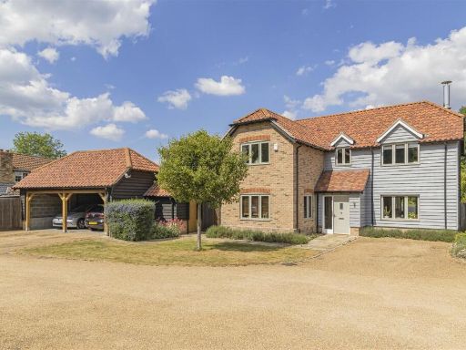 4 bedroom detached house for sale in Chapel Meadows, Great Wilbraham, Cambridge, CB21 — £1,100,000 • 4 bed • 3 bath • 2152 ft²
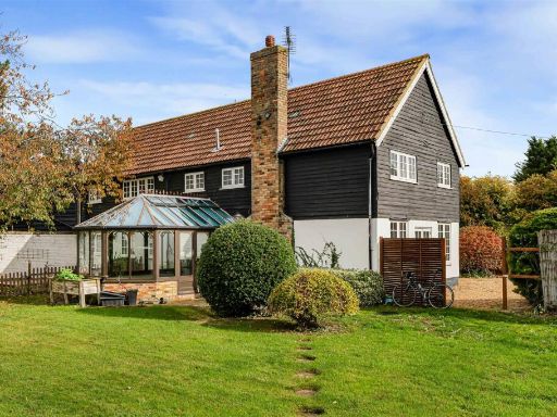 5 bedroom detached house for sale in Mill Road, Great Wilbraham, CB21 — £900,000 • 5 bed • 3 bath • 2947 ft²
 4 bedroom detached house for sale in Church Road, Little Wilbraham, Cambridge, CB21 — £700,000 • 4 bed • 2 bath • 1860 ft²
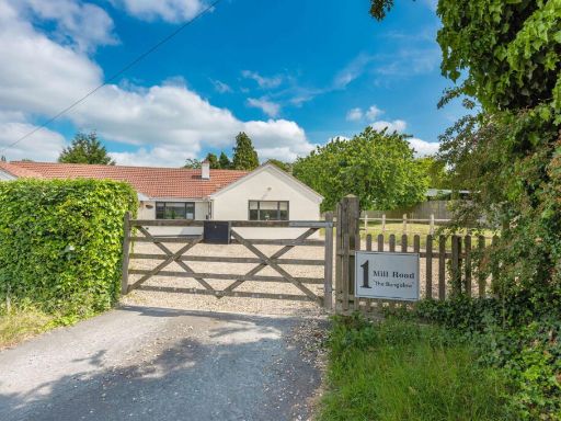 4 bedroom detached bungalow for sale in Mill Road, Great Wilbraham, Cambridge, SAT NAV CB21 5JW, CB21 — £900,000 • 4 bed • 3 bath • 1981 ft²
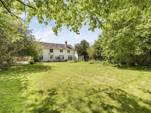 5 bedroom detached house for sale in High Green, Great Shelford, CB22 — £1,250,000 • 5 bed • 3 bath • 2610 ft²
Meta
- {
"@context": "https://schema.org",
"@type": "Residence",
"name": "4 bedroom detached house for sale in Toft Lane, Great Wilbr…",
"description": "",
"url": "https://propertypiper.co.uk/property/14f115b7-6d05-4d48-9f0e-612f5492d696",
"image": "https://image-a.propertypiper.co.uk/d8fa44a8-7680-413a-9cea-c2f3055885e5-1024.jpeg",
"address": {
"@type": "PostalAddress",
"streetAddress": "Toft Lane, Great Wilbraham, Cambridge",
"postalCode": "CB21 5JH",
"addressLocality": "South Cambridgeshire",
"addressRegion": "South East Cambridgeshire",
"addressCountry": "England"
},
"geo": {
"@type": "GeoCoordinates",
"latitude": 52.1935619,
"longitude": 0.2630907
},
"numberOfRooms": 4,
"numberOfBathroomsTotal": 3,
"floorSize": {
"@type": "QuantitativeValue",
"value": 3898,
"unitCode": "FTK"
},
"offers": {
"@type": "Offer",
"price": 785000,
"priceCurrency": "GBP",
"availability": "https://schema.org/InStock"
},
"additionalProperty": [
{
"@type": "PropertyValue",
"name": "Feature",
"value": "modern country"
},
{
"@type": "PropertyValue",
"name": "Feature",
"value": "brick facade"
},
{
"@type": "PropertyValue",
"name": "Feature",
"value": "wood cladding"
},
{
"@type": "PropertyValue",
"name": "Feature",
"value": "gable roof"
},
{
"@type": "PropertyValue",
"name": "Feature",
"value": "two-story"
},
{
"@type": "PropertyValue",
"name": "Feature",
"value": "garden"
},
{
"@type": "PropertyValue",
"name": "Feature",
"value": "garage"
},
{
"@type": "PropertyValue",
"name": "Feature",
"value": "gravel driveway"
},
{
"@type": "PropertyValue",
"name": "Feature",
"value": "modern"
},
{
"@type": "PropertyValue",
"name": "Feature",
"value": "kitchen"
},
{
"@type": "PropertyValue",
"name": "Feature",
"value": "island"
},
{
"@type": "PropertyValue",
"name": "Feature",
"value": "stainless steel"
},
{
"@type": "PropertyValue",
"name": "Feature",
"value": "tile floor"
},
{
"@type": "PropertyValue",
"name": "Feature",
"value": "white subway tiles"
},
{
"@type": "PropertyValue",
"name": "Feature",
"value": "wood counter"
},
{
"@type": "PropertyValue",
"name": "Feature",
"value": "neutral colors"
},
{
"@type": "PropertyValue",
"name": "Feature",
"value": "lighting"
},
{
"@type": "PropertyValue",
"name": "Feature",
"value": "open plan"
}
]
}
High Res Floorplan Images
Compatible Floorplan Images
FloorplanImages Thumbnail