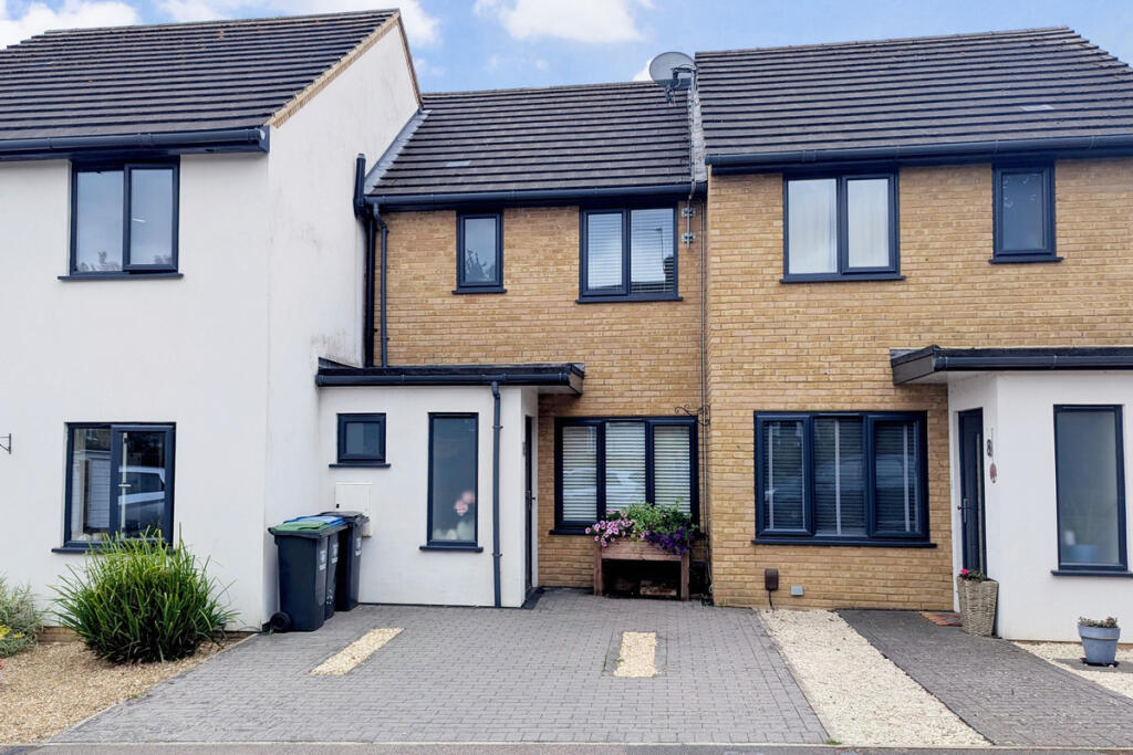
HP1 3ES - 2 bedroom terraced house for sale in Feacey Down, Hemel Hem…
View on Property Piper
2 bedroom terraced house for sale in Feacey Down, Hemel Hempstead, HP1
Property Details
- Price: £375000
- Bedrooms: 2
- Bathrooms: 2
- Property Type: undefined
- Property SubType: undefined
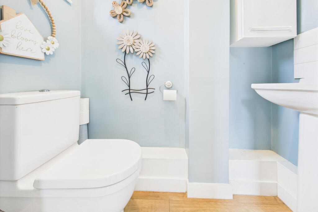
Image Descriptions
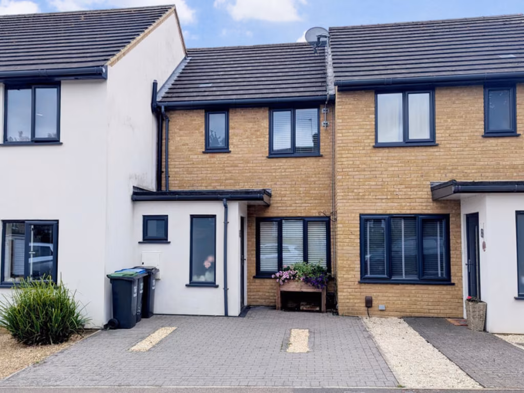
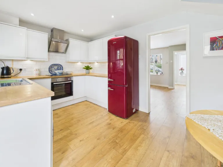
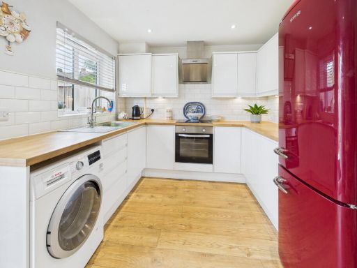
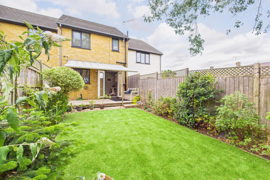
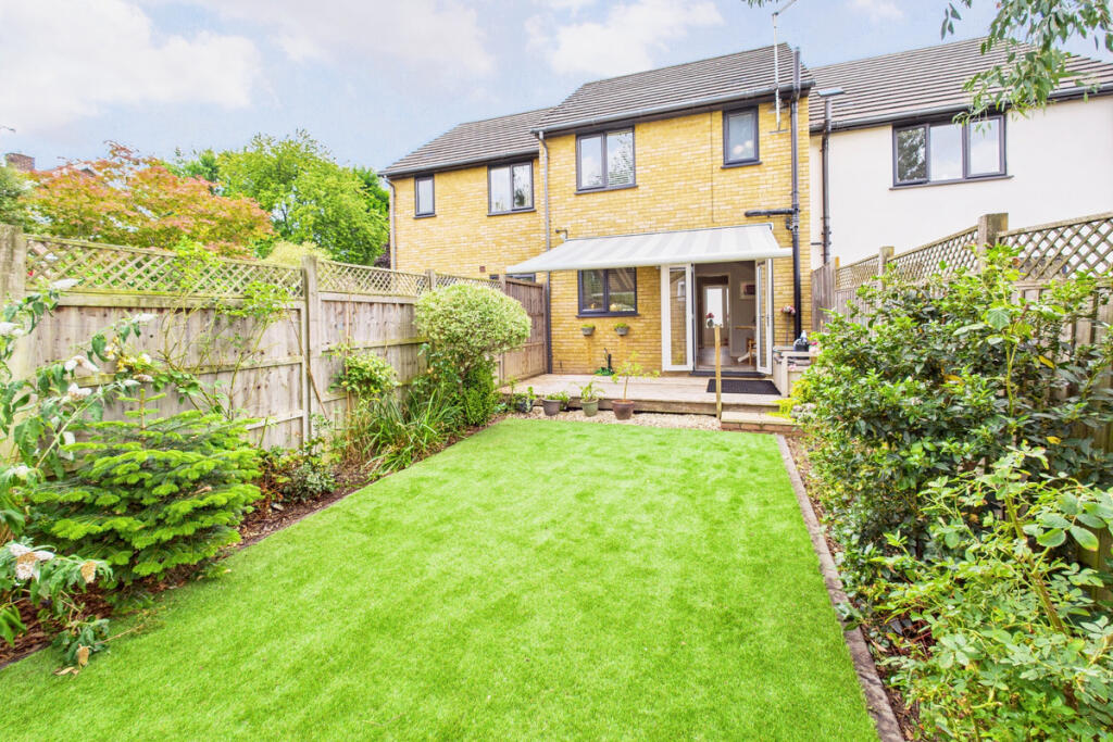
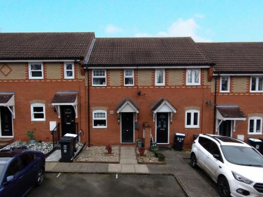
- brick townhouse exterior modern townhouse
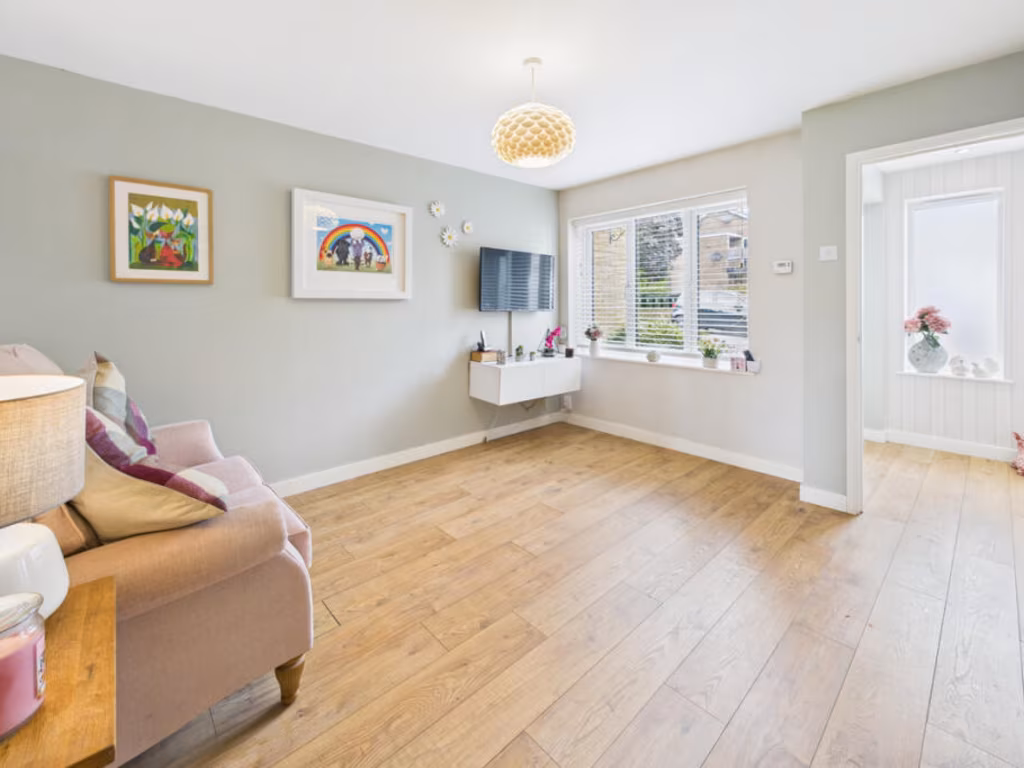
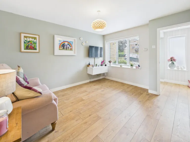
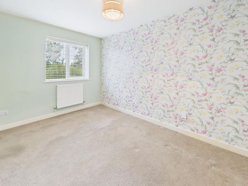
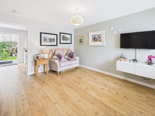
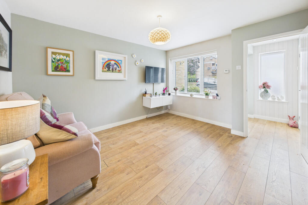
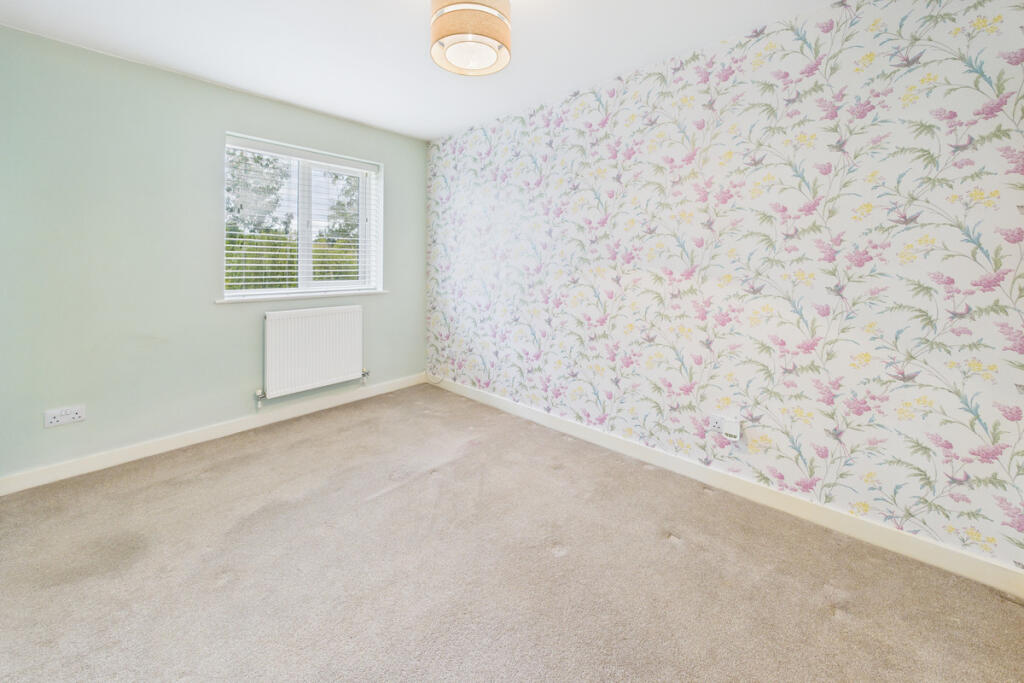
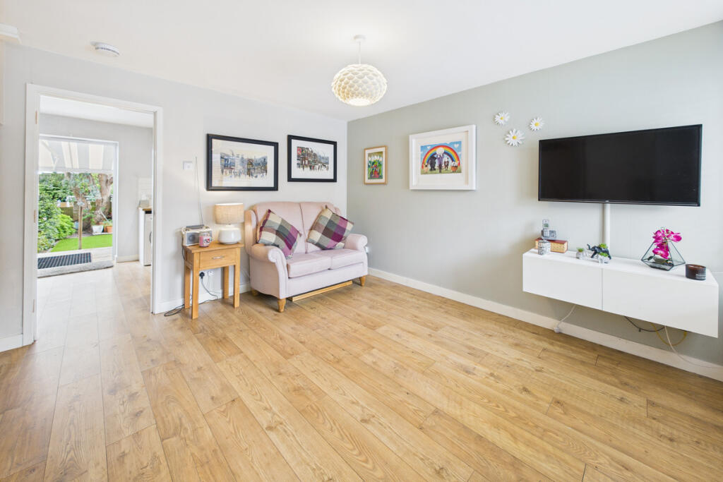
- living room contemporary
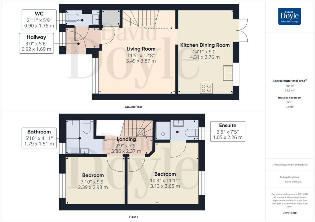
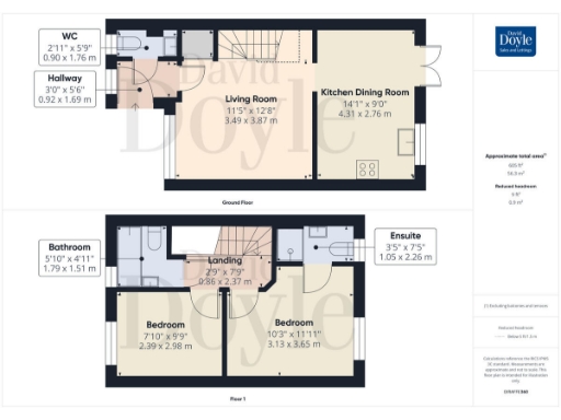
Floorplan Description
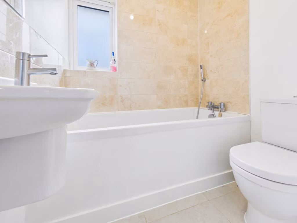
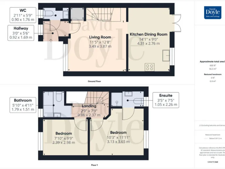
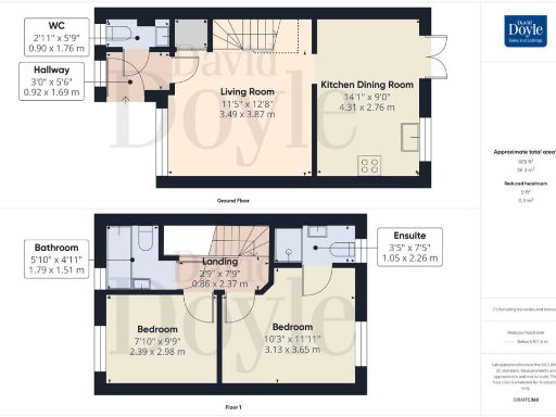
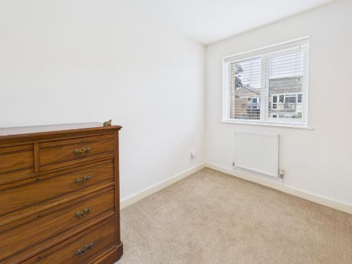
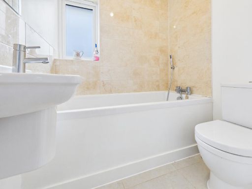
- A multi-story property with a traditional layout including two bedrooms and two bathrooms.
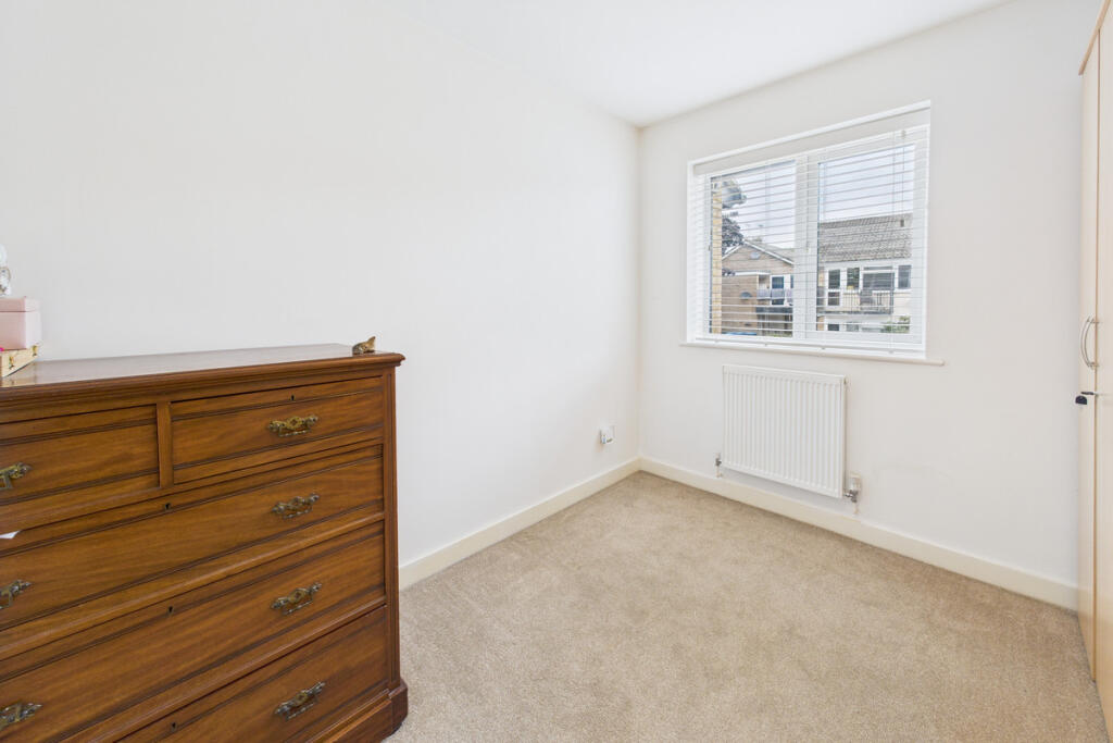
Rooms
- WC: small
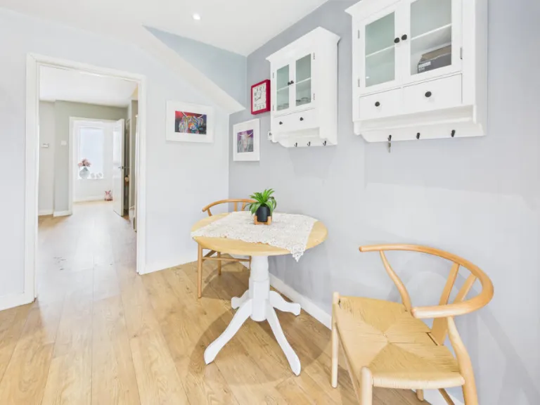
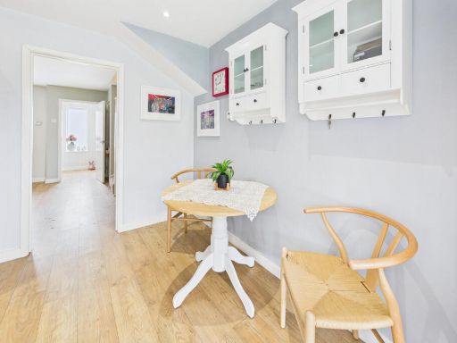
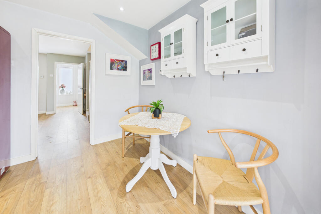
- Hallway: small
- Living Room: average
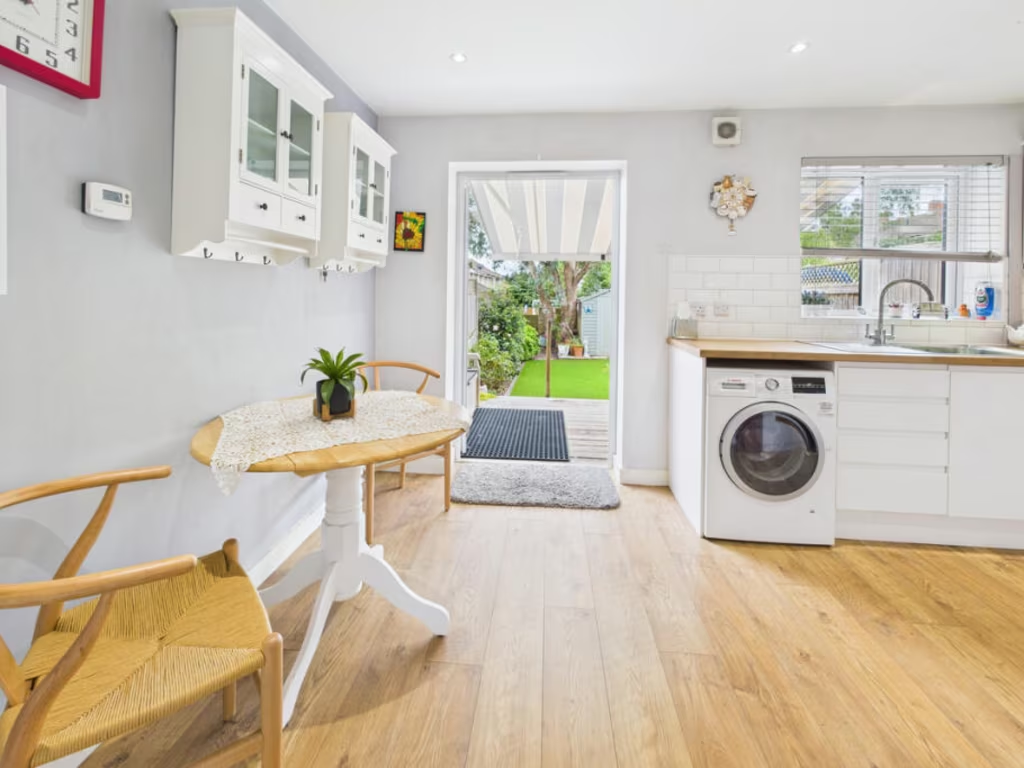
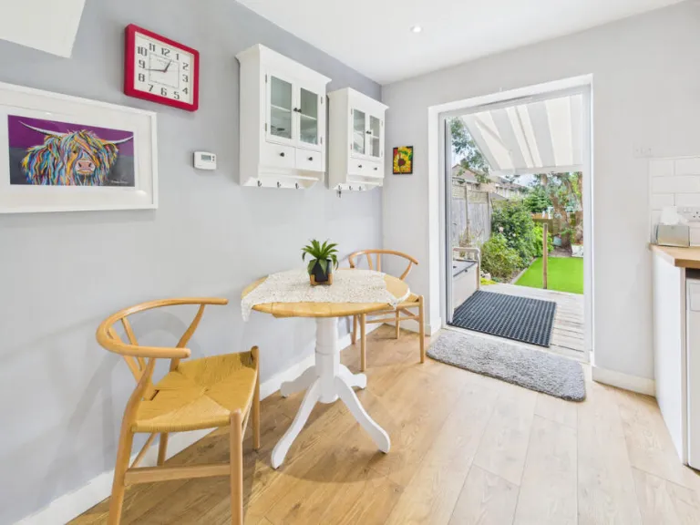
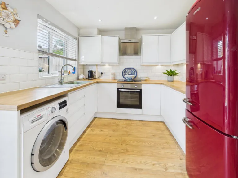
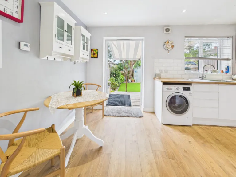
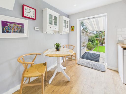
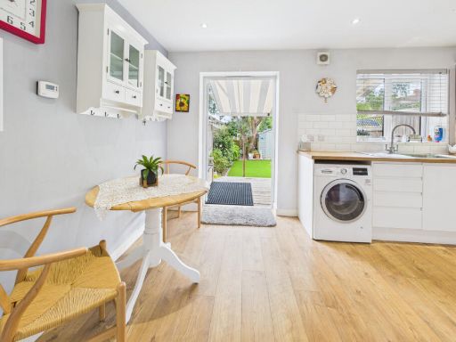
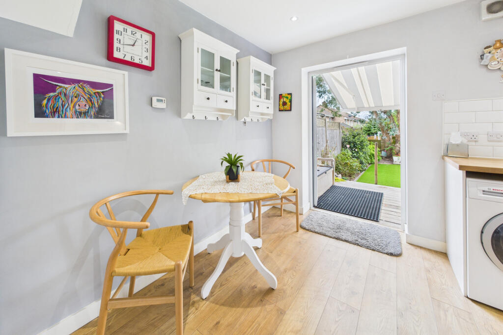
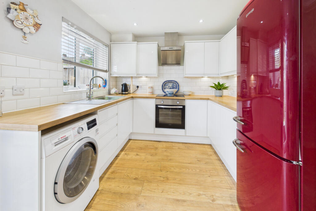
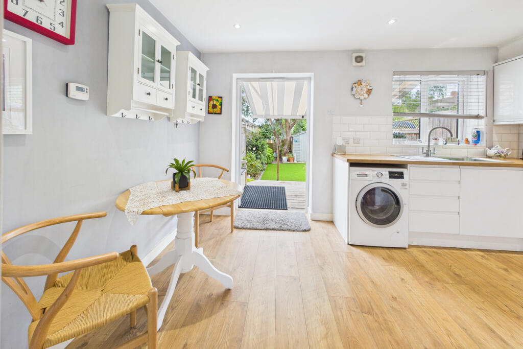
- Kitchen Dining Room: average
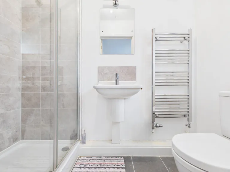
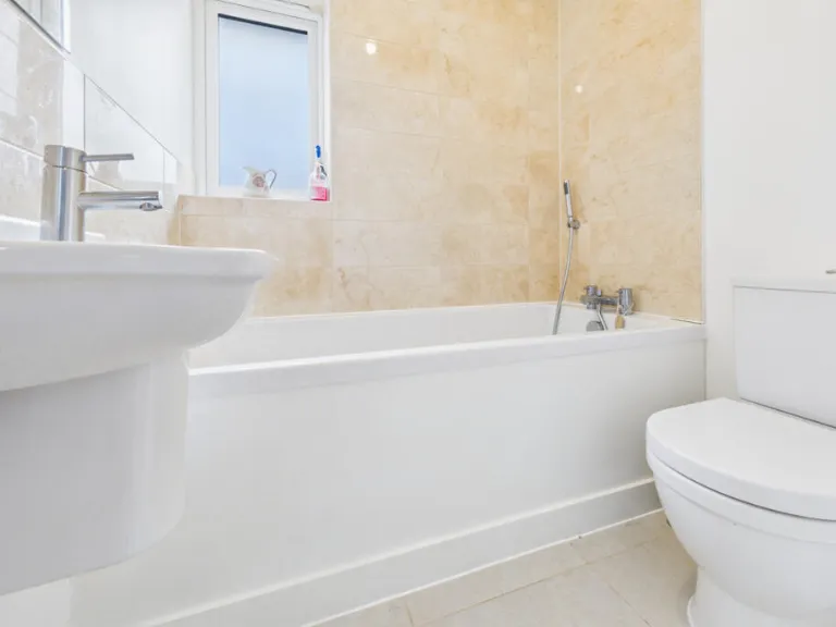
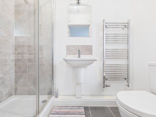
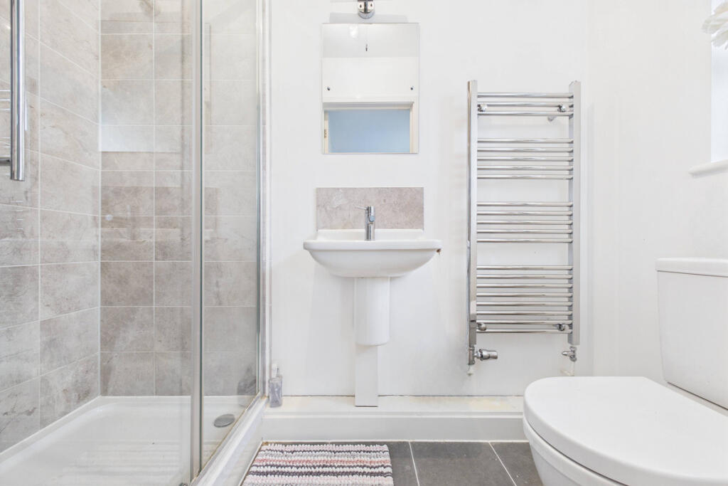
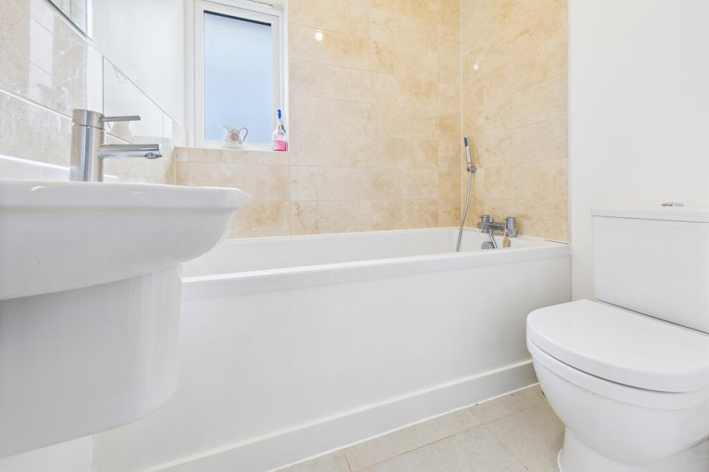
- Bathroom: small
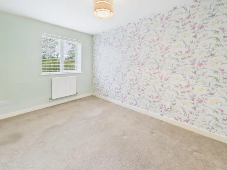
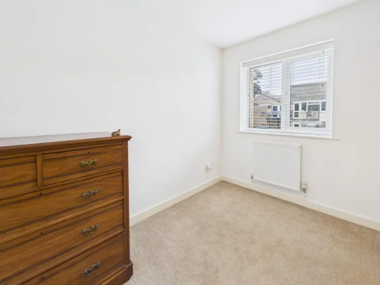
- Bedroom: average
- Bedroom: average
- Ensuite: small
- Landing: small
Textual Property Features
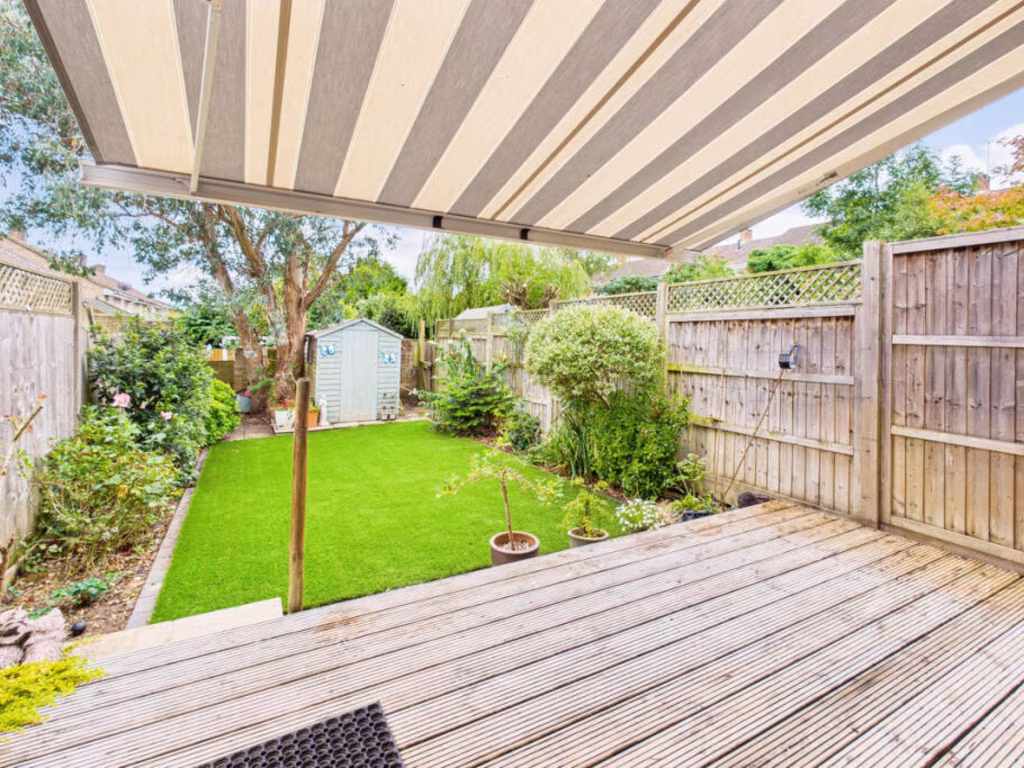
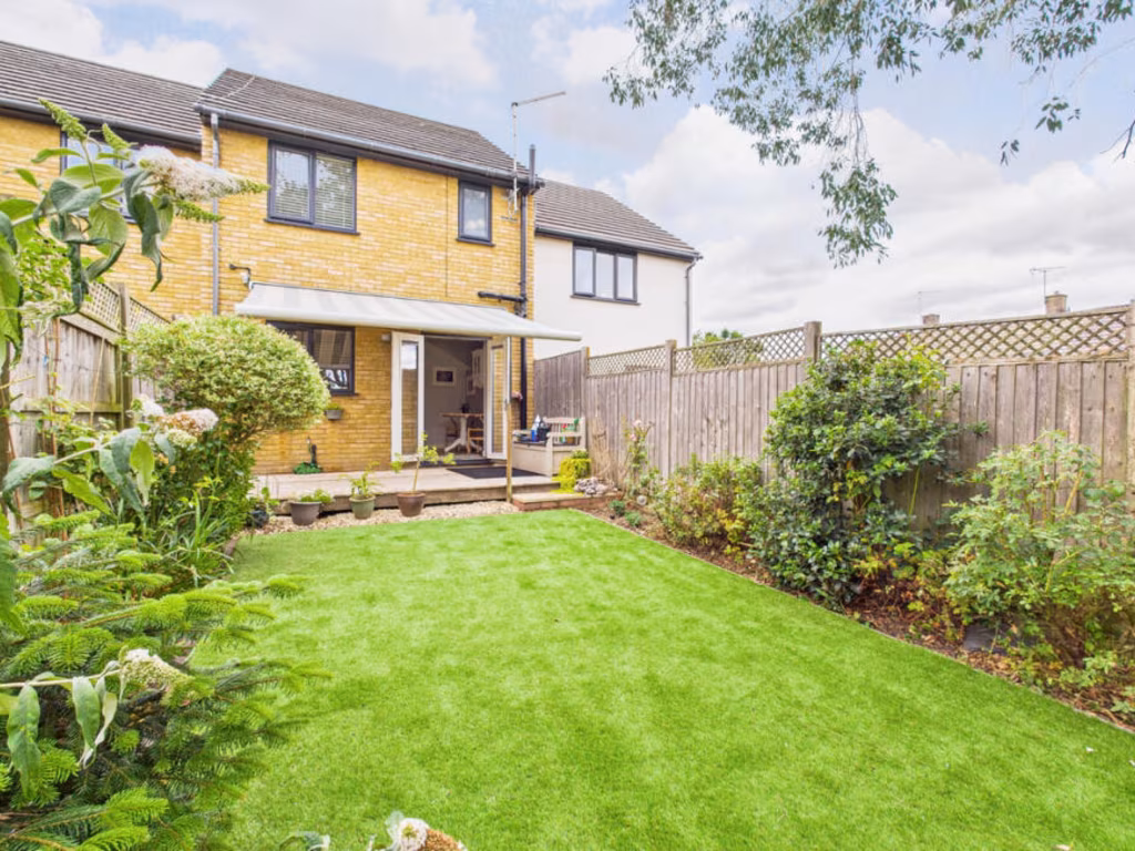
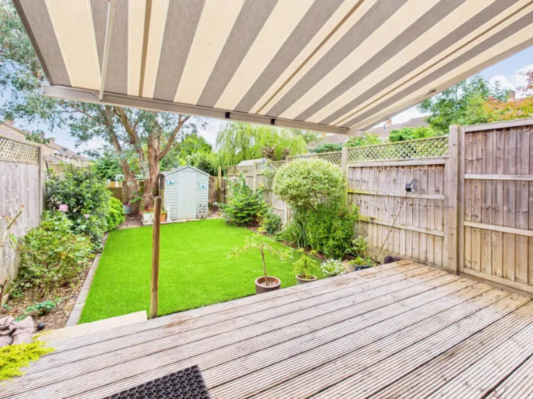
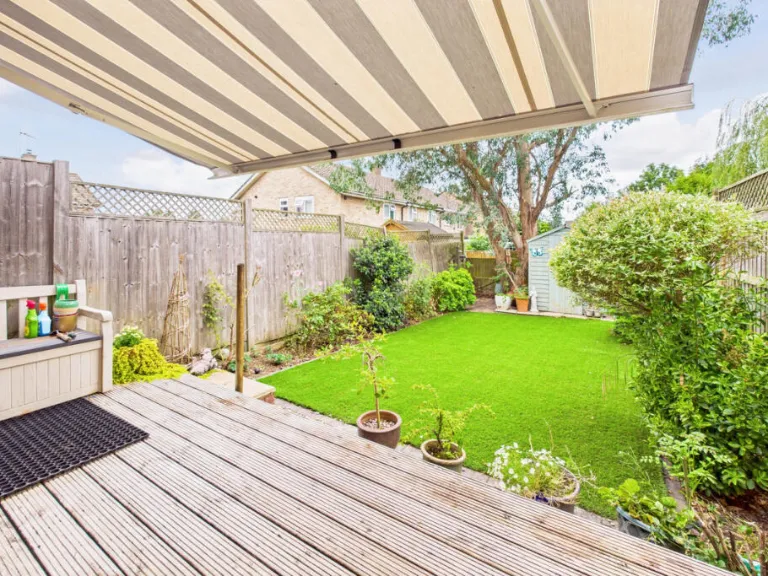
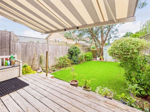
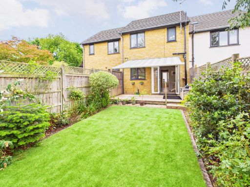
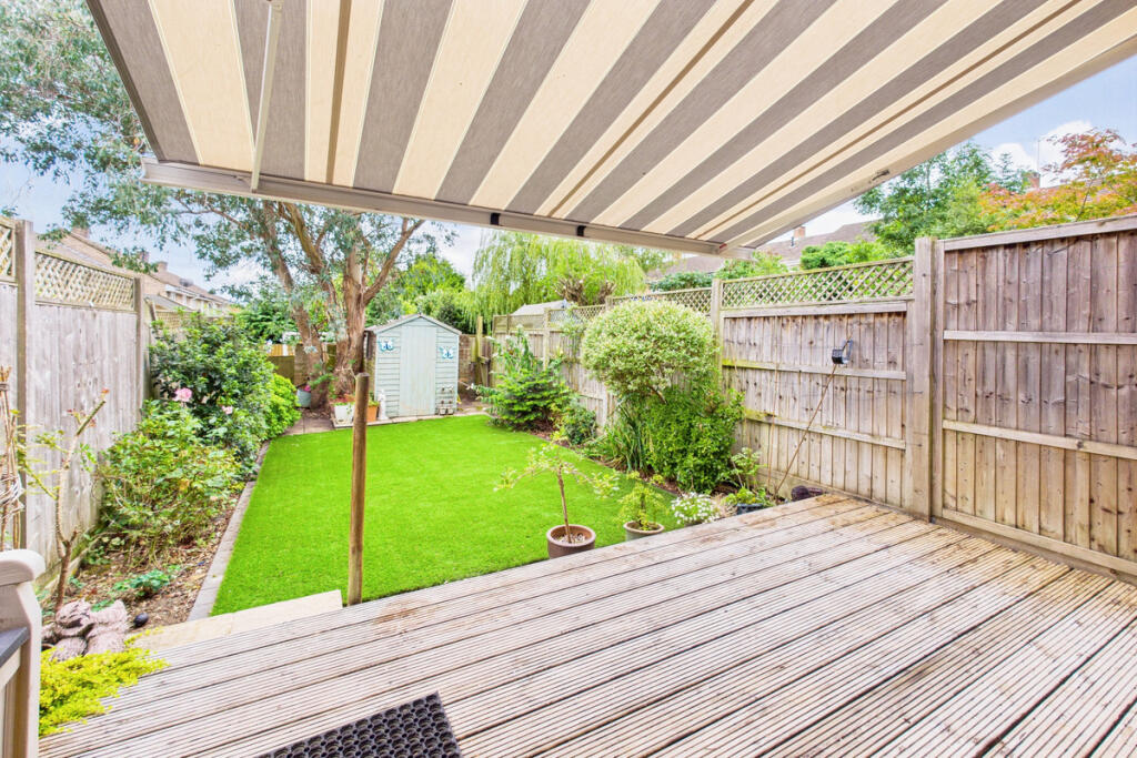
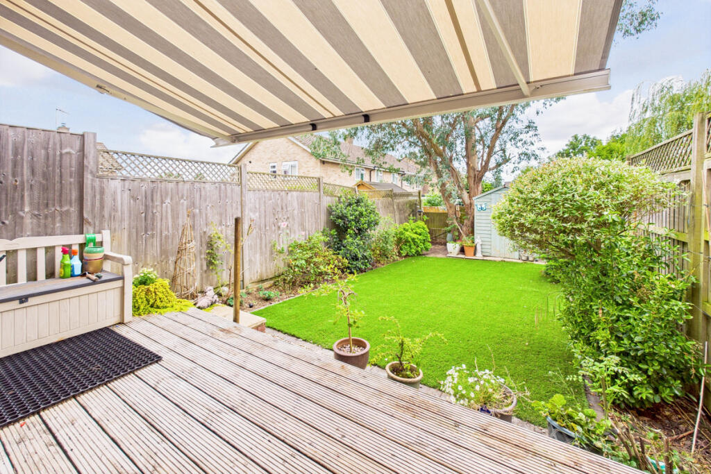
- Has Garden
- Chain Free
- Success
Detected Visual Features
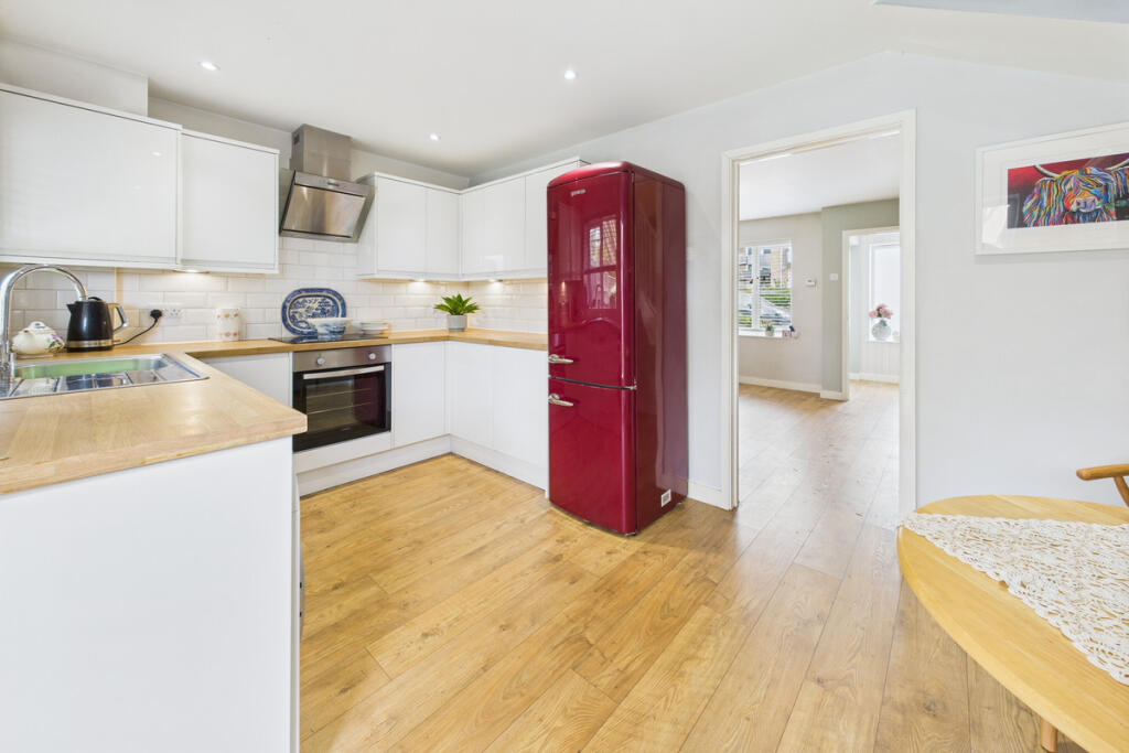
- modern
- brick
- townhouse
- compact
- low-maintenance
- driveway
- contemporary
- recently renovated
- bright
- wood flooring
- living room
- clean
- neutral colors
- medium-sized
EPC Details
- High performance glazing
- Average thermal transmittance 0.18 W/m-¦K
- Boiler and underfloor heating, mains gas
- Low energy lighting in all fixed outlets
- Average thermal transmittance 0.12 W/m-¦K
Nearby Schools
- Boxmoor Primary School
- Micklem Primary School
- John F Kennedy Catholic School
- George Street Primary School
- Hammond Academy
- Aycliffe Drive Primary School
- Tudor Primary School
- Westbrook Hay
- Laureate Academy
- Galley Hill Primary School and Nursery
- Pixies Hill Primary School
- Great Gaddesden Church of England Primary School
- The Hemel Hempstead School
- South Hill Primary School
- Broadfield Academy
- Lockers Park School
- Gade Valley Primary School
- Jupiter Primary School
- Hobletts Manor Junior School
- Yewtree Primary School
- Two Waters Primary School
- Lime Walk Primary School
Nearest General Shops
- Id: 9463710040
- Tags:
- TagsNormalized:
- Lat: 51.7561139
- Lon: -0.4932204
- FullGeoHash: gcpwkvbv5nuj
- PartitionGeoHash: gcpw
- Images:
- FoodStandards: null
- Distance: 880.2
,- Id: 487398244
- Tags:
- TagsNormalized:
- Lat: 51.7557347
- Lon: -0.491751
- FullGeoHash: gcpwkvcgj25z
- PartitionGeoHash: gcpw
- Images:
- FoodStandards: null
- Distance: 868.5
,- Id: 4798620781
- Tags:
- TagsNormalized:
- Lat: 51.7557881
- Lon: -0.4918945
- FullGeoHash: gcpwkvcg640v
- PartitionGeoHash: gcpw
- Images:
- FoodStandards: null
- Distance: 867.4
}
Nearest Grocery shops
- Id: 957062013
- Tags:
- Addr:
- City: Hemel Hempstead
- Housename: Tesco Express
- Housenumber: 33-35
- Postcode: HP1 2QF
- Street: Stoneycroft
- Brand: Tesco Express
- Brand:wikidata: Q98456772
- Brand:wikipedia: en:Tesco
- Contact:
- Website: https://www.tesco.com/store-locator/hemel-hempstead/33-35-stoneycroft
- Fhrs:
- Name: Tesco Express
- Operator: Tesco Stores Ltd
- Shop: convenience
- Source:
- TagsNormalized:
- tesco
- tesco express
- convenience
- shop
- Lat: 51.7561138
- Lon: -0.4934025
- FullGeoHash: gcpwkvbtnyuk
- PartitionGeoHash: gcpw
- Images:
- FoodStandards:
- Id: 202327
- FHRSID: 202327
- LocalAuthorityBusinessID: 1537
- BusinessName: Tesco
- BusinessType: Retailers - supermarkets/hypermarkets
- BusinessTypeID: 7840
- AddressLine1: Tesco Express
- AddressLine2: 33-35 Stoneycroft
- AddressLine3: Hemel Hempstead
- AddressLine4: Hertfordshire
- PostCode: HP1 2QF
- RatingValue: 5
- RatingKey: fhrs_5_en-GB
- RatingDate: 2019-03-15
- LocalAuthorityCode: 156
- LocalAuthorityName: Dacorum
- LocalAuthorityWebSite: http://www.dacorum.gov.uk
- LocalAuthorityEmailAddress: ecp@dacorum.gov.uk
- Scores:
- Hygiene: 5
- Structural: 5
- ConfidenceInManagement: 5
- NewRatingPending: false
- Geocode:
- Longitude: -0.49367900000000
- Latitude: 51.75594600000000
- Distance: 887
,- Id: 9463710035
- Tags:
- Amenity: fast_food
- Cuisine: fish and chips
- Name: Fish & Chip Shop
- TagsNormalized:
- fast food
- food
- fish
- chip
- shop
- Lat: 51.7561136
- Lon: -0.4930841
- FullGeoHash: gcpwkvbvnqcg
- PartitionGeoHash: gcpw
- Images:
- FoodStandards: null
- Distance: 875.3
,- Id: 702063568
- Tags:
- Addr:
- City: Hemel Hempstead
- Country: GB
- Postcode: HP1 3QF
- Street: Warners End Road
- Brand: Spar
- Brand:wikidata: Q610492
- Brand:wikipedia: en:SPAR (retailer)
- Building: yes
- Name: Spar
- Shop: convenience
- Website: https://www.spar.co.uk/store-locator/afb18005-spar---euro-garages---dacorum
- TagsNormalized:
- Lat: 51.7559149
- Lon: -0.4918533
- FullGeoHash: gcpwkvcu4czd
- PartitionGeoHash: gcpw
- Images:
- FoodStandards: null
- Distance: 853.5
}
Nearest Supermarkets
- Id: 957062007
- Tags:
- Brand: Co-op Food
- Brand:wikidata: Q3277439
- Brand:wikipedia: en:Co-op Food
- Name: Co-op Food
- Operator: The Co-operative Group
- Operator:wikidata: Q117202
- Shop: supermarket
- TagsNormalized:
- co-op
- co-op food
- food
- supermarket
- shop
- Lat: 51.7497568
- Lon: -0.501214
- FullGeoHash: gcpwksg00vgg
- PartitionGeoHash: gcpw
- Images:
- FoodStandards: null
- Distance: 1773.9
,- Id: 190663142
- Tags:
- Addr:
- City: Hemel Hempstead
- Country: GB
- Postcode: HP2 4AA
- Street: Hillfield Road
- Brand: Asda
- Brand:wikidata: Q297410
- Brand:wikipedia: en:Asda
- Building: supermarket
- Contact:
- Facebook: https://www.facebook.com/asda/
- Phone: +44 1442 212802
- Twitter: @asda
- Website: https://storelocator.asda.com/east-of-england/hemel-hempstead/hillfield-road
- Fhrs:
- Name: Asda
- Opening_hours:
- Covid19: Mo-Sa 08:00-22:00; Su 10:00-16:00
- Operator: Asda Stores Ltd
- Shop: supermarket
- TagsNormalized:
- Lat: 51.7539277
- Lon: -0.4707797
- FullGeoHash: gcpwmm90qp3h
- PartitionGeoHash: gcpw
- Images:
- FoodStandards:
- Id: 201982
- FHRSID: 201982
- LocalAuthorityBusinessID: 870
- BusinessName: ASDA
- BusinessType: Retailers - supermarkets/hypermarkets
- BusinessTypeID: 7840
- AddressLine1: Asda Store
- AddressLine2: Hillfield Road
- AddressLine3: Hemel Hempstead
- AddressLine4: Hertfordshire
- PostCode: HP2 4AA
- RatingValue: 5
- RatingKey: fhrs_5_en-GB
- RatingDate: 2022-07-14
- LocalAuthorityCode: 156
- LocalAuthorityName: Dacorum
- LocalAuthorityWebSite: http://www.dacorum.gov.uk
- LocalAuthorityEmailAddress: ecp@dacorum.gov.uk
- Scores:
- Hygiene: 5
- Structural: 5
- ConfidenceInManagement: 0
- NewRatingPending: false
- Geocode:
- Longitude: -0.47010600000000
- Latitude: 51.75293500000000
- Distance: 1458.5
,- Id: 957062016
- Tags:
- Brand: Co-op Food
- Brand:wikidata: Q3277439
- Brand:wikipedia: en:Co-op Food
- Name: Co-op Food
- Operator: The Co-operative Group
- Operator:wikidata: Q117202
- Shop: supermarket
- TagsNormalized:
- co-op
- co-op food
- food
- supermarket
- shop
- Lat: 51.7557934
- Lon: -0.4939942
- FullGeoHash: gcpwkvb7355j
- PartitionGeoHash: gcpw
- Images:
- FoodStandards: null
- Distance: 939.2
}
Nearest Religious buildings
- Id: 61989361
- Tags:
- Amenity: grave_yard
- Name: St Mary's churchyard
- TagsNormalized:
- Lat: 51.7592511
- Lon: -0.4728285
- FullGeoHash: gcpwmnrxqr9x
- PartitionGeoHash: gcpw
- Images:
- FoodStandards: null
- Distance: 1012.9
,- Id: 197366378
- Tags:
- Amenity: place_of_worship
- Building: church
- Denomination: anglican
- Name: St Alban's Church
- Religion: christian
- Wikidata: Q105085078
- TagsNormalized:
- place of worship
- church
- anglican
- christian
- Lat: 51.7564969
- Lon: -0.49203
- FullGeoHash: gcpwkvcxqy7c
- PartitionGeoHash: gcpw
- Images:
- FoodStandards: null
- Distance: 801.8
,- Id: 268147438
- Tags:
- Addr:
- City: Hemel Hempstead
- County: Hertfordshire
- Postcode: HP1 3LA
- Street: Galley Hill
- Amenity: place_of_worship
- Denomination: baptist
- Fhrs:
- Name: Gadebridge Baptist Church
- Religion: christian
- Source:
- TagsNormalized:
- place of worship
- baptist
- church
- christian
- Lat: 51.7634626
- Lon: -0.4921435
- FullGeoHash: gcpwkz38h0z1
- PartitionGeoHash: gcpw
- Images:
- FoodStandards:
- Id: 830578
- FHRSID: 830578
- LocalAuthorityBusinessID: 83289
- BusinessName: Gadebridge Baptist Church
- BusinessType: Other catering premises
- BusinessTypeID: 7841
- AddressLine1: Gadebridge Baptist Church
- AddressLine2: Galley Hill
- AddressLine3: Hemel Hempstead
- AddressLine4: Hertfordshire
- PostCode: HP1 3LA
- RatingValue: 5
- RatingKey: fhrs_5_en-GB
- RatingDate: 2022-04-20
- LocalAuthorityCode: 156
- LocalAuthorityName: Dacorum
- LocalAuthorityWebSite: http://www.dacorum.gov.uk
- LocalAuthorityEmailAddress: ecp@dacorum.gov.uk
- Scores:
- Hygiene: 0
- Structural: 0
- ConfidenceInManagement: 5
- NewRatingPending: false
- Geocode:
- Longitude: -0.49291600000000
- Latitude: 51.76364300000000
- Distance: 403.3
}
Nearest Medical buildings
- Id: 5866465654
- Tags:
- Amenity: dentist
- Healthcare: dentist
- TagsNormalized:
- Lat: 51.7539894
- Lon: -0.4721452
- FullGeoHash: gcpwmm80y4zh
- PartitionGeoHash: gcpw
- Images:
- FoodStandards: null
- Distance: 1385.9
,- Id: 9166120765
- Tags:
- Amenity: doctors
- Healthcare: doctor
- TagsNormalized:
- doctor
- doctors
- health
- healthcare
- Lat: 51.7545791
- Lon: -0.4716815
- FullGeoHash: gcpwmm8s30bc
- PartitionGeoHash: gcpw
- Images:
- FoodStandards: null
- Distance: 1363.8
,- Id: 5891232069
- Tags:
- Amenity: dentist
- Healthcare: dentist
- TagsNormalized:
- Lat: 51.7597373
- Lon: -0.4724993
- FullGeoHash: gcpwmnxfmfqg
- PartitionGeoHash: gcpw
- Images:
- FoodStandards: null
- Distance: 1014.4
,- Id: 9463710037
- Tags:
- Amenity: pharmacy
- Brand: Boots
- Brand:wikidata: Q6123139
- Brand:wikipedia: en:Boots (company)
- Healthcare: pharmacy
- Name: Boots Pharmacy
- TagsNormalized:
- pharmacy
- boots
- health
- healthcare
- Lat: 51.755991
- Lon: -0.4938298
- FullGeoHash: gcpwkvbksbjb
- PartitionGeoHash: gcpw
- Images:
- FoodStandards: null
- Distance: 914.6
}
Nearest Airports
- Id: 110273499
- Tags:
- Addr:
- Country: GB
- Postcode: LU2 9LY
- Aerodrome: international
- Aerodrome:type: public
- Aeroway: aerodrome
- Alt_name: London Luton
- Iata: LTN
- Icao: EGGW
- Name: London Luton Airport
- Website: https://www.london-luton.co.uk/
- Wikidata: Q8712
- Wikipedia: en:Luton Airport
- TagsNormalized:
- airport
- international airport
- Lat: 51.8780363
- Lon: -0.3701408
- FullGeoHash: gcpxps47rngh
- PartitionGeoHash: gcpx
- Images:
- FoodStandards: null
- Distance: 15100.2
}
Nearest Leisure Facilities
- Id: 219779635
- Tags:
- TagsNormalized:
- Lat: 51.7638141
- Lon: -0.492121
- FullGeoHash: gcpwkz3dhdrf
- PartitionGeoHash: gcpw
- Images:
- FoodStandards: null
- Distance: 410.7
,- Id: 149596443
- Tags:
- Leisure: pitch
- Sport: soccer
- TagsNormalized:
- Lat: 51.7601066
- Lon: -0.490334
- FullGeoHash: gcpwkyduqrhq
- PartitionGeoHash: gcpw
- Images:
- FoodStandards: null
- Distance: 404.8
,- Id: 149596438
- Tags:
- TagsNormalized:
- Lat: 51.7607292
- Lon: -0.490857
- FullGeoHash: gcpwkyf845q2
- PartitionGeoHash: gcpw
- Images:
- FoodStandards: null
- Distance: 384.8
,- Id: 219779636
- Tags:
- Leisure: pitch
- Sport: soccer
- TagsNormalized:
- Lat: 51.7630864
- Lon: -0.4893594
- FullGeoHash: gcpwkz5tv4ej
- PartitionGeoHash: gcpw
- Images:
- FoodStandards: null
- Distance: 207.3
,- Id: 219779631
- Tags:
- Leisure: pitch
- Sport: soccer
- TagsNormalized:
- Lat: 51.762897
- Lon: -0.489098
- FullGeoHash: gcpwkz5uepqh
- PartitionGeoHash: gcpw
- Images:
- FoodStandards: null
- Distance: 187.2
}
Nearest Tourist attractions
- Id: 631992923
- Tags:
- Name: The Paper Trail - The Paper Mill Museum
- Operator: Frogmore Paper Mill
- Tourism: museum
- Website: frogmorepapermill.org.uk
- TagsNormalized:
- Lat: 51.7385106
- Lon: -0.4686076
- FullGeoHash: gcpwm6dy8tkv
- PartitionGeoHash: gcpw
- Images:
- FoodStandards: null
- Distance: 2965.4
,- Id: 98118518
- Tags:
- Addr:
- City: Hemel Hempstead
- Housename: Frogmore Paper Mill
- Postcode: HP3 9RY
- Building: yes
- Name: The Paper Mill Museum
- Tourism: museum
- Website: http://frogmoremill.com/
- Wikidata: Q57243748
- TagsNormalized:
- Lat: 51.7386653
- Lon: -0.4686876
- FullGeoHash: gcpwm6dxwf30
- PartitionGeoHash: gcpw
- Images:
- FoodStandards: null
- Distance: 2947.5
,- Id: 2113490315
- Tags:
- Name: Alexandra Guest House
- Tourism: guest_house
- TagsNormalized:
- Lat: 51.7561341
- Lon: -0.4705669
- FullGeoHash: gcpwmmcm6fxv
- PartitionGeoHash: gcpw
- Images:
- FoodStandards: null
- Distance: 1317.1
}
Nearest Train stations
- Id: 9725567363
- Tags:
- Name: Whipsnade Central
- Public_transport: station
- Railway: station
- Train: yes
- Usage: tourism
- TagsNormalized:
- Lat: 51.8461109
- Lon: -0.5415762
- FullGeoHash: gcpwgwm9kred
- PartitionGeoHash: gcpw
- Images:
- FoodStandards: null
- Distance: 10010.6
,- Id: 20455872
- Tags:
- Name: Kings Langley
- Naptan:
- Network: National Rail
- Operator: London Northwestern Railway
- Public_transport: station
- Railway: station
- Ref:
- Source: GPX + NPE
- Wheelchair: no
- Wikidata: Q2206088
- Wikipedia: en:Kings Langley railway station
- TagsNormalized:
- Lat: 51.7064134
- Lon: -0.4378216
- FullGeoHash: gcpwnhc5wn0d
- PartitionGeoHash: gcpw
- Images:
- FoodStandards: null
- Distance: 7106.2
,- Id: 3956474228
- Tags:
- Name: Berkhamsted
- Naptan:
- Network: National Rail
- Public_transport: station
- Railway: station
- Ref:
- Wikidata: Q19955
- Wikipedia: en:Berkhamsted railway station
- TagsNormalized:
- Lat: 51.7635571
- Lon: -0.5626636
- FullGeoHash: gcpw7pq28frt
- PartitionGeoHash: gcpw
- Images:
- FoodStandards: null
- Distance: 5250.4
,- Id: 5520070965
- Tags:
- Name: Apsley
- Naptan:
- Network: National Rail
- Operator: London Northwestern Railway
- Public_transport: station
- Railway: station
- Ref:
- Wikidata: Q19950
- Wikipedia: en:Apsley railway station
- TagsNormalized:
- Lat: 51.732365
- Lon: -0.4629888
- FullGeoHash: gcpwm3wfgef9
- PartitionGeoHash: gcpw
- Images:
- FoodStandards: null
- Distance: 3748.2
,- Id: 7158905928
- Tags:
- Addr:
- City: Hemel Hempstead
- Postcode: HP3 9BQ
- Street: London Road
- Name: Hemel Hempstead
- Naptan:
- Network: National Rail
- Operator: London Midland
- Public_transport: station
- Railway: station
- Ref:
- Wheelchair: yes
- Wikidata: Q19965
- Wikipedia: en:Hemel Hempstead railway station
- TagsNormalized:
- Lat: 51.7422715
- Lon: -0.4911208
- FullGeoHash: gcpwkg6ks49b
- PartitionGeoHash: gcpw
- Images:
- FoodStandards: null
- Distance: 2306.2
}
Nearest Hotels
- Id: 656671235
- Tags:
- Brand: Premier Inn
- Brand:wikidata: Q2108626
- Brand:wikipedia: en:Premier Inn
- Internet_access: wlan
- Internet_access:fee: customers
- Internet_access:operator: Virgin Media
- Internet_access:ssid: Premier Inn Free Wi-Fi
- Name: Premier Inn
- Tourism: hotel
- Wheelchair: yes
- TagsNormalized:
- Lat: 51.7478264
- Lon: -0.4743189
- FullGeoHash: gcpwmhqsgw40
- PartitionGeoHash: gcpw
- Images:
- FoodStandards: null
- Distance: 1860.8
,- Id: 95779661
- Tags:
- Addr:
- City: Hemel Hempstead
- Postcode: HP2 4TU
- Street: Wolsey Road
- Brand: Travelodge
- Brand:wikidata: Q9361374
- Brand:wikipedia: en:Travelodge UK
- Building: yes
- Fhrs:
- Authority: Dacorum
- Id: 202440
- Local_authority_id: 3663
- Internet_access: wlan
- Internet_access:fee: customers
- Internet_access:ssid: Travelodge WiFi
- Name: Travelodge
- Phone: +44 871 984 6036
- Tourism: hotel
- Website: https://www.travelodge.co.uk/
- TagsNormalized:
- Lat: 51.7493121
- Lon: -0.4706393
- FullGeoHash: gcpwmk9m96cy
- PartitionGeoHash: gcpw
- Images:
- FoodStandards: null
- Distance: 1850.5
,- Id: 1109739039
- Tags:
- Name: Southville Private Hotel
- Tourism: hotel
- TagsNormalized:
- Lat: 51.7485114
- Lon: -0.4769503
- FullGeoHash: gcpwmhs8ym8n
- PartitionGeoHash: gcpw
- Images:
- FoodStandards: null
- Distance: 1716.6
}
Tags
- modern
- brick
- townhouse
- compact
- low-maintenance
- driveway
- contemporary
- recently renovated
- bright
- wood flooring
- living room
- modern
- clean
- neutral colors
- medium-sized
Local Market Stats
- Average Price/sqft: £454
- Avg Income: £53100
- Rental Yield: 4%
- Social Housing: 15%
- Planning Success Rate: 89%
Similar Properties
 2 bedroom terraced house for sale in Bencroft, Hemel Hempstead, HP2 — £365,000 • 2 bed • 1 bath • 629 ft²
 3 bedroom terraced house for sale in Stronsay Close, Hemel Hempstead, HP3 — £525,000 • 3 bed • 2 bath • 1500 ft²
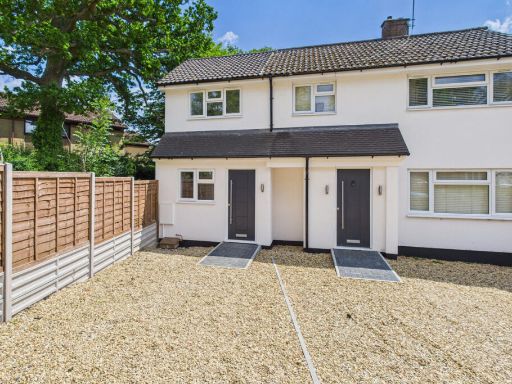 2 bedroom end of terrace house for sale in Pudding Lane, Hemel Hempstead, HP1 — £350,000 • 2 bed • 1 bath • 576 ft²
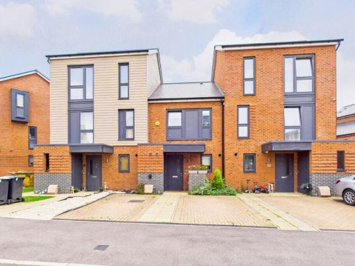 2 bedroom terraced house for sale in School End Crescent, Hemel Hempstead, HP1 — £400,000 • 2 bed • 1 bath • 803 ft²
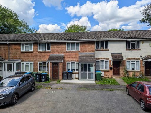 2 bedroom terraced house for sale in Hales Park, Hemel Hempstead, HP2 — £325,000 • 2 bed • 1 bath • 513 ft²
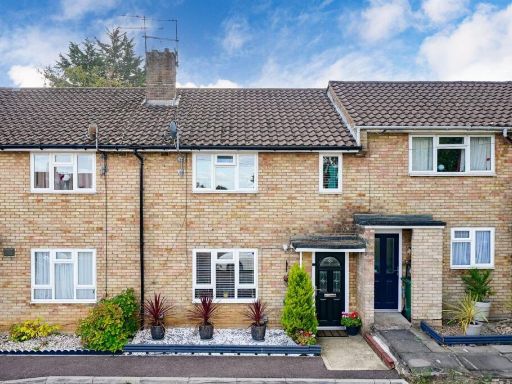 2 bedroom terraced house for sale in Boxted Road, Hemel Hempstead, HP1 — £350,000 • 2 bed • 1 bath • 769 ft²
Meta
- {
"@context": "https://schema.org",
"@type": "Residence",
"name": "2 bedroom terraced house for sale in Feacey Down, Hemel Hem…",
"description": "",
"url": "https://propertypiper.co.uk/property/141d8668-dfc5-47fe-9fe4-0094cdd3d77e",
"image": "https://image-a.propertypiper.co.uk/56cedc4d-4c9f-4e10-96d2-da0f79e5c30f-1024.jpeg",
"address": {
"@type": "PostalAddress",
"streetAddress": "10, Feacey Down",
"postalCode": "HP1 3ES",
"addressLocality": "Dacorum",
"addressRegion": "Hemel Hempstead",
"addressCountry": "England"
},
"geo": {
"@type": "GeoCoordinates",
"latitude": 51.76280309185452,
"longitude": -0.48638163609044854
},
"numberOfRooms": 2,
"numberOfBathroomsTotal": 2,
"floorSize": {
"@type": "QuantitativeValue",
"value": 605,
"unitCode": "FTK"
},
"offers": {
"@type": "Offer",
"price": 375000,
"priceCurrency": "GBP",
"availability": "https://schema.org/InStock"
},
"additionalProperty": [
{
"@type": "PropertyValue",
"name": "Feature",
"value": "modern"
},
{
"@type": "PropertyValue",
"name": "Feature",
"value": "brick"
},
{
"@type": "PropertyValue",
"name": "Feature",
"value": "townhouse"
},
{
"@type": "PropertyValue",
"name": "Feature",
"value": "compact"
},
{
"@type": "PropertyValue",
"name": "Feature",
"value": "low-maintenance"
},
{
"@type": "PropertyValue",
"name": "Feature",
"value": "driveway"
},
{
"@type": "PropertyValue",
"name": "Feature",
"value": "contemporary"
},
{
"@type": "PropertyValue",
"name": "Feature",
"value": "recently renovated"
},
{
"@type": "PropertyValue",
"name": "Feature",
"value": "bright"
},
{
"@type": "PropertyValue",
"name": "Feature",
"value": "wood flooring"
},
{
"@type": "PropertyValue",
"name": "Feature",
"value": "living room"
},
{
"@type": "PropertyValue",
"name": "Feature",
"value": "modern"
},
{
"@type": "PropertyValue",
"name": "Feature",
"value": "clean"
},
{
"@type": "PropertyValue",
"name": "Feature",
"value": "neutral colors"
},
{
"@type": "PropertyValue",
"name": "Feature",
"value": "medium-sized"
}
]
}
High Res Floorplan Images
Compatible Floorplan Images
FloorplanImages Thumbnail