BB12 0JG - 2 bedroom semidetached house for sale in Crow Wood Avenue,…
View on Property Piper
2 bedroom semi-detached house for sale in Crow Wood Avenue, Burnley, BB12
Property Details
- Price: £180000
- Bedrooms: 2
- Bathrooms: 1
- Property Type: undefined
- Property SubType: undefined
Image Descriptions
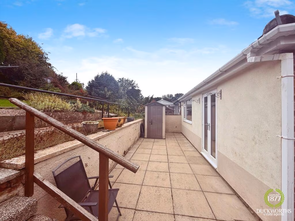
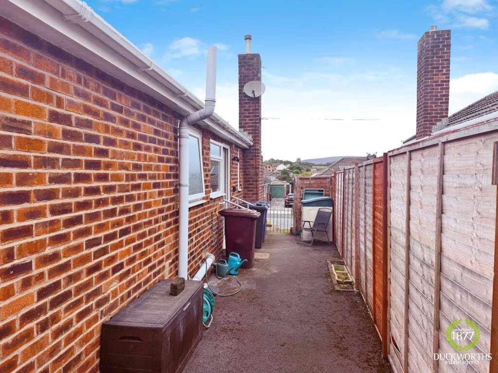
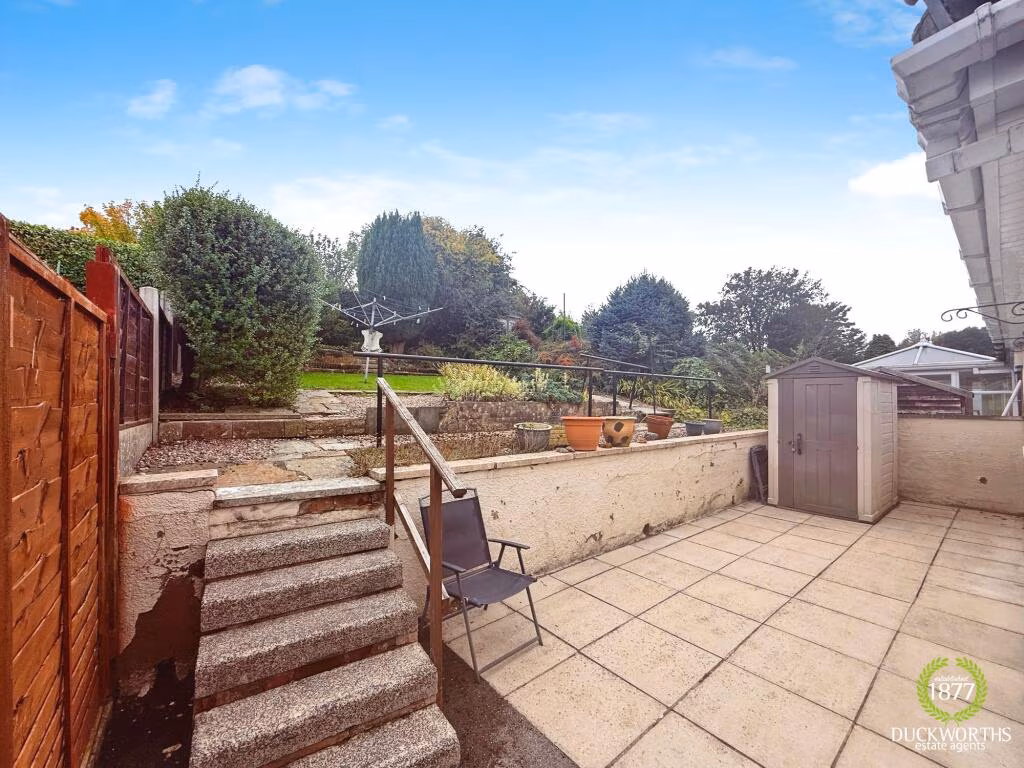
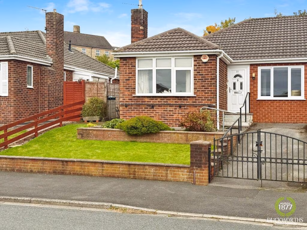
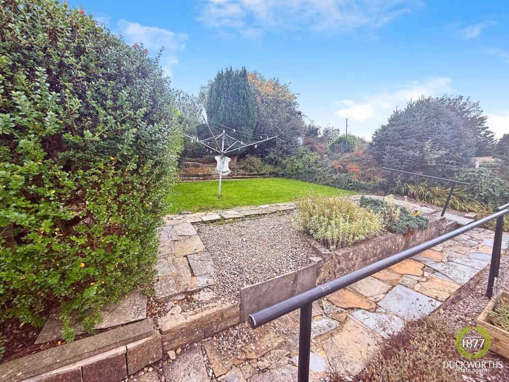
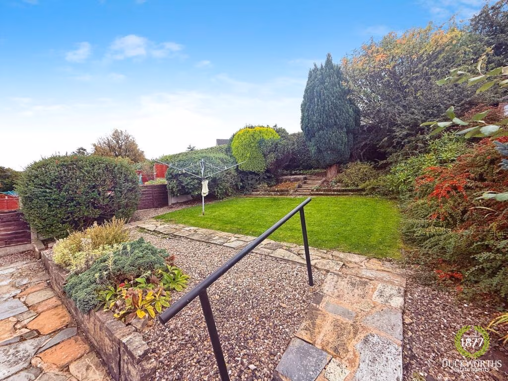
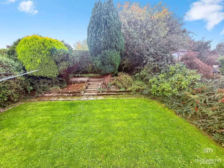
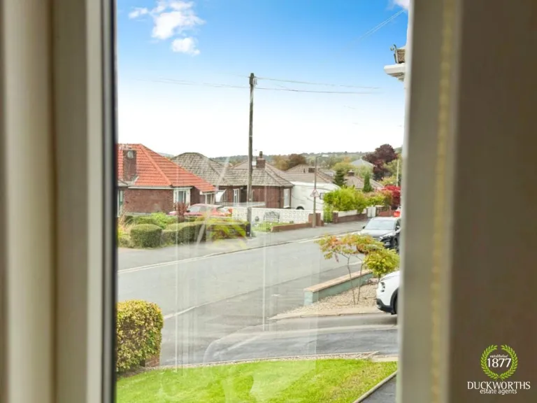
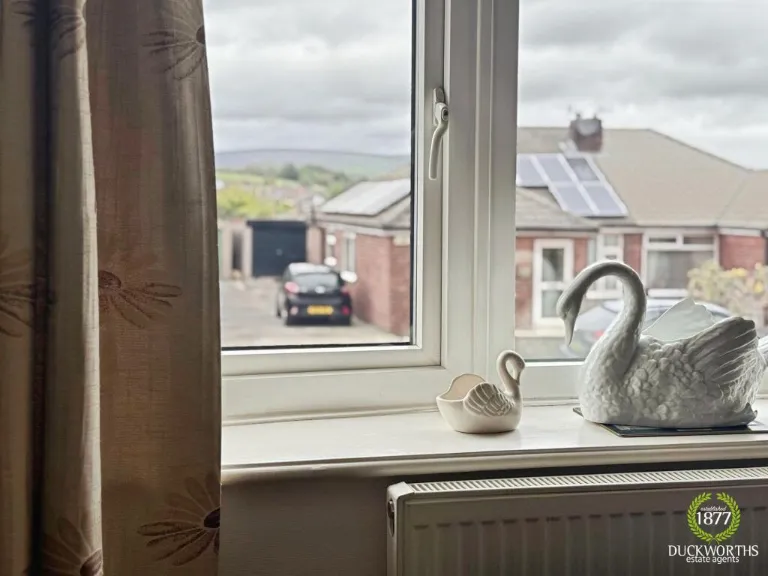
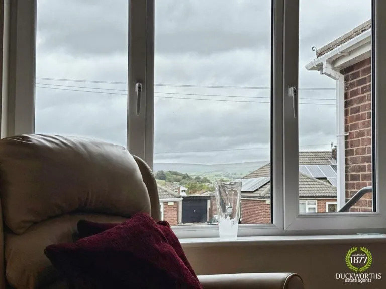
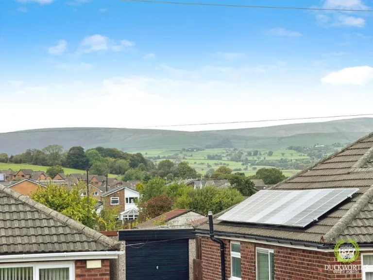
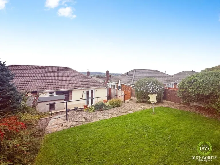
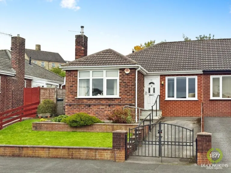
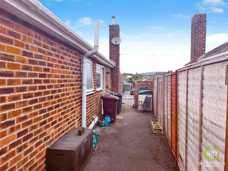
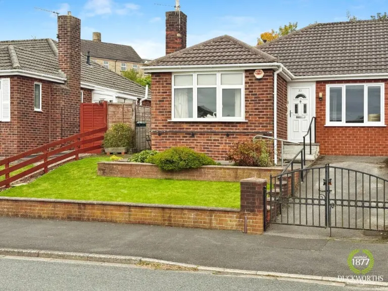
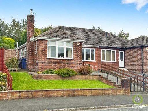
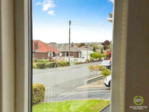
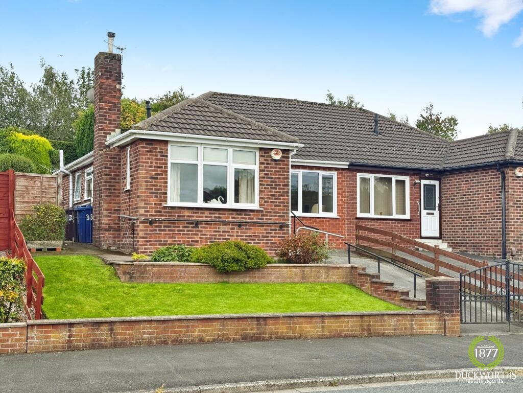
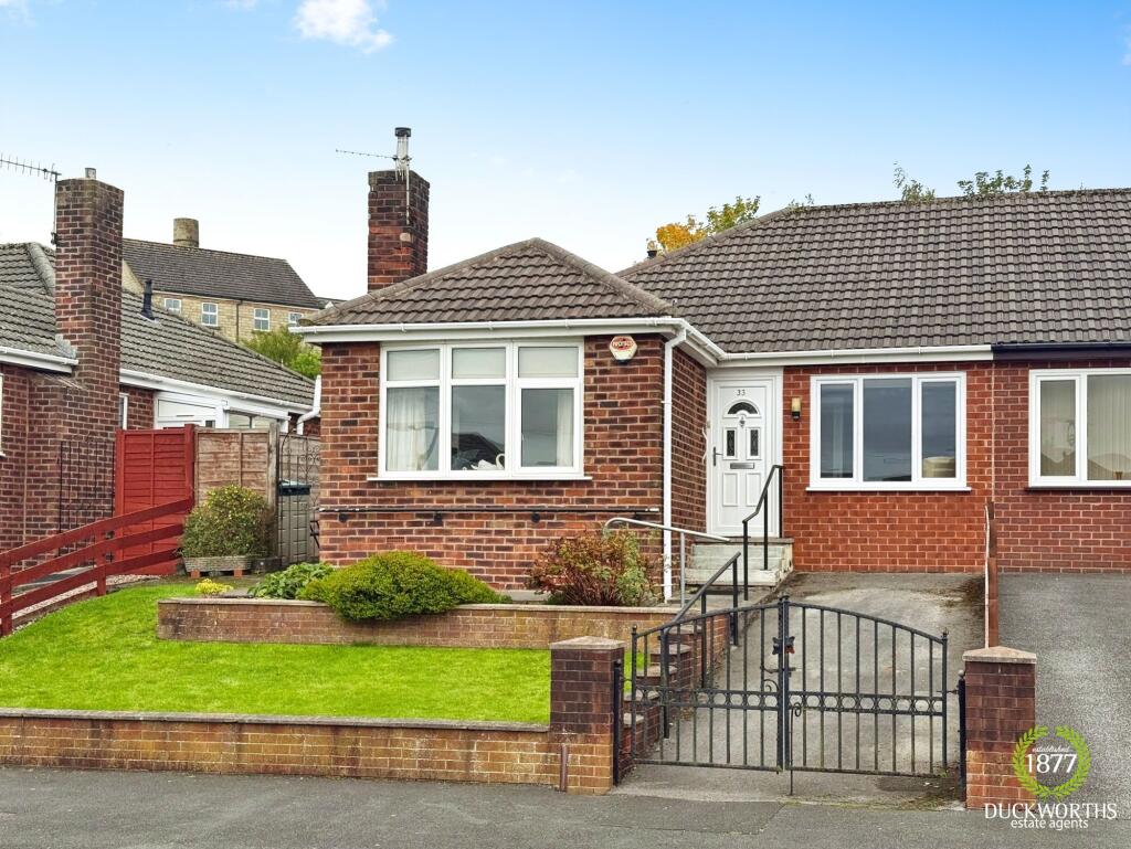
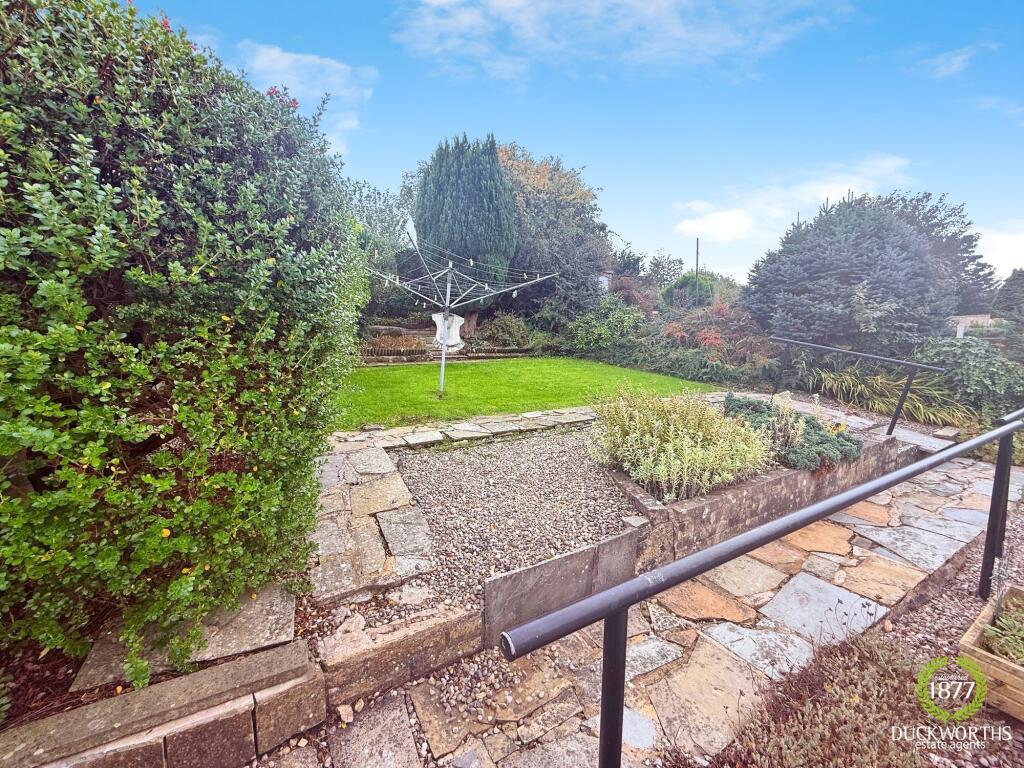
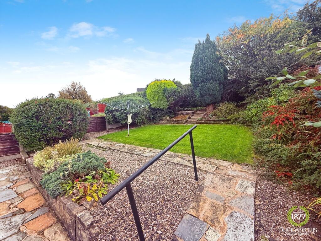
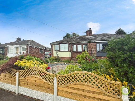
- Single-story residential property Mid-century bungalow
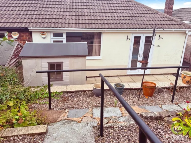
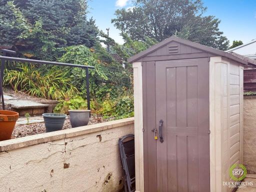
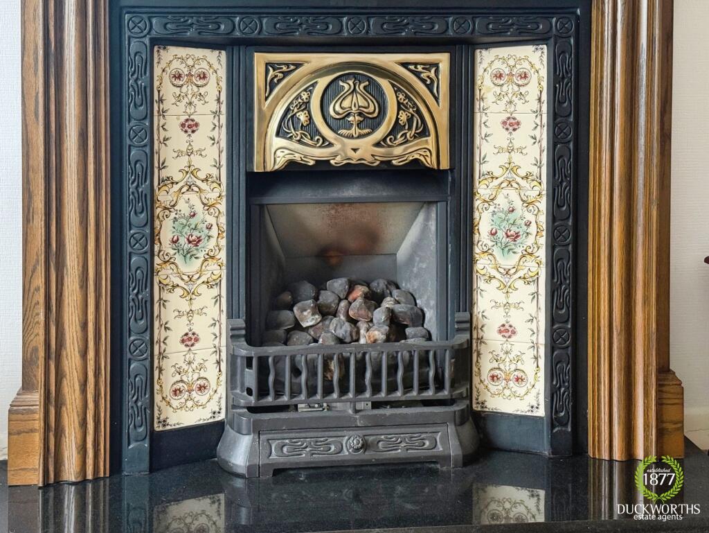
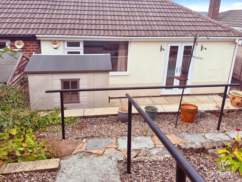
- garden cottage
Floorplan Description
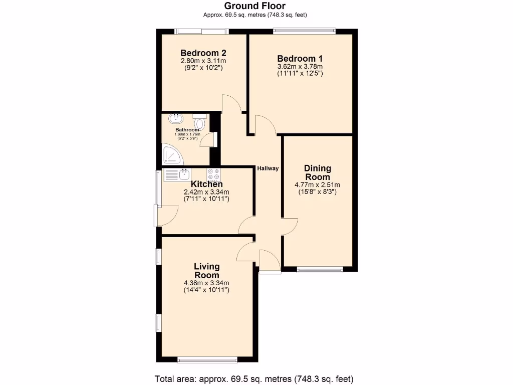
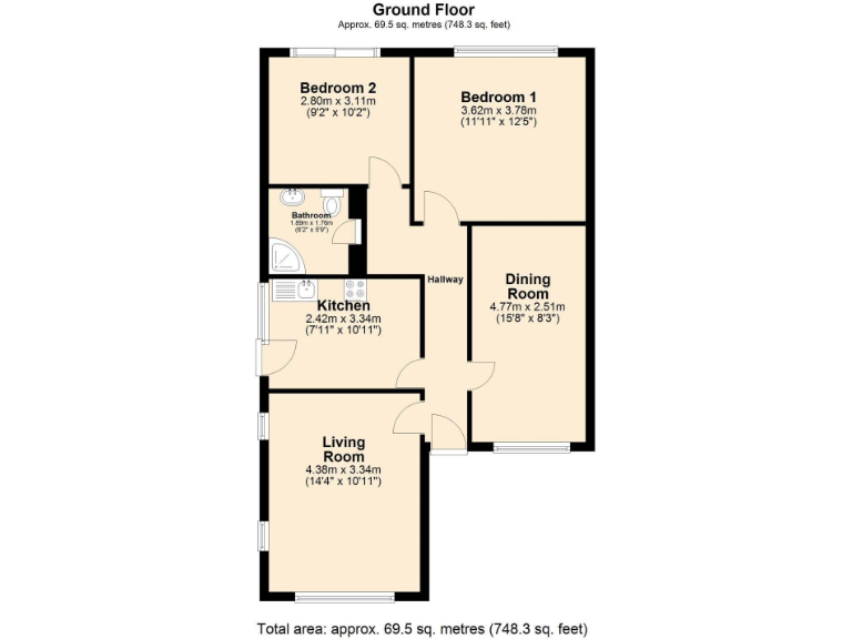
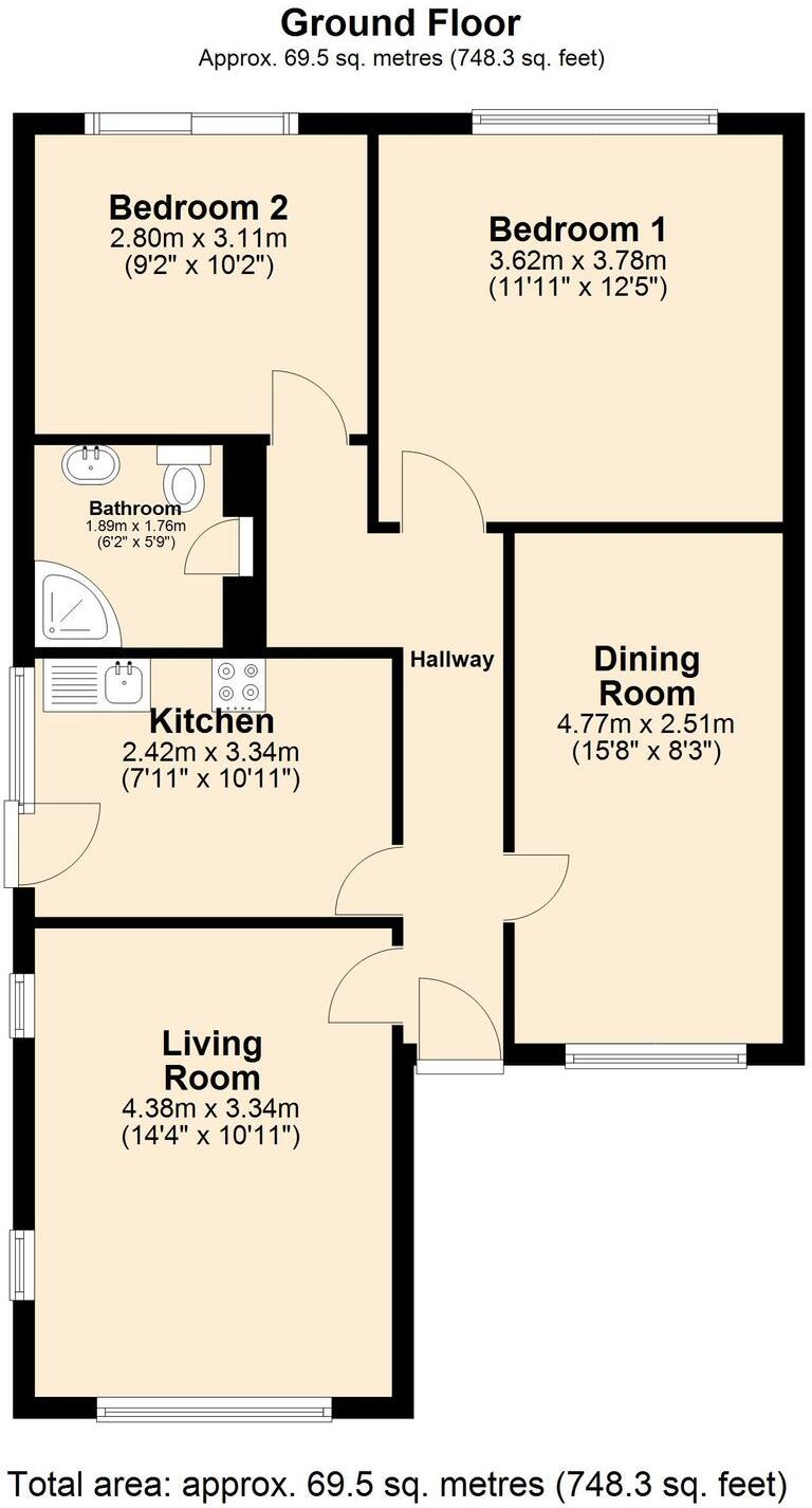
- Ground Floor plan showing rooms and dimensions.
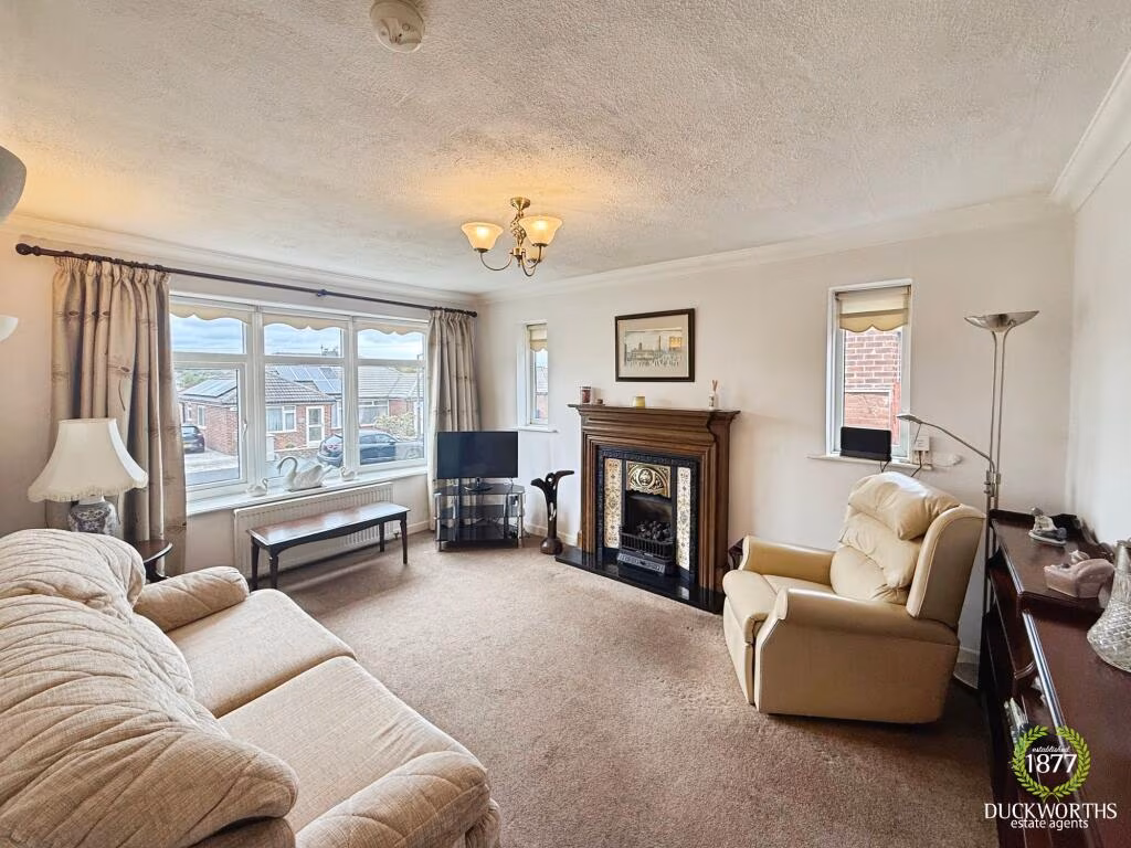
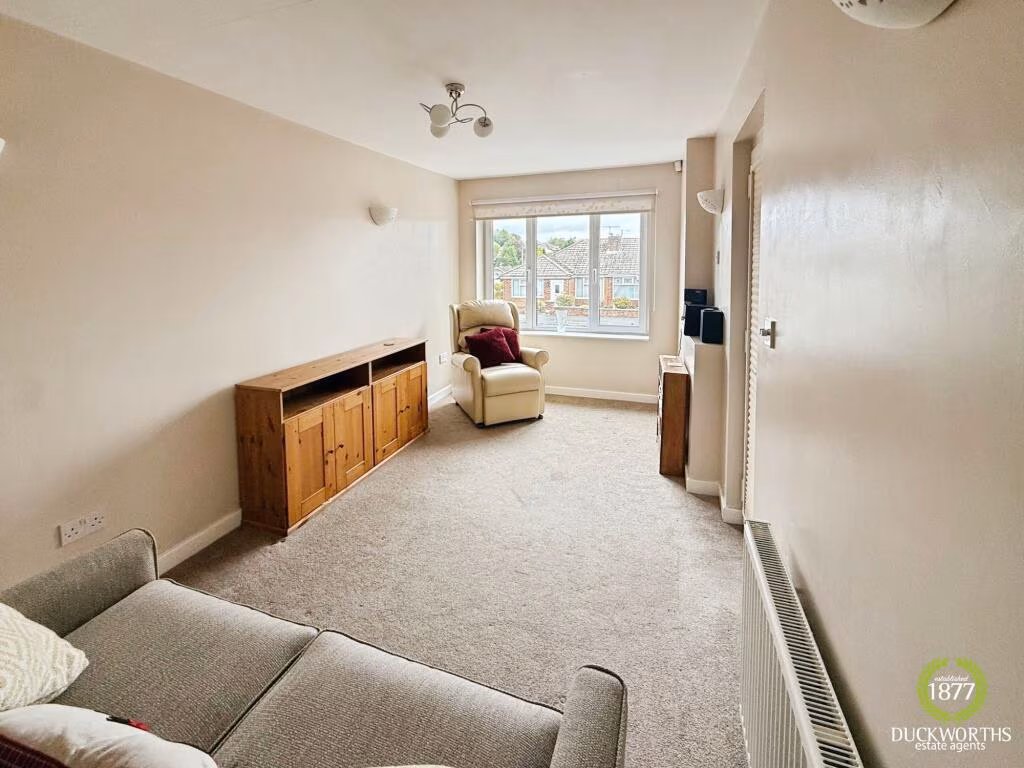
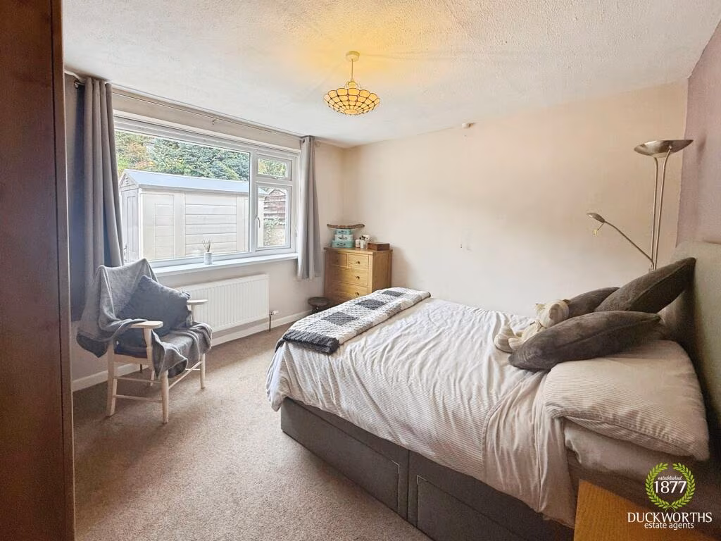
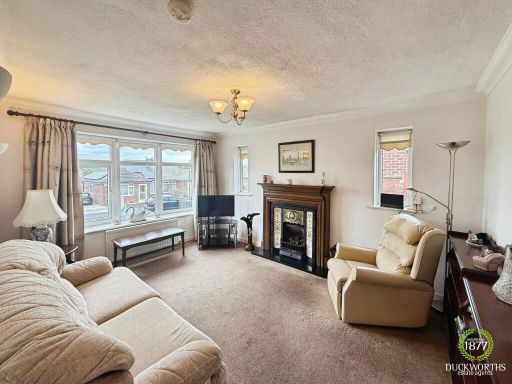
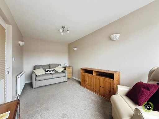
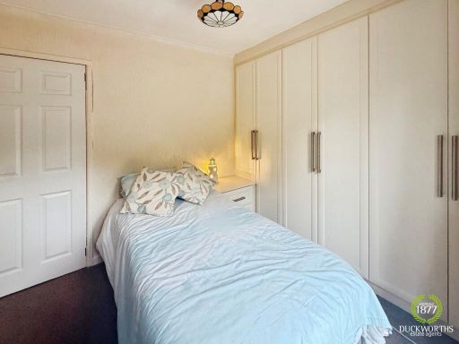
Rooms
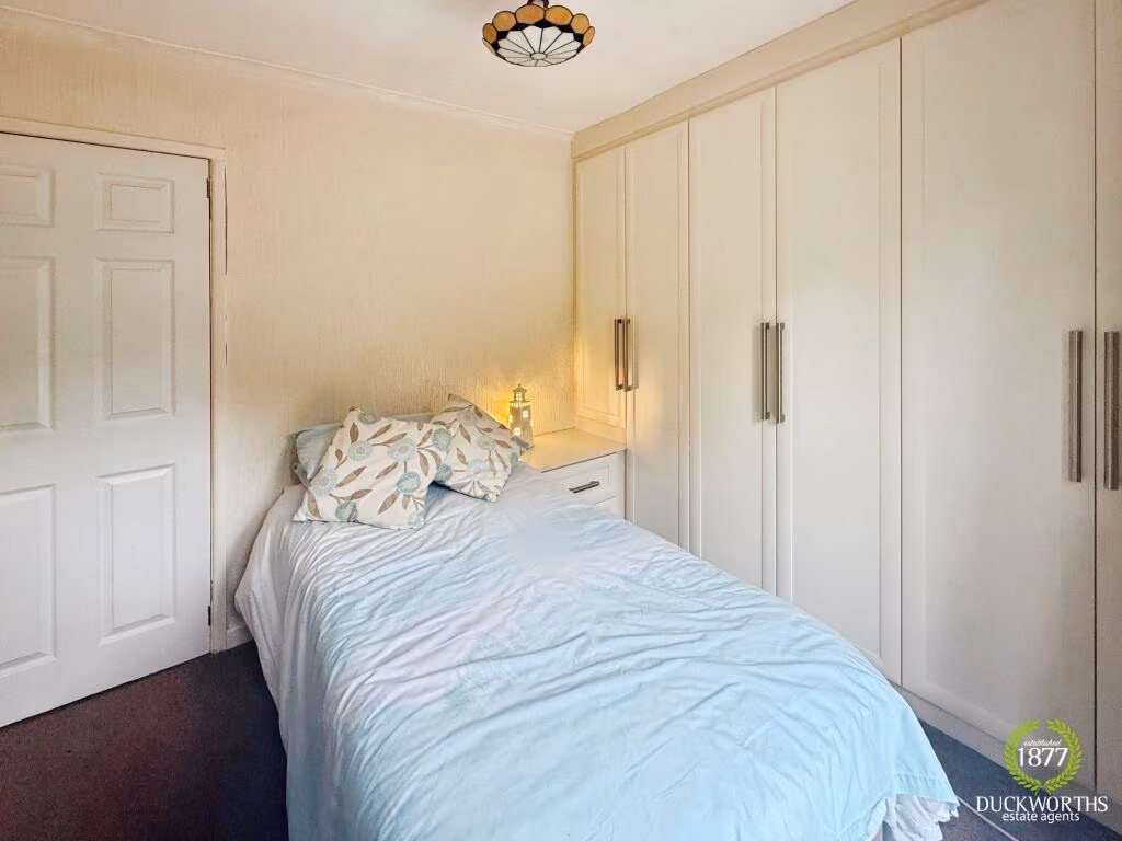
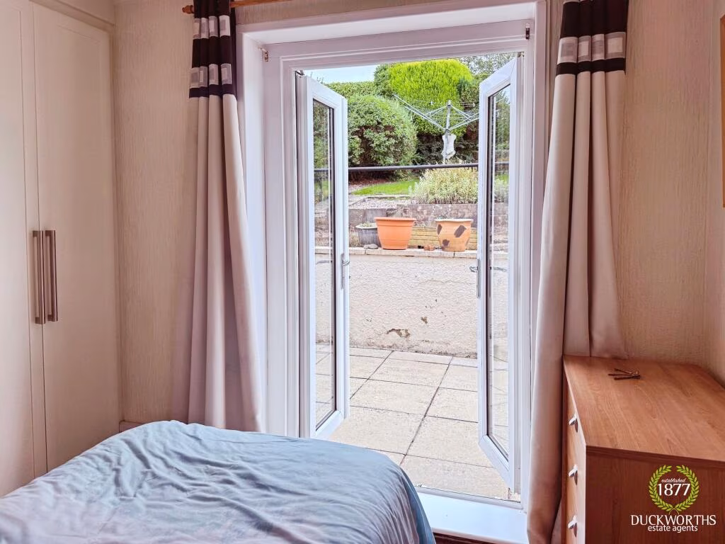
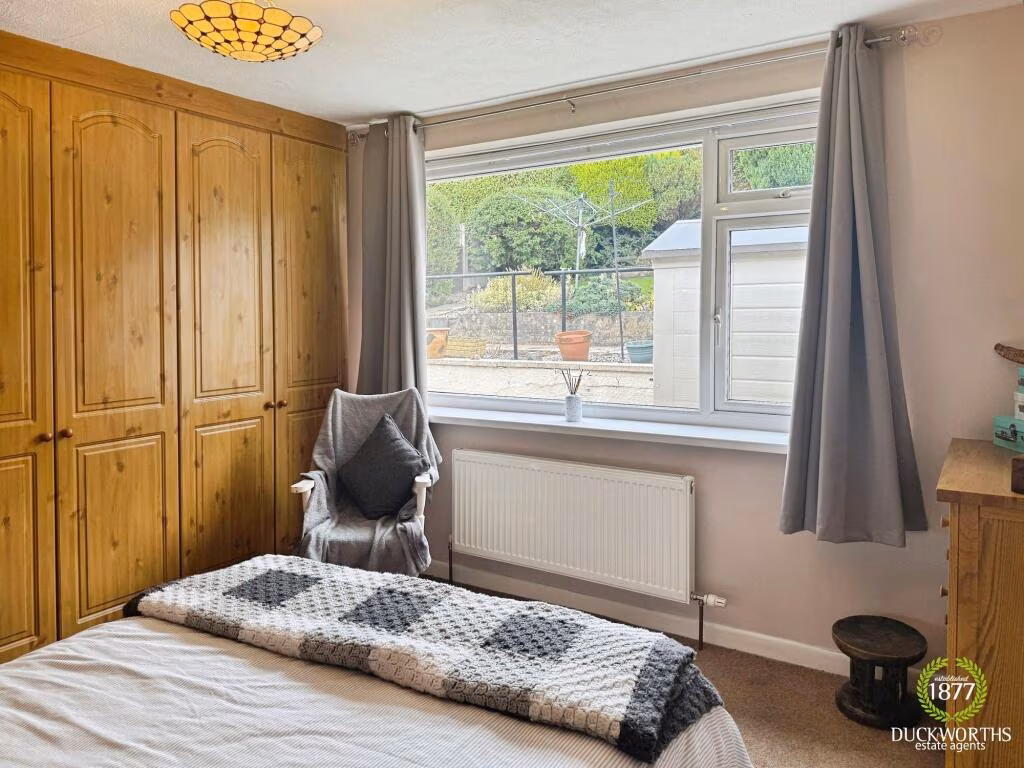
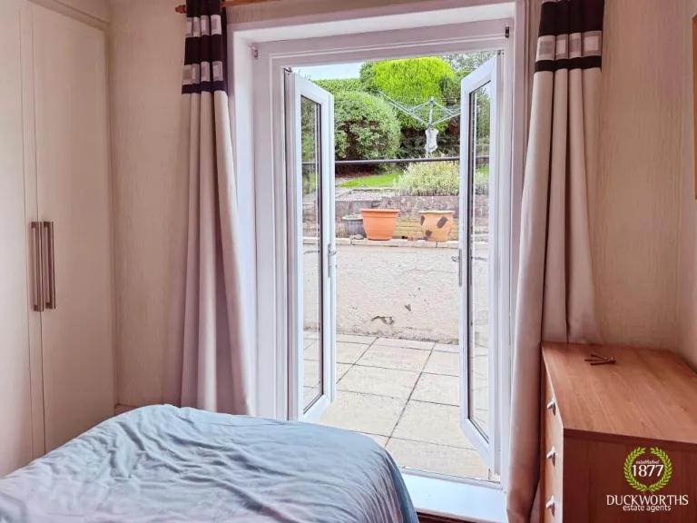
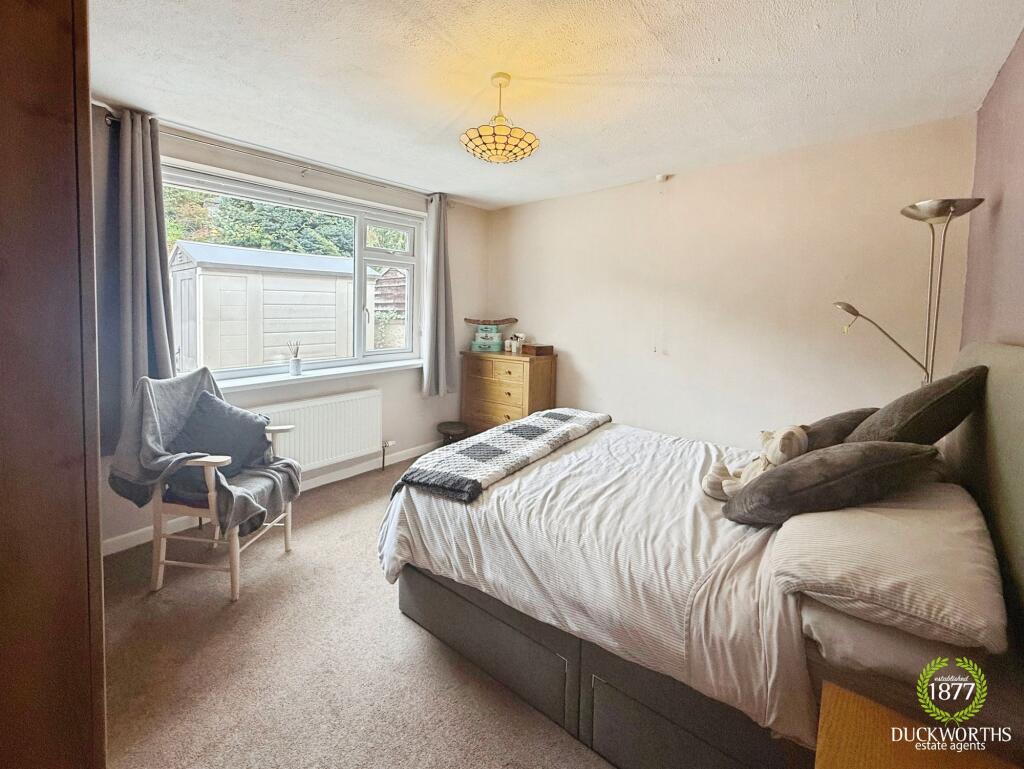
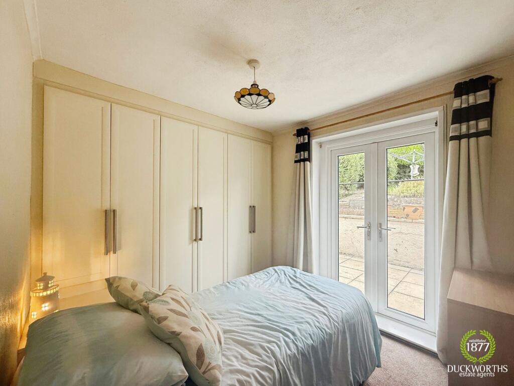
- Bedroom 2:
- Bedroom 1:
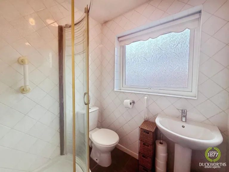
- Bathroom:
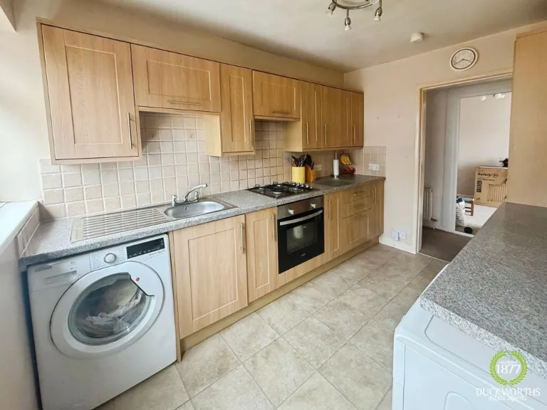
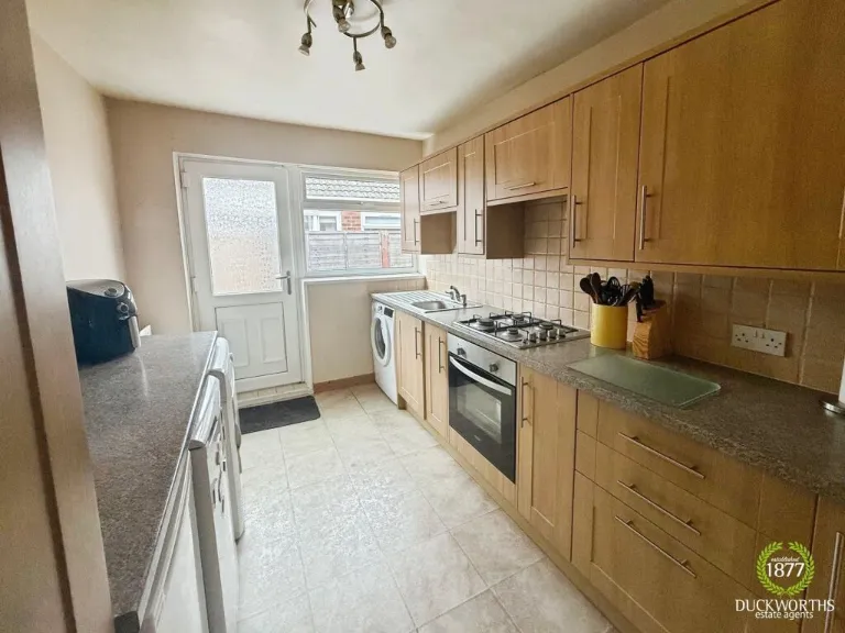
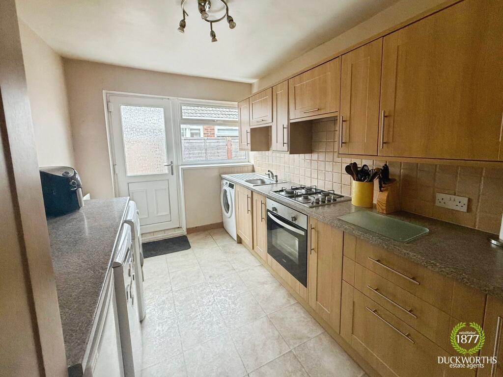
- Kitchen:
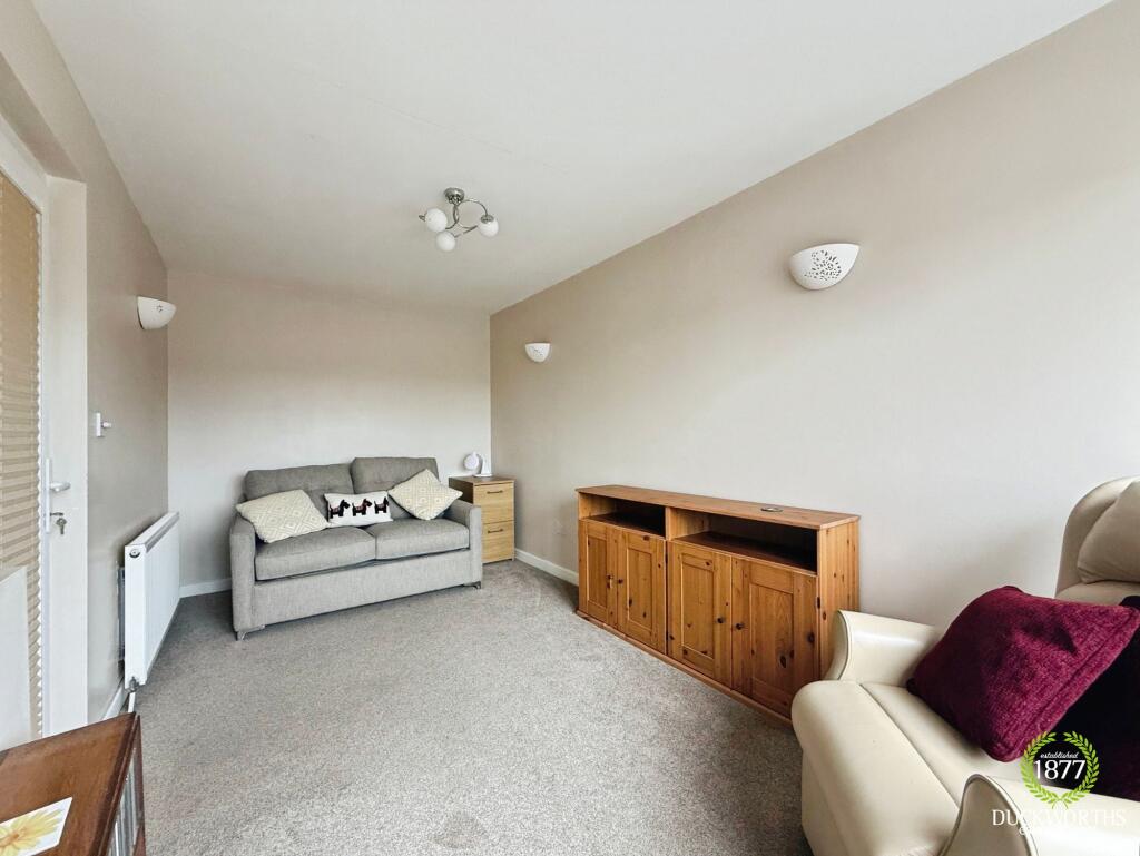
- Dining Room:
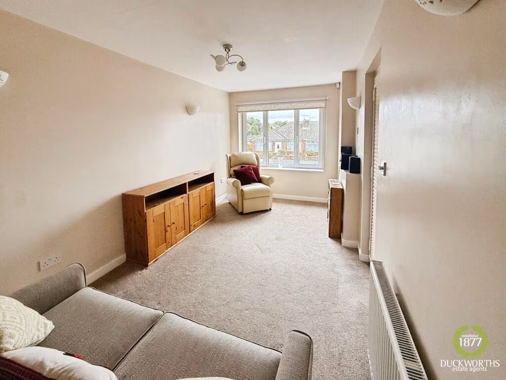
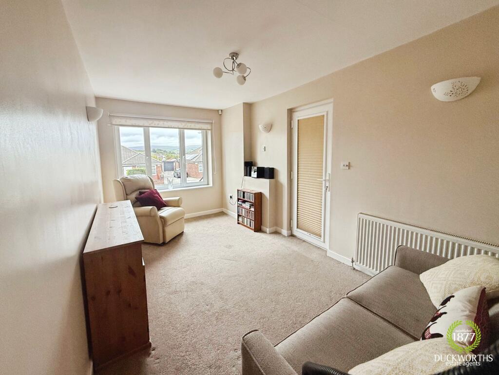
- Living Room:
- Hallway:
Textual Property Features
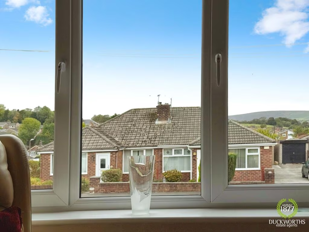
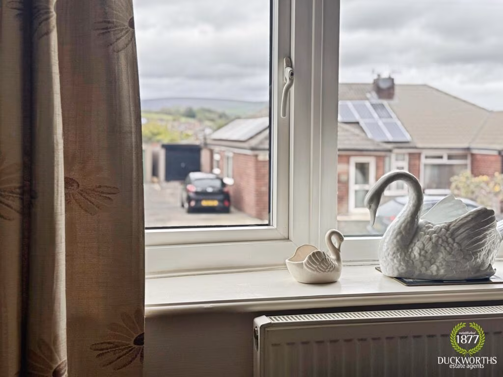
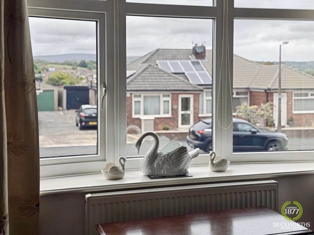
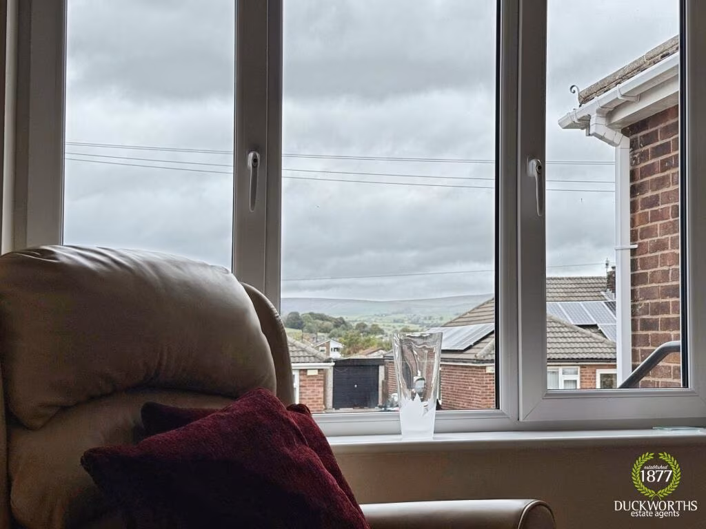
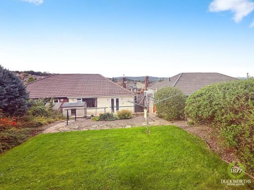
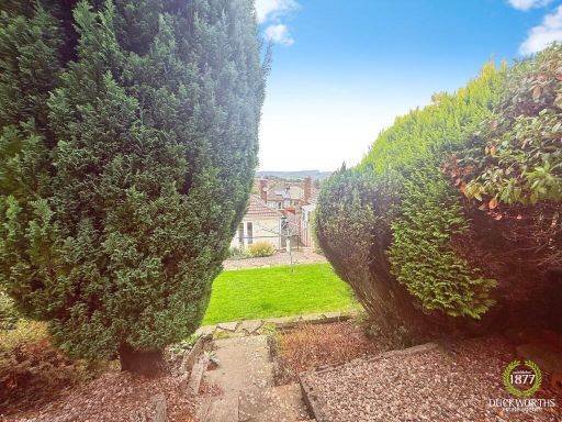
- Has Garden
- Chain Free
- Success
Detected Visual Features
- bungalow
- brick exterior
- single-story
- mid-century
- suburban
- chimney
- driveway
- garage potential
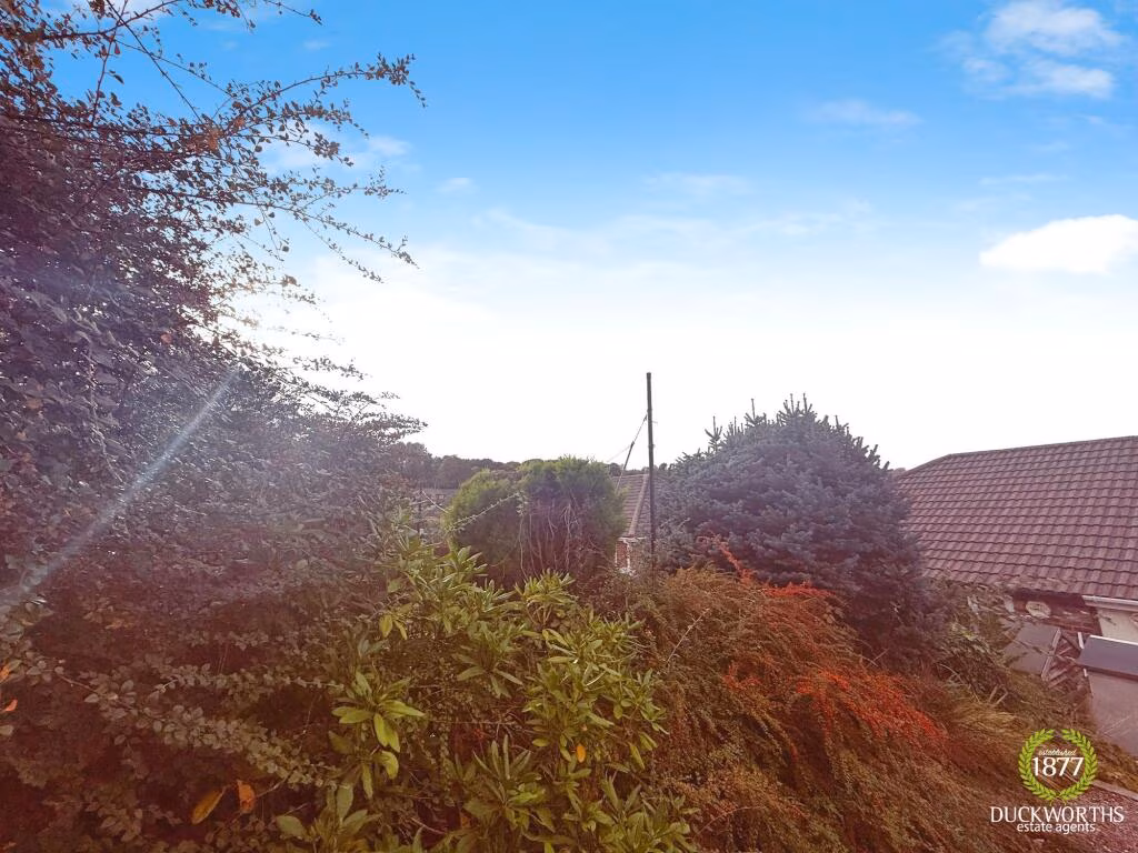
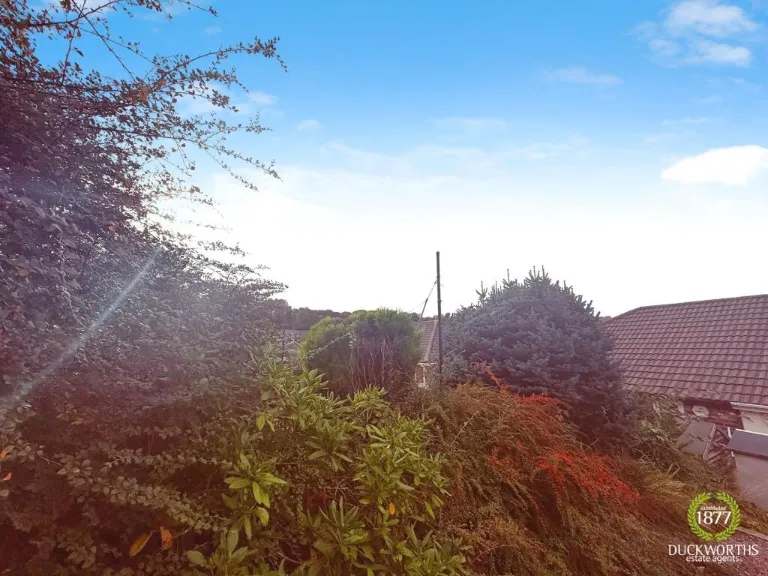
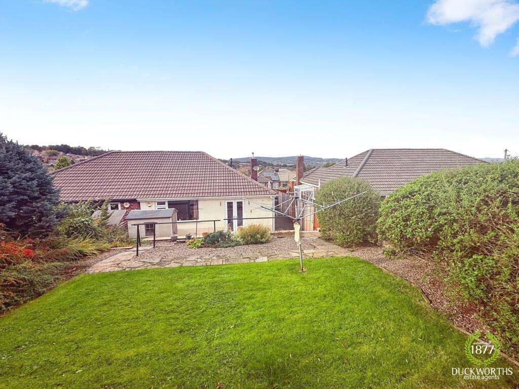
- garden
- mature trees
- shrubs
- lawn
- stone pathway
- elevated area
- greenery
- traditional garden
EPC Details
- Fully double glazed
- Cavity wall, filled cavity
- Boiler and radiators, mains gas
- Low energy lighting in all fixed outlets
- Solid, no insulation (assumed)
Nearby Schools
- Burnley Holy Trinity Church of England Primary School
- Whittlefield Primary School
- Burnley Stoneyholme Community Primary School
- Rawdhatul Uloom
- Heasandford Primary School
- Cherry Fold Community Primary School
- Coal Clough Academy
- Burnley St Peter's Church of England Primary School
- The Heights Burnley
- Christ The King Roman Catholic Primary School, a Voluntary Academy
- Burnley Springfield Community Primary School
- Rosegrove Infant School
- St Augustine of Canterbury RC Primary School, A Voluntary Academy
- Olive High
- Burnley Ightenhill Primary School
- Blessed Trinity Roman Catholic College, A Voluntary Academy
- Wellfield Methodist and Anglican Church School
- St Mary Magdalene Catholic Primary School, a Voluntary Academy
- Rosewood Primary School
- Burnley St Stephen's Church of England Voluntary Aided Primary School
- Burnley Lowerhouse Junior School
- St Mary's RC Primary School, a Voluntary Academy
- Lincoln House School
- Olive High Boys
- Burnley High School
- St Joseph's Park Hill School
- Barden Primary School
Nearest Bars And Restaurants
- Id: 444626412
- Tags:
- Addr:
- City: Burnley
- Housenumber: 41
- Postcode: BB11 4PG
- Street: Coal Clough Lane
- Amenity: pub
- Building: yes
- Name: Coal Clough Pub
- TagsNormalized:
- Lat: 53.7866619
- Lon: -2.2588086
- FullGeoHash: gcw3uxe4jbqp
- PartitionGeoHash: gcw3
- Images:
- FoodStandards: null
- Distance: 904.8
,- Id: 457320578
- Tags:
- Addr:
- City: Burnley
- Housenumber: 2A
- Postcode: BB11 4BT
- Street: Nairne Street
- Amenity: restaurant
- Building: yes
- Cuisine: kebab;burger;pizza
- Name: Samino's
- Takeaway: only
- Website: http://www.saminos.co.uk/
- TagsNormalized:
- restaurant
- kebab
- burgers
- pizza
- takeaway
- Lat: 53.7879745
- Lon: -2.2613699
- FullGeoHash: gcw3uxc3dm0m
- PartitionGeoHash: gcw3
- Images:
- FoodStandards: null
- Distance: 742.6
,- Id: 1093982190
- Tags:
- Amenity: cafe
- Brand: Starbucks
- Brand:wikidata: Q37158
- Building: yes
- Cuisine: coffee_shop
- Name: Starbucks
- Official_name: Starbucks Coffee
- Takeaway: yes
- TagsNormalized:
- cafe
- starbucks
- coffee
- takeaway
- Lat: 53.7884026
- Lon: -2.2610978
- FullGeoHash: gcw3uxcs0sgr
- PartitionGeoHash: gcw3
- Images:
- FoodStandards: null
- Distance: 695.3
,- Id: 444331856
- Tags:
- Addr:
- City: Burnley
- Housenumber: 1
- Postcode: BB11 4SB
- Street: Barracks Road
- Amenity: restaurant
- Building: yes
- Name: Kenanks
- TagsNormalized:
- Lat: 53.7894247
- Lon: -2.2610968
- FullGeoHash: gcw6h81d0es0
- PartitionGeoHash: gcw6
- Images:
- FoodStandards: null
- Distance: 581.7
,- Id: 91932414
- Tags:
- Amenity: pub
- Building: yes
- Name: The Tim Bobbin
- TagsNormalized:
- Lat: 53.7935966
- Lon: -2.2691626
- FullGeoHash: gcw6h2gdktjw
- PartitionGeoHash: gcw6
- Images:
- FoodStandards: null
- Distance: 523
}
Nearest General Shops
- Id: 473671429
- Tags:
- Addr:
- City: Burnley
- Postcode: BB11 4NS
- Street: Coal Clough Lane
- Building: yes
- Name: Allure
- Shop: hairdresser
- TagsNormalized:
- Lat: 53.7854531
- Lon: -2.2585436
- FullGeoHash: gcw3ux76up5v
- PartitionGeoHash: gcw3
- Images:
- FoodStandards: null
- Distance: 1040.1
,- Id: 316954379
- Tags:
- Addr:
- City: Burnley
- Housename: Princess Way Retail Park
- Housenumber: 11
- Postcode: BB12 0AD
- Street: Canning Street
- Brand: Argos
- Brand:wikidata: Q4789707
- Brand:wikipedia: en:Argos (retailer)
- Building: retail
- Contact:
- Website: https://www.argos.co.uk/stores/786-burnley-retail-park-argos
- Name: Argos
- Shop: catalogue
- TagsNormalized:
- Lat: 53.7940574
- Lon: -2.2461016
- FullGeoHash: gcw6hbumn517
- PartitionGeoHash: gcw6
- Images:
- FoodStandards: null
- Distance: 1007.2
,- Id: 444329771
- Tags:
- Addr:
- City: Burnley
- Housenumber: 215-233
- Postcode: BB11 5ES
- Street: Accrington Road
- Building: yes
- Name: The Fireplace Warehouse
- Shop: fireplace
- Website: https://www.thefireplacewarehouse.co.uk/
- TagsNormalized:
- Lat: 53.7868911
- Lon: -2.2685753
- FullGeoHash: gcw3urs5675x
- PartitionGeoHash: gcw3
- Images:
- FoodStandards: null
- Distance: 983.3
}
Nearest Grocery shops
- Id: 444329773
- Tags:
- Addr:
- City: Burnley
- Housenumber: 200
- Postcode: BB11 5ES
- Street: Cog Lane
- Brand: Farmfoods
- Brand:wikidata: Q5435841
- Brand:wikipedia: en:Farmfoods
- Building: yes
- Contact:
- Website: https://www.farmfoods.co.uk/store-finder.php?branch_code=339
- Name: Farmfoods
- Opening_hours:
- Url: https://www.farmfoods.co.uk/store-finder.php?branch_code=339
- Shop: frozen_food
- TagsNormalized:
- farmfoods
- frozen food
- food
- shop
- Lat: 53.7864036
- Lon: -2.2678932
- FullGeoHash: gcw3urs8d227
- PartitionGeoHash: gcw3
- Images:
- FoodStandards: null
- Distance: 1011.5
,- Id: 444626410
- Tags:
- Addr:
- City: Burnley
- Housenumber: 47-51
- Postcode: BB11 4NS
- Street: Coal Clough Lane
- Building: yes
- Name: Premier - Singhs Convenience Store
- Shop: alcohol
- Website: https://premier-stores.co.uk/
- TagsNormalized:
- convenience
- premier
- alcohol
- shop
- Lat: 53.7863373
- Lon: -2.2587982
- FullGeoHash: gcw3uxe0n5vz
- PartitionGeoHash: gcw3
- Images:
- FoodStandards: null
- Distance: 940.4
,- Id: 1093982188
- Tags:
- Brand: Spar
- Brand:wikidata: Q610492
- Building: yes
- Name: Spar
- Shop: convenience
- TagsNormalized:
- Lat: 53.7885348
- Lon: -2.2621914
- FullGeoHash: gcw3uxbszjeu
- PartitionGeoHash: gcw3
- Images:
- FoodStandards: null
- Distance: 682.3
}
Nearest Religious buildings
- Id: 401386735
- Tags:
- Addr:
- Postcode: BB11 4LB
- Street: Raglan Road
- Amenity: school
- Capacity: 210
- Denomination: anglican
- Diocese: Diocese of Blackburn
- Isced:
- Max_age: 11
- Min_age: 4
- Name: Burnley Holy Trinity Church of England Primary School
- Phone: +44 1282 434368
- Ref:
- Religion: christian
- School:
- Boarding: no
- Gender: mixed
- Selective: no
- Trust: no
- Type: voluntary_aided
- Website: https://holytrinitycofe.lancs.sch.uk/
- Wikidata: Q66137700
- TagsNormalized:
- school
- anglican
- church
- christian
- Lat: 53.7862909
- Lon: -2.2556426
- FullGeoHash: gcw3uxmrzeqf
- PartitionGeoHash: gcw3
- Images:
- FoodStandards: null
- Distance: 1003.9
,- Id: 102657418
- Tags:
- Amenity: place_of_worship
- Building: church
- Denomination: methodist
- Name: Padiham Road Methodist Church
- Religion: christian
- Source: OS StreetView
- TagsNormalized:
- place of worship
- church
- methodist
- christian
- Lat: 53.7950937
- Lon: -2.2720668
- FullGeoHash: gcw6h31e1h21
- PartitionGeoHash: gcw6
- Images:
- FoodStandards: null
- Distance: 702.1
,- Id: 102657410
- Tags:
- Amenity: place_of_worship
- Building: yes
- Source: OS StreetView
- TagsNormalized:
- Lat: 53.7963263
- Lon: -2.2593268
- FullGeoHash: gcw6h96f3f5f
- PartitionGeoHash: gcw6
- Images:
- FoodStandards: null
- Distance: 230.7
}
Nearest Medical buildings
- Id: 945058150
- Tags:
- Amenity: doctors
- Building: yes
- Healthcare: doctor
- TagsNormalized:
- doctor
- doctors
- health
- healthcare
- Lat: 53.7948954
- Lon: -2.2413577
- FullGeoHash: gcw6hcpcux6d
- PartitionGeoHash: gcw6
- Images:
- FoodStandards: null
- Distance: 1316.9
,- Id: 7497223032
- Tags:
- Addr:
- City: Burnley
- Country: GB
- Postcode: BB12 0EQ
- Street: Princess Way
- Amenity: pharmacy
- Brand: Asda
- Brand:wikidata: Q297410
- Brand:wikipedia: en:Asda
- Contact:
- Phone: +44 1282 838177
- Website: https://storelocator.asda.com/north-west/burnley/princess-way/pharmacy
- Fhrs:
- Fixme: Location not accurate
- Healthcare: pharmacy
- Name: Asda
- Operator: Asda Stores Ltd
- TagsNormalized:
- pharmacy
- asda
- health
- healthcare
- Lat: 53.7952015
- Lon: -2.2443386
- FullGeoHash: gcw6hcjez07u
- PartitionGeoHash: gcw6
- Images:
- FoodStandards: null
- Distance: 1122.5
,- Id: 473868309
- Tags:
- Addr:
- City: Burnley
- Housenumber: 68-70
- Postcode: BB11 4NW
- Street: Coal Clough Lane
- Amenity: pharmacy
- Building: yes
- Name: Cohens Chemist
- Website: https://www.cohenschemist.co.uk/
- TagsNormalized:
- pharmacy
- chemist
- cohens chemist
- Lat: 53.7850327
- Lon: -2.2580463
- FullGeoHash: gcw3ux78x8y9
- PartitionGeoHash: gcw3
- Images:
- FoodStandards: null
- Distance: 1092.2
,- Id: 457320563
- Tags:
- Addr:
- City: Burnley
- Postcode: BB11 4PQ
- Street: Howard Street
- Amenity: community_centre
- Building: yes
- Name: Howard Street Community Health Centre - NHS Choices
- Operator: National Health Service
- Website: nhs.uk
- TagsNormalized:
- community centre
- health
- health centre
- nhs
- Lat: 53.7873422
- Lon: -2.2595573
- FullGeoHash: gcw3uxdturrf
- PartitionGeoHash: gcw3
- Images:
- FoodStandards: null
- Distance: 821.9
}
Nearest Leisure Facilities
- Id: 907177145
- Tags:
- Leisure: pitch
- Sport: bowls
- TagsNormalized:
- Lat: 53.7942866
- Lon: -2.2539729
- FullGeoHash: gcw6h8ywqtgf
- PartitionGeoHash: gcw6
- Images:
- FoodStandards: null
- Distance: 489.7
,- Id: 511502213
- Tags:
- Leisure: pitch
- Sport: basketball
- TagsNormalized:
- pitch
- leisure
- basketball
- sports
- Lat: 53.7989337
- Lon: -2.2620769
- FullGeoHash: gcw6h9bc9b1h
- PartitionGeoHash: gcw6
- Images:
- FoodStandards: null
- Distance: 478
,- Id: 942903109
- Tags:
- TagsNormalized:
- Lat: 53.7945812
- Lon: -2.2666945
- FullGeoHash: gcw6h3j2nhy0
- PartitionGeoHash: gcw6
- Images:
- FoodStandards: null
- Distance: 347.6
,- Id: 477744309
- Tags:
- TagsNormalized:
- Lat: 53.7934152
- Lon: -2.2654647
- FullGeoHash: gcw6h2y36g7h
- PartitionGeoHash: gcw6
- Images:
- FoodStandards: null
- Distance: 300.2
,- Id: 942903118
- Tags:
- Leisure: pitch
- Sport: basketball
- TagsNormalized:
- pitch
- leisure
- basketball
- sports
- Lat: 53.7928413
- Lon: -2.2646973
- FullGeoHash: gcw6h2wyh8rm
- PartitionGeoHash: gcw6
- Images:
- FoodStandards: null
- Distance: 295.7
}
Nearest Tourist attractions
- Id: 330265161
- Tags:
- HE_ref: 1247300
- Building: yes
- Heritage: 2
- Heritage:operator: Historic England
- Historic: heritage
- Listed_status: Grade II
- Name: Museum of Local Crafts & Industries
- Note: opened 1971
- Operator: Burnley Borough Council
- Start_date: 1790
- Tourism: museum
- Website: https://historicengland.org.uk/listing/the-list/list-entry/1247300
- Wikidata: Q113369839
- TagsNormalized:
- Lat: 53.7741404
- Lon: -2.2230967
- FullGeoHash: gcw3vmm1n46f
- PartitionGeoHash: gcw3
- Images:
- FoodStandards: null
- Distance: 3396.5
,- Id: 52345147
- Tags:
- Building: house
- Historic: manor
- Name: Gawthorpe Hall
- Tourism: museum
- Wikidata: Q5528499
- Wikipedia: en:Gawthorpe Hall
- TagsNormalized:
- Lat: 53.8027522
- Lon: -2.2948019
- FullGeoHash: gcw65f2zxpzw
- PartitionGeoHash: gcw6
- Images:
- FoodStandards: null
- Distance: 2371.1
,- Id: 1371242127
- Tags:
- Name: Ormerod
- Tourism: guest_house
- TagsNormalized:
- Lat: 53.794089
- Lon: -2.2332877
- FullGeoHash: gcw6j0vv295b
- PartitionGeoHash: gcw6
- Images:
- FoodStandards: null
- Distance: 1847.7
}
Nearest Bus stations and stops
- Id: 5003181370
- Tags:
- Highway: bus_stop
- Name: Allerton Drive
- Public_transport: platform
- TagsNormalized:
- Lat: 53.7923046
- Lon: -2.2614339
- FullGeoHash: gcw6h896bu2e
- PartitionGeoHash: gcw6
- Images:
- FoodStandards: null
- Distance: 261.2
,- Id: 5003181368
- Tags:
- Highway: bus_stop
- Name: Crow Wood Farm
- Public_transport: platform
- TagsNormalized:
- Lat: 53.7934187
- Lon: -2.2641262
- FullGeoHash: gcw6h2z36h11
- PartitionGeoHash: gcw6
- Images:
- FoodStandards: null
- Distance: 225.5
,- Id: 5003181364
- Tags:
- Highway: bus_stop
- Name: Crow Wood Avenue
- Public_transport: platform
- TagsNormalized:
- Lat: 53.7959105
- Lon: -2.2592507
- FullGeoHash: gcw6h94zgss9
- PartitionGeoHash: gcw6
- Images:
- FoodStandards: null
- Distance: 198.8
,- Id: 5003181365
- Tags:
- Highway: bus_stop
- Name: Clifton Farm Shops
- Public_transport: platform
- TagsNormalized:
- Lat: 53.7963248
- Lon: -2.2611685
- FullGeoHash: gcw6h936qcy9
- PartitionGeoHash: gcw6
- Images:
- FoodStandards: null
- Distance: 186.5
,- Id: 5003181367
- Tags:
- Highway: bus_stop
- Name: Coverdale Way
- Public_transport: platform
- TagsNormalized:
- Lat: 53.7945728
- Lon: -2.262043
- FullGeoHash: gcw6h90b4e4q
- PartitionGeoHash: gcw6
- Images:
- FoodStandards: null
- Distance: 43
}
Nearest Hotels
- Id: 36931375
- Tags:
- Addr:
- City: Burnley
- Postcode: BB10 3EF
- Street: Queen Victoria Road
- Brand: Premier Inn
- Brand:wikidata: Q2108626
- Building: yes
- Contact:
- Website: https://www.premierinn.com/gb/en/hotels/england/lancashire/burnley/burnley.html
- Name: Premier Inn
- Source: yahoo_imagery
- Tourism: hotel
- TagsNormalized:
- Lat: 53.7965741
- Lon: -2.2329245
- FullGeoHash: gcw6j1q5c06b
- PartitionGeoHash: gcw6
- Images:
- FoodStandards: null
- Distance: 1882.6
,- Id: 444331855
- Tags:
- Addr:
- City: Burnley
- Street: Barracks Road
- Brand: Travelodge
- Brand:wikidata: Q9361374
- Building: yes
- Internet_access: yes
- Internet_access:fee: customers
- Internet_access:ssid: Travelodge WiFi
- Name: Travelodge
- Smoking: outside
- Stars: 3
- Tourism: hotel
- Website: https://www.travelodge.co.uk
- TagsNormalized:
- Lat: 53.7895033
- Lon: -2.260505
- FullGeoHash: gcw6h81fw6jm
- PartitionGeoHash: gcw6
- Images:
- FoodStandards: null
- Distance: 575.7
,- Id: 773641254
- Tags:
- Name: Holiday Inn Express Burnley
- Phone: +44 1282 855 955
- Source: OS OpenData StreetView
- Tourism: hotel
- Website: https://www.hiexburnley.com/
- TagsNormalized:
- Lat: 53.7938815
- Lon: -2.2563814
- FullGeoHash: gcw6h8uund24
- PartitionGeoHash: gcw6
- Images:
- FoodStandards: null
- Distance: 340.8
}
Tags
- bungalow
- brick exterior
- single-story
- mid-century
- suburban
- chimney
- driveway
- garage potential
- garden
- garden
- mature trees
- shrubs
- lawn
- stone pathway
- elevated area
- greenery
- traditional garden
Local Market Stats
- Average Price/sqft: £160
- Avg Income: £38300
- Rental Yield: 3.9%
- Social Housing: 7%
- Planning Success Rate: 83%
AirBnB Data
- 1km average: £87/night
- Listings in 1km: 2
Similar Properties
 2 bedroom semi-detached bungalow for sale in Crow Wood Avenue, Burnley, BB12 — £180,000 • 2 bed • 1 bath
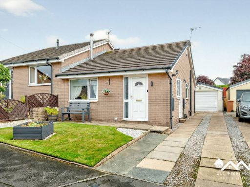 2 bedroom semi-detached bungalow for sale in Kirkfell Drive, Ightenhill, Burnley, BB12 — £185,000 • 2 bed • 1 bath • 1074 ft²
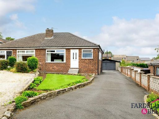 2 bedroom semi-detached bungalow for sale in Hargrove Avenue, Burnley, BB12 — £170,000 • 2 bed • 1 bath • 1025 ft²
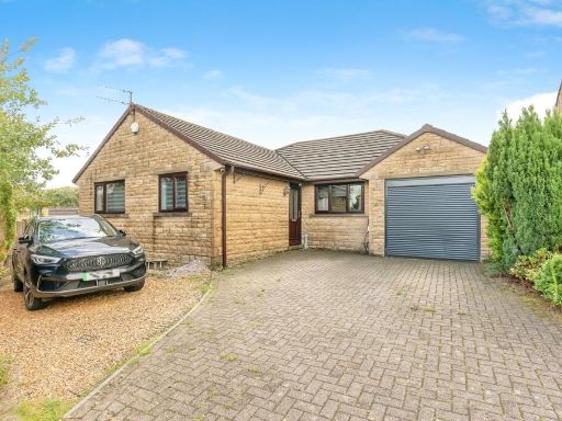 3 bedroom bungalow for sale in Stainton Drive, Burnley, Lancashire, BB12 — £320,000 • 3 bed • 2 bath • 1305 ft²
 2 bedroom semi-detached bungalow for sale in Crow Wood Avenue, Burnley, BB12 — £179,995 • 2 bed • 1 bath • 489 ft²
 2 bedroom semi-detached bungalow for sale in Wellfield Drive, Burnley, BB12 — £204,950 • 2 bed • 1 bath • 866 ft²
Meta
- {
"@context": "https://schema.org",
"@type": "Residence",
"name": "2 bedroom semidetached house for sale in Crow Wood Avenue,…",
"description": "",
"url": "https://propertypiper.co.uk/property/109b79cc-70ae-4f91-bcf6-2075aa696486",
"image": "https://image-a.propertypiper.co.uk/6463b902-5749-4f30-88f8-07ef699ce054-1024.jpeg",
"address": {
"@type": "PostalAddress",
"streetAddress": "33 CROW WOOD AVENUE BURNLEY",
"postalCode": "BB12 0JG",
"addressLocality": "Burnley",
"addressRegion": "Burnley",
"addressCountry": "England"
},
"geo": {
"@type": "GeoCoordinates",
"latitude": 53.79465324567624,
"longitude": -2.261403109003742
},
"numberOfRooms": 2,
"numberOfBathroomsTotal": 1,
"floorSize": {
"@type": "QuantitativeValue",
"value": 748,
"unitCode": "FTK"
},
"offers": {
"@type": "Offer",
"price": 180000,
"priceCurrency": "GBP",
"availability": "https://schema.org/InStock"
},
"additionalProperty": [
{
"@type": "PropertyValue",
"name": "Feature",
"value": "bungalow"
},
{
"@type": "PropertyValue",
"name": "Feature",
"value": "brick exterior"
},
{
"@type": "PropertyValue",
"name": "Feature",
"value": "single-story"
},
{
"@type": "PropertyValue",
"name": "Feature",
"value": "mid-century"
},
{
"@type": "PropertyValue",
"name": "Feature",
"value": "suburban"
},
{
"@type": "PropertyValue",
"name": "Feature",
"value": "chimney"
},
{
"@type": "PropertyValue",
"name": "Feature",
"value": "driveway"
},
{
"@type": "PropertyValue",
"name": "Feature",
"value": "garage potential"
},
{
"@type": "PropertyValue",
"name": "Feature",
"value": "garden"
},
{
"@type": "PropertyValue",
"name": "Feature",
"value": "garden"
},
{
"@type": "PropertyValue",
"name": "Feature",
"value": "mature trees"
},
{
"@type": "PropertyValue",
"name": "Feature",
"value": "shrubs"
},
{
"@type": "PropertyValue",
"name": "Feature",
"value": "lawn"
},
{
"@type": "PropertyValue",
"name": "Feature",
"value": "stone pathway"
},
{
"@type": "PropertyValue",
"name": "Feature",
"value": "elevated area"
},
{
"@type": "PropertyValue",
"name": "Feature",
"value": "greenery"
},
{
"@type": "PropertyValue",
"name": "Feature",
"value": "traditional garden"
}
]
}
High Res Floorplan Images
Compatible Floorplan Images
FloorplanImages Thumbnail