SS15 6JQ - 4 bedroom detached house for sale in Warwick Crescent, Basi…
View on Property Piper
4 bedroom detached house for sale in Warwick Crescent, Basildon, SS15
Property Details
- Price: £550000
- Bedrooms: 4
- Bathrooms: 3
- Property Type: undefined
- Property SubType: undefined
Brochure Descriptions
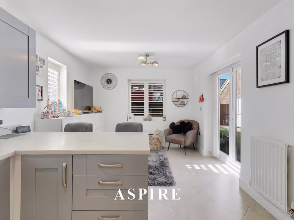
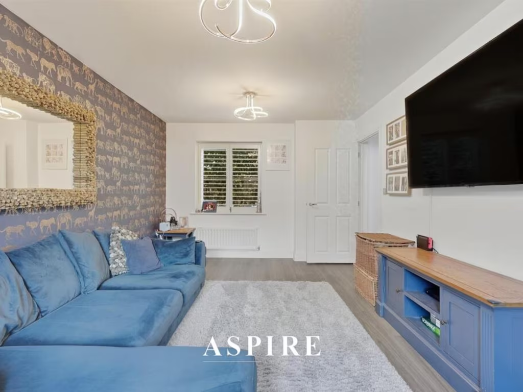
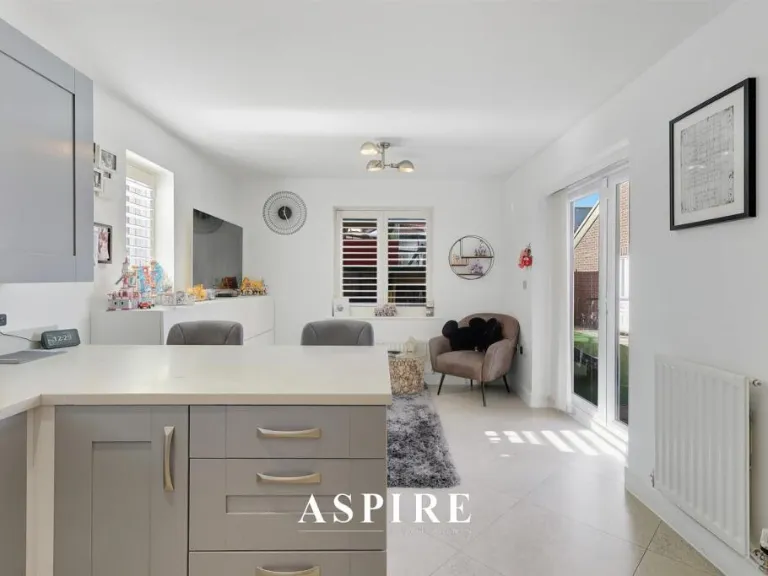
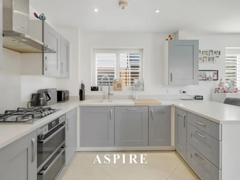
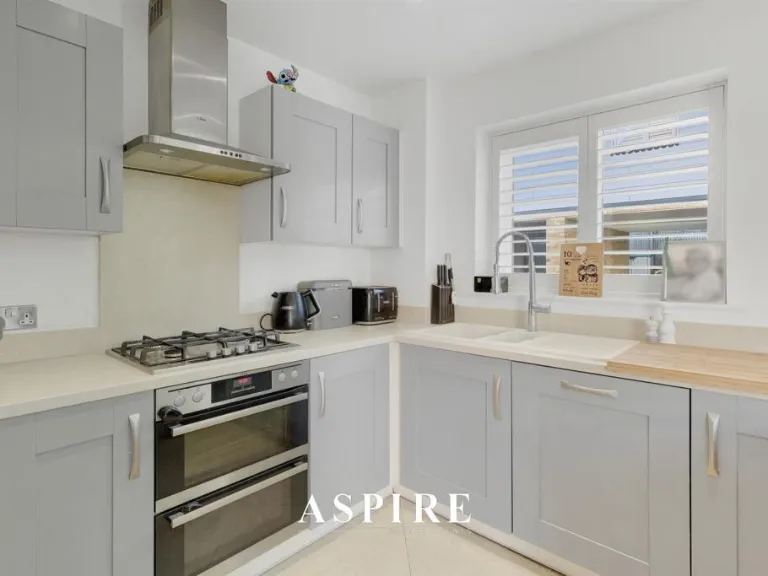
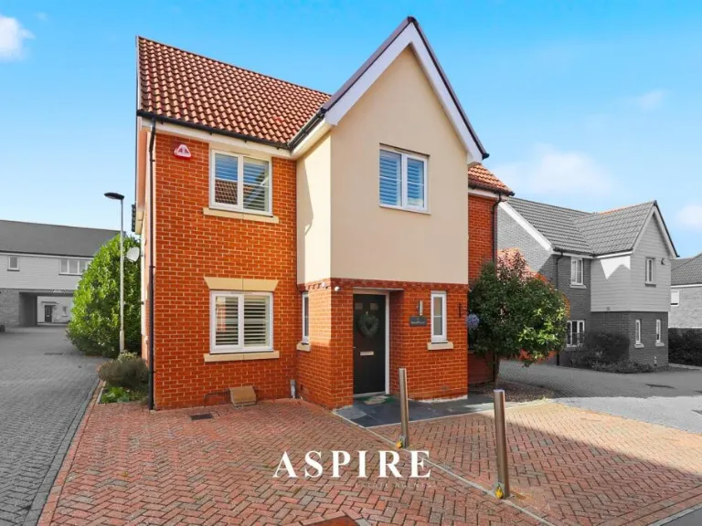
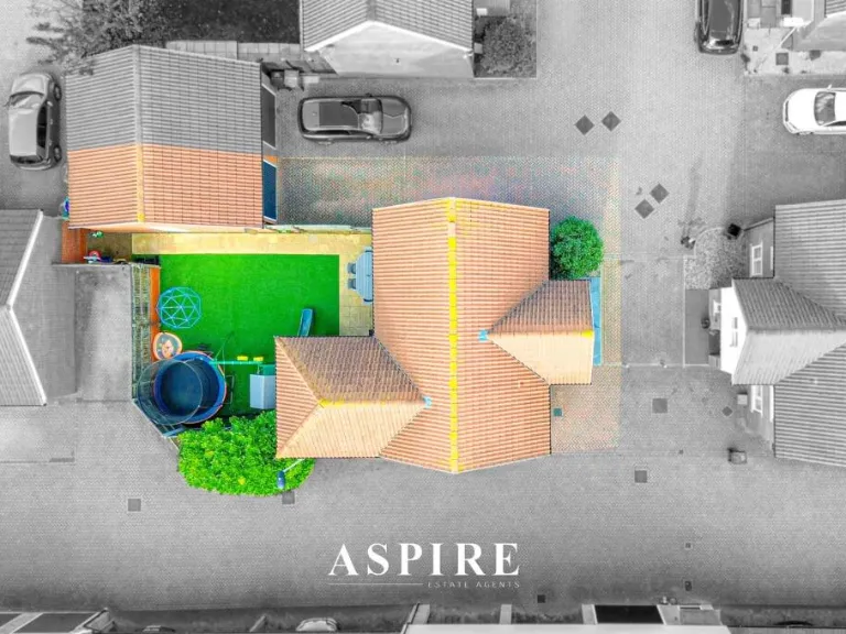
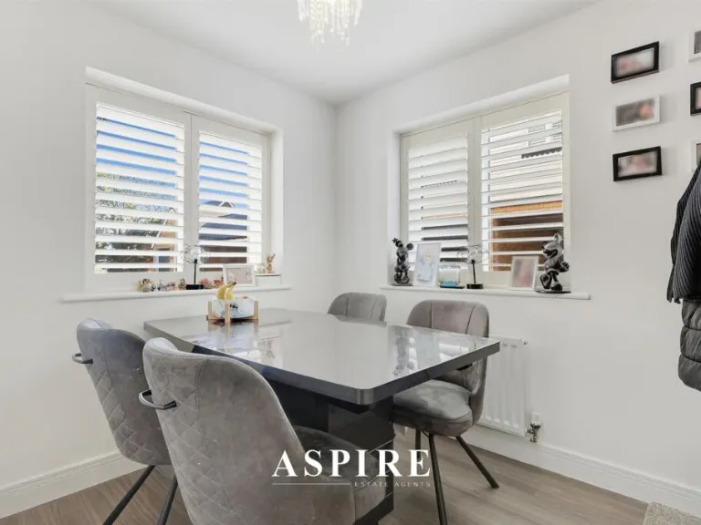
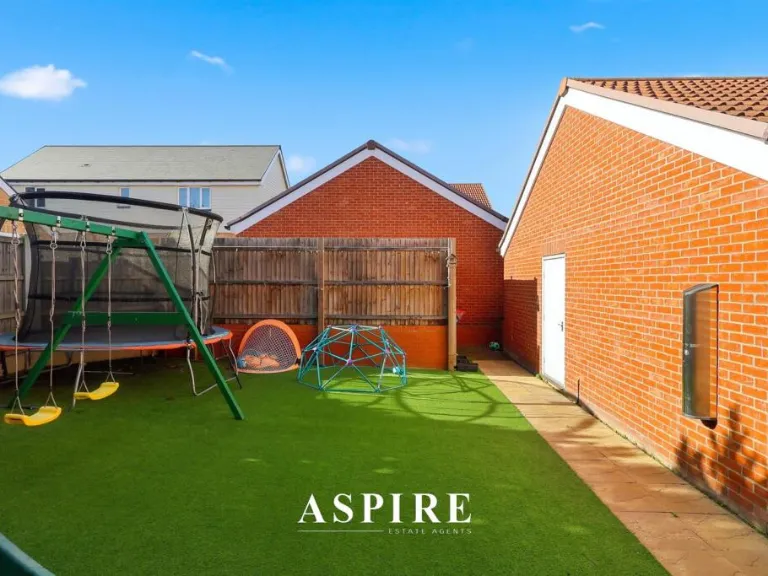
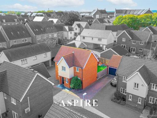
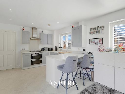
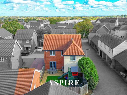
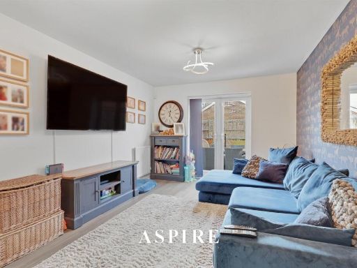
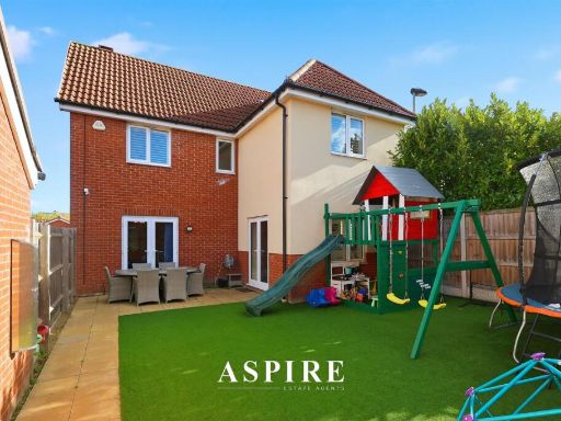
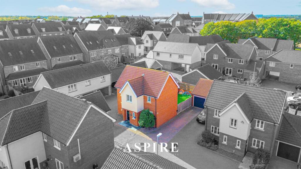
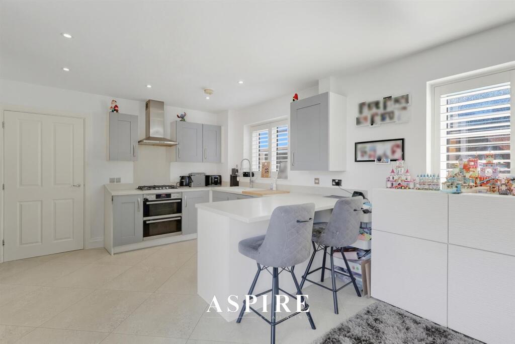
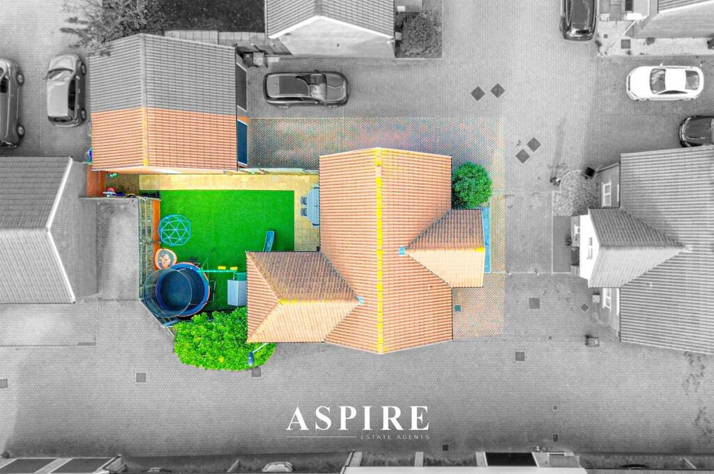
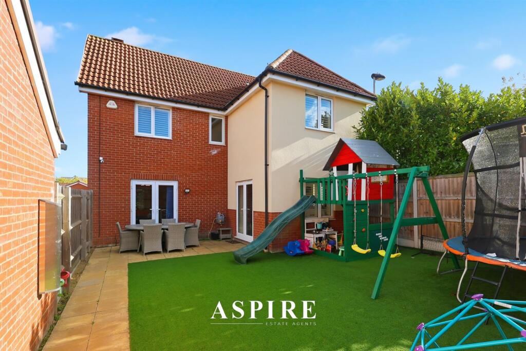
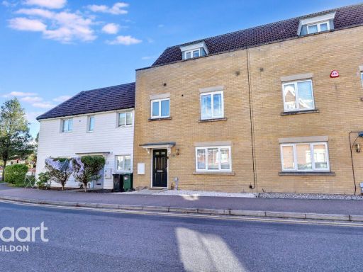
- Four-bedroom detached family house located in the Dunton Fields development. The property presents as a well-kept, modern family home with a bright, open-plan interior (contemporary kitchen/dining/living spaces pictured). Externally the home benefits from a large driveway and a detached garage with direct access to the rear garden. The rear garden is west-facing and described/appears sunny; garden size is average-to-large for a suburban plot. Overall the property is medium-to-large in size and well suited to family occupation, offering comfortable living space, parking and private garden amenity. No furniture or removable items considered in this description.
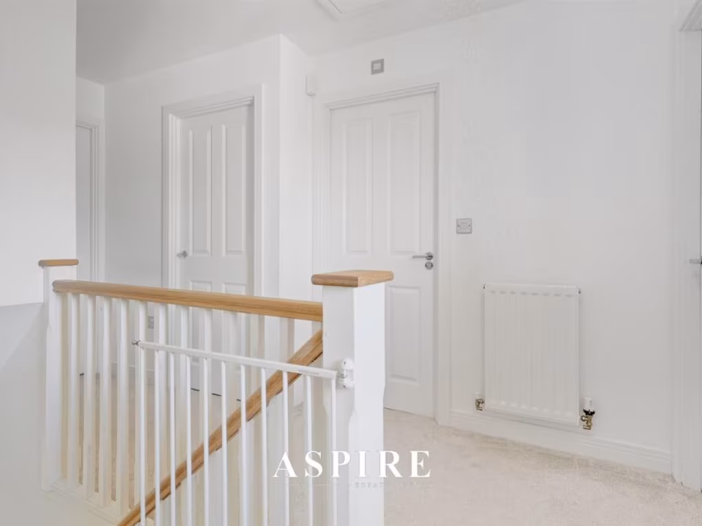
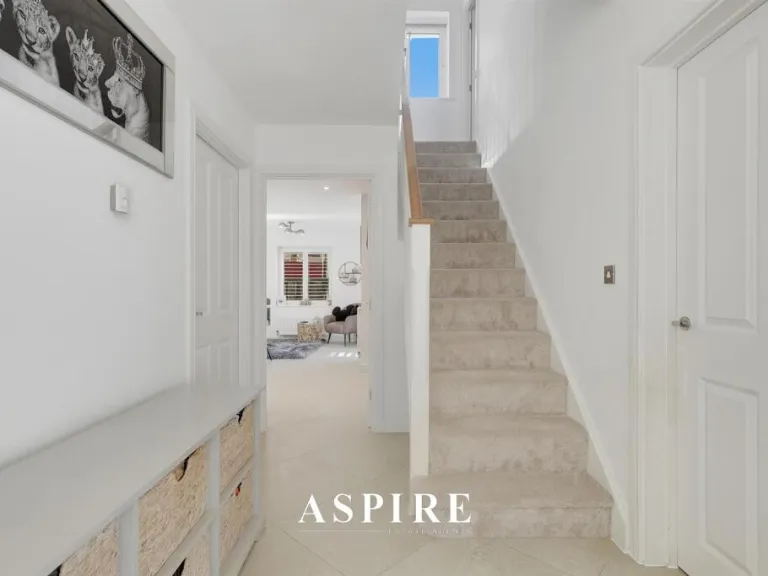
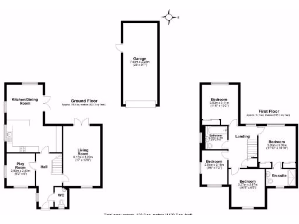
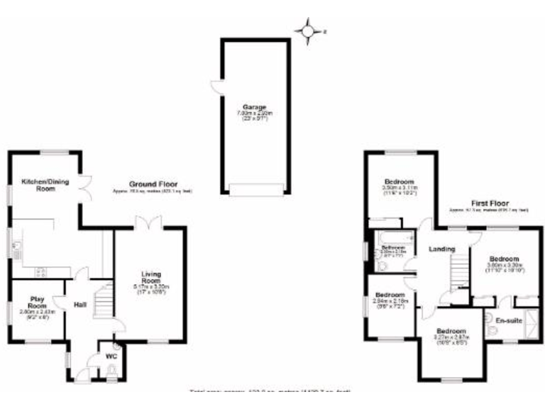
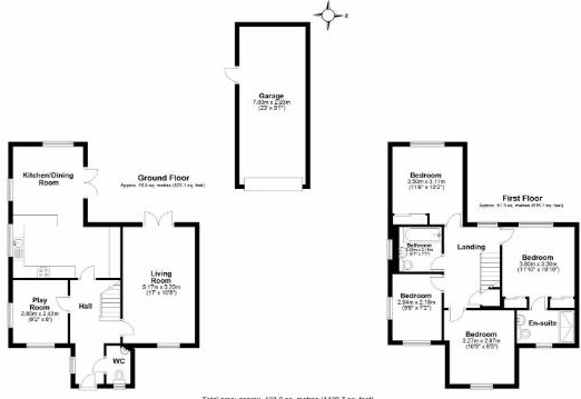
- Detached two-storey family house (based on floorplan). Ground floor: entrance hall, living room, kitchen/dining room, separate play/study room and downstairs WC. First floor: four bedrooms including a master with en-suite, plus a family bathroom and landing. Detached single garage shown separately. The layout indicates a substantial internal footprint for a family home (multiple reception rooms and four bedrooms). External grounds are not fully detailed on the plan, but the presence of a detached garage and the site map suggests an average-to-large garden and plot. Overall the property reads as a spacious family dwelling suitable for growing families, with good bedroom provision and a separate garage; location marker on the map is near Southend Arterial Road but no precise residential address for the property is visible in the images.
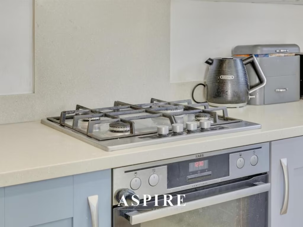
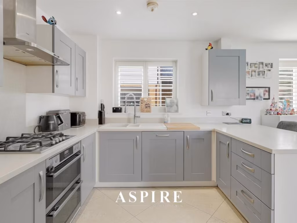
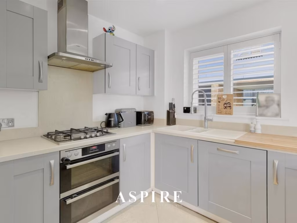
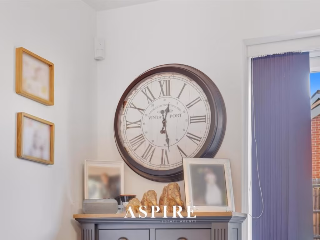
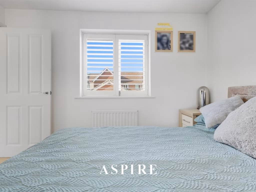
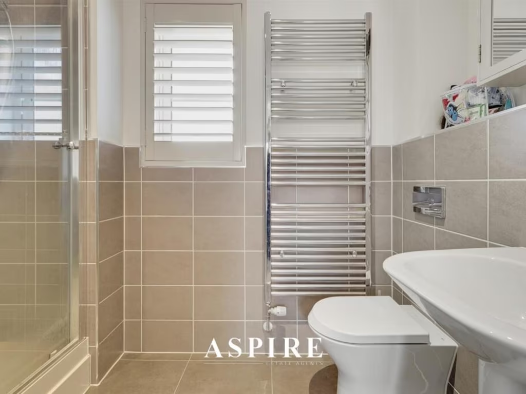
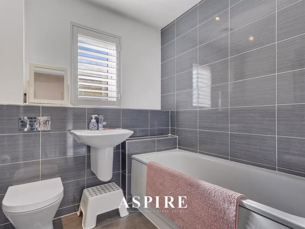
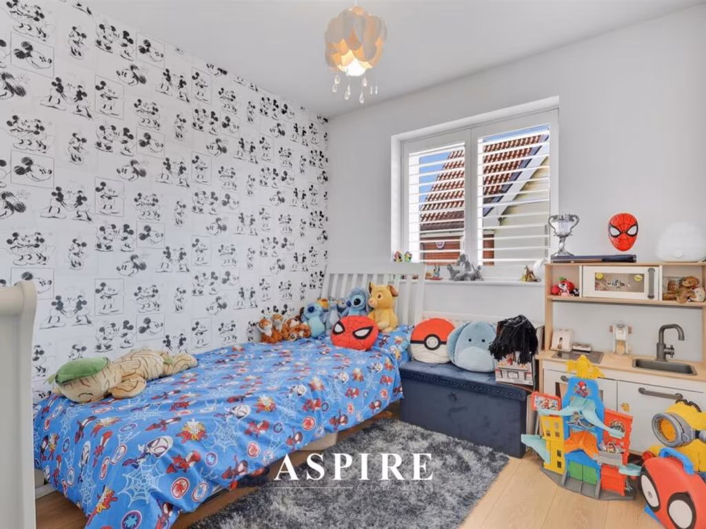
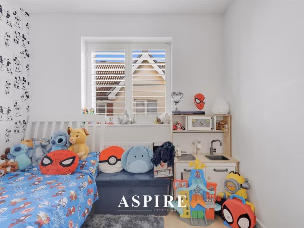
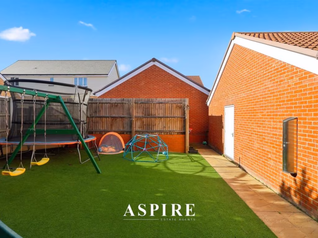
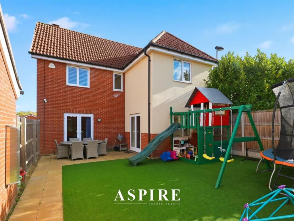
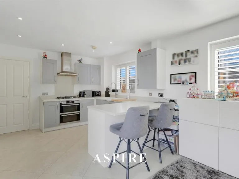
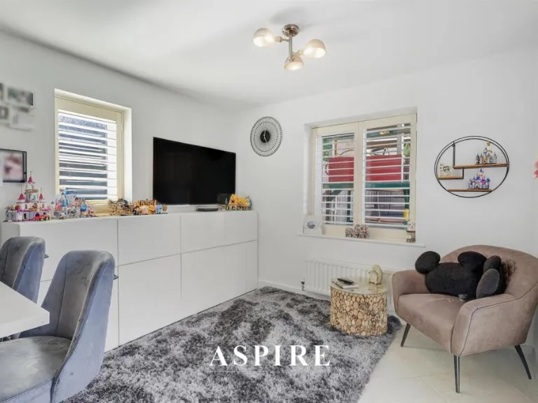
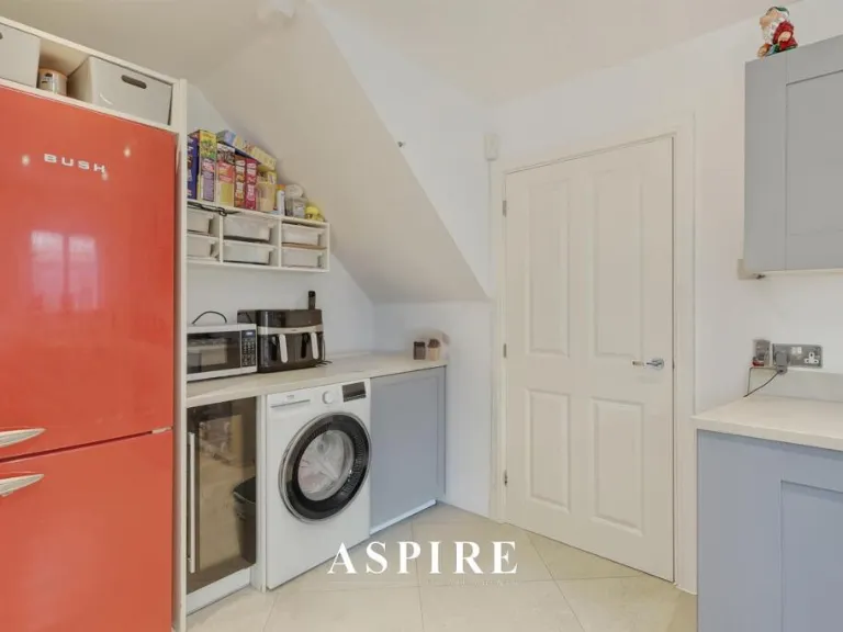
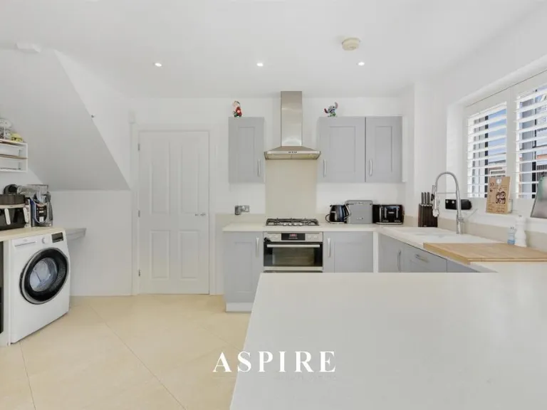
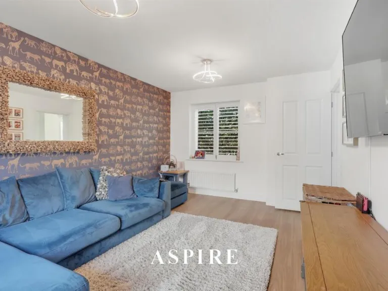
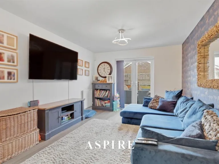
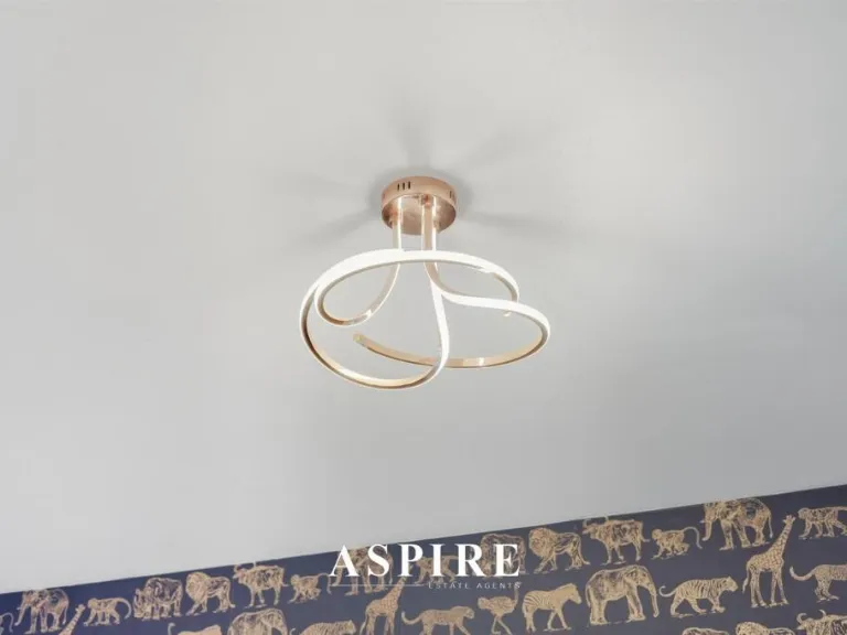
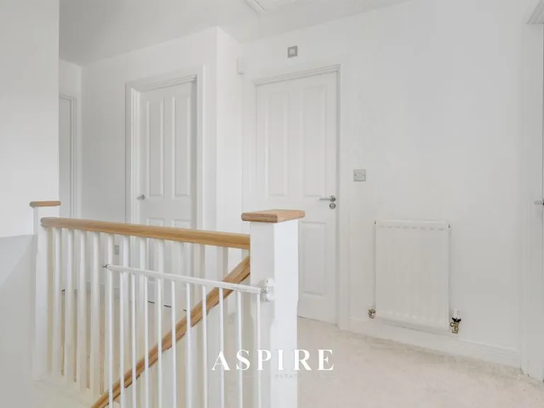
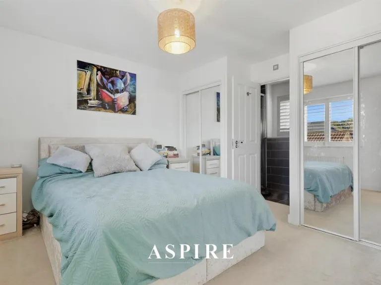
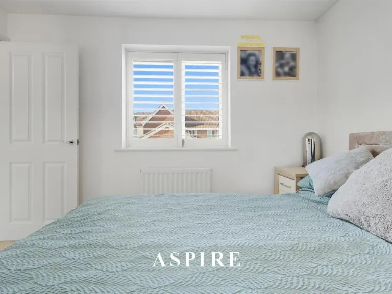
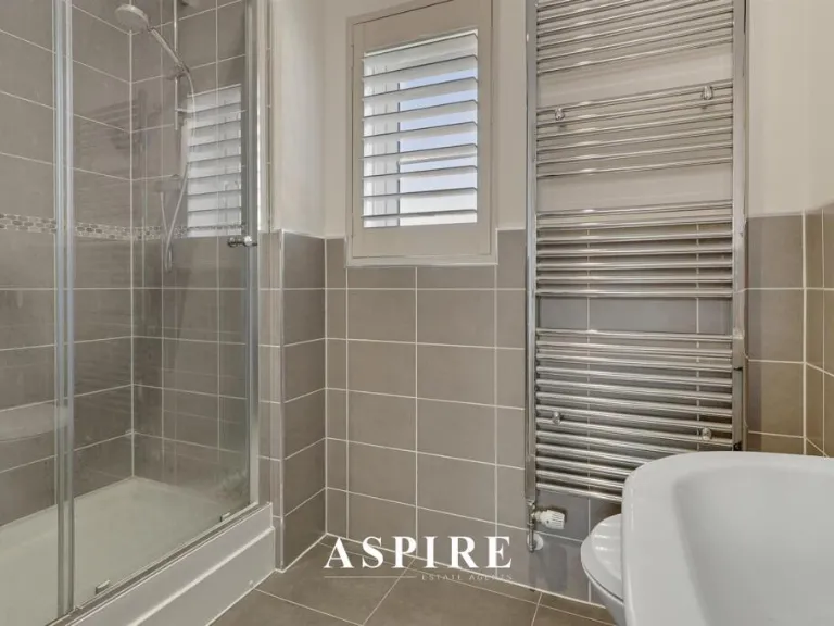
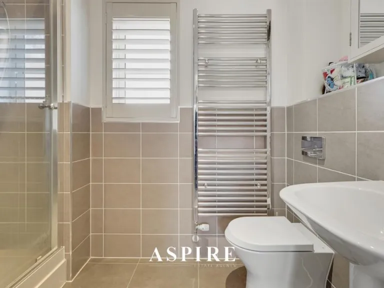
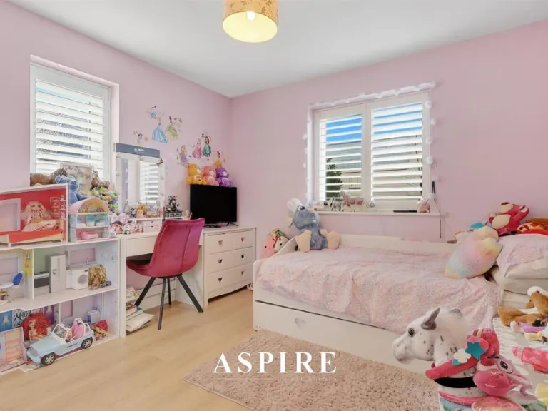
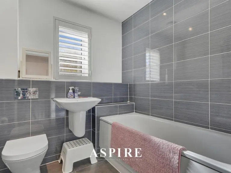
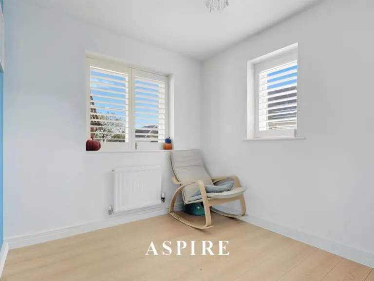
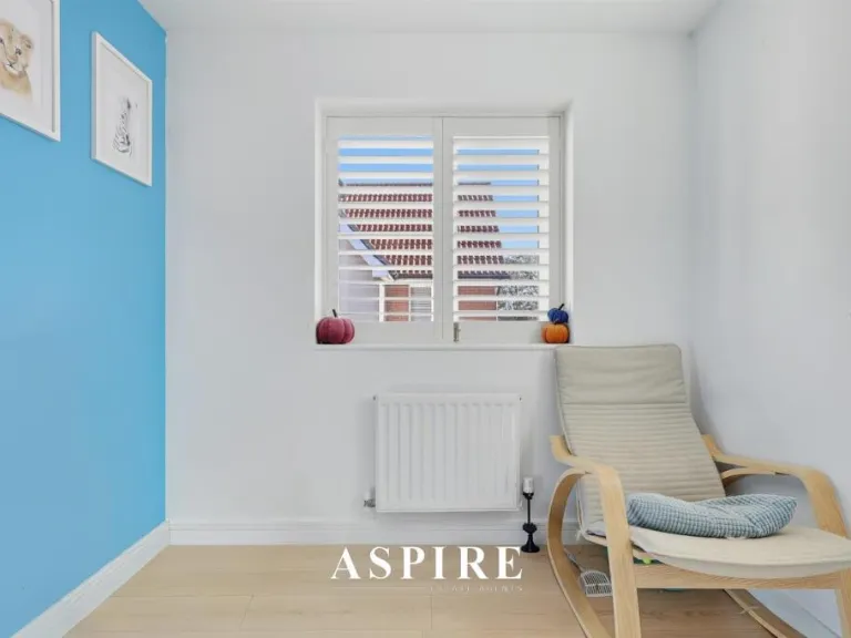
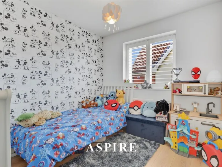
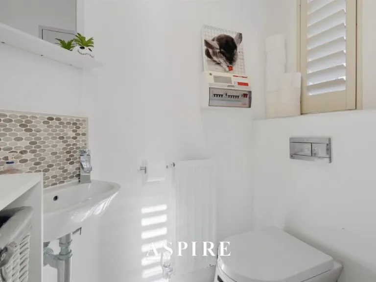
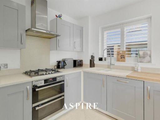
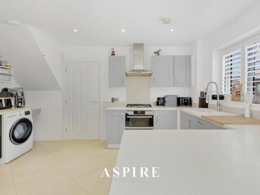
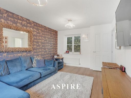
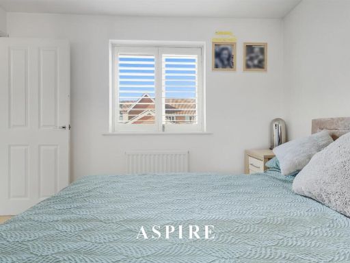
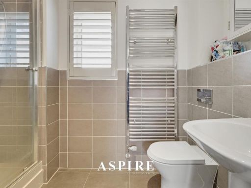
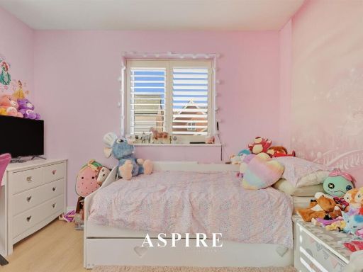
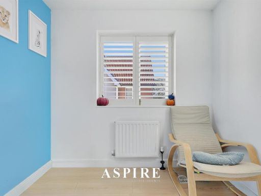
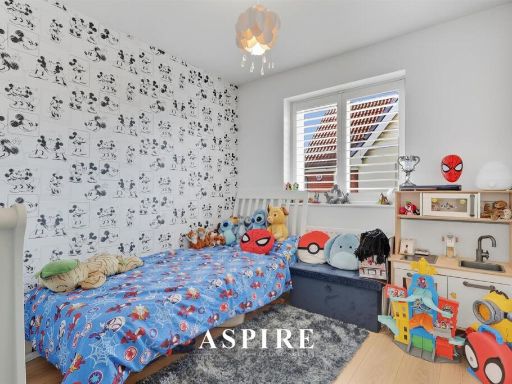
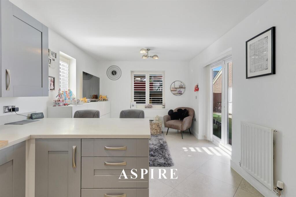
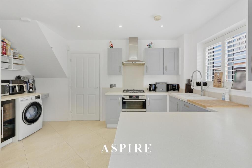
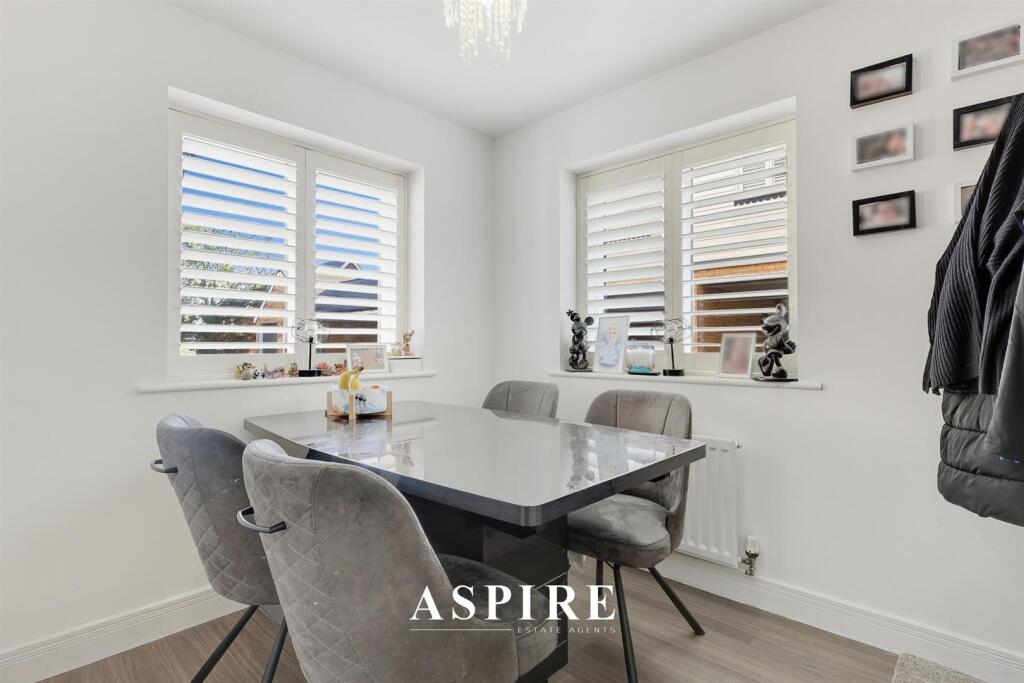
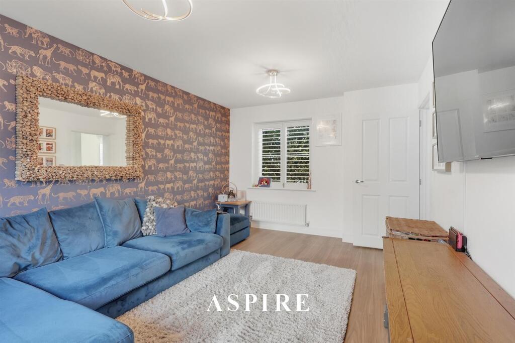
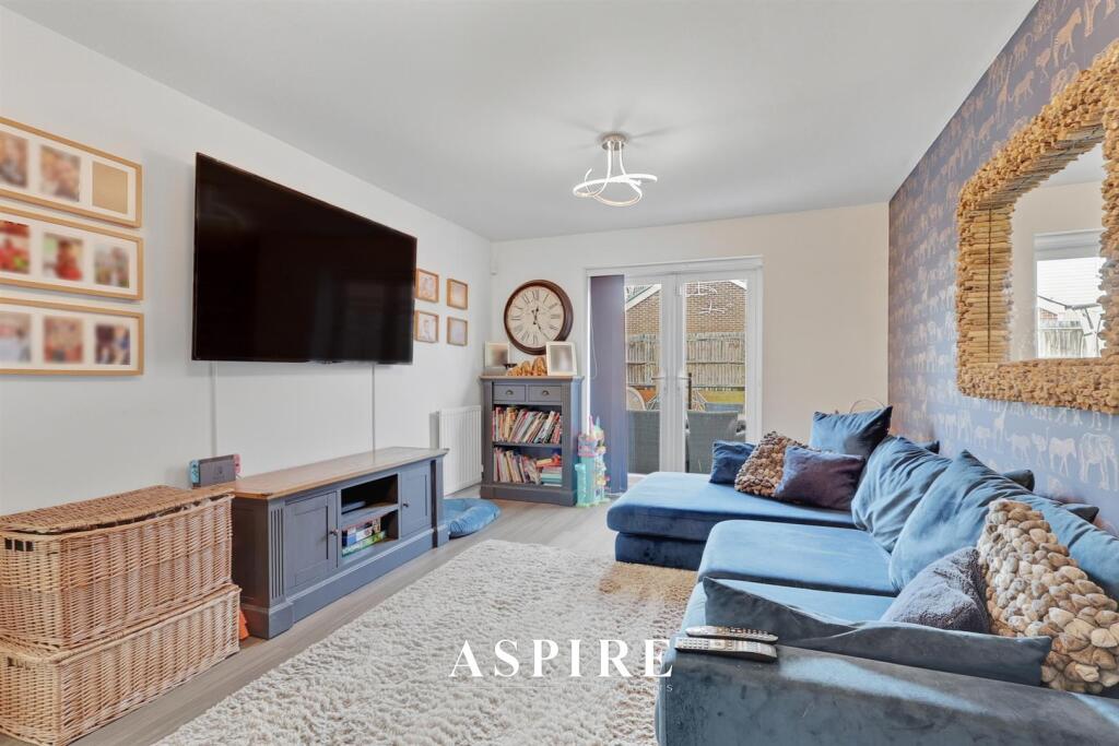
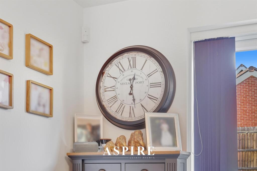
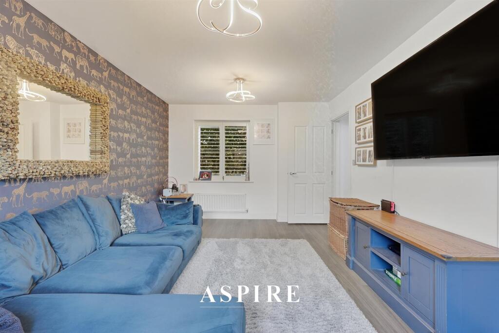
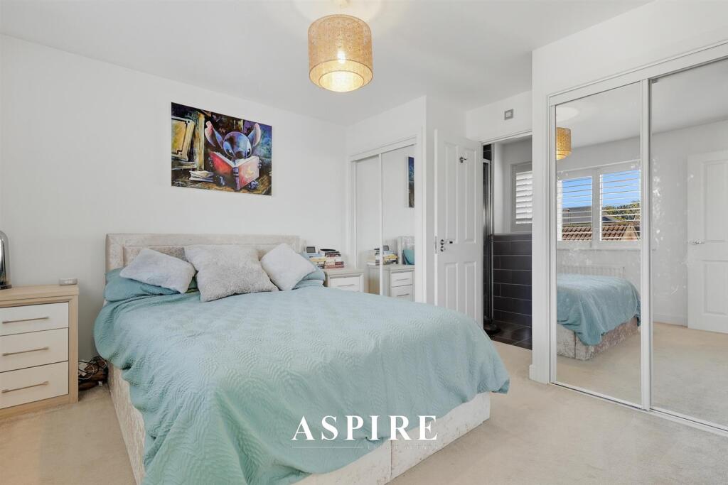
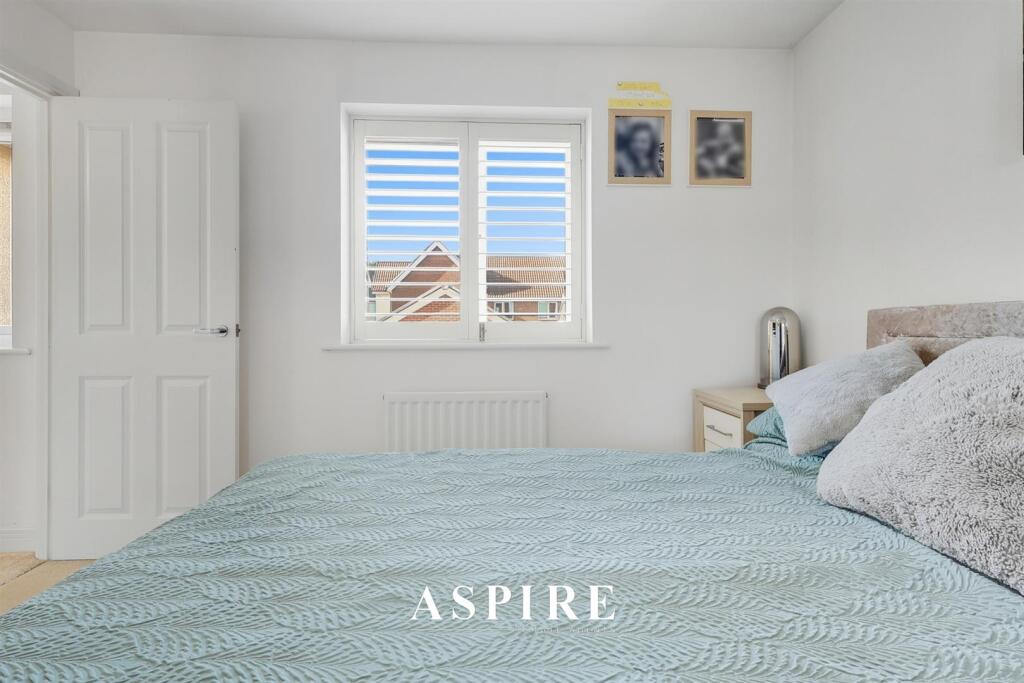
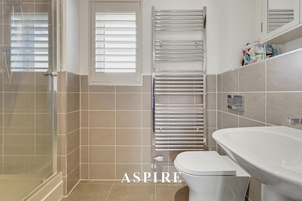
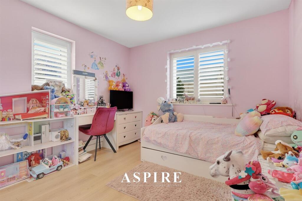
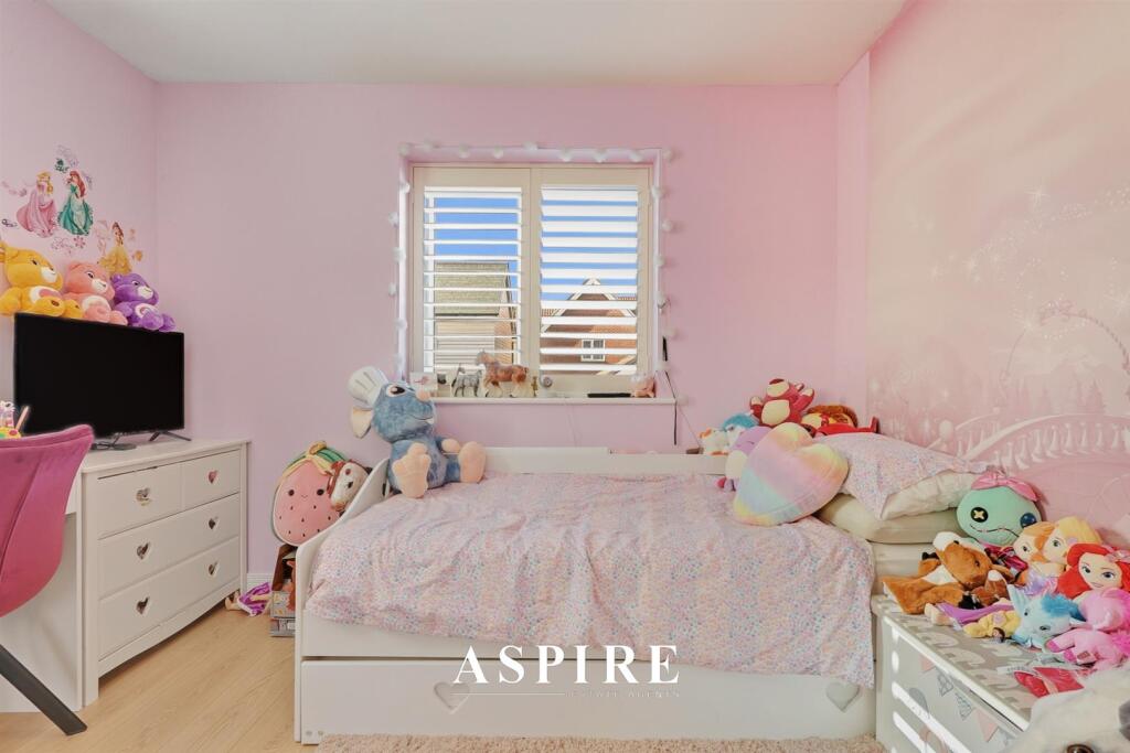
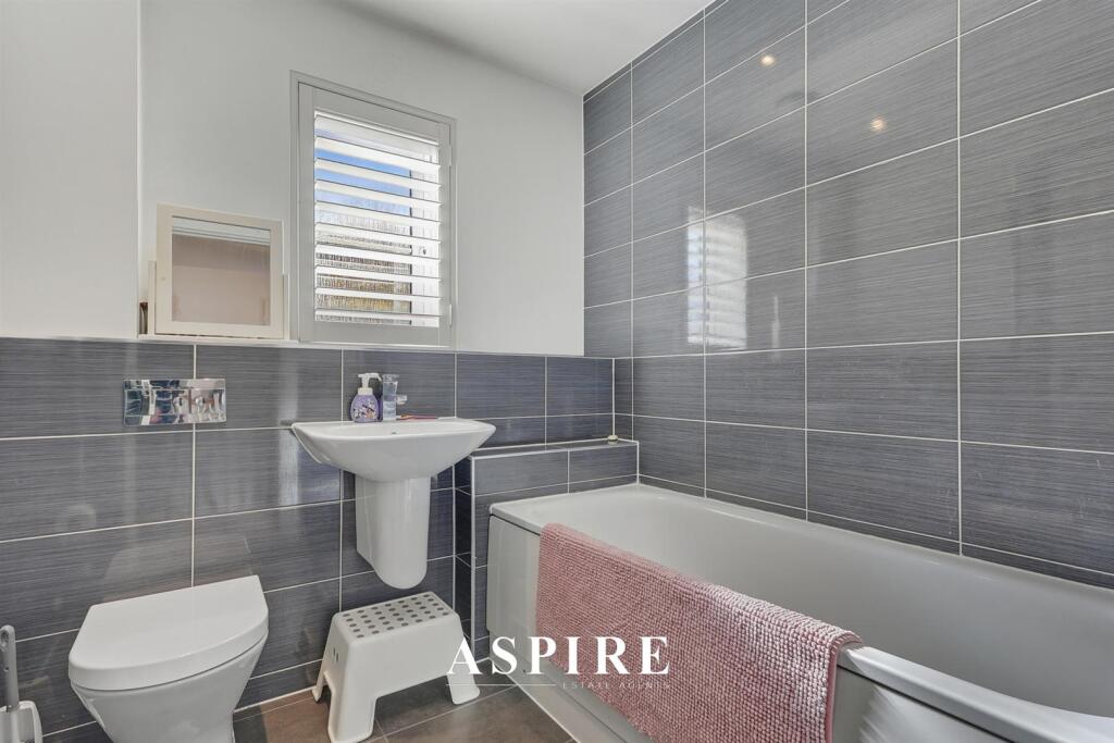
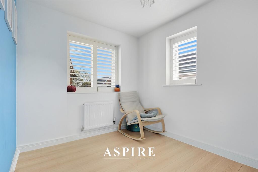
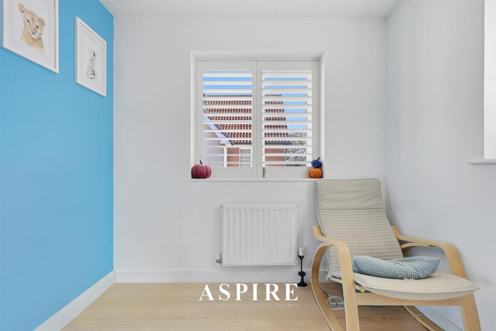
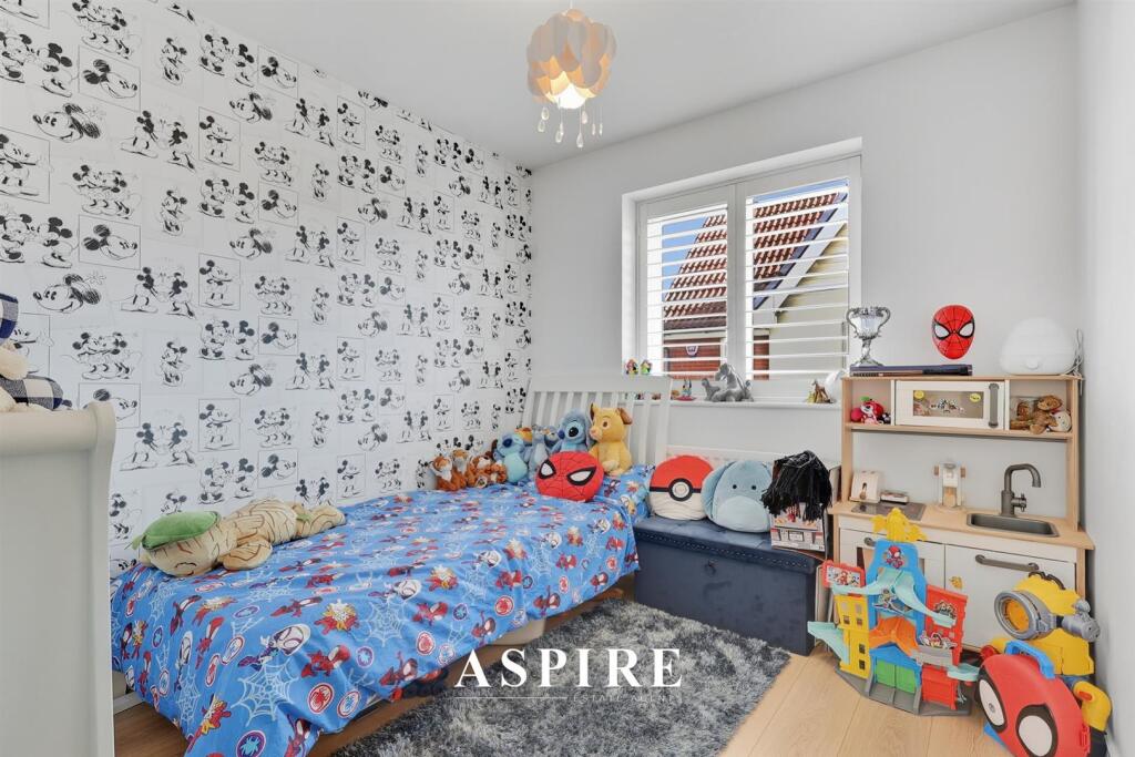
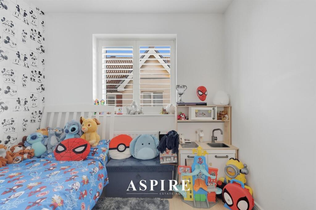
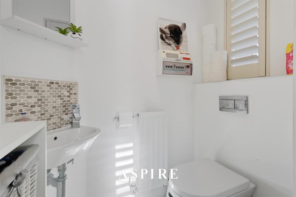
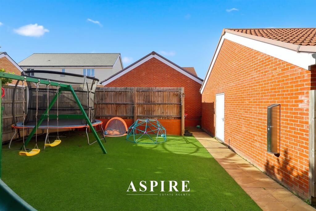
- A well-presented, modern four-bedroom family home in the Dunton Fields development. The ground floor opens to a bright entrance hall, cloakroom W.C., a flexible office/playroom and a spacious dual-aspect lounge with French doors opening to a west-facing rear garden. At the rear is a contemporary kitchen/dining room with integrated oven, gas hob and dishwasher and direct garden access via French doors, offering strong natural light and good family dining/entertaining space. Upstairs there are four generous bedrooms and a modern family bathroom; the principal bedroom benefits from fitted wardrobes and an en-suite shower room. The loft is boarded with ladder access providing useful additional storage. Externally the property features a west-facing rear garden (sunny aspect), direct access to a garage with pitched roof storage and a large driveway providing off-street parking for several cars. Overall the accommodation and garden indicate a medium-to-large family house suitable for growing families seeking practical living space, good storage and convenient local amenities.
Image Descriptions
- detached house modern
- kitchen modern
Textual Property Features
Detected Visual Features
- detached
- modern
- brick exterior
- two-story
- garage
- garden
- suburban
- residential
- family home
- modern kitchen
- gas hob
- built-in appliances
- contemporary design
EPC Details
- High performance glazing
- Average thermal transmittance 0.18 W/m-¦K
- Boiler and radiators, mains gas
- Low energy lighting in all fixed outlets
- Average thermal transmittance 0.17 W/m-¦K
Nearby Schools
- Lee Chapel Primary School
- Merrylands Primary School
- St Peter's Catholic Primary School
- South Green Junior School
- St John's School
- Great Berry Primary School
- The James Hornsby School
- South Green Infant School
- Quilters Infant School
- Quilters Junior School
- Sunnymede Primary School
- Woodlands School
- Kingswood Primary School and Nursery
- Ghyllgrove Primary School
- Millhouse Primary School
- Laindon Park Primary School & Nursery
- Noak Bridge Primary School
- The Billericay School
- Brightside Primary School
- Buttsbury Junior School
- St Anne Line Catholic Junior School
- Janet Duke Primary School
- The Phoenix Primary School
- De La Salle School
- Buttsbury Infant School
- Mayflower High School
Nearest Bars And Restaurants
- Id: 29011539
- Tags:
- Amenity: restaurant
- Name: Friern Manor
- Source: npe
- TagsNormalized:
- Lat: 51.5779615
- Lon: 0.3896688
- FullGeoHash: u10m2v7xruyh
- PartitionGeoHash: u10m
- Images:
- FoodStandards: null
- Distance: 1847.1
,- Id: 540215645
- Tags:
- Amenity: pub
- Name: The Noak Bridge
- Old_name: Prince of Wales
- TagsNormalized:
- Lat: 51.5884129
- Lon: 0.4388938
- FullGeoHash: u10m3zrs6cnv
- PartitionGeoHash: u10m
- Images:
- FoodStandards: null
- Distance: 1764
,- Id: 607422291
- Tags:
- Amenity: pub
- Building: yes
- Name: The Noak Bridge
- TagsNormalized:
- Lat: 51.5884445
- Lon: 0.4386583
- FullGeoHash: u10m3zrkmrp6
- PartitionGeoHash: u10m
- Images:
- FoodStandards: null
- Distance: 1749
,- Id: 618748343
- Tags:
- Amenity: pub
- Brand: Hungry Horse
- Brand:wikidata: Q5943510
- Brand:wikipedia: en:Hungry Horse
- Building: yes
- Contact:
- Website: https://www.hungryhorse.co.uk/pubs/essex/four-seasons/
- Name: Hungry Horse
- TagsNormalized:
- Lat: 51.5755058
- Lon: 0.4108764
- FullGeoHash: u10m3m51n55e
- PartitionGeoHash: u10m
- Images:
- FoodStandards: null
- Distance: 1055.5
,- Id: 246291822
- Tags:
- Amenity: fast_food
- Brand: McDonald's
- Brand:wikidata: Q38076
- Brand:wikipedia: en:McDonald's
- Building: yes
- Contact:
- Website: https://www.mcdonalds.com/gb/en-gb/location/laindon/laindon/fortune-of-war-roundabout/8261143.html
- Cuisine: burger
- Drive_through: yes
- Name: McDonald's
- Takeaway: yes
- TagsNormalized:
- fast food
- food
- mcdonalds
- burgers
- drive through
- takeaway
- Lat: 51.5842189
- Lon: 0.4240913
- FullGeoHash: u10m3wsgf537
- PartitionGeoHash: u10m
- Images:
- FoodStandards: null
- Distance: 697.7
}
Nearest General Shops
- Id: 9399556227
- Tags:
- Addr:
- City: Basildon
- Housenumber: 9
- Postcode: SS15 4HX
- Street: Fawcett Drive
- Name: Laindon Leisure
- Operator: Laindon Leisure
- Phone: +44 7507 661777
- Shop: party
- Website: https://www.laindonleisure.co.uk
- TagsNormalized:
- Lat: 51.5847167
- Lon: 0.4389427
- FullGeoHash: u10m3yxwu05m
- PartitionGeoHash: u10m
- Images:
- FoodStandards: null
- Distance: 1720.9
,- Id: 1016919523
- Tags:
- Building: yes
- Shop: massage
- TagsNormalized:
- Lat: 51.5885325
- Lon: 0.4190524
- FullGeoHash: u10m3x3huxkp
- PartitionGeoHash: u10m
- Images:
- FoodStandards: null
- Distance: 541.3
,- Id: 9379645239
- Tags:
- Addr:
- City: Basildon
- Housename: Barn Mews
- Postcode: SS15 4DB
- Street: Dunton Road
- Name: Barn Mews Well-Being Clinic
- Shop: massage
- TagsNormalized:
- Lat: 51.5885317
- Lon: 0.4190509
- FullGeoHash: u10m3x3hux6f
- PartitionGeoHash: u10m
- Images:
- FoodStandards: null
- Distance: 541.2
}
Nearest Grocery shops
- Id: 271215677
- Tags:
- Amenity: post_office
- Brand: McColl's
- Brand:wikidata: Q16997477
- Shop: convenience
- TagsNormalized:
- office
- post office
- mccolls
- convenience
- shop
- Lat: 51.5614971
- Lon: 0.4211918
- FullGeoHash: u10m3d6xqrxq
- PartitionGeoHash: u10m
- Images:
- FoodStandards: null
- Distance: 2637.2
,- Id: 6594427575
- Tags:
- Addr:
- Housenumber: 16A
- Street: Woolmer Green
- Air_conditioning: yes
- Name: Trinity Food and Wine
- Opening_hours: Mo-Sa 06:00-18:00
- Payment:
- Cards: yes
- Cash: yes
- Coins: yes
- Credit_cards: yes
- Debit_cards: yes
- Mastercard: yes
- Notes: yes
- Visa: yes
- Visa_debit: yes
- Shop: supermarket
- TagsNormalized:
- Lat: 51.5754393
- Lon: 0.4380948
- FullGeoHash: u10m3vp08qep
- PartitionGeoHash: u10m
- Images:
- FoodStandards: null
- Distance: 1961.1
,- Id: 9568587004
- Tags:
- TagsNormalized:
- Lat: 51.5797818
- Lon: 0.4186205
- FullGeoHash: u10m3tbf484p
- PartitionGeoHash: u10m
- Images:
- FoodStandards: null
- Distance: 641
}
Nearest Religious buildings
- Id: 500212437
- Tags:
- Amenity: place_of_worship
- Building: yes
- Name: Temple of Light Christian Spiritualist Church Laindon
- Religion: spiritualist
- Source: OS OpenMap Local
- TagsNormalized:
- place of worship
- christian
- church
- spiritualist
- temple
- Lat: 51.5703175
- Lon: 0.4193024
- FullGeoHash: u10m3s16f7yw
- PartitionGeoHash: u10m
- Images:
- FoodStandards: null
- Distance: 1650.3
,- Id: 150888687
- Tags:
- Addr:
- City: Laindon
- Housename: St Nicholas Church
- Postcode: SS15 5SE
- Street: Church Hill
- Amenity: place_of_worship
- Building: church
- Denomination: anglican
- Name: St Nicholas, Laindon w Dunton
- Religion: christian
- Wikidata: Q17535738
- TagsNormalized:
- place of worship
- church
- anglican
- christian
- Lat: 51.5792273
- Lon: 0.4346189
- FullGeoHash: u10m3vsqz2g7
- PartitionGeoHash: u10m
- Images:
- FoodStandards: null
- Distance: 1551.1
,- Id: 144046945
- Tags:
- Amenity: place_of_worship
- Denomination: anglican
- Name: St Mary the Virgin, Little Burstead
- Religion: christian
- Wikidata: Q17557075
- TagsNormalized:
- place of worship
- anglican
- christian
- church
- Lat: 51.5980854
- Lon: 0.4076013
- FullGeoHash: u10m930u9u38
- PartitionGeoHash: u10m
- Images:
- FoodStandards: null
- Distance: 1543.4
}
Nearest Medical buildings
- Id: 607471776
- Tags:
- Amenity: pharmacy
- Building: retail
- Dispensing: yes
- Healthcare: pharmacy
- Name: NHS Pharmacy Services
- Source: OS OpenMap Local
- TagsNormalized:
- pharmacy
- retail
- health
- healthcare
- nhs
- service
- Lat: 51.5868533
- Lon: 0.4448788
- FullGeoHash: u10m6p5gnqmw
- PartitionGeoHash: u10m
- Images:
- FoodStandards: null
- Distance: 2143.3
,- Id: 7492161243
- Tags:
- Addr:
- City: Basildon
- Postcode: SS14 3AF
- Street: Miles Gray Road
- Amenity: pharmacy
- Brand: Asda
- Brand:wikidata: Q297410
- Brand:wikipedia: en:Asda
- Contact:
- Phone: +44 1268 885510
- Website: https://storelocator.asda.com/east-of-england/basildon/heron-retail-park-miles-grey-road/pharmacy
- Dispensing: yes
- Drive_through: no
- Fixme: Location not accurate
- Healthcare: pharmacy
- Name: Asda
- Opening_hours: Mo-Sa 09:00-21:00; Su 10:00-16:00
- Operator: Asda Stores Ltd
- TagsNormalized:
- pharmacy
- asda
- health
- healthcare
- Lat: 51.5829999
- Lon: 0.4429239
- FullGeoHash: u10m6n6sbb5u
- PartitionGeoHash: u10m
- Images:
- FoodStandards: null
- Distance: 2006
,- Id: 621735410
- Tags:
- Amenity: doctors
- Building: yes
- Healthcare: doctor
- Name: Knights Surgery
- Operator: NHS
- TagsNormalized:
- doctor
- doctors
- health
- healthcare
- surgery
- Lat: 51.5757138
- Lon: 0.4367081
- FullGeoHash: u10m3vn421ch
- PartitionGeoHash: u10m
- Images:
- FoodStandards: null
- Distance: 1863.8
,- Id: 612321698
- Tags:
- Amenity: hospital
- Healthcare: hospital
- Name: Laindon Health Centre
- TagsNormalized:
- hospital
- health
- healthcare
- health centre
- Lat: 51.5732518
- Lon: 0.4233551
- FullGeoHash: u10m3ss7byuq
- PartitionGeoHash: u10m
- Images:
- FoodStandards: null
- Distance: 1435.9
}
Nearest Airports
- Id: 103894219
- Tags:
- Aerodrome: international
- Aeroway: aerodrome
- Iata: SEN
- Icao: EGMC
- Name: London Southend Airport
- Old_name: Southend Municipal Airport
- Ref: SEN
- Wikidata: Q1415441
- TagsNormalized:
- airport
- international airport
- Lat: 51.5701749
- Lon: 0.6924624
- FullGeoHash: u10mru04p937
- PartitionGeoHash: u10m
- Images:
- FoodStandards: null
- Distance: 19308.6
,- Id: 121158889
- Tags:
- Aerodrome: continental
- Aeroway: aerodrome
- Fhrs:
- Authority: City of London Corporation
- Iata: LCY
- Icao: EGLC
- Name: London City Airport
- Operator: London City Airport Limited
- Ref: LCY
- Website: https://www.londoncityairport.com/
- Wikidata: Q8982
- Wikipedia: en:London City Airport
- TagsNormalized:
- airport
- continental airport
- Lat: 51.5042658
- Lon: 0.0539987
- FullGeoHash: u10j10p64702
- PartitionGeoHash: u10j
- Images:
- FoodStandards: null
- Distance: 26458.7
}
Nearest Leisure Facilities
- Id: 974429975
- Tags:
- TagsNormalized:
- Lat: 51.5868725
- Lon: 0.4237911
- FullGeoHash: u10m3xhe7418
- PartitionGeoHash: u10m
- Images:
- FoodStandards: null
- Distance: 712.6
,- Id: 160337091
- Tags:
- Leisure: park
- Name: Victoria Park
- TagsNormalized:
- Lat: 51.5789154
- Lon: 0.4103388
- FullGeoHash: u10m3mducwdz
- PartitionGeoHash: u10m
- Images:
- FoodStandards: null
- Distance: 701.7
,- Id: 1039051576
- Tags:
- TagsNormalized:
- Lat: 51.5791588
- Lon: 0.4178831
- FullGeoHash: u10m3t8q3kh4
- PartitionGeoHash: u10m
- Images:
- FoodStandards: null
- Distance: 680.6
,- Id: 1039051577
- Tags:
- TagsNormalized:
- Lat: 51.5793937
- Lon: 0.4179211
- FullGeoHash: u10m3t8rdrbs
- PartitionGeoHash: u10m
- Images:
- FoodStandards: null
- Distance: 657.7
,- Id: 1039051572
- Tags:
- TagsNormalized:
- Lat: 51.5829088
- Lon: 0.4178376
- FullGeoHash: u10m3w2k0r4k
- PartitionGeoHash: u10m
- Images:
- FoodStandards: null
- Distance: 336.1
}
Nearest Tourist attractions
- Id: 343354569
- Tags:
- Amenity: cafe
- Information: office
- Name: Plotlands Visitor Centre
- Operator: Essex Wildlife Trust
- Tourism: information
- TagsNormalized:
- Lat: 51.5608417
- Lon: 0.3929624
- FullGeoHash: u10m2fq5stw1
- PartitionGeoHash: u10m
- Images:
- FoodStandards: null
- Distance: 3035.5
,- Id: 6013223423
- Tags:
- Name: Imperial Birds of Prey Academy
- Tourism: zoo
- Website: http://www.imperialbirdofpreyacademy.com/
- TagsNormalized:
- Lat: 51.6010527
- Lon: 0.4473896
- FullGeoHash: u10md1tvbvmv
- PartitionGeoHash: u10m
- Images:
- FoodStandards: null
- Distance: 2928.8
,- Id: 10068537346
- Tags:
- Addr:
- Housename: Studio 49 The Village Barleylands Road Billericay CM11 2UD
- Name: The Alchemy Gallery
- Operator: Craft Arena
- Tourism: gallery
- TagsNormalized:
- Lat: 51.6009474
- Lon: 0.4459175
- FullGeoHash: u10md1stq9u1
- PartitionGeoHash: u10m
- Images:
- FoodStandards: null
- Distance: 2842
}
Nearest Train stations
- Id: 6733461096
- Tags:
- Name: Pitsea
- Naptan:
- Network: National Rail
- Operator: c2c
- Platforms: 4
- Public_transport: station
- Railway: station
- Ref:
- Source: NPE
- Wikidata: Q2982936
- Wikipedia: en:Pitsea railway station
- TagsNormalized:
- Lat: 51.5602396
- Lon: 0.5079761
- FullGeoHash: u10m7d3bhtq3
- PartitionGeoHash: u10m
- Images:
- FoodStandards: null
- Distance: 7043
,- Id: 2008923738
- Tags:
- Name: West Horndon
- Naptan:
- Network: National Rail
- Public_transport: station
- Railway: station
- Ref:
- Wikidata: Q1808174
- Wikipedia: en:West Horndon railway station
- TagsNormalized:
- Lat: 51.5678537
- Lon: 0.3406801
- FullGeoHash: u10jrg8hd2tm
- PartitionGeoHash: u10j
- Images:
- FoodStandards: null
- Distance: 5407.8
,- Id: 2940652513
- Tags:
- Layer: 1
- Name: Billericay
- Name:lt: Bilerikis
- Naptan:
- Network: National Rail
- Public_transport: station
- Railway: station
- Ref:
- Wikidata: Q1971153
- Wikipedia: en:Billericay railway station
- TagsNormalized:
- Lat: 51.6288429
- Lon: 0.4181268
- FullGeoHash: u10m9w8rz1cu
- PartitionGeoHash: u10m
- Images:
- FoodStandards: null
- Distance: 4906.2
,- Id: 2008917061
- Tags:
- Name: Basildon
- Name:lt: Bazildonas
- Naptan:
- Network: National Rail
- Public_transport: station
- Railway: station
- Ref:
- Wheelchair: yes
- Wikidata: Q2752701
- Wikipedia: en:Basildon railway station
- TagsNormalized:
- Lat: 51.5681417
- Lon: 0.4567961
- FullGeoHash: u10m67swhn7g
- PartitionGeoHash: u10m
- Images:
- FoodStandards: null
- Distance: 3487.2
,- Id: 6733268329
- Tags:
- Name: Laindon
- Naptan:
- Network: National Rail
- Public_transport: station
- Railway: station
- Ref:
- Source: NPE
- Wheelchair: yes
- Wikidata: Q2801845
- Wikipedia: en:Laindon railway station
- TagsNormalized:
- Lat: 51.5675954
- Lon: 0.4237157
- FullGeoHash: u10m3ese1292
- PartitionGeoHash: u10m
- Images:
- FoodStandards: null
- Distance: 2026
}
Nearest Hotels
- Id: 122529490
- Tags:
- Addr:
- City: Basildon
- Postcode: SS14 3WB
- Street: Pipps Hill Road South
- Brand: Premier Inn
- Brand:wikidata: Q2108626
- Brand:wikipedia: en:Premier Inn
- Building: yes
- Internet_access: wlan
- Internet_access:fee: customers
- Internet_access:operator: Virgin Media
- Internet_access:ssid: Premier Inn Free Wi-Fi
- Name: Premier Inn
- Phone: +44 333 777 3683
- Tourism: hotel
- Website: https://www.premierinn.com/gb/en/
- TagsNormalized:
- Lat: 51.5879067
- Lon: 0.4610273
- FullGeoHash: u10m6rr9qdyf
- PartitionGeoHash: u10m
- Images:
- FoodStandards: null
- Distance: 3265.1
,- Id: 122529130
- Tags:
- Addr:
- City: Basildon
- Postcode: SS14 3DG
- Street: Cranes Farm Road
- Brand: Holiday Inn
- Brand:wikidata: Q2717882
- Brand:wikipedia: en:Holiday Inn
- Building: yes
- Internet_access: yes
- Internet_access:fee: customers
- Name: Holiday Inn
- Phone: +44 371 942 9003
- Tourism: hotel
- Website: https://www.ihg.com/holidayinn/hotels/gb/en/reservation
- Wheelchair: yes
- TagsNormalized:
- Lat: 51.5836089
- Lon: 0.4607461
- FullGeoHash: u10m6qx821th
- PartitionGeoHash: u10m
- Images:
- FoodStandards: null
- Distance: 3230.1
,- Id: 607501652
- Tags:
- Addr:
- Country: GB
- Postcode: SS14 3AE
- Street: Burches
- Fhrs:
- Name: Hotel Campanile
- Tourism: hotel
- TagsNormalized:
- Lat: 51.5843737
- Lon: 0.4426479
- FullGeoHash: u10m6ndkf2np
- PartitionGeoHash: u10m
- Images:
- FoodStandards: null
- Distance: 1977.5
}
Tags
- detached
- modern
- brick exterior
- two-story
- garage
- garden
- suburban
- residential
- family home
- modern kitchen
- gas hob
- built-in appliances
- contemporary design
Local Market Stats
- Average Price/sqft: £368
- Avg Income: £44200
- Rental Yield: 5.4%
- Social Housing: 16%
- Planning Success Rate: 81%
Similar Properties
 4 bedroom town house for sale in School Avenue, Dunton Fields - Garage To Rear!, SS15 — £540,000 • 4 bed • 3 bath • 1658 ft²
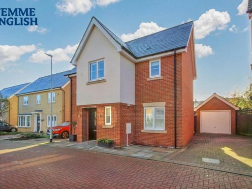 4 bedroom detached house for sale in Scholars Crescent, Basildon, SS15 — £550,000 • 4 bed • 3 bath • 312 ft²
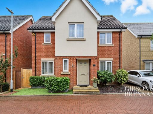 4 bedroom detached house for sale in Scholars Crescent, Basildon, SS15 — £575,000 • 4 bed • 2 bath • 1198 ft²
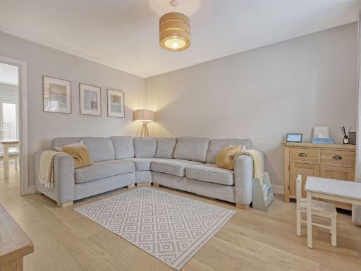 3 bedroom semi-detached house for sale in Abingdon Close, Dunton Fields, Laindon, SS15 — £450,000 • 3 bed • 2 bath • 1152 ft²
 4 bedroom detached house for sale in Althorne Close, Basildon, SS13 — £550,000 • 4 bed • 2 bath • 957 ft²
 2 bedroom terraced house for sale in School Avenue, Basildon, SS15 — £350,000 • 2 bed • 2 bath • 860 ft²
Meta
- {
"@context": "https://schema.org",
"@type": "Residence",
"name": "4 bedroom detached house for sale in Warwick Crescent, Basi…",
"description": "",
"url": "https://propertypiper.co.uk/property/0fc7f6c1-3d98-4fd6-b0dd-58ce4863b188",
"image": "https://image-a.propertypiper.co.uk/5dde7742-1894-40d2-adfe-afe90430ee4a-1024.jpeg",
"address": {
"@type": "PostalAddress",
"streetAddress": "15, WARWICK CRESCENT",
"postalCode": "SS15 6JQ",
"addressLocality": "Basildon",
"addressRegion": "Basildon and Billericay",
"addressCountry": "England"
},
"geo": {
"@type": "GeoCoordinates",
"latitude": 51.58479335893747,
"longitude": 0.4140350157946125
},
"numberOfRooms": 4,
"numberOfBathroomsTotal": 3,
"offers": {
"@type": "Offer",
"price": 550000,
"priceCurrency": "GBP",
"availability": "https://schema.org/InStock"
},
"additionalProperty": [
{
"@type": "PropertyValue",
"name": "Feature",
"value": "detached"
},
{
"@type": "PropertyValue",
"name": "Feature",
"value": "modern"
},
{
"@type": "PropertyValue",
"name": "Feature",
"value": "brick exterior"
},
{
"@type": "PropertyValue",
"name": "Feature",
"value": "two-story"
},
{
"@type": "PropertyValue",
"name": "Feature",
"value": "garage"
},
{
"@type": "PropertyValue",
"name": "Feature",
"value": "garden"
},
{
"@type": "PropertyValue",
"name": "Feature",
"value": "suburban"
},
{
"@type": "PropertyValue",
"name": "Feature",
"value": "residential"
},
{
"@type": "PropertyValue",
"name": "Feature",
"value": "family home"
},
{
"@type": "PropertyValue",
"name": "Feature",
"value": "modern kitchen"
},
{
"@type": "PropertyValue",
"name": "Feature",
"value": "gas hob"
},
{
"@type": "PropertyValue",
"name": "Feature",
"value": "built-in appliances"
},
{
"@type": "PropertyValue",
"name": "Feature",
"value": "contemporary design"
}
]
}
High Res Floorplan Images
Compatible Floorplan Images
FloorplanImages Thumbnail