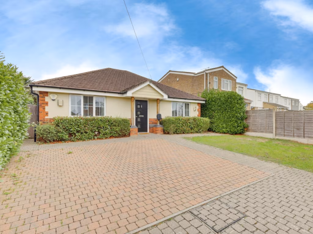
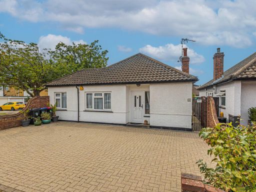
SS7 5BG - 2 bedroom detached bungalow for sale in High Beeches, Benfl…
View on Property Piper
2 bedroom detached bungalow for sale in High Beeches, Benfleet, SS7
Property Details
- Price: £301500
- Bedrooms: 2
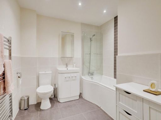
- Bathrooms: 2
- Property Type: undefined
- Property SubType: undefined
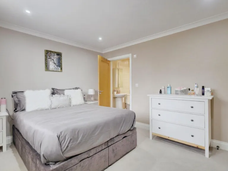
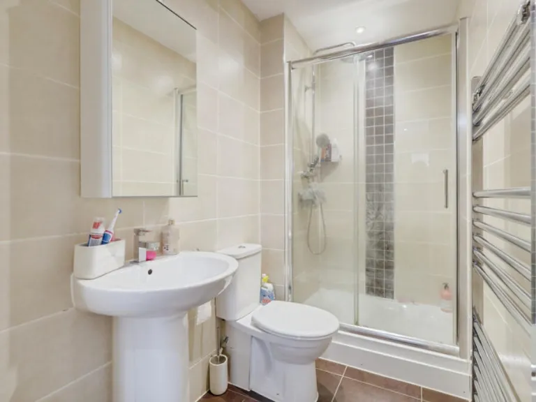
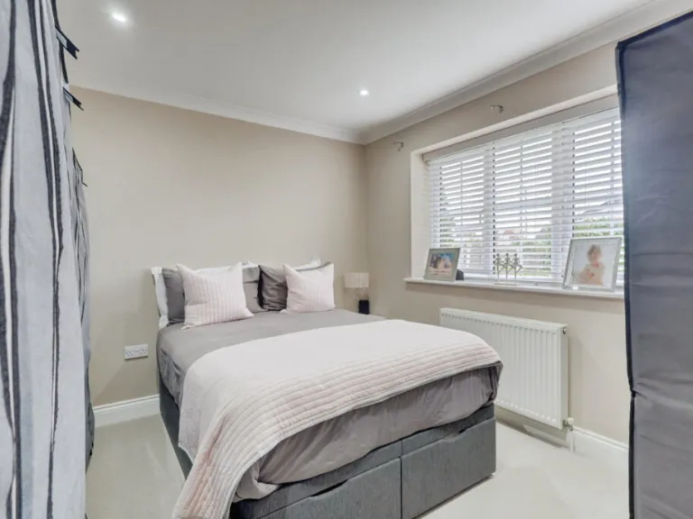
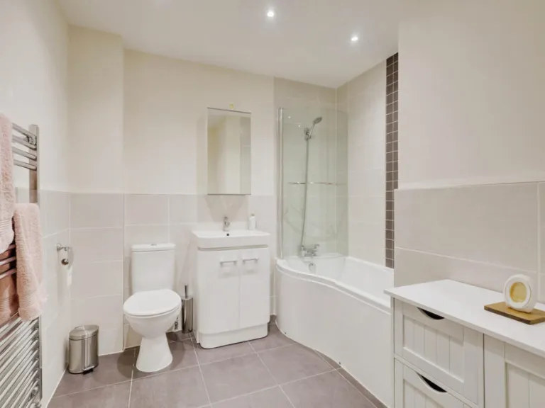
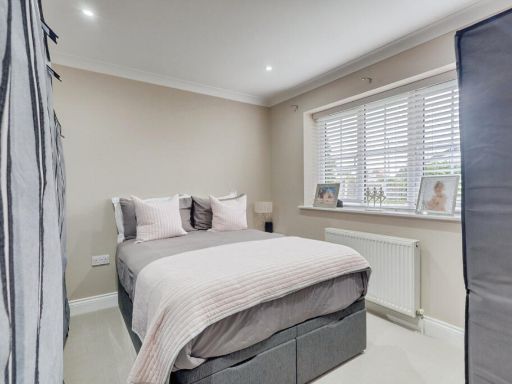
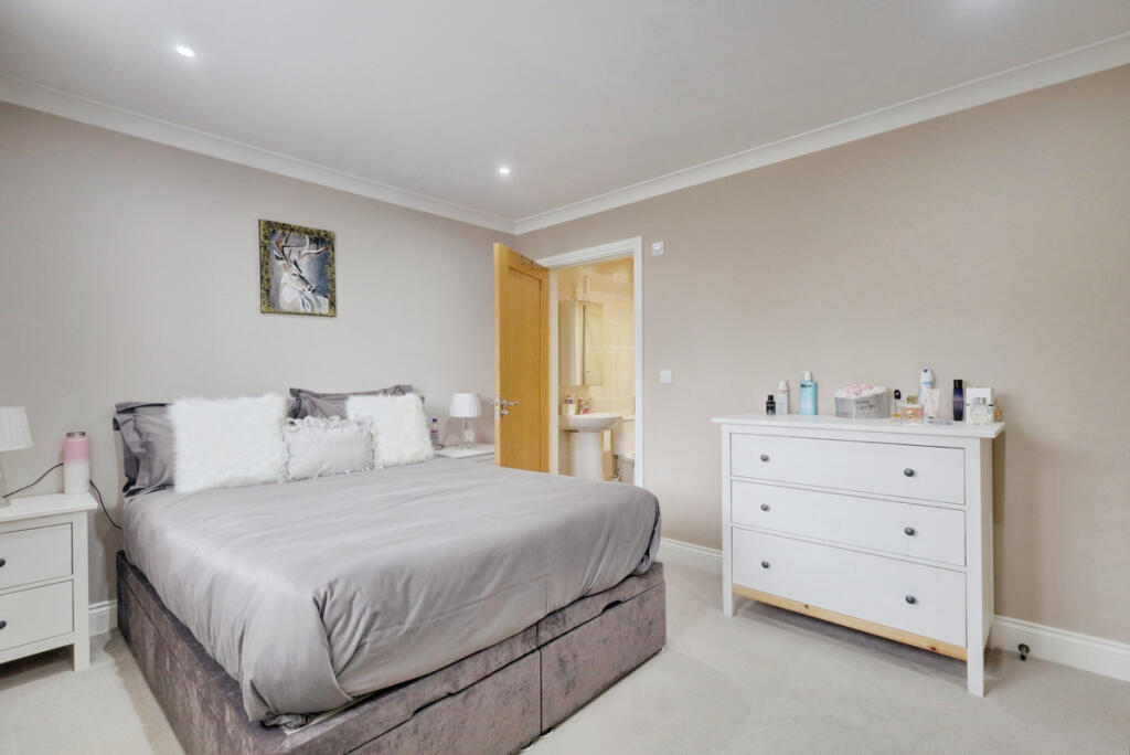
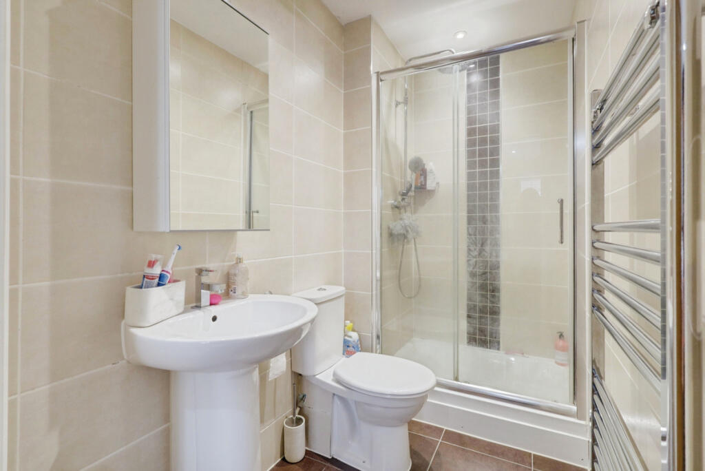
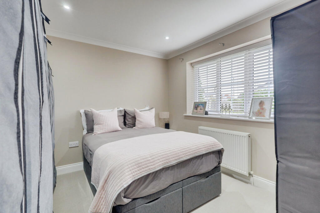
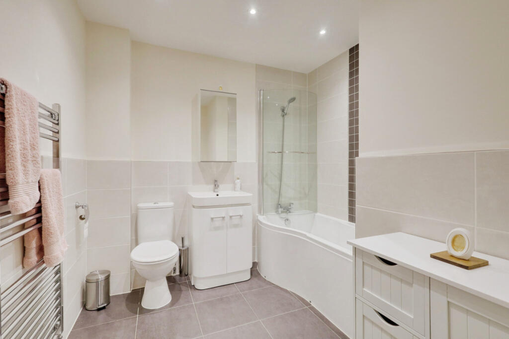
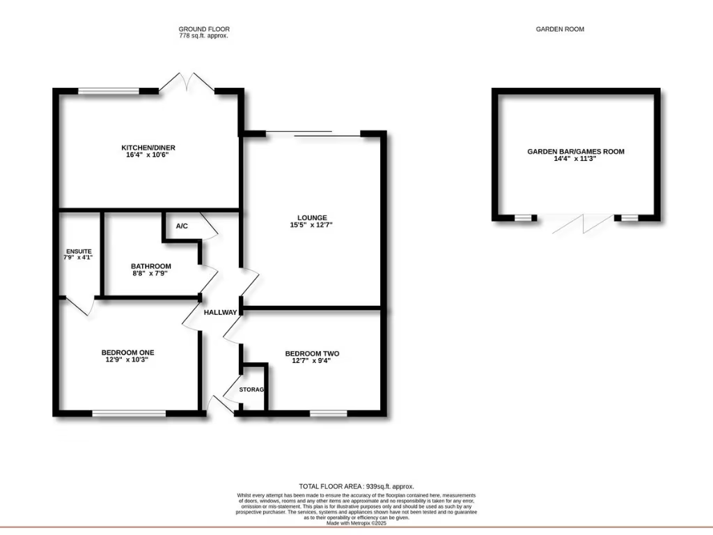
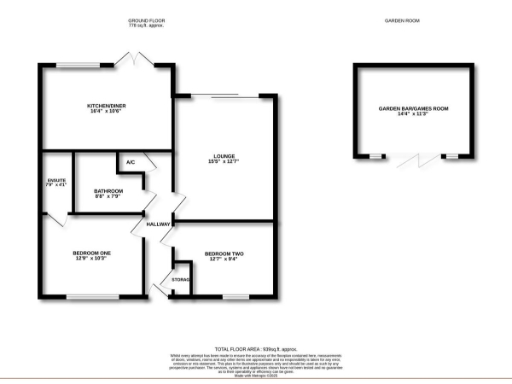
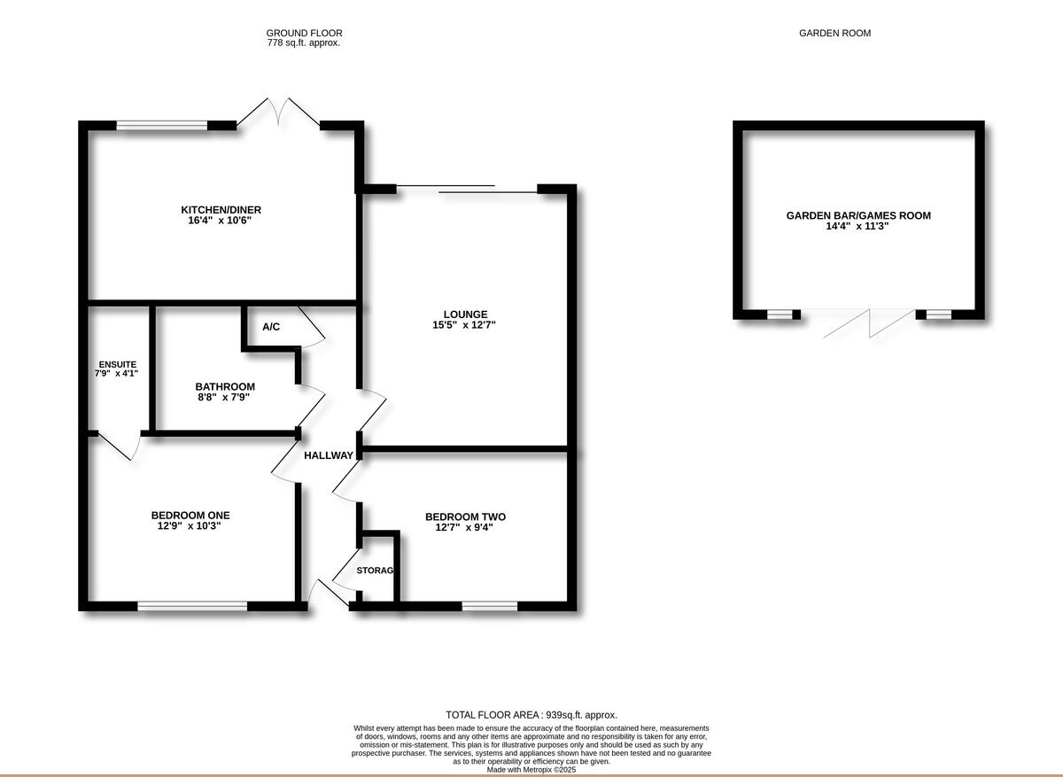
Rooms
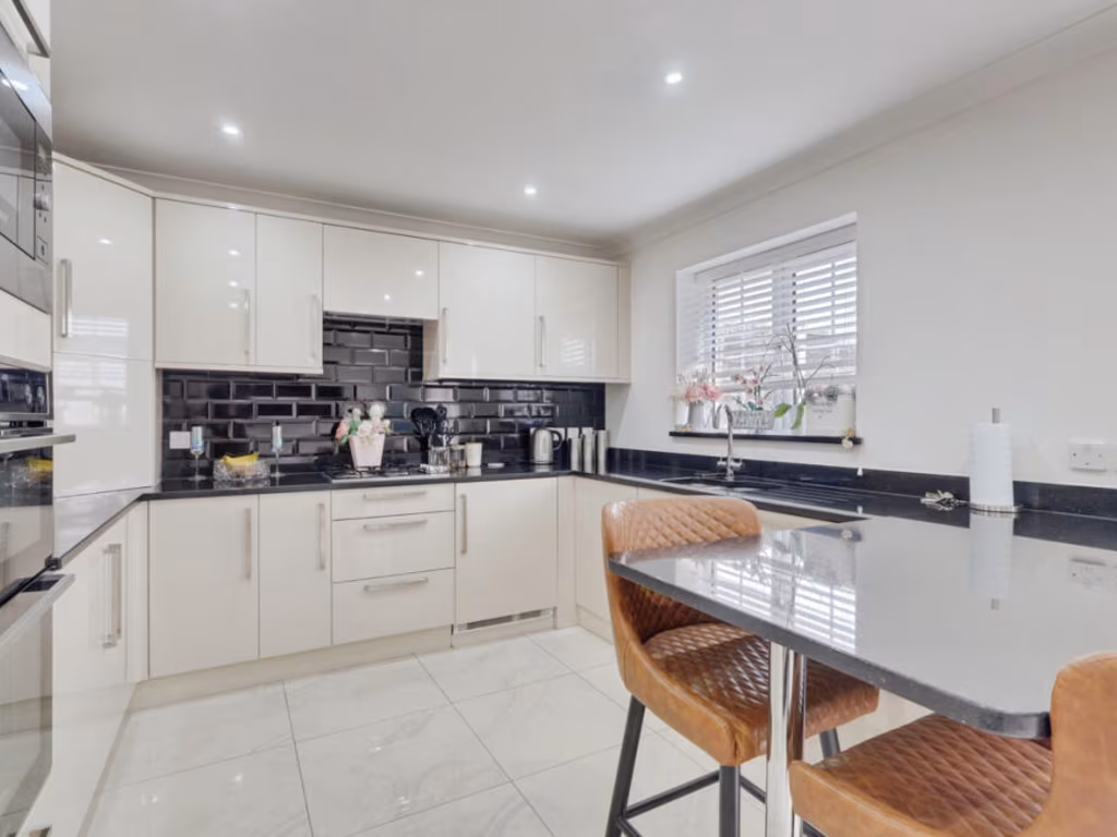
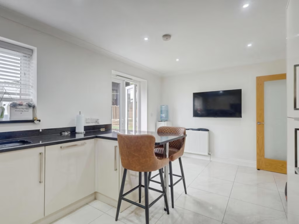
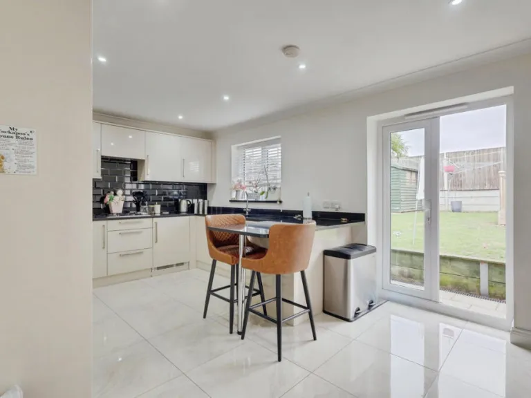
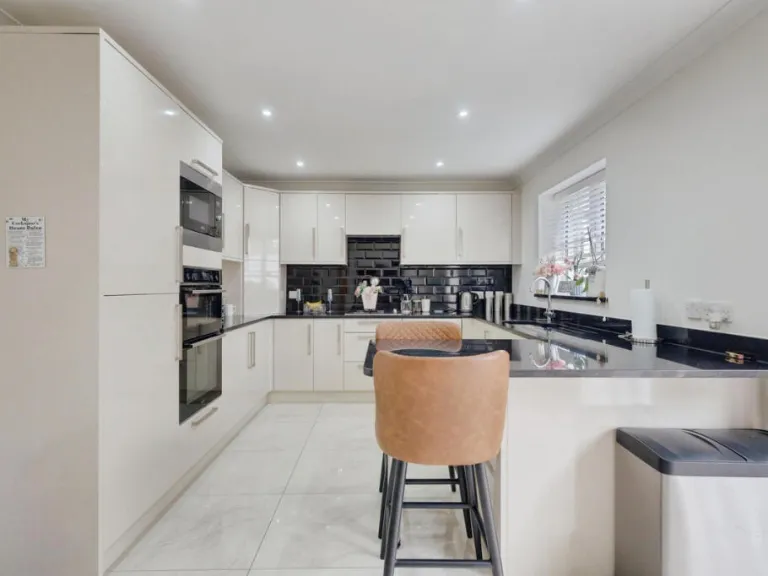
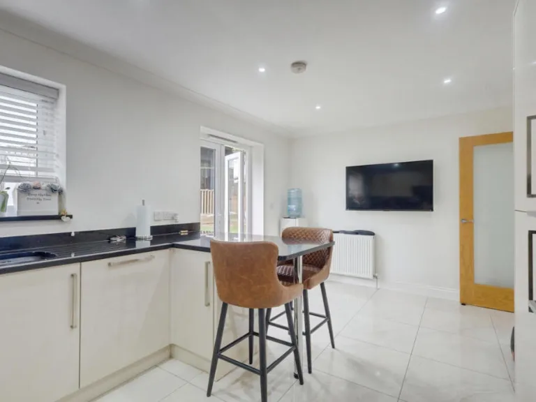
- KITCHEN/DINER:
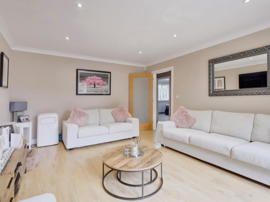
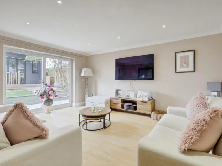
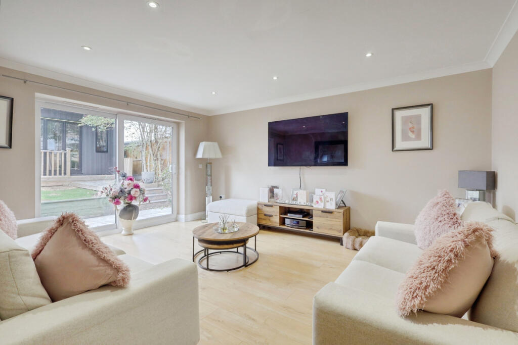
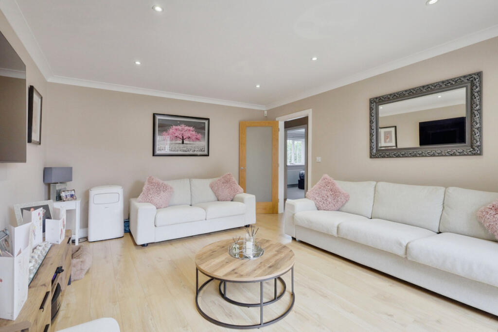
- LOUNGE:
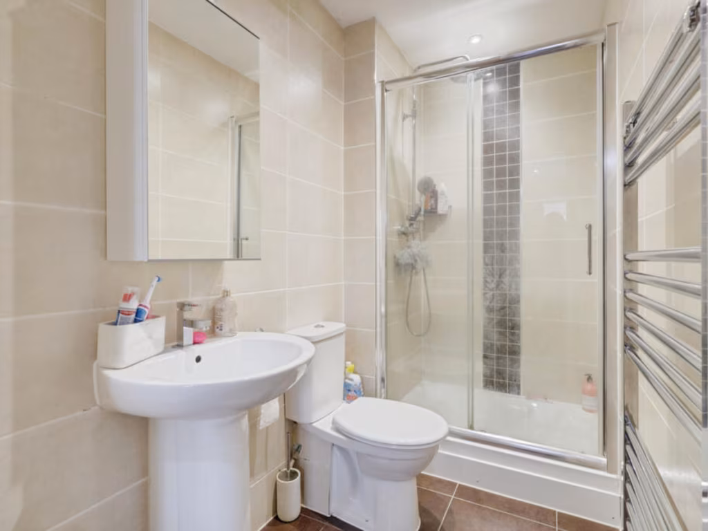
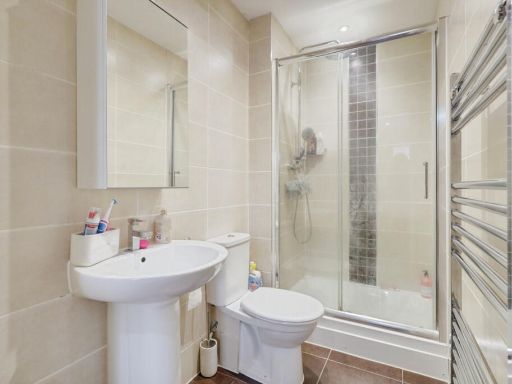
- ENSUITE:
- BATHROOM:
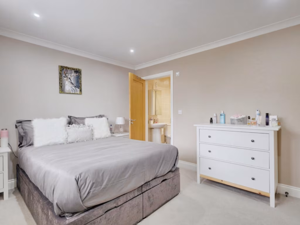
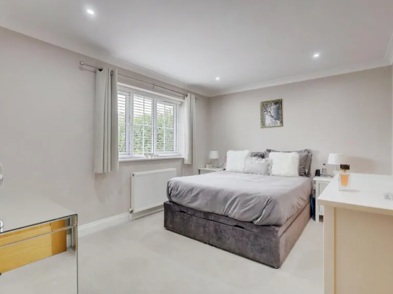
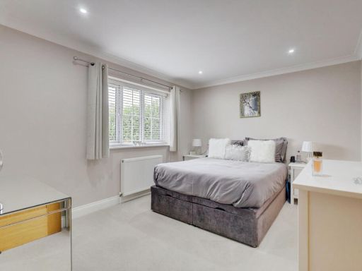
- BEDROOM ONE:
- BEDROOM TWO:
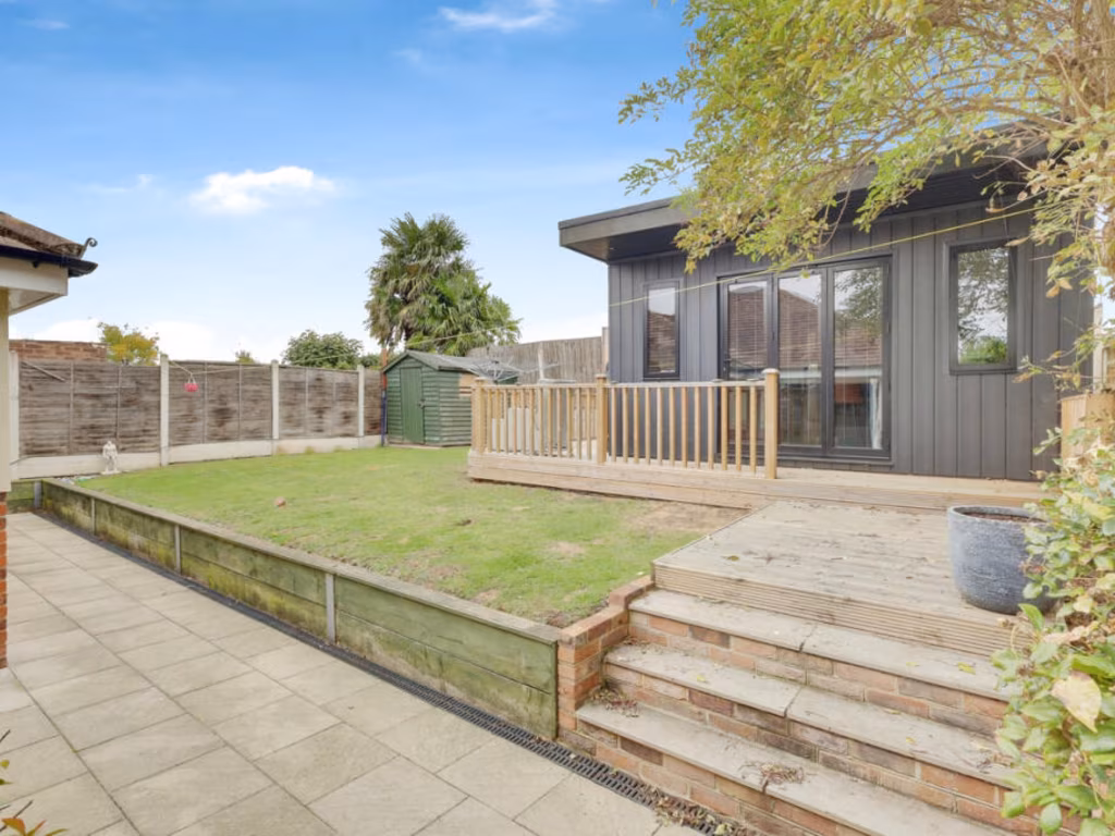
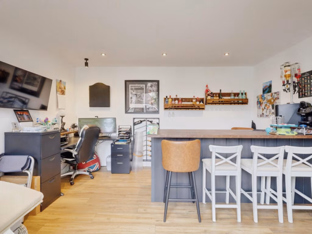
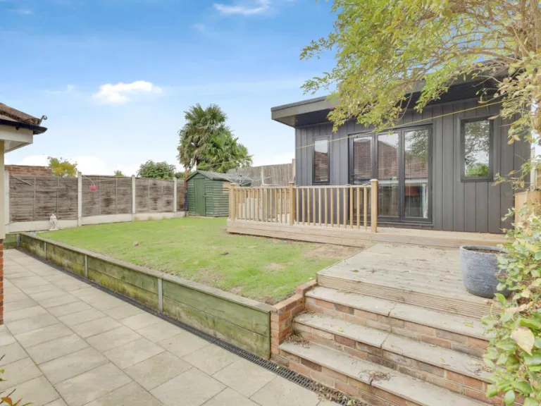
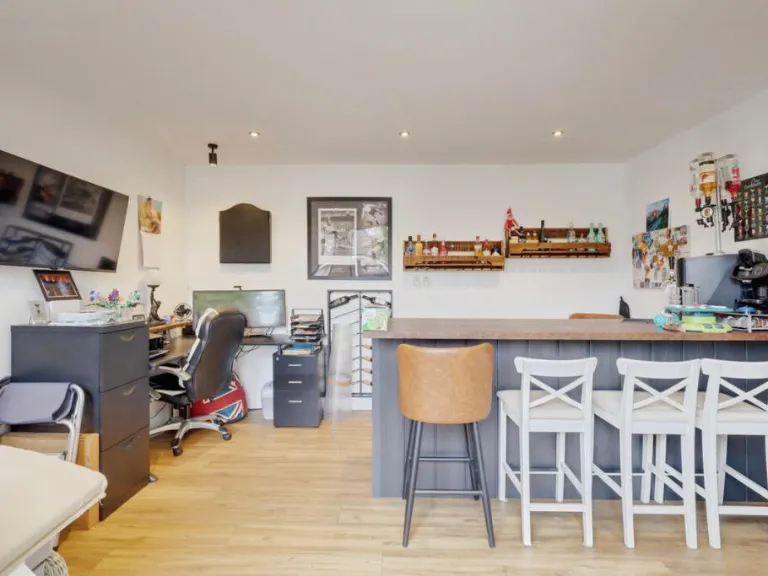
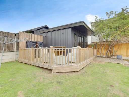
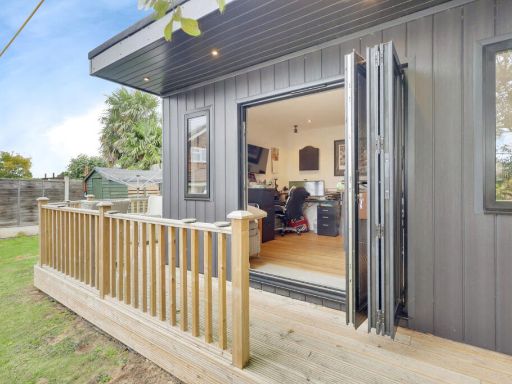
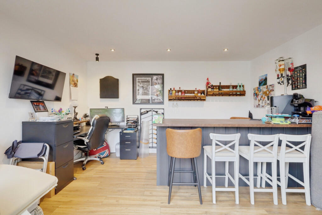
- GARDEN BAR/GAMES ROOM:
Textual Property Features
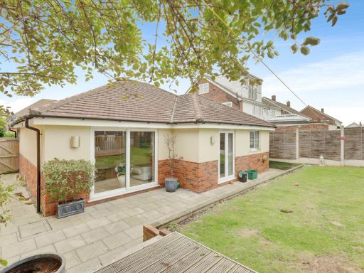
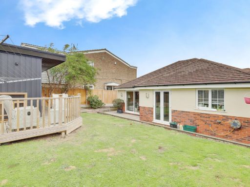
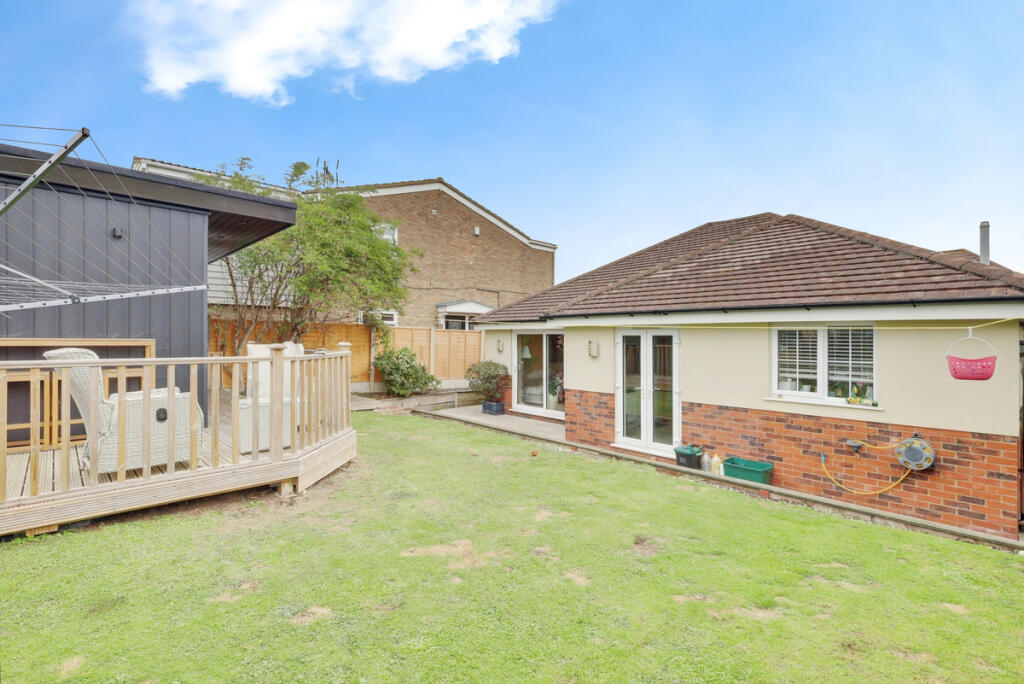
- Has Garden
- Is Retirement
- Success
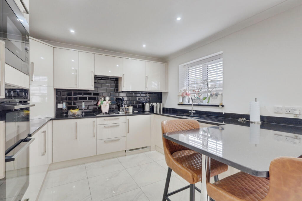
Detected Visual Features
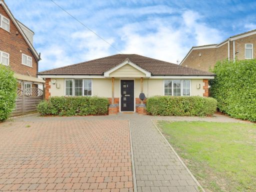
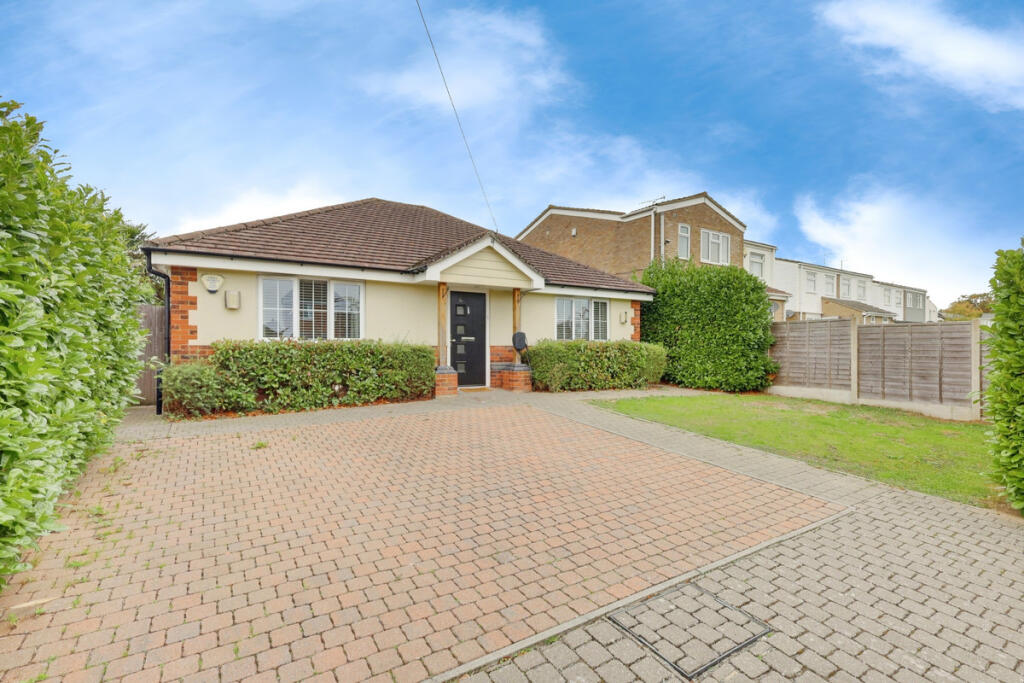
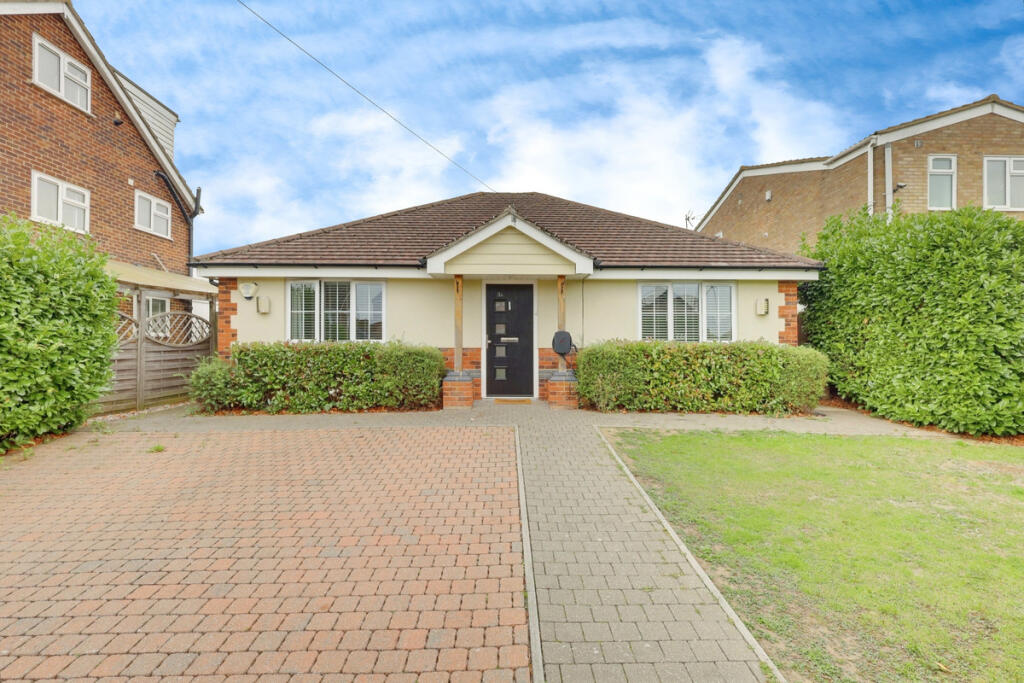
- Bungalow
- Detached
- Driveway
- Single-story
- Brickwork
- Residential
- Suburban
- modern
- kitchen
- glossy cabinetry
- black backsplash
- marble floor
- integrated appliances
- bright lighting
- recently updated
EPC Details
- High performance glazing
- Average thermal transmittance 0.14 W/m?K
- Boiler and radiators, mains gas
- Low energy lighting in all fixed outlets
- Average thermal transmittance 0.08 W/m?K
Nearby Schools
- Canvey Junior School
- St Katherine's Church of England Primary School
- The King John School
- St Margaret's Church of England Academy, Bowers Gifford
- William Read Primary Academy
- The Cornelius Vermuyden School
- Kents Hill Junior School
- Maple Grove Primary School
- Kingston Primary School
- The Basildon Upper Academy
- Northlands Primary School and Nursery
- Briscoe Primary School & Nursery Academy
- Abacus Primary School
- Oakfield Primary School
- Canvey Island Infant School and Nursery
- South Benfleet Primary School
- The Appleton School
- Thundersley Primary School
- Felmore Primary School
- Northwick Park Primary and Nursery Academy
- Winter Gardens Academy
- Kents Hill Infant Academy
- Jotmans Hall Primary School
- Holy Family Catholic Primary School
- Eversley Primary School
- Woodham Ley Primary School
- The Robert Drake Primary School
- Montgomerie Primary School
Nearest General Shops
- Id: 8584643103
- Tags:
- Addr:
- City: Benfleet
- Housenumber: 119-123
- Postcode: SS7 5UH
- Street: London Road
- Suburb: South Benfleet
- Brand: Nisa Extra
- Brand:wikidata: Q16999069
- Brand:wikipedia: en:Nisa (retailer)
- Fhrs:
- Name: Nisa Extra
- Shop: supermarket
- Source:
- TagsNormalized:
- Lat: 51.5676011
- Lon: 0.5511855
- FullGeoHash: u10mke97599d
- PartitionGeoHash: u10m
- Images:
- FoodStandards:
- Id: 1250745
- FHRSID: 1250745
- LocalAuthorityBusinessID: 100091621036
- BusinessName: Nisa
- BusinessType: Retailers - supermarkets/hypermarkets
- BusinessTypeID: 7840
- AddressLine1: 119-123 London Road
- AddressLine2: South Benfleet
- AddressLine3: Benfleet
- AddressLine4: Essex
- PostCode: SS7 5UH
- RatingValue: 5
- RatingKey: fhrs_5_en-GB
- RatingDate: 2021-09-22
- LocalAuthorityCode: 112
- LocalAuthorityName: Castle Point
- LocalAuthorityWebSite: http://www.castlepoint.gov.uk
- LocalAuthorityEmailAddress: environmentalhealth@castlepoint.gov.uk
- Scores:
- Hygiene: 0
- Structural: 0
- ConfidenceInManagement: 0
- NewRatingPending: false
- Geocode:
- Longitude: 0.55140000000000
- Latitude: 51.56761500000000
- Distance: 1126.4
,- Id: 10214729541
- Tags:
- Fixme: What is this?
- Shop: yes
- TagsNormalized:
- Lat: 51.5676323
- Lon: 0.5506763
- FullGeoHash: u10mke8gpxqh
- PartitionGeoHash: u10m
- Images:
- FoodStandards: null
- Distance: 1119.4
,- Id: 8584643102
- Tags:
- Addr:
- City: Benfleet
- Street: London Road
- Suburb: South Benfleet
- Name: J D Cycles
- Shop: bicycle
- TagsNormalized:
- Lat: 51.5676011
- Lon: 0.5508078
- FullGeoHash: u10mke954c84
- PartitionGeoHash: u10m
- Images:
- FoodStandards: null
- Distance: 1118.6
}
Nearest Grocery shops
- Id: 1976165827
- Tags:
- Name: Co-op
- Shop: convenience
- TagsNormalized:
- Lat: 51.5719844
- Lon: 0.5594558
- FullGeoHash: u10mksrks68m
- PartitionGeoHash: u10m
- Images:
- FoodStandards: null
- Distance: 1809.2
,- Id: 2253852981
- Tags:
- TagsNormalized:
- Lat: 51.5729657
- Lon: 0.5494871
- FullGeoHash: u10mks847cx7
- PartitionGeoHash: u10m
- Images:
- FoodStandards: null
- Distance: 1684.1
,- Id: 9392253372
- Tags:
- Addr:
- Country: GB
- Housenumber: 92
- Postcode: SS7 5TJ
- Street: London Road
- Brand: Tesco Express
- Brand:wikidata: Q98456772
- Contact:
- Website: https://www.tesco.com/store-locator/benfleet/92-london-rd
- Fhrs:
- Name: Tesco Express
- Shop: convenience
- TagsNormalized:
- tesco
- tesco express
- convenience
- shop
- Lat: 51.5671921
- Lon: 0.5498555
- FullGeoHash: u10mke82st3f
- PartitionGeoHash: u10m
- Images:
- FoodStandards:
- Id: 39379
- FHRSID: 39379
- LocalAuthorityBusinessID: 100091600978
- BusinessName: Tesco
- BusinessType: Retailers - supermarkets/hypermarkets
- BusinessTypeID: 7840
- AddressLine1: 92 London Road
- AddressLine2: South Benfleet
- AddressLine3: Benfleet
- AddressLine4: Essex
- PostCode: SS7 5TJ
- RatingValue: 5
- RatingKey: fhrs_5_en-GB
- RatingDate: 2023-01-09
- LocalAuthorityCode: 112
- LocalAuthorityName: Castle Point
- LocalAuthorityWebSite: http://www.castlepoint.gov.uk
- LocalAuthorityEmailAddress: environmentalhealth@castlepoint.gov.uk
- Scores:
- Hygiene: 0
- Structural: 0
- ConfidenceInManagement: 0
- NewRatingPending: false
- Geocode:
- Longitude: 0.54825700000000
- Latitude: 51.56715300000000
- Distance: 1057.4
}
Nearest Supermarkets
- Id: 620161225
- Tags:
- Brand: ALDI
- Brand:wikidata: Q41171672
- Brand:wikipedia: en:Aldi
- Building: retail
- Contact:
- Website: https://stores.aldi.co.uk/pitsea/northlands-pavement
- Name: Aldi
- Shop: supermarket
- TagsNormalized:
- aldi
- retail
- supermarket
- shop
- Lat: 51.5656669
- Lon: 0.5040835
- FullGeoHash: u10m77ppccpb
- PartitionGeoHash: u10m
- Images:
- FoodStandards: null
- Distance: 3033.8
,- Id: 122670239
- Tags:
- Addr:
- City: Pitsea
- Country: GB
- Housename: Old Market Retail Park
- Postcode: SS13 3BB
- Street: High Road
- Alt_name: LIDL Pitsea
- Brand: Lidl
- Brand:wikidata: Q151954
- Brand:wikipedia: en:Lidl
- Building: yes
- Fhrs:
- Name: Lidl
- Shop: supermarket
- TagsNormalized:
- Lat: 51.564544
- Lon: 0.5074713
- FullGeoHash: u10m7e190zwn
- PartitionGeoHash: u10m
- Images:
- FoodStandards:
- Id: 133525
- FHRSID: 133525
- LocalAuthorityBusinessID: 6630
- BusinessName: LIDL
- BusinessType: Retailers - supermarkets/hypermarkets
- BusinessTypeID: 7840
- AddressLine1: Old Market Site
- AddressLine2: High Road
- AddressLine3: Pitsea
- AddressLine4: Essex.
- PostCode: SS13 3BB
- RatingValue: 5
- RatingKey: fhrs_5_en-GB
- RatingDate: 2017-03-16
- LocalAuthorityCode: 109
- LocalAuthorityName: Basildon
- LocalAuthorityWebSite: http://www.basildon.gov.uk
- LocalAuthorityEmailAddress: ehs@basildon.gov.uk
- Scores:
- Hygiene: 5
- Structural: 5
- ConfidenceInManagement: 5
- NewRatingPending: false
- Geocode:
- Longitude: 0.50735700000000
- Latitude: 51.56523700000000
- Distance: 2774.4
,- Id: 852012915
- Tags:
- Brand: ALDI
- Brand:wikidata: Q41171672
- Brand:wikipedia: en:Aldi
- Building: retail
- Contact:
- Website: https://stores.aldi.co.uk/benfleet/2-rushbottom-lane
- Name: Aldi
- Shop: supermarket
- TagsNormalized:
- aldi
- retail
- supermarket
- shop
- Lat: 51.5683535
- Lon: 0.5511434
- FullGeoHash: u10mke9r6tf6
- PartitionGeoHash: u10m
- Images:
- FoodStandards: null
- Distance: 1205.4
}
Nearest Religious buildings
- Id: 515970120
- Tags:
- Addr:
- Amenity: school
- Capacity: 210
- Denomination: anglican
- Diocese: Diocese of Chelmsford
- Isced:
- Max_age: 11
- Min_age: 2
- Name: St Margaret's Church of England Academy
- Old_name: St Margaret's Church of England Voluntary Aided Primary School
- Phone: +44 1268 552176
- Ref:
- Ref:edubase:group: 4955
- Religion: christian
- School:
- Boarding: no
- Gender: mixed
- Selective: no
- Trust: yes
- Type: academy
- School:trust:name: The Diocese of Chelmsford Vine Schools Trust
- School:trust:type: multi_academy
- Source:
- Addr:
- Postcode: get-information-schools.service.gov.uk
- Website: https://st-margaretsacademy.co.uk/
- TagsNormalized:
- school
- anglican
- church
- christian
- Lat: 51.565388
- Lon: 0.5267272
- FullGeoHash: u10m7gpw1th2
- PartitionGeoHash: u10m
- Images:
- FoodStandards: null
- Distance: 1578.3
,- Id: 145551960
- Tags:
- Amenity: place_of_worship
- Denomination: anglican
- Name: St George, Benfleet New Thundersley
- Religion: christian
- Wikidata: Q105083696
- TagsNormalized:
- place of worship
- anglican
- christian
- church
- Lat: 51.5704778
- Lon: 0.5488382
- FullGeoHash: u10mkkpeucg6
- PartitionGeoHash: u10m
- Images:
- FoodStandards: null
- Distance: 1403.9
,- Id: 145634075
- Tags:
- Amenity: place_of_worship
- Denomination: anglican
- Name: St Margarets, Bowers Gifford
- Religion: christian
- Wikidata: Q17557079
- TagsNormalized:
- place of worship
- anglican
- christian
- church
- Lat: 51.5568323
- Lon: 0.5315545
- FullGeoHash: u10mk1eh645u
- PartitionGeoHash: u10m
- Images:
- FoodStandards: null
- Distance: 1019.1
}
Nearest Airports
- Id: 121158889
- Tags:
- Aerodrome: continental
- Aeroway: aerodrome
- Fhrs:
- Authority: City of London Corporation
- Iata: LCY
- Icao: EGLC
- Name: London City Airport
- Operator: London City Airport Limited
- Ref: LCY
- Website: https://www.londoncityairport.com/
- Wikidata: Q8982
- Wikipedia: en:London City Airport
- TagsNormalized:
- airport
- continental airport
- Lat: 51.5042658
- Lon: 0.0539987
- FullGeoHash: u10j10p64702
- PartitionGeoHash: u10j
- Images:
- FoodStandards: null
- Distance: 34565.5
,- Id: 103894219
- Tags:
- Aerodrome: international
- Aeroway: aerodrome
- Iata: SEN
- Icao: EGMC
- Name: London Southend Airport
- Old_name: Southend Municipal Airport
- Ref: SEN
- Wikidata: Q1415441
- TagsNormalized:
- airport
- international airport
- Lat: 51.5701749
- Lon: 0.6924624
- FullGeoHash: u10mru04p937
- PartitionGeoHash: u10m
- Images:
- FoodStandards: null
- Distance: 10202.1
}
Nearest Leisure Facilities
- Id: 134921502
- Tags:
- Leisure: pitch
- Sport: soccer
- TagsNormalized:
- Lat: 51.552847
- Lon: 0.5590674
- FullGeoHash: u10mk8zj55ny
- PartitionGeoHash: u10m
- Images:
- FoodStandards: null
- Distance: 1056.8
,- Id: 134921522
- Tags:
- Leisure: pitch
- Name: Legacy XS Skatepark
- Sport: skateboard
- TagsNormalized:
- pitch
- leisure
- skateboard
- sports
- Lat: 51.5525269
- Lon: 0.5583444
- FullGeoHash: u10mk8ye4rec
- PartitionGeoHash: u10m
- Images:
- FoodStandards: null
- Distance: 1035.3
,- Id: 134921530
- Tags:
- TagsNormalized:
- Lat: 51.5512248
- Lon: 0.5565197
- FullGeoHash: u10mk8t5xug4
- PartitionGeoHash: u10m
- Images:
- FoodStandards: null
- Distance: 1035.2
,- Id: 134921511
- Tags:
- Leisure: pitch
- Sport: skateboard
- TagsNormalized:
- pitch
- leisure
- skateboard
- sports
- Lat: 51.5526834
- Lon: 0.558355
- FullGeoHash: u10mk8ys4sex
- PartitionGeoHash: u10m
- Images:
- FoodStandards: null
- Distance: 1025.9
,- Id: 905786643
- Tags:
- TagsNormalized:
- Lat: 51.561408
- Lon: 0.5575182
- FullGeoHash: u10mkdmyzp5e
- PartitionGeoHash: u10m
- Images:
- FoodStandards: null
- Distance: 872.3
}
Nearest Tourist attractions
- Id: 5940883085
- Tags:
- Amenity: camera_obscura
- Name: Camera Obscura
- Tourism: artwork
- Website: http://www.heinrichpalmer.co.uk/page49.htm
- TagsNormalized:
- Lat: 51.5493079
- Lon: 0.5965974
- FullGeoHash: u10mm862mxrr
- PartitionGeoHash: u10m
- Images:
- FoodStandards: null
- Distance: 3615.9
,- Id: 5670992121
- Tags:
- Name: 239 Rectory Road
- Tourism: hostel
- TagsNormalized:
- Lat: 51.5782656
- Lon: 0.5110134
- FullGeoHash: u10m7ts15mx4
- PartitionGeoHash: u10m
- Images:
- FoodStandards: null
- Distance: 3317.6
,- Id: 138226831
- Tags:
- Building: yes
- Name: Motorboat Museum
- Tourism: museum
- TagsNormalized:
- Lat: 51.551163
- Lon: 0.5060319
- FullGeoHash: u10m7887r3k9
- PartitionGeoHash: u10m
- Images:
- FoodStandards: null
- Distance: 2877
}
Nearest Hotels
- Id: 702967806
- Tags:
- Amenity: pub
- Fixme: check location
- Name: The Oysterfleet
- Source: http://www.geograph.org.uk/photo/1207207
- Tourism: hotel
- TagsNormalized:
- Lat: 51.5239306
- Lon: 0.5920254
- FullGeoHash: u10mj7xhehy1
- PartitionGeoHash: u10m
- Images:
- FoodStandards: null
- Distance: 4936.5
,- Id: 135551062
- Tags:
- Addr:
- Postcode: SS6 7SP
- Street: Arterial Road
- Brand: Premier Inn
- Brand:wikidata: Q2108626
- Brand:wikipedia: en:Premier Inn
- Building: yes
- Contact:
- Fax: +44 871 527 8059
- Phone: +44 871 527 8058
- Website: http://www.premierinn.com/en/hotel/BASCOL/basildon-rayleigh
- Fhrs:
- Internet_access: yes
- Internet_access:fee: customers
- Internet_access:operator: Virgin Media
- Internet_access:ssid: Premier Inn Free Wi-Fi
- Name: Premier Inn
- Operator: Premier Inn
- Smoking: no
- Source:
- Tourism: hotel
- Wheelchair: yes
- TagsNormalized:
- Lat: 51.5772666
- Lon: 0.6005668
- FullGeoHash: u10mmtm765r5
- PartitionGeoHash: u10m
- Images:
- FoodStandards: null
- Distance: 4328.7
,- Id: 512042262
- Tags:
- Addr:
- City: Basildon
- Postcode: SS13 1BW
- Street: East Mayne
- Brand: Premier Inn
- Brand:wikidata: Q2108626
- Brand:wikipedia: en:Premier Inn
- Internet_access: wlan
- Internet_access:fee: customers
- Internet_access:operator: Virgin Media
- Internet_access:ssid: Premier Inn Free Wi-Fi
- Name: Premier Inn
- Tourism: hotel
- TagsNormalized:
- Lat: 51.5803328
- Lon: 0.4968233
- FullGeoHash: u10m7mcv0yfq
- PartitionGeoHash: u10m
- Images:
- FoodStandards: null
- Distance: 4222.2
}
Tags
- Bungalow
- Detached
- Driveway
- Single-story
- Brickwork
- Residential
- Suburban
- modern
- kitchen
- glossy cabinetry
- black backsplash
- marble floor
- integrated appliances
- bright lighting
- recently updated
Local Market Stats
- Average Price/sqft: £390
- Avg Income: £47500
- Rental Yield: 4.1%
- Social Housing: 2%
- Planning Success Rate: 77%
Similar Properties
 3 bedroom detached bungalow for sale in Gravel Road, Leigh-on-sea, SS9 — £308,250 • 3 bed • 1 bath
 3 bedroom detached bungalow for sale in Ferndale Crescent, Canvey Island, SS8 — £284,750 • 3 bed • 1 bath • 1540 ft²
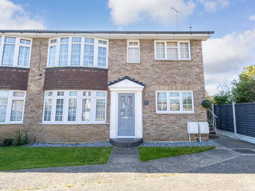 2 bedroom maisonette for sale in Muirway, Benfleet, SS7 — £184,250 • 2 bed • 1 bath
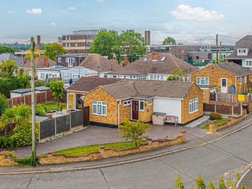 2 bedroom detached bungalow for sale in Croft Close, Benfleet, SS7 — £301,500 • 2 bed • 2 bath • 912 ft²
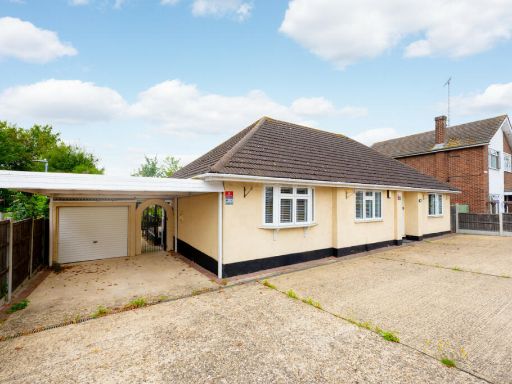 4 bedroom detached bungalow for sale in Rayleigh Road, Leigh-on-sea, SS9 — £375,250 • 4 bed • 2 bath • 1604 ft²
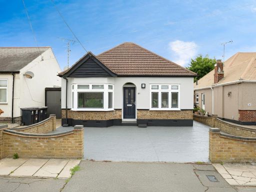 3 bedroom detached bungalow for sale in Queen Elizabeth Chase, Rochford, SS4 — £268,000 • 3 bed • 1 bath • 1021 ft²
Meta
- {
"@context": "https://schema.org",
"@type": "Residence",
"name": "2 bedroom detached bungalow for sale in High Beeches, Benfl…",
"description": "",
"url": "https://propertypiper.co.uk/property/0dca7f81-aa9f-4d42-8756-251f82374234",
"image": "https://image-a.propertypiper.co.uk/6bef8500-dd42-45fa-aa80-d90b3c566b8d-1024.jpeg",
"address": {
"@type": "PostalAddress",
"streetAddress": "11a, High Beeches",
"postalCode": "SS7 5BG",
"addressLocality": "Castle Point",
"addressRegion": "Castle Point",
"addressCountry": "England"
},
"geo": {
"@type": "GeoCoordinates",
"latitude": 51.55796049981051,
"longitude": 0.5461834681977169
},
"numberOfRooms": 2,
"numberOfBathroomsTotal": 2,
"floorSize": {
"@type": "QuantitativeValue",
"value": 778,
"unitCode": "FTK"
},
"offers": {
"@type": "Offer",
"price": 301500,
"priceCurrency": "GBP",
"availability": "https://schema.org/InStock"
},
"additionalProperty": [
{
"@type": "PropertyValue",
"name": "Feature",
"value": "Bungalow"
},
{
"@type": "PropertyValue",
"name": "Feature",
"value": "Detached"
},
{
"@type": "PropertyValue",
"name": "Feature",
"value": "Driveway"
},
{
"@type": "PropertyValue",
"name": "Feature",
"value": "Single-story"
},
{
"@type": "PropertyValue",
"name": "Feature",
"value": "Brickwork"
},
{
"@type": "PropertyValue",
"name": "Feature",
"value": "Residential"
},
{
"@type": "PropertyValue",
"name": "Feature",
"value": "Suburban"
},
{
"@type": "PropertyValue",
"name": "Feature",
"value": "modern"
},
{
"@type": "PropertyValue",
"name": "Feature",
"value": "kitchen"
},
{
"@type": "PropertyValue",
"name": "Feature",
"value": "glossy cabinetry"
},
{
"@type": "PropertyValue",
"name": "Feature",
"value": "black backsplash"
},
{
"@type": "PropertyValue",
"name": "Feature",
"value": "marble floor"
},
{
"@type": "PropertyValue",
"name": "Feature",
"value": "integrated appliances"
},
{
"@type": "PropertyValue",
"name": "Feature",
"value": "bright lighting"
},
{
"@type": "PropertyValue",
"name": "Feature",
"value": "recently updated"
}
]
}
High Res Floorplan Images
Compatible Floorplan Images
FloorplanImages Thumbnail